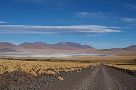
C'est un thème qui n'est pas fort traité sur ce forum, ni d'autres d'ailleurs mais, sans tomber dans la parano, je pense qu'il faut le savoir et que les gens qui essayent de sortir des sentiers battus, tant dans l'extrême nord du Chili qu'en Patagonie et Terre de Feu, doivent absolument en tenir compte. Eviter de manipuler des objets bizarres, par exemple.
En résumé, plus de 180 mille mines antipersonnelles ont été semées en 1978. C'était l'époque où les régimes militaires étaient au pouvoir dans la région et les chiliens craignaient une invasion des pays voisins. Finalement, ces invasions n'ont jamais eu lieu et le Chili a commençé à déminer en 2002, après avoir signé la Convention d'Ottawa sur l'interdiction des mines antipersonnelles.
À l'heure actuelle, plus de 150 mille ont été désactivées. Il enresterait donc 30.000 ce qui est quand même un chiffre assez impressionant.
Je laisse quelques liens intéressants ci-après, de diverses tendances politiques.
a) D'un journal chilien plutôt de gauche alternative www.theclinic.cl/...inas-antipersonales/
b) D'une chaîne de télévision de diffusion nationale www.t13.cl/...ipersonales-frontera
c) De la chambre des sénateurs sur un projet de loi qui favorisera les victimes www.senado.cl/...17-06-20/194613.html
d) De la commission nationale de déminage. www.cnad.cl/...0prevencion/afec.htm
Je traduis les deux premiers paragraphes qui sont importants.
Las zonas minadas que se encuentran en la República de Chile, están ubicadas en su mayoría se encuentran en áreas fronterizas, mayoritariamente de difícil acceso, despobladas y alejadas de centros poblados, siendo lugares por los cuales no existe tránsito regular de civiles.
Estas zonas minadas están protegidas en todo su perímetro con un cerco exterior consistente en 3 o 4 hebras de alambre de púas, afirmado por estacas metálicas de 2 metros de altura, debidamente señalizadas con letreros metálicos de forma triangular, de 40 centímetros por lado, pintados de color rojo con la inscripción "MINAS" en color amarillo o blanco.
Les zones minées qui se trouvent dans la République du Chili sont situées en grande partie à proximités des zones frontières, généralement d'accès difficile, inhabitées et éloignées des endroits peuplés, correspondant à des lieux qui ne sont pas fréquentés régulièrement par des civils.
Ces zones minées sont protégées sur tout leur périmètre par une clotûre extérieure composée de 3 ou 4 fils de fer barbelés, soutenu par des pieux métalliques de 2 mètres de hauteur, dûement signalés avec des panneaux métallique de forme triangulaire, de 40 centimètres de côté, peints de couleur rouge contenant l'inscription "MINAS" de couleur jaune ou blanche.
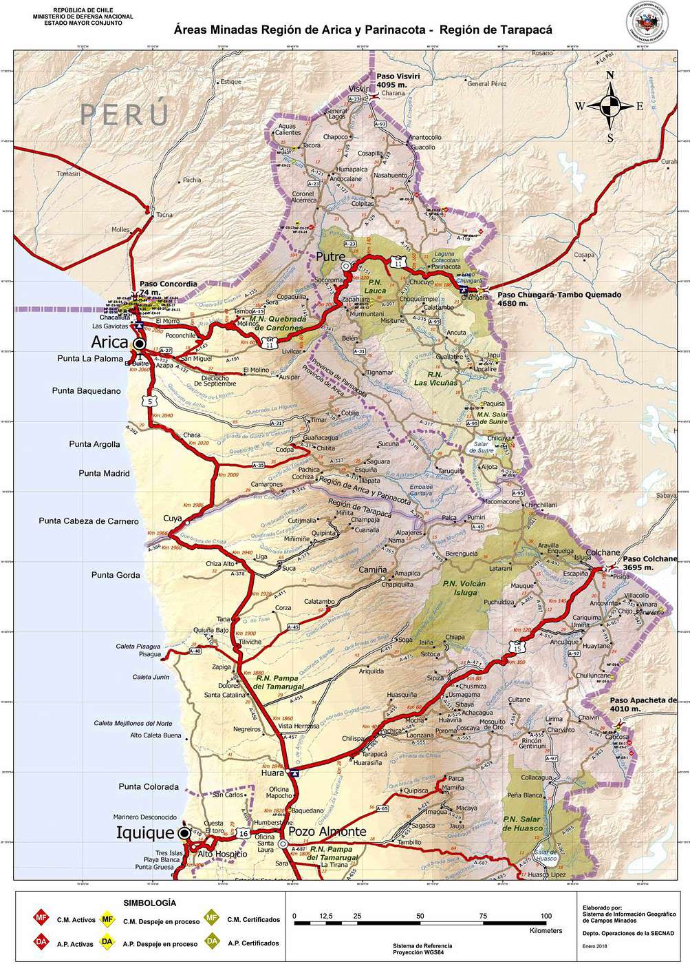
e) Sur le même lien précédent, se trouvent des cartes des endroits minés, examinez les avant de vous rendre dans les régions concernées.
Je recommande particulièrement la carte des environs de San Pedro de Atacama et d'Ollague www.cnad.cl/.../img/antofagasta.jpg
@Jayma qui va certainement lire ce message aussi, pourrait-elle me confirmer si ma mémoire est bonne, il me semble qu'il y a un terrain miné à la sortie de Puerto Natales, près de la laguna Figueroa, avant Cerro Castillo?
@Jayma qui va certainement lire ce message aussi, pourrait-elle me confirmer si ma mémoire est bonne, il me semble qu'il y a un terrain miné à la sortie de Puerto Natales, près de la laguna Figueroa, avant Cerro Castillo?
Pardon, j'étais pas dispo ;-)
Oui, c'est ce que j'ai toujours entendu, que ça avait été déminé en 2012 dans la zone de la laguna Figueroa, merci pour l'article !
Mille mercis Thierry
ça fait longtemps que je cherchais ces renseignements, j'étais allé pleurer à un organisme minier sur le port d'Antofagasta, près de la vieille grue. Ils ont les cartes mais ils ne les communiquent pas avec un enthousiasme délirant, ils m'en ont montrées mais c'est tout, j'ai pu faire une photo "mais c'est tout". Je suis assez étonné du nombre de zones autour de San Pedro, je n'ai rien vu sauf en allant vers la laguna Légia mais c'est assez loin et vers la frontière donc pas étonnant.
Encore merci et cordiales salutations
Michel
Je pense que c'est une information importante qui est souvent prise à la légère et qu'il faut néanmoins diffuser.
Il ne faut pas tomber dans la parano bien sûr, mais il faut être conscient qu'à certains endroits il reste encore des champs de mines, et que le processus de déminage est complexe et lent.
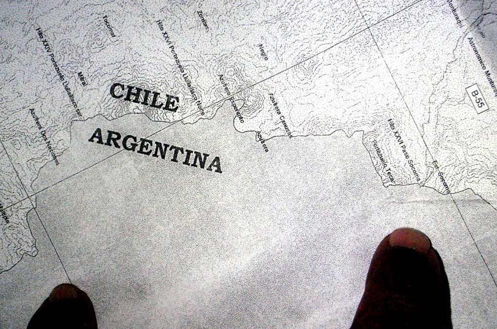
Je viens de retrouver la photo, pas très parlante, elle ne vaut que par la discussion que l'on avait eu, c'est entre les deux doigts! Ils sont en Argentine mais à prolonger au Chili, bien sûr. Donc en fin de compte, ils m'ont juste donné une zone, pourquoi ces cachotteries? J'avais bien senti des réticences.
Je me permets de réactualiser ce post pour deux raisons.
a) Apparement, de plus en plus de personnes souhaitent voyager seuls sur les hauts plateaux de l'extrême nord du Chili.
b) Les pluies importantes du mois de février 2019 sur cette région du Chili ont pu provoquer des glissements de terrain dans les zones minées et le déplacement des mines non encore enlevées.
Aux personnes qui souhaitent sortir des sentiers battus dans cette zone, je leur recommande de lire ce post et de consulter les différents liens indiqués, tout particulièrement les cartes et les différents types de mines qui ont été placées au cas où vous vous trouveriez nez-à-nez avec un objet étrange.
PS: Le site officiel de la Commission Nationale de Déminage du Chili est www.cnad.cl
Mais, si on fait les comptes, il resterait encore plus de 15.000 mines antipersonnelles actives distribuées sur 22 sites différents. Ce n'est pas négligeable et cela mérite de rester particulièrement attentif, surtout dans l'extrême nord du Chili.
En ce qui concerne la zone de Punta Arenas, les chiffres me paraissent néanmoins bizarres, plus de mines ont été désactivées que semées...
Pour la traduction de campos de minas levantados et campo de minas certificados, ce n'est pas trop clair pour moi, il faudrait me donner le lien exact du texte car je ne l'ai pas retrouvé.
À priori, je dirais que les campos de minas levantados font références au nombre de champs de mines installés. (Mais levantados pourrait aussi faire référence aux nombres de champs de mines qui ont été nettoyés, d'où l'importance du contexte.)
Salut Thierry,
Il n'y a pas tellement de contexte, c'est simplement écrit tel quel dans la légende des cartes du site (avec les liens que nous partageons)
A plus
Michel
Très bonne question, je n'avais pas ce détail sur la légende rouge/orange-jaune/verte sur les cartes.
J'ai fait une petite recherche sur le web et quand on parle de campo de mina certificado, c'est sous-entendu que l'armée certifie cet endroit comme étant déminé.
En théorie, ils devraient donc enlever ces champs de mines des cartes et apparement c'est le cas car je n'ai retrouvé aucune trace du triangle vert sur la carte de la région d'Antofagasta.
Par contre, je ne vois toujours pas la différence entre campo de mina levantado et campo de mina tout court...
Je me permets de reflotter le post car aujourd'hui justement un article sur le sujet a été publié par un journal chilien.
Il confirme ce que le CNAD indique sur son site, à savoir qu'environ 92% des mines antipersonnelles posées à proximité des frontières ont été désactivées au Chili.
Indirectement, on en déduit qu'il reste encore plus de 10.000 mines actives, essentiellement dans les régions d'Arica/Parinacota, Tarapacá et Antofagasta de l'extrême nord du pays.
Une fois de plus, je me permets d'insister à toutes les personnes qui veulent sortir des sentiers battus, de s'informer sur l'emplacement des zones minées.
Le site de la Commission Nationale de Déminage est www.cnad.cl
L'article paru dans la presse aujourd'hui lanacion.cl/...as-en-las-fronteras/
Hi everyone,
We’re planning 40 days in Uruguay and Argentina in February and March, trying to avoid as much rain as possible.
We’re thinking of starting in Buenos Aires, then heading to Bariloche, and from there flying to Córdoba, Mendoza, or Salta. Maybe by bus or renting a car to explore each region.
Do you have any suggestions or tips for us? We love picturesque, historic cities and landscapes. As seasoned travelers, we’re used to planning our trips ourselves.
Thanks in advance!
Hello,
my wife and I will be in Cusco for a week in March 2027.
I’d like to organize the visit to the site on our own, combining the Sacred Valley and Machu Picchu.
We’d leave Cusco on Day 1 to arrive at the site in the morning, then stay in Aguas Calientes or Ollantaytambo, and on Day 2 return to Cusco while visiting the Sacred Valley.
Is this doable?
Looking forward to hearing from you.
Cédric.
Hello,
We’re spending 3 weeks in Rio between February 20 and March 15, 2027, to visit our son and daughter-in-law. We’re thinking of one or two "escapes" from Rio—3-day trips to get away from the city (so not too far, max 3–4 hours by car or bus). We’re all ears for suggestions! We love beautiful nature and authentic experiences, not so much the touristy spots... even though those spots are often in beautiful places, we’d rather avoid them.
Thanks for your insights!
Catherine
Hello,
we’re arriving in Fortaleza on February 14, 2027, and planning to rent a car to drive to João Pessoa in two stages. We’ll leave from there on the 20th or 21st to head to Rio. Our questions:
- Which stop between Fortaleza and João Pessoa would be the most enjoyable?
- How long does it take to drive from Fortaleza to João Pessoa?
- Are there any easy hikes (no guide needed) around João Pessoa?
Thanks for all your replies—I’m hoping for lots!
Catherine
Hi there,
I’m planning a trip with my partner (no kids this time—thanks, Grandma!) for two weeks to celebrate her 40th birthday. I’ve been thinking about Chile. We’re looking at leaving around September 18, 2027, starting in the south and returning in early April.
Here’s what I had in mind:
8 nights in a van in the Lake District and the start of the Carretera Austral (up to the Chaitén area). We’re set to arrive in Puerto Montt around 2:00 PM. We don’t want to go too far south since we’re planning to explore the heart of Patagonia (Chile and Argentina) with the kids when they’re older. The idea is to spend 3 nights discovering the lakes (up to Cochamó) and 3 nights in Pumalín Park. I’ve also added two transition nights.
7 nights in the Atacama to experience another side of Chile (San Pedro), taking a domestic flight from Puerto Montt to Calama in the early afternoon. We’ll depart for France in the early evening from Santiago.
IMPORTANT NOTICE for those planning to take a bus to another city, state, or destination from Salvador!
Starting January 20, 2026, the intercity bus station Rodoviária is changing its address!
The Rodoviária is leaving the Iguatemi area and will now be located in ÁGUAS CLARAS (about twenty kilometers from downtown Salvador).
A brand-new station (the most modern in Brazil) has just been set up there, accessible by car/taxi/Uber/metro.
Allow for much more transfer time (especially during rush hours), so leave early if you're heading to Chapada Diamantina or other Brazilian cities by bus.
Remember, there are also private transfers (even French-speaking ones) that can take you directly from your hotel in Salvador to your hotel in Chapada. Sure, it’ll be more expensive, but you’ll save on transfer time and comfort.
Tropical greetings from Salvador,
@ivanbahiaguide
Loyal member of the French-Speaking Brazil Forums for over 15 years already 😊 🇧🇷
Hello,
We’re thinking of spending 1 month in Chile, maybe doing a loop?
From 12/23 to 01/22.
What are the must-see sights, given we’re more interested in the country’s cultural side than the beaches?
Thanks
Hi everyone,
We're planning a trip to southern Chile in November. Here's our tentative itinerary:
Day 1: Arrival in Santiago, then a flight the next day to Balmaceda where we'll pick up a rental car to reach Coyhaique.
Day 3: Walk in the Coyhaique National Reserve, then continue to Puerto Chacabuco. Return to Coyhaique for the second night.
Day 4: Drive to Villa Cerro Castillo for a hike in the national park. Continue to Puerto Tranquilo and stay there for 3 nights.
Day 5: Boat tour on Laguna San Rafael.
Day 6: Day trip to Monte San Valentin Glacier.
Day 7: Excursion to the Marble Chapels, then drive to Puerto Guadal. We'll stay there for 3 nights.
Day 8: Walk along Lago Carrera and return to Puerto Guadal.
Day 9: Rio Baker Valley and, if possible, a glacier excursion.
Day 10: Drive to Cochrane and hike in Tamango National Reserve. We'll stay 2 nights in Cochrane.
Day 11: Walk in the Chacabuco Valley.
Day 12: Drive to Caleta Tortel. We'll stay there for 2 nights.
Day 13: Cruise in the Rio Baker delta.
Day 14: Return to Cochrane.
Day 15: Return to Balmaceda in two stages.
Day 16: Continue the return journey.
Day 17: Return the rental car and head back to Santiago.
After this, we're also planning to explore northern Santiago. I'll post about that part once I have a clearer idea of the route.
What do you think of this itinerary? Is it doable in 17 days?
Thanks in advance for your tips and recommendations.
martine
Hi everyone! So happy to be back on this forum—it’s packed with such useful info! 🙂 My husband and I are planning a 2.5-week self-drive trip to Colombia at the end of the year, including some domestic flights. My first question is: is it possible, easy, and safe to do a road trip in Colombia?
Below is our draft itinerary (with questions at each stop):
29/11: France → Colombia. Overnight in Bogotá.
30/11: Exploring Bogotá: La Candelaria and Montserrate.
01/12: Gold Museum (closed on Mondays). Drive to Zipaquirá (1.5 hrs) to visit the Salt Cathedral. Then drive to Villa de Leyva (3 hrs). Explore the town. Overnight in Villa de Leyva.
02/12: Return to Bogotá via Laguna de Guatavita (5 hrs). Is it worth the detour? Overnight in Bogotá.
03/12: Flight to Pereira. Drive to Salento. Overnight in Salento.
04/12: Cocora Valley (hike among the wax palms) followed by a drive around the area. Are there any waterfalls or other sights nearby?
05/12: Visit a coffee finca—any recommendations? Then explore the surroundings: Filandia, Manizales, waterfalls? Hot springs? Which ones?
06/12: Flight to Medellín.
07/12: Exploring Medellín: Centro, Plaza Botero, Comuna 13. How do you visit Comuna 13? Is it easy to get around Medellín? Metro? Buses?
08/12: Drive to Guatapé (2 hrs). Visit the town, stroll around the lake, then El Peñol. Overnight in Guatapé.
09/12: Return to Medellín.
10/12: Flight to Santa Marta. Drive to a hotel near Tayrona Park.
11/12: Tayrona—El Zaino entrance.
12/12: Tayrona—Palangana entrance, then Bahia Concha and Santa Marta. What do you think?
13/12: Drive to Minca (45 mins). Can we reach the village by car? Pozo Azul and Marinka waterfalls. Overnight in Minca (or back in Tayrona?).
14/12: Drive to Puerto Nao (5 hrs). Stop in Ciénaga on the way + boat tour in Nueva Venecia and/or Buena Vista? Not enough time? Overnight in Puerto Nao.
15/12: Exploring Cartagena: Centro, Getsemaní, the walls + La Boquilla if we have time.
16/12: La Boquilla (is it really worth it?) if we didn’t have time yesterday, then back to the beach.
17/12: Return to France.
So, what do you think? Is this doable, or should we tweak it? Thanks in advance for your invaluable feedback and tips! 🙂
Hi there, I’ll be in Brazil from December 10th to the end of February.
I’ve sketched out a rough itinerary but I’m not sure how to arrange it—considering the climate, year-end holidays, and Carnival.
Basically, I’m thinking of the Amazon, the Northeast coast with Lençóis Maranhenses National Park (but skipping Chapada Diamantina),
Ouro Preto, Paraty, and Ilha Grande—but no Rio visit.
Is this doable in 3 months?
Which direction should I take for this itinerary?
Thanks in advance!
Hi everyone, does anyone know the agency Ventura Travel Agency (not ventura travel)? After lots of research and quotes, it’s the only one offering Uyuni at a reasonable price while meeting all the criteria: transfer to the border, private-room accommodation, and a very fair rate. Other agencies or guides either offer shared rooms, no border transfer, or prices that are way too high. But I’d love to hear some reviews about this agency. Thanks in advance!
Hi everyone,
We're planning a trip to Chile to visit the Atacama Desert and then head toward Putre, Lauca, Salar de Surire, etc.
Which would be the better time to go, April or November?
Is an SUV enough?
Looking forward to your tips!
Hi everyone, French travelers in Chile—what credit cards do you use for your various car rentals in the country? I’m traveling in September and was planning to switch my regular debit card (a VISA PREMIER in deferred debit mode) for the deposit guarantee.
My rentals are with Figal in Punta Arenas, Econautos in Arica, and Chilean Rent a Car in Temuco, and all of them want the deposit on a credit card. For me, deferred debit *should* work, but I’ve read comments saying the opposite.
How’s it actually working on the ground with these rental companies right now? Will a deferred debit card work, or not at all?
In France, banks don’t issue credit cards, right—or am I mistaken?
Hi everyone, is it still possible to travel in Ecuador outside the Amazon region? If so, do you have a reliable agency to recommend? All your recent experiences from the past few months would be greatly appreciated. Thanks so much
Hi,
We’re heading to Buenos Aires for 3 days in November and would like to do a guided tour of a few neighborhoods. There are "free" tours, but none in French. Does anyone have a guide to recommend so we can really get to know the city beyond just the architecture?
Thanks
Hi there,
I’m desperately looking for info on the schedules and routes of (shared) boats to visit the islands of Lake Titicaca.
From what I’ve found, there’s a *combi* (bus) that leaves from Puno to go to Llachon. Where do you catch it? What are the schedules and frequency? Does it take about 1 hour?
Then in Llachon, you can take a boat to Amantani (45 min). Same question—where do you check for frequency and schedule?
After that, from Amantani, boats go to Taquile and then Uros. Do you have enough time to visit the islands between two boats? Frequency and schedule?
The goal is to do this tour independently (no agency) over 2 days. Thanks for any tips you might have!
I just got back from a trip to Bolivia and wow—what a wake-up call. It’s not the easiest country, but it’s absolutely stunning.
I started with Isla del Sol, perfect for easing into the altitude at a relaxed pace. Try to stay in the northern part of the island—it’s quieter and the views are insane. And the trout there? Unreal. Quick tip: bring cash in small bills; they almost never have change, and cards are rarely accepted.
Next up, La Paz. The city’s pretty wild, built in every direction. I did a few hikes in the area, including the famous Charquini Lagoon (the blue lake) at over 5,000 m—let’s just say I struggled 😅 but it was so beautiful it was totally worth it.
After that, I headed to Sajama. It’s cool, especially for the hot springs, and I stayed in Tomarapi. But honestly, if you’re short on time, you can skip it without too many regrets.
The highlight of the trip: the Salar. I did it starting from Tupiza, and I *highly* recommend going Tupiza → Uyuni. Way less crowded at the start and the landscapes are super varied. For the tour, I used SplitYourGuide to find a group, and it worked out great. Super handy for splitting costs and meeting people.
I wrapped up in Sucre—this city is gorgeous, all white, with such a chill vibe. And the salteñas + ice cream? Next level 😋
Bottom line: Bolivia’s a bit rough around the edges, sometimes exhausting (shoutout to the altitude), but it’s 1000% worth it.
If you’ve got questions or need tips, I’m happy to help!
Martin
I was planning to go to Réunion and stay in half-board accommodation with non-professionals, but it seems that’s not really the custom there—or maybe my budget isn’t big enough.
So, since I’ve already traveled around Ecuador and Peru, I’m now looking at Argentina, especially for its mountains (like the ones in Réunion that tempted me, even though—frustratingly—I could only admire them from below).
I plan to get around by bus and don’t know in advance where I’ll sleep, so I won’t book ahead. If I like a place, I might stay for several days.
I know that in Chile, it’s easy to find half-board accommodation, but what about in Argentina?
I’d like to stay with locals in half-board without it being a professional setup. I’m not sure if this is common practice there. It’s up to me to find someone willing to host me.
What do you think?
What would be a fair price (keeping in mind that 40 to 50 € is the max I can spend on accommodation, breakfast, and dinner)?
Hi everyone,
We’re heading to Patagonia for three weeks in November, starting from Coyhaique in Chile.
We won’t have a car, and I’m struggling to find information about transportation options for a few parts of the itinerary we’d like to do:
1) From Perito Moreno (the town, near Los Antiguos), we’d like to travel down Ruta 40 to visit Perito Moreno National Park and then cross into Chile via the Paso Roballos (at the latitude of Bajo Caracoles) to reach the road to Cochrane. Without a car, it seems we’ll need to use private agencies to get to the national park—do you have any recommendations or suggestions? Also, does anyone know if it’s possible to cross into Chile via Paso Roballos (from Bajo Caracoles) without a rental car? That is, without having to go all the way down to El Chaltén or back up toward Perito Moreno/Los Antiguos, etc.?
2) The second stretch that seems a bit tricky (though still easier, in theory) is from Caleta Tortel to Villa O’Higgins on the Chilean side. Do we have to go back through Cochrane, or are there ways to get directly from Tortel to Villa O’Higgins?
3) Finally, we’d like to hike into Argentina (El Chaltén) from O’Higgins. Any recommendations for this? Do we need to go through an agency? What’s the estimated duration of the trek?
As you’ve probably gathered, we want to visit some off-the-beaten-path spots but don’t have a car, so we’re looking for the best possible compromises.
Thanks so much in advance for all your suggestions!
Thomas
Hi,
we’re planning a round trip from San Pedro de Atacama, Chile, to Salta, Argentina, in two months. On the way there, we’ll take the northern route via Susques, Route 27, then 52. But for the return, we were thinking of taking the southern route via San Antonio de los Cobres, Route 51, then 23. Is it similar to the northern route in terms of road surface? How busy is it, and are there gas stations? Basically, should we be worried about doing it in an SUV that’s supposedly 4x4 but has regular road tires and no second spare wheel, obviously...
I’ve seen that we can stop over in San Antonio de los Cobres.
Thanks for your feedback.
Raf.
Hi,
we’ll be in Calama at the end of March 2026, and I’m looking for a reliable car rental there for a 7-day road trip to Salta, Argentina. But I’m struggling with the car rental agencies in Calama because the reviews can be scary. I saw Gyg, which has great ratings, but I’m a bit wary (5/5 from 59 reviews—either the guy’s amazing or it’s fake...), but I can’t find any recent reviews on VF in general.
For Punta Arenas, I booked with Dachelet and didn’t have any issues with email exchanges.
Thanks in advance.
Raf.
I’m planning the trip of my dreams for next November—Chile!
I’d love to get your thoughts on my potential itinerary. I know it’s a big investment in terms of both time and money, so every bit of feedback, suggestion, or info helps immensely. Thank you in advance!!
1-Flight to Santiago
2-Explore Santiago
3-Explore Santiago
4-Bus from STG to Valpo (2h) + visit Valparaíso + night in Viña
5-Visit Valparaíso + bus back to STG (2h)
6-Flight to Calama + bus to San Pedro + explore and acclimate in San Pedro + car rental in the afternoon (+Chaxa?)
7-(Very early) Valle del Arcoíris + Laguna Cejar + Valle de la Luna
Good evening,
We’d love to go in November to enjoy some beautiful beaches for about two weeks, preferably around Bahia, as November/December seems like a great time.
We’ve already traveled to Brazil several times and know the south of Rio as well as the region between São Luís and Fortaleza, and Chapada Diamantina...
What advice would you give us: the south with Itaparica, Morro de São Paulo, Boipeba, Barra Grande—or all four? Or maybe the north?
Thanks in advance for your help
Hi everyone, it’s been a while since I last posted!
First time in South America for me, my wife, and our 7-year-old son. I’ve put together this itinerary and would love to hear your thoughts:
Bogotá 28/07 – 30/07: Arrival. Which neighborhood and outings would you recommend?
Flight to
2 Filandia 30/07 – 03/08: (255 €). Waterfalls and horseback riding,
Cocora Valley,
Hiking,
Nearby villages.
Flight to
3 Tayrona 03/08 – 07/08: Hotel La Casablanca
Hike with Tierra Nevada and the Kogui village (any feedback?). Return by inner tube for the little one.
Short night hike.
Second hike to La Piscina, etc., return by 🐎.
4 Cartagena 07/08 – 10/08: Air-conditioned bus.
Staying in Getsemaní? Mangroves & the Castle, exploring the city.
5 Bogotá 10/08 – 12/08
Feel free to share your feedback!
Have a great day!
Hi,
During an upcoming trip to Peru, we’ll have one day to explore around Arequipa (excluding Colca Canyon) with a car and driver.
We’ve got a few options:
- Toro Muerto petroglyphs and dinosaur footprints at Querulpa
- Ruta del Sillar and Quebrada de Culebrillas
We’re a group of 6 friends with an average age of 70, all mobile, and we’re planning a trip to Peru in September/October 2026. Below is an idea of what we’re looking for: a French-speaking guide, accommodation in 3-star hotels or homestays with comfort.
Duration: 16 to 20 days on-site.
Visit the main sites with immersion in the culture and way of life.
Which francophone agency in Peru would you recommend? Thanks
Hi there!
I’m putting together my itinerary for Brazil, looking for beautiful natural spots with wildlife, flora, and great hikes...
I’ve come across the Cananeia / Super Agui / Ilha do Mel region and the PETAR / Intervales / Alto Ribeira area.
Has anyone here been to these places? If so, do you have any recommendations for accommodations and activities?
Thanks in advance!
Best,
Olivier 🌍
I’ll be in ARICA in northern Chile at the end of May 2026 and want to get to TACNA.
Are there taxis, buses, or collectivos that run the border crossing route?
After that, bus to AREQUIPA (Peru): any bus company you’d recommend?