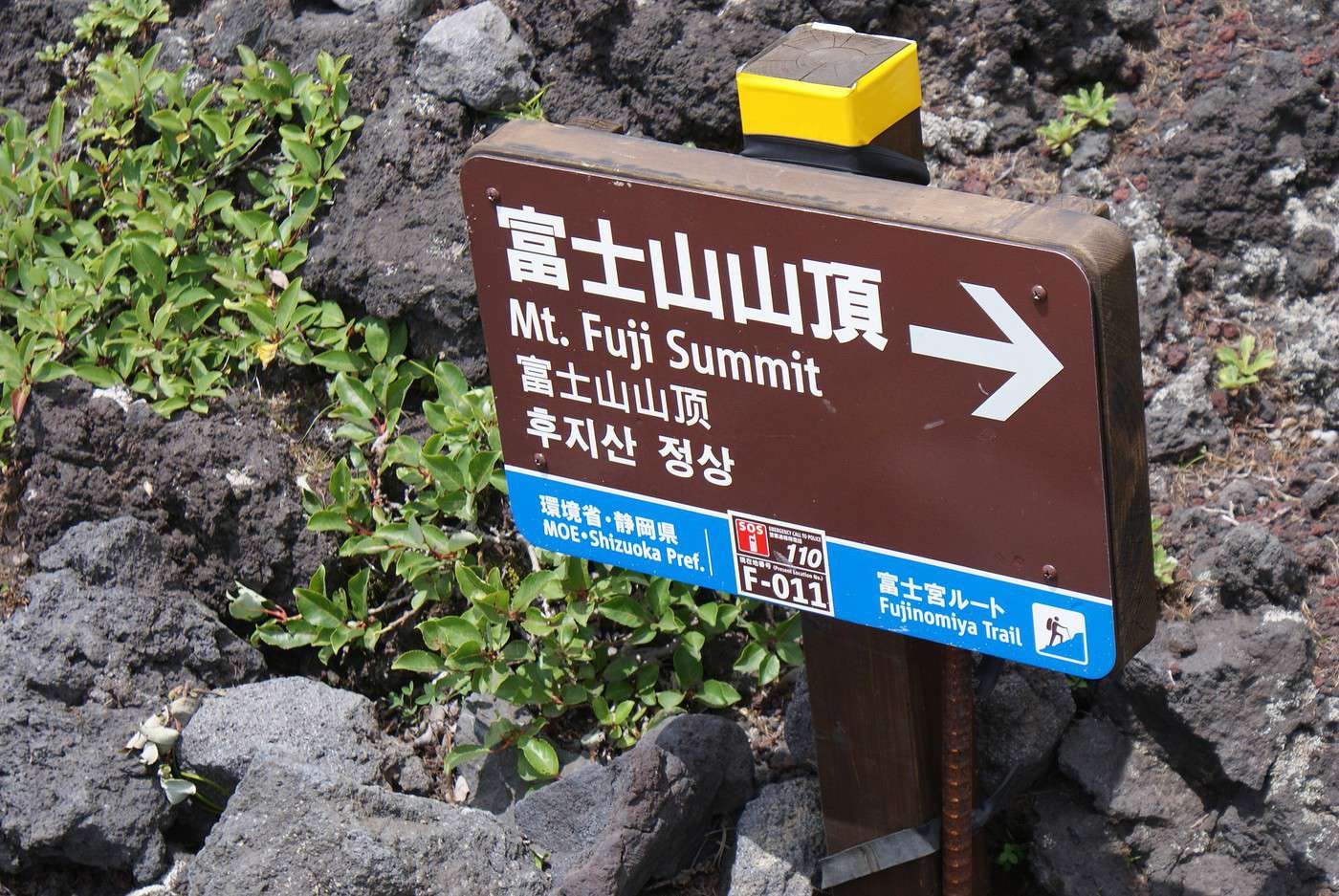
Juste un petit mot pour ceux qui voudraient tenter le montée du Mont Fuji
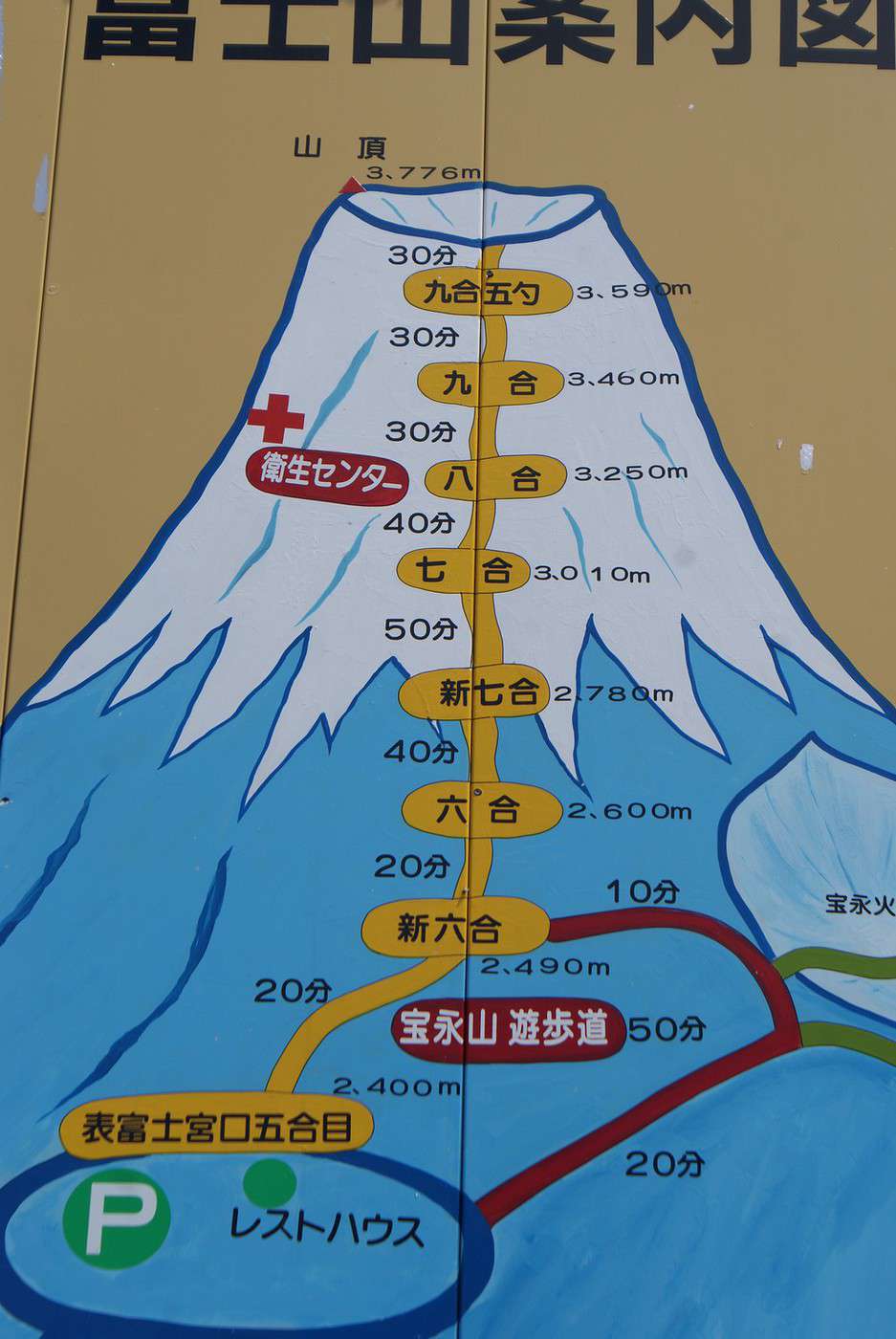
Par la route Fujinomiya qui commence au parking de la 5 ème étape à 2400 m et qui fini à 3776 m
Il m'a fallu 7 heures pour monter jusqu'en haut
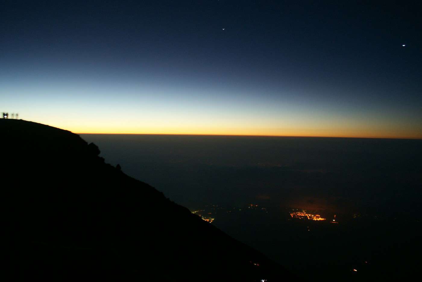
Je l'ai fais de nuit pour d'une part avoir moins chaud et d'autre part pour ne pas être démoralisé en voyant sans cesse le sommet que je n'atteindrais jamais
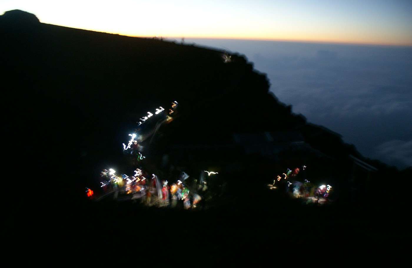
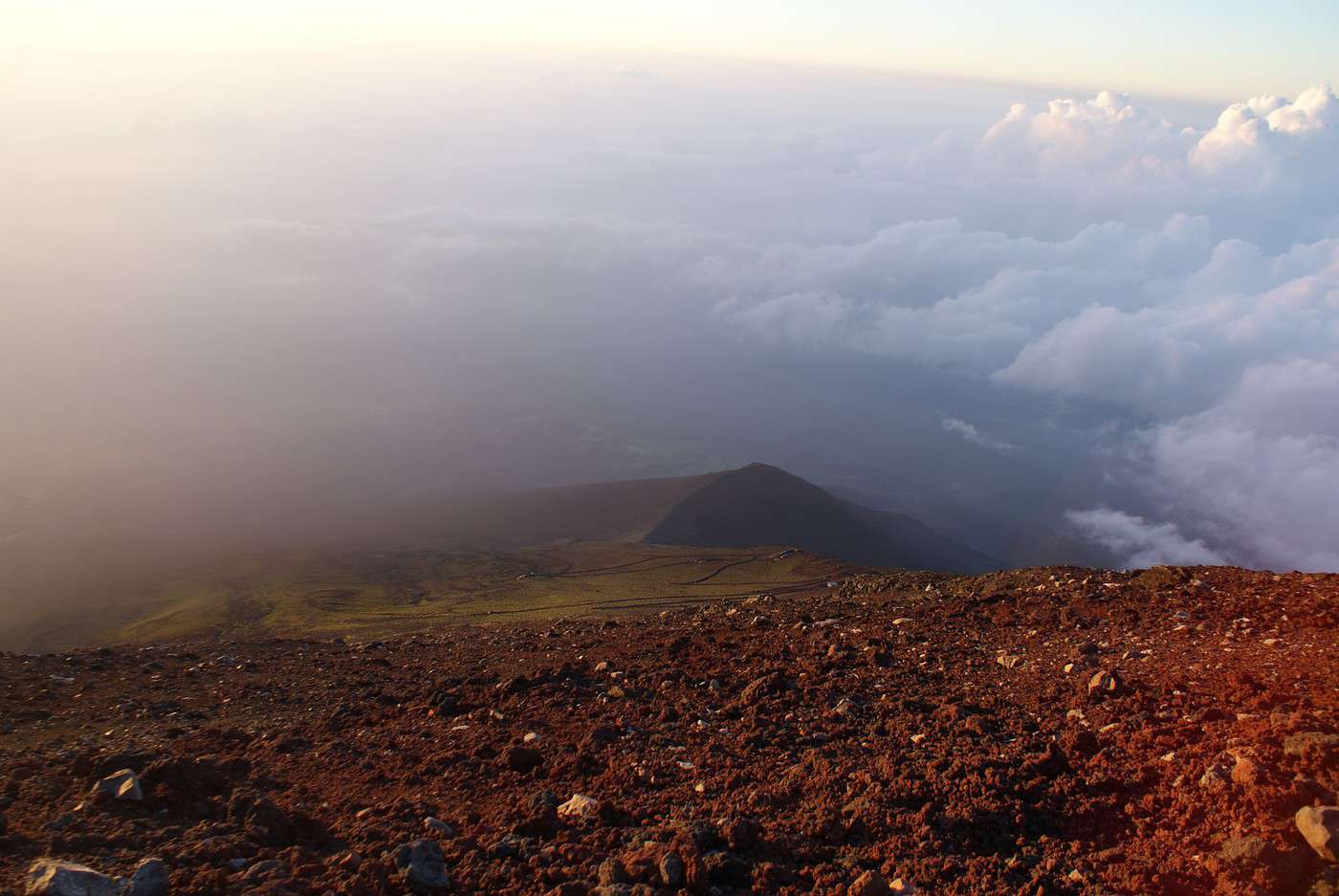
De nuit, on ne voit pas le sommet et voir toutes les lampes frontales se balancer le long du chemin, c'est très joli, surtout quand on est au dessus et que l'on se dit que l'on est déjà passé par là
Donc par une nuit de pleine lune, je n'avais pas besoin de lumière et je progressais
Enfin, le mot progresser est peu être trop fort après 1 heure de marche car je rampais plus que je ne progressais
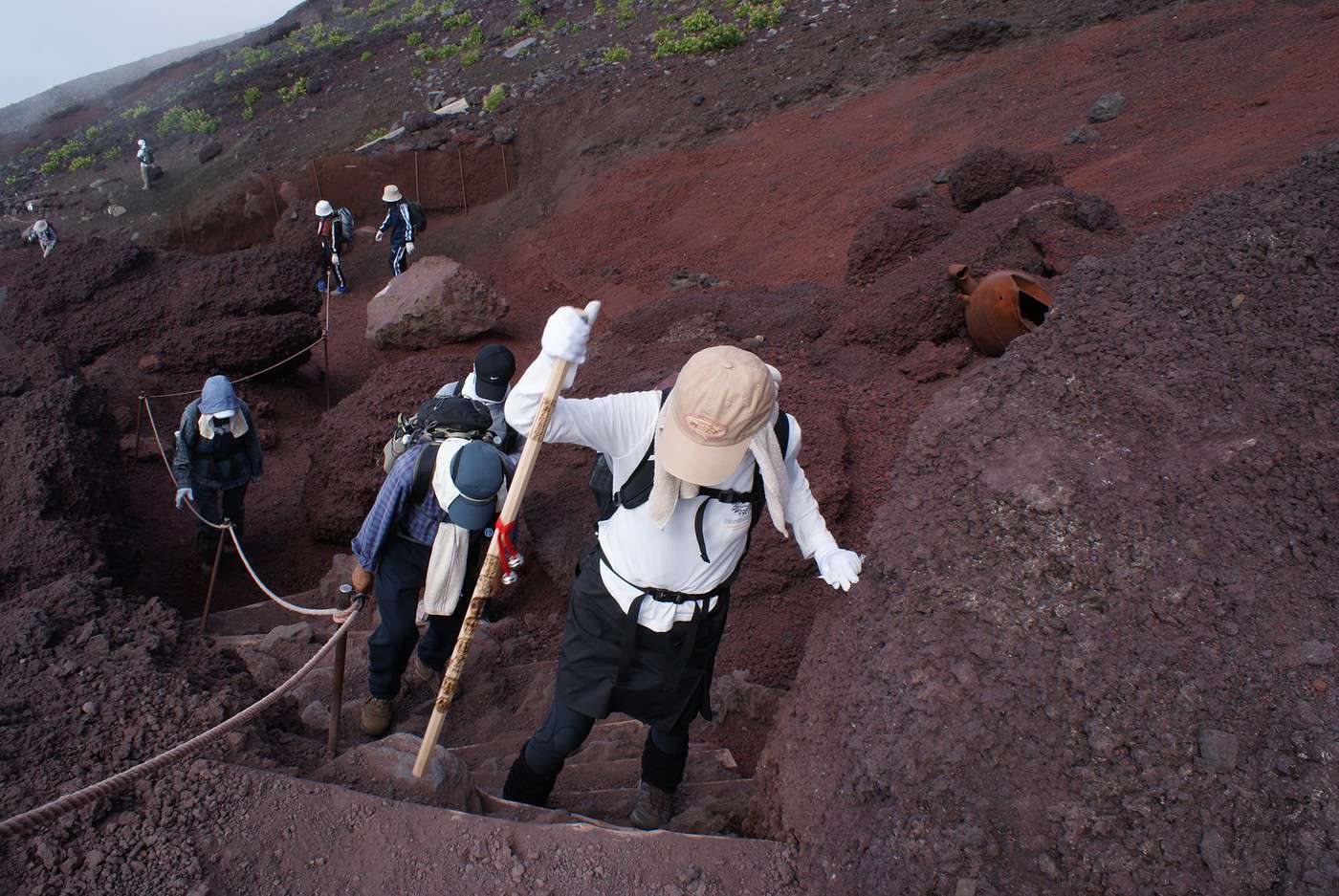
Mais heureusement qu'il y a une corde qui délimite le sentier, car je m'y suis cramponné et cela m'a beaucoup aidé pour monter, au départ, je n'osais toucher cette corde car personne ne le faisait mais après 1 heure de montée, je ne me suis plus posé la question et je me suis tiré avec cette corde qui est tantôt à gauche tantôt à droite en fonction du virage et de la montée (tiré ou plutôt hissé est bien le mot, je n'en vois pas d'autres)
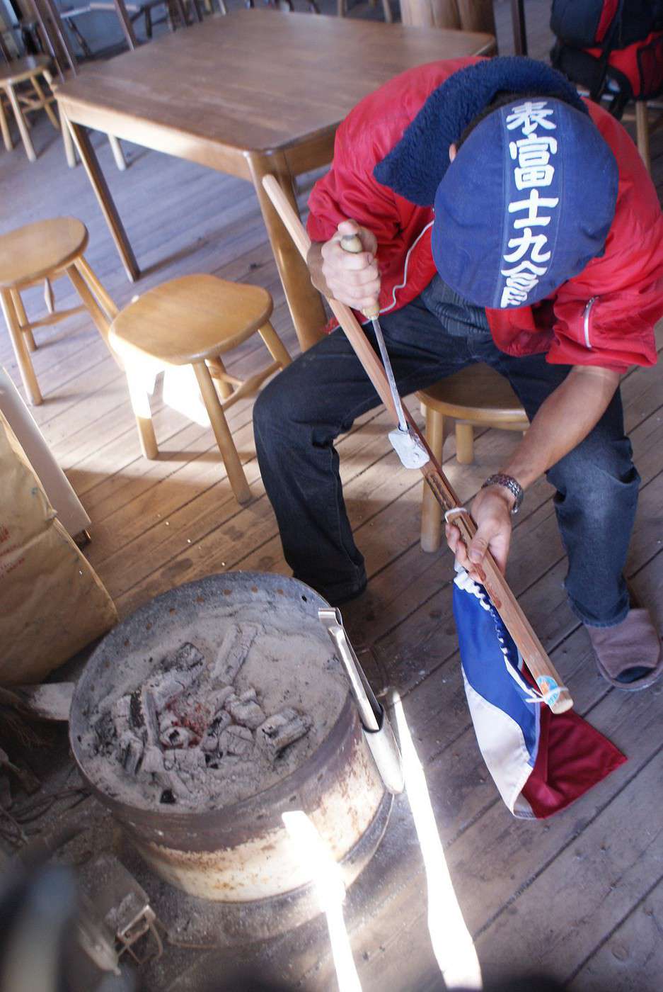
J'avais pris le traditionnel baton (que j'ai fais graver à chaque étape, mais le lendemain car la nuit, les gens dorment et ne se réveillent que vers 5 heures du matin) qui m'a bien servi pour reprendre mon souffle
En parlant de souffle, je n'ai pas souffert du manque d'oxygène, si manque d'oxygène il y a, car je n'ai pas senti la différence entre en bas et en haut, je soufflais comme un boeuf depuis le départ, il faut dire que je ne suis pas un athlète de haut niveau)
Je me suis dit que je n'y arriverais jamais au moins un bon milliers de fois, en fait tout les trois pas
Mais lorsque j'ai vu des personnes agées le faire (le monsieur avait 70 ans et la dame 69, et ils montaient pour la 3ème fois), je me suis dit que cela n'était pas possible de renoncer et que ce n'était qu'une question de volonté
Hé bien, la volonté ne fait pas tout et je suis arrivé au sommet exténué
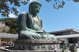
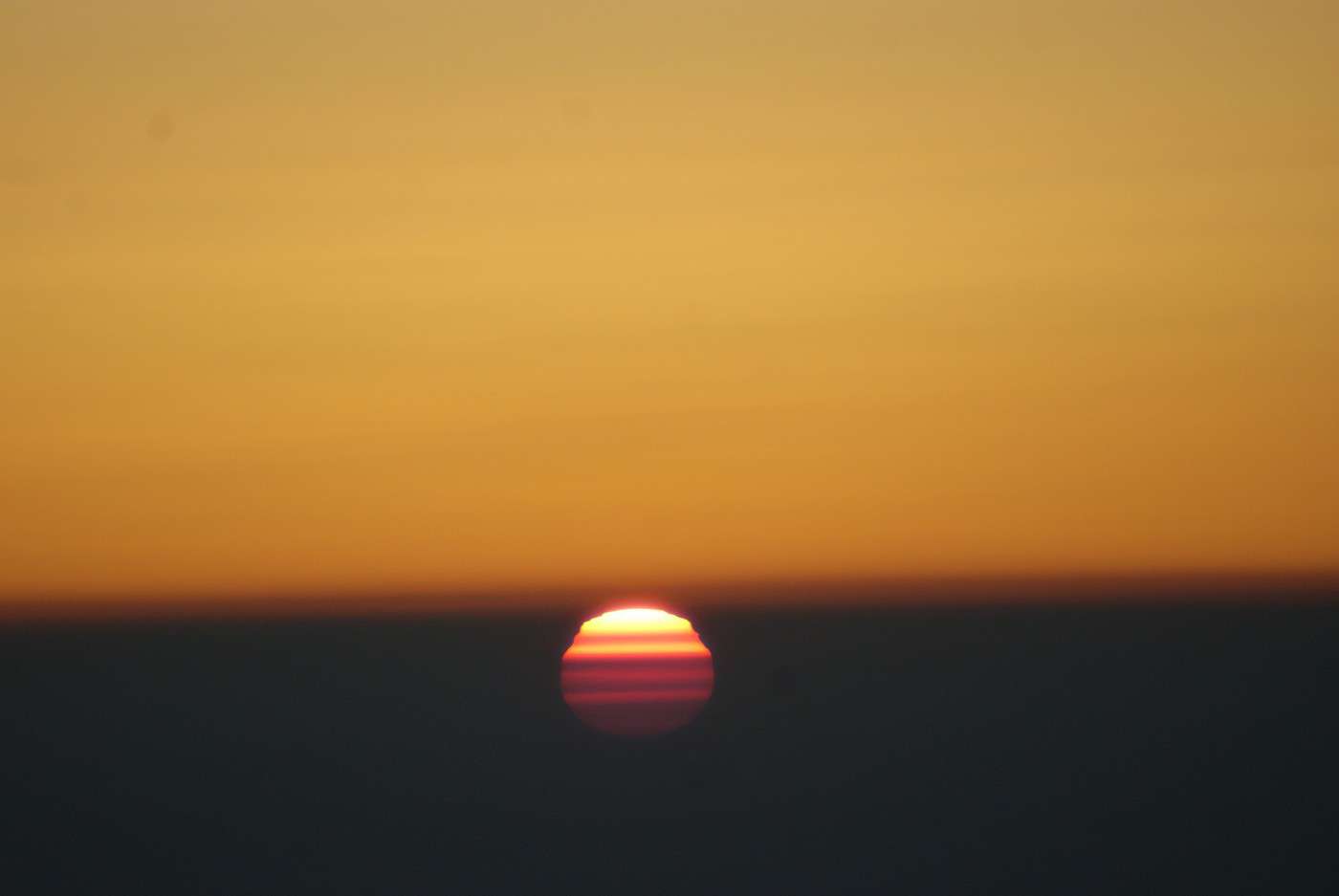
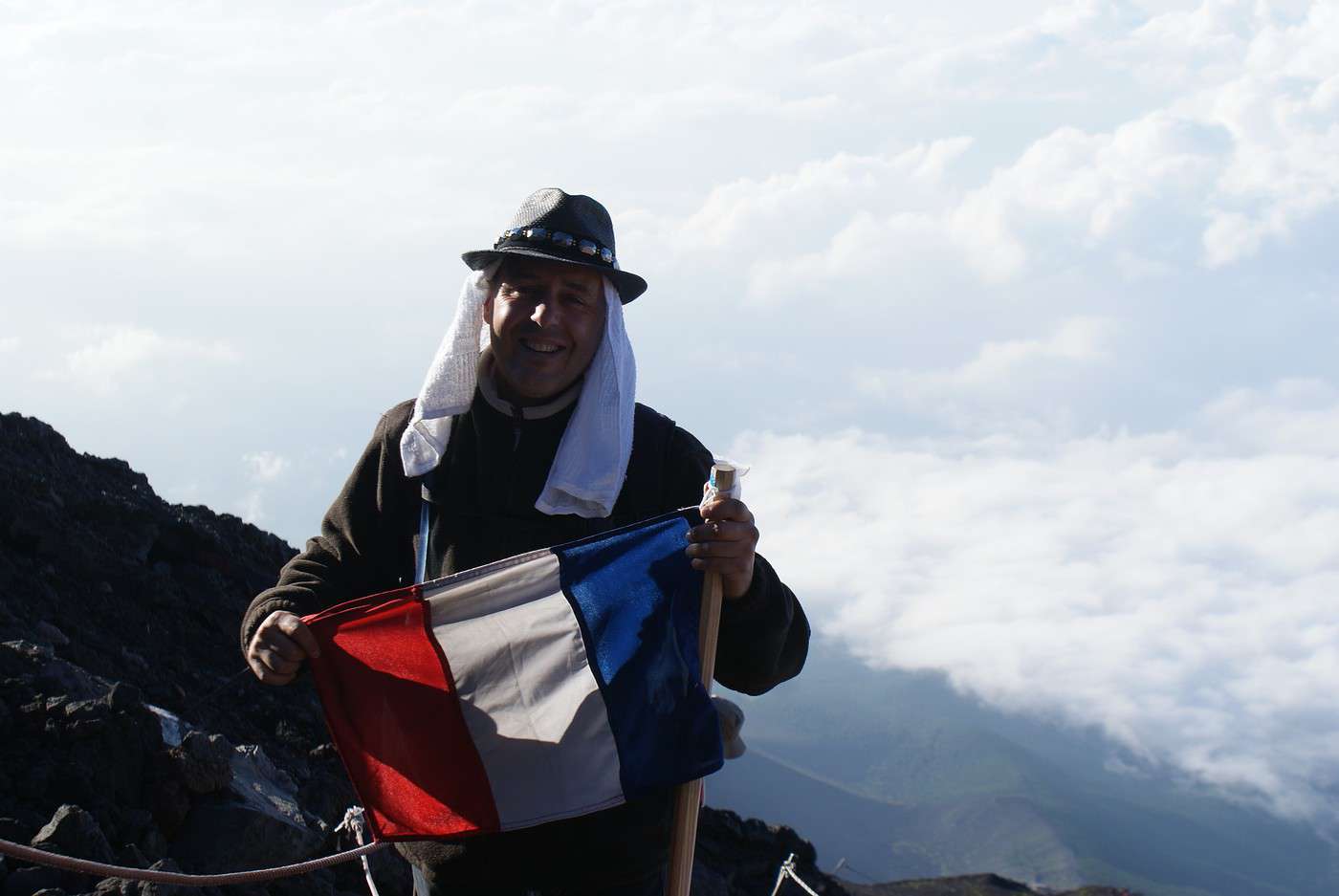
Mais quel spectacle, j'ai pris au moins 400 photos du lever de soleil (je ne suis pas venu pour rien, non mais!) et j'entendais les rires des japonais qui m'entouraient lorsque je déclenchait le mode rafale de mon appareil photo numérique (je m'en fous, j'aime les photos : j'ai ai pris près de 32000 sur tout mon périple de 6 semaine à travers tout le japon, de Sapporo à Nagasaki)
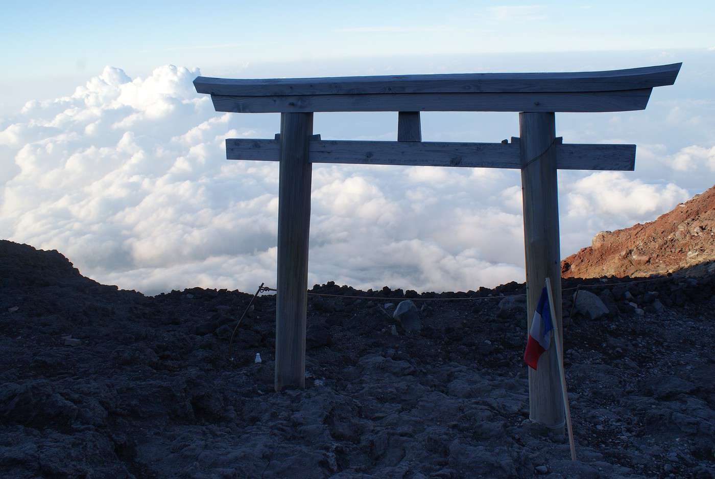
Ensuite il faut penser à redescendre (mais ne pas oublier de faire apposer la dernière marque sur le bâton, qui prouve que l'on a été jusqu'en haut, ce serait dommage de devoir remonter pour un foutu tampon (rouge celui là contrairement aux autres qui sont noirs, car ils marquent au fer rouge le bâton, en fait))
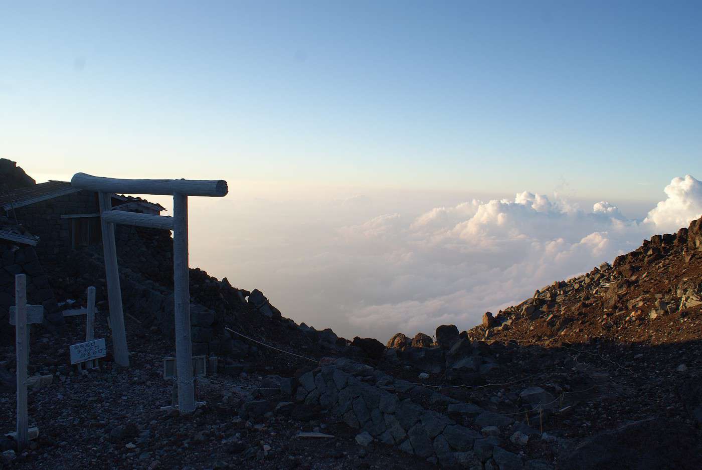
En parlant de descente, j'ai découvert un tout autre paysage qu'à la montée (c'est normal, je n'y voyais rien du tout)
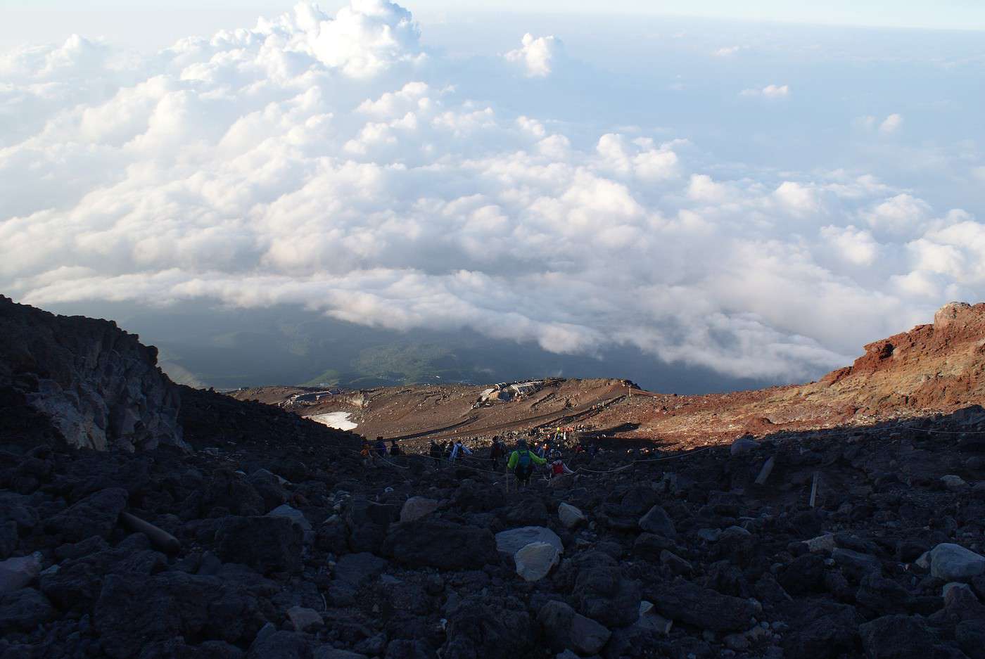
Mais le fait de découvrir ce paysage, hé bien je me suis demandé si j'étais bien passé par là car c'est long comme descente (c'est vraiment long) et pas question de courir, car on ne s'arrète pas et il y a des gens qui montent et il faut leur laisser le passage car la montée est plus pénible que la descente (il ne faut plus supporter son propre poids à la descente)
Mais oui, je suis passé par là, je vois la prochaine étape (ah, penser à demander le tampon!)
Mais qu'est ce qu'elle est loin cette foutu étape et il n'y en a pas que 7 (il y en a plus avec la 7 et demi , en fait l'ancienne 7ème étape)
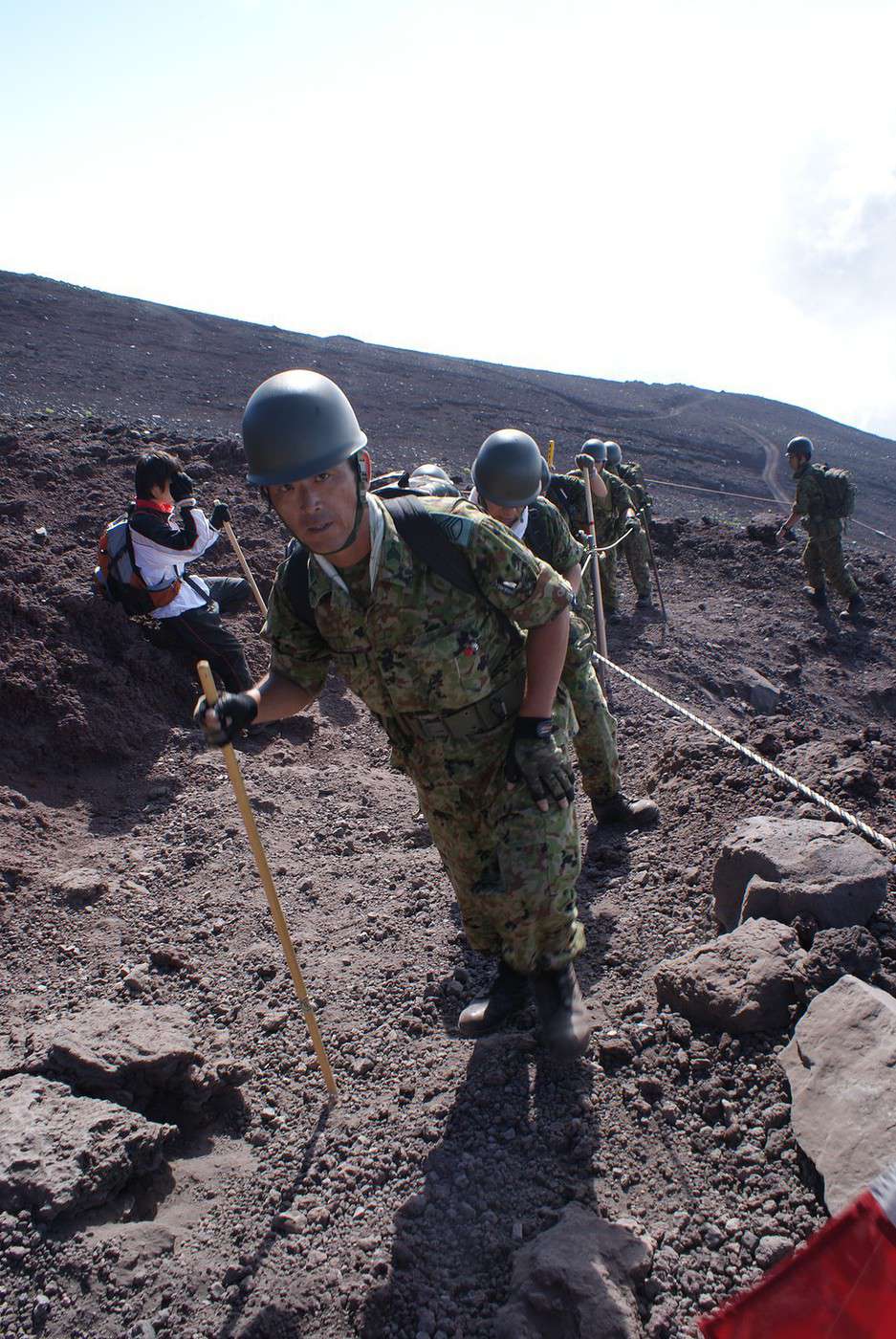
J'ai même rencontré des militaires japonais qui faisaient leur exercice du matin (j'y crois pas, le mont fuji tous les matins, dur dur l'armée niponne)
J'ai même vu des enfants monter, en sandalettes, lors de ma descente
Bref 6 heures plus tard, je rejoins ma voiture et je suis bien content de l'avoir fait
On dit que monter au sommet du Mont fuji, une fois, on est un sage ; mais grimper deux fois, on est un fou
Je veux bien les croire, car c'est vraiment dur, mais avec un peu (beaucoup, plutôt) de volonté et de patience, on y arrive
Je suis reparti directement sans avoir dormi de la nuit, 32 heures debout et une fois arrivé à Tokyo, je me suis couché de 15h au lendemain 11h : 20 heures de sommeil, il fallait bien ça pour récupérer
... qui n'a rêvé un jour, devant une photo ou une reproduction (ahhh les estampes d'Hokusai !! 🙂 ), d'aller promener ses yeux au sommet de cette si belle montagne ?
C'est la 1er fois que je lis une personne dire qu'il en n'a chier autant.
Je me demande si c'est tous simplement pas brunojapon qui est vraiment pas physique.
"Un bivouac c'est un peu comme le dépucelage et la première cuite, une espèce de rite qui fais de toi un homme" (MonsieurHenri du site randonner-léger.org).
C'est la 1er fois que je lis une personne dire qu'il en n'a chier autant.
Je me demande si c'est tous simplement pas brunojapon qui est vraiment pas physique.
ou Brunojapon qui a le rare courage de l'écrire...
Généralement on préfère raconter ses exploits que ses galères ou alors ne pas trop insister sur le coté "heureusement-que-vous-n'avez-pas-vu-ma-tête-à-ce-moment-là"
Tant mieux si cela en fait réfléchir d'autres avant de se lancer tête baissée dans l'aventure.
C'est la 1er fois que je lis une personne dire qu'il en n'a chier autant.
Je me demande si c'est tous simplement pas brunojapon qui est vraiment pas physique.
ou Brunojapon qui a le rare courage de l'écrire...
Généralement on préfère raconter ses exploits que ses galères ou alors ne pas trop insister sur le coté "heureusement-que-vous-n'avez-pas-vu-ma-tête-à-ce-moment-là"
Ou les deux 😎 !!!
Cela dit, c'est vrai qu'avec le temps, on oublie souvent le coté galère, consciemment ou pas. Par exemple, mon mal de tête monstrueux au sommet du Thorong La n'est pas vraiment dans mes souvenirs... alors qu'il est bien présent dans mon carnet de bord...
Y-a-t-il un spécialiste de la mémoire ici pour nous expliquer ce curieux phénomène qui fait qu'on repart 😉 ?
C'est la 1er fois que je lis une personne dire qu'il en n'a chier autant.
Je me demande si c'est tous simplement pas brunojapon qui est vraiment pas physique.
Justement, il n'en n'a que plus de mérite et effectivement , je pense que bien d'autres n'ont pas le courage d'écrire ce genre de texte, alors bravo à lui !😉
" Ils ne savaient pas que c'était impossible, alors ils l'ont fait. "
C'est la 1er fois que je lis une personne dire qu'il en n'a chier autant.
Je me demande si c'est tous simplement pas brunojapon qui est vraiment pas physique.
Justement, il n'en n'a que plus de mérite et effectivement , je pense que bien d'autres n'ont pas le courage d'écrire ce genre de texte, alors bravo à lui !😉
Salut,
Merci, merci
Je ne m'attendais pas à autant d'éloges
Mais j'en ai vraiment "chier" car je ne suis pas physique, je suis plutôt sport "à la maison"
Surtout que je ne fais du sport qu'en hiver durant 2 ou 3 week end en faisant du ski alpin et c'est tout
Donc je n'étais pas du tout préparé pour cette montée (AHHHrrrrgggghhh 7 heures de montée et 6 heures de descente)
J'ai même perdu 3 KG dans cette aventure
Et 3 Kg de plus avec toutes les visites de temples tout au long de mon périple
Tu sais, pour être habitué à de longues traversées "pédestres", je peux te dire que 7h00 pour un déniv de plus de 1.000 m apparement, pour quelqu'un qui n'a pas l'habitude et à cette altitude, tu n'a rien à cacher, certes c'est pas un record, mais qu'est que tu en as à faire, le principal c'est d'aller au bout de ton envie , tu l'as fait et c'est tant mieux ;
Comme c'est un endroit que je voudrai bien découvrir un de ces jours également , tu peux me dire comment tu t'es rendu au départ du sentier et à partir d'ou ?
merci
" Ils ne savaient pas que c'était impossible, alors ils l'ont fait. "
Comme c'est un endroit que je voudrai bien découvrir un de ces jours également , tu peux me dire comment tu t'es rendu au départ du sentier et à partir d'ou ?
merci
Salut,
J'y suis allé en voiture de location et je me suis garé au parking de la 5ème étape à 2400m de haut que l'on atteint par la route 152
Hi,
We’re planning to do the 4-day trek from Mestia to Ushguli without an agency. The descriptions mention that there are accommodations at each stop, but we can’t find any details about them. Has anyone got info or feedback on this route?
We're planning to trek in Peru and Bolivia and would love to find some local agencies.
If you know any, could you share details on prices and, of course, the names of the agencies?
Which trek would you recommend?
Elocine
Je pars en autonomie totale sur un trek au Maroc (10jrs) Imilchil - Aghbalou.
Trouve t-on des cartouches gaz à vis (Coleman, Primus) à Marrakech (adresse) ou villages entre Imilchil - Aghbalou ?
Si non , trouve-t-on des cartouches Butagaz pour camping-gaz (petit volume 230 gr ...)
Merci d' avance pour vos réponses
Hello, I’d like to embark on a little trip in my home country, Switzerland. I’ll start walking from La Cure, heading toward Le Noirmont first, then I’ll improvise my route—but it’ll probably follow the French border... at least as far as Lac de Joux.
I’ll decide day by day how much farther to go after that. My goal is to stay in nature as much as possible, wander around for as long as I can, and restock food in villages or towns along the way.
I’m thinking of mostly camping, but we’ll see if I end up in a hotel or another campsite depending on my route.
I’d love to reach La Chaux-de-Fonds on foot... maybe even Delémont.
The whole thing should take about a week, give or take.
I’ll be bringing my dog, and I’m preparing for this as soon as I’m ready.
Any tips to make sure everything goes smoothly for us? Things I should know—or avoid? What about shepherds with their flocks of sheep? And isn’t hunting season open right now?
I’m not sure if what I’m planning is even doable, which is why I’m asking around.
This’ll be my first time doing something like this—wandering in nature *and* with a dog. I’m really excited for this adventure... and I need it. Thanks!
We’re really keen on ecosystems and want to hike in "natural" ancient forests—not planted woods or areas heavily degraded by human activity. Travel guides (like Lonely Planet) don’t provide much info on this. Could you point us to the most interesting spots?
Thanks in advance for your tips.
We wish you happy holidays and a fantastic 2026, full of discoveries!
Claire and Albert
Hi, this might not be the right section, but I’d like to know if it’s possible to start mountaineering with another person without necessarily hiring a guide. We’ve done quite a bit of hiking but not mountaineering—we’ll just do a half-day glacier course. After that, we were thinking of starting with La Grande Motte and the Pointe de la Traversière, which were recommended to us. Honestly, for things like roping up and knots, I’ll learn at home with lots of videos and a book.
Jaimerais savoir si quelqu'un aurait fait des treks sur le Ruwenzori et combien ça coute en moyenne, les infrastructures, les paysages la sécurité sur les lieux, merci beaucoup. J'attends avec impatience vos réponses.
We’re leaving in 9 days for a two-week trip to Madeira, mainly to hike.
From my research, I’ve found that since last year, access to most trails—and systematically for the most popular ones—is now paid. You have to pay an access fee of 4.50 € per person per classified hike in 2026, and even 10.50 € for the most iconic hike: Pico Arieiro to Pico Ruivo. When paying, you also have to choose a day and a 30-minute time slot for your start time. Of course, this reservation is neither changeable nor refundable, even if the weather that day is terrible.
Personally, given the massive influx of tourists to the island in recent years, I don’t mind paying a fee to help maintain the trails. Similarly, setting a limit on the number of people who can hike them per day is certainly preferable to preserve this priceless heritage.
However, what’s much less fair is that in reality, most of the available spots are reserved: 1/ for Madeira residents (which is normal); 2/ for "economic operators" (meaning local tour operators). For example, if you’re a non-resident (independent tourist), no booking is possible for the Pico Arieiro hike for an early morning start before September! So, unfortunately, we’ll have to skip this hike.
It’s the same issue for Ponta de São Lourenço, the 25 Fontes, Pico Ruivo... in short, all the most popular hikes. Oh well, we’ll skip those too!
So my question is: which hikes do you recommend where we won’t face the huge crowds that the others get? And where we can book the day before for the next day, taking the weather into account?
Finally, a quick accommodation question: we’ve booked the first week in Funchal, but I haven’t decided yet for the second week. Do you have any advice on where to stay in the south or north, preferably avoiding overly concrete-heavy and touristy spots?
I’m reposting about the logistics for Samaria Gorge.
I’d love to get recent info, especially about whether it’s possible to park my car in Omalos, do the hike, and then catch a bus back to my vehicle.
In theory, it’s doable, but when you check the KTEL website, there aren’t any feasible schedules listed. If anyone has recently organized this with reliable, verified details, I’d really appreciate it. Thanks in advance!
Hi there,
We’re flying from Montreal to Lyon this August to go hiking in the French Alps. We’ve rented a car and will be staying at campgrounds. We’re planning to do day hikes and want to stay a few days in one spot, do a few hikes, then move on to our next camping spot. Could you share your favorite spots or any recommendations for places to spend a few days with great hikes?
A few details:
We arrive in early August and leave in early September.
We’re looking for day hikes (or shorter), moderate difficulty, with a cumulative elevation gain of no more than 1000m, and of course, beautiful scenery!
We’d prefer not to drive too much—maybe it’s best not to head too far south and deal with unnecessary heat?
Along the same lines, if you know of any great campgrounds where we can start our hike directly without needing the car, we’d love to hear your suggestions!
Bonjour
Souhaitant faire de la randonnée sur cette île, je voudrais d'abord savoir quelle serait la période la plus favorable sachant que j'avais passé quelques jours en novembre 2018 pas pour cette activité mais plus pour une simple découverte de l'île et le temps n'était pas top notamment en montagne. Donc peut on choisir une organisation en étoile sachant que je louerai un véhicule avec éventuellement 2 points d'hébergement.
Je n'envisage pas d'intégrer une structure mais de partir à 2 et de s'organiser sauf si vous me conseillez une agence locale ou un guide local. Enfin même si je compte me procurer les différents supports, carte et topo guide plus gps je vous remercie de bien vouloir me communiquer les randos à faire en priorité
Merci beaucoup pour vos informations
I’m planning to do the Mercantour crossing following the Randoxygène route in mid-July.
I’m used to hiking in the mountains, but I sometimes get vertigo, for example on ridges with drops on both sides. I wanted to check if there are any T4 or T3-T4 sections and find out if there are any very exposed passages—and if so, where—so I can plan an alternative route.
Can anyone give me some info on this?
Thanks!
I’m planning a trip around Cap Corse and the AGRIATES in 2026, from May 8th to 15th (there are still 2 spots left, by the way! Just DM me if you're interested).
I’d love to know which hikes are worth prioritizing in the AGRIATES. We’ll be staying in SALECCIA for two days as our base—what should we focus on from there?
A round trip to IGNHU beach? Any other suggestions?
For Ostricano, I think it’s too far for a round trip...
Thanks for your tips!
Have a great day,
Anie, Toulouse
I’d like to get some info about the GR10 Pyrenees traverse. I need help planning the daily stages and accommodations—my wife isn’t an experienced hiker but walks a lot, so I’d like to schedule shorter walking days and thus a longer overall trip in terms of number of days.
Could anyone give me some help and advice?
Best regards,
New to this forum, I’m planning a pretty big project for 2028.
I’m heading to Nepal to do a trek from Kathmandu all the way to Everest Base Camp (a cool 5,300 m 😄).
This trek is a bit special because even though I’ll be part of a group, I’m going solo (so far, no problem—I’m used to it). But it’s my first real trek, and it’s also a humanitarian one: once I reach base camp, I’ll stay an extra week to help clean up the waste left by tens of thousands of climbers! Since I’m originally from South America, from two countries that share the Andes, I have a deep respect for mountains—they fascinate me. So Everest… it’s kind of the trip of a lifetime!
So, a little question for those who’ve done treks to Everest before… any tips for good mental preparation (I’m already working on the physical side)?
Hi there, I’m planning the Annapurna Circuit for March 2027 and I’m looking for a local agency with a local guide—preferably French-speaking—to arrange this trek for us. Any suggestions? Thanks
Hello!
We’re spending a few days in Toraja country at the end of May. We’d love to do a day trek—taking our time—on a route that’s stunning in terms of scenery, but not a level 5 in difficulty!
Any suggestions you can share, please?
Thanks in advance
I’d like to do the Mare a Mare Sud in May over 4 days. I’ve found quite a few places to stay along the route, but I’m stuck on the start and finish.
I’ll be arriving by plane on Sunday evening and would like to start pretty early on Monday morning. Ideally, accommodation right at the trailhead (Alzu di Gallina) would be amazing, but I can’t find anything. Any tips?
Also, for the transfer from Figari Airport to Porto Vecchio or Alzu di Gallina?
At the end, I’d like to pick up a rental car—any advice on that too?
I’m traveling solo by plane to Catania in May and plan to hike the northern side of Etna, starting from Linguaglossa where I’ll arrive by bus. After that, I’d love some info on how to get up to Piano Provenzana (shuttles or hitchhiking), since it seems there’s no public transport except in the summer. Can you sleep there in a free or cheap refuge, or camp? And how far up can you go without having to hire a guide? Thanks in advance. Bernard.
Bonjour a tous,
je pars en voyage au Maroc en aout et nous allons commencer par nous arrêter a Chefchaouen(nous sommes en voiture).
Ma question: quelqu'un peut il m'indiquer un itinéraire de rando en boucle d'entre 5 et 7 jours aux départ de Chefchaouen dans le parc de Talassemtane passant si possible par le pont de dieux?Ou un guide papier qui en reunis quelques uns?
Nous privilégions le camping sauvage et les gites.
Merci d'avance
Hi there, for those who’ve been recently—is it possible to find other solo travelers in March on the island to share transport or room costs? It doesn’t seem easy to travel on a budget.
If you have any recommendations for simple lodgings or places with dorms, I’d love to hear them.
For those who’ve done multi-day treks while moving around: do you need to bring your own sleeping bag? I’d love to hear about itineraries you’ve done without a guide, just with a map and GPS.
Thanks, and have a great day!
Hi everyone!
We’re planning a 15-day road trip to Scotland this summer, specifically to explore and hike on Lewis and Harris—places we’ve never been before. We’ve visited other islands on previous road trips in Scotland (we usually go in April for a week). This would be our first time in Scotland in the summer and for 15 days. We’re looking at late August to early September.
I’m currently drafting the itinerary. We’d be crossing from Ullapool and were thinking of spending 3 nights on Harris and 4 nights on Lewis.
Does that sound balanced to you? Is it better to keep the same accommodation on Harris and the same on Lewis to explore the area? I’d love to hear about any past experiences you’ve had on these islands.
Thanks!
Hi there, I’m trying to leave for 15 days very soon to São Vicente. I’m either looking to join an agency or figure things out on my own to go hiking on one of these islands or both. From what I’ve seen, it’s not easy to organize with local transport, so it gets expensive. Can I use the services of a small local agency? I’m looking for the simplest way to hike for several days. Also, how do you get from São Vicente to São Nicolau? Thanks in advance and have a great day!
Aichatou
I’ve been wanting to do this for several years, and this year’s the one. Next September, I’ll be trekking in Tusheti (Georgia), from Omalo to Shatili.
Of course, I won’t be renting a vehicle that’d just sit unused. No problem getting to Pshaveli, but from there to Omalo, it’s a dirt road (still the case?)
There must be some form of public transport since there are so many guesthouses, and not all travelers come in a 4x4.
If any of you have been to Omalo, could you confirm that these shared transports exist and how often they run?
we’re planning a trip to Yellowstone and hoping to do a three-day backcountry hike if we get a permit.
if any of you have done this before, could you let me know if it’s possible to find water along the way? And if we can transport it, are we allowed to use a stove?
Hello,
I’ll be in Nepal from March 6th to 29th (we’re flying into Kathmandu via Varanasi and leaving via Delhi).
I’m a bit confused about the regulations requiring a guide.
My wife and I (we’re 63 and 64) aren’t experienced trekkers—we’re more used to walking on terrain with very moderate elevation changes. I’m looking for fairly easy hikes, possibly day trips.
Here are my questions:
- Does the Poon Hill trek from Pokhara require a guide, or is it better to go through a local agency? (I’ve seen a lot of them offering 4-day packages)
- I’d like to do a few multi-day hikes around Jomsom (Kagbeni, Mukitinath, Lupra, Marpha)... Do you need a guide for those, and can you find accommodations easily without booking in advance?
Last question—I’m really hesitant to lug around a sleeping bag or down jacket during our 6 weeks in India. Can you easily find these kinds of items at reasonable prices in Pokhara?
Thanks in advance for any tips you can share!
Yann
I’m a 56-year-old man who’s done several treks in Nepal and elsewhere. Also passionate about photography.
I’m looking for one or more people to form a group for a trek in Nepal. The trek is the Annapurna and Manaslu circuit (24 days), including a stop at Tilicho Lake. I’ve got a great itinerary and the local company seems solid. The price is around $1600.
I’ll be in Nepal from April 5 to May 12, 2026, so the trek would need to happen within those dates.
 C'est la 1er fois que je lis une personne dire qu'il en n'a chier autant.
Je me demande si c'est tous simplement pas brunojapon qui est vraiment pas physique.
C'est la 1er fois que je lis une personne dire qu'il en n'a chier autant.
Je me demande si c'est tous simplement pas brunojapon qui est vraiment pas physique.