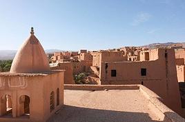
Je repars pour 2 semaines 18 mars-2 avril (vol Paris-Casa)dans la région d'Imilchil que j'ai découvert en Octobre dernier, coup de foudre😉.
Soit je rayonne autour de cet endroit , je dispose d'infos récentes sur cette région: hébergement, sites à voir... soit dans tout autre région où vous me donnerez envie d'aller.
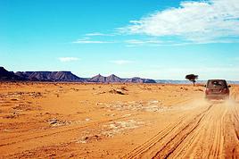
Je cherche avant tout le hors goudrons où la vie locale est encore préservée. Je voyage en bus, taxi collectifs et à pieds.
Je vous remercie pour toute expérience passée à partager.
Bonne fêtes de fin d'année aux forumistes!
salut toutes et tous:
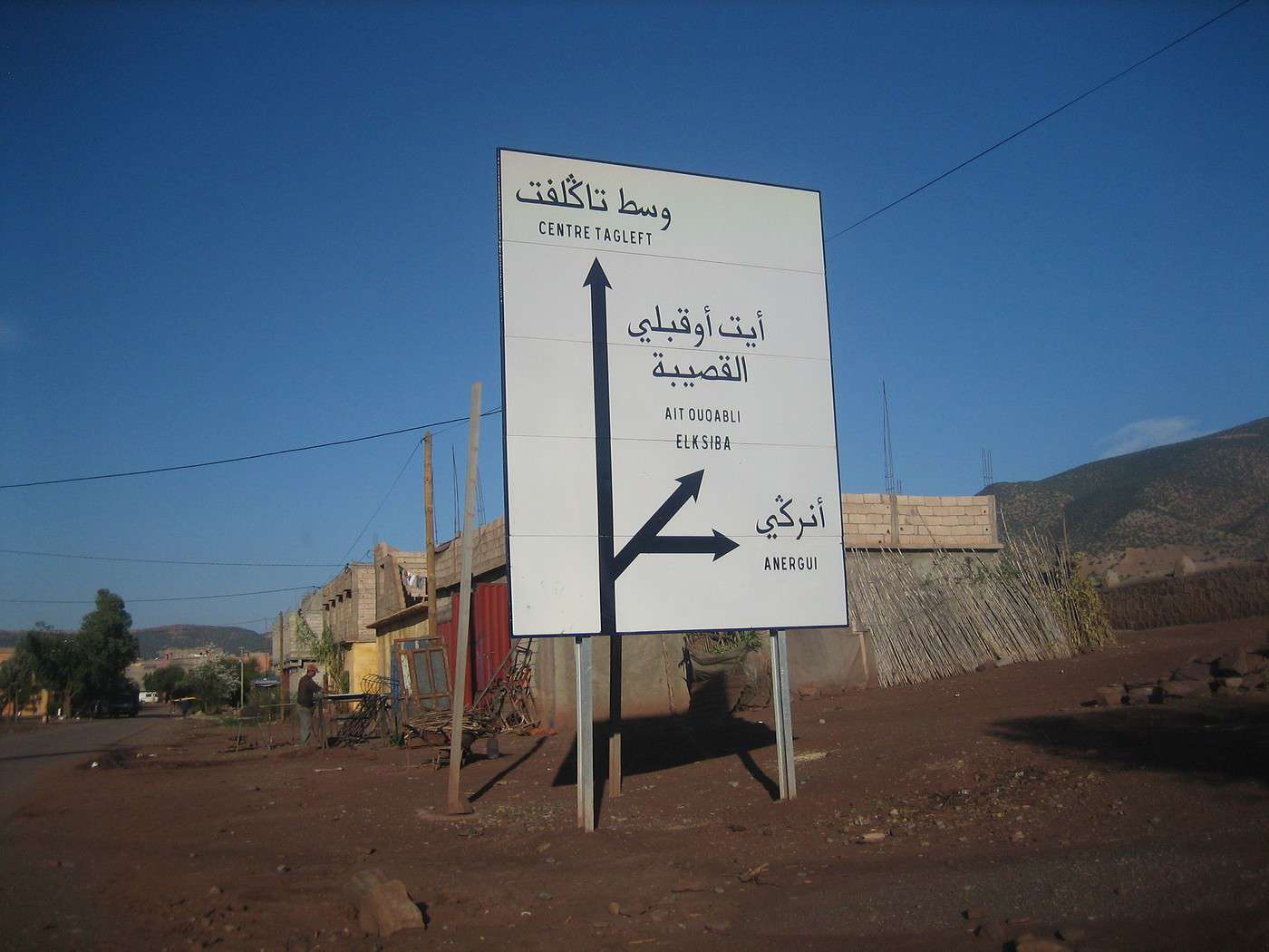
pour la region d Imilchil tu peux y acceder depuis Rich route goudronnée soit depuis Beni mellal aghbala de tres beaux sites à voir jusqu à Imilchil(route goudronnée) ; soit depuis Tounfiyte chemin moitie goudrounée mais accesible ; tres beaux sites à ne pas manquer aussi. a Imilchil il y a des auberges et de beaux paysages (lacs) pas loin d Imilchil (4km environ) apres tu peux descendre soit vers tinghir (gorges de toudgha) soit vers Boumalen Dades par les gorges de dades et apres c est ourzazate. une autre proposition si tu veux descendre vers goulmima par la vallée de gheris - Amellagou jusqu à la ville de goulmima. tu peux trouver des auberges et maisons d hotes et moyens de transports partout.
je te souhaite un tres bon voyage
Le problème quand on a perdu ses lunettes c'est que l'on est obligé de les retrouver pour pouvoir les chercher."
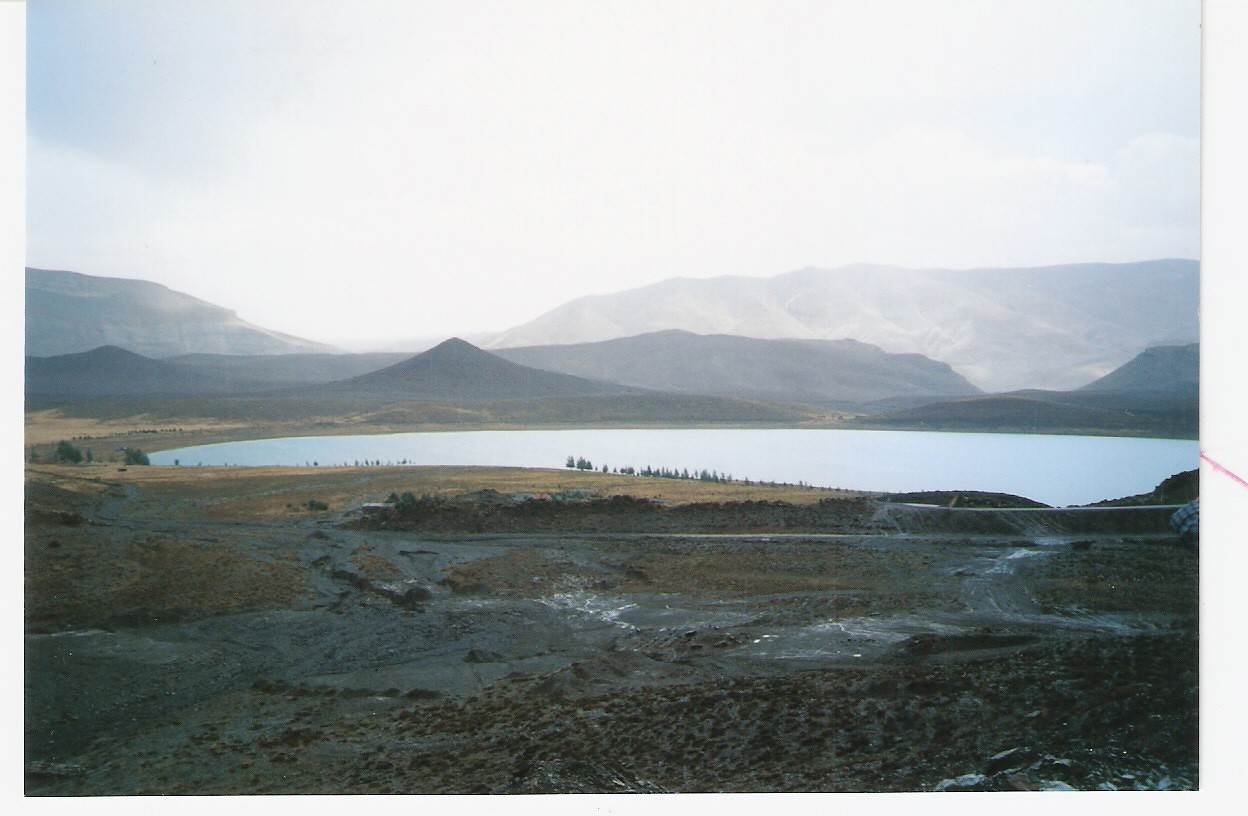
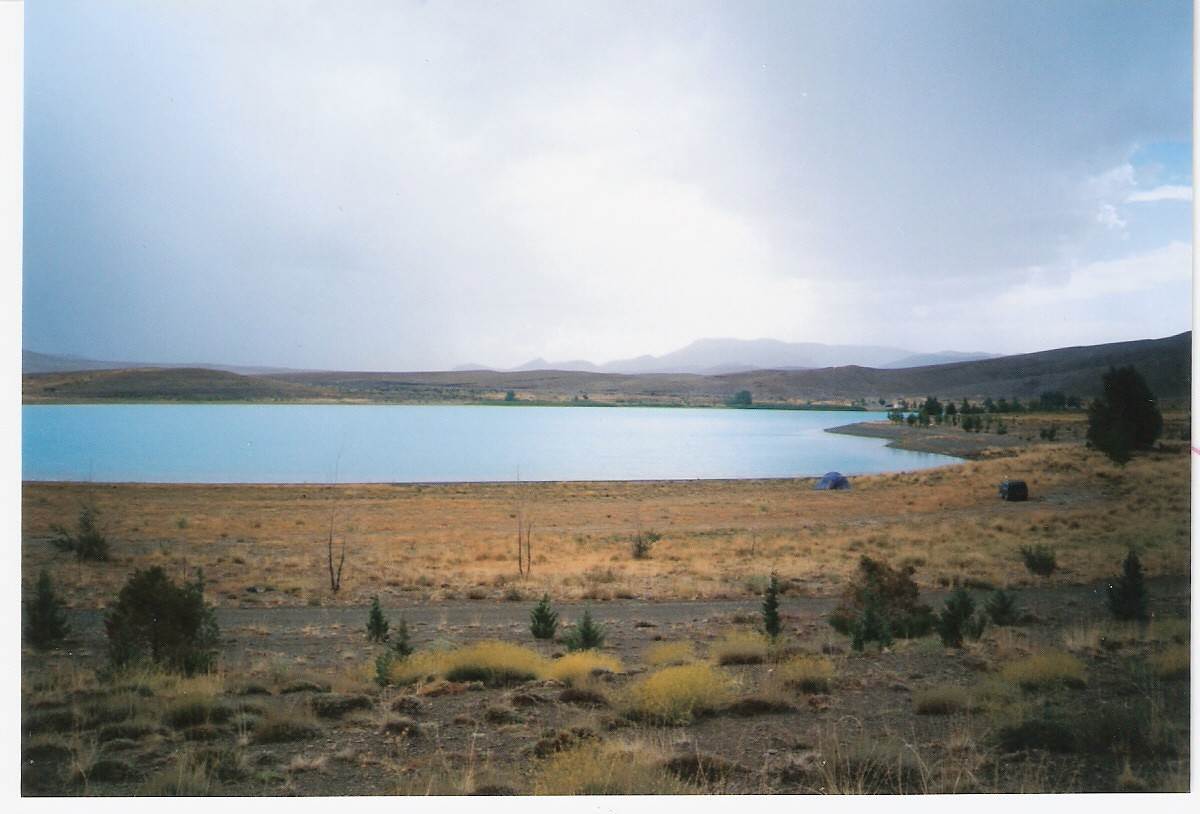
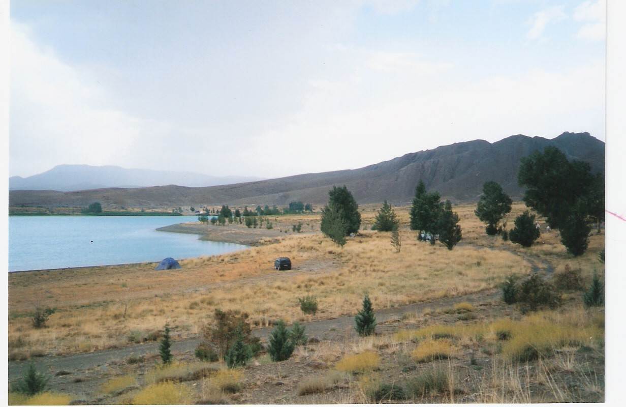
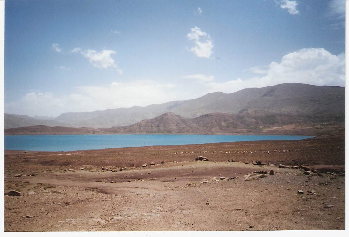
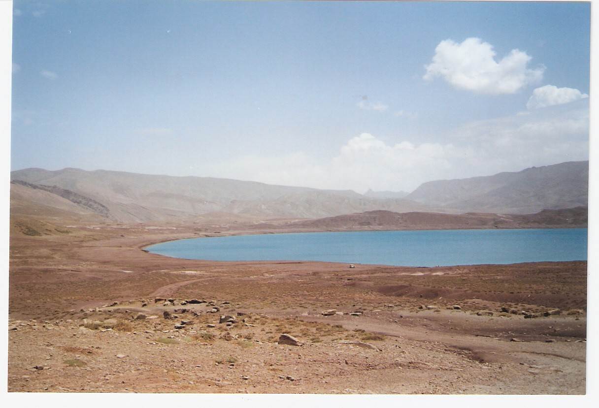
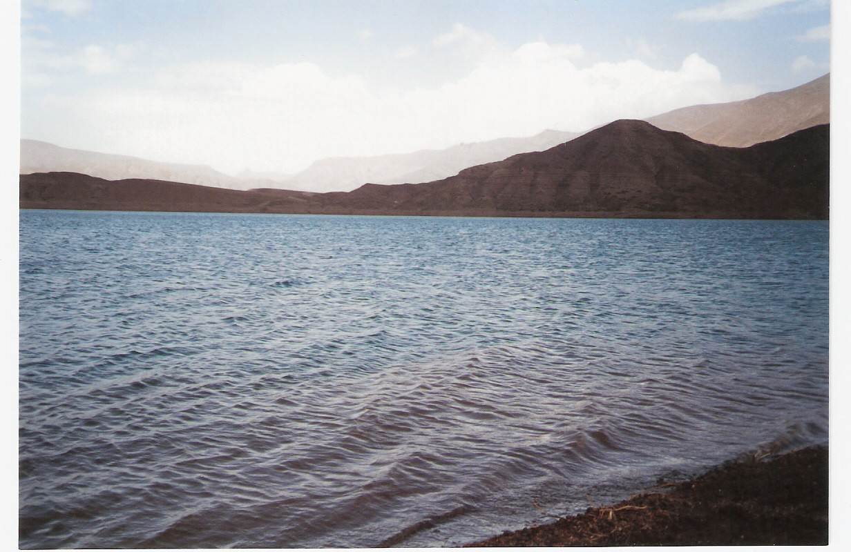
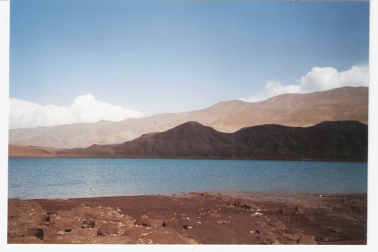
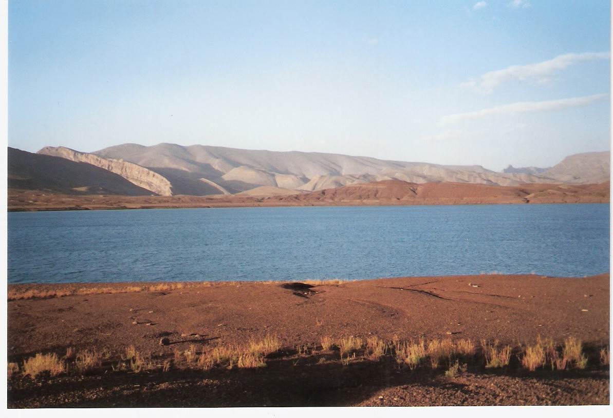
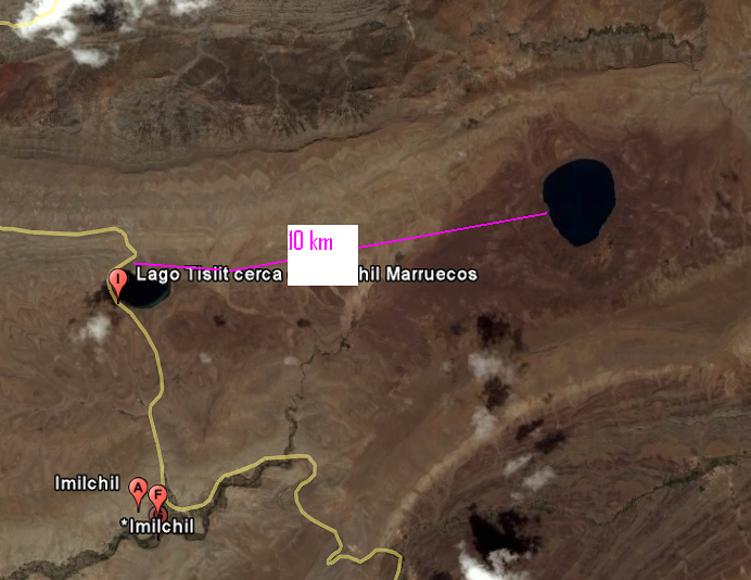
Comme le dit pleo, d’Imilchil , il faut aller voir les deux lacs Isli et Tislit se situant à plus 2000 mètres d’altitudes. Le mieux, suivant mon point de vu, c’est de le faire à pied avec un guide de montagne, Imilchil à Isli et revenir par Tislit. J’ai eu l’occasion de le faire en 2002 avec bivouac à Isli. Un endroit merveilleux, calme, reposant avec une eau d’une limpidité. Et ce qui fait la magie de cet endroit, c’est la légende qui raconte le commencement de ses deux lacs , Isli (le fiancé) et Tislit (la fiancé)………
Et pour les hébergements, je ne pourrais pas d’aider plus car lorsque je sillonne les chemins du Maroc, en générale, c’est en rando avec un guide de montagne, bivouac ou chez l’habitant…
Et mars/avril, c’est une bonne saison mais prévoir vêtements bien chauds pour le soir…
Bon séjour
On ne voit bien qu'avec le coeur car l'essentiel est invisible pour les yeux.... Antoine de Saint Exupéry
bonjour,
Merci pour tes infos pleo. Le temps de situer ces endroits sur la carte et j'avancerais dans mon projet. Je prends ensuite contact avec Hammou CHRIFI du gîte d'anergui avec qui j'ai sympatisé. Il a son 4x4 et il organise régulièrement des treks, de plus c'est un excellent cuisinier!
Je sais qu'on peut rejoindre Imilchil depuis Anergui par la piste(4x4) ou à pieds, j'ai rencontré un couple en octobre qui en venait, ils ne tarissaient pas d'éloge sur ce trek réalisé sans guide.
Bonjour izza,
Même commentaire que celui que je viens de laisser à l'attention de pleo, mention spéciale pour les photos, loin des horde touristes, là où la "vraie vie" existe encore. Tu me donnes envie d'aller faire un saut vers ces 2 lacs, je crois qu'Hammou sera partant également
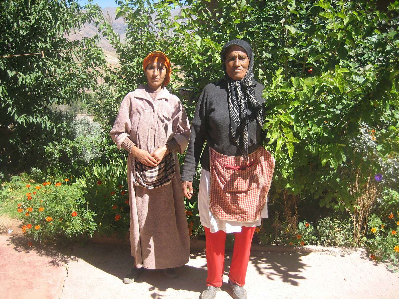
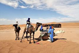
Pour toi une photo de 2 voisines de la vallée d'Anergui, la plus agée gère un gîte avec son mari et son fils.
Merci pour tes infos.
Voici la légende qui raconte la naissance de ces deux Lacs…..
Et depuis, chaque année, une grande fête est organisée à Imilchil, mais je ne saurais te dire à quelle période de l’année « La fête des amoureux »
Mais les locaux pourront te raconter
http://souss.com/Mammas-et-Aylimas.html
On ne voit bien qu'avec le coeur car l'essentiel est invisible pour les yeux.... Antoine de Saint Exupéry
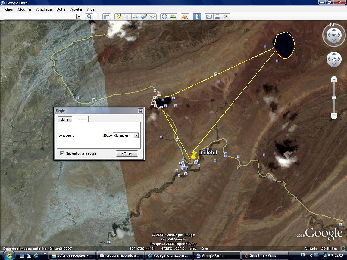
Pour les 2 lacs, inutile de mobiliser les services de Chrifi, ni meme d'un autre guide !
Le premier est au bord du goudron , à quelques kms au nord d'Imilchil, avec une auberge camping bien sympa
le second est à 10 km par une piste qui longe le premier au départ et qui y va sans possibilité d'hésitation (un passage un peu visqueux !).
Je pensais à CHRIFI et son 4x4 car mon idée est d'arriver jusqu'a Anergui par les transports en commun.
Venant de Casa en car (35dh), arrêt à Fquih Ben Salah(couple d'amis), Beni Mellal, de là je pense trouver un transport pour Anergui via Tagleft (pb neige jusqu'en mars d'après la 742?) évitant Afourer, bin el ouidane et ouaouizarth(tu l'a bien fait, dans des conditions cahotiques certes, mais...) de plus le goudron arrivant à Anergui je pense trouver un grand taxi faisant cette liaison.Qu'en penses-tu? Sinon je loue une Kia à FBS (200DH/JOUR). As-tu un plan B pour louer dans le coin? Je peux aussi faire la tournée des lacs à pieds en partant d'Imilchil comme me le conseille Izza, 30km sur 2 jours. Tout cela n'est qu'une première approche, je continue à chercher dans les réponses à mon message.
Bonne journée.
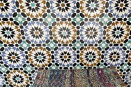
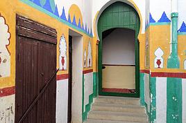
PS: J'aime bien le mélange de couleur locale dans la chambre de Tiznit, je passerais volontiers une nuit avec Snoopy😛
Bonjour
pour Hamou charifi le gîteur de la vallée d'anargui est joiniable au gsm 06 10 98 86 79
par contre à imilchil beaucoup de choix entre auberges , gites, guides de montagne partuculiereemnt je travail avec bassou chabou
aubergiste et guide de montagne joiniable au gsm 06 68 56 44 75
Beni mellal à imilchil fesable en six jours de mache par des pistes et sentier sans passer par anargui des etapes de 20 à 26 km par jour les deniveleS de 120O m à 32OO m pas de route goudrenier
bonne fete de noel et joyeux nouvel AN 2010
Merci pour tes informations, je retiens les coordonnées de bassou chabou, et si je passe à Imilchil je l'apellerais.
Je ne me sens pas de taille pour marcher de Beni Mellal à Imilchil, je suis un piêtre sportif! Par contre rayonner 1 semaine avec bivouac ou gîte le soir, là ok.
25 km représentent combien d'heures de marche?
Je sais qu'hamou organise des treks sur plusieurs jours et je vais lui écrire. Tout dépend si j'ai une voiture ou non. Raoulx dit que la tournée des lacs peut se faire en voiture, mais je ne veux pas en louer une et qu'elle reste devant le gîte.L'argent de la location, je préfêre le dépenser autrement, avec 200dh/jour sans l'essence on peut juste un peu aider la famille qui t'accueille, par exemple.
25 kms environs 5 heures de marche, c'est suivant ton rythme et + suivant l'importance des dénivelés
Oui raoulx, Tislit (près de la route) / Isli, 2 heures de marche et sans grandes difficultés
Par contre Imilchil / Isli à pied un tout petit peu plus et je n'ai suivi aucune piste et je ne sais même pas s'il y en a une d'où mon guide de montagne.
Mais sans guide, comme le dit raoulx dans son 1er post, en suivant la piste
Et l'aller / retour largement faisable en une journée
On ne voit bien qu'avec le coeur car l'essentiel est invisible pour les yeux.... Antoine de Saint Exupéry
Bonsoir
dans cet itineraire il faut compter cinq à sept heures de marche par jour pour les 25 km il est parcouru en six heure et demi jusqu'a sept heure de plus le relief est varier entre montagne et platau, vous fera un niveau moderé plus pour les deux lacs qui sont séparer par huit km que du plat dans un grand paturage plein de bergerie l'é
té et début d'automne;je vous informe que maleureusement dans cette region du maroc il est mois develope car sur l'ensemble du territoire des montagne de beni mellal il y a que trois gites sur le piement en direction de FES sachant que imilchil et beni mellal il y a 162km pas d'etablissement touristique entre.
Ben si tu confonds "le fiancé" avec "la fiancée", on peut plus grand chose pour toi jc!😛😛😛
Extrait du lien suggéré par Isabelle:
Quand ils atteignirent la montagne, emplis de tristesse, ils furent saisis de stupéfaction en découvrant deux immenses lacs qui emplissaient le creux du val. Ils marchèrent, émerveillés sur les rives encore boueuses, formant une procession funèbre pour rendre hommage aux deux disparus.
Ces deux lacs providentiels, ce sont les corps de Aylimas et Mammes ; ils les ont rempli des larmes de leur détresse et pour nous réconcilier et nous unir ! » Peu importait qui eût dit cette phrase, car tous approuvèrent, tant les deux lacs ressemblaient à deux magnifiques fiancés étendus côte à côte pour l’éternité. Ils donnèrent spontanément à chacune des deux étendues d’eau les noms des deux amoureux, « Isli », le lac du Fiancé, pour le plus vaste et « Tislit », le lac de la Fiancée, pour le petit.
Nous sommes un couple, plutot bons marcheurs et bien equipés, et nous desirons faire une randonnée dans le Parc de talassemtane pres de chaouen. 1 er jour:…
Nous souhaitons faire de la randonnée à la journée dans le parc de tazzeka près de fez ou vers azrou. Qui connait un peu les coins ou on pourrait randonné…
Nous souhaitons passer une ou 2 journées à Merzouga, je voudrai savoir s'il est facile de faire des randos à pied à la journée dans les dunes seul sans…
Un récap’ de notre trek de Zaouiat Ahençal à BouTaghar, la traversée de l’Atlas central Nord-Sud dans le secteur du M’Goun. Un grand classique pour lequel…
Je pars au maroc du 27 septembre au 7 octobre 2015 gérone marrakech avec ryanair. j'ai l'intention de randonner dans le m'goun avec le sommet en but (4068m)…
Hi,
We’re planning to do the 4-day trek from Mestia to Ushguli without an agency. The descriptions mention that there are accommodations at each stop, but we can’t find any details about them. Has anyone got info or feedback on this route?
We're planning to trek in Peru and Bolivia and would love to find some local agencies.
If you know any, could you share details on prices and, of course, the names of the agencies?
Which trek would you recommend?
Elocine
Je pars en autonomie totale sur un trek au Maroc (10jrs) Imilchil - Aghbalou.
Trouve t-on des cartouches gaz à vis (Coleman, Primus) à Marrakech (adresse) ou villages entre Imilchil - Aghbalou ?
Si non , trouve-t-on des cartouches Butagaz pour camping-gaz (petit volume 230 gr ...)
Merci d' avance pour vos réponses
Hello, I’d like to embark on a little trip in my home country, Switzerland. I’ll start walking from La Cure, heading toward Le Noirmont first, then I’ll improvise my route—but it’ll probably follow the French border... at least as far as Lac de Joux.
I’ll decide day by day how much farther to go after that. My goal is to stay in nature as much as possible, wander around for as long as I can, and restock food in villages or towns along the way.
I’m thinking of mostly camping, but we’ll see if I end up in a hotel or another campsite depending on my route.
I’d love to reach La Chaux-de-Fonds on foot... maybe even Delémont.
The whole thing should take about a week, give or take.
I’ll be bringing my dog, and I’m preparing for this as soon as I’m ready.
Any tips to make sure everything goes smoothly for us? Things I should know—or avoid? What about shepherds with their flocks of sheep? And isn’t hunting season open right now?
I’m not sure if what I’m planning is even doable, which is why I’m asking around.
This’ll be my first time doing something like this—wandering in nature *and* with a dog. I’m really excited for this adventure... and I need it. Thanks!
We’re really keen on ecosystems and want to hike in "natural" ancient forests—not planted woods or areas heavily degraded by human activity. Travel guides (like Lonely Planet) don’t provide much info on this. Could you point us to the most interesting spots?
Thanks in advance for your tips.
We wish you happy holidays and a fantastic 2026, full of discoveries!
Claire and Albert
Hi, this might not be the right section, but I’d like to know if it’s possible to start mountaineering with another person without necessarily hiring a guide. We’ve done quite a bit of hiking but not mountaineering—we’ll just do a half-day glacier course. After that, we were thinking of starting with La Grande Motte and the Pointe de la Traversière, which were recommended to us. Honestly, for things like roping up and knots, I’ll learn at home with lots of videos and a book.
Hi,
I don’t know Switzerland at all and was wondering if Vallée des Joux and especially Dent de Vaulion are packed early in the morning or late in the afternoon in July and September?
If so, do you have any quieter spots to recommend in the area, or in Luxembourg (yes, I know it’s not the same country 😉)?
Thanks a lot!
Jaimerais savoir si quelqu'un aurait fait des treks sur le Ruwenzori et combien ça coute en moyenne, les infrastructures, les paysages la sécurité sur les lieux, merci beaucoup. J'attends avec impatience vos réponses.
We’re leaving in 9 days for a two-week trip to Madeira, mainly to hike.
From my research, I’ve found that since last year, access to most trails—and systematically for the most popular ones—is now paid. You have to pay an access fee of 4.50 € per person per classified hike in 2026, and even 10.50 € for the most iconic hike: Pico Arieiro to Pico Ruivo. When paying, you also have to choose a day and a 30-minute time slot for your start time. Of course, this reservation is neither changeable nor refundable, even if the weather that day is terrible.
Personally, given the massive influx of tourists to the island in recent years, I don’t mind paying a fee to help maintain the trails. Similarly, setting a limit on the number of people who can hike them per day is certainly preferable to preserve this priceless heritage.
However, what’s much less fair is that in reality, most of the available spots are reserved: 1/ for Madeira residents (which is normal); 2/ for "economic operators" (meaning local tour operators). For example, if you’re a non-resident (independent tourist), no booking is possible for the Pico Arieiro hike for an early morning start before September! So, unfortunately, we’ll have to skip this hike.
It’s the same issue for Ponta de São Lourenço, the 25 Fontes, Pico Ruivo... in short, all the most popular hikes. Oh well, we’ll skip those too!
So my question is: which hikes do you recommend where we won’t face the huge crowds that the others get? And where we can book the day before for the next day, taking the weather into account?
Finally, a quick accommodation question: we’ve booked the first week in Funchal, but I haven’t decided yet for the second week. Do you have any advice on where to stay in the south or north, preferably avoiding overly concrete-heavy and touristy spots?
I’m reposting about the logistics for Samaria Gorge.
I’d love to get recent info, especially about whether it’s possible to park my car in Omalos, do the hike, and then catch a bus back to my vehicle.
In theory, it’s doable, but when you check the KTEL website, there aren’t any feasible schedules listed. If anyone has recently organized this with reliable, verified details, I’d really appreciate it. Thanks in advance!
Hi there,
We’re flying from Montreal to Lyon this August to go hiking in the French Alps. We’ve rented a car and will be staying at campgrounds. We’re planning to do day hikes and want to stay a few days in one spot, do a few hikes, then move on to our next camping spot. Could you share your favorite spots or any recommendations for places to spend a few days with great hikes?
A few details:
We arrive in early August and leave in early September.
We’re looking for day hikes (or shorter), moderate difficulty, with a cumulative elevation gain of no more than 1000m, and of course, beautiful scenery!
We’d prefer not to drive too much—maybe it’s best not to head too far south and deal with unnecessary heat?
Along the same lines, if you know of any great campgrounds where we can start our hike directly without needing the car, we’d love to hear your suggestions!
Bonjour
Souhaitant faire de la randonnée sur cette île, je voudrais d'abord savoir quelle serait la période la plus favorable sachant que j'avais passé quelques jours en novembre 2018 pas pour cette activité mais plus pour une simple découverte de l'île et le temps n'était pas top notamment en montagne. Donc peut on choisir une organisation en étoile sachant que je louerai un véhicule avec éventuellement 2 points d'hébergement.
Je n'envisage pas d'intégrer une structure mais de partir à 2 et de s'organiser sauf si vous me conseillez une agence locale ou un guide local. Enfin même si je compte me procurer les différents supports, carte et topo guide plus gps je vous remercie de bien vouloir me communiquer les randos à faire en priorité
Merci beaucoup pour vos informations
I’m planning to do the Mercantour crossing following the Randoxygène route in mid-July.
I’m used to hiking in the mountains, but I sometimes get vertigo, for example on ridges with drops on both sides. I wanted to check if there are any T4 or T3-T4 sections and find out if there are any very exposed passages—and if so, where—so I can plan an alternative route.
Can anyone give me some info on this?
Thanks!
I’m planning a trip around Cap Corse and the AGRIATES in 2026, from May 8th to 15th (there are still 2 spots left, by the way! Just DM me if you're interested).
I’d love to know which hikes are worth prioritizing in the AGRIATES. We’ll be staying in SALECCIA for two days as our base—what should we focus on from there?
A round trip to IGNHU beach? Any other suggestions?
For Ostricano, I think it’s too far for a round trip...
Thanks for your tips!
Have a great day,
Anie, Toulouse
I’d like to get some info about the GR10 Pyrenees traverse. I need help planning the daily stages and accommodations—my wife isn’t an experienced hiker but walks a lot, so I’d like to schedule shorter walking days and thus a longer overall trip in terms of number of days.
Could anyone give me some help and advice?
Best regards,
New to this forum, I’m planning a pretty big project for 2028.
I’m heading to Nepal to do a trek from Kathmandu all the way to Everest Base Camp (a cool 5,300 m 😄).
This trek is a bit special because even though I’ll be part of a group, I’m going solo (so far, no problem—I’m used to it). But it’s my first real trek, and it’s also a humanitarian one: once I reach base camp, I’ll stay an extra week to help clean up the waste left by tens of thousands of climbers! Since I’m originally from South America, from two countries that share the Andes, I have a deep respect for mountains—they fascinate me. So Everest… it’s kind of the trip of a lifetime!
So, a little question for those who’ve done treks to Everest before… any tips for good mental preparation (I’m already working on the physical side)?
Hi there, I’m planning the Annapurna Circuit for March 2027 and I’m looking for a local agency with a local guide—preferably French-speaking—to arrange this trek for us. Any suggestions? Thanks
Hello!
We’re spending a few days in Toraja country at the end of May. We’d love to do a day trek—taking our time—on a route that’s stunning in terms of scenery, but not a level 5 in difficulty!
Any suggestions you can share, please?
Thanks in advance
I’d like to do the Mare a Mare Sud in May over 4 days. I’ve found quite a few places to stay along the route, but I’m stuck on the start and finish.
I’ll be arriving by plane on Sunday evening and would like to start pretty early on Monday morning. Ideally, accommodation right at the trailhead (Alzu di Gallina) would be amazing, but I can’t find anything. Any tips?
Also, for the transfer from Figari Airport to Porto Vecchio or Alzu di Gallina?
At the end, I’d like to pick up a rental car—any advice on that too?
I’m traveling solo by plane to Catania in May and plan to hike the northern side of Etna, starting from Linguaglossa where I’ll arrive by bus. After that, I’d love some info on how to get up to Piano Provenzana (shuttles or hitchhiking), since it seems there’s no public transport except in the summer. Can you sleep there in a free or cheap refuge, or camp? And how far up can you go without having to hire a guide? Thanks in advance. Bernard.
Bonjour a tous,
je pars en voyage au Maroc en aout et nous allons commencer par nous arrêter a Chefchaouen(nous sommes en voiture).
Ma question: quelqu'un peut il m'indiquer un itinéraire de rando en boucle d'entre 5 et 7 jours aux départ de Chefchaouen dans le parc de Talassemtane passant si possible par le pont de dieux?Ou un guide papier qui en reunis quelques uns?
Nous privilégions le camping sauvage et les gites.
Merci d'avance
Hi there, for those who’ve been recently—is it possible to find other solo travelers in March on the island to share transport or room costs? It doesn’t seem easy to travel on a budget.
If you have any recommendations for simple lodgings or places with dorms, I’d love to hear them.
For those who’ve done multi-day treks while moving around: do you need to bring your own sleeping bag? I’d love to hear about itineraries you’ve done without a guide, just with a map and GPS.
Thanks, and have a great day!
Hi everyone!
We’re planning a 15-day road trip to Scotland this summer, specifically to explore and hike on Lewis and Harris—places we’ve never been before. We’ve visited other islands on previous road trips in Scotland (we usually go in April for a week). This would be our first time in Scotland in the summer and for 15 days. We’re looking at late August to early September.
I’m currently drafting the itinerary. We’d be crossing from Ullapool and were thinking of spending 3 nights on Harris and 4 nights on Lewis.
Does that sound balanced to you? Is it better to keep the same accommodation on Harris and the same on Lewis to explore the area? I’d love to hear about any past experiences you’ve had on these islands.
Thanks!
Hi there, I’m trying to leave for 15 days very soon to São Vicente. I’m either looking to join an agency or figure things out on my own to go hiking on one of these islands or both. From what I’ve seen, it’s not easy to organize with local transport, so it gets expensive. Can I use the services of a small local agency? I’m looking for the simplest way to hike for several days. Also, how do you get from São Vicente to São Nicolau? Thanks in advance and have a great day!
Aichatou
I’ve been wanting to do this for several years, and this year’s the one. Next September, I’ll be trekking in Tusheti (Georgia), from Omalo to Shatili.
Of course, I won’t be renting a vehicle that’d just sit unused. No problem getting to Pshaveli, but from there to Omalo, it’s a dirt road (still the case?)
There must be some form of public transport since there are so many guesthouses, and not all travelers come in a 4x4.
If any of you have been to Omalo, could you confirm that these shared transports exist and how often they run?
we’re planning a trip to Yellowstone and hoping to do a three-day backcountry hike if we get a permit.
if any of you have done this before, could you let me know if it’s possible to find water along the way? And if we can transport it, are we allowed to use a stove?
Hello,
I’ll be in Nepal from March 6th to 29th (we’re flying into Kathmandu via Varanasi and leaving via Delhi).
I’m a bit confused about the regulations requiring a guide.
My wife and I (we’re 63 and 64) aren’t experienced trekkers—we’re more used to walking on terrain with very moderate elevation changes. I’m looking for fairly easy hikes, possibly day trips.
Here are my questions:
- Does the Poon Hill trek from Pokhara require a guide, or is it better to go through a local agency? (I’ve seen a lot of them offering 4-day packages)
- I’d like to do a few multi-day hikes around Jomsom (Kagbeni, Mukitinath, Lupra, Marpha)... Do you need a guide for those, and can you find accommodations easily without booking in advance?
Last question—I’m really hesitant to lug around a sleeping bag or down jacket during our 6 weeks in India. Can you easily find these kinds of items at reasonable prices in Pokhara?
Thanks in advance for any tips you can share!
Yann