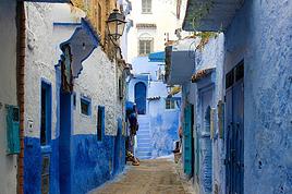
Jeune couple, atterrissant fin septembre sur Marrakech pour 8 jours au Maroc, on souhaite avant tout passer quelques jours dans l'Atlas.
Nous pensions opter pour les transports en communs (bus/taxi...) et rejoindre Setti Fatma d'où j'envisagerais de rejoindre Imlil à pied via Tacheddirt et sa vallée... (2jours et demie?)
Que pensez-vous de cet itinéraire?
Est-ce un bon choix? Est-t-il praticable en septembre? Devons-nous faire appel à un guide?
Faut t il réserver à l'avance pour les gites?
Ou... Opteriez-vous pour d'autres itinéraires à votre sens plus judicieux ou intéressants?
Tous vos meilleurs plans sont les bienvenus!
Une fois sur Imlil, est t il possible de rejoindre Asni en taxi/minibus ; et de Asni prendre un bus pour Taroudant qui a l'air très intéressante et authentique?
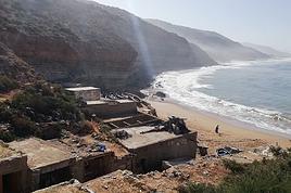
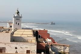
De Taroudant, on rejoindrait Essaouira en bus avant de rentrer sur Marrakech.
Merci pour vos conseils/suggestion, on en fera bon usage!
Nous pensions opter pour les transports en communs (bus/taxi...) et rejoindre Setti Fatma d'où j'envisagerais de rejoindre Imlil à pied via Tacheddirt et sa vallée... (2jours et demie?)
Est-ce un bon choix? Est-t-il praticable en septembre? Devons-nous faire appel à un guide?
Faut t il réserver à l'avance pour les gites?
je l'ai fait dans l'autre sens...en mars de cette année
Septembre c'est le bon choix en théorie moins de chaleur.
Pour aller de Setti Fatma à Timichi aucun problème piste tracée récente.
Descendre en bas du village ensuite le vallon se resserre il y a une buvette et emprunter la piste de sable qui monte en lacets.
Ensuite on arrive à un col qui domine Setti Fatma
Compter 3-4 heures environ pour atteindre Timichi
Le guide/hôte à Timichi, Brahim, m'a dit que l'électricité venait d'être installée il y a quelques mois.
Cet hôte peut héberger pour 100-200 drh par personne la nuit
Sinon pas besoin de guide pour randonner.
Ensuite de Timichi jusqu'au col du Tachedirt, attention au sentier je me suis perdu à un moment avant le village qui précéde Timichi ( qui s'appelle Labasséne).
Il faut repasser par Timguist rapidement puis Labassène
De Timichi il faut suivre le sentier qui fait un arc de cercle sinon on grimpe vers l'Oukaïmeden
Après Labassène le sentier grimpe franchement on peut noter une végétation particulière puis on passe une bergerie de montagne improvisée de pierres.
Le col de Tachedirt s'atteint au prix d'importants dénivelés.
Pour partir de Timichi , passer le col et redescendre sur Tachedirt de l'autre côté , partir à 5-6heures du matin je conseille vivement de procéder ainsi.
A Tachedirt il y a un autre refuge.
Ensuite de Tachedirt il y a la route goudronnée ; le sentier qui mène au col l'emprunte un peu pour aller au village de Tachedirt et c'est là où elle se termine..
En suivant cette route on arrive à un col il y a une sorte de café buvette sorti de nulle part
En mars de cette année 2012 j'y étais arrivé vers les 13heures en partant de Imlil au début avec la pluie puis le beau temps.
Et à 14Heures un temps apocalyptique avec des grossesrafales de vent et de la grêle j'ai bien crû y rester bloqué pour la nuit 😉
Mais en septembre ça doit passer tout seul.
Après descente tranquille sur Imlil
L'autre alternative que j'avais empruntée en 1993 c'est de passer par le col du Toubkal et le superbe lac d'Ifni
Désolé c'est un peu confus mais il faut se trouver un petit plan du massif on le trouve sur Internet
Merci pour ces précieuses infos Mathews, j'en ferai forcément bon usage!
D'une manière générale, tu penses que c'est un itinéraire à recommander pour une première dans l'Atlas ou t as peut être de meilleures suggestions?
A réfléchir, je me dis que ça peut être sympa d'être guidé, histoire d'en apprendre un peu plus sur la région...
Derrière, je vise Taroudant qui m'a l'air très intéressante, puis éventuellement un step par l'océan (Essaouira), éventuellement Sidi Ifni avant retour à Marrakech pour prendre l'avion sans forcément m' y attarder (sauf si on me le recommande vivement!).
Si tu as des conseils ou des suggestions par rapport à mon itinéraire, je suis preneur!
Merci pour ces précieuses infos Mathews, j'en ferai forcément bon usage!
D'une manière générale, tu penses que c'est un itinéraire à recommander pour une première dans l'Atlas ou t as peut être de meilleures suggestions?
le massif du Toubkal c'est un bel endroit au Maroc , très beaux paysages et puis surtout les villages berbères totalement perdus dans la montagne.
La piste tracée entre mettons Timichi et Setti Fatma n'existe que depuis un ou deux ans , les villageois sont obligés de vivre en autarcie ou bien d'aller à Setti-Fatma à dos de mules
Sinon oui c'est une bonne idée de prendre un guide ils connaissent parfaitement
Niveau physique le tizi n' Tachedirt est un peu éprouvant mais j'ai fait pire dans ma vie ( le Canyon du Colca notamment); pas plus éprouvant que les cols des Alpes
De retour de cette première au Maroc et dans l'Atlas, petit retour sur cette belle rando parsemée de paysages magnifiques et de belles rencontres...
Nous avons bien emprunté l'itinéraire Setti Fatma => Imlil
Jour1: Arrivée à Setti Fatma(1500m). Départ de trek, après le col de tizi-n-Boulemane, superbe vue sur la vallée de Setti fatma et les gorges de l'Ourika. Traversée de plusieurs villages berbères avec un accueil chaleureux et nuitée au gîte chez Brahim à Timichi ( 2100M). Très belle entré en en matière, avec la découverte de ces villages et des belles cultures implantézs autour de cette vallée fertile. Avons passé un très bon moment chez Brahim qui nous a très gentillement reçu (thé à la menthe sauvage, omelette berbère, repas complet le soir avec une délicieuse tajine de chèvre, petit dèj le matin à 6h00, plus confection du pic nic pour la journée du lendemain pour 125 dh par personne, nuit incluse!)
Jour 2 : On attaque le col de tizi-n-Tachedert ( 3100M ) à la fraiche. Malgré le dénivelée, la montée s’avale bien, au prix de quelques efforts dans un décor magnifique. En contrebas du col, on passe par un village très reculé accessible que par des petits sentiers de muletiers. Au sommet : belle vue sur les sommets de l'Atlas et la vallée Tachdert, partage de pommes et de noix avec des bergers berbères et leur troupeau. Descente sur la vallée et nuitée dans un gite (2300m). 6 à 7h de Marche.
Jour 3 : Traversée de jolie culture en terrasse. Après le col de Tizi-n-tamatert, on descend sur Imlil : belle vue sur le Toubkal 4167m . 4 à 5h de marche.
Vraiment un bel itinéraire pratiqué dans des conditions idéales! Nous n'avons pas croisé grand monde et avons apprécié ces montagnes et leur côté vivant autour de ces vallées fertiles. Les habitants des villages débordent de gentillesse et les quelques mots échangés en Berbère ou en Français se terminent souvent par de grands sourires ou meme une invitation à venir boire le thé...
Je lorgne déjà sur un prochain trek dans l'Atlas...
salut Warnaud merci pour ce témoignage 😉
As-tu dormi dans la salle où il y a plusieurs matelas par terre chez Brahim?
Brahim t'a-t-il dit qu'il est allé dans le Jura en avril 2012 ?
La fameuse pièce avec les matelas, bien sur!
On n'a peut être oublié de parler Jura avec Brahim, mais j'espère qu'il y a reçu un accueil digne de sa gentillesse ...
"Ischwa/Ifourki bezef!"
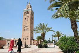
Commençons par la fin : les liaisons Imlil-Asni et Asni-Marrakech ne posent aucun problème (taxis, minibus..); par contre je serais surpris si vous trouviez à Asni un bus vers Taroudant ! un taxi peut-être après d'âpres négociations. En outre, si la route du Tizi n'Test offre de beaux paysages (pas facile de les apprécier en bus), Taroudant n'offre que peu d'intérêt ; partout des immeubles récents de mauvaise qualité, hormis les remparts le parpaing est omniprésent, des souks certes moins touristiques qu'à MRK mais sans caractère... Enfin la liaison en bus Taroudant-Essaouira va vous coûter pas mal de temps.
Maintenant le trek : là ça va, très facile à réaliser avec ou sans guide. Toutefois l'Atlas en septembre est dépourvu de la neige qui l'habille si bien en d'autres saisons, donc le paysage depuis un grand col comme le tizi n'tachdirt n'est pas au top ! En cette saison, il vaut mieux randonner de village en village, sous les noyers ou le long des seguias.
Je me permets de vous proposer un trek de 2-3 jours, plus adapté à la saison. Contacter Rachid à Tizi n'Oucheg où il tient un gîte et peut vous guider. Départ 4 ou 5km avant Setti Fatma (gros pont sur l'ourika) et grimper à tizi n'oucheg. Puis contourner par le nord puis l'est le plateau du Yagour pour rejoindre la vallée du Zat et Arba Tighdwine où on peut trouver des taxis pour MRK. C'est très coloré, plein de villages variés, de cultures, d'alpages. En outre possibilité de voir des gravures rupestres.
Me contacter pour plus de précisions.
J'ai contacter le bureau des guides de setti fatma pour prévoir une randonnée de 2 personnes d'un jour 1/2 au départ de Setti fatma entre le 20 et 25 mars…
Nous serons la semaine du 20.04 au28.04.2013 au Maroc Nous voulons faire le tour de l'Adrar Meltsene à partir de setti Fatma soit environ 6 jours de marche,…
Je cherche des infos sur les distances et temps de montées pour passer les cols entre seti fatme et imlil s'il y a des parapentiste qui ont déjà volé dans le…
Je cherche guide ou organisation qui pourrait me proposer randos en étoile dans l' Atlas au depart de Marrakech. Période debut septembre. 2 personnes bon…
Je cherche des compagnon (s) de randonnée pour faire le Djebel Toubkal en août. 4000 et quelques, c'est plus facile en groupe et plus sympa surtout. C'est pas…
Bonjour,
Nous souhaitons faire le trek de 4 jours reliant Mestia à Ushguli sans agence. Il est précisé dans les descriptifs qu'il existe des hébergement à chaque étape, mais on ne trouve pas d'info sur ces hébergements. Quelqu'un a-t-il des infos et un avis sur ce parcours?
We're planning to trek in Peru and Bolivia and would love to find some local agencies.
If you know any, could you share details on prices and, of course, the names of the agencies?
Which trek would you recommend?
Elocine
Je pars en autonomie totale sur un trek au Maroc (10jrs) Imilchil - Aghbalou.
Trouve t-on des cartouches gaz à vis (Coleman, Primus) à Marrakech (adresse) ou villages entre Imilchil - Aghbalou ?
Si non , trouve-t-on des cartouches Butagaz pour camping-gaz (petit volume 230 gr ...)
Merci d' avance pour vos réponses
Hello, I’d like to embark on a little trip in my home country, Switzerland. I’ll start walking from La Cure, heading toward Le Noirmont first, then I’ll improvise my route—but it’ll probably follow the French border... at least as far as Lac de Joux.
I’ll decide day by day how much farther to go after that. My goal is to stay in nature as much as possible, wander around for as long as I can, and restock food in villages or towns along the way.
I’m thinking of mostly camping, but we’ll see if I end up in a hotel or another campsite depending on my route.
I’d love to reach La Chaux-de-Fonds on foot... maybe even Delémont.
The whole thing should take about a week, give or take.
I’ll be bringing my dog, and I’m preparing for this as soon as I’m ready.
Any tips to make sure everything goes smoothly for us? Things I should know—or avoid? What about shepherds with their flocks of sheep? And isn’t hunting season open right now?
I’m not sure if what I’m planning is even doable, which is why I’m asking around.
This’ll be my first time doing something like this—wandering in nature *and* with a dog. I’m really excited for this adventure... and I need it. Thanks!
We’re really keen on ecosystems and want to hike in "natural" ancient forests—not planted woods or areas heavily degraded by human activity. Travel guides (like Lonely Planet) don’t provide much info on this. Could you point us to the most interesting spots?
Thanks in advance for your tips.
We wish you happy holidays and a fantastic 2026, full of discoveries!
Claire and Albert
Hi, this might not be the right section, but I’d like to know if it’s possible to start mountaineering with another person without necessarily hiring a guide. We’ve done quite a bit of hiking but not mountaineering—we’ll just do a half-day glacier course. After that, we were thinking of starting with La Grande Motte and the Pointe de la Traversière, which were recommended to us. Honestly, for things like roping up and knots, I’ll learn at home with lots of videos and a book.
Hi,
I don’t know Switzerland at all and was wondering if Vallée des Joux and especially Dent de Vaulion are packed early in the morning or late in the afternoon in July and September?
If so, do you have any quieter spots to recommend in the area, or in Luxembourg (yes, I know it’s not the same country 😉)?
Thanks a lot!
Jaimerais savoir si quelqu'un aurait fait des treks sur le Ruwenzori et combien ça coute en moyenne, les infrastructures, les paysages la sécurité sur les lieux, merci beaucoup. J'attends avec impatience vos réponses.
We’re leaving in 9 days for a two-week trip to Madeira, mainly to hike.
From my research, I’ve found that since last year, access to most trails—and systematically for the most popular ones—is now paid. You have to pay an access fee of 4.50 € per person per classified hike in 2026, and even 10.50 € for the most iconic hike: Pico Arieiro to Pico Ruivo. When paying, you also have to choose a day and a 30-minute time slot for your start time. Of course, this reservation is neither changeable nor refundable, even if the weather that day is terrible.
Personally, given the massive influx of tourists to the island in recent years, I don’t mind paying a fee to help maintain the trails. Similarly, setting a limit on the number of people who can hike them per day is certainly preferable to preserve this priceless heritage.
However, what’s much less fair is that in reality, most of the available spots are reserved: 1/ for Madeira residents (which is normal); 2/ for "economic operators" (meaning local tour operators). For example, if you’re a non-resident (independent tourist), no booking is possible for the Pico Arieiro hike for an early morning start before September! So, unfortunately, we’ll have to skip this hike.
It’s the same issue for Ponta de São Lourenço, the 25 Fontes, Pico Ruivo... in short, all the most popular hikes. Oh well, we’ll skip those too!
So my question is: which hikes do you recommend where we won’t face the huge crowds that the others get? And where we can book the day before for the next day, taking the weather into account?
Finally, a quick accommodation question: we’ve booked the first week in Funchal, but I haven’t decided yet for the second week. Do you have any advice on where to stay in the south or north, preferably avoiding overly concrete-heavy and touristy spots?
I’m reposting about the logistics for Samaria Gorge.
I’d love to get recent info, especially about whether it’s possible to park my car in Omalos, do the hike, and then catch a bus back to my vehicle.
In theory, it’s doable, but when you check the KTEL website, there aren’t any feasible schedules listed. If anyone has recently organized this with reliable, verified details, I’d really appreciate it. Thanks in advance!
Hi there,
We’re flying from Montreal to Lyon this August to go hiking in the French Alps. We’ve rented a car and will be staying at campgrounds. We’re planning to do day hikes and want to stay a few days in one spot, do a few hikes, then move on to our next camping spot. Could you share your favorite spots or any recommendations for places to spend a few days with great hikes?
A few details:
We arrive in early August and leave in early September.
We’re looking for day hikes (or shorter), moderate difficulty, with a cumulative elevation gain of no more than 1000m, and of course, beautiful scenery!
We’d prefer not to drive too much—maybe it’s best not to head too far south and deal with unnecessary heat?
Along the same lines, if you know of any great campgrounds where we can start our hike directly without needing the car, we’d love to hear your suggestions!
Bonjour
Souhaitant faire de la randonnée sur cette île, je voudrais d'abord savoir quelle serait la période la plus favorable sachant que j'avais passé quelques jours en novembre 2018 pas pour cette activité mais plus pour une simple découverte de l'île et le temps n'était pas top notamment en montagne. Donc peut on choisir une organisation en étoile sachant que je louerai un véhicule avec éventuellement 2 points d'hébergement.
Je n'envisage pas d'intégrer une structure mais de partir à 2 et de s'organiser sauf si vous me conseillez une agence locale ou un guide local. Enfin même si je compte me procurer les différents supports, carte et topo guide plus gps je vous remercie de bien vouloir me communiquer les randos à faire en priorité
Merci beaucoup pour vos informations
I’m planning to do the Mercantour crossing following the Randoxygène route in mid-July.
I’m used to hiking in the mountains, but I sometimes get vertigo, for example on ridges with drops on both sides. I wanted to check if there are any T4 or T3-T4 sections and find out if there are any very exposed passages—and if so, where—so I can plan an alternative route.
Can anyone give me some info on this?
Thanks!
I’m planning a trip around Cap Corse and the AGRIATES in 2026, from May 8th to 15th (there are still 2 spots left, by the way! Just DM me if you're interested).
I’d love to know which hikes are worth prioritizing in the AGRIATES. We’ll be staying in SALECCIA for two days as our base—what should we focus on from there?
A round trip to IGNHU beach? Any other suggestions?
For Ostricano, I think it’s too far for a round trip...
Thanks for your tips!
Have a great day,
Anie, Toulouse
I’d like to get some info about the GR10 Pyrenees traverse. I need help planning the daily stages and accommodations—my wife isn’t an experienced hiker but walks a lot, so I’d like to schedule shorter walking days and thus a longer overall trip in terms of number of days.
Could anyone give me some help and advice?
Best regards,
New to this forum, I’m planning a pretty big project for 2028.
I’m heading to Nepal to do a trek from Kathmandu all the way to Everest Base Camp (a cool 5,300 m 😄).
This trek is a bit special because even though I’ll be part of a group, I’m going solo (so far, no problem—I’m used to it). But it’s my first real trek, and it’s also a humanitarian one: once I reach base camp, I’ll stay an extra week to help clean up the waste left by tens of thousands of climbers! Since I’m originally from South America, from two countries that share the Andes, I have a deep respect for mountains—they fascinate me. So Everest… it’s kind of the trip of a lifetime!
So, a little question for those who’ve done treks to Everest before… any tips for good mental preparation (I’m already working on the physical side)?
Hi there, I’m planning the Annapurna Circuit for March 2027 and I’m looking for a local agency with a local guide—preferably French-speaking—to arrange this trek for us. Any suggestions? Thanks
Hello!
We’re spending a few days in Toraja country at the end of May. We’d love to do a day trek—taking our time—on a route that’s stunning in terms of scenery, but not a level 5 in difficulty!
Any suggestions you can share, please?
Thanks in advance
I’d like to do the Mare a Mare Sud in May over 4 days. I’ve found quite a few places to stay along the route, but I’m stuck on the start and finish.
I’ll be arriving by plane on Sunday evening and would like to start pretty early on Monday morning. Ideally, accommodation right at the trailhead (Alzu di Gallina) would be amazing, but I can’t find anything. Any tips?
Also, for the transfer from Figari Airport to Porto Vecchio or Alzu di Gallina?
At the end, I’d like to pick up a rental car—any advice on that too?
I’m traveling solo by plane to Catania in May and plan to hike the northern side of Etna, starting from Linguaglossa where I’ll arrive by bus. After that, I’d love some info on how to get up to Piano Provenzana (shuttles or hitchhiking), since it seems there’s no public transport except in the summer. Can you sleep there in a free or cheap refuge, or camp? And how far up can you go without having to hire a guide? Thanks in advance. Bernard.
Bonjour a tous,
je pars en voyage au Maroc en aout et nous allons commencer par nous arrêter a Chefchaouen(nous sommes en voiture).
Ma question: quelqu'un peut il m'indiquer un itinéraire de rando en boucle d'entre 5 et 7 jours aux départ de Chefchaouen dans le parc de Talassemtane passant si possible par le pont de dieux?Ou un guide papier qui en reunis quelques uns?
Nous privilégions le camping sauvage et les gites.
Merci d'avance
Hi there, for those who’ve been recently—is it possible to find other solo travelers in March on the island to share transport or room costs? It doesn’t seem easy to travel on a budget.
If you have any recommendations for simple lodgings or places with dorms, I’d love to hear them.
For those who’ve done multi-day treks while moving around: do you need to bring your own sleeping bag? I’d love to hear about itineraries you’ve done without a guide, just with a map and GPS.
Thanks, and have a great day!
Hi everyone!
We’re planning a 15-day road trip to Scotland this summer, specifically to explore and hike on Lewis and Harris—places we’ve never been before. We’ve visited other islands on previous road trips in Scotland (we usually go in April for a week). This would be our first time in Scotland in the summer and for 15 days. We’re looking at late August to early September.
I’m currently drafting the itinerary. We’d be crossing from Ullapool and were thinking of spending 3 nights on Harris and 4 nights on Lewis.
Does that sound balanced to you? Is it better to keep the same accommodation on Harris and the same on Lewis to explore the area? I’d love to hear about any past experiences you’ve had on these islands.
Thanks!
Hi there, I’m trying to leave for 15 days very soon to São Vicente. I’m either looking to join an agency or figure things out on my own to go hiking on one of these islands or both. From what I’ve seen, it’s not easy to organize with local transport, so it gets expensive. Can I use the services of a small local agency? I’m looking for the simplest way to hike for several days. Also, how do you get from São Vicente to São Nicolau? Thanks in advance and have a great day!
Aichatou
I’ve been wanting to do this for several years, and this year’s the one. Next September, I’ll be trekking in Tusheti (Georgia), from Omalo to Shatili.
Of course, I won’t be renting a vehicle that’d just sit unused. No problem getting to Pshaveli, but from there to Omalo, it’s a dirt road (still the case?)
There must be some form of public transport since there are so many guesthouses, and not all travelers come in a 4x4.
If any of you have been to Omalo, could you confirm that these shared transports exist and how often they run?
we’re planning a trip to Yellowstone and hoping to do a three-day backcountry hike if we get a permit.
if any of you have done this before, could you let me know if it’s possible to find water along the way? And if we can transport it, are we allowed to use a stove?
Hello,
I’ll be in Nepal from March 6th to 29th (we’re flying into Kathmandu via Varanasi and leaving via Delhi).
I’m a bit confused about the regulations requiring a guide.
My wife and I (we’re 63 and 64) aren’t experienced trekkers—we’re more used to walking on terrain with very moderate elevation changes. I’m looking for fairly easy hikes, possibly day trips.
Here are my questions:
- Does the Poon Hill trek from Pokhara require a guide, or is it better to go through a local agency? (I’ve seen a lot of them offering 4-day packages)
- I’d like to do a few multi-day hikes around Jomsom (Kagbeni, Mukitinath, Lupra, Marpha)... Do you need a guide for those, and can you find accommodations easily without booking in advance?
Last question—I’m really hesitant to lug around a sleeping bag or down jacket during our 6 weeks in India. Can you easily find these kinds of items at reasonable prices in Pokhara?
Thanks in advance for any tips you can share!
Yann