Hi everyone,
I’m planning to bike around the Mediterranean.
I’m supposed to go through North Africa, but it seems a bit complicated.
Visas and travel in Algeria and Egypt only work if you book a hotel (no nights spent outside?).
Libya is generally very unclear, and it seems you can only travel there with a local guide (which doesn’t exist for bike trips).
If necessary, I’d skip Libya, but neither a bus ride nor a boat detour seems possible to enter Egypt.
Does anyone have tips on how to get around these issues and secure a visa?
Thanks for any advice!
Hi everyone,
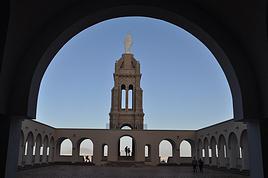
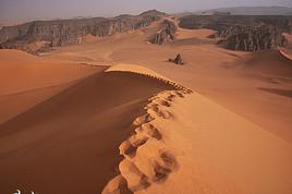
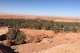
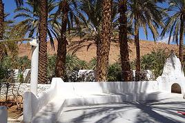
I’m planning a cycling trip in Algeria and looking for concrete firsthand accounts from cyclists who’ve recently traveled there (or residents who know the terrain well). My goal is to map out a realistic 2–4 week itinerary that prioritizes discovery, safety, and solid water/bivouac management.
My profile and gear
Semi-bivouac autonomous cyclist (light tent + sleeping bag + stove), with the option of simple accommodations in towns.
All-road/gravel bike with a rear rack, 40–45 mm tires (I can go up to 47–50 mm if needed).
Compact drivetrain with a small gear range for climbing while loaded.
Modular water capacity of 4–7 liters (soft flasks + bottles), plus a filter and purification tablets as backup.
Navigation via offline maps + GPS, GPX tracks if available.
Planned period
Late winter/early spring (timing to be refined based on your feedback about weather, wind, and day/night temperature swings). I’d love a seasonal breakdown: which areas are more pleasant/rideable during this time? Are there zones to avoid while others become ideal?
Preferred itinerary style
High plateaus and accessible Saharan fringes for a loaded bike, alternating between secondary roads and rideable tracks.
Moderate pace (60–90 km/day depending on terrain and wind), with stops in resource towns to restock, shower, and rest.
Safety and logistics (water/supplies) take priority over pure athletic performance.
My specific questions for those who’ve cycled in Algeria 1) Routes and areas
Which roads/tracks did you enjoy for their scenery and interest without being too rough for a loaded gravel bike?
If you’ve ridden the high plateaus: which connections do you recommend to avoid traffic and stick to small roads?
Saharan fringes: which sections are realistic for partial autonomy (reasonably spaced water points, rideable tracks, not too much soft sand)?
Areas to avoid by bike (recently) due to security, road conditions, katabatic winds, construction, etc.?
2) Water and supplies
How frequent were water points on your routes: reliable wells? taps? sources in towns/villages?
In “desert” sections, how many liters did you carry between secure points? Does a 6–7 L capacity seem comfortable, or should I aim for more on certain stretches?
Food: small shops, markets, availability of basics (semolina, sardines, dates, biscuits, powdered milk, etc.) — how often can you reasonably restock?
Filtration: did a filter + tablets suffice? Are there areas where you’d advise against filtering from unprotected wells?
3) Bivouacking and accommodations
Tolerance for discreet bivouacking (far from dwellings, leave-no-trace): recent experiences?
Simple alternatives: guesthouses, small hotels/hostels, campgrounds (if any), municipal lodgings?
Practical stopover towns for restocking, resting, and securing your bike overnight: reliable spots or neighborhoods to prioritize/avoid?
4) Roads, tracks, and weather
Road surface quality on secondary routes: generally decent or highly variable?
Tracks: rideable (compact gravel, laterite) or sometimes sand/washboard? At what tire width would you recommend switching (45 vs. 50 mm)?
Prevailing winds this season: direction, strength, most exposed hours; do you adjust your departures to ride “before the wind” in the morning?
Temperatures: day/night range; sun protection (long gloves, buff, sunscreen, sunglasses), managing nighttime cold at altitude or in the open desert.
5) Safety, formalities, and connectivity
Recently discouraged zones (please note the date if possible).
Roadside checks: which documents to keep handy; are there specific registrations or declarations required upon arrival or when moving between wilayas?
Local SIM/data: which operators work well on the routes you took; tips for recharging/buying credit.
Useful apps/maps on the ground (and reliable offline maps) for locating water, grocery stores, garages, accommodations, rideable segments, etc.
Bike security: how did you handle anti-theft and parking during errands/overnight stays?
6) Gear and adjustments
Recommended minimum gearing for loaded climbs on local roads/tracks.
Ideal tire width and casing (puncture resistance on gravel and rocks).
“Sweet spot” water capacity based on your experience (and tips: frame bags, extra bottles on the fork, bladders in frame bags, etc.).
Maintenance: dust/sand — greases/seals, drivetrain cleaning frequency, breathable filters, protective socks for zipped panniers.
Sample itinerary outline (to validate with your feedback)
Week 1: Arrival, adjustments, high plateaus, linking resource towns to get into the rhythm, test supplies and water.
Week 2: Accessible Saharan fringes, alternating road/track, nights in discreet bivouac when possible + simple accommodations every 3–4 days.
Week 3–4 (optional): Extend toward a second Saharan area or head back to a more temperate zone depending on weather/wind, prioritizing routes known to cyclists.
If you have GPX tracks (even partial), waypoints (water, grocery stores, accommodations), or a travel journal with dates, I’d love to see them. Dated info (year/month) will help me weigh what may have changed recently.
What I can share in return
After the trip, I’ll publish a detailed report with:
Final itinerary + cleaned GPX tracks,
List of confirmed water points and open supply spots,
Gear review (tires, gearing, water capacity),
Notes on bivouacking/accommodations and safety,
Budget and daily distances, to help future travelers.
Thanks in advance for your tips, warnings, good addresses, and updated feedback. Your experience is invaluable for planning a safe, smooth, and enjoyable cycling route in Algeria. Happy trails! 🚴
I’m planning a cycling trip in Algeria and looking for concrete firsthand accounts from cyclists who’ve recently traveled there (or residents who know the terrain well). My goal is to map out a realistic 2–4 week itinerary that prioritizes discovery, safety, and solid water/bivouac management.
My profile and gear
Semi-bivouac autonomous cyclist (light tent + sleeping bag + stove), with the option of simple accommodations in towns.
All-road/gravel bike with a rear rack, 40–45 mm tires (I can go up to 47–50 mm if needed).
Compact drivetrain with a small gear range for climbing while loaded.
Modular water capacity of 4–7 liters (soft flasks + bottles), plus a filter and purification tablets as backup.
Navigation via offline maps + GPS, GPX tracks if available.
Planned period
Late winter/early spring (timing to be refined based on your feedback about weather, wind, and day/night temperature swings). I’d love a seasonal breakdown: which areas are more pleasant/rideable during this time? Are there zones to avoid while others become ideal?
Preferred itinerary style
High plateaus and accessible Saharan fringes for a loaded bike, alternating between secondary roads and rideable tracks.
Moderate pace (60–90 km/day depending on terrain and wind), with stops in resource towns to restock, shower, and rest.
Safety and logistics (water/supplies) take priority over pure athletic performance.
My specific questions for those who’ve cycled in Algeria 1) Routes and areas
Which roads/tracks did you enjoy for their scenery and interest without being too rough for a loaded gravel bike?
If you’ve ridden the high plateaus: which connections do you recommend to avoid traffic and stick to small roads?
Saharan fringes: which sections are realistic for partial autonomy (reasonably spaced water points, rideable tracks, not too much soft sand)?
Areas to avoid by bike (recently) due to security, road conditions, katabatic winds, construction, etc.?
2) Water and supplies
How frequent were water points on your routes: reliable wells? taps? sources in towns/villages?
In “desert” sections, how many liters did you carry between secure points? Does a 6–7 L capacity seem comfortable, or should I aim for more on certain stretches?
Food: small shops, markets, availability of basics (semolina, sardines, dates, biscuits, powdered milk, etc.) — how often can you reasonably restock?
Filtration: did a filter + tablets suffice? Are there areas where you’d advise against filtering from unprotected wells?
3) Bivouacking and accommodations
Tolerance for discreet bivouacking (far from dwellings, leave-no-trace): recent experiences?
Simple alternatives: guesthouses, small hotels/hostels, campgrounds (if any), municipal lodgings?
Practical stopover towns for restocking, resting, and securing your bike overnight: reliable spots or neighborhoods to prioritize/avoid?
4) Roads, tracks, and weather
Road surface quality on secondary routes: generally decent or highly variable?
Tracks: rideable (compact gravel, laterite) or sometimes sand/washboard? At what tire width would you recommend switching (45 vs. 50 mm)?
Prevailing winds this season: direction, strength, most exposed hours; do you adjust your departures to ride “before the wind” in the morning?
Temperatures: day/night range; sun protection (long gloves, buff, sunscreen, sunglasses), managing nighttime cold at altitude or in the open desert.
5) Safety, formalities, and connectivity
Recently discouraged zones (please note the date if possible).
Roadside checks: which documents to keep handy; are there specific registrations or declarations required upon arrival or when moving between wilayas?
Local SIM/data: which operators work well on the routes you took; tips for recharging/buying credit.
Useful apps/maps on the ground (and reliable offline maps) for locating water, grocery stores, garages, accommodations, rideable segments, etc.
Bike security: how did you handle anti-theft and parking during errands/overnight stays?
6) Gear and adjustments
Recommended minimum gearing for loaded climbs on local roads/tracks.
Ideal tire width and casing (puncture resistance on gravel and rocks).
“Sweet spot” water capacity based on your experience (and tips: frame bags, extra bottles on the fork, bladders in frame bags, etc.).
Maintenance: dust/sand — greases/seals, drivetrain cleaning frequency, breathable filters, protective socks for zipped panniers.
Sample itinerary outline (to validate with your feedback)
Week 1: Arrival, adjustments, high plateaus, linking resource towns to get into the rhythm, test supplies and water.
Week 2: Accessible Saharan fringes, alternating road/track, nights in discreet bivouac when possible + simple accommodations every 3–4 days.
Week 3–4 (optional): Extend toward a second Saharan area or head back to a more temperate zone depending on weather/wind, prioritizing routes known to cyclists.
If you have GPX tracks (even partial), waypoints (water, grocery stores, accommodations), or a travel journal with dates, I’d love to see them. Dated info (year/month) will help me weigh what may have changed recently.
What I can share in return
After the trip, I’ll publish a detailed report with:
Final itinerary + cleaned GPX tracks,
List of confirmed water points and open supply spots,
Gear review (tires, gearing, water capacity),
Notes on bivouacking/accommodations and safety,
Budget and daily distances, to help future travelers.
Thanks in advance for your tips, warnings, good addresses, and updated feedback. Your experience is invaluable for planning a safe, smooth, and enjoyable cycling route in Algeria. Happy trails! 🚴
Hello, I spent a month cycling in Thailand earlier this year with a touring bike equipped with two rear panniers. I loved being able to ride and stop at a hotel every night, and eat just about anywhere. I tried India two months ago but gave up because of the road conditions and chaotic traffic.
I’m looking for countries where I can cycle "without autonomy"—so no tent, no stove, just the bare minimum. Ideally, I’d like to stop at hotels or similar accommodations regularly, without having to cover 200 km a day!
I’d love to hear from your experiences—what countries make it easy to travel this way? Thanks!
I’m looking for countries where I can cycle "without autonomy"—so no tent, no stove, just the bare minimum. Ideally, I’d like to stop at hotels or similar accommodations regularly, without having to cover 200 km a day!
I’d love to hear from your experiences—what countries make it easy to travel this way? Thanks!
Hi everyone,
We’re planning to spend 5 months cycling as a family in Central Asia. To align with the weather, we’re thinking of arriving in Uzbekistan in April, heading toward the Ferghana Valley in late April/early May, and wrapping up with a long stretch in Kyrgyzstan from mid-May to early August.
I haven’t really dug into the third part (Kyrgyzstan) yet, but from what I’ve seen on the forum and online, cycling across Uzbekistan doesn’t seem all that appealing: long, straight desert stretches with lots of trucks.
Has anyone come across any "hidden gem" routes they’d be willing to share? I’ve already noted that it’s best to avoid riding toward Tashkent. I’m looking for routes between Bukhara and Samarkand, and any nearby areas that are nice for cycling.
I’d love to fly into Dushanbe to reach Samarkand, but we all agree that it’s not a good fit for the season (early April) if we’re cycling, right?
Thanks for your feedback! Ludo
I haven’t really dug into the third part (Kyrgyzstan) yet, but from what I’ve seen on the forum and online, cycling across Uzbekistan doesn’t seem all that appealing: long, straight desert stretches with lots of trucks.
Has anyone come across any "hidden gem" routes they’d be willing to share? I’ve already noted that it’s best to avoid riding toward Tashkent. I’m looking for routes between Bukhara and Samarkand, and any nearby areas that are nice for cycling.
I’d love to fly into Dushanbe to reach Samarkand, but we all agree that it’s not a good fit for the season (early April) if we’re cycling, right?
Thanks for your feedback! Ludo
Hi there,
We’re a family of bike-travelers. Our long journey came to a halt in March 2020 in Ho Chi Minh City due to Covid. We’d been on the road for 8 months—2 in Thailand, 1 in Cambodia, and 1 in Vietnam (from the Mekong Delta up to Ho Chi Minh, where we got stopped). We’re heading back to Vietnam in July-August for 5 weeks to finish what we couldn’t in 2020 (introducing my kids to the country of my roots). We’d originally planned to backpack, figuring it’d be tough to cover the country by bike in such a short time... But the urge to pedal is strong for both parents and kids alike.
We’re thinking of keeping 10 days to explore the North by backpack (since the elevation changes are steep) and saving 3 solid weeks for biking—but we’re not sure where (ideally with minimal elevation gain). We’d love to return to Tam Coc (we visited in 2009 without the kids, thanks to Larsay’s great tips—still so grateful for all the valuable advice!). Logistically, we shipped our bikes 5 years ago, but that seems less doable now. We’re considering either renting (though 5 bikes for 3 weeks would get pricey fast) or buying locally to resell or donate afterward.
Is biking in August unrealistic? Thanks in advance for your insights! !
We’re a family of bike-travelers. Our long journey came to a halt in March 2020 in Ho Chi Minh City due to Covid. We’d been on the road for 8 months—2 in Thailand, 1 in Cambodia, and 1 in Vietnam (from the Mekong Delta up to Ho Chi Minh, where we got stopped). We’re heading back to Vietnam in July-August for 5 weeks to finish what we couldn’t in 2020 (introducing my kids to the country of my roots). We’d originally planned to backpack, figuring it’d be tough to cover the country by bike in such a short time... But the urge to pedal is strong for both parents and kids alike.
We’re thinking of keeping 10 days to explore the North by backpack (since the elevation changes are steep) and saving 3 solid weeks for biking—but we’re not sure where (ideally with minimal elevation gain). We’d love to return to Tam Coc (we visited in 2009 without the kids, thanks to Larsay’s great tips—still so grateful for all the valuable advice!). Logistically, we shipped our bikes 5 years ago, but that seems less doable now. We’re considering either renting (though 5 bikes for 3 weeks would get pricey fast) or buying locally to resell or donate afterward.
Is biking in August unrealistic? Thanks in advance for your insights! !
Hi everyone,
I’m trying to figure out how to get from Paris to Marseille or Montpellier with non-disassembled bikes by train in early July 2025... and it’s a total flop!!! Can’t find any trains that offer the bike-on-board option! It’s so complicated between SNCF-CONNECT, OUIGO, and TER INTERCITÉS!!! Nothing’s simple! I want to take my teens and their cousins on a bike trip to the Camargue, but I’ll have to start planning way ahead to sort out bike transport!!! So glad I found VoyageForum for tips! !
I’m trying to figure out how to get from Paris to Marseille or Montpellier with non-disassembled bikes by train in early July 2025... and it’s a total flop!!! Can’t find any trains that offer the bike-on-board option! It’s so complicated between SNCF-CONNECT, OUIGO, and TER INTERCITÉS!!! Nothing’s simple! I want to take my teens and their cousins on a bike trip to the Camargue, but I’ll have to start planning way ahead to sort out bike transport!!! So glad I found VoyageForum for tips! !
Hi there,
Just a few words about the loop I did by bike in Yunnan.
Entry and exit
I entered China through the Sino-Vietnamese border crossing at Lào Cai / Hekou under the 30-day visa exemption currently available to French nationals and others.
The process was simple and quick. A Chinese police officer even helped me complete my electronic pre-registration at a computer kiosk. I wasn’t aware this formality was required—it’s similar to Thailand’s TM6.
No issues with the bike.
I left the country via the Sino-Laotian border crossing at Mohan / Boten.
The atmosphere was a bit chaotic there, but again, no problems with the bike.
The timing
I visited Yunnan in February 2026.
Weather-wise, at higher altitudes (between 1,500 and 2,000 meters), it was around ten degrees at night and in the mornings, and around twenty degrees at the hottest part of the day.
I had two days of rain, so I took the bus to keep moving. Otherwise, clear blue skies.
Culturally, Chinese New Year fell on February 17th (and the 15 days following), right in the middle of my trip. Because of this, my take on the traffic might be off.
Accommodation and food I always found a hotel to stay in for prices ranging from 8 to 15 €. Except in Kunming (the capital), where many hotels were fully booked (Chinese New Year). I ended up at a 100 € hotel with great value for money.
A bowl of noodles costs about 1.5 € on average.
Onboard electronics Since my smartphone doesn’t support eSIMs, I subscribed to a China plan with my carrier. Otherwise, for much cheaper, Alipay offers eSIMs for foreigners that allow access to services usually blocked for Chinese users (WhatsApp, Facebook, etc.).
An internet connection is essential for paying with Alipay or WeChat, as this payment method is widespread.
I only managed to use Alipay.
Either way, always carry cash because sometimes there’s no signal, or the merchant only accepts WeChat.
Also, it’s best to bring a power adapter when you arrive rather than struggling to find one.
Traffic and roads The Chinese aren’t reckless drivers. They follow traffic rules and watch out for cyclists. This is slightly less true in Xishuangbanna (the region bordering Myanmar and Laos).
In urban areas, there are almost always wide bike lanes, separated from other roads, where bikes, electric mini-scooters, and scooters share the space pretty harmoniously.
The roads are in great condition, and traffic is generally manageable—even light—except for one stretch (Eshan -> Yangwu).
Most traffic is absorbed by expressways, China’s equivalent of highways: toll roads that are off-limits to slow vehicles.
You’re never far from these expressways; sometimes you even ride alongside them, which can be noisy at times.
The climbs are usually reasonable, around 5% to 6%. From what I remember, the steepest section was between Menglun and Mengla, with gradients of 8% to 10%, sometimes more.
Riding at these altitudes—though modest—took a bit of getting used to.
The route I didn’t plan anything in advance. My only goal was to reach Kunming. I don’t know why, but just hearing the name of that city, like Yunnan, always felt dreamy to me.
Here’s the breakdown: Hekou -> Man Hao (94 km); Man Hao -> Yuanyang (64 km); Yuanyang -> Jianshui (bus); Jianshui -> Tong Hai (78 km); Tong Hai -> Chenjiang (85 km); Chenjiang -> Kunming (60 km); Kunming -> Kunyang (60 km); Kunyang -> Eshan (67 km); Eshan -> Yangwu (58 km); Yangwu -> Yuanjiang (59 km); Yuanjiang -> Pu'er (bus); Pu'er -> Dadugang (75 km); Dadugang -> Jinghong (80 km); Jinghong -> Menglun (67 km); Menglun -> Mengyuancun (51 km); Mengyuancun -> Mengla (43 km); Mengla -> Boten (67 km).
Otherwise, I’m currently in Thailand and just hoping my return flight with Qatar won’t get canceled.
Oh well... 😉
Just a few words about the loop I did by bike in Yunnan.
Entry and exit
I entered China through the Sino-Vietnamese border crossing at Lào Cai / Hekou under the 30-day visa exemption currently available to French nationals and others.
The process was simple and quick. A Chinese police officer even helped me complete my electronic pre-registration at a computer kiosk. I wasn’t aware this formality was required—it’s similar to Thailand’s TM6.
No issues with the bike.
I left the country via the Sino-Laotian border crossing at Mohan / Boten.
The atmosphere was a bit chaotic there, but again, no problems with the bike.
The timing
I visited Yunnan in February 2026.
Weather-wise, at higher altitudes (between 1,500 and 2,000 meters), it was around ten degrees at night and in the mornings, and around twenty degrees at the hottest part of the day.
I had two days of rain, so I took the bus to keep moving. Otherwise, clear blue skies.
Culturally, Chinese New Year fell on February 17th (and the 15 days following), right in the middle of my trip. Because of this, my take on the traffic might be off.
Accommodation and food I always found a hotel to stay in for prices ranging from 8 to 15 €. Except in Kunming (the capital), where many hotels were fully booked (Chinese New Year). I ended up at a 100 € hotel with great value for money.
A bowl of noodles costs about 1.5 € on average.
Onboard electronics Since my smartphone doesn’t support eSIMs, I subscribed to a China plan with my carrier. Otherwise, for much cheaper, Alipay offers eSIMs for foreigners that allow access to services usually blocked for Chinese users (WhatsApp, Facebook, etc.).
An internet connection is essential for paying with Alipay or WeChat, as this payment method is widespread.
I only managed to use Alipay.
Either way, always carry cash because sometimes there’s no signal, or the merchant only accepts WeChat.
Also, it’s best to bring a power adapter when you arrive rather than struggling to find one.
Traffic and roads The Chinese aren’t reckless drivers. They follow traffic rules and watch out for cyclists. This is slightly less true in Xishuangbanna (the region bordering Myanmar and Laos).
In urban areas, there are almost always wide bike lanes, separated from other roads, where bikes, electric mini-scooters, and scooters share the space pretty harmoniously.
The roads are in great condition, and traffic is generally manageable—even light—except for one stretch (Eshan -> Yangwu).
Most traffic is absorbed by expressways, China’s equivalent of highways: toll roads that are off-limits to slow vehicles.
You’re never far from these expressways; sometimes you even ride alongside them, which can be noisy at times.
The climbs are usually reasonable, around 5% to 6%. From what I remember, the steepest section was between Menglun and Mengla, with gradients of 8% to 10%, sometimes more.
Riding at these altitudes—though modest—took a bit of getting used to.
The route I didn’t plan anything in advance. My only goal was to reach Kunming. I don’t know why, but just hearing the name of that city, like Yunnan, always felt dreamy to me.
Here’s the breakdown: Hekou -> Man Hao (94 km); Man Hao -> Yuanyang (64 km); Yuanyang -> Jianshui (bus); Jianshui -> Tong Hai (78 km); Tong Hai -> Chenjiang (85 km); Chenjiang -> Kunming (60 km); Kunming -> Kunyang (60 km); Kunyang -> Eshan (67 km); Eshan -> Yangwu (58 km); Yangwu -> Yuanjiang (59 km); Yuanjiang -> Pu'er (bus); Pu'er -> Dadugang (75 km); Dadugang -> Jinghong (80 km); Jinghong -> Menglun (67 km); Menglun -> Mengyuancun (51 km); Mengyuancun -> Mengla (43 km); Mengla -> Boten (67 km).
Otherwise, I’m currently in Thailand and just hoping my return flight with Qatar won’t get canceled.
Oh well... 😉
I’m planning a journey of about 2500 km starting from San Pedro de Atacama (duration: max. 2 months). This trip, almost entirely on remote trails, promises to be an extraordinary adventure.
Highlights of the trip - Crossing the Florido Desert (during the blooming season: October 15–30) - Hiking ascents of legendary volcanoes: - Ojos del Salado (6879 m) - Llullaillaco (6739 m) - Uturuncu (6008 m, with 5820 m reachable by mountain bike!) - A 300 km stage through the heart of the desert, with no resupply or habitation: the ultimate experience of solitude and self-transcendence.
Practical details - Daily distance: max. 100 km and 1000 m elevation gain per day - Average altitude: 4000 m (between 3500 and 5000 m) - Temperatures: ~15 °C during the day, down to -25 °C at night (in a tent) - Accommodation: ~50% in villages (with locals or small hostels), ~50% camping
Estimated budget - 1400 € for the flight ticket (including bike supplement) - 1000 € for on-the-ground expenses
Required equipment - Fatbike (essential for deep sand) - -25 °C comfort sleeping bag - Single-wheel trailer (indispensable for these tough terrains)
My experience In 2022, I completed a similar 1200 km trip north of San Pedro de Atacama: - Full crossing of the Salar de Uyuni (170 km) - Ascents of the Ollague (5868 m) and Aucanquilcha (6176 m) volcanoes - Two 200 km stages with no resupply or human presence Videos available for a glimpse of the adventure: - Atacama Crossing 2022 - Part 1 - Atacama Crossing 2022 - Part 2
Next steps If this adventure interests you, I suggest: 1. A first phone call to get to know each other 2. A meet-up over a drink or a test ride in the Bardenas Reales (similar terrain, and I live 100 km away)
Don’t hesitate to contact me for more info or to discuss the details!
Highlights of the trip - Crossing the Florido Desert (during the blooming season: October 15–30) - Hiking ascents of legendary volcanoes: - Ojos del Salado (6879 m) - Llullaillaco (6739 m) - Uturuncu (6008 m, with 5820 m reachable by mountain bike!) - A 300 km stage through the heart of the desert, with no resupply or habitation: the ultimate experience of solitude and self-transcendence.
Practical details - Daily distance: max. 100 km and 1000 m elevation gain per day - Average altitude: 4000 m (between 3500 and 5000 m) - Temperatures: ~15 °C during the day, down to -25 °C at night (in a tent) - Accommodation: ~50% in villages (with locals or small hostels), ~50% camping
Estimated budget - 1400 € for the flight ticket (including bike supplement) - 1000 € for on-the-ground expenses
Required equipment - Fatbike (essential for deep sand) - -25 °C comfort sleeping bag - Single-wheel trailer (indispensable for these tough terrains)
My experience In 2022, I completed a similar 1200 km trip north of San Pedro de Atacama: - Full crossing of the Salar de Uyuni (170 km) - Ascents of the Ollague (5868 m) and Aucanquilcha (6176 m) volcanoes - Two 200 km stages with no resupply or human presence Videos available for a glimpse of the adventure: - Atacama Crossing 2022 - Part 1 - Atacama Crossing 2022 - Part 2
Next steps If this adventure interests you, I suggest: 1. A first phone call to get to know each other 2. A meet-up over a drink or a test ride in the Bardenas Reales (similar terrain, and I live 100 km away)
Don’t hesitate to contact me for more info or to discuss the details!
Hi everyone,
I’m heading to Chile this coming November and I’d love to spend a few days cycling from Santiago (Chile) to Mendoza (Argentina).
Has anyone done this route before? If so, do you have any tips (stages, gear, accommodation spots, etc.)?
Also, to avoid carrying too much stuff, I’d like to rent a bike in Santiago. Any recommendations for a good rental shop?
Thanks so much in advance for your help :)
Clément
I’m heading to Chile this coming November and I’d love to spend a few days cycling from Santiago (Chile) to Mendoza (Argentina).
Has anyone done this route before? If so, do you have any tips (stages, gear, accommodation spots, etc.)?
Also, to avoid carrying too much stuff, I’d like to rent a bike in Santiago. Any recommendations for a good rental shop?
Thanks so much in advance for your help :)
Clément
Hi, I’d love some info on this GT20 route in Corsica.
Thanks for your feedback!
Hi! I’m planning to visit the Stockholm Archipelago by bike in early April.
Do you know if the boats will be running between the different islands at that time of year? For those who’ve already been, all your tips and recommendations are welcome—accommodation, etc. Also, do you know where I can rent a bike in Stockholm? Thanks so much in advance for your help!
Hi there,
We’re planning a bike trip around Brittany this summer. We’re driving from Belfort and looking for a parking spot (paid) to leave our car for 4-5 weeks, from mid-June to mid-July, somewhere near Rennes.
Best regards,
Hi there,
I’m cycling around the world and will soon arrive in Thailand. Is it easy to park my bike at hotels? If so, what are the usual arrangements? Thanks in advance!
Jean Michel
I’m cycling around the world and will soon arrive in Thailand. Is it easy to park my bike at hotels? If so, what are the usual arrangements? Thanks in advance!
Jean Michel
Hi everyone,
Happy owner of a Pegasus Estremo bike with a Rohloff hub, which is giving me trouble with the SF11-NCX-FT-E-LITE 700C TS 300/0 fork (serial number TD01329060). It’s starting to show its age, and I’d like to repair it to extend the life of my beloved bike.
The suspension is gone, and there’s an oil leak from the seals.
Does anyone know how to repair it? Where can I find parts that are about fifteen years old? Or where to find an identical replacement fork? Just to clarify, the Magura HS11 brakes are mounted using Firm Tech, meaning they’re on pivots behind the fork, facing the frame.
Thanks for your help! Have a great day, Alexandre
The suspension is gone, and there’s an oil leak from the seals.
Does anyone know how to repair it? Where can I find parts that are about fifteen years old? Or where to find an identical replacement fork? Just to clarify, the Magura HS11 brakes are mounted using Firm Tech, meaning they’re on pivots behind the fork, facing the frame.
Thanks for your help! Have a great day, Alexandre
hey everyone,
I’m landing in Madagascar with a buddy before the end of April 2026. We’re planning to bike around for about twenty days or so. We don’t have a specific goal other than exploring the country and meeting the locals.
Ideally, we’d prefer a loop route starting from Antananarivo with a good chunk of it along the coast. On the bike side, we’re used to riding 6 to 8 hours a day, depending on the needs, encounters, and mood 😉 Any feedback or tips from trips around this length?
Thanks in advance, Jérôme
I’m landing in Madagascar with a buddy before the end of April 2026. We’re planning to bike around for about twenty days or so. We don’t have a specific goal other than exploring the country and meeting the locals.
Ideally, we’d prefer a loop route starting from Antananarivo with a good chunk of it along the coast. On the bike side, we’re used to riding 6 to 8 hours a day, depending on the needs, encounters, and mood 😉 Any feedback or tips from trips around this length?
Thanks in advance, Jérôme
Age (80+) is making us stop our 20 years of bike travel (a good part of Europe), so we're selling (together or separately) our two touring bikes and switching to an electric city bike.🤪
They're already listed on a big national multi-product sales site, but potential buyers don't seem to know what a touring bike equipped with a Rohloff is....🙂
So my question: Do you know of a site where I'd have a better chance?😉
They're ROSE VTC bikes, Black Water III models from 2012.
Hi there,
We’re heading to three islands in March (Paros, Milos, and Sifnos). Given their small size and lack of major elevation, we’d love to explore them by bike. However, I can’t find any bike rental shops on any of these islands. Has anyone done this before and have any recommendations or addresses?
Thanks so much in advance!
I'm planning a 3-day weekend with my wife on this cycle path. The articles about this route are old, so if anyone has traveled it recently and can give me an update on its condition, that'd be great. We're riding 1994 ROCKRIDER 340 mountain bikes but with 1.5-inch tires suited for road touring—will that work, or should I switch back to MTB tires? Thanks for your replies!
A bit disappointed with the forum's revival—there isn’t much activity or shared travel stories anymore.
A bit disappointed with the forum's revival—there isn’t much activity or shared travel stories anymore.
Hello,
I’m 72 years old and I’m flying to Beijing from Rome on March 26th. My return is planned for May 11th from Ulaanbaatar to Frankfurt. I’m thinking of buying a cheap bike in Beijing and riding to Hohhot, stopping to see the Great Wall of China along the way. From Hohhot, I’ll take the train to cross the border and get off at Sainshand in Mongolia, then continue to Ulaanbaatar. Can anyone give me some tips? Thanks!
Gérald
Hi there,
We're thinking of cycling from Lisbon to Vila Real de Santo António in March.
Staying at campsites along the way.
I have two logistics questions:
1) Where to leave the van in Lisbon? Would it be okay to leave it a bit outside Lisbon if needed?
2) Can we take the train back from Vila Real de Santo António to Lisbon with our bikes?
Thanks for any insights!
Momo
I have 5 months left to prepare for the most ambitious project of my life...
In 5 months, I’ll hit the road, heading to Nepal. Not by plane. Not by train. But by bike.
13,000 km, 18 countries crossed. Powered only by my legs, my will, and a dream.
This journey isn’t just a physical challenge. It’s:
🌍 A human and cultural adventure, meeting locals, landscapes, and traditions. 🌱 A meaningful project: discussing climate change and, above all, listening to those who experience it daily. 🔥 An inner quest, to push my limits and inspire others to step out of their comfort zones. A message of hope for self-discovery.
I have 20 weeks left to: ✅ Finalize my route ✅ Gather the budget and equipment ✅ Sort out the logistics ✅ And most importantly… find committed sponsors to bring this adventure to life.
Any help is welcome!
In 5 months, I’ll hit the road, heading to Nepal. Not by plane. Not by train. But by bike.
13,000 km, 18 countries crossed. Powered only by my legs, my will, and a dream.
This journey isn’t just a physical challenge. It’s:
🌍 A human and cultural adventure, meeting locals, landscapes, and traditions. 🌱 A meaningful project: discussing climate change and, above all, listening to those who experience it daily. 🔥 An inner quest, to push my limits and inspire others to step out of their comfort zones. A message of hope for self-discovery.
I have 20 weeks left to: ✅ Finalize my route ✅ Gather the budget and equipment ✅ Sort out the logistics ✅ And most importantly… find committed sponsors to bring this adventure to life.
Any help is welcome!
Hi there,
Has anyone here cycled in the Canary Islands in August? Is it not too hot? Not too crowded on the roads?
Thanks
Hi there,
I’m planning to cycle around Taiwan in 2026 and I’d love to know if it’s possible to do the whole island on bike paths, how many kilometers that would be, whether wild camping is easy, and so on…
Hi, I’m planning a bike trip in Italy starting from Pisa to Cinque Terre and I’m looking for a company to transport two suitcases. The suitcases are picked up in the morning at our hotel and dropped off at the next hotel along our route. I’m looking for something like *La Malle Postale* in France, which some people use on the Camino de Santiago. Thanks for your feedback!
What’s the maximum weight of gear I can carry in my panniers:
- For a woman on an e-bike
- And for a man on a muscle-powered bike
Thanks
I’ve gotten used to crossing Europe by bus to return by bike.
It was really convenient to take the bike without having to disassemble it.
But FlixBus no longer accepts bikes...
What alternatives do you know about?
Thanks.
We’re planning to cycle along the Baltic coast this summer, from Flensburg all the way to the Polish border—and maybe even a little farther along the Polish coast.
By e-bike and staying in hotels (we’re not exactly spring chickens).
Any tips? Challenges, places to stay, signage?
Other thoughts?
Hi fellow travelers! I’m planning a trip to Japan from March 22 to April 12 and really want to bike the Shimanami Kaido starting from Onomichi, but I don’t cycle regularly. Has anyone here done it and could share their experience or tips? Is the weather in March-April favorable? Should I plan for 2 or 3 days? Electric or regular bike? What’s better—having my luggage forwarded along the route or leaving it in a locker? Any recommendations for accommodations or bike rentals? Thanks in advance for your replies!
Hi everyone,
I’m planning a short trip—max one week—to connect to the Dolce Via starting from La Voulte and then link up with the Dolce Fluvia. I’d like to head up via Le Puy and was wondering if it’s best to make the connection by going through Saint-Agrève, then up to Chambon/Lignon, and finally to Raucoules. Does anyone have a nice route suggestion? I’m traveling with a loaded touring bike (a Farrad TX800 with two rear panniers), but I’m limiting my load to 13 kg. I’m aiming for around 70 km a day, max 80 km, and I usually sleep at campsites or in a guest room if the rain’s too heavy.
On my way up to Le Puy-en-Velay, I plan to come back down through the Ardèche mountains, then head to Aubenas and the Rhône Valley. Does anyone have route ideas with scenic roads (like Lac d’Issarlès) or any other suggestions?
Thanks for all the tips!
Christian
I’m planning a short trip—max one week—to connect to the Dolce Via starting from La Voulte and then link up with the Dolce Fluvia. I’d like to head up via Le Puy and was wondering if it’s best to make the connection by going through Saint-Agrève, then up to Chambon/Lignon, and finally to Raucoules. Does anyone have a nice route suggestion? I’m traveling with a loaded touring bike (a Farrad TX800 with two rear panniers), but I’m limiting my load to 13 kg. I’m aiming for around 70 km a day, max 80 km, and I usually sleep at campsites or in a guest room if the rain’s too heavy.
On my way up to Le Puy-en-Velay, I plan to come back down through the Ardèche mountains, then head to Aubenas and the Rhône Valley. Does anyone have route ideas with scenic roads (like Lac d’Issarlès) or any other suggestions?
Thanks for all the tips!
Christian
Hi,
I’ve browsed the forum but can’t find an answer to my question: Which brand offers bikes suitable for bike touring for an 11-year-old / 140 cm tall? The D4 range is really limited... We’re looking at covering about 50/60 km max per day.
Thanks in advance for your suggestions!
I’ve browsed the forum but can’t find an answer to my question: Which brand offers bikes suitable for bike touring for an 11-year-old / 140 cm tall? The D4 range is really limited... We’re looking at covering about 50/60 km max per day.
Thanks in advance for your suggestions!