I wanted to share an incredible experience I had recently that really left an impression on me: hiking the Mercantour independently. It’s an absolutely stunning mountain range, with varied landscapes that go from lush forests to rocky ridges, passing through high-altitude lakes with unbelievable colors. I chose a one-week route, sleeping under the stars in a bivouac.
It was a pretty demanding adventure, with significant elevation changes and sometimes unpredictable weather. But every effort was rewarded with breathtaking views. I was lucky enough to spot marmots, chamois, and even ibex in the distance. It’s truly a total immersion in nature!
A little tip for those tempted by the adventure: plan your route and gear carefully. Independence requires good preparation. I particularly appreciated having a good water filtration system and lightweight cookware. And for safety, aside from a map and compass (or GPS), I never leave without my two-way radio. In these remote areas where there’s no mobile signal, it’s a real safety net in case of trouble or just to communicate with other hikers if you’re in a group. It can really make a difference!
If any of you have already hiked in the Mercantour or have questions about my experience, don’t hesitate to ask. I’d love to chat with you about this beautiful range or other hiking destinations.
See you on the trails! 🙂
Travel on foot (hiking)
Pour ceux qui aiment intégrer la randonnée pédestre dans leurs voyages. Conseils, suggestions, équipement, etc.
Showing 91–120 of 15,602 discussions.
Many threads here are in French, the community’s main language. English translations are added over time.
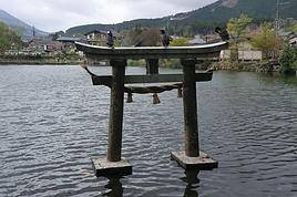
A really nice nature walk at the entrance to the lake in the Natura 2000-listed nature reserve. It’s a great opportunity to see lots of bird species, plants, and the famous European pond turtle, as well as some beautiful medieval architecture remnants with Thomas II’s castle. The walk is slightly spoiled by the noise from the Savoie parachute club’s planes, which take off every fifteen minutes and dump fuel on the site non-stop, even after nightfall.
Hi everyone,
I’m planning the Tour du Queyras from August 2nd to 8th, 2025, starting from Ceillac. 6 days if all goes well, 5 days if I’m moving fast, 7 days if the climbs are too much.
If anyone wants to join me, we can form a small group. I won’t handle bookings: I’ve got my tent, and if I can find a refuge, great—if not, no worries.
As you can see, I’m giving myself some flexibility to enjoy my hike without stress. I don’t walk fast: easy pace in the morning, not too quick in the evening. Yo
Hi everyone, we’re heading to Java in August, specifically to KAWAH IJEN. I’ve seen that there are new requirements like a medical certificate since 2024—is this still the case? Can our 6-year-old daughter do the ascent? Can she go down to see the blue flames at night with gas masks? If not, is it better during the day? Thanks for your feedback!
bonjour
je voulais savoir s'il y avait de belles randonnées à faire depuis Mestia, à la journée, avec, potentiellement des vues sympas sur l'Elbrouz???
Merci
Erick
je voulais savoir s'il y avait de belles randonnées à faire depuis Mestia, à la journée, avec, potentiellement des vues sympas sur l'Elbrouz???
Merci
Erick
Hi everyone,
I’ve planned a little day trip with my kids (12 and 16 years old) to Venice. The goal is to go for a walk through the city’s streets rather than visiting museums, which would take way too much time. We’d like to pass by the main landmarks, so I’ve put together a small 15 km hike... (thanks to Komoot and visioRando). Could you take a quick look and let me know if I’ve missed anything or made any mistakes?
1. Start at Santa Lucia Train Station 2. Ponte Degli Scalzi 3. Ponte dei Pugni 4. squero de San Trovaso 5 Le rio della Salute 6. Accademia Bridge 7. St. Mark’s Square 8. St. Mark’s Basilica 9. Ponte de la Canonica 10. Ponte de la Pietà 11. Ponte de la Tana 12. The Arsenale 13. Bridge of Sighs 14. Doge’s Palace Then return to the Rialto Bridge via Marzaria dell’Orologio
Also, could you tell me if the Doge’s Palace courtyard is paid entry? Thanks for your help and feedback!
Stéphane.
Hi there,
My wife and I are heading to Norwegian Lapland for a week soon. We arrive in Tromsø on January 9th and plan to visit Senja Island. We’d love to go snowshoeing there and would appreciate some tips:
1. Is it possible to go snowshoeing without a guide this time of year on Senja Island? Are there well-marked trails? If not, could anyone recommend some good local guides?
2. We’d also love recommendations for great snowshoeing routes on the island if possible.
3. Is 5 days in Dovær in the northern part of the island too long at this time of year?
4. Renting snowshoeing gear in Norway is super expensive—does anyone know a good place to rent between Tromsø and Senja Island?
Thanks!
Bonjour à toutes et tous,
Que pensez-vous de la visite des gorges du tigre à Qiatou?
Faut-il vraiment les faire ?Est-ce surfait? et quelle est la difficulté du trek pour y aller?
Merci pour les réponses.
Bonjour a tous
J'ai plutôt l'habitude de partir a l'étranger l'été, mais vu les événements je pense que cette année ça sera la France. J'aimerais savoir quels sont les endroits que vous me conseillez pour voir les plus beaux paysages de montagne, et faire les plus belles randos?
Merci d'avance pour votre aide.
😉
J'ai plutôt l'habitude de partir a l'étranger l'été, mais vu les événements je pense que cette année ça sera la France. J'aimerais savoir quels sont les endroits que vous me conseillez pour voir les plus beaux paysages de montagne, et faire les plus belles randos?
Merci d'avance pour votre aide.
😉
Hi there,
My partner and I are planning to hike a section of the GR10 this summer, mostly staying in campgrounds. But at Col d'Ibardin, where we’ve planned a stop, there’s only one guest room that’s pretty expensive...
Does anyone know if there are any bivouac spots in the area?
Thanks
Hi there,
I’d like to hike The Narrows in mid-June. Has anyone done this hike and can share their feedback? I’ll be hiking up to the narrowing, and I saw there’s an outfitter that rents the right gear—I plan to get equipped. Though it depends on a lot of factors, what’s the average water level like at that time of year?
Thanks
Hi there,
I'm looking for some nice hikes to do on foot around Fréjus.
Thanks
Hi there.
Is it legally possible to do this hike without a guide?
Thanks.
Hi there,
Once again, I’m turning to VoyageForum to kick off my trip planning—this time, it’s Croatia!
I’m treating my 29-year-old daughter to a trip where we’d love to combine hiking and snorkelling. I’m not sure if we can focus on just one region, but that’d be ideal since we’ll only have 10–15 days in August this year.
Could anyone point me in the right direction for a first lead?
Are transport links easy to navigate? Is it better to go with Airbnb or a hostel?
Thanks in advance for your tips!
Laurence from Bayonne
Hi there,
I’m planning a 6-day trip from Orléans to Tours.
There are very few detailed maps to figure out the main stages and what you’ll find along the way. Even though I’ve downloaded the Miam Miam Dodo app, it’s pretty tedious (everything is split into small map sections).
I’ve settled on the first leg: Orléans to Meung-sur-Loire, about 18 km. For the next one, I’m hesitating because I’d like to do around 20–25 km, but I see Beaugency is only about 10 km away, and Mer is almost 30 km. So, I’m stuck.
On top of that, I’m torn between taking the GR 3 route or the GR 655 (south).
If any of you know the area or have already done this hike/pilgrimage, I’d love to hear your tips for this section that goes through Blois and ends in Tours.
For the last legs, I’ve planned Blois -> ? Chaumont (no accommodations) -> Amboise -> Tours, knowing the final stage is about 30 km.
Thanks in advance for your help! 😉
Thanks in advance for your help! 😉
Hi,
We’re planning to spend 3 nights (4 days) in the Banaue area. We’ve booked 1 night in Banaue, 1 in Batad, and the 3rd back in Banaue. We’d like to get from one village to the other on our own (tricycle + hiking). Does that sound doable? Where can we find a hiking route so we don’t get lost (is Maps.me enough?)? The 2-day trek offered by guides is a bit tough and, above all, too expensive for us (83 €/person). Thanks for your feedback and experiences!
Hi there,
We’re heading to South Africa in August 2025 and planning a classic loop that I’d love to finish with the Drakensberg (I’m a big hiking fan) before returning to Johannesburg to catch our flight.
I’ve got 3 nights for this part of our trip. But I’m wondering if it’s actually a good idea to hike in the Drakensberg in August, since it’s the Southern Hemisphere winter (I’m from Réunion and we hike year-round there, but I don’t know what the climate’s like in South Africa, especially the Drakensberg).
I’m particularly worried about getting stuck because of snow and missing our flight... ;)
I’ve read so many different things that I’m totally confused!
If it’s okay to hike at this time of year, what would you recommend? I’m torn between Champagne Valley and Royal Natal National Park.
Thanks in advance for your firsthand tips!
Malijp
Hello,
I’d like to know what small gifts I could bring for women, children, and men in the Surma tribes of the western Omo Valley.
Usually, I bring pencils, pens, perfumes, and cigarettes, depending on the country.
What do you recommend?
Philippe Departure on 11/13/24
What do you recommend?
Philippe Departure on 11/13/24
Hi there! 😊
- About fifteen kilometers from Gallup, where we’re stopping, there’s a small state park: Red Rock Park.
Two hikes are catching my eye:
Pyramid Rock Trail (229 m elevation gain, 5.5 km, 1h45)
Church Rock Trail (78 m elevation gain, 3.5 km, 1 hour)
Has anyone been there? And if so, which one would you recommend?
Thanks for your replies and have a great rest of your afternoon!
Marcalamar :)
Hello,
We’re planning a 3-week trip to Laos, focusing solely on the north. Our main goal is to do two 4-day treks in two different areas of Northern Laos.
We land in Bangkok on December 12th and will head straight to Chiang Mai before crossing into northern Laos at Huay Xai. Our journey will start there, ending in Vientiane, with a stop in Luang Prabang and the surrounding area. We’ll then take a night train from Udon Thani on December 30th to catch our flight back in Bangkok.
Right now, we’re mainly looking for reliable contacts to organize our two treks. From what we’ve read so far, trekking options exist around Luang Namtha, Phongsali (if it’s not too cold during that period, since we’ll have our 3-year-old daughter with us), or near Muang Ngoi and Nong Khiaw, as we’ve seen there are possibilities in that area too.
If we can organize both treks with the same contact, that would be perfect.
We’d prefer to avoid big agencies with a high-street presence and instead work directly with a local who knows their stuff and can give us good advice. We want to combine stunning landscapes (we love hiking) with cultural encounters in local villages.
We’d love to hear your tips and experiences—maybe some areas are better than others, less crowded, or more challenging (though we’re keeping in mind our 3-year-old, who’s used to hiking but we don’t want to put her in any danger).
That’s the gist of our plans for now! Looking forward to hearing from you, fellow travelers
Hi,
I’ll be arriving in Nice from Quebec on June 20th. I’m planning to rent a car for 7 days to do day hikes in Mercantour Park. Which village would be best to stay in? Saint-Martin-Vésubie? Barcelonnette? Or split my time between both to access different areas of the park and avoid too much driving? Also, are there hikes in lush, flower-filled valleys (like alpine meadows)?
Thanks,
Sylvie
Hi there!
I’ll be in Peru in mid-May and I’d really love to do the Huayhuash trek. Back in France, I’ve done a few treks independently with my own gear, but since I travel light and solo, I think it’d be more interesting—and safer—for me to do this trek with a guide who can also provide equipment.
Does anyone have a recommendation for a guide and/or trekking agency, as well as an idea of the price for a 10- or 12-day trek?
Thanks so much! :)!!
hi,
is there (still) a ferry route between southern Turkey (Iskenderun) and Haifa?
direct or not?
Hey everyone!
I’m heading to Morocco in 2 weeks to climb M'Goun.
Which side is the most practical for logistics, please? I’ll be hiring a muleteer/cook.
I’m torn between starting from the Happy Valley (Agouti, Aït Bouguemez) or the southern slope (Skoura, Kalaat El M'Gouna).
I tried to go 5 years ago, 2 weeks before COVID, and ended up switching to Siroua based on Willempsie’s advice, given the season... but mid-May should be fine now, right?
Thanks for your help,
Pacoloco
Hi everyone,
I’m finalizing my trip plans for Sumatra in June. I’m trying to lock in a trek (around 5 days), but I’m not really finding what I’m looking for.
The idea is to really go "off the beaten path" (I’m not a fan of the phrase since it’s lost all meaning, but anyway...). However, I’m struggling to find destinations or programs that are even slightly original.
We’re leaning toward a jungle trek starting from Ketambe—it seems nice in itself, but it feels a bit repetitive. All the guides offer the same packages: stops at fixed camps, you settle in, walk around the camp, eat, sleep, then move on the next day for 2-3 hours with the same routine. After all my research, I feel like I’ve already seen it all because every guide and tourist posts the same photos (hollow tree, hot springs, etc.).
Anyway, do you know of a guide or agency that offers a *real* trek (meaning you walk all day until you find a spot for the night, from a starting point A to an endpoint B) in an area that’s a little different from where everyone else goes? (Gunung Leuser or similar, though for transport and time reasons, I’d ideally like to stay in northern Sumatra.)
Thanks, and if you have any good tips about anything related to Sumatra, I’m all ears.
Have a great day,
Thanks for the replies.
I'm looking for a bus that takes me from Colca Canyon to Arequipa—I can’t find anything online (I only see Chivay to Puno, but I’m doing it the other way around).
Bonjour à tous les voyageurs,
je suis nouvelle sur le forum. j'aimerai savoir si quelques uns d'entre vous ont déjà randonné dans le drakensberg, car j'envisage de m'inscrire à un voyage à pied là bas.
On m'a parlé des "échelles de Sentinel" pour atteindre le haut plateau de l'amphithéatre.
Certains d'entre vous l'ont-ils fait? Est-ce impressionnant (j'ai de temps en temps le vertige)
Sinon, quelles sont vos impressions sur cette partie de l'Afrique du sud et du Lesotho?
Merci d'avance pour vos réponses.
Elisabeth
Je suis parti (le 9 octobre 2010) avec mon sac à dos de l'arrêt de bus de Takijiri-oji, point de départ de la Nakahechi Route qui relie en 2 jours au temple de Hongu Taisha.
1er jour: 12km et un dénivelé positif cumulé (DPC) de 750m. Il pleuvait fort, mais j'étais très bien équipé en Gore-Tex light. Nuit et repas très japonais au ryokan Tsuki-no-ya à l'entrée du petit village de Chikatsuyu-oji.
2ème jour: le plus dur: 25km et 1000m de DPC (autant en descentes...). Très beau temps. Beaucoup de pentes assez raides avec nombre d'escaliers. Nuit et repas à B&B Café à Hongu. Voir site en anglais.
3ème jour: relâche pour visiter le Temple d'Hongu Taisha puis Yunomine Onsen et Kawayu Onsen où j'ai passé la nuit à Ashita-no-mori. Charmants, parlent anglais et ce sont eux qui m'avaient réservé les nuits des jours 2 et 4, faute que je ne parle japonais. Liaisons avec ces 3 villages par bus. Très beau temps.
4ème jour: Branche Kogumotori-goe, prise en sens inverse de ce que font nombre de pélerins. Très beau temps. 17km et 450m de DPC et autant en descentes. Pentes assez raides, dalles parfois glissantes, quelques passages en escalier. Nuit et repas à Koguchi Shizen-no-le.
5ème jour: Beau temps nuageux. Branche Ogumotori-goe jusqu'à Nachi Taisha. Près de 17km et 1250m de DPC et 1000m en descentes. Même configuration de terrain que les autres jours. Visite du Temple puis retour en bus et train à ma "base logistique" de Shirahama.
A noter: > ne pas se charger en eau. Il y a des distributeurs de boisson (vending machines) à un grand nombre d'endroits. Avantage: boissons fraiches et apport de sucre. > Ce parcours est un peu technique, mais il est faisable par quelqu'un qui s'est un peu préparé physiquement. PS: j'ai 62 ans et ne suis pas un sur-homme. > Aller sur le site de l'Office du Tourisme de Tanabe (www.tb-kumano.jp) très bien fait et demandez leur de vous envoyer le petit guide des cartes du chemin (Pilgrimage Route Maps). Il y a un certain Brad Towle, très pro et très efficace.
En conclusion: un trek hors des sentiers battus, très intéressant à vivre. La période (début octobre) semble parfaite. Mais en mai ou juin ce doit être bien aussi. Je n'ai pas rencontré beaucoup de marcheurs, sauf un peu les 2 premiers jours car le lundi était férié. Tous des japonais.
Je conseille ce chemin, le seul, avec le Chemin de St Jacques de Compostelle, à être classé au Patrimoine mondial de l'Unesco. N'hésitez pas à me contacter pour de plus amples renseignements.
Bonjour,
Mon copain et moi même cherchons à partir une semaine dans les Alpes fin Août. Mais ne connaissant la région que l'hiver je ne sais pas du tout vers quoi me tourner !
J'aimerai éviter les grosses stations avec des barres d'immeubles et plutôt me tourner vers un village typique, avec de belles randonnées (à pied et à vélo) à faire et si possible proche d'un lac, rivière ou point d'eau.
Toutes les réponses sont les bienvenue !!! :)
Morgane.
Toutes les réponses sont les bienvenue !!! :)
Morgane.
Hello everyone, dear Globetrotters,
Just a quick message to ask what the roads and trails are like in Sikkim in July and August, please?
I’m quite familiar with India during the monsoon since I’ve already slogged through it (Kolkata and the Ganges plain), and I live in Réunion where I do trail running, so I’m not too worried about walking in the rain... but my question is more about access and feasibility.
Do you think it’s still possible to get around easily in Sikkim (not too many roads closed) and have a chance of occasional clear views?
Ideally, I’d love to explore the north and west of Sikkim with views of Kanchenjunga. It’s not a big deal if I have to wait for moments when it clears—I’ll have time.
What do you think?
If you’ve got good reasons to check out the east of Sikkim, I’m all ears... ;-)
Have a great day, everyone, and thanks in advance,
Nico