Skip to content
What to See in Guinea

Travel guide · Guinea

What to See in Guinea

last edited Dec 11, 2019

UNESCO World Heritage Sites

Guinea has one site inscribed on the UNESCO World Heritage list:

Mount Nimba Strict Nature Reserve (1981)
The park, on the borders of Liberia, Guinea, and Côte d'Ivoire, is a UNESCO-listed site for its rich wildlife and flora. Hiking is possible here.

Cities and Cultural Heritage
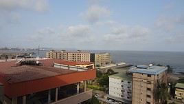
Conakry, Guinée
Conakry
Not a major tourist destination, Guinea’s capital is primarily the country’s entry point by air. There are some beautiful beaches in the surrounding area, such as the Loos Islands or along the coastal road to Kamsar.
Dabola
Surrounded by mountains, the town is a base for hiking or discovering nearby waterfalls like the Tinkisso Falls.
Loos Islands
These small islands off the coast of Conakry are popular for their beaches and fishing.
Kankan
It is the second-largest city in Guinea, at the heart of the Manding region. The sacred site of Gberedou-Hamana is about forty kilometres away.
Labé
Located in the heart of the Fouta Djallon, Labé is the country's third-largest city. The Sala and Kambadaga waterfalls are nearby.
Niani
This village in the Kankan region was once the capital of the Mandinka Empire. It holds the status of a "historical site".

Natural Heritage

Niger River
The great river rises in the Tingi Mountains in Guinea, on the border with Sierra Leone. You can explore its wildlife and beautiful landscapes by pirogue or canoe in various locations.
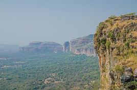
Fouta-Djalon, Guinée
Fouta Djallon
This is a beautiful mountainous and very rainy region in central Guinea. Visitors love it for its landscapes, numerous waterfalls, and excellent trekking opportunities.
Badiar National Park
Birds, antelopes, monkeys, lions, and leopards in this very small park, which is actually an extension of Niokolo-Koba in Senegal.
Haut Niger National Park
This savanna area in the country’s center is home to a few lions, hippopotamuses, buffalo, and chimpanzees.
Mount Nimba Strict Nature Reserve
The park, on the borders of Liberia, Guinea, and Côte d'Ivoire, is a UNESCO-listed site for its rich wildlife and flora. Hiking is possible here.

Recommended

★★★

Fouta Djallon

This is a beautiful mountainous and very rainy region in central Guinea. Visitors love it for its landscapes, numerous waterfalls, and…

Worth a look / Other

★★

Niger River

The great river rises in the Tingi Mountains in Guinea, on the border with Sierra Leone. You can explore its wildlife and beautiful…
★★

Loos Islands

These small islands off the coast of Conakry are popular for their beaches and fishing.
★★

Badiar National Park

Birds, antelopes, monkeys, lions, and leopards in this very small park, which is actually an extension of Niokolo-Koba in Senegal.
★★

Mount Nimba Strict Nature Reserve

The park, on the borders of Liberia, Guinea, and Côte d'Ivoire, is a UNESCO-listed site for its rich wildlife and flora. Hiking is possible…
★

Conakry

Not a major tourist destination, Guinea’s capital is primarily the country’s entry point by air. There are some beautiful…
★

Dabola

Surrounded by mountains, the town is a base for hiking or discovering nearby waterfalls like the Tinkisso Falls.
★

Kankan

It is the second-largest city in Guinea, at the heart of the Manding region. The sacred site of Gberedou-Hamana is about forty kilometres…
★

Labé

Located in the heart of the Fouta Djallon, Labé is the country's third-largest city. The Sala and Kambadaga waterfalls are nearby.
★

Niani

This village in the Kankan region was once the capital of the Mandinka Empire. It holds the status of a "historical site".
★

Haut Niger National Park

This savanna area in the country’s center is home to a few lions, hippopotamuses, buffalo, and chimpanzees.

Conakry

Not a major tourist destination, Guinea’s capital is primarily the country’s entry point by air. There are some beautiful beaches in the surrounding area, such as the Loos Islands or along the coastal road to Kamsar.

Overview of Conakry

Not a major tourist destination, Guinea’s capital is primarily the country’s entry point by air. There are some beautiful beaches in the surrounding area, such as the Loos Islands or along the coastal road to Kamsar.

Key Facts

  • Type of place: large city.
  • Tourist interest: (worth a stop if you are in the area).
  • Location:
  • Distances:
  • Local time: Heure : 12587.
  • Population: 3,667,864 inhabitants (2016).
  • Area: 450 km².
  • Altitude: sea level.

History of Conakry

What to See and Do in Conakry

In the Surrounding Area

Climate and Weather in Conakry

Transportation

Getting There

Getting Around

Accommodation

Food

Useful Addresses

Further Reading

View guide page: Conakry

Dabola

Surrounded by mountains, the town is a base for hiking or discovering nearby waterfalls like the Tinkisso Falls.

Overview of Dabola

Surrounded by mountains, the town is a base for hiking or discovering nearby waterfalls like the Tinkisso Falls.

Key Facts

  • Type of place: small town.
  • Tourist interest: (worth a stop if you are in the area).
  • Location:
  • Distances:
  • Local time: Heure : 12588.
  • Population: 38,617 inhabitants (2014).
  • Area:
  • Altitude: 363 m.
  • Website:

History of Dabola

What to see and do in Dabola

In the surrounding area

Climate and weather in Dabola

Transport

Getting there

Getting around

Accommodation

Food

Useful addresses

  1. == Additional information
View guide page: Dabola

Loos Islands

These small islands off the coast of Conakry are popular for their beaches and fishing.

Overview of the Loos Islands

These small islands, off the coast of Conakry, are popular for their beaches and fishing.

Key Facts

  • Type of place: archipelago.
  • Tourist interest: (worth seeing).
  • Location:
  • Local time: Heure : 12589
  • Number of islands: 7.
  • Main islands: Tamara, Kassa and Roume.
  • Population:
  • Area: 60 km².
  • Highest point: Sommet Lacroix (47 m).

History of the Loos Islands

Environment of the Archipelago

Wildlife and Flora

Precautions

What to See and Do on the Loos Islands

In the Surrounding Area

Climate and Weather on the Loos Islands

Transport

Getting There

Getting Around

Accommodation

Food

Useful Addresses

  1. == Additional Information
View guide page: Loos Islands

Kankan

It is the second-largest city in Guinea, at the heart of the Manding region. The sacred site of Gberedou-Hamana is about forty kilometres away.

Overview of Kankan

It is the second-largest city in Guinea, at the heart of the Manding region. The sacred site of Gberedou-Hamana is about forty kilometres away.

Key facts

  • Type of place: city.
  • Tourist interest: (worth a stop if you are in the area).
  • Location:
  • Distances:
  • Local time: Heure : 12590.
  • Population: 472,112 inhabitants (2014).
  • Area:
  • Altitude:
  • Website:

History of Kankan

What to see and do in Kankan

In the surrounding area

Climate and weather in Kankan

Transport

Getting there

Getting around

Accommodation

Food

Useful addresses

Further information

View guide page: Kankan

Labé

Located in the heart of the Fouta Djallon, Labé is the country's third-largest city. The Sala and Kambadaga waterfalls are nearby.

Overview of Labé

Located in the heart of the Fouta Djallon, Labé is the third-largest city in Guinea. The Sala and Kambadaga waterfalls are nearby.

Key facts

  • Type of place: city.
  • Tourist interest: (worth a stop if you are in the area).
  • Location:
  • Distances:
  • Local time: Heure : 12591.
  • Population: 107,695 inhabitants (2011).
  • Area:
  • Altitude:
  • Website:

History of Labé

What to see and do in Labé

Nearby

Climate and weather in Labé

Transport

Getting there

Getting around

Where to stay

Where to eat

Useful addresses

Further information

View guide page: Labé

Niani

This village in the Kankan region was once the capital of the Mandinka Empire. It holds the status of a "historical site".

Overview of Niani

This village in the region of Kankan was once the capital of the Mandinka Empire. It holds the status of a "historical site".

Key Facts

  • Type of place: village.
  • Tourist interest: (worth a stop if you are in the area).
  • Location:
  • Distances:
  • Local time: Heure : 12592.
  • Population:
  • Area:
  • Altitude:
  • Website:

History of Niani

What to See and Do in Niani

In the Surrounding Area

Climate and Weather in Niani

Transportation

Getting There

Getting Around

Accommodation

Food

Useful Addresses

  1. == Additional Information
View guide page: Niani

Niger River

The great river rises in the Tingi Mountains in Guinea, on the border with Sierra Leone. You can explore its wildlife and beautiful landscapes by pirogue or canoe in various locations.

Overview of the Niger River

The great river rises in the Tingi Mountains in Guinea, on the border with Sierra Leone. You can explore its wildlife and beautiful landscapes by pirogue or canoe in various locations.

Key facts

  • Type of place: river.
  • Tourist interest: (worth seeing).
  • Features:
  • Length: 4,184 km.
  • Altitude: from 800 m (source) to sea level (in Nigeria).

Environment

What to see and do

Practical information

  • Location:

Getting around

Accommodation and dining

What to see nearby

Further reading

View guide page: Niger River

Fouta Djallon

This is a beautiful mountainous and very rainy region in central Guinea. Visitors love it for its landscapes, numerous waterfalls, and excellent trekking opportunities.

Overview of Fouta Djallon

This is a beautiful mountainous and very rainy region in central Guinea. Visitors appreciate it for its landscapes, numerous waterfalls, and excellent trekking opportunities.

Key Facts

  • Type of place: secondary tourist region.
  • Tourist interest: (recommended).
  • Location:
  • Local time: Heure : 12594
  • Population:
  • Area: 81,952 km².
  • Highest point: Mount Loura (1,515 m).
  • Lowest point:

Climate and Weather

Main Cities

Tourist Attractions

Cities and Heritage

Nature and Activities

Transportation

Getting There

Getting Around

Accommodation

Food

Additional Information

View guide page: Fouta Djallon

Haut Niger National Park

This savanna area in the country’s center is home to a few lions, hippopotamuses, buffalo, and chimpanzees.

Overview of Haut Niger Park

This savanna area in central Guinea is home to a few lions, hippopotamuses, buffalo, and chimpanzees.

Key details

  • Type of place: national park.
  • Tourist interest: (worth a stop if you are in the area).
  • Features:
  • Local time: Heure : 12595
  • Annual visitors:
  • Area: 554 km².
  • Altitude:

Environment

Landscape of the park

Wildlife and flora

Climate and weather

Precautions

What to see and do

Practical information

  • Location:
  • Distances:
  • Opening period:
  • Rates:
  • Website:

Getting there

Getting around

Sleeping and eating

What to see nearby

  1. == En complément
View guide page: Haut Niger National Park

Badiar National Park

Birds, antelopes, monkeys, lions, and leopards in this very small park, which is actually an extension of Niokolo-Koba in Senegal.

Overview of Badiar Park

Birds, antelopes, monkeys, lions, and leopards in this very small park, which is actually an extension of Niokolo-Koba in Senegal.

Key details

  • Type of place: national park.
  • Tourist interest: (worth seeing).
  • Features:
  • Local time: Heure : 12596
  • Annual visitors:
  • Area: 382 km².
  • Altitude:

Environment

Landscape of the park

Wildlife and flora

Climate and weather

Precautions

What to see and do

Practical information

  • Location:
  • Distances:
  • Opening period:
  • Rates:

Getting there

Getting around

Accommodation and dining

Nearby attractions

  1. == In addition
View guide page: Badiar National Park

Mount Nimba Strict Nature Reserve

The park, on the borders of Liberia, Guinea, and Côte d'Ivoire, is a UNESCO-listed site for its rich wildlife and flora. Hiking is possible here.

Overview of the Mount Nimba Reserve

The park, on the borders of Liberia, Guinea and Ivory Coast, is a UNESCO-listed site for its rich wildlife and flora. Hiking is possible here.

Key details

  • Type of place: nature reserve.
  • Tourist interest: (worth seeing).
  • Features:
  • Local time: Heure : 12597
  • Annual visitors:
  • Area: 180 km².
  • Altitude:

Environment

Landscape of the reserve

Wildlife and flora

Climate and weather

Precautions

What to see and do

Practical information

  • Location:
  • Distances:
  • Opening period:
  • Rates:

Getting there

Getting around

Sleeping and eating

Nearby attractions

  1. == In addition
View guide page: Mount Nimba Strict Nature Reserve

Something wrong or out of date? Report this page