The Via Rhôna: 700 kilometers by bike from Lake Geneva to the sea! (Travel journal and video, July 2018)
Hey everyone, travelers! Here’s a little post to share our bike trip this summer. We did the Via Rhôna from Geneva all the way to the Mediterranean Sea. It was a truly amazing adventure—no hitches, lots of independent greenways, and we felt like we had the Rhône all to ourselves as our guide for 700 km over 7 days. That averages out to 100 km a day. We thought we’d do less, but the Via Rhôna is flat and not too tiring, which let us push to around 100 km each day!
Here’s the full video of our route: Play video
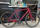
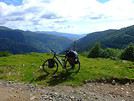
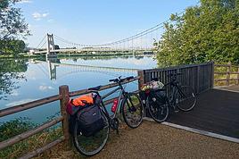
We’re not seasoned cyclists—we just love biking, and this trip was our first big bike touring adventure. As for our bikes (see photo), we had road bikes, sturdy ones with fairly large wheels and rear racks for our gear.
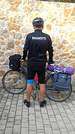
Speaking of gear, here’s what we brought: just the essentials for 7 days of biking and camping—1 tent for 2, two sleeping bags, a few clothes (not too many), 1 book each, toiletries, phone chargers, a basic bike repair kit... and maybe 2 or 3 things I’m forgetting. The idea is to travel light so you’re carrying as little as possible!
We camped every night. Along the Rhône, it’s pretty easy to find campgrounds, and they’re cheap too! Each morning, we’d decide on our destination for the evening (usually based on available campgrounds) and call during the day to book. We always managed to get a spot right away (except when we reached the Mediterranean coast, but we should’ve seen that coming 😛).
For expenses, we slept at campgrounds (between 15 and 25 € per site for 2) and either picnicked or ate at restaurants. Other than that, there weren’t really any other costs besides a few small souvenirs here and there. In total, we spent about 500 € for two over 7 days (so 35 € per person per day). I think it’s possible to spend even less—we decided not to restrict ourselves when it came to restaurants and campground prices.
For us, the most beautiful part was between Geneva and Lyon! The Rhône is still a bit wild there, as are its banks. Not too many roads, highways, trains, or factories around—just nature and peace. You gradually leave the Alps behind and head further south. It was truly stunning. We also loved the "Rhône Valley" after Lyon. The succession of dozens of suspension bridges and little villages, each more charming than the last, really enchanted us.
The trickiest part was leaving Lyon... The Via Rhôna disappears for a long stretch, forcing you to alternate between roads, traffic, danger, and pollution. We had to wait until Givors, further south, to finally get back to the quiet bike path and the Rhône showing us the way. Also, after Lyon, the Rhône becomes a bit more industrial—you pass by dams, factories, and power plants more often. But it’s really just a small detail, the exception that proves the rule of this magnificent Via Rhôna.
The Via Rhôna is a fantastic way to see how water from the mountains of Lake Geneva flows, travels, and winds its way for hundreds of kilometers to reach the sea. With this trip, you get closer to the Rhône—it becomes your accomplice, your guide. Plus, you cross a beautiful part of France, with its charm and little villages. It’s the France we love, and it’s great to explore your own country like a tourist.
That’s it for our little travel journal. I didn’t go into too much detail about our days since everyone will follow the same route, and everyone can go at their own pace :) But I’m happy to answer any questions (logistics, technical stuff, routes, etc.)—I’d be glad to help!
Here’s the video of our route again—I also composed the music, so I hope you’ll like it:Play video
Happy travels,
Flo
Here’s the full video of our route:
Play videoWe’re not seasoned cyclists—we just love biking, and this trip was our first big bike touring adventure. As for our bikes (see photo), we had road bikes, sturdy ones with fairly large wheels and rear racks for our gear.
Speaking of gear, here’s what we brought: just the essentials for 7 days of biking and camping—1 tent for 2, two sleeping bags, a few clothes (not too many), 1 book each, toiletries, phone chargers, a basic bike repair kit... and maybe 2 or 3 things I’m forgetting. The idea is to travel light so you’re carrying as little as possible!
We camped every night. Along the Rhône, it’s pretty easy to find campgrounds, and they’re cheap too! Each morning, we’d decide on our destination for the evening (usually based on available campgrounds) and call during the day to book. We always managed to get a spot right away (except when we reached the Mediterranean coast, but we should’ve seen that coming 😛).
For expenses, we slept at campgrounds (between 15 and 25 € per site for 2) and either picnicked or ate at restaurants. Other than that, there weren’t really any other costs besides a few small souvenirs here and there. In total, we spent about 500 € for two over 7 days (so 35 € per person per day). I think it’s possible to spend even less—we decided not to restrict ourselves when it came to restaurants and campground prices.
For us, the most beautiful part was between Geneva and Lyon! The Rhône is still a bit wild there, as are its banks. Not too many roads, highways, trains, or factories around—just nature and peace. You gradually leave the Alps behind and head further south. It was truly stunning. We also loved the "Rhône Valley" after Lyon. The succession of dozens of suspension bridges and little villages, each more charming than the last, really enchanted us.
The trickiest part was leaving Lyon... The Via Rhôna disappears for a long stretch, forcing you to alternate between roads, traffic, danger, and pollution. We had to wait until Givors, further south, to finally get back to the quiet bike path and the Rhône showing us the way. Also, after Lyon, the Rhône becomes a bit more industrial—you pass by dams, factories, and power plants more often. But it’s really just a small detail, the exception that proves the rule of this magnificent Via Rhôna.
The Via Rhôna is a fantastic way to see how water from the mountains of Lake Geneva flows, travels, and winds its way for hundreds of kilometers to reach the sea. With this trip, you get closer to the Rhône—it becomes your accomplice, your guide. Plus, you cross a beautiful part of France, with its charm and little villages. It’s the France we love, and it’s great to explore your own country like a tourist.
That’s it for our little travel journal. I didn’t go into too much detail about our days since everyone will follow the same route, and everyone can go at their own pace :) But I’m happy to answer any questions (logistics, technical stuff, routes, etc.)—I’d be glad to help!
Here’s the video of our route again—I also composed the music, so I hope you’ll like it:
Play videoHappy travels,
Flo


70 replies

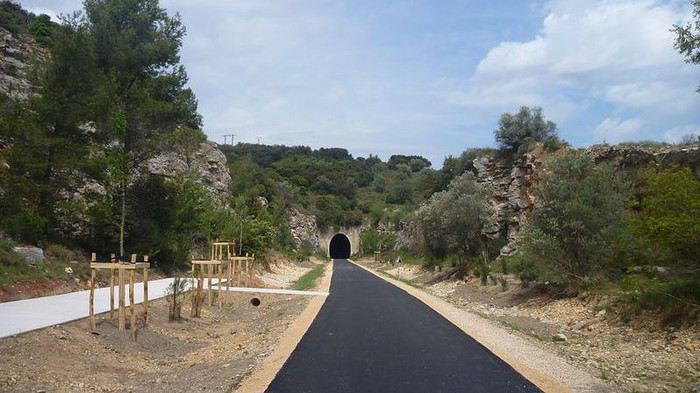 The tunnel is on the greenway from Comps to Pont du Gard, heading toward Beaucaire and the south when following the ViaRhôna.
You might also like
 The Via Rhôna: 700 kilometers by bike from Lake Geneva to the sea! (Travel journal and video, July 2018)
 Polynesia: How to choose between the Society Islands, Tuamotu, and the Marquesas?
 A Few Days in Turkmenistan from Uzbekistan
 Slovak travel journal
 14 Days in Japan – September-October 2026
 Trek in Norway: Jotunheimen and Dovrefjell, you’ll adapt to the rain...
 CARIBBEAN: The island of SAINT-MARTIN, a different perspective
 Northern Morocco, the kingdom of kif?