Back to the discussion

in Entre deux voyages › Carnets de voyage

The "Must-Sees" of the American West (page 4 of 10)

Discussion started by Marati on 2024-11-11

195 replies

This thread has been translated into English.


The "must-sees" of the American West

Marati · 2024-11-19 · Message 61 of 196

Yves, From up top, it had seemed to us that the base of the wall was too high—around 2.5–3 m—and none of us three thought it would be easy to climb down and then back up. Based on what you’re saying, we were probably too cautious at the time. I kinda regret it now. I just went through all my photos, and I don’t have a single one that shows the detail at the top, which could’ve helped you figure out if you can place a cam. For the access from below, though, I *did* take a photo of where you need to set up the telescopic ladder...😛

For Burger Rock, we only had the GPS point, and we took a path way too far south to get there. Yet after Mélody Arch, the access seemed simple by going around a rocky mound via a southeast headland. Then as soon as we could head east, we did. We didn’t get it... Gotta go back 😏 !

Must-sees in the American West

Marati · 2024-11-19 · Message 62 of 196

Thanks Isabelle for your encouraging words! 🙂 For the difficulty of the hike, you can limit the number of spots by sticking to those on the main trail (Rock Fins, Ginger Rocks, The Wave, then Second Wave) and skipping The Alcove, Melody Arch, and Burger Rock. I’ll keep entering the lottery to explore the area more, with several arches (Hugh Heel Arch and Moby Dick Arch) and the entire southern sector that I had to skip to avoid rushing through the different spots...

The "must-sees" of the American West

MycoVtt · 2024-11-20 · Message 63 of 196

it’s not just a question of height—you can kind of oppose it a bit, I think, by going over the top. But from what I remember, Sunny Stroer told me she went underneath. That actually surprised me.

Must-Sees of the American West

Marati · 2024-11-23 · Message 64 of 196

09/27/2022: Day 4 - Coyote Buttes South - White Pocket

Another insane day awaits us on the Paria Plateau. Well, that’s to be expected—it’s the trip of the Must-Sees! Especially for Franck and Sullivan, who’ve never been to Coyote Buttes South or White Pocket before!

For me, this’ll be my third time at White Pocket after 2015 and 2018, and my fourth at Coyote Buttes South after visits in 2015 (Paw Hole only), 2018, and just two months ago in July. Despite my two previous visits to the Cottonwood Cove area, I still haven’t explored the farthest zone. In 2018, we only had a little time because of a flat tire. This summer, our oldest son’s physical abilities—on crutches with partial weight on his left leg—limited him to hiking 7-8 km a day, which is already a lot !

After setting up the tent again and a pretty simple lunch, we tackle the access road to Cottonwood Cove, which alternates between sandy patches and rough sections. A 4x4 is absolutely necessary, with good ground clearance to avoid scraping the undercarriage.

Half an hour later, we park at the trailhead—or rather, just 50 meters before the parking lot—because I still have a bad memory from 2018 when we almost got stuck in the sand with a Ford Expedition just 20 meters from the lot on a super sandy stretch. I’d rather walk 50 meters than take unnecessary risks!

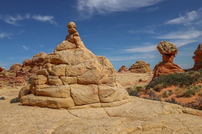
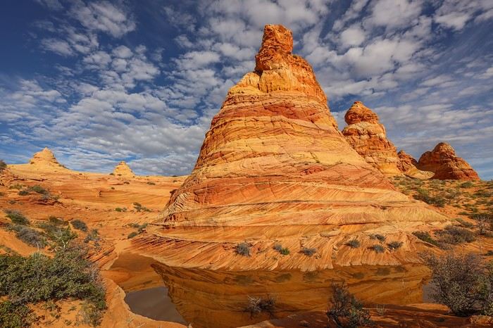
We start the fun around 9 a.m. and follow the trail to the first teepees, which are characteristic of both the North and South Coyote Buttes areas.


Our first stop is the unmissable Half and Half, a stunning two-toned rock.


And here’s Control Tower, the most famous rock formation along with Half & Half Rock.


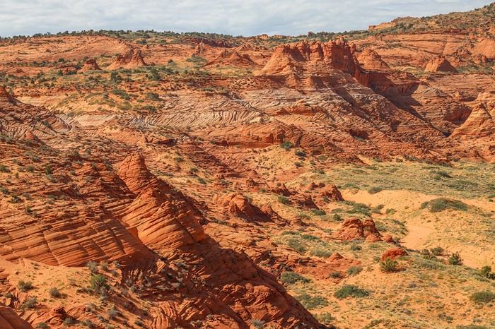
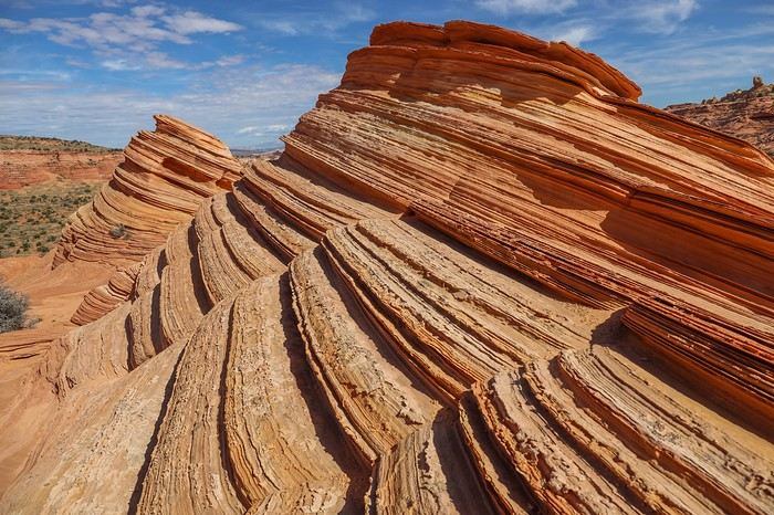
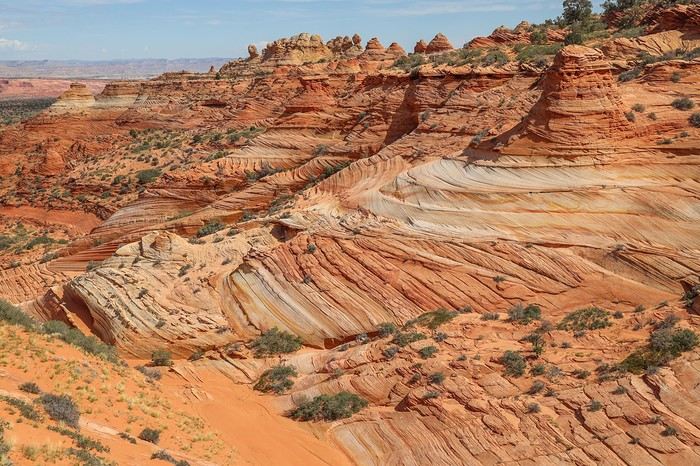
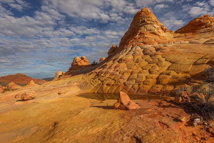
There are tons of oddly shaped rocks in different shades. All these formations are quite fragile, which is why the number of permits issued is limited to 20 per day. The views are as spectacular as the rocks themselves.

We then head to the westernmost hoodoo area of the site, down below. There’s even a mini-wave—nothing like the ones from the day before, but still cool!


There are even some dinosaur footprints, and we had the GPS points for them. Next, we decide to go to The Beauty, a rock located 1.5 km further south. It’s not easy to make progress because there are several plateaus. We first move across an intermediate plateau that eventually becomes a dead end unless you dare to climb along a steep cliffside. So we backtrack until we can descend to the lower plateau, and then we can move at a good pace toward The Beauty. The setting of the hike is just amazing...

Along the way, a few rocks are worth the detour!

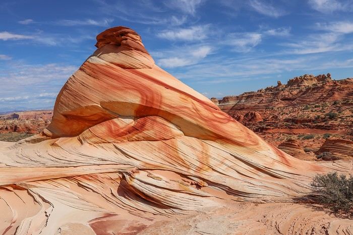
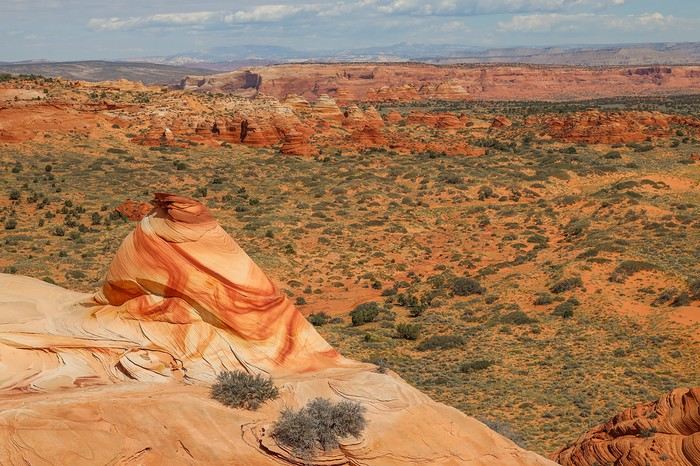
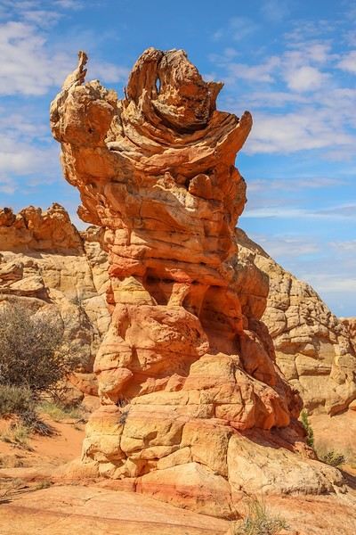
And finally, we arrive at The Beauty—a rock with a shape, texture, and colors that stand out from everything around it! Gorgeous!!


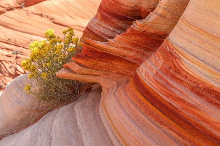
A shrub survives the drought at the base of the rock.

[....]

Must-sees in the American West

Marati · 2024-11-23 · Message 65 of 196

This rock is stunning, and the landscape it sits in is just as breathtaking. So much open space all around—we’re loving it 😎!


Then we head back toward the trailhead.


The trail takes us through Rose Plateau, then past two iconic hoodoos, named The Hydra and Olympic Torch—it definitely lives up to its name 😛!

It’s nearly 2 PM when we reach Tahoe, after about 5 hours of exploring 🙂! After scarfing down a few sandwiches, we head to White Pocket via the direct route between the two areas. The road is rougher, and we cross paths with our first 4x4—a tour operator’s vehicle. Luckily, it was in a section where passing was possible. The last stretch is a steep descent with deep sand, and Sedonax had warned me not to take it the other way to avoid getting stuck.

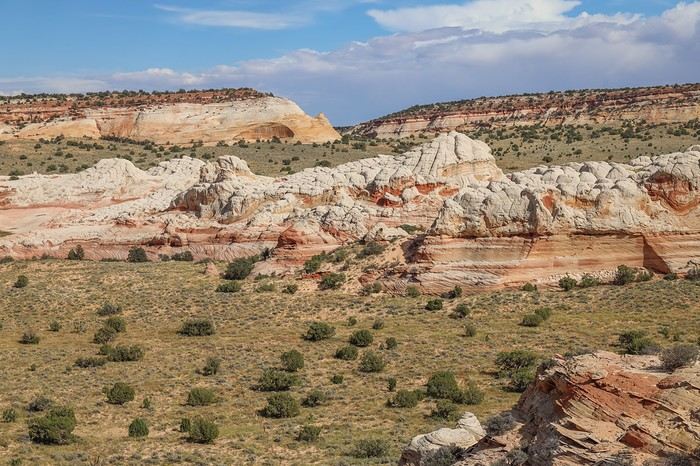
We arrive at the White Pocket parking lot around 3 PM, without needing to buy any permit—this site is strangely still exempt from permits! And yet, it’s just as impressive as its famous neighbors!

The area isn’t very large, so we split up, each wandering wherever we please. Sullivan takes his drone since the site allows them. Meanwhile, I head toward a slightly off-center monolith because I’d found a cool spot on Bill Belvin’s site called Lace Rock.

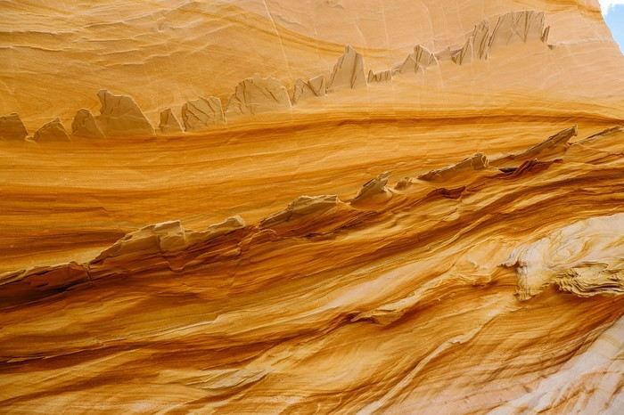
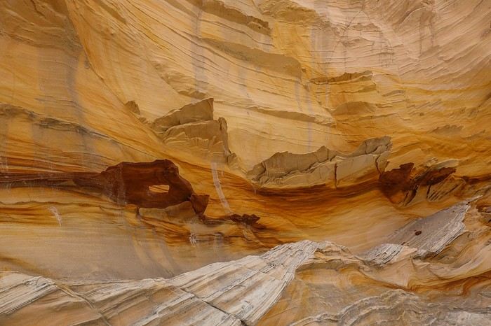
You have to climb the rock, and then you reach a wall with thin, lace-like rock formations jutting out. Really unique!


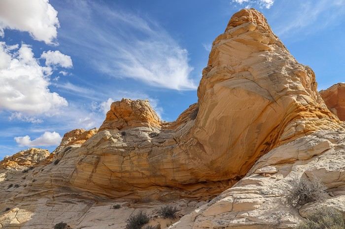
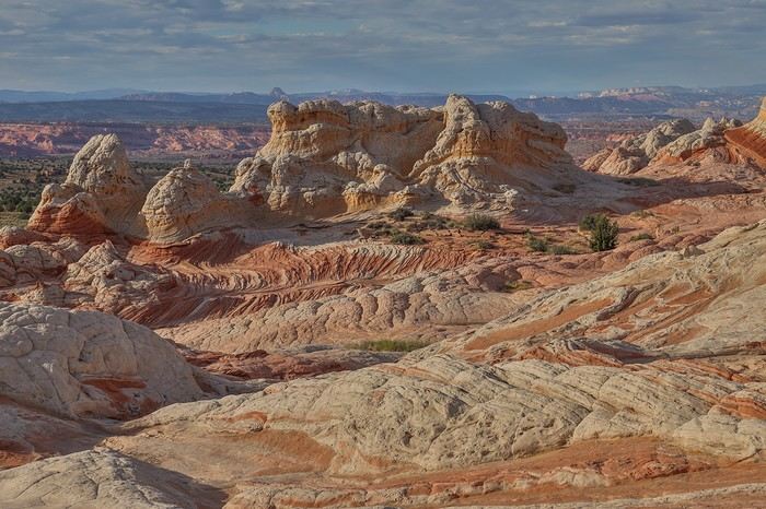
The monolith also offers a different view of White Pocket’s main area!


Even if I’m not sure Lace Rock is worth spending *that* much time on, I still thought the spot was pretty cool.

Must-Sees of the American West

Marati · 2024-11-23 · Message 66 of 196

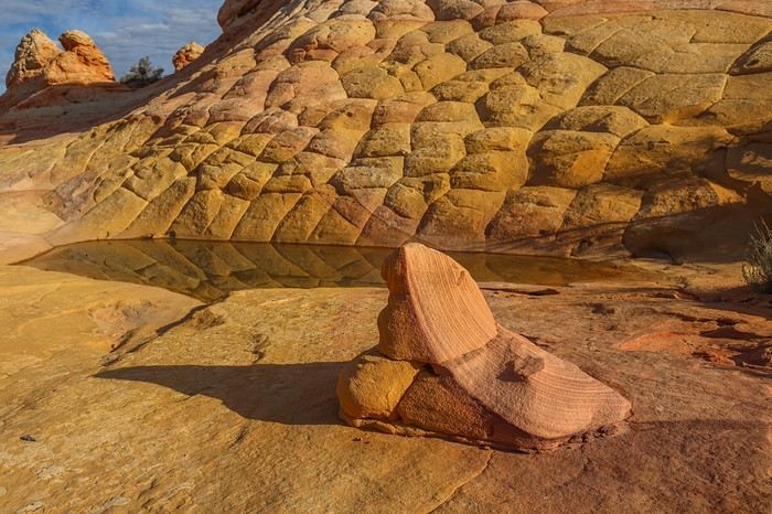
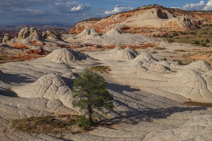
Once back in the area, I start with the white rock zone, featuring a very photogenic tree,


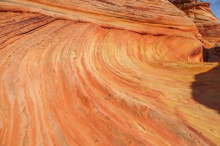
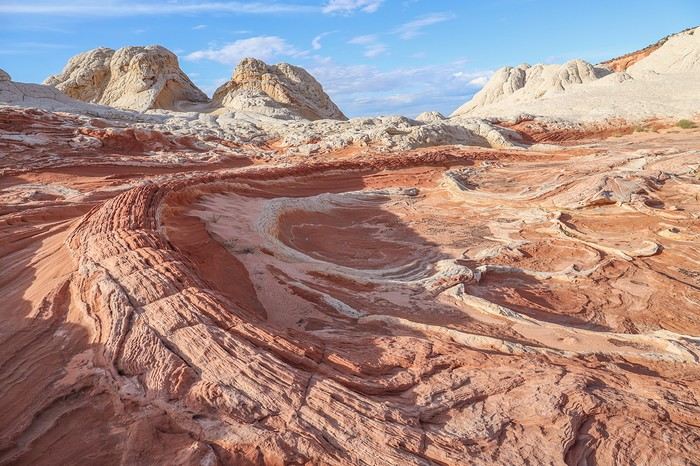
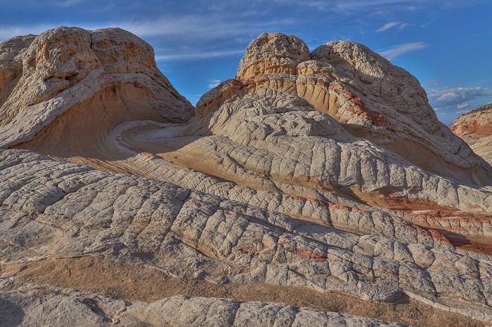
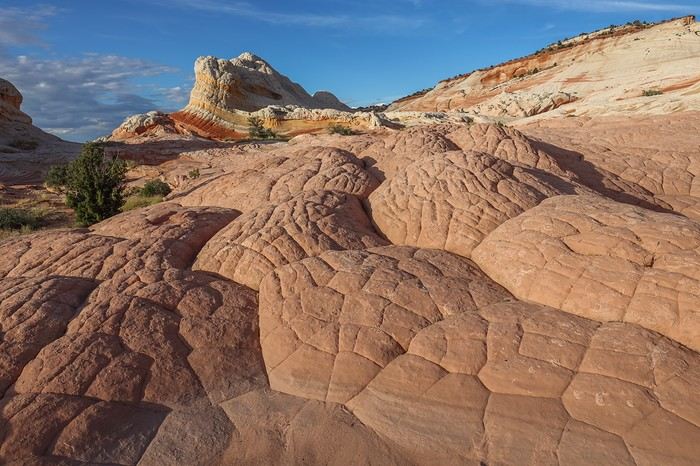
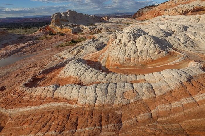
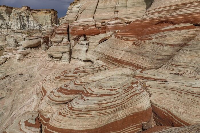
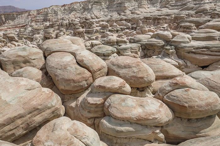
then I explore the sector where rocks in shades of pink, white, and yellow intertwine with shapes, twists, and striations that are just unimaginable!


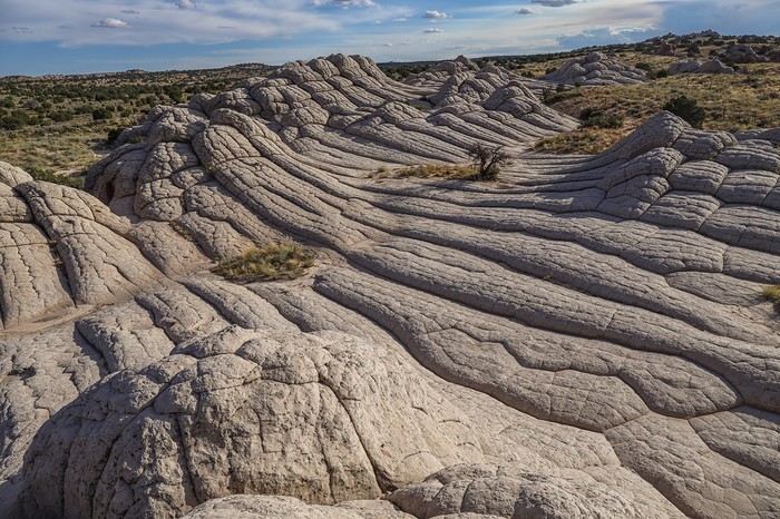
You just get the impression of a huge ice cream scoop melting any which way, or even a human brain spread out on a platter...


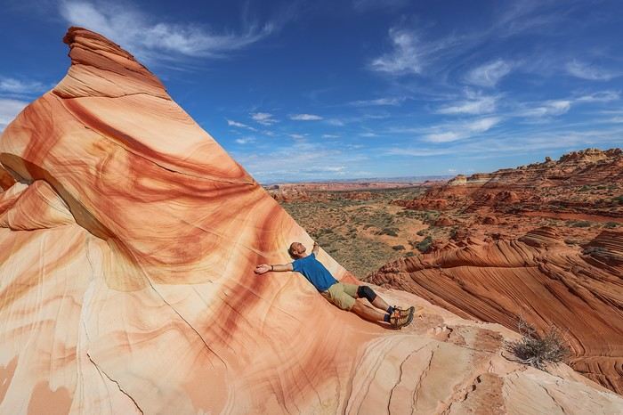
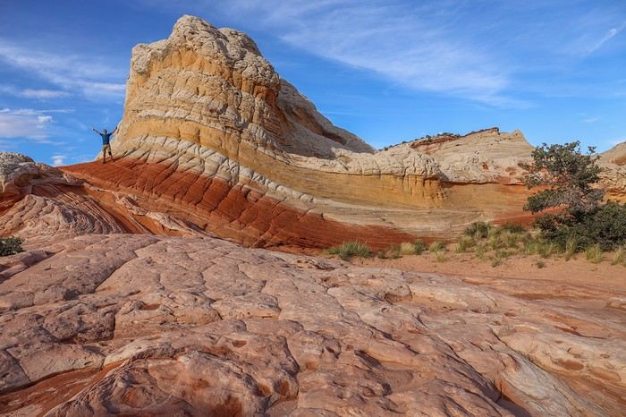
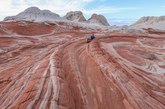
My favorite rock, and my avatar by the way, is The Swirl 😎 !! A photo with me on it to give you an idea of its size! The area all around The Swirl is nice too, with brainrocks—literally "brain rocks"...


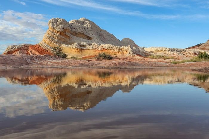
We’re lucky to be able to photograph The Swirl differently thanks to a well-placed pool!

After sunset, we stay a while longer to soak it all in! Franck and Sullivan really liked it, but they admit they didn’t fall in love with White Pocket, which for me is my favorite site in the American West, after The Wave, of course!

Instead of camping on-site, we quickly head back down the trail, taking a long detour to the south to avoid getting stuck in the sand—especially at night. On the way, we stop for groceries in Kanab, then grab burgers and all-you-can-drink Dr Pepper at a Denny’s!

It’s late in the evening when we finally find a spot just north of Highway 89, near Churchwekk, to camp and be as close as possible to our next hike, which we’ll start at night with headlamps!

Summary: only 11 and 5 km covered. Coyotes Buttes South and White Pocket aren’t very large sites, but you get tired quickly in Cottonwood Cove because a big part of the walk is through sand. These two must-see spots remain very quiet since they require taking difficult, sandy roads—all at your own risk, as no company covers off-road damage. None... except one... but you’d have to land in Salt Lake City.

The "Must-Sees" of the American West

Marati · 2024-11-24 · Message 67 of 196

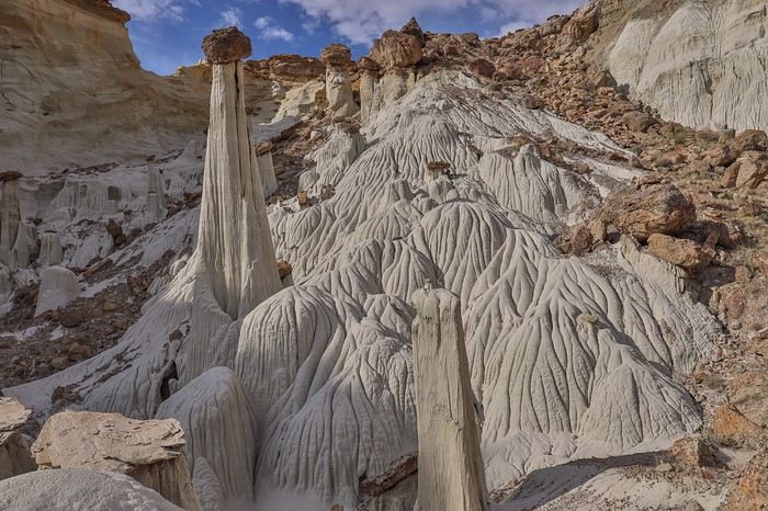
09/28/2022: Day 5 - Wahweap Hoodoos - Sidestep Canyon - Colorful Canyon - White Rocks - Sunset Yellow Rock This day belongs to Franck. He’s been dreaming about this hike for months—it combines four spots in one day: the Wahweap Hoodoos, Sidestep Canyon (with its slot canyon), Colorful Canyon, and the White Rocks. We leave the car parked near a reservoir, around the point (37.13141 -111.75620°), at the western end of our loop planned with Franck.

The Wahweap Hoodoos are over 6 km from the trailhead, which is why we set off at night with headlamps. We want to arrive just after sunrise to catch the best light on the hoodoos.

Barely started, we follow a barbed-wire fence until we find a weak spot where, by helping each other, we manage to cross without scraping ourselves or snagging our jewelry.

Then, we head northeast. According to our study of the contour lines, there’s only one tricky part: a canyon we’ll need to descend and then climb back up on the other side.

The descent is trickier than expected, forcing us to take a detour. From there, two options: climb back up via Sidestep Canyon or take the more direct route—a wall that *looks* easy to scramble. We all vote for the direct path, but the rock crumbles under our feet, and we have to help each other multiple times to make the climb safely. The rest of the hike is easy until we reach the Wahweap Hoodoos.

And then—big mistake! Not wanting to get too close so Sullivan could be surprised at the last minute, and forgetting that a scree slope lets you descend the wall directly, we start moving away to find another way down. But that access never comes, and we end up taking a 3 km detour to reach the site. This detour has one upside: it lets us enjoy a lunar landscape...


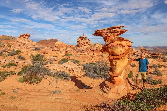
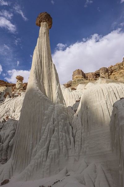
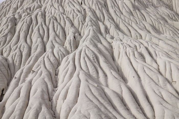
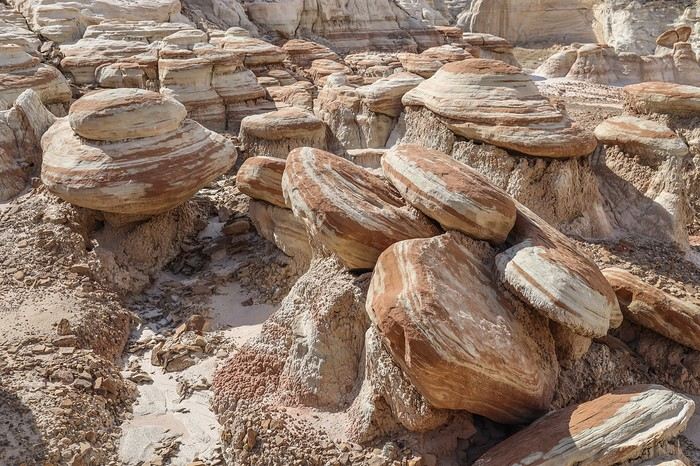
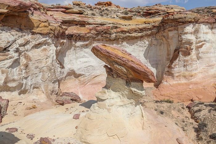
By 9:30 AM, we’ve already covered 9 km—this doesn’t bode well for the rest of the day...! To make matters worse, a big cloud blocks the sun, making the hoodoos look duller. Still, we enjoy the area and a spot further south with a few two-toned hoodoos topped with "hats."

Luckily, the cloud eventually moves, giving us a few minutes of sunlight before it disappears behind the rock wall, letting us snap some great photos.


And of course, once we’re there, we spot the scree slope that would’ve let us leave the site. Our memory comes back—westusa had mentioned this western access point. The second spot of the day is Sidestep Canyon, with countless mushroom-shaped rocks and a rarely visited slot canyon.


We start with a small detour to see the Stripped Hoodoos,

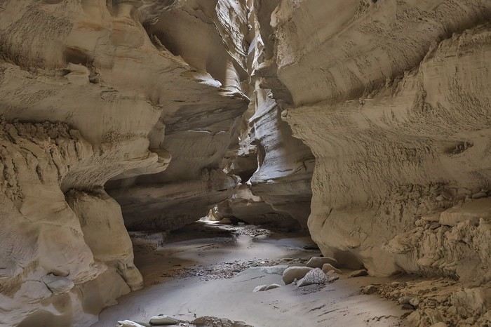
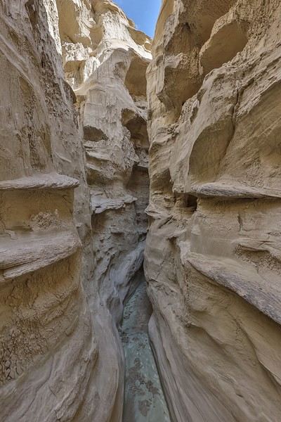
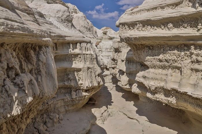
then enter the crevice, the prelude to a promising slot canyon!

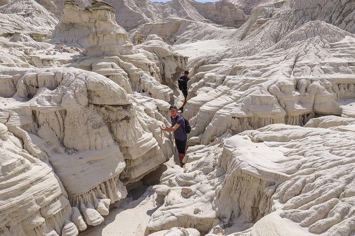
After lunch in one of the few shady spots, we leave our bulky backpacks behind and enter the slot. We move carefully because the site is fragile, and the slightest impact can dislodge crumbly rocks.

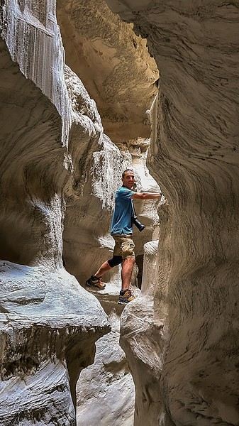
It’s not very long but impressive with its intricately carved rocks.


We all love it, and of course, we’re alone in the world—just like the day before! [...]

Must-sees in the American West

MycoVtt · 2024-11-24 · Message 68 of 196

Nice start to the hike! Didn’t you see an arch in that slot canyon? A few years ago, I saw a photo of a more or less "white" arch, and no one’s ever been able to say where it is. Not even sure it’s actually an arch—maybe it’s an alcove? I’ll send you the photo on Messenger...

The "Must-Sees" of the American West

Marati · 2024-11-24 · Message 69 of 196

Once we exited the canyon, we looked for a spot to climb onto the upper plateau to gain some altitude and get a panoramic view of this mushroom forest.


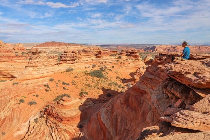
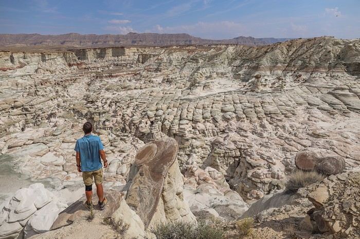
Franck, who had studied the site in detail online, promised us an amazing day. I think he was right—because the view from the top of Sidestep Canyon is just incredible 😇!!

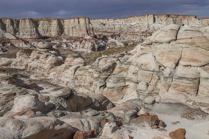
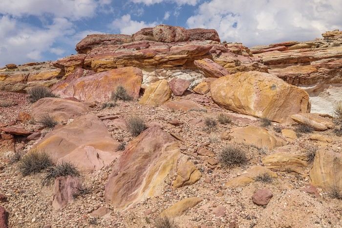
A quick drone flight for Sullivan, then we move on to Colourful Canyon, a small canyon with some pretty cool multicolored rocks. It’s not the most photogenic area,


but it lets us continue our loop toward the White Rocks. The route is pretty intuitive, and we weave through some really unique rock formations!


At the end of the hike, I’d noted a detour to see Camel Hoodoo, but we strayed from the planned route, and it would’ve meant an extra 3 km just for one hoodoo. Even though Franck and I know this massive hoodoo is worth the detour, we don’t have the energy to push our legs any harder. So we decide to head back to the car. This unforgettable loop still required hiking 25 km. If we’d prepared better, we could’ve avoided that 3 km detour this morning 🤪.

Back at the 4x4 around 4 PM, we rush to slip into flip-flops and let our feet breathe. Still no blisters! We do use preventive bandages to stop them from forming 😛!

To reach our next stop, we take Cottonwood Canyon Road. Around 4:30 PM, while it’s still bright out, we pass the Yellow Rock trailhead, and Franck and I exchange a look.

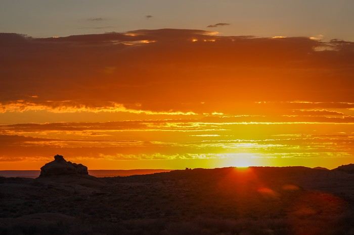
We both know what the other’s thinking, and we pull over to reconsider the rest of the plan. Our legs are begging for a break, but we figure we might not get another chance to be here with a shot at a sunny sunset despite the cloud cover 😎.

Sullivan’s up for it, as long as the spot’s worth it. Franck and I vouch for it, so off we go to Yellow Rock—chef’s surprise!!!

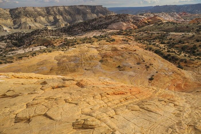
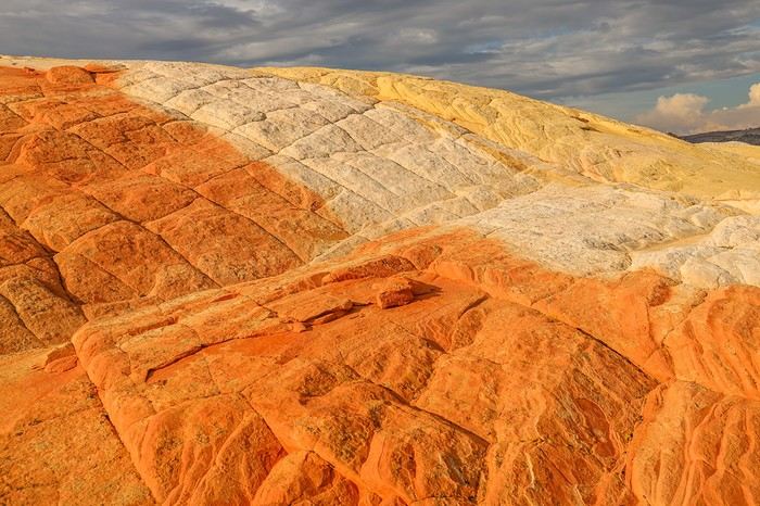
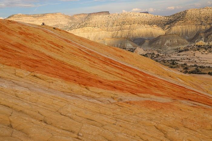
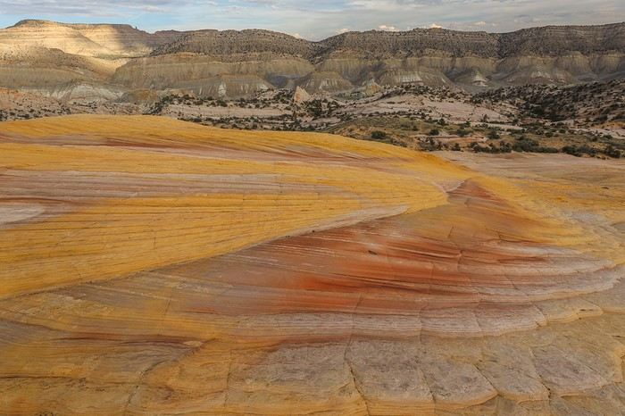
The hike to Yellow Rock isn’t long, but it’s full of obstacles! First, we cross a forest of shrubs and reeds to reach the base of the rock formation, then climb a rocky scree with about 150 m of elevation gain. It’s sketchy, and it feels like we’re not making any progress... Then, at the top of the plateau, we get a great view of Yellow Rock’s monolith. The colors really pop once you climb to the summit! This late-afternoon light is nothing like what I’d seen in the middle of the day in July. We’re treated to an explosion of yellow, white, and orange hues with an insane view of the surrounding massifs.


Sullivan at his command post, piloting his drone...

With stars in our eyes, after an incredibly discovery-packed day and a solid 28 km under our belts, we head to a campsite in Escalante. Too late for a burger—all the restaurants close early—but not too late for a couple of beers at the local pub. Then, a proper hot shower, laundry time, a huge plate of pasta to recharge, and a deep sleep... because after a few days of training, we’ve planned to up our hiking distance tomorrow... 😏

The "must-sees" of the American West

Marati · 2024-11-24 · Message 70 of 196

Didn’t you see an arch in that spot? I’ll send you the photo on Messenger...

No, I don’t remember seeing one. If you send me the photo, I’ll compare it with all the pictures I took along the way—there are tons of them.

The "Must-Sees" of the American West

Cheesecake14 · 2024-11-26 · Message 71 of 196

Hi Guillaume, Your road trip is a must for those in the know. Thanks for the feedback from a fellow enthusiast. Best regards,

The "must-sees" of the American West

Marati · 2024-11-26 · Message 72 of 196

Welcome Fabrice, and thanks for your kind words! 😊

The "Must-Sees" of the American West

Marati · 2024-11-28 · Message 73 of 196

09/29/2022: Day 6 - Broken Bow Arch - Reflection Canyon

It seems like the heat is lingering later and later into September or October. But this morning, at sunrise, that wasn’t the case! At 6:30 AM, the humidity and morning chill jolted us awake from our restful sleep 🤪!

Bad luck, because if there’s one day we need to be in top shape, it’s today. After the morning chores—packing up camp and breakfast—we hit the Hole-in-the-Road, an 80 km track that cuts through the Grand Staircase Escalante monument. There are about twenty spots to see along this route, and we decided to go for the most remote ones, at the very end of the track, where the road is notoriously rough toward the finish!

Our first stop of the day is Broken Bow Arch, a massive arch at the end of Willow Creek. It takes us a good 1.5 hours to cover the 70 km to the trailhead. Only the last few kilometers are a bit tricky; otherwise, the HIRR is smooth driving! The hike is only 6 km, so we each take very little water.

The fun starts as soon as we begin descending into Willow Gulch canyon, with the quirky Mortarboard Rock, a hoodoo named after the cap worn by American students during graduation ceremonies.
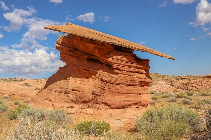
The canyon is easy to navigate, with a well-marked trail and few steep sections. At this time of year, there’s no water at the bottom of the canyon—not even a pool... Which is fine by us because we make quick progress.

After half an hour of walking and 3 km covered, we spot the stunning and massive Broken Bow Arch! 😎
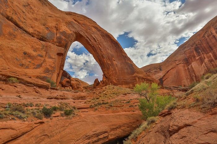


It’s a good thirty meters wide and tall! Photos don’t do justice to the immensity of the arch amid the red sandstone cliffs.

We head back, and—overconfident—we take a wrong turn at a canyon fork we hadn’t noticed on the way in. On another day, the few hundred meters wasted wouldn’t have mattered, but today, we need to be careful... because we still have a big chunk left to explore!

To reach the trailhead for the next hike, we only have about ten kilometers of track left. But the road quality deteriorates sharply, with lots of loose rocks and boulders forcing us to drive very slowly. Not to mention the infamous Tahoe’s mud flap that keeps catching on every wash crossing 🤪. What’s the point of building a 4x4 with high ground clearance if you’re just going to lower the front of the body more than necessary and add a flap!

Anyway, we finally reach the trailhead for the legendary hike to Reflection Canyon. I call it "legendary" because this viewpoint over a Lake Powell meander is 13 km from the parking lot, and I’ve read plenty of stories about hikers struggling—or even getting dehydrated—in the scorching heat. Most people do this hike over two days to enjoy the soft evening and morning light.

Two factors made us consider another option. First, a few weeks before the trip, I saw recent photos of Lake Powell, and they showed that this viewpoint was just a shadow of its former self—unless you fly a drone to gain precious meters in height to recapture the old perspective.

Second, bivouacking on-site and hiking back in the morning would cut into our next day’s plans, which are impossible to do in just half a day. And since there was no way we were wasting half a day hanging around Coyote Gulch, we decided to take the bold gamble of enjoying the sunset at Reflection Canyon and then hiking back that same night—or rather, in the dark...

By late September, temperatures are much more pleasant, and when it comes to packing our backpacks, there are two teams: the "No Fear" team with just one gallon of water split into different bottles with ice, and the "I’m Not Feeling It" team with 6.5 L of water—which isn’t negligible given the fast-paced hike-run we’re about to do! Franck and Sullivan are on Team "No Fear," while I’m more of a "belt and suspenders" kind of guy... Before setting off, we have a light lunch by the car to avoid side stitches later.

We start around 1 PM. The beginning is tough—uphill on slickrock—and we struggle to find the right trail. Eventually, we spot the faint path we’ll follow for most of the way.

We walk at a good pace, around 5 km/h, and with every valley crossing, we take advantage of the downhill to run and tackle the uphill without breaking a sweat—still running.
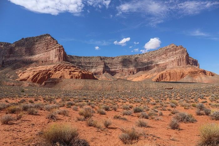
The landscapes we cross aren’t mind-blowing, but they’re not as dull as I’d read.
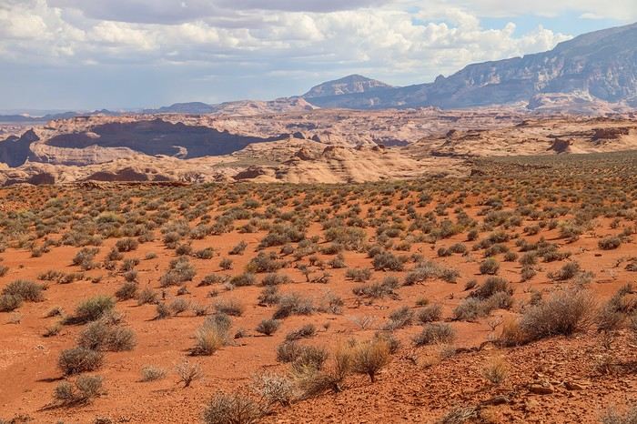
Time flies, and our little game is to guess the direction of Reflection Canyon without using the GPS. It’s impossible to imagine what awaits us at the end, and we can’t even see Lake Powell yet.

The last section of the hike requires a GPS—it’s super easy to get lost! We regularly set a bearing to follow so we don’t stray from the final goal, which remains invisible...

Finally, after 2.5 hours of fast hiking, we spot Lake Powell. It’s truly breathtaking!
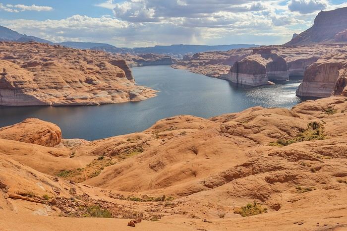
Climbing up a small hill, we see the famous lake meander, though the angle isn’t the one everyone knows!
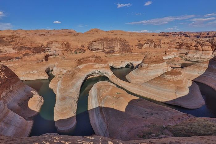
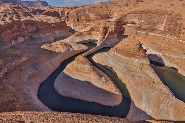

Then, we round the cliff, and there it is—the viewpoint we’ve dreamed about, Franck and I...
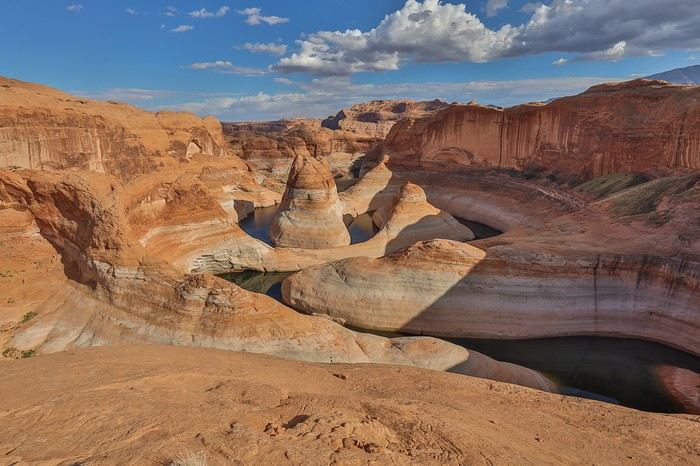
It’s magnificent 🙂, the site is vast, but I have to admit that with the current water level, Reflection Canyon doesn’t give me that "wow" effect. We can’t get any closer to the edge—the slope is too steep...

We spend 1.5 hours there, soaking in the view while lounging on the slickrock to recharge before the sun sets.
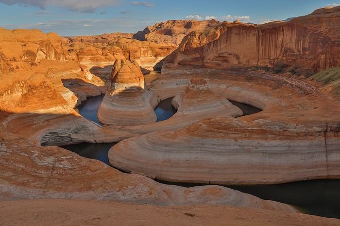
Around 6 PM, the shadows stretch dramatically, and the sun won’t be far from setting... Our last photos before heading back: Without a tripod, we decide there’s no point staying longer and that it’s better to take advantage of the blue hour to make progress on the return trip and cover as much ground as possible toward the car! After all, we’re not sure our headlamps will last 3 hours!!
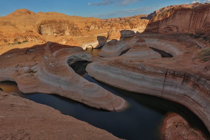
Shortly after 6 PM, we set off, devouring the 5 km of confusing slickrock in about an hour. The twilight deepens, and 2-3 km later, it’s pitch black, and the real challenge begins.

Having pushed the pace a bit too hard, our water reserves dwindle—especially for Franck and Sullivan, who probably have only half a liter left by the halfway point.

We switch to commando mode: Sullivan, our metronome, sets the pace at the front; Franck follows in his footsteps; and I bring up the rear with the GPS, regularly checking we’re on the right track. But with night fallen, what was easy on the way in is now much harder. We keep losing the trail and struggle to find the best path. We’re exhausted, wasting precious meters, adding unnecessary elevation, and getting slowed down by bushes and brambles 😊...

In short, 3 km from the end, Franck and Sullivan’s bottles are empty 🏴‍☠️, while we still have a good hour of walking ahead, over 30 km already logged, and we absolutely need to avoid dehydration... Luckily, I still have nearly 2 L left, so we share the remaining water to finish the last kilometers of this legendary hike smoothly!

We’re full of energy when we find our beloved Tahoe, and after 34 km hiked in this insane day, we quickly slip into flip-flops to prepare our feast!

It took us 2.5 hours to get there and 3 hours to return—nearly half the usual times I’ve read about. So it’s doable, at least this late in the season. In the middle of July, I wouldn’t necessarily risk it unless I was ready to carry 10 L of water 😊.

To make up for the calories burned, we have pasta, chicken, and a big can of pineapple for each of us. Tonight, in addition to our swollen feet, we’ll sleep with full bellies and a head full of memories...
The "must-sees" of the American West

Rjulie95 · 2024-11-28 · Message 74 of 196

Showing off with gallons, I had to Google to find out how much that was in liters for the "no fear" team. 😏

West Coast US "musts"

Marati · 2024-11-28 · Message 75 of 196

In New York, you weren't walking around Manhattan with your gallon of water 😏!? Or did you cancel that trip?

West American "Must-Sees"

Rjulie95 · 2024-11-29 · Message 76 of 196

No idea at all—I had a one-liter water bottle 😄

Must-sees in the American West

Ticapi · 2024-11-30 · Message 77 of 196

I love the rock formations at Coyote Buttes South and White Pocket. 🤩

Your hike around Lake Powell was stunning—what an achievement! So many kilometers in such a short time. Way to go! 👏

The "must-sees" of the American West

Marati · 2024-12-02 · Message 78 of 196

09/30/2022: Day 7 - Coyote Gulch

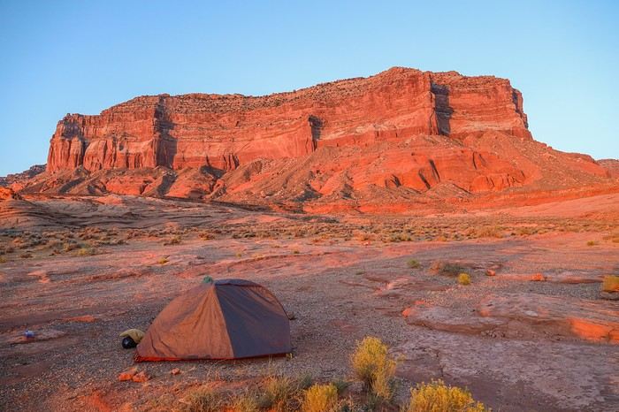
Our legs feel a little heavy this morning when we wake up, but that’s pretty normal. Now that it’s daylight, we’re discovering the setting where we randomly pitched our tent last night—good thing it was dark! Could’ve been worse, I guess...


After breakfast, we head back onto Hole-in-the-Rock Road heading north. After about ten rough kilometers, the road smooths out.

It takes us a good hour to cover the 30 kilometers to the Coyote Gulch parking lot.

Coyote Gulch is a canyon considered by some specialized sites as one of the most beautiful spots in the Southwest, with its river winding through sandstone cliffs and its mix of waterfalls, arches, and natural bridges. The highlight of this hike is the massive and impressive Jacob Hamblin Arch, nestled in an alcove—at least, that’s what the photos we saw online suggested. There are two ways to access it: a two-day hike via Hurricane Wash (western access) or a slightly shorter hike (eastern access) over one or two days via "Crack-in-the-Wall," a natural crevice in the rock. Most people choose the second option, camping on-site.

During our planning, Franck and I weren’t too keen on weighing down our packs with camping gear, since the loop we had in mind requires climbing up a steep slickrock cliff to exit the canyon and then cutting across to the trailhead. That’s why it’s best to hike light to reduce risks when leaving the canyon, but we knew the day’s hike would be around 25 kilometers.

When we arrive at the parking lot, there are 5-6 cars already parked. We won’t be alone!

We start by packing our backpacks. Along with lunch, some dried fruit, and water, Franck brings his 30-meter rope, and I bring my climbing shoes, which I packed specifically for this hike.

Here we go!

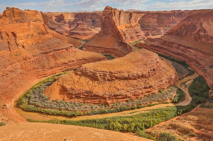
A few weeks before the trip, we saw a post about a stunning "Bend" located just a few hundred meters from Crack-in-the-Wall. We naturally head there, and now we’re standing in front of a viewpoint—something the Southwest seems to have dozens of 😎!


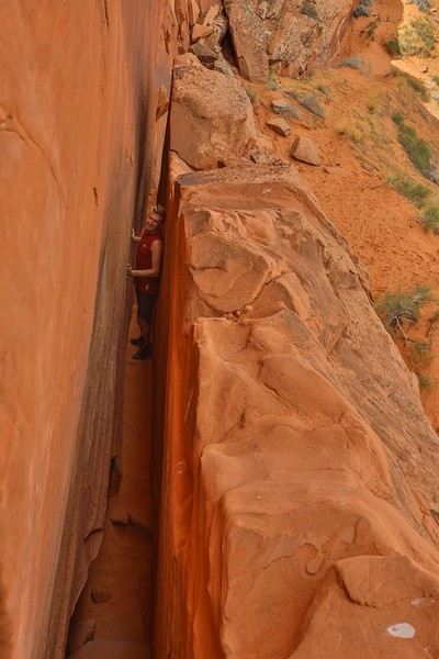
We then arrive at Crack-in-the-Wall.

We use a rope left behind to rappel our backpacks down since they wouldn’t fit through the very narrow crevice that leads into the amphitheater. Good thing we haven’t been overdoing the beer on this road trip—it all fits without a problem!


The plunging view into the canyon is absolutely stunning, especially in the sunlight 😇!

The descent is through soft sand, and we’re glad we’re not doing a round trip—going back up wouldn’t be much fun!


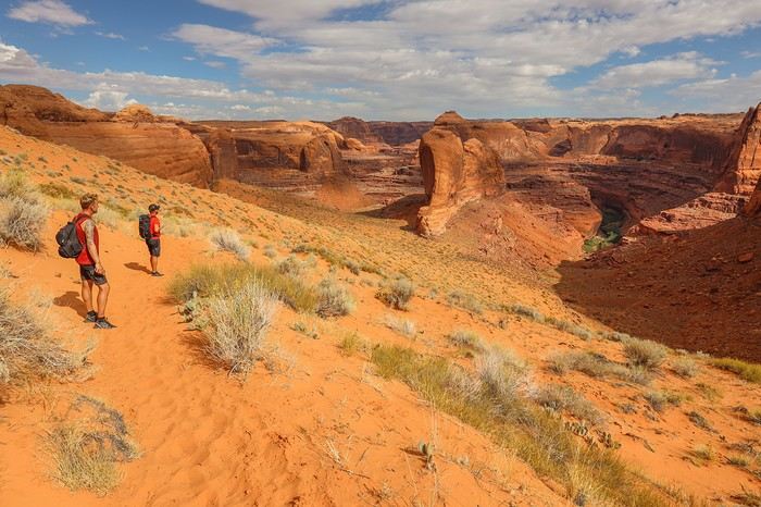
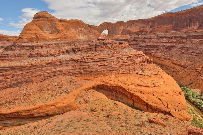
We start by circling this dinosaur ridge with the goal of getting a closer look at Stevens Arch, which we can already see in the background!


Here’s the best viewpoint for Stevens Arch, at the end of the ridge. To get closer, you’d have to follow the wash and then walk along the river, but I’m not sure the angle would be any better...


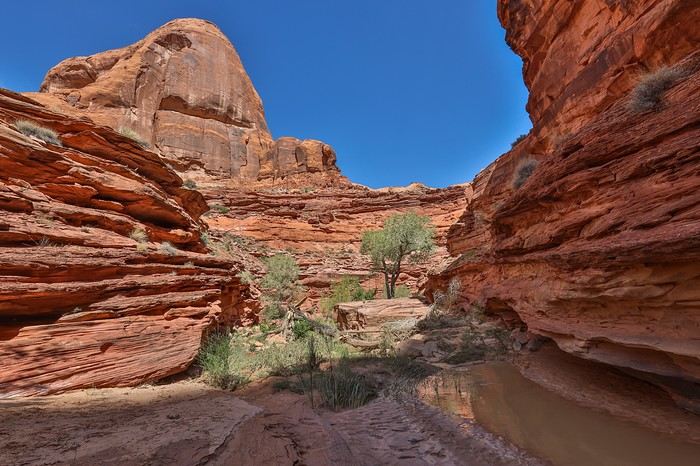
We then start walking along the wash, occasionally getting our sneakers wet. The sandstone cliffs on either side create a constantly shifting backdrop. We’re not bored as we follow the meanders!


The trail alternates between fairly open sections and much bushier areas that slow us down.

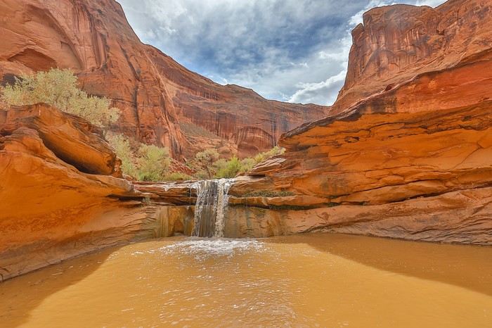
We also have to cross several waterfalls. While crossing one of them, Sullivan slips and loses his Ray-Bans, which fall into the water. After 10 minutes of searching, we can’t find them.

Second waterfall

https://voyageforum.com/images/posts/small/1733170097-08njtyVKFhn5z37.jpg

The "must-sees" of the American West

Marati · 2024-12-02 · Message 79 of 196

At one point, we veer off from the main canyon to head to Black Lagoon.

From up high, you better understand where its name comes from, and you wouldn’t even think of taking a dip in that brackish water. Nothing exceptional either, so we head back the way we came. Even though the scenery is stunning, you have to admit that winding over 10 km through the river’s meanders gets pretty long. Not all areas are as open as this one!
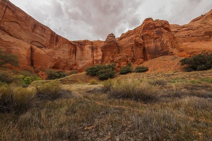
To add a bit of variety, here’s Coyote Natural Bridge 🙂
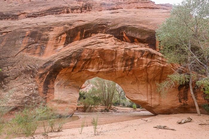


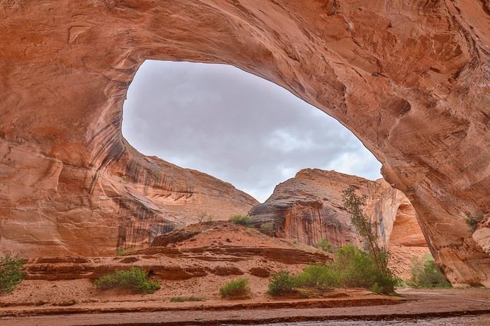
Since early afternoon, the weather has been getting cloudier, and rain even starts to fall just a short distance from the finish. After a few more long bends where it feels like we’ll never reach the end, we arrive at an alcove the size of a cathedral!! The sheltered part at the back must be several dozen meters deep and a good fifty meters high!

We still haven’t seen the arch, the main goal of the hike, but this alcove alone is worth all those hours spent walking...
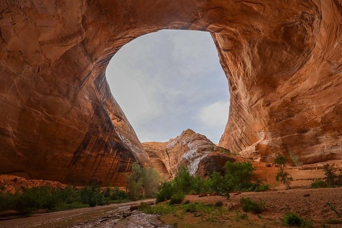
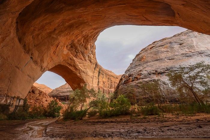
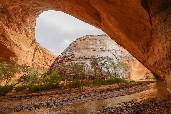
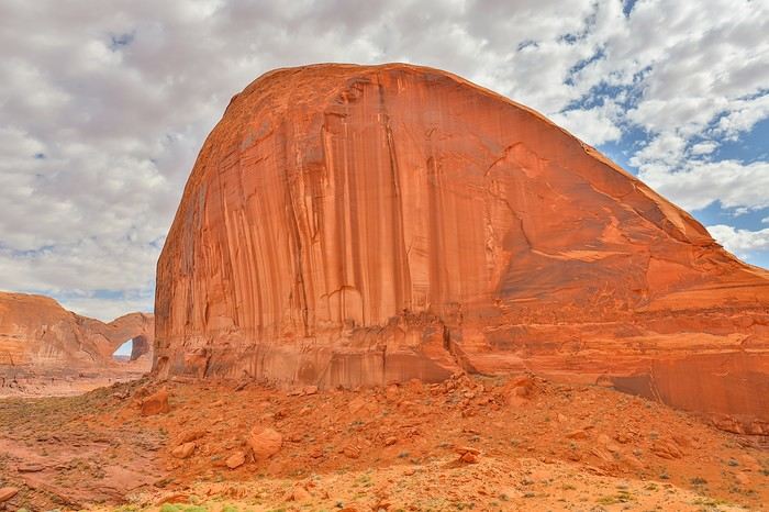
It’s only 3:30 PM, and we tell ourselves our instincts were right—we wouldn’t have wanted to spend the whole evening and night there. We head into the curve, and Jacob Hamblin Arch comes into view on our right! We didn’t imagine such a setting: to the left, there’s Jacob Hamblin Arch, and to the right, a second alcove even more impressive than the arch, almost as gigantic as the first one, just 300 meters away! It’s magical; we’re speechless... 😇 😇


After a solid half-hour of continuous rain, the weather calms down, and we decide to retrace our steps to the recorded point to exit the canyon. With Franck in the photo, you get a better sense of the cliff heights!! Everything is gigantic around here!
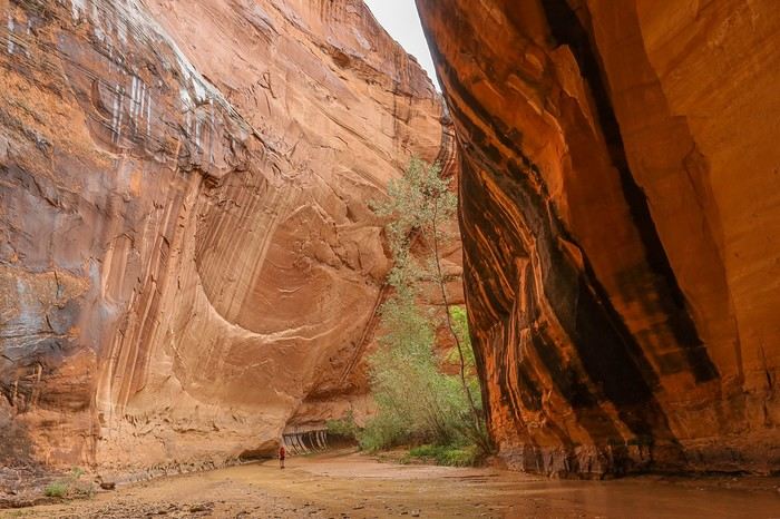
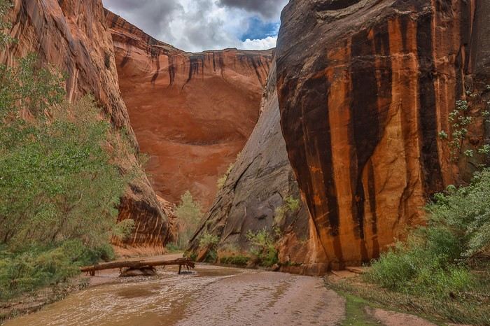

At the base of the cliff, as expected, everything is soaked, and the first few meters on the slickrock don’t bode well. The rocks are slippery. After 30 seconds of discussion, we all agree: no way are we hiking another 5 hours back the other way—we’ve got to make it through here... 🤪
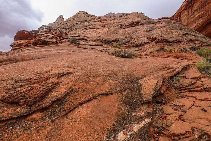


I suggest to Franck and Sullivan that I put on my climbing shoes and lead the way. But they’re very confident in their Speedcross shoes, and Sullivan takes the lead. The first 30 meters seem easy, and while I’m putting on my shoes, I see them speeding ahead. I set off after them, and then I see Sullivan frozen in the section where the slope gets seriously steeper. He shouts that he’s stuck and the rock is too slippery on the steep parts. Given the height we’re at, one slip means a guaranteed tumble all the way down... Franck, in turn, gets stuck a few meters from Sullivan, in a section to the left where he thought he could pass. Despite their spikes, the Speedcross shoes don’t have enough grip on wet rock and start slipping. A few meters behind Franck, I ask him to get out his 30-meter rope. I move up to his level and loop it around my neck after shifting my backpack to my front so it doesn’t pull me backward. In the very steep area where my buddies are stuck, my climbing shoes pass easily, and the tips grip the slightest rock crevice. I clear the tricky section without difficulty and reach a false flat with a huge boulder that must weigh a good ton. Perfect for wrapping the rope around and then tossing it to Sullivan. While I brace myself with the rope, using the boulder for security, Sullivan can then climb the steep section without hesitation. Franck can do the same afterward, even though he asks me several times if the rock will hold! He climbs with his butt well back, facing the cliff, and it’s time to trust our gear—if he lets go of the rope, it’s a nasty fall for sure... Once Franck is pulled up to the top, we congratulate ourselves for being prepared with all that gear just in case... The rest of the climb is much less exposed, and we quickly reach the top of the cliff. All that’s left is to reach the parking lot, and we take a well-marked trail. Too confident after our canyon escape, I don’t check my GPS right away. After 20 minutes of walking, we realize we’re actually on a trail leading to Fortymile Ridge, not our parking lot! We turn left, due east, to minimize the detour. The end of the day is long under a gloomy sky. A few breaks in the clouds highlight the canyon. When we get back to our car, Sullivan’s GPS shows 28 km, but I don’t buy it despite the 2-3 km detour on the way back. The planned route for the day was about 20 km, so we must have hiked around 23 km. During the debrief at the end of the day, we all agree on one thing: Coyote Gulch is a beautiful hike in the heart of a photogenic canyon, but its most stunning parts are definitely at the start and end of the hike. The Crack-in-the-Wall section with the descent into the canyon is gorgeous, but the highlight of the day is without a doubt Jacob Hamblin Arch, nestled between two majestic alcoves. This spot alone makes the long, exhausting day of hiking worth it! We head back onto the trail, continuing up Hole-in-the-Rock Road. Further north, the rain was much heavier, and we’re disappointed because we know we’ll have to skip Zebra Slot Canyon, which was on the agenda for tomorrow morning. We decide to head back to Escalante for a good burger at the Circle D and sleep again at Escalante Outfitters campground.

Must-sees in the American West

MycoVtt · 2024-12-02 · Message 80 of 196

Personally, Coyote Gulch didn’t seem long at all to me (same route as you). I won’t say I *loved* it either—you know how I feel about water ;)—but I thought it was a cool day trip.

On the other hand, 5-6 cars? You got lucky—I had over 20! This was in April 2022.

Trail shoes in general aren’t great on slickrock. I’ve used several pairs of Meindl in the same model, with Contagrip soles that had a very "smooth" tread (I say "had" because they don’t make them anymore—very few lugs and very flexible). Unlike in the mountains, you really want to avoid Vibram lugs in the West in general. If you want to stick with trail shoes, the La Sportiva Ultra Raptors—available in low and high versions—have soles with the perfect tread for slickrock, even when wet. And the ideal ones are those with the red logo under the sole, which means the softest rubber. It’s silly, but depending on the shoe color, the rubber isn’t the same! I have them in low-cut with and without Gore-Tex, and in high-cut too. The "non-Gore-Tex" ones are more flexible and mold better to slickrock on the ascent. But now I’m on my second pair of Lowa Innoxs—super flexible, *very* soft rubber (won’t last 10,000 km on slickrock), with a low but dense tread pattern. They grip *really* well.

VoyageForum — the largest community of French-speaking travellers.