Back to the discussion

in Entre deux voyages › Carnets de voyage

The "Must-Sees" of the American West (page 5 of 10)

Discussion started by Marati on 2024-11-11

195 replies

This thread has been translated into English.


Must-haves for the American West

Marati · 2024-12-02 · Message 81 of 196

For this road trip, as a backup pair for rivers, I had my old Speedcross that I threw away before taking the flight, and some ultra-comfy Meindl shoes with good grip but no protection at all. The material was some kind of chamois leather that I actually tore on the last day in some bushes at Buffington Pockets. A pair of shoes for 140 € that lasted 2 weeks, then max 3-4 times after the trip—ugh...

I’d tried the Sportiva Ultra Raptors and really liked them. Sturdy and comfortable, in a low-cut version. Since I have weak ankles, I wanted the high-top model, but unfortunately, my foot wouldn’t fit (high arches and a very pronounced instep). So, I went with the Meindls instead.

The "musts" of the American West

MycoVtt · 2024-12-03 · Message 82 of 196

I’ve done 2 trips each time, so roughly 600-700 km of slickrock with lightweight high Meindls. Meindl Response Mid GTX. I bought them again, but they changed the sole to some kind of small oval lugs. They grip a bit less well on steep slickrock. But mostly, they’re less comfortable for me...

I never wear low-cut shoes for hiking. I go through too many scree fields.

Must-Sees in the American West

Marati · 2024-12-03 · Message 83 of 196

10/01/2022: Day 8 - The Volcano - North Caineville Mesa

With Zebra Slot Canyon off the itinerary, the day’s plan is more relaxed, and we take our time over breakfast at the campsite.

Our first stop of the day is a quiet one, often overlooked as a Plan B when Hole-in-the-Rock Road is impassable. Perfect for us—today’s exactly that situation!

The Volcano has the advantage of being close to the famous Scenic Byway 12, considered one of the most beautiful roads in the U.S., and accessible via a trail that holds up well in bad weather.

After a half-hour drive from Escalante, we reach the trailhead for Cosmic Ashtray, the Volcano’s other nickname.

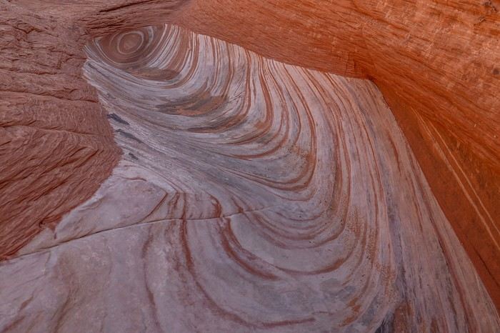
Along the way, we spot some moqui marbles and a cool wave I’d saved the coordinates for so we wouldn’t miss it.
After a 5 km hike, we arrive at The Volcano from above. The crater is massive.

We immediately realize the timing isn’t ideal—the sand dune inside is completely in shadow. While my two buddies head straight left to enter the crater, I take the right side to hunt for a rock Sedonax once captured in some really unique shots from a specific angle 🙂!
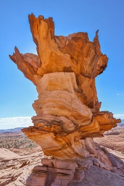
Fun fact: Sedonax saw this photo in a ranger’s office about twenty years ago but never knew where it was taken. It wasn’t until a few years back that he discovered the location thanks to new photos circulating online.

From the side, the rock doesn’t look like much—except for the amazing color gradient...!
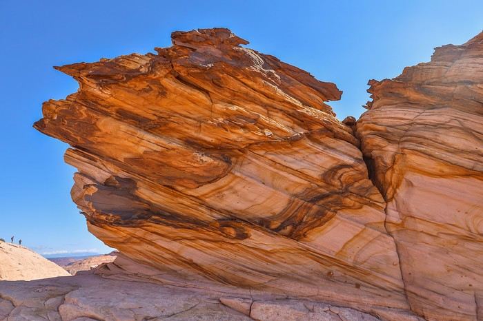
I eventually catch up with my friends and descend into The Volcano.
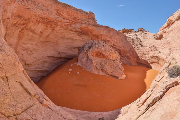


No need to worry about entering the crater—the rangers have ground steps into the rock to act as a staircase and prevent anyone from getting stuck inside!
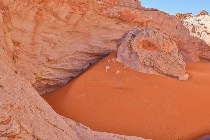


The pristine sand is stunning, and we stick to the edges to avoid damaging the reddish sand dune. This place is nothing like the Great Chamber, where tour operators bring groups to mess around on the dune.
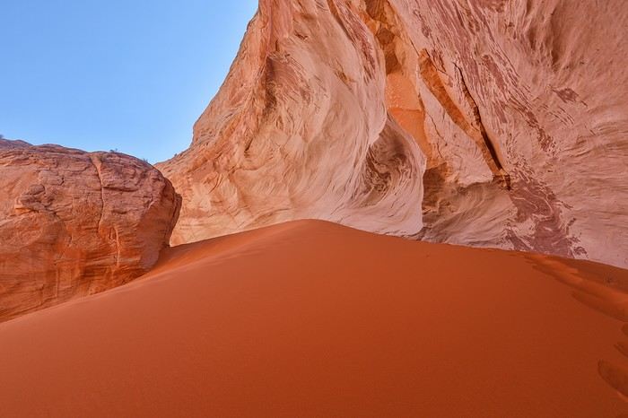
After circling the crater, we head back out calmly to start the return trip.

We hit the road again, first taking Old Sheffield Road, then Scenic Byway 12.

After crossing a pass through a forest, we drive through Capitol Reef National Park with its iconic rock formations!
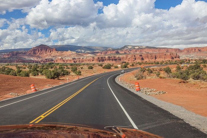
After a solid 2.5-hour drive, we reach the yellow truck that marks the starting point for our next adventure: climbing to the top of North Caineville Mesa.

The truck was repainted gray to cover up anti-Hillary Clinton graffiti that was everywhere in 2018. To get to it, we have to climb over a gated fence with a new "Private property, no trespassing" sign that wasn’t there four years ago. Our English is a little rusty, but we take the risk anyway...
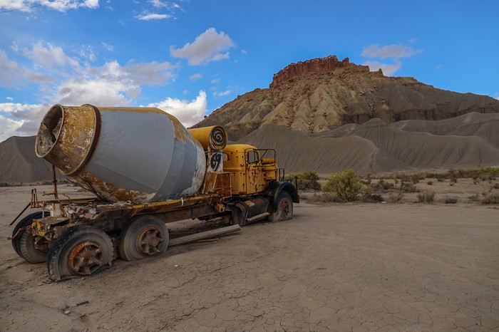
I tell Franck and Sullivan about Yves, who recently challenged himself to time his climb to the top of the Mesa. Sullivan isn’t tempted by the idea of pushing himself for no reason, but Franck and I are way more childish—total kids 😛—and we’re curious to see how long it’ll take us to tackle the 320 m elevation gain over just 1.5 km. Plus, it’s a light hiking day, a transition before the big Canyonlands adventure planned for tomorrow.

Off we go, alternating between running and walking. It’s easy to run along the rocky ridges, but way harder when the climb gets steep.

The loose rock sections really slow us down! With every step, we slip and slide backward—it’s brutal. I still take a quick break to snap a photo of Franck struggling too!
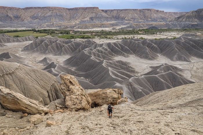
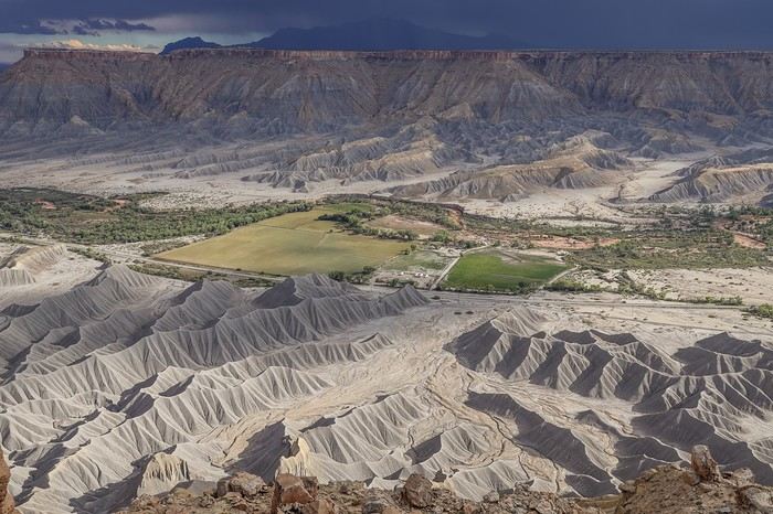
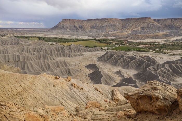
As we get closer to the top, the mesas gain more definition—it’s gorgeous, especially with the dramatic sky!

The "Must-Sees" of the American West

Marati · 2024-12-03 · Message 84 of 196

After 28 minutes of climbing, I finally reach the summit. Franck follows close behind—he’d tried a different route by leaving the official trail but didn’t succeed in the end. Once we catch our breath and give our calves a break, Sullivan joins us, and we can’t help but admire the insane scenery unfolding before us!

In the distance, the sky unleashes a massive storm rolling across the plain from west to east.
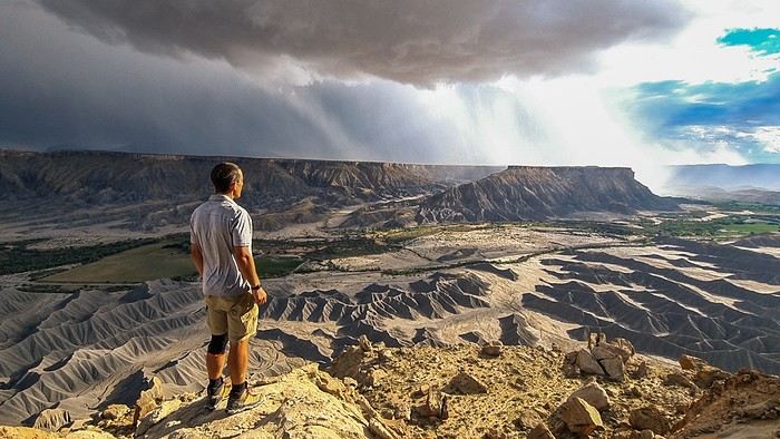
Stormy downpours are hitting just behind the parking lot where our Tahoe is parked—it’s seriously impressive!
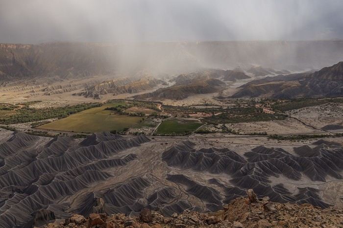
We end up staying up there for nearly an hour, not realizing we could’ve climbed the last rocky section—a few meters higher—to wander around the plateau at the very top. Guess we’ll have to come back!
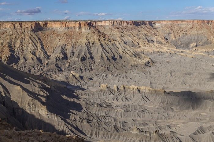
The sun eventually returns, with clear skies to boot.

Since we’re craving a burger in Moab, we don’t waste any time heading back down, much more relaxed this time, stopping to snap some photos with the lengthening shadows—and even a rainbow!
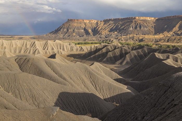
The mesas are just as photogenic from the summit as they are when wandering along the ridges. What a fantastic surprise—North Caineville Mesa totally lived up to our expectations!
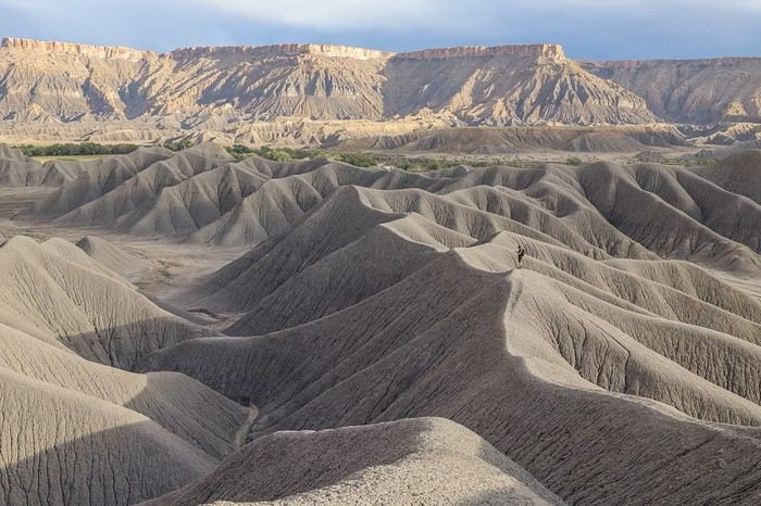
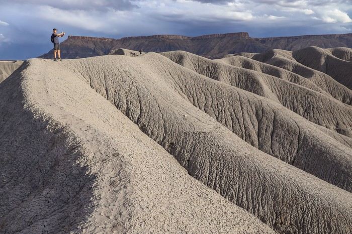

A quick look back, and it’s hard to believe we actually found a way to climb all the way up here.
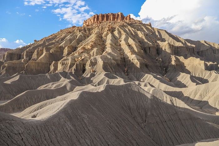
After another 2 hours on the road (yeah, the Southwest is *huge*!), we finally arrive in Moab to grab a burger at Wendy’s, washing it down with all the Dr Pepper we can handle—same as always.

All in all, even though we had to skip Zebra Slot Canyon (which we’d been dreaming about), this transition day turned out great with two off-the-beaten-path spots. Mother Nature really hooked us up with North Caineville Mesa—today’s highlight for sure!

The "must-sees" of the American West

MycoVtt · 2024-12-03 · Message 85 of 196

Hehehe😉 You’re not explaining it well 😏. No, I did it at my usual pace, so not with a kom in mind, and it was only when I got home that I realized I had the kom on the climb (just like at Hickman Bridge, and in sandals on top of that). Otherwise, I could’ve gone up much faster, with trekking poles and less photo gear. And it was only later (months, years—I don’t even remember) when I saw an American beat my time that I thought about reclaiming the kom, but I never got the chance again. But you’ve gotta go all the way to the top, okay? Don’t stop at the second-to-last plateau! That said, I just checked and didn’t see Sullivan’s time, so either it didn’t record or he didn’t take the right path.

Must-sees in the American West

Marati · 2024-12-03 · Message 86 of 196

You’ll have noticed I didn’t give you your time…😛 😏 Just teasing… I figured if you hadn’t had that Achilles tendon issue and if you’d wanted to push the pace, you could’ve done it—especially with proper shoes! The worst part is I’m not even sure about my own time, which must be less than what I said, since I forgot to record it on my phone. I just estimated it by checking the difference between the photo of the truck and the first photo (almost) at the top near the hoodoo. Sullivan hadn’t started his watch because it wasn’t a real hike. Either way, he was a good 5 minutes behind us, just walking…

Must-sees in the American West

MycoVtt · 2024-12-03 · Message 87 of 196

But you said you didn’t go all the way to the top... Yeah, I only walked—I don’t run. I always have a pretty heavy pack. I was in sandals, so that was in 2018? Can’t even remember, you know better than me... lol

Must-Sees of the American West

Rouquine38 · 2024-12-04 · Message 88 of 196

Wow! Amazing vibe with this storm... quite a change from the blue sky ;)

Must-sees of the American West

MycoVtt · 2024-12-04 · Message 89 of 196

Okay, so I double-checked my stuff to be sure. I actually did it for the first time in 2018 with my heel bursitis, but not in sandals—it was my first hike I was redoing in shoes while recovering. I was with Michèle and Jean-Michèle (who didn’t make it to the top). That time, I took a slightly sketchy route with a climbing move. I did it again solo in 2019 at my usual pace (fast, but not trying to set a record), while Tom waited in the car. He was too lazy ;) That time, I went through a hole under a rock to avoid the climbing move. It wasn’t until I got home that I saw there was a segment on Strava. There are even two segments—one all the way to the top, and another a few dozen meters lower. My KOM was beaten a few months later by an American, and again in 2023 by another guy. So I’ve never gone back with the goal of reclaiming the KOM. I already have good photos, so I’m less enthusiastic... otherwise, trekking poles, a not-too-heavy pack, and it’s easily doable.

The "must-sees" of the American West

Marati · 2024-12-04 · Message 90 of 196

Wow! Amazing vibe with that storm... such a change from the blue sky 😉

Oh yeah! We were really lucky with that!

The "must-sees" of the American West

Marati · 2024-12-04 · Message 91 of 196

I did it again solo in 2019 at my usual pace (fast, but not trying to set a record), while Tom waited in the car. He was too lazy ;) This time I went through a hole under a rock to avoid the climbing step.

Did you know you could climb to the summit, or did you discover it by chance?

The "must-sees" of the American West

MycoVtt · 2024-12-04 · Message 92 of 196

Yeah, I knew that. I’d read it in a travel journal, can’t remember whose. Or maybe a Facebook discussion? Can’t recall now.

Must-Sees of the American West

Marati · 2024-12-05 · Message 93 of 196

10/02/2022: Day 9 - Canyonlands - The Needles: Big Spring Canyon - Druid Arch - Chesler Park

We’ve got a big day ahead, starting with a 5:30 AM wake-up in Moab. We grab groceries at 6 AM before heading to the Needles Visitor Center. We arrive right at opening (8 AM) to pick up the permits we need for backpacking in Upper Salt Creek to reach Angel Arch.

Angel Arch is the cover photo of *Photographing the Southwest Utah*, 3rd edition—my bedside book. Needless to say, seeing it has been a dream of mine, maybe even my ultimate quest, given how remote it is—at least 25 km from the nearest trail. This hike is impossible to do with family in the summer because of the extreme heat and the amount of water you’d need to carry.

We stand excitedly in front of the Visitor Center desk, Bear Box in hand—a mandatory, odor-proof plastic container required in this bear country.

But we hadn’t counted on Gretchen, the Ranger who greets us. She immediately warns us about the risk of storms later in the day, which could make the access road to the Upper Salt Creek trailhead impassable. Another Ranger shows us the wash that floods easily and asks what kind of 4x4 we have. Once we tell him, he confirms our Tahoe won’t make it. Maps shows 14 km between the wash and the trailhead—adding another 30 km to the 50 we’d already planned over two days. Ugh...

We’ll have to hope the weather forecast is overly alarmist and trust in our lucky stars!

Since the permits are already paid for, we pick them up anyway for the next day, knowing we’ll keep a close eye on the local weather and track any storm activity in the area.

Meanwhile, Gretchen asks what we have planned for today. I show her the map of our combo hike, which mixes two routes usually done in separate days: Big Loop starting from Squaw Flat Campground, an extension to Druid Arch, then Lost Canyon to reach Chesler Park, followed by Chesler Park itself, and finally returning via the northern part of Big Loop—32 km on paper.

Gretchen’s eyes widen, and she tells us it’s impossible to do in one day. We just reply, "We think it’s possible..." As we leave, she shakes her head, probably wondering where we’re from. Consider us warned...

We start at 9:20 AM from Squaw Flat Campground.

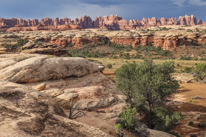
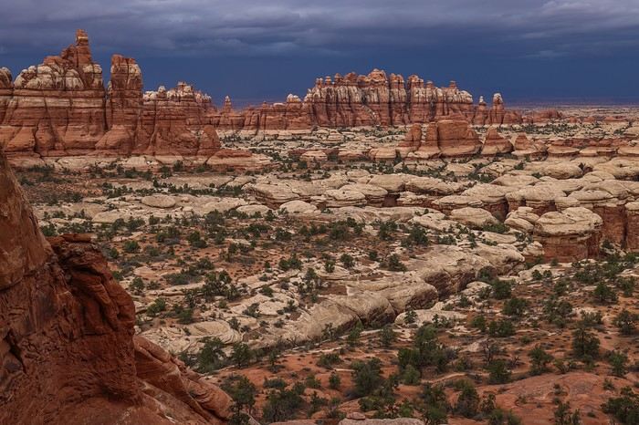
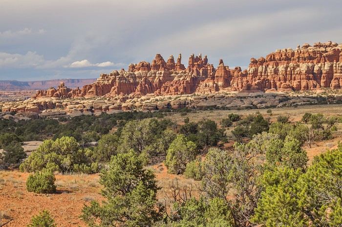
A few minutes into the hike, we’re treated to a panoramic view of the rock needles that give the area its name.

The trail then takes us along a rock wall leading to a cirque.
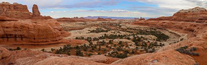


This fairly exposed section gives us constant, sweeping views of the Needles and endless landscapes.
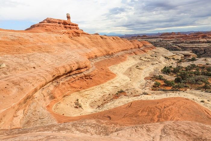
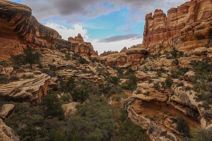
As we approach the southern end of Big Spring, the trail starts winding through the canyons.
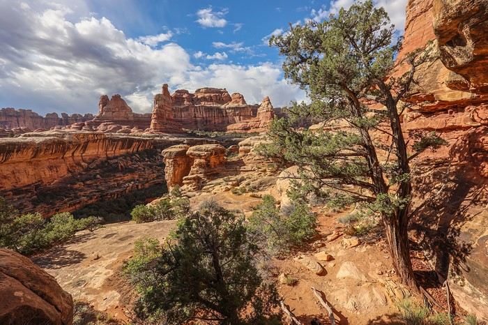
There are even a few metal staircases built to help cross from one canyon to another. The kids would love it here...
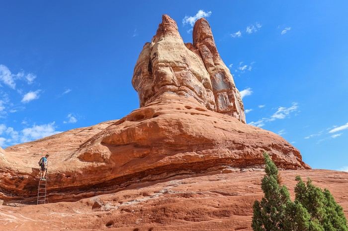
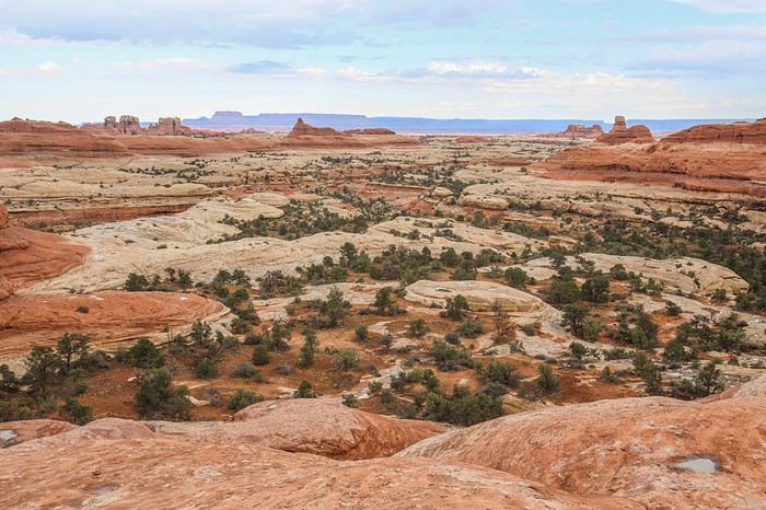
Crossing over the ridge, a new spectacle unfolds before us. It’s breathtaking!
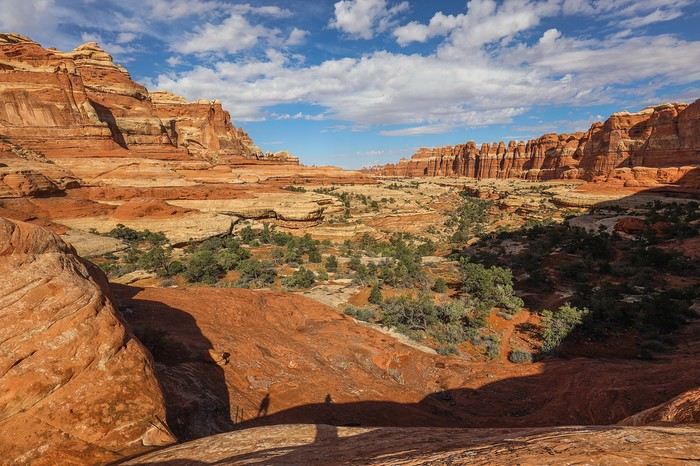


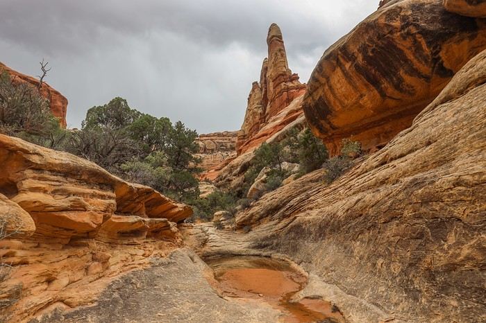
We then reach the fork leading to Druid Arch. This section is less enjoyable since we’re hiking at the bottom of a canyon with limited visibility, but it’s still beautiful.

Must-Sees of the American West

Marati · 2024-12-05 · Message 94 of 196

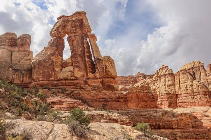
Druid Arch is one of the most beautiful arches in the West, probably the most monumental. Nearly 50 meters high, this double arch gets its name from its resemblance to the megaliths of Stonehenge.

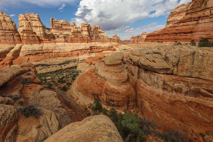
We take the opportunity to have lunch on a large natural terrace at the foot of Druid Arch. It’s not just the arch that’s impressive—the surrounding scenery is just as stunning.
We then head back through the canyon in the opposite direction before turning west via Lost Canyon.
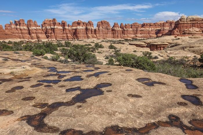
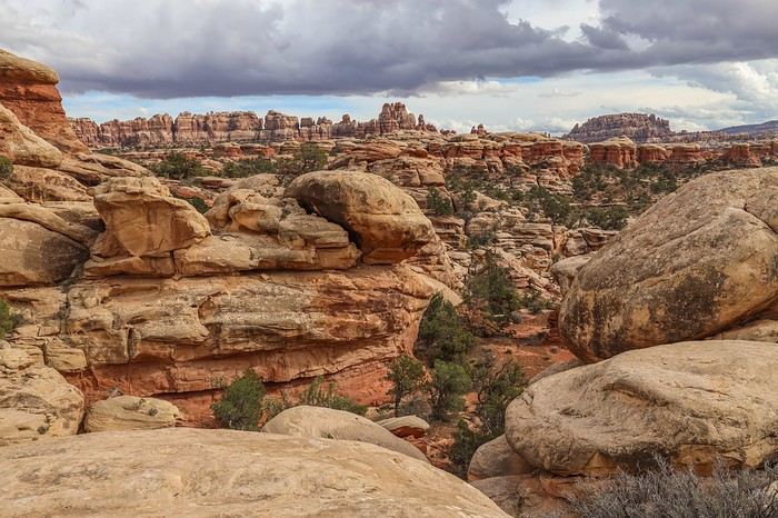
At this vast plateau covered in potholes, we cross paths with our first hikers—Americans.

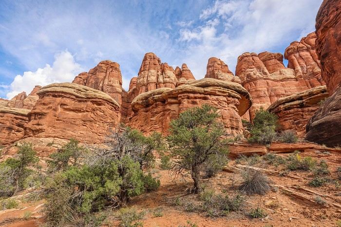
Eventually, we reach Chesler Park, a vast grassy plain with brush at the heart of hundreds of ochre and cream-colored needles and rock spires.
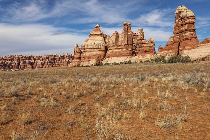
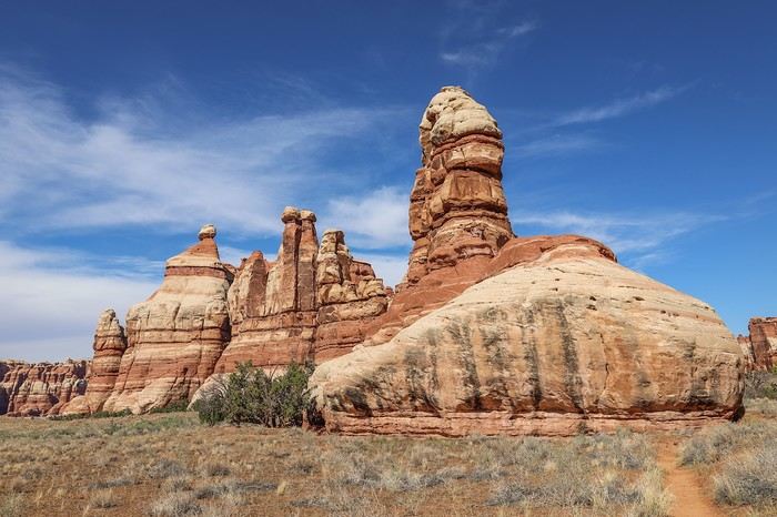

Here’s the wall of needles we saw at the start of the hike, but this time from the other side.
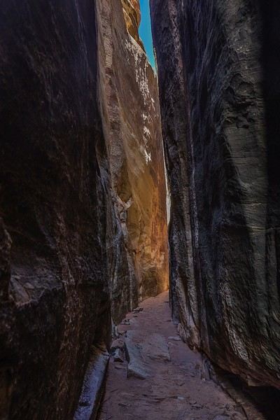
To leave Chesler Park, we take Join Trail, a very narrow crevice where you walk between two towering walls. At the end, you emerge into a bright slit that creates beautiful contrasts.
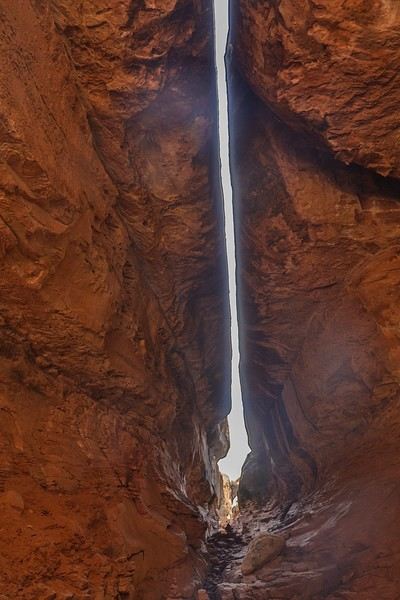

We’ll come back to this area with our families since it’s possible to do just 18 km by sticking to this zone.
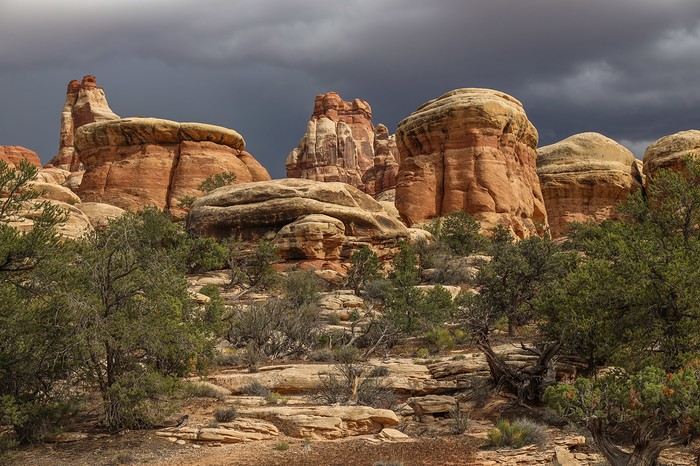
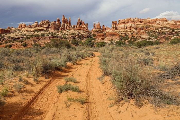
The end of the Chesler Park loop, at the western edge, is a bit less enjoyable for hikers because it follows a 4x4 trail.


The "must-sees" of the American West

Marati · 2024-12-05 · Message 95 of 196

I get a little careless with my GPS and we miss a turnoff, adding nearly a kilometer to our route...

It’s already past 3 PM, we’ve already hiked 20 km, but roughly speaking, we still have about 15 km left to reach the parking lot! Yikes, we were a bit too optimistic about our pace, but at the same time, there were so many photo spots...

Sullivan takes charge and starts moving at his famous, almost military pace. We don’t take any more breaks until we reach that plateau, which offers insane views!

By late afternoon, the sky is pitch black in the background! And if the Rangers’ forecasts were right 🏴‍☠️...

We’re just hoping we don’t get caught in a downpour, because we’re heading straight toward the stormy area!
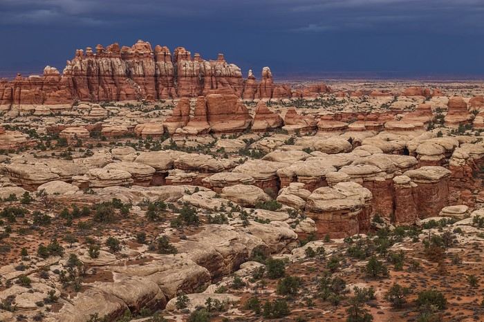
The end of the hike via Big Loop (North) gets really long, and our legs feel heaviest of all. In the end, after those never-ending last kilometers, we finally reach the parking lot at 6:40 PM—34 km in 9 hours and 20 minutes.

What to take away from this unique combo? For me, I’d rank this hike in the top 3 of the most beautiful I’ve ever done. The day was exceptional in terms of landscape diversity, atmosphere throughout the hike, and difficulty. Gretchen was wrong: this route wasn’t impossible if we avoided the summer heat...

Barely two minutes after taking off our shoes and arriving at the car, a huge storm breaks out. Torrential rain pours down on us. As we leave the Needles, we drive through two spots on the road where we’re *this close* to getting stuck in leftover mudflows!!

Of course, we realize we have to give up on Angel Arch and move to Plan B. I don’t even know a word to describe how we feel—100 times more gutted than gutted... Life is made of dreams, and Angel Arch will stay in that category for now...

We end the evening at a restaurant in Monticello, brainstorming all possible options. We were tempted to spend two days in the Bisti Badlands, but tomorrow, rain is forecast from Santa Fe all the way to Las Vegas. Not wanting to ruin those visits, we finally decide to head to the Cameron area to camp, with the goal of picking up our Navajo permits at dawn the next day. And for the rest, we’ll see in the morning...

Must-sees in the American West

MycoVtt · 2024-12-05 · Message 96 of 196

Oh, that's too bad about Salt Creek... but it happens often that you have to cancel something... unfortunately. Unless you go in May-June like Philippe, but then the heat is the problem.

Well, next time ;)

Beautiful loop in the Needles. Druid Arch via Chesler Park, starting with a headlamp, remains my all-time favorite hike. And the sunrise light over all those areas was amazing.

Rangers are always the same. They don’t bother to check people’s skill levels. I don’t know if you were already on my FB friends list last year when I did the Subway... The ranger laughed in my face (seriously, he laughed out loud while looking at his colleague in front of other tourists) when I told him I wanted to do it in under 5 hours. He said he’d been there 40 times and had never done it in under 5h30–6h00. The next day, I went back to the visitor center just to shove my phone in his face, showing him my Strava time, and told him to check someone’s level before mocking them. I also suggested he get a gym membership while he was at it... His colleague was dying of laughter, and he was so stunned he didn’t know what to say... A guy in his 30s–40s, not overweight or anything... And every time I went to get a permit for Salt Creek, the ranger did everything to talk me out of going... it’s unbelievable...

Must-sees in the American West

Marati · 2024-12-05 · Message 97 of 196

Love your story about the Subway hike 😏😏! I would’ve loved to see his face...

The "must-sees" of the American West

Rjulie95 · 2024-12-05 · Message 98 of 196

We’ve got a huge day ahead of us

Like, are there even any relaxed days? I’m in awe of what you guys can handle! 🏴‍☠️

Must-Sees in the American West

Marati · 2024-12-06 · Message 99 of 196

Since we didn’t do any specific training, the first 3-4 days were the toughest—we were pretty wiped out. After that, our bodies adjusted. Still, we’re nowhere near the level of mountain trail runners who, on top of covering long distances, tackle 2,000m of elevation gain, with their knees really taking a beating.

The "Must-Sees" of the American West

Marati · 2024-12-11 · Message 100 of 196

10/02/2022: Day 10 - West Cove - Spencer Trail

As planned, the weather is pretty gray at dawn. Not wanting to "sacrifice" one of the long-awaited must-sees for any of us, we decide to make it a transition and "rest" day, with West Cove—a lesser-known area between Kanab and Page—and the Spencer Trail on the agenda.

Another bit of morning news: Sharon Fredericks, our Hopi guide we booked months ago for our day after tomorrow, drops a bombshell about a death that forces her to leave Arizona today and tomorrow...

Despite several insistent exchanges, she tells us she has no choice but to go but adds that she’s giving us permission to visit the planned sites. Hmm, hmm... Not sure an email authorization would cut it if Hopi Rangers check, so we’ll see tomorrow what we’ll do.

Still planning for the day after tomorrow, we start by heading to Cameron to pick up one-day Navajo permits that’ll be good for two spots.

Then, we tackle the day’s program with West Cove, located on US89 near Paria Outpost. Big mistake on my part—distances that seemed reasonable on paper had us driving nearly 2 hours to get there...

West Cove is an off-the-beaten-path site I’d seen a few photos of in a Facebook group. Access is simple: just park along US89 (N37.10991° W111.92234°), go under a gate (no "no entry" sign), and the approach hike is super short—about 2 km.

The only point I’d noted was a formation (N37.12391° W111.92465°) that looked great in the Facebook photos.

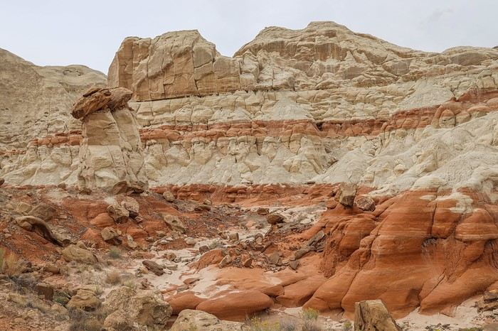
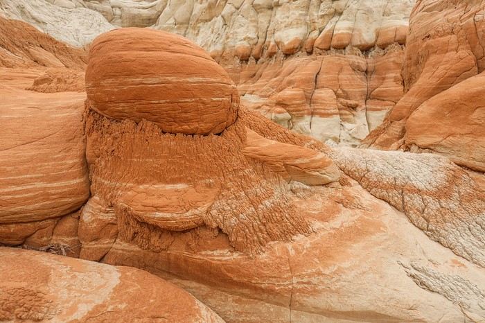
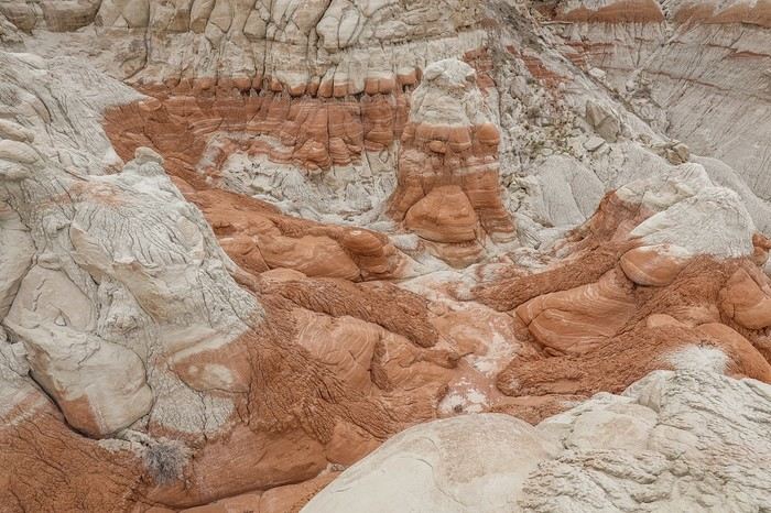
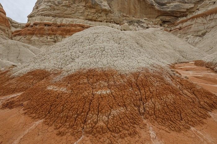
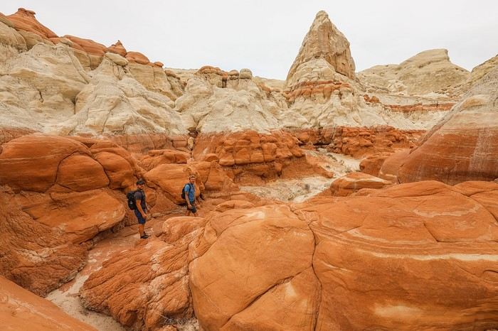
The site is a two-tone rocky area with a few hoodoos and mushroom rocks.


We then reach the mini-mushroom zone that caught my eye.


We manage to get a bit of elevation for a plunging view of the amphitheater.
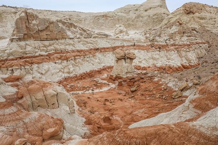


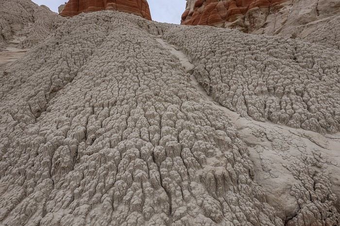
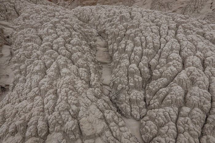
The loop is relatively quick, so we backtrack to wander through the heart of the badlands.
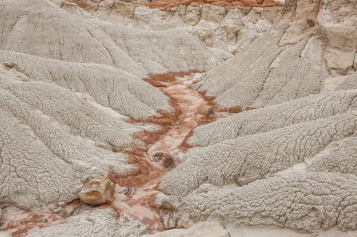


In the end, West Cove was a bit of a letdown—not quite what we’d hoped for or worth the detour today, even if the site itself is pleasant to visit.

VoyageForum — the largest community of French-speaking travellers.