Back to the discussion

in Entre deux voyages › Carnets de voyage

The "Must-Sees" of the American West (page 8 of 10)

Discussion started by Marati on 2024-11-11

195 replies

This thread has been translated into English.


Must-sees in the American West

Ticapi · 2024-12-22 · Message 141 of 196

For next summer (Peru is on the agenda, especially), I’m really dreading 2–3 days that’ll involve (too much) elevation gain for Laetitia (Machu Picchu, Rainbow Mountain, and Colca Canyon). Plus, the altitude won’t help.

We’ll be in Peru in 2025 too. 🙂

Must-sees in the American West

Marati · 2024-12-22 · Message 142 of 196

Watch out Guillaume, in Peru, there’s the altitude, and what seems doable in France isn’t at high altitude. Plus, you can be prone to altitude sickness, and then all your plans come crashing down. That’s what happened to me in 2022. Machu Picchu isn’t very high—I got a bit of a break then. But when I arrived in Chivay (3,600m) to go to Colca Canyon, the altitude sickness hit me and didn’t let up until the end of the trip. Rainbow Mountain is at 5,000m, and there are Peruvians with horses if you need them 😊

That’s why I put the Sacred Valley at the start of the trip, with 2 days to acclimate in Cusco, then a "descent" to Machu Picchu before climbing up to Rainbow Mountain and Palcoyo Mountain. I’m noting the option to ride horses up Rainbow Mountain if one of us isn’t feeling it... But if AMS (altitude sickness) gets the better of us, we’ll turn back immediately. After that, we’ll head to Bolivia—La Paz, then the Salar de Uyuni—before finishing in the Atacama Desert, so it won’t get any better altitude-wise...!

The "must-sees" of the American West

Marati · 2024-12-22 · Message 143 of 196

We’ll be in Peru in 2025 too! 🙂

We’ll be there from July 12th to 17th in the Sacred Valley (Machu Picchu on the 14th), then from the 18th to 21st in Arequipa/Colca, before heading to Lake Titicaca and continuing on to Bolivia. How about you?

The "must-sees" of the American West

Attila · 2024-12-22 · Message 144 of 196

Normally, if the Peru portion has been processed, you're good to go after that.

Personally, I didn’t feel anything on Lake Titicaca or in La Paz.

On the other hand, I got a headache at the Salar de Uyuni, and this year, a slight headache during some excursions from San Pedro (too many hours above 4,200/4,500 meters).

If you’re forced to skip the Titicaca-to-Uyuni portion, you can reach San Pedro via Arequipa - Tacna - Iquique.

The toughest excursion due to altitude is the Salar de Tara one because you stay at very high elevations for hours.

The Altiplano is absolutely stunning, but it’s really tough on the body! !

The "Must-Sees" of the American West

Rouquine38 · 2024-12-22 · Message 145 of 196

Wow! Great itinerary, Bolivia was really at the top of my to-do list 😊 but now I’m skipping anything above 3,500 m in altitude. Luckily, there are so many amazing places in the world 😊

The "must-sees" of the American West

Ticapi · 2024-12-22 · Message 146 of 196

I haven’t bought the flight tickets or rented the car yet. But it’ll be for a departure in April or early May.

Are you doing a self-drive trip?

The "must-sees" of the American West

Marati · 2024-12-22 · Message 147 of 196

I haven’t bought the flight tickets or rented the car yet. But it’ll be for a departure in April or early May.

Are you doing a self-drive?

Yes, I rented a car for 4 days in Cusco and 4 days in SPDA. I’d thought about hiring a driver for the day and had found some contacts in a Facebook group, but they only take a max of 4 people. If I find a driver with a van for 5-6 people, I’ll decide based on the price...

The "must-sees" of the American West

Ticapi · 2024-12-22 · Message 148 of 196

My daughter went to SPDA two years ago and she was disappointed. Too touristy, too many restrictions, mandatory reservations for some sites… Nothing like the Sud Lípez.

Must-sees in the American West

Attila · 2024-12-22 · Message 149 of 196

I’m back from SPA (see my latest travel journal).

It’s definitely not the Kalahari, but for an independent trip with a car, it’s better than a guided tour of the Salar de Uyuni… (I’m only talking about Uyuni—I didn’t go beyond the salt flats toward the lagoons and then SPA).

Plus, in July, it’s winter. There are fewer people because of the cold.

Avoid: sunset from the Moon Valley viewpoints. Piedras Rojas also gets pretty crowded.

too many restrictions, mandatory reservations for certain sites…

For the first point, I get it—even if the surveillance is almost North Korean-level. The sites would’ve been destroyed if people weren’t kept in check.🤪

But it does mean you can take amazing photos without anyone in them!😛

The mandatory reservations only affected me for the high-altitude lagoons. It’s mostly just really poorly organized… Booking and paying online, then having to pick up a physical ticket elsewhere—some French bureaucrat must’ve come up with that process…😏

The "must-sees" of the American West

Ticapi · 2024-12-22 · Message 150 of 196

I’ll have to read your travel journal. 🙂

Photos without people in them weren’t an issue in Bolivia. Check out my journal—there’s absolutely no one in them, 😛 except in the hot springs at Laguna Chalviri. We got there and left right away.

Sorry, Guillaume, I’ll stop talking about Bolivia, Peru, and SPDA in your amazing journal. We can switch to Agnès’s. 🙂

Must-sees in the American West

Marati · 2024-12-22 · Message 151 of 196

My daughter went to SPDA two years ago and was disappointed. Too touristy, too many restrictions, mandatory reservations for some sites... Nothing like the Sud Lipez.

I just found out there are mandatory reservations for some sites in SPDA . Thanks for the info! Nothing mentioned in the *Guide du Routard* or on the various websites I used to plan. I hadn’t seen Attila’s travel journal, but I’ll check it out to ask my questions—or maybe even start a thread about my itinerary to fine-tune it...

The "must-sees" of the American West

Marati · 2024-12-22 · Message 152 of 196

Avoid: sunset from the Moon Valley Belvederes. There are also quite a few people at Piedras Rojas.

I had it on my itinerary and suspected we wouldn’t be alone, but *avoid* it altogether! Even with the soft evening light, you’re really not recommending it...

Too many restrictions, mandatory reservations for certain sites... Booking and paying online just to pick up a physical ticket elsewhere—some French bureaucrat must’ve come up with that process...

I’ll go read your travel journal for more details on this and ask you about it, since I’m just finding out there are reservations to plan for... 🏴‍☠️

The "Must-Sees" of the American West

Marati · 2024-12-22 · Message 153 of 196

10/05/2022: Day 13 - Upper East Canyon of Zion - East Temple Loop, Jughandle Arch, Center of the Universe, and Checkerboard Mesa Summit

After discovering the Subway early in the trip, we’re heading back to THE park for hiking lovers!

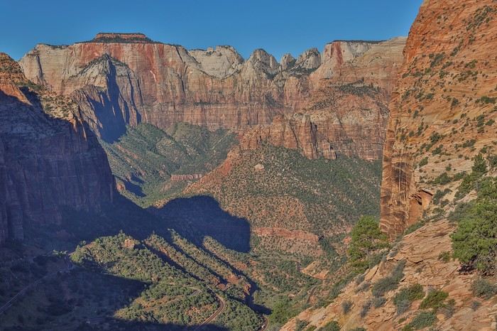
For a first visit to Zion National Park, 99% of people stick to the main canyon to do the big classics like Emerald Pools (dry in July), the Narrows, and maybe Angels Landing. Sullivan will always have time later to explore this busy canyon with family.

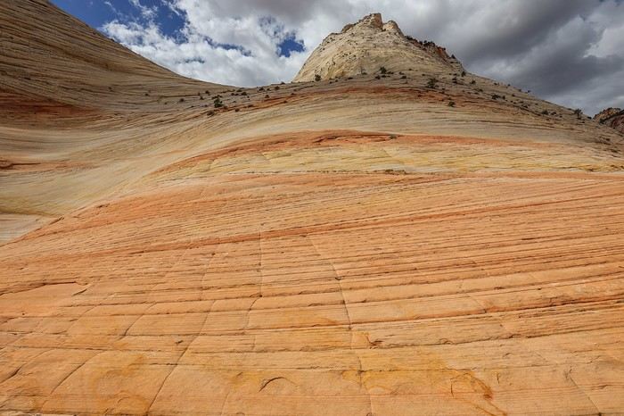
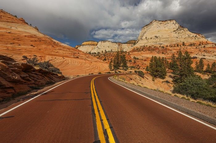
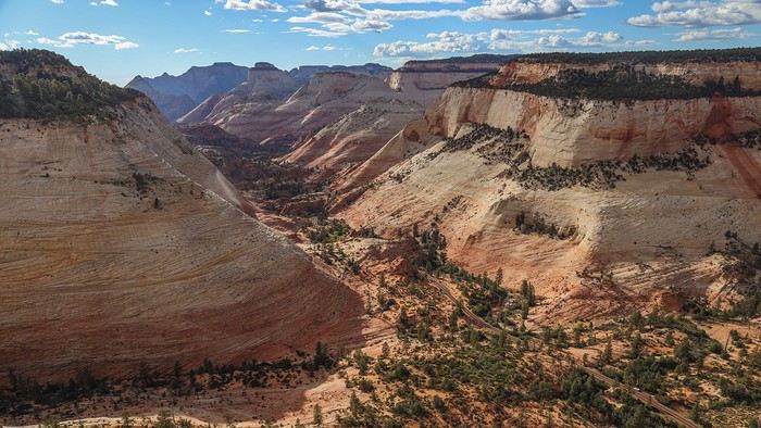
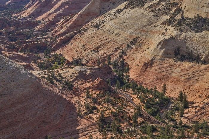
For our part, Franck and I have a (big) soft spot for Upper East Zion, the area east of the long tunnel, which is unfairly overlooked by the public. Most tourists just drive slowly along the stunning scenic drive, instantly recognizable by its red pavement that blends perfectly into the breathtaking landscape!! The only family-friendly hike people know is the one leading to Canyon Overlook.

Lucky for us, because our first hike, East Temple Loop, follows the same initial path as Canyon Overlook Trail. The parking lot is tiny and fills up quickly during the day, which is why we decided to start the day with this hike.

In about twenty minutes along a fun, well-marked family trail, we reach Canyon Overlook.

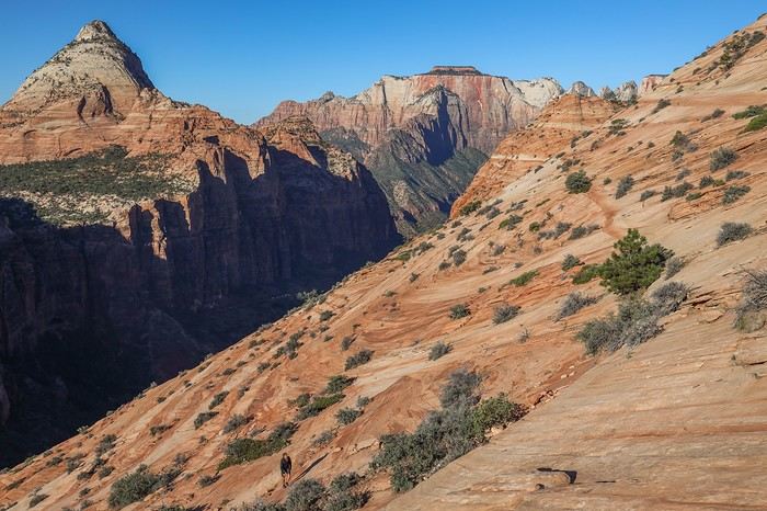
But instead of turning back, we decide to follow the advice of Zion expert Joe Braun and his site citrusmilo.com. That’s how we end up climbing the steep rocky wall. No real danger since the slickrock provides good grip, but our calves are burning!!

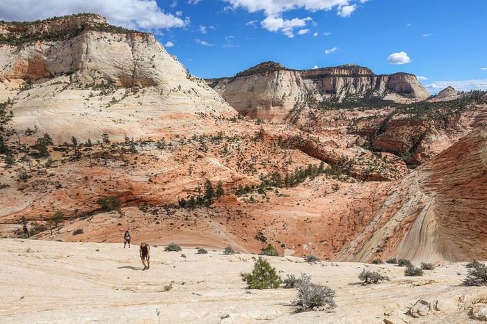
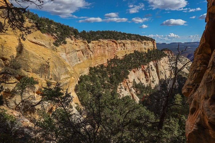
We gradually gain elevation above the canyon.

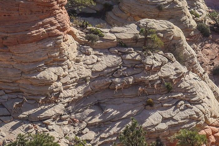
We slowly approach East Temple mountain. When I’m the first to cross over the summit, I’m lucky enough to spot a whole herd of bighorn sheep below!

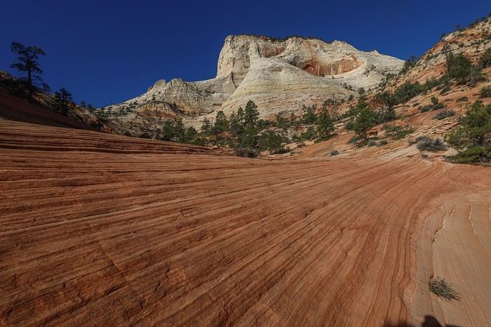
Franck and Sullivan also get to see them, but the sheep quickly sense our presence and move farther away. A glance back, and we enjoy a beautiful view of East Temple.

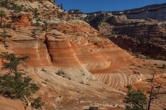
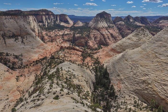
But it’s the succession of peaks in front of us that really catches our eye! What a landscape, so close to the Scenic Drive!


The end of this first loop takes us through Upper Pine Creek, navigating by feel, always heading south until we reach the main road.

Back at the car, we drive a few kilometers to the point (N37.22388° W112.90049°) and park at the lot indicated on the Citrusmilo site to tackle the second loop of the day: a combo of Jughandle Arch, Plateau Route, and Center of the Universe.

For me, this is attempt number two. The first time, in 2018, I hadn’t printed Joe Braun’s instructions, and we’d just relied on the GPS track. But some sections are a bit tricky and not very intuitive, so we decided to turn back rather than take risks... It’s definitely better to go with both the GPS track AND Joe’s explanations!

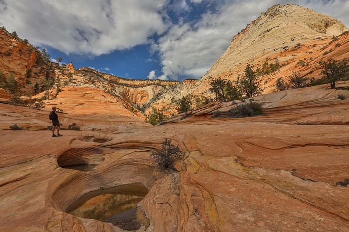
Right from the start, it’s a steep climb. Then, we have to descend a somewhat steep section to cross Keyhole Canyon. No need to get our feet wet, but it’s clear that venturing in there would be risky! The rest of the hike is pleasant, on a gentle uphill slope, right in the middle of the landscapes we love so much.

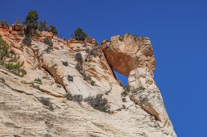
Then, we spot Jughandle Arch, an arch attached to the cliff wall—not very photogenic.


We continue along the canyon, leaving Jughandle Arch to our left. But we have to admit, the view at the end isn’t great because the angle narrows as we go deeper into the canyon. The side canyons are also too narrow to be worth lingering in.


The "Must-Sees" of the American West

Marati · 2024-12-22 · Message 154 of 196

So, we turn back to follow Joe Braun’s trail, which involves circling the plateau containing Jughandle Arch and climbing to its summit. In some spots, we struggle a bit to move forward without getting our feet tangled in the brush, and the trick is to stick as close as possible to the rocky massif to avoid scratching our shoes or legs!

Again, it’s a steep climb. Sullivan and I are wiped out and want to turn back 🏴‍☠️! But Franck is stubborn 😏, and despite being outvoted, he manages to sweet-talk us into believing the view from the top of the plateau would be exceptional! I admit I didn’t look at the photos much before leaving because this hike is mostly Franck’s thing, so I wanted to keep the surprise by not digging too much online.

And so, we end up straining our calves again, despite being in great shape, to climb to the top of this supposedly amazing plateau... Plus, we have to make our way through rocky scree, which is mentally and physically exhausting.

Along the way, the landscapes would’ve been enough for Sullivan and me, but we have to follow Franck, who’s full of energy this morning and climbing the mountain at a crazy pace. At the top of the plateau, the scenery changes completely.

Then we reach the edge of the "plateau" that Franck sold us on... !!! 😎 😇 😇

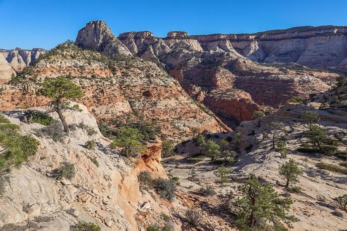
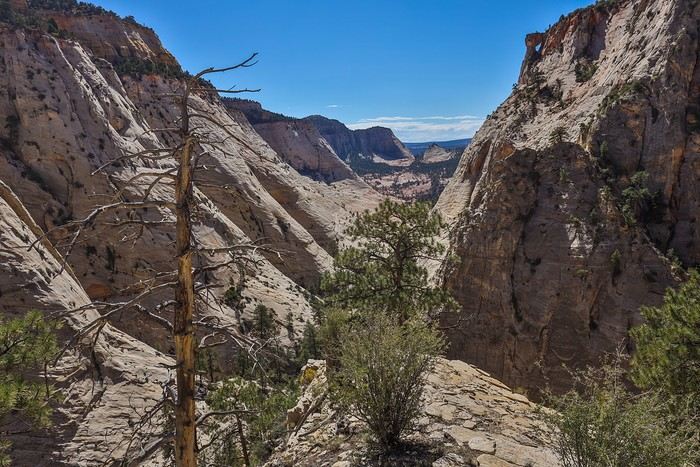
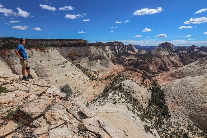
We see him beaming, with that sparkling, triumphant look in his eyes 😄! We have to admit the scenery is absolutely breathtaking—probably one of the most incredible 180° views in the American West—and we give him credit for it! And a view that’s almost unknown to the general public 😛!

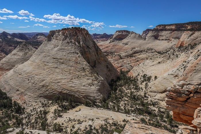
Across from us, we can see the massive Aries Peak and the smaller South Ariel Peak, between which we’ll pass to reach Center of Universe.

It’s the perfect spot for a picnic! While rereading Citrumilo.Com to write the travel journal, I discovered we could’ve had a unique view of Jughandle Arch from above! And to think we were just a few dozen meters away without knowing what we were missing. Oh well...

After lunch, we descend from the plateau through loose rocks and reach the base of Aries Peak, which we’ll climb to get to Center of Universe.


Center of Universe is a pretty pompous name for this traverse between two rocky peaks.

The place is nice, but not necessarily prettier than other spots on our route. There’s an interesting succession of potholes, but you shouldn’t follow your instinct to take the path slightly higher up—it leads to a dangerous cliff!

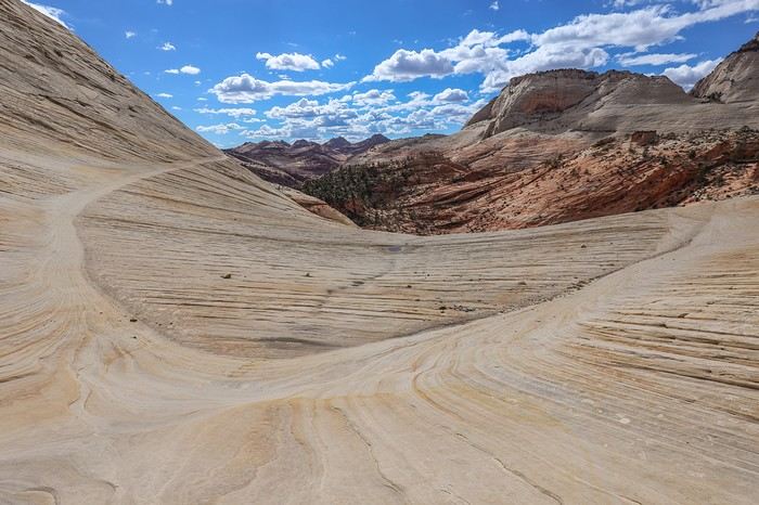
So, we wisely head to the other side of the hill into a more colorful area. The colors change, and so does the atmosphere, in just a few hundred meters.


We stumble upon some petroglyphs by chance, then walk a few hundred meters along Scenic Drive to reach our car.

We never get tired of the scenery, and we better understand why most tourists stick to the viewpoints along the road!


The "Must-Sees" of the American West

Marati · 2024-12-22 · Message 155 of 196

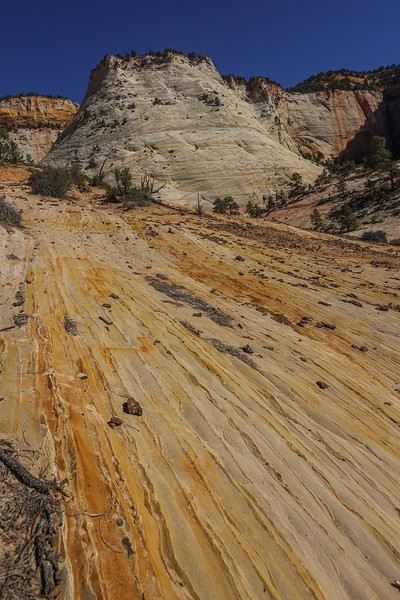
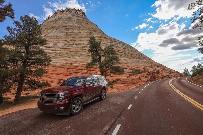
However, for us, there was no question of stopping our daily explorations—it was only 3:30 PM! So we parked a mile further at the foot of Checkerboard Mesa. Sullivan admires the summit and is blown away 🙂

We then explain to Sullivan that normal people are content just admiring Checkerboard Mesa from this viewpoint, but we’re not normal people! He asks if we’re really serious !!

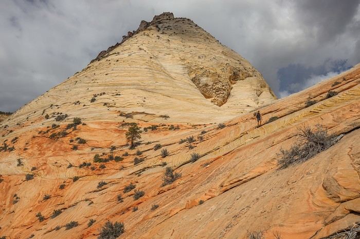
That’s when Joe Braun’s site comes into play again—it gave us this idea... Of course, to climb to the summit, you shouldn’t go at it head-on. Instead, you just need to go to the back of the canyon, follow the thalweg, then take a faint trail that zigzags up the steepest sections. At the top of the mountain, we first get a view of the south side

Then, we use the GPS to head due north toward the edge of the plateau. When we reach the end—another *wow* moment in a day already full of surprises!! We’re treated to a panoramic view of the Scenic Drive and all the surrounding summits!

Zooming in, you can clearly see the Scenic Drive

In the end, it was another insane day, during which we must’ve climbed nearly 1000 m in elevation gain. But you can adjust the difficulty based on your fitness level or stamina.

That said, if we were to do it again, we’d change the order. It would’ve been better to start with Checkerboard Mesa Summit to take advantage of the soft eastern light, continue with East Temple Loop (even if it means waiting for a parking spot), and finish the day in style with the famous plateau above Jughandle Arch.

Of course, we didn’t see a single person on any of the three hikes, while at the main canyon entrance, all the parking lots are packed by 9 AM, and most people are trudging along in a line at Emerald Pools or the Narrows. And to think I still have a week’s worth of hikes lined up just in this part of Upper East Canyon...

After this big day, we decide to head to St. George to sleep—and, more importantly, to eat at the Chuck-A-Rama buffet! This must be the 5th time I’ve eaten there, and I never get tired of it! The three of us stuff ourselves to replenish all the calories burned during this amazing, unforgettable day!

Must-Sees in the American West

Marati · 2024-12-23 · Message 156 of 196

10/06/2022: Day 14 - Buffington Pockets

For our last day, we activated another Plan B: Buffington Pockets.

This set of rocky spots in Nevada is rarely visited, and I had some trouble finding info on whether the access track was doable with a "low clearance" 4x4 and on the coordinates for the rocks.

To get there, you need to leave Highway 15 at the west junction of Route 169 leading to Valley of Fire. At the point (N36.46154° W114.73632°), take a gravel road that starts out very smooth but gradually gets rougher as you go. A few sections are tricky with quite a few big rocks, but it’s passable without scraping if you take it slow.

In the end, we managed to park much farther than I expected (N36.352637, W114.68406), which shortened our approach hike.

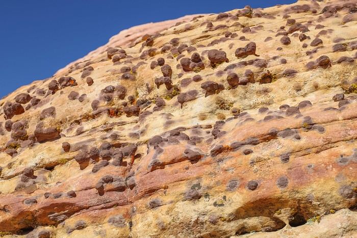
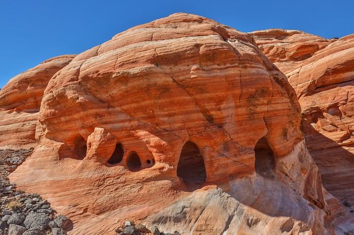
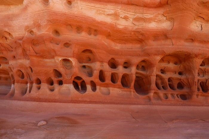
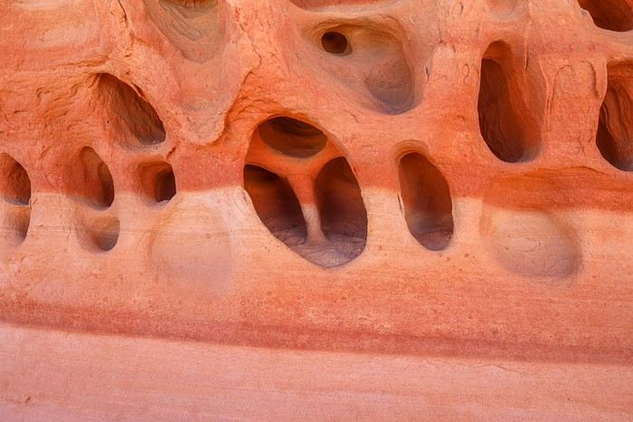
The first recorded area is supposed to have moqui marbles and "tafonis," natural mosaics carved into the rock (N36.34378° W114.69836°).

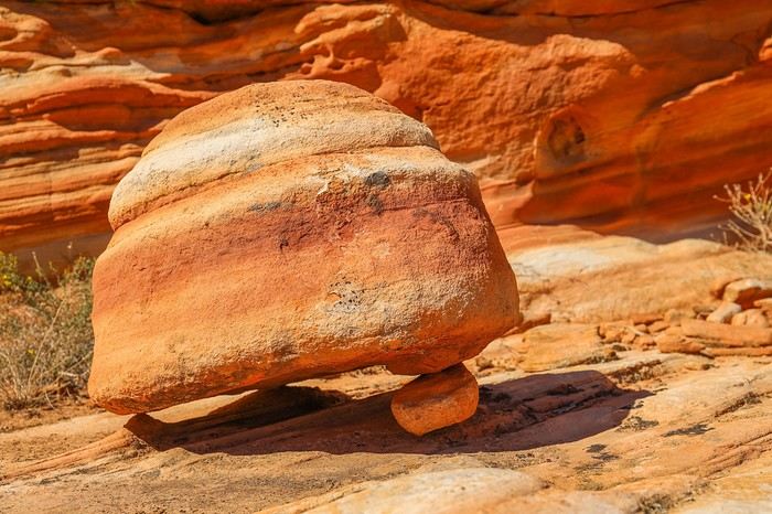
We quickly found the moqui marbles, attached to a large boulder:

But we struggled a bit more to find the tafonis.

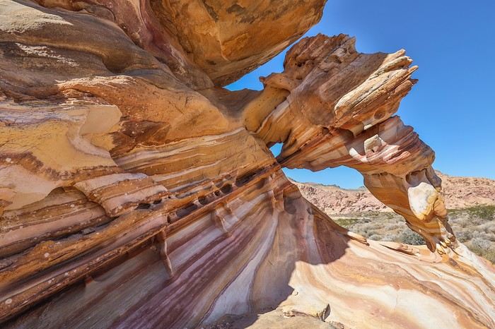
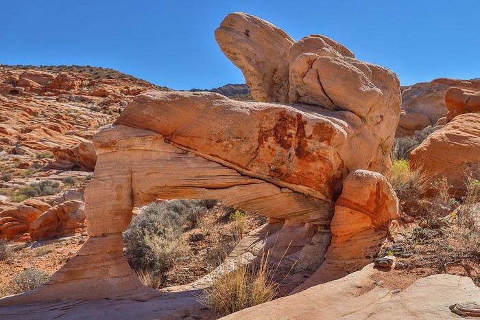
Buffington Pockets is a favorite among enthusiasts for two very photogenic arches. The first is called Striped Arch because of the colorful stripes that make it up. It’s absolutely stunning 😎!!

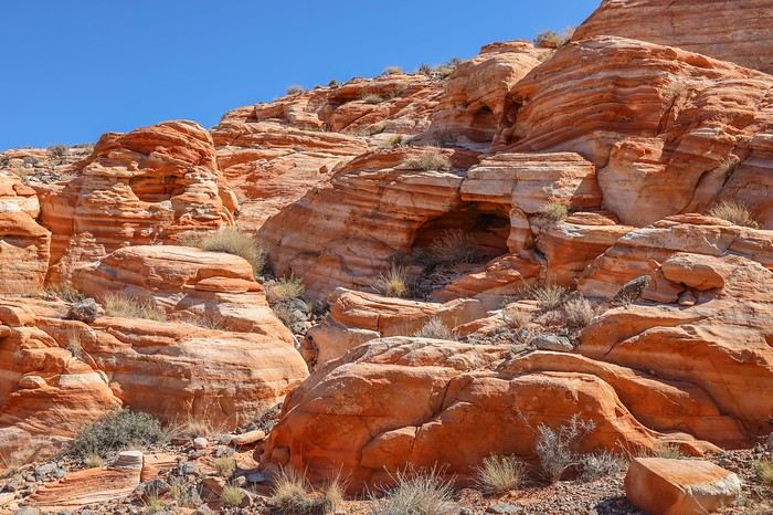
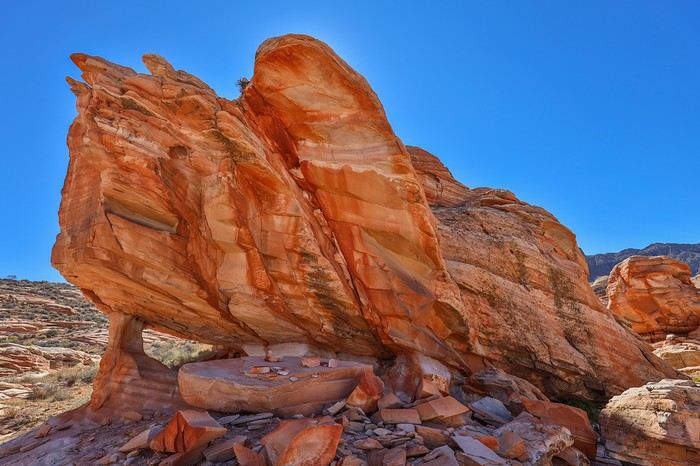
We then headed south and wandered among the two-toned rocks with all sorts of unique shapes:

A unique piano-shaped arch:

There are tons of mini-arches, caves, and special rock formations, and even a tripod (N36.32683° W114.70508°):


A Swiss-cheese rock:

A "Mercedes" tafoni we stumbled upon by accident (N36.32616° W114.70500°) 😇!


The "Must-Sees" of the American West

Marati · 2024-12-23 · Message 157 of 196

or even a tarantula (N36.32585° W114.70490°).

Every rock deserves to be explored because it might hold surprises!

We then arrive at a viewpoint (N36.32517° W114.70514°) that offers us a stunning panoramic view of the entire area we’ve just crossed !

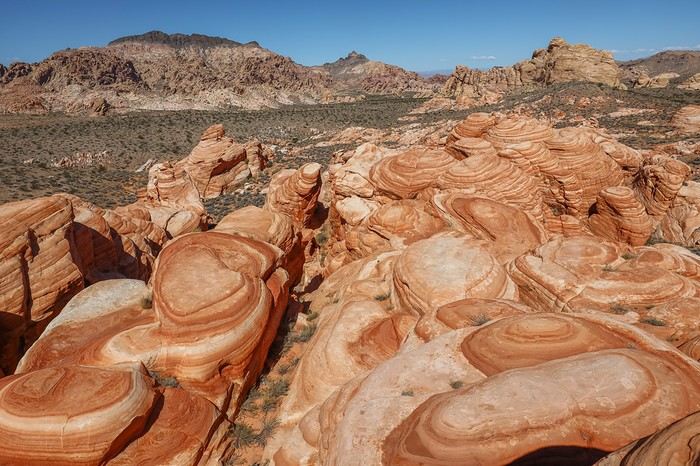
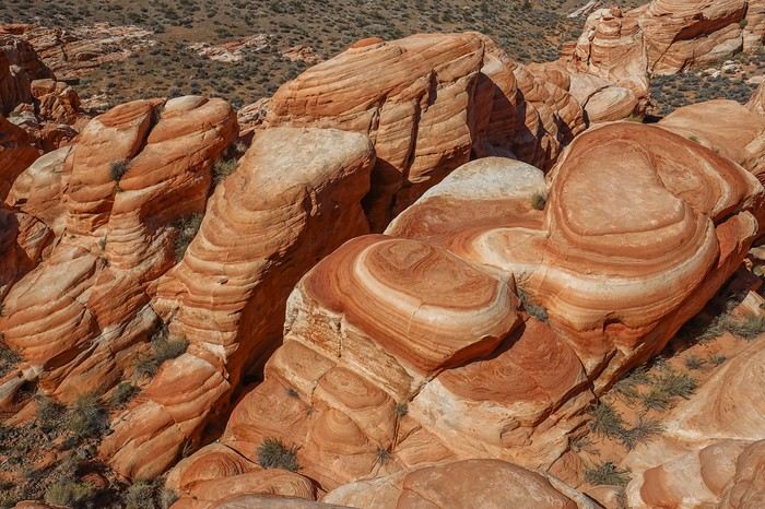


I’d never seen photos of this area before—the surprise is total, and we’re thrilled!

Around a bend in the rocks, we even discover another unlisted arch, "Striped Arch" bis (N36.32275° W114.70603°), though it’s less pretty than the first one we saw earlier.
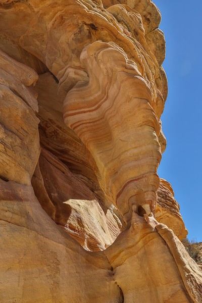
Right next to it, other mini-arches or rocks balanced on tiny bases.
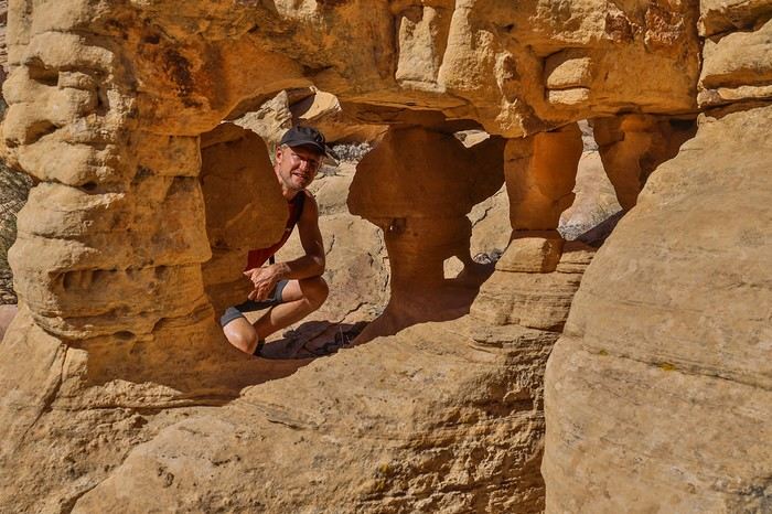
The second remarkable arch in Buffington Pockets is "Triple Arch," which, as the name suggests, is a triple arch. At first glance, you only see two, and you have to contort yourself under the arch to spot the third mini mini-arch (invisible in this wide shot)!
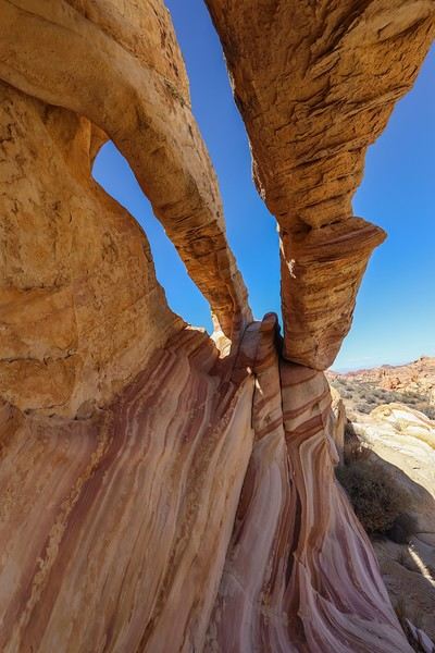
We continue our loop heading north toward Zebra Wave.

And here’s Zebra Wave (N36.32653° W114.69864°), where we make a surprising discovery. A camera trap is set at the edge of the hole to capture wildlife—just point and shoot without breaking a sweat 😕!
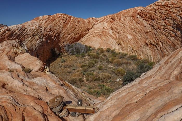
Climbing to the top of Zebra Wave, you understand its name!
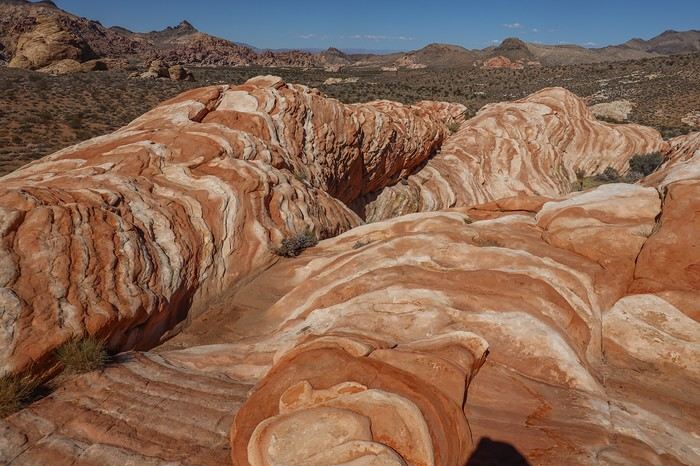
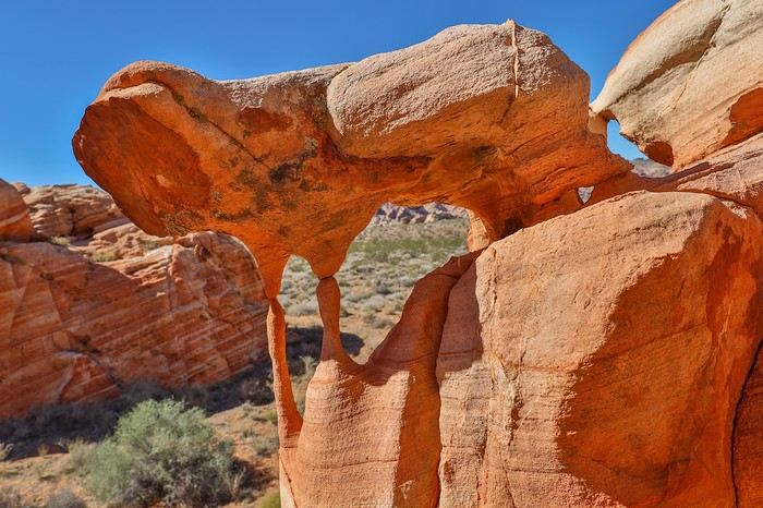
The last area we explore has an arch called "Lion King Arch" (N36.33148° W114.69522°). It’s easy to spot and so cute and fragile!!
We finish our loop by passing through several areas that could be explored more deeply. But we’re a bit tired from the blazing sun, so we move through them a little quickly.

To get back to our car, we walk, guided by GPS, through thorny bushes that take a toll on my Meindl boots—ripping off a piece of fabric. My hiking shoes barely lasted two weeks before giving up...

Back at the car, after retracing the track in reverse, we realize we won’t have time to make it to Little Finland for sunset. Oh well, maybe next time.

Off to Las Vegas and its famous welcome sign at the city’s entrance for a souvenir photo!

There’s a crowd, and we have to wait nearly 20 minutes to strike a pose. The harsh return to civilization!

Night begins to fall as we cross the Strip.

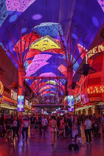
Since Franck and I know the Strip and Sullivan will be back another time, we head straight to Fremont Street, known for its illuminated ceiling, zip line, wild atmosphere, bars, souvenir shops, and some scantily clad women.
We’re also there for its fast-food joint, the Heart Attack Grill! At the entrance, there’s a scale to weigh yourself before and after—so you can see how much weight you’ve gained. The Heart Attack Grill even takes it to the next level by offering free single burgers to anyone weighing over 350 pounds ! That’s still 160 kg... Sullivan and I combined barely exceed that!

As soon as we step inside, we’re greeted by a pretty waitress, dressed all in white, who puts a white gown on us.

The burgers on the menu range from double ($17) to octuple ($35). The last rule of the place is that anyone who bites off more than they can chew gets a spanking from one of the waitresses!
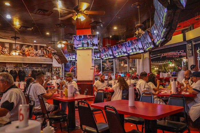
We all decide on a triple burger, which we each finish—though that doesn’t stop us from getting spanked by a waitress, just for fun...

After this last dinner, we wander around Fremont Street, buying a few souvenirs for our loved ones,

then we have a couple of beers at the casino bar where our car is parked—just to get free parking !

It’s nearly midnight when we leave Las Vegas to drive all night toward... San Francisco Airport, 900 km away (about 8 hours and 20 minutes of driving). Despite the exhaustion from this trip, it goes smoothly by switching drivers every 3 hours.

Our return flight is at 3:30 PM, so we arrive with plenty of time to clean the car and vacuum it to return it in decent condition.

Let’s not forget that off-road tracks are technically off-limits to rental 4x4s... The return flight goes smoothly, and we part ways in Paris with connections to all corners of France.

In conclusion, this trip of superlatives lived up to all its promises—and then some! The sequence of Southwest must-sees, each more remarkable than the last, flowed seamlessly and blew our minds every single day .

We were generally lucky with the weather, even if a memorable storm dashed my dreams of Angel Arch. Otherwise, we enjoyed glorious sunshine at all the major and unmissable sites on our ambitious itinerary. None of us had any real physical issues that could’ve slowed down the group, and our pre-trip training helped us keep up the pace without overexerting ourselves.

It’ll take time to process the density of spots we discovered and the variety of landscapes, atmospheres, colors, and rock formations!

Hope this inspires you to venture off the beaten path... Thanks for following along!
The "must-sees" of the American West

Rjulie95 · 2024-12-23 · Message 158 of 196

Thanks for sharing, Guillaume—I’m in awe of everything you’ve done.

Happy holidays!

The "Must-Sees" of the American West

Rouquine38 · 2024-12-23 · Message 159 of 196

Thanks so much, Guillaume, for showing us these amazing sites—I was absolutely blown away! 🤩 I’ll definitely be re-reading this travel journal when we head back to the American West. 😊

Must-Sees in the American West

Marati · 2024-12-24 · Message 160 of 196

Thanks Régis and Isabelle! Have a great holiday season.

VoyageForum — the largest community of French-speaking travellers.