Which entrance to choose for Pinnacles National Park (California): East or West?
Hi everyone! 🙂
I’m almost done planning our September road trip. After our 3-night visit to Sequoia, we’ll have a stopover night in Coalinga (to break up the drive). We’ll be staying two nights in Monterey and would like to stop along the way to visit one side of Pinnacles National Park. We’re torn between the West entrance and the East entrance, and we’d like to do a short hike of no more than 2 hours since we don’t want to arrive too late in Monterey.
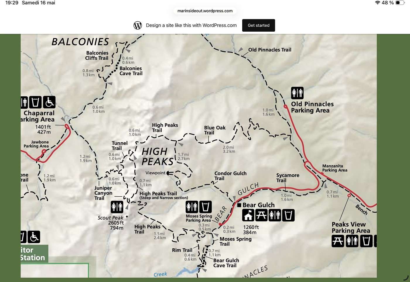
This park is split into two distinct zones with no connection between them, and the mileage from Coalinga to Monterey is pretty much the same for both. Which area do you recommend visiting—east or west? And which route is the most scenic?
I’ve spotted two short hikes: - East: Moses Spring to Rim Trail Loop - West: Balconies Cliffs Cave Loop
Has anyone been there, or do you have another hike to suggest?
Thanks in advance, and have a great afternoon! Marcalamar 🙂
I’m almost done planning our September road trip. After our 3-night visit to Sequoia, we’ll have a stopover night in Coalinga (to break up the drive). We’ll be staying two nights in Monterey and would like to stop along the way to visit one side of Pinnacles National Park. We’re torn between the West entrance and the East entrance, and we’d like to do a short hike of no more than 2 hours since we don’t want to arrive too late in Monterey.
This park is split into two distinct zones with no connection between them, and the mileage from Coalinga to Monterey is pretty much the same for both. Which area do you recommend visiting—east or west? And which route is the most scenic?
I’ve spotted two short hikes: - East: Moses Spring to Rim Trail Loop - West: Balconies Cliffs Cave Loop
Has anyone been there, or do you have another hike to suggest?
Thanks in advance, and have a great afternoon! Marcalamar 🙂
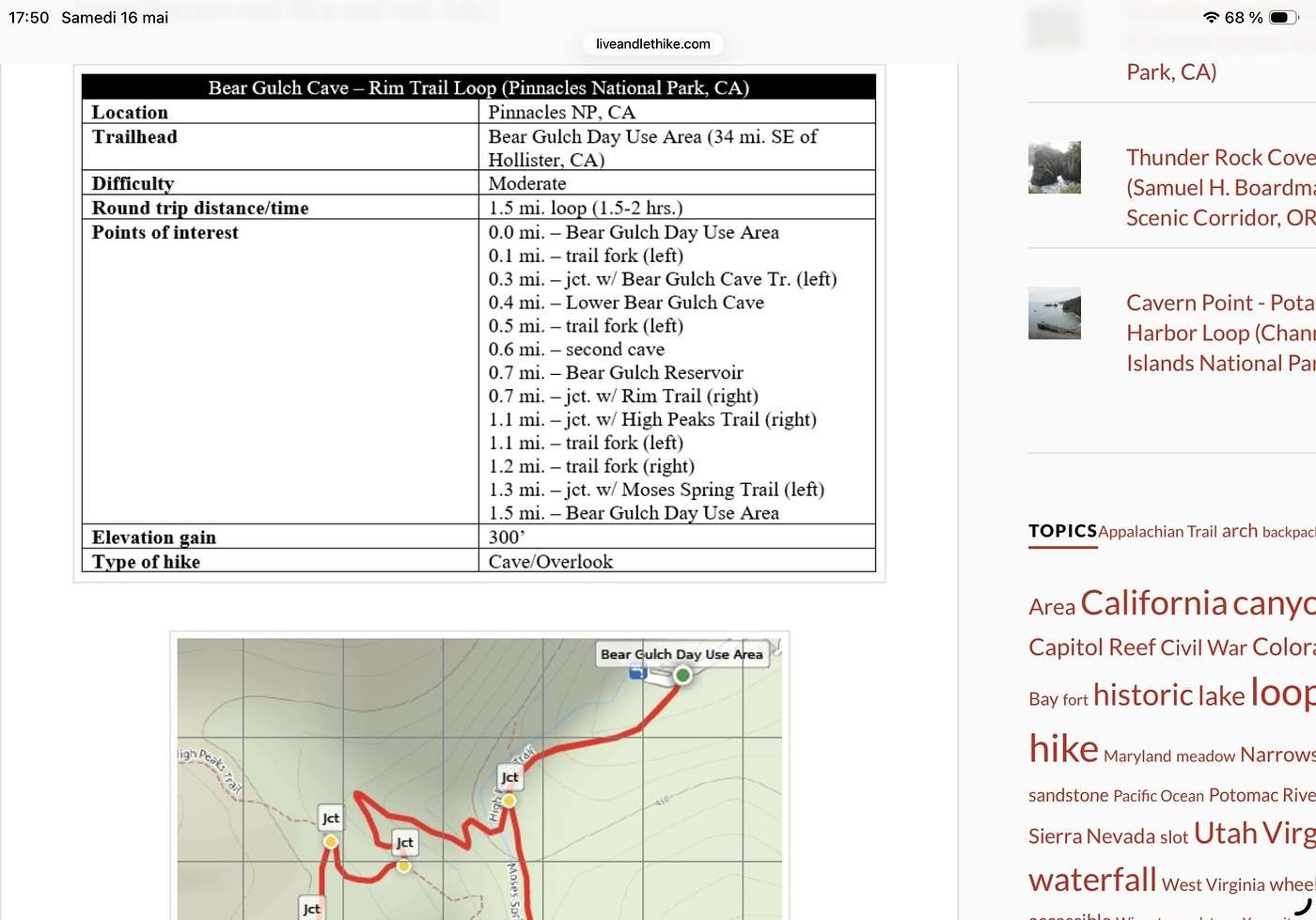
 The Moses Spring to RIM Trail Loop starts from a different parking lot (Moses Spring Parking Area).
It’s listed as about 2 hours and just under 4 km. I found the details and the map on an American site (long live the translator 😉), plus a short YouTube video that sums it up well.
The Moses Spring to RIM Trail Loop starts from a different parking lot (Moses Spring Parking Area).
It’s listed as about 2 hours and just under 4 km. I found the details and the map on an American site (long live the translator 😉), plus a short YouTube video that sums it up well.
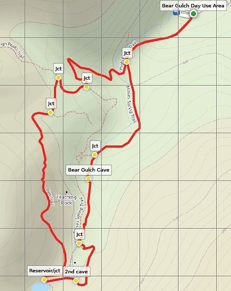
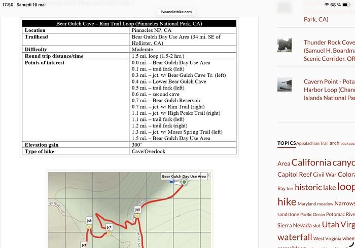 There are two caves to walk through, a small water retention area, and you return to the parking lot by following a rim.
After your first message, I even considered skipping the park and heading up to Monterey via Highway 1, but I decided against it because it really adds time, and we wouldn’t have been on the right side of the road either. So, I’m sticking with my original plan, and we’ll drive part of Highway 1 between our two nights in Monterey. I saw you really liked the road after Three Rivers. We’re staying right by Lake Kaweah. We’ll take our time getting to Coalinga (just a stopover town to break up the drive) and enjoy the scenery.
Thanks again for all your research, and have a great evening!
Martine 🙂
There are two caves to walk through, a small water retention area, and you return to the parking lot by following a rim.
After your first message, I even considered skipping the park and heading up to Monterey via Highway 1, but I decided against it because it really adds time, and we wouldn’t have been on the right side of the road either. So, I’m sticking with my original plan, and we’ll drive part of Highway 1 between our two nights in Monterey. I saw you really liked the road after Three Rivers. We’re staying right by Lake Kaweah. We’ll take our time getting to Coalinga (just a stopover town to break up the drive) and enjoy the scenery.
Thanks again for all your research, and have a great evening!
Martine 🙂