Results for "Revel+|+127"
60111 results found.
What budget should you plan for 2 weeks of travel in China?
Hi there,
We just got back from a 2-week trip to China as a couple, and before we left, the budget was the hardest thing to picture concretely. We found plenty of info on visas, apps, transport, and itineraries, but way fewer detailed breakdowns of what you *actually* spend on the ground.
So, we took the time to share our real budget for 14 days. In our case, we spent around 1,800 € per person, with a big chunk of that going toward round-trip flights at about 600 € per person. We were also pretty surprised by how affordable China can be once you’re there—transport is often cheap, and a lot of everyday expenses stay reasonable.
The trickiest part, in the end, was figuring out how to pay while you’re there, since it’s not always obvious if you’re not prepared. But once everything’s set up and you get the hang of it, it’s really smooth.
If this can help other travelers get a better idea before they go, we’ve broken it all down here:
https://aventures-sans-mesaventure.com/budget-2-semaines-de-voyage-en-chine/
Happy travels and enjoy your adventure! Hélia
Happy travels and enjoy your adventure! Hélia
Solar vehicle Otonomi: seeking senior adventurer for journey from France to the Pamir!
It’s never too late to live intensely.
I’m Guy, I’ve passed 70, and I’m looking for a female travel companion for an extraordinary adventure aboard OTONOMI—a solar-powered tandem I built with my own hands over two years.
My past is that of an unrepentant traveler: crossing the Atlantic in an ultralight aircraft, swimming across channels, and a high-level sailing record in major transatlantic races... OTONOMI isn’t a retiree’s whim—it’s the final chapter of a life of adventure, perhaps the most beautiful one.
Departure at the end of May. Route: Europe to Baku, crossing the Caspian by ferry, then Turkmenistan, Uzbekistan, Tajikistan, the Pamir, Kyrgyzstan, and return via Kazakhstan. At least 3-4 months.
No need to be athletic—a session of *longe côte* (coastal walking) requires more physical effort than a full day on OTONOMI. You don’t even have to pedal at all.
OTONOMI tows a foldable solar-powered caravan trailer—camping under the stars or staying in small local hotels, depending on your mood. Road expenses are shared simply.
I’m looking for a free-spirited woman, curious, passionate about genuine encounters and wide-open spaces—appearance or insecurities don’t matter. Just that flame still burning inside you.
A real-life test run is planned before departure—so we can meet naturally, without pressure.
📩 guy.otonomi@outlook.fr
My Australia itinerary: What to do in 3 weeks between Sydney and Cairns?
Discover everything you can do during a three-week road trip between Sydney and Cairns on Australia’s east coast. All the steps for a memorable journey.
3-week road trip between Sydney and Cairns: itinerary tips A three-week stay in Australia is the perfect amount of time to explore part of the country. Just a part, because the territory is so vast that you could spend months there without seeing it all. For a first trip to this Oceanic country, the route between Sydney and Cairns is a classic. It offers a glimpse of what makes so many travelers dream, with legendary beaches, vibrant cities, tropical forests, paradise islands, and the unmissable Great Barrier Reef. This route along the East Coast alternates between natural landscapes and urban atmosphere, scenic roads, and relaxing days. Here’s a realistic itinerary designed for three weeks, with balanced stops and time to enjoy without feeling rushed.
Days 1 to 3 – Sydney, first steps in Australia Even before setting foot on Australian soil, travelers must have a valid passport and a visa. Australia doesn’t mess around with entry formalities, so it’s best to take care of this in advance. To apply for a tourist visa, the site aus-visa.org guides travelers step by step. Once this formality is sorted, it’s time to focus on the most exciting part: the trip itself. Arriving in Sydney is often a memorable step. You discover one of Australia’s most iconic cities and immediately feel far from Europe. The first few days are for adjusting to the time difference while exploring the city’s landmarks. There’s the Opera House, of course, but also the Harbour Bridge, which dominates the bay and gives Sydney its instantly recognizable silhouette. During these three days in Sydney, you can head to Circular Quay to take a ferry to Manly, just for the pleasure of crossing the bay and admiring the city from the water. You can also walk along Bondi Beach or lay out your towel, depending on the time of year. The coastal walk between Bondi and Coogee offers a spectacular view of the Australian coast. Of course, you won’t want to miss strolling through The Rocks district to soak up the buzz of the capital of New South Wales.
Days 4 to 6 – From Sydney to Byron Bay, the road trip begins The road trip kicks off heading north. The Pacific Highway unfolds its kilometers between the ocean and eucalyptus forests. You quickly realize that driving in Australia is a unique experience. Sure, the distances are long, but the landscapes make every stretch enjoyable. A first stop in Port Macquarie or Coffs Harbour lets you rest while discovering wild beaches. Then comes Byron Bay, the beach town often described as Australia’s surfing and alternative lifestyle capital. After Sydney, the vibe slows down. You wake up early to watch the sunrise near the lighthouse, then spend your days swimming, trying surfing, and exploring the tropical hinterland. You can also hike in nearby national parks to discover hidden waterfalls in the heart of wild landscapes. You might plan to spend one night in Byron Bay before hitting the road again, but it’s so nice that you end up staying for three days.
Days 7 to 9 – Gold Coast and Sunshine Coast, between modernity and nature Heading toward the Gold Coast, the contrast is striking again. Here, skyscrapers line the beach, and you stroll along wide avenues. The vibe is more urban. Surfers Paradise is another ideal stop for surfing. You can also enjoy a lively nightlife. Those who prefer tranquility can relax in Burleigh Heads, known for its beautiful beach and more local atmosphere. The hinterland also holds surprises. The lush forests of Springbrook National Park and its waterfalls remind you that Australia’s nature is everywhere, even near big cities. As you head up to the Sunshine Coast, we recommend stopping in Noosa to discover its elegant houses, peaceful beaches, and national park bordering the ocean. The coastal trails reveal exceptional marine landscapes. The locals’ hospitality is also remarkable.
Days 10 to 12 – Fraser Island, adventure on sand Get ready for a magical moment! From Hervey Bay, you board a ferry to Fraser Island—or K’gari—the world’s largest sand island. Once there, you drive a 4x4 on the beach and discover raw, almost surreal landscapes. Lake McKenzie, with its impressively clear water and dazzling white sand, remains one of the trip’s most memorable highlights. You swim, walk barefoot, observe dingoes from a distance, and feel a rare sense of isolation. It’s as if you’re far from civilization. After two intense days, you hit the road north again. The distances get longer, but the excitement grows as you approach the Whitsundays.
Days 13 to 15 – The Whitsundays, a giant postcard Airlie Beach is the gateway to the Whitsundays, a group of islands 55 km off the coast of Queensland. The water turns turquoise, lush green islands emerge on the horizon, and the sand at Whitehaven Beach looks too white to be real. What to do in the archipelago? Well, snorkel for hours over the coral, swim in secluded coves, and spend peaceful evenings watching the sunset. For those who love discovering hidden spots, head to Cedar Creek Falls for a picnic and a refreshing swim. These days at sea often rank among travelers’ favorite moments. You’ll understand why once you’re there.
Days 16 to 18 – Mission Beach, the tropical break After the magical moments in the Whitsundays, Mission Beach offers a quieter pause. Here, you enjoy a long palm-fringed beach and an almost intimate atmosphere. It’s the perfect spot between Sydney and Cairns to take time to do nothing. That means walking along the water at sunrise, then exploring the surroundings between tropical forest and isolated backroads. Thrill-seekers, however, can skydive over the beach. It’s a uniquely Australian experience that offers plenty of wow moments. This stop marks the entry into North Queensland’s tropical region, where many more wonders await travelers.
Days 19 to 21 – Cairns, the Great Barrier Reef, and the ancient rainforest Cairns is a city in Australia that’s loved for its lively markets, cafés, and beautiful beaches. It’s also the gateway to one of the world’s natural jewels: the Great Barrier Reef. A boat excursion lets you dive or snorkel over colorful reefs. Seeing the coral and fish in this crystal-clear water leaves a lasting impression. But you’ll also discover another wonder with the poetic name of Daintree Rainforest. It’s one of the oldest tropical forests on the planet. Walking under its dense canopy lets you feel the power of nature preserved in its original state. At Cape Tribulation, the forest meets the ocean in a spectacular setting. This end of the trip is packed with emotion.
Traveling from Sydney to Cairns in three weeks means exploring a contrasting and exotic Australia. You start in a dynamic metropolis, cross endless beaches, sail between paradise islands, and finish in an ancient tropical forest. Often, as soon as you’re back, you’re already thinking about returning.
3-week road trip between Sydney and Cairns: itinerary tips A three-week stay in Australia is the perfect amount of time to explore part of the country. Just a part, because the territory is so vast that you could spend months there without seeing it all. For a first trip to this Oceanic country, the route between Sydney and Cairns is a classic. It offers a glimpse of what makes so many travelers dream, with legendary beaches, vibrant cities, tropical forests, paradise islands, and the unmissable Great Barrier Reef. This route along the East Coast alternates between natural landscapes and urban atmosphere, scenic roads, and relaxing days. Here’s a realistic itinerary designed for three weeks, with balanced stops and time to enjoy without feeling rushed.
Days 1 to 3 – Sydney, first steps in Australia Even before setting foot on Australian soil, travelers must have a valid passport and a visa. Australia doesn’t mess around with entry formalities, so it’s best to take care of this in advance. To apply for a tourist visa, the site aus-visa.org guides travelers step by step. Once this formality is sorted, it’s time to focus on the most exciting part: the trip itself. Arriving in Sydney is often a memorable step. You discover one of Australia’s most iconic cities and immediately feel far from Europe. The first few days are for adjusting to the time difference while exploring the city’s landmarks. There’s the Opera House, of course, but also the Harbour Bridge, which dominates the bay and gives Sydney its instantly recognizable silhouette. During these three days in Sydney, you can head to Circular Quay to take a ferry to Manly, just for the pleasure of crossing the bay and admiring the city from the water. You can also walk along Bondi Beach or lay out your towel, depending on the time of year. The coastal walk between Bondi and Coogee offers a spectacular view of the Australian coast. Of course, you won’t want to miss strolling through The Rocks district to soak up the buzz of the capital of New South Wales.
Days 4 to 6 – From Sydney to Byron Bay, the road trip begins The road trip kicks off heading north. The Pacific Highway unfolds its kilometers between the ocean and eucalyptus forests. You quickly realize that driving in Australia is a unique experience. Sure, the distances are long, but the landscapes make every stretch enjoyable. A first stop in Port Macquarie or Coffs Harbour lets you rest while discovering wild beaches. Then comes Byron Bay, the beach town often described as Australia’s surfing and alternative lifestyle capital. After Sydney, the vibe slows down. You wake up early to watch the sunrise near the lighthouse, then spend your days swimming, trying surfing, and exploring the tropical hinterland. You can also hike in nearby national parks to discover hidden waterfalls in the heart of wild landscapes. You might plan to spend one night in Byron Bay before hitting the road again, but it’s so nice that you end up staying for three days.
Days 7 to 9 – Gold Coast and Sunshine Coast, between modernity and nature Heading toward the Gold Coast, the contrast is striking again. Here, skyscrapers line the beach, and you stroll along wide avenues. The vibe is more urban. Surfers Paradise is another ideal stop for surfing. You can also enjoy a lively nightlife. Those who prefer tranquility can relax in Burleigh Heads, known for its beautiful beach and more local atmosphere. The hinterland also holds surprises. The lush forests of Springbrook National Park and its waterfalls remind you that Australia’s nature is everywhere, even near big cities. As you head up to the Sunshine Coast, we recommend stopping in Noosa to discover its elegant houses, peaceful beaches, and national park bordering the ocean. The coastal trails reveal exceptional marine landscapes. The locals’ hospitality is also remarkable.
Days 10 to 12 – Fraser Island, adventure on sand Get ready for a magical moment! From Hervey Bay, you board a ferry to Fraser Island—or K’gari—the world’s largest sand island. Once there, you drive a 4x4 on the beach and discover raw, almost surreal landscapes. Lake McKenzie, with its impressively clear water and dazzling white sand, remains one of the trip’s most memorable highlights. You swim, walk barefoot, observe dingoes from a distance, and feel a rare sense of isolation. It’s as if you’re far from civilization. After two intense days, you hit the road north again. The distances get longer, but the excitement grows as you approach the Whitsundays.
Days 13 to 15 – The Whitsundays, a giant postcard Airlie Beach is the gateway to the Whitsundays, a group of islands 55 km off the coast of Queensland. The water turns turquoise, lush green islands emerge on the horizon, and the sand at Whitehaven Beach looks too white to be real. What to do in the archipelago? Well, snorkel for hours over the coral, swim in secluded coves, and spend peaceful evenings watching the sunset. For those who love discovering hidden spots, head to Cedar Creek Falls for a picnic and a refreshing swim. These days at sea often rank among travelers’ favorite moments. You’ll understand why once you’re there.
Days 16 to 18 – Mission Beach, the tropical break After the magical moments in the Whitsundays, Mission Beach offers a quieter pause. Here, you enjoy a long palm-fringed beach and an almost intimate atmosphere. It’s the perfect spot between Sydney and Cairns to take time to do nothing. That means walking along the water at sunrise, then exploring the surroundings between tropical forest and isolated backroads. Thrill-seekers, however, can skydive over the beach. It’s a uniquely Australian experience that offers plenty of wow moments. This stop marks the entry into North Queensland’s tropical region, where many more wonders await travelers.
Days 19 to 21 – Cairns, the Great Barrier Reef, and the ancient rainforest Cairns is a city in Australia that’s loved for its lively markets, cafés, and beautiful beaches. It’s also the gateway to one of the world’s natural jewels: the Great Barrier Reef. A boat excursion lets you dive or snorkel over colorful reefs. Seeing the coral and fish in this crystal-clear water leaves a lasting impression. But you’ll also discover another wonder with the poetic name of Daintree Rainforest. It’s one of the oldest tropical forests on the planet. Walking under its dense canopy lets you feel the power of nature preserved in its original state. At Cape Tribulation, the forest meets the ocean in a spectacular setting. This end of the trip is packed with emotion.
Traveling from Sydney to Cairns in three weeks means exploring a contrasting and exotic Australia. You start in a dynamic metropolis, cross endless beaches, sail between paradise islands, and finish in an ancient tropical forest. Often, as soon as you’re back, you’re already thinking about returning.
Mamoudzou, Mayotte - December 2025
There exists a rare land where life expresses itself, a land where everything is destroyed, patched up, where everything is dirty and faded, yet paradoxically, each passing day is synonymous with light and joy. Seen from the sea, magnified by its translucent waters, the island is splendid; seen from inland, ochre and green dress a landscape one would wish to be pristine. As you approach the coast with the tides, countless boat wrecks never finish dying; returning from a hike, you know you’re nearing the city by the increasingly obvious proliferation of all kinds of trash. Overflowing the towns, makeshift homes made of corrugated iron stand here and there, wherever the eye lands; from a height, looking toward the horizon, you find the calm blue of the ocean and the beauty of infinity.
But where does all this corrugated iron come from? Blue, gray, red, or black, you find it pretty much everywhere—except, of course, on the island’s heights, where the heat is such that all life seems impossible. Yet, a few kilometers from the capital, more than an hour’s walk away, the corrugated iron is very much there, omnipresent, guaranteeing a land registry as hypothetical for us Europeans as it is very real for those who live there, far from civilization and comfort. I keep climbing. I’m precisely looking to meet these people who live on very little, if not nothing.
- Jéjé Mogné (Hello, sir in Shimahorais)! Where do you get water here, in this place? How do you drink, irrigate your plants?
- I wait for the rain. We have tanks that fill up well with each rainfall. But right now, it’s not raining much.
At the top of the next hill, lost in the bushes, it’s easier for me to guess the distant city, Mamoudzou, than the rest of the path, a remnant of a magnificent GR called the Island Tour, abandoned for the most part, sometimes maintained between two lost hamlets. The city, the pulse, water. Below, the ocean, running water, drinking water—despite regular interruptions; here, up high, an hour and a half’s walk away, tanks, arbitrariness. On other slopes, however, during another hike, I saw the water supply network, made of sturdy pipes tangled in the earth, right there by the path. It seems there are places where water climbs. Others not. Each to their own karma. In 2025. In a French department.
A path of misfortune, lost and regained, thanks to a sign, an inscription, or the compass’s directions. No one walks here anymore, except those who live here or come to harvest their crops. I remember that breathtaking hike in 2013, when I connected Bandrélé to Mamoudzou, passing by the peaks of Bénara (660m) and Bépilipili (643m), barely pausing at Tsararano and Vahibé: 34 km of intense effort on a rollercoaster path, along a trail that was still discernible. Today, it’s as if everything had disappeared. By also destroying the paths and vegetation, Chido* broke the last momentum of these cautious hikers: insecurity has made its way across the archipelago, and Sunday strolls are no longer the norm. Me, I keep going. I will have walked here and there during these three weeks to get an idea of the places, the people, the landscapes, and the superhuman effort required to move forward in over 40°C. To tell the truth, during my last hike, I cut my plans short and let myself be carried by a group of young people heading back to the city. The path is now just an inextricable network of small trails, the specter of Providence** comes to mind. True wisdom is knowing when to give up. I leave.
* A cyclone named "desire" (in Shona), which ravaged the island of Mayotte on December 14, 2024. ** June 2023, a very poorly prepared hike on Providence Island (Caribbean) from which I miraculously escaped.
On Petite-Terre, Marie takes me to visit some locals, white people who have lived there for a long time and make a living from their art; jewelry for her, all kinds of objects for him. We love this little shop, this oasis amid the chaos that embodies Dostoevsky’s phrase: "Beauty will save the world." It’s clean and tidy, beautiful, well-kept. Invariably, the question of insecurity resurfaces in the middle of the conversation. The woman says:
- I know someone who slipped in their bathtub. Still, I keep taking baths…
So, is this insecurity a myth or reality? I hear stories that are often true but sometimes seemingly exaggerated through the lens of misunderstanding and one-upmanship. Like that of this midwife assaulted one evening (it gets dark early) on her way home from work. Sometimes she was attacked on the path, dragged by the hair for several meters, sometimes she made it home, but it was her roommate who let the two men in. One version talks about a snatched phone and gratuitous violence, another about violence outright. In short, one thing is certain: walking around at night flaunting your phone isn’t a good idea, no more in Mamoudzou than in the rough neighborhoods of Nantes. Also, I played it safe: nothing flashy, nothing bling-bling, and always something to give if needed. I was never approached. It’s not easy to get a sense of the realities, between the hazy reports from journalists sensationalizing everything and the real lives of real people. But I know I can’t rely on these few ideas I’ve formed: I’m nobody, and above all, I don’t live here. What I do know, however, is that since my last visit to the island in 2017, over 80,000 babies have been born, and tens of thousands of immigrants have reached the archipelago’s shores. What’s also obvious is that poverty, hunger, and—let’s say it—indignity foster delinquency and insecurity. So, without taking journalists’ alarmist speeches at face value, we’ll try to keep in mind that a young person rendered orphaned by circumstances (parents expelled), poor and often hungry, involved more or less against their will in village wars and fueled by synthetic drugs*, will readily turn to violence when they truly have nothing to lose. We can trace the origin of this despair to the fact that in Mayotte, those without legal existence have virtually no hope of accessing anything.
* "Chimique" is a series of synthetic cannabinoids
Meanwhile, in the evening, it’s good to go home before the time of stone-throwing. From time to time, along the roads, gangs throw stones at vehicles and school buses, but mostly at police cars—almost all the white Dusters on the island! In front of the Mamoudzou police station, all parked vehicles—mostly Dusters—bear the scars of these attacks. Maybe it’s only at night that gangs unleash and all the burglaries happen? I saw nothing, heard nothing. I lived three weeks in a sort of bunker with no real access to outside light, protected by a fake wooden door doubled with a real metal door, both locked at all times. You don’t tempt fate. You endure it differently.
Today, extraordinarily, it’s raining. Yet, it’s the rainy season! But with my karma helping (what selfishness to want to walk dry when so many souls live off the rain) or is it climate change? The rain only falls once I’ve put on my horrible green pajamas. In front of the board outlining the program, I’m told that out of the six scheduled C-sections today (sic), they’ll probably only do two, maybe three. Because it’s raining. And when it rains, people don’t move around. Not for lack of will. Rather, for lack of means. And that ties into those sad days when the police patrol around the hospital: patients don’t come. They’ll come back tomorrow. To compensate, I’m happy at the thought of tackling the abscess program, but the sterilization unit is acting up and blocking the instrument trays. When it’s not the rain, it’s the unions. And when both finally quiet down, there’s always someone to find fault with the order of operations. You have to imagine an operating room where the question of urgency reigns supreme. Here, no surgery is scheduled more than 24 hours in advance—only emergencies, nothing but emergencies. So, following that reasonable adage that what’s done is no longer to be done, it’s sheer madness when the rain meets the interests of Force Ouvrière and the bad will of some combines with the laziness of others. To tell the truth, I’ve never seen so much energy expended to… do nothing. Hallucinating. But who am I, a small-time striver, an islander in my spare time, a temporary worker at the end of the world? I came, I saw, I was disappointed? Not really. Here again, I can’t judge a system in so little time. I can barely utter a few bitter words in front of obvious facts. But nothing will take away my joy of being here for three weeks. Here, they heal with somewhat outdated but still functional means. You do what you can with what you have, 8,000 km from the Métropole. Yes, the operating room doors hesitate, and the operating tables stutter, but in this blessed period, we lack neither medicines nor supplies. So we examine, anesthetize, and repair, far more undocumented people than French—if I may play with somewhat borderline statistics here; we deliver babies, dress wounds, and relieve pain in this hospital at the end of the world where neither white women nor Mahorais women would ever consider giving birth or getting treated.
What’s the solution? The obstetrician talks to the woman during a C-section under spinal anesthesia:
- Bouéni! (Madame, in Shimahorais) You need to think about tubal ligation. This is your fourth C-section. Your uterus is like tissue paper. Your next pregnancy will be very risky.
No answer. Culture. It’s all about culture. The funniest thing is that France also gets bogged down with the idea of other cultures’… cultures. The woman in question arrived illegally a few years ago to give birth to her first child. Since then, rejecting the very idea of contraception—her husband, for his part, will invoke God or Allah to refuse a vasectomy—she comes back every 12-14 months. And the obstetrician explains to me how his idea of making information about permanent contraception mandatory was deemed racist by associations. It’s always the same story. I suggest to the associations that they take charge of all these extra births, not only the medical costs but also the entire education, not just financial, of all these children doomed to live a life of misery on this forsaken archipelago. The probability that one of these offspring will emerge as a gifted, sensitive, and fiercely happy individual must truly be weighed against the degradation and abandonment that will invariably afflict the thousands of others living around him. In reality, simply mentioning a very real danger to the mother should be enough to impose sterilization. But we are a country whose greatness of soul is measured by the number of heads cut off to uphold the famous rights of man... Already a proponent at home of ending family allowances after the third child—you can’t subscribe to a certain idea of society and, at the same time, accept that tens of thousands of children are sacrificed on the altar of thoughtlessness and financial interest*—I will weakly advocate here for a controlled right to have children. Well, what will they say about me when I express the idea of imposing sterilization on women in irregular situations after the birth of their third child? National solidarity funds the noblest ideals? In Mayotte? Let’s be serious. It’s so much easier to hide behind the inalienable right of women to control their bodies than to acknowledge one’s own powerlessness to assume the consequences of such a policy. Because after 18 years of struggles as a second-class citizen, the young stateless person will have no choice but to live in hiding: faced with the impossibility of claiming birthright citizenship**, they will be deportable. In Mayotte, there aren’t enough schools, not enough housing, not enough projects for youth, not enough jobs, not enough money, not enough future… In Mayotte, an average of 5 children are born per woman. In reality, we never ask about the right of children to control their own lives.
* Single parent with 4 children: RSA at 1937 € + family allowances… ** Law of May 12, 2025 aiming to strengthen the conditions for accessing French nationality in Mayotte.
I live in the city in a clean apartment where air conditioning eases my aches and sweat, and where water flows abundantly, thanks to huge tanks that fill up between water cuts. On the hills of Koungou, I was struck by this image: there, women (a matriarchal society?) do the dishes in a miserable stream. Upstream of the same stream, the same image as downstream: disgusting water with bits of foam floating on it. A little further, however, there are taps with running water that children play with. Strange. In any case, water is a question. They tell me it’s drinkable; I doubt it. A system that’s regularly cut doesn’t seem reliable to me. In any case, I can’t help but think of the Canary Islands and their chronic water shortage, especially in Lanzarote. Without entering the debate on desalination plants—I’m quite ignorant about environmental repercussions—I’ll just say that in the Canary Islands, you can buy 8 L jugs of purified water for less than 2 €. Here, in Mayotte, the price of water—as is the price of gasoline—is the same everywhere: 0.65 € for a bottle of Cristaline (1 €/L)*. While I was walking up there with a couple of farmers shuttling between two remote spots, I know I hit the mark by offering them one of my two bottles I’d brought for the occasion.
* At home, we find Cristaline at 1.14 € for a 9 L pack, i.e., 0.13 € per liter.
Outside, everything is broken, abandoned, old, worn, torn, faded, heavy, dirty, forsaken. But life goes on. And that’s fascinating. At home, at 5:45 PM, people close their shutters and watch cable TV, sometimes late into the night, emptying the streets of any salutary clamor, unwittingly extinguishing the necessary pulse of life. At home, we die of boredom. In Mamoudzou, between two dying trash cans, metal frames laid on the ground are covered by the elements of a broken garden set. A bare concrete staircase, without railings, provides access to the upper floor of a dwelling. On the steps, you can read: Private space - Please take your trash with you. Metal rods protrude from the said dwelling. On the ground, it’s a festival of screws and nails… A cat passes by. It doesn’t look great. A madwoman crosses the street dancing. A slightly hurried driver brakes. A six- or seven-year-old boy comes out in his underwear from his low house made of corrugated iron. He smiles. He’s having fun doing acrobatic figures over an old mattress on the sidewalk. Forward roll, backward roll. You wonder if he eats enough. Different culture. Different customs.
I will remember for a long time this blinding morning light, a raw, vital, striking light. I almost forgot where I came from, the grayness and boredom of that continental European country where nothing really happens anymore. Here, I could join Camus, contemplating these people placed halfway between misery and the sun, resigned for the most part and, for the other part, not too unhappy with their lot. But the Mahorais discourse is unanimous: "France really screwed us over!" Today, more than half of the island’s inhabitants are undocumented; a tremendous amount of energy is spent expelling 20,000 to 25,000 of them each year; colossal sums are swallowed up to care for all these people, and the island is drifting. I talk with some gendarmes. One of them tells me:
- They intercept one kwassa* out of three… Can you explain to me why they can’t catch everyone? It’s 2025! Can’t they put the necessary boats in place?
Clearly, and this is also my opinion, this whole mess serves interests beyond us. For who can believe for a second that this glaring incompetence isn’t orchestrated? Shared interests between secret France and the Union of the Comoros? A desire to bring insecurity to its peak, either by the Comoros to eventually take back control of Mayotte, or by our own government, in a deliberate effort to see all the white people leave the archipelago and let the Mahorais fend for themselves? At one point, I’m even told about an extraordinary deposit beneath Mayotte’s soil, a promise of infinite wealth**. Not to infringe on human rights, to do some cleaning from time to time, to calm things down to avoid implosion, while waiting to go after this providential bounty? Decidedly, Mayotte hasn’t said its last word!
*What’s paradoxical is that in the early 2010s, to revive traditional fishing activity, the UN financed in Anjouan the construction of a factory to produce these light boats, 7-10m long and 1m wide, which largely served the interests of smugglers. This skiff owes its name to a Congolese dance known for being as rhythmic as it is jerky, much like the navigation experience offered during a crossing to Mayotte. ** A 2025 study revealed the existence of a gigantic magmatic reservoir located 23km beneath the archipelago. If the Icelandic experiment succeeds (Project KMT, see here), Mayotte will then possess almost unlimited energy.
Hell on earth. Paradise at sea. The world’s largest lagoon offering spectacular marine depths, Mayotte’s coral reef suffers less from the abundance of tourists* than from tropical storms**. So, let’s admit that Mayotte is best appreciated when approached from the lagoon. The heights are for old hands like me. The sea spray is rather for the snobs who shun the sun god Ra, risking too much exposure and ending up on sick leave for sunstroke! But I’m not exclusive: I twice don my snob attire and head out to tackle the waves, the seabeds, and the elusive. Because yes, underwater, we leave our landlubber reflexes behind, and flying over corals and other magnificent drop-offs, it’s as if we’re soaring, keeping in memory only what our eyes can store. Multicolored, even phosphorescent fish, sharks, rays, the immensity of the blue, and then, there, dolphins, just a few meters from me, underwater. Incredible.
* 70,000 tourists annually, mostly affinity tourism (links with family or an expatriate). ** Present almost at the water’s surface, the reefs were largely destroyed by Chido.
Paradise at sea? When you think that Mayotte comes from the Arabic Jazirat al Mawet—literally, Island of Death—because of its double coral barrier where many skiffs have run aground and continue to do so… Paradise. Eldorado. The Comoros now face an unprecedented influx of immigrants from the African Great Lakes. And Mayotte, for its part, continues to attract relentlessly, thanks to the evolution of the law*. In reality, whether hidden interests exist or not, France remains bound hand and foot by international, European, and French rules: it can’t do much. Barely has it boarded a kwassa when the one who flees by swimming cries attempted murder; barely has one been sent back to the Comoros when an association will look into their detention conditions and find a loophole; barely has one told a bouéni how her next pregnancy could be fatal when so-called human voices cry scandal.
* Regarding the Métropole, the rights of squatters and other bad payers against the notion of private property, legally violated in favor of the right to housing… ** You can read about France being condemned for its illegal practices of expelling Comorian minors. Inhumane treatment, arbitrary detention, collective expulsion.
Everyone forms their own idea of justice, and no one can claim a monopoly on good thinking. So, as long as I treat without prejudice, as long as my hands are sincerely guided by the love I bear for our humanity, I’ll allow myself to think what I think, understanding that I’m rather open to dialogue and that my opinions evolve with time and events. Today, Mayotte represents for me the failure of a model, a European one in this case, where opulence quickly meets its limits. For it’s not wrong to think that our society can’t share more than it produces, nor is it wrong to think that every human being has a right to their share of the pie; in Mayotte, you’ll find the proven result of our civilization: it doesn’t work. Exclusively financed by the right, the ideas of the left jam in Mayotte more than anywhere else: national solidarity coupled with a sense of guilt creates chaos. Political courage, or true social justice, would be to offer a future to those who have no choice—the one who’s already here, the child to be born—not to offer a present to those who can choose or to whom one can give keys to understanding—the woman of childbearing age, the candidate for exile. Ultimately, the Comoros’ coup d’état over France comes at the cost of many innocent victims, starting with the children*.
* Tens of thousands of deaths by drowning between Anjouan and Mayotte, tens of thousands of children left to fend for themselves and doomed to a non-existent future.
On the evening of the 31st, I go for my usual run and notice near a roundabout a fool in rags pedaling the wrong way. A police car passes by: the guy gets stopped. A rather quick identity check. The guy is taken away. Would he still be among us if he had ridden the right way? In the evening, the line is long in front of the club near the dock. Me, I’m just passing by, greeting my friends of the season, much more inclined to savor rest than to exhaust myself on an overheated dance floor. There, a man, thirty or forty years old, clearly in a world of his own, is searching the trash for something to eat. He’s barefoot. I console myself by thinking that at least he won’t die of cold. Out of ten children born in Mayotte, I can reasonably think that only one will be able to afford an existence that minimally meets any of our criteria.
It’s time to go home. After sweating and thinking so much about this gem of the Mozambique Channel, I spend peaceful hours by the pool at a hotel next to the airport. We checked out at 8 AM, and the flight is at 7 PM. The perfect opportunity to slack off and chat a bit more. I’m happy to get to know one of the co-pilots of tonight’s flight, staying at this hotel, while one of my flight attendant friends from this airline had already recommended me to the crew. But it’s not the captain’s day, who’s in a rather gloomy mood. I’ll travel in the back, up to the vertical of Cairo. Midnight has just struck; it’s January 2nd, my name day. Concerned about solving an unsolvable problem with a passenger, the crew asks me to give up my exit row seat and takes me to the front for the last four hours of the flight. In the end, the captain gave in? I laugh to myself: if there’s one thing I mustn’t forget, it’s that God never abandons me!
But where does all this corrugated iron come from? Blue, gray, red, or black, you find it pretty much everywhere—except, of course, on the island’s heights, where the heat is such that all life seems impossible. Yet, a few kilometers from the capital, more than an hour’s walk away, the corrugated iron is very much there, omnipresent, guaranteeing a land registry as hypothetical for us Europeans as it is very real for those who live there, far from civilization and comfort. I keep climbing. I’m precisely looking to meet these people who live on very little, if not nothing.
- Jéjé Mogné (Hello, sir in Shimahorais)! Where do you get water here, in this place? How do you drink, irrigate your plants?
- I wait for the rain. We have tanks that fill up well with each rainfall. But right now, it’s not raining much.
At the top of the next hill, lost in the bushes, it’s easier for me to guess the distant city, Mamoudzou, than the rest of the path, a remnant of a magnificent GR called the Island Tour, abandoned for the most part, sometimes maintained between two lost hamlets. The city, the pulse, water. Below, the ocean, running water, drinking water—despite regular interruptions; here, up high, an hour and a half’s walk away, tanks, arbitrariness. On other slopes, however, during another hike, I saw the water supply network, made of sturdy pipes tangled in the earth, right there by the path. It seems there are places where water climbs. Others not. Each to their own karma. In 2025. In a French department.
A path of misfortune, lost and regained, thanks to a sign, an inscription, or the compass’s directions. No one walks here anymore, except those who live here or come to harvest their crops. I remember that breathtaking hike in 2013, when I connected Bandrélé to Mamoudzou, passing by the peaks of Bénara (660m) and Bépilipili (643m), barely pausing at Tsararano and Vahibé: 34 km of intense effort on a rollercoaster path, along a trail that was still discernible. Today, it’s as if everything had disappeared. By also destroying the paths and vegetation, Chido* broke the last momentum of these cautious hikers: insecurity has made its way across the archipelago, and Sunday strolls are no longer the norm. Me, I keep going. I will have walked here and there during these three weeks to get an idea of the places, the people, the landscapes, and the superhuman effort required to move forward in over 40°C. To tell the truth, during my last hike, I cut my plans short and let myself be carried by a group of young people heading back to the city. The path is now just an inextricable network of small trails, the specter of Providence** comes to mind. True wisdom is knowing when to give up. I leave.
* A cyclone named "desire" (in Shona), which ravaged the island of Mayotte on December 14, 2024. ** June 2023, a very poorly prepared hike on Providence Island (Caribbean) from which I miraculously escaped.
On Petite-Terre, Marie takes me to visit some locals, white people who have lived there for a long time and make a living from their art; jewelry for her, all kinds of objects for him. We love this little shop, this oasis amid the chaos that embodies Dostoevsky’s phrase: "Beauty will save the world." It’s clean and tidy, beautiful, well-kept. Invariably, the question of insecurity resurfaces in the middle of the conversation. The woman says:
- I know someone who slipped in their bathtub. Still, I keep taking baths…
So, is this insecurity a myth or reality? I hear stories that are often true but sometimes seemingly exaggerated through the lens of misunderstanding and one-upmanship. Like that of this midwife assaulted one evening (it gets dark early) on her way home from work. Sometimes she was attacked on the path, dragged by the hair for several meters, sometimes she made it home, but it was her roommate who let the two men in. One version talks about a snatched phone and gratuitous violence, another about violence outright. In short, one thing is certain: walking around at night flaunting your phone isn’t a good idea, no more in Mamoudzou than in the rough neighborhoods of Nantes. Also, I played it safe: nothing flashy, nothing bling-bling, and always something to give if needed. I was never approached. It’s not easy to get a sense of the realities, between the hazy reports from journalists sensationalizing everything and the real lives of real people. But I know I can’t rely on these few ideas I’ve formed: I’m nobody, and above all, I don’t live here. What I do know, however, is that since my last visit to the island in 2017, over 80,000 babies have been born, and tens of thousands of immigrants have reached the archipelago’s shores. What’s also obvious is that poverty, hunger, and—let’s say it—indignity foster delinquency and insecurity. So, without taking journalists’ alarmist speeches at face value, we’ll try to keep in mind that a young person rendered orphaned by circumstances (parents expelled), poor and often hungry, involved more or less against their will in village wars and fueled by synthetic drugs*, will readily turn to violence when they truly have nothing to lose. We can trace the origin of this despair to the fact that in Mayotte, those without legal existence have virtually no hope of accessing anything.
* "Chimique" is a series of synthetic cannabinoids
Meanwhile, in the evening, it’s good to go home before the time of stone-throwing. From time to time, along the roads, gangs throw stones at vehicles and school buses, but mostly at police cars—almost all the white Dusters on the island! In front of the Mamoudzou police station, all parked vehicles—mostly Dusters—bear the scars of these attacks. Maybe it’s only at night that gangs unleash and all the burglaries happen? I saw nothing, heard nothing. I lived three weeks in a sort of bunker with no real access to outside light, protected by a fake wooden door doubled with a real metal door, both locked at all times. You don’t tempt fate. You endure it differently.
Today, extraordinarily, it’s raining. Yet, it’s the rainy season! But with my karma helping (what selfishness to want to walk dry when so many souls live off the rain) or is it climate change? The rain only falls once I’ve put on my horrible green pajamas. In front of the board outlining the program, I’m told that out of the six scheduled C-sections today (sic), they’ll probably only do two, maybe three. Because it’s raining. And when it rains, people don’t move around. Not for lack of will. Rather, for lack of means. And that ties into those sad days when the police patrol around the hospital: patients don’t come. They’ll come back tomorrow. To compensate, I’m happy at the thought of tackling the abscess program, but the sterilization unit is acting up and blocking the instrument trays. When it’s not the rain, it’s the unions. And when both finally quiet down, there’s always someone to find fault with the order of operations. You have to imagine an operating room where the question of urgency reigns supreme. Here, no surgery is scheduled more than 24 hours in advance—only emergencies, nothing but emergencies. So, following that reasonable adage that what’s done is no longer to be done, it’s sheer madness when the rain meets the interests of Force Ouvrière and the bad will of some combines with the laziness of others. To tell the truth, I’ve never seen so much energy expended to… do nothing. Hallucinating. But who am I, a small-time striver, an islander in my spare time, a temporary worker at the end of the world? I came, I saw, I was disappointed? Not really. Here again, I can’t judge a system in so little time. I can barely utter a few bitter words in front of obvious facts. But nothing will take away my joy of being here for three weeks. Here, they heal with somewhat outdated but still functional means. You do what you can with what you have, 8,000 km from the Métropole. Yes, the operating room doors hesitate, and the operating tables stutter, but in this blessed period, we lack neither medicines nor supplies. So we examine, anesthetize, and repair, far more undocumented people than French—if I may play with somewhat borderline statistics here; we deliver babies, dress wounds, and relieve pain in this hospital at the end of the world where neither white women nor Mahorais women would ever consider giving birth or getting treated.
What’s the solution? The obstetrician talks to the woman during a C-section under spinal anesthesia:
- Bouéni! (Madame, in Shimahorais) You need to think about tubal ligation. This is your fourth C-section. Your uterus is like tissue paper. Your next pregnancy will be very risky.
No answer. Culture. It’s all about culture. The funniest thing is that France also gets bogged down with the idea of other cultures’… cultures. The woman in question arrived illegally a few years ago to give birth to her first child. Since then, rejecting the very idea of contraception—her husband, for his part, will invoke God or Allah to refuse a vasectomy—she comes back every 12-14 months. And the obstetrician explains to me how his idea of making information about permanent contraception mandatory was deemed racist by associations. It’s always the same story. I suggest to the associations that they take charge of all these extra births, not only the medical costs but also the entire education, not just financial, of all these children doomed to live a life of misery on this forsaken archipelago. The probability that one of these offspring will emerge as a gifted, sensitive, and fiercely happy individual must truly be weighed against the degradation and abandonment that will invariably afflict the thousands of others living around him. In reality, simply mentioning a very real danger to the mother should be enough to impose sterilization. But we are a country whose greatness of soul is measured by the number of heads cut off to uphold the famous rights of man... Already a proponent at home of ending family allowances after the third child—you can’t subscribe to a certain idea of society and, at the same time, accept that tens of thousands of children are sacrificed on the altar of thoughtlessness and financial interest*—I will weakly advocate here for a controlled right to have children. Well, what will they say about me when I express the idea of imposing sterilization on women in irregular situations after the birth of their third child? National solidarity funds the noblest ideals? In Mayotte? Let’s be serious. It’s so much easier to hide behind the inalienable right of women to control their bodies than to acknowledge one’s own powerlessness to assume the consequences of such a policy. Because after 18 years of struggles as a second-class citizen, the young stateless person will have no choice but to live in hiding: faced with the impossibility of claiming birthright citizenship**, they will be deportable. In Mayotte, there aren’t enough schools, not enough housing, not enough projects for youth, not enough jobs, not enough money, not enough future… In Mayotte, an average of 5 children are born per woman. In reality, we never ask about the right of children to control their own lives.
* Single parent with 4 children: RSA at 1937 € + family allowances… ** Law of May 12, 2025 aiming to strengthen the conditions for accessing French nationality in Mayotte.
I live in the city in a clean apartment where air conditioning eases my aches and sweat, and where water flows abundantly, thanks to huge tanks that fill up between water cuts. On the hills of Koungou, I was struck by this image: there, women (a matriarchal society?) do the dishes in a miserable stream. Upstream of the same stream, the same image as downstream: disgusting water with bits of foam floating on it. A little further, however, there are taps with running water that children play with. Strange. In any case, water is a question. They tell me it’s drinkable; I doubt it. A system that’s regularly cut doesn’t seem reliable to me. In any case, I can’t help but think of the Canary Islands and their chronic water shortage, especially in Lanzarote. Without entering the debate on desalination plants—I’m quite ignorant about environmental repercussions—I’ll just say that in the Canary Islands, you can buy 8 L jugs of purified water for less than 2 €. Here, in Mayotte, the price of water—as is the price of gasoline—is the same everywhere: 0.65 € for a bottle of Cristaline (1 €/L)*. While I was walking up there with a couple of farmers shuttling between two remote spots, I know I hit the mark by offering them one of my two bottles I’d brought for the occasion.
* At home, we find Cristaline at 1.14 € for a 9 L pack, i.e., 0.13 € per liter.
Outside, everything is broken, abandoned, old, worn, torn, faded, heavy, dirty, forsaken. But life goes on. And that’s fascinating. At home, at 5:45 PM, people close their shutters and watch cable TV, sometimes late into the night, emptying the streets of any salutary clamor, unwittingly extinguishing the necessary pulse of life. At home, we die of boredom. In Mamoudzou, between two dying trash cans, metal frames laid on the ground are covered by the elements of a broken garden set. A bare concrete staircase, without railings, provides access to the upper floor of a dwelling. On the steps, you can read: Private space - Please take your trash with you. Metal rods protrude from the said dwelling. On the ground, it’s a festival of screws and nails… A cat passes by. It doesn’t look great. A madwoman crosses the street dancing. A slightly hurried driver brakes. A six- or seven-year-old boy comes out in his underwear from his low house made of corrugated iron. He smiles. He’s having fun doing acrobatic figures over an old mattress on the sidewalk. Forward roll, backward roll. You wonder if he eats enough. Different culture. Different customs.
I will remember for a long time this blinding morning light, a raw, vital, striking light. I almost forgot where I came from, the grayness and boredom of that continental European country where nothing really happens anymore. Here, I could join Camus, contemplating these people placed halfway between misery and the sun, resigned for the most part and, for the other part, not too unhappy with their lot. But the Mahorais discourse is unanimous: "France really screwed us over!" Today, more than half of the island’s inhabitants are undocumented; a tremendous amount of energy is spent expelling 20,000 to 25,000 of them each year; colossal sums are swallowed up to care for all these people, and the island is drifting. I talk with some gendarmes. One of them tells me:
- They intercept one kwassa* out of three… Can you explain to me why they can’t catch everyone? It’s 2025! Can’t they put the necessary boats in place?
Clearly, and this is also my opinion, this whole mess serves interests beyond us. For who can believe for a second that this glaring incompetence isn’t orchestrated? Shared interests between secret France and the Union of the Comoros? A desire to bring insecurity to its peak, either by the Comoros to eventually take back control of Mayotte, or by our own government, in a deliberate effort to see all the white people leave the archipelago and let the Mahorais fend for themselves? At one point, I’m even told about an extraordinary deposit beneath Mayotte’s soil, a promise of infinite wealth**. Not to infringe on human rights, to do some cleaning from time to time, to calm things down to avoid implosion, while waiting to go after this providential bounty? Decidedly, Mayotte hasn’t said its last word!
*What’s paradoxical is that in the early 2010s, to revive traditional fishing activity, the UN financed in Anjouan the construction of a factory to produce these light boats, 7-10m long and 1m wide, which largely served the interests of smugglers. This skiff owes its name to a Congolese dance known for being as rhythmic as it is jerky, much like the navigation experience offered during a crossing to Mayotte. ** A 2025 study revealed the existence of a gigantic magmatic reservoir located 23km beneath the archipelago. If the Icelandic experiment succeeds (Project KMT, see here), Mayotte will then possess almost unlimited energy.
Hell on earth. Paradise at sea. The world’s largest lagoon offering spectacular marine depths, Mayotte’s coral reef suffers less from the abundance of tourists* than from tropical storms**. So, let’s admit that Mayotte is best appreciated when approached from the lagoon. The heights are for old hands like me. The sea spray is rather for the snobs who shun the sun god Ra, risking too much exposure and ending up on sick leave for sunstroke! But I’m not exclusive: I twice don my snob attire and head out to tackle the waves, the seabeds, and the elusive. Because yes, underwater, we leave our landlubber reflexes behind, and flying over corals and other magnificent drop-offs, it’s as if we’re soaring, keeping in memory only what our eyes can store. Multicolored, even phosphorescent fish, sharks, rays, the immensity of the blue, and then, there, dolphins, just a few meters from me, underwater. Incredible.
* 70,000 tourists annually, mostly affinity tourism (links with family or an expatriate). ** Present almost at the water’s surface, the reefs were largely destroyed by Chido.
Paradise at sea? When you think that Mayotte comes from the Arabic Jazirat al Mawet—literally, Island of Death—because of its double coral barrier where many skiffs have run aground and continue to do so… Paradise. Eldorado. The Comoros now face an unprecedented influx of immigrants from the African Great Lakes. And Mayotte, for its part, continues to attract relentlessly, thanks to the evolution of the law*. In reality, whether hidden interests exist or not, France remains bound hand and foot by international, European, and French rules: it can’t do much. Barely has it boarded a kwassa when the one who flees by swimming cries attempted murder; barely has one been sent back to the Comoros when an association will look into their detention conditions and find a loophole; barely has one told a bouéni how her next pregnancy could be fatal when so-called human voices cry scandal.
* Regarding the Métropole, the rights of squatters and other bad payers against the notion of private property, legally violated in favor of the right to housing… ** You can read about France being condemned for its illegal practices of expelling Comorian minors. Inhumane treatment, arbitrary detention, collective expulsion.
Everyone forms their own idea of justice, and no one can claim a monopoly on good thinking. So, as long as I treat without prejudice, as long as my hands are sincerely guided by the love I bear for our humanity, I’ll allow myself to think what I think, understanding that I’m rather open to dialogue and that my opinions evolve with time and events. Today, Mayotte represents for me the failure of a model, a European one in this case, where opulence quickly meets its limits. For it’s not wrong to think that our society can’t share more than it produces, nor is it wrong to think that every human being has a right to their share of the pie; in Mayotte, you’ll find the proven result of our civilization: it doesn’t work. Exclusively financed by the right, the ideas of the left jam in Mayotte more than anywhere else: national solidarity coupled with a sense of guilt creates chaos. Political courage, or true social justice, would be to offer a future to those who have no choice—the one who’s already here, the child to be born—not to offer a present to those who can choose or to whom one can give keys to understanding—the woman of childbearing age, the candidate for exile. Ultimately, the Comoros’ coup d’état over France comes at the cost of many innocent victims, starting with the children*.
* Tens of thousands of deaths by drowning between Anjouan and Mayotte, tens of thousands of children left to fend for themselves and doomed to a non-existent future.
On the evening of the 31st, I go for my usual run and notice near a roundabout a fool in rags pedaling the wrong way. A police car passes by: the guy gets stopped. A rather quick identity check. The guy is taken away. Would he still be among us if he had ridden the right way? In the evening, the line is long in front of the club near the dock. Me, I’m just passing by, greeting my friends of the season, much more inclined to savor rest than to exhaust myself on an overheated dance floor. There, a man, thirty or forty years old, clearly in a world of his own, is searching the trash for something to eat. He’s barefoot. I console myself by thinking that at least he won’t die of cold. Out of ten children born in Mayotte, I can reasonably think that only one will be able to afford an existence that minimally meets any of our criteria.
It’s time to go home. After sweating and thinking so much about this gem of the Mozambique Channel, I spend peaceful hours by the pool at a hotel next to the airport. We checked out at 8 AM, and the flight is at 7 PM. The perfect opportunity to slack off and chat a bit more. I’m happy to get to know one of the co-pilots of tonight’s flight, staying at this hotel, while one of my flight attendant friends from this airline had already recommended me to the crew. But it’s not the captain’s day, who’s in a rather gloomy mood. I’ll travel in the back, up to the vertical of Cairo. Midnight has just struck; it’s January 2nd, my name day. Concerned about solving an unsolvable problem with a passenger, the crew asks me to give up my exit row seat and takes me to the front for the last four hours of the flight. In the end, the captain gave in? I laugh to myself: if there’s one thing I mustn’t forget, it’s that God never abandons me!
What destination for a honeymoon by the sea and mountains?
Hello everyone,
Thanks for this amazing forum—I’ve spent hours browsing through it.
I’m reaching out to ask for your help as we’re looking for a destination for our honeymoon.
We never travel outside Europe, so we’re total newbies, but we want to treat ourselves for this special occasion.
Dates: June 23 → July 8 (possibly until July 12) Duration: 2 to 3 weeks Budget: Not really an issue for this trip
Our plan: - A seaside destination first and foremost, with beautiful beaches - We’d like to do some hiking or at least go on walks with scenic viewpoints - A relaxing trip with sunshine, lush greenery, and stunning landscapes - A safe destination
Our thoughts so far: - New Zealand: our dream, but it seems like the wrong time of year weather-wise ++ - Azores: ruled out due to unpredictable weather—what do you think? - Mauritius/Reunion combo: vetoed by my future wife ^^ - Seychelles: seems like it could work, but I’ve read about a few downsides (no shops to buy food, snorkeling not always amazing, occasional weather/tide issues making swimming tricky)
Other options: - French Polynesia: we’re really dreaming of it, but is 2 weeks too short for such a long trip? - Hawaii: same question—too far? - Sardinia?
Thanks so much for your help, and have a great weekend!
Blanche & Nicolas
Dates: June 23 → July 8 (possibly until July 12) Duration: 2 to 3 weeks Budget: Not really an issue for this trip
Our plan: - A seaside destination first and foremost, with beautiful beaches - We’d like to do some hiking or at least go on walks with scenic viewpoints - A relaxing trip with sunshine, lush greenery, and stunning landscapes - A safe destination
Our thoughts so far: - New Zealand: our dream, but it seems like the wrong time of year weather-wise ++ - Azores: ruled out due to unpredictable weather—what do you think? - Mauritius/Reunion combo: vetoed by my future wife ^^ - Seychelles: seems like it could work, but I’ve read about a few downsides (no shops to buy food, snorkeling not always amazing, occasional weather/tide issues making swimming tricky)
Other options: - French Polynesia: we’re really dreaming of it, but is 2 weeks too short for such a long trip? - Hawaii: same question—too far? - Sardinia?
Thanks so much for your help, and have a great weekend!
Blanche & Nicolas
Is there a ferry from Pam/Fam Island to Sorong?
Hi there,
I’m looking for information about a ferry that runs between Pam (or Fam) Island and Sorong every Saturday morning. We’re traveling in February–March.
It’s been tough to find precise details, especially whether it still exists!
If you have any info on this ferry, thanks in advance!
Evelyne
Where to go for an all-inclusive trip with a wheelchair but fully independent?
Hi everyone, I’m writing here because I’m really torn—I want to go on a trip. A vacation? 10 to 12 days, maybe 14 days. Starting March 14th. I’m in a wheelchair but completely independent. I was thinking of going to Martinique, but apparently, the hotels aren’t all-inclusive, which might be a hassle. If you have any advice, that’d be great. Otherwise, I was considering Mexico—a long-time dream. At an all-inclusive hotel with accessibility on one level (since I’m independent but in a wheelchair). Do you know of any nice, budget-friendly hotels with activities in Mexico? Or Zanzibar is also an option for me, same idea.
Thanks in advance for your help! If you have any tips, that would be amazing so I can finally make up my mind and plan my trip without too much stress. I’m looking ahead so I have plenty of time. Feel free to ask questions if you’d like. Thanks for your feedback, have a great evening!
Thanks in advance for your help! If you have any tips, that would be amazing so I can finally make up my mind and plan my trip without too much stress. I’m looking ahead so I have plenty of time. Feel free to ask questions if you’d like. Thanks for your feedback, have a great evening!
Flores or Sulawesi? Can't decide!
Hi everyone,
First post in years on the forum—I’m so happy it’s back up and running!
I’ve been wrestling with this question for weeks now: Flores or Sulawesi?
I’m leaving in July for 24 days, followed by 2 weeks around Makassar/Wakatobi for work. For the first part, I’m traveling with my family (my partner + 3 kids aged 6 to 14).
I’ve had a long-time dream of Komodo, but I’m worried it’s become super touristy... though the crossing to Maumere still sounds amazing. I’m also not thrilled about all the internal flights.
On the other hand, since I’ll be in Sulawesi anyway, I’m thinking a crossing from Gorontalo to Luwuk via the Togians (maybe even a few days in Banggai) + a detour to Toraja (which I visited 10 years ago) could be an incredible trip too.
For my family, this is their first trip to Indonesia, so I’d love it to feel *mythic* ;).
Any advice is welcome—I’m really struggling to decide! I know it’s a choice between two great options...
Thanks!
I’ve been wrestling with this question for weeks now: Flores or Sulawesi?
I’m leaving in July for 24 days, followed by 2 weeks around Makassar/Wakatobi for work. For the first part, I’m traveling with my family (my partner + 3 kids aged 6 to 14).
I’ve had a long-time dream of Komodo, but I’m worried it’s become super touristy... though the crossing to Maumere still sounds amazing. I’m also not thrilled about all the internal flights.
On the other hand, since I’ll be in Sulawesi anyway, I’m thinking a crossing from Gorontalo to Luwuk via the Togians (maybe even a few days in Banggai) + a detour to Toraja (which I visited 10 years ago) could be an incredible trip too.
For my family, this is their first trip to Indonesia, so I’d love it to feel *mythic* ;).
Any advice is welcome—I’m really struggling to decide! I know it’s a choice between two great options...
Thanks!
Bryce Canyon in pictures
https://www.youtube.com/watch?v=jpks5X1WYt8
Winter is here. It's that time of year when we sort through our photos. Bryce Canyon in pictures. It's one of the most iconic sites in the USA.
Winter is here. It's that time of year when we sort through our photos. Bryce Canyon in pictures. It's one of the most iconic sites in the USA.
The forum is launching its "WhatsApp Thread" for your unanswered or urgent travel questions
Dear community members,
For years, we’ve shared our stories, tips, and travel mishaps here. That’s the strength of our forum. However, we’ve noticed a trend: more and more travelers find themselves stuck with critical questions that need an immediate answer.
Sometimes, a post on the forum takes a few hours or even days to get the right response. When you’re traveling, you don’t always have that time—nor do you when you come across a great deal that’s only available for a few hours for booking. Some questions also go unanswered.
Why a WhatsApp group? To complement our discussions here, we’ve decided to launch a WhatsApp support group. The idea is simple: provide an instant communication channel for those who need reliable info, right away. Locals with real-time access to information can answer your questions.
What you’ll find there:
Answers to your specific destination questions: Unsure about a document? Ask your question live. On-the-ground alerts: Last-minute updates on border openings or transport conditions. No promotional content: we focus on your questions
How to join us?
The group is open to all forum members. Whether you’re in the middle of planning or already on the road with your backpack, this thread is here to help keep you safe.
Join the WhatsApp support thread here
Note: We’ll of course continue exchanging long stories and in-depth advice on the forum, but for urgent or technical/logistical questions, we’ll see you on WhatsApp!
Why a WhatsApp group? To complement our discussions here, we’ve decided to launch a WhatsApp support group. The idea is simple: provide an instant communication channel for those who need reliable info, right away. Locals with real-time access to information can answer your questions.
What you’ll find there:
Answers to your specific destination questions: Unsure about a document? Ask your question live. On-the-ground alerts: Last-minute updates on border openings or transport conditions. No promotional content: we focus on your questions
How to join us?
The group is open to all forum members. Whether you’re in the middle of planning or already on the road with your backpack, this thread is here to help keep you safe.
Join the WhatsApp support thread here
Note: We’ll of course continue exchanging long stories and in-depth advice on the forum, but for urgent or technical/logistical questions, we’ll see you on WhatsApp!
Bright red and a headache
Hello 🙂
I should be serving a warming drink to the participants in the discussion about gardens and parks that provide us with beautiful photos, I could mention the delicious buttery scent wafting from bakeries in the thread about returning to France, but my heart, its powerful pulse that nourishes my entire being, is elsewhere.
Dasht-e Lut, Yazd, Esfahan, Bam, Kerman, Qeshm, Hormuz—a melody, a prayer at the heart of desire.
A dream, an unattainable fantasy? No. Not anymore. A very serious Italian travel agency is organizing this trip for 6 people this winter. I’m signed up, I’m going, I’m living. Maybe.
"But you’re completely crazy!!!!"
I know... I know that every civilization, every society has a vital need to create scapegoats to define and justify itself, pathetically. And Iran is one of them, top of the list. I laugh or sigh, and it doesn’t bother me.
But that unchanging red, deep red and garnet, so beautiful in itself, in all the Western chancelleries repeats, whispers, shouts: don’t go, don’t go, don’t go, you’re putting yourself in danger and we can’t do anything for you. You’ll be turned into mere bargaining chips, into arguments for endless negotiations. Fear must be instilled, its power absolutely preserved, no concessions made to the enemy. The information (how many French hostages, real or fake, compared to the number of travelers?) is always lacking.
Traveling becomes a merciless confrontation between desire, the vital pulse, and anxiety, its ghosts.
Catherine
I should be serving a warming drink to the participants in the discussion about gardens and parks that provide us with beautiful photos, I could mention the delicious buttery scent wafting from bakeries in the thread about returning to France, but my heart, its powerful pulse that nourishes my entire being, is elsewhere.
Dasht-e Lut, Yazd, Esfahan, Bam, Kerman, Qeshm, Hormuz—a melody, a prayer at the heart of desire.
A dream, an unattainable fantasy? No. Not anymore. A very serious Italian travel agency is organizing this trip for 6 people this winter. I’m signed up, I’m going, I’m living. Maybe.
"But you’re completely crazy!!!!"
I know... I know that every civilization, every society has a vital need to create scapegoats to define and justify itself, pathetically. And Iran is one of them, top of the list. I laugh or sigh, and it doesn’t bother me.
But that unchanging red, deep red and garnet, so beautiful in itself, in all the Western chancelleries repeats, whispers, shouts: don’t go, don’t go, don’t go, you’re putting yourself in danger and we can’t do anything for you. You’ll be turned into mere bargaining chips, into arguments for endless negotiations. Fear must be instilled, its power absolutely preserved, no concessions made to the enemy. The information (how many French hostages, real or fake, compared to the number of travelers?) is always lacking.
Traveling becomes a merciless confrontation between desire, the vital pulse, and anxiety, its ghosts.
Catherine
Are the Celebes and Togian Islands still exceptional destinations?
Hey everyone,
I travel quite a bit, and I’m here to share my thoughts about an upcoming trip to Indonesia, specifically the Togian Islands.
I’m planning to go for 3 or 4 weeks in July-August and looking for a sunny destination that’s not too expensive (flights + cost of living), with varied points of interest. About fifteen years ago, I had planned a trip to the Togian Islands, but it didn’t happen, so I’m revisiting this destination (Sulawesi, Toraja country) + maybe others? Given that in Indonesia, I’ve already done volcanoes in Java, Bali, part of Lombok, and the Gili Islands. The issue is that I’ve read some posts about the plastic waste problems around the Togians, and it seems like they’re not the paradise islands they once were.
So, I have a few questions: I’d love to hear recent feedback from travelers who’ve been to the Togians to get an objective opinion (?) or if you’d recommend other paradise-like islands in Indonesia (not overcrowded).
If you confirm that it’s still an exceptional destination, what did you pair it with? The Moluccas and which islands in particular? Or Flores/Komodo? For my part, I don’t scuba dive—just snorkeling.
Finally, if you have other dream-island destinations (affordable and sunny), I’m all ears.
Thanks in advance!
I’m planning to go for 3 or 4 weeks in July-August and looking for a sunny destination that’s not too expensive (flights + cost of living), with varied points of interest. About fifteen years ago, I had planned a trip to the Togian Islands, but it didn’t happen, so I’m revisiting this destination (Sulawesi, Toraja country) + maybe others? Given that in Indonesia, I’ve already done volcanoes in Java, Bali, part of Lombok, and the Gili Islands. The issue is that I’ve read some posts about the plastic waste problems around the Togians, and it seems like they’re not the paradise islands they once were.
So, I have a few questions: I’d love to hear recent feedback from travelers who’ve been to the Togians to get an objective opinion (?) or if you’d recommend other paradise-like islands in Indonesia (not overcrowded).
If you confirm that it’s still an exceptional destination, what did you pair it with? The Moluccas and which islands in particular? Or Flores/Komodo? For my part, I don’t scuba dive—just snorkeling.
Finally, if you have other dream-island destinations (affordable and sunny), I’m all ears.
Thanks in advance!
Is it possible not to book in advance for a trip to Sulawesi in July-August with kids?
Hi there,
We’re planning a solid six-week trip (July/August) to Sulawesi with our two kids, aged 5 and 7.
I’ve been browsing various forums and have a lot of questions:
Can we "improvise"? We love traveling without planning every step, going with the flow based on fatigue, encounters, and discoveries. So, can we book NO accommodations in advance (except maybe our arrival in Makassar)? On the Togian Islands—is that possible? Same question—can we "improvise" local transport like buses, taxis, or scooter rentals, and book flight tickets (e.g., Makassar-Luwuk) or ferry tickets just a few days ahead? Is it safe enough to travel by scooter for day trips with the kids? Do they generally have child-sized helmets available? We’re struggling to map out an itinerary. Our priorities are hiking (trekking) in the Mamasa Valley and Toraja region, and seeing at least one volcano. Then, of course, we’d love to enjoy the water—easy snorkeling. The Togian Islands look dreamy, but are they the best for "easy" snorkeling (from the beach) with young kids? The journey there is long, too. The Banggai Islands look amazing—could they be a good alternative to the Togian Islands (where finding accommodation might be trickier)? Any feedback?
Other questions: My oldest is crazy about crystals and geology. Has anyone explored the karst region north of Makassar? I also just learned there’s a volcano in the Togian Islands—Una Una (Colo Volcano). Any feedback on that?
Thanks so much for your insights!
Can we "improvise"? We love traveling without planning every step, going with the flow based on fatigue, encounters, and discoveries. So, can we book NO accommodations in advance (except maybe our arrival in Makassar)? On the Togian Islands—is that possible? Same question—can we "improvise" local transport like buses, taxis, or scooter rentals, and book flight tickets (e.g., Makassar-Luwuk) or ferry tickets just a few days ahead? Is it safe enough to travel by scooter for day trips with the kids? Do they generally have child-sized helmets available? We’re struggling to map out an itinerary. Our priorities are hiking (trekking) in the Mamasa Valley and Toraja region, and seeing at least one volcano. Then, of course, we’d love to enjoy the water—easy snorkeling. The Togian Islands look dreamy, but are they the best for "easy" snorkeling (from the beach) with young kids? The journey there is long, too. The Banggai Islands look amazing—could they be a good alternative to the Togian Islands (where finding accommodation might be trickier)? Any feedback?
Other questions: My oldest is crazy about crystals and geology. Has anyone explored the karst region north of Makassar? I also just learned there’s a volcano in the Togian Islands—Una Una (Colo Volcano). Any feedback on that?
Thanks so much for your insights!
Aviophobia, how to overcome it?
Hello fellow travelers,
After an engine failure in mid-2016 on a long-haul flight from BRISBANE to LYON, I developed a persistent aviophobia that I’m struggling to shake off. It’s becoming more and more of a hindrance.
Up until now, I’ve been using an avoidance strategy (for example, avoiding destinations that would require any other mode of transport than a car or train), but lately, it’s become really limiting.
I’m looking for a therapist—either in-person or via video call—who could help me get past this hurdle.
Thanks in advance for your help!
After an engine failure in mid-2016 on a long-haul flight from BRISBANE to LYON, I developed a persistent aviophobia that I’m struggling to shake off. It’s becoming more and more of a hindrance.
Up until now, I’ve been using an avoidance strategy (for example, avoiding destinations that would require any other mode of transport than a car or train), but lately, it’s become really limiting.
I’m looking for a therapist—either in-person or via video call—who could help me get past this hurdle.
Thanks in advance for your help!
Kerala as Seen by AI: Pretty, Hollow, and Desperately Standard
Why a local expert will never give you the same trip
Type “Kerala trip 15 days” into a search engine, or ask an AI for advice.
Here’s what you’ll get:
“Day 1: Cochin. Day 3: Munnar. Day 6: Thekkady. Day 9: Backwaters. Day 11: Beach.”
A perfectly polished itinerary, calibrated, with no wrong notes.
And completely interchangeable: whether you’re Pierre, Marie, or a group of 40 people, it’s the same copy-paste.
Smooth, safe, marketable... and devoid of meaning.
That’s what we call automated travel.
It “works,” yes.
But it doesn’t resonate.
Kerala from a brochure: when the dream becomes a product Munnar, Periyar, Alleppey, Marari... Exotic names lined up like on a TV show. Buses drop you off, photos follow one after another, the backwaters suffocate under engines and waste. Even Ayurveda is sold à la carte—“60-minute massage” instead of “a path to healing.” This is consumed Kerala, the one that promises “authenticity” but destroys what it claims to admire. And it’s not the travelers’ fault. It’s the system’s fault: cloned, standardized offers, disconnected from the ground.
What if? What if, instead of following the well-trodden paths, we dared to open another map of Kerala? A Kerala that’s quieter, greener, more human. Villages in the hills of Wayanad, tea plantations where leaves are still hand-picked, families who cook Ayurveda daily, markets where no one thinks of “Instagram.” There’s also Vagamon, Munroe Island, Athirappally, and so many others. This Kerala isn’t found in brochures or in the automated responses of forums or AIs. It’s discovered in slowness, in exchange, in connection.
I used to plan my trips to India myself, searching for authentic experiences. Then I realized that sometimes, you need to be accompanied—not to be guided, but to be introduced. Because a good local expert doesn’t impose an itinerary: they open doors. So I decided to become that travel facilitator—the one I was looking for. Because the India I’ve lived in daily for 25 years, I don’t want to reduce it to an AI. I’m Véro. And I’m available if you’d like to ask me questions. Photo credit: Frédéric Soltan
Kerala from a brochure: when the dream becomes a product Munnar, Periyar, Alleppey, Marari... Exotic names lined up like on a TV show. Buses drop you off, photos follow one after another, the backwaters suffocate under engines and waste. Even Ayurveda is sold à la carte—“60-minute massage” instead of “a path to healing.” This is consumed Kerala, the one that promises “authenticity” but destroys what it claims to admire. And it’s not the travelers’ fault. It’s the system’s fault: cloned, standardized offers, disconnected from the ground.
What if? What if, instead of following the well-trodden paths, we dared to open another map of Kerala? A Kerala that’s quieter, greener, more human. Villages in the hills of Wayanad, tea plantations where leaves are still hand-picked, families who cook Ayurveda daily, markets where no one thinks of “Instagram.” There’s also Vagamon, Munroe Island, Athirappally, and so many others. This Kerala isn’t found in brochures or in the automated responses of forums or AIs. It’s discovered in slowness, in exchange, in connection.
I used to plan my trips to India myself, searching for authentic experiences. Then I realized that sometimes, you need to be accompanied—not to be guided, but to be introduced. Because a good local expert doesn’t impose an itinerary: they open doors. So I decided to become that travel facilitator—the one I was looking for. Because the India I’ve lived in daily for 25 years, I don’t want to reduce it to an AI. I’m Véro. And I’m available if you’d like to ask me questions. Photo credit: Frédéric Soltan
Discussion for October's Theme (Doors)
Hello again!
If you'd like to post non-contest photos or chat about this month's theme, this is the place! 🙂
If you'd like to post non-contest photos or chat about this month's theme, this is the place! 🙂
Which tracks are allowed north of Lüderitz?
hi everyone, we’re itching to see the Namib Desert again, and looking at the Tracks4Africa map I notice there’s a track that reaches Saddle Hill Ghost Town and seems to be allowed. Has anyone done it? We’re used to dunes—on our first visit we went from Walvis Bay to Sandwich Harbour with our rental 4x4 but followed a licensed guide. Thanks for your replies!
Brigitte
Travel Journal - 28 Days in China in August 2025
Hi everyone! I’m sharing a modest travel journal from my trip to China in August 2025.
There wasn’t much room for improvisation on this trip—everything was planned in advance. Since August is peak season, I decided to book train tickets early, and once that was set, I reserved all the accommodations too. I got everything on Trip.com.
I bought the flight tickets back in March from Hainan Airlines. They were super expensive, but with these travel dates, I couldn’t exactly dream of a bargain!
I picked up e-SIMs valid for a month from Free just before departure: 10 € for the e-SIM + 19.90 € for a one-month plan with 35 GB of data abroad.
No need for a VPN with these e-SIMs, but D. still got one—a multi-device plan for 5 € with a discount from Let’s VPN, valid for a month. It was for evenings at the hotel on Wi-Fi to avoid burning through the 35 GB with video.
I downloaded Alipay, WeChat, Amap (Baidu Maps), and Trip.com. We also have Google Translate and Maps.me—absolute must-haves.
We’re ready to go!
I’ve been waiting for this day for nearly 15 years!! I travel a lot, but this one—this is MY TRIP 🙂 It’s been postponed so many times: because I wanted to do it with the right person, because I have a Turkish stamp in my passport and heard they don’t issue visas with that, because of COVID... and then China introduced a 30-day visa exemption, and that was the green light! Ugh, they forced us to take our vacation in August this year—far from ideal—but no more delays. Saturday, August 2, 2025: it’s finally the big day!
Days 1 and 2: We got dropped off at Charles de Gaulle at 9:30 AM. I supposedly checked in online, but only for the first flight and without getting the boarding pass... Might as well scrap online check-in in that case. So, we spent over an hour in line at the counter to get them. We didn’t have any checked luggage—just our backpacks as carry-ons—so this was a step we’d never had to deal with before, but whatever, it’s done. No wait at passport control, 5 minutes through security, a quick walk around the terminal, 10 minutes in the boarding area, and it was already time to board. Departure around 12:45 PM, arrival in Chongqing at 4:50 AM. We had a few hours of layover before our next flight. Went through immigration, connecting flight control, and security. Pro tip: check your next flight’s boarding gate right after immigration. We never saw it displayed again anywhere in the terminal.
The Free e-SIMs work—phew!
Took off at 9:30 AM, arrived in Guangzhou (Canton) at 11:20 AM in the rain. I love how Chongqing is translated as "Tchoung King" on the screens in the plane—very French!
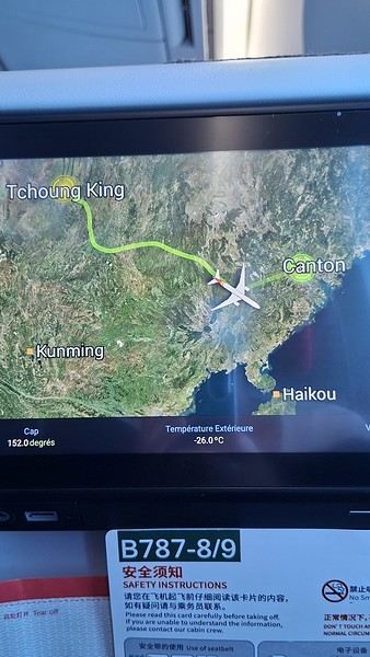
During my first two trips to China, we paid for everything in cash, but this time, we’re going all-in on Alipay and WeChat. I still brought the leftover change from previous trips—it might come in handy. At the metro station, they showed us a QR code to buy tickets via WeChat. There were probably machines and even a ticket counter, but we didn’t see them, and buying via WeChat was pretty simple. 8 yuan to Changshu Lu, which is 22 stops. So far, so good. Then, we had to find the hotel, which wasn’t on Google Maps, Maps.me, or Amap... Easy 😎! We found it without too much hassle, though. Dropped off our stuff and went out to eat. 55 yuan for two claypots with fish/eel, rice, cabbage, and purple eggplant. When we left, it was pouring. We grabbed our umbrellas and set off to explore the neighborhood: Enning Road (we’ll come back later to check out a specific spot), Shangxiajiu (the pedestrian shopping street), Baohua Road... The area is pretty diverse—one street to the next, it’s like stepping into a different world.

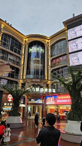
There weren’t many people around, probably because of the rain. We grabbed a quick street food dinner and went to bed—we were exhausted. We struggled to stay awake until 11 PM to adjust to the time change as quickly as possible. There’s a 6-hour time difference.
There wasn’t much room for improvisation on this trip—everything was planned in advance. Since August is peak season, I decided to book train tickets early, and once that was set, I reserved all the accommodations too. I got everything on Trip.com.
I bought the flight tickets back in March from Hainan Airlines. They were super expensive, but with these travel dates, I couldn’t exactly dream of a bargain!
I picked up e-SIMs valid for a month from Free just before departure: 10 € for the e-SIM + 19.90 € for a one-month plan with 35 GB of data abroad.
No need for a VPN with these e-SIMs, but D. still got one—a multi-device plan for 5 € with a discount from Let’s VPN, valid for a month. It was for evenings at the hotel on Wi-Fi to avoid burning through the 35 GB with video.
I downloaded Alipay, WeChat, Amap (Baidu Maps), and Trip.com. We also have Google Translate and Maps.me—absolute must-haves.
We’re ready to go!
I’ve been waiting for this day for nearly 15 years!! I travel a lot, but this one—this is MY TRIP 🙂 It’s been postponed so many times: because I wanted to do it with the right person, because I have a Turkish stamp in my passport and heard they don’t issue visas with that, because of COVID... and then China introduced a 30-day visa exemption, and that was the green light! Ugh, they forced us to take our vacation in August this year—far from ideal—but no more delays. Saturday, August 2, 2025: it’s finally the big day!
Days 1 and 2: We got dropped off at Charles de Gaulle at 9:30 AM. I supposedly checked in online, but only for the first flight and without getting the boarding pass... Might as well scrap online check-in in that case. So, we spent over an hour in line at the counter to get them. We didn’t have any checked luggage—just our backpacks as carry-ons—so this was a step we’d never had to deal with before, but whatever, it’s done. No wait at passport control, 5 minutes through security, a quick walk around the terminal, 10 minutes in the boarding area, and it was already time to board. Departure around 12:45 PM, arrival in Chongqing at 4:50 AM. We had a few hours of layover before our next flight. Went through immigration, connecting flight control, and security. Pro tip: check your next flight’s boarding gate right after immigration. We never saw it displayed again anywhere in the terminal.
The Free e-SIMs work—phew!
Took off at 9:30 AM, arrived in Guangzhou (Canton) at 11:20 AM in the rain. I love how Chongqing is translated as "Tchoung King" on the screens in the plane—very French!
During my first two trips to China, we paid for everything in cash, but this time, we’re going all-in on Alipay and WeChat. I still brought the leftover change from previous trips—it might come in handy. At the metro station, they showed us a QR code to buy tickets via WeChat. There were probably machines and even a ticket counter, but we didn’t see them, and buying via WeChat was pretty simple. 8 yuan to Changshu Lu, which is 22 stops. So far, so good. Then, we had to find the hotel, which wasn’t on Google Maps, Maps.me, or Amap... Easy 😎! We found it without too much hassle, though. Dropped off our stuff and went out to eat. 55 yuan for two claypots with fish/eel, rice, cabbage, and purple eggplant. When we left, it was pouring. We grabbed our umbrellas and set off to explore the neighborhood: Enning Road (we’ll come back later to check out a specific spot), Shangxiajiu (the pedestrian shopping street), Baohua Road... The area is pretty diverse—one street to the next, it’s like stepping into a different world.
There weren’t many people around, probably because of the rain. We grabbed a quick street food dinner and went to bed—we were exhausted. We struggled to stay awake until 11 PM to adjust to the time change as quickly as possible. There’s a 6-hour time difference.
Travelers are changing their habits as the climate deteriorates
Hi everyone.
Not sure if guidebooks, agencies, and other tour operators are keeping up by changing their visiting hours and offerings.
Personally, I see a promising opportunity here—jumping on this adaptation to extreme climates before others do, since they’re inevitably coming.
From my own travel experience, I’ve met a few guides so far who are starting to adjust, like in Egypt, Kenya, Senegal, and elsewhere.
They avoid crowds and the hottest hours by starting their tours around 6–7 AM, when it’s cooler.
Yeah, you’ve gotta wake up early, but the payoff is so worth it. 😴
If you’ve got any great tips like this, why not discuss them in this thread and share addresses or websites where the people in charge have realized climate change is real and are adapting? 😊
Off on an adventure to Java (and a bit of Bali)
Hey there, community! Back this weekend, below is my travel journal from my adventure in Indonesia. Enjoy the read!!!
Day 1 - August 10, 2025 New life downloading for three weeks! And for that, Flo and I launched a public tender... A public tender? What’s that got to do with a travel journal???... Well, when you think about it, few destinations tick all the boxes for an August adventure: Meaning, finding a place that’s exotic in the middle of August, not too expensive, not too packed with tourists, warm but not *too* warm, with postcard-perfect landscapes, dreamy beaches, tasty cuisine with a hint of exoticism, friendly and welcoming locals, where you’re free to sleep under the stars among the mosquitos, take transport surrounded by chickens, and even eat from a pig trough if you feel like it—well, turns out it’s not that easy to find! I’d even say, given how thick the list of requirements is, there’s a big risk the tender could be declared unsuccessful for failing to meet just one criterion. Let’s just say the candidates better submit a rock-solid proposal!
After reviewing all the responses and presentations from the candidates, the obvious choice for us is... Indonesia! Except that trying to explore a country as vast as Indonesia and its 17,504 islands in less than five years is a bit like reading the summary of a Proust novel without taking the time to savor each of its 950 pages! Don’t worry, I won’t name them all here. Besides, do they even all have names? No! Only 7,870 have been named—their parents clearly ran out of ideas for the rest. Anyway, our society, which worships the "work more to earn more" mantra, unfortunately limits our adventure time. So we’ll only get to see a small part of Indonesia, and we’ll have to make a tough choice to head for the best of the best in this archipelago of over seventeen thousand islands. Each one has its own selling points: Sumatra, Sulawesi, Java, the Celebes, Bali, Borneo, Papua, Timor, the Moluccas... So many names that smell of adventure... Another tender, another list of requirements, another review of proposals... Drumroll... Splash splash... And the lucky winner is... Ta-da... Java, Bali’s big sister, where I’ve already been eight years ago... Java the programming language. The Java of Broadway. We’re gonna *do* the Java. Java the coffee. And yes, Java is also an island!
This island, four times smaller than France, is home to 136 million people, making it the most populated island in the world! Fun fact: Indonesia, with its 260 million inhabitants, is just shy of the podium for the world’s most populated countries, after the winning trio of India, China, and the United States. And it’s on this island of Java that you’ll find Jakarta, the (soon-to-be-former) capital and main airport of the country, where we’ll soon land after our nineteen-hour flight! Yep, nineteen hours! I mean, Indonesia in general—and Java in particular—is a *tad* farther than going on vacation to Grandma Yoyo’s! Not sure where it is? Easy. Grab a map. Plant your finger on the big island at the bottom right—aka Australia for those who struggle with geography—move it up two centimeters, and bam, welcome to Indonesia!
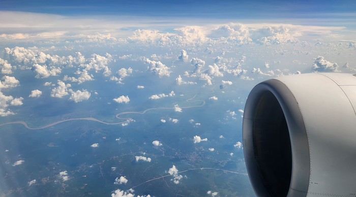
Nice transition, right? Because "Welcome to Indonesia" is exactly what the friendly flight attendant just said to me as we got off the plane! That’s it, our chakras are open, we’ve arrived at our (air)port. Time for rest, pool, cocktails, and a beach with our toes spread out... Wait, if you bought that, you clearly don’t know us yet! Since we still have energy to burn and need to adjust to the flight and time difference, we tackle the long administrative formalities to enter Indonesia, just to earn the right to hop in a 45-minute Grab taxi to the train station. The train station? What train station?... What do you usually do at a train station? Take a train, of course! Off we go for a three-hour train ride to Bandung, where we’ll officially start our adventure tomorrow after our first Indonesian night...
Unfortunately, we were a bit slow off the mark, which meant we missed the 6:25 PM train by two minutes. Oh well, we’ll have to wait until 11 PM. We take the opportunity to stretch our legs in Jakarta, soak up the atmosphere, and enjoy the delicious smells wafting from the *warungs*—those little typical street restaurants. A quick stop at the National Monument, a detour to a night market to devour our first *kwetiaw goreng* and *teh manis* for 60,000 rupiahs (that’s 3 € for two), and just like that, our penalty is lifted, and we’re allowed to hit the road again. Off to Bandung, where we arrive at 2 AM for... a *very* short night...
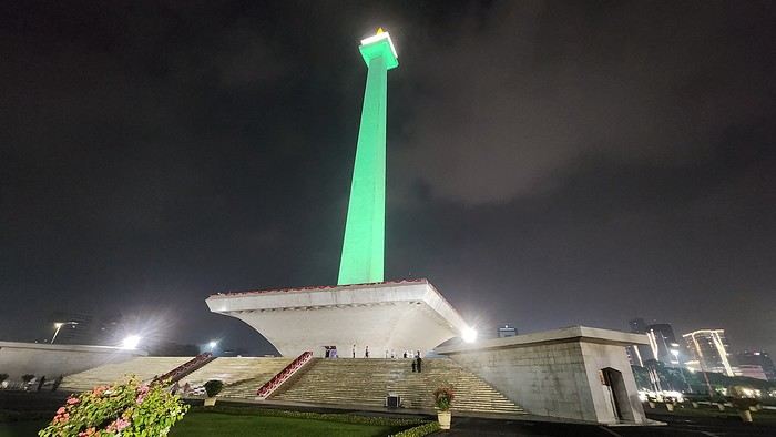
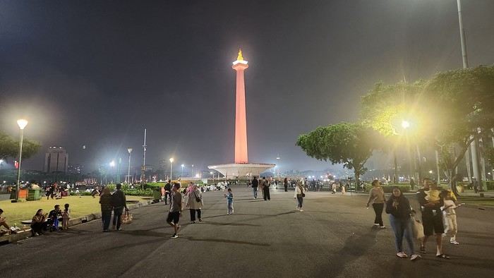
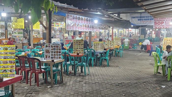
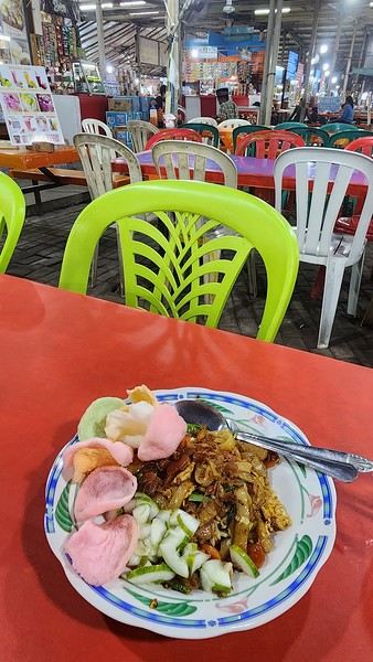
Day 1 - August 10, 2025 New life downloading for three weeks! And for that, Flo and I launched a public tender... A public tender? What’s that got to do with a travel journal???... Well, when you think about it, few destinations tick all the boxes for an August adventure: Meaning, finding a place that’s exotic in the middle of August, not too expensive, not too packed with tourists, warm but not *too* warm, with postcard-perfect landscapes, dreamy beaches, tasty cuisine with a hint of exoticism, friendly and welcoming locals, where you’re free to sleep under the stars among the mosquitos, take transport surrounded by chickens, and even eat from a pig trough if you feel like it—well, turns out it’s not that easy to find! I’d even say, given how thick the list of requirements is, there’s a big risk the tender could be declared unsuccessful for failing to meet just one criterion. Let’s just say the candidates better submit a rock-solid proposal!
After reviewing all the responses and presentations from the candidates, the obvious choice for us is... Indonesia! Except that trying to explore a country as vast as Indonesia and its 17,504 islands in less than five years is a bit like reading the summary of a Proust novel without taking the time to savor each of its 950 pages! Don’t worry, I won’t name them all here. Besides, do they even all have names? No! Only 7,870 have been named—their parents clearly ran out of ideas for the rest. Anyway, our society, which worships the "work more to earn more" mantra, unfortunately limits our adventure time. So we’ll only get to see a small part of Indonesia, and we’ll have to make a tough choice to head for the best of the best in this archipelago of over seventeen thousand islands. Each one has its own selling points: Sumatra, Sulawesi, Java, the Celebes, Bali, Borneo, Papua, Timor, the Moluccas... So many names that smell of adventure... Another tender, another list of requirements, another review of proposals... Drumroll... Splash splash... And the lucky winner is... Ta-da... Java, Bali’s big sister, where I’ve already been eight years ago... Java the programming language. The Java of Broadway. We’re gonna *do* the Java. Java the coffee. And yes, Java is also an island!
This island, four times smaller than France, is home to 136 million people, making it the most populated island in the world! Fun fact: Indonesia, with its 260 million inhabitants, is just shy of the podium for the world’s most populated countries, after the winning trio of India, China, and the United States. And it’s on this island of Java that you’ll find Jakarta, the (soon-to-be-former) capital and main airport of the country, where we’ll soon land after our nineteen-hour flight! Yep, nineteen hours! I mean, Indonesia in general—and Java in particular—is a *tad* farther than going on vacation to Grandma Yoyo’s! Not sure where it is? Easy. Grab a map. Plant your finger on the big island at the bottom right—aka Australia for those who struggle with geography—move it up two centimeters, and bam, welcome to Indonesia!
Nice transition, right? Because "Welcome to Indonesia" is exactly what the friendly flight attendant just said to me as we got off the plane! That’s it, our chakras are open, we’ve arrived at our (air)port. Time for rest, pool, cocktails, and a beach with our toes spread out... Wait, if you bought that, you clearly don’t know us yet! Since we still have energy to burn and need to adjust to the flight and time difference, we tackle the long administrative formalities to enter Indonesia, just to earn the right to hop in a 45-minute Grab taxi to the train station. The train station? What train station?... What do you usually do at a train station? Take a train, of course! Off we go for a three-hour train ride to Bandung, where we’ll officially start our adventure tomorrow after our first Indonesian night...
Unfortunately, we were a bit slow off the mark, which meant we missed the 6:25 PM train by two minutes. Oh well, we’ll have to wait until 11 PM. We take the opportunity to stretch our legs in Jakarta, soak up the atmosphere, and enjoy the delicious smells wafting from the *warungs*—those little typical street restaurants. A quick stop at the National Monument, a detour to a night market to devour our first *kwetiaw goreng* and *teh manis* for 60,000 rupiahs (that’s 3 € for two), and just like that, our penalty is lifted, and we’re allowed to hit the road again. Off to Bandung, where we arrive at 2 AM for... a *very* short night...
The Most Read Travel Journals on VoyageForum
I briefly set out to tally things up, having asked myself the same question, and here are some figures and my thoughts on the travel journals that have seen the greatest success over more than 22 years—the first one was posted on 04/17/2003.
Before sharing the TOP 25, I notice that the United States of America seems to have sparked the most interest among readers: 11 out of the 25 most read. The American dream is still very much alive. With passionate travelers, too, since there are often many participants (quite chatty ones), which significantly boosts the number of views. Since VF was hosted in Canada, maybe there’s also a fair number of Canadian readers adding to that?
Asia comes in second with 8 journals, confirming the appeal of these destinations. We also see 4 Europe-related journals in this best-of.
The numbers are undeniable, but they should be put into perspective. For example: - A journal published a long time ago has a better chance of being widely read than a more recent one. - A journal published all at once will get fewer visitors than one published over 30 days, recounting a month-long trip. - Some journals have renewed readability because their author or readers add information or comments.
You could also say that a journal with 5,000 views about Ireland or Iceland, for instance, doesn’t fall short compared to those about a more popular destination like the U.S., which might have tens of thousands of views.
Personally, I regret the absence from the ranking of journals I admired—both very well-written and featuring stunning photos. On the other hand, the presence of some journals in the most-read list is quite puzzling to me.
Three distinct periods stand out: - The 2000s. It took some time for the site to become known and for word-of-mouth to spread. Back then, some people, especially older travelers (who are more likely to both travel and publish journals on VF), didn’t even have internet yet. Plus, many journals from that era had few or no photos, which doesn’t attract some readers. - The early 2010s. There was probably a peak, an optimal moment, with the site being more well-known and visible, and a generation of travelers ready to share and help. With few exceptions, all the most-read journals date from 2006 to 2016. - From the late 2010s onward, there may have been a turning point. Fewer people enjoying (or knowing how to) read, more people moving to various social media platforms for their immediacy and ease?
I’m not unhappy to be in 26th place with my 2013 journal about a part of southern Thailand. I owe it largely to the photos of the adorable langur monkeys and the messages from all those who went to see them thanks to me. Those were good times that will be hard to relive.
Before sharing the TOP 25, I notice that the United States of America seems to have sparked the most interest among readers: 11 out of the 25 most read. The American dream is still very much alive. With passionate travelers, too, since there are often many participants (quite chatty ones), which significantly boosts the number of views. Since VF was hosted in Canada, maybe there’s also a fair number of Canadian readers adding to that?
Asia comes in second with 8 journals, confirming the appeal of these destinations. We also see 4 Europe-related journals in this best-of.
The numbers are undeniable, but they should be put into perspective. For example: - A journal published a long time ago has a better chance of being widely read than a more recent one. - A journal published all at once will get fewer visitors than one published over 30 days, recounting a month-long trip. - Some journals have renewed readability because their author or readers add information or comments.
You could also say that a journal with 5,000 views about Ireland or Iceland, for instance, doesn’t fall short compared to those about a more popular destination like the U.S., which might have tens of thousands of views.
Personally, I regret the absence from the ranking of journals I admired—both very well-written and featuring stunning photos. On the other hand, the presence of some journals in the most-read list is quite puzzling to me.
Three distinct periods stand out: - The 2000s. It took some time for the site to become known and for word-of-mouth to spread. Back then, some people, especially older travelers (who are more likely to both travel and publish journals on VF), didn’t even have internet yet. Plus, many journals from that era had few or no photos, which doesn’t attract some readers. - The early 2010s. There was probably a peak, an optimal moment, with the site being more well-known and visible, and a generation of travelers ready to share and help. With few exceptions, all the most-read journals date from 2006 to 2016. - From the late 2010s onward, there may have been a turning point. Fewer people enjoying (or knowing how to) read, more people moving to various social media platforms for their immediacy and ease?
I’m not unhappy to be in 26th place with my 2013 journal about a part of southern Thailand. I owe it largely to the photos of the adorable langur monkeys and the messages from all those who went to see them thanks to me. Those were good times that will be hard to relive.
I Tried Nordic Power Walking (in the Cévennes, France) with Poles
Hi everyone.
I’ve been doing brisk walking every day for years (an hour every morning at dawn) through forests, along rivers, on trails, tracks, and pavement. I wanted to try Nordic walking, so I bought the poles (apparently, they work your abs extra). I lasted 5 days 😄 And I’m stopping because, for me, it’s incompatible with how I combine sport and wildlife. I tried all the tips (rubber and steel), and they all make a racket that scares off every animal 😅
I get that some athletes go from point A to point B without paying attention to what’s in between, but that’s not me. I love intense exercise, but whenever something’s beautiful, I stop to enjoy it for a few moments (same when I spot an animal). With the poles, it’s impossible—they’re too noisy, even if you don’t press hard.
Oh well, I wasted 20 € on this purchase (though they might come in handy for scrambling, for example).
Anyway, for the brisk walking I do, the poles I totally mastered by the second day (syncing the movement) actually slow me down. Plus, it’s annoying to hear that constant noise in a dreamy landscape when my shoes barely make a sound. And on roads (pavement), they make all the dogs in their houses bark 😅
As for working the abs, brisk walking without poles lets you engage your core if you want, so it works those muscles too.
Into the bin go my poles and their tips, already dead after 5 days (long live wildlife and nature!) 🤘
I’ve been doing brisk walking every day for years (an hour every morning at dawn) through forests, along rivers, on trails, tracks, and pavement. I wanted to try Nordic walking, so I bought the poles (apparently, they work your abs extra). I lasted 5 days 😄 And I’m stopping because, for me, it’s incompatible with how I combine sport and wildlife. I tried all the tips (rubber and steel), and they all make a racket that scares off every animal 😅
I get that some athletes go from point A to point B without paying attention to what’s in between, but that’s not me. I love intense exercise, but whenever something’s beautiful, I stop to enjoy it for a few moments (same when I spot an animal). With the poles, it’s impossible—they’re too noisy, even if you don’t press hard.
Oh well, I wasted 20 € on this purchase (though they might come in handy for scrambling, for example).
Anyway, for the brisk walking I do, the poles I totally mastered by the second day (syncing the movement) actually slow me down. Plus, it’s annoying to hear that constant noise in a dreamy landscape when my shoes barely make a sound. And on roads (pavement), they make all the dogs in their houses bark 😅
As for working the abs, brisk walking without poles lets you engage your core if you want, so it works those muscles too.
Into the bin go my poles and their tips, already dead after 5 days (long live wildlife and nature!) 🤘
Cantal—have you heard of it?
...
After Southern Tanzania, I’m sharing a travel story about the Cantal region with you...
...
For us, at the start of 2025, Le CANTAL was a true “Terra Incognita”!!
After seeing some tempting TV reports, we decided to fill this gap—especially in terms of landscapes. On the same trip, we’ll also head to the Arcachon Basin, the International Seaplane Gathering in Biscarrosse, and my native Landes region...
So, on May 20th, we left Marseille in the rain and thunder, heading toward Nîmes, Saint-Hippolyte, Mont Aigoual, Florac, and stopping in Marvejols to give my arthritic back a break for the night.
The next morning, we decided to revisit the Parc aux Loups du Gévaudan (Europe’s largest wolf park). As someone used to photo safaris in the wilds of East Africa, I’m not a fan of zoos at all—but I *do* have a deep admiration for wolves!!
Since it’s pretty unlikely I’ll ever see one in the wild, I’ll settle for this Parc aux Loups in Marvejols. This will be our third visit to this incredible gathering of these fascinating canines.
Some are still finishing their chilly night...
...
After Southern Tanzania, I’m sharing a travel story about the Cantal region with you...
...
For us, at the start of 2025, Le CANTAL was a true “Terra Incognita”!!
After seeing some tempting TV reports, we decided to fill this gap—especially in terms of landscapes. On the same trip, we’ll also head to the Arcachon Basin, the International Seaplane Gathering in Biscarrosse, and my native Landes region...
So, on May 20th, we left Marseille in the rain and thunder, heading toward Nîmes, Saint-Hippolyte, Mont Aigoual, Florac, and stopping in Marvejols to give my arthritic back a break for the night.
The next morning, we decided to revisit the Parc aux Loups du Gévaudan (Europe’s largest wolf park). As someone used to photo safaris in the wilds of East Africa, I’m not a fan of zoos at all—but I *do* have a deep admiration for wolves!!
Since it’s pretty unlikely I’ll ever see one in the wild, I’ll settle for this Parc aux Loups in Marvejols. This will be our third visit to this incredible gathering of these fascinating canines.
Some are still finishing their chilly night...
...
Facebook Travel Groups vs. Travel Forums
Hi there, I’m not quite sure how to introduce this topic...
Let’s just say that since Covid—and the shutdown of VF—Facebook travel groups have exploded, while travel forums (VF or Le Forum du Routard) are much less active than they used to be.
And that’s where I realize (maybe it’s just my impression) that the average traveler seems to need assistance with *every* little detail... When I look at the questions posted in travel groups on social media—oh my goodness, we’re really not in the same traveler universe. You might think I’m being harsh, even condescending toward the overwhelming majority of travelers, but at the end of the day, travel forums still inspire way more and are much more geared toward long-term travelers, those who set off on adventures, who have the traveler’s soul—rather than those asking what clothes to pack for Bogotá or whether the weather will be nice in Mexico from April 18 to 30...
I’m just noticing that travelers who have the time and love to improvise their trips are becoming really rare...
For a travel aficionado like me, it’s kind of sad to see such a demand for hand-holding... but I guess it fits with our times.
There, I said it!
Let’s just say that since Covid—and the shutdown of VF—Facebook travel groups have exploded, while travel forums (VF or Le Forum du Routard) are much less active than they used to be.
And that’s where I realize (maybe it’s just my impression) that the average traveler seems to need assistance with *every* little detail... When I look at the questions posted in travel groups on social media—oh my goodness, we’re really not in the same traveler universe. You might think I’m being harsh, even condescending toward the overwhelming majority of travelers, but at the end of the day, travel forums still inspire way more and are much more geared toward long-term travelers, those who set off on adventures, who have the traveler’s soul—rather than those asking what clothes to pack for Bogotá or whether the weather will be nice in Mexico from April 18 to 30...
I’m just noticing that travelers who have the time and love to improvise their trips are becoming really rare...
For a travel aficionado like me, it’s kind of sad to see such a demand for hand-holding... but I guess it fits with our times.
There, I said it!
Travel companion for a world cycling tour in 2028
Hi everyone,
I’m planning a round-the-world cycling trip and I’m looking for a travel companion. I’m aiming to set off in 2028 (so we’ve got time to get to know each other). The philosophy behind this long-term journey—spanning several years (at least 3)—is camping and as much self-sufficiency as possible. For me, this’ll be the last trip I take (I’ll be 67 and finally retired). As a result, I plan to visit a ton of places.
If you’re interested, more info by email.
Lake Bourget: The Parachuting Nightmare
If you're walking around the southern part of Lake Bourget, you can't escape the noise from a parachuting club's planes. A group of climate skeptics actually takes off in small, very noisy aircraft every 15 minutes over a Natura 2000 classified area. They don’t seem to face any restrictions—neither for noise nor for greenhouse gas emissions. They occupy the airspace without paying fuel taxes or providing carbon compensation to local municipalities or environmental preservation associations, apparently. It sounds surreal, but it’s very real in such an important location.
Namibia Travel Journal: May 2025 - Trip Review
NAMIBIA TRIP 2025: April 24 to May 20: Feel free to comment or ask us any questions about this amazing journey.
>> Find all our photos and videos for each day on our website here: www.montagne-aventure.net
**DAY 1: Thursday, April 24, 2025: Outbound Flights from Lyon to Windhoek via Munich - Visit to Munich:**

Off we go on a new adventure. The alarm rings at 6:30 AM, the travel bags are packed, and we head to Lyon Airport. We booked our flight tickets with Lufthansa. The first leg to Munich, Germany, is operated by AirBaltic. Departure at 1:05 PM for a 1-hour and 20-minute flight. We arrive at 2:30 PM.
**We now have a 7-hour layover, so we take the opportunity to get some fresh air and explore Munich.** We quickly exit Terminal 2 of the airport and head towards the subway. We buy a group day ticket "Airport-city Day Zone M-5," valid for 2 to 5 people at a price of 30.50 € (instead of 16.30 € per person). We take the S8 line to **Marienplatz** in 35 minutes. **This is the heart of the city.** The weather is overcast, quite cool, but dry. Perfect for a little city trip between two flights while leaving our large luggage in transit at the airport. **Munich is the third-largest German city after Berlin and Hamburg, in the Bavaria region.** **The center has a lot of charm and brings together several religious buildings, easy to explore on foot.** We are impressed by the number of people enjoying these 100% pedestrian streets, which are very pleasant. After Marienplatz, the most famous square with the town hall, we head to the Cathedral of Our Lady, a Gothic church, then continue to **Karlsplatz** and move on to **the food market offering a wide selection of high-end food products in an atmosphere where a certain art of living prevails.** We also visit St. Peter's Church before grabbing a bite to eat. Two good hours were enough for this 10 km city walk. It's time to take the subway back: by 6:30 PM, we are back at the airport. Now, it's time for a bit of waiting and rest. Our second flight is scheduled for 9:35 PM for a 9-hour and 30-minute journey to our final destination in Namibia: **Windhoek.**
> Round-trip flight tickets with Lufthansa from Lyon: 2029 €, or 1,014.50 € per person.
> Lyon Airport parking: 120 €
> Today's expenses: 7 € for 2 pizzas in France / 14 € for the restaurant in Munich / 30.50 € for the daily subway ticket in Munich.
**DAY 2: Friday, April 25, 2024: Arrival in Windhoek, Visit to the Namibian Capital:**
After a 9-hour and 30-minute overnight flight with Discover Airlines, we finally land on Namibian soil just before 7:30 AM. The day is breaking, and the colors are already stunning. We are eager despite the usual fatigue from the flight. The airline was punctual, with friendly staff and good meals, though a bit light. We are the first flight of the day to land, with no more than 15 flights per day here, from 7 AM to 8 PM. We disembark on the tarmac at this airport located in the middle of nowhere, **I finally set foot on African soil for the first time.** We exit among the first from the aircraft to go through the long formalities at the front of the line, as the wait can quickly become endless. Allow at least 5 minutes per person for e-visas. We still wait 45 minutes despite only about twenty people ahead of us. Phew, it's done. We collect our luggage and then withdraw money from an ATM. We make 4 withdrawals of the maximum amount, 2000 NAD $ per withdrawal, for a total of 380 €, or 95.33 € per withdrawal.
Our driver arrives at the same time, perfect timing, we were quick.
We leave the airport at 8:45 AM. By 9:30 AM, we arrive at the **Gracious Whisp vehicle rental agency**, located at the entrance of Windhoek, small and human-sized with a fleet of recent vehicles. More formalities, then a short wait as our vehicle is not yet ready. Time to decompress, catch our breath, and enjoy the very pleasant morning temperature. Not a cloud in sight. Next, a briefing on the vehicle, always with a bit of apprehension due to our approximate English. Allow 45 minutes of explanations, including setting up the roof tent, camping equipment, technical information in case of a flat tire, driving tips in Namibia, and a tour of the 4x4. We have all the necessary equipment for camping: mattresses, sleeping bags, pillows, table, chairs, gas stove, BBQ grill... as well as 2 spare tires, a compressor, a dual tank, and accessories for removing wheels. Off we go, it's time to muster our courage and get behind the wheel. **Heading to SuperSpar Maerua**, fortunately located less than 10 minutes away. We park with the help of a parking attendant; it's very crowded, the space is narrow, but everything goes well despite the cursed right-hand drive. Today's new mission: stock up on groceries. The store is well-stocked with local and imported products, catering to all tastes. We spend 114 € on groceries, from pasta to meat, BBQ lighters to dishwashing products. Two people load our groceries into two carts and transfer them to our vehicle; we feel compelled to leave a tip, 50 NAD $, as we don't have change yet. Now, we head to the hotel, 15 minutes away. Traffic is difficult at a complicated intersection; this will likely be the only traffic jam in Namibia. **We arrive at Kate's Nest Guesthouse & Backpackers around 1:15 PM, quite tired.** We take some well-deserved rest at this recent establishment, quite calm with secure private parking. After a short nap, we enjoy the quiet by the hotel pool. Night falls between 6:30 PM and 7 PM. We eat quietly in our room tonight before starting this long 4x4 road trip in camping mode in the heart of Namibia.
> Today's grocery expenses: 114 € at Super Spar Marua (2395.21 NAD $).
> Round-trip flight tickets with Lufthansa from Lyon: 2029 €, or 1,014.50 € per person.
> Vehicle rental: 4x4 Toyota with roof tent for 24 days: Gracious Whisp Car Rentals: 2,638 € (N$50,640) or **1,319 €** per person - (https://gwcarrentals.com/)
> Distance driven today: 15 km.
> Accommodation: Kate's Nest Guesthouse & Backpackers - 4 Aristotles Street Academia, 9000 Windhoek - 36 € for two for one night.
> Windhoek International Airport website: (https://www.airports.com.na/)
**DAY 3: Saturday, April 26, 2025: Windhoek to Hardap: Mariental Region - Kalahari Desert:**
After a good, restful night, we wake up leisurely around 7 AM. We enjoy the comfort provided by this first and last hotel before 24 nights under the tent.
**We leave Kate's Nest Guesthouse at 8:30 AM to tackle the Namibian roads.** We quickly leave the capital; in just 30 minutes, we find ourselves almost alone in the world. The landscape is dotted with small domes. We leave the **paved B1** quickly to turn left onto the **C15**. **From there, we won't see more than 10 vehicles all day.** After passing through the few houses of **Lekkerwaterpoort**, we tackle our first gravel road. These road sections are limited to 100 km/h, but even at 70 km/h, I find it already challenging. However, I quickly get used to it and gradually pick up speed to reach my cruising speed of around 80 to 90 km/h. **We are on immense straight lines crossing wild expanses as far as the eye can see.** **We come across two baboons, a few ostriches, and numerous cattle and sheep farms.** We pass through the charming village of **Uhlenhorst** with its typical houses and children with broad smiles waving at us. Life here is already very different from Windhoek. **The thermometer rises quickly from 16°C at 8:30 AM to over 28°C in the early afternoon.**
**We arrive at the Hardap Dam reserve at 2 PM.** We stop at the toll booth at the park entrance to pay the entrance fee: 250 NAD $ for 2 people and 1 vehicle. We continue to the dam and then the camp entrance, located a bit further. We had booked in advance, but this place remains little frequented by foreigners.
We take advantage of the hottest hours to rest by the large pool overlooking the immense lake, a very enjoyable moment. Would this be a bit of a vacation?
Around 4:30 PM, we head to the campsite. We overlook this vast water reserve. We arrive first; we will be only 3 vehicles spending the night here. It's time to get to work and set up our equipment for the first time. It takes us a good 20 minutes to set everything up, with a slight apprehension about unfolding the tent. Once this task is done, which we will have to repeat for almost a month, we will become much more efficient over time. Time for rest and contemplation in total silence. The sun gradually sets, and the heat quickly becomes bearable again. Bliss! **This dam is located 20 km northwest of Mariental in an area dotted with conical hills topped with dolerite buttons (Hardap means "hillock" in Nama). It captures the Fish River, which flows south, creating a large lake in the middle of an arid environment. The contrast is striking.** We enjoy our first sunset facing this 360° otherworldly landscape.
Around 7 PM, we start our first BBQ, or "braai" as it's called here. The temperature is perfect. The sun sets, giving way to a star-filled sky of incredible beauty thanks to the absence of any light pollution. The Milky Way will lull us throughout the evening. After some good sausages and potatoes on the BBQ, we head to our roof tent around 9:30 PM with a complete change of scenery in just 24 hours. France already seems so far away...
This campsite has shared showers and toilets, quite clean and functional, as well as a central area with several BBQs and tables. The sites are arranged in a semicircle, each with an electrical outlet. The sites are close to each other but spacious, some slightly shaded. We are only three vehicles tonight, so it's perfectly comfortable and quiet. Not to mention the large pool near the restaurant. Our trip is off to a great start.
> Today's road itinerary: Windhoek > Head south on the B1 to Rehoboth > Turn left onto the C25 then C15 to Stampriet > C20 to Hardap > Full north on the B1 > Then turn left onto the M93 - 5 hours of driving.
> Distance driven today: 354 km.
> Accommodation: Hardap Recreation Resort - 23.3 € for two - Large pool - GR6W+3M2, Hardap Game Reserve, Mariental, Namibia - (http://www.nwr.com.na/resorts/hardap-resort/)
**DAY 4: Sunday, April 27, 2025: Hardap - Brukkaros Volcano - Keetmanshoop - Quivertree Forest Rest Camp**
Our first night under the tent was very pleasant; the little wind quickly calmed down, giving way to absolute silence. The mattress is decent, more comfortable than some nights in Nepal. The length and width give us enough space for maximum comfort, despite my height (1.91 m). We wake up a little before 7 AM as the sun rises, and the lights dazzle us from the start of the day. We pack up the equipment in 30 minutes, quite easily. Then we enjoy the sun, which warms up quickly while we keep our light fleece on.
At 8:30 AM, **we hit the road again, heading south** to our first stop in **Mariental**. We want to do some shopping at SuperSpar, but once we arrive in the parking lot, a young local is fighting with the supermarket security guards and then threatens to throw stones. We don't want to take any risks right at the start, so despite the baton blows he receives, he doesn't stop. We leave empty-handed but fill up with fuel at the Shell station 1 km further. The price per liter is 21.33 NAD $, we fill our 107-liter tank for 107 €. In Namibia, you get served, and they bring the card machine to the window to pay. It's then customary to leave a tip.
We then take the B1 heading due south on a recently renovated road. Around 11:30 AM, we leave it on our right to take **a wild gravel road, the M98**. Just before **Berseba**, we turn right onto a small track, the **D3904 towards Brukkaros Crater up to a camp at 1588 m altitude**. The track then becomes too bumpy. We stop on the counter-slopes where **a wide panorama unfolds over these immense plains as far as the eye can see**. It's 12:15 PM, time for us to eat a rice and tuna salad facing this landscape.
**We are alone in the world until a vehicle arrives and parks next to us.** A bit of apprehension, 4 men head towards us. It turns out to be 4 shepherds looking for a lost foal. The conversation is pleasant, lost in the middle of nowhere. We find ourselves alone again in this absolute silence. **The heat becomes stifling with a good 30°C**. We get back on the road around 1 PM. Back on the B1, **we continue due south to Keetmanshoop**, which we reach around 3 PM. We stop there to do some shopping for 262 NAD $ (12 eggs, a can of tuna, a can of corn, bread, a soda, and a 5-liter water container), or 12.48 €. Two quite insistent children ask us for money or candy at the store exit, yet we give them a small tip, but they continue to cling to the car. Locals parked next to us tell them to leave us alone. Anyway, we finish the trip to **Quivertree Forest**, 15 km away. We will spend the night in this **pleasant farm run by a German**. Upon arrival, as the day before, and as I suppose in the future, we dive straight into the cool pool to relax after all these kilometers. A bliss. Then we take our 4x4 and choose a spot near these famous trees. After the 33°C this afternoon, once 4 PM passed, the temperature drops again and becomes very pleasant. **We are in the middle of the Kokerboom, one of the most interesting and characteristic plants of hot and arid regions. It's not really a tree but a variant of the aloe plant whose botanical name is Aloe Dichotoma. This Kokerboom has a smooth and thick trunk reaching up to 1 m in thickness and 9 m in height. They bloom for the first time at the age of 20 to 30 years.** The flowers are yellow and reach about thirty centimeters during the season between June and July. **They grow mainly in an environment with a high concentration of black rocks absorbing a large amount of heat (38°C). The rocks also serve to anchor the tree with its tentacle-like roots. It also resists frost. Each is between 200 and 300 years old.**
Around 5 PM, we walk to the farm reception to watch the feeding of **two cheetahs**. Magnificent carnivores taking their time to savor their piece of meat. **Then we return near our campsite to enjoy the sunset among these trees. The colors are sublime, as every evening apparently. A magnificent spectacle with colors evolving from yellow to orange then to pink, before giving way once again to a sky filled with thousands of stars.** Our campsite at Quiver Tree Forest Camp is very comfortable; we have a water supply, a stone table, a small lamp, an electrical outlet, a small tree for shade, and a BBQ that we won't use tonight; we'll cook on gas. The sites are far apart, with some shared facilities scattered around, a very beautiful setting. No reservation possible, no need, just show up directly. **The campsite accommodation for 2 people costs 28 €, including the reserve entrance fee of 5 €**. We finish this second bivouac evening around 9:30 PM, time for some reading and sleep in peaceful silence without wind.
> Today's road itinerary: Mariental > B1 heading south to Brukkaros > At Tses turn right towards Berseba via the M98 > Turn right onto the D3904 > 8 km > Brukkaros Volcano (stop at the lower camp as the track is difficult for 1 hour) > Keetmanshoop > Turn left onto the M29 > Quivertree Forest - 4 hours of driving.
> Distance driven today: 371 km.
> Distance walked today: 6 km.
> Today's expenses: Groceries for 12.48 € (262 NAD $) / Fuel for 107 € (1 liter of diesel for 21.33 NAD $).
> Accommodation: Quivertree Forest Rest Camp, P.O. Box 262, Keetmanshoop, Namibia - BBQ, hot showers, toilets, and electricity - No reservation - Pool - 18 €/Person (N$ 340.00 with park entrance) - (http://www.quivertreeforest.com/)
**DAY 5: Monday, April 28, 2025: Quivertree Forest Rest Camp - Giant's Playground - Keetmanshoop - Fish River Canyon - Canyon Roadhouse:**
After an excellent start to the night, we are woken up by the wind shortly before 6 AM, but the sunrise is not far off. We get up at 6:30 AM to enjoy it. The atmosphere is a bit cooler this morning, but the reward is already here.
The adventure continues. At 7:45 AM, we head towards **Giant's Playground**, 4 km away. We take a 3-kilometer walk through this expanse of blocks and igneous rocks.
We continue south at 8:45 AM, passing through Keetmanshoop again where we do some shopping for 25 €, a big stock-up for a good part of the trip: meats, canned goods, pasta, fruits... At 9:30 AM, we take the B4 to Fish River Canyon.
At 11:30 AM, we arrive at the entrance to the NWR park (350 NAD $ entrance for 2 people and 1 vehicle). The track becomes bumpy immediately upon entering the park. After about ten kilometers, we come upon this landscape carved by nature. In the end, it's well worth the detour. We were at the Grand Canyon in the USA exactly (https://www.montagne-aventure.net/2024/04/29/j21-3-juin-2024-grand-canyon-et-lac-powell/) and can thus confirm that this Fish River Canyon is comparable. We make several stops along the southern flank. **Here, nothing is developed; nature is almost in the wild state.** **With 160 km in length, up to 27 km in width, and a depth of 150 m, it is indeed the second-largest canyon in the world.** The history of the canyon is apparent in its different earth layers and stratification: the antiquity of the place is tangible, and the absence of vegetation is surprising. **It consists of two nested canyons, formed at distinct periods. The first distinct layer of schist, sandstone, and eruptive material surrounding the canyon was formed a few two billion years ago, then transformed due to heat and pressure into more solid rock such as gneiss. The inner canyon, carved more recently by the Fish River, has a depth of 270 m.**
We have a picnic once again alone in the world facing this grand panorama at the **Sulphur Spring View Point**. This is where the hiking trail begins, plunging into this narrow canyon, but it is forbidden to venture there alone without a guide. It's 30°C, but a slight wind makes the atmosphere bearable. At 1 PM, we retrace our steps and continue to the **Main View Point** then to the **Hikers View Point**.
In the south of Namibia, the Fish River Canyon, 160 km long, is a true geological wonder: a canyon nested within another canyon, one of the largest in the world. The first sedimentary layers formed two billion years ago; 500 million years ago, a period of tectonic activity caused these layers to crack and tilt, opening a vast canyon in the Earth's crust. The second canyon, with a depth of 270 m, was carved over time by the passage of the Fish River in this new valley.
At 3 PM, we arrive at our very charming camp for the evening, the **Canyon Road House**. We fill up with fuel right away because tomorrow we have a long day of isolated driving: 55 liters for 1240 NAD $. Then we settle into the campsite we had previously reserved in France. We are assigned site 2, very well set up under a tree with its BBQ and stone table just steps from the pool. We quickly set up the tent and jump straight into the pool for the relaxation moment of the day. As usual, the water is quite cool, but it's a real pleasure. Then we stroll around this Canyon Road House, which recreates the atmosphere of the roadside inns of the 1950s with old car wrecks and vintage gas pumps in a bygone era. **Around 5:45 PM, we start a short walk leading us to the top of a hill overlooking the wide plateau where we are to watch the sunset.**
And finally, to end this beautiful day, it's time for the braai, with grilled sausages and white beans on the evening menu.
> Park entrance: 150 DN/person + 50 DN/vehicle (18 € for two). It is possible to enter at two access points: Hobas in the north and Ai-Ais in the south.
> Today's road itinerary: M29 > Keetmanshoop > B1 > B4 > C12 (track) > After Holoog turn right onto the D601 (C37 track) > Accommodation on our right (stop just to check in before 6 PM) > Continue 30 km (30 minutes of track) to the viewpoints after Hobas where you must pay the entrance fee. Sunset View Point to the left > Return before sunset as the park closes (best lights at sunrise). 3 hours.
> Distance driven today: 228 km.
> Distance walked today: 10 km.
> Today's expenses: 25 € for groceries / 17 € for the Fish River Canyon park entrance / 58 € for fuel.
> Accommodation: Canyon Roadhouse, Gondwana Collection Namibia – 34.4 € for two - Pool - Near Hobas - (http://www.gondwana-collection.com/fr/accommodation/canyon-road-campsite)
**DAY 6: Tuesday, April 29, 2025: Canyon Roadhouse - Orange River - South African Border - Vista Trail - Gondwana Sperrgebiet Park - Aus:**
The night was excellent in this very comfortable campsite. **We wake up to the sound of birds** before the alarm at 6:45 AM. Our little morning routine starts as the sun rises. **A big day of driving awaits us to the South African border. This will be the southernmost point of our journey.** We hit the road at 8 AM via the C37, pass through **Hobas**, then turn onto the D207 to **Aussenkehr.** **We cross a mountainous barrier with some high peaks and perfect cones. The rock varies from orange to pink to black.**
We then cross a lunar desert as far as the eye can see on a giant dome; the track winds through nowhere without meeting anyone for hours. The landscapes are surprising. **We spot several ostriches and a gemsbok.** In the middle of this endless expanse, we come to an improbable intersection and continue right onto the D278.
In the middle of these arid lands, we come across a green zone: a vast vineyard. At 10:30 AM, **we come across a "Road closed" sign, fortunately, a local resident waves us to continue; a bit stressed, we proceed.** We start to follow the beautiful Orange River. On the other side of the bank, just a few meters away, South Africa is there. It is the second-longest river in Southern Africa, after the Zambezi. It flows over 2,000 km to the Atlantic. After passing through narrow gorges, we regain altitude before starting the descent, gently heading back north.
**We now cross and follow the Fish River, which joins the Orange River further south** **along this gorge dating back millennia.** At exactly noon, we take a lunch break by the Fish River, still without meeting a soul in this landscape between greenery and aridity. The temperature here is cooler with a pleasant 23°C on the banks, the perfect spot. **We continue on the track to Rosh Pinah**, where we find a paved road again. **The section along the Orange River and the Fish River was officially closed, but we were able to pass without any issues, avoiding a detour of at least 3 hours.** Phew. We now drive at high speed (limited to 120 km/h) through these vast spaces. We come across many ostriches after the **dozens of monkeys along the Fish River**. Around 3 PM, 3 km after the very small town of **Aus**, we reach **our campsite for the evening at Klein Aus Vista**. A new **small peaceful haven very well set up**. As usual, after checking in at reception, we jump straight into the beautiful pool to get our well-deserved dose of coolness, another good thermal shock that our bodies appreciate. Once this moment of relaxation is over, we take our 4x4 to reach the campsite located a bit higher, set apart at the foot of a hill that overlooks us.
After setting up, **around 5 PM, we head to the Vista Trail to climb to the top of a mountain overlooking the vast plain that surrounds us at 360°**. It takes about 30 minutes to climb. The place is just magical, **the perfect viewpoint to admire the sunset**. **We fully savor the moment. We also spot one of the few wild horses in the world capable of living in the desert.** Their numbers have decreased in recent years due to predation and drought (around 100 to 150). At 7 PM, we return to the camp, time for the braai and preparing the meal in this peaceful little camp.
In the south of Namibia, the Fish River Canyon, 160 km long, is a true geological wonder: a canyon nested within another canyon, one of the largest in the world. The first sedimentary layers formed two billion years ago; 500 million years ago, a period of tectonic activity caused these layers to crack and tilt, opening a vast canyon in the Earth's crust. The second canyon, with a depth of 270 m, was carved over time by the passage of the Fish River in this new valley.
> Today's road itinerary: 5 hours of driving: D324 heading south (track) > turn right onto the C10 (track) > D316 heading south > turn right onto the C13 > In Aus turn left onto the B4 > Campsite via a track on the left.
> Fuel station: Solitaire or Aus.
> Distance driven today: 398 km.
> Distance walked today: 7 km.
> Accommodation: Klein-Aus Vista Desert Horse Campsite - Farm Klein-Aus No 8 on the B4 main road to Luederitz Aus 9000, Aus, Namibia - (http://www.klein-aus-vista.com/accommodation/desert-horse-campsite/) 17908 420 DN - Water + Shared shower (hot water). No electricity.
**DAY 7: Wednesday, April 30, 2025: Aus - Kolmanskop - Diaz Point - Luderitz - Kanaan Desert:**
We wake up around 6:45 AM, with partly cloudy weather for once; we feel the ocean's influence gradually. But the sun isn't far off. At 7 AM, we leave the campsite heading west towards Luderitz via the B4. **First stop of the day: Kolmanskop, the ghost town we reach at 8:30 AM**, entry costs 180 NAD $ per person. We discover this **timeless place** in 1.5 hours, moving from building to building amidst violent sand-laden gusts of wind. There's a lot of charm in these different living spaces. **The sand quickly reclaimed the place after this mining town was abandoned.** This was once the headquarters of Consolidated Diamond Mines. It's hard to believe that this former town, where the diamond industry once flourished, had a hospital, a bowling alley, and a theater. The decline in diamond sales after World War II and the discovery of richer deposits put an end to this golden age. By 1956, the town was already completely deserted, and the sand had reclaimed its rights. **These dilapidated buildings swallowed by shifting dunes have something surreal about them.**
At 10:15 AM, we hit the road again **heading to Luderitz, 22 km away**, and first to **Diaz Point** **facing the Atlantic Ocean**. It's a wind-swept peninsula with its characteristic red and white lighthouse. There's a campsite and a coffee shop on site, but the place doesn't inspire rest without shade or shelter from the wind. We return to the city via the D701 track that runs along the ocean, be careful at low tide. We come across **a few fishermen and a fox as well as flamingos.**
We walk through the few streets of the city, much smaller than I imagined, then climb to the **famous little Lutheran church that overlooks the city, the Felsenkirchr.** **The wind blows very strongly here, and the sand is omnipresent, surrounded by the Namib Desert and the southern Atlantic coast.** **A German colonial relic barely touched by the 21st century, Luderitz seems frozen in the past, giving it both a gloomy and a certain charm. In short, it's certainly one of the most incongruous places in Africa.**
At 1:15 PM, just before leaving Luderitz, we do some shopping for 20.50 € and fill up with fuel: 61.50 €, 1290 NAD $ for 61 liters (21.18 $ per liter).
**We return via the B4 to Aus** (paved), **then via rougher tracks**, the C13 then the D707, magnificent as it runs along a mountain range with multiple colors on our right and an endless flat desert on the other side.
To access our campsite for the evening, we must take a **narrow private track for 7 km** on our right to emerge, in this total vastness, at the **isolated Kanaan Desert Retreat on a small hill**. I don't have time today to jump into the pool near the reception; we arrive at 5 PM at 8 small, isolated, and unique sites with a small kitchen, a shower, and a private toilet under a small tarp shelter. **A crazy charm with a unique view...** **This will be my favorite accommodation of this trip. The photos speak for themselves.** We jump into the outdoor shower while savoring the landscape, then prepare our evening braai while enjoying the colors fading, facing this plateau with bushes turning a vivid orange. **A moment that will remain etched for life.** **Savanna atmosphere under a thin emerging moon. Every minute offers different colors. Facing our meal, we have a natural giant screen.**
We end this day contemplating the stars and admire this thin orange moon setting on the horizon (8:42 PM).
**Ghost town just before Luderitz: Kolmanskop** (open from 8 AM to 3 PM - N$ 180 p.p – 9 €). Once, Kolmanskoppe was organized around diamond mining. After finding new, more prolific spots, the town was abandoned and is now a ghost town. The sand and dunes have reclaimed their rights and buried everything humans had built. Houses, train station, bakery, everything has been covered by sand, which passes through the windows, even though they are 1 meter high.
> Today's road itinerary: 5h30: B4 to Luderitz (paved) > Round trip > Kolmanskop on the left > Return via the previous campsite > Then C13 (track) > Turn left D707 (track) > Then track to the right to the campsite.
> Distance driven today: 438 km.
> Distance walked today: 8 km.
> Today's expenses: Groceries at the Spar in Luderitz for 20.50 € / Fuel fill-up in Luderitz for 61.50 €.
> Official Kolmanskop website: (https://kolmanskuppe.com) (open from 8 AM to 1 PM - N$ 180 p.p – 9 €).
> Accommodation: Night at the south of the Namibrand Nature Reserve: Kanaan Desert Retreat – 26.5 € for two - (http://www.kanaannamibia.com/) - Farm 104 Karas 9000 - Sanitary facilities + BBQ + Water + Pool - No electricity - My favorite accommodation of this trip.
**DAY 8: Thursday, May 1, 2025: Kanaan Desert Retreat - Namib Desert - Crossing the Namibrand Nature Reserve – Sesriem Canyon - Elim Dune - Little Sossus Lodge**
After a cooler night than the previous ones with about 10°C, we wake up around 7 AM. We admire, as usual, the sunrise between the desert and the mountains. **The spot from last night was truly perfect, isolated from the world, in total serenity, with a wake-up call to the sound of birds.**
We hit the road a little after 8 AM, heading north via the D707 to Spes Bona, then the gravel road C27 via Betta to Sesriem. **The landscapes roll by and dazzle us.** **We are right in the heart of the Namibrand reserve**, coming across numerous **zebras**, **impalas**, **ruminants that reproduce in large numbers**, and **gemsboks**. At noon, we stop in the shade of a tree to eat. The spot is so romantic facing orange arid mountains and a vast green plateau. **A landscape full of contrasts, timeless and silent.**
**The Namib Desert is the oldest on the planet; its name means "vast arid plain," and it also gave its name to the entire country: Namibia.** The majority of these arid and semi-arid lands dotted with viewpoints are part of the Namib-Naukluft National Park, which covers 23,000 km².
At 1 PM, we enter the Sossusvlei park. We start with the **Sesriem Canyon**, which is 3 km long and 30 m deep. We enter it with a short 1-hour hike into its depths. **It was carved by the Tsauchab River in an agglomerate of sand and pebbles over 15 million years old.** We retrace our steps back to Sesriem, which means "six belts," referring to the number of leather belts (from ox wagons) needed to draw water from the canyon. This remote locality is mainly the gateway to Sossusvlei but offers a gas station and some accommodations. For our part, we sleep 40 km away tonight.
**We then move on to Elim Dune.** It takes about 45 minutes of walking to reach its summit, and the climb is very breath-taking as we progress in the sand where we almost slide back with each step. **A first grand 360° panorama unfolds. The ochre color of the sand contrasts completely with the yellow plain and the brown and black mountains in the distance.**
At 3:15 PM, we start the descent facing Sesriem. We were completely alone once again on this dune. **These Namib dunes are composed of colored quartzite sand, presenting hues ranging from cream to orange and from red to purple. Unlike the ancient dunes of the Kalahari, these move with the wind and adopt distinct, ever-changing shapes.** Star dunes resemble stars seen from above, while transverse dunes, like those on the coast south of Walvis Bay, stand perpendicular to the prevailing southwest wind. The most stable dunes, which thus have the most vegetation, are parabolic dunes, due to the variability of the winds. Longitudinal (seif) dunes measure up to 100 m in height, while barchan dunes, crescent-shaped and predominant at the extreme north of the Skeleton Coast and south of Luderitz, are the most mobile, created by unidirectional winds.
**We get back on the road for 45 minutes to our campsite for the evening, Little Sossus, which we reach at 5 PM**, via C27 then right onto C19. As often upon our arrival, I jump into the cool pool to relax after all this driving, then we proceed to set up the camp. As the day before, the campsite consists of 10 fairly distant sites, with private sanitary facilities and a small roof. We are delighted with this crazy charm. The hot water for our shower is wood-heated: a Namibian lights it every evening around 5 PM.
For a change, or not, the menu features a small BBQ with pork ribs and pasta, facing another sunset, this time with partial cloud cover giving equally splendid colors. Time for a well-deserved rest after long corrugated tracks covered in our 4x4 today.
> Today's road itinerary: 4h45 of driving: Find the D707 and head north (track) > At Spesbona turn left onto the C27 (track) > At Sesriem after entering the park, turn left following View Point Sesriem > Continue 4.5 km to the Sesriem Canyon Parking > Return then head towards Elim Dune > Exit the park then take the D826 > Turn right onto the C19 heading SE > Turn right facing the D854 to the campsite (campsite closes at 7 PM).
> Distance driven today: 272 km.
> Distance walked today: 8 km.
> Today's expenses: Entry to the Sossusvlei Namib-Naukluft Park: 17 € for two (with one car).
> Accommodation: Little Sossus Lodge – 35 € for two - At the junction of the C19 and D854 roads Maltahohe 9000, Maltahohe, Namibia - (http://www.littlesossus.net/) - Pool + Private bathroom + Hot water + Electricity + BBQ + Grocery store (bread to order the day before).
**DAY 9: Friday, May 2, 2025: Little Sossus Lodge - Namib-Naukluft National Park – Sesriem - Sossusvlei - Big Daddy – Deadvlei - Tsauchab River Camp**
Today we start the day early to tackle **the famous dunes of Sossusvlei at first light**. The alarm goes off at 6 AM to leave the camp at 6:45 AM. The wind is blowing quite strongly in gusts this morning, but it only woke us up a quarter of an hour before sunrise. The park opens at 7:15 AM. We start with a small encounter: a friendly **jackal lounging by the roadside.**
We first have to cover the 40 km of track to Sesriem, pay the entrance fee (350 NAD $), and drive 65 km on a paved road this time to reach the **vast salt pan (a lake whose sediments are made of salts) of Sossusvlei**. **It appears amidst the gigantic red dunes that rise on either side. The wind constantly changes the shape of the dunes, as well as their colors, which vary with the light. The setting is breathtaking, giving an impression of immensity and timeless grandeur.**
The paved road ends; the last 4 kilometers become technical and are reserved for 4x4s. Phew, I pass without any problems, though not without stress, switching to L4 mode. **We start the ascent to Big Daddy at 8:45 AM, 325 m of elevation gain in the sand nonetheless.** We climb at an excellent speed despite the strong wind, in exactly 1 hour. At 9:45 AM, we are at the summit of what will remain etched for a long time. The 360° view is simply unimaginable; you have to experience it to believe it. The wind blows violently up there, **it feels like being in the high mountains, on a snow ridge, with a strong transport of sand. The atmosphere is magical.** We start the descent running barefoot in the steep sand.
**We then move on to its neighbor, Deadvlei.** **Here, petrified trees stand in the "vlei" (basin) with their dried branches casting desolate shadows on the white ground. The juxtaposition of the deep blue sky and the towering dunes is captivating.**
We return to the 4x4 parking at 11 AM, the stress rises again for the sandy track passage. We retrace our steps and stop at **Dune 45**.
At noon, we take the opportunity to picnic at the foot of **the beautiful Dune 40**, where there is already no one left. We enjoy the quiet again, well, almost, as the wind remains omnipresent.
At 1 PM, we return to **Sesriem**, where we fill up with fuel (21.15 NAD $ per liter), totaling 1630 for 77 liters (78 €), and do some shopping for 245 NAD $ (two nice pieces of pork, 2 cans, 2 sandwiches for tomorrow, and 1 soda), which is 12.48 €. It's 27°C. We hit the road again, heading to a new destination at 2 PM. We take the C19 back to Little Sossus where we spent the night, then turn left onto the gravel road D854 for about 40 km to **Tsauchab River camp**. Finally, we won't be sleeping here; we are redirected 7 km downstream to **Naukluft View Camp**, which also belongs to Tsauchab River Camp.
We arrive at 4 PM, and thankfully, the fatigue was starting to set in. **Our campsite is located under a small forest, providing some protection from the wind that blew strongly all day. The calm does us a world of good. Once again, a lot of charm**, with very spaced-out sites without any visibility. We can't wait to take our shower. It will be possible from 5 PM with, as the day before, water heated by a wood fire. Time to prepare the campsite for the night. And on the menu, a braai with two superb pieces of pork bought in Sesriem and fries!!!!
**The Namib Desert**
An impressive coastal desert stretching from the Atlantic to a high plateau inland, the narrow Namib Desert runs along the southwest African coast for about 1,300 km. **Considered one of the oldest deserts in the world**, it is bordered to the north by the Kaokoland Desert, which extends into Angola, and to the south by South Africa's Karoo. The narrow Namib is mostly less than 160 km wide. Despite this, it is considered to consist of three sections: the coastal strip influenced by the Atlantic; the Outer Namib, occupying what remains of the western half; and the Inner Namib, comprising the eastern half of the desert. Generally called the Skeleton Coast, the coastal Namib receives almost no rain and depends on regular marine fogs for moisture. From sea level, the terrain rises to 900 m, where the desert meets the base of the Great Escarpment to the east. In the Inner Namib, average annual rainfall is only about 50 mm.
The dryness is such a characteristic of the Namib that it is thought to have been in this arid state for at least 55 million years. It is all the more surprising to learn that animals such as vipers, geckos, zebras, and elephants live in this desert. Some areas of the Namib are also rich in flora, including Welwitschia mirabilis, which grows near the ground with seemingly exhausted leaves, extracting moisture from marine fogs and can live over 1,000 years. In the southern Namib, some dunes are up to 32 km long and 240 m high.
**The frequent fog of the Skeleton Coast:** Driving north along the coast of Namibia, the cold Benguela Current in the Atlantic cools the moist air above the ocean, which, upon meeting the warm desert air, leads to the formation of thick fog banks that drift up to 100 km into the center of the Namib before evaporating under the sun.
> Today's road itinerary: 4 hours of driving: C19 towards Sesriem (track) > D826 (paved) > Foot of Big Daddy via a technical sandy track > Return via the same route > D854 to Tsauchab.
> Gas station: Sesriem.
> Distance driven today: 254 km.
> Distance walked today: 12 km.
> Today's expenses: Park entry at Sesriem for 2 people: 17 € / Fuel fill-up: 78 € / Groceries at Sesriem gas station: 12 € (245 NAD $).
> Accommodation: Tsauchab River Camp - Naukluft View Camp - D054 & D850 GPS: S24 26' 37" E16 10' 11" Sossusvlei 22007, Maltahohe, Namibia - BBQ + Private sanitary facilities + Water - www.tsauchab.com
**DAY 10: Saturday, May 3, 2025: Tsauchab River Camp - Naukluft National Park - Olive Trail Hike (10 km) - Ababis Guest Farm**
We pack up the camp at 8 AM and continue our road trip north via the D854, a bumpy track with many corrugated sections. It's cool this morning, 12°C.
**We enter the Naukluft massif, discovering landscapes with very different terrain than before.** We first need to check in at the campsite, 13 km from the entrance at the end of the track: 350 NAD $ for 2 people and 1 vehicle, then return 4 km back. **On the agenda is the lovely Olive Trail, a 10 km hiking loop that starts 4 km northwest of the park office**, along the D854 that we follow. At 9:45 AM, the hike begins with a fairly steep ascent (about 45 minutes) among the **wild olive trees** from which the trail gets its name. **At the summit, we enjoy a view that embraces the Naukluft Valley.** We then turn east and gradually descend into a deep valley, passing over sometimes slippery rocks. We have a snack around 11:30 AM in these small gorges. **Further on, to cross the wall of a canyon in front of us, some chains are fixed to the rock to help us pass.** We finish this superb loop clockwise at 1:15 PM, taking 3.5 hours including 30 minutes of breaks. We only crossed a small group of 3 people on this wild adventure far from everything. At 1:45 PM, we exit the park and take the **D854 track north to Bullsport**. From there, we turn left and take the C14, which **runs along the bed of the Tsondab River.**
**We arrive at our campsite for the evening, Ababis Guest Farm, at 3 PM.** Quite early for once, allowing us to rest a bit in this peaceful farm where many sheep wander around us. We also enjoy the pool under a magnificent sun, less hot than the previous days, it's 22°C. The camp has only 4 spaced-out sites around shared sanitary facilities. **We are in the middle of a vast plain facing the Naukluft massif mountains.** We will have another beautiful sunset on these mountains. For the first time on this trip, **we will be completely alone at this campsite.** **We haven't encountered many people today**, just 3 during the hike and fewer than 10 vehicles all day.
> Today's road itinerary: Head north on the D854 (track) > Turn left to enter the Naukfluft National Park > Continue on the track then turn right to the Olive Trail hike parking lot (1 hour for 45 km). Return to the D854 and continue north > At Bullsport turn left onto the C14 to Ababis (still a track) > The camp is located on the left facing the D1261 (1 hour for 60 km from Olive Trail). Total: 2 hours of driving for 100 km.
> Gas station: No gas station on the route, except in Solitaire.
> Distance driven today: 115 km.
> Distance walked today: 13 km.
> Accommodation: Ababis Gaestefarm - Night booked by email – payment on site: (https://www.ababis-gaestefarm.de/) - P.O.Box 1004, Maltahöhe - N$ 300.00 per person
**DAY 11: Sunday, May 4, 2025: Ababis Gaestefarm - Namib-Naukluft National Park – Solitaire - Gaub Pass - Kuiseb Canyon - Moon Landscape - Walvis Bay**
The night was, for the first time since the start of this road trip, quite difficult. A strong wind accompanied us all night, making the tent flap constantly. A racket that drove us crazy. We still managed to sleep a few hours. The morning sun brings back our smiles. We hit the road for this new stage a little before 7:45 AM.
We start the day with a first stop less than 15 km away **on the C14 in Solitaire** at 8:15 AM. **This town is lost in the middle of nowhere with its small gas station with a western atmosphere adorned with rusted and sand-covered car wrecks.** After a quick supply stop: 86 NAD $, or 4 € for 1 water container and a box of cookies, we continue north still on the C14, **crossing the Tropic of Capricorn** then devouring this **magnificent track up to Gaub Pass**. **A succession of narrow gorges, turns, climbs, and descents breaking the monotony of the previous long straight lines.** We are right in the heart of no man's land for 200 km. We then start the descent to the **Kuiseb Canyon. It houses the wide bed of the eponymous river, dry almost all year.** Even when it flows for 2 to 3 weeks during the rainy season, it doesn't go beyond Gobabeb and then seeps into the sand. **The drinking water that supplies Walvis Bay is pumped at Rooibank from this underground water table.** **We now cross the Kuiseb Desert where impressive dunes roll down.** We make a short stop at a **natural rock arch** reminding us of our (https://www.montagne-aventure.net/2024/04/29/j19-1-juin-2024-canyonlands-national-park-et-arches-national-park/). Then we gradually descend towards **Walvis Bay** where we will spend the night. At noon, we enter the **Dorob National Park**. The thermometer drops 10°C in 10 minutes as we get closer to the Atlantic Ocean.
At 12:45 PM, much earlier than initially planned, we arrive at the **Moon Landscape** (View Point 4, free) to have a snack, via a very recent surprising dual carriageway in the middle of nowhere, then via the C28. We are again in the hinterlands, the temperature has soared: 30°C without a bit of shade. Even if the colors and the panorama must be exceptional at sunrise or sunset, the detour for this 360° panorama is still worth it. Extreme aridity as far as the eye can see. The place lives up to its name; it really feels like being on the moon. We get back on the road at 1:30 PM via the D1991, C28, then again the A2, which is very new. The latter runs along the beautiful dunes up to the **Dune 7**, where we make another stop.
Then we head towards our final destination of the day, **Walvis Bay. Its port is sheltered by a sand spit, a natural breakwater that protects the city from the powerful assaults of the ocean. Its port was long a strategic place: claimed by the Cape Colony in 1795, it was officially annexed by the British in 1878 to counter Germany's ambitions in the region. A colony of fur seals, pelicans, flamingos, and whale terns have made it their home.**
We do a big grocery shopping at the Spar located in the center for 66 €; it's very easy to park there. Then we fill up with fuel at an Engen station right across for 1117 NAD $ for 54 liters (20.6 NAD $ per liter), which is 54 €. We then **enjoy the seaside in the Lagoon neighborhood**, where it's also easy to park. After kilometers in the desert, **this cool break is more than welcome. The outside temperature is 22°C. In the distance, we can clearly see the clouds lingering over Swakopmund.**
We take the 4x4 one last time to the **Lagoon Chalets where we will spend the night**. The spot is well set up and surprising in the heart of a residential neighborhood. The sites are quite large, separated by fences around very comfortable shared sanitary facilities. BBQ, electricity, and shaded area. We settle in quietly before going out on foot to watch the **sunset over the Pacific Ocean along Lagoon Promenade Road**. We can still see this impressive persistent mist in the distance. The neighborhood is very peaceful, certainly without much charm, but with a very well-developed seafront that inspires relaxation after kilometers without meeting anyone in inhospitable lands. We end the day with our traditional braai: grilled chicken thighs and sautéed potatoes in the coolness of a starry sky.
> Today's road itinerary: 5h30 of driving (or 3h30 of driving for 250 km without the Moon Landscape): Head north on the C14 > Cross the Tropic of Capricorn > Gaub Pass > Kuiseb Canyon on our left in a round trip > Continue to Green Valley and leave the C14 to the right on the D1984 > Turn right on the C28 > Then left D1991 to Moon Landscape D1991 View Point 4 > Return via the same road and stop at Dune 7 for sunset > Walvis Bay.
> Gas station: Solitaire or Walvis Bay.
> Distance driven today: 372 km.
> Distance walked today: 5 km.
> Today's expenses: Fuel fill-up for 54 € + Groceries for 66 € at Spar.
> Accommodation: Walvis Bay: Lagoon Chalets – 36.6 € for two - (http://www.lagoonchaletswb.com/) - 8th Road West, Meersig Meersig 9000, Walvis Bay, Namibia - BBQ – Electricity – Shared sanitary facilities.

**DAY 12: Monday, May 5, 2025: Walvis Bay - Swakopmund - Round Trip to Cape Cross (seals) - Wreck of the Zeila en route - Henties Bay - Spitzkoppe Tented Camp & Campsite**
After an excellent night, a bit cooler and more humid than usual, we wake up around 7 AM and leave the camp at 7:45 AM to **follow the Atlantic coast heading north**. We thus leave **Walvis Bay**, a very pleasant stopover town, and follow the ocean via the B2. **We enter the mist and Swakopmund** at 8:40 AM, parking **near the lighthouse**. The atmosphere is very quiet, the streets seem dead with large empty parking lots and very little traffic, but the few open shops are filled with expatriates enjoying their breakfasts, French bakeries, cafes, travel agencies... **We are in this Benguela Current, a fast cold ocean current that flows from South Africa, up the coasts of Namibia and Angola, towards the northwest to join a warm equatorial current. Hence the supply of very fish-rich waters and this tenacious mist depending on the seasons. In the northern part of the Namib Desert, fogs are frequent during the southern winter. It's almost the only source of moisture since the city of Swakopmund receives, on average, only 11 liters of water per m² in December and January.**
**Swakopmund is wedged between the dunes and the Atlantic rollers. It is the Namibian capital of adventure activities and has a ghostly colonial remnant. With its German architecture, its seaside promenade, it resembles a seaside town of the North Sea or the Baltic.** It is also a bustling African city. **Nearly two-thirds of Swakopmund's population live in Mondesa, a township created during apartheid, northeast of the city center, a legacy of the South African mandate.** The heart of the city is located in the area of the pier, at the foot of the lighthouse, better known as the Mole. During the South African occupation of Swakopmund, the port took a back seat to Walvis Bay.
Continuing on this C34, sometimes on salt, we come across the famous **wreck of the Zeila, stranded in 2008**, on our left. We can see it through the thick fog, being very close to the beach. It's 10:15 AM. Further on, Henties Bay is a bay that attracts many fishermen; it's teeming with vehicles equipped with fishing rods. Besides its fish-rich waters, it enjoys a relaxed atmosphere and a large beach suitable for walks.
We continue further north, heading to Cape Cross, this time a round trip because we will turn off later here in Henties Bay to reach Spitzkoppe via good gravel roads that are quiet alternatives to the very busy paved B2 further south. **Henties Bay is part of the Dorob National Park, a multi-purpose park protecting coastal ecosystems and hosting the many renowned recreational activities of the region. The part of the coast north of Swakopmund up to the Ugab is particularly popular with fishermen who come in droves to fish for saltwater fish.** The small concrete buildings spaced at regular intervals are actually toilets for fishermen and campers. The coastline is also dotted with world-renowned surf spots.
Even before arriving, we can already smell it before we come across thousands of seals (population in 2021: 1.5 million). **The Cape Cross Seal Reserve, the most renowned on the Namibian coast, is home to the most famous breeding colony of fur seals, which seems to take full advantage of the high concentrations of fish present in the icy waters of the Benguela Current. We are impressed by the sight of these 100,000 pinnipeds lounging on the beach and frolicking in the waves.** We have a picnic a little away from the smells facing the ocean in the sun.
At 12:45 PM, it's time to hit the road again. We retrace our steps back to Henties Bay. We stop there to do another big grocery run before not encountering any big cities for many days. We will only buy fresh items day by day until the end of the trip; we have 23 € worth. **In the space of 30 minutes, we go from 15 to 36°C. The thermal shock with an amplitude of more than 20°C.** At 1:45 PM, we hit the road again via the D1918, then we try a very small track on our left, the D1925. It becomes narrow and rough; I have a bit of apprehension. We arrive at a gate to open in the middle of nowhere, then young children run up to us asking for water or food... We then drive to **Spitzkoppe. The arrival right in front of the mountains is majestic, off the beaten path. This mountain appears in the distance like a mirage above the dusty plains of southern Damaraland.** We come across a second gate held by a guard. We enter the "Community Camp" campsite without realizing it through the west entrance. We are given a small paper, then we go to the reception passing **at the foot of these gigantic, magnificent rocks.** Once at the reception, we are informed that this is not the camp we had booked. Ours is located just a little further, and in the end, it's better because the latter was packed. We were able to cross the park very close to these rocks without paying. We exit through the main entrance; 5 Himba children cling to our doors and trunk asking for bread and food again. We continue despite them staying attached, worried about hurting them. Phew, more fear than harm. We cross the few houses and arrive at the right camp at 4:30 PM, the Spitzkoppe Tented & Campsite. The spot is much quieter and well set up. We have site C12, cozy to perfection with its sink, a private shower and toilet, as well as electricity, under the shade of a tree and facing the mountains. The sunset and sunrise will be perfect. We set up the tent and, without delay, head to the pool for a big dose of coolness. Then it's time to prepare the BBQ and **contemplate the fading lights on the Spitzkoppe massif.**
> Today's road itinerary: 5 hours of driving: Head north on the B2 (paved) along the ocean > Swakopmund > C34 (paved) still heading north > On the left, the wreck of the Zeila before Henties Bay > Cape Cross round trip > Henties Bay > D1916 heading east (track) > Turn left onto D3716 > Turn left to the campsite.
> Gas station: Swakopmund or Henties Bay.
> Distance driven today: 344 km.
> Distance walked today: 6 km.
> Today's expenses: Groceries in Henties Bay: 23 € + Cape Cross park entry: 17 €.
> Accommodation: Spitzkoppe Tented Camp & Campsite - Spitzkoppe River Valley 00000, Spitzkoppe river valley, Namibia - (http://spitzkoppemountaincamp.com/) - 26 € - Pool - BBQ - Shower and toilet.
**DAY 13: Tuesday, May 6, 2025: Spitzkoppe - Rock Pools - Uis**
It's 6:45 AM, **we wake up at the foot of one of the most emblematic landscapes of the country, Spitzkoppe, which towers over the valley at 1,728 m.** **The Spitzkoppe massif, "pointed hat" in Afrikaans, is actually a set of three rock formations: Big Spitzkoppe, the granite domes of the Pontok Mountains that surround it, and Little Spitzkoppe, to the southwest. It was first climbed in 1946 and has never stopped attracting experienced climbers; it remains one of the most challenging ascents in the country. The climate in the region is hot**, so try to visit during the cooler months, as it can quickly reach 36°C in the sun in the afternoon. **Spitzkoppe is particularly striking at dusk, as it was last night, and at dawn this morning when the low light sets the rocks ablaze with red and orange hues. The spectacle is unique.**
We re-enter the park managed by the local community (160 NAD $ per person), then start with the **arch sector**. We quietly enjoy all the viewpoints under perfect orange colors. We leave this magnificent spot, reminding us of (https://www.montagne-aventure.net/2024/04/29/j19-1-juin-2024-canyonlands-national-park-et-arches-national-park/), but with much less crowding here. Around 10 AM, we head closer to these mythical peaks, including the main one nicknamed the Matterhorn of Namibia. Then we finish with the **ascent of the rock above Rock Pool. The 360° view of the park is a must-see. Small natural pools carved into the rock bring a bit of water to this arid and rocky landscape.** The wind blows strongly up there, and during a photo shoot with a tripod, it falls forward right onto the lens glass, cracking it... Frustration and shouts, these will be the last quality photos of this trip, and a new bill to pay when we return to replace it... Disgusted.
We continue to **Bushmans Paradise**, have a lunch break in the shade of a rock before hitting the road again around 12:30 PM after thoroughly exploring the park, feeling weakened and sad about my passion: photography...
We fill up with fuel as soon as we arrive in Uis at the price of 21 NAD $ per liter, a total of 1021 NAD $ for 50 liters (52 € by card). **Uis is a former mining town. Tin mining ceased in the early 1990s, but the high white mountain where the ore was dumped is clearly visible. The region is rich in amethysts, Brandberg crystals, and other semi-precious stones; we come across many vendors on the roadside.**
We then head to our final destination of the day, the **Daureb Isib Restcamp**. We arrive quite early for once at 2:45 PM in the heat, but the camp is just perfectly set up, surely the most upscale we will have during this trip. We are in a fortunately shaded area under palm leaves, with a table, chairs with cushions, a sink, a hot shower, toilets, a beautiful pool, and of course our private BBQ. Perfect for regaining a bit of a smile after the fall of my DSLR camera. **We are facing the Brandberg massif, the "fire mountain" in Afrikaans, dominated by Königstein (2,573 m), the highest peak in Namibia.** **The Brandberg owes its name to the reddish-orange glow that forms on its slopes at dawn and dusk, when the sun's rays awaken its red granite faces studded with crystals. It also hides a real treasure inside, as it contains an exceptional concentration of prehistoric rock art**, mainly paintings and some petroglyphs, including the most famous of them, the **White Lady in the Tsisab Gorge**. There are over 43,000 in total, dating back 2,000 to 4,000 years, scattered in hundreds of crevices around the mountain.
Time for the usual swim, laundry, and evening cooking. On the braai menu, local sausages with cheese pasta and leftovers for a good salad the next day.
> Today's road itinerary: 1h45: Head north on the D3716 > Then D1930 (gravel and sand track) to Uis.
> Gas station: Uis.
> Distance driven today: 113 km.
> Distance walked today: 6 km.
> Today's expenses: Fuel fill-up in Uis for 52 € (1,021 NAD $).

> Accommodation: Daureb Isib Restcamp - Erf 672 C/O 3rd & 4th Avenue Uis 9000, Uis, Namibia - (http://www.daurebisib.com/) – 31 € - Pool. Comfort with private bathroom + electricity + Wi-Fi at the restaurant. Clear sky for a beautiful starry night.
**DAY 14: Wednesday, May 7, 2025: Brandberg (Namibia's Highest Mountain) - Damaraland:**
**The Brandberg massif is an isolated, dome-shaped mountain, an inselberg, that towers over the gravel plains scorched by the sun of the Namib Desert to the northwest. It measures 23 km long and 20 km wide. It is the highest point in Namibia at 2,573 meters.**
This massif formed about 130 million years ago when a gigantic viscous mass of magma from deep within the Earth's crust rose through the surrounding rock layers before solidifying. Later, the granite mass was exposed by the erosion of the surrounding rocks.
**The Brandberg is the highest mountain in Namibia, peaking at an altitude of 2,573 m. The indigenous San people call it the "burning mountain," as it appears to glow with a red light at sunset. With its considerable height and width, this massif influences the local climate, attracting more rain on its slopes than the desert below.** The rain seeps through the springs. Unique animal and plant species thrive in this high-altitude environment, and prehistoric paintings adorn the rock faces hidden in the ravines around the base of the mountain.
The first night was also hot since the start of this trip, the thermometer did not drop below 20°C. We wake up gently around 8 AM, a pleasant sleep-in, the sun is already out. After a quick morning cleanup of the 4x4, we have time today, we hit the road at 9:30 AM, getting lost in the Brandberg massif. We are now in the **Damaraland, which stretches from the majestic rock formations of the Brandberg in the south, where we are today, to the bushy expanses at the foot of the rugged mountains of Sesfontein in the north, where we will be tomorrow. It is the perfect destination for wildlife and flora observation.**
We take the track heading towards the **White Lady**, but we want an alternative to this guided visit only. So, just before arriving, we turn right towards a viewpoint named on Google Maps **Rastplatz**. We come across **small Himba villages, living in extreme poverty with no natural resources; the inhabitants ask for water with every passing vehicle...** A bit further, we encounter about ten **ostriches** in the middle of the track, magnificent, as we get closer to the mountains in the background, and a few meters further, **a herd of Oryx**. Then we approach the **bed of the Ugab River**. We then go back and have a snack in the middle of nowhere, under the shade of our 4x4, facing the mountainous massif. We get back on the road around noon, while the temperature is at its peak in this very hot region, 35°C on the gauge with very dry air. We go up the C35 slightly then turn left onto the small track D2319 until we reach the Ugab bed again. Back to Uis in the mid-afternoon.
We did not book the same campsite as the previous night; today we are at the Brandberg Rest Camp. Unfortunately, the camp is not at the same level as the previous one, which was perfect. But the price is also much lower. The sites are next to each other, separated by small fences behind the main building. But it will do just fine. We have our BBQ and electricity, the shared sanitary facilities are decent. We then lounge in the large pool. We will then buy some water for 10 € at the supermarket located right across.
> Gas station: Uis.
> Distance driven today: 118 km.
> Today's expenses: Groceries in Uis: 10 €.
> Accommodation: Brandberg Rest Camp Uis - No 3 Uis Street Namibia 9000, Damaraland, Namibia - (http://www.brandbergrestcamp.com/) - Large pool – Shower – Electricity
**DAY 15: Thursday, May 8, 2025: Damaraland: Petrified Forest - Ugab Valley - Palmwag**
The night was excellent and slightly cooler than the previous one. We wake up around 7 AM and hit the road just before 7:45 AM heading to a new destination as we continue this Namibian road trip. **We cross Damaraland today from south to north.** First via the C35 to **Khorixas**, then turning left onto the C39. **We come across some villagers walking kilometers under the scorching sun with only a small water container in their hand... What a tough life, light-years away from ours.** About 40 km west of this town, we arrive at the **Petrified Forest National Monument**. It is a vast expanse of veld (open vegetation area), dotted with petrified tree trunks that can reach 34 m in length and 6 m in circumference, estimated to be over 260 million years old. These trees belonged to the Gymnospermae family, conifers among which we find today's cycads and welwitschias. The absence of roots and branches suggests that the trunks were deposited here during a significant flood. The site has about fifty trees, some half-buried in sandstone, others perfectly petrified in silica with their bark and growth rings. A guide is mandatory at the entrance to visit the site.
We then continue on this C39 due west to the junction of the D2612. We make a round trip to the south to **Twyfelfontein, which means "uncertain spring" or "bubbling spring" in Damara**. The site is a UNESCO World Heritage site, located at the entrance of the grassy Aba Huab Valley and houses one of the largest collections of rock art on the continent. More than **2,500 petroglyphs** have been discovered on over 200 stones, as well as some rock paintings. They date back about 6,000 years and others 2,500 years. Many engravings depict species that have since disappeared from the region, such as elephants, rhinoceroses, giraffes, and lions. The presence of a seal attests to the existence of links with the coastline at the time, now over 100 km away. It is here, as well as at Brandberg, that the human history of Namibia began with these testimonies of ritual and economic practices among hunter-gatherer peoples.
We continue a bit further south on the D3214 then D3254 to visit the **Organ Pipes, "organ pipes"**. The entrance is also paid, much to our regret... 500 NAD $ for two. We take a well-marked trail leading to a small gorge containing dolerite (coarse-grained basalt) columns 4 m high and aligned on an astonishing 100 m long wall. We are in a volcanic chain stretching over a dozen kilometers, a pile of scoria that seems to have been exposed to fire, the Burnt Mountain "burnt mountain" stands in a bleak and desolate landscape where almost nothing grows.
We head back north and return to the C39 then the C43 to **Palmwag where we will spend the night**. **This concession, covering an area of 5,500 km², is a region of red hills and plains, remarkable for its rolling landscapes as well as its rich fauna and flora**. The region serves as a **buffer zone between Etosha and the Skeleton Coast**. We have a good chance of encountering black rhinos, desert elephants, and lions, as well as spotted hyenas, giraffes, gemsboks, and other antelopes.
We pass the sanitary control barrier at 4 PM, just before entering Palmwag. In our direction, from south to north, we are simply asked about our future destinations and to present my French driver's license. A few meters further, there is a small gas station, then on our left our final destination of the day: the Palmwag Lodge Campsites. We are happy to arrive after this long journey. The welcome is very pleasant, and the site is very comfortable with a real brick shelter housing our shower and toilet, as well as water and electricity. We always have a BBQ available, but today we unfortunately no longer have meat due to concerns about the sanitary control, but we were not sure if it was rather in the other direction that the transport of fresh meat and dairy products is prohibited. We now cross our fingers to be able to observe some different animals, as the place is renowned for elephants, giraffes, and rhinos. We first take some time to relax in the pool before going for a walk around the reserve, without encountering anything unfortunately this evening, but the wake-up will be up to par... Time for the sunset, which is always one of the highlights of the day.
> Today's road itinerary: 5h30 of driving: C35 heading north > Then turn left onto the C39 > Petrified Forest > Go down on the D3612 in a round trip to Twyfelfontain (rock paintings and Organ Pipes) > Go back up on the C39 then C43 to Palmwag > Round trip on the C40 to Mount Grootberg Pass.
For info on the C43, there is a sanitary control at the entrance and exit (transporting raw meat is prohibited).
Palmwag: black rhinos (guided or free visit? at sunrise or sunset).
> Gas station: Twyfelfontain or Palmwag (07:00 – 19:00) – Tire repair in Palmwag.
> Distance driven today: 349 km.
> Distance walked today: km.
> Accommodation: North of Palmwag Lodge Campsites - GPS Coordinates -19.88556°, 13.93694° - Pool – Water and electricity – 34 € - (https://gondwana-collection.com/accommodation/palmwag-campsite?LodgeName=PALMWAG%20CAMPSITE)
**DAY 16: Friday, May 9, 2025: Palmwag - Sesfontein - Entry into Kaokoland - Opuwo**
This morning, we take our time watching for wildlife. We can finally observe our first **kudus** as the sun begins to illuminate the plain in front of us (see video and time-lapse of the day). A few minutes later, we also spot **a couple of giraffes with their calf**, moving calmly and serenely.
**We leave Palmwag** at 9 AM, heading to the northernmost point of Damaraland via the C43 to Sesfontein.
A few kilometers on the track, and we come across **a herd of zebras**, 11 to be exact, in the middle of green hills. Even further, it's more than twenty that cross right in front of us, a treat for our eyes. Their gait is majestic; they are very sensitive to noise. Some are more curious than others and don't hesitate to stay close if we remain quiet. We then cross numerous rough riverbeds. We must always stay very attentive at the wheel because we can drive at over 80 km/h on straight lines and then suddenly have to brake to cross these small streams, usually already dry at this time of year. Many antelopes are still present by the side of the track; the heat is already rising, and they are often lying on the ground at this hour.
**We arrive in Sesfontein at 11:15 AM**, just as the children are leaving school. Transportation is done by donkey-drawn carts. The villagers spend their time in the shade of the trees and in front of the few small shops. The atmosphere of its streets is dusty with a laid-back pace; this town has the feel of an oasis located **by the Hoanib River**, the town of six springs from which it gets its name. Founded in 1896, it was a military outpost built after a cattle plague epidemic. This page of its history is reflected in Fort Sesfontein, erected in 1905 to fight cattle diseases, arms smuggling, and poaching.
We take a lunch break at the exit of the village around 11:30 AM in the shade of a tree, so peaceful, it's 32°C. We continue further north, away from the usual tourist routes, and **enter the Kunene region, also called Kaokoland**. The track becomes narrower and more winding. **These are now vast solitary spaces largely devoid of roads, simply crossed by sandy tracks opened by the South African army just a few decades ago.** The fauna and flora have managed to adapt to this harsh and dry environment, like the desert elephant, an endangered species whose slender legs are perfectly suited to the long journeys the animal must make to find water, a rare resource. This region is also the territory of the Himba people, emblematic of the country. Its name comes from the Kunene River, which marks a narrow belt of vegetation at the Angolan border.
**We arrive in Opuwo at 3 PM**, **this town is the capital of the Kunene region**. Its name means "the end" in the Herero language, a fitting term for this dusty collection of commercial buildings surrounded by traditional huts with round thatched roofs.
**Opuwo is a strong cultural moment of this trip in Himba territory, this semi-nomadic people traditionally settles in an onganda (small village), moving if necessary to find access to water. Himba women are known for their ochre-colored cream, otjize, a mixture of butterfat and ochre powder, applied to protect and moisturize the skin and hair. Fire and smoke play an important role in their culture.** Smoke, often scented with herbs, is used by women for purification. It can also convey prayers to the supreme being, Muluru. In traditional celebrations, there is always a sacred fire that remains lit between the main hut and the animal enclosure, to maintain ties with the ancestors.
Right upon arrival, we fill up with fuel at the Shell station at the price of 21.48 NAD $ per liter, or 67 liters for 1454 NAD $ (72 €) by card. We then quickly stock up on meat at the Spar **where Himba women with bare breasts mix with us, the only white people shopping in the aisles**. **Since the beginning of this trip, this is where life is most bustling**. There are many people on these dusty streets, after kilometers without seeing anyone, the shock is brutal. There are small markets, poverty but also wealth. The town is quite spread out. There are no white people left, **we finally discover the true, harsh African life.**
We arrive at the **Opuwo Country Lodge at 3:30 PM**, located slightly on the heights. We have site 9 at the end of the property for maximum isolation as we like. Once again, we have private sanitary facilities, a BBQ, and electricity. Once settled, we walk 10 minutes to the reception where the pool is located to cool off. An infinity pool that is just magnificent facing the vast landscape before us. But this contrast between this little comfort and the town below makes us uneasy. The employees walk back down. A guard is present at the entrance of the lodge to ensure security; the park where we are is fenced. We enjoy a good braai, then enjoy the few lights of the town gradually lighting up. The night will be quite noisy for once with very loud music rising from a party below until 2:30 AM... And yet it comes from far away... Maybe a bar? In any case, we rule out what we thought was just a party during our visit here on Friday.
> Today's road itinerary: 4 hours of track: Return via the C43 heading south to Opuwo.
> Gas station: Okangwati or Opuwo
> Distance driven today: 261 km.
> Today's expenses: Fuel fill-up in Opuwo for 72 € + Groceries in Opuwo for 21 €.
> Accommodation: Opuwo Country Hotel - Opuwo Hilltop Opuwo 9000, Opuwo, Namibia - -18.044682 / 13.833861 - (http://www.opuwolodge.com/) - N$600.00 - Pool / Water / Private sanitary facilities / Electricity / BBQ.
**DAY 17: Saturday, May 10, 2025: Opuwo to Epupa Falls:**
We take our time this morning by the **Kunene River**, then we hit the road at 8:45 AM. This is our return trip to Opuwo.
After 4 good hours of driving, **we return to the bustling life of Opuwo**. We refill with fuel at the Shell station (21.48 NAD $ per liter) 820 NAD $ (40 €) for 38 liters and do a quick grocery run at the Spar for 488 NAD $ (24 €). We don't take any meat because we have the **sanitary barrier** to cross tomorrow before entering Etosha Park. We pay for these two expenses in cash for the first time; until now, the credit card was always accepted, so we now have to use the cash we withdrew at the airport. Then we head back to the Opuwo Country Lodge, arriving at the campsite at 2 PM. We are the first to arrive, we rest for a moment before heading to the pool and then end the day around our traditional BBQ with sausages and sautéed potatoes. The full moon accompanies us, perfect for nighttime observations in Etosha starting tomorrow.
The campsite's location should be avoided because we again have infernal music that gets louder from 7 PM to 2:30 AM... And yet it comes from far away... Maybe a bar? In any case, we eliminate what we thought was just a party during our visit here on Friday.
> Today's road itinerary: 4 hours of track: Return via the C43 heading south to Opuwo.
> Gas station: Okangwati or Opuwo
> Distance driven today: 180 km.
> Accommodation: Opuwo Country Hotel - Opuwo Hilltop Opuwo 9000, Opuwo, Namibia - -18.044682 / 13.833861 - (http://www.opuwolodge.com/) - N$600.00 - Pool / Water / Electricity / BBQ
**DAY 18: Sunday, May 11, 2025: Epupa Falls:**
Time for a "vacation" day; we wake up leisurely at 8 AM and take our time this morning. Breakfast and even coffee. The night was good, lulled by the sound of the waterfalls.
In the late morning, we head out on the small path along the banks of the Kunene River, which offers magnificent landscapes. We have a beautiful view of Angola from the opposite bank. The falls extend over about 1.5 km and flow over a series of promontories, the highest of which reaches 37 m.
At noon, we return to our campsite to eat in the shade of the palm trees. On the menu: fried eggs and pasta. We take advantage of this afternoon to rest before the last part of this road trip, with reading, writing, and pool time on the agenda.
In the late afternoon, we return to one of the viewpoints overlooking Epupa Falls to once again enjoy the sunset colors from a different angle. We are over the moon; our thoughts wander in all directions. We discuss future trips, adventures, reminisce about our memories, and think about the world around us... We savor the luck of being here. On the way back, a Himba woman asks if we can give her a ride in our 4x4 to Opuwo tomorrow.
Tonight, we dine on our traditional braai with white beans by the Kunene River. We are lulled by the sound of this powerful river flowing under the song of insects. The coolness sets in, and we fall asleep under the stars.
> Distance driven today: 0 km.
> Distance walked today: 10 km.
> Accommodation: Omarunga Lodge Campsites - 68 € for two nights - Site by the river - (https://gondwana-collection.com/fr/accommodation/omarunga-epupa-falls-campsite?LodgeName=OMARUNGA%20EPUPA-FALLS%20CAMPSITE&hsLang=en)

**DAY 19: Monday, May 12, 2025: Epupa to Opuwo**
We enjoy the morning a bit more by the **Kunene River**, then we hit the road at 8:45 AM. This is our return trip to Opuwo.
After 4 good hours on the road, **we return to the bustling life of Opuwo**. We refill with fuel at the Shell station (21.48 NAD $ per liter) for 820 NAD $ (40 €) for 38 liters and do a quick grocery run at the Spar for 488 NAD $ (24 €). We don't take any meat because we have the **sanitary barrier** to cross tomorrow before entering Etosha Park. We pay in cash for these two expenses for the first time; until now, the credit card was always accepted, so we have to use the cash we withdrew at the airport. Then we head back to the Opuwo Country Lodge, arriving at the campsite at 2:30 PM. We are the first to arrive, rest for a moment before heading to the pool, and then end the day with our traditional BBQ: sausages and sautéed potatoes. The full moon accompanies us, perfect for nighttime observations in Etosha starting tomorrow.
The campsite's location should be avoided, as we again have loud music until 2:30 AM... And it comes from far away... Maybe a bar? In any case, we rule out what we thought was just a party during our visit here on Friday.
> Today's road itinerary: 4 hours of track: Return via the C43 heading south to Opuwo.
> Gas station: Okangwati or Opuwo
> Distance driven today: 180 km.
> Accommodation: Opuwo Country Hotel - Opuwo Hilltop Opuwo 9000, Opuwo, Namibia - -18.044682 / 13.833861 - (http://www.opuwolodge.com/) - N$600.00 - Pool / Water / Private sanitary facilities / Electricity / BBQ
**DAY 20: Tuesday, May 13, 2025: Opuwo – Etosha - Olifantsrus**
We wake up before dawn around 6:30 AM. We pack up the camp at 7:15 AM heading to a first waterhole to watch the sunrise and start our day of observations and discoveries. It's 11°C, and as soon as we leave the campsite, we come across numerous zebras, foxes, and springboks with the sun rising on the horizon. Magnificent images.
**At 8:30 AM, we are still alone**, we witness **one of the most beautiful scenes of this trip: 3 lionesses hunting springboks**. It's thanks to the latter, slowing down, that we manage to spot 4 lionesses' heads barely above the tall grass. They hide, stand up, move slowly... We wait without moving. This is their perfect terrain for camouflage. **We are on the lookout and try to be discreet during this hunting scene**. We leave the area to let them finish their remarkable work and continue the track towards the East. The terrain becomes completely flat. It's now been 3 hours since we left the campsite without noticing the time passing, and especially without meeting anyone. Around 10 AM, near a waterhole, we come across a solitary elephant mixed with zebras, buffaloes, and springboks.
Around 11 AM, we take a lunch break; here, it's us who are enclosed in enclosures. Whether in the campsites or the few small equipped areas, we are fenced in by a gate. The animals are free on their territory. The wind has picked up again, just like the sun. We eat alone in absolute calm in the heart of this incredible, unique park; there are no words to describe what nature offers us here, far from any human activity. We start to see some safari vehicles arriving, but the attendance remains much lower than I had imagined. At most, a total of fifteen throughout the day.
Etosha is also a wonderful reserve of vegetation; you can find multiple mopane groves. But also acacias and other trees appreciated by ruminants. The south and east of the park have the most waterholes, which is where most animals gather. In the West, the vegetation is denser, and the wildlife is harder to spot, but it is well present, especially the black-faced impala and Hartmann's mountain zebra, which are found almost nowhere else. The area being less frequented, the bush feeling is more pronounced.
30 minutes of track after eating, **we come across a solitary male lion. The build compared to the females this morning is noticeable from afar**, even though this one is quite far from us unfortunately, unlike this morning when they were right on top of us.
**Etosha is the preferred habitat of lions in Namibia, with about 330 individuals roaming the park's plains, nearly half of the country's wild lions.** The big cats rest under the trees near waterholes, especially the one at Okaukuejo where we arrive today, but it's also a good spot for elephants and rhinos.
We then enter the territory of buffaloes, which we come across by the dozens now. Wow, the encounters keep coming. Then around 2 PM, we follow this immense **Etosha Pan** for the first time, which we will follow for a good part of tomorrow's day.
We arrive at our campsite at 3:30 PM after more than 8 hours of self-safari filled with discoveries. We sleep tonight at the **Olifantsrus Camp**, which we had previously booked in France. We had to wait and click several times for a spot to open up, as the camp has very few sites, and that's a good thing. It is located in one of the wildest areas of Etosha and has a practical observation tower overlooking a waterhole, offering us great opportunities to spot wildlife after nightfall (see photos). **The sunset is once again memorable.** In the guestbook at the reception, where each visitor can note their observations, 3 lions were seen the day before just a few steps from here (1 male, 1 female, and their cub), on a part of the track we didn't cover today; it will be on tomorrow morning's program. We cross our fingers for these predators.
> Today's road itinerary: 6 hours of driving: Leave Opuwo via the C41 (paved road) > Turn right onto the C35 (paved road) to the Galton Gate > Enter Etosha Park.
> Gas station: Opuwo.
> Distance driven today: 369 km.
> Accommodation: Olifantsrus Camping site - 53.4 € for two – Shared sanitary facilities – Electricity – BBQ – No grocery store - (https://www.etoshanationalpark.org/fr/accommodation/olifantsrus-camp)

**DAY 21: Wednesday, May 14, 2025: Etosha National Park: From Olifantsrus to Okaukuejo:**
We wake up before dawn around 6:30 AM. We pack up the camp at 7:15 AM as the gates open, heading to a first waterhole to watch the sunrise and start our day of observations. It's 11°C, and just outside the campsite, we come across numerous zebras, foxes, and springboks with the sun rising on the horizon. Magnificent scenes.
**At 8:30 AM, we are still alone**, and we witness **one of the most beautiful moments of this trip: three lionesses hunting springboks**. Thanks to the springboks slowing down, we manage to spot four lionesses' heads barely above the tall grass. They hide, stand up, and move slowly... We wait without moving. This is their perfect terrain for camouflage. **We stay alert and try to be discreet during this hunting scene**. We leave the area to let them finish their remarkable work and continue the track towards the east. The terrain becomes completely flat. It's been 3 hours since we left the campsite without noticing the time, and especially without meeting anyone. Around 10 AM, near a waterhole, we come across a solitary elephant mixed with zebras, buffaloes, and springboks.
Around 11 AM, we take a lunch break; here, it's us who are enclosed in enclosures. Whether in the campsites or the few small equipped areas, we are fenced in by a gate. The animals are free on their territory. The wind has picked up again, just like the sun. We eat alone in absolute calm in the heart of this incredible, unique park; there are no words to describe what nature offers us here, far from any human activity. We start to see some safari vehicles arriving, but the attendance remains much lower than I had imagined. At most, a total of fifteen throughout the day.
Etosha is also a wonderful reserve of vegetation; you can find multiple mopane groves. But also acacias and other trees appreciated by ruminants. The south and east of the park have the most waterholes, which is where most animals gather. In the west, the vegetation is denser, and the wildlife is harder to spot, but it is well present, especially the black-faced impala and Hartmann's mountain zebra, which are found almost nowhere else. The area being less frequented, the bush feeling is more pronounced.
Thirty minutes of track after eating, **we come across a solitary male lion. The build compared to the females this morning is noticeable from afar**, even though this one is quite far from us unfortunately, unlike this morning when they were right on top of us.
**Etosha is the preferred habitat of lions in Namibia, with about 330 individuals roaming the park's plains, nearly half of the country's wild lions.** The big cats rest under the trees near waterholes, especially the one at Okaukuejo where we arrive today, but it's also a good spot for elephants and rhinos.
We then enter the territory of buffaloes, which we come across by the dozens now. Wow, the encounters keep coming. Then around 2 PM, we follow this immense **Etosha Pan** for the first time, which we will follow for a good part of tomorrow's day.
We arrive at our campsite at 3:30 PM after more than 8 hours of self-safari filled with discoveries. We sleep tonight at the **Okaukuejo Resort**. Upon arrival, this impression of a small town in the middle of hundreds of kilometers without infrastructure remains shocking. **The atmosphere is quite different from last night in our small wild campsite**. However, even though the attendance is higher, we are lucky to get a site in a corner (number 46). **The lit waterhole will also be a reward**. After checking in, we take advantage of the small grocery store to buy two meats for our next BBQs in the park, 3 pork chops and sausages, as well as a cold drink for 252 NAD $. This locality also offers a gas station, a restaurant, and a nice pool, but our goal during this park stay remains focused on the wildlife, so I won't give in this time. Time to set up, followed by a short rest, then our toilette before heading to the "waterhole" for the sunset around 6 PM. **A new grand spectacle unfolds before us, a hundred zebras come to hydrate right before our eyes at the water reserve facing the sunset in a cloud of dust. Then a couple of lions approach stealthily without managing to fill their stomachs. A third guest arrives, a second male lion also comes to drink. The waterhole now becomes the territory of the lions... We are speechless facing what nature offers us, we savor for over an hour scrutinizing the smallest details. What an intense day, images that will remain forever etched in our minds.** It's our turn to have our meal with three beautiful pork chops on the BBQ accompanied by curry vegetables.
At 9 PM, we decide to return to the waterhole, a wonderful idea because we find **an elephant and two black rhinos courting in the water. The male has a hard time seducing his sweetheart and eventually leaves, but a third rhino appears out of nowhere to join her. The scenes unfold under the spotlights** accompanied by a sky full of stars. We eventually go to bed. Looking forward to the rest of the story tomorrow.
> Today's road itinerary: Camp Olifantsrus > Camp Okaukuejo.
> Gas station: Okaukuejo camp.
> Distance driven today: 229 km. > Today's expenses: Groceries for 12 €.
> Accommodation: Okaukuejo Camping Site - 48.12 € for two - Pool - Gas station - Lit waterhole - Grocery store - (https://www.etoshanationalpark.org/fr/accommodation/okaukuejo)

**DAY 22: Thursday, May 15, 2025: Etosha National Park: From Okaukuejo to Halali:**
We wake up around 5:30 AM to a strange noise getting closer, a few thunderclaps, then heavy rain pours down on us! The first since the start of this trip, we had forgotten its sound and smell. We leave the campsite quickly at 7:13 AM as the gates open, the rain stops just in time!
We are right in the heart of the park today. We arrive at the Etosha Pan, an immense flat salt desert that, a few days a year, transforms into a shallow expanse teeming with flamingos and pelicans. At the end of the dry season, everything, from elephants to grasslands, is covered in the white, chalky dust of Etosha.
Around noon, at the Riedfontein waterhole, we spot two male lions in this picturesque savannah. As we've noticed, the females hunt while the males protect the territory. The males and cubs will benefit first.
The day was less emotional than the previous one. We encounter far fewer animals, often at a greater distance. Is it because of the stormy rain we had at dawn this morning, or is it the area? The tracks were also more exhausting, especially the Rhino Drive without meeting a soul. But the view over the immense salt pan as far as the eye can see is worth seeing. Maybe the waterhole at the campsite will surprise us tonight as it did yesterday?
We arrive at 4 PM at the Halali Resort for our last night in the park. We still have a lit waterhole, more intimate than yesterday's, and we can walk around the park thanks to a hiking trail. The sanitary facilities are shared and quite recent, with each site offering its own BBQ and electrical outlet. After setting up and a quick wash, we head on foot to the Halali waterhole for sunset. Tonight's menu features local sausages (beef and pork) with curry pasta.
> Today's road itinerary: Camp Okaukuejo > Camp Halali.
> Gas station: Halali Camp.
> Distance driven today: 242 km.
> Accommodation: Halali Camping Site - 48.12 € for two - Pool - Gas station - Lit waterhole - Grocery store - (https://www.nwr.com.na/resorts/halali-resort/)

**DAY 23: Friday, May 16, 2025: Etosha National Park: From Halali to Namutoni - Waterberg Park:**
We pack up the camp at 7:15 AM as the gates open. It's 17°C, and the sun is out as usual. **We follow the Etosha Pan, still quite wet at this time of year.** The small track offers different viewpoints under a sun gradually rising higher.
The further east we go, the more we encounter gnus, kudus, and impalas. **We are once again spoiled and delighted by everything we discover this morning.** A majestic **giraffe** appears before our eyes just before arriving at **Namutoni** around 9:45 AM, quickly followed by 4 other companions. From there, we change plans, do the **Fischer's Pan** loop, and then decide to exit through the northern gate, allowing us to cover the entire park. Our last encounters will be with these tallest animals, the giraffes, and what a spectacle to see them spread their legs to hydrate, followed by gnus.
Just before the exit, we take a lunch break at an equipped area at 11:30 AM.
**We leave Etosha National Park with a touch of nostalgia through the King Nehale Iya Mpingana gate** at 12:30 PM. We find the beautiful paved B1 road, which is a great relief. Cows and goats take over; driving at 120 km/h on these single-lane, two-way roads with these animals we brush past requires constant vigilance. We fill up with fuel at 1:30 PM in **Oshivelo** (21.33 $ per liter), 93 liters for 99 € by card. Since we hadn't planned to go so far north out of Etosha, we are surprised to go through a **sanitary check** at the exit of the town, but it turns out to be even quicker than the previous one, a simple glance in the fridge by very smiling women, much more pleasant than the staff at the Etosha entrances and exits.
We pass **near Lake Otjikoto** ("deep hole" in Herero), which is **one of the only two natural lakes in Namibia along with its neighbor Lake Guinas**. In 1851, explorers Charles Andersson and Francis Galton came across this karst lake occupying a limestone cauldron 100 m long, 150 m wide, and 55 m deep. Its steep walls, about 20 m high, are the result of the collapse of the rock roof of the sinkhole under water pressure. This lake is also known for the large quantity of weapons and ammunition found in its depths. Remnants of the region's violent past, they were dumped there in 1915 by the retreating German army, refusing to let South African troops get their hands on them. Unfortunately, it's paid entry, and given the late hour, we continue on our way. To our great surprise, there is a lot of traffic on this B1, including many trucks, the first time we've seen so many people in this country. The landscapes change; we even discover deciduous trees taking on their autumn colors.
We pass through **Tsumeb**, and the road continues to **Otjiwarongo**, which means "pleasant place" in the Herero language, and the town lives up to its name. Prosperous and peaceful, with wide avenues and a relaxed atmosphere, we stop there to do some shopping. We buy some local meat to treat ourselves during these last two remaining camping nights: skewers, pork, and sausages, as well as biscuits, a last water tank, and yogurt for Mimi; 388 NAD $ - 20 €. We get back on the road heading south via the B1 for 15 minutes, then turn left onto the C42, still paved, for 30 minutes and 41 km, then left again onto the D2512, a wavy sandy track for 15 minutes.
**We enter the Waterberg National Park this evening.** The arrival facing this mountainous massif in the middle of the plains under the end-of-day lights of a deep red makes us even more eager to discover it. **Composed of impressive sandstone cliffs, tangles of vines, a canopy teeming with birds, elusive wildlife, and improbable dinosaur footprints. The Waterberg occupies a large sandstone plateau 50 km long and 16 km wide, at an altitude of 150 m above the plain.** It is possible to encounter elands, black wildebeests, roan antelopes, buffaloes, and red hartebeests, and with luck, leopards, as well as 200 identified bird species.
We arrive at the NWR campsite at 6 PM, the first time we arrive so late, just before nightfall. It's from here that various hiking trails start for tomorrow's day, including the **Mountain View Trail** that climbs to the edge of the plateau. We quickly settle into this peaceful camp where calm reigns, no more than 5 vehicles tonight. The place is shaded, with fairly recent shared sanitary facilities, electricity, and a BBQ for each. We savor our second-to-last braai under the stars, hearing our plane that brought us to Frankfurt fly over, every day at the same time over the Waterberg then Etosha. Very rare, as there are very few flights that land or fly over Namibian skies.
> Today's road itinerary: 10 hours of driving: B1 then C42 then D2512.
> Gas station: Exit of Etosha Park, Tsumeb, Otavi, or Waterberg Park.
> Distance driven today: 616 km.
> Accommodation: NWR Waterberg Camping Site - Pool - Water - 45 € for two - (https://www.nwr.com.na/resorts/waterberg-resort/#1577510913112-8f243e49-35a647e7-1997)

**DAY 24: Saturday, May 17, 2025: Waterberg Park - Otjiwa:**
We wake up around 7 AM after a very cool night.
**At sunrise, the cliffs appear even redder, and the cries of baboons echo around us.** We come across about thirty of them. We start the hike around 8:15 AM. **The Mountain View Trail will take us to the Waterberg Plateau.** The temperature is pleasant for walking. **The trail starts in a thick forest where the song of birds resonates.** The path is little frequented, so progress is slow and irregular; we regularly have to duck, step over, and climb rocks. However, in 35 minutes, we reach the top of the plateau. We are once again alone in the world in this Namibian nature. **The 360° panorama extends over a wide plain of green shrubs below, then over these steep red cliffs** giving access to this suspended plateau of the Waterberg. To enter, unfortunately, a special permit is required, and you must be accompanied by a guide. We savor the moment under the already hot sun at 9 AM. After an hour reminiscing about our journey on our rocky promontory, we start the descent at 10 AM, completing a loop back to our starting point. **At 10:30 AM, we pass by the small cemetery of German fighters who died in 1904**, then we hit the road back to the B1. We take a lunch break at noon at one of the tables scattered regularly along the paved roads. We are watched by **baboons** perched in their tree. We then decide to make a **detour through the town of Otjiwarongo**, which we didn't have time to explore properly yesterday. **A quick visit to the train station is a must to see locomotive No. 41, built in 1912 by the German company Henschel. It was transported to Namibia to carry ore between the mines of Tsumeb and the port of Swakopmund before being decommissioned in 1960 when the tracks were modified.**
We return to do some shopping and bring back some souvenirs for 300 NAD $ (14 €). We then take the road south on the B1. I start to feel the end of this immense loop through Namibia. Morale is gradually dropping. But we still have plenty of beautiful things to discover. We arrive at 3 PM at the **Otjiwa Safari Lodge. This will be our last night camping after 22 nights sleeping in the wild to the sound of animals.** The nostalgia is palpable. We enter this high-end private park; we don't really feel at home upon arrival. The reception, the pool, the restaurant, everything is very upscale, unlike anything we've experienced during this road trip. However, the reserve has its charm; we come across our beautiful antelopes again. The 10 sites are very comfortable, spaced apart under some bushes. Each has, of course, its BBQ, electricity, lighting, and sink. Before enjoying our last evening, we need to do a thorough dusting of the 4x4 and a good cleaning and organizing of our belongings. Then it's time for our last perfect braai: chicken and pork skewers, as well as tomato-flavored white beans.
> Today's road itinerary: 1h30 of driving: Waterberg > Otjiwarongo > Okonjima wildlife reserve - D2512 then C22 then B1 then turn right onto a 3 km track.
> Gas station: Waterberg Park.
> Distance driven today: 135 km.
> Distance walked today: 6 km.
> Today's expenses: Souvenirs for 14 €.
> Accommodation: Otjiwa Safari Lodge - B1 main road, west side Otjiwarongo 12001, Otjiwarongo, Namibia - (http://www.otjiwa.com.na/) – 40 € for two – From 3 PM.
**DAY 25: Sunday, May 18, 2025: Otjiwa - Windhoek:**
For this last leg of our Namibian journey, we complete the loop back to our starting point, Windhoek. We leave our last campsite at Otjiwa, later than usual, at 10 AM. We head due south on the B1 in less than 3 hours to the country's capital, not without a touch of nostalgia after all these kilometers traveled through Namibia. The landscapes roll by with a lot of melancholy. We make a stop 60 km north, in Okahandja. We take the opportunity to fill up with fuel (21.10 $ per liter), 500 NAD $ for 23 liters; the card machine wasn't working, so we had to withdraw from an ATM at the next gas station. A local was quite insistent at my window, asking for food or money. Anyway, after 15 minutes, we get back on the road.
From here, we take the new A1, a 2x2 lane highway limited, like the previous roads, to 120 km/h. Then we gradually see some of the country's industries before entering the capital in the blink of an eye. We arrive at 1:45 PM at Chameleon Backpackers. It's a small hostel-style hotel with a central pool, a shared kitchen, secure indoor parking, and a restaurant. They also organize tours (3 Day Express, 3 Day Link, 4 Days Etosha, 7 Day Norbert Adventure), very different from everything we've encountered so far, a kind of atmosphere like in Thailand. There are dormitories, rooms with shared bathrooms, and our little cocoon, the Love Bird, a room located alone on the upper floor with its small balcony, a swing, its bathroom, and its large bed with a thatched roof. A lot of charm while overlooking the pool. We eat before setting off to explore the capital.
Windhoek is a modern and well-maintained city, contrasting completely with the rest of the country. It is heavily influenced by its German colonial heritage, still very present in some streets of the capital. The architecture is colorful and surprising. The skyline is shared between the spires of a neo-baroque cathedral, the unusual silhouette of three castles from the German colonial era, and glass and steel skyscrapers. Office workers head to Zoo Park at lunchtime.
We enjoy the smell of grills at some street corners lined with small single-story houses with zinc roofs.
We first head to Windhoek's emblematic monument, its unofficial symbol: Christuskirche, just a 10-minute walk away. This German Lutheran church rises above the traffic at the center of an intersection. Built in 1907 with local sandstone. The roof and other elements were imported from Europe. The result evokes a gingerbread house.
We then walk along the pedestrian shopping street of **Post Street Mall** to admire African crafts, but on this Sunday, most shops are closed; we'll come back tomorrow. We return via the Wernhil shopping center.
> Today's road itinerary: Return to Windhoek in 3 hours via the B1 then the A1. In the capital, turn left onto Florence Nightingale, then right onto Beethoven Street then C28 then B6, then Bismarck Street. Take Church Street and Trift Street towards Voight Street.
> Gas station: Okahandja or Windhoek.
> Distance driven today: 245 km.
> Accommodation: Chameleon Backpackers & Guesthouse – 49 € for two - 5-7 Voigt St, North Windhoek Central, 9000 Windhoek
**DAY 26: Monday, May 19, 2025: Windhoek, Visit to the Namibian Capital:**
Our last sleep in Namibia... The wake-up is a bit sad; we still enjoy this return to comfort in a real bed. After a hearty breakfast, we check out of our little cocoon at 10 AM. We leave our vehicle in the secure parking lot and return for a walk in the center of Windhoek. On this Monday, the center is immediately livelier while still remaining extremely calm for a capital. The pace of life is slow; employees move slowly without rushing, each task is performed with a slowness that is almost surprising. A few skyscrapers further on, we quickly leave the hyper-center. We retrace our steps to the shopping gallery where we linger for a while. We eat around noon with African music in the background, making us even more nostalgic. Then the trip will gradually come to an end, unfortunately, until the moment when we will have to, not without regret, return our rental vehicle around 3 PM... We stop by the hotel again and then head to the rental agency and then to the airport by shuttle, included in our contract.
At 4:20 PM, we are back at the airport. We see ourselves upon arrival as if it were yesterday... Tears are not far off; we wait, the formalities are much quicker than upon arrival. **We board by walking across the tarmac on foot, escorted by about fifteen Namibians, facing the sunset. It will be there until the end, beautifully drawn on the horizon, to say goodbye to Namibia...**
> Round-trip flight tickets with Lufthansa from Lyon: 2029 €, or **1,014.50 €** per person.
> Vehicle rental: 4x4 Toyota with roof tent for 24 days: Gracious Whisp Car Rentals: 2,638 € (N$50,640) or **1,319 €** per person - (https://gwcarrentals.com/)
**DAY 27: Tuesday, May 20, 2025:** Flight FRA 8:15 AM -> 9:35 AM LYS (Air Dolomite No. 1074)
Total expenses including flight tickets + vehicle rental + visa + Lyon parking + food + fuel:
Cost per person: 3467 € Cost for two: 6935 €
>> All our photos and videos for each day on our website here: (https://www.montagne-aventure.net/voyages-découvertes/namibie-2025/)
>> Find all our photos and videos for each day on our website here: www.montagne-aventure.net
**DAY 1: Thursday, April 24, 2025: Outbound Flights from Lyon to Windhoek via Munich - Visit to Munich:**
Off we go on a new adventure. The alarm rings at 6:30 AM, the travel bags are packed, and we head to Lyon Airport. We booked our flight tickets with Lufthansa. The first leg to Munich, Germany, is operated by AirBaltic. Departure at 1:05 PM for a 1-hour and 20-minute flight. We arrive at 2:30 PM.
**We now have a 7-hour layover, so we take the opportunity to get some fresh air and explore Munich.** We quickly exit Terminal 2 of the airport and head towards the subway. We buy a group day ticket "Airport-city Day Zone M-5," valid for 2 to 5 people at a price of 30.50 € (instead of 16.30 € per person). We take the S8 line to **Marienplatz** in 35 minutes. **This is the heart of the city.** The weather is overcast, quite cool, but dry. Perfect for a little city trip between two flights while leaving our large luggage in transit at the airport. **Munich is the third-largest German city after Berlin and Hamburg, in the Bavaria region.** **The center has a lot of charm and brings together several religious buildings, easy to explore on foot.** We are impressed by the number of people enjoying these 100% pedestrian streets, which are very pleasant. After Marienplatz, the most famous square with the town hall, we head to the Cathedral of Our Lady, a Gothic church, then continue to **Karlsplatz** and move on to **the food market offering a wide selection of high-end food products in an atmosphere where a certain art of living prevails.** We also visit St. Peter's Church before grabbing a bite to eat. Two good hours were enough for this 10 km city walk. It's time to take the subway back: by 6:30 PM, we are back at the airport. Now, it's time for a bit of waiting and rest. Our second flight is scheduled for 9:35 PM for a 9-hour and 30-minute journey to our final destination in Namibia: **Windhoek.**
> Round-trip flight tickets with Lufthansa from Lyon: 2029 €, or 1,014.50 € per person.
> Lyon Airport parking: 120 €
> Today's expenses: 7 € for 2 pizzas in France / 14 € for the restaurant in Munich / 30.50 € for the daily subway ticket in Munich.
**DAY 2: Friday, April 25, 2024: Arrival in Windhoek, Visit to the Namibian Capital:**
After a 9-hour and 30-minute overnight flight with Discover Airlines, we finally land on Namibian soil just before 7:30 AM. The day is breaking, and the colors are already stunning. We are eager despite the usual fatigue from the flight. The airline was punctual, with friendly staff and good meals, though a bit light. We are the first flight of the day to land, with no more than 15 flights per day here, from 7 AM to 8 PM. We disembark on the tarmac at this airport located in the middle of nowhere, **I finally set foot on African soil for the first time.** We exit among the first from the aircraft to go through the long formalities at the front of the line, as the wait can quickly become endless. Allow at least 5 minutes per person for e-visas. We still wait 45 minutes despite only about twenty people ahead of us. Phew, it's done. We collect our luggage and then withdraw money from an ATM. We make 4 withdrawals of the maximum amount, 2000 NAD $ per withdrawal, for a total of 380 €, or 95.33 € per withdrawal.
Our driver arrives at the same time, perfect timing, we were quick.
We leave the airport at 8:45 AM. By 9:30 AM, we arrive at the **Gracious Whisp vehicle rental agency**, located at the entrance of Windhoek, small and human-sized with a fleet of recent vehicles. More formalities, then a short wait as our vehicle is not yet ready. Time to decompress, catch our breath, and enjoy the very pleasant morning temperature. Not a cloud in sight. Next, a briefing on the vehicle, always with a bit of apprehension due to our approximate English. Allow 45 minutes of explanations, including setting up the roof tent, camping equipment, technical information in case of a flat tire, driving tips in Namibia, and a tour of the 4x4. We have all the necessary equipment for camping: mattresses, sleeping bags, pillows, table, chairs, gas stove, BBQ grill... as well as 2 spare tires, a compressor, a dual tank, and accessories for removing wheels. Off we go, it's time to muster our courage and get behind the wheel. **Heading to SuperSpar Maerua**, fortunately located less than 10 minutes away. We park with the help of a parking attendant; it's very crowded, the space is narrow, but everything goes well despite the cursed right-hand drive. Today's new mission: stock up on groceries. The store is well-stocked with local and imported products, catering to all tastes. We spend 114 € on groceries, from pasta to meat, BBQ lighters to dishwashing products. Two people load our groceries into two carts and transfer them to our vehicle; we feel compelled to leave a tip, 50 NAD $, as we don't have change yet. Now, we head to the hotel, 15 minutes away. Traffic is difficult at a complicated intersection; this will likely be the only traffic jam in Namibia. **We arrive at Kate's Nest Guesthouse & Backpackers around 1:15 PM, quite tired.** We take some well-deserved rest at this recent establishment, quite calm with secure private parking. After a short nap, we enjoy the quiet by the hotel pool. Night falls between 6:30 PM and 7 PM. We eat quietly in our room tonight before starting this long 4x4 road trip in camping mode in the heart of Namibia.
> Today's grocery expenses: 114 € at Super Spar Marua (2395.21 NAD $).
> Round-trip flight tickets with Lufthansa from Lyon: 2029 €, or 1,014.50 € per person.
> Vehicle rental: 4x4 Toyota with roof tent for 24 days: Gracious Whisp Car Rentals: 2,638 € (N$50,640) or **1,319 €** per person - (https://gwcarrentals.com/)
> Distance driven today: 15 km.
> Accommodation: Kate's Nest Guesthouse & Backpackers - 4 Aristotles Street Academia, 9000 Windhoek - 36 € for two for one night.
> Windhoek International Airport website: (https://www.airports.com.na/)
**DAY 3: Saturday, April 26, 2025: Windhoek to Hardap: Mariental Region - Kalahari Desert:**
After a good, restful night, we wake up leisurely around 7 AM. We enjoy the comfort provided by this first and last hotel before 24 nights under the tent.
**We leave Kate's Nest Guesthouse at 8:30 AM to tackle the Namibian roads.** We quickly leave the capital; in just 30 minutes, we find ourselves almost alone in the world. The landscape is dotted with small domes. We leave the **paved B1** quickly to turn left onto the **C15**. **From there, we won't see more than 10 vehicles all day.** After passing through the few houses of **Lekkerwaterpoort**, we tackle our first gravel road. These road sections are limited to 100 km/h, but even at 70 km/h, I find it already challenging. However, I quickly get used to it and gradually pick up speed to reach my cruising speed of around 80 to 90 km/h. **We are on immense straight lines crossing wild expanses as far as the eye can see.** **We come across two baboons, a few ostriches, and numerous cattle and sheep farms.** We pass through the charming village of **Uhlenhorst** with its typical houses and children with broad smiles waving at us. Life here is already very different from Windhoek. **The thermometer rises quickly from 16°C at 8:30 AM to over 28°C in the early afternoon.**
**We arrive at the Hardap Dam reserve at 2 PM.** We stop at the toll booth at the park entrance to pay the entrance fee: 250 NAD $ for 2 people and 1 vehicle. We continue to the dam and then the camp entrance, located a bit further. We had booked in advance, but this place remains little frequented by foreigners.
We take advantage of the hottest hours to rest by the large pool overlooking the immense lake, a very enjoyable moment. Would this be a bit of a vacation?
Around 4:30 PM, we head to the campsite. We overlook this vast water reserve. We arrive first; we will be only 3 vehicles spending the night here. It's time to get to work and set up our equipment for the first time. It takes us a good 20 minutes to set everything up, with a slight apprehension about unfolding the tent. Once this task is done, which we will have to repeat for almost a month, we will become much more efficient over time. Time for rest and contemplation in total silence. The sun gradually sets, and the heat quickly becomes bearable again. Bliss! **This dam is located 20 km northwest of Mariental in an area dotted with conical hills topped with dolerite buttons (Hardap means "hillock" in Nama). It captures the Fish River, which flows south, creating a large lake in the middle of an arid environment. The contrast is striking.** We enjoy our first sunset facing this 360° otherworldly landscape.
Around 7 PM, we start our first BBQ, or "braai" as it's called here. The temperature is perfect. The sun sets, giving way to a star-filled sky of incredible beauty thanks to the absence of any light pollution. The Milky Way will lull us throughout the evening. After some good sausages and potatoes on the BBQ, we head to our roof tent around 9:30 PM with a complete change of scenery in just 24 hours. France already seems so far away...
This campsite has shared showers and toilets, quite clean and functional, as well as a central area with several BBQs and tables. The sites are arranged in a semicircle, each with an electrical outlet. The sites are close to each other but spacious, some slightly shaded. We are only three vehicles tonight, so it's perfectly comfortable and quiet. Not to mention the large pool near the restaurant. Our trip is off to a great start.
> Today's road itinerary: Windhoek > Head south on the B1 to Rehoboth > Turn left onto the C25 then C15 to Stampriet > C20 to Hardap > Full north on the B1 > Then turn left onto the M93 - 5 hours of driving.
> Distance driven today: 354 km.
> Accommodation: Hardap Recreation Resort - 23.3 € for two - Large pool - GR6W+3M2, Hardap Game Reserve, Mariental, Namibia - (http://www.nwr.com.na/resorts/hardap-resort/)
**DAY 4: Sunday, April 27, 2025: Hardap - Brukkaros Volcano - Keetmanshoop - Quivertree Forest Rest Camp**
Our first night under the tent was very pleasant; the little wind quickly calmed down, giving way to absolute silence. The mattress is decent, more comfortable than some nights in Nepal. The length and width give us enough space for maximum comfort, despite my height (1.91 m). We wake up a little before 7 AM as the sun rises, and the lights dazzle us from the start of the day. We pack up the equipment in 30 minutes, quite easily. Then we enjoy the sun, which warms up quickly while we keep our light fleece on.
At 8:30 AM, **we hit the road again, heading south** to our first stop in **Mariental**. We want to do some shopping at SuperSpar, but once we arrive in the parking lot, a young local is fighting with the supermarket security guards and then threatens to throw stones. We don't want to take any risks right at the start, so despite the baton blows he receives, he doesn't stop. We leave empty-handed but fill up with fuel at the Shell station 1 km further. The price per liter is 21.33 NAD $, we fill our 107-liter tank for 107 €. In Namibia, you get served, and they bring the card machine to the window to pay. It's then customary to leave a tip.
We then take the B1 heading due south on a recently renovated road. Around 11:30 AM, we leave it on our right to take **a wild gravel road, the M98**. Just before **Berseba**, we turn right onto a small track, the **D3904 towards Brukkaros Crater up to a camp at 1588 m altitude**. The track then becomes too bumpy. We stop on the counter-slopes where **a wide panorama unfolds over these immense plains as far as the eye can see**. It's 12:15 PM, time for us to eat a rice and tuna salad facing this landscape.
**We are alone in the world until a vehicle arrives and parks next to us.** A bit of apprehension, 4 men head towards us. It turns out to be 4 shepherds looking for a lost foal. The conversation is pleasant, lost in the middle of nowhere. We find ourselves alone again in this absolute silence. **The heat becomes stifling with a good 30°C**. We get back on the road around 1 PM. Back on the B1, **we continue due south to Keetmanshoop**, which we reach around 3 PM. We stop there to do some shopping for 262 NAD $ (12 eggs, a can of tuna, a can of corn, bread, a soda, and a 5-liter water container), or 12.48 €. Two quite insistent children ask us for money or candy at the store exit, yet we give them a small tip, but they continue to cling to the car. Locals parked next to us tell them to leave us alone. Anyway, we finish the trip to **Quivertree Forest**, 15 km away. We will spend the night in this **pleasant farm run by a German**. Upon arrival, as the day before, and as I suppose in the future, we dive straight into the cool pool to relax after all these kilometers. A bliss. Then we take our 4x4 and choose a spot near these famous trees. After the 33°C this afternoon, once 4 PM passed, the temperature drops again and becomes very pleasant. **We are in the middle of the Kokerboom, one of the most interesting and characteristic plants of hot and arid regions. It's not really a tree but a variant of the aloe plant whose botanical name is Aloe Dichotoma. This Kokerboom has a smooth and thick trunk reaching up to 1 m in thickness and 9 m in height. They bloom for the first time at the age of 20 to 30 years.** The flowers are yellow and reach about thirty centimeters during the season between June and July. **They grow mainly in an environment with a high concentration of black rocks absorbing a large amount of heat (38°C). The rocks also serve to anchor the tree with its tentacle-like roots. It also resists frost. Each is between 200 and 300 years old.**
Around 5 PM, we walk to the farm reception to watch the feeding of **two cheetahs**. Magnificent carnivores taking their time to savor their piece of meat. **Then we return near our campsite to enjoy the sunset among these trees. The colors are sublime, as every evening apparently. A magnificent spectacle with colors evolving from yellow to orange then to pink, before giving way once again to a sky filled with thousands of stars.** Our campsite at Quiver Tree Forest Camp is very comfortable; we have a water supply, a stone table, a small lamp, an electrical outlet, a small tree for shade, and a BBQ that we won't use tonight; we'll cook on gas. The sites are far apart, with some shared facilities scattered around, a very beautiful setting. No reservation possible, no need, just show up directly. **The campsite accommodation for 2 people costs 28 €, including the reserve entrance fee of 5 €**. We finish this second bivouac evening around 9:30 PM, time for some reading and sleep in peaceful silence without wind.
> Today's road itinerary: Mariental > B1 heading south to Brukkaros > At Tses turn right towards Berseba via the M98 > Turn right onto the D3904 > 8 km > Brukkaros Volcano (stop at the lower camp as the track is difficult for 1 hour) > Keetmanshoop > Turn left onto the M29 > Quivertree Forest - 4 hours of driving.
> Distance driven today: 371 km.
> Distance walked today: 6 km.
> Today's expenses: Groceries for 12.48 € (262 NAD $) / Fuel for 107 € (1 liter of diesel for 21.33 NAD $).
> Accommodation: Quivertree Forest Rest Camp, P.O. Box 262, Keetmanshoop, Namibia - BBQ, hot showers, toilets, and electricity - No reservation - Pool - 18 €/Person (N$ 340.00 with park entrance) - (http://www.quivertreeforest.com/)
**DAY 5: Monday, April 28, 2025: Quivertree Forest Rest Camp - Giant's Playground - Keetmanshoop - Fish River Canyon - Canyon Roadhouse:**
After an excellent start to the night, we are woken up by the wind shortly before 6 AM, but the sunrise is not far off. We get up at 6:30 AM to enjoy it. The atmosphere is a bit cooler this morning, but the reward is already here.
The adventure continues. At 7:45 AM, we head towards **Giant's Playground**, 4 km away. We take a 3-kilometer walk through this expanse of blocks and igneous rocks.
We continue south at 8:45 AM, passing through Keetmanshoop again where we do some shopping for 25 €, a big stock-up for a good part of the trip: meats, canned goods, pasta, fruits... At 9:30 AM, we take the B4 to Fish River Canyon.
At 11:30 AM, we arrive at the entrance to the NWR park (350 NAD $ entrance for 2 people and 1 vehicle). The track becomes bumpy immediately upon entering the park. After about ten kilometers, we come upon this landscape carved by nature. In the end, it's well worth the detour. We were at the Grand Canyon in the USA exactly (https://www.montagne-aventure.net/2024/04/29/j21-3-juin-2024-grand-canyon-et-lac-powell/) and can thus confirm that this Fish River Canyon is comparable. We make several stops along the southern flank. **Here, nothing is developed; nature is almost in the wild state.** **With 160 km in length, up to 27 km in width, and a depth of 150 m, it is indeed the second-largest canyon in the world.** The history of the canyon is apparent in its different earth layers and stratification: the antiquity of the place is tangible, and the absence of vegetation is surprising. **It consists of two nested canyons, formed at distinct periods. The first distinct layer of schist, sandstone, and eruptive material surrounding the canyon was formed a few two billion years ago, then transformed due to heat and pressure into more solid rock such as gneiss. The inner canyon, carved more recently by the Fish River, has a depth of 270 m.**
We have a picnic once again alone in the world facing this grand panorama at the **Sulphur Spring View Point**. This is where the hiking trail begins, plunging into this narrow canyon, but it is forbidden to venture there alone without a guide. It's 30°C, but a slight wind makes the atmosphere bearable. At 1 PM, we retrace our steps and continue to the **Main View Point** then to the **Hikers View Point**.
In the south of Namibia, the Fish River Canyon, 160 km long, is a true geological wonder: a canyon nested within another canyon, one of the largest in the world. The first sedimentary layers formed two billion years ago; 500 million years ago, a period of tectonic activity caused these layers to crack and tilt, opening a vast canyon in the Earth's crust. The second canyon, with a depth of 270 m, was carved over time by the passage of the Fish River in this new valley.
At 3 PM, we arrive at our very charming camp for the evening, the **Canyon Road House**. We fill up with fuel right away because tomorrow we have a long day of isolated driving: 55 liters for 1240 NAD $. Then we settle into the campsite we had previously reserved in France. We are assigned site 2, very well set up under a tree with its BBQ and stone table just steps from the pool. We quickly set up the tent and jump straight into the pool for the relaxation moment of the day. As usual, the water is quite cool, but it's a real pleasure. Then we stroll around this Canyon Road House, which recreates the atmosphere of the roadside inns of the 1950s with old car wrecks and vintage gas pumps in a bygone era. **Around 5:45 PM, we start a short walk leading us to the top of a hill overlooking the wide plateau where we are to watch the sunset.**
And finally, to end this beautiful day, it's time for the braai, with grilled sausages and white beans on the evening menu.
> Park entrance: 150 DN/person + 50 DN/vehicle (18 € for two). It is possible to enter at two access points: Hobas in the north and Ai-Ais in the south.
> Today's road itinerary: M29 > Keetmanshoop > B1 > B4 > C12 (track) > After Holoog turn right onto the D601 (C37 track) > Accommodation on our right (stop just to check in before 6 PM) > Continue 30 km (30 minutes of track) to the viewpoints after Hobas where you must pay the entrance fee. Sunset View Point to the left > Return before sunset as the park closes (best lights at sunrise). 3 hours.
> Distance driven today: 228 km.
> Distance walked today: 10 km.
> Today's expenses: 25 € for groceries / 17 € for the Fish River Canyon park entrance / 58 € for fuel.
> Accommodation: Canyon Roadhouse, Gondwana Collection Namibia – 34.4 € for two - Pool - Near Hobas - (http://www.gondwana-collection.com/fr/accommodation/canyon-road-campsite)
**DAY 6: Tuesday, April 29, 2025: Canyon Roadhouse - Orange River - South African Border - Vista Trail - Gondwana Sperrgebiet Park - Aus:**
The night was excellent in this very comfortable campsite. **We wake up to the sound of birds** before the alarm at 6:45 AM. Our little morning routine starts as the sun rises. **A big day of driving awaits us to the South African border. This will be the southernmost point of our journey.** We hit the road at 8 AM via the C37, pass through **Hobas**, then turn onto the D207 to **Aussenkehr.** **We cross a mountainous barrier with some high peaks and perfect cones. The rock varies from orange to pink to black.**
We then cross a lunar desert as far as the eye can see on a giant dome; the track winds through nowhere without meeting anyone for hours. The landscapes are surprising. **We spot several ostriches and a gemsbok.** In the middle of this endless expanse, we come to an improbable intersection and continue right onto the D278.
In the middle of these arid lands, we come across a green zone: a vast vineyard. At 10:30 AM, **we come across a "Road closed" sign, fortunately, a local resident waves us to continue; a bit stressed, we proceed.** We start to follow the beautiful Orange River. On the other side of the bank, just a few meters away, South Africa is there. It is the second-longest river in Southern Africa, after the Zambezi. It flows over 2,000 km to the Atlantic. After passing through narrow gorges, we regain altitude before starting the descent, gently heading back north.
**We now cross and follow the Fish River, which joins the Orange River further south** **along this gorge dating back millennia.** At exactly noon, we take a lunch break by the Fish River, still without meeting a soul in this landscape between greenery and aridity. The temperature here is cooler with a pleasant 23°C on the banks, the perfect spot. **We continue on the track to Rosh Pinah**, where we find a paved road again. **The section along the Orange River and the Fish River was officially closed, but we were able to pass without any issues, avoiding a detour of at least 3 hours.** Phew. We now drive at high speed (limited to 120 km/h) through these vast spaces. We come across many ostriches after the **dozens of monkeys along the Fish River**. Around 3 PM, 3 km after the very small town of **Aus**, we reach **our campsite for the evening at Klein Aus Vista**. A new **small peaceful haven very well set up**. As usual, after checking in at reception, we jump straight into the beautiful pool to get our well-deserved dose of coolness, another good thermal shock that our bodies appreciate. Once this moment of relaxation is over, we take our 4x4 to reach the campsite located a bit higher, set apart at the foot of a hill that overlooks us.
After setting up, **around 5 PM, we head to the Vista Trail to climb to the top of a mountain overlooking the vast plain that surrounds us at 360°**. It takes about 30 minutes to climb. The place is just magical, **the perfect viewpoint to admire the sunset**. **We fully savor the moment. We also spot one of the few wild horses in the world capable of living in the desert.** Their numbers have decreased in recent years due to predation and drought (around 100 to 150). At 7 PM, we return to the camp, time for the braai and preparing the meal in this peaceful little camp.
In the south of Namibia, the Fish River Canyon, 160 km long, is a true geological wonder: a canyon nested within another canyon, one of the largest in the world. The first sedimentary layers formed two billion years ago; 500 million years ago, a period of tectonic activity caused these layers to crack and tilt, opening a vast canyon in the Earth's crust. The second canyon, with a depth of 270 m, was carved over time by the passage of the Fish River in this new valley.
> Today's road itinerary: 5 hours of driving: D324 heading south (track) > turn right onto the C10 (track) > D316 heading south > turn right onto the C13 > In Aus turn left onto the B4 > Campsite via a track on the left.
> Fuel station: Solitaire or Aus.
> Distance driven today: 398 km.
> Distance walked today: 7 km.
> Accommodation: Klein-Aus Vista Desert Horse Campsite - Farm Klein-Aus No 8 on the B4 main road to Luederitz Aus 9000, Aus, Namibia - (http://www.klein-aus-vista.com/accommodation/desert-horse-campsite/) 17908 420 DN - Water + Shared shower (hot water). No electricity.
**DAY 7: Wednesday, April 30, 2025: Aus - Kolmanskop - Diaz Point - Luderitz - Kanaan Desert:**
We wake up around 6:45 AM, with partly cloudy weather for once; we feel the ocean's influence gradually. But the sun isn't far off. At 7 AM, we leave the campsite heading west towards Luderitz via the B4. **First stop of the day: Kolmanskop, the ghost town we reach at 8:30 AM**, entry costs 180 NAD $ per person. We discover this **timeless place** in 1.5 hours, moving from building to building amidst violent sand-laden gusts of wind. There's a lot of charm in these different living spaces. **The sand quickly reclaimed the place after this mining town was abandoned.** This was once the headquarters of Consolidated Diamond Mines. It's hard to believe that this former town, where the diamond industry once flourished, had a hospital, a bowling alley, and a theater. The decline in diamond sales after World War II and the discovery of richer deposits put an end to this golden age. By 1956, the town was already completely deserted, and the sand had reclaimed its rights. **These dilapidated buildings swallowed by shifting dunes have something surreal about them.**
At 10:15 AM, we hit the road again **heading to Luderitz, 22 km away**, and first to **Diaz Point** **facing the Atlantic Ocean**. It's a wind-swept peninsula with its characteristic red and white lighthouse. There's a campsite and a coffee shop on site, but the place doesn't inspire rest without shade or shelter from the wind. We return to the city via the D701 track that runs along the ocean, be careful at low tide. We come across **a few fishermen and a fox as well as flamingos.**
We walk through the few streets of the city, much smaller than I imagined, then climb to the **famous little Lutheran church that overlooks the city, the Felsenkirchr.** **The wind blows very strongly here, and the sand is omnipresent, surrounded by the Namib Desert and the southern Atlantic coast.** **A German colonial relic barely touched by the 21st century, Luderitz seems frozen in the past, giving it both a gloomy and a certain charm. In short, it's certainly one of the most incongruous places in Africa.**
At 1:15 PM, just before leaving Luderitz, we do some shopping for 20.50 € and fill up with fuel: 61.50 €, 1290 NAD $ for 61 liters (21.18 $ per liter).
**We return via the B4 to Aus** (paved), **then via rougher tracks**, the C13 then the D707, magnificent as it runs along a mountain range with multiple colors on our right and an endless flat desert on the other side.
To access our campsite for the evening, we must take a **narrow private track for 7 km** on our right to emerge, in this total vastness, at the **isolated Kanaan Desert Retreat on a small hill**. I don't have time today to jump into the pool near the reception; we arrive at 5 PM at 8 small, isolated, and unique sites with a small kitchen, a shower, and a private toilet under a small tarp shelter. **A crazy charm with a unique view...** **This will be my favorite accommodation of this trip. The photos speak for themselves.** We jump into the outdoor shower while savoring the landscape, then prepare our evening braai while enjoying the colors fading, facing this plateau with bushes turning a vivid orange. **A moment that will remain etched for life.** **Savanna atmosphere under a thin emerging moon. Every minute offers different colors. Facing our meal, we have a natural giant screen.**
We end this day contemplating the stars and admire this thin orange moon setting on the horizon (8:42 PM).
**Ghost town just before Luderitz: Kolmanskop** (open from 8 AM to 3 PM - N$ 180 p.p – 9 €). Once, Kolmanskoppe was organized around diamond mining. After finding new, more prolific spots, the town was abandoned and is now a ghost town. The sand and dunes have reclaimed their rights and buried everything humans had built. Houses, train station, bakery, everything has been covered by sand, which passes through the windows, even though they are 1 meter high.
> Today's road itinerary: 5h30: B4 to Luderitz (paved) > Round trip > Kolmanskop on the left > Return via the previous campsite > Then C13 (track) > Turn left D707 (track) > Then track to the right to the campsite.
> Distance driven today: 438 km.
> Distance walked today: 8 km.
> Today's expenses: Groceries at the Spar in Luderitz for 20.50 € / Fuel fill-up in Luderitz for 61.50 €.
> Official Kolmanskop website: (https://kolmanskuppe.com) (open from 8 AM to 1 PM - N$ 180 p.p – 9 €).
> Accommodation: Night at the south of the Namibrand Nature Reserve: Kanaan Desert Retreat – 26.5 € for two - (http://www.kanaannamibia.com/) - Farm 104 Karas 9000 - Sanitary facilities + BBQ + Water + Pool - No electricity - My favorite accommodation of this trip.
**DAY 8: Thursday, May 1, 2025: Kanaan Desert Retreat - Namib Desert - Crossing the Namibrand Nature Reserve – Sesriem Canyon - Elim Dune - Little Sossus Lodge**
After a cooler night than the previous ones with about 10°C, we wake up around 7 AM. We admire, as usual, the sunrise between the desert and the mountains. **The spot from last night was truly perfect, isolated from the world, in total serenity, with a wake-up call to the sound of birds.**
We hit the road a little after 8 AM, heading north via the D707 to Spes Bona, then the gravel road C27 via Betta to Sesriem. **The landscapes roll by and dazzle us.** **We are right in the heart of the Namibrand reserve**, coming across numerous **zebras**, **impalas**, **ruminants that reproduce in large numbers**, and **gemsboks**. At noon, we stop in the shade of a tree to eat. The spot is so romantic facing orange arid mountains and a vast green plateau. **A landscape full of contrasts, timeless and silent.**
**The Namib Desert is the oldest on the planet; its name means "vast arid plain," and it also gave its name to the entire country: Namibia.** The majority of these arid and semi-arid lands dotted with viewpoints are part of the Namib-Naukluft National Park, which covers 23,000 km².
At 1 PM, we enter the Sossusvlei park. We start with the **Sesriem Canyon**, which is 3 km long and 30 m deep. We enter it with a short 1-hour hike into its depths. **It was carved by the Tsauchab River in an agglomerate of sand and pebbles over 15 million years old.** We retrace our steps back to Sesriem, which means "six belts," referring to the number of leather belts (from ox wagons) needed to draw water from the canyon. This remote locality is mainly the gateway to Sossusvlei but offers a gas station and some accommodations. For our part, we sleep 40 km away tonight.
**We then move on to Elim Dune.** It takes about 45 minutes of walking to reach its summit, and the climb is very breath-taking as we progress in the sand where we almost slide back with each step. **A first grand 360° panorama unfolds. The ochre color of the sand contrasts completely with the yellow plain and the brown and black mountains in the distance.**
At 3:15 PM, we start the descent facing Sesriem. We were completely alone once again on this dune. **These Namib dunes are composed of colored quartzite sand, presenting hues ranging from cream to orange and from red to purple. Unlike the ancient dunes of the Kalahari, these move with the wind and adopt distinct, ever-changing shapes.** Star dunes resemble stars seen from above, while transverse dunes, like those on the coast south of Walvis Bay, stand perpendicular to the prevailing southwest wind. The most stable dunes, which thus have the most vegetation, are parabolic dunes, due to the variability of the winds. Longitudinal (seif) dunes measure up to 100 m in height, while barchan dunes, crescent-shaped and predominant at the extreme north of the Skeleton Coast and south of Luderitz, are the most mobile, created by unidirectional winds.
**We get back on the road for 45 minutes to our campsite for the evening, Little Sossus, which we reach at 5 PM**, via C27 then right onto C19. As often upon our arrival, I jump into the cool pool to relax after all this driving, then we proceed to set up the camp. As the day before, the campsite consists of 10 fairly distant sites, with private sanitary facilities and a small roof. We are delighted with this crazy charm. The hot water for our shower is wood-heated: a Namibian lights it every evening around 5 PM.
For a change, or not, the menu features a small BBQ with pork ribs and pasta, facing another sunset, this time with partial cloud cover giving equally splendid colors. Time for a well-deserved rest after long corrugated tracks covered in our 4x4 today.
> Today's road itinerary: 4h45 of driving: Find the D707 and head north (track) > At Spesbona turn left onto the C27 (track) > At Sesriem after entering the park, turn left following View Point Sesriem > Continue 4.5 km to the Sesriem Canyon Parking > Return then head towards Elim Dune > Exit the park then take the D826 > Turn right onto the C19 heading SE > Turn right facing the D854 to the campsite (campsite closes at 7 PM).
> Distance driven today: 272 km.
> Distance walked today: 8 km.
> Today's expenses: Entry to the Sossusvlei Namib-Naukluft Park: 17 € for two (with one car).
> Accommodation: Little Sossus Lodge – 35 € for two - At the junction of the C19 and D854 roads Maltahohe 9000, Maltahohe, Namibia - (http://www.littlesossus.net/) - Pool + Private bathroom + Hot water + Electricity + BBQ + Grocery store (bread to order the day before).
**DAY 9: Friday, May 2, 2025: Little Sossus Lodge - Namib-Naukluft National Park – Sesriem - Sossusvlei - Big Daddy – Deadvlei - Tsauchab River Camp**
Today we start the day early to tackle **the famous dunes of Sossusvlei at first light**. The alarm goes off at 6 AM to leave the camp at 6:45 AM. The wind is blowing quite strongly in gusts this morning, but it only woke us up a quarter of an hour before sunrise. The park opens at 7:15 AM. We start with a small encounter: a friendly **jackal lounging by the roadside.**
We first have to cover the 40 km of track to Sesriem, pay the entrance fee (350 NAD $), and drive 65 km on a paved road this time to reach the **vast salt pan (a lake whose sediments are made of salts) of Sossusvlei**. **It appears amidst the gigantic red dunes that rise on either side. The wind constantly changes the shape of the dunes, as well as their colors, which vary with the light. The setting is breathtaking, giving an impression of immensity and timeless grandeur.**
The paved road ends; the last 4 kilometers become technical and are reserved for 4x4s. Phew, I pass without any problems, though not without stress, switching to L4 mode. **We start the ascent to Big Daddy at 8:45 AM, 325 m of elevation gain in the sand nonetheless.** We climb at an excellent speed despite the strong wind, in exactly 1 hour. At 9:45 AM, we are at the summit of what will remain etched for a long time. The 360° view is simply unimaginable; you have to experience it to believe it. The wind blows violently up there, **it feels like being in the high mountains, on a snow ridge, with a strong transport of sand. The atmosphere is magical.** We start the descent running barefoot in the steep sand.
**We then move on to its neighbor, Deadvlei.** **Here, petrified trees stand in the "vlei" (basin) with their dried branches casting desolate shadows on the white ground. The juxtaposition of the deep blue sky and the towering dunes is captivating.**
We return to the 4x4 parking at 11 AM, the stress rises again for the sandy track passage. We retrace our steps and stop at **Dune 45**.
At noon, we take the opportunity to picnic at the foot of **the beautiful Dune 40**, where there is already no one left. We enjoy the quiet again, well, almost, as the wind remains omnipresent.
At 1 PM, we return to **Sesriem**, where we fill up with fuel (21.15 NAD $ per liter), totaling 1630 for 77 liters (78 €), and do some shopping for 245 NAD $ (two nice pieces of pork, 2 cans, 2 sandwiches for tomorrow, and 1 soda), which is 12.48 €. It's 27°C. We hit the road again, heading to a new destination at 2 PM. We take the C19 back to Little Sossus where we spent the night, then turn left onto the gravel road D854 for about 40 km to **Tsauchab River camp**. Finally, we won't be sleeping here; we are redirected 7 km downstream to **Naukluft View Camp**, which also belongs to Tsauchab River Camp.
We arrive at 4 PM, and thankfully, the fatigue was starting to set in. **Our campsite is located under a small forest, providing some protection from the wind that blew strongly all day. The calm does us a world of good. Once again, a lot of charm**, with very spaced-out sites without any visibility. We can't wait to take our shower. It will be possible from 5 PM with, as the day before, water heated by a wood fire. Time to prepare the campsite for the night. And on the menu, a braai with two superb pieces of pork bought in Sesriem and fries!!!!
**The Namib Desert**
An impressive coastal desert stretching from the Atlantic to a high plateau inland, the narrow Namib Desert runs along the southwest African coast for about 1,300 km. **Considered one of the oldest deserts in the world**, it is bordered to the north by the Kaokoland Desert, which extends into Angola, and to the south by South Africa's Karoo. The narrow Namib is mostly less than 160 km wide. Despite this, it is considered to consist of three sections: the coastal strip influenced by the Atlantic; the Outer Namib, occupying what remains of the western half; and the Inner Namib, comprising the eastern half of the desert. Generally called the Skeleton Coast, the coastal Namib receives almost no rain and depends on regular marine fogs for moisture. From sea level, the terrain rises to 900 m, where the desert meets the base of the Great Escarpment to the east. In the Inner Namib, average annual rainfall is only about 50 mm.
The dryness is such a characteristic of the Namib that it is thought to have been in this arid state for at least 55 million years. It is all the more surprising to learn that animals such as vipers, geckos, zebras, and elephants live in this desert. Some areas of the Namib are also rich in flora, including Welwitschia mirabilis, which grows near the ground with seemingly exhausted leaves, extracting moisture from marine fogs and can live over 1,000 years. In the southern Namib, some dunes are up to 32 km long and 240 m high.
**The frequent fog of the Skeleton Coast:** Driving north along the coast of Namibia, the cold Benguela Current in the Atlantic cools the moist air above the ocean, which, upon meeting the warm desert air, leads to the formation of thick fog banks that drift up to 100 km into the center of the Namib before evaporating under the sun.
> Today's road itinerary: 4 hours of driving: C19 towards Sesriem (track) > D826 (paved) > Foot of Big Daddy via a technical sandy track > Return via the same route > D854 to Tsauchab.
> Gas station: Sesriem.
> Distance driven today: 254 km.
> Distance walked today: 12 km.
> Today's expenses: Park entry at Sesriem for 2 people: 17 € / Fuel fill-up: 78 € / Groceries at Sesriem gas station: 12 € (245 NAD $).
> Accommodation: Tsauchab River Camp - Naukluft View Camp - D054 & D850 GPS: S24 26' 37" E16 10' 11" Sossusvlei 22007, Maltahohe, Namibia - BBQ + Private sanitary facilities + Water - www.tsauchab.com
**DAY 10: Saturday, May 3, 2025: Tsauchab River Camp - Naukluft National Park - Olive Trail Hike (10 km) - Ababis Guest Farm**
We pack up the camp at 8 AM and continue our road trip north via the D854, a bumpy track with many corrugated sections. It's cool this morning, 12°C.
**We enter the Naukluft massif, discovering landscapes with very different terrain than before.** We first need to check in at the campsite, 13 km from the entrance at the end of the track: 350 NAD $ for 2 people and 1 vehicle, then return 4 km back. **On the agenda is the lovely Olive Trail, a 10 km hiking loop that starts 4 km northwest of the park office**, along the D854 that we follow. At 9:45 AM, the hike begins with a fairly steep ascent (about 45 minutes) among the **wild olive trees** from which the trail gets its name. **At the summit, we enjoy a view that embraces the Naukluft Valley.** We then turn east and gradually descend into a deep valley, passing over sometimes slippery rocks. We have a snack around 11:30 AM in these small gorges. **Further on, to cross the wall of a canyon in front of us, some chains are fixed to the rock to help us pass.** We finish this superb loop clockwise at 1:15 PM, taking 3.5 hours including 30 minutes of breaks. We only crossed a small group of 3 people on this wild adventure far from everything. At 1:45 PM, we exit the park and take the **D854 track north to Bullsport**. From there, we turn left and take the C14, which **runs along the bed of the Tsondab River.**
**We arrive at our campsite for the evening, Ababis Guest Farm, at 3 PM.** Quite early for once, allowing us to rest a bit in this peaceful farm where many sheep wander around us. We also enjoy the pool under a magnificent sun, less hot than the previous days, it's 22°C. The camp has only 4 spaced-out sites around shared sanitary facilities. **We are in the middle of a vast plain facing the Naukluft massif mountains.** We will have another beautiful sunset on these mountains. For the first time on this trip, **we will be completely alone at this campsite.** **We haven't encountered many people today**, just 3 during the hike and fewer than 10 vehicles all day.
> Today's road itinerary: Head north on the D854 (track) > Turn left to enter the Naukfluft National Park > Continue on the track then turn right to the Olive Trail hike parking lot (1 hour for 45 km). Return to the D854 and continue north > At Bullsport turn left onto the C14 to Ababis (still a track) > The camp is located on the left facing the D1261 (1 hour for 60 km from Olive Trail). Total: 2 hours of driving for 100 km.
> Gas station: No gas station on the route, except in Solitaire.
> Distance driven today: 115 km.
> Distance walked today: 13 km.
> Accommodation: Ababis Gaestefarm - Night booked by email – payment on site: (https://www.ababis-gaestefarm.de/) - P.O.Box 1004, Maltahöhe - N$ 300.00 per person
**DAY 11: Sunday, May 4, 2025: Ababis Gaestefarm - Namib-Naukluft National Park – Solitaire - Gaub Pass - Kuiseb Canyon - Moon Landscape - Walvis Bay**
The night was, for the first time since the start of this road trip, quite difficult. A strong wind accompanied us all night, making the tent flap constantly. A racket that drove us crazy. We still managed to sleep a few hours. The morning sun brings back our smiles. We hit the road for this new stage a little before 7:45 AM.
We start the day with a first stop less than 15 km away **on the C14 in Solitaire** at 8:15 AM. **This town is lost in the middle of nowhere with its small gas station with a western atmosphere adorned with rusted and sand-covered car wrecks.** After a quick supply stop: 86 NAD $, or 4 € for 1 water container and a box of cookies, we continue north still on the C14, **crossing the Tropic of Capricorn** then devouring this **magnificent track up to Gaub Pass**. **A succession of narrow gorges, turns, climbs, and descents breaking the monotony of the previous long straight lines.** We are right in the heart of no man's land for 200 km. We then start the descent to the **Kuiseb Canyon. It houses the wide bed of the eponymous river, dry almost all year.** Even when it flows for 2 to 3 weeks during the rainy season, it doesn't go beyond Gobabeb and then seeps into the sand. **The drinking water that supplies Walvis Bay is pumped at Rooibank from this underground water table.** **We now cross the Kuiseb Desert where impressive dunes roll down.** We make a short stop at a **natural rock arch** reminding us of our (https://www.montagne-aventure.net/2024/04/29/j19-1-juin-2024-canyonlands-national-park-et-arches-national-park/). Then we gradually descend towards **Walvis Bay** where we will spend the night. At noon, we enter the **Dorob National Park**. The thermometer drops 10°C in 10 minutes as we get closer to the Atlantic Ocean.
At 12:45 PM, much earlier than initially planned, we arrive at the **Moon Landscape** (View Point 4, free) to have a snack, via a very recent surprising dual carriageway in the middle of nowhere, then via the C28. We are again in the hinterlands, the temperature has soared: 30°C without a bit of shade. Even if the colors and the panorama must be exceptional at sunrise or sunset, the detour for this 360° panorama is still worth it. Extreme aridity as far as the eye can see. The place lives up to its name; it really feels like being on the moon. We get back on the road at 1:30 PM via the D1991, C28, then again the A2, which is very new. The latter runs along the beautiful dunes up to the **Dune 7**, where we make another stop.
Then we head towards our final destination of the day, **Walvis Bay. Its port is sheltered by a sand spit, a natural breakwater that protects the city from the powerful assaults of the ocean. Its port was long a strategic place: claimed by the Cape Colony in 1795, it was officially annexed by the British in 1878 to counter Germany's ambitions in the region. A colony of fur seals, pelicans, flamingos, and whale terns have made it their home.**
We do a big grocery shopping at the Spar located in the center for 66 €; it's very easy to park there. Then we fill up with fuel at an Engen station right across for 1117 NAD $ for 54 liters (20.6 NAD $ per liter), which is 54 €. We then **enjoy the seaside in the Lagoon neighborhood**, where it's also easy to park. After kilometers in the desert, **this cool break is more than welcome. The outside temperature is 22°C. In the distance, we can clearly see the clouds lingering over Swakopmund.**
We take the 4x4 one last time to the **Lagoon Chalets where we will spend the night**. The spot is well set up and surprising in the heart of a residential neighborhood. The sites are quite large, separated by fences around very comfortable shared sanitary facilities. BBQ, electricity, and shaded area. We settle in quietly before going out on foot to watch the **sunset over the Pacific Ocean along Lagoon Promenade Road**. We can still see this impressive persistent mist in the distance. The neighborhood is very peaceful, certainly without much charm, but with a very well-developed seafront that inspires relaxation after kilometers without meeting anyone in inhospitable lands. We end the day with our traditional braai: grilled chicken thighs and sautéed potatoes in the coolness of a starry sky.
> Today's road itinerary: 5h30 of driving (or 3h30 of driving for 250 km without the Moon Landscape): Head north on the C14 > Cross the Tropic of Capricorn > Gaub Pass > Kuiseb Canyon on our left in a round trip > Continue to Green Valley and leave the C14 to the right on the D1984 > Turn right on the C28 > Then left D1991 to Moon Landscape D1991 View Point 4 > Return via the same road and stop at Dune 7 for sunset > Walvis Bay.
> Gas station: Solitaire or Walvis Bay.
> Distance driven today: 372 km.
> Distance walked today: 5 km.
> Today's expenses: Fuel fill-up for 54 € + Groceries for 66 € at Spar.
> Accommodation: Walvis Bay: Lagoon Chalets – 36.6 € for two - (http://www.lagoonchaletswb.com/) - 8th Road West, Meersig Meersig 9000, Walvis Bay, Namibia - BBQ – Electricity – Shared sanitary facilities.
**DAY 12: Monday, May 5, 2025: Walvis Bay - Swakopmund - Round Trip to Cape Cross (seals) - Wreck of the Zeila en route - Henties Bay - Spitzkoppe Tented Camp & Campsite**
After an excellent night, a bit cooler and more humid than usual, we wake up around 7 AM and leave the camp at 7:45 AM to **follow the Atlantic coast heading north**. We thus leave **Walvis Bay**, a very pleasant stopover town, and follow the ocean via the B2. **We enter the mist and Swakopmund** at 8:40 AM, parking **near the lighthouse**. The atmosphere is very quiet, the streets seem dead with large empty parking lots and very little traffic, but the few open shops are filled with expatriates enjoying their breakfasts, French bakeries, cafes, travel agencies... **We are in this Benguela Current, a fast cold ocean current that flows from South Africa, up the coasts of Namibia and Angola, towards the northwest to join a warm equatorial current. Hence the supply of very fish-rich waters and this tenacious mist depending on the seasons. In the northern part of the Namib Desert, fogs are frequent during the southern winter. It's almost the only source of moisture since the city of Swakopmund receives, on average, only 11 liters of water per m² in December and January.**
**Swakopmund is wedged between the dunes and the Atlantic rollers. It is the Namibian capital of adventure activities and has a ghostly colonial remnant. With its German architecture, its seaside promenade, it resembles a seaside town of the North Sea or the Baltic.** It is also a bustling African city. **Nearly two-thirds of Swakopmund's population live in Mondesa, a township created during apartheid, northeast of the city center, a legacy of the South African mandate.** The heart of the city is located in the area of the pier, at the foot of the lighthouse, better known as the Mole. During the South African occupation of Swakopmund, the port took a back seat to Walvis Bay.
Continuing on this C34, sometimes on salt, we come across the famous **wreck of the Zeila, stranded in 2008**, on our left. We can see it through the thick fog, being very close to the beach. It's 10:15 AM. Further on, Henties Bay is a bay that attracts many fishermen; it's teeming with vehicles equipped with fishing rods. Besides its fish-rich waters, it enjoys a relaxed atmosphere and a large beach suitable for walks.
We continue further north, heading to Cape Cross, this time a round trip because we will turn off later here in Henties Bay to reach Spitzkoppe via good gravel roads that are quiet alternatives to the very busy paved B2 further south. **Henties Bay is part of the Dorob National Park, a multi-purpose park protecting coastal ecosystems and hosting the many renowned recreational activities of the region. The part of the coast north of Swakopmund up to the Ugab is particularly popular with fishermen who come in droves to fish for saltwater fish.** The small concrete buildings spaced at regular intervals are actually toilets for fishermen and campers. The coastline is also dotted with world-renowned surf spots.
Even before arriving, we can already smell it before we come across thousands of seals (population in 2021: 1.5 million). **The Cape Cross Seal Reserve, the most renowned on the Namibian coast, is home to the most famous breeding colony of fur seals, which seems to take full advantage of the high concentrations of fish present in the icy waters of the Benguela Current. We are impressed by the sight of these 100,000 pinnipeds lounging on the beach and frolicking in the waves.** We have a picnic a little away from the smells facing the ocean in the sun.
At 12:45 PM, it's time to hit the road again. We retrace our steps back to Henties Bay. We stop there to do another big grocery run before not encountering any big cities for many days. We will only buy fresh items day by day until the end of the trip; we have 23 € worth. **In the space of 30 minutes, we go from 15 to 36°C. The thermal shock with an amplitude of more than 20°C.** At 1:45 PM, we hit the road again via the D1918, then we try a very small track on our left, the D1925. It becomes narrow and rough; I have a bit of apprehension. We arrive at a gate to open in the middle of nowhere, then young children run up to us asking for water or food... We then drive to **Spitzkoppe. The arrival right in front of the mountains is majestic, off the beaten path. This mountain appears in the distance like a mirage above the dusty plains of southern Damaraland.** We come across a second gate held by a guard. We enter the "Community Camp" campsite without realizing it through the west entrance. We are given a small paper, then we go to the reception passing **at the foot of these gigantic, magnificent rocks.** Once at the reception, we are informed that this is not the camp we had booked. Ours is located just a little further, and in the end, it's better because the latter was packed. We were able to cross the park very close to these rocks without paying. We exit through the main entrance; 5 Himba children cling to our doors and trunk asking for bread and food again. We continue despite them staying attached, worried about hurting them. Phew, more fear than harm. We cross the few houses and arrive at the right camp at 4:30 PM, the Spitzkoppe Tented & Campsite. The spot is much quieter and well set up. We have site C12, cozy to perfection with its sink, a private shower and toilet, as well as electricity, under the shade of a tree and facing the mountains. The sunset and sunrise will be perfect. We set up the tent and, without delay, head to the pool for a big dose of coolness. Then it's time to prepare the BBQ and **contemplate the fading lights on the Spitzkoppe massif.**
> Today's road itinerary: 5 hours of driving: Head north on the B2 (paved) along the ocean > Swakopmund > C34 (paved) still heading north > On the left, the wreck of the Zeila before Henties Bay > Cape Cross round trip > Henties Bay > D1916 heading east (track) > Turn left onto D3716 > Turn left to the campsite.
> Gas station: Swakopmund or Henties Bay.
> Distance driven today: 344 km.
> Distance walked today: 6 km.
> Today's expenses: Groceries in Henties Bay: 23 € + Cape Cross park entry: 17 €.
> Accommodation: Spitzkoppe Tented Camp & Campsite - Spitzkoppe River Valley 00000, Spitzkoppe river valley, Namibia - (http://spitzkoppemountaincamp.com/) - 26 € - Pool - BBQ - Shower and toilet.
**DAY 13: Tuesday, May 6, 2025: Spitzkoppe - Rock Pools - Uis**
It's 6:45 AM, **we wake up at the foot of one of the most emblematic landscapes of the country, Spitzkoppe, which towers over the valley at 1,728 m.** **The Spitzkoppe massif, "pointed hat" in Afrikaans, is actually a set of three rock formations: Big Spitzkoppe, the granite domes of the Pontok Mountains that surround it, and Little Spitzkoppe, to the southwest. It was first climbed in 1946 and has never stopped attracting experienced climbers; it remains one of the most challenging ascents in the country. The climate in the region is hot**, so try to visit during the cooler months, as it can quickly reach 36°C in the sun in the afternoon. **Spitzkoppe is particularly striking at dusk, as it was last night, and at dawn this morning when the low light sets the rocks ablaze with red and orange hues. The spectacle is unique.**
We re-enter the park managed by the local community (160 NAD $ per person), then start with the **arch sector**. We quietly enjoy all the viewpoints under perfect orange colors. We leave this magnificent spot, reminding us of (https://www.montagne-aventure.net/2024/04/29/j19-1-juin-2024-canyonlands-national-park-et-arches-national-park/), but with much less crowding here. Around 10 AM, we head closer to these mythical peaks, including the main one nicknamed the Matterhorn of Namibia. Then we finish with the **ascent of the rock above Rock Pool. The 360° view of the park is a must-see. Small natural pools carved into the rock bring a bit of water to this arid and rocky landscape.** The wind blows strongly up there, and during a photo shoot with a tripod, it falls forward right onto the lens glass, cracking it... Frustration and shouts, these will be the last quality photos of this trip, and a new bill to pay when we return to replace it... Disgusted.
We continue to **Bushmans Paradise**, have a lunch break in the shade of a rock before hitting the road again around 12:30 PM after thoroughly exploring the park, feeling weakened and sad about my passion: photography...
We fill up with fuel as soon as we arrive in Uis at the price of 21 NAD $ per liter, a total of 1021 NAD $ for 50 liters (52 € by card). **Uis is a former mining town. Tin mining ceased in the early 1990s, but the high white mountain where the ore was dumped is clearly visible. The region is rich in amethysts, Brandberg crystals, and other semi-precious stones; we come across many vendors on the roadside.**
We then head to our final destination of the day, the **Daureb Isib Restcamp**. We arrive quite early for once at 2:45 PM in the heat, but the camp is just perfectly set up, surely the most upscale we will have during this trip. We are in a fortunately shaded area under palm leaves, with a table, chairs with cushions, a sink, a hot shower, toilets, a beautiful pool, and of course our private BBQ. Perfect for regaining a bit of a smile after the fall of my DSLR camera. **We are facing the Brandberg massif, the "fire mountain" in Afrikaans, dominated by Königstein (2,573 m), the highest peak in Namibia.** **The Brandberg owes its name to the reddish-orange glow that forms on its slopes at dawn and dusk, when the sun's rays awaken its red granite faces studded with crystals. It also hides a real treasure inside, as it contains an exceptional concentration of prehistoric rock art**, mainly paintings and some petroglyphs, including the most famous of them, the **White Lady in the Tsisab Gorge**. There are over 43,000 in total, dating back 2,000 to 4,000 years, scattered in hundreds of crevices around the mountain.
Time for the usual swim, laundry, and evening cooking. On the braai menu, local sausages with cheese pasta and leftovers for a good salad the next day.
> Today's road itinerary: 1h45: Head north on the D3716 > Then D1930 (gravel and sand track) to Uis.
> Gas station: Uis.
> Distance driven today: 113 km.
> Distance walked today: 6 km.
> Today's expenses: Fuel fill-up in Uis for 52 € (1,021 NAD $).
> Accommodation: Daureb Isib Restcamp - Erf 672 C/O 3rd & 4th Avenue Uis 9000, Uis, Namibia - (http://www.daurebisib.com/) – 31 € - Pool. Comfort with private bathroom + electricity + Wi-Fi at the restaurant. Clear sky for a beautiful starry night.
**DAY 14: Wednesday, May 7, 2025: Brandberg (Namibia's Highest Mountain) - Damaraland:**
**The Brandberg massif is an isolated, dome-shaped mountain, an inselberg, that towers over the gravel plains scorched by the sun of the Namib Desert to the northwest. It measures 23 km long and 20 km wide. It is the highest point in Namibia at 2,573 meters.**
This massif formed about 130 million years ago when a gigantic viscous mass of magma from deep within the Earth's crust rose through the surrounding rock layers before solidifying. Later, the granite mass was exposed by the erosion of the surrounding rocks.
**The Brandberg is the highest mountain in Namibia, peaking at an altitude of 2,573 m. The indigenous San people call it the "burning mountain," as it appears to glow with a red light at sunset. With its considerable height and width, this massif influences the local climate, attracting more rain on its slopes than the desert below.** The rain seeps through the springs. Unique animal and plant species thrive in this high-altitude environment, and prehistoric paintings adorn the rock faces hidden in the ravines around the base of the mountain.
The first night was also hot since the start of this trip, the thermometer did not drop below 20°C. We wake up gently around 8 AM, a pleasant sleep-in, the sun is already out. After a quick morning cleanup of the 4x4, we have time today, we hit the road at 9:30 AM, getting lost in the Brandberg massif. We are now in the **Damaraland, which stretches from the majestic rock formations of the Brandberg in the south, where we are today, to the bushy expanses at the foot of the rugged mountains of Sesfontein in the north, where we will be tomorrow. It is the perfect destination for wildlife and flora observation.**
We take the track heading towards the **White Lady**, but we want an alternative to this guided visit only. So, just before arriving, we turn right towards a viewpoint named on Google Maps **Rastplatz**. We come across **small Himba villages, living in extreme poverty with no natural resources; the inhabitants ask for water with every passing vehicle...** A bit further, we encounter about ten **ostriches** in the middle of the track, magnificent, as we get closer to the mountains in the background, and a few meters further, **a herd of Oryx**. Then we approach the **bed of the Ugab River**. We then go back and have a snack in the middle of nowhere, under the shade of our 4x4, facing the mountainous massif. We get back on the road around noon, while the temperature is at its peak in this very hot region, 35°C on the gauge with very dry air. We go up the C35 slightly then turn left onto the small track D2319 until we reach the Ugab bed again. Back to Uis in the mid-afternoon.
We did not book the same campsite as the previous night; today we are at the Brandberg Rest Camp. Unfortunately, the camp is not at the same level as the previous one, which was perfect. But the price is also much lower. The sites are next to each other, separated by small fences behind the main building. But it will do just fine. We have our BBQ and electricity, the shared sanitary facilities are decent. We then lounge in the large pool. We will then buy some water for 10 € at the supermarket located right across.
> Gas station: Uis.
> Distance driven today: 118 km.
> Today's expenses: Groceries in Uis: 10 €.
> Accommodation: Brandberg Rest Camp Uis - No 3 Uis Street Namibia 9000, Damaraland, Namibia - (http://www.brandbergrestcamp.com/) - Large pool – Shower – Electricity
**DAY 15: Thursday, May 8, 2025: Damaraland: Petrified Forest - Ugab Valley - Palmwag**
The night was excellent and slightly cooler than the previous one. We wake up around 7 AM and hit the road just before 7:45 AM heading to a new destination as we continue this Namibian road trip. **We cross Damaraland today from south to north.** First via the C35 to **Khorixas**, then turning left onto the C39. **We come across some villagers walking kilometers under the scorching sun with only a small water container in their hand... What a tough life, light-years away from ours.** About 40 km west of this town, we arrive at the **Petrified Forest National Monument**. It is a vast expanse of veld (open vegetation area), dotted with petrified tree trunks that can reach 34 m in length and 6 m in circumference, estimated to be over 260 million years old. These trees belonged to the Gymnospermae family, conifers among which we find today's cycads and welwitschias. The absence of roots and branches suggests that the trunks were deposited here during a significant flood. The site has about fifty trees, some half-buried in sandstone, others perfectly petrified in silica with their bark and growth rings. A guide is mandatory at the entrance to visit the site.
We then continue on this C39 due west to the junction of the D2612. We make a round trip to the south to **Twyfelfontein, which means "uncertain spring" or "bubbling spring" in Damara**. The site is a UNESCO World Heritage site, located at the entrance of the grassy Aba Huab Valley and houses one of the largest collections of rock art on the continent. More than **2,500 petroglyphs** have been discovered on over 200 stones, as well as some rock paintings. They date back about 6,000 years and others 2,500 years. Many engravings depict species that have since disappeared from the region, such as elephants, rhinoceroses, giraffes, and lions. The presence of a seal attests to the existence of links with the coastline at the time, now over 100 km away. It is here, as well as at Brandberg, that the human history of Namibia began with these testimonies of ritual and economic practices among hunter-gatherer peoples.
We continue a bit further south on the D3214 then D3254 to visit the **Organ Pipes, "organ pipes"**. The entrance is also paid, much to our regret... 500 NAD $ for two. We take a well-marked trail leading to a small gorge containing dolerite (coarse-grained basalt) columns 4 m high and aligned on an astonishing 100 m long wall. We are in a volcanic chain stretching over a dozen kilometers, a pile of scoria that seems to have been exposed to fire, the Burnt Mountain "burnt mountain" stands in a bleak and desolate landscape where almost nothing grows.
We head back north and return to the C39 then the C43 to **Palmwag where we will spend the night**. **This concession, covering an area of 5,500 km², is a region of red hills and plains, remarkable for its rolling landscapes as well as its rich fauna and flora**. The region serves as a **buffer zone between Etosha and the Skeleton Coast**. We have a good chance of encountering black rhinos, desert elephants, and lions, as well as spotted hyenas, giraffes, gemsboks, and other antelopes.
We pass the sanitary control barrier at 4 PM, just before entering Palmwag. In our direction, from south to north, we are simply asked about our future destinations and to present my French driver's license. A few meters further, there is a small gas station, then on our left our final destination of the day: the Palmwag Lodge Campsites. We are happy to arrive after this long journey. The welcome is very pleasant, and the site is very comfortable with a real brick shelter housing our shower and toilet, as well as water and electricity. We always have a BBQ available, but today we unfortunately no longer have meat due to concerns about the sanitary control, but we were not sure if it was rather in the other direction that the transport of fresh meat and dairy products is prohibited. We now cross our fingers to be able to observe some different animals, as the place is renowned for elephants, giraffes, and rhinos. We first take some time to relax in the pool before going for a walk around the reserve, without encountering anything unfortunately this evening, but the wake-up will be up to par... Time for the sunset, which is always one of the highlights of the day.
> Today's road itinerary: 5h30 of driving: C35 heading north > Then turn left onto the C39 > Petrified Forest > Go down on the D3612 in a round trip to Twyfelfontain (rock paintings and Organ Pipes) > Go back up on the C39 then C43 to Palmwag > Round trip on the C40 to Mount Grootberg Pass.
For info on the C43, there is a sanitary control at the entrance and exit (transporting raw meat is prohibited).
Palmwag: black rhinos (guided or free visit? at sunrise or sunset).
> Gas station: Twyfelfontain or Palmwag (07:00 – 19:00) – Tire repair in Palmwag.
> Distance driven today: 349 km.
> Distance walked today: km.
> Accommodation: North of Palmwag Lodge Campsites - GPS Coordinates -19.88556°, 13.93694° - Pool – Water and electricity – 34 € - (https://gondwana-collection.com/accommodation/palmwag-campsite?LodgeName=PALMWAG%20CAMPSITE)
**DAY 16: Friday, May 9, 2025: Palmwag - Sesfontein - Entry into Kaokoland - Opuwo**
This morning, we take our time watching for wildlife. We can finally observe our first **kudus** as the sun begins to illuminate the plain in front of us (see video and time-lapse of the day). A few minutes later, we also spot **a couple of giraffes with their calf**, moving calmly and serenely.
**We leave Palmwag** at 9 AM, heading to the northernmost point of Damaraland via the C43 to Sesfontein.
A few kilometers on the track, and we come across **a herd of zebras**, 11 to be exact, in the middle of green hills. Even further, it's more than twenty that cross right in front of us, a treat for our eyes. Their gait is majestic; they are very sensitive to noise. Some are more curious than others and don't hesitate to stay close if we remain quiet. We then cross numerous rough riverbeds. We must always stay very attentive at the wheel because we can drive at over 80 km/h on straight lines and then suddenly have to brake to cross these small streams, usually already dry at this time of year. Many antelopes are still present by the side of the track; the heat is already rising, and they are often lying on the ground at this hour.
**We arrive in Sesfontein at 11:15 AM**, just as the children are leaving school. Transportation is done by donkey-drawn carts. The villagers spend their time in the shade of the trees and in front of the few small shops. The atmosphere of its streets is dusty with a laid-back pace; this town has the feel of an oasis located **by the Hoanib River**, the town of six springs from which it gets its name. Founded in 1896, it was a military outpost built after a cattle plague epidemic. This page of its history is reflected in Fort Sesfontein, erected in 1905 to fight cattle diseases, arms smuggling, and poaching.
We take a lunch break at the exit of the village around 11:30 AM in the shade of a tree, so peaceful, it's 32°C. We continue further north, away from the usual tourist routes, and **enter the Kunene region, also called Kaokoland**. The track becomes narrower and more winding. **These are now vast solitary spaces largely devoid of roads, simply crossed by sandy tracks opened by the South African army just a few decades ago.** The fauna and flora have managed to adapt to this harsh and dry environment, like the desert elephant, an endangered species whose slender legs are perfectly suited to the long journeys the animal must make to find water, a rare resource. This region is also the territory of the Himba people, emblematic of the country. Its name comes from the Kunene River, which marks a narrow belt of vegetation at the Angolan border.
**We arrive in Opuwo at 3 PM**, **this town is the capital of the Kunene region**. Its name means "the end" in the Herero language, a fitting term for this dusty collection of commercial buildings surrounded by traditional huts with round thatched roofs.
**Opuwo is a strong cultural moment of this trip in Himba territory, this semi-nomadic people traditionally settles in an onganda (small village), moving if necessary to find access to water. Himba women are known for their ochre-colored cream, otjize, a mixture of butterfat and ochre powder, applied to protect and moisturize the skin and hair. Fire and smoke play an important role in their culture.** Smoke, often scented with herbs, is used by women for purification. It can also convey prayers to the supreme being, Muluru. In traditional celebrations, there is always a sacred fire that remains lit between the main hut and the animal enclosure, to maintain ties with the ancestors.
Right upon arrival, we fill up with fuel at the Shell station at the price of 21.48 NAD $ per liter, or 67 liters for 1454 NAD $ (72 €) by card. We then quickly stock up on meat at the Spar **where Himba women with bare breasts mix with us, the only white people shopping in the aisles**. **Since the beginning of this trip, this is where life is most bustling**. There are many people on these dusty streets, after kilometers without seeing anyone, the shock is brutal. There are small markets, poverty but also wealth. The town is quite spread out. There are no white people left, **we finally discover the true, harsh African life.**
We arrive at the **Opuwo Country Lodge at 3:30 PM**, located slightly on the heights. We have site 9 at the end of the property for maximum isolation as we like. Once again, we have private sanitary facilities, a BBQ, and electricity. Once settled, we walk 10 minutes to the reception where the pool is located to cool off. An infinity pool that is just magnificent facing the vast landscape before us. But this contrast between this little comfort and the town below makes us uneasy. The employees walk back down. A guard is present at the entrance of the lodge to ensure security; the park where we are is fenced. We enjoy a good braai, then enjoy the few lights of the town gradually lighting up. The night will be quite noisy for once with very loud music rising from a party below until 2:30 AM... And yet it comes from far away... Maybe a bar? In any case, we rule out what we thought was just a party during our visit here on Friday.
> Today's road itinerary: 4 hours of track: Return via the C43 heading south to Opuwo.
> Gas station: Okangwati or Opuwo
> Distance driven today: 261 km.
> Today's expenses: Fuel fill-up in Opuwo for 72 € + Groceries in Opuwo for 21 €.
> Accommodation: Opuwo Country Hotel - Opuwo Hilltop Opuwo 9000, Opuwo, Namibia - -18.044682 / 13.833861 - (http://www.opuwolodge.com/) - N$600.00 - Pool / Water / Private sanitary facilities / Electricity / BBQ.
**DAY 17: Saturday, May 10, 2025: Opuwo to Epupa Falls:**
We take our time this morning by the **Kunene River**, then we hit the road at 8:45 AM. This is our return trip to Opuwo.
After 4 good hours of driving, **we return to the bustling life of Opuwo**. We refill with fuel at the Shell station (21.48 NAD $ per liter) 820 NAD $ (40 €) for 38 liters and do a quick grocery run at the Spar for 488 NAD $ (24 €). We don't take any meat because we have the **sanitary barrier** to cross tomorrow before entering Etosha Park. We pay for these two expenses in cash for the first time; until now, the credit card was always accepted, so we now have to use the cash we withdrew at the airport. Then we head back to the Opuwo Country Lodge, arriving at the campsite at 2 PM. We are the first to arrive, we rest for a moment before heading to the pool and then end the day around our traditional BBQ with sausages and sautéed potatoes. The full moon accompanies us, perfect for nighttime observations in Etosha starting tomorrow.
The campsite's location should be avoided because we again have infernal music that gets louder from 7 PM to 2:30 AM... And yet it comes from far away... Maybe a bar? In any case, we eliminate what we thought was just a party during our visit here on Friday.
> Today's road itinerary: 4 hours of track: Return via the C43 heading south to Opuwo.
> Gas station: Okangwati or Opuwo
> Distance driven today: 180 km.
> Accommodation: Opuwo Country Hotel - Opuwo Hilltop Opuwo 9000, Opuwo, Namibia - -18.044682 / 13.833861 - (http://www.opuwolodge.com/) - N$600.00 - Pool / Water / Electricity / BBQ
**DAY 18: Sunday, May 11, 2025: Epupa Falls:**
Time for a "vacation" day; we wake up leisurely at 8 AM and take our time this morning. Breakfast and even coffee. The night was good, lulled by the sound of the waterfalls.
In the late morning, we head out on the small path along the banks of the Kunene River, which offers magnificent landscapes. We have a beautiful view of Angola from the opposite bank. The falls extend over about 1.5 km and flow over a series of promontories, the highest of which reaches 37 m.
At noon, we return to our campsite to eat in the shade of the palm trees. On the menu: fried eggs and pasta. We take advantage of this afternoon to rest before the last part of this road trip, with reading, writing, and pool time on the agenda.
In the late afternoon, we return to one of the viewpoints overlooking Epupa Falls to once again enjoy the sunset colors from a different angle. We are over the moon; our thoughts wander in all directions. We discuss future trips, adventures, reminisce about our memories, and think about the world around us... We savor the luck of being here. On the way back, a Himba woman asks if we can give her a ride in our 4x4 to Opuwo tomorrow.
Tonight, we dine on our traditional braai with white beans by the Kunene River. We are lulled by the sound of this powerful river flowing under the song of insects. The coolness sets in, and we fall asleep under the stars.
> Distance driven today: 0 km.
> Distance walked today: 10 km.
> Accommodation: Omarunga Lodge Campsites - 68 € for two nights - Site by the river - (https://gondwana-collection.com/fr/accommodation/omarunga-epupa-falls-campsite?LodgeName=OMARUNGA%20EPUPA-FALLS%20CAMPSITE&hsLang=en)
**DAY 19: Monday, May 12, 2025: Epupa to Opuwo**
We enjoy the morning a bit more by the **Kunene River**, then we hit the road at 8:45 AM. This is our return trip to Opuwo.
After 4 good hours on the road, **we return to the bustling life of Opuwo**. We refill with fuel at the Shell station (21.48 NAD $ per liter) for 820 NAD $ (40 €) for 38 liters and do a quick grocery run at the Spar for 488 NAD $ (24 €). We don't take any meat because we have the **sanitary barrier** to cross tomorrow before entering Etosha Park. We pay in cash for these two expenses for the first time; until now, the credit card was always accepted, so we have to use the cash we withdrew at the airport. Then we head back to the Opuwo Country Lodge, arriving at the campsite at 2:30 PM. We are the first to arrive, rest for a moment before heading to the pool, and then end the day with our traditional BBQ: sausages and sautéed potatoes. The full moon accompanies us, perfect for nighttime observations in Etosha starting tomorrow.
The campsite's location should be avoided, as we again have loud music until 2:30 AM... And it comes from far away... Maybe a bar? In any case, we rule out what we thought was just a party during our visit here on Friday.
> Today's road itinerary: 4 hours of track: Return via the C43 heading south to Opuwo.
> Gas station: Okangwati or Opuwo
> Distance driven today: 180 km.
> Accommodation: Opuwo Country Hotel - Opuwo Hilltop Opuwo 9000, Opuwo, Namibia - -18.044682 / 13.833861 - (http://www.opuwolodge.com/) - N$600.00 - Pool / Water / Private sanitary facilities / Electricity / BBQ
**DAY 20: Tuesday, May 13, 2025: Opuwo – Etosha - Olifantsrus**
We wake up before dawn around 6:30 AM. We pack up the camp at 7:15 AM heading to a first waterhole to watch the sunrise and start our day of observations and discoveries. It's 11°C, and as soon as we leave the campsite, we come across numerous zebras, foxes, and springboks with the sun rising on the horizon. Magnificent images.
**At 8:30 AM, we are still alone**, we witness **one of the most beautiful scenes of this trip: 3 lionesses hunting springboks**. It's thanks to the latter, slowing down, that we manage to spot 4 lionesses' heads barely above the tall grass. They hide, stand up, move slowly... We wait without moving. This is their perfect terrain for camouflage. **We are on the lookout and try to be discreet during this hunting scene**. We leave the area to let them finish their remarkable work and continue the track towards the East. The terrain becomes completely flat. It's now been 3 hours since we left the campsite without noticing the time passing, and especially without meeting anyone. Around 10 AM, near a waterhole, we come across a solitary elephant mixed with zebras, buffaloes, and springboks.
Around 11 AM, we take a lunch break; here, it's us who are enclosed in enclosures. Whether in the campsites or the few small equipped areas, we are fenced in by a gate. The animals are free on their territory. The wind has picked up again, just like the sun. We eat alone in absolute calm in the heart of this incredible, unique park; there are no words to describe what nature offers us here, far from any human activity. We start to see some safari vehicles arriving, but the attendance remains much lower than I had imagined. At most, a total of fifteen throughout the day.
Etosha is also a wonderful reserve of vegetation; you can find multiple mopane groves. But also acacias and other trees appreciated by ruminants. The south and east of the park have the most waterholes, which is where most animals gather. In the West, the vegetation is denser, and the wildlife is harder to spot, but it is well present, especially the black-faced impala and Hartmann's mountain zebra, which are found almost nowhere else. The area being less frequented, the bush feeling is more pronounced.
30 minutes of track after eating, **we come across a solitary male lion. The build compared to the females this morning is noticeable from afar**, even though this one is quite far from us unfortunately, unlike this morning when they were right on top of us.
**Etosha is the preferred habitat of lions in Namibia, with about 330 individuals roaming the park's plains, nearly half of the country's wild lions.** The big cats rest under the trees near waterholes, especially the one at Okaukuejo where we arrive today, but it's also a good spot for elephants and rhinos.
We then enter the territory of buffaloes, which we come across by the dozens now. Wow, the encounters keep coming. Then around 2 PM, we follow this immense **Etosha Pan** for the first time, which we will follow for a good part of tomorrow's day.
We arrive at our campsite at 3:30 PM after more than 8 hours of self-safari filled with discoveries. We sleep tonight at the **Olifantsrus Camp**, which we had previously booked in France. We had to wait and click several times for a spot to open up, as the camp has very few sites, and that's a good thing. It is located in one of the wildest areas of Etosha and has a practical observation tower overlooking a waterhole, offering us great opportunities to spot wildlife after nightfall (see photos). **The sunset is once again memorable.** In the guestbook at the reception, where each visitor can note their observations, 3 lions were seen the day before just a few steps from here (1 male, 1 female, and their cub), on a part of the track we didn't cover today; it will be on tomorrow morning's program. We cross our fingers for these predators.
> Today's road itinerary: 6 hours of driving: Leave Opuwo via the C41 (paved road) > Turn right onto the C35 (paved road) to the Galton Gate > Enter Etosha Park.
> Gas station: Opuwo.
> Distance driven today: 369 km.
> Accommodation: Olifantsrus Camping site - 53.4 € for two – Shared sanitary facilities – Electricity – BBQ – No grocery store - (https://www.etoshanationalpark.org/fr/accommodation/olifantsrus-camp)
**DAY 21: Wednesday, May 14, 2025: Etosha National Park: From Olifantsrus to Okaukuejo:**
We wake up before dawn around 6:30 AM. We pack up the camp at 7:15 AM as the gates open, heading to a first waterhole to watch the sunrise and start our day of observations. It's 11°C, and just outside the campsite, we come across numerous zebras, foxes, and springboks with the sun rising on the horizon. Magnificent scenes.
**At 8:30 AM, we are still alone**, and we witness **one of the most beautiful moments of this trip: three lionesses hunting springboks**. Thanks to the springboks slowing down, we manage to spot four lionesses' heads barely above the tall grass. They hide, stand up, and move slowly... We wait without moving. This is their perfect terrain for camouflage. **We stay alert and try to be discreet during this hunting scene**. We leave the area to let them finish their remarkable work and continue the track towards the east. The terrain becomes completely flat. It's been 3 hours since we left the campsite without noticing the time, and especially without meeting anyone. Around 10 AM, near a waterhole, we come across a solitary elephant mixed with zebras, buffaloes, and springboks.
Around 11 AM, we take a lunch break; here, it's us who are enclosed in enclosures. Whether in the campsites or the few small equipped areas, we are fenced in by a gate. The animals are free on their territory. The wind has picked up again, just like the sun. We eat alone in absolute calm in the heart of this incredible, unique park; there are no words to describe what nature offers us here, far from any human activity. We start to see some safari vehicles arriving, but the attendance remains much lower than I had imagined. At most, a total of fifteen throughout the day.
Etosha is also a wonderful reserve of vegetation; you can find multiple mopane groves. But also acacias and other trees appreciated by ruminants. The south and east of the park have the most waterholes, which is where most animals gather. In the west, the vegetation is denser, and the wildlife is harder to spot, but it is well present, especially the black-faced impala and Hartmann's mountain zebra, which are found almost nowhere else. The area being less frequented, the bush feeling is more pronounced.
Thirty minutes of track after eating, **we come across a solitary male lion. The build compared to the females this morning is noticeable from afar**, even though this one is quite far from us unfortunately, unlike this morning when they were right on top of us.
**Etosha is the preferred habitat of lions in Namibia, with about 330 individuals roaming the park's plains, nearly half of the country's wild lions.** The big cats rest under the trees near waterholes, especially the one at Okaukuejo where we arrive today, but it's also a good spot for elephants and rhinos.
We then enter the territory of buffaloes, which we come across by the dozens now. Wow, the encounters keep coming. Then around 2 PM, we follow this immense **Etosha Pan** for the first time, which we will follow for a good part of tomorrow's day.
We arrive at our campsite at 3:30 PM after more than 8 hours of self-safari filled with discoveries. We sleep tonight at the **Okaukuejo Resort**. Upon arrival, this impression of a small town in the middle of hundreds of kilometers without infrastructure remains shocking. **The atmosphere is quite different from last night in our small wild campsite**. However, even though the attendance is higher, we are lucky to get a site in a corner (number 46). **The lit waterhole will also be a reward**. After checking in, we take advantage of the small grocery store to buy two meats for our next BBQs in the park, 3 pork chops and sausages, as well as a cold drink for 252 NAD $. This locality also offers a gas station, a restaurant, and a nice pool, but our goal during this park stay remains focused on the wildlife, so I won't give in this time. Time to set up, followed by a short rest, then our toilette before heading to the "waterhole" for the sunset around 6 PM. **A new grand spectacle unfolds before us, a hundred zebras come to hydrate right before our eyes at the water reserve facing the sunset in a cloud of dust. Then a couple of lions approach stealthily without managing to fill their stomachs. A third guest arrives, a second male lion also comes to drink. The waterhole now becomes the territory of the lions... We are speechless facing what nature offers us, we savor for over an hour scrutinizing the smallest details. What an intense day, images that will remain forever etched in our minds.** It's our turn to have our meal with three beautiful pork chops on the BBQ accompanied by curry vegetables.
At 9 PM, we decide to return to the waterhole, a wonderful idea because we find **an elephant and two black rhinos courting in the water. The male has a hard time seducing his sweetheart and eventually leaves, but a third rhino appears out of nowhere to join her. The scenes unfold under the spotlights** accompanied by a sky full of stars. We eventually go to bed. Looking forward to the rest of the story tomorrow.
> Today's road itinerary: Camp Olifantsrus > Camp Okaukuejo.
> Gas station: Okaukuejo camp.
> Distance driven today: 229 km. > Today's expenses: Groceries for 12 €.
> Accommodation: Okaukuejo Camping Site - 48.12 € for two - Pool - Gas station - Lit waterhole - Grocery store - (https://www.etoshanationalpark.org/fr/accommodation/okaukuejo)
**DAY 22: Thursday, May 15, 2025: Etosha National Park: From Okaukuejo to Halali:**
We wake up around 5:30 AM to a strange noise getting closer, a few thunderclaps, then heavy rain pours down on us! The first since the start of this trip, we had forgotten its sound and smell. We leave the campsite quickly at 7:13 AM as the gates open, the rain stops just in time!
We are right in the heart of the park today. We arrive at the Etosha Pan, an immense flat salt desert that, a few days a year, transforms into a shallow expanse teeming with flamingos and pelicans. At the end of the dry season, everything, from elephants to grasslands, is covered in the white, chalky dust of Etosha.
Around noon, at the Riedfontein waterhole, we spot two male lions in this picturesque savannah. As we've noticed, the females hunt while the males protect the territory. The males and cubs will benefit first.
The day was less emotional than the previous one. We encounter far fewer animals, often at a greater distance. Is it because of the stormy rain we had at dawn this morning, or is it the area? The tracks were also more exhausting, especially the Rhino Drive without meeting a soul. But the view over the immense salt pan as far as the eye can see is worth seeing. Maybe the waterhole at the campsite will surprise us tonight as it did yesterday?
We arrive at 4 PM at the Halali Resort for our last night in the park. We still have a lit waterhole, more intimate than yesterday's, and we can walk around the park thanks to a hiking trail. The sanitary facilities are shared and quite recent, with each site offering its own BBQ and electrical outlet. After setting up and a quick wash, we head on foot to the Halali waterhole for sunset. Tonight's menu features local sausages (beef and pork) with curry pasta.
> Today's road itinerary: Camp Okaukuejo > Camp Halali.
> Gas station: Halali Camp.
> Distance driven today: 242 km.
> Accommodation: Halali Camping Site - 48.12 € for two - Pool - Gas station - Lit waterhole - Grocery store - (https://www.nwr.com.na/resorts/halali-resort/)
**DAY 23: Friday, May 16, 2025: Etosha National Park: From Halali to Namutoni - Waterberg Park:**
We pack up the camp at 7:15 AM as the gates open. It's 17°C, and the sun is out as usual. **We follow the Etosha Pan, still quite wet at this time of year.** The small track offers different viewpoints under a sun gradually rising higher.
The further east we go, the more we encounter gnus, kudus, and impalas. **We are once again spoiled and delighted by everything we discover this morning.** A majestic **giraffe** appears before our eyes just before arriving at **Namutoni** around 9:45 AM, quickly followed by 4 other companions. From there, we change plans, do the **Fischer's Pan** loop, and then decide to exit through the northern gate, allowing us to cover the entire park. Our last encounters will be with these tallest animals, the giraffes, and what a spectacle to see them spread their legs to hydrate, followed by gnus.
Just before the exit, we take a lunch break at an equipped area at 11:30 AM.
**We leave Etosha National Park with a touch of nostalgia through the King Nehale Iya Mpingana gate** at 12:30 PM. We find the beautiful paved B1 road, which is a great relief. Cows and goats take over; driving at 120 km/h on these single-lane, two-way roads with these animals we brush past requires constant vigilance. We fill up with fuel at 1:30 PM in **Oshivelo** (21.33 $ per liter), 93 liters for 99 € by card. Since we hadn't planned to go so far north out of Etosha, we are surprised to go through a **sanitary check** at the exit of the town, but it turns out to be even quicker than the previous one, a simple glance in the fridge by very smiling women, much more pleasant than the staff at the Etosha entrances and exits.
We pass **near Lake Otjikoto** ("deep hole" in Herero), which is **one of the only two natural lakes in Namibia along with its neighbor Lake Guinas**. In 1851, explorers Charles Andersson and Francis Galton came across this karst lake occupying a limestone cauldron 100 m long, 150 m wide, and 55 m deep. Its steep walls, about 20 m high, are the result of the collapse of the rock roof of the sinkhole under water pressure. This lake is also known for the large quantity of weapons and ammunition found in its depths. Remnants of the region's violent past, they were dumped there in 1915 by the retreating German army, refusing to let South African troops get their hands on them. Unfortunately, it's paid entry, and given the late hour, we continue on our way. To our great surprise, there is a lot of traffic on this B1, including many trucks, the first time we've seen so many people in this country. The landscapes change; we even discover deciduous trees taking on their autumn colors.
We pass through **Tsumeb**, and the road continues to **Otjiwarongo**, which means "pleasant place" in the Herero language, and the town lives up to its name. Prosperous and peaceful, with wide avenues and a relaxed atmosphere, we stop there to do some shopping. We buy some local meat to treat ourselves during these last two remaining camping nights: skewers, pork, and sausages, as well as biscuits, a last water tank, and yogurt for Mimi; 388 NAD $ - 20 €. We get back on the road heading south via the B1 for 15 minutes, then turn left onto the C42, still paved, for 30 minutes and 41 km, then left again onto the D2512, a wavy sandy track for 15 minutes.
**We enter the Waterberg National Park this evening.** The arrival facing this mountainous massif in the middle of the plains under the end-of-day lights of a deep red makes us even more eager to discover it. **Composed of impressive sandstone cliffs, tangles of vines, a canopy teeming with birds, elusive wildlife, and improbable dinosaur footprints. The Waterberg occupies a large sandstone plateau 50 km long and 16 km wide, at an altitude of 150 m above the plain.** It is possible to encounter elands, black wildebeests, roan antelopes, buffaloes, and red hartebeests, and with luck, leopards, as well as 200 identified bird species.
We arrive at the NWR campsite at 6 PM, the first time we arrive so late, just before nightfall. It's from here that various hiking trails start for tomorrow's day, including the **Mountain View Trail** that climbs to the edge of the plateau. We quickly settle into this peaceful camp where calm reigns, no more than 5 vehicles tonight. The place is shaded, with fairly recent shared sanitary facilities, electricity, and a BBQ for each. We savor our second-to-last braai under the stars, hearing our plane that brought us to Frankfurt fly over, every day at the same time over the Waterberg then Etosha. Very rare, as there are very few flights that land or fly over Namibian skies.
> Today's road itinerary: 10 hours of driving: B1 then C42 then D2512.
> Gas station: Exit of Etosha Park, Tsumeb, Otavi, or Waterberg Park.
> Distance driven today: 616 km.
> Accommodation: NWR Waterberg Camping Site - Pool - Water - 45 € for two - (https://www.nwr.com.na/resorts/waterberg-resort/#1577510913112-8f243e49-35a647e7-1997)
**DAY 24: Saturday, May 17, 2025: Waterberg Park - Otjiwa:**
We wake up around 7 AM after a very cool night.
**At sunrise, the cliffs appear even redder, and the cries of baboons echo around us.** We come across about thirty of them. We start the hike around 8:15 AM. **The Mountain View Trail will take us to the Waterberg Plateau.** The temperature is pleasant for walking. **The trail starts in a thick forest where the song of birds resonates.** The path is little frequented, so progress is slow and irregular; we regularly have to duck, step over, and climb rocks. However, in 35 minutes, we reach the top of the plateau. We are once again alone in the world in this Namibian nature. **The 360° panorama extends over a wide plain of green shrubs below, then over these steep red cliffs** giving access to this suspended plateau of the Waterberg. To enter, unfortunately, a special permit is required, and you must be accompanied by a guide. We savor the moment under the already hot sun at 9 AM. After an hour reminiscing about our journey on our rocky promontory, we start the descent at 10 AM, completing a loop back to our starting point. **At 10:30 AM, we pass by the small cemetery of German fighters who died in 1904**, then we hit the road back to the B1. We take a lunch break at noon at one of the tables scattered regularly along the paved roads. We are watched by **baboons** perched in their tree. We then decide to make a **detour through the town of Otjiwarongo**, which we didn't have time to explore properly yesterday. **A quick visit to the train station is a must to see locomotive No. 41, built in 1912 by the German company Henschel. It was transported to Namibia to carry ore between the mines of Tsumeb and the port of Swakopmund before being decommissioned in 1960 when the tracks were modified.**
We return to do some shopping and bring back some souvenirs for 300 NAD $ (14 €). We then take the road south on the B1. I start to feel the end of this immense loop through Namibia. Morale is gradually dropping. But we still have plenty of beautiful things to discover. We arrive at 3 PM at the **Otjiwa Safari Lodge. This will be our last night camping after 22 nights sleeping in the wild to the sound of animals.** The nostalgia is palpable. We enter this high-end private park; we don't really feel at home upon arrival. The reception, the pool, the restaurant, everything is very upscale, unlike anything we've experienced during this road trip. However, the reserve has its charm; we come across our beautiful antelopes again. The 10 sites are very comfortable, spaced apart under some bushes. Each has, of course, its BBQ, electricity, lighting, and sink. Before enjoying our last evening, we need to do a thorough dusting of the 4x4 and a good cleaning and organizing of our belongings. Then it's time for our last perfect braai: chicken and pork skewers, as well as tomato-flavored white beans.
> Today's road itinerary: 1h30 of driving: Waterberg > Otjiwarongo > Okonjima wildlife reserve - D2512 then C22 then B1 then turn right onto a 3 km track.
> Gas station: Waterberg Park.
> Distance driven today: 135 km.
> Distance walked today: 6 km.
> Today's expenses: Souvenirs for 14 €.
> Accommodation: Otjiwa Safari Lodge - B1 main road, west side Otjiwarongo 12001, Otjiwarongo, Namibia - (http://www.otjiwa.com.na/) – 40 € for two – From 3 PM.
**DAY 25: Sunday, May 18, 2025: Otjiwa - Windhoek:**
For this last leg of our Namibian journey, we complete the loop back to our starting point, Windhoek. We leave our last campsite at Otjiwa, later than usual, at 10 AM. We head due south on the B1 in less than 3 hours to the country's capital, not without a touch of nostalgia after all these kilometers traveled through Namibia. The landscapes roll by with a lot of melancholy. We make a stop 60 km north, in Okahandja. We take the opportunity to fill up with fuel (21.10 $ per liter), 500 NAD $ for 23 liters; the card machine wasn't working, so we had to withdraw from an ATM at the next gas station. A local was quite insistent at my window, asking for food or money. Anyway, after 15 minutes, we get back on the road.
From here, we take the new A1, a 2x2 lane highway limited, like the previous roads, to 120 km/h. Then we gradually see some of the country's industries before entering the capital in the blink of an eye. We arrive at 1:45 PM at Chameleon Backpackers. It's a small hostel-style hotel with a central pool, a shared kitchen, secure indoor parking, and a restaurant. They also organize tours (3 Day Express, 3 Day Link, 4 Days Etosha, 7 Day Norbert Adventure), very different from everything we've encountered so far, a kind of atmosphere like in Thailand. There are dormitories, rooms with shared bathrooms, and our little cocoon, the Love Bird, a room located alone on the upper floor with its small balcony, a swing, its bathroom, and its large bed with a thatched roof. A lot of charm while overlooking the pool. We eat before setting off to explore the capital.
Windhoek is a modern and well-maintained city, contrasting completely with the rest of the country. It is heavily influenced by its German colonial heritage, still very present in some streets of the capital. The architecture is colorful and surprising. The skyline is shared between the spires of a neo-baroque cathedral, the unusual silhouette of three castles from the German colonial era, and glass and steel skyscrapers. Office workers head to Zoo Park at lunchtime.
We enjoy the smell of grills at some street corners lined with small single-story houses with zinc roofs.
We first head to Windhoek's emblematic monument, its unofficial symbol: Christuskirche, just a 10-minute walk away. This German Lutheran church rises above the traffic at the center of an intersection. Built in 1907 with local sandstone. The roof and other elements were imported from Europe. The result evokes a gingerbread house.
We then walk along the pedestrian shopping street of **Post Street Mall** to admire African crafts, but on this Sunday, most shops are closed; we'll come back tomorrow. We return via the Wernhil shopping center.
> Today's road itinerary: Return to Windhoek in 3 hours via the B1 then the A1. In the capital, turn left onto Florence Nightingale, then right onto Beethoven Street then C28 then B6, then Bismarck Street. Take Church Street and Trift Street towards Voight Street.
> Gas station: Okahandja or Windhoek.
> Distance driven today: 245 km.
> Accommodation: Chameleon Backpackers & Guesthouse – 49 € for two - 5-7 Voigt St, North Windhoek Central, 9000 Windhoek
**DAY 26: Monday, May 19, 2025: Windhoek, Visit to the Namibian Capital:**
Our last sleep in Namibia... The wake-up is a bit sad; we still enjoy this return to comfort in a real bed. After a hearty breakfast, we check out of our little cocoon at 10 AM. We leave our vehicle in the secure parking lot and return for a walk in the center of Windhoek. On this Monday, the center is immediately livelier while still remaining extremely calm for a capital. The pace of life is slow; employees move slowly without rushing, each task is performed with a slowness that is almost surprising. A few skyscrapers further on, we quickly leave the hyper-center. We retrace our steps to the shopping gallery where we linger for a while. We eat around noon with African music in the background, making us even more nostalgic. Then the trip will gradually come to an end, unfortunately, until the moment when we will have to, not without regret, return our rental vehicle around 3 PM... We stop by the hotel again and then head to the rental agency and then to the airport by shuttle, included in our contract.
At 4:20 PM, we are back at the airport. We see ourselves upon arrival as if it were yesterday... Tears are not far off; we wait, the formalities are much quicker than upon arrival. **We board by walking across the tarmac on foot, escorted by about fifteen Namibians, facing the sunset. It will be there until the end, beautifully drawn on the horizon, to say goodbye to Namibia...**
> Round-trip flight tickets with Lufthansa from Lyon: 2029 €, or **1,014.50 €** per person.
> Vehicle rental: 4x4 Toyota with roof tent for 24 days: Gracious Whisp Car Rentals: 2,638 € (N$50,640) or **1,319 €** per person - (https://gwcarrentals.com/)
**DAY 27: Tuesday, May 20, 2025:** Flight FRA 8:15 AM -> 9:35 AM LYS (Air Dolomite No. 1074)
Total expenses including flight tickets + vehicle rental + visa + Lyon parking + food + fuel:
Cost per person: 3467 € Cost for two: 6935 €
>> All our photos and videos for each day on our website here: (https://www.montagne-aventure.net/voyages-découvertes/namibie-2025/)
Your reviews on the ARANUI 5 cruise to the Marquesas Islands
Hello,
My husband and I are heading to French Polynesia on August 21st for a cruise on the ARANUI 5 to the Marquesas Islands. If anyone has taken this cruise recently or during the late August/early September period, I’d love to hear your impressions and any practical details. Thanks for your feedback! Elettra69
My husband and I are heading to French Polynesia on August 21st for a cruise on the ARANUI 5 to the Marquesas Islands. If anyone has taken this cruise recently or during the late August/early September period, I’d love to hear your impressions and any practical details. Thanks for your feedback! Elettra69
Kenya - January 2025 - Tsavo East - Tsavo West - Samburu - Meru NP - Aberdare NP
Hello everyone,
I’d like to invite you on a new adventure in Kenya.
Back in 2010, my husband Ben and I fell in love with Kenya, and we’ve been traveling there regularly ever since. This 2025 safari marked the first weeks of an important milestone in my life: retirement.
Of course, Felix—our guide and friend for all these years, whom some of you may even know from this forum—joined us again.
We chose an itinerary that takes us through the parks and reserves we particularly love in Kenya: Tsavo East (3 nights), Tsavo West (2 nights), a transition day in Embu, Samburu (5 nights), Meru NP (4 nights), Nanuyki to visit the Mount Kenya Animal Orphanage (https://mountkenyawildlifeconservancy.org/) (1 night), and Aberdare NP (2 nights).
This safari wasn’t our most prolific in terms of wildlife sightings and photos (all taken by Ben), but I still think it’s worth sharing our experiences and impressions of the places we visited. Maybe other travelers will find useful information here to help them fulfill their dream of a Kenyan safari one day...
Living in Brittany, we left from Nantes on Wednesday, January 8, 2025, on the 6 AM Air France flight to CDG, then took the direct flight to Nairobi at 10:50 AM. No issues this time on either flight (unlike in October 2023...).
We arrived in Nairobi at 9:20 PM local time (there’s a two-hour time difference with France at this time of year). Going through passport control and collecting our luggage went smoothly. The hotel shuttle (https://67airporthotel.co.ke/) was waiting for us. We shared it with a friendly Swiss couple who were there to climb Mount Kenya. We arrived at the hotel around midnight. The 67 Airport Hotel is 10-15 minutes from Jomo Kenyatta Airport and offers great value for money. Plus, it’s close to the Mombasa road, which is handy when heading that way the next morning.
On Thursday, January 9, we had breakfast at the hotel restaurant at 6:30 AM, and as planned, Felix arrived around 7 AM. We got to check out his brand-new 4x4 Nissan—we’d be the first to test it! 🙂
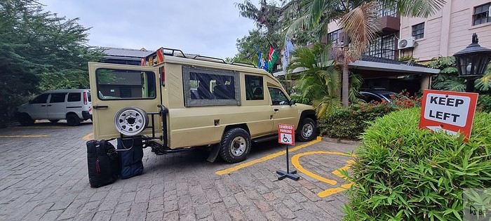
We set off for Voi, making our usual stop in Mtito Andei. Traffic was heavy on the Mombasa road, with lots of trucks.
We arrived at the entrance of Tsavo East around 1 PM and made it to Sentrim Camp (https://www.sentrim-hotels.com/sentrim-tsavo.html) just in time for lunch.
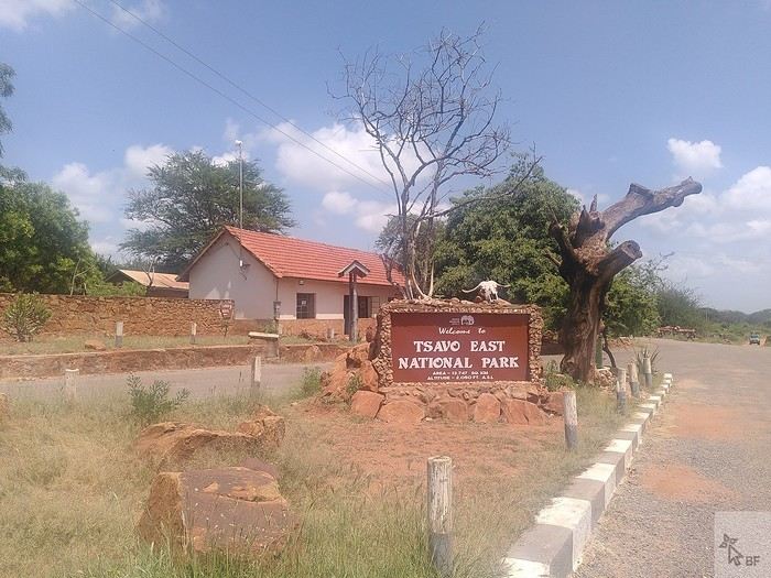
We found Tsavo East unusually green—there had been heavy rains in December, which isn’t typical. As a result, the animals were scattered and harder to spot. The watering hole visible from the camp’s dining area was completely deserted, whereas it’s usually bustling with herds of elephants and other mammals.
Our tent, No. 9, for 3 nights.
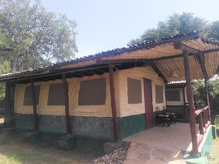
This camp is well-located inside the park. It’s simple but comfortable enough for our tastes, the staff is super friendly (as is often the case in Kenya), and the buffet-style meals are varied and good. Tsavo is the main destination for tourists staying on the coast who come for a night or two on safari. In January, some days at the camp are very quiet, while some evenings, the restaurant is packed with groups (lots of Italians, in particular).
Tsavo is, of course, famous for its elephants. This time, we didn’t see many large herds, but we did have some great encounters with solitary males.
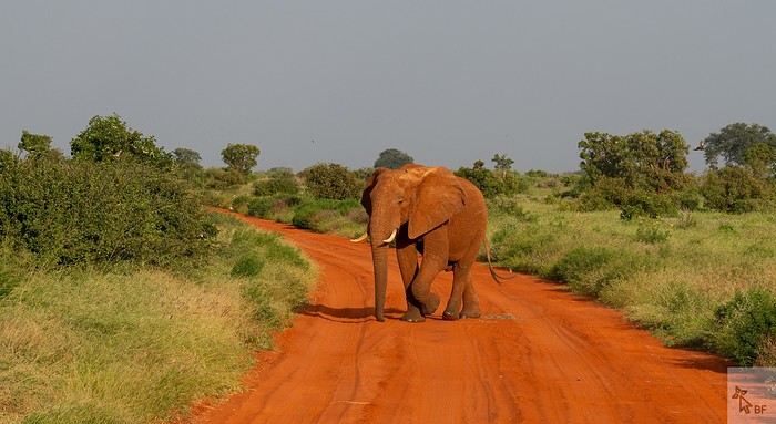
Around this small watering hole, we saw a gathering of African open-billed storks—we’d never seen so many before!
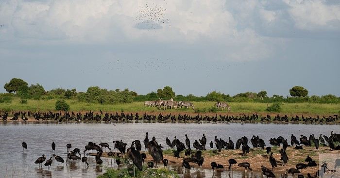
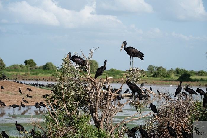
I’d like to invite you on a new adventure in Kenya.
Back in 2010, my husband Ben and I fell in love with Kenya, and we’ve been traveling there regularly ever since. This 2025 safari marked the first weeks of an important milestone in my life: retirement.
Of course, Felix—our guide and friend for all these years, whom some of you may even know from this forum—joined us again.
We chose an itinerary that takes us through the parks and reserves we particularly love in Kenya: Tsavo East (3 nights), Tsavo West (2 nights), a transition day in Embu, Samburu (5 nights), Meru NP (4 nights), Nanuyki to visit the Mount Kenya Animal Orphanage (https://mountkenyawildlifeconservancy.org/) (1 night), and Aberdare NP (2 nights).
This safari wasn’t our most prolific in terms of wildlife sightings and photos (all taken by Ben), but I still think it’s worth sharing our experiences and impressions of the places we visited. Maybe other travelers will find useful information here to help them fulfill their dream of a Kenyan safari one day...
Living in Brittany, we left from Nantes on Wednesday, January 8, 2025, on the 6 AM Air France flight to CDG, then took the direct flight to Nairobi at 10:50 AM. No issues this time on either flight (unlike in October 2023...).
We arrived in Nairobi at 9:20 PM local time (there’s a two-hour time difference with France at this time of year). Going through passport control and collecting our luggage went smoothly. The hotel shuttle (https://67airporthotel.co.ke/) was waiting for us. We shared it with a friendly Swiss couple who were there to climb Mount Kenya. We arrived at the hotel around midnight. The 67 Airport Hotel is 10-15 minutes from Jomo Kenyatta Airport and offers great value for money. Plus, it’s close to the Mombasa road, which is handy when heading that way the next morning.
On Thursday, January 9, we had breakfast at the hotel restaurant at 6:30 AM, and as planned, Felix arrived around 7 AM. We got to check out his brand-new 4x4 Nissan—we’d be the first to test it! 🙂
We set off for Voi, making our usual stop in Mtito Andei. Traffic was heavy on the Mombasa road, with lots of trucks.
We arrived at the entrance of Tsavo East around 1 PM and made it to Sentrim Camp (https://www.sentrim-hotels.com/sentrim-tsavo.html) just in time for lunch.
We found Tsavo East unusually green—there had been heavy rains in December, which isn’t typical. As a result, the animals were scattered and harder to spot. The watering hole visible from the camp’s dining area was completely deserted, whereas it’s usually bustling with herds of elephants and other mammals.
Our tent, No. 9, for 3 nights.
This camp is well-located inside the park. It’s simple but comfortable enough for our tastes, the staff is super friendly (as is often the case in Kenya), and the buffet-style meals are varied and good. Tsavo is the main destination for tourists staying on the coast who come for a night or two on safari. In January, some days at the camp are very quiet, while some evenings, the restaurant is packed with groups (lots of Italians, in particular).
Tsavo is, of course, famous for its elephants. This time, we didn’t see many large herds, but we did have some great encounters with solitary males.
Around this small watering hole, we saw a gathering of African open-billed storks—we’d never seen so many before!
Looking for a nice island off the beaten path for diving
Hi everyone!
I’ve been in Malaysia for a month now and still have two more to go. I started traveling with friends, but I’ll be solo for the next month and a half.
We did a pretty classic route: Perhentians, Cameron Highlands (which I found pointless), Tioman, and Kinabatangan in Borneo. Now I’m thinking of heading to Redang Island—Langkawi is also an option, but it doesn’t appeal to me as much. Any feedback on these two spots?
Especially Redang?
Any thoughts on the diving there?
So far, I haven’t had much luck with diving—at the Perhentians, it was pretty disastrous with water at 31°C 😵😫
I’d love to find a nice island where I can meet people (locals and travelers) because going from a group of six to solo at the end is going to feel weird.
So I’m open to all tips and opinions. Also, I’d love to hear about Langkawi, and if anyone knows of an island that’s a bit more off the beaten path, that’d be amazing. Thanks in advance, and happy travels to you all!