Results for "stop"
27584 results found.
Aloha State: Hawaii February 2025
Alright, I'm diving into this Hawaiian travel journal!
I hope lots of you will follow along because the destination is absolutely charming. 🙂
Just a heads-up—I might take a while to finish it.
The trip took place from February 20th to March 3rd, 2025 (11 days total, with 9 days on-site). It was a trip with my friend Christelle, with whom I’ve already traveled to Iceland and Morocco in recent years. We’re totally on the same wavelength, with the same expectations and desires, which makes things a lot easier (and, as a bonus, it helps cut down the final bill). Being the generous soul I am, I asked Christelle which country she wanted to visit. Her answer: Asia, since I’ve never been, or Namibia... Hawaii is basically the same thing, right?!! All thanks to the search comparator—I stumbled upon round-trip tickets from Paris to Honolulu for 580 € per person during school holidays, with a layover in Canada (I don’t get to choose my vacation dates). We jumped on it on August 28th (didn’t take much convincing). For info, I always check flight tickets during the last week of August or the first half of September because there are always amazing deals.
Nine days on-site is short, so we had to make some tough choices for the islands we’d visit (I’m only listing the main ones): - Oahu: the most urbanized but also home to Honolulu, Pearl Harbor, and some stunning beaches.
Kauai: the Garden Isle. It’s the island from *Jurassic Park*, with lush vegetation—so it’s pretty rainy. Big Island: volcanoes, volcanoes, and more, but also things like night snorkeling with manta rays. Maui: very touristy, with a magnificent volcano, the Road to Hana, and the ultimate spot for whale watching (and we were there right in the middle of whale season).
We limited ourselves to two islands to avoid rushing, and in the end, we picked Kauai (non-negotiable) and Oahu (which saved us an extra domestic flight and, since we were there in winter, let us experience the BIG WAVES on the North Shore). We would’ve loved to visit Big Island, but we’d already seen volcanoes in Iceland, and the island is huge—we just didn’t have enough time. Maui was recently hit by a major wildfire and is also the most expensive island (along with Kauai). We were really hoping to see humpback whales (my favorite animal) on both Oahu and Kauai. Hawaii is far, and it’s worth the effort. The journey went smoothly. I took a 40-minute bus ride and a 1h32 RER trip just to get to Roissy, then a 9h15 flight to Calgary, with a two-hour layover before a 6h45 flight to Honolulu. 11 hours of time difference, arriving at 10 PM local time. And you know what? (spoiler alert) I’d do it a thousand times if I got the chance.
Alright, let’s go—here we go!

The trip took place from February 20th to March 3rd, 2025 (11 days total, with 9 days on-site). It was a trip with my friend Christelle, with whom I’ve already traveled to Iceland and Morocco in recent years. We’re totally on the same wavelength, with the same expectations and desires, which makes things a lot easier (and, as a bonus, it helps cut down the final bill). Being the generous soul I am, I asked Christelle which country she wanted to visit. Her answer: Asia, since I’ve never been, or Namibia... Hawaii is basically the same thing, right?!! All thanks to the search comparator—I stumbled upon round-trip tickets from Paris to Honolulu for 580 € per person during school holidays, with a layover in Canada (I don’t get to choose my vacation dates). We jumped on it on August 28th (didn’t take much convincing). For info, I always check flight tickets during the last week of August or the first half of September because there are always amazing deals.
Nine days on-site is short, so we had to make some tough choices for the islands we’d visit (I’m only listing the main ones): - Oahu: the most urbanized but also home to Honolulu, Pearl Harbor, and some stunning beaches.
Kauai: the Garden Isle. It’s the island from *Jurassic Park*, with lush vegetation—so it’s pretty rainy. Big Island: volcanoes, volcanoes, and more, but also things like night snorkeling with manta rays. Maui: very touristy, with a magnificent volcano, the Road to Hana, and the ultimate spot for whale watching (and we were there right in the middle of whale season).
We limited ourselves to two islands to avoid rushing, and in the end, we picked Kauai (non-negotiable) and Oahu (which saved us an extra domestic flight and, since we were there in winter, let us experience the BIG WAVES on the North Shore). We would’ve loved to visit Big Island, but we’d already seen volcanoes in Iceland, and the island is huge—we just didn’t have enough time. Maui was recently hit by a major wildfire and is also the most expensive island (along with Kauai). We were really hoping to see humpback whales (my favorite animal) on both Oahu and Kauai. Hawaii is far, and it’s worth the effort. The journey went smoothly. I took a 40-minute bus ride and a 1h32 RER trip just to get to Roissy, then a 9h15 flight to Calgary, with a two-hour layover before a 6h45 flight to Honolulu. 11 hours of time difference, arriving at 10 PM local time. And you know what? (spoiler alert) I’d do it a thousand times if I got the chance.
Alright, let’s go—here we go!
From Essaouira to Sidi Ifni: What to see and do off the tourist trail?
Hi everyone,
I know there are some *reaaaal* Morocco experts here, so I’m giving it a shot.
Early June, we’re heading back to the country for the third time for a little week-long trip.
We’ll arrive and depart from Essaouira, where we’ll rent a car to drive south down to roughly Sidi Ifni.
The plan is to make short stops of 2-3 hours max, a mix of coastal spots and a bit inland.
We’re looking for natural, quiet places that feel untouched.
We loved Taghazout years ago and Larache two years back—just to give you an idea of our vibe.
What spots would you recommend along this route?
I’m tempted by Paradise Valley but worried it’ll be as crowded as Agadir. What do you think?
Any other valleys in the area worth the detour?
Thanks, and have a great weekend! 😊
Three-week trip to Japan: feedback on our itinerary
Hi everyone,
After years of silence and wonderful memories from our exchanges during two trips to South Africa, I’m back on the forum with plans for a trip to Japan.
We’re considering traveling from June 16 to July 9. I know this isn’t the best time weather-wise, but it’s our only option, especially since we want to include climbing Mount Fuji.
Here’s our itinerary—I’d love your thoughts: - Day 1: Arrival at Haneda in the evening (Night in Tokyo) - Day 2: Tokyo (Night in Tokyo) - Day 3: Nikko (Night in Tokyo) - Day 4: Travel to Hiroshima, then visit (Night in Hiroshima) - Day 5: Day in Miyajima (Night in Hiroshima) - Day 6: Day in Kagura Monzen Tojimura (Night in Hiroshima) - Day 7: Travel to Himeji, then visit (Night in Himeji) - Day 8: Himeji (Night in Himeji) - Day 9: Travel to Koyasan (Night in Koyasan) - Day 10: Koyasan (Night in Koyasan) - Day 11: Travel to Nara (Night in Nara) - Day 12: Travel to Kyoto (Night in Kyoto) - Day 13: Kyoto (Night in Kyoto) - Day 14: Travel to Fukui (Night in Fukui) - Day 15: Travel to Kanazawa (Night in Kanazawa) - Day 16: Travel to Hakone (Night in Hakone) - Day 17: Hakone (Night in Hakone) - Day 18: Travel to Kamakura (Night in Kamakura) - Day 19: Travel to Tokyo (Night in Tokyo) - Day 20: Travel to Fujiyoshida (Night in Fujiyoshida) - Day 21: Ascent via Yoshida Trail - Day 22: Descent via Yoshida Trail (Night in Fujiyoshida) - Day 23: Travel to Tokyo (Night in Tokyo) - Day 24: Departure from Narita
Let me know if any stops seem unnecessary or if you’d add something.
I’m planning to rent a car from Himeji (Day 9) until Hakone (Day 16) to make travel easier.
Have a great day!
Thomas
After years of silence and wonderful memories from our exchanges during two trips to South Africa, I’m back on the forum with plans for a trip to Japan.
We’re considering traveling from June 16 to July 9. I know this isn’t the best time weather-wise, but it’s our only option, especially since we want to include climbing Mount Fuji.
Here’s our itinerary—I’d love your thoughts: - Day 1: Arrival at Haneda in the evening (Night in Tokyo) - Day 2: Tokyo (Night in Tokyo) - Day 3: Nikko (Night in Tokyo) - Day 4: Travel to Hiroshima, then visit (Night in Hiroshima) - Day 5: Day in Miyajima (Night in Hiroshima) - Day 6: Day in Kagura Monzen Tojimura (Night in Hiroshima) - Day 7: Travel to Himeji, then visit (Night in Himeji) - Day 8: Himeji (Night in Himeji) - Day 9: Travel to Koyasan (Night in Koyasan) - Day 10: Koyasan (Night in Koyasan) - Day 11: Travel to Nara (Night in Nara) - Day 12: Travel to Kyoto (Night in Kyoto) - Day 13: Kyoto (Night in Kyoto) - Day 14: Travel to Fukui (Night in Fukui) - Day 15: Travel to Kanazawa (Night in Kanazawa) - Day 16: Travel to Hakone (Night in Hakone) - Day 17: Hakone (Night in Hakone) - Day 18: Travel to Kamakura (Night in Kamakura) - Day 19: Travel to Tokyo (Night in Tokyo) - Day 20: Travel to Fujiyoshida (Night in Fujiyoshida) - Day 21: Ascent via Yoshida Trail - Day 22: Descent via Yoshida Trail (Night in Fujiyoshida) - Day 23: Travel to Tokyo (Night in Tokyo) - Day 24: Departure from Narita
Let me know if any stops seem unnecessary or if you’d add something.
I’m planning to rent a car from Himeji (Day 9) until Hakone (Day 16) to make travel easier.
Have a great day!
Thomas
Authentic travel on a small budget in Southern Africa
Hi everyone, I’m thinking of heading to Southern Africa next autumn for several months.
I’d love some advice on my itinerary—I’m looking for authentic spots with cheap accommodation.
I know Southern Africa is generally pricier than Asia or Latin America because of the lack of backpacker infrastructure (except maybe Cape Town).
I’m planning to visit South Africa, Mozambique, Lesotho, and maybe Eswatini.
My main goal in South Africa is to see the coexistence between white, mixed-race, and Black communities.
I think I’ll skip Namibia and Botswana because of the cost of living.
Thanks
Mae Hong Son and Pai on foot + day-long tuk-tuk trips
Hi there, I’m planning to stay in Mae Hong Son for 4 days and Pai for 3 or 4 days to explore both towns and their surroundings. I’m not renting a car or scooter—I like to travel at a relaxed pace...
I’d love to know if it’s possible to do quite a few walks on foot from both towns and if it’s easy to find a tuk-tuk for the day to go a bit further.
I’ve heard that biking is really only for brave cyclists, which definitely isn’t me!
Thanks for your tips
I’d love to know if it’s possible to do quite a few walks on foot from both towns and if it’s easy to find a tuk-tuk for the day to go a bit further.
I’ve heard that biking is really only for brave cyclists, which definitely isn’t me!
Thanks for your tips
Driver for independent northern Thailand itinerary
Hello everyone,
Not long ago, I used to travel as a couple, but my husband has since passed away, and I’ve decided to set off again. The trip I took to Cambodia in January 2025 did me a world of good.
I’m now considering Thailand, a destination we never included in our plans because even 15 years ago, people said it was too touristy. Still, I’m thinking about the itinerary below, but I don’t feel up to arranging buses, trains, or guides on my own while I’m there. I’m looking for one or more drivers and have been in touch with an agency, but their offers are just copy-paste group tours that I don’t want.
So, if you have any contacts, experiences, or advice, I’d be so grateful if you’d share them with me. Here’s my rough plan:
Arrival in Bangkok
Ayutthaya (2 nights)
Kanchanaburi (2 or 3 nights)
Sangkhlaburi/Sai Yok (3 nights)
Sukhothai (2 nights)
Lampang (I’ve planned 3 nights, but that might be a bit much—it depends on what time I arrive in the city)
Chiang Mai
Chiang Dao
Pai
Chiang Rai
I was thinking about the Mae Hong Son loop—thoughts?
What do you think about staying overnight at the Golden Triangle?
When I look online, of course, I can find agencies that organize tours to national parks, etc.
I’m retired but in great physical shape. I’d rather go hiking than sit in hot springs with crowds of tourists who’ve all arranged meet-ups. I don’t want to spend a day at an elephant camp, and I don’t want to visit Karen villages.
I’d love to hear your advice.
Thank you all,
West Cork or Kerry in summer: which itinerary to choose for a family road trip?
Hi there,
I’ve just booked our flight tickets for my family.
We’re heading to Ireland for a week between July and August—it’s our first time (with 1 teen and 2 younger kids).
We’ll be landing in Cork where we’ve rented a car. Initially, I was planning to focus our visits and walks on the Ring of Kerry and Dingle, but it looks like the roads get pretty busy in the summer.
So now I’m thinking of sticking to the "West Cork" area (Beara, Sheep’s Head, Mizen Head), which seems quieter.
For those who know the area, is this a good idea, or are we at risk of missing out on more spectacular landscapes? Thanks in advance! Best regards
We’ll be landing in Cork where we’ve rented a car. Initially, I was planning to focus our visits and walks on the Ring of Kerry and Dingle, but it looks like the roads get pretty busy in the summer.
So now I’m thinking of sticking to the "West Cork" area (Beara, Sheep’s Head, Mizen Head), which seems quieter.
For those who know the area, is this a good idea, or are we at risk of missing out on more spectacular landscapes? Thanks in advance! Best regards
Driver guide / agency for 3 days in Kanchanaburi
Hi there,
We’ll be traveling to Thailand this summer and are looking to spend 3 days in Kanchanaburi. Any agencies or guides you’d recommend?
3-week Panama itinerary plan for summer
Hi there,
I’m planning a trip to Panama in the summer of 2026 (2 adults and 2 kids, ages 9 and 6).
Here’s my first draft for the itinerary. Could you give me some advice, please?
Day 1: Panama City + night 1 Day 2: Departure for the San Blas Islands (I don’t have a transfer company yet and I’m hesitant to drive there myself in an SUV) + 1 or 2 nights depending on the price Day 3 (or 4): Return to Panama City + departure for Isla Grande (maybe too much in one day, so maybe an extra night in Panama City and leave the next day for Isla Grande) For Isla Grande, should I go through Portobelo? Day 3 or 4: Isla Grande + night Day 4 or 5: From Isla Grande to Lake Gatun for an Embera immersion (I haven’t checked the travel time yet) + night Day 5 or 6: Departure from Lake Gatun to El Valle de Antón + 2 or 3 nights Day 7 or max Day 9: Head to the Gulf of Chiriquí and Boca Chica + 2 or 3 nights? Day 9 or max Day 12: Boquete + 2 nights Day 11 or 14: Bocas del Toro (one of the surrounding islands) + 2 nights Day 13 or 16: Return to Panama City by plane the day before the international flight. I don’t have all 21 nights planned yet, but there are still some details to work out with your help ;)
Also, is it possible to rent a car in Panama City and drop it off at the Bocas del Toro airport? (I think so...) Finally, what are the steps for driving back from Bocas del Toro to Panama City (to avoid the domestic flight)?
Thanks in advance!
I’m planning a trip to Panama in the summer of 2026 (2 adults and 2 kids, ages 9 and 6).
Here’s my first draft for the itinerary. Could you give me some advice, please?
Day 1: Panama City + night 1 Day 2: Departure for the San Blas Islands (I don’t have a transfer company yet and I’m hesitant to drive there myself in an SUV) + 1 or 2 nights depending on the price Day 3 (or 4): Return to Panama City + departure for Isla Grande (maybe too much in one day, so maybe an extra night in Panama City and leave the next day for Isla Grande) For Isla Grande, should I go through Portobelo? Day 3 or 4: Isla Grande + night Day 4 or 5: From Isla Grande to Lake Gatun for an Embera immersion (I haven’t checked the travel time yet) + night Day 5 or 6: Departure from Lake Gatun to El Valle de Antón + 2 or 3 nights Day 7 or max Day 9: Head to the Gulf of Chiriquí and Boca Chica + 2 or 3 nights? Day 9 or max Day 12: Boquete + 2 nights Day 11 or 14: Bocas del Toro (one of the surrounding islands) + 2 nights Day 13 or 16: Return to Panama City by plane the day before the international flight. I don’t have all 21 nights planned yet, but there are still some details to work out with your help ;)
Also, is it possible to rent a car in Panama City and drop it off at the Bocas del Toro airport? (I think so...) Finally, what are the steps for driving back from Bocas del Toro to Panama City (to avoid the domestic flight)?
Thanks in advance!
Traveling to Mongolia in Winter: Practical Info and Experience Feedback
Hi everyone, here are some practical tips from my 5 weeks in Mongolia in February.
The famous Lonely Planet paper guide mostly gives wrong information—we often got let down.
From the airport to the city center (25 km), there are normally buses, but it’s not straightforward, especially for your return trip. Check with the tourism office on Genghis Khan Square.
If you need to stay more than 30 days, your hotel can request an extension for you online. Do this immediately because it can take time. At customs, you’ll get an extra stamp. Each day costs a very small fee, and no photo is needed.
I only travel by public transport. Don’t follow the paper guide, and remember there are buses running daily between Ulaanbaatar and Ölgii (and other routes).
The main issue is finding out the departure time and location. Insist strongly with your hotel—the bus might pass in the middle of the night. Locals have the drivers’ numbers and will let them know there are passengers to pick up. You pay on the bus.
From Karakorum Monastery, if you want to reach Arvaikheer via the mountains, the route is truly stunning. The postal service has a 6-seater van that leaves around 1 PM from the post office—ask around. This avoids going back to Ulaanbaatar. Plus, the van stops right in the center of Arvaikheer, next to a hotel that’s a really ugly red but has good rooms, great prices, and friendly staff.
The Black Market isn’t far, and neither are the city’s two museums.
The yurt camp next to the monastery is well-maintained, with very kind people. It gets too hot in winter, so you’ll have to sleep with the door open.
Ulaanbaatar There are two main long-distance bus stations: "Dragon Station." They’re far from the city center, so take a bus or a taxi—allow plenty of time to get there.
The city is constantly congested and polluted. Climate change is a very visible issue here.
To see a wrestling match in Ulaanbaatar, go directly to the "stadium" on Peace Avenue. Matches often take place at 11 AM, and tickets are sold on-site. Bus No. 1 goes there, among others.
For the Black Market, taking the bus is faster. You’ll find everything for daily life—fabrics, dishes, etc. But be careful: the "antique dealers" don’t provide authenticity papers, and you could get stopped at customs. Stick to the antique dealers in the city center.
I was really disappointed by the Lunar New Year—nothing happens outside, shops and banks are closed. Make sure to bring food, though ATMs work.
To exchange money, go to the 4th floor of the "state store" across from Beatles Park on Peace Avenue. The exchange rate seems good.
There are many great museums in Ulaanbaatar and smaller towns—worth a visit, even if you sometimes have to hunt for the keys and lights. However, the art galleries in Ulaanbaatar no longer exist (at least not when I was there).
I stayed at GoldenGobi Guesthouse—very family-like atmosphere, right in the center, and budget-friendly. They can also help organize things. There’s a kitchen and a terrace for summer, and it’s just a short walk from the "state store" and museums.
The Thousand Camel Festival in Dalanzadgad takes place at the end of January—check the dates, as climate change may shift them.
There’s a direct bus from "Dragon Station" very early in the morning. For accommodation, I stayed at "Happy Bee Hostel," which is well-located on the festival route. It has 3 nice dorms and a small kitchen, and the owner is very friendly. The place was clean.
The festival is 5 km away, but hitchhiking works really well. It lasts 3 days and is free. Day 1: Introductions, networking, and handicrafts. Day 2: Archery (men’s and women’s), camel presentations, and camel polo. Day 3: Camel races, beauty contests, and training demonstrations. There are several yurts where you can enjoy culinary tastings—very pleasant when it’s a bit windy and cold.
You can eat on-site throughout the festival.
There’s also the Ice Festival in the north, which lasts 3 weeks—look into it.
Alcohol (vodka and very strong Mongolian alcohol—cheap) I never encountered any issues on the road—there are lots of police checks. However, I did witness several nighttime fights in hotels. I always made sure my door locked and let the shouting and punches fly. I only took out my whistle if I heard a woman screaming, but usually, it’s just men drinking in their rooms.
I didn’t experience any specific issues as a woman.
Health: Don’t forget your prescriptions. I used SMECTA (a digestive aid), which helped when I couldn’t refuse mutton dumplings—I’m not a big meat eater.
That’s all—I’m sure I forgot some things. I chose winter to attend the Camel Festival and also because there are no tourists or 4x4s everywhere. The downside is that there’s a lot of snow, especially near the Kazakh region, and sometimes it’s impossible to go off the beaten path. Near Ölgii, summer must offer some great hikes. Marie
The famous Lonely Planet paper guide mostly gives wrong information—we often got let down.
From the airport to the city center (25 km), there are normally buses, but it’s not straightforward, especially for your return trip. Check with the tourism office on Genghis Khan Square.
If you need to stay more than 30 days, your hotel can request an extension for you online. Do this immediately because it can take time. At customs, you’ll get an extra stamp. Each day costs a very small fee, and no photo is needed.
I only travel by public transport. Don’t follow the paper guide, and remember there are buses running daily between Ulaanbaatar and Ölgii (and other routes).
The main issue is finding out the departure time and location. Insist strongly with your hotel—the bus might pass in the middle of the night. Locals have the drivers’ numbers and will let them know there are passengers to pick up. You pay on the bus.
From Karakorum Monastery, if you want to reach Arvaikheer via the mountains, the route is truly stunning. The postal service has a 6-seater van that leaves around 1 PM from the post office—ask around. This avoids going back to Ulaanbaatar. Plus, the van stops right in the center of Arvaikheer, next to a hotel that’s a really ugly red but has good rooms, great prices, and friendly staff.
The Black Market isn’t far, and neither are the city’s two museums.
The yurt camp next to the monastery is well-maintained, with very kind people. It gets too hot in winter, so you’ll have to sleep with the door open.
Ulaanbaatar There are two main long-distance bus stations: "Dragon Station." They’re far from the city center, so take a bus or a taxi—allow plenty of time to get there.
The city is constantly congested and polluted. Climate change is a very visible issue here.
To see a wrestling match in Ulaanbaatar, go directly to the "stadium" on Peace Avenue. Matches often take place at 11 AM, and tickets are sold on-site. Bus No. 1 goes there, among others.
For the Black Market, taking the bus is faster. You’ll find everything for daily life—fabrics, dishes, etc. But be careful: the "antique dealers" don’t provide authenticity papers, and you could get stopped at customs. Stick to the antique dealers in the city center.
I was really disappointed by the Lunar New Year—nothing happens outside, shops and banks are closed. Make sure to bring food, though ATMs work.
To exchange money, go to the 4th floor of the "state store" across from Beatles Park on Peace Avenue. The exchange rate seems good.
There are many great museums in Ulaanbaatar and smaller towns—worth a visit, even if you sometimes have to hunt for the keys and lights. However, the art galleries in Ulaanbaatar no longer exist (at least not when I was there).
I stayed at GoldenGobi Guesthouse—very family-like atmosphere, right in the center, and budget-friendly. They can also help organize things. There’s a kitchen and a terrace for summer, and it’s just a short walk from the "state store" and museums.
The Thousand Camel Festival in Dalanzadgad takes place at the end of January—check the dates, as climate change may shift them.
There’s a direct bus from "Dragon Station" very early in the morning. For accommodation, I stayed at "Happy Bee Hostel," which is well-located on the festival route. It has 3 nice dorms and a small kitchen, and the owner is very friendly. The place was clean.
The festival is 5 km away, but hitchhiking works really well. It lasts 3 days and is free. Day 1: Introductions, networking, and handicrafts. Day 2: Archery (men’s and women’s), camel presentations, and camel polo. Day 3: Camel races, beauty contests, and training demonstrations. There are several yurts where you can enjoy culinary tastings—very pleasant when it’s a bit windy and cold.
You can eat on-site throughout the festival.
There’s also the Ice Festival in the north, which lasts 3 weeks—look into it.
Alcohol (vodka and very strong Mongolian alcohol—cheap) I never encountered any issues on the road—there are lots of police checks. However, I did witness several nighttime fights in hotels. I always made sure my door locked and let the shouting and punches fly. I only took out my whistle if I heard a woman screaming, but usually, it’s just men drinking in their rooms.
I didn’t experience any specific issues as a woman.
Health: Don’t forget your prescriptions. I used SMECTA (a digestive aid), which helped when I couldn’t refuse mutton dumplings—I’m not a big meat eater.
That’s all—I’m sure I forgot some things. I chose winter to attend the Camel Festival and also because there are no tourists or 4x4s everywhere. The downside is that there’s a lot of snow, especially near the Kazakh region, and sometimes it’s impossible to go off the beaten path. Near Ölgii, summer must offer some great hikes. Marie
Local transport Marrakech - Ait Bou Oulli
Hi there,
I’m planning to cross the Atlas M’Goun-Toubkal range at the end of March and I’m looking for info on how to get to Ait Bou Oulli from Marrakech via Demnate.
Can anyone tell me if there’s a direct bus to Demnate and then a minibus (once it’s full) to Ait Bou Oulli? Is it doable in a day by bus or even a shared taxi?
Thanks in advance
Thanks in advance
Which airline for Paris-Tokyo in business class?
Hi there,
My daughter, wife, and I are starting to plan a two-week trip to Japan for... April 2026. My wife wants us to really treat ourselves, so we’re considering business class (we usually fly premium economy or even economy). Since we’re departing from Paris and want a direct flight, we have three options: JAL, ANA, or Air France.
I’ve flown Air France in business quite a bit for work, and I do find it very comfortable. But I wonder if I’m just defaulting to a national bias—maybe the other two airlines have advantages I’m not considering.
If I’m looking at criteria like: - Comfort (especially for sleeping) - Meals - Entertainment
Any advice? Personal experiences? Have any of the three airlines updated their business class on this route recently?
Thanks! !
My daughter, wife, and I are starting to plan a two-week trip to Japan for... April 2026. My wife wants us to really treat ourselves, so we’re considering business class (we usually fly premium economy or even economy). Since we’re departing from Paris and want a direct flight, we have three options: JAL, ANA, or Air France.
I’ve flown Air France in business quite a bit for work, and I do find it very comfortable. But I wonder if I’m just defaulting to a national bias—maybe the other two airlines have advantages I’m not considering.
If I’m looking at criteria like: - Comfort (especially for sleeping) - Meals - Entertainment
Any advice? Personal experiences? Have any of the three airlines updated their business class on this route recently?
Thanks! !
First trip to South Africa: what itinerary?
Hello forum,
We’re a family of 4 adults (2 grown daughters) planning our first trip to South Africa for 3 weeks in August 2025, traveling independently. I’ve been drawing inspiration from several posts on the forum. I’d like to book our flight tickets and nights in Kruger Park as soon as possible since that’s the most urgent part to finalize, if I understood correctly.
Here’s a first draft of our itinerary (with lots of unknowns about what there’ll be to see/do in Eswatini, Lesotho, Durban, etc.—I feel like the Lesotho leg involves a lot of driving).
I’d really appreciate input from the experts to help us craft a great trip. Thanks in advance!
Day 1
Departure from Paris Day 2
Morning Early arrival in Johannesburg Pick up rental car Groceries Afternoon Sightseeing Night in AirBNB near Johannesburg (1/1) Day 3
Morning Drive to Blyde River Canyon (500 km - 6h30) Afternoon Visit the canyon Night in AirBNB near Blyde River Canyon (1/1) Day 4
Morning Drive to central Kruger (200 km - 3h30) Night in Rest Camp (1/2) Day 5
Night in Rest Camp (2/2) Day 6
Morning Drive to southern Kruger (150 km - 3h) Night in Rest Camp (1/3) Day 7
Night in Rest Camp (2/3) Day 8
Night in Rest Camp (3/3) Day 9
Morning Drive to Mbabane (Eswatini) (250 km - 4h) Night in AirBNB or other (1/1) Day 10
Morning Drive to Maputaland (300 km - 4h) Afternoon Swimming (hippos and crocs?) Night in AirBNB or other (1/1) Day 11
Morning Drive to Hluhluwe-Umfolozi (130 km - 2h) Night in Rest Camp (1/2) Day 12
Night in Rest Camp (2/2) Day 13
Morning Drive to Durban (250 km - 3h) Night in AirBNB (1/1) Day 14
Morning First half of drive to Lesotho (225 km - 4h) Night in AirBNB or other (1/1) Day 15
Morning Second half of drive to Lesotho (225 km - 4h) Night in AirBNB or other (1/1) Day 16
Morning First half of drive to Drakensberg (250 km - 4h) Night in AirBNB or other (1/1) Day 17
Morning Second half of drive to Drakensberg (250 km - 4h) Night in AirBNB or other (1/2) Day 18
Night in AirBNB or other (2/2) Day 19
Morning Drive to Johannesburg (300 km - 4h) Night in AirBNB (1/2) Day 20
Night in AirBNB (2/2) Day 21
Morning Departure in early afternoon Day 22
Arrival in Paris
We’re a family of 4 adults (2 grown daughters) planning our first trip to South Africa for 3 weeks in August 2025, traveling independently. I’ve been drawing inspiration from several posts on the forum. I’d like to book our flight tickets and nights in Kruger Park as soon as possible since that’s the most urgent part to finalize, if I understood correctly.
Here’s a first draft of our itinerary (with lots of unknowns about what there’ll be to see/do in Eswatini, Lesotho, Durban, etc.—I feel like the Lesotho leg involves a lot of driving).
I’d really appreciate input from the experts to help us craft a great trip. Thanks in advance!
Day 1
Departure from Paris Day 2
Morning Early arrival in Johannesburg Pick up rental car Groceries Afternoon Sightseeing Night in AirBNB near Johannesburg (1/1) Day 3
Morning Drive to Blyde River Canyon (500 km - 6h30) Afternoon Visit the canyon Night in AirBNB near Blyde River Canyon (1/1) Day 4
Morning Drive to central Kruger (200 km - 3h30) Night in Rest Camp (1/2) Day 5
Night in Rest Camp (2/2) Day 6
Morning Drive to southern Kruger (150 km - 3h) Night in Rest Camp (1/3) Day 7
Night in Rest Camp (2/3) Day 8
Night in Rest Camp (3/3) Day 9
Morning Drive to Mbabane (Eswatini) (250 km - 4h) Night in AirBNB or other (1/1) Day 10
Morning Drive to Maputaland (300 km - 4h) Afternoon Swimming (hippos and crocs?) Night in AirBNB or other (1/1) Day 11
Morning Drive to Hluhluwe-Umfolozi (130 km - 2h) Night in Rest Camp (1/2) Day 12
Night in Rest Camp (2/2) Day 13
Morning Drive to Durban (250 km - 3h) Night in AirBNB (1/1) Day 14
Morning First half of drive to Lesotho (225 km - 4h) Night in AirBNB or other (1/1) Day 15
Morning Second half of drive to Lesotho (225 km - 4h) Night in AirBNB or other (1/1) Day 16
Morning First half of drive to Drakensberg (250 km - 4h) Night in AirBNB or other (1/1) Day 17
Morning Second half of drive to Drakensberg (250 km - 4h) Night in AirBNB or other (1/2) Day 18
Night in AirBNB or other (2/2) Day 19
Morning Drive to Johannesburg (300 km - 4h) Night in AirBNB (1/2) Day 20
Night in AirBNB (2/2) Day 21
Morning Departure in early afternoon Day 22
Arrival in Paris
7-day mini road trip in Corsica: your thoughts?
Hi everyone, after a stay in the South and one in the North, I’m planning a mini road trip in Corsica (Bastia-Bastia) in June to explore places I haven’t seen yet. Since we’re heading to the mountains later this year, we’ve deliberately skipped the Corsican mountains. Could you share your thoughts and, most importantly, suggest things to see? We love nature, reasonable hikes, peaceful spots, and small villages. No cities. No boat excursions (yes, that includes Piana and Scandola). We already know the area between Bastia and Calvi.
June 7 Flight arrival in Bastia and night at the hotel
June 8 Drive to Calvi (beach and/or fortress) Meal at Les Boucaniers restaurant Night in Calvi
June 9 Walk from Calvi fortress to Alga beach Charcuterie platter at A Casetta Calvi Night in Calvi
June 10 Drive from Calvi to Piana Buvette du col de la Croix and visit the orientation table Chemin des muletiers (Muleteers’ Path) Or Sentier de la source des roches bleues (Blue Rocks Spring Trail) counterclockwise Or (less scenic) Tête du chien (Dog’s Head, starting at the parking lot) Dinner at Épicerie Castellani in Piana Night in Piana
June 11 Drive from Piana to Propriano Arone beach and meal at Le Café de la plage Drive along the coast, stopping wherever we like Night in Propriano
June 12 Hike starting from Campomoro in the Jardin du Vent (Wind Garden), and visit the Genoese tower of Campomoro Meal in Campomoro: restaurant Chez Pierre Paul U spuntinu Night in Propriano
June 13 Around Propriano (avoid Capu Laurosu beach—sewage treatment plant...) Night in Propriano
June 14 Drive from Propriano to Bastia airport Meal at L’Éternisula in Zonza Aiguilles de Bavella (Hole of the Bomb) Night at the same hotel as arrival
June 15 Departure
June 7 Flight arrival in Bastia and night at the hotel
June 8 Drive to Calvi (beach and/or fortress) Meal at Les Boucaniers restaurant Night in Calvi
June 9 Walk from Calvi fortress to Alga beach Charcuterie platter at A Casetta Calvi Night in Calvi
June 10 Drive from Calvi to Piana Buvette du col de la Croix and visit the orientation table Chemin des muletiers (Muleteers’ Path) Or Sentier de la source des roches bleues (Blue Rocks Spring Trail) counterclockwise Or (less scenic) Tête du chien (Dog’s Head, starting at the parking lot) Dinner at Épicerie Castellani in Piana Night in Piana
June 11 Drive from Piana to Propriano Arone beach and meal at Le Café de la plage Drive along the coast, stopping wherever we like Night in Propriano
June 12 Hike starting from Campomoro in the Jardin du Vent (Wind Garden), and visit the Genoese tower of Campomoro Meal in Campomoro: restaurant Chez Pierre Paul U spuntinu Night in Propriano
June 13 Around Propriano (avoid Capu Laurosu beach—sewage treatment plant...) Night in Propriano
June 14 Drive from Propriano to Bastia airport Meal at L’Éternisula in Zonza Aiguilles de Bavella (Hole of the Bomb) Night at the same hotel as arrival
June 15 Departure
Feasibility of 15-day Bulgaria-Istanbul family itinerary
Hi everyone,
This summer, our family (dad, mom, a 17-year-old teen, and an 11-year-old pre-teen) wants to explore Bulgaria and include 4 days in Istanbul during our trip. I’ve got a rough plan, but I’m not sure if it’s doable—here’s what I’m thinking:
Arrival on August 12th in Sofia at 2:00 PM → pick up rental car, visit Sofia. 13th: Sofia → Rila → Sofia 14th: Sofia to Plovdiv, overnight in Plovdiv 15th: Plovdiv to Nessebar (or Sozopol—which is better?) 16th/17th/18th: Exploring the Black Sea coast, based in Sozopol/Nessebar 19th: Bus from Burgas to Istanbul (7-hour trip) 20th-21st-22nd-23rd: Istanbul 24th: Return bus from Istanbul to Burgas. Overnight in Burgas 25th: Burgas → Veliko Tarnovo (Bojentsi) 26th: Veliko Tarnovo to Sofia via Koprivshtitsa 27th: Early flight home
→ In this itinerary, I’ve planned 4 full days in Istanbul. I could reduce it to 3 (since we’ll also spend the evening of the 19th there) and add an extra day to the return trip from Burgas to Sofia, around Veliko Tarnovo/Koprivshtitsa.
My questions: -My 17-year-old son and I are passionate about music, especially klezmer, Romani, and jazz. Any good spots in Sofia, Istanbul, or elsewhere? -Things to do with an 11-year-old kid? -Experiences with the Burgas-Istanbul bus?
Thanks for your feedback!
This summer, our family (dad, mom, a 17-year-old teen, and an 11-year-old pre-teen) wants to explore Bulgaria and include 4 days in Istanbul during our trip. I’ve got a rough plan, but I’m not sure if it’s doable—here’s what I’m thinking:
Arrival on August 12th in Sofia at 2:00 PM → pick up rental car, visit Sofia. 13th: Sofia → Rila → Sofia 14th: Sofia to Plovdiv, overnight in Plovdiv 15th: Plovdiv to Nessebar (or Sozopol—which is better?) 16th/17th/18th: Exploring the Black Sea coast, based in Sozopol/Nessebar 19th: Bus from Burgas to Istanbul (7-hour trip) 20th-21st-22nd-23rd: Istanbul 24th: Return bus from Istanbul to Burgas. Overnight in Burgas 25th: Burgas → Veliko Tarnovo (Bojentsi) 26th: Veliko Tarnovo to Sofia via Koprivshtitsa 27th: Early flight home
→ In this itinerary, I’ve planned 4 full days in Istanbul. I could reduce it to 3 (since we’ll also spend the evening of the 19th there) and add an extra day to the return trip from Burgas to Sofia, around Veliko Tarnovo/Koprivshtitsa.
My questions: -My 17-year-old son and I are passionate about music, especially klezmer, Romani, and jazz. Any good spots in Sofia, Istanbul, or elsewhere? -Things to do with an 11-year-old kid? -Experiences with the Burgas-Istanbul bus?
Thanks for your feedback!
From Split to Zadar: Car rental agency and transport to Plitvice
Hi everyone! We're planning to visit Croatia during the last week of June and the first week of July, flying into Split from Lille. Here's our itinerary: one week in Split to explore the nearby areas and visit the Krka waterfalls, which aren't too far. Then, a second week in Zadar to check out the surrounding sights and head to the Plitvice waterfalls. We'll be renting a car for the entire trip, but for Plitvice, we intentionally want to take a bus from Zadar and spend a night there to take our time exploring this incredible place.
Here's where I'd love your help, please. First, in Split, which rental agency allows payment on-site with a credit card (or debit/credit card) to avoid mandatory last-minute insurance costing several hundred euros? We had this issue in Sardinia last summer—online booking was fine, but once we arrived, they claimed our card wasn’t working and refused to hand over the keys unless we took out extra insurance, which we didn’t need. It’s becoming a frustrating trend, even though I’ll clarify that we have a *credit* card (specifically a debit/credit card, not just a debit card). I don’t want to reopen the debate about credit vs. debit cards—just know that our card explicitly states both terms, even though it’s technically a credit card.
Next, in Zadar, we know there are buses to Plitvice, and sometimes accommodations near bus stops. What’s the name of Zadar’s main bus station where we’ll catch the bus (so we can find nearby accommodation)? More importantly, which bus line and stop (please give the exact stop name) will get us closest to accommodations in Plitvice? I’ve done some research before posting and think I’ve identified the "Mukinje station" stop, which is near Entrance 2 where there are lodgings, and the "flexible bus stop north," which is close to Entrance 1 with accommodations just a few hundred meters away. Perfect for two days in nature without needing the car! I’ve tried to find the exact bus line and route with all the stops between Zadar and Plitvice but haven’t had any luck so far.
Huge thanks in advance to anyone who can share their experiences on these two specific topics: reliable rental agencies and the exact bus station/stop details in Zadar for Plitvice.
Here's where I'd love your help, please. First, in Split, which rental agency allows payment on-site with a credit card (or debit/credit card) to avoid mandatory last-minute insurance costing several hundred euros? We had this issue in Sardinia last summer—online booking was fine, but once we arrived, they claimed our card wasn’t working and refused to hand over the keys unless we took out extra insurance, which we didn’t need. It’s becoming a frustrating trend, even though I’ll clarify that we have a *credit* card (specifically a debit/credit card, not just a debit card). I don’t want to reopen the debate about credit vs. debit cards—just know that our card explicitly states both terms, even though it’s technically a credit card.
Next, in Zadar, we know there are buses to Plitvice, and sometimes accommodations near bus stops. What’s the name of Zadar’s main bus station where we’ll catch the bus (so we can find nearby accommodation)? More importantly, which bus line and stop (please give the exact stop name) will get us closest to accommodations in Plitvice? I’ve done some research before posting and think I’ve identified the "Mukinje station" stop, which is near Entrance 2 where there are lodgings, and the "flexible bus stop north," which is close to Entrance 1 with accommodations just a few hundred meters away. Perfect for two days in nature without needing the car! I’ve tried to find the exact bus line and route with all the stops between Zadar and Plitvice but haven’t had any luck so far.
Huge thanks in advance to anyone who can share their experiences on these two specific topics: reliable rental agencies and the exact bus station/stop details in Zadar for Plitvice.
20-Day Itinerary in Namibia
Hi there,
I’m sharing my itinerary for your expert eyes and feedback.
Quick question: Is it worth cutting a few nights to visit Epupa Falls?
Would it be interesting to stop by Aus before Sesriem? Thanks everyone!
Day 1: Windhoek Day 2: Mariental Day 3: Sesriem Day 4: Sesriem Day 5: Gecko Camp Day 6: Walvis Bay / Swakopmund Day 7: Walvis Bay / Swakopmund Day 8: Spitzkoppe Day 9: Twyfelfontein Day 10: Twyfelfontein Day 11: Grootberg Day 12: Grootberg Day 13: Etosha West Day 14: Etosha West Day 15: Etosha East Day 16: Etosha East Day 17: Weaver’s Rock Guest Farm (CCF & Waterberg, rhinos) Day 18: Weaver’s Rock Guest Farm Day 19: Okonjima Day 20: Windhoek – evening departure
Day 1: Windhoek Day 2: Mariental Day 3: Sesriem Day 4: Sesriem Day 5: Gecko Camp Day 6: Walvis Bay / Swakopmund Day 7: Walvis Bay / Swakopmund Day 8: Spitzkoppe Day 9: Twyfelfontein Day 10: Twyfelfontein Day 11: Grootberg Day 12: Grootberg Day 13: Etosha West Day 14: Etosha West Day 15: Etosha East Day 16: Etosha East Day 17: Weaver’s Rock Guest Farm (CCF & Waterberg, rhinos) Day 18: Weaver’s Rock Guest Farm Day 19: Okonjima Day 20: Windhoek – evening departure
Our South Africa Trip Itinerary
Hi everyone,
I’m reaching out today to gather some great tips for the second part of our trip to South Africa, which will take place from 03/21 to 04/11. We don’t want to rush too much either. We’ll start in Cape Town (tickets already booked) since it seems like a good time to visit this region—except for the whales in Hermanus, which we won’t be seeing. Oh, and I almost forgot, we’re renting a car for both legs of the trip for more freedom.
The first part is planned like this:
- 03/21: Arrival in Cape Town, staying until 03/24 - 03/25: Visit to the Cape, including a stop in Simon’s Town - 2 nights in Stellenbosch from 03/26 to 03/28 - 3 nights in Knysna to explore the area from 03/28 to 03/31 - 03/31: Flight from Port Elizabeth to Durban, where we’ll spend one night in Umhlanga
After that, I’m a bit lost 🙂. Next, I was thinking of doing:
2 nights in St. Lucia 2 nights in Eswatini 4 nights in Kruger Park (2 nights in Skukuza and 2 nights in Balule to visit a private reserve) 1 night at Blyde Canyon 1 night somewhere to get closer to Johannesburg (Graskop?) since we’ll need to return the car by around 11:00 AM on 04/11.
So, does the second part make sense or not? I’ve done quite a bit of research, but I’m still a little lost . We can’t wait to be there, and your valuable advice would be very welcome. Thanks so much in advance, and have a great day! Luis
The first part is planned like this:
- 03/21: Arrival in Cape Town, staying until 03/24 - 03/25: Visit to the Cape, including a stop in Simon’s Town - 2 nights in Stellenbosch from 03/26 to 03/28 - 3 nights in Knysna to explore the area from 03/28 to 03/31 - 03/31: Flight from Port Elizabeth to Durban, where we’ll spend one night in Umhlanga
After that, I’m a bit lost 🙂. Next, I was thinking of doing:
2 nights in St. Lucia 2 nights in Eswatini 4 nights in Kruger Park (2 nights in Skukuza and 2 nights in Balule to visit a private reserve) 1 night at Blyde Canyon 1 night somewhere to get closer to Johannesburg (Graskop?) since we’ll need to return the car by around 11:00 AM on 04/11.
So, does the second part make sense or not? I’ve done quite a bit of research, but I’m still a little lost . We can’t wait to be there, and your valuable advice would be very welcome. Thanks so much in advance, and have a great day! Luis
Choosing between Sumatra and Sulawesi
Hi there,
We’re heading out for 3 weeks from September 20th to October 12th, and we’re torn between Sumatra and Sulawesi. Are the landscapes similar, or is one less touristy? What about the cost of living, trekking, typical small villages, and beaches?
We’re a bit lost—any info or suggestions would be super welcome!
Crossing the Salma Plateau by 4x4
Hi there,
I’ll be in Oman in early March 2025. I’ve rented a 4x4 to reach the Oman Sea coast from Ibra. I’ve seen two options on Oman Off Road:
The OOR 30 route via Wadi Kabbah, Wadi Bani Jabir to Qalhat.
Combine the OOR 30 and OOR 28 routes via the Salma Plateau to Tiwi or Fins.
Can anyone advise me on the current condition of the tracks? For option 2, is it better to head down to Tiwi or Fins? Can this trip be done in one day? Thanks in advance to those who can share some great tips!
Best regards.
The OOR 30 route via Wadi Kabbah, Wadi Bani Jabir to Qalhat.
Combine the OOR 30 and OOR 28 routes via the Salma Plateau to Tiwi or Fins.
Can anyone advise me on the current condition of the tracks? For option 2, is it better to head down to Tiwi or Fins? Can this trip be done in one day? Thanks in advance to those who can share some great tips!
Best regards.
A Trip to Australia: New South Wales
Wednesday, November 15, 2023
Flight Cairns – Sydney
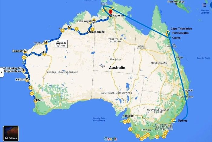 Okay, let’s recap. We’ve traveled through Western Australia, the Northern Territory, Queensland, and tonight we’ll be in New South Wales. We’ll even lose an extra hour—and a bunch of degrees!
We’re on a flawless journey so far. One of our suitcases is almost two kilos overweight. The guy checking us in gives us a nice smile and decides to overlook the excess baggage fee.
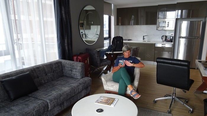
A flight, for once, without a hitch, no delay (just half an hour…). Taxi… We discover our… room… We’ve got a suite like never before on this trip. It’s a posh apartment on the 7th floor—on cloud nine, really! We can’t believe it. 113.26 € per night! The Meriton Suites Mascot Central if you ever find yourself in this city… We even have a washing machine (and it works!). Such a change from the cabins in the west!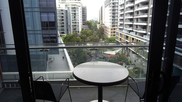
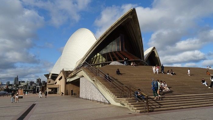
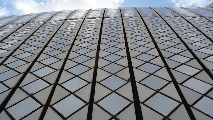
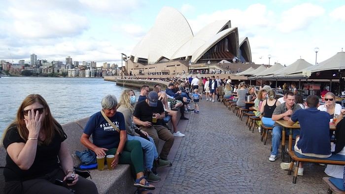
We don’t linger, though. We take the metro. Why? Well, yeah, we’re still kids at heart—off to the Opera House, of course!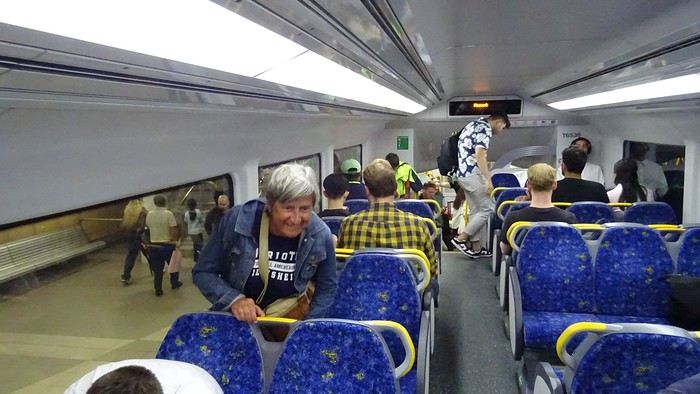
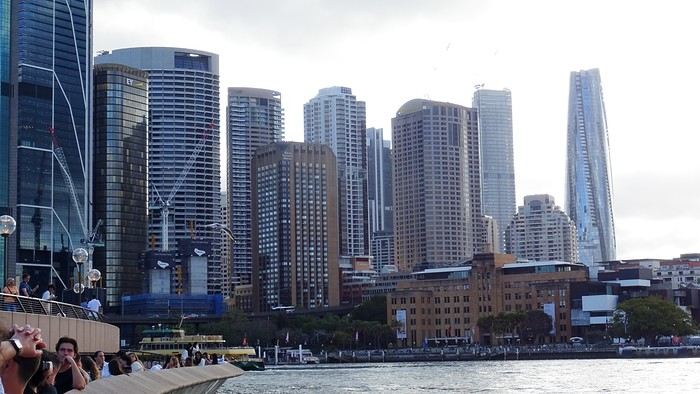
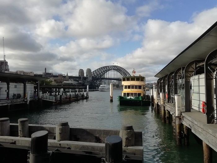 Restaurant prices have doubled. Even tripled. We reluctantly settle for a pizzeria because that T-bone for 155 AUD (100 €)…
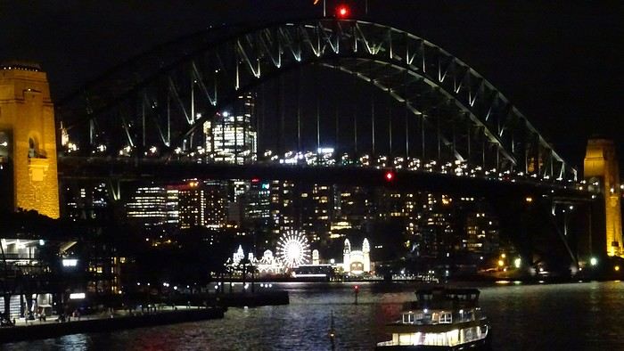
We know how to handle ourselves. There’s a Woolworths right downstairs. And we’ve got a kitchen, remember! And a terrace! We even have huge bats to brighten up our skies!
Okay, let’s recap. We’ve traveled through Western Australia, the Northern Territory, Queensland, and tonight we’ll be in New South Wales. We’ll even lose an extra hour—and a bunch of degrees!
We’re on a flawless journey so far. One of our suitcases is almost two kilos overweight. The guy checking us in gives us a nice smile and decides to overlook the excess baggage fee.A flight, for once, without a hitch, no delay (just half an hour…). Taxi… We discover our… room… We’ve got a suite like never before on this trip. It’s a posh apartment on the 7th floor—on cloud nine, really! We can’t believe it. 113.26 € per night! The Meriton Suites Mascot Central if you ever find yourself in this city… We even have a washing machine (and it works!). Such a change from the cabins in the west!
We don’t linger, though. We take the metro. Why? Well, yeah, we’re still kids at heart—off to the Opera House, of course!
Restaurant prices have doubled. Even tripled. We reluctantly settle for a pizzeria because that T-bone for 155 AUD (100 €)…
We know how to handle ourselves. There’s a Woolworths right downstairs. And we’ve got a kitchen, remember! And a terrace! We even have huge bats to brighten up our skies!
One-month itinerary in Central Asia
Hello! I’m so excited to be back on this forum—it’s helped me so much in the past! I need your expert advice for our next trip, which will take us to Central Asia: Uzbekistan, Tajikistan, Kyrgyzstan, and Kazakhstan.
We have a month, and here’s the itinerary I have in mind: Arrival in Tashkent – 2 days Bukhara – 2 days Samarkand – 3 days Panjakent – 1 day The Seven Lakes + Iskanderkul – 3 days Khujand – 2 days Fergana Valley – 3 days Song Kol Lake – 2 days Issyk-Kul Lake – 3 days Charyn Canyon – 1 day Kaindy Lake – 1 day Altyn Emel Park – 1 day Almaty – 1 day and departure
I know the travel times, especially in the mountains, can be long, but I’ve tried to optimize it so we can rest after the long drives. Our family includes three kids aged 5, 13, and 17. We’re used to backpacking. But I have *so* many questions: -Will it be extremely hot in Uzbekistan, but manageable in the other regions on my itinerary? -I’ve read conflicting things about trains in Uzbekistan: is it possible to book train tickets in advance from France? -For the Seven Lakes and Iskanderkul, do I need to hire a driver? Is it easy to find one? Since there are five of us, we’d need a large car… or is it possible to rent a car in Panjakent and drop it off in Khujand? -What’s worth visiting in the Fergana Valley? -I’d prefer to avoid domestic flights, so I planned to break up the Osh-Issyk-Kul Lake route by stopping at Song Kol Lake and taking a horseback ride. Is that realistic? Again, do I need to find a driver, or can we do it independently? -Where’s the best base for Issyk-Kul Lake? The main goal is to relax and swim (is it acceptable for women to wear swimsuits in these regions?) -For the last part of the trip—Charyn Canyon and Kaindy Lake from Issyk-Kul—is it doable, or do I need a driver once more? -Is Altyn Emel Park doable in the summer, or is it too hot? The idea is to see the views and do a short 3-hour hike.
Thanks so much for any firsthand tips or experiences you can share!
We have a month, and here’s the itinerary I have in mind: Arrival in Tashkent – 2 days Bukhara – 2 days Samarkand – 3 days Panjakent – 1 day The Seven Lakes + Iskanderkul – 3 days Khujand – 2 days Fergana Valley – 3 days Song Kol Lake – 2 days Issyk-Kul Lake – 3 days Charyn Canyon – 1 day Kaindy Lake – 1 day Altyn Emel Park – 1 day Almaty – 1 day and departure
I know the travel times, especially in the mountains, can be long, but I’ve tried to optimize it so we can rest after the long drives. Our family includes three kids aged 5, 13, and 17. We’re used to backpacking. But I have *so* many questions: -Will it be extremely hot in Uzbekistan, but manageable in the other regions on my itinerary? -I’ve read conflicting things about trains in Uzbekistan: is it possible to book train tickets in advance from France? -For the Seven Lakes and Iskanderkul, do I need to hire a driver? Is it easy to find one? Since there are five of us, we’d need a large car… or is it possible to rent a car in Panjakent and drop it off in Khujand? -What’s worth visiting in the Fergana Valley? -I’d prefer to avoid domestic flights, so I planned to break up the Osh-Issyk-Kul Lake route by stopping at Song Kol Lake and taking a horseback ride. Is that realistic? Again, do I need to find a driver, or can we do it independently? -Where’s the best base for Issyk-Kul Lake? The main goal is to relax and swim (is it acceptable for women to wear swimsuits in these regions?) -For the last part of the trip—Charyn Canyon and Kaindy Lake from Issyk-Kul—is it doable, or do I need a driver once more? -Is Altyn Emel Park doable in the summer, or is it too hot? The idea is to see the views and do a short 3-hour hike.
Thanks so much for any firsthand tips or experiences you can share!
Malaysia/Borneo 4-week itinerary
We're a family with two kids aged 15 and 12 planning to visit Malaysia and Borneo. We'd like to travel from 23/07/2025 to 20/08/2025, which is almost 4 full weeks on the ground.
We've made good progress but would love some advice.
We're planning a flight from Paris to Singapore.
Singapore – 2 days Malaysia: Malacca Kuala Lumpur Cameron Highlands Pulau Pangkor Taman Negara National Park Georgetown and Penang Island Perhentian Islands Other islands on the west coast Tioman
Borneo: Semporna Archipelago Turtle Island National Park Traditional village in Sarawak Gunung Mulu National Park Borneo jungles to see orangutans
Do you think this is doable or not?
Thanks in advance for your replies
Singapore – 2 days Malaysia: Malacca Kuala Lumpur Cameron Highlands Pulau Pangkor Taman Negara National Park Georgetown and Penang Island Perhentian Islands Other islands on the west coast Tioman
Borneo: Semporna Archipelago Turtle Island National Park Traditional village in Sarawak Gunung Mulu National Park Borneo jungles to see orangutans
Do you think this is doable or not?
Thanks in advance for your replies
Summer trip to South Africa
Hello,
Happy 2025, filled with wonderful travels! 🙂
We’re traveling as a family to South Africa for the first time in July (two parents and our four young adult children). We’ve planned a loop starting from Port Elizabeth for 13 days, followed by another loop from Johannesburg with 2 days at Blyde River Canyon and 5 days in Kruger NP.
We’re wondering about the Port Elizabeth loop. Here’s our initial idea: Day 1: Early arrival in Port Elizabeth, morning walk in Tsitsikamma NP, night at Storm River Rest Camp. Day 2: Continue visiting Tsitsikamma NP early in the morning, then Robberg Nature Reserve, night at Ebb and Flow Rest Camp. Day 3: Visit the Wilderness area, night at Ebb and Flow Rest Camp. Day 4: Drive to Hermanus. Several options: Bontebok NP or The Hoop and Cape Agulhas; night in Hermanus. Day 5: Coastal trail, boat trip (?), night in Cape Town. Day 6: Table Mountain, Bo-Kaap, Waterfront; night in Cape Town. Day 7: Cape Peninsula, night in Cape Town. Day 8: Karoo Desert National Botanical Garden, Matjiesfontein; night in the area. Day 9: AM: Karoo NP; night in Beaufort West. Day 10: Karoo NP; night in Beaufort West. Day 11: AM: Camdeboo NP; night in Graaff-Reinet. Day 12: Morning: Camdeboo NP; drive to Addo Elephant NP; visit depending on arrival time; night at Addo Elephant Rest Camp. Day 13: Addo Elephant NP; night in Port Elizabeth. Day 14: Early flight.
Does this seem balanced and suitable for July? It’s quite packed, but we’ve already had to skip quite a bit. Initially, would it be better to spend 2 nights in Tsitsikamma and just one in Wilderness? Or just one night at each to free up a day for something else?
For the car, is a minivan enough, or should we plan at least an SUV for the parks given the season?
Thanks in advance for your feedback. Have a great evening
Happy 2025, filled with wonderful travels! 🙂
We’re traveling as a family to South Africa for the first time in July (two parents and our four young adult children). We’ve planned a loop starting from Port Elizabeth for 13 days, followed by another loop from Johannesburg with 2 days at Blyde River Canyon and 5 days in Kruger NP.
We’re wondering about the Port Elizabeth loop. Here’s our initial idea: Day 1: Early arrival in Port Elizabeth, morning walk in Tsitsikamma NP, night at Storm River Rest Camp. Day 2: Continue visiting Tsitsikamma NP early in the morning, then Robberg Nature Reserve, night at Ebb and Flow Rest Camp. Day 3: Visit the Wilderness area, night at Ebb and Flow Rest Camp. Day 4: Drive to Hermanus. Several options: Bontebok NP or The Hoop and Cape Agulhas; night in Hermanus. Day 5: Coastal trail, boat trip (?), night in Cape Town. Day 6: Table Mountain, Bo-Kaap, Waterfront; night in Cape Town. Day 7: Cape Peninsula, night in Cape Town. Day 8: Karoo Desert National Botanical Garden, Matjiesfontein; night in the area. Day 9: AM: Karoo NP; night in Beaufort West. Day 10: Karoo NP; night in Beaufort West. Day 11: AM: Camdeboo NP; night in Graaff-Reinet. Day 12: Morning: Camdeboo NP; drive to Addo Elephant NP; visit depending on arrival time; night at Addo Elephant Rest Camp. Day 13: Addo Elephant NP; night in Port Elizabeth. Day 14: Early flight.
Does this seem balanced and suitable for July? It’s quite packed, but we’ve already had to skip quite a bit. Initially, would it be better to spend 2 nights in Tsitsikamma and just one in Wilderness? Or just one night at each to free up a day for something else?
For the car, is a minivan enough, or should we plan at least an SUV for the parks given the season?
Thanks in advance for your feedback. Have a great evening
Information about the San Blas Islands before booking your excursion (Panama)
I’ve put together this information sheet based on my own experience, feedback from my clients, and reviews from travelers on various travel forums and social media.
I think it’s important to share the reality of these postcard-perfect little islands with their white sandy beaches and palm trees before you set off. That way, you can make the most of your trip to the San Blas Islands, know exactly what to expect, and decide if this destination is right for you.
The San Blas Islands are run by the indigenous Guna people. They have their own rules, and Panamanian law doesn’t really apply. Today, their main income comes from tourism, so please note that foreigners aren’t allowed to operate cabanas there. This means that as soon as you board their small boats, you’re in the hands of the Gunas, and it’ll be tough to complain about delays, logistical issues, or refunds. Wait times can be long, and the Gunas are pretty informal—at first glance, they might even seem unwelcoming. But you have to understand that their culture and way of life are simply different from yours.
You’ll find plenty of tour operators offering day trips or one- or two-night stays on the same islands at different prices. I think all these listings create confusion and uncertainty for travelers. You can book with operators who care about their clients and deal directly with them, while others act only as intermediaries or booking systems between travelers, the Gunas, and transport companies without providing any follow-up during your stay. Don’t forget that all the San Blas Islands are beautiful, and your choice shouldn’t be based on which of the 365 islands is the prettiest, but on the hospitality of the Guna family, the accommodation, and the service they provide. I also recommend avoiding San Blas on weekends and public holidays.
To explain the sometimes "low" level of service mentioned in traveler reviews, you need to understand that the San Blas Islands are very basic and rustic—that’s also the charm of the experience, which, for some of you, will push you out of your comfort zone. Not all huts have electricity, or even light. If you want to charge your phone, ask the island owner, who might charge you a small fee. Needless to say, WiFi isn’t available on all islands.
Not all Gunas working there have studied hospitality management, logistics, gastronomy, or tourism. There’s been a big "boom" in the last 10 years, and they haven’t been trained for it.
Regarding the 4x4 road transport, expect to be a bit cramped since the car can fit 6 passengers. Also, you might face delays, or the car might already be waiting for you because the pickup route can change, and sometimes other passengers are late, causing delays. To avoid this, I recommend paying extra for private transport—it’ll make your trip smoother and save you frustration before arriving in San Blas, as well as on your return to Panama City, which can sometimes be chaotic.
Stay flexible! Expect delays, lack of communication, waiting for someone or something without knowing why, rustic cabanas, no fish but pasta instead (yes! sometimes the fish season is low!), fried eggs and bread for breakfast—but in the end, everything works out if you can accept these little inconveniences. Just enjoy the adventure!
Finally, the San Blas Islands have a waste collection problem, so you might see trash on the islands, especially during the summer season due to strong currents. Most of the waste comes from the sea and the mainland. For the sake of the island, please take your trash with you.
I think it’s important to share the reality of these postcard-perfect little islands with their white sandy beaches and palm trees before you set off. That way, you can make the most of your trip to the San Blas Islands, know exactly what to expect, and decide if this destination is right for you.
The San Blas Islands are run by the indigenous Guna people. They have their own rules, and Panamanian law doesn’t really apply. Today, their main income comes from tourism, so please note that foreigners aren’t allowed to operate cabanas there. This means that as soon as you board their small boats, you’re in the hands of the Gunas, and it’ll be tough to complain about delays, logistical issues, or refunds. Wait times can be long, and the Gunas are pretty informal—at first glance, they might even seem unwelcoming. But you have to understand that their culture and way of life are simply different from yours.
You’ll find plenty of tour operators offering day trips or one- or two-night stays on the same islands at different prices. I think all these listings create confusion and uncertainty for travelers. You can book with operators who care about their clients and deal directly with them, while others act only as intermediaries or booking systems between travelers, the Gunas, and transport companies without providing any follow-up during your stay. Don’t forget that all the San Blas Islands are beautiful, and your choice shouldn’t be based on which of the 365 islands is the prettiest, but on the hospitality of the Guna family, the accommodation, and the service they provide. I also recommend avoiding San Blas on weekends and public holidays.
To explain the sometimes "low" level of service mentioned in traveler reviews, you need to understand that the San Blas Islands are very basic and rustic—that’s also the charm of the experience, which, for some of you, will push you out of your comfort zone. Not all huts have electricity, or even light. If you want to charge your phone, ask the island owner, who might charge you a small fee. Needless to say, WiFi isn’t available on all islands.
Not all Gunas working there have studied hospitality management, logistics, gastronomy, or tourism. There’s been a big "boom" in the last 10 years, and they haven’t been trained for it.
Regarding the 4x4 road transport, expect to be a bit cramped since the car can fit 6 passengers. Also, you might face delays, or the car might already be waiting for you because the pickup route can change, and sometimes other passengers are late, causing delays. To avoid this, I recommend paying extra for private transport—it’ll make your trip smoother and save you frustration before arriving in San Blas, as well as on your return to Panama City, which can sometimes be chaotic.
Stay flexible! Expect delays, lack of communication, waiting for someone or something without knowing why, rustic cabanas, no fish but pasta instead (yes! sometimes the fish season is low!), fried eggs and bread for breakfast—but in the end, everything works out if you can accept these little inconveniences. Just enjoy the adventure!
Finally, the San Blas Islands have a waste collection problem, so you might see trash on the islands, especially during the summer season due to strong currents. Most of the waste comes from the sea and the mainland. For the sake of the island, please take your trash with you.
Bruges to Amsterdam by bike - July 2025
Hi there!
I’m really keen to cycle from Bruges to Amsterdam. Has anyone here done it before? We’re a group of three—is it easy to find accommodation on the go, or should we book ahead? If we do a round trip and take our bikes, would it be simpler to plan two different routes?!
Thanks so much!
Laurence from Bayonne
21-Day Trip to La Gomera and La Palma
Travel Journal: 21 Days in La Gomera and La Palma
From February 6 to February 26, 2024
Tuesday, February 6 We left around 9 AM with our car, along with Pierre-Paul and Patricia, heading to the Bluepark parking lot in Bartenheim. As expected, we were awaited and left promptly for EuroAirport Basel. Took off at 12:25 PM for a 4-hour-15-minute flight under excellent conditions. Beautiful arrival in Tenerife with Teide in sight under a clear blue sky. Fifteen minutes later, we waited for bus No. 40 to Los Cristianos with quite a few other tourists, but we managed to find four seats. From the bus station, it was a 20-minute walk to our hotel. We checked into a lovely apartment for the four of us, complete with all the comforts. Outside, it was quite warm—at least 25°C! After dropping off our luggage, we went for a stroll. The immediate surroundings of the hotel held no interest for us: a modern, concrete area filled with hotels, bars, tourist agencies, and unappealing restaurants all offering the same bland international cuisine. Pat went to cool off at the pool, unfortunately overrun by loud, drunk English tourists. I took a walk to the paseo maritimo that leads to the port, skirting the seafront. The promenade was pleasant, but it could have been any seaside resort in the world—same old scene: a succession of bars with blaring music where many elderly people sipped cold beers waiting for the sunset, the backdrop a wall of resort-style hotels resembling rabbit hutches! Upon reaching the port, I scouted the route we’d take the next day to the Fred Olsen ferry. Back at the apartment, in the early evening, we looked for a non-touristy restaurant for dinner. Monique stopped a woman to ask her opinion! In this area, she told us, there’s no restaurant that serves Canarian or Spanish cuisine! The only place with decent restaurants is at the port. Off we went to the port, where we sat down at Al Bordo restaurant and ordered a seafood paella for four. Excellent, and at a very reasonable price (36 € for two). We returned to the hotel along the seafront.
Wednesday, February 7
Woke up at 6 AM. Had breakfast in the apartment with what we’d bought the day before at a supermarket. It was still dark when we left on foot toward the port, walking along the calm seafront at this early hour. Forty minutes later, we arrived and waited 10 minutes before the ferry docked. At 9:30 AM, we left the port of Los Cristianos for a 50-minute crossing on a calm sea under a beautiful blue sky. There were quite a few people on this large ferry, but many had no luggage, meaning they were visiting La Gomera for the day and would take the ferry back in the evening. Upon disembarking, we went straight to our rental car agency to pick up the car we’d booked online a few months earlier. It was a nice Peugeot 2008, spacious enough for the four of us and our luggage. We immediately took the beautiful road from San Sebastián that climbs directly into the mountains toward our rental in Vallehermoso. The road was in perfect condition—it seemed brand new, like all the others we’d take on this island later. This side of the island is very arid with little vegetation, and the terrain is particularly rugged, as it is throughout the island. We stopped at our first miradors, which would be followed by many more throughout our Canarian trip. Our first visit was to the small village of Agulo, perched on a promontory above the sea and at the foot of a high cliff. The village features typical Canarian houses with windows flush with the façade and black volcanic stone masonry on white or reddish-brown walls. The first recommended restaurant was already booked for a group, so we settled for the shaded terrace of the excellent El Alameda bar-restaurant. From Agulo, you can access the Abrante viewpoint via a winding road, where the view of Agulo, 600 meters below, is exceptional. A glass ledge over the void lets you test your fear of heights!
We drove to Vallehermoso to do our grocery shopping at the supermarket—a habit that would continue until the end of the trip. Our little house, "Casa rural El Encatadora," is located in a beautiful flower-filled valley a few kilometers west of Vallehermoso. Each of us had a bedroom with an en-suite bathroom, plus a living room, kitchen, and a small terrace overlooking the quiet street at the valley’s end, which didn’t bother us at all.
Thursday, February 8 The good weather seemed to follow us since our arrival in the Canary Islands. This morning, we took the road—still as beautiful and new—toward Arure, high up to the west. The landscape was magnificent, with breathtaking glimpses of the sea far below. In Arure, we parked in front of Conchita’s bar, where a hike (Rother No. 30) starts toward two viewpoints: Alojera, which we reached after 45 minutes on a lovely path. Monique, tired from the first steep climb, stopped at the first viewpoint and hitchhiked back to Arure. Meanwhile, we continued toward the second viewpoint, Los Barranquillos, where the view of the surroundings was partially hidden by misty clouds rising from the sea. The entire mountain is sculpted by ancient, endless terraces climbing until the slope becomes too steep for construction—visible traces of the hard work of past inhabitants trying to survive in a harsh environment. We had a decent lunch at La Conchita bar, then drove to the small seaside town of Puerto la Caleta, sheltered by an immense cliff plunging into the sea. Black sand beach, rough sea—despite our encouragement, Pat didn’t dare to swim! As for the old village of Caleta, it’s perched on the mountainside, and visiting it requires climbing steep, stair-filled alleys to discover a few traditional houses. Back at the casa, dinner in, and card games...
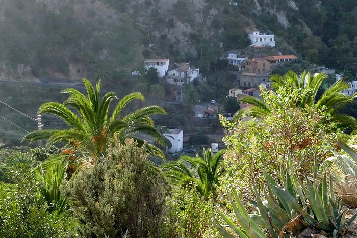 Vallehermoso
Friday, February 9 This morning, the sky was overcast, and the peaks around us were shrouded in clouds. We took the same road as yesterday to hike Las Creces. Quickly gaining altitude, we entered a thick fog—visibility was very limited. We stopped at the Las Creces parking lot; visibility improved, and the sun wasn’t far off. The hike is entirely within a beautiful laurel forest, with the sun playing hide-and-seek, but it wasn’t cold despite the altitude. After finishing the loop trail, we decided to picnic—not there, as it was too chilly—but on Vallehermoso’s beach, where we found a nice picnic area sheltered by large black rocks. A short digestive walk on the surrounding hill to admire the little beach from above. Back in Vallehermoso, we did some grocery shopping, then tried to return to the casa—only to find ourselves locked out because we’d left the key in the lock inside! After several attempts and with the help of Yéli, a relative of the owner we called for help, we were finally able to get back in!
Saturday, February 10
It rained last night, and the sky remained overcast. Monique decided to rest this morning. PP, Pat, and I set off on the hike that starts from the house toward the Marichal reservoir. The sun wasn’t far off, and by 11 AM, it was fully out. The pleasant hike passed by many flower-filled gardens and orchards—orange, lemon, and mandarin trees in fruit. The path climbed gently toward the reservoir, where the view of the Cano rock dominating the landscape was magnificent. The last part of the climb was a bit tough, overgrown with lush vegetation, and the trail was slippery from last night’s rain. We descended via a different, much more pleasant path and returned to the casa just in time for lunch, prepared by Monique. This valley is rich with its many farmers and market gardeners who’ve cultivated the entire valley, taking advantage of the water flowing down from the mountain, captured upstream and redistributed through countless pipes snaking along the paths. Numerous tanks also store water during dry periods. The houses are scattered across both sides of the valley, and these colorful little homes add a beautiful touch to the landscape. The many palm trees give this valley a distinctly tropical feel—you could almost imagine yourself in the Caribbean. Add to that some salsa music drifting from a hut where farmers were working, and the picture is complete. A well-chilled beer apéro capped off a lovely morning. The afternoon was dedicated to rest, relaxation, reading, and games.
Sunday, February 11 The blue sky returned, though a few clouds still capped the highest peaks. Today, we visited Garajonay National Park, which covers the highest central mountains. Up there, we were above the clouds, and the panoramas from the various viewpoints were stunning: first, Cherelepin, accessible from the Laguna Grande parking lot, then Alto de Garajonay, offering an exceptional view of Teide—over 3,000 meters high—emerging from the clouds on Tenerife, far in the distance. We continued to the Los Roques viewpoints, then stopped for lunch at the Degollada de Peraza restaurant, where the view of the barranco was impressive. We descended toward San Sebastián and checked into our new lodging, La Cabezada, located in the countryside about 3 km above San Sebastián. It’s a small apartment adjacent to the owner’s, with a lovely terrace overlooking the surrounding mountains and surrounded by a beautiful garden. Apéro, then dinner on our beautiful terrace.
Monday, February 12 This morning, we went down to visit San Sebastián de La Gomera: its old tower, main street with some beautiful traditional houses, and the Church of the Assumption. Back at the casa for lunch. In the afternoon, Pat, PP, and I set off on the short hike from San Sebastián beach to La Guancha beach. We drove down and parked on the beach. The path climbs along the hill overlooking San Sebastián, passes by the tall Christ statue dominating the landscape, and roughly follows the coast down to the isolated Guancha beach. A beautiful hike under a hot sun, and a swim was welcome, even if the beach and sea access weren’t very comfortable due to large pebbles and quickly deepening water. Apart from two nudist bathers, there was no one on this beach. We returned the same way.
Tuesday, February 13 Rest day. We went down to town to stroll and do some shopping. I took the opportunity to visit the parador, beautifully situated above the city in a lovely garden overlooking the port and town. Together, we went for a cuba libre at the "Cuba Libre" bar, then had lunch at Breñusca (mediocre paella!). Back at the casa, then we went back down to town to see a carnival parade, a "passacalles," which actually passed an hour earlier than scheduled. Oh well.
Wednesday, February 14 Each to their own program this morning. Pat went swimming at San Sebastián beach, Monique rested at the casa, and PP and I set off on the hike from Playa de Avalos to the Ermita de Guadalupe on Playa del Cangrejo. It wasn’t easy to find the right road or the parking spot, but we managed. The path seemed to have suffered landslides, according to a sign at the trailhead! We decided to check it out, ready to turn back if it seemed too dangerous. In the end, apart from one or two slightly tricky spots where we had to climb a pile of rocks, the trail remained passable, though a bit vertigo-inducing in places. The narrow path clings to very vertical cliffs nearly 300 meters above sea level! But what a magnificent view. At one point, the trail runs alongside a wall of basaltic pipes. We returned via the drivable track that parallels the trail a bit lower. Back at the house for lunch. In the late afternoon, we returned to town to attend the "Entierro de las Sardinas" (Burial of the Sardine), which closes the Canarian carnival festivities. While waiting, we strolled through the parador’s gardens and had mojitos in town. Around 9 PM, we heard the noise and cries of the mourners. The procession advanced, led by a large papier-mâché sardine on a float, surrounded by wailing mourners. The procession headed toward the sea, where the sardine was burned, and a mini fireworks display ended the procession. It was all very good-natured, and everyone had fun. We ended the evening with dinner at a good fish restaurant, El Pajar.
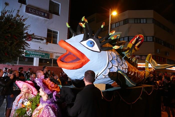 Entierro de la Sardina in San Sebastián de La Gomera
Thursday, February 15
Woke up at 5:15 AM. The only suitable ferry was at 7 AM, which would get us to La Palma by late morning rather than evening. We packed our bags, had breakfast, then headed to the port, left our rental car, and boarded the ferry to Tenerife, from where we’d continue to La Palma. Calm sea, beautiful sun—by 10:30 AM, we disembarked in La Palma. We picked up our car and immediately headed to our new apartment in Breña Alta. It’s a large apartment with a superb terrace facing the sea, fully equipped and very comfortable. The hosts recommended Casa Goyo restaurant, near the airport and close to us. It’s a restaurant with many small rooms, some of which can be reserved for families. The fish-based cuisine (chipirones, pulpo) was excellent, hearty, and reasonably priced. Since it’s in the airport’s flight path, we occasionally heard planes landing. Quick and efficient service. Afterward, we visited Santa Cruz de La Palma, which reminded us of the historic quarters of La Orotava in Tenerife or the capital of Gran Canaria.
Friday, February 16
Beautiful weather, blue sky. We headed to the San Bartolo viewpoint toward the northeast coast, then to the lovely village of San Andrés, which we explored. From there, we walked along the shore to the natural pools of Charco Azul, where we swam in the cool but "swimmable" sea. Back in San Andrés for lunch at the "San Andrés" restaurant on the beautiful church square. Very good fish-based meal. We got back in the car and continued along the north coast to the port of Espindola and the natural pools of Fajana near the Cumplida lighthouse. A fairly strong wind whipped up beautiful waves crashing onto the rocky coast in bursts of foam. Back in Santa Cruz, we stopped at the Mercadona supermarket to buy fresh shrimp for dinner.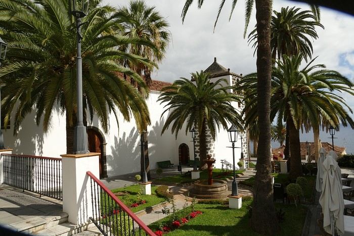 San Andrés
Saturday, February 17
Uniform blue sky, even on the heights. We took the beautiful road that winds up to the summit of the Caldera de Taburiente. Several viewpoints offer 360° views of the entire island and beyond: you can make out La Gomera, El Hierro, and, of course, Tenerife with the perfect triangle of Teide. We parked at the Los Andes viewpoint parking lot and started our hike to Pico de la Cruz along a trail following the ridge, offering superb views into the caldera. We got back in the car and passed by the Roque de los Muchachos astronomical complex, composed of numerous observatories, some with very aesthetic mirror telescopes. We hiked from the Roque de los Muchachos parking lot to the various viewpoints, always as impressive. Picnic on site, then back to Santa Cruz. We stopped by our car dealer because the oil warning light came on—better safe than sorry. The representative reassured us but preferred to give us a Fiat Cross SUV instead.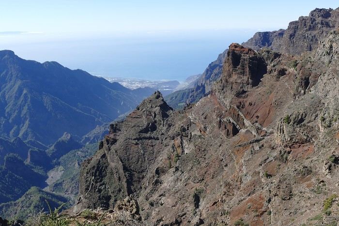 The Caldera de Taburiente
Sunday, February 18 The weather was a bit mixed, with cloudy patches. We set off to hike the Barranco de la Cuba de Galga. Unfortunately, the Los Tilos trail had been closed for several months due to a major landslide. The parking lot by the road was already quite full, and indeed, we crossed paths with many hikers along the way—it’s an easy hike with little elevation gain, which is rare here in La Palma! The beautiful path winds through a very narrow, deep gorge covered in lush tropical vegetation—you’d think you were in a Southeast Asian forest, especially with the humidity in the gorge bringing out earthy and floral scents. Halfway through, Monique turned back while the rest of us continued to the Cuba de Galga. A light drizzle accompanied us on the return. For lunch, we went to Chipi Chipi restaurant in the heights of Santa Cruz. The cool air forced us to leave the lovely terrace for the slightly noisy dining room. The meal was very good and hearty. Afternoon spent resting at our house.
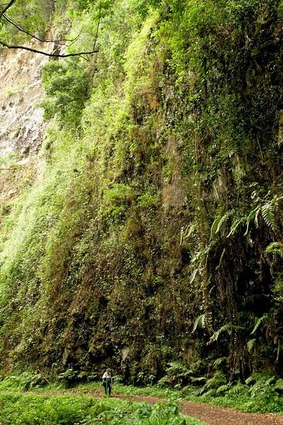 La Cuba de la Galga
Monday, February 19 A few clouds still clung to the nearby mountain peaks. We headed south to Los Canarios. We stopped in front of the small San Antonio Abad church, where a path leads to the viewpoint in 15 minutes. Then we visited the San Antonio Volcano Interpretation Center and climbed to the viewpoint via the trail along the crater’s edge, offering a plunging view into the crater. Then PP, Pat, and I headed toward the Teneguía volcano but turned back given the remaining distance and the intense heat bearing down on us! Plus, the landscape was rather arid and not very interesting. We got back in the car and drove down to the salt flats at the island’s southern tip. The ocean crashes here in large waves, exploding against the volcanic rocks and feeding a "blowhole" carved into the rock. We stopped for drinks at the salt flats restaurant, then headed home.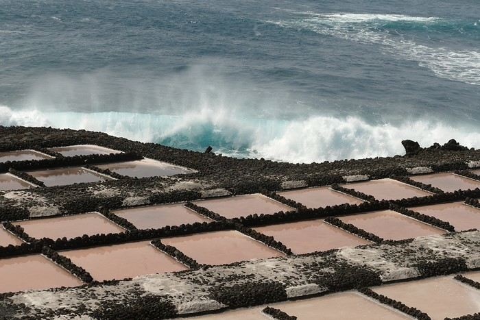 The salt flats in Fuencaliente
Tuesday, February 20 Beautiful weather with a few clouds clinging to the mountains, as usual. A relaxed morning since my parking reservation at La Cumbrecita didn’t start until 1 PM. It takes about 30 minutes from Santa Cruz to reach the valley floor via a beautiful but narrow road toward the end, though there’s very little traffic. Meanwhile, the clouds had disappeared, and the view from the La Cumbrecita viewpoint was superb. We recognized Pico de la Cruz in the distance, where we’d been a few days earlier. We then took the path leading to the Las Chozas viewpoint through a magnificent Canarian pine forest. We picnicked on site, then took the path to the Los Roques viewpoint. We returned the same way since the direct route was closed for construction. Back in Santa Cruz, we visited the Sanctuary of Las Nieves, with its beautiful golden Baroque altar.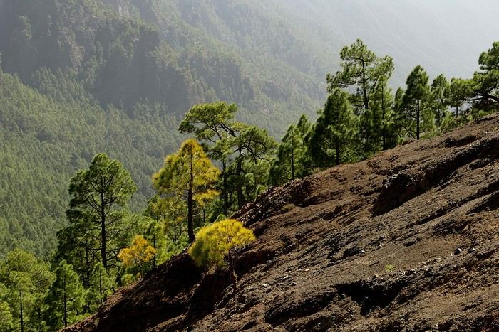 Hike from La Cumbrecita
Wednesday, February 21 After packing our things and loading the car, we left Santa Cruz under a very blue sky for Los Llanos de Aridane, where we stopped to visit this lovely town. The Church of Nuestra Señora de los Remedios has a beautiful coffered ceiling and an original papier-mâché Christ statue from the 16th century. Around it, colorful old Canarian houses brighten the streets of the town center. We took the opportunity to stroll, do some shopping, and finally sat down at La Pergola restaurant for a mediocre lunch. We got back in the car to check into our new house in Arecida. On the way, we stopped at the Mirador del Time, which once again offered an impressive panorama, allowing us—for the first time—to see the damage caused by the Tajogaite volcano eruption in 2021. You can clearly see the still-smoking crater and the large black lava flow covering the landscape down to the sea. We really liked our new accommodation: a local house that’s been renovated on the heights of Arecida, not far from the Canarian pine forest. From several terraces, we have a 360° view of the sea and mountains. We even have a private pool! There are two beautiful, brand-new bedrooms, each with its own bathroom—the best. Plus, we’re on the GR 131 trail that runs along the Barranco de las Angustias toward the northeast.
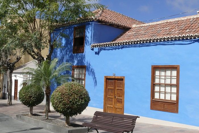 Los Llanos de Aridane
Thursday, February 22 Once again, beautiful weather greeted us when we woke up. We started the GR 131 with the goal of reaching the Torre del Time viewpoint—about 400 meters of elevation gain. The path, quite steep at first, winds through a superb Canarian pine forest. A few viewpoints let you appreciate the sheer drop of the Barranco de las Angustias—watch out for vertigo! At the Torre del Time viewpoint, there’s a nearly 1,000-meter vertical drop. We returned via another path, the PLP1, which meanders first through this beautiful forest, then along lovely flower-filled gardens adjacent to beautiful properties that cascade from the forest down to the road serving these neighborhoods. This afternoon, we tried to get closer to the area devastated by the 2021 lava flows. Several roads are still closed or reserved for residents, while others—brand new—have been rebuilt to open up this densely populated and cultivated region. In some places, the lava flow slightly diverted, sparing some properties that logically should have disappeared. Now, they’re encircled by a massive cooled lava field. In other spots, twisted and charred metal scraps or greenhouse remains protrude from the lava—all that’s left of the former banana plantations. A little higher up, you can see the slightly smoking crater of Tajogaite, responsible for this disaster. Back to Casa Barreros.
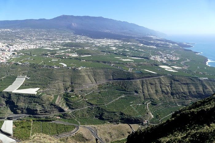 View of Los Llanos and, in the background, the 2021 lava flow
Friday, February 23
Though the sky was still blue, the temperature had dropped due to a chilly wind. By midday, it still rose to 22°C. Today, we headed north, specifically to the town of Tijarafe, where a very narrow road descends to the small port, Porís de Candelaria. The 3.7-kilometer road drops 700 meters in elevation, with gradients up to 30%—it was going to be intense! Indeed, the descent was scary, with the void right next to the very narrow road where passing was impossible except at a few rare spots. Everything went well—there was little traffic at this early hour. From the parking lot at the bottom, a path leads to Porís de Candelaria. It’s surprising to see this small fishing hamlet nestled in the shelter of an immense cave opening onto the sea, which was quite rough today. The sun, at this time of year, would appear late in the cave, which remained in shadow for much of the day. We returned via the same road, strolled through the small town of Puntagorda, and had lunch at El Jardín de los Naranjos restaurant—excellent meal.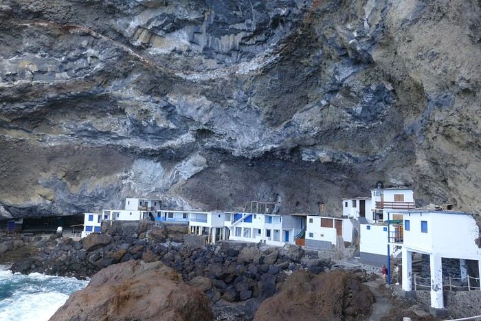 Fishing hamlet of Candelaria
Saturday, February 24 The air was still cool, but the sun was beautiful. While Monique stayed home to rest, the three of us headed to the village of Las Tricias to hike the Buracas Caves trail. We left the car parked on the LP1 road and took the small paved road down to the sign marking the trail’s start. The signage for all the trails we took here, as in La Gomera, was very well done. The path descended steadily, then more steeply toward the caves where the island’s first inhabitants lived—some petroglyphs are still visible in certain caves. The path then climbed back up, passing magnificent dragon trees and more or less elaborate huts occupied by Germans who’ve lived here for many years. Back at Casa Barreros for some rest.
Sunday, February 25 The weather once again blessed us with a beautiful day. This morning, we visited the local produce market held on weekends in Puntagorda. You’ll find agricultural products, crafts, and food to keep you going. A little further on, there’s a glass viewpoint overlooking the barranco plunging toward the sea, with a view of the thrill-seekers trying the zip line right next to it. Lunch at Naranjos—definitely a good spot—with their shrimp and spice tagliatelle. Back home for an afternoon of relaxation.
Monday, February 26 We left Arecida under a cloudy sky. Driving up from Los Llanos de Aridane toward the east, an enormous cascade of clouds poured from the mountain peaks into the Los Llanos plain—very impressive. Arriving in Santa Cruz, we went for a stroll, did some last-minute shopping, then had a final good-quality paella at La Chalana on the paseo maritimo. We left the car in the parking lot and took the 5 PM Olsen ferry to Tenerife on a slightly choppy sea, but the ferry didn’t rock too much. Arriving at 7:15 PM, we dropped off our things near the port in our reserved apartment and went for dinner at Abordo—rubbery chipirones. A digestive stroll among the ever-increasing number of tourists in Los Cristianos—restaurants were packed to the brim, the season is in full swing here. Gone is the calm of La Gomera and La Palma, and the laid-back tourism of German hikers among whom a few French were hiding!
Tuesday, February 27 To make our homemade breakfast more enjoyable, we went to buy pastries at the local bakery, then took one last walk on the paseo along the beaches, mingling with the many mobility scooters driven by elderly or disabled people, joggers, and tourists. Last apéro near the bus station, then off to the airport. After a smooth 4-hour-30-minute flight, we arrived in Basel-Mulhouse at 10:20 PM.
THE END
Conclusion A fantastic trip to two islands with magnificent and diverse nature, where landscapes range from desert-like to tropical depending on exposure to winds and clouds. Thanks to the many beautiful viewpoints, you can truly appreciate these exceptionally dynamic reliefs. A hiker’s paradise, the trails are all very well marked, though the choice of easy or moderate paths for "casual walkers" is quite limited. Another notable advantage, in our opinion, is that these islands are very lightly developed—you’ll hardly see any of those ugly hotel blocks that spoil the landscapes of some other Canary Islands. It’s true that the beaches on these two islands don’t meet traditional international tourism criteria: they’re small, with black sand, and often difficult to access. Special mention for the quality of the road network (except for a few small local roads), which seems brand new, well-paved, and well-signposted. We also enjoyed exceptional weather for February, with fewer than three days of gray or rainy weather out of 21.
Almost all the accommodations we chose met or exceeded our expectations, often at reasonable prices: an average of 98 € per night for an apartment or house with two bedrooms for four people.
All photos can be viewed by clicking this link: https://photos.app.goo.gl/G44pPk4g9PW1rNzg8
Tuesday, February 6 We left around 9 AM with our car, along with Pierre-Paul and Patricia, heading to the Bluepark parking lot in Bartenheim. As expected, we were awaited and left promptly for EuroAirport Basel. Took off at 12:25 PM for a 4-hour-15-minute flight under excellent conditions. Beautiful arrival in Tenerife with Teide in sight under a clear blue sky. Fifteen minutes later, we waited for bus No. 40 to Los Cristianos with quite a few other tourists, but we managed to find four seats. From the bus station, it was a 20-minute walk to our hotel. We checked into a lovely apartment for the four of us, complete with all the comforts. Outside, it was quite warm—at least 25°C! After dropping off our luggage, we went for a stroll. The immediate surroundings of the hotel held no interest for us: a modern, concrete area filled with hotels, bars, tourist agencies, and unappealing restaurants all offering the same bland international cuisine. Pat went to cool off at the pool, unfortunately overrun by loud, drunk English tourists. I took a walk to the paseo maritimo that leads to the port, skirting the seafront. The promenade was pleasant, but it could have been any seaside resort in the world—same old scene: a succession of bars with blaring music where many elderly people sipped cold beers waiting for the sunset, the backdrop a wall of resort-style hotels resembling rabbit hutches! Upon reaching the port, I scouted the route we’d take the next day to the Fred Olsen ferry. Back at the apartment, in the early evening, we looked for a non-touristy restaurant for dinner. Monique stopped a woman to ask her opinion! In this area, she told us, there’s no restaurant that serves Canarian or Spanish cuisine! The only place with decent restaurants is at the port. Off we went to the port, where we sat down at Al Bordo restaurant and ordered a seafood paella for four. Excellent, and at a very reasonable price (36 € for two). We returned to the hotel along the seafront.
Wednesday, February 7
Woke up at 6 AM. Had breakfast in the apartment with what we’d bought the day before at a supermarket. It was still dark when we left on foot toward the port, walking along the calm seafront at this early hour. Forty minutes later, we arrived and waited 10 minutes before the ferry docked. At 9:30 AM, we left the port of Los Cristianos for a 50-minute crossing on a calm sea under a beautiful blue sky. There were quite a few people on this large ferry, but many had no luggage, meaning they were visiting La Gomera for the day and would take the ferry back in the evening. Upon disembarking, we went straight to our rental car agency to pick up the car we’d booked online a few months earlier. It was a nice Peugeot 2008, spacious enough for the four of us and our luggage. We immediately took the beautiful road from San Sebastián that climbs directly into the mountains toward our rental in Vallehermoso. The road was in perfect condition—it seemed brand new, like all the others we’d take on this island later. This side of the island is very arid with little vegetation, and the terrain is particularly rugged, as it is throughout the island. We stopped at our first miradors, which would be followed by many more throughout our Canarian trip. Our first visit was to the small village of Agulo, perched on a promontory above the sea and at the foot of a high cliff. The village features typical Canarian houses with windows flush with the façade and black volcanic stone masonry on white or reddish-brown walls. The first recommended restaurant was already booked for a group, so we settled for the shaded terrace of the excellent El Alameda bar-restaurant. From Agulo, you can access the Abrante viewpoint via a winding road, where the view of Agulo, 600 meters below, is exceptional. A glass ledge over the void lets you test your fear of heights!
We drove to Vallehermoso to do our grocery shopping at the supermarket—a habit that would continue until the end of the trip. Our little house, "Casa rural El Encatadora," is located in a beautiful flower-filled valley a few kilometers west of Vallehermoso. Each of us had a bedroom with an en-suite bathroom, plus a living room, kitchen, and a small terrace overlooking the quiet street at the valley’s end, which didn’t bother us at all.
Thursday, February 8 The good weather seemed to follow us since our arrival in the Canary Islands. This morning, we took the road—still as beautiful and new—toward Arure, high up to the west. The landscape was magnificent, with breathtaking glimpses of the sea far below. In Arure, we parked in front of Conchita’s bar, where a hike (Rother No. 30) starts toward two viewpoints: Alojera, which we reached after 45 minutes on a lovely path. Monique, tired from the first steep climb, stopped at the first viewpoint and hitchhiked back to Arure. Meanwhile, we continued toward the second viewpoint, Los Barranquillos, where the view of the surroundings was partially hidden by misty clouds rising from the sea. The entire mountain is sculpted by ancient, endless terraces climbing until the slope becomes too steep for construction—visible traces of the hard work of past inhabitants trying to survive in a harsh environment. We had a decent lunch at La Conchita bar, then drove to the small seaside town of Puerto la Caleta, sheltered by an immense cliff plunging into the sea. Black sand beach, rough sea—despite our encouragement, Pat didn’t dare to swim! As for the old village of Caleta, it’s perched on the mountainside, and visiting it requires climbing steep, stair-filled alleys to discover a few traditional houses. Back at the casa, dinner in, and card games...
VallehermosoFriday, February 9 This morning, the sky was overcast, and the peaks around us were shrouded in clouds. We took the same road as yesterday to hike Las Creces. Quickly gaining altitude, we entered a thick fog—visibility was very limited. We stopped at the Las Creces parking lot; visibility improved, and the sun wasn’t far off. The hike is entirely within a beautiful laurel forest, with the sun playing hide-and-seek, but it wasn’t cold despite the altitude. After finishing the loop trail, we decided to picnic—not there, as it was too chilly—but on Vallehermoso’s beach, where we found a nice picnic area sheltered by large black rocks. A short digestive walk on the surrounding hill to admire the little beach from above. Back in Vallehermoso, we did some grocery shopping, then tried to return to the casa—only to find ourselves locked out because we’d left the key in the lock inside! After several attempts and with the help of Yéli, a relative of the owner we called for help, we were finally able to get back in!
Saturday, February 10
It rained last night, and the sky remained overcast. Monique decided to rest this morning. PP, Pat, and I set off on the hike that starts from the house toward the Marichal reservoir. The sun wasn’t far off, and by 11 AM, it was fully out. The pleasant hike passed by many flower-filled gardens and orchards—orange, lemon, and mandarin trees in fruit. The path climbed gently toward the reservoir, where the view of the Cano rock dominating the landscape was magnificent. The last part of the climb was a bit tough, overgrown with lush vegetation, and the trail was slippery from last night’s rain. We descended via a different, much more pleasant path and returned to the casa just in time for lunch, prepared by Monique. This valley is rich with its many farmers and market gardeners who’ve cultivated the entire valley, taking advantage of the water flowing down from the mountain, captured upstream and redistributed through countless pipes snaking along the paths. Numerous tanks also store water during dry periods. The houses are scattered across both sides of the valley, and these colorful little homes add a beautiful touch to the landscape. The many palm trees give this valley a distinctly tropical feel—you could almost imagine yourself in the Caribbean. Add to that some salsa music drifting from a hut where farmers were working, and the picture is complete. A well-chilled beer apéro capped off a lovely morning. The afternoon was dedicated to rest, relaxation, reading, and games.
Sunday, February 11 The blue sky returned, though a few clouds still capped the highest peaks. Today, we visited Garajonay National Park, which covers the highest central mountains. Up there, we were above the clouds, and the panoramas from the various viewpoints were stunning: first, Cherelepin, accessible from the Laguna Grande parking lot, then Alto de Garajonay, offering an exceptional view of Teide—over 3,000 meters high—emerging from the clouds on Tenerife, far in the distance. We continued to the Los Roques viewpoints, then stopped for lunch at the Degollada de Peraza restaurant, where the view of the barranco was impressive. We descended toward San Sebastián and checked into our new lodging, La Cabezada, located in the countryside about 3 km above San Sebastián. It’s a small apartment adjacent to the owner’s, with a lovely terrace overlooking the surrounding mountains and surrounded by a beautiful garden. Apéro, then dinner on our beautiful terrace.
Monday, February 12 This morning, we went down to visit San Sebastián de La Gomera: its old tower, main street with some beautiful traditional houses, and the Church of the Assumption. Back at the casa for lunch. In the afternoon, Pat, PP, and I set off on the short hike from San Sebastián beach to La Guancha beach. We drove down and parked on the beach. The path climbs along the hill overlooking San Sebastián, passes by the tall Christ statue dominating the landscape, and roughly follows the coast down to the isolated Guancha beach. A beautiful hike under a hot sun, and a swim was welcome, even if the beach and sea access weren’t very comfortable due to large pebbles and quickly deepening water. Apart from two nudist bathers, there was no one on this beach. We returned the same way.
Tuesday, February 13 Rest day. We went down to town to stroll and do some shopping. I took the opportunity to visit the parador, beautifully situated above the city in a lovely garden overlooking the port and town. Together, we went for a cuba libre at the "Cuba Libre" bar, then had lunch at Breñusca (mediocre paella!). Back at the casa, then we went back down to town to see a carnival parade, a "passacalles," which actually passed an hour earlier than scheduled. Oh well.
Wednesday, February 14 Each to their own program this morning. Pat went swimming at San Sebastián beach, Monique rested at the casa, and PP and I set off on the hike from Playa de Avalos to the Ermita de Guadalupe on Playa del Cangrejo. It wasn’t easy to find the right road or the parking spot, but we managed. The path seemed to have suffered landslides, according to a sign at the trailhead! We decided to check it out, ready to turn back if it seemed too dangerous. In the end, apart from one or two slightly tricky spots where we had to climb a pile of rocks, the trail remained passable, though a bit vertigo-inducing in places. The narrow path clings to very vertical cliffs nearly 300 meters above sea level! But what a magnificent view. At one point, the trail runs alongside a wall of basaltic pipes. We returned via the drivable track that parallels the trail a bit lower. Back at the house for lunch. In the late afternoon, we returned to town to attend the "Entierro de las Sardinas" (Burial of the Sardine), which closes the Canarian carnival festivities. While waiting, we strolled through the parador’s gardens and had mojitos in town. Around 9 PM, we heard the noise and cries of the mourners. The procession advanced, led by a large papier-mâché sardine on a float, surrounded by wailing mourners. The procession headed toward the sea, where the sardine was burned, and a mini fireworks display ended the procession. It was all very good-natured, and everyone had fun. We ended the evening with dinner at a good fish restaurant, El Pajar.
Entierro de la Sardina in San Sebastián de La GomeraThursday, February 15
Woke up at 5:15 AM. The only suitable ferry was at 7 AM, which would get us to La Palma by late morning rather than evening. We packed our bags, had breakfast, then headed to the port, left our rental car, and boarded the ferry to Tenerife, from where we’d continue to La Palma. Calm sea, beautiful sun—by 10:30 AM, we disembarked in La Palma. We picked up our car and immediately headed to our new apartment in Breña Alta. It’s a large apartment with a superb terrace facing the sea, fully equipped and very comfortable. The hosts recommended Casa Goyo restaurant, near the airport and close to us. It’s a restaurant with many small rooms, some of which can be reserved for families. The fish-based cuisine (chipirones, pulpo) was excellent, hearty, and reasonably priced. Since it’s in the airport’s flight path, we occasionally heard planes landing. Quick and efficient service. Afterward, we visited Santa Cruz de La Palma, which reminded us of the historic quarters of La Orotava in Tenerife or the capital of Gran Canaria.
Friday, February 16
Beautiful weather, blue sky. We headed to the San Bartolo viewpoint toward the northeast coast, then to the lovely village of San Andrés, which we explored. From there, we walked along the shore to the natural pools of Charco Azul, where we swam in the cool but "swimmable" sea. Back in San Andrés for lunch at the "San Andrés" restaurant on the beautiful church square. Very good fish-based meal. We got back in the car and continued along the north coast to the port of Espindola and the natural pools of Fajana near the Cumplida lighthouse. A fairly strong wind whipped up beautiful waves crashing onto the rocky coast in bursts of foam. Back in Santa Cruz, we stopped at the Mercadona supermarket to buy fresh shrimp for dinner.
San AndrésSaturday, February 17
Uniform blue sky, even on the heights. We took the beautiful road that winds up to the summit of the Caldera de Taburiente. Several viewpoints offer 360° views of the entire island and beyond: you can make out La Gomera, El Hierro, and, of course, Tenerife with the perfect triangle of Teide. We parked at the Los Andes viewpoint parking lot and started our hike to Pico de la Cruz along a trail following the ridge, offering superb views into the caldera. We got back in the car and passed by the Roque de los Muchachos astronomical complex, composed of numerous observatories, some with very aesthetic mirror telescopes. We hiked from the Roque de los Muchachos parking lot to the various viewpoints, always as impressive. Picnic on site, then back to Santa Cruz. We stopped by our car dealer because the oil warning light came on—better safe than sorry. The representative reassured us but preferred to give us a Fiat Cross SUV instead.
The Caldera de TaburienteSunday, February 18 The weather was a bit mixed, with cloudy patches. We set off to hike the Barranco de la Cuba de Galga. Unfortunately, the Los Tilos trail had been closed for several months due to a major landslide. The parking lot by the road was already quite full, and indeed, we crossed paths with many hikers along the way—it’s an easy hike with little elevation gain, which is rare here in La Palma! The beautiful path winds through a very narrow, deep gorge covered in lush tropical vegetation—you’d think you were in a Southeast Asian forest, especially with the humidity in the gorge bringing out earthy and floral scents. Halfway through, Monique turned back while the rest of us continued to the Cuba de Galga. A light drizzle accompanied us on the return. For lunch, we went to Chipi Chipi restaurant in the heights of Santa Cruz. The cool air forced us to leave the lovely terrace for the slightly noisy dining room. The meal was very good and hearty. Afternoon spent resting at our house.
La Cuba de la GalgaMonday, February 19 A few clouds still clung to the nearby mountain peaks. We headed south to Los Canarios. We stopped in front of the small San Antonio Abad church, where a path leads to the viewpoint in 15 minutes. Then we visited the San Antonio Volcano Interpretation Center and climbed to the viewpoint via the trail along the crater’s edge, offering a plunging view into the crater. Then PP, Pat, and I headed toward the Teneguía volcano but turned back given the remaining distance and the intense heat bearing down on us! Plus, the landscape was rather arid and not very interesting. We got back in the car and drove down to the salt flats at the island’s southern tip. The ocean crashes here in large waves, exploding against the volcanic rocks and feeding a "blowhole" carved into the rock. We stopped for drinks at the salt flats restaurant, then headed home.
The salt flats in FuencalienteTuesday, February 20 Beautiful weather with a few clouds clinging to the mountains, as usual. A relaxed morning since my parking reservation at La Cumbrecita didn’t start until 1 PM. It takes about 30 minutes from Santa Cruz to reach the valley floor via a beautiful but narrow road toward the end, though there’s very little traffic. Meanwhile, the clouds had disappeared, and the view from the La Cumbrecita viewpoint was superb. We recognized Pico de la Cruz in the distance, where we’d been a few days earlier. We then took the path leading to the Las Chozas viewpoint through a magnificent Canarian pine forest. We picnicked on site, then took the path to the Los Roques viewpoint. We returned the same way since the direct route was closed for construction. Back in Santa Cruz, we visited the Sanctuary of Las Nieves, with its beautiful golden Baroque altar.
Hike from La CumbrecitaWednesday, February 21 After packing our things and loading the car, we left Santa Cruz under a very blue sky for Los Llanos de Aridane, where we stopped to visit this lovely town. The Church of Nuestra Señora de los Remedios has a beautiful coffered ceiling and an original papier-mâché Christ statue from the 16th century. Around it, colorful old Canarian houses brighten the streets of the town center. We took the opportunity to stroll, do some shopping, and finally sat down at La Pergola restaurant for a mediocre lunch. We got back in the car to check into our new house in Arecida. On the way, we stopped at the Mirador del Time, which once again offered an impressive panorama, allowing us—for the first time—to see the damage caused by the Tajogaite volcano eruption in 2021. You can clearly see the still-smoking crater and the large black lava flow covering the landscape down to the sea. We really liked our new accommodation: a local house that’s been renovated on the heights of Arecida, not far from the Canarian pine forest. From several terraces, we have a 360° view of the sea and mountains. We even have a private pool! There are two beautiful, brand-new bedrooms, each with its own bathroom—the best. Plus, we’re on the GR 131 trail that runs along the Barranco de las Angustias toward the northeast.
Los Llanos de AridaneThursday, February 22 Once again, beautiful weather greeted us when we woke up. We started the GR 131 with the goal of reaching the Torre del Time viewpoint—about 400 meters of elevation gain. The path, quite steep at first, winds through a superb Canarian pine forest. A few viewpoints let you appreciate the sheer drop of the Barranco de las Angustias—watch out for vertigo! At the Torre del Time viewpoint, there’s a nearly 1,000-meter vertical drop. We returned via another path, the PLP1, which meanders first through this beautiful forest, then along lovely flower-filled gardens adjacent to beautiful properties that cascade from the forest down to the road serving these neighborhoods. This afternoon, we tried to get closer to the area devastated by the 2021 lava flows. Several roads are still closed or reserved for residents, while others—brand new—have been rebuilt to open up this densely populated and cultivated region. In some places, the lava flow slightly diverted, sparing some properties that logically should have disappeared. Now, they’re encircled by a massive cooled lava field. In other spots, twisted and charred metal scraps or greenhouse remains protrude from the lava—all that’s left of the former banana plantations. A little higher up, you can see the slightly smoking crater of Tajogaite, responsible for this disaster. Back to Casa Barreros.
View of Los Llanos and, in the background, the 2021 lava flowFriday, February 23
Though the sky was still blue, the temperature had dropped due to a chilly wind. By midday, it still rose to 22°C. Today, we headed north, specifically to the town of Tijarafe, where a very narrow road descends to the small port, Porís de Candelaria. The 3.7-kilometer road drops 700 meters in elevation, with gradients up to 30%—it was going to be intense! Indeed, the descent was scary, with the void right next to the very narrow road where passing was impossible except at a few rare spots. Everything went well—there was little traffic at this early hour. From the parking lot at the bottom, a path leads to Porís de Candelaria. It’s surprising to see this small fishing hamlet nestled in the shelter of an immense cave opening onto the sea, which was quite rough today. The sun, at this time of year, would appear late in the cave, which remained in shadow for much of the day. We returned via the same road, strolled through the small town of Puntagorda, and had lunch at El Jardín de los Naranjos restaurant—excellent meal.
Fishing hamlet of CandelariaSaturday, February 24 The air was still cool, but the sun was beautiful. While Monique stayed home to rest, the three of us headed to the village of Las Tricias to hike the Buracas Caves trail. We left the car parked on the LP1 road and took the small paved road down to the sign marking the trail’s start. The signage for all the trails we took here, as in La Gomera, was very well done. The path descended steadily, then more steeply toward the caves where the island’s first inhabitants lived—some petroglyphs are still visible in certain caves. The path then climbed back up, passing magnificent dragon trees and more or less elaborate huts occupied by Germans who’ve lived here for many years. Back at Casa Barreros for some rest.
Sunday, February 25 The weather once again blessed us with a beautiful day. This morning, we visited the local produce market held on weekends in Puntagorda. You’ll find agricultural products, crafts, and food to keep you going. A little further on, there’s a glass viewpoint overlooking the barranco plunging toward the sea, with a view of the thrill-seekers trying the zip line right next to it. Lunch at Naranjos—definitely a good spot—with their shrimp and spice tagliatelle. Back home for an afternoon of relaxation.
Monday, February 26 We left Arecida under a cloudy sky. Driving up from Los Llanos de Aridane toward the east, an enormous cascade of clouds poured from the mountain peaks into the Los Llanos plain—very impressive. Arriving in Santa Cruz, we went for a stroll, did some last-minute shopping, then had a final good-quality paella at La Chalana on the paseo maritimo. We left the car in the parking lot and took the 5 PM Olsen ferry to Tenerife on a slightly choppy sea, but the ferry didn’t rock too much. Arriving at 7:15 PM, we dropped off our things near the port in our reserved apartment and went for dinner at Abordo—rubbery chipirones. A digestive stroll among the ever-increasing number of tourists in Los Cristianos—restaurants were packed to the brim, the season is in full swing here. Gone is the calm of La Gomera and La Palma, and the laid-back tourism of German hikers among whom a few French were hiding!
Tuesday, February 27 To make our homemade breakfast more enjoyable, we went to buy pastries at the local bakery, then took one last walk on the paseo along the beaches, mingling with the many mobility scooters driven by elderly or disabled people, joggers, and tourists. Last apéro near the bus station, then off to the airport. After a smooth 4-hour-30-minute flight, we arrived in Basel-Mulhouse at 10:20 PM.
THE END
Conclusion A fantastic trip to two islands with magnificent and diverse nature, where landscapes range from desert-like to tropical depending on exposure to winds and clouds. Thanks to the many beautiful viewpoints, you can truly appreciate these exceptionally dynamic reliefs. A hiker’s paradise, the trails are all very well marked, though the choice of easy or moderate paths for "casual walkers" is quite limited. Another notable advantage, in our opinion, is that these islands are very lightly developed—you’ll hardly see any of those ugly hotel blocks that spoil the landscapes of some other Canary Islands. It’s true that the beaches on these two islands don’t meet traditional international tourism criteria: they’re small, with black sand, and often difficult to access. Special mention for the quality of the road network (except for a few small local roads), which seems brand new, well-paved, and well-signposted. We also enjoyed exceptional weather for February, with fewer than three days of gray or rainy weather out of 21.
Almost all the accommodations we chose met or exceeded our expectations, often at reasonable prices: an average of 98 € per night for an apartment or house with two bedrooms for four people.
All photos can be viewed by clicking this link: https://photos.app.goo.gl/G44pPk4g9PW1rNzg8
Harley Road Trip in the American West with West Forever
Hi there,
I’m planning a road trip in the American West in July 2025 with West Forever, which was highly recommended to me.
Has anyone done this route recently and could tell me a bit more about:
- the stages (easy or not/the stops)
- hotels
- restaurants to recommend
- things to prepare for
- must-see spots
This will be my first time in the U.S. and my first group road trip, so I have tons of questions, and your advice would be invaluable.
Thanks in advance!
Southwest! 8 weeks with the family, Denver-to-Denver loop, 1st part...
Hey there, VoyageForum!!!
I’ve combed through this site up, down, and sideways to plan our two-month road trip across the American Southwest during the summer of 2022, so it only feels right to give back and revive the USA travel journal section—helping others prep, travel, or relive their own memories! 😏
A quick intro to the stars of this trip is coming soon... in an upcoming post!
Table of Contents:
Road trip introduction Day 1 & 2: the days we double-checked all our papers... Day 3 & 3 bis: The day we discovered Denver... Day 4: The day of the race, the carriage, and the little one’s cough... Day 5: the day the road trip truly began... Day 6 & 6 bis: the day of Nature’s first wonders... Day 7: the day the sky fell on our heads... Day 8 & 8 bis: the day we saw ghosts... Day 9: the day we climbed the mountain... Day 10: the day the theme song from "The Last Picture Show" played on loop in my head... Day 11: the day we lived like Native Americans... Day 12: the day we left civilization behind... Day 13 & 13 bis: the day we explored another planet... Day 14 & 14 bis: the day Caro reunited with HER rocks... Day 15 & 15 bis: the day of the fantastic ride... Day 16: the day we cooled off in Lake Powell... Day 17: the day the Colorado River’s meanders were all ours... Day 18: the day we dipped our feet in the Colorado... Day 19: the day the guys discovered true vastness... Day 20 & 20 bis: the day we covered a few acres of Route 66 before sunset... Day 21: the day the credit card said stop... right before the STRIP... Day 22: the day we finally discovered Cirque du Soleil... Day 23: the day we returned to calm... well, almost... Day 24: the day we reached our home base for 6 nights: Saint George Day 25: the day we should’ve explored Yant Flat... Day 26: the day it was 13°C at Cedar Breaks... Day 27: the day we explored The Narrows in Zion NP... Day 28: the day we discovered Snow Canyon... Day 29: the day we hiked to the "SUBWAY"... Day 30: the day we encountered the abyss—from the north this time... Day 31: the day we arrived in a place where dreams begin... Kanab... Day 32: the day we discovered the first treasures along House Rock Valley... 2nd part: the second part of the journey... Day 33: the day we discovered a magical place... Edmaier's Secret... Day 34: the day Cottonwood Road didn’t open up to us... Day 35: the day of the classic Queen’s Garden + Navajo Loop—and another event that became a classic... Day 36: the second day in Bryce... pure bliss!!! Day 37: the day we swam at the foot of Calf Creek Falls... Day 38: the day we took the Burr Trail, even with storms lurking... Day 39: The day of the goblins... Day 40: the day we enjoyed the peaceful Capitol Reef NP... Day 41: the day of the Rim Overlook and another letdown... Day 42: the day we arrived in... Moab... Day 43: the first day in Arches National Park... Day 44: the day of the Fisher Towers... Day 45: the day of Bow Tie & Corona Arches... Day 46: The day of Shafer Trail + Potash Road... Day 47: The second day in Arches NP... Day 48: the day we discovered Colorado NM in a flash... Day 49: the day of Black Canyon... Day 50: the day we passed through Durango before falling for Silverton... Day 51: the day we went through Ouray and ended up in Gunnison... Day 52: the day of Kebler Pass and arriving at the hot springs... Day 53: the day of hot springs II, then the road back to Denver... Day 54: the last day... Day 55: back home and the RECAP...
I’ve combed through this site up, down, and sideways to plan our two-month road trip across the American Southwest during the summer of 2022, so it only feels right to give back and revive the USA travel journal section—helping others prep, travel, or relive their own memories! 😏
A quick intro to the stars of this trip is coming soon... in an upcoming post!
Table of Contents:
Road trip introduction Day 1 & 2: the days we double-checked all our papers... Day 3 & 3 bis: The day we discovered Denver... Day 4: The day of the race, the carriage, and the little one’s cough... Day 5: the day the road trip truly began... Day 6 & 6 bis: the day of Nature’s first wonders... Day 7: the day the sky fell on our heads... Day 8 & 8 bis: the day we saw ghosts... Day 9: the day we climbed the mountain... Day 10: the day the theme song from "The Last Picture Show" played on loop in my head... Day 11: the day we lived like Native Americans... Day 12: the day we left civilization behind... Day 13 & 13 bis: the day we explored another planet... Day 14 & 14 bis: the day Caro reunited with HER rocks... Day 15 & 15 bis: the day of the fantastic ride... Day 16: the day we cooled off in Lake Powell... Day 17: the day the Colorado River’s meanders were all ours... Day 18: the day we dipped our feet in the Colorado... Day 19: the day the guys discovered true vastness... Day 20 & 20 bis: the day we covered a few acres of Route 66 before sunset... Day 21: the day the credit card said stop... right before the STRIP... Day 22: the day we finally discovered Cirque du Soleil... Day 23: the day we returned to calm... well, almost... Day 24: the day we reached our home base for 6 nights: Saint George Day 25: the day we should’ve explored Yant Flat... Day 26: the day it was 13°C at Cedar Breaks... Day 27: the day we explored The Narrows in Zion NP... Day 28: the day we discovered Snow Canyon... Day 29: the day we hiked to the "SUBWAY"... Day 30: the day we encountered the abyss—from the north this time... Day 31: the day we arrived in a place where dreams begin... Kanab... Day 32: the day we discovered the first treasures along House Rock Valley... 2nd part: the second part of the journey... Day 33: the day we discovered a magical place... Edmaier's Secret... Day 34: the day Cottonwood Road didn’t open up to us... Day 35: the day of the classic Queen’s Garden + Navajo Loop—and another event that became a classic... Day 36: the second day in Bryce... pure bliss!!! Day 37: the day we swam at the foot of Calf Creek Falls... Day 38: the day we took the Burr Trail, even with storms lurking... Day 39: The day of the goblins... Day 40: the day we enjoyed the peaceful Capitol Reef NP... Day 41: the day of the Rim Overlook and another letdown... Day 42: the day we arrived in... Moab... Day 43: the first day in Arches National Park... Day 44: the day of the Fisher Towers... Day 45: the day of Bow Tie & Corona Arches... Day 46: The day of Shafer Trail + Potash Road... Day 47: The second day in Arches NP... Day 48: the day we discovered Colorado NM in a flash... Day 49: the day of Black Canyon... Day 50: the day we passed through Durango before falling for Silverton... Day 51: the day we went through Ouray and ended up in Gunnison... Day 52: the day of Kebler Pass and arriving at the hot springs... Day 53: the day of hot springs II, then the road back to Denver... Day 54: the last day... Day 55: back home and the RECAP...
8-day road trip starting from Agadir
Hi everyone!
I’m heading to Morocco for a full 8 days in early November—it’s my first time visiting. I’m traveling solo and arrive in Agadir on Sunday at 10 PM.
I plan to rent a car to get around.
I’m reaching out to get your advice so I can plan my trip as well as possible...
Here are my questions:
1 - Given my late arrival, is it better to stay overnight in Agadir for the first night? If so, do you have any hotel recommendations, and is transportation easy to arrange at that hour?
2 - Do you have any trusted rental car companies to recommend in Agadir?
3 - For 7 days, here’s the route I’ve planned: Agadir → Taroudant → Taliouine → Tafraoute → Tiznit → Agadir. Does this route seem good (not too short, not too long, any spots worth adding?), considering I enjoy driving?
4 - Should I book my accommodations in advance?
Thanks in advance for your recommendations! I hope these questions aren’t too repetitive compared to what’s already been asked on the forum.
Sébastien