Results for "bus"
136463 results found.
Tips for a 20-day Montenegro and Croatia itinerary
hello
I’m looking for advice for a last-minute trip—about 3 weeks (half Montenegro, half Croatia).
I’m traveling solo, backpacker style (low budget, hostels). I’m 40 and love exploring cool spots—cities, beaches, mountains, sports activities, you name it.
I’m torn between renting a car or just going with the flow using buses once I’m there. A car would definitely be more convenient, but it might be pricier—plus, parking (is it paid?) and having to return it to the same place. My plan is to start in Montenegro (flying into Podgorica or Albania) and finish in Croatia, so I’d either need to do short-term rentals per country or one-way.
In Montenegro, here are the spots I’ve noted: - Ulcinj and Velika Plaža beach - A side trip to Lake Skadar and Virpazar - Budva, Sveti Stefan, and Petrovac - Cetinje and Lovćen National Park - Kotor / Perast - Žabljak and Durmitor National Park + rafting in the Tara Canyon Is 8–10 days enough?
And in Croatia, I’ve got: - Dubrovnik - Korčula - Hvar - Split + Trogir and Krka National Park - Zadar - Plitvice Lakes National Park - Croatian Istria / Rovinj / Pula - Zagreb Around 10–12 days.
Any tips on the stops (adding or cutting some from my list) or transportation options?
Thanks in advance!
I’m torn between renting a car or just going with the flow using buses once I’m there. A car would definitely be more convenient, but it might be pricier—plus, parking (is it paid?) and having to return it to the same place. My plan is to start in Montenegro (flying into Podgorica or Albania) and finish in Croatia, so I’d either need to do short-term rentals per country or one-way.
In Montenegro, here are the spots I’ve noted: - Ulcinj and Velika Plaža beach - A side trip to Lake Skadar and Virpazar - Budva, Sveti Stefan, and Petrovac - Cetinje and Lovćen National Park - Kotor / Perast - Žabljak and Durmitor National Park + rafting in the Tara Canyon Is 8–10 days enough?
And in Croatia, I’ve got: - Dubrovnik - Korčula - Hvar - Split + Trogir and Krka National Park - Zadar - Plitvice Lakes National Park - Croatian Istria / Rovinj / Pula - Zagreb Around 10–12 days.
Any tips on the stops (adding or cutting some from my list) or transportation options?
Thanks in advance!
From Mexico to the Wonderful Chiapas
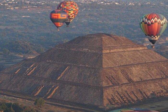
This one-month trip, from January 18 to February 17, 2026, allowed us to visit Mexico City and travel through the states of Puebla, Oaxaca, and Chiapas. We mainly used buses (ADO company) for medium and long distances and colectivos or taxis (or Uber) for shorter trips. Before leaving, I had contacted several people on the ground: Harry, a Vendéan settled in Oaxaca offering, among other things, discoveries of artisan villages or the Monte Albán site, and Oscar in Comitán de Domínguez. I’ll come back to our meeting with Oscar, who runs a local agency (CVL Travel Turismo Alternativo & Corre la voz) and owns a very pleasant hostel, a real highlight of our trip. Our journey took place in 8 stages on a loop starting from Mexico City. The connections between each were made by day or night buses depending on the trip duration. I had booked our seats in advance, either directly on the ADO company’s website or through booking platforms depending on the rates offered. Note that by planning ahead, I was able to benefit from very interesting "Early Booking" rates. There are several comfort classes. For all our trips, I had booked seats in Primera class buses, except for two in GL (Grand Luxe) class. The rates are very reasonable, and the buses turned out to be comfortable or even very comfortable (only the basic seat recline might surprise you).
Our itinerary and number of days per stage: Stage 1 – Mexico City: 4 days Stage 2 – Puebla: 2 days Stage 3 – Oaxaca: 4 days Stage 4 – San Agustinillo: 4 days Stage 5 – San Cristóbal de las Casas: 3 days Stage 6 – Comitán de Domínguez: 6 days Stage 7 – Palenque: 4 days Stage 8 – Mexico City: 2 days If I were to do it again, I’d remove one day from Palenque and add it either to Puebla or San Cristóbal to visit nearby sites or villages, or to San Agustinillo to enjoy one more day by the Pacific Ocean.
Stage 1: Mexico City (2,200 m / 9.2 million inhabitants) We arrived in the Mexican capital around 10:00 PM. The simplified customs process was very quick. After exchanging some money at the airport, we took a taxi to our youth hostel. We got around the capital on foot, of course, but also by metro. Signs are very rare, and we took the train in the wrong direction several times. After a few mistakes, we systematically asked on the platform if we were going the right way. The metro is very affordable. You need to get a rechargeable card (the Tarjeta de Movilidad Integrada) and top it up as needed. This card (less than 1 €) isn’t personal, so there’s no need to get one per person.
Mexico City: Day 1.
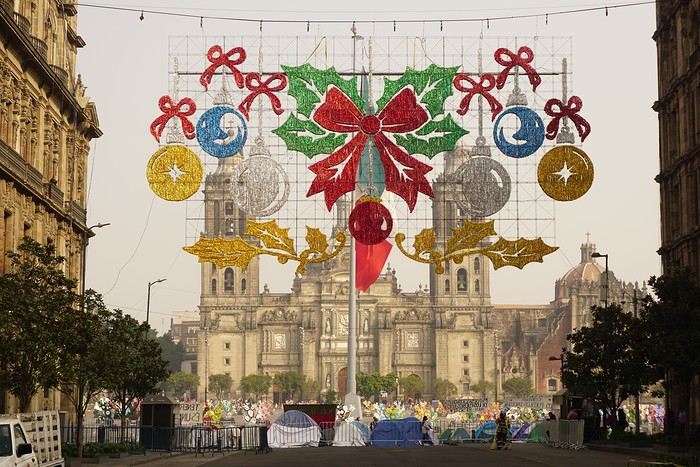
Visits and walks of the day (note: many museums are closed on Mondays): The Zócalo or Constitution Square: it’s one of the most beautiful, largest (195m x 240m), and oldest squares in the world. This is where Cortés decided to build the center of the new Spanish city on the site of the former Tenochtitlan market. Stones from the pyramids were used to pave the esplanade and build the surrounding colonial churches and buildings. During our visit, the huge square was covered with (resin) cacti, the theme of the temporary exhibition at the time. Indeed, temporary events or exhibitions take place here throughout the year. It’s also the endpoint for many protest marches.
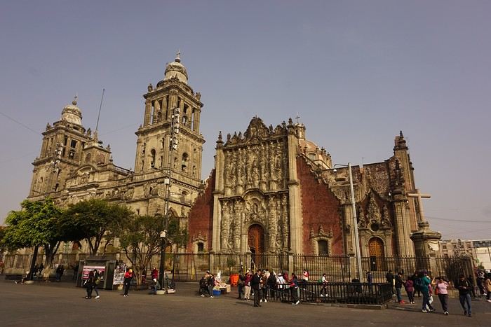
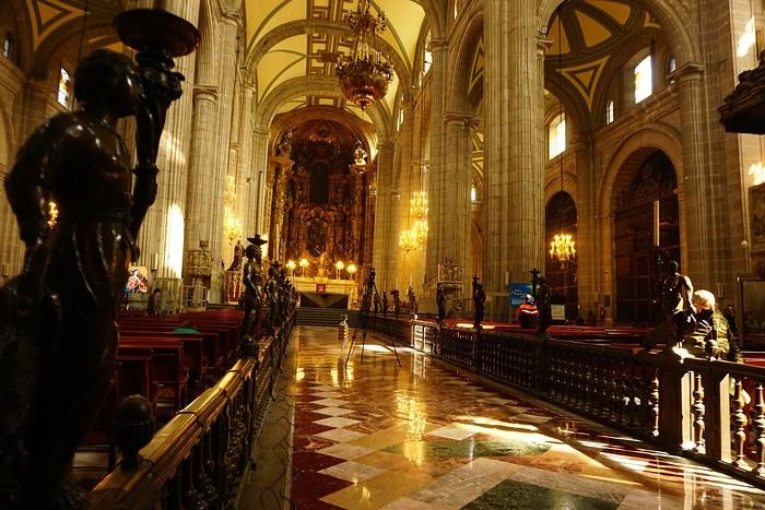


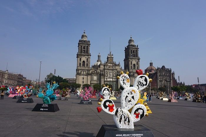
The cathedral: it’s sinking by one centimeter per year despite massive stabilization work (the collapse of many Mexican buildings—30 cm/year—is due to groundwater pumping). It was built starting in 1571 and completed in... 1813. The modest remains of the Templo Mayor (exterior view): they have high symbolic value, as this monument was the most important in the Mexica Empire.
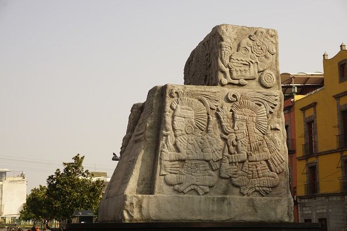 We then walked through the streets of the historic center to the Santísima Church, unfortunately closed for renovation work.
Next, we took the metro to visit one of Mexico’s most important pilgrimage sites: the Insigne y Nacional Basílicas de Santa María de Guadalupe, as well as the Capilla del Cerrito on the hill.
The first, dating from the colonial era, is really leaning a lot.
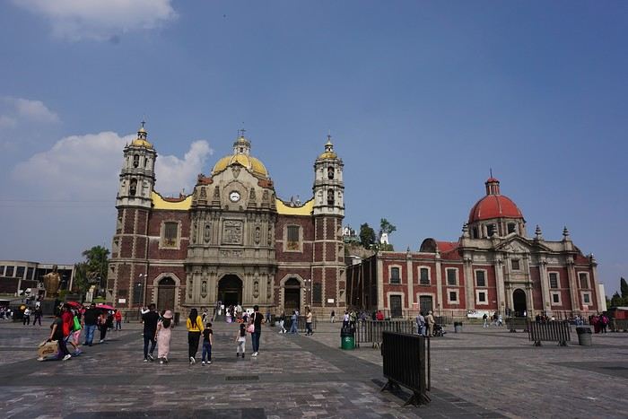
The second, shaped like a rotunda, is very impressive from the inside.
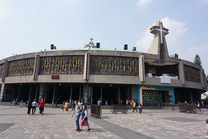
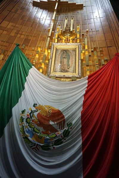
In the basement, there’s a sacred tunic where, in 1531, an image of the Virgin Mary is said to have appeared. A real mystery for scientists, the garment has never deteriorated since that date. Slow-moving conveyor belts allow pilgrims to admire it, preventing crowds from gathering in front of the image for hours. Well thought out!
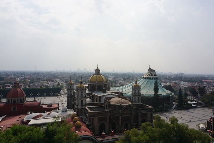
 From the top of the Capilla del Cerrito, you get beautiful views of huge Mexico City.
Hiking on Mount Etna in May
I’m traveling solo by plane to Catania in May and plan to hike the northern side of Etna, starting from Linguaglossa where I’ll arrive by bus. After that, I’d love some info on how to get up to Piano Provenzana (shuttles or hitchhiking), since it seems there’s no public transport except in the summer. Can you sleep there in a free or cheap refuge, or camp? And how far up can you go without having to hire a guide? Thanks in advance. Bernard.
How to get from Albania to Greece by bus
Hi,
I'm heading to Greece via Albania soon. Does anyone have info on transportation from Gjirokastër to Ioannina?
Which company, fares, and schedules—it's not very clear with Google.
Thanks!
Patrice
Thanks!
Patrice
Feedback on my Chile travel itinerary
Hi everyone!
I’m planning the trip of my dreams for next November—Chile! I’d love to get your thoughts on my potential itinerary. I know it’s a big investment in terms of both time and money, so every bit of feedback, suggestion, or info helps immensely. Thank you in advance!!
1-Flight to Santiago
2-Explore Santiago
3-Explore Santiago
4-Bus from STG to Valpo (2h) + visit Valparaíso + night in Viña
5-Visit Valparaíso + bus back to STG (2h)
6-Flight to Calama + bus to San Pedro + explore and acclimate in San Pedro + car rental in the afternoon (+Chaxa?)
7-(Very early) Valle del Arcoíris + Laguna Cejar + Valle de la Luna
8-Laguna Miñiques & Miscanti + Salar de Talar + Laguna Tuyajto
9-Geysers El Tatio early in the morning + Cañón de Guatín + return car
10-Excursion to Salar de Uyuni
11-Excursion to Salar de Uyuni
12-Excursion to Salar de Uyuni
13-Excursion to Salar de Uyuni + return to San Pedro for the night
14-Bus to Calama + flight Calama-La Serena + explore La Serena
15-Excursion to Reserva Pingüino + bonus time (sunset at Playa Tongoy or elsewhere...)
16-Rent a car in Pisco Elqui & Vicuña + Observatory
17-Return car in La Serena + flight Santiago & Puerto Montt (4h)
18-Rent a 4x2 car + drive to Temuco (4h)
19-Reserva Nacional Malalcahuello + hike + night in Temuco
20-Parque Nacional Conguillío then drive and night in Pucón
21-Villarrica Volcano
22-Parque Huerquehue
23-Activities on-site
24-Drive to Valdivia + explore and night there
25-Drive to Puerto Varas (via Frutillar, etc.) + activities on-site
26-Salto Las Cascadas + Parque Nacional Vicente Pérez Rosales (Salto del Petrohué) + Canoeing/Rafting?
27-Drive to Parque Alerce Andino (round trip 3h) + hike Sendero Sargazo?
28-Drive to Castro + explore Chiloé and night in Castro
29-Explore Chiloé
30-Explore Chiloé + return to Puerto Varas
31-Drive to Cochamó (1h30) + drive to Hornopirén (2h30)
32-Ferry to Caleta Gonzalo + drive to Chaitén (1h20)
33-Parque Nacional Pumalín, night in Chaitén
34-Drive to Puyuhuapi + Sendero Ventisquero Yelcho?
35-Ventisquero Colgante + drive to Coyhaique
36-Drive to Villa Cerro Castillo
37-Hike Cerro Castillo
38-Drive to Puerto Río Tranquilo
39-Excursion to Glaciar Exploradores
40-Mármol Cathedral + lake activities
41-Drive to Cochrane
42-Parque Patagonia
43-Drive to Chile Chico
44-Ferry Chile Chico-Ibañez + drive to Coyhaique + drop off car
45-Flight to Punta Arenas (1h30) + explore the city
46-Rent a car + drive to Puerto Natales
47-Drive to Torres del Paine in the morning + hike to the base of the towers (return to Puerto Natales for the night)
48-Torres del Paine hike 2 (return to Puerto Natales for the night)
49-Torres del Paine hike 3 (return to Puerto Natales for the night)
50-Drive to Punta Arenas
51-Flight Punta Arenas-Santiago + flight Santiago-Buenos Aires (2h)
52-Explore Buenos Aires
53-Explore Buenos Aires
54-Explore Buenos Aires
55-Flight back to France
I’m planning the trip of my dreams for next November—Chile! I’d love to get your thoughts on my potential itinerary. I know it’s a big investment in terms of both time and money, so every bit of feedback, suggestion, or info helps immensely. Thank you in advance!!
1-Flight to Santiago
2-Explore Santiago
3-Explore Santiago
4-Bus from STG to Valpo (2h) + visit Valparaíso + night in Viña
5-Visit Valparaíso + bus back to STG (2h)
6-Flight to Calama + bus to San Pedro + explore and acclimate in San Pedro + car rental in the afternoon (+Chaxa?)
7-(Very early) Valle del Arcoíris + Laguna Cejar + Valle de la Luna
8-Laguna Miñiques & Miscanti + Salar de Talar + Laguna Tuyajto
9-Geysers El Tatio early in the morning + Cañón de Guatín + return car
10-Excursion to Salar de Uyuni
11-Excursion to Salar de Uyuni
12-Excursion to Salar de Uyuni
13-Excursion to Salar de Uyuni + return to San Pedro for the night
14-Bus to Calama + flight Calama-La Serena + explore La Serena
15-Excursion to Reserva Pingüino + bonus time (sunset at Playa Tongoy or elsewhere...)
16-Rent a car in Pisco Elqui & Vicuña + Observatory
17-Return car in La Serena + flight Santiago & Puerto Montt (4h)
18-Rent a 4x2 car + drive to Temuco (4h)
19-Reserva Nacional Malalcahuello + hike + night in Temuco
20-Parque Nacional Conguillío then drive and night in Pucón
21-Villarrica Volcano
22-Parque Huerquehue
23-Activities on-site
24-Drive to Valdivia + explore and night there
25-Drive to Puerto Varas (via Frutillar, etc.) + activities on-site
26-Salto Las Cascadas + Parque Nacional Vicente Pérez Rosales (Salto del Petrohué) + Canoeing/Rafting?
27-Drive to Parque Alerce Andino (round trip 3h) + hike Sendero Sargazo?
28-Drive to Castro + explore Chiloé and night in Castro
29-Explore Chiloé
30-Explore Chiloé + return to Puerto Varas
31-Drive to Cochamó (1h30) + drive to Hornopirén (2h30)
32-Ferry to Caleta Gonzalo + drive to Chaitén (1h20)
33-Parque Nacional Pumalín, night in Chaitén
34-Drive to Puyuhuapi + Sendero Ventisquero Yelcho?
35-Ventisquero Colgante + drive to Coyhaique
36-Drive to Villa Cerro Castillo
37-Hike Cerro Castillo
38-Drive to Puerto Río Tranquilo
39-Excursion to Glaciar Exploradores
40-Mármol Cathedral + lake activities
41-Drive to Cochrane
42-Parque Patagonia
43-Drive to Chile Chico
44-Ferry Chile Chico-Ibañez + drive to Coyhaique + drop off car
45-Flight to Punta Arenas (1h30) + explore the city
46-Rent a car + drive to Puerto Natales
47-Drive to Torres del Paine in the morning + hike to the base of the towers (return to Puerto Natales for the night)
48-Torres del Paine hike 2 (return to Puerto Natales for the night)
49-Torres del Paine hike 3 (return to Puerto Natales for the night)
50-Drive to Punta Arenas
51-Flight Punta Arenas-Santiago + flight Santiago-Buenos Aires (2h)
52-Explore Buenos Aires
53-Explore Buenos Aires
54-Explore Buenos Aires
55-Flight back to France
What's the best way to get around Northern India?
Hi,
I’m leaving this Saturday for Northern India from 15/02 to 27/02. I’m planning to visit New Delhi, Agra, Chand Baori, Jaipur, Ranthambore, Bundi, Udaipur, and Jodhpur.
What’s the best way to get around? I was thinking of doing everything by train. Maybe taking the bus for some stretches?
As for renting a car with a driver, it seems expensive, so I’ve pretty much ruled that out. Unless someone’s got space for the same dates?
Thanks for your insights!
What’s the best way to get around? I was thinking of doing everything by train. Maybe taking the bus for some stretches?
As for renting a car with a driver, it seems expensive, so I’ve pretty much ruled that out. Unless someone’s got space for the same dates?
Thanks for your insights!
Trip report: Cayenne - Macapá - Belém
I’ve seen some info about this route, but not nearly enough, so I thought I’d share what I did for anyone interested.
Cayenne - Saint-Georges: From Cayenne’s bus station, the TIG No. 8 bus goes to Saint-Georges. It’s a minibus run by a contractor you can call ahead to reserve a seat. I managed to get a spot the same day. It was parked on the other side of the river, across from the main bus stops. Price: 40 €, departures at 7 AM, 9 AM, 11 AM, and 3 PM except Sundays, depending on driver availability.
Saint-Georges - Oiapoque: Once in Saint-Georges, cross the river by canoe for 10 €. The canoe made a first stop on the opposite bank, then a second in the center of Oiapoque. To enter Brazil, you’ll need to get your passport stamped. This can be done at the federal police station, less than 1 km from the dock, heading into Oiapoque.
Oiapoque - Macapá: From Oiapoque, there are buses or taxis. Not knowing when the next bus would come, I didn’t want to wait, so I went back to the dock and took a 4x4, a kind of shared taxi, for 250 reals. I left around 4 PM and arrived at 2 AM in Macapá. If I had to do it again, I’d take the bus—apparently, it has reclining seats and travels overnight to arrive the next morning.
Macapá - Santana You need to get to Santana to take the ferry to Belém—tricky on a Sunday... After waiting for a bus that was taking forever, I took a *carretera pirata* (unofficial taxi) on the advice of a local Brazilian. It took me to Santana for 10 reals (vs. 5 for the bus). The ride takes about 15 minutes from Macapá to Santana’s port. You can do this the same morning.
Santana - Belém I bought tickets directly at the port when I arrived from one of the many agencies. I slept in a no-frills little hotel right by the port, run by a charming elderly couple, and boarded the next day at 9 AM. You’ll need a hammock to sleep if you’re not taking a cabin. The fare is 250 reals—it’s listed as 300, but they gave me a "discount" without me even asking. The trip takes 24 hours to Belém. There’s a small snack bar for those who didn’t have time to pack food.
Article on the topic (in French): https://la1ere.franceinfo.fr/guyane/macapa-belem-au-fil-de-l-amazone-1302076.html
Hope this helps someone avoid some of the hassle I went through!
Cayenne - Saint-Georges: From Cayenne’s bus station, the TIG No. 8 bus goes to Saint-Georges. It’s a minibus run by a contractor you can call ahead to reserve a seat. I managed to get a spot the same day. It was parked on the other side of the river, across from the main bus stops. Price: 40 €, departures at 7 AM, 9 AM, 11 AM, and 3 PM except Sundays, depending on driver availability.
Saint-Georges - Oiapoque: Once in Saint-Georges, cross the river by canoe for 10 €. The canoe made a first stop on the opposite bank, then a second in the center of Oiapoque. To enter Brazil, you’ll need to get your passport stamped. This can be done at the federal police station, less than 1 km from the dock, heading into Oiapoque.
Oiapoque - Macapá: From Oiapoque, there are buses or taxis. Not knowing when the next bus would come, I didn’t want to wait, so I went back to the dock and took a 4x4, a kind of shared taxi, for 250 reals. I left around 4 PM and arrived at 2 AM in Macapá. If I had to do it again, I’d take the bus—apparently, it has reclining seats and travels overnight to arrive the next morning.
Macapá - Santana You need to get to Santana to take the ferry to Belém—tricky on a Sunday... After waiting for a bus that was taking forever, I took a *carretera pirata* (unofficial taxi) on the advice of a local Brazilian. It took me to Santana for 10 reals (vs. 5 for the bus). The ride takes about 15 minutes from Macapá to Santana’s port. You can do this the same morning.
Santana - Belém I bought tickets directly at the port when I arrived from one of the many agencies. I slept in a no-frills little hotel right by the port, run by a charming elderly couple, and boarded the next day at 9 AM. You’ll need a hammock to sleep if you’re not taking a cabin. The fare is 250 reals—it’s listed as 300, but they gave me a "discount" without me even asking. The trip takes 24 hours to Belém. There’s a small snack bar for those who didn’t have time to pack food.
Article on the topic (in French): https://la1ere.franceinfo.fr/guyane/macapa-belem-au-fil-de-l-amazone-1302076.html
Hope this helps someone avoid some of the hassle I went through!
Nepal Feedback
NAMASTE NEPAL! PRACTICAL INFO AND EXPERIENCE FEEDBACK
Stay from March 25 to April 16, 2025
· Flight tickets Air India (via Delhi) (via Skyscanner) = 1130 € per person · Planned budget (and respected without too many restrictions and while buying a few small gifts) = 2000 € for the stay for two. Buses, taxis, and entrance fees to various sites represent a budget to consider. Meals are cheap. Drinks like beer/Coke, however, are not cheap and cost the equivalent of a meal. · Exchange rate of the rupee during our stay = 0.0064 € (the exchange rate is almost identical everywhere, including at the airport). · At the airport, purchase of two SIM cards (phone) = 1000 NPR x 2 for 28 days. · Kathmandu: we had booked the hotel upon arrival: Kathmandu Boutique Hotel (+977 015 357 446 – email: booking@kathmanduboutiquehotel.com), very well located in a quiet alley off the street, south of Thamel, a 10-minute walk from Durbar Square. A hotel like Nepal knows how to do, where tall people will have to duck. Night + breakfast = 18 € for two. Very warm welcome, great location, excellent value for money. · Bhaktapur: we had also booked a hotel for the end of our stay because the chance of the year 2025 made the Nepali New Year and Bisket Jatra particularly festive in Bhaktapur: Manju Baha Hotel School (+977 976 7234014 – email: manjubahahotel@gmail.com) located in an old monastery. "A social enterprise transforming an old monastery into a charming hotel, offering professional hospitality training to underprivileged Nepali youth." Night + breakfast = 32 € for two. Beautifully decorated room. Very warm welcome. Don’t miss the Changunarayan site (near Bhaktapur), it’s amazing. And if you’re lucky enough to be in Bhaktapur in mid-April for 3 days, there’s the Bisket Jatra festivities (Newari festival), joyful, noisy, fun, and wild… · Pokhara (hotel recommended by the Kathmandu hotel): Hotel Green Tara, Lakeside, 10th street, set back, quiet (Tel. +977 61 462698 – email: greentara_67@hotmail.com) · Trek permit (Lower Mustang, no need for an agency or guide, permits checked at Ghasa and Jomsom) = 2000 NPR per person (2 ID photos) · Bus Kathmandu/Pokhara and return = 2000 NPR per person · Bus Pokhara/Jomsom, 2 one-way tickets = 2800 NPR. · Taxi: negotiation with a driver we recommend, Vicky (+977 984 075 599). You explain what you want, negotiate the price, and he waits for you during the visit. Very charming, we used him several times. For example: departure from our hotel at 10 AM -> Boudhanath/Pashupatinath/Patan return at 5 PM to the hotel = 6500 NPR – Swayambhunath (round trip) = 1200 NPR · Site prices: https://ntb.gov.np/plan-your-trip/before-you-come/heritage-site-entry-fees o Visitor Pass for Kathmandu Durbar Square (for the duration of the stay, show your visa) = 1000 NPR per person (1 ID photo) o Bhaktapur Durbar Square (old town) = 1800 NPR per person o Patan = 1000 NPR per person o Swayambhu Stupa = 200 NPR per person o Boudha Stupa = 200 NPR per person o Pashupatinath Temple = 1000 NPR per person (interesting to take a guide) o Changunarayan Temple (6 km north of Bhaktapur) = 400 NPR per person o Mountain Museum in Pokhara = 750 NPR per person · E-cigarettes: e-cigarettes are banned in India and confiscated whether they’re in carry-on or checked luggage. On the way there, we had kept them in our carry-on, they were confiscated in Delhi. On the way back, learning from our previous experience, we put them in our checked luggage. Someone came to get us to take them out of our bags and confiscate them… You can find e-cigarettes and products in Kathmandu.
* * *
I’m 74 years old. I went to Nepal in 1982, 1983, and the last time in 1986. I wanted to introduce this beautiful and endearing country to my husband, and it was… now or never. So we decided it was now.
I knew the trek starting from Pokhara: Naudanda/Birethanti/Ghorepani/Tatopani/Kalopani. There was no way I was going to do that trek, especially the 1000-meter staircase to reach Ghorepani… You have to stay humble with age.
Back then, the road didn’t exist. I didn’t consider, with the construction of this road (NH48) along the western bank of the Kali Gandaki, doing a trek along a windy and dusty road. Was there an alternative hiking trail on the eastern bank? No one answered my question on VoyageForum, so I did my research online. And I found this site: "Andrées de Ruiter and Prem Rai - Trekking the Annapurna Circuit, including the new NATT trails that avoid the road - A guide to one of the most beautiful trekking regions in Nepal and the world (2011) - NATT = New Annapurna Trekking Trail".
Phew! A solution was emerging. This circuit from 2011 wasn’t fully marked. The idea was to go from Jomsom to Tatopani, so we needed to make sure the path was well-marked all the way, which we did, and the path exists, marked in red and white!
So, with the walking times information, we built our 8-day circuit:
· Jomsom/Thinigaon · Thinigaon/Chimang · Chimang/Saura · Saura/Kokhetanti · Rest day or, if in good shape: loop to Sekong Lake · Kokhetanti/Jhipra Deurali · Jhipra Deurali/Kopchepani · Kopchepani/Tatopani
It’s a senior trek, after all. So the walking times noted on the sites indicated 3 hours or even 4 hours for the two longest stages. That pace suited us fine.
On March 29, we left Kathmandu (1400m), after visiting the must-see sites, by bus to Pokhara: 200 km and 8.5 hours on a chaotic road under construction. I had a memory of Pokhara where it was the first city where you could see the Himalayan range, especially Machhapuchhare. But the pollution is such, the dust raised by traffic and construction, that no horizon is visible except the first hills around Pokhara.
We stayed 24 hours in Pokhara (820m), and on March 31, we left our luggage at the hotel and set off with our lightest backpacks: change of clothes, toiletries, first aid kit, anti-chafing cream, water bottle, sleeping bag liner, and light shoes for the stages.
We took the bus to Jomsom: 160 km/7.5 hours including stops for bathroom breaks, tea, and lunch. The road is nothing but a chaos of potholes, landslides, construction, dust, rebuilding, and mudslides. In Ghasa, the bus stops, and we’re told we’re at a checkpoint and that the two foreigners in the bus, my husband and I, need to have our permits checked, which takes a few minutes. The driving is rock-and-roll, surprising, and courteous. The drivers have their codes, and on these improbable roads, they’re virtuosos.
We could have chosen the plane, but several reasons dissuaded us: if there’s too much wind, the planes don’t take off; personally, I wasn’t reassured about landing in Jomsom, and this transport has a cost.
We arrived around 2 PM in Jomsom (2720m), and despite the early wake-up, the nearly 8 hours on the bus, and the altitude, we decided to head straight to Thinigaon (2840m). At the Jomsom checkpoint, they told us it was a 30-minute walk. Great! Except we took an hour and a half on an uphill road, bent over to fight a strong wind. But the Himalayan range is there! The Dhaulagiri, the Nilgiri, the Annapurnas as a reward.
In Thinigaon, we found a room at the "Nilgiri View Hotel" run by a didi (big sister in Nepali). From the lodge’s roof, she proudly showed us the different peaks surrounding the village and told us, worried, that it hadn’t snowed here for 3 years. She said there are very few tourists, that the season is rather in September/October/November. It seems there’s not a soul in this village, yet mules pass through the narrow street paved with large flat stones, their bells ringing. We dine at 6 PM and go to bed… Room = 1200 NPR and dinner, breakfast, and drinks = 2560 NPR.
On April 1, we set off at 9 AM, not for Chimang as planned but for Marpha! The didi from the Thinigaon lodge had said it was a 3-hour walk. The first part of this stage is attractive, the mountains are magnificent and imposing, the landscape is superb, there’s no one around, a feeling of being "alone in the world." We follow Dhumbra Tal, this small green lake. The path is a rocky track that climbs steeply. Then, around a hill, we start the big descent that joins the Kali Gandaki. We face the wind head-on, and the violent gusts take our breath away, throw us off balance, and envelop us in dust. We see the road on the other side of the Kali Gandaki. We arrive in the village of Chhairo at 2 PM, completely exhausted and with blistered feet, after 5 hours of walking instead of the planned 3.5 hours.
We’re welcomed by the village nurse, who tells us there’s a lodge in the village. Chhairo is a Tibetan village, a 20-minute walk from Marpha (according to the locals, multiply by 2 or even 3 for us…). We’re going to revise our trek plan and, first of all, spend the night in Chhairo.
The lodge is quite pleasant, and Karma, the hostess, is very friendly. She asks about our plans and suggests we stay in Chhairo the next day, from where we can visit Marpha and also Chimang, a 1-hour walk away, in light mode, meaning without backpacks. She invites us to participate in a village ceremony the next evening.
We immediately accept the proposal, as our feet need rest and the welcome is so warm… Dinner and bed!
We reworked our trek plan, which was too ambitious for our untrained bodies and, let’s face it… no longer in our first youth. In the initial plan, we thought there wouldn’t be too much elevation gain following the Kali Gandaki, but checking the map, we realize there might be significant elevation changes between Sauru and Sirkung. So we plan:
· Tomorrow: visit Marpha (2670m) and Chimang (2744m) · April 3: bus from Chhairo (2700m) to Kalopani (2530m) and continue on foot to Ghasa (2010m) · April 4: Ghasa/Pairataplo (1940m) · April 5: Pairatapla/Gadpar (1580m) · April 6: Gadpar/Narchyang (1510m) · April 7: Narchyang/Tatopani (1190m) · April 8: return to Pokhara.
Normally, it’s all downhill…
April 2, a rest day then… We set off in the morning to explore Marpha. We have to take a temporary bridge because the suspension bridge is closed due to road construction. We join the road and arrive in Marpha, a village famous for its apple orchards, brandy, cider, and apple juice production. This village is magnificent with its stone houses and monastery clinging to the hillside. The road construction spared it. There are people, but very few Western tourists.
We have lunch in Marpha and go back through Chhairo to take the path to Chimang. We cross a fragrant pine forest and find the rocky path; the landscape is splendid. We walk quietly, passing peaceful buffaloes and cows, and arrive at the foot of a stone staircase… 275 steps (which we counted on the way back) leading us to the village of Chimang. Chimang is an isolated Newari village that seems a bit desolate. Despite the slopes, there are crops on every little bit of land. Thankfully, we changed our initial program because there’s no lodge in this village, contrary to what we saw on a map… We wander through the village, which seems very deserted, have coffee in a house from another world, and then head back to Chhairo.
A rest day? = 5 hours of walking!!
Dinner and village ceremony. From what we understand, this ceremony is in honor of the Dalai Lama. Men, women, and children in traditional costumes gather twice a month; they dance, make, and offer small sweet cakes with Tibetan tea (made from tea, yak butter—often rancid—water, and salt). Surprising for first-timers…
Around 10 PM, we leave the ceremony; tomorrow morning, we need to be on the roadside by 7 AM to catch the bus to Kalopani…
This village of Chhairo is very pleasant and welcoming, no tourists, just two motorcyclists who arrived in the evening, one of whom participated in the ceremony and discreetly poured his Tibetan tea outside.
Lodge: "Norsang Tibetan Guesthouse and Restaurant". Total bill for 2 nights, 2 dinners, 2 breakfasts, and drinks = 8000 NPR.
April 3: bus from Chhairo to Kalopani, about 1.5 hours for the 20 km (200 NPR per person). We descend on the right bank of the Kali Gandaki. We find the red and white markings to resume the trek toward Ghasa. We’re in a fragrant pine forest, the Dhaulagiri on one side and the Annapurnas on the other, magnificent, and the path is pleasant and easy. We get a bit lost in this forest, always looking for the markings. Near Lete, two trekkers pass us, and we meet them again a little further on with two very young children, to whom we give the 2 hard-boiled eggs I didn’t eat this morning. They accepted them without hesitation.
We arrive in a village and ask for directions to Ghasa. The young girls point the way. But we come across a forest being logged, trees cut in all directions. We turn back and ask for confirmation. They confirm… But the two young girls catch up with us and clear the way. We have to step over, go around, and cross the felled trees, with no indication at all. Through this pick-up sticks of felled trees, the girls lead us to the top of a stone staircase, indicating that was the path. It’s the only place where we saw rhododendrons in bloom.
We descend the staircase. At the bottom, to the left, there’s a bridge to go toward Choyo, and to the right, a path to Ghasa. We take the right path and join the road. We should normally find the red and white markings, but we don’t… So we continue on the western bank road of the Kali Gandaki.
A little before the village of Misi, we see fumaroles on the opposite bank that seem to come from the ground. We don’t understand. We stopped to eat in the village of Misi (noodle soup = 600 NPR), but it’s hard to communicate with the elderly people running the guesthouse.
We continued on the road, not finding the marked path parallel to the road. Landslides, both on the left and right banks, seem to have taken over the marked routes. It’s a place where the Kali Gandaki gorge narrows, and on the opposite bank, the mountain smokes more and more, and we now hear the crackling of fire. Across from us, the mountain is burning… Our initial plan had us passing on that burning bank right now…
We arrive in Ghasa at 3:30 PM, a 6.5-hour stage but with a 1-hour stop at noon. We’re at the "Florida Guesthouse and Restaurant." From our room, we see the mountain smoking on the other side of the river, and at night, we see the flames. In this village, posters show Himalayan eagles and vultures that seem to be protected species. Indeed, we saw (and heard) 3 eagles circling today.
April 4 – Today, heading to Pairothapla or Kopchepani depending on our feet, accommodation options, and simply our desires.
No more smoke on the mountain this morning. It’s chilly, 7:45 AM, the sky is clear, just a smell of smoke outside.
Price of the lodge = 1000 NPR for the night + 3580 NPR for meals.
We cross Ghasa, which stretches over more than a kilometer. We have a drink at the last guesthouse in the village, and the didi, when she learns our destination, tells us to be careful because the villages we’re going to aren’t safe. Should we distribute our rupees in different pockets? Nah, we kept going.
At the exit of Ghasa, we find the red and white markings and take the suspension bridge to cross the boiling waters of the Kali Gandaki. The passage is impressive because the river is tumultuous. Lots of climbs and even more descents. We’re back on the eastern bank. It’s hot! On the narrow path, we meet a group of buffaloes. Who has the right of way? We decide to stick as close as possible to the rock wall and move forward calmly. The buffaloes look at us, chewing placidly, with no intention of jumping on us. Phew!
After a 5-hour stage (including stops), we arrive in Pairothapla, with hot feet and firm thighs, and decide we won’t go any further. It’s a good thing because there’s a lodge, the most basic so far, but with a great welcome. We have a meal and a short nap. The buffaloes we met on the way belong to this house. They come to drink at the fountain by the path.
Our host, very pleasant, doesn’t know what to do to please us and is very attentive. He wants to chat. He has two children, a 4-year-old girl and a 7-year-old boy. Where do they go to school? Do they go? He tells us that the fires in the mountain are caused by people, but for what reason? We won’t find out, but it’s illegal. From here, we can still see smoke rising in the distance. The wife is a bit less friendly. Corn kernels dry on a woven straw mat on the ground, and the mom sorts them.
From where we are, we overlook the valley and see the road under construction winding along the mountainside on the other bank.
Dinner on the terrace of the house overlooking the path, windbreaker and fleece on: dal bhat chicken for me and chicken curry for my husband: "organic" products, at least local production. There are small vegetable gardens everywhere with all sorts of vegetables.
April 5 – While we’re having breakfast on the terrace of our lodge, 5 porters, straps on their foreheads, heavily loaded, pass by on the path. A few minutes later, a group of 9 people appears. It must be said that since the beginning of our journey, we’ve met very few hikers. Two backpackers in Chhairo, the two hikers near Lete, two female hikers passed us before Pairothapla, a solo female hiker passed us…
The lodge in Pairothapla is called "Bimala Lodge & Thakali Kitchen" – Price for night + 4 meals + 2 breakfasts = 3000 NPR.
The descent toward the Kali Gandaki involves climbs whose steps we didn’t count. Clearly, the landslides on the mountain cause changes to the official ACAP trek marked in red and white, and the marking updates can’t keep up with the pace of these landslides. It’s almost always by chance that we find the markings. Fortunately, we can follow the power line that guides us somewhat.
Drink stop in Kopchepani, the legs are fine, but the feet don’t like being tightly enclosed. A group of trekkers with porters passes on the path. We met buffaloes that we kindly let pass; the path was wide enough, but it was a staircase going up, and we didn’t want to take any risks.
Across, a view of the magnificent Rupse Waterfall on the other bank of the Kali Gandaki, at the bottom, lots of vehicles and people.
Arrival in Gadpar after crossing a rather unwelcoming small village and cultivated gardens between dry stone walls, each better built than the last.
First lodge spotted, first lodge adopted to answer the call of our feet, and a very warm welcome from the owner. Since we hadn’t eaten at noon, we had Tibetan bread/jam. 6-hour stage including 1 hour of stops. Night + dinner + breakfast + drinks = 5060 NPR
April 6 – Today, heading to Narchyang.
For several days, we’ve seen banana trees with their bunches of fruit and even a prickly pear with large fruits ripening.
This stage is quite peaceful and pleasant. We take a suspension bridge to cross a tributary of the Kali Gandaki. While we’re resting for a moment before crossing the bridge, a couple of porters, a man and a woman, arrive and start across the bridge with their wood load in a basket held by a strap on their forehead, making them bend. We set off too… lighter than them.
On the other side of the bridge… a stone staircase, and it climbs steeply. The porter couple didn’t take this staircase; they went right on the path.
At the top of the staircase, we arrive in Narchyang after a 4-hour stage. A magnificent waterfall overlooks the village. We get lost in this fairly large village looking for a lodge. After wandering around for a while, we ask for directions, and an 84-year-old man takes us through the whole village and accompanies us to a very nice lodge run by a woman.
We chat with our hostess, who asks where we’re from and where we’re going. We explain that we want to reach Tatopani the next day and then return to Pokhara. She tells us there are 4x4s going directly to Pokhara and that it would probably be easier than taking a bus that might be full in Tatopani. After a quick consultation, we decide to return to Pokhara the next day by 4x4. She finds us a 4x4 with 2 seats left, departure at 8 AM – 5 hours on the road and 1500 NPR per person. A charming didi who does everything to be pleasant and helpful.
Narchyang community lodge = night + snacks + dinner + breakfast = 3000 NPR.
There you go, our trek ends tomorrow. Many necessary changes and adaptations to our initial trek, but no regrets, it was superb and a great experience that, for my part, I won’t be able to repeat. Always this encounter with the endearing, welcoming, curious, and very kind Nepali people. It was now or never, and we did it!
* * *
In conclusion, 3 full weeks in Nepal is a duration that allows visiting Kathmandu, Patan, and Bhaktapur, enjoying the various sites, and soaking in the atmosphere and urban Nepali life.
The trek, even revised and corrected, allowed us to get close to the impressive Annapurna and Dhaulagiri peaks. One or two acclimatization days might be necessary to get the body in tune with this magical and extraordinary land.
Stay from March 25 to April 16, 2025
· Flight tickets Air India (via Delhi) (via Skyscanner) = 1130 € per person · Planned budget (and respected without too many restrictions and while buying a few small gifts) = 2000 € for the stay for two. Buses, taxis, and entrance fees to various sites represent a budget to consider. Meals are cheap. Drinks like beer/Coke, however, are not cheap and cost the equivalent of a meal. · Exchange rate of the rupee during our stay = 0.0064 € (the exchange rate is almost identical everywhere, including at the airport). · At the airport, purchase of two SIM cards (phone) = 1000 NPR x 2 for 28 days. · Kathmandu: we had booked the hotel upon arrival: Kathmandu Boutique Hotel (+977 015 357 446 – email: booking@kathmanduboutiquehotel.com), very well located in a quiet alley off the street, south of Thamel, a 10-minute walk from Durbar Square. A hotel like Nepal knows how to do, where tall people will have to duck. Night + breakfast = 18 € for two. Very warm welcome, great location, excellent value for money. · Bhaktapur: we had also booked a hotel for the end of our stay because the chance of the year 2025 made the Nepali New Year and Bisket Jatra particularly festive in Bhaktapur: Manju Baha Hotel School (+977 976 7234014 – email: manjubahahotel@gmail.com) located in an old monastery. "A social enterprise transforming an old monastery into a charming hotel, offering professional hospitality training to underprivileged Nepali youth." Night + breakfast = 32 € for two. Beautifully decorated room. Very warm welcome. Don’t miss the Changunarayan site (near Bhaktapur), it’s amazing. And if you’re lucky enough to be in Bhaktapur in mid-April for 3 days, there’s the Bisket Jatra festivities (Newari festival), joyful, noisy, fun, and wild… · Pokhara (hotel recommended by the Kathmandu hotel): Hotel Green Tara, Lakeside, 10th street, set back, quiet (Tel. +977 61 462698 – email: greentara_67@hotmail.com) · Trek permit (Lower Mustang, no need for an agency or guide, permits checked at Ghasa and Jomsom) = 2000 NPR per person (2 ID photos) · Bus Kathmandu/Pokhara and return = 2000 NPR per person · Bus Pokhara/Jomsom, 2 one-way tickets = 2800 NPR. · Taxi: negotiation with a driver we recommend, Vicky (+977 984 075 599). You explain what you want, negotiate the price, and he waits for you during the visit. Very charming, we used him several times. For example: departure from our hotel at 10 AM -> Boudhanath/Pashupatinath/Patan return at 5 PM to the hotel = 6500 NPR – Swayambhunath (round trip) = 1200 NPR · Site prices: https://ntb.gov.np/plan-your-trip/before-you-come/heritage-site-entry-fees o Visitor Pass for Kathmandu Durbar Square (for the duration of the stay, show your visa) = 1000 NPR per person (1 ID photo) o Bhaktapur Durbar Square (old town) = 1800 NPR per person o Patan = 1000 NPR per person o Swayambhu Stupa = 200 NPR per person o Boudha Stupa = 200 NPR per person o Pashupatinath Temple = 1000 NPR per person (interesting to take a guide) o Changunarayan Temple (6 km north of Bhaktapur) = 400 NPR per person o Mountain Museum in Pokhara = 750 NPR per person · E-cigarettes: e-cigarettes are banned in India and confiscated whether they’re in carry-on or checked luggage. On the way there, we had kept them in our carry-on, they were confiscated in Delhi. On the way back, learning from our previous experience, we put them in our checked luggage. Someone came to get us to take them out of our bags and confiscate them… You can find e-cigarettes and products in Kathmandu.
* * *
I’m 74 years old. I went to Nepal in 1982, 1983, and the last time in 1986. I wanted to introduce this beautiful and endearing country to my husband, and it was… now or never. So we decided it was now.
I knew the trek starting from Pokhara: Naudanda/Birethanti/Ghorepani/Tatopani/Kalopani. There was no way I was going to do that trek, especially the 1000-meter staircase to reach Ghorepani… You have to stay humble with age.
Back then, the road didn’t exist. I didn’t consider, with the construction of this road (NH48) along the western bank of the Kali Gandaki, doing a trek along a windy and dusty road. Was there an alternative hiking trail on the eastern bank? No one answered my question on VoyageForum, so I did my research online. And I found this site: "Andrées de Ruiter and Prem Rai - Trekking the Annapurna Circuit, including the new NATT trails that avoid the road - A guide to one of the most beautiful trekking regions in Nepal and the world (2011) - NATT = New Annapurna Trekking Trail".
Phew! A solution was emerging. This circuit from 2011 wasn’t fully marked. The idea was to go from Jomsom to Tatopani, so we needed to make sure the path was well-marked all the way, which we did, and the path exists, marked in red and white!
So, with the walking times information, we built our 8-day circuit:
· Jomsom/Thinigaon · Thinigaon/Chimang · Chimang/Saura · Saura/Kokhetanti · Rest day or, if in good shape: loop to Sekong Lake · Kokhetanti/Jhipra Deurali · Jhipra Deurali/Kopchepani · Kopchepani/Tatopani
It’s a senior trek, after all. So the walking times noted on the sites indicated 3 hours or even 4 hours for the two longest stages. That pace suited us fine.
On March 29, we left Kathmandu (1400m), after visiting the must-see sites, by bus to Pokhara: 200 km and 8.5 hours on a chaotic road under construction. I had a memory of Pokhara where it was the first city where you could see the Himalayan range, especially Machhapuchhare. But the pollution is such, the dust raised by traffic and construction, that no horizon is visible except the first hills around Pokhara.
We stayed 24 hours in Pokhara (820m), and on March 31, we left our luggage at the hotel and set off with our lightest backpacks: change of clothes, toiletries, first aid kit, anti-chafing cream, water bottle, sleeping bag liner, and light shoes for the stages.
We took the bus to Jomsom: 160 km/7.5 hours including stops for bathroom breaks, tea, and lunch. The road is nothing but a chaos of potholes, landslides, construction, dust, rebuilding, and mudslides. In Ghasa, the bus stops, and we’re told we’re at a checkpoint and that the two foreigners in the bus, my husband and I, need to have our permits checked, which takes a few minutes. The driving is rock-and-roll, surprising, and courteous. The drivers have their codes, and on these improbable roads, they’re virtuosos.
We could have chosen the plane, but several reasons dissuaded us: if there’s too much wind, the planes don’t take off; personally, I wasn’t reassured about landing in Jomsom, and this transport has a cost.
We arrived around 2 PM in Jomsom (2720m), and despite the early wake-up, the nearly 8 hours on the bus, and the altitude, we decided to head straight to Thinigaon (2840m). At the Jomsom checkpoint, they told us it was a 30-minute walk. Great! Except we took an hour and a half on an uphill road, bent over to fight a strong wind. But the Himalayan range is there! The Dhaulagiri, the Nilgiri, the Annapurnas as a reward.
In Thinigaon, we found a room at the "Nilgiri View Hotel" run by a didi (big sister in Nepali). From the lodge’s roof, she proudly showed us the different peaks surrounding the village and told us, worried, that it hadn’t snowed here for 3 years. She said there are very few tourists, that the season is rather in September/October/November. It seems there’s not a soul in this village, yet mules pass through the narrow street paved with large flat stones, their bells ringing. We dine at 6 PM and go to bed… Room = 1200 NPR and dinner, breakfast, and drinks = 2560 NPR.
On April 1, we set off at 9 AM, not for Chimang as planned but for Marpha! The didi from the Thinigaon lodge had said it was a 3-hour walk. The first part of this stage is attractive, the mountains are magnificent and imposing, the landscape is superb, there’s no one around, a feeling of being "alone in the world." We follow Dhumbra Tal, this small green lake. The path is a rocky track that climbs steeply. Then, around a hill, we start the big descent that joins the Kali Gandaki. We face the wind head-on, and the violent gusts take our breath away, throw us off balance, and envelop us in dust. We see the road on the other side of the Kali Gandaki. We arrive in the village of Chhairo at 2 PM, completely exhausted and with blistered feet, after 5 hours of walking instead of the planned 3.5 hours.
We’re welcomed by the village nurse, who tells us there’s a lodge in the village. Chhairo is a Tibetan village, a 20-minute walk from Marpha (according to the locals, multiply by 2 or even 3 for us…). We’re going to revise our trek plan and, first of all, spend the night in Chhairo.
The lodge is quite pleasant, and Karma, the hostess, is very friendly. She asks about our plans and suggests we stay in Chhairo the next day, from where we can visit Marpha and also Chimang, a 1-hour walk away, in light mode, meaning without backpacks. She invites us to participate in a village ceremony the next evening.
We immediately accept the proposal, as our feet need rest and the welcome is so warm… Dinner and bed!
We reworked our trek plan, which was too ambitious for our untrained bodies and, let’s face it… no longer in our first youth. In the initial plan, we thought there wouldn’t be too much elevation gain following the Kali Gandaki, but checking the map, we realize there might be significant elevation changes between Sauru and Sirkung. So we plan:
· Tomorrow: visit Marpha (2670m) and Chimang (2744m) · April 3: bus from Chhairo (2700m) to Kalopani (2530m) and continue on foot to Ghasa (2010m) · April 4: Ghasa/Pairataplo (1940m) · April 5: Pairatapla/Gadpar (1580m) · April 6: Gadpar/Narchyang (1510m) · April 7: Narchyang/Tatopani (1190m) · April 8: return to Pokhara.
Normally, it’s all downhill…
April 2, a rest day then… We set off in the morning to explore Marpha. We have to take a temporary bridge because the suspension bridge is closed due to road construction. We join the road and arrive in Marpha, a village famous for its apple orchards, brandy, cider, and apple juice production. This village is magnificent with its stone houses and monastery clinging to the hillside. The road construction spared it. There are people, but very few Western tourists.
We have lunch in Marpha and go back through Chhairo to take the path to Chimang. We cross a fragrant pine forest and find the rocky path; the landscape is splendid. We walk quietly, passing peaceful buffaloes and cows, and arrive at the foot of a stone staircase… 275 steps (which we counted on the way back) leading us to the village of Chimang. Chimang is an isolated Newari village that seems a bit desolate. Despite the slopes, there are crops on every little bit of land. Thankfully, we changed our initial program because there’s no lodge in this village, contrary to what we saw on a map… We wander through the village, which seems very deserted, have coffee in a house from another world, and then head back to Chhairo.
A rest day? = 5 hours of walking!!
Dinner and village ceremony. From what we understand, this ceremony is in honor of the Dalai Lama. Men, women, and children in traditional costumes gather twice a month; they dance, make, and offer small sweet cakes with Tibetan tea (made from tea, yak butter—often rancid—water, and salt). Surprising for first-timers…
Around 10 PM, we leave the ceremony; tomorrow morning, we need to be on the roadside by 7 AM to catch the bus to Kalopani…
This village of Chhairo is very pleasant and welcoming, no tourists, just two motorcyclists who arrived in the evening, one of whom participated in the ceremony and discreetly poured his Tibetan tea outside.
Lodge: "Norsang Tibetan Guesthouse and Restaurant". Total bill for 2 nights, 2 dinners, 2 breakfasts, and drinks = 8000 NPR.
April 3: bus from Chhairo to Kalopani, about 1.5 hours for the 20 km (200 NPR per person). We descend on the right bank of the Kali Gandaki. We find the red and white markings to resume the trek toward Ghasa. We’re in a fragrant pine forest, the Dhaulagiri on one side and the Annapurnas on the other, magnificent, and the path is pleasant and easy. We get a bit lost in this forest, always looking for the markings. Near Lete, two trekkers pass us, and we meet them again a little further on with two very young children, to whom we give the 2 hard-boiled eggs I didn’t eat this morning. They accepted them without hesitation.
We arrive in a village and ask for directions to Ghasa. The young girls point the way. But we come across a forest being logged, trees cut in all directions. We turn back and ask for confirmation. They confirm… But the two young girls catch up with us and clear the way. We have to step over, go around, and cross the felled trees, with no indication at all. Through this pick-up sticks of felled trees, the girls lead us to the top of a stone staircase, indicating that was the path. It’s the only place where we saw rhododendrons in bloom.
We descend the staircase. At the bottom, to the left, there’s a bridge to go toward Choyo, and to the right, a path to Ghasa. We take the right path and join the road. We should normally find the red and white markings, but we don’t… So we continue on the western bank road of the Kali Gandaki.
A little before the village of Misi, we see fumaroles on the opposite bank that seem to come from the ground. We don’t understand. We stopped to eat in the village of Misi (noodle soup = 600 NPR), but it’s hard to communicate with the elderly people running the guesthouse.
We continued on the road, not finding the marked path parallel to the road. Landslides, both on the left and right banks, seem to have taken over the marked routes. It’s a place where the Kali Gandaki gorge narrows, and on the opposite bank, the mountain smokes more and more, and we now hear the crackling of fire. Across from us, the mountain is burning… Our initial plan had us passing on that burning bank right now…
We arrive in Ghasa at 3:30 PM, a 6.5-hour stage but with a 1-hour stop at noon. We’re at the "Florida Guesthouse and Restaurant." From our room, we see the mountain smoking on the other side of the river, and at night, we see the flames. In this village, posters show Himalayan eagles and vultures that seem to be protected species. Indeed, we saw (and heard) 3 eagles circling today.
April 4 – Today, heading to Pairothapla or Kopchepani depending on our feet, accommodation options, and simply our desires.
No more smoke on the mountain this morning. It’s chilly, 7:45 AM, the sky is clear, just a smell of smoke outside.
Price of the lodge = 1000 NPR for the night + 3580 NPR for meals.
We cross Ghasa, which stretches over more than a kilometer. We have a drink at the last guesthouse in the village, and the didi, when she learns our destination, tells us to be careful because the villages we’re going to aren’t safe. Should we distribute our rupees in different pockets? Nah, we kept going.
At the exit of Ghasa, we find the red and white markings and take the suspension bridge to cross the boiling waters of the Kali Gandaki. The passage is impressive because the river is tumultuous. Lots of climbs and even more descents. We’re back on the eastern bank. It’s hot! On the narrow path, we meet a group of buffaloes. Who has the right of way? We decide to stick as close as possible to the rock wall and move forward calmly. The buffaloes look at us, chewing placidly, with no intention of jumping on us. Phew!
After a 5-hour stage (including stops), we arrive in Pairothapla, with hot feet and firm thighs, and decide we won’t go any further. It’s a good thing because there’s a lodge, the most basic so far, but with a great welcome. We have a meal and a short nap. The buffaloes we met on the way belong to this house. They come to drink at the fountain by the path.
Our host, very pleasant, doesn’t know what to do to please us and is very attentive. He wants to chat. He has two children, a 4-year-old girl and a 7-year-old boy. Where do they go to school? Do they go? He tells us that the fires in the mountain are caused by people, but for what reason? We won’t find out, but it’s illegal. From here, we can still see smoke rising in the distance. The wife is a bit less friendly. Corn kernels dry on a woven straw mat on the ground, and the mom sorts them.
From where we are, we overlook the valley and see the road under construction winding along the mountainside on the other bank.
Dinner on the terrace of the house overlooking the path, windbreaker and fleece on: dal bhat chicken for me and chicken curry for my husband: "organic" products, at least local production. There are small vegetable gardens everywhere with all sorts of vegetables.
April 5 – While we’re having breakfast on the terrace of our lodge, 5 porters, straps on their foreheads, heavily loaded, pass by on the path. A few minutes later, a group of 9 people appears. It must be said that since the beginning of our journey, we’ve met very few hikers. Two backpackers in Chhairo, the two hikers near Lete, two female hikers passed us before Pairothapla, a solo female hiker passed us…
The lodge in Pairothapla is called "Bimala Lodge & Thakali Kitchen" – Price for night + 4 meals + 2 breakfasts = 3000 NPR.
The descent toward the Kali Gandaki involves climbs whose steps we didn’t count. Clearly, the landslides on the mountain cause changes to the official ACAP trek marked in red and white, and the marking updates can’t keep up with the pace of these landslides. It’s almost always by chance that we find the markings. Fortunately, we can follow the power line that guides us somewhat.
Drink stop in Kopchepani, the legs are fine, but the feet don’t like being tightly enclosed. A group of trekkers with porters passes on the path. We met buffaloes that we kindly let pass; the path was wide enough, but it was a staircase going up, and we didn’t want to take any risks.
Across, a view of the magnificent Rupse Waterfall on the other bank of the Kali Gandaki, at the bottom, lots of vehicles and people.
Arrival in Gadpar after crossing a rather unwelcoming small village and cultivated gardens between dry stone walls, each better built than the last.
First lodge spotted, first lodge adopted to answer the call of our feet, and a very warm welcome from the owner. Since we hadn’t eaten at noon, we had Tibetan bread/jam. 6-hour stage including 1 hour of stops. Night + dinner + breakfast + drinks = 5060 NPR
April 6 – Today, heading to Narchyang.
For several days, we’ve seen banana trees with their bunches of fruit and even a prickly pear with large fruits ripening.
This stage is quite peaceful and pleasant. We take a suspension bridge to cross a tributary of the Kali Gandaki. While we’re resting for a moment before crossing the bridge, a couple of porters, a man and a woman, arrive and start across the bridge with their wood load in a basket held by a strap on their forehead, making them bend. We set off too… lighter than them.
On the other side of the bridge… a stone staircase, and it climbs steeply. The porter couple didn’t take this staircase; they went right on the path.
At the top of the staircase, we arrive in Narchyang after a 4-hour stage. A magnificent waterfall overlooks the village. We get lost in this fairly large village looking for a lodge. After wandering around for a while, we ask for directions, and an 84-year-old man takes us through the whole village and accompanies us to a very nice lodge run by a woman.
We chat with our hostess, who asks where we’re from and where we’re going. We explain that we want to reach Tatopani the next day and then return to Pokhara. She tells us there are 4x4s going directly to Pokhara and that it would probably be easier than taking a bus that might be full in Tatopani. After a quick consultation, we decide to return to Pokhara the next day by 4x4. She finds us a 4x4 with 2 seats left, departure at 8 AM – 5 hours on the road and 1500 NPR per person. A charming didi who does everything to be pleasant and helpful.
Narchyang community lodge = night + snacks + dinner + breakfast = 3000 NPR.
There you go, our trek ends tomorrow. Many necessary changes and adaptations to our initial trek, but no regrets, it was superb and a great experience that, for my part, I won’t be able to repeat. Always this encounter with the endearing, welcoming, curious, and very kind Nepali people. It was now or never, and we did it!
* * *
In conclusion, 3 full weeks in Nepal is a duration that allows visiting Kathmandu, Patan, and Bhaktapur, enjoying the various sites, and soaking in the atmosphere and urban Nepali life.
The trek, even revised and corrected, allowed us to get close to the impressive Annapurna and Dhaulagiri peaks. One or two acclimatization days might be necessary to get the body in tune with this magical and extraordinary land.
Question about Rome2Rio in Thailand
Hi there,
I have a question about the Rome2Rio app. Can you set it up to show routes using the BTS and MRT (for Bangkok) instead of buses or taxis? For example, I’d like to know how long the trip from Chong Nonsi to Bang Khun Non will take, but the app doesn’t suggest the MRT or BTS, even though it’s totally doable. Any tips on how to fix this?
I have a question about the Rome2Rio app. Can you set it up to show routes using the BTS and MRT (for Bangkok) instead of buses or taxis? For example, I’d like to know how long the trip from Chong Nonsi to Bang Khun Non will take, but the app doesn’t suggest the MRT or BTS, even though it’s totally doable. Any tips on how to fix this?
Layover in Motril: how to get to the Alhambra?
Hi, we have a layover in Motril and want to get to the Alhambra on our own. Has anyone here already made this trip? Thanks! :)
Best snorkeling destination in Malaysia from Singapore?
Hi, I'm looking for the best snorkeling destination from Singapore for August. Any thoughts on Tioman? Is it easy to get there by bus or taxi?
2 nights there or more? Thanks for your help
2 nights there or more? Thanks for your help
Patagonia Itinerary
Hi there,
I’m about to fulfill a dream that includes a trip to Patagonia between October and December 2026. I’ll be traveling solo.
My plan: - Take a boat from Puerto Montt to Puerto Natales (4-5 days) - Torres del Paine National Park (2-3 days) - Bus from Puerto Natales to Ushuaïa (1-2 days) - Exploring around Ushuaïa (3-4 days) - Cruise from Ushuaïa to Punta Arenas (Oct 31 - Nov 4) - Rent a vehicle and head back up to Puerto Montt by around December 10, which is about 35 days total, via Los Glaciares, El Chaltén, Patagonia NP, Caleta Tortel, Villa O’Higgins, Puerto Río Tranquilo, Bahía Exploradores, Cerro Castillo NP, Coyhaique, Queulat NP, Chaitén, Pumalín NP, and Hornopirén NP.
My goal is to enjoy nature and do some hiking.
I’ll be in Torres del Paine around October 20—is the weather manageable for day hikes at that time?
30-35 days from Punta Arenas to Puerto Montt? That’s about 3,600 km. Is this timeframe doable to enjoy the scenery without rushing? If I arrive in the north earlier, it’s no big deal—I’ll just explore more spots above Puerto Montt.
Now, about the vehicle... I’m torn between a car + tent (regular car with a tent on top) and a small van. Is this enough for the Carretera Austral or unpaved roads? Or would a 4x4 be better? I’m not an experienced 4x4 driver—I’ve only driven occasionally to give the main driver a break on easy sections. A van is tempting for the comfort. Are there any rental options for slightly modified cars or ones where you can sleep, like a Kangoo?
Thanks in advance for your thoughts on my itinerary and advice on the vehicle!
I’m about to fulfill a dream that includes a trip to Patagonia between October and December 2026. I’ll be traveling solo.
My plan: - Take a boat from Puerto Montt to Puerto Natales (4-5 days) - Torres del Paine National Park (2-3 days) - Bus from Puerto Natales to Ushuaïa (1-2 days) - Exploring around Ushuaïa (3-4 days) - Cruise from Ushuaïa to Punta Arenas (Oct 31 - Nov 4) - Rent a vehicle and head back up to Puerto Montt by around December 10, which is about 35 days total, via Los Glaciares, El Chaltén, Patagonia NP, Caleta Tortel, Villa O’Higgins, Puerto Río Tranquilo, Bahía Exploradores, Cerro Castillo NP, Coyhaique, Queulat NP, Chaitén, Pumalín NP, and Hornopirén NP.
My goal is to enjoy nature and do some hiking.
I’ll be in Torres del Paine around October 20—is the weather manageable for day hikes at that time?
30-35 days from Punta Arenas to Puerto Montt? That’s about 3,600 km. Is this timeframe doable to enjoy the scenery without rushing? If I arrive in the north earlier, it’s no big deal—I’ll just explore more spots above Puerto Montt.
Now, about the vehicle... I’m torn between a car + tent (regular car with a tent on top) and a small van. Is this enough for the Carretera Austral or unpaved roads? Or would a 4x4 be better? I’m not an experienced 4x4 driver—I’ve only driven occasionally to give the main driver a break on easy sections. A van is tempting for the comfort. Are there any rental options for slightly modified cars or ones where you can sleep, like a Kangoo?
Thanks in advance for your thoughts on my itinerary and advice on the vehicle!
From Nicaragua to Honduras and El Salvador: Where to Cross the Borders?
Hi there, after my trip to Nicaragua in January, I’m planning to visit Honduras and El Salvador during the same journey. Can anyone tell me where to cross the border from Nicaragua to Honduras by bus? Is it doable? Safe? And most importantly, what’s a good route to take and what’s worth seeing in Honduras in a safe way?
Is it better to travel with a group (through an agency) or is solo travel no problem?
P.S.: And for El Salvador, same question—what’s a good route and what’s generally worth seeing? Is it better to start in the south (El Salvador) and then head north to Honduras before continuing to Guatemala, or...?
Thanks for the tips!
Is it better to travel with a group (through an agency) or is solo travel no problem?
P.S.: And for El Salvador, same question—what’s a good route and what’s generally worth seeing? Is it better to start in the south (El Salvador) and then head north to Honduras before continuing to Guatemala, or...?
Thanks for the tips!
Cambodia Itinerary Feedback
Alright, I’m scaling back the kilometers thanks to the relevance and patience of our Cambodia experts!
Here’s yet another hesitation /\
When I arrive early on 01/12 in PP, I have the choice between spending a day in PP (booking a convenience room for half a day and leaving by night bus), sleeping in PP and taking the bus to SR the next morning, or hiring a driver to head back up to PP with a nice little stop and maybe sleeping in Kampong Thom or Kampong Chhnang, then heading to SP on the 13th.
Then from the 13th to the 17th or 18th, exploring Angkor.
I continue to Kampong Thom and stay for 2 nights (if I didn’t do it on the way there), but I might be templed-out by then.
I head to Kampong Cham, where I’ll spend 2 nights—one on the island and one on the mainland.
Next, I go to Kampot and Kep: probably 2 nights in Kampot, 2 in Kep, and 1 night on Tonsay Island.
On 01/28, I return to PP until 01/29.
One detail: how long does it take to get from downtown PP to the new airport? Because I leave on 01/29 around 7:50 PM...
Anyway, I’m ready to read your unfiltered reactions 🤓 and thank you in advance for your help!
Transport and Tour Operator for Phang Nga Bay Excursion from Phuket
Hello Forum,
we’ve planned a trip to Thailand in January 2027, including an excursion to Phang Nga Bay from Phuket.
- Could anyone recommend a local tour operator that offers boat excursions?
-Is it worth taking a BUS to Phang Nga Bay from Phuket and then catching a boat locally? Which BUS should we take?
Thanks in advance, and happy travels to everyone
-Is it worth taking a BUS to Phang Nga Bay from Phuket and then catching a boat locally? Which BUS should we take?
Thanks in advance, and happy travels to everyone
What's the best way to get to Bangkok from Trat?
Hi there
What’s the best way to travel to Bangkok from TRAT (Koh Chang)?
Thanks
Aimé Delisle
Closest city to the border for buying an onward ticket to Panama
Hi everyone, I’m planning to go to Panama in December and I’d like to know which city is closest to the Panama-Costa Rica border—and just across the border in Costa Rica—to buy the cheapest bus ticket? Just so I have proof of onward travel when I take my flight, thanks.
Getting from Tenerife South Airport to the port
Hi everyone,
how do I get from TENERIFE SOUTH Airport to the port of TENERIFE???
Thanks for your reply
Cruise stopover in Messina: is it possible to get to Taormina?
Hi, I have a stopover in Messina—is it possible to get to Taormina without booking the ship’s excursions?
How to get to and how long to stay in Janakpur?
Hi everyone,
I’ll be in Nepal in January and would like to go to Janakpur, either from Sauraha or Kathmandu. Are there frequent buses during the day from these two places? Is it also possible to get an estimate of how long the trips take—I know it depends heavily on road conditions. Also, I’m unsure how many days to dedicate to exploring this city, which apparently has quite a few sights to see.
Thanks in advance for your tips.
Christiane
Travel companion for Bolivia January 2026
Hello fellow travelers,
I’ve booked my flight ticket for early January for a month in Bolivia, and I was wondering if anyone would be interested in joining me for the trip—or part of it. I travel light, with just the essentials—kind of a semi-backpacker style. I prefer clean, small hotels and getting around by bus, though I’ll take a domestic flight for long distances since buses can take forever. Plus, it helps to return to the starting point for the return flight. Anyway, I’m all ears and happy to give more details. Travelingly yours, Zorica
I’ve booked my flight ticket for early January for a month in Bolivia, and I was wondering if anyone would be interested in joining me for the trip—or part of it. I travel light, with just the essentials—kind of a semi-backpacker style. I prefer clean, small hotels and getting around by bus, though I’ll take a domestic flight for long distances since buses can take forever. Plus, it helps to return to the starting point for the return flight. Anyway, I’m all ears and happy to give more details. Travelingly yours, Zorica
Does Uber work from Marsa Alam?
Hi,
I’d like to know if Uber works for a trip between Marsa Alam and Hurghada Airport? Thanks
Shuttle between Rome Airport and Civitavecchia
I’d love to know if there are any shuttles or other easy and cheaper ways to get to Civitavecchia from Rome Airport, which should be about 70 km away.
Thanks in advance for your great tips!
Question: 15-Day Guatemala Itinerary
Hello,
Here’s our itinerary for 15 days in Guatemala. Does it seem logical in terms of distances to avoid overly long trips? If not, which stop should we cut?
- Antigua - Atitlán - Lanquín - Río Dulce - El Remate – Flores - Guatemala City
Could you help me estimate the approximate travel time for these routes by tourist bus or shuttle?
- Atitlán – Lanquín - Lanquín – Río Dulce - Río Dulce – El Remate - Flores – Guatemala City
Thanks for your help
Here’s our itinerary for 15 days in Guatemala. Does it seem logical in terms of distances to avoid overly long trips? If not, which stop should we cut?
- Antigua - Atitlán - Lanquín - Río Dulce - El Remate – Flores - Guatemala City
Could you help me estimate the approximate travel time for these routes by tourist bus or shuttle?
- Atitlán – Lanquín - Lanquín – Río Dulce - Río Dulce – El Remate - Flores – Guatemala City
Thanks for your help
Southern Morocco solo: feasible by public transport?
Hi there,
I’m planning a 3-week trip in November after having visited Morocco extensively 30 years ago. I’m thinking of taking the bus to Ouarzazate, then heading to Boulmane and Tinghir, and returning. Is this doable by public transport? Next, from Ouarzazate, I’d like to go to Tagounit or M’hamid. Same question—is public transport feasible? If I rent a car, which agency is reliable in Ouarzazate, considering I only have a debit card? Are there any deposits required? I’d also love recommendations for simple homestays. Thanks a lot!
I’m planning a 3-week trip in November after having visited Morocco extensively 30 years ago. I’m thinking of taking the bus to Ouarzazate, then heading to Boulmane and Tinghir, and returning. Is this doable by public transport? Next, from Ouarzazate, I’d like to go to Tagounit or M’hamid. Same question—is public transport feasible? If I rent a car, which agency is reliable in Ouarzazate, considering I only have a debit card? Are there any deposits required? I’d also love recommendations for simple homestays. Thanks a lot!
Mysore to Cochin Trip
Hi there, it's me again with more questions about Kerala!
I'm thinking of making the trip from Mysore to Cochin by private car (with a driver, of course) in one day. I'd love to get an idea of the price and travel time (and if you know a reliable agency).
Alternatively, maybe it's more interesting to do this trip by bus? I'm worried it might take much longer than with a private car. This will be my first trip to South India, and I'm not really sure about travel times or how easy it is to get around by local buses or trains. Thanks!
Marsyork
I'm thinking of making the trip from Mysore to Cochin by private car (with a driver, of course) in one day. I'd love to get an idea of the price and travel time (and if you know a reliable agency).
Alternatively, maybe it's more interesting to do this trip by bus? I'm worried it might take much longer than with a private car. This will be my first trip to South India, and I'm not really sure about travel times or how easy it is to get around by local buses or trains. Thanks!
Marsyork
Feedback on 6-day Alicante itinerary
Hi everyone!
I’m planning a little trip in October and wanted to share where I’m at with my preparations.
We’re heading to Alicante from October 18th to 23rd and will be staying on C/ Bailén. (We won’t have a car.) We’ve decided to buy a bus and tram card with 20 trips for the two of us to start. Depending on the weather, here’s what we’ve planned: a visit to Alicante including the covered market, the bullring (?), Santa Cruz…
La Illeta del Banyets,
Lucentum,
the MARQ museum,
ELCHE,
Tabarca Island,
Villajoyosa,
Villena Castle,
Orihuela (if we have time).
Any thoughts? Anything that doesn’t seem worth it? I’m bringing my snorkel mask and a wetsuit just in case.
I remember a bit of Spanish—just *unas pocas palabras*—but otherwise, I get by in English. I’m bringing some euros in small bills. I don’t eat gluten, lactose, legumes, or rice—not allergic, but I feel sick if I eat them. If there are any dishes you’d recommend trying (I’ve heard about *patatas bravas*, and there must be seafood and octopus), or anything for my husband, who can eat everything.
We’re hoping to find a holiday vibe with some atmosphere, even though we’ll be there at the end of October.
I remember a bit of Spanish—just *unas pocas palabras*—but otherwise, I get by in English. I’m bringing some euros in small bills. I don’t eat gluten, lactose, legumes, or rice—not allergic, but I feel sick if I eat them. If there are any dishes you’d recommend trying (I’ve heard about *patatas bravas*, and there must be seafood and octopus), or anything for my husband, who can eat everything.
We’re hoping to find a holiday vibe with some atmosphere, even though we’ll be there at the end of October.
How to get from Rio Galeão Airport to Ipanema?
Hello,
We’re arriving at Rio Galeão on October 10th at 4:40 PM. We’ve booked a hotel near Ipanema.
I’ve seen there are several options to get to Ipanema—bus plus metro, taxis—but I haven’t found any shuttle bus. Could you tell me if one exists and, if so, where to catch it at the airport?
Thanks in advance
Day-hike guide in Northern Vietnam
My husband and I are planning a 10-day trip to Northern Vietnam in November, traveling independently (no agency organizing everything) and using local buses. We’d like to spend at least 3 days in each place (including Meo Vac). We’re wondering if it’s possible to find local guides for day hikes, and if so, in which towns/villages (Meo Vac plus one or two other spots to explore the surrounding area).
Thanks!
Getting to Yamaga for the day from Kumamoto (Kyushu)
Hi there,
I’d like to spend the day in Yamaga starting from Kumamoto.
I’m wondering how to get there using public transport.
I see there’s a train and then a bus, but I can’t find any precise info on the bus schedules for the round trip.
I’ve already checked Navitime.
Thanks for your help