Results for "ferry"
31498 results found.
22-day itinerary in Bosnia and Herzegovina and Croatia: your thoughts and advice?
Hello,
After spending some time reading through the forum posts, I’m finally taking the plunge to ask for your help. We’re planning a family trip—a couple with two kids aged 10 and 12—and we’ll be driving from the Paris region. Flying isn’t an option for us. We’ll pass through Munich on the way out and Mantua on the way back. I’ve tried to design an itinerary that suits our preferences: moving at a relaxed pace, avoiding constant packing and unpacking, and keeping the kids engaged. To give you an idea, our oldest wasn’t too impressed with Corsica because "it was meh, just pretty landscapes to look at." Our youngest is only happy when she can dip her feet in the water, and the parents aren’t fans of lounging on a towel for too long.
After all my research, I’ll admit I’m feeling a bit overwhelmed. Is this itinerary doable without turning into a mad dash? Am I missing any must-see spots? Is the Croatia leg realistic? Is it worth staying 4 nights on Brač, given we’re not big beach fans? Have I accounted for enough time at the border crossings? I’d love to hear your thoughts and advice.
Here’s the planned itinerary from July 21 to August 17: Day 1 to 4: Munich Day 5: Depart Munich for Plitvice Lakes (overnight there) Day 6: Visit Plitvice Lakes (overnight there) Day 7: Drive to Una (overnight in Cardaklije) Day 8: Visit Una (overnight in Cardaklije) Day 9: Rafting? (overnight in Cardaklije) Day 10: Drive to Sarajevo. Visit Jajce and Travnik? (overnight in Sarajevo) Day 11: Visit Sarajevo (overnight in Sarajevo) Day 12: Skakavac Waterfalls or other points of interest in the area (overnight in Sarajevo) Day 13: Drive to Mostar. Visit Konjic and Jablanica (overnight in Mostar or Blagaj?) Day 14: Kravica Waterfalls (overnight in Mostar or Blagaj?) Day 15: Visit Blagaj (overnight in Mostar or Blagaj?) Day 16: Visit Počitelj—drive to Hutovo Blato (overnight where???) Day 17: Visit (overnight where??) Day 18: Visit Split (and Trogir?) (overnight in Split or nearby) Day 19: Ferry to Brač (4 nights on Brač) Day 23: Ferry back to Split—drive to Šibenik (overnight in Šibenik or nearby) Day 24: Day trip to the Kornati Islands? (overnight in Šibenik) Day 25: Krka National Park (overnight in Šibenik) Day 26: Depart for Mantua
What do you think? I’m eagerly awaiting your responses. Thanks so much for your help!
After spending some time reading through the forum posts, I’m finally taking the plunge to ask for your help. We’re planning a family trip—a couple with two kids aged 10 and 12—and we’ll be driving from the Paris region. Flying isn’t an option for us. We’ll pass through Munich on the way out and Mantua on the way back. I’ve tried to design an itinerary that suits our preferences: moving at a relaxed pace, avoiding constant packing and unpacking, and keeping the kids engaged. To give you an idea, our oldest wasn’t too impressed with Corsica because "it was meh, just pretty landscapes to look at." Our youngest is only happy when she can dip her feet in the water, and the parents aren’t fans of lounging on a towel for too long.
After all my research, I’ll admit I’m feeling a bit overwhelmed. Is this itinerary doable without turning into a mad dash? Am I missing any must-see spots? Is the Croatia leg realistic? Is it worth staying 4 nights on Brač, given we’re not big beach fans? Have I accounted for enough time at the border crossings? I’d love to hear your thoughts and advice.
Here’s the planned itinerary from July 21 to August 17: Day 1 to 4: Munich Day 5: Depart Munich for Plitvice Lakes (overnight there) Day 6: Visit Plitvice Lakes (overnight there) Day 7: Drive to Una (overnight in Cardaklije) Day 8: Visit Una (overnight in Cardaklije) Day 9: Rafting? (overnight in Cardaklije) Day 10: Drive to Sarajevo. Visit Jajce and Travnik? (overnight in Sarajevo) Day 11: Visit Sarajevo (overnight in Sarajevo) Day 12: Skakavac Waterfalls or other points of interest in the area (overnight in Sarajevo) Day 13: Drive to Mostar. Visit Konjic and Jablanica (overnight in Mostar or Blagaj?) Day 14: Kravica Waterfalls (overnight in Mostar or Blagaj?) Day 15: Visit Blagaj (overnight in Mostar or Blagaj?) Day 16: Visit Počitelj—drive to Hutovo Blato (overnight where???) Day 17: Visit (overnight where??) Day 18: Visit Split (and Trogir?) (overnight in Split or nearby) Day 19: Ferry to Brač (4 nights on Brač) Day 23: Ferry back to Split—drive to Šibenik (overnight in Šibenik or nearby) Day 24: Day trip to the Kornati Islands? (overnight in Šibenik) Day 25: Krka National Park (overnight in Šibenik) Day 26: Depart for Mantua
What do you think? I’m eagerly awaiting your responses. Thanks so much for your help!
Mediterranean Bike Tour: Crossing Algeria, Egypt, and Libya
Hi everyone,
I’m planning to bike around the Mediterranean. I’m supposed to go through North Africa, but it seems a bit complicated. Visas and travel in Algeria and Egypt only work if you book a hotel (no nights spent outside?). Libya is generally very unclear, and it seems you can only travel there with a local guide (which doesn’t exist for bike trips). If necessary, I’d skip Libya, but neither a bus ride nor a boat detour seems possible to enter Egypt.
Does anyone have tips on how to get around these issues and secure a visa?
Thanks for any advice!
I’m planning to bike around the Mediterranean. I’m supposed to go through North Africa, but it seems a bit complicated. Visas and travel in Algeria and Egypt only work if you book a hotel (no nights spent outside?). Libya is generally very unclear, and it seems you can only travel there with a local guide (which doesn’t exist for bike trips). If necessary, I’d skip Libya, but neither a bus ride nor a boat detour seems possible to enter Egypt.
Does anyone have tips on how to get around these issues and secure a visa?
Thanks for any advice!
Various questions about Uzbekistan
(I sense the moderators changing the title here...)
Good evening! 🙂
The departure date is approaching, and I’m side-eyeing my suitcase... well... uh... It’s true I’m allowed 30 + 8 kg, but if I can pack much lighter, that wouldn’t bother me. So, to eliminate a few "uhs":
1. It’s going to be quite chilly outside, especially in the mornings—I know that—but what about indoors? Do Uzbek hotels tend to be overheated? (More than 21/22°C?)
2. Is this country like Turkey, where you find foam slippers in the room’s linen kit?
3. Are dry cleaners or laundromats common?
Possibly more to come later.
Cat
Good evening! 🙂
The departure date is approaching, and I’m side-eyeing my suitcase... well... uh... It’s true I’m allowed 30 + 8 kg, but if I can pack much lighter, that wouldn’t bother me. So, to eliminate a few "uhs":
1. It’s going to be quite chilly outside, especially in the mornings—I know that—but what about indoors? Do Uzbek hotels tend to be overheated? (More than 21/22°C?)
2. Is this country like Turkey, where you find foam slippers in the room’s linen kit?
3. Are dry cleaners or laundromats common?
Possibly more to come later.
Cat
Family road trip in the Balkans for 16/17 nights
Hi there,
I’m planning a family road trip (with young kids) next August in Montenegro, Bosnia, and Dubrovnik. Not sure if it’s doable to combine all three in 16/17 nights.
Here’s my first draft itinerary:
Day 1: Arrival in Dubrovnik. Head to Mostar (Blagaj village, Kravica waterfalls, Počitelj) in Bosnia. 3 nights. 2h35 drive Day 4: Head to Sarajevo (city), stopping by Jablanica Lake for 2 nights. 2h00 drive. Unsure if we should go all the way to the capital. Day 6: Head to Durmitor National Park (Zabljak) for 3 nights (hike, Durmitor Ring, Tara Canyon, Black Lake). 4h00 drive (anything worth seeing along the way?) Day 9: Head to the Bay of Kotor (between Kotor and Budva) for 4 nights. 3h00 drive. Day 13: Morning departure for Mljet Island (Croatia) for 3 nights. 5h00 drive (via Trebinje in Bosnia). Day 16: Head back to Dubrovnik (city + Lokrum Island) for 1/2 nights. Day 17/18: Return flight
What do you think?
Day 1: Arrival in Dubrovnik. Head to Mostar (Blagaj village, Kravica waterfalls, Počitelj) in Bosnia. 3 nights. 2h35 drive Day 4: Head to Sarajevo (city), stopping by Jablanica Lake for 2 nights. 2h00 drive. Unsure if we should go all the way to the capital. Day 6: Head to Durmitor National Park (Zabljak) for 3 nights (hike, Durmitor Ring, Tara Canyon, Black Lake). 4h00 drive (anything worth seeing along the way?) Day 9: Head to the Bay of Kotor (between Kotor and Budva) for 4 nights. 3h00 drive. Day 13: Morning departure for Mljet Island (Croatia) for 3 nights. 5h00 drive (via Trebinje in Bosnia). Day 16: Head back to Dubrovnik (city + Lokrum Island) for 1/2 nights. Day 17/18: Return flight
What do you think?
Seascape Cruise: Sold-Out Excursions
Hello,
I’m reaching out for your valuable advice before our Caribbean cruise on the Seascape (departing February 22, 2025, from Miami).
In Jamaica, we’re considering the excursion to the Green Grotto Caves. If anyone has done this excursion, what did you think, please? We also planned to take the “Tulum Mayan Ruins” excursion in Mexico and the “Island-to-Island Panoramic Tour, Hell and Starfish Point” in the Cayman Islands. Unfortunately, these two excursions are fully booked. What do you recommend? Can we visit on our own (not the Mayan ruins, as they’re too far and the risk of missing the ship is too high in my opinion)? Is it safe enough? Will these excursions be available on the ship (in case of cancellations, for example)? For your information, I’m traveling with my parents, who are 80 years old. Thanks in advance for your advice and suggestions...
In Jamaica, we’re considering the excursion to the Green Grotto Caves. If anyone has done this excursion, what did you think, please? We also planned to take the “Tulum Mayan Ruins” excursion in Mexico and the “Island-to-Island Panoramic Tour, Hell and Starfish Point” in the Cayman Islands. Unfortunately, these two excursions are fully booked. What do you recommend? Can we visit on our own (not the Mayan ruins, as they’re too far and the risk of missing the ship is too high in my opinion)? Is it safe enough? Will these excursions be available on the ship (in case of cancellations, for example)? For your information, I’m traveling with my parents, who are 80 years old. Thanks in advance for your advice and suggestions...
A Trip to Australia: Tasmania
Sunday, November 26, 2023
Melbourne - Hobart
Flawless journey to Hobart. Our stay in the southernmost land we’ve ever visited. And indeed, everything’s different. The climate—14°C, rain that varies in intensity but never stops, the landscapes… It’s a shock! But, apart from the bad weather, Dom is thrilled.
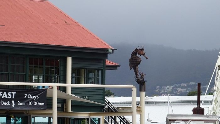
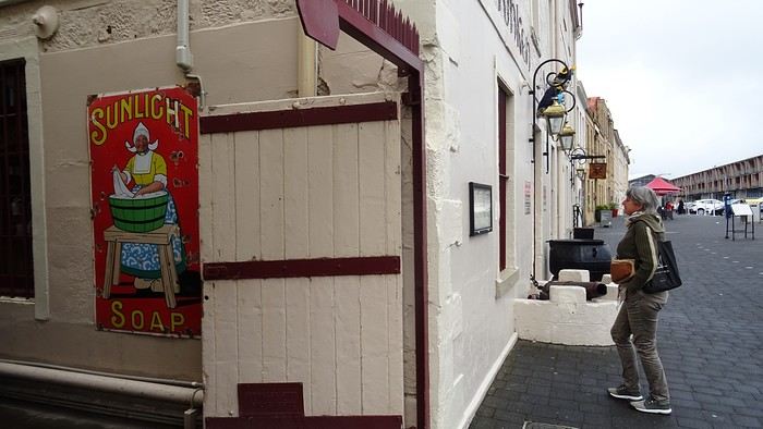
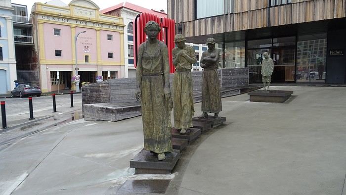
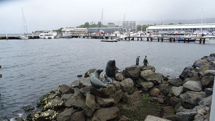
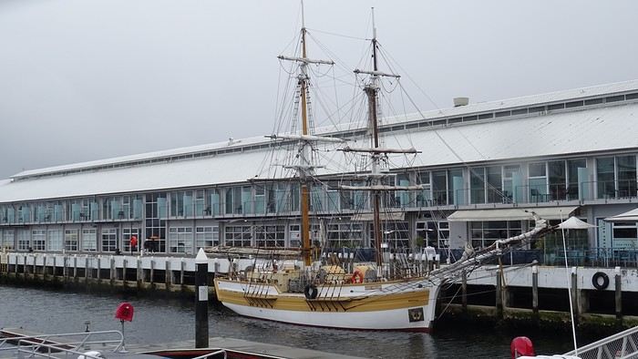
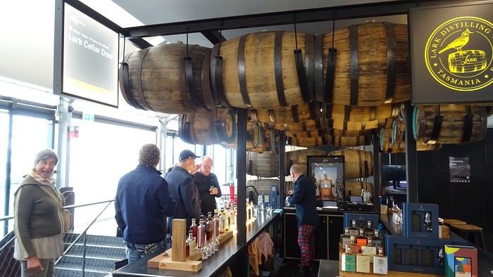
We’ve also downgraded our accommodations. We’ve got a tiny room, and the bathroom—private, at least—is two hallways away… But the price is reasonable (under 100 €) and the location is central.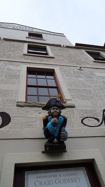
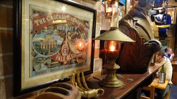
We cheered ourselves up by dining at *The Drunken Admiral* (reservations are a must—we barely snagged a table for 8 PM!). The decor is straight out of an old ship, complete with cheeky statues in the style of *Pirates of the Caribbean*… We had fun! The food was decent, but pricey. Dom loved it; I was less impressed.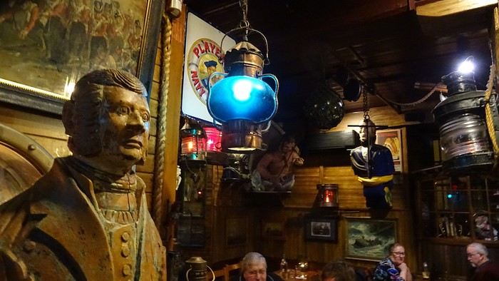
We bailed on the British series *Emma*, based on Jane Austen. We couldn’t take it anymore. The boredom was so intense that the specter of a collective suicide loomed over us. This show, where the world’s most insufferable bourgeoisie—the English nobility—lives out love stories with such improbable naivety that I wanted to scream, is pure torture. Mercy, I surrender! I’ll tell you anything you want, just make it stop! We got rid of it. We’re safe now!
We’ve also downgraded our accommodations. We’ve got a tiny room, and the bathroom—private, at least—is two hallways away… But the price is reasonable (under 100 €) and the location is central.
We cheered ourselves up by dining at *The Drunken Admiral* (reservations are a must—we barely snagged a table for 8 PM!). The decor is straight out of an old ship, complete with cheeky statues in the style of *Pirates of the Caribbean*… We had fun! The food was decent, but pricey. Dom loved it; I was less impressed.
We bailed on the British series *Emma*, based on Jane Austen. We couldn’t take it anymore. The boredom was so intense that the specter of a collective suicide loomed over us. This show, where the world’s most insufferable bourgeoisie—the English nobility—lives out love stories with such improbable naivety that I wanted to scream, is pure torture. Mercy, I surrender! I’ll tell you anything you want, just make it stop! We got rid of it. We’re safe now!
Matsumoto - Shirakawa-go - Magome getaway: what's the best way to get around?
Hello,
What a joy to be back on this forum that I’ve browsed for so many years :-)!
I’m heading to Japan with my partner in November 2025. This will be my second trip there and his first.
I was planning to go from Tokyo to Matsumoto, which I haven’t visited before, and from there, check out Shirahone Onsen and then hike from Magome to Tsumago. However, after reading several travel journals, I’ve realized that the village of Shirakawa-go and its surroundings look amazing. Back in 2006, I visited Takayama, which I loved, but I don’t want to stay there again.
To visit the places mentioned above (Shirahone Onsen, Shirakawa-go, Magome, and Tsumago), I’m thinking that a car might be more convenient than public transport, especially for getting from Shirakawa-go to Magome. Could you confirm if that’s the case? If so, is it easy to rent a car for a few days to do a loop starting from Matsumoto?
Thanks in advance for your valuable tips.
Have a great evening
What a joy to be back on this forum that I’ve browsed for so many years :-)!
I’m heading to Japan with my partner in November 2025. This will be my second trip there and his first.
I was planning to go from Tokyo to Matsumoto, which I haven’t visited before, and from there, check out Shirahone Onsen and then hike from Magome to Tsumago. However, after reading several travel journals, I’ve realized that the village of Shirakawa-go and its surroundings look amazing. Back in 2006, I visited Takayama, which I loved, but I don’t want to stay there again.
To visit the places mentioned above (Shirahone Onsen, Shirakawa-go, Magome, and Tsumago), I’m thinking that a car might be more convenient than public transport, especially for getting from Shirakawa-go to Magome. Could you confirm if that’s the case? If so, is it easy to rent a car for a few days to do a loop starting from Matsumoto?
Thanks in advance for your valuable tips.
Have a great evening
Continuing Greece trip preparations: the itinerary
Hello,
We’ve finally decided on which Cycladic island to visit...
My partner and I are planning our first trip to Greece for June 2025. We’re leaving France for 15 days.
Here’s our itinerary, and I’d love your feedback on whether it’s doable, plus any other suggestions...
Arrival in Athens for 2 nights =
- Visiting the Acropolis, Parthenon, Theatre of Dionysus, Archaeological Museum, Syntagma Square for the changing of the guard, and strolling through the Plaka neighborhood...
4 nights in Nafplio
- To explore the town of Nafplio, the Theatre of Epidaurus, Mycenae, and Olympia
Then off to Milos for 7/8 nights (it was so hard to pick just one island). I’m considering flying from Athens with Olympic Air.
Is it worth doing a guided tour of the Acropolis or the other sites?
I’m open to all your tips.
Thanks so much.
The rule of the three unities
"In one place, in one day, a single deed accomplished,
May hold the theater filled until the end."
- Sunday morning, a chilly dawn - The kitchen - Smell of coffee and toast, a jar of honey on the table.
- Tits pecking at sunflower seeds in the transparent feeder stuck to the window.
- France Musique on the radio: Brahms, violin concerto by the lovely Hilary Hahn - Characters: - An old man in a plush dark blue dressing gown - An old woman in a worn-out duck-blue dressing gown. They dance cheek to cheek, the woman’s head resting on the old man’s broad chest. The old man breathes in the tangled hair of the lady. She smiles. Happy. Tomorrow, they’re off on a trip.
- Sunday morning, a chilly dawn - The kitchen - Smell of coffee and toast, a jar of honey on the table.
- Tits pecking at sunflower seeds in the transparent feeder stuck to the window.
- France Musique on the radio: Brahms, violin concerto by the lovely Hilary Hahn - Characters: - An old man in a plush dark blue dressing gown - An old woman in a worn-out duck-blue dressing gown. They dance cheek to cheek, the woman’s head resting on the old man’s broad chest. The old man breathes in the tangled hair of the lady. She smiles. Happy. Tomorrow, they’re off on a trip.
Traveling by bus in Argentina and Chile
Hi there,
We’re heading to Argentina and Chile next February and really want to do the Carretera Austral starting from Coyhaique.
We’d love some info and feedback on bus routes to get to Coyhaique: Buenos Aires to Comodoro (which we’ve found pretty easily so far), or Buenos Aires to Bariloche (same, there are buses).
The tricky part is getting to Coyhaique in Chile, the starting point for the Carretera Austral. We can’t find any routes! Has anyone done this trip before and could share some tips?
Thanks in advance
We’d love some info and feedback on bus routes to get to Coyhaique: Buenos Aires to Comodoro (which we’ve found pretty easily so far), or Buenos Aires to Bariloche (same, there are buses).
The tricky part is getting to Coyhaique in Chile, the starting point for the Carretera Austral. We can’t find any routes! Has anyone done this trip before and could share some tips?
Thanks in advance
12-day family trip to Cambodia: opinions and advice
Hi there, a regular reader of the forum for planning my past trips—I’m now reaching out to ask for your thoughts on a 12-day itinerary in Cambodia, as so much there appeals to me...
Thanks for your tips and feedback!!
Day 1: arrival in PP
Day 2: PP
Day 3: PP to Kampot (bus)
Day 4: Kampot to Kep (scooter)
Day 5: Kampot to Koh Rong via Sihanoukville
Day 6: Koh Rong
Day 7: Koh Rong
Day 8: Koh Rong to Sihanoukville to Siem Reap (flight)
Day 9: Siem Reap
Day 10: Siem Reap
Day 11: Siem Reap
Day 12: departure from Siem Reap
I was thinking of exploring Tonlé Sap Lake to visit the floating villages during our 3 days in Siem Reap, but I’m also considering squeezing in a stay in Battambang since it seems worth visiting... Is the lake level high enough in February to make it worthwhile?
Thanks for your input!
I was thinking of exploring Tonlé Sap Lake to visit the floating villages during our 3 days in Siem Reap, but I’m also considering squeezing in a stay in Battambang since it seems worth visiting... Is the lake level high enough in February to make it worthwhile?
Thanks for your input!
Family boat trip from Manaus (Brazil) to Yurimaguas (Peru)
Hello,
As part of a 10-month trip to explore and discover South America, we’d like to start our journey in northern Brazil since the timing is perfect for traveling up the Amazon. We’re traveling as a family of five with three kids aged 6, 9, and 18.
Our plan is to leave from Manaus and reach Yurimaguas in Peru via the Amazon, mostly by boat. Since we have plenty of time, we can take breaks to explore the different stops along the way that are worth it. The idea is to eventually head to Colombia via Ecuador later on.
So far, we’ve identified the following stops: - Manaus - Tabatinga - Iquitos - Sumiria Reserve (we’d like to stay there for a week) - Yurimaguas.
We’re thinking of traveling in a cabin/hammock for the longest leg (Manaus to Tabatinga) and just in hammocks for the shorter trips (max 3 days).
I have a few questions: 1. From a safety perspective, is the area we’re planning to cross safe, considering we’ll be with our three kids, the youngest being 6? 2. Isn’t this route a bit too ambitious for our kids? 3. We’re considering adding the Santarém/Manaus leg. Is Santarém a city worth adding to the itinerary? 4. Among the planned stops, which ones deserve a special visit? 5. Do the boat trips always include meals on board, or should we be careful when booking? 6. What would be a reasonable estimate for the duration of this trip to fully enjoy it?
I’ve read quite a bit—like trying to board early to get the best hammock spots, and that travel times can vary depending on currents, stops, and potential technical issues. But that’s not a problem since we have all the time in the world! :)
We’d love to hear from anyone who’s traveled in this area before!
Thanks so much in advance for your help in planning our trip.
Rémy, Céline, Antoine, Sacha, and Paul
As part of a 10-month trip to explore and discover South America, we’d like to start our journey in northern Brazil since the timing is perfect for traveling up the Amazon. We’re traveling as a family of five with three kids aged 6, 9, and 18.
Our plan is to leave from Manaus and reach Yurimaguas in Peru via the Amazon, mostly by boat. Since we have plenty of time, we can take breaks to explore the different stops along the way that are worth it. The idea is to eventually head to Colombia via Ecuador later on.
So far, we’ve identified the following stops: - Manaus - Tabatinga - Iquitos - Sumiria Reserve (we’d like to stay there for a week) - Yurimaguas.
We’re thinking of traveling in a cabin/hammock for the longest leg (Manaus to Tabatinga) and just in hammocks for the shorter trips (max 3 days).
I have a few questions: 1. From a safety perspective, is the area we’re planning to cross safe, considering we’ll be with our three kids, the youngest being 6? 2. Isn’t this route a bit too ambitious for our kids? 3. We’re considering adding the Santarém/Manaus leg. Is Santarém a city worth adding to the itinerary? 4. Among the planned stops, which ones deserve a special visit? 5. Do the boat trips always include meals on board, or should we be careful when booking? 6. What would be a reasonable estimate for the duration of this trip to fully enjoy it?
I’ve read quite a bit—like trying to board early to get the best hammock spots, and that travel times can vary depending on currents, stops, and potential technical issues. But that’s not a problem since we have all the time in the world! :)
We’d love to hear from anyone who’s traveled in this area before!
Thanks so much in advance for your help in planning our trip.
Rémy, Céline, Antoine, Sacha, and Paul
Crossing the Ceuta-Morocco border customs
Hi everyone,
Have any travelers recently returned to Morocco via the border at Ceuta?
If so, how is the crossing at Moroccan customs going right now? Are there any products bought in Ceuta that are banned from import into Morocco?
Thanks for your replies!
Hope you had a great holiday
Visiting Martinique and Guadeloupe in 15 days
Hi everyone,
I bought tickets for Martinique in April 2025 for 15 days, without really looking into what there was to do, and with the idea in my head that we could: hike, do water activities, swim, visit rum distilleries...
But... I’m worried I’ll get bored over 15 days and I’m considering maybe spending 1 week in Guadeloupe and 1 week in Martinique. For example, I don’t know how to spend a whole afternoon at the beach. 2 hours, max.
I know it’s a personal question and depends on how you travel, but I’d love to hear your thoughts if you’ve done it: - Did you feel too rushed? - Is it reasonable to do? - How much time would you spend on each island?
I’m open to all your comments.
Thanks so much.
Have a lovely afternoon! :)
I bought tickets for Martinique in April 2025 for 15 days, without really looking into what there was to do, and with the idea in my head that we could: hike, do water activities, swim, visit rum distilleries...
But... I’m worried I’ll get bored over 15 days and I’m considering maybe spending 1 week in Guadeloupe and 1 week in Martinique. For example, I don’t know how to spend a whole afternoon at the beach. 2 hours, max.
I know it’s a personal question and depends on how you travel, but I’d love to hear your thoughts if you’ve done it: - Did you feel too rushed? - Is it reasonable to do? - How much time would you spend on each island?
I’m open to all your comments.
Thanks so much.
Have a lovely afternoon! :)
A week in the Algarve
Back from a week in the Algarve.
The goal was to get some fresh air, walk at a relaxed pace (80 km in 6 days), and visit friends.
Transavia flight: No issues YorCar rental: No issues (and cheap) B&B 1: Quinta do Mocho Turismo Rural in Estoy: Good, even if a bit remote B&B 2: Casa Luma B&B in Lagos: Disappointed (and really disappointed with room #3)
Day 1: Flight, rental car, stop at São Lourenço in Almancil, and visit to Loulé Day 2: Olhão, walk at Praia do Barril, Tavira, and evening in Faro’s old town (park at São Francisco parking lot) Day 3: Walk on the boardwalks at Quinto do Ludo, Falesia beaches, Carvoeiro Day 4: The boardwalks in Alvor, Praia da Rocha in Portimão, Ferragudo, and the boardwalks around Algar Seco Day 5: Ponta da Piedade in Lagos, walk to Praia de Luz from Praia Camilho Day 6: Burgau, Cape Sagres, Cape St. Vincent, Carrapateira, and Praia da Bordeira Day 7: "Sete Vales Suspensos" hike from Marinha Beach
Our highlights: - The Vincentine Coast (Carrapateira), much nicer than the concrete of the southern coast - The fish restaurants and Cataplana (A Barrigada in Lagos, Ribeira do Poço in Vila do Bispo...) - The boardwalks everywhere (Quinto do Ludo, Alvor, Algar Seco...) - The sun on the cliffs and Falesia Beach (it’s the local Bryce Canyon) - Chatting with the fishermen perched on the cliffs of Carrapateira - The weather (we were lucky for early March)
Our disappointments: - The towns and villages (Tavira and Lagos stand out) - The traffic off the highway - The English, the English, and more English everywhere

The goal was to get some fresh air, walk at a relaxed pace (80 km in 6 days), and visit friends.
Transavia flight: No issues YorCar rental: No issues (and cheap) B&B 1: Quinta do Mocho Turismo Rural in Estoy: Good, even if a bit remote B&B 2: Casa Luma B&B in Lagos: Disappointed (and really disappointed with room #3)
Day 1: Flight, rental car, stop at São Lourenço in Almancil, and visit to Loulé Day 2: Olhão, walk at Praia do Barril, Tavira, and evening in Faro’s old town (park at São Francisco parking lot) Day 3: Walk on the boardwalks at Quinto do Ludo, Falesia beaches, Carvoeiro Day 4: The boardwalks in Alvor, Praia da Rocha in Portimão, Ferragudo, and the boardwalks around Algar Seco Day 5: Ponta da Piedade in Lagos, walk to Praia de Luz from Praia Camilho Day 6: Burgau, Cape Sagres, Cape St. Vincent, Carrapateira, and Praia da Bordeira Day 7: "Sete Vales Suspensos" hike from Marinha Beach
Our highlights: - The Vincentine Coast (Carrapateira), much nicer than the concrete of the southern coast - The fish restaurants and Cataplana (A Barrigada in Lagos, Ribeira do Poço in Vila do Bispo...) - The boardwalks everywhere (Quinto do Ludo, Alvor, Algar Seco...) - The sun on the cliffs and Falesia Beach (it’s the local Bryce Canyon) - Chatting with the fishermen perched on the cliffs of Carrapateira - The weather (we were lucky for early March)
Our disappointments: - The towns and villages (Tavira and Lagos stand out) - The traffic off the highway - The English, the English, and more English everywhere
Quiet island accessible from Tokyo
Hi there,
My wife and I are heading to Japan from March 27 to April 22, 2025. On the evening of the 21st, we’ll be staying in Tokyo to catch our international flight. For this first trip, we’ve prioritized a fairly classic itinerary. Here’s the plan:
- Osaka (arriving at Kansai Airport) - Hiroshima - Itsukushima (also known as Miyajima) - Kyoto - Nara - Kanazawa - Shirakawa-go - Takayama - Tokyo
We’ll likely finish our sightseeing in Tokyo around March 17.
We’re thinking of heading somewhere "quiet" or "by the sea," maybe an island, between the 17th/18th and the evening of the 21st.
What are your thoughts or experiences?
Thanks
My wife and I are heading to Japan from March 27 to April 22, 2025. On the evening of the 21st, we’ll be staying in Tokyo to catch our international flight. For this first trip, we’ve prioritized a fairly classic itinerary. Here’s the plan:
- Osaka (arriving at Kansai Airport) - Hiroshima - Itsukushima (also known as Miyajima) - Kyoto - Nara - Kanazawa - Shirakawa-go - Takayama - Tokyo
We’ll likely finish our sightseeing in Tokyo around March 17.
We’re thinking of heading somewhere "quiet" or "by the sea," maybe an island, between the 17th/18th and the evening of the 21st.
What are your thoughts or experiences?
Thanks
Two weeks in Bangkok: your off-the-beaten-path suggestions
Hello,
After a lot of searching, exchanging ideas, and thinking it over, I’ve decided to go back to my original plan of spending two weeks in Bangkok. From January 19th to February 2nd. I’ll also take a quick trip for one night/two days to Ayutthaya (and return to Bangkok, where I’ll have kept the apartment I booked), and possibly the same for Kanchanaburi, depending on how I feel once I’m there—whether I find something more interesting in Bangkok or nearby.
The key word is: taking my time to take photos, observe, taste, savor (in every sense of the word), and most importantly, not rushing.
Beyond the must-see tourist spots, I’d love to wander around the city and maybe within a 40 to 50 km radius for a day trip to discover unusual and lesser-known streets, houses, temples, markets, gardens, and more.
I’ll also be spending two weeks in Chiang Mai and two weeks in Nan.
I’m open to any suggestions. Thank you so much!
Which islands should we prioritize in the Philippines?
We’re planning a month there, and there are definitely some beautiful—*very* beautiful—islands, but which ones to choose? Can you point me to the must-sees, the ones that are easiest to reach by boat, bus, or flight if it saves a ton of time and isn’t too expensive? Also, which island should we start our loop on, given we’re coming from Vietnam and our return flight to Paris is already booked out of Manila?
Thanks in advance for all your tips. Philippe
French-speaking guide in Cambodia
Hi,
Does anyone have the contact details for a French-speaking guide?
Bruges to Amsterdam by bike - July 2025
Hi there!
I’m really keen to cycle from Bruges to Amsterdam. Has anyone here done it before? We’re a group of three—is it easy to find accommodation on the go, or should we book ahead? If we do a round trip and take our bikes, would it be simpler to plan two different routes?!
Thanks so much!
Laurence from Bayonne
The 4000 Islands (Southern Laos)
PAKSE AND THE BOLAVENS PLATEAU
Bolavens (or "Bolovens" – "the region of the Lavens," an old tribe).
PAKSE
A sleepy town, but packed with backpackers in transit between Laos and Cambodia. The streets are numbered, but since there are no signs, you just have to figure it out (rumor has it the signs have been planned for years; luckily, the center isn’t big). Tons of small hotels, including the well-known Sabaidy 2 on Street 20, a big bazaar catering to all budgets, from dark dorms with shared bathrooms to real rooms with terraces or balconies. Since it’s so popular, booking ahead is recommended. My favorite: the Sala Champa, pricier but with two large terraces, one with a bar, and especially a terrace restaurant I consider the best in Pakse (try the divine steamed fish with lemongrass + Lao Gold beer, a rare delight; ask for room 100, with a big terrace). More upscale, the lovely Résidence Sisouk, run by the very classy and French-speaking Mme Sisouk, from the wealthy Lao Sisouk family, the country’s top coffee producer and one of those francophone families you encounter here and there around the world, where class and culture reign – and perfect French. Delicious pastries and, of course, extraordinary coffee tastings. Similar prices at the Pakse Hotel, run by French owners and famous for its rooftop bar-restaurant (great view!).
Tons of restaurants besides those at Sala Champa and Pakse Hotel: from Dao Lin and Sabaidee at the corner of Street 20 and 13, to a decent Indian place (Hassan) and a nice, cheap spot, the Lao Restaurant & Bar, where you can enjoy Lao cuisine for just a few kips, both also on Street 20. You can feast on grilled fish at the countless riverside stalls along the Mekong.
Pakse is home to the famous Yves, a Belgian married to a Lao woman, Noy, who opened the travel agency Miss Noy. He’ll go out of his way to help tourists; he’s incredible, the real tourism office for the region, with maps, endless advice, and every weekday at 6 PM, a full-blown lecture on the Bolavens and the 4000 Islands. A bunch of young travelers listen intently to his explanations about the whole area (he hands out a well-made photocopied map). He also rents bikes and has an internet café with computers that, miraculously, work perfectly. He’s so popular that in high season, you need to book a motorbike 2-3 days in advance (but if he’s out – and he has 40 – he’ll find one for you).
THE BOLAVENS PLATEAU
Plateaus just aren’t my thing – flat-lands! There are some relatively high peaks in the middle, but they’re only accessible by trekking. You can do a small loop from Pakse-Tad Lo-Thateng-Pakson-Pakse, or a big one from Tad Lo to Sekong, then head south to join the Paksong-Pakse road. Starting in the north, the Phu Xam waterfalls are okay (interesting local minority village-museum to the right of the parking lot, and a terrace restaurant above the small falls). Well, they’re on the way, so you might as well see them! After that, a boring road leads to the Tad Lo waterfalls, with tons of small hotels. I chose the big blue house by the river at the right corner of the bridge, the Sipaseth GH, with cute little bungalows in the garden, 4 rooms with balconies overlooking the river, and great food on the terrace facing the falls. **Avoid at all costs**: the Saisee GH, once nice with its little stilt houses by the falls, but now a monument to filth, indifference, and rudeness (confirmed by several people, unanimous on the issue). Luckily, the lovely Tad Lo Lodge, with its bungalows by the falls and gourmet restaurant right above them – not cheap at all – finally built small houses in the woods on the other side for $25.
The next morning, I’d had enough of plateaus, so I took a small loop heading south from Tad Lo to Thateng, and there, a wonder 5 km south of town: the Sinouk Resort. It’s like stepping into *Gone with the Wind* or the Chevalier de Leyritz’s Martinique. In the middle of the Sisouk family’s 34-hectare coffee plantation, a huge garden with three large colonial-style houses: one by the river and pond with a suite + 3 luxury rooms + a small, cozy one for $40 (that’s where I stayed), one with 4 superior rooms for $60, and a very large one overlooking everything with 6 luxury rooms ($60) + 2 huge suites for $90. Of course, it’s all decorated with antique furniture, local knick-knacks, and antiques; there’s a pool, a beautiful restaurant with two terraces, one overlooking a large pond and one by its edge. The food and service are impeccable, and the coffee: from espresso with whipped cream to green tea or wild honey cappuccino… too bad it keeps you up, or you’d sip it all evening (and morning, and afternoon, and in between). In short, a dream!
Back to Pakse via Paksong (what a dump!) and the Tad Fane waterfalls, those are spectacular – twin sisters plunging 200 meters. You can hike down to swim at the bottom (1-hour jungle trek round trip). Across the way, the nice Tad Fane Resort (small houses and a big terrace-restaurant facing the falls).
I think I missed the Katamkok waterfalls, but I don’t believe it – all these falls can’t compare to Ban Gioc Falls in northern Vietnam!!!
CHAMPASAK AND THE 4000 ISLANDS
CHAMPASAK
Even sleepier than Pakse! To avoid the ferry, cross the new Mekong bridge in Pakse, and after about 10 km, turn left at the big "Phaphinoy" sign (the first village in town). When you arrive, turn at the "River Resort" sign. A sumptuous resort on the Mekong, developed with American capital – pure luxury (they even have their own rice field and vegetable garden for the restaurant). Continuing on, you’ll come across the very pleasant Anouxa GH, where I had dinner and stayed. Small bungalows facing the river, garden rooms, and two large wooden houses with huge family rooms + a big terrace on the Mekong, and the food is great! They rent bikes and motorbikes. Further to the right, the pricey Inthira Hotel, which I found uninteresting since it’s on the road instead of by the Mekong. There’s also a Folie Lodge on Don Daeng Island, which I didn’t visit (the word "Folie" is justified: crazy prices, up to $200 and more).
A few nice wats and, of course, Wat Phou, Laos’ most important archaeological site, 10 km south of Champassak in the plains and on the mountainside (the stairs are a killer!). Watch out for the scorching heat, and it closes at 4:30 PM. It’s not Angkor Wat, but it’s still worth the detour. Plan for 2 hours. Entry is 50,000 kips + 5,000 to park your motorbike.
KHIET NGON
To continue south to the 4000 Islands, you have to take the "ferry" (actually fun little things – two canoes joined by a platform; better not mess up when loading your motorbike!). Once on the other side, turn left, and you’ll hit National Road 13 (Pakse-Siphandone, the 4000 Islands), the most boring road I’ve ever been on, like Phnom Penh-Siem Reap – flat and nothing to see. BUT there’s a real gem worth checking out: Kiet Ngon. At Km 48, take the laterite road toward Attapeu (big sign: "Attapeu 155 km") and eat red dust for 8 km (toll: 20,000 kips), then turn right (signposted) onto a good track. You enter the beautiful Xe Pian National Park, where you can still find wild elephants, leopards, and tigers. You arrive at the entrance of the small village of Ban Khiet Ngon. On your right, a small concrete building with 4 decent, cheap rooms (60,000 kips), facing an old wooden house that serves as the tourism office and its "elephant parking" garden. This village is where you can go on an elephant ride (20,000 kips) to the top of Phou Asa, one of the most unusual places I’ve ever seen. You climb through the jungle and emerge onto a flat slate summit, completely bare – it really feels like the Moon! In the distance, an astonishing site built to commemorate a victory by Lao nationalists over Siamese invaders in the 19th century (so the site isn’t 1,000 years old, as the locals claim). A vast archaeological site with an enclosure 180 m by 50 m, marked by 2-meter-high walls and columns made of slate stacked without mortar. At the back, a ruined temple and a tower. Beautiful views of the whole region. Popular with tourists arriving by minibus from Pakse. The elephant rides in a line aren’t my thing, so they tell you it’s forbidden to ride a motorbike, but I did it anyway without any issues – except for the unhappy looks from the mahouts (turn right at the village entrance, sign for "Phou Asa").
If you’ve got the funds, follow the signs for "Kingfisher Lodge" and arrive at Laos’ first ecolodge, developed by a Lao-Italian family. Lovely stilt houses (750,000 kips with breakfast) and 2 bungalows with just fans (250,000 kips). A small two-story wooden building with a restaurant and a terrace by a pond – the bonus: in the evening, wild elephants and buffalo come to drink with you. Booking ahead is recommended since it’s popular with groups from Pakse.
Paper guides also mention the more remote village of Ban Papho, deep in the jungle. There used to be elephant rides, but they’ve stopped. However, there are great treks in the national park (check with the Green Discovery agency in Pakse, which specializes in treks all over Laos).
THE 4000 ISLANDS
You continue on the mind-numbing Road 13 from Pakse and arrive at a brand-new bridge leading to Don Khong Island, where there’s nothing to see except two wats, so if you skip it, you’re not missing much. Next, the Nakasang sign, a small port with mini-ferries crossing the Mekong to Don Det Island. A celebrity, that one – one of those trashy spots for young people who think you can only have fun if you’re wasted on alcohol and drugs. A small street along the river, lined with guesthouses, restaurants, and bars – total chaos! Plus, there’s nothing to see on the island. So, take a tuk-tuk from the jetty, cross the dump, and arrive in a little paradise: Don Khone Island. I planned to stay 2 days but had to be dragged away after 6. A small main village with a dirt road, tons of guesthouses and great restaurants, and lots of beautiful things to see.
For lodging on Don Khone, it’s usually wooden bungalows with river-view terraces. Options range from the elegant and pricey Sala Done Hotel to Somphamit, Pan’s, Pakha GH, and many others. I found my haven away from everything: the little Phonvilay, 3 small bamboo buildings with 2 simple rooms each, terraces above a branch of the Mekong, and a big plus – a small path just to the right that goes down the riverbank, so 3-4 nice swims a day. All for 60,000 kips. To get there, turn right at the end of the bridge until you reach the wat, then take the small path to the river on the right of the wat’s wall.
For food, you’re spoiled for choice. I had all my dinners at the Cordon Bleu of the Fleur du Mékong. I don’t know how she does it, but even the simplest dishes have something extra. She’s famous for her curry (more like a mild stew) of duck or chicken with potatoes and sweet potatoes – a hearty treat. Go for the chicken; Asian ducks are all skin and bones. Her grilled fish is divine!
The island has quite a history: the Mekong upstream is over a kilometer wide (it’s said to reach 14 km during high water) and "falls" onto a rocky barrier. It splits into countless small branches, flowing wherever there’s a crack – hence the 4000 Islands and the impressive rapids. The French discovered this while trying to navigate the Mekong from Saigon to Luang Prabang and China – and bam, impassable! So they built a narrow-gauge railway starting from the south of the island, bypassing the rapids, and ending at the north of Don Det Island. You can see two rusted locomotives, discovered in the jungle in 1990 by a French explorer: one in the southern extension of the bridge and the other in Ban Hang Khone village at the southern tip of the island, both with large English signs and fascinating old photos explaining the whole history of the railway, abandoned when Road 13 was built along the 4000 Islands (the rails were removed, and the railway track is now an excellent trail).
Somphamit Rapids (Li Phi)
Locals call them Li Phi, meaning "the abyss of evil spirits" (the "phi" that Lao people still believe in), because they think the falls and rapids trap spirits, to the point that no one would ever swim there. It’s very dramatic. Entry fee: 35,000 kips. Small beach and a big restaurant with a terrace and thatched-roof tables.
Khon Pa Sai Rapids
A completely different kind, just as spectacular, and less crowded. Turn left at the bridge exit and go to the northern end of the island (Ban Khon Nua village), then continue south until you see a big yellow sign "Khon Pa Sai Waterfalls" pointing to a small path on the left. You arrive at a small suspension bridge with a corner restaurant and terrace where the food is great (I had most of my lunches there). Cross the bridge and follow the path to a spectacular site of falls and rapids. In the middle, you’ll see unique structures – gigantic fish traps over 10 meters long. During high water, each trap can catch up to 500 kg of fish (yes, five hundred) per day.
Ban Hang Khone
This is the "French port" at the southern tip of the island, where the Mekong, after its rapids, spreads out for kilometers – a real inland sea. This is where you can see the famous Irrawaddy dolphins in the morning or late afternoon (boat excursions). To get there, take the trail that was the old railway track, or continue south on the path past the Khon Pa Sai falls (but not by motorbike – the bridge is out). A huge concrete terrace, part of the old port facilities, with a magnificent panoramic view of the Mekong stretching into the distance. Just before, a small path leads to a big beach (with restaurants).
If you go back to Road 13 (or take a pirogue from Don Khone), further south are the Pha Peng Falls, Asia’s highest river falls (15 m). I didn’t go, but they’re said to be spectacular.
Bolavens (or "Bolovens" – "the region of the Lavens," an old tribe).
PAKSE
A sleepy town, but packed with backpackers in transit between Laos and Cambodia. The streets are numbered, but since there are no signs, you just have to figure it out (rumor has it the signs have been planned for years; luckily, the center isn’t big). Tons of small hotels, including the well-known Sabaidy 2 on Street 20, a big bazaar catering to all budgets, from dark dorms with shared bathrooms to real rooms with terraces or balconies. Since it’s so popular, booking ahead is recommended. My favorite: the Sala Champa, pricier but with two large terraces, one with a bar, and especially a terrace restaurant I consider the best in Pakse (try the divine steamed fish with lemongrass + Lao Gold beer, a rare delight; ask for room 100, with a big terrace). More upscale, the lovely Résidence Sisouk, run by the very classy and French-speaking Mme Sisouk, from the wealthy Lao Sisouk family, the country’s top coffee producer and one of those francophone families you encounter here and there around the world, where class and culture reign – and perfect French. Delicious pastries and, of course, extraordinary coffee tastings. Similar prices at the Pakse Hotel, run by French owners and famous for its rooftop bar-restaurant (great view!).
Tons of restaurants besides those at Sala Champa and Pakse Hotel: from Dao Lin and Sabaidee at the corner of Street 20 and 13, to a decent Indian place (Hassan) and a nice, cheap spot, the Lao Restaurant & Bar, where you can enjoy Lao cuisine for just a few kips, both also on Street 20. You can feast on grilled fish at the countless riverside stalls along the Mekong.
Pakse is home to the famous Yves, a Belgian married to a Lao woman, Noy, who opened the travel agency Miss Noy. He’ll go out of his way to help tourists; he’s incredible, the real tourism office for the region, with maps, endless advice, and every weekday at 6 PM, a full-blown lecture on the Bolavens and the 4000 Islands. A bunch of young travelers listen intently to his explanations about the whole area (he hands out a well-made photocopied map). He also rents bikes and has an internet café with computers that, miraculously, work perfectly. He’s so popular that in high season, you need to book a motorbike 2-3 days in advance (but if he’s out – and he has 40 – he’ll find one for you).
THE BOLAVENS PLATEAU
Plateaus just aren’t my thing – flat-lands! There are some relatively high peaks in the middle, but they’re only accessible by trekking. You can do a small loop from Pakse-Tad Lo-Thateng-Pakson-Pakse, or a big one from Tad Lo to Sekong, then head south to join the Paksong-Pakse road. Starting in the north, the Phu Xam waterfalls are okay (interesting local minority village-museum to the right of the parking lot, and a terrace restaurant above the small falls). Well, they’re on the way, so you might as well see them! After that, a boring road leads to the Tad Lo waterfalls, with tons of small hotels. I chose the big blue house by the river at the right corner of the bridge, the Sipaseth GH, with cute little bungalows in the garden, 4 rooms with balconies overlooking the river, and great food on the terrace facing the falls. **Avoid at all costs**: the Saisee GH, once nice with its little stilt houses by the falls, but now a monument to filth, indifference, and rudeness (confirmed by several people, unanimous on the issue). Luckily, the lovely Tad Lo Lodge, with its bungalows by the falls and gourmet restaurant right above them – not cheap at all – finally built small houses in the woods on the other side for $25.
The next morning, I’d had enough of plateaus, so I took a small loop heading south from Tad Lo to Thateng, and there, a wonder 5 km south of town: the Sinouk Resort. It’s like stepping into *Gone with the Wind* or the Chevalier de Leyritz’s Martinique. In the middle of the Sisouk family’s 34-hectare coffee plantation, a huge garden with three large colonial-style houses: one by the river and pond with a suite + 3 luxury rooms + a small, cozy one for $40 (that’s where I stayed), one with 4 superior rooms for $60, and a very large one overlooking everything with 6 luxury rooms ($60) + 2 huge suites for $90. Of course, it’s all decorated with antique furniture, local knick-knacks, and antiques; there’s a pool, a beautiful restaurant with two terraces, one overlooking a large pond and one by its edge. The food and service are impeccable, and the coffee: from espresso with whipped cream to green tea or wild honey cappuccino… too bad it keeps you up, or you’d sip it all evening (and morning, and afternoon, and in between). In short, a dream!
Back to Pakse via Paksong (what a dump!) and the Tad Fane waterfalls, those are spectacular – twin sisters plunging 200 meters. You can hike down to swim at the bottom (1-hour jungle trek round trip). Across the way, the nice Tad Fane Resort (small houses and a big terrace-restaurant facing the falls).
I think I missed the Katamkok waterfalls, but I don’t believe it – all these falls can’t compare to Ban Gioc Falls in northern Vietnam!!!
CHAMPASAK AND THE 4000 ISLANDS
CHAMPASAK
Even sleepier than Pakse! To avoid the ferry, cross the new Mekong bridge in Pakse, and after about 10 km, turn left at the big "Phaphinoy" sign (the first village in town). When you arrive, turn at the "River Resort" sign. A sumptuous resort on the Mekong, developed with American capital – pure luxury (they even have their own rice field and vegetable garden for the restaurant). Continuing on, you’ll come across the very pleasant Anouxa GH, where I had dinner and stayed. Small bungalows facing the river, garden rooms, and two large wooden houses with huge family rooms + a big terrace on the Mekong, and the food is great! They rent bikes and motorbikes. Further to the right, the pricey Inthira Hotel, which I found uninteresting since it’s on the road instead of by the Mekong. There’s also a Folie Lodge on Don Daeng Island, which I didn’t visit (the word "Folie" is justified: crazy prices, up to $200 and more).
A few nice wats and, of course, Wat Phou, Laos’ most important archaeological site, 10 km south of Champassak in the plains and on the mountainside (the stairs are a killer!). Watch out for the scorching heat, and it closes at 4:30 PM. It’s not Angkor Wat, but it’s still worth the detour. Plan for 2 hours. Entry is 50,000 kips + 5,000 to park your motorbike.
KHIET NGON
To continue south to the 4000 Islands, you have to take the "ferry" (actually fun little things – two canoes joined by a platform; better not mess up when loading your motorbike!). Once on the other side, turn left, and you’ll hit National Road 13 (Pakse-Siphandone, the 4000 Islands), the most boring road I’ve ever been on, like Phnom Penh-Siem Reap – flat and nothing to see. BUT there’s a real gem worth checking out: Kiet Ngon. At Km 48, take the laterite road toward Attapeu (big sign: "Attapeu 155 km") and eat red dust for 8 km (toll: 20,000 kips), then turn right (signposted) onto a good track. You enter the beautiful Xe Pian National Park, where you can still find wild elephants, leopards, and tigers. You arrive at the entrance of the small village of Ban Khiet Ngon. On your right, a small concrete building with 4 decent, cheap rooms (60,000 kips), facing an old wooden house that serves as the tourism office and its "elephant parking" garden. This village is where you can go on an elephant ride (20,000 kips) to the top of Phou Asa, one of the most unusual places I’ve ever seen. You climb through the jungle and emerge onto a flat slate summit, completely bare – it really feels like the Moon! In the distance, an astonishing site built to commemorate a victory by Lao nationalists over Siamese invaders in the 19th century (so the site isn’t 1,000 years old, as the locals claim). A vast archaeological site with an enclosure 180 m by 50 m, marked by 2-meter-high walls and columns made of slate stacked without mortar. At the back, a ruined temple and a tower. Beautiful views of the whole region. Popular with tourists arriving by minibus from Pakse. The elephant rides in a line aren’t my thing, so they tell you it’s forbidden to ride a motorbike, but I did it anyway without any issues – except for the unhappy looks from the mahouts (turn right at the village entrance, sign for "Phou Asa").
If you’ve got the funds, follow the signs for "Kingfisher Lodge" and arrive at Laos’ first ecolodge, developed by a Lao-Italian family. Lovely stilt houses (750,000 kips with breakfast) and 2 bungalows with just fans (250,000 kips). A small two-story wooden building with a restaurant and a terrace by a pond – the bonus: in the evening, wild elephants and buffalo come to drink with you. Booking ahead is recommended since it’s popular with groups from Pakse.
Paper guides also mention the more remote village of Ban Papho, deep in the jungle. There used to be elephant rides, but they’ve stopped. However, there are great treks in the national park (check with the Green Discovery agency in Pakse, which specializes in treks all over Laos).
THE 4000 ISLANDS
You continue on the mind-numbing Road 13 from Pakse and arrive at a brand-new bridge leading to Don Khong Island, where there’s nothing to see except two wats, so if you skip it, you’re not missing much. Next, the Nakasang sign, a small port with mini-ferries crossing the Mekong to Don Det Island. A celebrity, that one – one of those trashy spots for young people who think you can only have fun if you’re wasted on alcohol and drugs. A small street along the river, lined with guesthouses, restaurants, and bars – total chaos! Plus, there’s nothing to see on the island. So, take a tuk-tuk from the jetty, cross the dump, and arrive in a little paradise: Don Khone Island. I planned to stay 2 days but had to be dragged away after 6. A small main village with a dirt road, tons of guesthouses and great restaurants, and lots of beautiful things to see.
For lodging on Don Khone, it’s usually wooden bungalows with river-view terraces. Options range from the elegant and pricey Sala Done Hotel to Somphamit, Pan’s, Pakha GH, and many others. I found my haven away from everything: the little Phonvilay, 3 small bamboo buildings with 2 simple rooms each, terraces above a branch of the Mekong, and a big plus – a small path just to the right that goes down the riverbank, so 3-4 nice swims a day. All for 60,000 kips. To get there, turn right at the end of the bridge until you reach the wat, then take the small path to the river on the right of the wat’s wall.
For food, you’re spoiled for choice. I had all my dinners at the Cordon Bleu of the Fleur du Mékong. I don’t know how she does it, but even the simplest dishes have something extra. She’s famous for her curry (more like a mild stew) of duck or chicken with potatoes and sweet potatoes – a hearty treat. Go for the chicken; Asian ducks are all skin and bones. Her grilled fish is divine!
The island has quite a history: the Mekong upstream is over a kilometer wide (it’s said to reach 14 km during high water) and "falls" onto a rocky barrier. It splits into countless small branches, flowing wherever there’s a crack – hence the 4000 Islands and the impressive rapids. The French discovered this while trying to navigate the Mekong from Saigon to Luang Prabang and China – and bam, impassable! So they built a narrow-gauge railway starting from the south of the island, bypassing the rapids, and ending at the north of Don Det Island. You can see two rusted locomotives, discovered in the jungle in 1990 by a French explorer: one in the southern extension of the bridge and the other in Ban Hang Khone village at the southern tip of the island, both with large English signs and fascinating old photos explaining the whole history of the railway, abandoned when Road 13 was built along the 4000 Islands (the rails were removed, and the railway track is now an excellent trail).
Somphamit Rapids (Li Phi)
Locals call them Li Phi, meaning "the abyss of evil spirits" (the "phi" that Lao people still believe in), because they think the falls and rapids trap spirits, to the point that no one would ever swim there. It’s very dramatic. Entry fee: 35,000 kips. Small beach and a big restaurant with a terrace and thatched-roof tables.
Khon Pa Sai Rapids
A completely different kind, just as spectacular, and less crowded. Turn left at the bridge exit and go to the northern end of the island (Ban Khon Nua village), then continue south until you see a big yellow sign "Khon Pa Sai Waterfalls" pointing to a small path on the left. You arrive at a small suspension bridge with a corner restaurant and terrace where the food is great (I had most of my lunches there). Cross the bridge and follow the path to a spectacular site of falls and rapids. In the middle, you’ll see unique structures – gigantic fish traps over 10 meters long. During high water, each trap can catch up to 500 kg of fish (yes, five hundred) per day.
Ban Hang Khone
This is the "French port" at the southern tip of the island, where the Mekong, after its rapids, spreads out for kilometers – a real inland sea. This is where you can see the famous Irrawaddy dolphins in the morning or late afternoon (boat excursions). To get there, take the trail that was the old railway track, or continue south on the path past the Khon Pa Sai falls (but not by motorbike – the bridge is out). A huge concrete terrace, part of the old port facilities, with a magnificent panoramic view of the Mekong stretching into the distance. Just before, a small path leads to a big beach (with restaurants).
If you go back to Road 13 (or take a pirogue from Don Khone), further south are the Pha Peng Falls, Asia’s highest river falls (15 m). I didn’t go, but they’re said to be spectacular.
Papua or Papua New Guinea for backpacking?
Hi everyone,
so glad the forum’s back up!
I’m planning a trip for next June but I’m still torn between Papua and Papua New Guinea.
Solo backpacking trip, about 3 weeks (trekking, culture, and a tiny bit of beach time).
It’s still tough to find recent info—anyone know if backpacking is doable there?
Thanks in advance for your tips!
carpediem
Nine days around Phuket
Hi everyone,
I’m arriving in Phuket on March 1st until the 10th. We’ll have about 9 days there with two kids, aged 10 and 7.
We’d like to visit a few islands... Any ideas? We’ve looked at Koh Phi Phi, Koh Lanta, Similan Islands, Phang Nga Bay...
Based on your experiences, what could be a good mini-itinerary?
We’d like to do some diving or snorkelling, a bit of sightseeing (viewpoints, etc.), and some beach time...
Thanks everyone
I’m arriving in Phuket on March 1st until the 10th. We’ll have about 9 days there with two kids, aged 10 and 7.
We’d like to visit a few islands... Any ideas? We’ve looked at Koh Phi Phi, Koh Lanta, Similan Islands, Phang Nga Bay...
Based on your experiences, what could be a good mini-itinerary?
We’d like to do some diving or snorkelling, a bit of sightseeing (viewpoints, etc.), and some beach time...
Thanks everyone
Three weeks in Norway (July 2022): fantastic memories despite the rain
Our trip to Norway was two years ago already, but I thought it might still be of interest—and it’ll let me relive it a bit by proxy.
Before booking our flight tickets, we debated the route: should we prioritize the north with the Lofoten and Senja islands, or the south with its countless fjords? I was tempted to stay in the south—the country is so vast, and the drive north is long... but my husband really didn’t want to miss the Lofoten. In the end, we figured that since Norway is known for being expensive, we might only visit once (funny how we said the same thing before our first trip to the American West, and look how that turned out 😎), so we didn’t want to skip anything. That meant a 2–3 day drive up north. With 22 days on the ground, it was doable. Especially since, as usual, we skip big cities and gave Oslo a pass.
Practical details: - Flight tickets: 1195 € for 4 with Air France (Paris–Oslo outbound, Tromsø–Bergen–Paris return) - Car rental: 2020 € for 21 days (including the outrageous drop-off fee between Oslo and Tromsø—about 1000 €) - Tolls and ferries: 250 € for the portion billed directly by the rental company. Some ferries required advance booking and payment at the time of reservation—I’ll note their prices as I go through the story. - Hotels: 4135 €, averaging 188 € per night. We blew past our usual budgets from trips to the U.S., but oh well... - Food: 1570 €, averaging 71 € per day for 4 in a country where everything’s expensive... How’d we manage? We rarely ate out, mostly grocery shopped, and even packed half a suitcase with non-perishables: pasta, rice, a few cans, and even some cured sausage! We also stayed 3 nights at Clarion Collection hotels, where an evening buffet was included in the room rate.
Before booking our flight tickets, we debated the route: should we prioritize the north with the Lofoten and Senja islands, or the south with its countless fjords? I was tempted to stay in the south—the country is so vast, and the drive north is long... but my husband really didn’t want to miss the Lofoten. In the end, we figured that since Norway is known for being expensive, we might only visit once (funny how we said the same thing before our first trip to the American West, and look how that turned out 😎), so we didn’t want to skip anything. That meant a 2–3 day drive up north. With 22 days on the ground, it was doable. Especially since, as usual, we skip big cities and gave Oslo a pass.
Practical details: - Flight tickets: 1195 € for 4 with Air France (Paris–Oslo outbound, Tromsø–Bergen–Paris return) - Car rental: 2020 € for 21 days (including the outrageous drop-off fee between Oslo and Tromsø—about 1000 €) - Tolls and ferries: 250 € for the portion billed directly by the rental company. Some ferries required advance booking and payment at the time of reservation—I’ll note their prices as I go through the story. - Hotels: 4135 €, averaging 188 € per night. We blew past our usual budgets from trips to the U.S., but oh well... - Food: 1570 €, averaging 71 € per day for 4 in a country where everything’s expensive... How’d we manage? We rarely ate out, mostly grocery shopped, and even packed half a suitcase with non-perishables: pasta, rice, a few cans, and even some cured sausage! We also stayed 3 nights at Clarion Collection hotels, where an evening buffet was included in the room rate.
Crossing the Phsar Prum border + transport between Battambang/Pailin and Ben Pakkad/Chantaburi
Hi there,
1) I’d love to get some recent info on crossing this border. We’ll be entering Cambodia through Siem Reap Airport with an e-visa (electronic visa), and I’d like to know if we’ll be able to leave Cambodia through this border crossing without any issues using this type of visa.
2) I’m also looking for info (company names and schedules) on public transport options to Battambang/Pailin and then to Ben Pakkad/Chantaburi. Or, since there’ll be six of us (5 adults and 1 young child), would it be better to go for a taxi instead? If so, I’d appreciate recommendations for reliable taxi companies. Price isn’t a deal-breaker for the taxi option.
Thanks in advance!
1) I’d love to get some recent info on crossing this border. We’ll be entering Cambodia through Siem Reap Airport with an e-visa (electronic visa), and I’d like to know if we’ll be able to leave Cambodia through this border crossing without any issues using this type of visa.
2) I’m also looking for info (company names and schedules) on public transport options to Battambang/Pailin and then to Ben Pakkad/Chantaburi. Or, since there’ll be six of us (5 adults and 1 young child), would it be better to go for a taxi instead? If so, I’d appreciate recommendations for reliable taxi companies. Price isn’t a deal-breaker for the taxi option.
Thanks in advance!
Sandflies in Southern Thailand
Hi there,
I’m heading back to Thailand soon, and from what I’ve been reading, it seems some beaches/islands are infested with these dreaded sandflies!
I’ve noted the remedy: rub the bitten area with 90% alcohol, then apply soothing cream.
But prevention is better than cure!
Which areas should I avoid right now?
Are there seasons that are more prone to these itchy invasions than others?
I’ve already stayed in Hua Hin, Koh Samui, Koh Phangan, Koh Tao, Krabi, and Phuket without any issues like this.
I’d love to keep it that way...
Thanks
I’m heading back to Thailand soon, and from what I’ve been reading, it seems some beaches/islands are infested with these dreaded sandflies!
I’ve noted the remedy: rub the bitten area with 90% alcohol, then apply soothing cream.
But prevention is better than cure!
Which areas should I avoid right now?
Are there seasons that are more prone to these itchy invasions than others?
I’ve already stayed in Hua Hin, Koh Samui, Koh Phangan, Koh Tao, Krabi, and Phuket without any issues like this.
I’d love to keep it that way...
Thanks
15-Day Itinerary for Cambodia
Hello,
My wife and I are planning a 15-day trip to Cambodia. Could you share some itinerary ideas with us? Thanks
21-Day Trip to La Gomera and La Palma
Travel Journal: 21 Days in La Gomera and La Palma
From February 6 to February 26, 2024
Tuesday, February 6 We left around 9 AM with our car, along with Pierre-Paul and Patricia, heading to the Bluepark parking lot in Bartenheim. As expected, we were awaited and left promptly for EuroAirport Basel. Took off at 12:25 PM for a 4-hour-15-minute flight under excellent conditions. Beautiful arrival in Tenerife with Teide in sight under a clear blue sky. Fifteen minutes later, we waited for bus No. 40 to Los Cristianos with quite a few other tourists, but we managed to find four seats. From the bus station, it was a 20-minute walk to our hotel. We checked into a lovely apartment for the four of us, complete with all the comforts. Outside, it was quite warm—at least 25°C! After dropping off our luggage, we went for a stroll. The immediate surroundings of the hotel held no interest for us: a modern, concrete area filled with hotels, bars, tourist agencies, and unappealing restaurants all offering the same bland international cuisine. Pat went to cool off at the pool, unfortunately overrun by loud, drunk English tourists. I took a walk to the paseo maritimo that leads to the port, skirting the seafront. The promenade was pleasant, but it could have been any seaside resort in the world—same old scene: a succession of bars with blaring music where many elderly people sipped cold beers waiting for the sunset, the backdrop a wall of resort-style hotels resembling rabbit hutches! Upon reaching the port, I scouted the route we’d take the next day to the Fred Olsen ferry. Back at the apartment, in the early evening, we looked for a non-touristy restaurant for dinner. Monique stopped a woman to ask her opinion! In this area, she told us, there’s no restaurant that serves Canarian or Spanish cuisine! The only place with decent restaurants is at the port. Off we went to the port, where we sat down at Al Bordo restaurant and ordered a seafood paella for four. Excellent, and at a very reasonable price (36 € for two). We returned to the hotel along the seafront.
Wednesday, February 7
Woke up at 6 AM. Had breakfast in the apartment with what we’d bought the day before at a supermarket. It was still dark when we left on foot toward the port, walking along the calm seafront at this early hour. Forty minutes later, we arrived and waited 10 minutes before the ferry docked. At 9:30 AM, we left the port of Los Cristianos for a 50-minute crossing on a calm sea under a beautiful blue sky. There were quite a few people on this large ferry, but many had no luggage, meaning they were visiting La Gomera for the day and would take the ferry back in the evening. Upon disembarking, we went straight to our rental car agency to pick up the car we’d booked online a few months earlier. It was a nice Peugeot 2008, spacious enough for the four of us and our luggage. We immediately took the beautiful road from San Sebastián that climbs directly into the mountains toward our rental in Vallehermoso. The road was in perfect condition—it seemed brand new, like all the others we’d take on this island later. This side of the island is very arid with little vegetation, and the terrain is particularly rugged, as it is throughout the island. We stopped at our first miradors, which would be followed by many more throughout our Canarian trip. Our first visit was to the small village of Agulo, perched on a promontory above the sea and at the foot of a high cliff. The village features typical Canarian houses with windows flush with the façade and black volcanic stone masonry on white or reddish-brown walls. The first recommended restaurant was already booked for a group, so we settled for the shaded terrace of the excellent El Alameda bar-restaurant. From Agulo, you can access the Abrante viewpoint via a winding road, where the view of Agulo, 600 meters below, is exceptional. A glass ledge over the void lets you test your fear of heights!
We drove to Vallehermoso to do our grocery shopping at the supermarket—a habit that would continue until the end of the trip. Our little house, "Casa rural El Encatadora," is located in a beautiful flower-filled valley a few kilometers west of Vallehermoso. Each of us had a bedroom with an en-suite bathroom, plus a living room, kitchen, and a small terrace overlooking the quiet street at the valley’s end, which didn’t bother us at all.
Thursday, February 8 The good weather seemed to follow us since our arrival in the Canary Islands. This morning, we took the road—still as beautiful and new—toward Arure, high up to the west. The landscape was magnificent, with breathtaking glimpses of the sea far below. In Arure, we parked in front of Conchita’s bar, where a hike (Rother No. 30) starts toward two viewpoints: Alojera, which we reached after 45 minutes on a lovely path. Monique, tired from the first steep climb, stopped at the first viewpoint and hitchhiked back to Arure. Meanwhile, we continued toward the second viewpoint, Los Barranquillos, where the view of the surroundings was partially hidden by misty clouds rising from the sea. The entire mountain is sculpted by ancient, endless terraces climbing until the slope becomes too steep for construction—visible traces of the hard work of past inhabitants trying to survive in a harsh environment. We had a decent lunch at La Conchita bar, then drove to the small seaside town of Puerto la Caleta, sheltered by an immense cliff plunging into the sea. Black sand beach, rough sea—despite our encouragement, Pat didn’t dare to swim! As for the old village of Caleta, it’s perched on the mountainside, and visiting it requires climbing steep, stair-filled alleys to discover a few traditional houses. Back at the casa, dinner in, and card games...
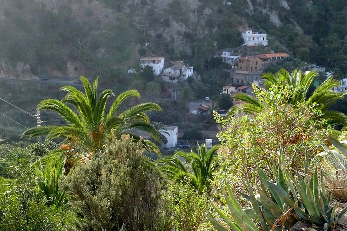 Vallehermoso
Friday, February 9 This morning, the sky was overcast, and the peaks around us were shrouded in clouds. We took the same road as yesterday to hike Las Creces. Quickly gaining altitude, we entered a thick fog—visibility was very limited. We stopped at the Las Creces parking lot; visibility improved, and the sun wasn’t far off. The hike is entirely within a beautiful laurel forest, with the sun playing hide-and-seek, but it wasn’t cold despite the altitude. After finishing the loop trail, we decided to picnic—not there, as it was too chilly—but on Vallehermoso’s beach, where we found a nice picnic area sheltered by large black rocks. A short digestive walk on the surrounding hill to admire the little beach from above. Back in Vallehermoso, we did some grocery shopping, then tried to return to the casa—only to find ourselves locked out because we’d left the key in the lock inside! After several attempts and with the help of Yéli, a relative of the owner we called for help, we were finally able to get back in!
Saturday, February 10
It rained last night, and the sky remained overcast. Monique decided to rest this morning. PP, Pat, and I set off on the hike that starts from the house toward the Marichal reservoir. The sun wasn’t far off, and by 11 AM, it was fully out. The pleasant hike passed by many flower-filled gardens and orchards—orange, lemon, and mandarin trees in fruit. The path climbed gently toward the reservoir, where the view of the Cano rock dominating the landscape was magnificent. The last part of the climb was a bit tough, overgrown with lush vegetation, and the trail was slippery from last night’s rain. We descended via a different, much more pleasant path and returned to the casa just in time for lunch, prepared by Monique. This valley is rich with its many farmers and market gardeners who’ve cultivated the entire valley, taking advantage of the water flowing down from the mountain, captured upstream and redistributed through countless pipes snaking along the paths. Numerous tanks also store water during dry periods. The houses are scattered across both sides of the valley, and these colorful little homes add a beautiful touch to the landscape. The many palm trees give this valley a distinctly tropical feel—you could almost imagine yourself in the Caribbean. Add to that some salsa music drifting from a hut where farmers were working, and the picture is complete. A well-chilled beer apéro capped off a lovely morning. The afternoon was dedicated to rest, relaxation, reading, and games.
Sunday, February 11 The blue sky returned, though a few clouds still capped the highest peaks. Today, we visited Garajonay National Park, which covers the highest central mountains. Up there, we were above the clouds, and the panoramas from the various viewpoints were stunning: first, Cherelepin, accessible from the Laguna Grande parking lot, then Alto de Garajonay, offering an exceptional view of Teide—over 3,000 meters high—emerging from the clouds on Tenerife, far in the distance. We continued to the Los Roques viewpoints, then stopped for lunch at the Degollada de Peraza restaurant, where the view of the barranco was impressive. We descended toward San Sebastián and checked into our new lodging, La Cabezada, located in the countryside about 3 km above San Sebastián. It’s a small apartment adjacent to the owner’s, with a lovely terrace overlooking the surrounding mountains and surrounded by a beautiful garden. Apéro, then dinner on our beautiful terrace.
Monday, February 12 This morning, we went down to visit San Sebastián de La Gomera: its old tower, main street with some beautiful traditional houses, and the Church of the Assumption. Back at the casa for lunch. In the afternoon, Pat, PP, and I set off on the short hike from San Sebastián beach to La Guancha beach. We drove down and parked on the beach. The path climbs along the hill overlooking San Sebastián, passes by the tall Christ statue dominating the landscape, and roughly follows the coast down to the isolated Guancha beach. A beautiful hike under a hot sun, and a swim was welcome, even if the beach and sea access weren’t very comfortable due to large pebbles and quickly deepening water. Apart from two nudist bathers, there was no one on this beach. We returned the same way.
Tuesday, February 13 Rest day. We went down to town to stroll and do some shopping. I took the opportunity to visit the parador, beautifully situated above the city in a lovely garden overlooking the port and town. Together, we went for a cuba libre at the "Cuba Libre" bar, then had lunch at Breñusca (mediocre paella!). Back at the casa, then we went back down to town to see a carnival parade, a "passacalles," which actually passed an hour earlier than scheduled. Oh well.
Wednesday, February 14 Each to their own program this morning. Pat went swimming at San Sebastián beach, Monique rested at the casa, and PP and I set off on the hike from Playa de Avalos to the Ermita de Guadalupe on Playa del Cangrejo. It wasn’t easy to find the right road or the parking spot, but we managed. The path seemed to have suffered landslides, according to a sign at the trailhead! We decided to check it out, ready to turn back if it seemed too dangerous. In the end, apart from one or two slightly tricky spots where we had to climb a pile of rocks, the trail remained passable, though a bit vertigo-inducing in places. The narrow path clings to very vertical cliffs nearly 300 meters above sea level! But what a magnificent view. At one point, the trail runs alongside a wall of basaltic pipes. We returned via the drivable track that parallels the trail a bit lower. Back at the house for lunch. In the late afternoon, we returned to town to attend the "Entierro de las Sardinas" (Burial of the Sardine), which closes the Canarian carnival festivities. While waiting, we strolled through the parador’s gardens and had mojitos in town. Around 9 PM, we heard the noise and cries of the mourners. The procession advanced, led by a large papier-mâché sardine on a float, surrounded by wailing mourners. The procession headed toward the sea, where the sardine was burned, and a mini fireworks display ended the procession. It was all very good-natured, and everyone had fun. We ended the evening with dinner at a good fish restaurant, El Pajar.
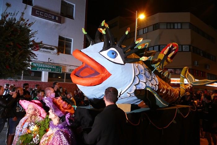 Entierro de la Sardina in San Sebastián de La Gomera
Thursday, February 15
Woke up at 5:15 AM. The only suitable ferry was at 7 AM, which would get us to La Palma by late morning rather than evening. We packed our bags, had breakfast, then headed to the port, left our rental car, and boarded the ferry to Tenerife, from where we’d continue to La Palma. Calm sea, beautiful sun—by 10:30 AM, we disembarked in La Palma. We picked up our car and immediately headed to our new apartment in Breña Alta. It’s a large apartment with a superb terrace facing the sea, fully equipped and very comfortable. The hosts recommended Casa Goyo restaurant, near the airport and close to us. It’s a restaurant with many small rooms, some of which can be reserved for families. The fish-based cuisine (chipirones, pulpo) was excellent, hearty, and reasonably priced. Since it’s in the airport’s flight path, we occasionally heard planes landing. Quick and efficient service. Afterward, we visited Santa Cruz de La Palma, which reminded us of the historic quarters of La Orotava in Tenerife or the capital of Gran Canaria.
Friday, February 16
Beautiful weather, blue sky. We headed to the San Bartolo viewpoint toward the northeast coast, then to the lovely village of San Andrés, which we explored. From there, we walked along the shore to the natural pools of Charco Azul, where we swam in the cool but "swimmable" sea. Back in San Andrés for lunch at the "San Andrés" restaurant on the beautiful church square. Very good fish-based meal. We got back in the car and continued along the north coast to the port of Espindola and the natural pools of Fajana near the Cumplida lighthouse. A fairly strong wind whipped up beautiful waves crashing onto the rocky coast in bursts of foam. Back in Santa Cruz, we stopped at the Mercadona supermarket to buy fresh shrimp for dinner.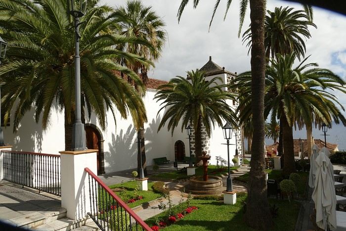 San Andrés
Saturday, February 17
Uniform blue sky, even on the heights. We took the beautiful road that winds up to the summit of the Caldera de Taburiente. Several viewpoints offer 360° views of the entire island and beyond: you can make out La Gomera, El Hierro, and, of course, Tenerife with the perfect triangle of Teide. We parked at the Los Andes viewpoint parking lot and started our hike to Pico de la Cruz along a trail following the ridge, offering superb views into the caldera. We got back in the car and passed by the Roque de los Muchachos astronomical complex, composed of numerous observatories, some with very aesthetic mirror telescopes. We hiked from the Roque de los Muchachos parking lot to the various viewpoints, always as impressive. Picnic on site, then back to Santa Cruz. We stopped by our car dealer because the oil warning light came on—better safe than sorry. The representative reassured us but preferred to give us a Fiat Cross SUV instead.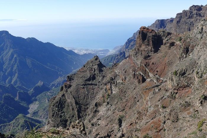 The Caldera de Taburiente
Sunday, February 18 The weather was a bit mixed, with cloudy patches. We set off to hike the Barranco de la Cuba de Galga. Unfortunately, the Los Tilos trail had been closed for several months due to a major landslide. The parking lot by the road was already quite full, and indeed, we crossed paths with many hikers along the way—it’s an easy hike with little elevation gain, which is rare here in La Palma! The beautiful path winds through a very narrow, deep gorge covered in lush tropical vegetation—you’d think you were in a Southeast Asian forest, especially with the humidity in the gorge bringing out earthy and floral scents. Halfway through, Monique turned back while the rest of us continued to the Cuba de Galga. A light drizzle accompanied us on the return. For lunch, we went to Chipi Chipi restaurant in the heights of Santa Cruz. The cool air forced us to leave the lovely terrace for the slightly noisy dining room. The meal was very good and hearty. Afternoon spent resting at our house.
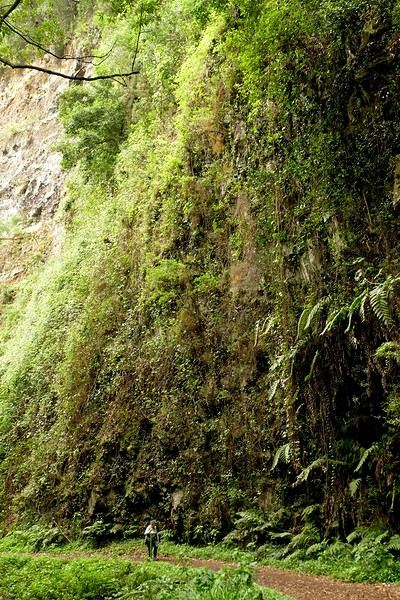 La Cuba de la Galga
Monday, February 19 A few clouds still clung to the nearby mountain peaks. We headed south to Los Canarios. We stopped in front of the small San Antonio Abad church, where a path leads to the viewpoint in 15 minutes. Then we visited the San Antonio Volcano Interpretation Center and climbed to the viewpoint via the trail along the crater’s edge, offering a plunging view into the crater. Then PP, Pat, and I headed toward the Teneguía volcano but turned back given the remaining distance and the intense heat bearing down on us! Plus, the landscape was rather arid and not very interesting. We got back in the car and drove down to the salt flats at the island’s southern tip. The ocean crashes here in large waves, exploding against the volcanic rocks and feeding a "blowhole" carved into the rock. We stopped for drinks at the salt flats restaurant, then headed home.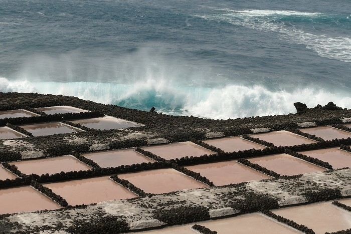 The salt flats in Fuencaliente
Tuesday, February 20 Beautiful weather with a few clouds clinging to the mountains, as usual. A relaxed morning since my parking reservation at La Cumbrecita didn’t start until 1 PM. It takes about 30 minutes from Santa Cruz to reach the valley floor via a beautiful but narrow road toward the end, though there’s very little traffic. Meanwhile, the clouds had disappeared, and the view from the La Cumbrecita viewpoint was superb. We recognized Pico de la Cruz in the distance, where we’d been a few days earlier. We then took the path leading to the Las Chozas viewpoint through a magnificent Canarian pine forest. We picnicked on site, then took the path to the Los Roques viewpoint. We returned the same way since the direct route was closed for construction. Back in Santa Cruz, we visited the Sanctuary of Las Nieves, with its beautiful golden Baroque altar.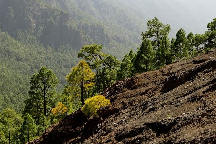 Hike from La Cumbrecita
Wednesday, February 21 After packing our things and loading the car, we left Santa Cruz under a very blue sky for Los Llanos de Aridane, where we stopped to visit this lovely town. The Church of Nuestra Señora de los Remedios has a beautiful coffered ceiling and an original papier-mâché Christ statue from the 16th century. Around it, colorful old Canarian houses brighten the streets of the town center. We took the opportunity to stroll, do some shopping, and finally sat down at La Pergola restaurant for a mediocre lunch. We got back in the car to check into our new house in Arecida. On the way, we stopped at the Mirador del Time, which once again offered an impressive panorama, allowing us—for the first time—to see the damage caused by the Tajogaite volcano eruption in 2021. You can clearly see the still-smoking crater and the large black lava flow covering the landscape down to the sea. We really liked our new accommodation: a local house that’s been renovated on the heights of Arecida, not far from the Canarian pine forest. From several terraces, we have a 360° view of the sea and mountains. We even have a private pool! There are two beautiful, brand-new bedrooms, each with its own bathroom—the best. Plus, we’re on the GR 131 trail that runs along the Barranco de las Angustias toward the northeast.
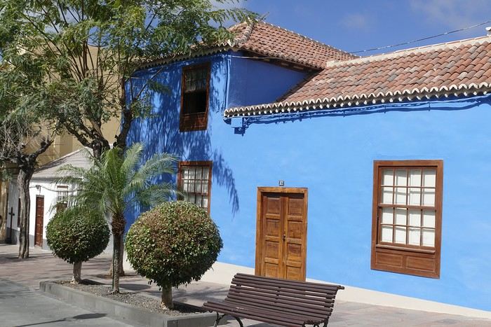 Los Llanos de Aridane
Thursday, February 22 Once again, beautiful weather greeted us when we woke up. We started the GR 131 with the goal of reaching the Torre del Time viewpoint—about 400 meters of elevation gain. The path, quite steep at first, winds through a superb Canarian pine forest. A few viewpoints let you appreciate the sheer drop of the Barranco de las Angustias—watch out for vertigo! At the Torre del Time viewpoint, there’s a nearly 1,000-meter vertical drop. We returned via another path, the PLP1, which meanders first through this beautiful forest, then along lovely flower-filled gardens adjacent to beautiful properties that cascade from the forest down to the road serving these neighborhoods. This afternoon, we tried to get closer to the area devastated by the 2021 lava flows. Several roads are still closed or reserved for residents, while others—brand new—have been rebuilt to open up this densely populated and cultivated region. In some places, the lava flow slightly diverted, sparing some properties that logically should have disappeared. Now, they’re encircled by a massive cooled lava field. In other spots, twisted and charred metal scraps or greenhouse remains protrude from the lava—all that’s left of the former banana plantations. A little higher up, you can see the slightly smoking crater of Tajogaite, responsible for this disaster. Back to Casa Barreros.
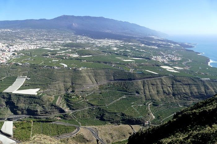 View of Los Llanos and, in the background, the 2021 lava flow
Friday, February 23
Though the sky was still blue, the temperature had dropped due to a chilly wind. By midday, it still rose to 22°C. Today, we headed north, specifically to the town of Tijarafe, where a very narrow road descends to the small port, Porís de Candelaria. The 3.7-kilometer road drops 700 meters in elevation, with gradients up to 30%—it was going to be intense! Indeed, the descent was scary, with the void right next to the very narrow road where passing was impossible except at a few rare spots. Everything went well—there was little traffic at this early hour. From the parking lot at the bottom, a path leads to Porís de Candelaria. It’s surprising to see this small fishing hamlet nestled in the shelter of an immense cave opening onto the sea, which was quite rough today. The sun, at this time of year, would appear late in the cave, which remained in shadow for much of the day. We returned via the same road, strolled through the small town of Puntagorda, and had lunch at El Jardín de los Naranjos restaurant—excellent meal.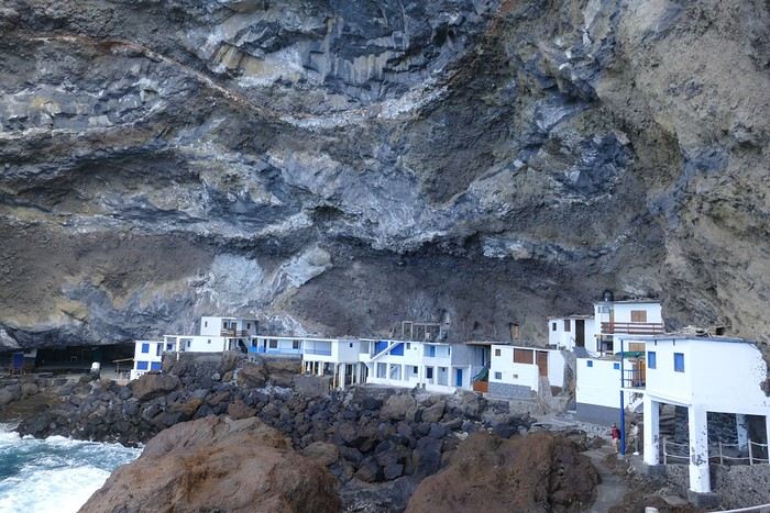 Fishing hamlet of Candelaria
Saturday, February 24 The air was still cool, but the sun was beautiful. While Monique stayed home to rest, the three of us headed to the village of Las Tricias to hike the Buracas Caves trail. We left the car parked on the LP1 road and took the small paved road down to the sign marking the trail’s start. The signage for all the trails we took here, as in La Gomera, was very well done. The path descended steadily, then more steeply toward the caves where the island’s first inhabitants lived—some petroglyphs are still visible in certain caves. The path then climbed back up, passing magnificent dragon trees and more or less elaborate huts occupied by Germans who’ve lived here for many years. Back at Casa Barreros for some rest.
Sunday, February 25 The weather once again blessed us with a beautiful day. This morning, we visited the local produce market held on weekends in Puntagorda. You’ll find agricultural products, crafts, and food to keep you going. A little further on, there’s a glass viewpoint overlooking the barranco plunging toward the sea, with a view of the thrill-seekers trying the zip line right next to it. Lunch at Naranjos—definitely a good spot—with their shrimp and spice tagliatelle. Back home for an afternoon of relaxation.
Monday, February 26 We left Arecida under a cloudy sky. Driving up from Los Llanos de Aridane toward the east, an enormous cascade of clouds poured from the mountain peaks into the Los Llanos plain—very impressive. Arriving in Santa Cruz, we went for a stroll, did some last-minute shopping, then had a final good-quality paella at La Chalana on the paseo maritimo. We left the car in the parking lot and took the 5 PM Olsen ferry to Tenerife on a slightly choppy sea, but the ferry didn’t rock too much. Arriving at 7:15 PM, we dropped off our things near the port in our reserved apartment and went for dinner at Abordo—rubbery chipirones. A digestive stroll among the ever-increasing number of tourists in Los Cristianos—restaurants were packed to the brim, the season is in full swing here. Gone is the calm of La Gomera and La Palma, and the laid-back tourism of German hikers among whom a few French were hiding!
Tuesday, February 27 To make our homemade breakfast more enjoyable, we went to buy pastries at the local bakery, then took one last walk on the paseo along the beaches, mingling with the many mobility scooters driven by elderly or disabled people, joggers, and tourists. Last apéro near the bus station, then off to the airport. After a smooth 4-hour-30-minute flight, we arrived in Basel-Mulhouse at 10:20 PM.
THE END
Conclusion A fantastic trip to two islands with magnificent and diverse nature, where landscapes range from desert-like to tropical depending on exposure to winds and clouds. Thanks to the many beautiful viewpoints, you can truly appreciate these exceptionally dynamic reliefs. A hiker’s paradise, the trails are all very well marked, though the choice of easy or moderate paths for "casual walkers" is quite limited. Another notable advantage, in our opinion, is that these islands are very lightly developed—you’ll hardly see any of those ugly hotel blocks that spoil the landscapes of some other Canary Islands. It’s true that the beaches on these two islands don’t meet traditional international tourism criteria: they’re small, with black sand, and often difficult to access. Special mention for the quality of the road network (except for a few small local roads), which seems brand new, well-paved, and well-signposted. We also enjoyed exceptional weather for February, with fewer than three days of gray or rainy weather out of 21.
Almost all the accommodations we chose met or exceeded our expectations, often at reasonable prices: an average of 98 € per night for an apartment or house with two bedrooms for four people.
All photos can be viewed by clicking this link: https://photos.app.goo.gl/G44pPk4g9PW1rNzg8
Tuesday, February 6 We left around 9 AM with our car, along with Pierre-Paul and Patricia, heading to the Bluepark parking lot in Bartenheim. As expected, we were awaited and left promptly for EuroAirport Basel. Took off at 12:25 PM for a 4-hour-15-minute flight under excellent conditions. Beautiful arrival in Tenerife with Teide in sight under a clear blue sky. Fifteen minutes later, we waited for bus No. 40 to Los Cristianos with quite a few other tourists, but we managed to find four seats. From the bus station, it was a 20-minute walk to our hotel. We checked into a lovely apartment for the four of us, complete with all the comforts. Outside, it was quite warm—at least 25°C! After dropping off our luggage, we went for a stroll. The immediate surroundings of the hotel held no interest for us: a modern, concrete area filled with hotels, bars, tourist agencies, and unappealing restaurants all offering the same bland international cuisine. Pat went to cool off at the pool, unfortunately overrun by loud, drunk English tourists. I took a walk to the paseo maritimo that leads to the port, skirting the seafront. The promenade was pleasant, but it could have been any seaside resort in the world—same old scene: a succession of bars with blaring music where many elderly people sipped cold beers waiting for the sunset, the backdrop a wall of resort-style hotels resembling rabbit hutches! Upon reaching the port, I scouted the route we’d take the next day to the Fred Olsen ferry. Back at the apartment, in the early evening, we looked for a non-touristy restaurant for dinner. Monique stopped a woman to ask her opinion! In this area, she told us, there’s no restaurant that serves Canarian or Spanish cuisine! The only place with decent restaurants is at the port. Off we went to the port, where we sat down at Al Bordo restaurant and ordered a seafood paella for four. Excellent, and at a very reasonable price (36 € for two). We returned to the hotel along the seafront.
Wednesday, February 7
Woke up at 6 AM. Had breakfast in the apartment with what we’d bought the day before at a supermarket. It was still dark when we left on foot toward the port, walking along the calm seafront at this early hour. Forty minutes later, we arrived and waited 10 minutes before the ferry docked. At 9:30 AM, we left the port of Los Cristianos for a 50-minute crossing on a calm sea under a beautiful blue sky. There were quite a few people on this large ferry, but many had no luggage, meaning they were visiting La Gomera for the day and would take the ferry back in the evening. Upon disembarking, we went straight to our rental car agency to pick up the car we’d booked online a few months earlier. It was a nice Peugeot 2008, spacious enough for the four of us and our luggage. We immediately took the beautiful road from San Sebastián that climbs directly into the mountains toward our rental in Vallehermoso. The road was in perfect condition—it seemed brand new, like all the others we’d take on this island later. This side of the island is very arid with little vegetation, and the terrain is particularly rugged, as it is throughout the island. We stopped at our first miradors, which would be followed by many more throughout our Canarian trip. Our first visit was to the small village of Agulo, perched on a promontory above the sea and at the foot of a high cliff. The village features typical Canarian houses with windows flush with the façade and black volcanic stone masonry on white or reddish-brown walls. The first recommended restaurant was already booked for a group, so we settled for the shaded terrace of the excellent El Alameda bar-restaurant. From Agulo, you can access the Abrante viewpoint via a winding road, where the view of Agulo, 600 meters below, is exceptional. A glass ledge over the void lets you test your fear of heights!
We drove to Vallehermoso to do our grocery shopping at the supermarket—a habit that would continue until the end of the trip. Our little house, "Casa rural El Encatadora," is located in a beautiful flower-filled valley a few kilometers west of Vallehermoso. Each of us had a bedroom with an en-suite bathroom, plus a living room, kitchen, and a small terrace overlooking the quiet street at the valley’s end, which didn’t bother us at all.
Thursday, February 8 The good weather seemed to follow us since our arrival in the Canary Islands. This morning, we took the road—still as beautiful and new—toward Arure, high up to the west. The landscape was magnificent, with breathtaking glimpses of the sea far below. In Arure, we parked in front of Conchita’s bar, where a hike (Rother No. 30) starts toward two viewpoints: Alojera, which we reached after 45 minutes on a lovely path. Monique, tired from the first steep climb, stopped at the first viewpoint and hitchhiked back to Arure. Meanwhile, we continued toward the second viewpoint, Los Barranquillos, where the view of the surroundings was partially hidden by misty clouds rising from the sea. The entire mountain is sculpted by ancient, endless terraces climbing until the slope becomes too steep for construction—visible traces of the hard work of past inhabitants trying to survive in a harsh environment. We had a decent lunch at La Conchita bar, then drove to the small seaside town of Puerto la Caleta, sheltered by an immense cliff plunging into the sea. Black sand beach, rough sea—despite our encouragement, Pat didn’t dare to swim! As for the old village of Caleta, it’s perched on the mountainside, and visiting it requires climbing steep, stair-filled alleys to discover a few traditional houses. Back at the casa, dinner in, and card games...
VallehermosoFriday, February 9 This morning, the sky was overcast, and the peaks around us were shrouded in clouds. We took the same road as yesterday to hike Las Creces. Quickly gaining altitude, we entered a thick fog—visibility was very limited. We stopped at the Las Creces parking lot; visibility improved, and the sun wasn’t far off. The hike is entirely within a beautiful laurel forest, with the sun playing hide-and-seek, but it wasn’t cold despite the altitude. After finishing the loop trail, we decided to picnic—not there, as it was too chilly—but on Vallehermoso’s beach, where we found a nice picnic area sheltered by large black rocks. A short digestive walk on the surrounding hill to admire the little beach from above. Back in Vallehermoso, we did some grocery shopping, then tried to return to the casa—only to find ourselves locked out because we’d left the key in the lock inside! After several attempts and with the help of Yéli, a relative of the owner we called for help, we were finally able to get back in!
Saturday, February 10
It rained last night, and the sky remained overcast. Monique decided to rest this morning. PP, Pat, and I set off on the hike that starts from the house toward the Marichal reservoir. The sun wasn’t far off, and by 11 AM, it was fully out. The pleasant hike passed by many flower-filled gardens and orchards—orange, lemon, and mandarin trees in fruit. The path climbed gently toward the reservoir, where the view of the Cano rock dominating the landscape was magnificent. The last part of the climb was a bit tough, overgrown with lush vegetation, and the trail was slippery from last night’s rain. We descended via a different, much more pleasant path and returned to the casa just in time for lunch, prepared by Monique. This valley is rich with its many farmers and market gardeners who’ve cultivated the entire valley, taking advantage of the water flowing down from the mountain, captured upstream and redistributed through countless pipes snaking along the paths. Numerous tanks also store water during dry periods. The houses are scattered across both sides of the valley, and these colorful little homes add a beautiful touch to the landscape. The many palm trees give this valley a distinctly tropical feel—you could almost imagine yourself in the Caribbean. Add to that some salsa music drifting from a hut where farmers were working, and the picture is complete. A well-chilled beer apéro capped off a lovely morning. The afternoon was dedicated to rest, relaxation, reading, and games.
Sunday, February 11 The blue sky returned, though a few clouds still capped the highest peaks. Today, we visited Garajonay National Park, which covers the highest central mountains. Up there, we were above the clouds, and the panoramas from the various viewpoints were stunning: first, Cherelepin, accessible from the Laguna Grande parking lot, then Alto de Garajonay, offering an exceptional view of Teide—over 3,000 meters high—emerging from the clouds on Tenerife, far in the distance. We continued to the Los Roques viewpoints, then stopped for lunch at the Degollada de Peraza restaurant, where the view of the barranco was impressive. We descended toward San Sebastián and checked into our new lodging, La Cabezada, located in the countryside about 3 km above San Sebastián. It’s a small apartment adjacent to the owner’s, with a lovely terrace overlooking the surrounding mountains and surrounded by a beautiful garden. Apéro, then dinner on our beautiful terrace.
Monday, February 12 This morning, we went down to visit San Sebastián de La Gomera: its old tower, main street with some beautiful traditional houses, and the Church of the Assumption. Back at the casa for lunch. In the afternoon, Pat, PP, and I set off on the short hike from San Sebastián beach to La Guancha beach. We drove down and parked on the beach. The path climbs along the hill overlooking San Sebastián, passes by the tall Christ statue dominating the landscape, and roughly follows the coast down to the isolated Guancha beach. A beautiful hike under a hot sun, and a swim was welcome, even if the beach and sea access weren’t very comfortable due to large pebbles and quickly deepening water. Apart from two nudist bathers, there was no one on this beach. We returned the same way.
Tuesday, February 13 Rest day. We went down to town to stroll and do some shopping. I took the opportunity to visit the parador, beautifully situated above the city in a lovely garden overlooking the port and town. Together, we went for a cuba libre at the "Cuba Libre" bar, then had lunch at Breñusca (mediocre paella!). Back at the casa, then we went back down to town to see a carnival parade, a "passacalles," which actually passed an hour earlier than scheduled. Oh well.
Wednesday, February 14 Each to their own program this morning. Pat went swimming at San Sebastián beach, Monique rested at the casa, and PP and I set off on the hike from Playa de Avalos to the Ermita de Guadalupe on Playa del Cangrejo. It wasn’t easy to find the right road or the parking spot, but we managed. The path seemed to have suffered landslides, according to a sign at the trailhead! We decided to check it out, ready to turn back if it seemed too dangerous. In the end, apart from one or two slightly tricky spots where we had to climb a pile of rocks, the trail remained passable, though a bit vertigo-inducing in places. The narrow path clings to very vertical cliffs nearly 300 meters above sea level! But what a magnificent view. At one point, the trail runs alongside a wall of basaltic pipes. We returned via the drivable track that parallels the trail a bit lower. Back at the house for lunch. In the late afternoon, we returned to town to attend the "Entierro de las Sardinas" (Burial of the Sardine), which closes the Canarian carnival festivities. While waiting, we strolled through the parador’s gardens and had mojitos in town. Around 9 PM, we heard the noise and cries of the mourners. The procession advanced, led by a large papier-mâché sardine on a float, surrounded by wailing mourners. The procession headed toward the sea, where the sardine was burned, and a mini fireworks display ended the procession. It was all very good-natured, and everyone had fun. We ended the evening with dinner at a good fish restaurant, El Pajar.
Entierro de la Sardina in San Sebastián de La GomeraThursday, February 15
Woke up at 5:15 AM. The only suitable ferry was at 7 AM, which would get us to La Palma by late morning rather than evening. We packed our bags, had breakfast, then headed to the port, left our rental car, and boarded the ferry to Tenerife, from where we’d continue to La Palma. Calm sea, beautiful sun—by 10:30 AM, we disembarked in La Palma. We picked up our car and immediately headed to our new apartment in Breña Alta. It’s a large apartment with a superb terrace facing the sea, fully equipped and very comfortable. The hosts recommended Casa Goyo restaurant, near the airport and close to us. It’s a restaurant with many small rooms, some of which can be reserved for families. The fish-based cuisine (chipirones, pulpo) was excellent, hearty, and reasonably priced. Since it’s in the airport’s flight path, we occasionally heard planes landing. Quick and efficient service. Afterward, we visited Santa Cruz de La Palma, which reminded us of the historic quarters of La Orotava in Tenerife or the capital of Gran Canaria.
Friday, February 16
Beautiful weather, blue sky. We headed to the San Bartolo viewpoint toward the northeast coast, then to the lovely village of San Andrés, which we explored. From there, we walked along the shore to the natural pools of Charco Azul, where we swam in the cool but "swimmable" sea. Back in San Andrés for lunch at the "San Andrés" restaurant on the beautiful church square. Very good fish-based meal. We got back in the car and continued along the north coast to the port of Espindola and the natural pools of Fajana near the Cumplida lighthouse. A fairly strong wind whipped up beautiful waves crashing onto the rocky coast in bursts of foam. Back in Santa Cruz, we stopped at the Mercadona supermarket to buy fresh shrimp for dinner.
San AndrésSaturday, February 17
Uniform blue sky, even on the heights. We took the beautiful road that winds up to the summit of the Caldera de Taburiente. Several viewpoints offer 360° views of the entire island and beyond: you can make out La Gomera, El Hierro, and, of course, Tenerife with the perfect triangle of Teide. We parked at the Los Andes viewpoint parking lot and started our hike to Pico de la Cruz along a trail following the ridge, offering superb views into the caldera. We got back in the car and passed by the Roque de los Muchachos astronomical complex, composed of numerous observatories, some with very aesthetic mirror telescopes. We hiked from the Roque de los Muchachos parking lot to the various viewpoints, always as impressive. Picnic on site, then back to Santa Cruz. We stopped by our car dealer because the oil warning light came on—better safe than sorry. The representative reassured us but preferred to give us a Fiat Cross SUV instead.
The Caldera de TaburienteSunday, February 18 The weather was a bit mixed, with cloudy patches. We set off to hike the Barranco de la Cuba de Galga. Unfortunately, the Los Tilos trail had been closed for several months due to a major landslide. The parking lot by the road was already quite full, and indeed, we crossed paths with many hikers along the way—it’s an easy hike with little elevation gain, which is rare here in La Palma! The beautiful path winds through a very narrow, deep gorge covered in lush tropical vegetation—you’d think you were in a Southeast Asian forest, especially with the humidity in the gorge bringing out earthy and floral scents. Halfway through, Monique turned back while the rest of us continued to the Cuba de Galga. A light drizzle accompanied us on the return. For lunch, we went to Chipi Chipi restaurant in the heights of Santa Cruz. The cool air forced us to leave the lovely terrace for the slightly noisy dining room. The meal was very good and hearty. Afternoon spent resting at our house.
La Cuba de la GalgaMonday, February 19 A few clouds still clung to the nearby mountain peaks. We headed south to Los Canarios. We stopped in front of the small San Antonio Abad church, where a path leads to the viewpoint in 15 minutes. Then we visited the San Antonio Volcano Interpretation Center and climbed to the viewpoint via the trail along the crater’s edge, offering a plunging view into the crater. Then PP, Pat, and I headed toward the Teneguía volcano but turned back given the remaining distance and the intense heat bearing down on us! Plus, the landscape was rather arid and not very interesting. We got back in the car and drove down to the salt flats at the island’s southern tip. The ocean crashes here in large waves, exploding against the volcanic rocks and feeding a "blowhole" carved into the rock. We stopped for drinks at the salt flats restaurant, then headed home.
The salt flats in FuencalienteTuesday, February 20 Beautiful weather with a few clouds clinging to the mountains, as usual. A relaxed morning since my parking reservation at La Cumbrecita didn’t start until 1 PM. It takes about 30 minutes from Santa Cruz to reach the valley floor via a beautiful but narrow road toward the end, though there’s very little traffic. Meanwhile, the clouds had disappeared, and the view from the La Cumbrecita viewpoint was superb. We recognized Pico de la Cruz in the distance, where we’d been a few days earlier. We then took the path leading to the Las Chozas viewpoint through a magnificent Canarian pine forest. We picnicked on site, then took the path to the Los Roques viewpoint. We returned the same way since the direct route was closed for construction. Back in Santa Cruz, we visited the Sanctuary of Las Nieves, with its beautiful golden Baroque altar.
Hike from La CumbrecitaWednesday, February 21 After packing our things and loading the car, we left Santa Cruz under a very blue sky for Los Llanos de Aridane, where we stopped to visit this lovely town. The Church of Nuestra Señora de los Remedios has a beautiful coffered ceiling and an original papier-mâché Christ statue from the 16th century. Around it, colorful old Canarian houses brighten the streets of the town center. We took the opportunity to stroll, do some shopping, and finally sat down at La Pergola restaurant for a mediocre lunch. We got back in the car to check into our new house in Arecida. On the way, we stopped at the Mirador del Time, which once again offered an impressive panorama, allowing us—for the first time—to see the damage caused by the Tajogaite volcano eruption in 2021. You can clearly see the still-smoking crater and the large black lava flow covering the landscape down to the sea. We really liked our new accommodation: a local house that’s been renovated on the heights of Arecida, not far from the Canarian pine forest. From several terraces, we have a 360° view of the sea and mountains. We even have a private pool! There are two beautiful, brand-new bedrooms, each with its own bathroom—the best. Plus, we’re on the GR 131 trail that runs along the Barranco de las Angustias toward the northeast.
Los Llanos de AridaneThursday, February 22 Once again, beautiful weather greeted us when we woke up. We started the GR 131 with the goal of reaching the Torre del Time viewpoint—about 400 meters of elevation gain. The path, quite steep at first, winds through a superb Canarian pine forest. A few viewpoints let you appreciate the sheer drop of the Barranco de las Angustias—watch out for vertigo! At the Torre del Time viewpoint, there’s a nearly 1,000-meter vertical drop. We returned via another path, the PLP1, which meanders first through this beautiful forest, then along lovely flower-filled gardens adjacent to beautiful properties that cascade from the forest down to the road serving these neighborhoods. This afternoon, we tried to get closer to the area devastated by the 2021 lava flows. Several roads are still closed or reserved for residents, while others—brand new—have been rebuilt to open up this densely populated and cultivated region. In some places, the lava flow slightly diverted, sparing some properties that logically should have disappeared. Now, they’re encircled by a massive cooled lava field. In other spots, twisted and charred metal scraps or greenhouse remains protrude from the lava—all that’s left of the former banana plantations. A little higher up, you can see the slightly smoking crater of Tajogaite, responsible for this disaster. Back to Casa Barreros.
View of Los Llanos and, in the background, the 2021 lava flowFriday, February 23
Though the sky was still blue, the temperature had dropped due to a chilly wind. By midday, it still rose to 22°C. Today, we headed north, specifically to the town of Tijarafe, where a very narrow road descends to the small port, Porís de Candelaria. The 3.7-kilometer road drops 700 meters in elevation, with gradients up to 30%—it was going to be intense! Indeed, the descent was scary, with the void right next to the very narrow road where passing was impossible except at a few rare spots. Everything went well—there was little traffic at this early hour. From the parking lot at the bottom, a path leads to Porís de Candelaria. It’s surprising to see this small fishing hamlet nestled in the shelter of an immense cave opening onto the sea, which was quite rough today. The sun, at this time of year, would appear late in the cave, which remained in shadow for much of the day. We returned via the same road, strolled through the small town of Puntagorda, and had lunch at El Jardín de los Naranjos restaurant—excellent meal.
Fishing hamlet of CandelariaSaturday, February 24 The air was still cool, but the sun was beautiful. While Monique stayed home to rest, the three of us headed to the village of Las Tricias to hike the Buracas Caves trail. We left the car parked on the LP1 road and took the small paved road down to the sign marking the trail’s start. The signage for all the trails we took here, as in La Gomera, was very well done. The path descended steadily, then more steeply toward the caves where the island’s first inhabitants lived—some petroglyphs are still visible in certain caves. The path then climbed back up, passing magnificent dragon trees and more or less elaborate huts occupied by Germans who’ve lived here for many years. Back at Casa Barreros for some rest.
Sunday, February 25 The weather once again blessed us with a beautiful day. This morning, we visited the local produce market held on weekends in Puntagorda. You’ll find agricultural products, crafts, and food to keep you going. A little further on, there’s a glass viewpoint overlooking the barranco plunging toward the sea, with a view of the thrill-seekers trying the zip line right next to it. Lunch at Naranjos—definitely a good spot—with their shrimp and spice tagliatelle. Back home for an afternoon of relaxation.
Monday, February 26 We left Arecida under a cloudy sky. Driving up from Los Llanos de Aridane toward the east, an enormous cascade of clouds poured from the mountain peaks into the Los Llanos plain—very impressive. Arriving in Santa Cruz, we went for a stroll, did some last-minute shopping, then had a final good-quality paella at La Chalana on the paseo maritimo. We left the car in the parking lot and took the 5 PM Olsen ferry to Tenerife on a slightly choppy sea, but the ferry didn’t rock too much. Arriving at 7:15 PM, we dropped off our things near the port in our reserved apartment and went for dinner at Abordo—rubbery chipirones. A digestive stroll among the ever-increasing number of tourists in Los Cristianos—restaurants were packed to the brim, the season is in full swing here. Gone is the calm of La Gomera and La Palma, and the laid-back tourism of German hikers among whom a few French were hiding!
Tuesday, February 27 To make our homemade breakfast more enjoyable, we went to buy pastries at the local bakery, then took one last walk on the paseo along the beaches, mingling with the many mobility scooters driven by elderly or disabled people, joggers, and tourists. Last apéro near the bus station, then off to the airport. After a smooth 4-hour-30-minute flight, we arrived in Basel-Mulhouse at 10:20 PM.
THE END
Conclusion A fantastic trip to two islands with magnificent and diverse nature, where landscapes range from desert-like to tropical depending on exposure to winds and clouds. Thanks to the many beautiful viewpoints, you can truly appreciate these exceptionally dynamic reliefs. A hiker’s paradise, the trails are all very well marked, though the choice of easy or moderate paths for "casual walkers" is quite limited. Another notable advantage, in our opinion, is that these islands are very lightly developed—you’ll hardly see any of those ugly hotel blocks that spoil the landscapes of some other Canary Islands. It’s true that the beaches on these two islands don’t meet traditional international tourism criteria: they’re small, with black sand, and often difficult to access. Special mention for the quality of the road network (except for a few small local roads), which seems brand new, well-paved, and well-signposted. We also enjoyed exceptional weather for February, with fewer than three days of gray or rainy weather out of 21.
Almost all the accommodations we chose met or exceeded our expectations, often at reasonable prices: an average of 98 € per night for an apartment or house with two bedrooms for four people.
All photos can be viewed by clicking this link: https://photos.app.goo.gl/G44pPk4g9PW1rNzg8
Opinions on Azerbaijan Airlines and Uzbekistan Airways?
Hi everyone,
For my round-trip flights between Milan and Tashkent, I have several airline options, with Turkish Airlines being the most familiar and offering plenty of combinations. But I’m also being offered an outbound flight with a layover in Baku via Azerbaijan Airlines and a direct return (7.5 hours without stretching my long legs 😱) with Uzbekistan Airways. I’m not a fan of flying at all (I feel uneasy when I’m not on solid ground, but it’s a necessary evil when you’re short on time). However, I’m tempted by the idea of trying these two airlines and getting a glimpse of Baku Airport.
Do you have any advice that could tip the scales toward curiosity or fear?
Catherine
For my round-trip flights between Milan and Tashkent, I have several airline options, with Turkish Airlines being the most familiar and offering plenty of combinations. But I’m also being offered an outbound flight with a layover in Baku via Azerbaijan Airlines and a direct return (7.5 hours without stretching my long legs 😱) with Uzbekistan Airways. I’m not a fan of flying at all (I feel uneasy when I’m not on solid ground, but it’s a necessary evil when you’re short on time). However, I’m tempted by the idea of trying these two airlines and getting a glimpse of Baku Airport.
Do you have any advice that could tip the scales toward curiosity or fear?
Catherine
Budget for Tanzania with a safari
Hi there,
We’re planning a trip for 2 adults and 2 kids to Tanzania and Zanzibar. I’ve had a quick look, and the prices are starting to get pretty wild.
We’ve got a budget of 8,000 €, and I was thinking of doing three or four days of safari and three or four days in Zanzibar, but even that seems like it might be over budget. Have you got any thoughts? I was also considering heading straight to Zanzibar and doing a one- or two-day excursion by plane instead—maybe that’d be cheaper than staying in a lodge.
Anyway, thanks for sharing your experiences and any price tips, departing from Nice!