Results for "Pasto+|+4+>+128"
3516 results found.
Second trip to Curaçao Island
Returning to Curaçao is a bit like reopening a book whose pages still smell of sun and salt.
As soon as the plane descends toward the island, the familiar colors reappear: the dazzling turquoise of the sea, the pastel facades of Willemstad, and that unique light that seems to soften everything.
For this second trip, we no longer arrive as hesitant explorers, but as confirmed lovers of this warm island.
We already know that the warm wind will welcome us as soon as we step out of the airport, that the beaches will once again offer their infinite shades of blue, and that each day will have that unhurried pace that makes you forget the rest of the world.
Yet, despite this sense of déjà vu, Curaçao always manages to surprise. A new cove to discover, a different sunset, a smile shared with a local...
The island has that rare talent for reinventing itself without ever betraying what makes it so endearing.
This second trip isn’t a repetition, then, but a reunion: a chance to rediscover Curaçao with more attentive, more connected, and perhaps even more amazed eyes.
I invite you to keep reading this travel journal and watch the videos that will help you learn a little more about the island’s different attractions.
Just click on the video image to start watching.
To go to a specific post, here are the appropriate links:
Exploring Willemstad’s colorful neighborhoods The Most Beautiful Beaches in Curaçao Hike at Boka Sint Michiel | Flamingos & panoramic views Climbing Christoffel Mountain Den Dunki & Flamingos of Jan Thiel Must-see spots in Curaçao Snorkeling at Playa Kenepa Chiki: Turquoise Water & Tropical Fish Snorkeling at Porto Mari: One of Curaçao’s Best Spots Snorkeling at Mambo Beach, the Perfect Spot Snorkeling at Daaibooi Beach, a diverse marine world
As soon as the plane descends toward the island, the familiar colors reappear: the dazzling turquoise of the sea, the pastel facades of Willemstad, and that unique light that seems to soften everything.
For this second trip, we no longer arrive as hesitant explorers, but as confirmed lovers of this warm island.
We already know that the warm wind will welcome us as soon as we step out of the airport, that the beaches will once again offer their infinite shades of blue, and that each day will have that unhurried pace that makes you forget the rest of the world.
Yet, despite this sense of déjà vu, Curaçao always manages to surprise. A new cove to discover, a different sunset, a smile shared with a local...
The island has that rare talent for reinventing itself without ever betraying what makes it so endearing.
This second trip isn’t a repetition, then, but a reunion: a chance to rediscover Curaçao with more attentive, more connected, and perhaps even more amazed eyes.
I invite you to keep reading this travel journal and watch the videos that will help you learn a little more about the island’s different attractions.
Just click on the video image to start watching.
To go to a specific post, here are the appropriate links:
Exploring Willemstad’s colorful neighborhoods The Most Beautiful Beaches in Curaçao Hike at Boka Sint Michiel | Flamingos & panoramic views Climbing Christoffel Mountain Den Dunki & Flamingos of Jan Thiel Must-see spots in Curaçao Snorkeling at Playa Kenepa Chiki: Turquoise Water & Tropical Fish Snorkeling at Porto Mari: One of Curaçao’s Best Spots Snorkeling at Mambo Beach, the Perfect Spot Snorkeling at Daaibooi Beach, a diverse marine world
June 2026 Photo Contest Theme: Such a Beautiful Landscape
Hello,
It might not be very original, but I see it hasn’t been suggested—or at least not for a very long time. I’d like to invite you to discover the beauty of the great outdoors through landscape photos. Whether they’re desert, sea, countryside, or mountain scenes—with or without other elements (people, buildings, animals, etc.)—they should make us want to dive right in without hesitation.
To participate: Photo submissions until Wednesday, June 24 at 11:59 PM You can post up to 3 photos, numbered and shared in separate messages, along with a short description of the place and the story behind it.
To vote: from Thursday, June 25 at 12:01 AM to Monday, June 29 at 11:59 PM After the deadline, it’s too late!
Please include the photo number, username, and the points awarded: Photo #1 = 3 pts Photo #2 = 2 pts Photo #3 = 1 pt
All VF members can vote (even those who didn’t submit photos). In case of a tie for first place, the winning photo will be the one with the most first-place votes, then second-place votes! The lucky winner will get to organize July 2026’s photo contest.
For discussions about the theme, it’s here: Discussion thread for June 2026’s theme: Such a Beautiful Landscape
Good luck to everyone!
Philippe
Chumphon, Thailand: Doi Tapang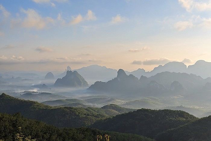
It might not be very original, but I see it hasn’t been suggested—or at least not for a very long time. I’d like to invite you to discover the beauty of the great outdoors through landscape photos. Whether they’re desert, sea, countryside, or mountain scenes—with or without other elements (people, buildings, animals, etc.)—they should make us want to dive right in without hesitation.
To participate: Photo submissions until Wednesday, June 24 at 11:59 PM You can post up to 3 photos, numbered and shared in separate messages, along with a short description of the place and the story behind it.
To vote: from Thursday, June 25 at 12:01 AM to Monday, June 29 at 11:59 PM After the deadline, it’s too late!
Please include the photo number, username, and the points awarded: Photo #1 = 3 pts Photo #2 = 2 pts Photo #3 = 1 pt
All VF members can vote (even those who didn’t submit photos). In case of a tie for first place, the winning photo will be the one with the most first-place votes, then second-place votes! The lucky winner will get to organize July 2026’s photo contest.
For discussions about the theme, it’s here: Discussion thread for June 2026’s theme: Such a Beautiful Landscape
Good luck to everyone!
Philippe
Chumphon, Thailand: Doi Tapang
From Mexico to the Wonderful Chiapas
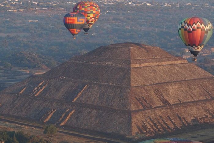
This one-month trip, from January 18 to February 17, 2026, allowed us to visit Mexico City and travel through the states of Puebla, Oaxaca, and Chiapas. We mainly used buses (ADO company) for medium and long distances and colectivos or taxis (or Uber) for shorter trips. Before leaving, I had contacted several people on the ground: Harry, a Vendéan settled in Oaxaca offering, among other things, discoveries of artisan villages or the Monte Albán site, and Oscar in Comitán de Domínguez. I’ll come back to our meeting with Oscar, who runs a local agency (CVL Travel Turismo Alternativo & Corre la voz) and owns a very pleasant hostel, a real highlight of our trip. Our journey took place in 8 stages on a loop starting from Mexico City. The connections between each were made by day or night buses depending on the trip duration. I had booked our seats in advance, either directly on the ADO company’s website or through booking platforms depending on the rates offered. Note that by planning ahead, I was able to benefit from very interesting "Early Booking" rates. There are several comfort classes. For all our trips, I had booked seats in Primera class buses, except for two in GL (Grand Luxe) class. The rates are very reasonable, and the buses turned out to be comfortable or even very comfortable (only the basic seat recline might surprise you).
Our itinerary and number of days per stage: Stage 1 – Mexico City: 4 days Stage 2 – Puebla: 2 days Stage 3 – Oaxaca: 4 days Stage 4 – San Agustinillo: 4 days Stage 5 – San Cristóbal de las Casas: 3 days Stage 6 – Comitán de Domínguez: 6 days Stage 7 – Palenque: 4 days Stage 8 – Mexico City: 2 days If I were to do it again, I’d remove one day from Palenque and add it either to Puebla or San Cristóbal to visit nearby sites or villages, or to San Agustinillo to enjoy one more day by the Pacific Ocean.
Stage 1: Mexico City (2,200 m / 9.2 million inhabitants) We arrived in the Mexican capital around 10:00 PM. The simplified customs process was very quick. After exchanging some money at the airport, we took a taxi to our youth hostel. We got around the capital on foot, of course, but also by metro. Signs are very rare, and we took the train in the wrong direction several times. After a few mistakes, we systematically asked on the platform if we were going the right way. The metro is very affordable. You need to get a rechargeable card (the Tarjeta de Movilidad Integrada) and top it up as needed. This card (less than 1 €) isn’t personal, so there’s no need to get one per person.
Mexico City: Day 1.
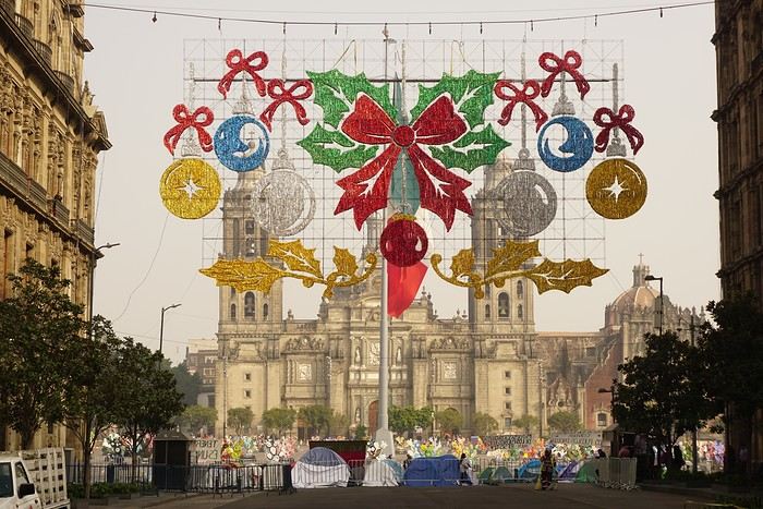
Visits and walks of the day (note: many museums are closed on Mondays): The Zócalo or Constitution Square: it’s one of the most beautiful, largest (195m x 240m), and oldest squares in the world. This is where Cortés decided to build the center of the new Spanish city on the site of the former Tenochtitlan market. Stones from the pyramids were used to pave the esplanade and build the surrounding colonial churches and buildings. During our visit, the huge square was covered with (resin) cacti, the theme of the temporary exhibition at the time. Indeed, temporary events or exhibitions take place here throughout the year. It’s also the endpoint for many protest marches.
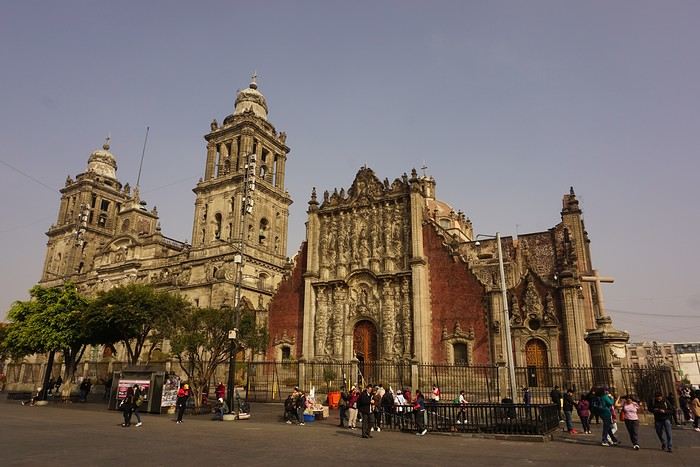
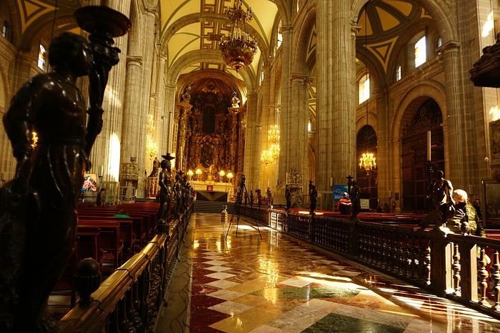


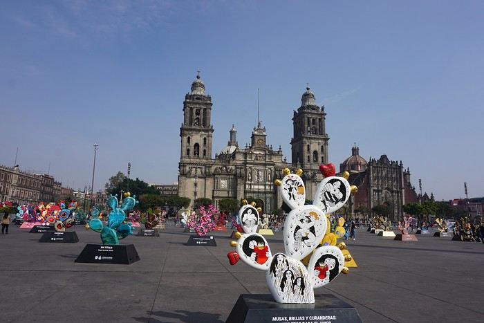
The cathedral: it’s sinking by one centimeter per year despite massive stabilization work (the collapse of many Mexican buildings—30 cm/year—is due to groundwater pumping). It was built starting in 1571 and completed in... 1813. The modest remains of the Templo Mayor (exterior view): they have high symbolic value, as this monument was the most important in the Mexica Empire.
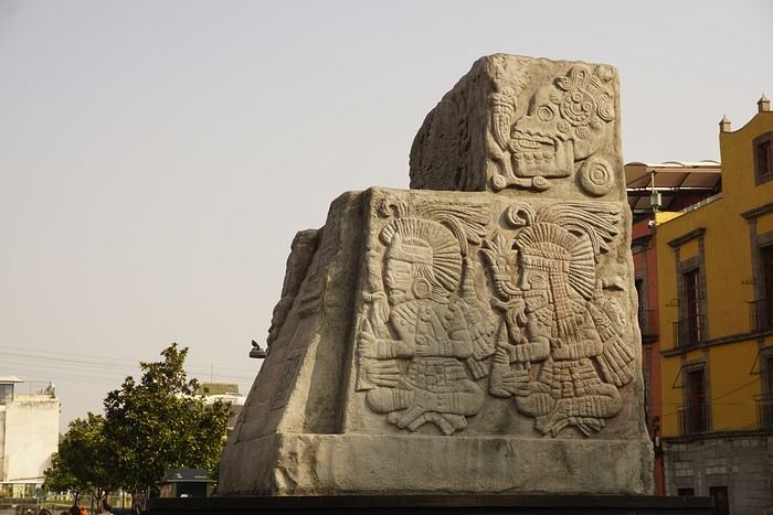 We then walked through the streets of the historic center to the Santísima Church, unfortunately closed for renovation work.
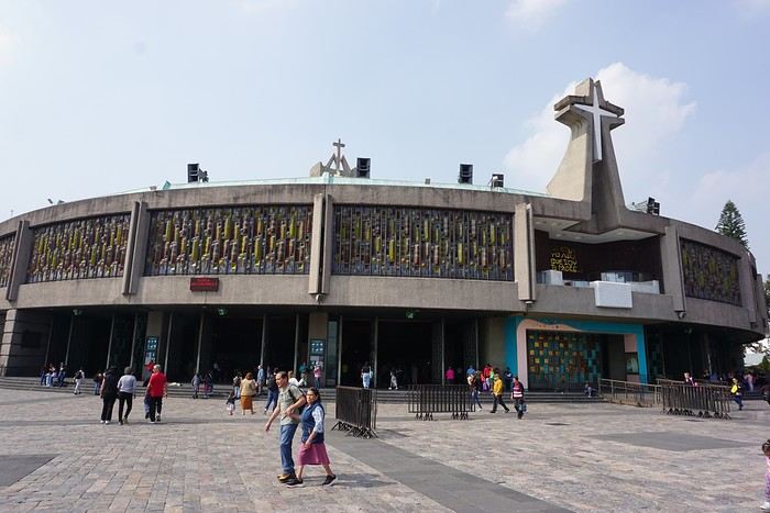
Next, we took the metro to visit one of Mexico’s most important pilgrimage sites: the Insigne y Nacional Basílicas de Santa María de Guadalupe, as well as the Capilla del Cerrito on the hill.
The first, dating from the colonial era, is really leaning a lot.
We then walked through the streets of the historic center to the Santísima Church, unfortunately closed for renovation work.
Next, we took the metro to visit one of Mexico’s most important pilgrimage sites: the Insigne y Nacional Basílicas de Santa María de Guadalupe, as well as the Capilla del Cerrito on the hill.
The first, dating from the colonial era, is really leaning a lot.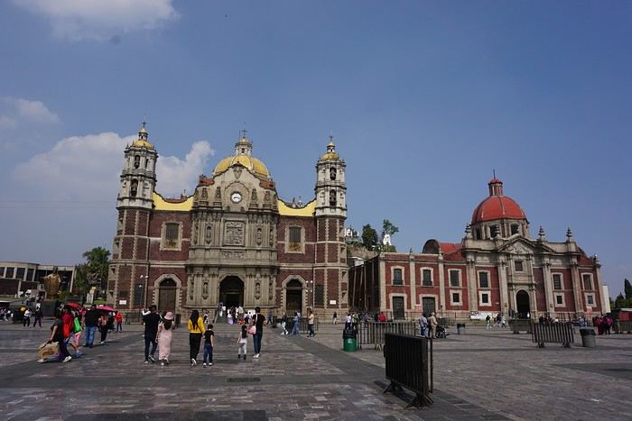
The second, shaped like a rotunda, is very impressive from the inside.
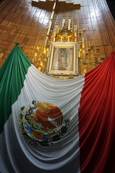
In the basement, there’s a sacred tunic where, in 1531, an image of the Virgin Mary is said to have appeared. A real mystery for scientists, the garment has never deteriorated since that date. Slow-moving conveyor belts allow pilgrims to admire it, preventing crowds from gathering in front of the image for hours. Well thought out!
 From the top of the Capilla del Cerrito, you get beautiful views of huge Mexico City.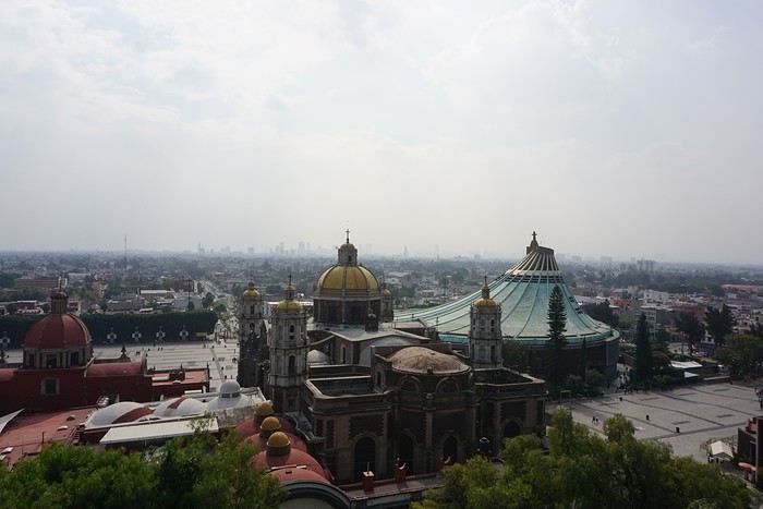
Ideas for a one-week Andalusia itinerary
Hi everyone,
I’m sharing my draft itinerary with you because I just booked our flight tickets, and I feel like it’s quite late in the season. So, I’d like to be sure about my stops before reserving the hotels. I’ll be traveling alone with my two adult children. We want to prioritize outdoor walks, avoid too many indoor visits (both for budget and preference), and not spend too much time on the road.
D1: Arrival at 9 AM in Malaga, day in Malaga and overnight stay D2: Head straight to Nerja (1-hour drive) and spend the night there D3: Head straight to Granada (1.5-hour drive), spend the day and night there D4: Granada. Visit the Alhambra (Nasrid Palaces tour at 5 PM) and spend the night D5: Head to Ronda (2.5-hour drive) and spend the night D6: White Villages and overnight in Ronda D7: Head straight to the Costa del Sol (e.g., Estepona), spend the day and night there D8: Return to Malaga to catch our flight
There you go! This itinerary takes into account that we’d like to do a circuit starting from Seville in a few years. That said, it’d be a shame to miss something doable from Malaga.
Questions: Since the Alhambra visit is only at 5 PM, and we’d already have the day to explore Granada, would arriving the day before be a mistake? Or should we skip this day and dedicate it elsewhere (Costa del Sol? Head toward Tabernas?)? The old town appeals to me, but maybe the Sacromonte neighborhood isn’t essential... Same question for Ronda: should we dedicate a full day to it, or combine Ronda and the White Villages in one day? Note that we love wandering around villages outside, so that might answer my question! :)
Final question: Is it better to rent the car at Malaga Airport or in the city? If we rent at the airport, we’d need a hotel with parking, which doesn’t seem easy. Or stay outside the city and park for free near the center if possible? I’ve read comments about taking a taxi to Malaga and then picking up the rental car at the airport the next morning. The taxi would really need to be affordable...
Thanks so much for your feedback and suggestions for visits during this little circuit. Have a great day, everyone! Christine
D1: Arrival at 9 AM in Malaga, day in Malaga and overnight stay D2: Head straight to Nerja (1-hour drive) and spend the night there D3: Head straight to Granada (1.5-hour drive), spend the day and night there D4: Granada. Visit the Alhambra (Nasrid Palaces tour at 5 PM) and spend the night D5: Head to Ronda (2.5-hour drive) and spend the night D6: White Villages and overnight in Ronda D7: Head straight to the Costa del Sol (e.g., Estepona), spend the day and night there D8: Return to Malaga to catch our flight
There you go! This itinerary takes into account that we’d like to do a circuit starting from Seville in a few years. That said, it’d be a shame to miss something doable from Malaga.
Questions: Since the Alhambra visit is only at 5 PM, and we’d already have the day to explore Granada, would arriving the day before be a mistake? Or should we skip this day and dedicate it elsewhere (Costa del Sol? Head toward Tabernas?)? The old town appeals to me, but maybe the Sacromonte neighborhood isn’t essential... Same question for Ronda: should we dedicate a full day to it, or combine Ronda and the White Villages in one day? Note that we love wandering around villages outside, so that might answer my question! :)
Final question: Is it better to rent the car at Malaga Airport or in the city? If we rent at the airport, we’d need a hotel with parking, which doesn’t seem easy. Or stay outside the city and park for free near the center if possible? I’ve read comments about taking a taxi to Malaga and then picking up the rental car at the airport the next morning. The taxi would really need to be affordable...
Thanks so much for your feedback and suggestions for visits during this little circuit. Have a great day, everyone! Christine
Veneto: Dolomites and Opera
I'm starting a new travel journal in Italy.
It's about a month-long trip (from September 3, 2025, to October 4, 2025), or rather a part of it. This section matches the title: an opera festival in Verona (one evening) and the Dolomites in the Veneto region.
I'm posting the part of the trip I think will interest French-speaking readers the most (since this is where I saw the most French travelers).
Here’s a quick summary:
- Trip in September 2025
- Solo travel with camping (caravan)
- Small geographic area: besides Verona, the surroundings of the Marmolada massif and Cortina d'Ampezzo.
- Main but not exclusive activity: hiking.
Since I have limited internet access where I am now, I’ll be writing slowly. Here we go!
Day 1: Thursday, September 4, 2025
I arrived in Veneto under the sun and with warm weather. I drove to Verona and tried to find a spot at the campsite (Verona Village) located south of the city. Unfortunately, it was full. Booking on the website was mandatory, but when I tried to reserve a few days ago, the site never moved from the "reservation" step to the "payment" step (I don’t know why—it’s always like that in these cases). I found another solution over the phone; the drive from southern Verona to the northeast was a bit long, but I finally settled at the "Oro Verde" campsite. It’s an "agricampeggio" (farm camping or rural campsite) on the outskirts of the city, and its name (green gold) suggests they produce olives there. Since it wasn’t late, I biked to the Adige River, following the recommended route into the city.
Since I have limited internet access where I am now, I’ll be writing slowly. Here we go!
Day 1: Thursday, September 4, 2025
I arrived in Veneto under the sun and with warm weather. I drove to Verona and tried to find a spot at the campsite (Verona Village) located south of the city. Unfortunately, it was full. Booking on the website was mandatory, but when I tried to reserve a few days ago, the site never moved from the "reservation" step to the "payment" step (I don’t know why—it’s always like that in these cases). I found another solution over the phone; the drive from southern Verona to the northeast was a bit long, but I finally settled at the "Oro Verde" campsite. It’s an "agricampeggio" (farm camping or rural campsite) on the outskirts of the city, and its name (green gold) suggests they produce olives there. Since it wasn’t late, I biked to the Adige River, following the recommended route into the city.
Review of Renaissance Cruise (Iberian Flavors) from October 18 to 29, 2025
Hi there,
Here’s a little review of our cruise on the Renaissance from October 18 to 29, 2025 (11 nights). It was our first experience with CFC.
Some other forum members were on board too, so we can probably compare notes and correct me if I’m wrong!
The stops were as follows: 10/18 departure from Marseille 10/19 at sea 10/20 Cartagena 10/21 Almería 10/22 Gibraltar 10/23 Cádiz 10/24 at sea 10/25 Leixões (Porto) 10/26 Vigo 10/27 at sea 10/28 at sea 10/29 Dunkirk
First, a quick intro. We’re a family of four with two kids, ages 8 and 11. We booked this cruise in January 2025, right when it went on sale. At the time, it was priced at 763 € per adult (+ 99 € in tips) and 114.45 € per child (under 12, no tips to pay) for an ocean-view cabin (all ocean-view categories were the same price). Since there was also a single-parent offer (meaning one paying adult in the cabin was enough to get the child rate for the accompanying kid), I asked if we could take advantage of this offer to get two double cabins at the same price as one quadruple cabin (to have more space), and yes, it was possible. So we booked two premium ocean-view double cabins side by side. It was the same price as a quadruple. We booked directly through CFC because my husband had a promotional code from his works council. In total, for the four of us, we paid 1830 €, tips included. It’s true we booked early, but the rate was good, and we had the constraint of traveling as a family of four, so cabin choices were more limited. It’s also worth noting that the single-parent offer is limited.
Now, about embarkation: 10/18 Marseille Coming from the north, we took the direct TGV that morning at 7:22 AM, scheduled to arrive in Marseille at 12:24 PM. The trip went smoothly, great weather, and we arrived just one minute late. I had planned to get to the port using the free 35T shuttle from Joliette. To get to the bus stop, there were two options: the metro or walking. Since the weather was beautiful and the kids needed to stretch their legs, we opted for the second option. The route is all downhill, so it was pretty easy even with the suitcases. But I wouldn’t do it the other way around! We arrived at Joliette around 12:50 PM, just in time for the 1:00 PM shuttle, which arrived a few minutes late. Other cruisers got on board too. That day, there were two Costa ships and one MSC ship at the port as well. Traffic was heavy, and the shuttle arrived at the port entrance at 1:30 PM. We were scheduled for 2:30 PM. We were lucky to be at the closest embarkation terminal. So we were among those who had the least walking to do. We dropped off our suitcases and headed to the check-in counter. There were plenty of desks and almost no passengers. So we quickly completed the embarkation formalities—in just a few minutes—and when we boarded, it wasn’t even 2:00 PM yet. We headed to the buffet, where there weren’t many people. As we finished lunch, it was around 3:00 PM when they announced the cabins were ready. We went down to drop off our luggage in the cabins and then went up to the top deck to take some photos. The ship’s daily program said the safety drill would be at 4:00 PM. So we went to deck 6 at the scheduled time. But later, they announced it would actually be at 4:30 PM! In short, we waited 30 minutes for nothing because of a difference between the scheduled and actual time! The drill itself was long. Gathering everyone took about 20 minutes, I think. Just as we finished, they announced the departure, originally scheduled for 5:00 PM, was delayed until 9:00 PM due to latecomers. We went to check out the library, which had tons of board games and books—more than we’d ever seen. What stood out on this first day was that, for the first time, we had a French-speaking embarkation, announcements only in French (except for the safety drill), French-speaking servers, a paper daily program in French, books in French (which we’d never find on another ship), and menus in French. To wrap up the day, we had dinner at Vatel. I had requested the first seating (6:30 PM) and a table for four, and we got it. We were seated upstairs near the window—a very pleasant table that we’d occupy every evening. What was a little surprising, but we got used to it, was that you had to order everything you wanted at once. The portions weren’t big, but you could choose what you wanted. The cheese was French and excellent.
To be continued...
The stops were as follows: 10/18 departure from Marseille 10/19 at sea 10/20 Cartagena 10/21 Almería 10/22 Gibraltar 10/23 Cádiz 10/24 at sea 10/25 Leixões (Porto) 10/26 Vigo 10/27 at sea 10/28 at sea 10/29 Dunkirk
First, a quick intro. We’re a family of four with two kids, ages 8 and 11. We booked this cruise in January 2025, right when it went on sale. At the time, it was priced at 763 € per adult (+ 99 € in tips) and 114.45 € per child (under 12, no tips to pay) for an ocean-view cabin (all ocean-view categories were the same price). Since there was also a single-parent offer (meaning one paying adult in the cabin was enough to get the child rate for the accompanying kid), I asked if we could take advantage of this offer to get two double cabins at the same price as one quadruple cabin (to have more space), and yes, it was possible. So we booked two premium ocean-view double cabins side by side. It was the same price as a quadruple. We booked directly through CFC because my husband had a promotional code from his works council. In total, for the four of us, we paid 1830 €, tips included. It’s true we booked early, but the rate was good, and we had the constraint of traveling as a family of four, so cabin choices were more limited. It’s also worth noting that the single-parent offer is limited.
Now, about embarkation: 10/18 Marseille Coming from the north, we took the direct TGV that morning at 7:22 AM, scheduled to arrive in Marseille at 12:24 PM. The trip went smoothly, great weather, and we arrived just one minute late. I had planned to get to the port using the free 35T shuttle from Joliette. To get to the bus stop, there were two options: the metro or walking. Since the weather was beautiful and the kids needed to stretch their legs, we opted for the second option. The route is all downhill, so it was pretty easy even with the suitcases. But I wouldn’t do it the other way around! We arrived at Joliette around 12:50 PM, just in time for the 1:00 PM shuttle, which arrived a few minutes late. Other cruisers got on board too. That day, there were two Costa ships and one MSC ship at the port as well. Traffic was heavy, and the shuttle arrived at the port entrance at 1:30 PM. We were scheduled for 2:30 PM. We were lucky to be at the closest embarkation terminal. So we were among those who had the least walking to do. We dropped off our suitcases and headed to the check-in counter. There were plenty of desks and almost no passengers. So we quickly completed the embarkation formalities—in just a few minutes—and when we boarded, it wasn’t even 2:00 PM yet. We headed to the buffet, where there weren’t many people. As we finished lunch, it was around 3:00 PM when they announced the cabins were ready. We went down to drop off our luggage in the cabins and then went up to the top deck to take some photos. The ship’s daily program said the safety drill would be at 4:00 PM. So we went to deck 6 at the scheduled time. But later, they announced it would actually be at 4:30 PM! In short, we waited 30 minutes for nothing because of a difference between the scheduled and actual time! The drill itself was long. Gathering everyone took about 20 minutes, I think. Just as we finished, they announced the departure, originally scheduled for 5:00 PM, was delayed until 9:00 PM due to latecomers. We went to check out the library, which had tons of board games and books—more than we’d ever seen. What stood out on this first day was that, for the first time, we had a French-speaking embarkation, announcements only in French (except for the safety drill), French-speaking servers, a paper daily program in French, books in French (which we’d never find on another ship), and menus in French. To wrap up the day, we had dinner at Vatel. I had requested the first seating (6:30 PM) and a table for four, and we got it. We were seated upstairs near the window—a very pleasant table that we’d occupy every evening. What was a little surprising, but we got used to it, was that you had to order everything you wanted at once. The portions weren’t big, but you could choose what you wanted. The cheese was French and excellent.
To be continued...
55 days with the family in the Yucatán, including a side trip to Belize...
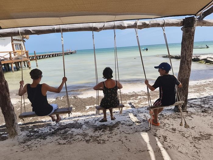
Hi everyone!
That was about all the Spanish I could speak before we left... Luckily, Tom, 15 and in high school, gets by just fine! And Caroline did a year of Duolingo before we took off... Anyway, after 55 days in the American West three years ago, it’s Mexico’s turn for this second long adventure.
A quick intro to the crew:
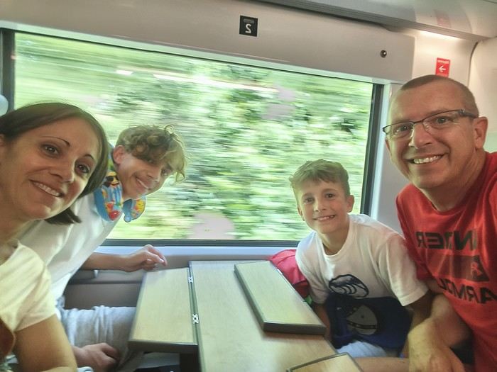

- Oscar, 10, a sporty and lively little boy who loves swimming and basketball, - Tom, 15, a high schooler, sporty and tall, who loves swimming and American football, - Caroline, 47, a PE teacher, sporty , loves hiking and snorkeling, - and me, Sylvain, 50, a science teacher, sporty, loves traveling and always has a possible next trip in mind
We mostly travel by swapping our house to discover beautiful France and the world: 135 swaps over the last 13 years.....
Our itinerary is pretty classic since it’s our first time in the Yucatán, and we’ll make a little 10-day detour to Belize...
See you soon...
Join me in discovering Gran Canaria
Introduction
We stayed on the island of Gran Canaria during the first three months of 2024. It’s the third Canary Island we’ve visited, after Tenerife and Lanzarote.
We rented an apartment in Temisas. By staying in the same place for such a long period, the total price dropped by 50%.
We also rented a vehicle to make getting around the island easier.
Why the Canary Islands, and Gran Canaria in particular? For its pleasant climate, the nature and diversity of its landscapes, the charming villages, and especially the beauty of its many beaches.
In this travel journal, you’ll find a list of the many activities we did during our stay to explore the different attractions of this island.
These attractions are categorized to make it easier to find what interests you.
Videos are included throughout the summary. Click on the image to start the video.
To jump to a specific post, here are the relevant links:
HIKES:
Roque Nublo Maspalomas Dunes - Part 1 Maspalomas Dunes - Part 2 Los Azulejos de Veneguera Barranco de Las Vacas Ventana del Bentayga (Arco del Aserrador) Caves of the King Ventana de Morro (Ventana de la Ganifa) The Dog of Bentayga Cave of the Four Doors Ventana del Nublo Artenera - Caves of Acusa Seca Temisas - El Gigante Cave Fortress of Ansite Puerto de Las Nieves - Roque de Las Nieves Temisas - Cuevas de la Audiencia Roque Bentayga Guayadeque Ravine (Guayadeque Hermitage) Guayadeque Ravine (Cueva de Bartalo) El Zumacal - Barranco Tauco Casablanca Dam (Los Dolores Dam) Ayagaures - La Angostura Dam & Gambuesa Dam Santa Brígida - Alonso Ravine & Centennial Dragon Tree Pino Santo Hike in the Azuaje Ravine Gáldar - Red Lands of Samarrita Tejeda - Charco de La Paloma Bandama Boiler (Camino Borde de Caldera Bandama) Teror - Alamo Ravine Trail – SL-4 Telde - Calasio Caves Special Natural Reserve of Los Tilos de Moya Los Azulejos - Charco de Las Aneas Fataga Ravine Arinaga Military Battery Trail Maspalomas - Las Fuentes and del Canizo Ravines Mogán - Tauro Mountain Trail Tamabada - Llanos de La Mimbre & Sobre la Cueva Viewpoints Trail Hike to the Coronadero Arch via Barranco Hondo Barranco de Silva - Hike to the Jerez Caves Gáldar - Samson Cave - La Atalaya Peak Agaete - Roque Guayedra and Guayedra Ravine Artenara - Caballero Caves Arucas - Bufadero Salt Flats Barranco de Pino Gordo - Natural Pools Telde - Los Cernícalos Ravine Las Cruces - Toba Caves & Picón Puerto de Las Nieves - Moro Cave Agüimes - Morros de Ávila Caves Juncalillo del Sur - Laguna & Salinas de Abajo Caves of Camino de San Felipe Cruz de Tejeda, Cruz Chico and Degollada Viewpoint Hike on the Patalavaca Circuit Motor Grande - Puerto Rico Arch El Montañón - Los Hornos Dam Seafront Walk - Amadores Beach – Puerto Rico Beach Las Niñas Dam El Hornillo - Omega & Omicron Caves Arteara Necropolis Mogán - El Mulato Dam Las Garzas - El Regante Dam La Plata Route - Cho Flores Dam & El Charco Hondo Vega de Acusa - La Candelaria Dam Candelaria Hermitage – Acusa Seca Viewpoint Valsequillo de Gran Canaria – Roque La Vela Ayagaures Dam – GC-602 Lomo del Palo - Monte Pavón Trail Lugar La Laguna - Levada Fataga Dam & Ravine
BEACHES:
Mogán Beach Taurito Beach Tauro Beach Amadores Beach Puerto Rico Beach Anfi del Mar Beach Patalavaca Beach Meloneras Beach Maspalomas Beach English Beach (Playa del Inglés) Las Burras Beach San Agustin Beach Las Alcaravaneras Beach Las Canteras Beach (La Cicer) Las Canteras Beach (La Puntilla) Las Canteras Beach (Santa Catalina) Aquamarina Beach El Agujero - Bocabarranco Beach Hoya Del Pozo Beach Hoya Del Pozo Beach - Lizard with amputated tail El Cabron Beach Ojos de Garza Beach El Burrero Beach
NATURAL POOLS:
Charco Azul - El Risco Agaete Salt Flats Charco de Los Espejos - Sardina del Norte Natural Pools of Punta de Gáldar Snorkeling in the natural pool of Punta de Gáldar Natural Pool La Furnia o El Clavo - Gáldar Natural Pool of Los Dos Roques Emiliano Natural Pool - El Agujero Natural Pool of El Agujero Natural Pools of Roque Prieto Natural Pool El Altillo Los Charcones de Bañaderos – Arucas Natural Pools of El Charco de Las Palomas – Arucas Natural Pools of La Laja - Las Palmas de Gran Canaria Cueva de la Reina Mora - La Garita Natural Pools of Castillo del Romeral
TOWNS:
Center
Santa Brigida Vega de San Mateo Tejeda Artenara Vallesco Teror
Southwest
Santa Lucia de Tirajana Fataga San Bartolomé de Tirajana Puerto de Mogán La Aldea de San Nicolas
North
Arucas Firgas Moya Santa Maria de Guia Gáldar Agaete Puerto de Las Nieves
East
Vegueta - Las Palmas de Gran Canaria Triana - Las Palmas de Gran Canaria Ciudad Jardin - Las Palmas de Gran Canaria Canteras - Las Palmas de Gran Canaria Telde Valsequillo de Gran Canaria Ingenio Agüimes Temisas
VIEWPOINTS:
GC-60 Route (or nearby) GC-210 Route (or nearby) GC-210 Route between the tunnel and La Aldea de San Nicolás GC-215 & GC-65 Routes (or nearby) GC-200 Route (or nearby) GC-130 Route (or nearby) & GC-605 GC-70 Route (or nearby) & GC-21 Sheep herd on GC-70 Route GC-150, GC-240, GC-305, GC-350 & GC-301 Routes GC-606, GC-295, GC-231 and GC-41 Routes (or nearby) Viewpoints – GC-1 Route (or nearby) Viewpoints - Las Palmas de Gran Canaria Viewpoints - GC-2, GC-21, GC-15, GC-216 and GC-132 Routes (or nearby) Viewpoints - GC-503 & GC-217 Routes Viewpoints - GC-604, GC-505, GC-132, GC-42 and GC-802 Routes
MISCELLANEOUS:
San Rafael Aqueduct - Telde Abandoned San Rafael Estate - La Higuera Cenobio de Valerón La Cesta - Tejeda Puerto de la Aldea Scenic Route GC-671 to El Espinillo Scenic Route GC-607 to El Chorrillo The Galdar Cube (Santiago Quarry) Scenic Route GC-504 to Ayagaures Abandoned seaside resort in the Azuaje Ravine El Bufadero de La Garita – Telde GC-505 Route Abandoned Finca Las Haciendas (Los Mocanes) – Las Vegas de Valsequillo Ruins of San Juan Battery - Las Palmas de Gran Canaria Viera y Clavijo Canarian Botanical Garden - Las Palmas de Gran Canaria Tenefé Salt Flats Los Pérez, Lugarejos & Las Hoyas Dams Monte Pavón, Gran Canaria’s little Ireland Valleseco Lagoon Recreational Area Climbing - Fataga Ravine Surfing – El Agujero El Cairete Restaurant - Carrizal de Tejeda Paragliding flight observation - Los Giles La Cuevita Ayagaures Restaurant Statues and Murals - Cruce de Arinaga Aviation Monument (Las Majoreras) & Murals – Carrizal Artistic recycling by Antonio Peñita - Ojos de Garza Rainbows
We stayed on the island of Gran Canaria during the first three months of 2024. It’s the third Canary Island we’ve visited, after Tenerife and Lanzarote.
We rented an apartment in Temisas. By staying in the same place for such a long period, the total price dropped by 50%.
We also rented a vehicle to make getting around the island easier.
Why the Canary Islands, and Gran Canaria in particular? For its pleasant climate, the nature and diversity of its landscapes, the charming villages, and especially the beauty of its many beaches.
In this travel journal, you’ll find a list of the many activities we did during our stay to explore the different attractions of this island.
These attractions are categorized to make it easier to find what interests you.
Videos are included throughout the summary. Click on the image to start the video.
To jump to a specific post, here are the relevant links:
HIKES:
Roque Nublo Maspalomas Dunes - Part 1 Maspalomas Dunes - Part 2 Los Azulejos de Veneguera Barranco de Las Vacas Ventana del Bentayga (Arco del Aserrador) Caves of the King Ventana de Morro (Ventana de la Ganifa) The Dog of Bentayga Cave of the Four Doors Ventana del Nublo Artenera - Caves of Acusa Seca Temisas - El Gigante Cave Fortress of Ansite Puerto de Las Nieves - Roque de Las Nieves Temisas - Cuevas de la Audiencia Roque Bentayga Guayadeque Ravine (Guayadeque Hermitage) Guayadeque Ravine (Cueva de Bartalo) El Zumacal - Barranco Tauco Casablanca Dam (Los Dolores Dam) Ayagaures - La Angostura Dam & Gambuesa Dam Santa Brígida - Alonso Ravine & Centennial Dragon Tree Pino Santo Hike in the Azuaje Ravine Gáldar - Red Lands of Samarrita Tejeda - Charco de La Paloma Bandama Boiler (Camino Borde de Caldera Bandama) Teror - Alamo Ravine Trail – SL-4 Telde - Calasio Caves Special Natural Reserve of Los Tilos de Moya Los Azulejos - Charco de Las Aneas Fataga Ravine Arinaga Military Battery Trail Maspalomas - Las Fuentes and del Canizo Ravines Mogán - Tauro Mountain Trail Tamabada - Llanos de La Mimbre & Sobre la Cueva Viewpoints Trail Hike to the Coronadero Arch via Barranco Hondo Barranco de Silva - Hike to the Jerez Caves Gáldar - Samson Cave - La Atalaya Peak Agaete - Roque Guayedra and Guayedra Ravine Artenara - Caballero Caves Arucas - Bufadero Salt Flats Barranco de Pino Gordo - Natural Pools Telde - Los Cernícalos Ravine Las Cruces - Toba Caves & Picón Puerto de Las Nieves - Moro Cave Agüimes - Morros de Ávila Caves Juncalillo del Sur - Laguna & Salinas de Abajo Caves of Camino de San Felipe Cruz de Tejeda, Cruz Chico and Degollada Viewpoint Hike on the Patalavaca Circuit Motor Grande - Puerto Rico Arch El Montañón - Los Hornos Dam Seafront Walk - Amadores Beach – Puerto Rico Beach Las Niñas Dam El Hornillo - Omega & Omicron Caves Arteara Necropolis Mogán - El Mulato Dam Las Garzas - El Regante Dam La Plata Route - Cho Flores Dam & El Charco Hondo Vega de Acusa - La Candelaria Dam Candelaria Hermitage – Acusa Seca Viewpoint Valsequillo de Gran Canaria – Roque La Vela Ayagaures Dam – GC-602 Lomo del Palo - Monte Pavón Trail Lugar La Laguna - Levada Fataga Dam & Ravine
BEACHES:
Mogán Beach Taurito Beach Tauro Beach Amadores Beach Puerto Rico Beach Anfi del Mar Beach Patalavaca Beach Meloneras Beach Maspalomas Beach English Beach (Playa del Inglés) Las Burras Beach San Agustin Beach Las Alcaravaneras Beach Las Canteras Beach (La Cicer) Las Canteras Beach (La Puntilla) Las Canteras Beach (Santa Catalina) Aquamarina Beach El Agujero - Bocabarranco Beach Hoya Del Pozo Beach Hoya Del Pozo Beach - Lizard with amputated tail El Cabron Beach Ojos de Garza Beach El Burrero Beach
NATURAL POOLS:
Charco Azul - El Risco Agaete Salt Flats Charco de Los Espejos - Sardina del Norte Natural Pools of Punta de Gáldar Snorkeling in the natural pool of Punta de Gáldar Natural Pool La Furnia o El Clavo - Gáldar Natural Pool of Los Dos Roques Emiliano Natural Pool - El Agujero Natural Pool of El Agujero Natural Pools of Roque Prieto Natural Pool El Altillo Los Charcones de Bañaderos – Arucas Natural Pools of El Charco de Las Palomas – Arucas Natural Pools of La Laja - Las Palmas de Gran Canaria Cueva de la Reina Mora - La Garita Natural Pools of Castillo del Romeral
TOWNS:
Center
Santa Brigida Vega de San Mateo Tejeda Artenara Vallesco Teror
Southwest
Santa Lucia de Tirajana Fataga San Bartolomé de Tirajana Puerto de Mogán La Aldea de San Nicolas
North
Arucas Firgas Moya Santa Maria de Guia Gáldar Agaete Puerto de Las Nieves
East
Vegueta - Las Palmas de Gran Canaria Triana - Las Palmas de Gran Canaria Ciudad Jardin - Las Palmas de Gran Canaria Canteras - Las Palmas de Gran Canaria Telde Valsequillo de Gran Canaria Ingenio Agüimes Temisas
VIEWPOINTS:
GC-60 Route (or nearby) GC-210 Route (or nearby) GC-210 Route between the tunnel and La Aldea de San Nicolás GC-215 & GC-65 Routes (or nearby) GC-200 Route (or nearby) GC-130 Route (or nearby) & GC-605 GC-70 Route (or nearby) & GC-21 Sheep herd on GC-70 Route GC-150, GC-240, GC-305, GC-350 & GC-301 Routes GC-606, GC-295, GC-231 and GC-41 Routes (or nearby) Viewpoints – GC-1 Route (or nearby) Viewpoints - Las Palmas de Gran Canaria Viewpoints - GC-2, GC-21, GC-15, GC-216 and GC-132 Routes (or nearby) Viewpoints - GC-503 & GC-217 Routes Viewpoints - GC-604, GC-505, GC-132, GC-42 and GC-802 Routes
MISCELLANEOUS:
San Rafael Aqueduct - Telde Abandoned San Rafael Estate - La Higuera Cenobio de Valerón La Cesta - Tejeda Puerto de la Aldea Scenic Route GC-671 to El Espinillo Scenic Route GC-607 to El Chorrillo The Galdar Cube (Santiago Quarry) Scenic Route GC-504 to Ayagaures Abandoned seaside resort in the Azuaje Ravine El Bufadero de La Garita – Telde GC-505 Route Abandoned Finca Las Haciendas (Los Mocanes) – Las Vegas de Valsequillo Ruins of San Juan Battery - Las Palmas de Gran Canaria Viera y Clavijo Canarian Botanical Garden - Las Palmas de Gran Canaria Tenefé Salt Flats Los Pérez, Lugarejos & Las Hoyas Dams Monte Pavón, Gran Canaria’s little Ireland Valleseco Lagoon Recreational Area Climbing - Fataga Ravine Surfing – El Agujero El Cairete Restaurant - Carrizal de Tejeda Paragliding flight observation - Los Giles La Cuevita Ayagaures Restaurant Statues and Murals - Cruce de Arinaga Aviation Monument (Las Majoreras) & Murals – Carrizal Artistic recycling by Antonio Peñita - Ojos de Garza Rainbows
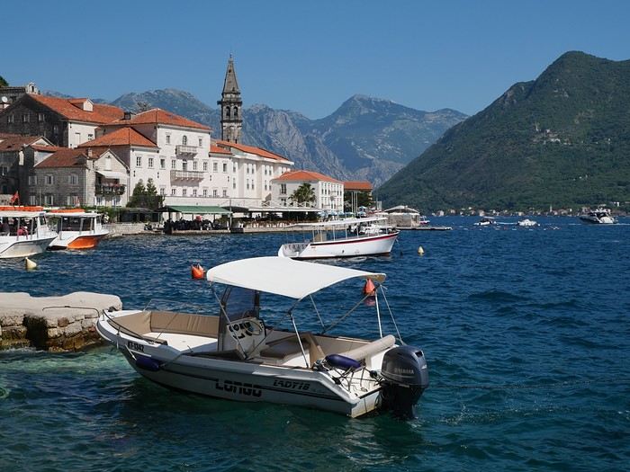
Croatia, Montenegro – two victims of overtourism?
Mid-June, two Auvergnats on the starting blocks—off we go to the former Yugoslavia!
We’d already explored some nooks and crannies of northern Croatia back in 2019, so we’re keeping the momentum going by planning a trip to the south of the country and then Montenegro.
On the way back, we’ll drift into Bosnia-Herzegovina just to mix things up a bit!
We’re a little unsure about what to expect in terms of tourist crowds.
Dubrovnik has a reputation for being the hardest-hit city by overtourism, and Kotor and the whole Dalmatian coast aren’t exactly empty...
Luckily, most European countries haven’t started school holidays yet, and some measures seem to have been put in place to limit the flow (like restrictions on the number of cruise ships allowed to dock at the same time).
Maybe we’ll manage to escape the promised hell?
For now, we’re slamming the doors of the Scirocco and heading off to our first stop: northern Italy!
On the way back, we’ll drift into Bosnia-Herzegovina just to mix things up a bit!
We’re a little unsure about what to expect in terms of tourist crowds.
Dubrovnik has a reputation for being the hardest-hit city by overtourism, and Kotor and the whole Dalmatian coast aren’t exactly empty...
Luckily, most European countries haven’t started school holidays yet, and some measures seem to have been put in place to limit the flow (like restrictions on the number of cruise ships allowed to dock at the same time).
Maybe we’ll manage to escape the promised hell?
For now, we’re slamming the doors of the Scirocco and heading off to our first stop: northern Italy!
Come discover the island of Madeira with me
Introduction
We arrived on the island of Madeira (Portugal) at the beginning of May 2023 and stayed for 5 weeks.
This island is renowned for its rich cultural heritage, its famous hikes through lush landscapes, and its seaside resorts. It offers an unforgettable experience for nature lovers.
In this travel journal, you’ll find a list of the many activities we did during our stay to explore the different attractions of this magnificent island.
These attractions are categorized to make it easier to search based on your interests, if needed.
Videos are included throughout the summary. Please click on the image to start the video.
To jump to a specific post, here are the appropriate links:
HIKES:
Calheta - PR19 Caminho Real do Paúl do Mar Santana - Ribeiro Frio - PR11 Vereda dos Balcões Sao Vicente - Gingas - PR16 Levada Fajã do Rodrigues Rabaçal - PR6.1 Levada do Risco & PR6 Levada das 25 fontes Rabaçal - PR6.2 Levada do Alecrim & PR6.3 Vereda da Lagoa do Vento Caniçal - PR8 Vereda da Ponta de São Lourenço São Jorge - PR18 Levada do Rei Ponta do Sol - PR7 modified - Levada Nova & Levada do Moinho Machico - PR5 Vereda das Funduras Funchal - PR1 Vereda do Areeiro (Pico do Areeiro to Pico Ruivo) Funchal - PR1 Vereda do Areeiro (Pico Ruivo to Pico do Areeiro) Funchal - PR1.2 Vereda do Pico Ruivo (outbound) Funchal - PR1.2 Vereda do Pico Ruivo (return) Porto Moniz - Fanal Forest Porto Moniz - PR14 Levada dos Cedros Ribeira Brava - PR17 Caminho do Pináculo e Folhadal (Encumeada) Ribeira Brava - PR17 Caminho do Pináculo e Folhadal (Lombo do Mouro) Ribeira Brava - PR17 Caminho do Pináculo e Folhadal (Bica da Cana) Santana - PR9 Levada do Caldeirão Verde Lamaceiros - Levada Ribeira da Janela Ribeiro Frio - PR10 Levada do Furado Tabua - Levada da Nova (Eastern Sector) Tabua - Levada da Nova (Western Sector) Boa Morte - Levada do Norte Verada da Levada do Facho - Levada do Norte (South) Vale Paraiso - Levada da Serra do Faial Porto Moniz - PR13 Vereda do Fanal Referta - Levada do Castelejo Porto da Cruz - Levada do Castelejo Estanquinhos - Pico Ruivo do Paul da Serra Boaventura - Levada de Cima & Levada da Acha Grande
SEASIDE RESORTS & NATURAL POOLS:
Natural pools of Seixal Seixal Naval Club Seaside Resort - Natural pool Natural pools of Porto Moniz Funchal - Lido Seaside Resort Santana - Foz da Ribeira do Faial Seaside Resort Câmara de Lobos - Salinas Seaside Resort Porto Moniz - Aquário/Cachalote Natural Pools Funchal - Doca do Cavacas Seaside Resort Funchal - Ponta Gorda Seaside Resort Caniço - Roca Mar Hotel Seaside Resort Caniço - Lido Galoma Seaside Resort Calhau de São Jorge Seaside Resort Ribeira Brava Seaside Resort
BEACHES:
São Jorge Beach Calheta Beach Seixal - Laje Beach (Jamaica) Porto de Seixal Beach Caniço - Reis Magos Beach Machico - Machico Beach (Banda d'Além) Machico - São Roque Beach Machico - Ribeira Natal Beach Caniçal - Prainha Beach Porto da Cruz - Alagoa Beach
TOWNS:
Stroll through the town of Ponta do Sol Stroll through the town of Câmara de Lobos Stroll through the town of Ribeira Brava Stroll through the town of Funchal Funchal - Wicker toboggan ride Stroll through the town of Machico Stroll through the town of Santana Stroll through the town of São Vicente São Vicente Caves Park
VIEWPOINTS:
Calheta Region Ponta do Sol Region Ribeira Brava Region Câmara de Lobos Region Funchal Region Santa Cruz Region Porto Moniz Region São Vicente Region Santana Region Machico Region On the road in Madeira
WATERFALLS ALONG THE WAY
Ponta do Sol - Anjos Waterfall Sao Vicente - Água d'Alto Waterfall Seixal - Córrego da Furna Waterfall
We arrived on the island of Madeira (Portugal) at the beginning of May 2023 and stayed for 5 weeks.
This island is renowned for its rich cultural heritage, its famous hikes through lush landscapes, and its seaside resorts. It offers an unforgettable experience for nature lovers.
In this travel journal, you’ll find a list of the many activities we did during our stay to explore the different attractions of this magnificent island.
These attractions are categorized to make it easier to search based on your interests, if needed.
Videos are included throughout the summary. Please click on the image to start the video.
To jump to a specific post, here are the appropriate links:
HIKES:
Calheta - PR19 Caminho Real do Paúl do Mar Santana - Ribeiro Frio - PR11 Vereda dos Balcões Sao Vicente - Gingas - PR16 Levada Fajã do Rodrigues Rabaçal - PR6.1 Levada do Risco & PR6 Levada das 25 fontes Rabaçal - PR6.2 Levada do Alecrim & PR6.3 Vereda da Lagoa do Vento Caniçal - PR8 Vereda da Ponta de São Lourenço São Jorge - PR18 Levada do Rei Ponta do Sol - PR7 modified - Levada Nova & Levada do Moinho Machico - PR5 Vereda das Funduras Funchal - PR1 Vereda do Areeiro (Pico do Areeiro to Pico Ruivo) Funchal - PR1 Vereda do Areeiro (Pico Ruivo to Pico do Areeiro) Funchal - PR1.2 Vereda do Pico Ruivo (outbound) Funchal - PR1.2 Vereda do Pico Ruivo (return) Porto Moniz - Fanal Forest Porto Moniz - PR14 Levada dos Cedros Ribeira Brava - PR17 Caminho do Pináculo e Folhadal (Encumeada) Ribeira Brava - PR17 Caminho do Pináculo e Folhadal (Lombo do Mouro) Ribeira Brava - PR17 Caminho do Pináculo e Folhadal (Bica da Cana) Santana - PR9 Levada do Caldeirão Verde Lamaceiros - Levada Ribeira da Janela Ribeiro Frio - PR10 Levada do Furado Tabua - Levada da Nova (Eastern Sector) Tabua - Levada da Nova (Western Sector) Boa Morte - Levada do Norte Verada da Levada do Facho - Levada do Norte (South) Vale Paraiso - Levada da Serra do Faial Porto Moniz - PR13 Vereda do Fanal Referta - Levada do Castelejo Porto da Cruz - Levada do Castelejo Estanquinhos - Pico Ruivo do Paul da Serra Boaventura - Levada de Cima & Levada da Acha Grande
SEASIDE RESORTS & NATURAL POOLS:
Natural pools of Seixal Seixal Naval Club Seaside Resort - Natural pool Natural pools of Porto Moniz Funchal - Lido Seaside Resort Santana - Foz da Ribeira do Faial Seaside Resort Câmara de Lobos - Salinas Seaside Resort Porto Moniz - Aquário/Cachalote Natural Pools Funchal - Doca do Cavacas Seaside Resort Funchal - Ponta Gorda Seaside Resort Caniço - Roca Mar Hotel Seaside Resort Caniço - Lido Galoma Seaside Resort Calhau de São Jorge Seaside Resort Ribeira Brava Seaside Resort
BEACHES:
São Jorge Beach Calheta Beach Seixal - Laje Beach (Jamaica) Porto de Seixal Beach Caniço - Reis Magos Beach Machico - Machico Beach (Banda d'Além) Machico - São Roque Beach Machico - Ribeira Natal Beach Caniçal - Prainha Beach Porto da Cruz - Alagoa Beach
TOWNS:
Stroll through the town of Ponta do Sol Stroll through the town of Câmara de Lobos Stroll through the town of Ribeira Brava Stroll through the town of Funchal Funchal - Wicker toboggan ride Stroll through the town of Machico Stroll through the town of Santana Stroll through the town of São Vicente São Vicente Caves Park
VIEWPOINTS:
Calheta Region Ponta do Sol Region Ribeira Brava Region Câmara de Lobos Region Funchal Region Santa Cruz Region Porto Moniz Region São Vicente Region Santana Region Machico Region On the road in Madeira
WATERFALLS ALONG THE WAY
Ponta do Sol - Anjos Waterfall Sao Vicente - Água d'Alto Waterfall Seixal - Córrego da Furna Waterfall
Grand tour of Argentina March 2025
My buddy Christian and I (Patrick) are off for 28 days in Argentina in March.
We’ve already shared several trips as a duo (Bolivia Peru, Namibia, Laos, Costa Rica).
Since we’re starting from the idea that at our age (65) we won’t be coming back here—there are just too many other corners of the world to discover—we did the "grand tour" of Argentina, with 6 domestic flights to make the most of our 28 days.
Here are our stops:
1) Departure from Brussels to Buenos Aires via Madrid
2) Arrival and first contact with Buenos Aires
3) Early morning flight to Ushuaia. Boat trip on the Beagle Channel
4) Ushuaia: hikes in Tierra del Fuego National Park
5) Ushuaia: last hike and flight to El Calafate
6) El Calafate to El Chaltén by bus. First hike
7) El Chaltén: hike
8) El Chaltén: hike
9) El Chaltén: hike and bus back to El Calafate
10) El Calafate: Perito Moreno Glacier
11) Flight to Bariloche. Car rental and surrounding areas
12) Seven Lakes Region
13) Nahuel Huapi National Park region
14) Flight to Salta. Car rental
15) To Tilcara
16) To Humahuaca
17) To Purmamarca
18) To Jujuy via the salt flats
19) To Cafayate
20) Around Cafayate
21) To Cachi
22) Back to Salta
23) Flight to Iguazu
24) Waterfalls on the Argentine side
25) Waterfalls on the Brazilian side and flight to Buenos Aires
26) Buenos Aires
27) Return flight
28) Morning arrival
Happy reading!..
Discovering South India: Tamil Nadu and Kerala
Hello everyone!
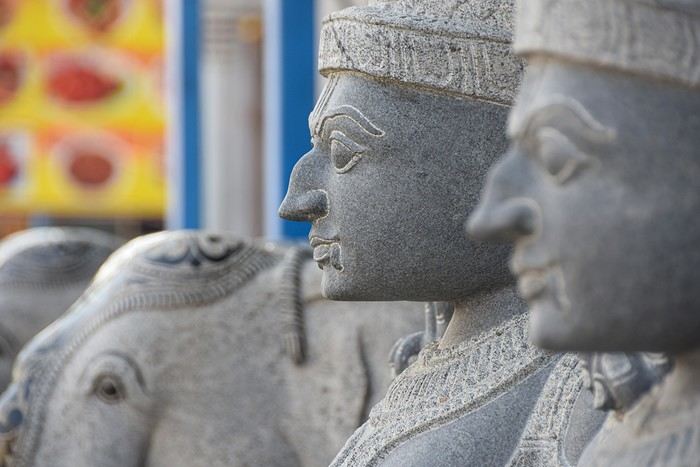
We're off! After exploring the north, the four friends have now discovered the south. We’re excited to share this new travel journal, dedicated to our little group and our strong friendship, written by Richard and illustrated with Kate’s photos. I’ll chime in from time to time with practical tips.
First of all, a big thank you to everyone on VoyageForum who helped us plan this trip. It would’ve been quite different if we’d just relied on guidebooks.
The itinerary lasted just over 3 weeks: Mahabalipuram, Pondicherry, Thanjavur, the Chettinad region, Madurai, Munnar, Munroe Island, Cochin, and Chennai. We traveled by train, taxi, and private car with a driver, took a domestic flight, and stayed in guesthouses, Airbnb apartments, and hotels. For each of us, including flights, the total budget barely reached 2000 €, and we didn’t hold back—knowing we avoid resorts and love street food and small Indian restaurants.
We're off! After exploring the north, the four friends have now discovered the south. We’re excited to share this new travel journal, dedicated to our little group and our strong friendship, written by Richard and illustrated with Kate’s photos. I’ll chime in from time to time with practical tips.
First of all, a big thank you to everyone on VoyageForum who helped us plan this trip. It would’ve been quite different if we’d just relied on guidebooks.
The itinerary lasted just over 3 weeks: Mahabalipuram, Pondicherry, Thanjavur, the Chettinad region, Madurai, Munnar, Munroe Island, Cochin, and Chennai. We traveled by train, taxi, and private car with a driver, took a domestic flight, and stayed in guesthouses, Airbnb apartments, and hotels. For each of us, including flights, the total budget barely reached 2000 €, and we didn’t hold back—knowing we avoid resorts and love street food and small Indian restaurants.
From Caño Cristales to Tayrona Park
After about 12 hours of flying from Toulouse (via Paris), we landed in Bogotá six years after our first trip to Colombia. This time, our journey will be very different, with only this stop in the Colombian capital in common.
Our travel itinerary
Bogotá / La Macarena (Caño Cristales) / Villa de Leyva / Barichara / San Gil / Girón / Mompox / Ciénaga and the Santa Marta lagoon / Minca / Los Naranjos (Tayrona Park) / Bogotá.
Step 1: Bogotá (and Nemecon)
Bogotá (1/3)
This morning, we had a meet-up with Flora from Aventure Colombia, who helped me organize one of our stops, a few transfers, and tomorrow’s day trip, the program of which I changed at the last minute after deciding to skip the visit to the Salt Cathedral of Zipaquirá. Flora is a kind and lovely person, always available, and she did everything to answer my questions and give me advice.
She’s a local contact I highly recommend. Flora can help you plan your trip, whether you want a fully organized tour or, like us, just need assistance with a specific stop or one or more transfers between cities.
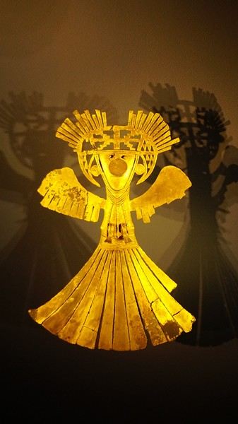
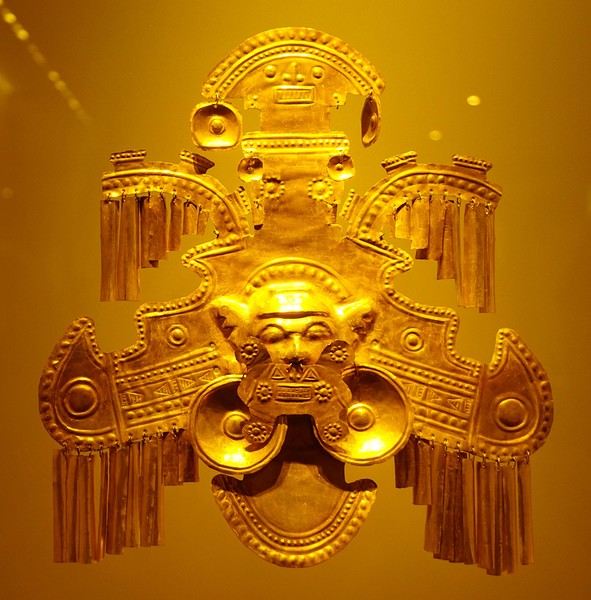
We left Flora after setting a meet-up for our return to Bogotá in a month. As we walked out of her agency, we headed to the wonderful Gold Museum, located just a hundred meters away. I was excited to revisit this amazing museum.
Note: Free entry for those over 60, regardless of nationality. Just show your passport.
Like six years ago, I was amazed by its museography, the beauty of the pieces on display, and that breathtaking shamanic room.
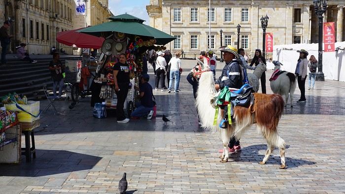
About two hours later, we decided to walk (careful, it’s a climb!) to the Monserrate cable car (3152m). Long wait to buy tickets and board the cable car! Once we arrived, a few raindrops, an impressive panoramic view of Bogotá’s vastness, a quick visit to the basilica (a pilgrimage site for Colombians), a walk through the tourist market, and at the top, plenty of small restaurants where we had our first Colombian meal. After our hearty lunch, we were lucky to see the sun return! No line for the descent. We then headed back to the hotel because Justine wanted to rest and recover from the trip. As for me, I continued my walk. I discovered a really nice craft market recommended by Flora, Pasaje Rivas, returned to Bolívar Square, and wandered through different streets, including the main pedestrian avenue (Calle 7), where there’s always something to see.
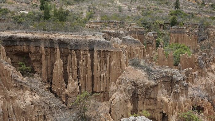
Tomorrow, a change of scenery as we head out for a hike in a small desert (Desierto de Chueca), located about 2 hours from Bogotá in the village of Nemecon. For this outing from Bogotá, with Flora’s help, we booked a car with a driver for the day. Flora also took care of booking the guide (since the site can only be visited with one). Nemecon (2/3) Today, we went to Nemecon to hike about 7.5 km in the ‘Desert of Checua.’ It’s nothing like sandy deserts! Instead, it’s geological formations sculpted by time, wind, and water. After two hours on the road—almost one of them spent navigating traffic jams with cars, trucks, buses, and a continuous flow of motorcycles on either side of our taxi—we reached Nemecon! The village center is really (too?) quiet. We met up with Deisy and headed toward the ‘desert,’ about twenty minutes away on a bumpy dirt road. Once there, a quick briefing, and off we went! Deisy didn’t stop talking (in Spanish) for over 3 hours!!! She told us so much about her region (flower farming, water management, traditions, songs, etc.), the origin of the site, and even mentioned Antonio Banderas, who filmed *The 33* in the village’s salt mine (the story of the survival of 33 Chilean miners after a collapse in their copper and gold mine). One hour of walking to reach the site, one hour to explore it, and one hour to return.
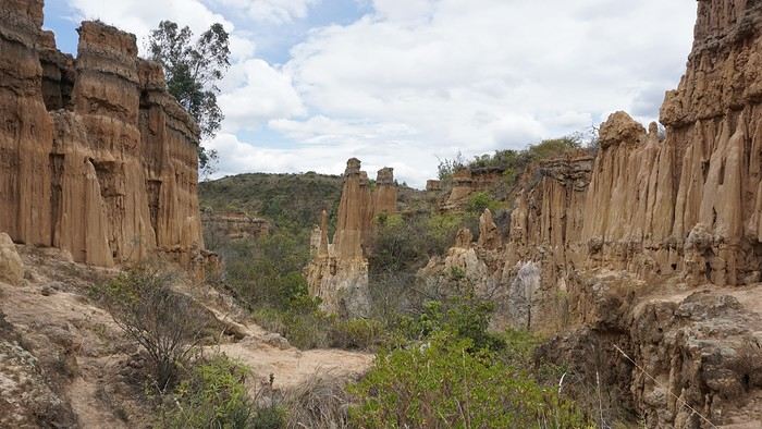
The advantage of this non-stop chatter was that it forced us to brush up on our Spanish at lightning speed. I even wondered if the effort to concentrate wasn’t more exhausting than the physical effort! Especially since on the way back, I got an oral quiz. Deisy wanted to make sure I remembered some of the information she’d given me during the visit: why is this rock white, that one red, and that one black? Back in the village, we had lunch at a restaurant recommended by Deisy before visiting the Nemecon salt mine. Before entering, a guide spent a good half-hour explaining the origin of the salt and the presence of many fossils in the area. Again, concentrating was tough because all the comments were exclusively in Spanish! An hour and a half wandering through the tunnels with a ‘lovely miner’s helmet’ on our heads!
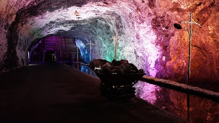
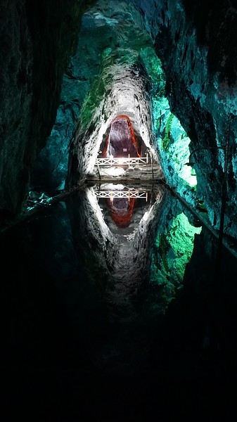
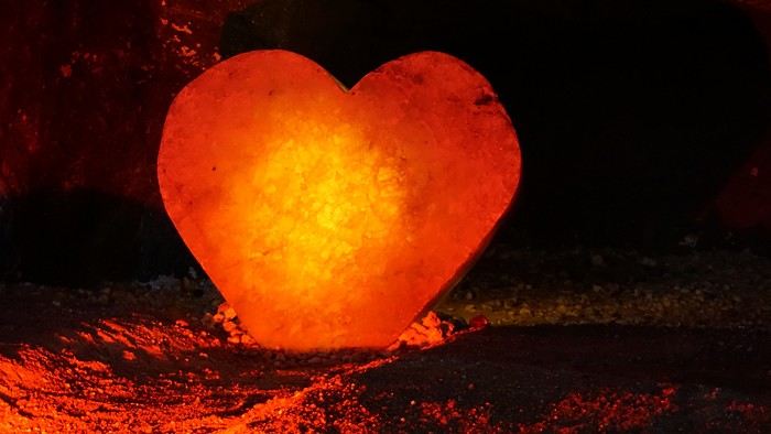
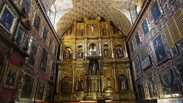
We met our driver at the mine entrance. The return to Bogotá was a bit faster, but traffic in the city center was still heavy! We arrived in front of our hotel between 8:00 and 8:30 PM. It’s been a pretty intense start to the trip! Tonight, our legs are tired. Hopefully, tomorrow will be a bit more relaxed! Bogotá (3/3) We started the day by visiting the Santa Clara Church Museum, located next to the presidential palace. Alejandra (from the local agency ‘Gaia Tours Colombia,’ which organized our stay in Caño Cristales (La Macarena)) had recommended this visit for its rich mural paintings.
A few hundred meters further, after crossing the Plaza Mayor again, we visited the cultural complex housing the Botero Museum, the Mint Museum, and the Bank of the Republic Art Museum. Note that entry is free for all three museums. Botero Museum: There are fewer works by Botero here than in the Medellín museum, but more paintings and sculptures by other artists, all from Botero’s private collection (donated to Colombia). Mint Museum: We limited ourselves to visiting one room (on Flora’s advice) where three gold and gemstone monstrances and a Christ with a crown of emerald thorns are displayed. Photos are not allowed. Art Museum: We visited two temporary exhibitions. Lunchtime came quickly. We had a good meal at a reasonably priced small restaurant in the La Candelaria micro-district, near the Chorro de Quevedo square. We decided to spend the afternoon wandering the streets and alleys of the historic center to discover local street art.
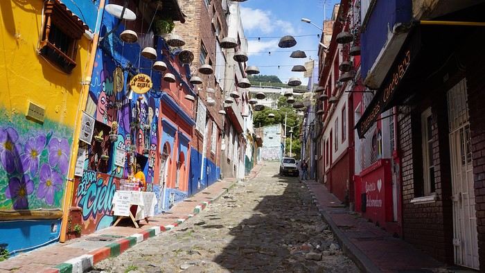
We also passed through very lively pedestrian streets. I also decided to revisit Pasaje Rivas to show Justine all the shops selling more or less artisanal products. Tomorrow morning, we fly to La Macarena at 10:30 AM. Not to dance (you’d be surprised if I told you we were going to take a South American dance class, right?!), but to visit the fabulous Caño Cristales, a river naturally colored by aquatic plants. The planned program includes hiking, horseback riding, canoeing, and swimming among these plants. This site was long inaccessible because the area was controlled by the FARC. Access and tourism development became possible after agreements and amnesty measures between the Colombian government and paramilitary groups. As in other regions, former FARC members have been able to transition into various tourism-related activities.
About two hours later, we decided to walk (careful, it’s a climb!) to the Monserrate cable car (3152m). Long wait to buy tickets and board the cable car! Once we arrived, a few raindrops, an impressive panoramic view of Bogotá’s vastness, a quick visit to the basilica (a pilgrimage site for Colombians), a walk through the tourist market, and at the top, plenty of small restaurants where we had our first Colombian meal. After our hearty lunch, we were lucky to see the sun return! No line for the descent. We then headed back to the hotel because Justine wanted to rest and recover from the trip. As for me, I continued my walk. I discovered a really nice craft market recommended by Flora, Pasaje Rivas, returned to Bolívar Square, and wandered through different streets, including the main pedestrian avenue (Calle 7), where there’s always something to see.
Tomorrow, a change of scenery as we head out for a hike in a small desert (Desierto de Chueca), located about 2 hours from Bogotá in the village of Nemecon. For this outing from Bogotá, with Flora’s help, we booked a car with a driver for the day. Flora also took care of booking the guide (since the site can only be visited with one). Nemecon (2/3) Today, we went to Nemecon to hike about 7.5 km in the ‘Desert of Checua.’ It’s nothing like sandy deserts! Instead, it’s geological formations sculpted by time, wind, and water. After two hours on the road—almost one of them spent navigating traffic jams with cars, trucks, buses, and a continuous flow of motorcycles on either side of our taxi—we reached Nemecon! The village center is really (too?) quiet. We met up with Deisy and headed toward the ‘desert,’ about twenty minutes away on a bumpy dirt road. Once there, a quick briefing, and off we went! Deisy didn’t stop talking (in Spanish) for over 3 hours!!! She told us so much about her region (flower farming, water management, traditions, songs, etc.), the origin of the site, and even mentioned Antonio Banderas, who filmed *The 33* in the village’s salt mine (the story of the survival of 33 Chilean miners after a collapse in their copper and gold mine). One hour of walking to reach the site, one hour to explore it, and one hour to return.
The advantage of this non-stop chatter was that it forced us to brush up on our Spanish at lightning speed. I even wondered if the effort to concentrate wasn’t more exhausting than the physical effort! Especially since on the way back, I got an oral quiz. Deisy wanted to make sure I remembered some of the information she’d given me during the visit: why is this rock white, that one red, and that one black? Back in the village, we had lunch at a restaurant recommended by Deisy before visiting the Nemecon salt mine. Before entering, a guide spent a good half-hour explaining the origin of the salt and the presence of many fossils in the area. Again, concentrating was tough because all the comments were exclusively in Spanish! An hour and a half wandering through the tunnels with a ‘lovely miner’s helmet’ on our heads!
We met our driver at the mine entrance. The return to Bogotá was a bit faster, but traffic in the city center was still heavy! We arrived in front of our hotel between 8:00 and 8:30 PM. It’s been a pretty intense start to the trip! Tonight, our legs are tired. Hopefully, tomorrow will be a bit more relaxed! Bogotá (3/3) We started the day by visiting the Santa Clara Church Museum, located next to the presidential palace. Alejandra (from the local agency ‘Gaia Tours Colombia,’ which organized our stay in Caño Cristales (La Macarena)) had recommended this visit for its rich mural paintings.
A few hundred meters further, after crossing the Plaza Mayor again, we visited the cultural complex housing the Botero Museum, the Mint Museum, and the Bank of the Republic Art Museum. Note that entry is free for all three museums. Botero Museum: There are fewer works by Botero here than in the Medellín museum, but more paintings and sculptures by other artists, all from Botero’s private collection (donated to Colombia). Mint Museum: We limited ourselves to visiting one room (on Flora’s advice) where three gold and gemstone monstrances and a Christ with a crown of emerald thorns are displayed. Photos are not allowed. Art Museum: We visited two temporary exhibitions. Lunchtime came quickly. We had a good meal at a reasonably priced small restaurant in the La Candelaria micro-district, near the Chorro de Quevedo square. We decided to spend the afternoon wandering the streets and alleys of the historic center to discover local street art.
We also passed through very lively pedestrian streets. I also decided to revisit Pasaje Rivas to show Justine all the shops selling more or less artisanal products. Tomorrow morning, we fly to La Macarena at 10:30 AM. Not to dance (you’d be surprised if I told you we were going to take a South American dance class, right?!), but to visit the fabulous Caño Cristales, a river naturally colored by aquatic plants. The planned program includes hiking, horseback riding, canoeing, and swimming among these plants. This site was long inaccessible because the area was controlled by the FARC. Access and tourism development became possible after agreements and amnesty measures between the Colombian government and paramilitary groups. As in other regions, former FARC members have been able to transition into various tourism-related activities.
Martine and DD in Colorado and Utah
Hello everyone! 🙂
So many silent months, and now Voyage Forum is accessible again. That’s cool because we can pick up our discussions for our mutual enjoyment.
I hope everyone is doing well and that you’ve been able to take some great trips, whether to the USA or elsewhere.
In September 2020, we had planned a round trip to explore Colorado, but unfortunately, a nasty virus messed up our plans, closing borders and keeping us stuck at home. Luckily for us, canceling the car, flights, and accommodations didn’t cost us a thing—everything was refunded.
In 2023, a loop from Las Vegas let us revisit places we’d seen in 2017 and discover new ones, this time spending more time at each stop with some lovely hikes.
In 2024, we finally revisited the 2020 plan, and I’ll start with that.
However, unforeseen circumstances mean I have much less time than before, so I’ll keep my trip reports shorter (ha ha ha—you’ll have less of my prose to endure).
Another change: for those who remember the "Gang of Four crazy sixty-somethings," it was just DD and me this time. Our dear Mimi and Maumau left the Var to focus on raising horses and can’t leave their little green paradise to join us anymore. We were unfortunately much tamer without them.
We traveled from September 11 to October 3.
The itinerary
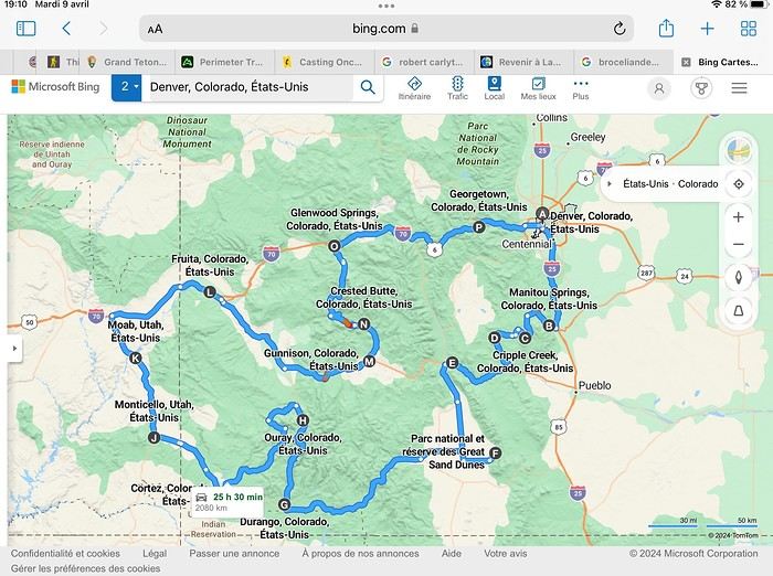
Day 1: Flight Marseille-Paris-Denver, then Manitou Springs (133 km) Day 2: Manitou Springs (49 km) Day 3: Cripple Creek (104 km) Day 4: Salida (254 km) Day 5: Great Sand Dunes (231 km) Day 6: Durango (283 km) Day 7: Durango (Durango-Silverton train) Day 8: Ouray (121 km) Day 9: Ouray (Perimeter Trail hike) Day 10: Cortez (213 km) Day 11: Cortez (Mesa Verde National Park, 134 km) Day 12: Monticello (268 km, detour to Chesler Park) Day 13: Moab (171 km, Delicate Arch) Day 14: Moab (98 km, Fisher Towers) Day 15: Moab (171 km, Canyonlands) Day 16: Fruita (210 km, Colorado National Monument) Day 17: Crested Butte (224 km via Kebler Pass) Day 18: Crested Butte (57 km) Day 19: Glenwood Springs (150 km) Day 20: Glenwood Springs (118 km, Rifle State Park) Day 21: Georgetown (258 km via Independence Pass) Day 22: Denver (123 km), then return flight
We speak very little English. We spent 21 nights there and covered a 3,400 km loop by car and 160 km on foot (we’re still trying to hike while we’re in shape) from Denver in September 2024. We wanted this road trip to help us explore Colorado a bit more—we’d only spent 6 nights there in 2019—and to see it during the fall foliage season. We also wanted to return to Utah (we love Moab) to enjoy its red rocks, which we adore.
In the prices you see (some in euros, others in dollars), I’ve included bank fees and exchange charges. The flights, car, and parking were paid by credit card when we booked in February. Usually, we book around November, but some obligations kept us from doing it earlier. We downloaded the MPC (Mobile Passport Control) app on our phone, which saved us time at immigration.
📊 **Budget: just under 8,500 € for both of us, all included**
📊 **Flights** Marseille-Paris (CDG)-Denver: 2,152 € for both of us, with one checked bag each
📊 **ESTA and America the Beautiful Pass** The ones from our 2023 road trip were still valid
📊 **Parking at Marseille airport: 122 €**
📊 **Car: Nissan Rogue (the French X-Trail) from Hertz: 1,165 €** By booking through Air France (and earning miles), we got a 15% discount. Hertz offers a free Hertz Gold Plus Rewards program, which gives us priority counter service.
📊 **Accommodation: 3,050 €** We stayed in motels and hotels of various ranges (from 100 € to 270 € per night, depending on the city), all booked through Hotels.com or Booking. Booking sometimes offers cheaper rates if you book via the "Booking mobile" app. We also got some preferential rates thanks to our Genius 2 status. Out of 21 nights, only one place didn’t include breakfast.
📊 **Other expenses (activities booked by credit card before leaving)** Durango-Silverton train: 210 € (we booked the enclosed vintage coach in March) Mesa Verde: Balcony House: 15.15 € (booked 14 days before the visit) Timed-entry passes for Arches National Park: 6 € for 3 days (booked June 1 for September entries via http://récreation.gov/). We booked three different days to play with the weather.
📊 **Supplementary insurance with AVA: 204 €** (due to our age 😅 and the high cost of medical consultations in the USA)
📊 **Cash: 1,540 €** We left with 1,000 € exchanged before departure and made two withdrawals (500 $ and 200 $). This cash was used to pay for: - Evening restaurants and tips (between 70 $ and 95 $ for two meals and two drinks) - Two state parks: Dead Horse State Park (20 $) and Rifle State Park (10 $) - The Monarch Pass gondola (24 $) - Midday picnics - Gas (slightly cheaper with cash): 204 $ for 3,400 km - Personal souvenirs and little treats.
Like in our previous road trips, we didn’t rent a GPS. We used the offline GPS app Here We Go, for which we’d downloaded maps of Colorado and Utah from France, as well as a new offline app called Organic Maps as a backup—though we didn’t end up needing it.
❤️❤️❤️ **Highlights (there are so many!)** 📍 The stunning landscapes of Colorado, especially with the fall colors 📍 A step back in time at the old farm in Florissant Fossil Beds National Monument 📍 The prairies of Cripple Creek and the mining remnants of the Vindicator Trail 📍 The cheeky chipmunks in the ghost town of St. Elmo 📍 Great Sand Dunes and its soft sand 📍 The steam train between Durango and Silverton: we’re glad we chose the round-trip because it rained heavily on the way there, but we got to enjoy the scenery on the way back when the sun came out 📍 The unexpected meet-up with Michèle from the group outside a restaurant in Durango 📍 The hot springs in Ouray 📍 Mesa Verde and its still-vibrant past 📍 The red rocks of Moab and Delicate Arch at sunset 📍 The lace-like Fisher Towers and the view from the end of the trail 📍 The gorgeous Route 128 leading to Colorado National Monument—small, easy to visit, and so beautiful 📍 The colors of the fabulous Kebler Pass, Crested Butte, and especially the hike through the golden aspens (Lower and Upper Loop) 📍 The waterfalls at Rifle State Park 📍 The tundra of Independence Pass 📍 The Halloween decorations in Georgetown and Idaho Springs
😞😞 **Flops (there are very few!)** 📍 The viewpoints we missed because they weren’t well-marked or we didn’t see the signs 📍 The closure of some hiking trails (Hanging Lake and parts of Canyonlands) and the Sal Mountain Loop road, which kept us from accessing it 📍😢 The Chesler Park hike we had to cut short due to poor time management—180 km between our stop in Cortez meant we didn’t arrive until 10:30 AM, way too late for a 17 km hike.
Hope this helps! Have a great evening, everyone, and see you soon! 😊
The itinerary
Day 1: Flight Marseille-Paris-Denver, then Manitou Springs (133 km) Day 2: Manitou Springs (49 km) Day 3: Cripple Creek (104 km) Day 4: Salida (254 km) Day 5: Great Sand Dunes (231 km) Day 6: Durango (283 km) Day 7: Durango (Durango-Silverton train) Day 8: Ouray (121 km) Day 9: Ouray (Perimeter Trail hike) Day 10: Cortez (213 km) Day 11: Cortez (Mesa Verde National Park, 134 km) Day 12: Monticello (268 km, detour to Chesler Park) Day 13: Moab (171 km, Delicate Arch) Day 14: Moab (98 km, Fisher Towers) Day 15: Moab (171 km, Canyonlands) Day 16: Fruita (210 km, Colorado National Monument) Day 17: Crested Butte (224 km via Kebler Pass) Day 18: Crested Butte (57 km) Day 19: Glenwood Springs (150 km) Day 20: Glenwood Springs (118 km, Rifle State Park) Day 21: Georgetown (258 km via Independence Pass) Day 22: Denver (123 km), then return flight
We speak very little English. We spent 21 nights there and covered a 3,400 km loop by car and 160 km on foot (we’re still trying to hike while we’re in shape) from Denver in September 2024. We wanted this road trip to help us explore Colorado a bit more—we’d only spent 6 nights there in 2019—and to see it during the fall foliage season. We also wanted to return to Utah (we love Moab) to enjoy its red rocks, which we adore.
In the prices you see (some in euros, others in dollars), I’ve included bank fees and exchange charges. The flights, car, and parking were paid by credit card when we booked in February. Usually, we book around November, but some obligations kept us from doing it earlier. We downloaded the MPC (Mobile Passport Control) app on our phone, which saved us time at immigration.
📊 **Budget: just under 8,500 € for both of us, all included**
📊 **Flights** Marseille-Paris (CDG)-Denver: 2,152 € for both of us, with one checked bag each
📊 **ESTA and America the Beautiful Pass** The ones from our 2023 road trip were still valid
📊 **Parking at Marseille airport: 122 €**
📊 **Car: Nissan Rogue (the French X-Trail) from Hertz: 1,165 €** By booking through Air France (and earning miles), we got a 15% discount. Hertz offers a free Hertz Gold Plus Rewards program, which gives us priority counter service.
📊 **Accommodation: 3,050 €** We stayed in motels and hotels of various ranges (from 100 € to 270 € per night, depending on the city), all booked through Hotels.com or Booking. Booking sometimes offers cheaper rates if you book via the "Booking mobile" app. We also got some preferential rates thanks to our Genius 2 status. Out of 21 nights, only one place didn’t include breakfast.
📊 **Other expenses (activities booked by credit card before leaving)** Durango-Silverton train: 210 € (we booked the enclosed vintage coach in March) Mesa Verde: Balcony House: 15.15 € (booked 14 days before the visit) Timed-entry passes for Arches National Park: 6 € for 3 days (booked June 1 for September entries via http://récreation.gov/). We booked three different days to play with the weather.
📊 **Supplementary insurance with AVA: 204 €** (due to our age 😅 and the high cost of medical consultations in the USA)
📊 **Cash: 1,540 €** We left with 1,000 € exchanged before departure and made two withdrawals (500 $ and 200 $). This cash was used to pay for: - Evening restaurants and tips (between 70 $ and 95 $ for two meals and two drinks) - Two state parks: Dead Horse State Park (20 $) and Rifle State Park (10 $) - The Monarch Pass gondola (24 $) - Midday picnics - Gas (slightly cheaper with cash): 204 $ for 3,400 km - Personal souvenirs and little treats.
Like in our previous road trips, we didn’t rent a GPS. We used the offline GPS app Here We Go, for which we’d downloaded maps of Colorado and Utah from France, as well as a new offline app called Organic Maps as a backup—though we didn’t end up needing it.
❤️❤️❤️ **Highlights (there are so many!)** 📍 The stunning landscapes of Colorado, especially with the fall colors 📍 A step back in time at the old farm in Florissant Fossil Beds National Monument 📍 The prairies of Cripple Creek and the mining remnants of the Vindicator Trail 📍 The cheeky chipmunks in the ghost town of St. Elmo 📍 Great Sand Dunes and its soft sand 📍 The steam train between Durango and Silverton: we’re glad we chose the round-trip because it rained heavily on the way there, but we got to enjoy the scenery on the way back when the sun came out 📍 The unexpected meet-up with Michèle from the group outside a restaurant in Durango 📍 The hot springs in Ouray 📍 Mesa Verde and its still-vibrant past 📍 The red rocks of Moab and Delicate Arch at sunset 📍 The lace-like Fisher Towers and the view from the end of the trail 📍 The gorgeous Route 128 leading to Colorado National Monument—small, easy to visit, and so beautiful 📍 The colors of the fabulous Kebler Pass, Crested Butte, and especially the hike through the golden aspens (Lower and Upper Loop) 📍 The waterfalls at Rifle State Park 📍 The tundra of Independence Pass 📍 The Halloween decorations in Georgetown and Idaho Springs
😞😞 **Flops (there are very few!)** 📍 The viewpoints we missed because they weren’t well-marked or we didn’t see the signs 📍 The closure of some hiking trails (Hanging Lake and parts of Canyonlands) and the Sal Mountain Loop road, which kept us from accessing it 📍😢 The Chesler Park hike we had to cut short due to poor time management—180 km between our stop in Cortez meant we didn’t arrive until 10:30 AM, way too late for a 17 km hike.
Hope this helps! Have a great evening, everyone, and see you soon! 😊
Northern Chile, Andean impressions.
Alright, this year, we're heading back to South America!
The initial plan was to retrace the route we imagined in the summer of 2020: a trip to northern Argentina starting from Córdoba.
Unfortunately, the flight to Córdoba no longer exists, and airfares to Javier Milei’s country are both outrageously priced and involve multiple layovers.
So, I tweaked Google Flights every which way and finally found a flight within my budget—departing from Clermont-Ferrand!
Not to Argentina, though...
Our transatlantic flight will cross the snow-capped Andes, landing in Santiago, Chile, with a return from Lima!
In between, two domestic flights and a big road trip loop starting from the coastal city of Arica to explore the treasures of northern Chile.
Our mode of transport: a pseudo 4x4 that won’t take us through sand dunes or devilish tracks but will let us tackle the entire secondary network, including unpaved main roads, while still being insured.
Is the suitcase packed with all-season clothes?
Are the driver’s license and passport ready?
Bank cards and a few euros too?
Off we go for just over 3 weeks of southern wanderings!
--/--
To keep all my esteemed readers on track, here are a few maps outlining the Arica-Arica loop!
1- From Arica to San Pedro de Atacama via Pica and the Salar de Huasco
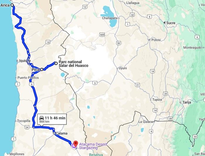 2- Around San Pedro
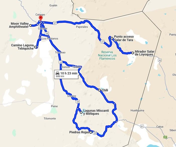
3- From San Pedro to Cariquima
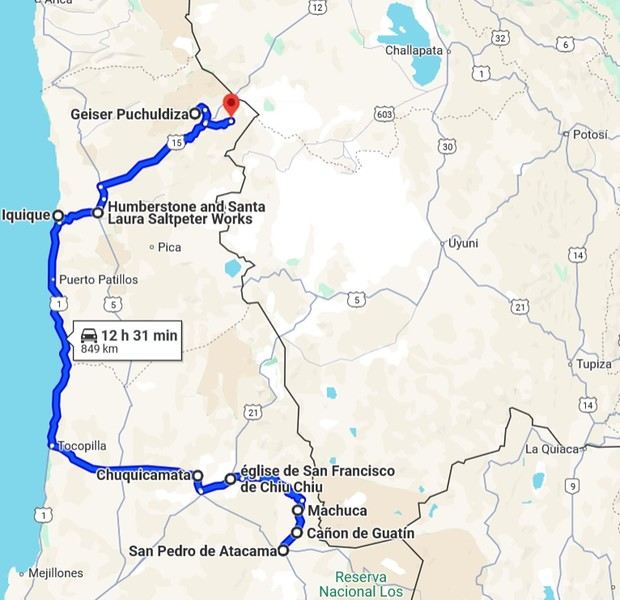
4- From Cariquima to Putre
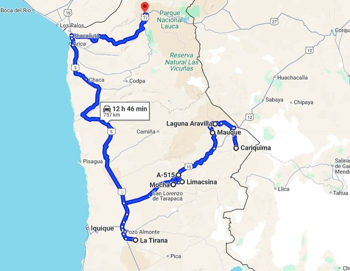
5 - From Putre to Arica
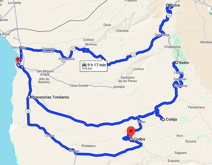
Gas stations in this part of Chile are located in Arica, Iquique, Pozo Almonte, Pica, Calama, and San Pedro de Atacama.
The initial plan was to retrace the route we imagined in the summer of 2020: a trip to northern Argentina starting from Córdoba.
Unfortunately, the flight to Córdoba no longer exists, and airfares to Javier Milei’s country are both outrageously priced and involve multiple layovers.
So, I tweaked Google Flights every which way and finally found a flight within my budget—departing from Clermont-Ferrand!
Not to Argentina, though...
Our transatlantic flight will cross the snow-capped Andes, landing in Santiago, Chile, with a return from Lima!
In between, two domestic flights and a big road trip loop starting from the coastal city of Arica to explore the treasures of northern Chile.
Our mode of transport: a pseudo 4x4 that won’t take us through sand dunes or devilish tracks but will let us tackle the entire secondary network, including unpaved main roads, while still being insured.
Is the suitcase packed with all-season clothes?
Are the driver’s license and passport ready?
Bank cards and a few euros too?
Off we go for just over 3 weeks of southern wanderings!
--/--
To keep all my esteemed readers on track, here are a few maps outlining the Arica-Arica loop!
1- From Arica to San Pedro de Atacama via Pica and the Salar de Huasco
2- Around San Pedro3- From San Pedro to Cariquima
4- From Cariquima to Putre
5 - From Putre to Arica
Gas stations in this part of Chile are located in Arica, Iquique, Pozo Almonte, Pica, Calama, and San Pedro de Atacama.
Morocco, an encounter...
Hello everyone,
I’ve been to Morocco about fifteen times, but I’ve never posted a travel journal here on Voyage Forum. Why? I have no idea… Maybe because this section was so active, with lots of stories and photos. I thought sharing my adventures in *al Maghrib* wouldn’t be very original. Today, this space feels quieter, so what if I tried to give it a little life back, modestly? With some help…
This trip will be different. From the start of my relationship with Richard, I was determined to introduce him to *my* Morocco. But he was a bit reluctant… He’ll tell you about our 2022 meeting, and I’ll illustrate it with my photos, just like we did with our India travel journal.
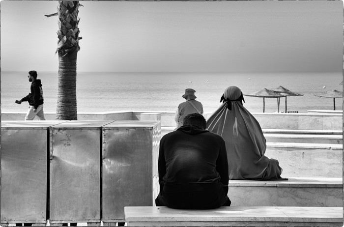
I’ve been to Morocco about fifteen times, but I’ve never posted a travel journal here on Voyage Forum. Why? I have no idea… Maybe because this section was so active, with lots of stories and photos. I thought sharing my adventures in *al Maghrib* wouldn’t be very original. Today, this space feels quieter, so what if I tried to give it a little life back, modestly? With some help…
This trip will be different. From the start of my relationship with Richard, I was determined to introduce him to *my* Morocco. But he was a bit reluctant… He’ll tell you about our 2022 meeting, and I’ll illustrate it with my photos, just like we did with our India travel journal.
Three weeks in Norway (July 2022): fantastic memories despite the rain
Our trip to Norway was two years ago already, but I thought it might still be of interest—and it’ll let me relive it a bit by proxy.
Before booking our flight tickets, we debated the route: should we prioritize the north with the Lofoten and Senja islands, or the south with its countless fjords? I was tempted to stay in the south—the country is so vast, and the drive north is long... but my husband really didn’t want to miss the Lofoten. In the end, we figured that since Norway is known for being expensive, we might only visit once (funny how we said the same thing before our first trip to the American West, and look how that turned out 😎), so we didn’t want to skip anything. That meant a 2–3 day drive up north. With 22 days on the ground, it was doable. Especially since, as usual, we skip big cities and gave Oslo a pass.
Practical details: - Flight tickets: 1195 € for 4 with Air France (Paris–Oslo outbound, Tromsø–Bergen–Paris return) - Car rental: 2020 € for 21 days (including the outrageous drop-off fee between Oslo and Tromsø—about 1000 €) - Tolls and ferries: 250 € for the portion billed directly by the rental company. Some ferries required advance booking and payment at the time of reservation—I’ll note their prices as I go through the story. - Hotels: 4135 €, averaging 188 € per night. We blew past our usual budgets from trips to the U.S., but oh well... - Food: 1570 €, averaging 71 € per day for 4 in a country where everything’s expensive... How’d we manage? We rarely ate out, mostly grocery shopped, and even packed half a suitcase with non-perishables: pasta, rice, a few cans, and even some cured sausage! We also stayed 3 nights at Clarion Collection hotels, where an evening buffet was included in the room rate.
Before booking our flight tickets, we debated the route: should we prioritize the north with the Lofoten and Senja islands, or the south with its countless fjords? I was tempted to stay in the south—the country is so vast, and the drive north is long... but my husband really didn’t want to miss the Lofoten. In the end, we figured that since Norway is known for being expensive, we might only visit once (funny how we said the same thing before our first trip to the American West, and look how that turned out 😎), so we didn’t want to skip anything. That meant a 2–3 day drive up north. With 22 days on the ground, it was doable. Especially since, as usual, we skip big cities and gave Oslo a pass.
Practical details: - Flight tickets: 1195 € for 4 with Air France (Paris–Oslo outbound, Tromsø–Bergen–Paris return) - Car rental: 2020 € for 21 days (including the outrageous drop-off fee between Oslo and Tromsø—about 1000 €) - Tolls and ferries: 250 € for the portion billed directly by the rental company. Some ferries required advance booking and payment at the time of reservation—I’ll note their prices as I go through the story. - Hotels: 4135 €, averaging 188 € per night. We blew past our usual budgets from trips to the U.S., but oh well... - Food: 1570 €, averaging 71 € per day for 4 in a country where everything’s expensive... How’d we manage? We rarely ate out, mostly grocery shopped, and even packed half a suitcase with non-perishables: pasta, rice, a few cans, and even some cured sausage! We also stayed 3 nights at Clarion Collection hotels, where an evening buffet was included in the room rate.
Western USA Oct 2024 - Arches and Other Delights...
Aaah, I'm so glad Voyage Forum is back up and running. For reading... and for writing...
My last travel journal was from 2019, when I went hiking and backpacking with my son, who was 15 at the time. We visited some places that were still pretty unknown back then! I was supposed to go in April 2020, still solo, with arches as the main focus. I’d spent nearly two months getting physically prepared, and had managed to snag a bunch of permits for CBS, The Needles, and so on... Of course, it all got postponed—first to October 2020, then April 2021, then October 2021, and finally it happened in April 2022. Maybe I’ll write about that in another journal. The thing is, every time, I spend at least 6 to 8 weeks getting physically ready, even though I work out all year. Huge disappointment during that trip—so much had changed because of Covid, kind of like in the mountains back home. Overcrowding, not just in the national parks (we knew about that), but also in a lot of remote, lesser-known spots. Like the French, Americans realized they had a lot of beautiful places in their own country during those travel bans. And they kept exploring... Prices for pretty much everything had already gone up a lot. Gas, restaurants, cars, but especially lodging! Then, after dealing with so much wind in April, I got a little "fed up" with that time of year. It felt like I had strong winds and sandstorms for 3 out of the 3.5 weeks I was there...
So, the next trip was October 2023, to catch the partial eclipse in New Mexico, and of course, a bunch of arches ;). So many arches. Maybe I’ll write about that one too... Then came (among others) April 2024 for the total eclipse, in Texas, but starting from L.A., with my partner Valérie. Since I’d never visited some places I wanted to see further south of my usual loops, it was the perfect opportunity... And here we are at the end of September 2024. Another trip focused on arches—I never get tired of them. Every time I check one off my list, another gets added. Often it’s a photo I’ve seen online or in the NABS (Natural Arches and Bridges Society) magazine, which I’m a member of. I also scour the WAD (World Arches Database) and make a list of arches I want to visit. Fewer and fewer "viewpoints"—I’ve done all the most famous ones, and unless the sky is amazing, the photos all look the same. Since my goal is always photography *and* hiking, I’m always on the lookout. So this time, a packed itinerary—27 days, very busy. In past trips, if I didn’t plan enough and hiked fast, I’d end up with too many "gaps" in my days. This time, I’d rather have too much than too little (like in 2023, actually).
A few stats: - 6,589 km, including +/-1,400 km of off-road trails - 323 km of hiking, 8,829 m of elevation gain - 142 new arches for my collection, including some stunning ones, some less so, and some downright ugly—but all in the WAD. - Two outings with a Navajo guide - Almost no injuries - 8 bivouacs, including 2 backpacking trips - 4 days of backpacking - 22 freeze-dried meals and 15 Subways eaten - 6 thorns in my shoes (long live the tweezers in my backpack) - 3 kg lost (plus the 5 kg lost during prep)
Almost every day, I posted a little update on Facebook for family and friends. So I’ll be copy-pasting those texts here, written "my way" as usual. Some will like it, some won’t—that’s just how it is... 😏
For months, I planned this trip—looking for info, creating GPS tracks on Google Earth, exchanging tips with NABS members and other passionate friends. I snagged permits for The Needles again (4-5 days), for Fiery Furnace, timed entries for Arches National Park (2), and booked just one campsite, a "triple tour" in Monument Valley, and the first night in a motel. This is the first time I haven’t booked 80% of the motels—I was tired of having constraints because of the weather. This time, I want to be able to adjust my plans based on the weather and what I feel like doing more or less of. Camp when the weather’s nice, hotel/motel when it’s crappy.
Here we go...
Day 1
As usual, early morning flights: BRU-AMS, then AMS-SLC. Those who follow me know I’ve been renting a Rubicon from Rugged for years, which "forces" me to land in SLC. Up at 3:30 AM, but I’d been awake since 2:00 AM—the day’s going to be long. Shuttle to the airport. In Brussels, only two check-in counters open. I get there—no cabin baggage weigh-in, while the agent next to me is weighing everyone’s, even kids’ backpacks! A bit of luck, because as usual, if they weighed my backpack *and* my cabin bag, I’d already be over 20 kg. I check two hold bags, since I’ve got a lot of camping/backpacking gear, lots of freeze-dried meals, the backpacking bag, the Bear Canister needed for The Needles, etc. First flight is 30 minutes late, so the second one is already boarding. I’ve got the SSSS mark on my ticket (extra security check), so I head straight to the front when I arrive at the same time as Zone 3, even though I’m Zone 6. I pretend the check will take a while, and it "works"—they didn’t notice! No way I want to board last and risk them making me check my cabin bag. It’s packed with photo gear, laptop, drone, etc.—unthinkable to have to put it in the hold. Always a worry... SLC: baggage claim, customs, and out in 32 minutes. The MPC app makes something that was already quick even faster at this airport. And all the bags are there. That’s always a relief too. Since I drive at least 3 hours straight after landing, losing a hold bag would really mess up the trip and force me to spend the first night closer to SLC. On the way to Rugged. A young French couple from Reims is in the shuttle with me—they discovered Rugged thanks to my post in a Facebook group! Well, the team has changed again, and they lost half the stuff I’d left last October (plastic boxes, pillow, sugar, gas cartridges, folding chair, Crocs, etc.), but at least there are gas cartridges, so I don’t have to go to REI. REI would’ve been at least an hour out of my way. But as far as I know, there are no gas cartridges in Green River. I still get my tent stake hammer back, and a folding chair—different from mine but identical.
20,000 km Rubicon 4Xe, white. I check the tires—they’re in great shape, as requested. I’ll come back to the hybrid later. I didn’t want a hybrid, but that’s all they had this year. Why? Higher fuel consumption, smaller tank, higher cargo floor.
Stop at the Walmart near Provo, whose layout I know like the back of my hand (Walmarts are often similar). Start-of-trip shopping: water, Coke, Gatorade, UHT milk for cereal (not very common in the US), Special K "Almond and Vanilla", cold meds that work well (and don’t exist back home—you never know), two plastic bins, a pillow for the tent, Trail Mix, that’s about it. On the road to Nebo Loop for the fall colors. I’d driven this route last year, in the opposite direction on my way back to SLC, but it was a bit too late. This time, I’m a little early. At the start of the road, the maples are in the sun, so I go up to 2,200 m for the bright yellow aspens, then head back down. Mostly drone shots—no time to go for a walk. After a day like this, 4.5-5 hours of driving is already a lot... Arrived in Green River at 9:00 PM. Organize all the stuff from the bags properly, then sleep.
A few photos from these first few hours.
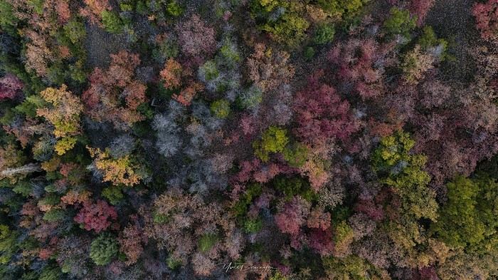
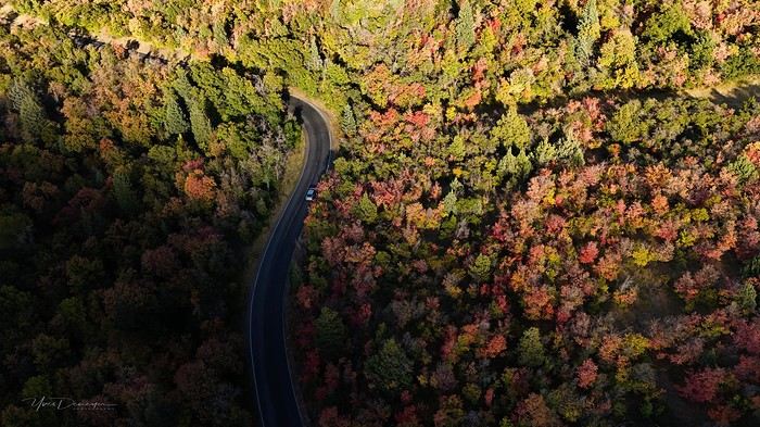
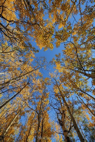
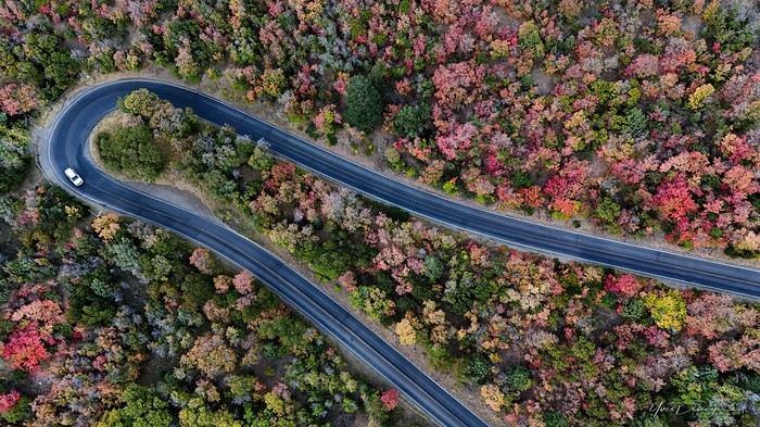
My last travel journal was from 2019, when I went hiking and backpacking with my son, who was 15 at the time. We visited some places that were still pretty unknown back then! I was supposed to go in April 2020, still solo, with arches as the main focus. I’d spent nearly two months getting physically prepared, and had managed to snag a bunch of permits for CBS, The Needles, and so on... Of course, it all got postponed—first to October 2020, then April 2021, then October 2021, and finally it happened in April 2022. Maybe I’ll write about that in another journal. The thing is, every time, I spend at least 6 to 8 weeks getting physically ready, even though I work out all year. Huge disappointment during that trip—so much had changed because of Covid, kind of like in the mountains back home. Overcrowding, not just in the national parks (we knew about that), but also in a lot of remote, lesser-known spots. Like the French, Americans realized they had a lot of beautiful places in their own country during those travel bans. And they kept exploring... Prices for pretty much everything had already gone up a lot. Gas, restaurants, cars, but especially lodging! Then, after dealing with so much wind in April, I got a little "fed up" with that time of year. It felt like I had strong winds and sandstorms for 3 out of the 3.5 weeks I was there...
So, the next trip was October 2023, to catch the partial eclipse in New Mexico, and of course, a bunch of arches ;). So many arches. Maybe I’ll write about that one too... Then came (among others) April 2024 for the total eclipse, in Texas, but starting from L.A., with my partner Valérie. Since I’d never visited some places I wanted to see further south of my usual loops, it was the perfect opportunity... And here we are at the end of September 2024. Another trip focused on arches—I never get tired of them. Every time I check one off my list, another gets added. Often it’s a photo I’ve seen online or in the NABS (Natural Arches and Bridges Society) magazine, which I’m a member of. I also scour the WAD (World Arches Database) and make a list of arches I want to visit. Fewer and fewer "viewpoints"—I’ve done all the most famous ones, and unless the sky is amazing, the photos all look the same. Since my goal is always photography *and* hiking, I’m always on the lookout. So this time, a packed itinerary—27 days, very busy. In past trips, if I didn’t plan enough and hiked fast, I’d end up with too many "gaps" in my days. This time, I’d rather have too much than too little (like in 2023, actually).
A few stats: - 6,589 km, including +/-1,400 km of off-road trails - 323 km of hiking, 8,829 m of elevation gain - 142 new arches for my collection, including some stunning ones, some less so, and some downright ugly—but all in the WAD. - Two outings with a Navajo guide - Almost no injuries - 8 bivouacs, including 2 backpacking trips - 4 days of backpacking - 22 freeze-dried meals and 15 Subways eaten - 6 thorns in my shoes (long live the tweezers in my backpack) - 3 kg lost (plus the 5 kg lost during prep)
Almost every day, I posted a little update on Facebook for family and friends. So I’ll be copy-pasting those texts here, written "my way" as usual. Some will like it, some won’t—that’s just how it is... 😏
For months, I planned this trip—looking for info, creating GPS tracks on Google Earth, exchanging tips with NABS members and other passionate friends. I snagged permits for The Needles again (4-5 days), for Fiery Furnace, timed entries for Arches National Park (2), and booked just one campsite, a "triple tour" in Monument Valley, and the first night in a motel. This is the first time I haven’t booked 80% of the motels—I was tired of having constraints because of the weather. This time, I want to be able to adjust my plans based on the weather and what I feel like doing more or less of. Camp when the weather’s nice, hotel/motel when it’s crappy.
Here we go...
Day 1
As usual, early morning flights: BRU-AMS, then AMS-SLC. Those who follow me know I’ve been renting a Rubicon from Rugged for years, which "forces" me to land in SLC. Up at 3:30 AM, but I’d been awake since 2:00 AM—the day’s going to be long. Shuttle to the airport. In Brussels, only two check-in counters open. I get there—no cabin baggage weigh-in, while the agent next to me is weighing everyone’s, even kids’ backpacks! A bit of luck, because as usual, if they weighed my backpack *and* my cabin bag, I’d already be over 20 kg. I check two hold bags, since I’ve got a lot of camping/backpacking gear, lots of freeze-dried meals, the backpacking bag, the Bear Canister needed for The Needles, etc. First flight is 30 minutes late, so the second one is already boarding. I’ve got the SSSS mark on my ticket (extra security check), so I head straight to the front when I arrive at the same time as Zone 3, even though I’m Zone 6. I pretend the check will take a while, and it "works"—they didn’t notice! No way I want to board last and risk them making me check my cabin bag. It’s packed with photo gear, laptop, drone, etc.—unthinkable to have to put it in the hold. Always a worry... SLC: baggage claim, customs, and out in 32 minutes. The MPC app makes something that was already quick even faster at this airport. And all the bags are there. That’s always a relief too. Since I drive at least 3 hours straight after landing, losing a hold bag would really mess up the trip and force me to spend the first night closer to SLC. On the way to Rugged. A young French couple from Reims is in the shuttle with me—they discovered Rugged thanks to my post in a Facebook group! Well, the team has changed again, and they lost half the stuff I’d left last October (plastic boxes, pillow, sugar, gas cartridges, folding chair, Crocs, etc.), but at least there are gas cartridges, so I don’t have to go to REI. REI would’ve been at least an hour out of my way. But as far as I know, there are no gas cartridges in Green River. I still get my tent stake hammer back, and a folding chair—different from mine but identical.
20,000 km Rubicon 4Xe, white. I check the tires—they’re in great shape, as requested. I’ll come back to the hybrid later. I didn’t want a hybrid, but that’s all they had this year. Why? Higher fuel consumption, smaller tank, higher cargo floor.
Stop at the Walmart near Provo, whose layout I know like the back of my hand (Walmarts are often similar). Start-of-trip shopping: water, Coke, Gatorade, UHT milk for cereal (not very common in the US), Special K "Almond and Vanilla", cold meds that work well (and don’t exist back home—you never know), two plastic bins, a pillow for the tent, Trail Mix, that’s about it. On the road to Nebo Loop for the fall colors. I’d driven this route last year, in the opposite direction on my way back to SLC, but it was a bit too late. This time, I’m a little early. At the start of the road, the maples are in the sun, so I go up to 2,200 m for the bright yellow aspens, then head back down. Mostly drone shots—no time to go for a walk. After a day like this, 4.5-5 hours of driving is already a lot... Arrived in Green River at 9:00 PM. Organize all the stuff from the bags properly, then sleep.
A few photos from these first few hours.
Which itinerary to choose for 15 days in the American West
Hi everyone!
First time for me in the States from March 24 to April 7, 2025—only 15 days, so choices have to be made. I want to explore part of the West, but obviously planning the route is the trickiest part, so here’s what I’ve come up with and where I have doubts:
-Leaving Paris for LA
1 or 2 nights to visit
-Heading to Vegas, where one couple would go by motorcycle (they’re fans and want the thrill of Route 66) and another by plane (I won’t linger here either—1 or 2 days max!)
Then, Lake Powell, Monument Valley, Grand Canyon, all by rental car for everyone, so the motorcycle gets returned in Vegas.
Now here’s where it gets tricky: either I continue the road trip through the big parks to finish in San Francisco (but it doesn’t seem like the best time—might be too cold), or I head down to San Diego for the return flight. But which itinerary? Kingman, Joshua Tree, Palm Springs, and San Diego—does that make sense? Is it better to go back to Vegas to take a plane or drive the whole way?
So many questions—your help and advice would be super welcome! Thanks in advance, Anne from Périgord Noir
Now here’s where it gets tricky: either I continue the road trip through the big parks to finish in San Francisco (but it doesn’t seem like the best time—might be too cold), or I head down to San Diego for the return flight. But which itinerary? Kingman, Joshua Tree, Palm Springs, and San Diego—does that make sense? Is it better to go back to Vegas to take a plane or drive the whole way?
So many questions—your help and advice would be super welcome! Thanks in advance, Anne from Périgord Noir
Mexique fin janvier 2021 English translation pending
Salut a tous,
j'ouvre ce topic car j’espère partir au Mexique du 23 Janvier 2021 au 13 Février 2021. Meme si je sais que rien n'est sur pour le moment, je me prépare tout de même.
- Ma première question est au niveau du climat. Je trouve un peu de tout sur le net, je préfère donc demander a ceux qui l'ont vécu. Fin Janvier et début Février, quelles températures fait-il a Mexico, Oaxaca et Mérida ?
- Je vais prendre des vols internes, notamment avec Aero Mexico et Viva Aerobus. Ces compagnies sont-elles fiables ?
- Je vais rester 7 jours complets a Mexico (-1 jour pour aller a Teotihuacan), donc 6 jours pleins, ça suffit pour cette grande capitale ? Que me conseillez-vous de voir de pas trop touristique ?
- Trouve-t-on des Uber partout au Mexique, ou seulement a Mexico ?
- Quels marchés locaux pourriez-vous me conseiller a Oaxaca et Mérida ?
J'aurais surement d'autres question au fil du temps, mais je pense que c'est déjà pas mal😎
Merci :)
j'ouvre ce topic car j’espère partir au Mexique du 23 Janvier 2021 au 13 Février 2021. Meme si je sais que rien n'est sur pour le moment, je me prépare tout de même.
- Ma première question est au niveau du climat. Je trouve un peu de tout sur le net, je préfère donc demander a ceux qui l'ont vécu. Fin Janvier et début Février, quelles températures fait-il a Mexico, Oaxaca et Mérida ?
- Je vais prendre des vols internes, notamment avec Aero Mexico et Viva Aerobus. Ces compagnies sont-elles fiables ?
- Je vais rester 7 jours complets a Mexico (-1 jour pour aller a Teotihuacan), donc 6 jours pleins, ça suffit pour cette grande capitale ? Que me conseillez-vous de voir de pas trop touristique ?
- Trouve-t-on des Uber partout au Mexique, ou seulement a Mexico ?
- Quels marchés locaux pourriez-vous me conseiller a Oaxaca et Mérida ?
J'aurais surement d'autres question au fil du temps, mais je pense que c'est déjà pas mal😎
Merci :)
Chorizo ou pas dans la paëlla? English translation pending
Tout fout le camp...
Chorizo ou pas ? Un illustre chef espagnol ravive le «paellagate»
(Mais moi j'en ai toujours mis... 😛 )
Plan de reprise des croisières Costa English translation pending
Bonjour
Voilà ce qui serait prévu à partir de la mi-août :
http://crew-center.com/costa-cruises-plans-re-start-voyages-7-ships-5-phases
Cordialement
Voilà ce qui serait prévu à partir de la mi-août :
http://crew-center.com/costa-cruises-plans-re-start-voyages-7-ships-5-phases
Cordialement
Brazil 2020: Amazon, Northeast, Chapada, and Boipeba – a winning combo!
Hello everyone.
Preamble:
Sooner or later, you’ve got to take the plunge! I thought lockdown would be the perfect time to start this travel journal, but between working from home and gardening, I just didn’t have the time (or the motivation). Plus, long-haul trips weren’t really on the cards back then... But then I stumbled upon my photos and thought, "I’ve got to share my latest adventure in Brazil—you guessed it!"
First, a little flashback: some of you (yes, really, in DMs!) pointed out the big gaps in my travel journals—India in 2019, Vietnam in 2018, so many missed opportunities!
Truth is, for India, I traveled with a private guide and honestly didn’t have much to add to the tons of well-documented journals already out there. Plus, I still haven’t decided if I love or hate India... So, how do you share your feelings when you’re not even sure yourself? As for Vietnam, I had plenty to say—even though the itinerary was pretty classic—but I’ll admit the vibe on this part of the forum at the time kinda put me off for a while... And time flies, and memories fade... Anyway, just wanted to clear that up for my (many or few) readers. *Tudo bem*, let’s get started!!
Preamble:
Sooner or later, you’ve got to take the plunge! I thought lockdown would be the perfect time to start this travel journal, but between working from home and gardening, I just didn’t have the time (or the motivation). Plus, long-haul trips weren’t really on the cards back then... But then I stumbled upon my photos and thought, "I’ve got to share my latest adventure in Brazil—you guessed it!"
First, a little flashback: some of you (yes, really, in DMs!) pointed out the big gaps in my travel journals—India in 2019, Vietnam in 2018, so many missed opportunities!
Truth is, for India, I traveled with a private guide and honestly didn’t have much to add to the tons of well-documented journals already out there. Plus, I still haven’t decided if I love or hate India... So, how do you share your feelings when you’re not even sure yourself? As for Vietnam, I had plenty to say—even though the itinerary was pretty classic—but I’ll admit the vibe on this part of the forum at the time kinda put me off for a while... And time flies, and memories fade... Anyway, just wanted to clear that up for my (many or few) readers. *Tudo bem*, let’s get started!!
Glacier/Yellowstone ou Toronto/Boston/Québec à la Toussaint 2021? English translation pending
Hello,
J'ai commencé à bosser sur 2 itinéraires pour la Toussaint 2021 (Environ du 07 au 31 octobre 2021, arrivée en France le 1/11).
Idéalement, je voudrais reprendre mon parcours annulé de juin 2020 (Dans les grandes lignes, arrivée à Seattle, Olympic NP > Glacier NP > Yellowstone NP > Black Hills > Badlands NP > Minneapolis).
Toutefois, en suivant celui-ci, j'arrive à Glacier le 18 octobre, Yellowstone entre le 21 et 24 octobre et les Black Hills le 28 octobre. J'ai pris l'option de faire le chemin en sens inverse, modifiant quelques étapes et j'arriverais dans mon 1er jet aux Black hills le 10 octobre, Yellowstone du 14 au 17 octobre et Glacier NP le 19 octobre. Cela me fait arriver plus tard sur la côte Pacifique mais je prends moins de risque pour la neige.
Pensez-vous qu'il soit inconscient d'organiser YS et Glacier à cette période? Yellowstone me semble encore plausible, les routes ne fermant (sauf une qui est déjà fermé cet été) que début novembre. Glacier est plus un point d'interrogation.
L'autre hypothèse est une région que nous n'avons jamais arpenté: Le Nord Est.
J'ai commencé à étudier dans les grandes lignes quelque chose qui ferait: Toronto > ?? > Boston > Salem > ?? > Acadia NP > Quebec > Montréal mais cela est complètement au stade de l'ébauche.
L'avantage à cette période est de pouvoir profiter du côté un peu kitch de Salem à cette période. Toutefois, bien que cela soit encore l'été indien, j'ai peur des températures et de la pluviométrie.... ce qui est assez stupide car on est sur les même latitudes que de l'autre côté.
Qu'en pensez vous?
Ps: Si vous avez des idées pour compléter le 2ème parcours, surtout la partie Québec ou Nouveau-Brunswick , je suis preneur!
J'ai commencé à bosser sur 2 itinéraires pour la Toussaint 2021 (Environ du 07 au 31 octobre 2021, arrivée en France le 1/11).
Idéalement, je voudrais reprendre mon parcours annulé de juin 2020 (Dans les grandes lignes, arrivée à Seattle, Olympic NP > Glacier NP > Yellowstone NP > Black Hills > Badlands NP > Minneapolis).
Toutefois, en suivant celui-ci, j'arrive à Glacier le 18 octobre, Yellowstone entre le 21 et 24 octobre et les Black Hills le 28 octobre. J'ai pris l'option de faire le chemin en sens inverse, modifiant quelques étapes et j'arriverais dans mon 1er jet aux Black hills le 10 octobre, Yellowstone du 14 au 17 octobre et Glacier NP le 19 octobre. Cela me fait arriver plus tard sur la côte Pacifique mais je prends moins de risque pour la neige.
Pensez-vous qu'il soit inconscient d'organiser YS et Glacier à cette période? Yellowstone me semble encore plausible, les routes ne fermant (sauf une qui est déjà fermé cet été) que début novembre. Glacier est plus un point d'interrogation.
L'autre hypothèse est une région que nous n'avons jamais arpenté: Le Nord Est.
J'ai commencé à étudier dans les grandes lignes quelque chose qui ferait: Toronto > ?? > Boston > Salem > ?? > Acadia NP > Quebec > Montréal mais cela est complètement au stade de l'ébauche.
L'avantage à cette période est de pouvoir profiter du côté un peu kitch de Salem à cette période. Toutefois, bien que cela soit encore l'été indien, j'ai peur des températures et de la pluviométrie.... ce qui est assez stupide car on est sur les même latitudes que de l'autre côté.
Qu'en pensez vous?
Ps: Si vous avez des idées pour compléter le 2ème parcours, surtout la partie Québec ou Nouveau-Brunswick , je suis preneur!
Le Tonkin, une région superbe et accueillante English translation pending
Bonjour à tous,
Voici venu le temps du confinement
et la publication de carnets de voyages d’antan.
J’entre dans la danse également et me voici venue vous conter un séjour de 17 jours dans le nord du Vietnam en décembre 2011.
Présentation rapide : nous partons en couple (nos fils de 4 et 3 ans sont confiés à leurs grands- parents). Habitués à voyager en mode autonome, sans réservations à l’avance et privilégiant la conduite d’un véhicule, nous devons changer nos habitudes en raison de l’interdiction faite aux étrangers de louer des véhicules. Nous décidons donc de faire appel aux services d’une agence locale pour nous permettre de visiter le nord du Vietnam à proximité de la frontière chinoise. Nous (enfin je 😇) ajoutons à ce programme la découverte de la région de Sapa, de Tam Coc (la baie d’Ha Long terrestre) et la baie d’Ha Long (avec une surprise pour mon mari). Peu férus des villes, nous visiterons un peu Hanoi le jour de notre arrivée et avant notre départ.
Jour 0 – dimanche 4 décembre
Après avoir fêté les 60 ans et trois jours de mon beau-père autour d’un déjeuner au restaurant, nous nous rendons en fin de journée à Roissy CDG pour un vol direct Paris – Hanoi sur Vietnam Airlines. Pas de souvenir particulier presque dix ans après ce vol 🙂
Jour 1 – lundi 5 décembre
Arrivée matinale à 6h40. J’étais passée par ACA Voyages pour obtenir une lettre d’invitation (24 $) pour nous permettre d’obtenir un visa d’entrée. Les formalités sont vite effectuées au guichet d'immigration (40 € pour nous deux). Après avoir effectué du change (500 euros contre 14 millions de dongs), nous prenons un taxi et nous rendons au Paramount Hotel & Travel, seul hôtel réservé à l’avance pour notre première nuit. Nous débutons notre journée par quelques démarches. Nous nous rendons dans les locaux de l’agence locale pour faire connaissance avec notre conseillère et régler le solde de la prestation. Direction ensuite la gare pour acheter des billets de train pour Tam Coc et Lao Cai. Aucun souci rencontré pour acheter les billets auprès d’un guichetier très aimable. L’après-midi est consacré à la visite d’Hanoi : le lac Hoan Kiem (le lac de l’Epée Restituée) et ses agréables berges.
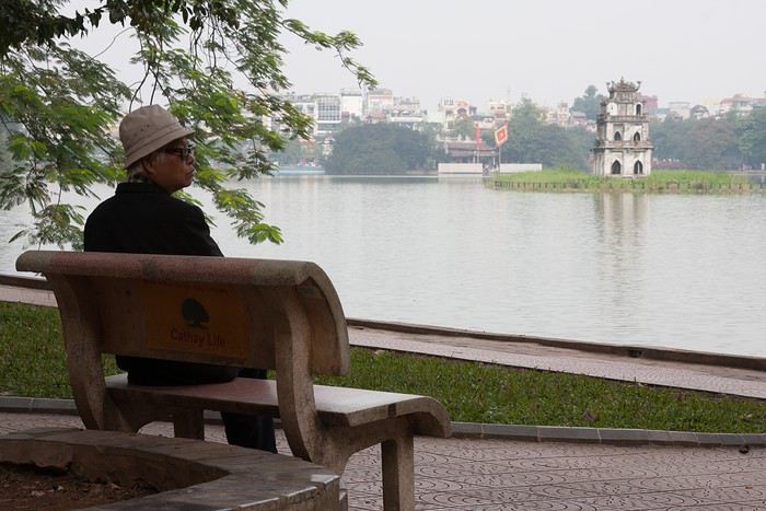
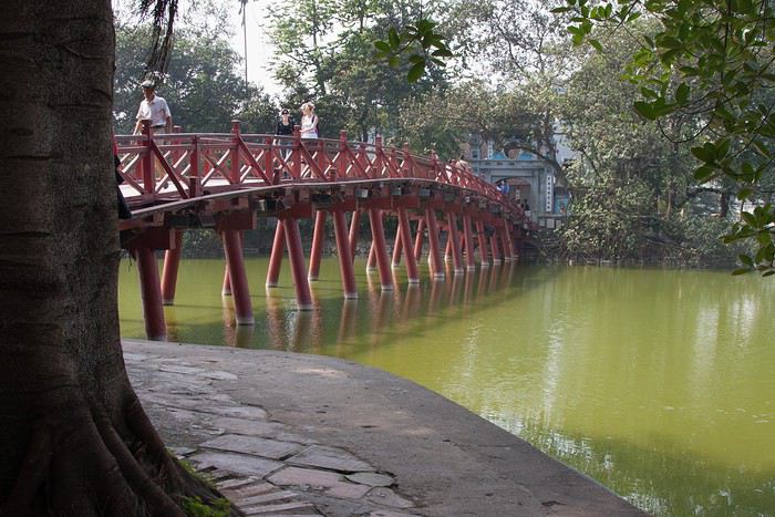
J’entre dans la danse également et me voici venue vous conter un séjour de 17 jours dans le nord du Vietnam en décembre 2011.
Présentation rapide : nous partons en couple (nos fils de 4 et 3 ans sont confiés à leurs grands- parents). Habitués à voyager en mode autonome, sans réservations à l’avance et privilégiant la conduite d’un véhicule, nous devons changer nos habitudes en raison de l’interdiction faite aux étrangers de louer des véhicules. Nous décidons donc de faire appel aux services d’une agence locale pour nous permettre de visiter le nord du Vietnam à proximité de la frontière chinoise. Nous (enfin je 😇) ajoutons à ce programme la découverte de la région de Sapa, de Tam Coc (la baie d’Ha Long terrestre) et la baie d’Ha Long (avec une surprise pour mon mari). Peu férus des villes, nous visiterons un peu Hanoi le jour de notre arrivée et avant notre départ.
Jour 0 – dimanche 4 décembre
Après avoir fêté les 60 ans et trois jours de mon beau-père autour d’un déjeuner au restaurant, nous nous rendons en fin de journée à Roissy CDG pour un vol direct Paris – Hanoi sur Vietnam Airlines. Pas de souvenir particulier presque dix ans après ce vol 🙂
Jour 1 – lundi 5 décembre
Arrivée matinale à 6h40. J’étais passée par ACA Voyages pour obtenir une lettre d’invitation (24 $) pour nous permettre d’obtenir un visa d’entrée. Les formalités sont vite effectuées au guichet d'immigration (40 € pour nous deux). Après avoir effectué du change (500 euros contre 14 millions de dongs), nous prenons un taxi et nous rendons au Paramount Hotel & Travel, seul hôtel réservé à l’avance pour notre première nuit. Nous débutons notre journée par quelques démarches. Nous nous rendons dans les locaux de l’agence locale pour faire connaissance avec notre conseillère et régler le solde de la prestation. Direction ensuite la gare pour acheter des billets de train pour Tam Coc et Lao Cai. Aucun souci rencontré pour acheter les billets auprès d’un guichetier très aimable. L’après-midi est consacré à la visite d’Hanoi : le lac Hoan Kiem (le lac de l’Epée Restituée) et ses agréables berges.
Je vous invite à découvrir l'île de Lanzarote English translation pending
INTRODUCTION
Des vidéos sont insérées tout au long du résumé. Veuillez cliquer sur l'image pour démarrer la vidéo.
En février dernier, nous avons séjourné 2 semaines sur l'île de Lanzarote afin d'en découvrir les différents attraits touristiques.
Comme la plupart de nos précédents voyages, plusieurs semaines ont été consacrées à la création de notre itinéraire afin de pouvoir être en mesure d'atteindre parfaitement nos objectifs.
Lors de notre séjour, nous avons utilisé l'application Maps.me, une application mobile qui fournit des cartes hors ligne. Cette application s'avère très précieuse lors de nos déplacements en voiture, en randonnée et même lors de nos circuits à pied dans les grandes villes.
J'avais préalablement téléchargé les coordonnées GPS de toutes les attractions prévues à notre itinéraire dans l'application Maps.me, ce qui a facilité grandement nos déplacements.
La réservation de l'hébergement ainsi que la location d'une voiture ont été effectuées sur le web avant notre départ.
Nous sommes partis de l'aéroport de Québec et avons eu une escale à Montréal ainsi qu'à Bruxelles en Belgique avant d'atteindre Lanzarote.
Lanzarote fait partie des Îles Canaries qui elles-mêmes sont situées dans l'océan Atlantique, à l'ouest du Maroc. Celles-ci font d'ailleurs partie de l'Espagne.
Nous avions déjà visité l'île de Tenerife et nous avions adoré notre séjour à cet endroit.
Nous avons donc décidé de poursuivre la découverte des Îles Canaries en nous rendant à Lanzarote car cette île offre un paysage volcanique spectaculaire, des plages à faire rêver ainsi que de magnifiques villages aux maisons typiques de l'île qui sont majoritairement blanches.
Les sentiers de randonnée sont nombreux et nous permettent de découvrir une grande diversité de paysages.
Les attraits touristiques sont également fort nombreux et facilement accessibles car les routes de Lanzarote se parcourent aisément en voiture car celles-ci sont dans un état impeccable.
D'ailleurs, c'est un pur plaisir que de se déplacer sur ces routes car les paysages qui défilent sous nos yeux sont sensationnels et présentent une perspective différente selon la lumière du jour.
Des vidéos sont insérées tout au long du résumé. Veuillez cliquer sur l'image pour démarrer la vidéo.
En février dernier, nous avons séjourné 2 semaines sur l'île de Lanzarote afin d'en découvrir les différents attraits touristiques.
Comme la plupart de nos précédents voyages, plusieurs semaines ont été consacrées à la création de notre itinéraire afin de pouvoir être en mesure d'atteindre parfaitement nos objectifs.
Lors de notre séjour, nous avons utilisé l'application Maps.me, une application mobile qui fournit des cartes hors ligne. Cette application s'avère très précieuse lors de nos déplacements en voiture, en randonnée et même lors de nos circuits à pied dans les grandes villes.
J'avais préalablement téléchargé les coordonnées GPS de toutes les attractions prévues à notre itinéraire dans l'application Maps.me, ce qui a facilité grandement nos déplacements.
La réservation de l'hébergement ainsi que la location d'une voiture ont été effectuées sur le web avant notre départ.
Nous sommes partis de l'aéroport de Québec et avons eu une escale à Montréal ainsi qu'à Bruxelles en Belgique avant d'atteindre Lanzarote.
Lanzarote fait partie des Îles Canaries qui elles-mêmes sont situées dans l'océan Atlantique, à l'ouest du Maroc. Celles-ci font d'ailleurs partie de l'Espagne.
Nous avions déjà visité l'île de Tenerife et nous avions adoré notre séjour à cet endroit.
Nous avons donc décidé de poursuivre la découverte des Îles Canaries en nous rendant à Lanzarote car cette île offre un paysage volcanique spectaculaire, des plages à faire rêver ainsi que de magnifiques villages aux maisons typiques de l'île qui sont majoritairement blanches.
Les sentiers de randonnée sont nombreux et nous permettent de découvrir une grande diversité de paysages.
Les attraits touristiques sont également fort nombreux et facilement accessibles car les routes de Lanzarote se parcourent aisément en voiture car celles-ci sont dans un état impeccable.
D'ailleurs, c'est un pur plaisir que de se déplacer sur ces routes car les paysages qui défilent sous nos yeux sont sensationnels et présentent une perspective différente selon la lumière du jour.
Porto Rico: 10 lieux à découvrir à San Juan English translation pending
Le temps d'une escale à San Juan de Porto Rico, j'ai récemment découvert quelques lieux parmi les plus intéressants à visiter dans la capitale de cette île du nord des Caraïbes.
Bienvenue à Puerto Rrrrrico ! A prononcer avec un accent chantant et en faisant rouler les « r » comme aiment tant le faire les habitants de l'île.
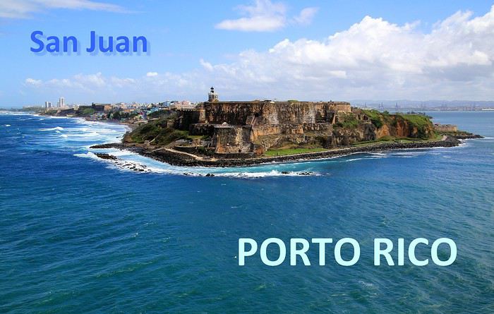
Abordées par la mer, les côtes portoricaines se dévoilent peu à peu … l'agglomération de San Juan est maintenant bien en vue. Des fortifications dominent la ville, sur un versant de falaise apparaît un quartier haut en couleurs, plus loin, on distingue dans la brume des plages et un alignement de buildings.

A mesure que l'on progresse dans la rade, c'est la vieille ville fondée par les conquistadors que l'on détaille du regard : une imbrication d'habitations et une imposante demeure blanche, celle des gouverneurs du territoire.

Voici 5 lieux au programme de nos visites, il en reste 5 autres à découvrir en suivant notre itinéraire d'une dizaine d'étapes dans cette agglomération de plus de deux millions d'habitants.
--
Viejo San Juan, le cœur historique de la ville
A placer en tête des visites à effectuer à San Juan de Porto Rico, celle de son Vieux quartier. Pour y apprécier notamment le charme de ses anciens monuments et de ses habitations au style colonial espagnol et pour y côtoyer également la décontraction de ses habitants au comportement très latino.
Il faut parcourir les rues de ce secteur historique, arpenter la rue SantoCristo ou Fortaleza, les plus fréquentées, les plus animées. Mais bien entendu, on ne doit pas hésiter à cheminer vers les petites rues de traverse, quitte à tomber sur une impasse ou à s'y égarer.

On y découvre des façades aux multiples couleurs, de belles décorations murales, des balcons et des ferronneries ouvragées. Un style inspiré par la lointaine Espagne, nous voilà plongés dans l'atmosphère coloniale du Nouveau Monde, celle des conquistadors des XVe au XVIe siècle.

Des maisons coloniales et des commerces longent les rues principales. Restaurants, bars, boutiques de souvenirs, galeries d'art et quelques magasins d'articles de luxe. Un exemple parmi d'autres avec au 202 de la RueSanto Cristo, une entrée par un porche qui dévoile une cour intérieure, un vrai patio qui ne détonnerait pas en Andalousie.

On continue la flânerie en battant le pavé du Viejo San Juan. Justement, au sujet de ces pavés, leur teinte bleutée étonne. On apprendra que ces pavés étaient utilisés comme ballast dans les cales des navires marchands à l'époque de la colonisation et que leurs reflets bleus satinés sont dus à l'usure du temps.

La façade inondée de lumière de la Cathédrale de San Juan domine de sa hauteur tout le quartier. Le premier édifice édifié ici date de 1521 mais il n'a pas résisté aux ouragans tropicaux fréquents sous ces latitudes. L'aspect actuel est plus récent, précisément de 1917.
Plus loin, notre déambulation nous mène de rue en rue, de la place ombragée de l'édifice catholique à la Place de l'Hôtel de ville. Là encore, la plupart des bâtiments témoignent du passé colonial de la ville les bâtisses restaurées dans le pure style de l'époque, il n'en manque pas dans le Viejo San Juan, on en compterait près de quatre cents.

A l'extrémité de la rue Fortaleza, on parvient à cette imposante maison blanche appelée aussi « Fortaleza ». Perchée sur les falaises, elle domine toute la baie de San Juan. Sur la photo, on ne voit qu'une partie seulement du bâtiment construit à partir de 1533. L'édifice rénovée depuis son origine a été utilisé à certaines périodes d'arsenal et de prison.
Une bâtisse où résident les Gouverneurs de l'île. Ainsi, ce sont quelques 170 Gouverneurs qui se sont succédé à la tête de cette colonie ultramarine.. L'île de Porto Rico s'honore d'être la première colonie espagnole du Nouveau Monde. Sur une des places de la ville trône la statue de l'illustre Ponce de Leon, un vaillant explorateur qui fut le premier Gouverneur de Porto Rico en 1509.

Après la guerre hispano-américaine, l'île est passée sous domination américaine, c'était en 1898. De nos jours Porto Rico a un statut particulier au sein des USA. Un État libre mais associé aux États-Unis. Les Porto Ricains ont la nationalité américaine mais ils ne votent pas pour les élections présidentielles des États-Unis. Le Gouverneur de l'île bénéficie d'une large autonomie de gestion de son territoire insulaire.
--
Les couleurs portoricaines
Là, il ne s'agit pas d'un lieu précis à voir mais plutôt d'une vision qui s'impose au regard lorsque l'on se balade dans les rues de San Juan. La ville est pavoisée presque à chaque coin de rue de drapeaux aux couleurs portoricaines.
Dans une des rues passantes de la vieille ville il y a même un immense drapeau qui concurrence le bleu du ciel. Immense, ce voile fait office de décor et tamise les chauds rayons du soleil tropical. Ce drapeau local avec ses teintes bleues, blanches et rouges n'est pas sans en évoquer un autre, celui de l'île sœur, la proche Cuba. En effet, le graphisme est identique entre les deux étendards mais les couleurs sont inversées. Triangle bleu et alternance de bandes horizontales blanches et rouges pour Porto Rico et tout l'inverse pour celui de Cuba (triangle rouge et bandes blanches et bleues). Une certaine harmonie donc mais dans la différence, une idée inspirée à l'origine par le parti révolutionnaire cubain. La signification de ces teintes ? Le bleu pour le ciel et la mer, le blanc évoque la paix et le rouge le sang versé pour la patrie.
--
La Perla, un quartier populaire haut en couleur
Une vraie mosaïque aux teintes éclatantes, ce quartier de « La Perla » accroché aux falaises qui font face à l'océan. Il vaut assurément le coup d’œil et même un peu plus.
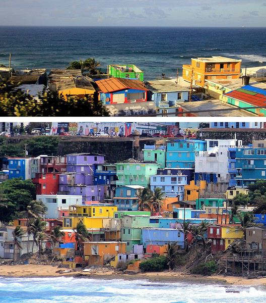
La meilleure vision est celle que l'on a depuis la mer, d'ailleurs on en avait bénéficié en arrivant depuis le large. A présent, nous longeons ce quartier ouvrier en parcourant la route de la corniche. Quel bric-à-brac avec ses modestes maisons dont certaines sont en piteux états … mais les couleurs sont là, tentant d'égayer à grand renfort de coups de pinceaux. La misère semble plus belle en technicolor. Tenez, là ! une façade est parée des couleurs de l'étendard portoricain, une tradition sur cette île.
Longtemps ce quartier populaire de San Juan a eu une mauvaise réputation : trafic de drogue et insécurité … autant dire que les visiteurs évitaient de s'y aventurer. Mais depuis 2017 la situation a changé, beaucoup de touristes vont y faire un tour et pas seulement pour sa palette de couleurs vives. Connaissez-vous Luis Fonsi ? Et la musique entêtante de son titre phare, « Despacito * » ? Ce chanteur portoricain a tourné son clip dans les ruelles de La Perla, aussi, des amateurs de ce morceau très « caliente », véritable hymne à la séduction latino, sont attirés ici. Ce clip de janvier 2017 a été un tube mondial et serait même le plus « streamé » de l'histoire !
--
Imposantes et dissuasives forteresses
Après la visite de la vielle ville, il faut en faire le tour, on pourrait presque parler de balade sur un long chemin de ronde tellement la périphérie du quartier est protégée de fortifications et de murailles. Les conquistadors savaient que leur colonie était convoitée, ils ont fait en sorte de bien la préserver. Quelques mots d'histoire à ce sujet. En 1595, ce sont les troupes de la marine anglaise qui attaquent, sans succès ! Puis c'est au tour des Hollandais en 1625 de tenter la prise de San Juan, ils réussirent à accéder à une partie de la cité mais furent repoussés par des Espagnols, ardents défenseurs de leur possession. En 1797, un nouvel assaut des Britanniques et un nouvel échec. Mais face aux bombardements américains de 1898, les militaires espagnols ont cette fois capitulés … San Juan et l'île de Porto Rico passèrent ainsi sous domination des États-Unis.
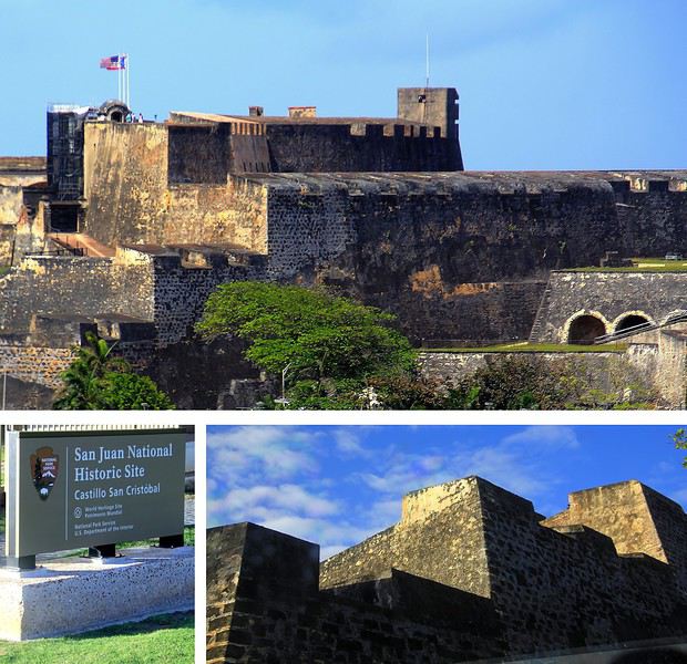
La route sur la corniche nord fait passer au pied d'imposantes murailles. Voici le Fort San Cristobal, une forteresse qui avait de bons atouts pour dissuader toutes attaques étrangères. Construit à partir de 1634, ce massif château fort fait honneur évidemment au célébrissime explorateur Christophe Colomb. Perché sur une colline, il domine l'ensemble de la ville, les falaises et surtout l'océan. Depuis le large, les éventuels assaillants l'apercevaient ainsi de très loin, aussi ils comprenaient vite ce a quoi il devaient s'attendre !
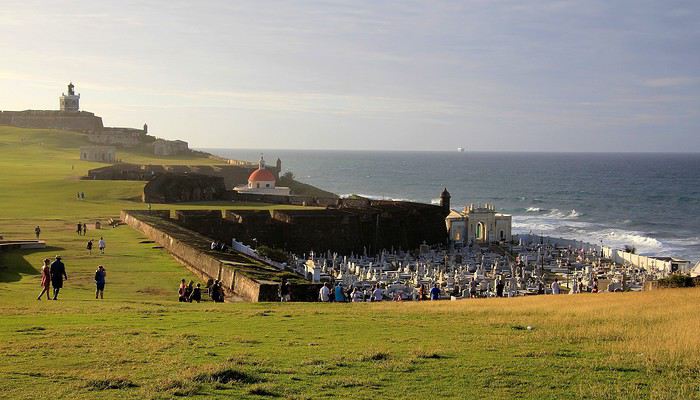
Tout au bout de la corniche, juché sur un promontoire rocheux on voit maintenant plein cadre le Fort San Felipe del Morro. Cette autre forteresse est idéalement située à l'entrée de la rade. Sa construction est antérieure à celle du Fort San Cristobal elle a débuté en 1539. A cette époque, il était facile de trouver de la main-d’œuvre … on parle de centaines d'esclaves enrôlés dans ces gigantesques travaux ! Un fort, un phare et à proximité une église et son cimetière au nom à rallonge : Santa Maria Magdalena de Pazzis. Un cimetière avec vue privilégié sur l'horizon marin, dommage que les morts qui y reposent en paix ne puissent en profiter ! L'impression de puissance que dégage le château amplement fortifié par ses murailles est contrebalancée par la douceur de la luminosité et par cette étendue verdoyante. La colline couverte d'herbe fait penser à un green de golf. On ne peut pas mieux dire … en effet, plus tard, lorsque ce lieu défensif a été investi par les troupes américaines, sur ces pelouses un terrain de golf a été aménagé pour les loisirs des soldats US !
Abordées par la mer, les côtes portoricaines se dévoilent peu à peu … l'agglomération de San Juan est maintenant bien en vue. Des fortifications dominent la ville, sur un versant de falaise apparaît un quartier haut en couleurs, plus loin, on distingue dans la brume des plages et un alignement de buildings.
A mesure que l'on progresse dans la rade, c'est la vieille ville fondée par les conquistadors que l'on détaille du regard : une imbrication d'habitations et une imposante demeure blanche, celle des gouverneurs du territoire.
Voici 5 lieux au programme de nos visites, il en reste 5 autres à découvrir en suivant notre itinéraire d'une dizaine d'étapes dans cette agglomération de plus de deux millions d'habitants.
--
Viejo San Juan, le cœur historique de la ville
A placer en tête des visites à effectuer à San Juan de Porto Rico, celle de son Vieux quartier. Pour y apprécier notamment le charme de ses anciens monuments et de ses habitations au style colonial espagnol et pour y côtoyer également la décontraction de ses habitants au comportement très latino.
Il faut parcourir les rues de ce secteur historique, arpenter la rue SantoCristo ou Fortaleza, les plus fréquentées, les plus animées. Mais bien entendu, on ne doit pas hésiter à cheminer vers les petites rues de traverse, quitte à tomber sur une impasse ou à s'y égarer.
On y découvre des façades aux multiples couleurs, de belles décorations murales, des balcons et des ferronneries ouvragées. Un style inspiré par la lointaine Espagne, nous voilà plongés dans l'atmosphère coloniale du Nouveau Monde, celle des conquistadors des XVe au XVIe siècle.
Des maisons coloniales et des commerces longent les rues principales. Restaurants, bars, boutiques de souvenirs, galeries d'art et quelques magasins d'articles de luxe. Un exemple parmi d'autres avec au 202 de la RueSanto Cristo, une entrée par un porche qui dévoile une cour intérieure, un vrai patio qui ne détonnerait pas en Andalousie.
On continue la flânerie en battant le pavé du Viejo San Juan. Justement, au sujet de ces pavés, leur teinte bleutée étonne. On apprendra que ces pavés étaient utilisés comme ballast dans les cales des navires marchands à l'époque de la colonisation et que leurs reflets bleus satinés sont dus à l'usure du temps.
La façade inondée de lumière de la Cathédrale de San Juan domine de sa hauteur tout le quartier. Le premier édifice édifié ici date de 1521 mais il n'a pas résisté aux ouragans tropicaux fréquents sous ces latitudes. L'aspect actuel est plus récent, précisément de 1917.
Plus loin, notre déambulation nous mène de rue en rue, de la place ombragée de l'édifice catholique à la Place de l'Hôtel de ville. Là encore, la plupart des bâtiments témoignent du passé colonial de la ville les bâtisses restaurées dans le pure style de l'époque, il n'en manque pas dans le Viejo San Juan, on en compterait près de quatre cents.
A l'extrémité de la rue Fortaleza, on parvient à cette imposante maison blanche appelée aussi « Fortaleza ». Perchée sur les falaises, elle domine toute la baie de San Juan. Sur la photo, on ne voit qu'une partie seulement du bâtiment construit à partir de 1533. L'édifice rénovée depuis son origine a été utilisé à certaines périodes d'arsenal et de prison.
Une bâtisse où résident les Gouverneurs de l'île. Ainsi, ce sont quelques 170 Gouverneurs qui se sont succédé à la tête de cette colonie ultramarine.. L'île de Porto Rico s'honore d'être la première colonie espagnole du Nouveau Monde. Sur une des places de la ville trône la statue de l'illustre Ponce de Leon, un vaillant explorateur qui fut le premier Gouverneur de Porto Rico en 1509.
Après la guerre hispano-américaine, l'île est passée sous domination américaine, c'était en 1898. De nos jours Porto Rico a un statut particulier au sein des USA. Un État libre mais associé aux États-Unis. Les Porto Ricains ont la nationalité américaine mais ils ne votent pas pour les élections présidentielles des États-Unis. Le Gouverneur de l'île bénéficie d'une large autonomie de gestion de son territoire insulaire.
--
Les couleurs portoricaines
Là, il ne s'agit pas d'un lieu précis à voir mais plutôt d'une vision qui s'impose au regard lorsque l'on se balade dans les rues de San Juan. La ville est pavoisée presque à chaque coin de rue de drapeaux aux couleurs portoricaines.
Dans une des rues passantes de la vieille ville il y a même un immense drapeau qui concurrence le bleu du ciel. Immense, ce voile fait office de décor et tamise les chauds rayons du soleil tropical. Ce drapeau local avec ses teintes bleues, blanches et rouges n'est pas sans en évoquer un autre, celui de l'île sœur, la proche Cuba. En effet, le graphisme est identique entre les deux étendards mais les couleurs sont inversées. Triangle bleu et alternance de bandes horizontales blanches et rouges pour Porto Rico et tout l'inverse pour celui de Cuba (triangle rouge et bandes blanches et bleues). Une certaine harmonie donc mais dans la différence, une idée inspirée à l'origine par le parti révolutionnaire cubain. La signification de ces teintes ? Le bleu pour le ciel et la mer, le blanc évoque la paix et le rouge le sang versé pour la patrie.
--
La Perla, un quartier populaire haut en couleur
Une vraie mosaïque aux teintes éclatantes, ce quartier de « La Perla » accroché aux falaises qui font face à l'océan. Il vaut assurément le coup d’œil et même un peu plus.
La meilleure vision est celle que l'on a depuis la mer, d'ailleurs on en avait bénéficié en arrivant depuis le large. A présent, nous longeons ce quartier ouvrier en parcourant la route de la corniche. Quel bric-à-brac avec ses modestes maisons dont certaines sont en piteux états … mais les couleurs sont là, tentant d'égayer à grand renfort de coups de pinceaux. La misère semble plus belle en technicolor. Tenez, là ! une façade est parée des couleurs de l'étendard portoricain, une tradition sur cette île.
Longtemps ce quartier populaire de San Juan a eu une mauvaise réputation : trafic de drogue et insécurité … autant dire que les visiteurs évitaient de s'y aventurer. Mais depuis 2017 la situation a changé, beaucoup de touristes vont y faire un tour et pas seulement pour sa palette de couleurs vives. Connaissez-vous Luis Fonsi ? Et la musique entêtante de son titre phare, « Despacito * » ? Ce chanteur portoricain a tourné son clip dans les ruelles de La Perla, aussi, des amateurs de ce morceau très « caliente », véritable hymne à la séduction latino, sont attirés ici. Ce clip de janvier 2017 a été un tube mondial et serait même le plus « streamé » de l'histoire !
--
Imposantes et dissuasives forteresses
Après la visite de la vielle ville, il faut en faire le tour, on pourrait presque parler de balade sur un long chemin de ronde tellement la périphérie du quartier est protégée de fortifications et de murailles. Les conquistadors savaient que leur colonie était convoitée, ils ont fait en sorte de bien la préserver. Quelques mots d'histoire à ce sujet. En 1595, ce sont les troupes de la marine anglaise qui attaquent, sans succès ! Puis c'est au tour des Hollandais en 1625 de tenter la prise de San Juan, ils réussirent à accéder à une partie de la cité mais furent repoussés par des Espagnols, ardents défenseurs de leur possession. En 1797, un nouvel assaut des Britanniques et un nouvel échec. Mais face aux bombardements américains de 1898, les militaires espagnols ont cette fois capitulés … San Juan et l'île de Porto Rico passèrent ainsi sous domination des États-Unis.
La route sur la corniche nord fait passer au pied d'imposantes murailles. Voici le Fort San Cristobal, une forteresse qui avait de bons atouts pour dissuader toutes attaques étrangères. Construit à partir de 1634, ce massif château fort fait honneur évidemment au célébrissime explorateur Christophe Colomb. Perché sur une colline, il domine l'ensemble de la ville, les falaises et surtout l'océan. Depuis le large, les éventuels assaillants l'apercevaient ainsi de très loin, aussi ils comprenaient vite ce a quoi il devaient s'attendre !
Tout au bout de la corniche, juché sur un promontoire rocheux on voit maintenant plein cadre le Fort San Felipe del Morro. Cette autre forteresse est idéalement située à l'entrée de la rade. Sa construction est antérieure à celle du Fort San Cristobal elle a débuté en 1539. A cette époque, il était facile de trouver de la main-d’œuvre … on parle de centaines d'esclaves enrôlés dans ces gigantesques travaux ! Un fort, un phare et à proximité une église et son cimetière au nom à rallonge : Santa Maria Magdalena de Pazzis. Un cimetière avec vue privilégié sur l'horizon marin, dommage que les morts qui y reposent en paix ne puissent en profiter ! L'impression de puissance que dégage le château amplement fortifié par ses murailles est contrebalancée par la douceur de la luminosité et par cette étendue verdoyante. La colline couverte d'herbe fait penser à un green de golf. On ne peut pas mieux dire … en effet, plus tard, lorsque ce lieu défensif a été investi par les troupes américaines, sur ces pelouses un terrain de golf a été aménagé pour les loisirs des soldats US !
Été 1985 : un voyage de noces hors du commun dans la Chine pop English translation pending
Deuxième séjour à Pékin en 2018, je discute à l'auberge avec une voyageuse :
"Pékin ! Ici on vit vraiment dans un autre monde."
"Peut-être, mais alors que dire du Pékin des années 80. Une autre planète !"
Ceux qui découvrent cette Chine du 21° siècle ne retrouveront guère que des fragments de celle que je vais raconter ici, comme j'ai pu le constater par moi-même. (Voir mes carnets sur la route de la soie.)
Ce sera donc un carnet "impressions de Chine", ce qui m'est resté de plus marquant. Les quelques photos jaunies que j'ai pu sauver sont scannées et de mauvaise qualité. Merci à Jacqueline et Jean-Pierre pour leur contribution photographique, entièrement d'époque elle aussi.
AU MENU
Préambule - le contexte politique et économique du pays Chapitre 1 - Un voyage qui s'annonce pas très romantique, c'était prévu... Chapitre 2 - Pékin : le trafic de monnaie. Illégal mais indispensable. Chapitre 3 - Pékin 1985-2018 : du Moyen-Age à la révolution technologique. Immersion comparative. Chapitre 4 - Pékin : un billet de train pour Xi'an ? Pas si simple que ça. Chapitre 5 - Le "qi feng shui". Le soigneur se fait soigner. Chapitre 6 - Xi'an : «mei yo», la réponse favorite des fonctionnaires. Chapitre 7 - Vol au-dessus de la jungle. Le coucou arrivera-t-il à bon port ? Chapitre 8 - Chongqing : le bal, ou la vie sexuelle des jeunes chinois. Chapitre 9 - Croisière pop sur le Yangtse. Chapitre 10 - L'hôtel à rats. C'est à Wuhan, comme par hasard. Chapitre 11 - Canton : à la recherche de xiao Wu. Chapitre 12 - Canton : un train sous haute surveillance. Chapitre 13 - Hong Kong : dur retour à la civilisation. Albums : les photos d'époque signées Jacqueline et Jean-Pierre. A partir de la page 5 Témoignages et photos d'époque. Merci aux différents contributeurs. A partir de la page 6. Ne manquez pas le Tibet et le Xinjiang !
PREAMBULE : le contexte politique et économique Comment voyager dans ce pays encore très fermé, obscur, énigmatique, dont en Europe on ne connaît guère la mentalité, les règles de fonctionnement, dont on ne perçoit à l'étranger que quelques images soigneusement filtrées par la censure. Comment se déplacer, se loger, se nourrir, sans moyen de communication, sans réservation d'hôtel ou de train, sans connaître la langue , sans aide, sans guide, sans assistance, sans carte bleue...
1984, date clé pour le voyageur Après trente années de communisme à marche forcée, de campagnes idéologiques calamiteuses pour les populations, de luttes intestines pour le pouvoir, le pays n'arrive pas à décoller économiquement. L'écart grandit avec les nations développées. Mais avec le rétablissement des relations diplomatiques avec les Etats Unis en 1979, le nouveau président, Deng Xiaoping, tient enfin sa revanche et entame sa longue marche vers le progrès. Les fossiles maoïstes de la "longue marche", des "cent fleurs", du "grand bond en avant", les criminels de la "grande révolution culturelle prolétarienne", représentés par la "bande des quatre", tous ceux qui l'avaient évincé du pouvoir et condamné à l'oubli au fin fond d'une province, le sont à leur tour.
Le "révisionniste", comme l'a appelé la veuve Mao, lance ses réformes de libéralisation et d'ouverture de l'économie : « Peu importe qu'un chat soit blanc ou noir, l'essentiel est qu'il attrape les souris ! » Parole du maître.
Parmi ces réformes : l'ouverture au tourisme. Jusqu'à présent, pour visiter le pays, il fallait obligatoirement, soit passer par un tour opérateur avec guide et circuit programmé, soit demander des autorisations de voyage pour un nombre limité de destinations. Très peu pour moi. Mais en 1984, monsieur Deng supprime le permis de circuler et ouvre quasiment tout le pays aux visiteurs. L'info provoque un déclic : - C'est l'occasion ou jamais. L'année prochaine, ce sera la Chine. Et en sac à dos! Et ce sera aussi notre voyage de noces...
Nous aurons le privilège d'être parmi les premiers voyageurs occidentaux à tenter l'aventure. Je pourrai enfin mettre en pratique ce que j'ai appris de chinois à la fac et réaliser un vieux rêve. A nous la Chine, à nous la découverte de ce pays mystérieux et fascinant. Quelle réalité se cache derrière ces images édulcorées de bonheur populaire que nous distillent les images officielles ? Comment vit-on réellement dans ce pays ? Quel accueil réserve-t-on aux impérialistes occidentaux ?

Wuhan, 1985 : slogans révolutionnaires pour mini gardes rouges
CHAPITRE 1 : un voyage qui s'annonce pas très romantique, c'était prévu... Eh oui, juste mariés, il y a peut-être plus glamour comme destination. Bon, Venise, on connaît déjà. Quoi de mieux qu'une telle aventure pour forger un couple ? Pendant toute l'année, je peaufine le projet : itinéraire, transports, hébergements... Les guides de voyage sur la Chine ne sont pas nombreux, il n'en existe d'ailleurs qu'un en français. Pour ce qui est de l'itinéraire, c'est à peu près établi, pour le reste, ce sera au coup par coup, improvisation et opportunités. L'aventure quoi. Juste qu'on dispose d'un mois entre l'atterrissage et le retour à Hong-Kong. Pour l'itinéraire, ce sera donc Pékin - Hong Kong, mais par où et comment ? C'est le grand mystère, même si certains incontournables sont au programme : la Grande Muraille, Xi'an et son armée en terre cuite, la croisière sur le Yang Tse Kiang...
Août 1985 : Hong Kong, premiers pas en extrême-orient Munis d'un joli visa sur notre passeport et d'un billet d'avion Hong Kong - Pékin acheté en agence en France, nous débarquons à Hong Kong pour y passer une nuit avant de repartir pour Pékin le lendemain, L'atterrissage au-dessus de la ville est spectaculaire, l'avion louvoie entre les immeubles pour plonger vers la piste au raz de l'océan, un véritable tour de manège à sensations. Pas trop le temps d'explorer la ville, mais le dépaysement est déjà total. Et pourtant, ce n'est rien à côté de ce qui nous attend...
Ca commence plutôt mal Aéroport de Hong Kong, le lendemain. Nos billets sont valables, pas de problème, seulement : - Désolé, mais vous n'avez pas confirmé votre vol, l'avion est complet. Il va falloir attendre deux ou trois jours... Eh oui, en 1985, il faut confirmer son vol la veille par téléphone. Dans l'excitation et l'émotion, nous avions complètement oublié la consigne. Zut alors, deux ou trois jours de perdus sur le projet, c'est beaucoup trop. - Attendez ici, peut-être il y aura des places si des voyageurs ne se présentent pas. Longue attente plutôt anxieuse, et quelques minutes avant le décollage, petit signe de l'employé : - C'est bon, il reste deux places, vous pouvez partir.
Pékin : avenue Xidan. Photo : Jacqueline et Jean-Pierre
Dès l'aéroport, j'ai senti le choc... Une simple piste en béton, pas d'avion en attente, un trafic aérien quasi nul, un bâtiment à la chinoise, usé et vieillot à souhait, des gardes en uniforme. L'aéroport est encore une base militaire, accessoirement civile pour quelques rares liaisons vers l'URSS et les pays d'Asie. Il n'y a rien dans ce qui fait office de hall d'accueil, une pièce de quelques dizaines de mètres carré tout au plus.
Contrôles minutieux, file d'attente, les militaires ne sont pas très souriants, et le comité d'accueil pas très... accueillant. On n'est pas là pour rigoler, surtout avec ces étrangers qui débarquent de Hong Kong, la zone capitaliste. Eh oui, Hong Kong chinois, ce sera dans une dizaine d'années. D'ici là...
Des billets de Monopoly ?! Un simple bureau dans un recoin fait office de banque. Vite, changer nos travelers chèques en dollars. Ben oui, la carte bleue, ça n'existe pas encore. Derrière son boulier, l'employé fait ses calculs à une vitesse incroyable et me rend le change. Surprise : j'ai une liasse de jolis billets tout neufs dans la main, mais ils n'ont rien à voir avec la monnaie locale. La preuve, il n'y a pas le portrait du grand timonier, mais des jolis dessins de monuments et paysages ! Ca ressemble davantage à des billets de Monopoly.
C'est quoi ce truc ?
Une bonne affaire, mais un gros risque En fait, c'est une monnaie spéciale réservée aux étrangers. Nous allons vite apprendre deux choses. - Un, cette monnaie n'est pas utilisée (et même interdite) par les chinois dans leur vie quotidienne. Elle est réservée aux étrangers et ils doivent payer avec. - Deux, elle est très recherchée par quelques autochtones, car c'est la seule monnaie ayant un équivalent dollar. A l'époque, le yuan chinois ne vaut absolument rien, il n'est pas convertible dans une autre monnaie. Pire que le kopeck. Du coup, notre monnaie "spécial étrangers" fait l'objet d'un trafic formellement interdit et sévèrement réprimé par les autorités.
Mais comment faire si tu veux voyager en dehors des circuits touristiques et des grands hôtels, juste prendre le bus par exemple ou manger dans une gargote. Ca, les autorités n'en ont cure. Un étranger, ça dort dans les hôtels de luxe, ça prend l'avion ou le train en première classe, ça mange dans les grands restaurants. Mieux encore, ça voyage en groupe avec un guide.
Pas d'autre solution, il faudra changer au black Dans la rue, avec les petits trafiquants locaux. Il y a même un cours « officiel » du change : un yuan de Monopoly contre trois yuans de monnaie populaire. A l'époque, un yuan, c'est à peu près un franc. Une sacrée bonne affaire ! Le tout, c'est de ne pas se faire pincer. Les rumeurs les plus folles courent sur les peines encourues pour les trafiquants, mais aussi pour les étrangers qui se font pincer. C'est d'ailleurs marqué sur certains documents. Si les peines de prison ferme ont de quoi dissuader le voyageur, il faudra quand même prendre le risque, pas le choix. Une des nombreuses absurdités du système.
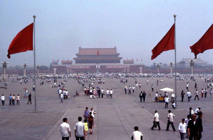
Pékin : place Tian An Men. Photo : Jacqueline et Jean-Pierre
Mise à l'épreuve 1 : trouver un hébergement... Sortie de l'aéroport, c'est l'après-midi. Quelques taxis attendent, réservés aux privilégiés du régime et aux étrangers. Mais nous ne savons même pas où nous allons, juste en ville, et on verra après. Donc ce sera le bus, celui-ci prend la monnaie de Monopoly. C'est notre premier transport en commun, direction le centre ville, à une vingtaine de kilomètres. Très bien, mais où aller, à qui demander un tuyau, un renseignement, une bonne adresse ?
L'aéroport étant en rase campagne, la route bordée d'arbres qui conduit à Pékin centre ressemble à une de nos départementales. De part et d'autres, c'est le défilé des paysans, le plus souvent à pied, tirant des charrettes à bras, quelques fois à bicyclette ou en tracteur. Pour nous occidentaux déjà rodés aux autoroutes, c'est un choc. Ici, pas de voiture individuelle : les véhicules à moteur, c'est juste des camions, quelques bus et de rares taxi, c'est tout .
La carte de Pékin n'indique rien d'autre que le nom des rues, impossible de savoir où se trouve tel service, hôtel, restaurant... Il faut se débrouiller. Les quelques éléments écrits et oraux de chinois que je possède, je vais vite devoir les mettre à l'épreuve. L'anglais ici, on connaît pas.
Juste à côté de nous est assise une jeune femme, bien de sa personne, sans doute un cadre du parti ou d'une grande entreprise. Elle semble plus amène que les autres voyageurs, plus disposée à rendre service. J'entame la conversation comme je peux. Après les échanges d'usage : - Nous sommes français, c'est notre premier voyage en Chine. Connaissez-vous un hôtel sur le trajet du bus qui nous accepterait ? Coup de chance, la femme nous en indique un non loin d'un arrêt, elle nous dira quand il faudra descendre.
Mise à l'épreuve 2 : et qui accepte les étrangers... L'hôtel n'est pas facile à trouver, tout se ressemble ici et rien ne permet de discerner au premier coup d'oeil la fonction d'un bâtiment. Ce n'est même pas écrit « hôtel » à l'entrée. Finalement nous poussons la porte de ce qui semble être ce que nous cherchons. Un étroit couloir sombre, un guichet, une sorte de réception, on dirait un peu un hôtel. Le type de l'accueil est très surpris de nous voir ici, mais oui, c'est bien un hôtel, sauf que : - C'est interdit aux étrangers, vous ne devez pas rester ici ! - Mais comment faire alors ? Le type décroche son téléphone, puis, au bout d'un moment : - Prenez le bus et descendez à cet arrêt, vous y trouverez un hôtel pour vous.
C'est ainsi que nous découvrons que nous ne pourrons pas loger comme on veut dans le pays. La plupart des hôtels sont interdits aux étrangers, il faut toujours aller à l'hôtel spécial « wai guo ren». Oui, mais ce n'est pas forcément indiqué. Quant à dormir chez l'habitant, ce n'est même pas la peine d'y songer, c'est interdit. De plus, quand on voit dans quoi vivent les gens en ville, le peu d'espace dont ils disposent, ça ne donne pas vraiment envie de se faire inviter.
Je ne me souviens plus comment nous avons fait pour trouver le bon bus et le bon arrêt, juste que ça n'a pas été facile du tout. La contrôleuse du bus a tiré une drôle de tronche quand je lui ai tendu le billet de Monoploy, mais elle n'avait pas le choix. Un mao le ticket, dix centimes de franc. Premier aperçu du coup de la vie : trois fois rien. Dans le bus, tous les regards sont fixés sur nous...
Pas de doute, il faut absolument trouver de la monnaie locale, et le plus vite possible. On ne va rien pouvoir faire avec cette monnaie de m... Et quand par hasard ils sont acceptés, on y perd sacrément au change, car ils nous rendent l'argent en monnaie locale. C'est une arnaque gouvernementale bien calculée !
Prochain épisode : le trafic de monnaie
Ce sera donc un carnet "impressions de Chine", ce qui m'est resté de plus marquant. Les quelques photos jaunies que j'ai pu sauver sont scannées et de mauvaise qualité. Merci à Jacqueline et Jean-Pierre pour leur contribution photographique, entièrement d'époque elle aussi.
AU MENU
Préambule - le contexte politique et économique du pays Chapitre 1 - Un voyage qui s'annonce pas très romantique, c'était prévu... Chapitre 2 - Pékin : le trafic de monnaie. Illégal mais indispensable. Chapitre 3 - Pékin 1985-2018 : du Moyen-Age à la révolution technologique. Immersion comparative. Chapitre 4 - Pékin : un billet de train pour Xi'an ? Pas si simple que ça. Chapitre 5 - Le "qi feng shui". Le soigneur se fait soigner. Chapitre 6 - Xi'an : «mei yo», la réponse favorite des fonctionnaires. Chapitre 7 - Vol au-dessus de la jungle. Le coucou arrivera-t-il à bon port ? Chapitre 8 - Chongqing : le bal, ou la vie sexuelle des jeunes chinois. Chapitre 9 - Croisière pop sur le Yangtse. Chapitre 10 - L'hôtel à rats. C'est à Wuhan, comme par hasard. Chapitre 11 - Canton : à la recherche de xiao Wu. Chapitre 12 - Canton : un train sous haute surveillance. Chapitre 13 - Hong Kong : dur retour à la civilisation. Albums : les photos d'époque signées Jacqueline et Jean-Pierre. A partir de la page 5 Témoignages et photos d'époque. Merci aux différents contributeurs. A partir de la page 6. Ne manquez pas le Tibet et le Xinjiang !
PREAMBULE : le contexte politique et économique Comment voyager dans ce pays encore très fermé, obscur, énigmatique, dont en Europe on ne connaît guère la mentalité, les règles de fonctionnement, dont on ne perçoit à l'étranger que quelques images soigneusement filtrées par la censure. Comment se déplacer, se loger, se nourrir, sans moyen de communication, sans réservation d'hôtel ou de train, sans connaître la langue , sans aide, sans guide, sans assistance, sans carte bleue...
1984, date clé pour le voyageur Après trente années de communisme à marche forcée, de campagnes idéologiques calamiteuses pour les populations, de luttes intestines pour le pouvoir, le pays n'arrive pas à décoller économiquement. L'écart grandit avec les nations développées. Mais avec le rétablissement des relations diplomatiques avec les Etats Unis en 1979, le nouveau président, Deng Xiaoping, tient enfin sa revanche et entame sa longue marche vers le progrès. Les fossiles maoïstes de la "longue marche", des "cent fleurs", du "grand bond en avant", les criminels de la "grande révolution culturelle prolétarienne", représentés par la "bande des quatre", tous ceux qui l'avaient évincé du pouvoir et condamné à l'oubli au fin fond d'une province, le sont à leur tour.
Le "révisionniste", comme l'a appelé la veuve Mao, lance ses réformes de libéralisation et d'ouverture de l'économie : « Peu importe qu'un chat soit blanc ou noir, l'essentiel est qu'il attrape les souris ! » Parole du maître.
Parmi ces réformes : l'ouverture au tourisme. Jusqu'à présent, pour visiter le pays, il fallait obligatoirement, soit passer par un tour opérateur avec guide et circuit programmé, soit demander des autorisations de voyage pour un nombre limité de destinations. Très peu pour moi. Mais en 1984, monsieur Deng supprime le permis de circuler et ouvre quasiment tout le pays aux visiteurs. L'info provoque un déclic : - C'est l'occasion ou jamais. L'année prochaine, ce sera la Chine. Et en sac à dos! Et ce sera aussi notre voyage de noces...
Nous aurons le privilège d'être parmi les premiers voyageurs occidentaux à tenter l'aventure. Je pourrai enfin mettre en pratique ce que j'ai appris de chinois à la fac et réaliser un vieux rêve. A nous la Chine, à nous la découverte de ce pays mystérieux et fascinant. Quelle réalité se cache derrière ces images édulcorées de bonheur populaire que nous distillent les images officielles ? Comment vit-on réellement dans ce pays ? Quel accueil réserve-t-on aux impérialistes occidentaux ?
Wuhan, 1985 : slogans révolutionnaires pour mini gardes rouges
CHAPITRE 1 : un voyage qui s'annonce pas très romantique, c'était prévu... Eh oui, juste mariés, il y a peut-être plus glamour comme destination. Bon, Venise, on connaît déjà. Quoi de mieux qu'une telle aventure pour forger un couple ? Pendant toute l'année, je peaufine le projet : itinéraire, transports, hébergements... Les guides de voyage sur la Chine ne sont pas nombreux, il n'en existe d'ailleurs qu'un en français. Pour ce qui est de l'itinéraire, c'est à peu près établi, pour le reste, ce sera au coup par coup, improvisation et opportunités. L'aventure quoi. Juste qu'on dispose d'un mois entre l'atterrissage et le retour à Hong-Kong. Pour l'itinéraire, ce sera donc Pékin - Hong Kong, mais par où et comment ? C'est le grand mystère, même si certains incontournables sont au programme : la Grande Muraille, Xi'an et son armée en terre cuite, la croisière sur le Yang Tse Kiang...
Août 1985 : Hong Kong, premiers pas en extrême-orient Munis d'un joli visa sur notre passeport et d'un billet d'avion Hong Kong - Pékin acheté en agence en France, nous débarquons à Hong Kong pour y passer une nuit avant de repartir pour Pékin le lendemain, L'atterrissage au-dessus de la ville est spectaculaire, l'avion louvoie entre les immeubles pour plonger vers la piste au raz de l'océan, un véritable tour de manège à sensations. Pas trop le temps d'explorer la ville, mais le dépaysement est déjà total. Et pourtant, ce n'est rien à côté de ce qui nous attend...
Ca commence plutôt mal Aéroport de Hong Kong, le lendemain. Nos billets sont valables, pas de problème, seulement : - Désolé, mais vous n'avez pas confirmé votre vol, l'avion est complet. Il va falloir attendre deux ou trois jours... Eh oui, en 1985, il faut confirmer son vol la veille par téléphone. Dans l'excitation et l'émotion, nous avions complètement oublié la consigne. Zut alors, deux ou trois jours de perdus sur le projet, c'est beaucoup trop. - Attendez ici, peut-être il y aura des places si des voyageurs ne se présentent pas. Longue attente plutôt anxieuse, et quelques minutes avant le décollage, petit signe de l'employé : - C'est bon, il reste deux places, vous pouvez partir.
Pékin : avenue Xidan. Photo : Jacqueline et Jean-Pierre
Dès l'aéroport, j'ai senti le choc... Une simple piste en béton, pas d'avion en attente, un trafic aérien quasi nul, un bâtiment à la chinoise, usé et vieillot à souhait, des gardes en uniforme. L'aéroport est encore une base militaire, accessoirement civile pour quelques rares liaisons vers l'URSS et les pays d'Asie. Il n'y a rien dans ce qui fait office de hall d'accueil, une pièce de quelques dizaines de mètres carré tout au plus.
Contrôles minutieux, file d'attente, les militaires ne sont pas très souriants, et le comité d'accueil pas très... accueillant. On n'est pas là pour rigoler, surtout avec ces étrangers qui débarquent de Hong Kong, la zone capitaliste. Eh oui, Hong Kong chinois, ce sera dans une dizaine d'années. D'ici là...
Des billets de Monopoly ?! Un simple bureau dans un recoin fait office de banque. Vite, changer nos travelers chèques en dollars. Ben oui, la carte bleue, ça n'existe pas encore. Derrière son boulier, l'employé fait ses calculs à une vitesse incroyable et me rend le change. Surprise : j'ai une liasse de jolis billets tout neufs dans la main, mais ils n'ont rien à voir avec la monnaie locale. La preuve, il n'y a pas le portrait du grand timonier, mais des jolis dessins de monuments et paysages ! Ca ressemble davantage à des billets de Monopoly.
C'est quoi ce truc ?
Une bonne affaire, mais un gros risque En fait, c'est une monnaie spéciale réservée aux étrangers. Nous allons vite apprendre deux choses. - Un, cette monnaie n'est pas utilisée (et même interdite) par les chinois dans leur vie quotidienne. Elle est réservée aux étrangers et ils doivent payer avec. - Deux, elle est très recherchée par quelques autochtones, car c'est la seule monnaie ayant un équivalent dollar. A l'époque, le yuan chinois ne vaut absolument rien, il n'est pas convertible dans une autre monnaie. Pire que le kopeck. Du coup, notre monnaie "spécial étrangers" fait l'objet d'un trafic formellement interdit et sévèrement réprimé par les autorités.
Mais comment faire si tu veux voyager en dehors des circuits touristiques et des grands hôtels, juste prendre le bus par exemple ou manger dans une gargote. Ca, les autorités n'en ont cure. Un étranger, ça dort dans les hôtels de luxe, ça prend l'avion ou le train en première classe, ça mange dans les grands restaurants. Mieux encore, ça voyage en groupe avec un guide.
Pas d'autre solution, il faudra changer au black Dans la rue, avec les petits trafiquants locaux. Il y a même un cours « officiel » du change : un yuan de Monopoly contre trois yuans de monnaie populaire. A l'époque, un yuan, c'est à peu près un franc. Une sacrée bonne affaire ! Le tout, c'est de ne pas se faire pincer. Les rumeurs les plus folles courent sur les peines encourues pour les trafiquants, mais aussi pour les étrangers qui se font pincer. C'est d'ailleurs marqué sur certains documents. Si les peines de prison ferme ont de quoi dissuader le voyageur, il faudra quand même prendre le risque, pas le choix. Une des nombreuses absurdités du système.
Pékin : place Tian An Men. Photo : Jacqueline et Jean-Pierre
Mise à l'épreuve 1 : trouver un hébergement... Sortie de l'aéroport, c'est l'après-midi. Quelques taxis attendent, réservés aux privilégiés du régime et aux étrangers. Mais nous ne savons même pas où nous allons, juste en ville, et on verra après. Donc ce sera le bus, celui-ci prend la monnaie de Monopoly. C'est notre premier transport en commun, direction le centre ville, à une vingtaine de kilomètres. Très bien, mais où aller, à qui demander un tuyau, un renseignement, une bonne adresse ?
L'aéroport étant en rase campagne, la route bordée d'arbres qui conduit à Pékin centre ressemble à une de nos départementales. De part et d'autres, c'est le défilé des paysans, le plus souvent à pied, tirant des charrettes à bras, quelques fois à bicyclette ou en tracteur. Pour nous occidentaux déjà rodés aux autoroutes, c'est un choc. Ici, pas de voiture individuelle : les véhicules à moteur, c'est juste des camions, quelques bus et de rares taxi, c'est tout .
La carte de Pékin n'indique rien d'autre que le nom des rues, impossible de savoir où se trouve tel service, hôtel, restaurant... Il faut se débrouiller. Les quelques éléments écrits et oraux de chinois que je possède, je vais vite devoir les mettre à l'épreuve. L'anglais ici, on connaît pas.
Juste à côté de nous est assise une jeune femme, bien de sa personne, sans doute un cadre du parti ou d'une grande entreprise. Elle semble plus amène que les autres voyageurs, plus disposée à rendre service. J'entame la conversation comme je peux. Après les échanges d'usage : - Nous sommes français, c'est notre premier voyage en Chine. Connaissez-vous un hôtel sur le trajet du bus qui nous accepterait ? Coup de chance, la femme nous en indique un non loin d'un arrêt, elle nous dira quand il faudra descendre.
Mise à l'épreuve 2 : et qui accepte les étrangers... L'hôtel n'est pas facile à trouver, tout se ressemble ici et rien ne permet de discerner au premier coup d'oeil la fonction d'un bâtiment. Ce n'est même pas écrit « hôtel » à l'entrée. Finalement nous poussons la porte de ce qui semble être ce que nous cherchons. Un étroit couloir sombre, un guichet, une sorte de réception, on dirait un peu un hôtel. Le type de l'accueil est très surpris de nous voir ici, mais oui, c'est bien un hôtel, sauf que : - C'est interdit aux étrangers, vous ne devez pas rester ici ! - Mais comment faire alors ? Le type décroche son téléphone, puis, au bout d'un moment : - Prenez le bus et descendez à cet arrêt, vous y trouverez un hôtel pour vous.
C'est ainsi que nous découvrons que nous ne pourrons pas loger comme on veut dans le pays. La plupart des hôtels sont interdits aux étrangers, il faut toujours aller à l'hôtel spécial « wai guo ren». Oui, mais ce n'est pas forcément indiqué. Quant à dormir chez l'habitant, ce n'est même pas la peine d'y songer, c'est interdit. De plus, quand on voit dans quoi vivent les gens en ville, le peu d'espace dont ils disposent, ça ne donne pas vraiment envie de se faire inviter.
Je ne me souviens plus comment nous avons fait pour trouver le bon bus et le bon arrêt, juste que ça n'a pas été facile du tout. La contrôleuse du bus a tiré une drôle de tronche quand je lui ai tendu le billet de Monoploy, mais elle n'avait pas le choix. Un mao le ticket, dix centimes de franc. Premier aperçu du coup de la vie : trois fois rien. Dans le bus, tous les regards sont fixés sur nous...
Pas de doute, il faut absolument trouver de la monnaie locale, et le plus vite possible. On ne va rien pouvoir faire avec cette monnaie de m... Et quand par hasard ils sont acceptés, on y perd sacrément au change, car ils nous rendent l'argent en monnaie locale. C'est une arnaque gouvernementale bien calculée !
Prochain épisode : le trafic de monnaie
Mais où qu'il est ce truc là (4) English translation pending
Off to explore Jordan!
Well, since the lockdown is dragging on, I’m starting a new travel journal following the one I finished publishing yesterday:
https://voyageforum.com/discussion/voyage-pays-perles-voyage-dans-ouest-americain-d9943984/
This time, after the U.S., we’re heading to the Middle East—Jordan!
And we’re keeping up the good habits: one day’s entry published every day at 5:30 PM! Happy reading, and feel free to leave a comment, question, or remark...
Franck
Franck