Results for "Haut-Karabagh+|+5"
68461 results found.
West American Itinerary
Hello Everyone!!
Is this American West dream finally going to come true? Illness and the loss of loved ones have forced us to cancel this trip several times over the past few years...
Here’s the rough outline I’m sharing with you—feel free to give constructive feedback!!
From April 20, 2025, to May 5, 2025, that’s 14 days on-site excluding flights.
D20: Flight from Lyon to Phoenix, night in Phoenix L21: Phoenix (visit the zoo, city, Apache Trail? The road is apparently closed??) night in Sedona M22: Sedona, night in Sedona M23: Depart for GC, visit GC, night in GC (no accommodation booked yet, same goes for the following visits) J24: Drive to MV, visit MV, night in Mexican Hat or? V25: End of MV, drive to Page, night in Page S26: Page—Antelope Canyon, Horseshoe Bend, Lake Powell, night in Page D27: Drive to Bryce, visit Bryce, night? L28: End of Bryce, depart for Zion (I’m wondering if it’s worth visiting Zion at the end of April—since the park is at high altitude, is there a risk of snow? Temperatures?) If we skip Zion, could we plan 2 days for Arches before heading to Bryce? Night in Springdale if Zion, otherwise drive to Valley of Fire, night? M29: Valley of Fire, then drive to LV, night in LV M30: Morning in LV, then drive to Death Valley, night in Furnace Creek? J1: Visit Death Valley, return to LV, night in LV And then we have 3 days left... where should we add them? More time in Arches and Zion? An extra day in Sedona? In Page? We’re not big hikers, so we won’t spend more than a day in each park.
Just to clarify: passports and ESTA are all set!!
Thanks for your advice! Best regards, Christophe
Is this American West dream finally going to come true? Illness and the loss of loved ones have forced us to cancel this trip several times over the past few years...
Here’s the rough outline I’m sharing with you—feel free to give constructive feedback!!
From April 20, 2025, to May 5, 2025, that’s 14 days on-site excluding flights.
D20: Flight from Lyon to Phoenix, night in Phoenix L21: Phoenix (visit the zoo, city, Apache Trail? The road is apparently closed??) night in Sedona M22: Sedona, night in Sedona M23: Depart for GC, visit GC, night in GC (no accommodation booked yet, same goes for the following visits) J24: Drive to MV, visit MV, night in Mexican Hat or? V25: End of MV, drive to Page, night in Page S26: Page—Antelope Canyon, Horseshoe Bend, Lake Powell, night in Page D27: Drive to Bryce, visit Bryce, night? L28: End of Bryce, depart for Zion (I’m wondering if it’s worth visiting Zion at the end of April—since the park is at high altitude, is there a risk of snow? Temperatures?) If we skip Zion, could we plan 2 days for Arches before heading to Bryce? Night in Springdale if Zion, otherwise drive to Valley of Fire, night? M29: Valley of Fire, then drive to LV, night in LV M30: Morning in LV, then drive to Death Valley, night in Furnace Creek? J1: Visit Death Valley, return to LV, night in LV And then we have 3 days left... where should we add them? More time in Arches and Zion? An extra day in Sedona? In Page? We’re not big hikers, so we won’t spend more than a day in each park.
Just to clarify: passports and ESTA are all set!!
Thanks for your advice! Best regards, Christophe
Under Antalya's Sky (Turkey)
Saturday, November 9, 2024
We left the house in the late morning, heading to the nearby airport parking lot, shuttle, formalities, and a quiet flight on a half-empty plane. Three hours eastward, we arrived in pitch-black night. Like everywhere in the world, we entered the city by crossing a vast, garish commercial zone, then the roads turned into streets, then alleys. Eventually, our driver had to stop to move poorly parked scooters so his oversized minibus could pass. We arrived in the middle of the old town, in a huge old house. We’re thrilled. The neighborhood is lively, full of atmosphere. Hungry and exhausted, we ate (very well) at the hotel restaurant, then strolled around. First impressions are promising!
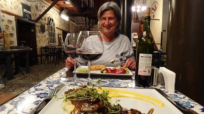
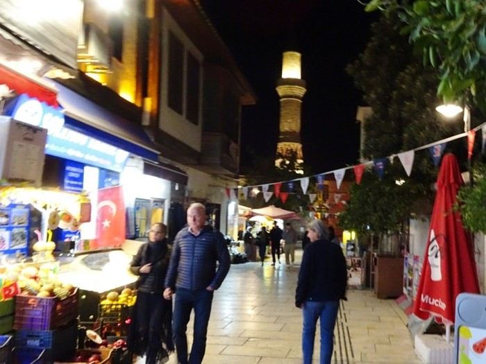
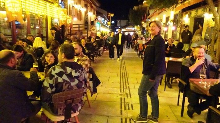
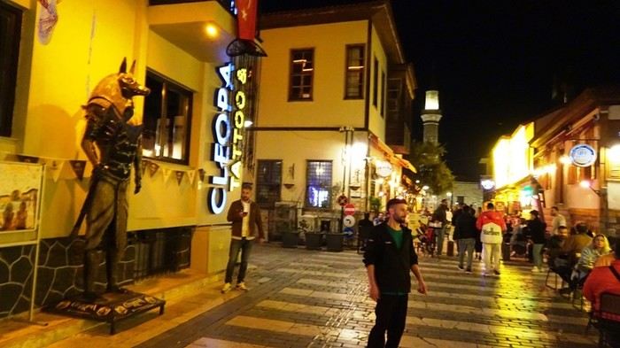
Sunday, November 10, 2024 Antalya In this part of the world, there are some quirks that don’t always suit us infidels! Here in Antalya, the religious influence is still pretty light. You can drink freely, girls can save a lot on fabric—it’s all good, no one’s gonna say anything. But there’s the muezzin. That lanky guy who belts out his tune five times a day from the top of his minaret didn’t spare us this morning. Just a heads-up, we’ve got a two-hour time difference, and this guy starts his serenade at 4 AM, right in the middle of the night. That’s early!
Anyway, we recover, have breakfast, and realize that in terms of revered figures, Atatürk doesn’t take a backseat to the prophet responsible for our nighttime disturbances. We’d already been surprised by how ubiquitous his portrait is, but on the restaurant terrace, we see it’s a full-blown cult. There’s a little altar with rose petals under his portrait. First thing in the morning, the staff lines up to pay their respects, then sings a stirring hymn while some customers stand, hand on heart.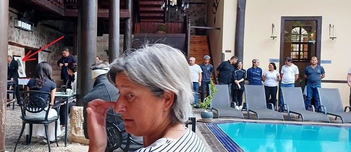
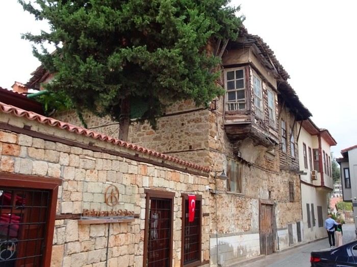
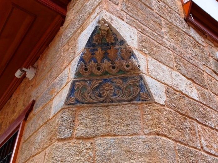
Right after breakfast, we set off like explorers through the old town. It’s incredible how many walls, monuments, and statues have survived from the glorious Greek and Roman eras. Back then, they built things to last!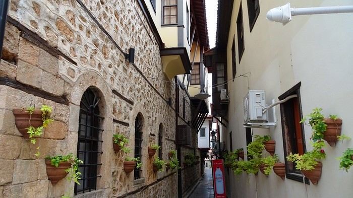

Sunday, November 10, 2024 Antalya In this part of the world, there are some quirks that don’t always suit us infidels! Here in Antalya, the religious influence is still pretty light. You can drink freely, girls can save a lot on fabric—it’s all good, no one’s gonna say anything. But there’s the muezzin. That lanky guy who belts out his tune five times a day from the top of his minaret didn’t spare us this morning. Just a heads-up, we’ve got a two-hour time difference, and this guy starts his serenade at 4 AM, right in the middle of the night. That’s early!
Anyway, we recover, have breakfast, and realize that in terms of revered figures, Atatürk doesn’t take a backseat to the prophet responsible for our nighttime disturbances. We’d already been surprised by how ubiquitous his portrait is, but on the restaurant terrace, we see it’s a full-blown cult. There’s a little altar with rose petals under his portrait. First thing in the morning, the staff lines up to pay their respects, then sings a stirring hymn while some customers stand, hand on heart.
Right after breakfast, we set off like explorers through the old town. It’s incredible how many walls, monuments, and statues have survived from the glorious Greek and Roman eras. Back then, they built things to last!
Da Nang and Hoi An (Vietnam)
DANANG
A big city in the midst of an economic boom. The setting is stunning, with its large bay, the Son Tra Peninsula, and the Annamite Mountains on the horizon.
Where to stay and eat? Da Nang is a bustling business hub, so hotels are pricier and often fully booked. I was lucky to find a motorbike taxi driver who, after six full hotels, took me to Mai Son Hotel, 113 Nguyen Van Linh, a spotless 2-star place. Plus, right next door, there’s a great restaurant that seems popular with locals, and a good Chinese restaurant just a 5-minute walk away, Phi Lu (178 Nguyen Van Linh), recommended by the *Guide du Routard*. So, I’d definitely recommend this hotel. For a pricier option, the very Christian Dai A Hotel, near the tiny pink cathedral, is nice, but why pay more?
Actually, why stay in Da Nang when the gorgeous Hoi An is just 34 km to the south?
What to see? - The lovely Cham Museum (small, takes at most an hour) - The climb up Son Tra Peninsula (great views of the whole area) - The “tour” of the peninsula—quotation marks because the road stops two-thirds of the way. There’s an interesting little museum on the left before reaching the base of the huge statue, the Đong Đinh (large entrance on the left side of the hill), with traditional houses in the jungle holding artifacts over 2,000 years old (Sa Huynh culture; if you’re interested, check out the small Sa Huynh Museum in Hoi An, just before the Japanese Bridge). However, the big Linh Ung Pagoda is just colorful concrete! A beautiful resort, the Son Tra Beach Resort and Spa, sits on a pristine beach and isn’t too expensive: $120 for a garden room and $200–$270 for duplexes with a pool, where you can sleep six. Before reaching the resort, you’ll find two excellent seafood restaurants with large beachfront terraces on your right. - On the way to Hoi An, Marble Mountain, where I loved the village of marble sculpture workshops, the pretty pagodas and caves, and the stunning view from the top of the last promontory (the stairs are steep!). However, you can skip the famous China Beach and its resorts—all pretentious and expensive, not to mention the ones under construction on both sides of the road (they’re multiplying like crazy!). So, when traveling from Da Nang to Hoi An, I recommend two stops: the Cham Museum and Marble Mountain. - The beautiful drive to the Hai Van Pass (there weren’t any clouds!), offering spectacular views of the Da Nang region to the south and the coast to the north. The descent leads to the fishing village and beach of Lang Co, which is lovely but destined for rampant resort development, judging by the huge projects advertised on billboards along the road after the village. - Some affordable guesthouses ($15) and big resorts, including the lovely Lang Co Beach Resort, with a large pool and great value given the beautiful gardens and elegant bungalows. Recommended in Lang Co: lunch at one of the two stilt restaurants over the lagoon—great views and fresh seafood.
The public bus to Hoi An, 34 km south of Da Nang, takes 45 minutes for 50,000 dong. There’s one every half hour.
HOI AN This is a “must-see” for so many reasons: stunning old houses, temples, and pagodas; a colorful daily open-air and covered market near the bridge; charming little streets in the old quarter—especially at night, with all the multicolored lanterns and riverside restaurant terraces, it’s very romantic. The local food is delicious, the people are friendly and kind, there are two beautiful beaches, and attractions like the Cham ruins of My Son. Some say Hoi An is overrun with tourists and should be avoided. That’s true for the historic center and An Bang Beach, but not at all once you step outside.
WHERE TO STAY For a 2-star option, I recommend Ngo House Villa (99 Nguyen Phuc Tan St), very quiet on the island just across from the Old Quarter: 3-star rooms + suites, a large “Family” room, and a nice pool, all for $20 ($40 for the “Family” room). The same charming owner has a second hotel 20 meters away (No. 74), Phan Ngô, which is older but has a large terrace and a small pool—I prefer this one. For 3 stars, Thuy Duong 3 (92 Ba Trieu) is perfect, with a pool and garden ($40–$60). A bit pricier but great is A Han on Phan Bai Chau, with a large garden and terrace restaurant.
For those with a bigger budget, I recommend two riverside spots with rooms, suites, and pools, priced at $200–$350: the secluded Coco River Resort (formerly Ancient House River, with a large wooden terrace for romantic dinners by the river) and Anantara, (formerly Heritage), with bungalows close to the old town—but pricey.
Outside the city, my favorite hotel is Villa Loan, the new place from the famous Loan of Tam Coc, very quiet in the countryside, 15 minutes by bike from Old Hoi An and An Bang Beach. Beautiful rooms ($35), a Family room with two double beds ($55), two 65 m² twins that can sleep six (two large beds + two single beds—$80), a terrace restaurant, and a lovely pool. Prices include a buffet breakfast and a bike.
Also great is Daisy Anbang on An Bang Beach, elegant with a pool and beach just 50 meters away (skip the Aira next door—too expensive).
WHERE TO EAT Hoi An is Vietnam’s culinary capital. For Vietnamese food, I recommend Dao Tien, 21 Phan Bai Chau. No surprise—the chef is a former chef at the luxury 4-star Victoria Hoi An, a solid reference. The restaurant now has a beautiful terrace by the river (take the alley on the right side of the main street Dao Tien). Plus, you’re doing a good deed: a large part of the profits goes toward educating underprivileged children—one year of free hospitality, cooking, and English training, followed by job placement in local establishments. Madame Hien Hoi An (formerly Co Mai), 2 Nguyen Thai Hoc (left of the market), is another great spot—the chef is Didier Corlou, formerly of the famous *Porte d’Annam* and *Madame Hien* in Hanoi (closed in March 2022 due to COVID, so foreign tourists are still scarce). Also worth checking out is Secret Garden, in the Phuong Minh An alley (entrance at 60 Le Loi), set in a beautiful space. One of my favorites is Madam Kieu, 43 Nguyen Phuc Chu, right on the river across from the little bridge—very elegant with excellent Vietnamese cuisine. Unfortunately, all the restaurants on this esplanade blast “music” (boom boom boom yeah yeah yeah) in the evenings, so it’s impossible to talk—go for lunch instead.
For a break from Vietnamese food, try Good Morning Vietnam, a ridiculous name for an excellent Italian restaurant (11 Le Loi). The cheerful chef is from Bologna, the “Lyon of Italy”: lasagna like an Italian *mama*’s, delicious tagliatelle ai porcini (porcini mushrooms imported from Italy), and a divine homemade tiramisu (pro tip: order a grappa and drizzle a few drops on the tiramisu). It’s also one of the few places where you can get an excellent bottle of red wine for 350,000 dong instead of the usual 600,000–800,000 dong (South African Robertson Chapel). Another gem: the Japanese restaurant Samurai Kitchen (no sushi, but divine gyoza), 21 Phan Chau Trinh—the street on the right side of the market when you turn your back to the river. Finally, Ganesh, which I consider the best Indian restaurant in Vietnam (99 Tran Hung Dao St).
At An Bang, there are plenty of beachfront restaurants. The two best are the large one at the far right of the parking lot (huge seafood selection) and the fantastic La Luna d’Autumno, owned by the same person as the Italian restaurant of the same name, once considered the best in Vietnam but closed in 2020 due to COVID. Divine pizzas, including the vegetariana.
WHAT TO VISIT The Japanese Bridge and all the old Chinese houses, temples, and pagodas in the three historic streets. Don’t miss the extraordinary gallery-museum of the great French photographer Réhahn, the Precious Heritage Museum at 26 Phan Boi Chau. His remarkable photo collection—including the famous shot of the little Cham girl with clear blue eyes—has graced the covers of many magazines. His Montagnard Museum is a wonder, with a larger collection of tribal women’s costumes than the Museum of Ethnology in Hanoi. Free entry.
THE BEACHES Cua Dai Beach has mostly disappeared, a victim of the waves, except in a few spots. The beautiful An Bang Beach remains, with great beachfront restaurants, or you can head to Cham Island.
MY SON A beautiful complex of Cham ruins surrounded by mountains, 50 km southwest of Hoi An via a scenic road. You can rent a motorbike, take a motorbike taxi, or join a half-day organized tour. It’s best to go in the afternoon—less crowded than in the morning.
CHAM ISLANDS (Cu Lao Cham) Wow, I loved it! It reminded me of St. Barts 35 years ago. The archipelago, 19 km from Hoi An, consists of eight small islands within the Cu Lao Cham Marine Reserve, declared a “Biosphere Reserve” by UNESCO. The largest and only inhabited island, Hon Lao (Pearl Island), covers 1,317 hectares, and its highest peak reaches 517 meters. Hon Lao has two villages: Bai Lang, where the boats from Hoi An dock, and the charming little fishing port of Bai Huong. Part of the island is a military zone, so only the east coast is accessible to tourists.
To get there, you have three options: - The public boat (100,000 dong) that leaves from in front of Café des Amis at 7:30 AM. The catch is it returns to Hoi An at noon, so to enjoy the charm of the place, you’ll need to spend a night on the island (which I highly recommend). - Organized tours by Cham Diving Club, with two options: diving or snorkeling only. - A private speedboat, but it’s not cheap: $200 for the day!
Note: Even if the weather seems fine, the large public boat won’t leave if the sea is too rough. The only solution is to go to the port around 7:30 AM and check (easy, since it brings all the supplies for the island’s locals—if it’s leaving, it’ll be loading up). Avoid weekends—it gets swarmed with locals.
Small coves with dreamy beaches, as they say. Two are very close to Bai Lang: one to the left (facing the village), Bai Ong, lined with restaurants, and a tiny one to the right of the village. The other two beaches, including Bai Chong and the little fishing port of Bai Huong, are accessible by motorbike or boat. I recommend renting a motorbike (biking is tough due to steep hills) and taking the road that overlooks the coast—it’s stunning.
Great diving. The Cham Diving Club is superbly organized by a very friendly Italian, Lodovico, and two French guys (www.chamislanddiving.com).
When you arrive at Bai Lang’s pier, they’ll offer you TWO family-run guesthouses in the village. There are also homestays, but they’re really basic (usually bamboo mats on wooden planks as beds), no English or French is spoken, and locals speak a dialect that’s hard to understand even if you’re decent at Vietnamese. Anyway, I don’t recommend staying in Bai Lang because of the public loudspeakers. Two options if you want a quiet night: - A small guesthouse facing the tiny rice field on the way to Bai Ong Beach. Very clean rooms and a large terrace overlooking the “rice field.” 300,000 dong, with meals available on the terrace. Nha Nghi Vu Truong Tel: 235 386 4783 Mobile: 01 67 76 63 110. - Homestays in the little fishing port of Bai Huong.
Where to stay and eat? Da Nang is a bustling business hub, so hotels are pricier and often fully booked. I was lucky to find a motorbike taxi driver who, after six full hotels, took me to Mai Son Hotel, 113 Nguyen Van Linh, a spotless 2-star place. Plus, right next door, there’s a great restaurant that seems popular with locals, and a good Chinese restaurant just a 5-minute walk away, Phi Lu (178 Nguyen Van Linh), recommended by the *Guide du Routard*. So, I’d definitely recommend this hotel. For a pricier option, the very Christian Dai A Hotel, near the tiny pink cathedral, is nice, but why pay more?
Actually, why stay in Da Nang when the gorgeous Hoi An is just 34 km to the south?
What to see? - The lovely Cham Museum (small, takes at most an hour) - The climb up Son Tra Peninsula (great views of the whole area) - The “tour” of the peninsula—quotation marks because the road stops two-thirds of the way. There’s an interesting little museum on the left before reaching the base of the huge statue, the Đong Đinh (large entrance on the left side of the hill), with traditional houses in the jungle holding artifacts over 2,000 years old (Sa Huynh culture; if you’re interested, check out the small Sa Huynh Museum in Hoi An, just before the Japanese Bridge). However, the big Linh Ung Pagoda is just colorful concrete! A beautiful resort, the Son Tra Beach Resort and Spa, sits on a pristine beach and isn’t too expensive: $120 for a garden room and $200–$270 for duplexes with a pool, where you can sleep six. Before reaching the resort, you’ll find two excellent seafood restaurants with large beachfront terraces on your right. - On the way to Hoi An, Marble Mountain, where I loved the village of marble sculpture workshops, the pretty pagodas and caves, and the stunning view from the top of the last promontory (the stairs are steep!). However, you can skip the famous China Beach and its resorts—all pretentious and expensive, not to mention the ones under construction on both sides of the road (they’re multiplying like crazy!). So, when traveling from Da Nang to Hoi An, I recommend two stops: the Cham Museum and Marble Mountain. - The beautiful drive to the Hai Van Pass (there weren’t any clouds!), offering spectacular views of the Da Nang region to the south and the coast to the north. The descent leads to the fishing village and beach of Lang Co, which is lovely but destined for rampant resort development, judging by the huge projects advertised on billboards along the road after the village. - Some affordable guesthouses ($15) and big resorts, including the lovely Lang Co Beach Resort, with a large pool and great value given the beautiful gardens and elegant bungalows. Recommended in Lang Co: lunch at one of the two stilt restaurants over the lagoon—great views and fresh seafood.
The public bus to Hoi An, 34 km south of Da Nang, takes 45 minutes for 50,000 dong. There’s one every half hour.
HOI AN This is a “must-see” for so many reasons: stunning old houses, temples, and pagodas; a colorful daily open-air and covered market near the bridge; charming little streets in the old quarter—especially at night, with all the multicolored lanterns and riverside restaurant terraces, it’s very romantic. The local food is delicious, the people are friendly and kind, there are two beautiful beaches, and attractions like the Cham ruins of My Son. Some say Hoi An is overrun with tourists and should be avoided. That’s true for the historic center and An Bang Beach, but not at all once you step outside.
WHERE TO STAY For a 2-star option, I recommend Ngo House Villa (99 Nguyen Phuc Tan St), very quiet on the island just across from the Old Quarter: 3-star rooms + suites, a large “Family” room, and a nice pool, all for $20 ($40 for the “Family” room). The same charming owner has a second hotel 20 meters away (No. 74), Phan Ngô, which is older but has a large terrace and a small pool—I prefer this one. For 3 stars, Thuy Duong 3 (92 Ba Trieu) is perfect, with a pool and garden ($40–$60). A bit pricier but great is A Han on Phan Bai Chau, with a large garden and terrace restaurant.
For those with a bigger budget, I recommend two riverside spots with rooms, suites, and pools, priced at $200–$350: the secluded Coco River Resort (formerly Ancient House River, with a large wooden terrace for romantic dinners by the river) and Anantara, (formerly Heritage), with bungalows close to the old town—but pricey.
Outside the city, my favorite hotel is Villa Loan, the new place from the famous Loan of Tam Coc, very quiet in the countryside, 15 minutes by bike from Old Hoi An and An Bang Beach. Beautiful rooms ($35), a Family room with two double beds ($55), two 65 m² twins that can sleep six (two large beds + two single beds—$80), a terrace restaurant, and a lovely pool. Prices include a buffet breakfast and a bike.
Also great is Daisy Anbang on An Bang Beach, elegant with a pool and beach just 50 meters away (skip the Aira next door—too expensive).
WHERE TO EAT Hoi An is Vietnam’s culinary capital. For Vietnamese food, I recommend Dao Tien, 21 Phan Bai Chau. No surprise—the chef is a former chef at the luxury 4-star Victoria Hoi An, a solid reference. The restaurant now has a beautiful terrace by the river (take the alley on the right side of the main street Dao Tien). Plus, you’re doing a good deed: a large part of the profits goes toward educating underprivileged children—one year of free hospitality, cooking, and English training, followed by job placement in local establishments. Madame Hien Hoi An (formerly Co Mai), 2 Nguyen Thai Hoc (left of the market), is another great spot—the chef is Didier Corlou, formerly of the famous *Porte d’Annam* and *Madame Hien* in Hanoi (closed in March 2022 due to COVID, so foreign tourists are still scarce). Also worth checking out is Secret Garden, in the Phuong Minh An alley (entrance at 60 Le Loi), set in a beautiful space. One of my favorites is Madam Kieu, 43 Nguyen Phuc Chu, right on the river across from the little bridge—very elegant with excellent Vietnamese cuisine. Unfortunately, all the restaurants on this esplanade blast “music” (boom boom boom yeah yeah yeah) in the evenings, so it’s impossible to talk—go for lunch instead.
For a break from Vietnamese food, try Good Morning Vietnam, a ridiculous name for an excellent Italian restaurant (11 Le Loi). The cheerful chef is from Bologna, the “Lyon of Italy”: lasagna like an Italian *mama*’s, delicious tagliatelle ai porcini (porcini mushrooms imported from Italy), and a divine homemade tiramisu (pro tip: order a grappa and drizzle a few drops on the tiramisu). It’s also one of the few places where you can get an excellent bottle of red wine for 350,000 dong instead of the usual 600,000–800,000 dong (South African Robertson Chapel). Another gem: the Japanese restaurant Samurai Kitchen (no sushi, but divine gyoza), 21 Phan Chau Trinh—the street on the right side of the market when you turn your back to the river. Finally, Ganesh, which I consider the best Indian restaurant in Vietnam (99 Tran Hung Dao St).
At An Bang, there are plenty of beachfront restaurants. The two best are the large one at the far right of the parking lot (huge seafood selection) and the fantastic La Luna d’Autumno, owned by the same person as the Italian restaurant of the same name, once considered the best in Vietnam but closed in 2020 due to COVID. Divine pizzas, including the vegetariana.
WHAT TO VISIT The Japanese Bridge and all the old Chinese houses, temples, and pagodas in the three historic streets. Don’t miss the extraordinary gallery-museum of the great French photographer Réhahn, the Precious Heritage Museum at 26 Phan Boi Chau. His remarkable photo collection—including the famous shot of the little Cham girl with clear blue eyes—has graced the covers of many magazines. His Montagnard Museum is a wonder, with a larger collection of tribal women’s costumes than the Museum of Ethnology in Hanoi. Free entry.
THE BEACHES Cua Dai Beach has mostly disappeared, a victim of the waves, except in a few spots. The beautiful An Bang Beach remains, with great beachfront restaurants, or you can head to Cham Island.
MY SON A beautiful complex of Cham ruins surrounded by mountains, 50 km southwest of Hoi An via a scenic road. You can rent a motorbike, take a motorbike taxi, or join a half-day organized tour. It’s best to go in the afternoon—less crowded than in the morning.
CHAM ISLANDS (Cu Lao Cham) Wow, I loved it! It reminded me of St. Barts 35 years ago. The archipelago, 19 km from Hoi An, consists of eight small islands within the Cu Lao Cham Marine Reserve, declared a “Biosphere Reserve” by UNESCO. The largest and only inhabited island, Hon Lao (Pearl Island), covers 1,317 hectares, and its highest peak reaches 517 meters. Hon Lao has two villages: Bai Lang, where the boats from Hoi An dock, and the charming little fishing port of Bai Huong. Part of the island is a military zone, so only the east coast is accessible to tourists.
To get there, you have three options: - The public boat (100,000 dong) that leaves from in front of Café des Amis at 7:30 AM. The catch is it returns to Hoi An at noon, so to enjoy the charm of the place, you’ll need to spend a night on the island (which I highly recommend). - Organized tours by Cham Diving Club, with two options: diving or snorkeling only. - A private speedboat, but it’s not cheap: $200 for the day!
Note: Even if the weather seems fine, the large public boat won’t leave if the sea is too rough. The only solution is to go to the port around 7:30 AM and check (easy, since it brings all the supplies for the island’s locals—if it’s leaving, it’ll be loading up). Avoid weekends—it gets swarmed with locals.
Small coves with dreamy beaches, as they say. Two are very close to Bai Lang: one to the left (facing the village), Bai Ong, lined with restaurants, and a tiny one to the right of the village. The other two beaches, including Bai Chong and the little fishing port of Bai Huong, are accessible by motorbike or boat. I recommend renting a motorbike (biking is tough due to steep hills) and taking the road that overlooks the coast—it’s stunning.
Great diving. The Cham Diving Club is superbly organized by a very friendly Italian, Lodovico, and two French guys (www.chamislanddiving.com).
When you arrive at Bai Lang’s pier, they’ll offer you TWO family-run guesthouses in the village. There are also homestays, but they’re really basic (usually bamboo mats on wooden planks as beds), no English or French is spoken, and locals speak a dialect that’s hard to understand even if you’re decent at Vietnamese. Anyway, I don’t recommend staying in Bai Lang because of the public loudspeakers. Two options if you want a quiet night: - A small guesthouse facing the tiny rice field on the way to Bai Ong Beach. Very clean rooms and a large terrace overlooking the “rice field.” 300,000 dong, with meals available on the terrace. Nha Nghi Vu Truong Tel: 235 386 4783 Mobile: 01 67 76 63 110. - Homestays in the little fishing port of Bai Huong.
Quy Nhon (Vietnam)
For centuries, until its capture by the Vietnamese in 1407, Quy Nhon was Asia’s busiest port. Marco Polo stopped here on his way back from China to Venice. It was the port of Viraja, capital of the Champa kingdom, which explains the many Cham towers found all over the place, including right in the city center. Today, it’s a lovely beach resort, less crowded than others. There’s a gigantic seaside esplanade lined with alternating gardens and hotel towers, with not a single tree (not on the beach either), except at the café-restaurant-terrace of the 4-star hotel Hoang Yen and another one to the right of it. I was lucky to find a brand-new, spotless little hotel run by a very friendly family, the Ngoc Linh, on a quiet little street just 50 meters from the beach. $12 for a single room and $14 for a double. There’s a terrace restaurant. No bikes, but motorbike rentals are available ($10 per day). 6 Tran Van On 0563 54 66 99 or nearby on the esplanade (19 Xuan Dieu).
Beautiful beach establishments north of the city.
That said, it allowed me to indulge my passion for history with the beautiful Cham towers, especially those at Banh It, 20 km north of Quy Nhon on the Mandarin Road (you can see them in the distance as they sit atop a hill, offering a magnificent view of the entire region). Four well-preserved towers (the largest has been very well restored), built in the late 11th to early 12th century. At the foot of the mountain, you’ll find a beautiful 14th-century pagoda and the ruins of Viraja. Right in the middle of the city on Tran Hung Dao, there are also the two beautiful towers of Thap Doi.
Beautiful beach establishments north of the city.
That said, it allowed me to indulge my passion for history with the beautiful Cham towers, especially those at Banh It, 20 km north of Quy Nhon on the Mandarin Road (you can see them in the distance as they sit atop a hill, offering a magnificent view of the entire region). Four well-preserved towers (the largest has been very well restored), built in the late 11th to early 12th century. At the foot of the mountain, you’ll find a beautiful 14th-century pagoda and the ruins of Viraja. Right in the middle of the city on Tran Hung Dao, there are also the two beautiful towers of Thap Doi.
From Lot-et-Garonne to the North Cape
Hi there,
Last spring, I set off from Villeréal (47) on a road bike and reached the North Cape after 6 weeks of cycling.
I had a particular concept: I’d cycle each stage (averaging 140 km) and then return to the starting point either by carpooling, hitchhiking (not often), bus, or train. I’d meet up with my van (a Trafic) and then drive the same stage to eat and sleep there.
This approach let me choose where I stayed for the night and, most importantly, ride the distance I wanted—my longest stage was 217 km—without carrying any weight, since I can’t imagine doing a fully self-supported bike trip.
I did a first 3-week stretch that took me to the top of Denmark using this method. Then I drove back to Hamburg in my van, left it there, and flew back to Bordeaux.
I spent two weeks at home because my autistic son was staying with me, then my wife and I flew to Hamburg. We picked up the van and drove back to the top of Denmark to catch a ferry to Oslo.
For this second leg, my wife drove the Trafic, and we met up along the stages, which allowed me to focus solely on my ride.
I chose to go through Sweden—it would’ve been much more complicated going up through Norway because of all the tunnels, frequent small ferries to cross the fjords, and a lot more elevation gain.
I had favorable winds most of the time, a few hiccups, but overall everything went smoothly, and I stuck to my route and schedule.
I kept a travel journal on My Atlas—here’s the link: https://www.myatlas.com/danielcramay/du-47-au-cap-nord
Ha Giang and Dong Van in Vietnam
Back from Dong Van
Big plus: a brand-new highway between Hanoi airport and Tuyen Quang, halfway between Hanoi and Ha Giang. The speed limit is usually 50 km/h, but it still saves time.
In Ha Giang, the Truong Xuan Hotel (Ha Giang Resort) has gone downhill. Stay at the gorgeous guesthouse (varnished wooden bungalows with panoramic terrace and excellent meals) run by Mr. WIN (03 64 86 67 66) in Thôn Tha village, 5 kilometers before Ha Giang. If it's full, try next door at Mr. Cay’s place—also bungalows, but with a less stunning view: 09 79 76 94 67.
Dong Van has become so popular that there are now over 200 hotels and guesthouses (only one existed 5 years ago). I stayed at my usual spot, the Hoang Ngoc, which now has an elevator, but it’s gotten expensive (450,000 VND). Instead, check out one of the two 2-star hotels across the street.
On the other hand, dining options have really improved. The excellent Green Karst (one of the servers, Mr. Hung, is also a French-speaking guide) has two locations—one on the main street and another a bit uphill to the left. Go to the latter.
I revisited Lung Cu, still just as spectacular. There are now small electric trains that take you up to the viewpoint (30,000 VND per person round trip). The Hmong King’s Palace in Sa Phin is still standing strong. Small shops to the left of the staircase—the closest one is run by a descendant of the king, actually a traditional costume chief.
There’s a lovely guesthouse at the top of Ma Pi Leng, run by a super-friendly Hmong guy in a beret (a French legacy) who speaks decent French. The terrace overlooks the Nho Qué River canyon. 250,000 VND for two, breakfast included (dinner is 200,000 VND).
In Ha Giang, the Truong Xuan Hotel (Ha Giang Resort) has gone downhill. Stay at the gorgeous guesthouse (varnished wooden bungalows with panoramic terrace and excellent meals) run by Mr. WIN (03 64 86 67 66) in Thôn Tha village, 5 kilometers before Ha Giang. If it's full, try next door at Mr. Cay’s place—also bungalows, but with a less stunning view: 09 79 76 94 67.
Dong Van has become so popular that there are now over 200 hotels and guesthouses (only one existed 5 years ago). I stayed at my usual spot, the Hoang Ngoc, which now has an elevator, but it’s gotten expensive (450,000 VND). Instead, check out one of the two 2-star hotels across the street.
On the other hand, dining options have really improved. The excellent Green Karst (one of the servers, Mr. Hung, is also a French-speaking guide) has two locations—one on the main street and another a bit uphill to the left. Go to the latter.
I revisited Lung Cu, still just as spectacular. There are now small electric trains that take you up to the viewpoint (30,000 VND per person round trip). The Hmong King’s Palace in Sa Phin is still standing strong. Small shops to the left of the staircase—the closest one is run by a descendant of the king, actually a traditional costume chief.
There’s a lovely guesthouse at the top of Ma Pi Leng, run by a super-friendly Hmong guy in a beret (a French legacy) who speaks decent French. The terrace overlooks the Nho Qué River canyon. 250,000 VND for two, breakfast included (dinner is 200,000 VND).
The New VoyageForum
Hi there,
Thanks for letting me know about the launch of the new VoyageForum.
I just want to say that I hope this fresh start has helped get rid of those rude people who thought they knew everything about every topic and would attack (and sometimes insult) participants who didn’t agree with them.
It was starting to feel like social media, where everyone thinks their own posts are the most accurate and truthful, and it was getting really tiresome—especially when all we really want to do is talk about travel.
So, my hope is that there’ll now be stricter moderation of exchanges between travelers.
Good luck with this new beginning!
Thanks for letting me know about the launch of the new VoyageForum.
I just want to say that I hope this fresh start has helped get rid of those rude people who thought they knew everything about every topic and would attack (and sometimes insult) participants who didn’t agree with them.
It was starting to feel like social media, where everyone thinks their own posts are the most accurate and truthful, and it was getting really tiresome—especially when all we really want to do is talk about travel.
So, my hope is that there’ll now be stricter moderation of exchanges between travelers.
Good luck with this new beginning!
Romania with the wind in my face
Hi there,
In spring 2023, I headed to Romania by motorcycle. I’ve been going there for over 20 years—by car, bike, and plane—and I’ve really fallen for this country. I feel so at home there. The big difference this time? I had all the time in the world, no constraints at all.
I left the Paris region (IDF) and headed for the Sundgau, avoiding the motorways. I know a little hotel tucked away in the countryside there. The next day, I followed the Swiss border on a small road along the Lucelle River, which acts as the frontier. Around a bend, you cross to the other side and then back into France—kind of fun.

I crossed Switzerland via the motorway—I know the route well, so no sightseeing. I arrived in Austria, which I also know pretty well, and took the Arlberg Pass. It was deserted, everything was closed, and there was still snow.

The weather wasn’t great—it was raining—so I stopped for the night at a remote inn. Perfect for drying off! I set off in the rain the next morning and kept going. Gradually, the rain stopped. I took a detour through the Trentino-Alto Adige region and the Sella Pass. Up there, it was rain, snow, and a bit of black ice in a tunnel (wind + rain + sub-zero temps = skating rink).

I arrived in Burgenland to see the famous giant glass-and-metal grape cluster, the largest in Europe. The region is hilly, full of tiny roads, and covered in vineyards.

Burgenland

Then into Slovenia.

I stopped for the night at a winegrower’s B&B perched on a ridge straddling the Croatian border. The welcome was fantastic—I spent the evening with the owners and their friends who arrived later. The white wine was amazing! The next day, I hit the road again.

I headed for Vukovar, on the Danube, a symbol of resistance during the Balkan War. I found a really comfortable B&B by the river and stayed for two nights to explore. What a strange monument!

I visited the water tower, which you can go inside—it’s riddled with bullet holes. There’s an exhibition inside. I also checked out a museum of equipment used during the Balkan War. Since it’s in a barracks, it’s guarded. I asked if I could bring my motorcycle in, and a Croatian officer came to meet me and gave me permission, along with a sticker to put on the bike. I met some fellow bikers from Marseille riding beautiful vintage bikes.

I left Vukovar following the Danube toward Serbia. The rain caught up with me. The roads were busy, with construction causing mud everywhere and crazy truck drivers. At one point, I cut through the construction zone! I stopped for coffee in a village—it had a *Deliverance* vibe. Total silence when I walked in, and the owner gave me a suspicious look. Finally, the Romanian border... and the sun came out! The Romanian customs officer asked if I had anything to declare. "Yes—just happy to be back in Romania!" I stopped for the night at a *cabana* (mountain hut) lost in the forest. Chaos ensued—a tourist! So they rushed to get supplies, quench my thirst, give me a room, and then the owner took charge: țuică (plum brandy), omelette, beers... Everyone bent over backwards to make me happy.
I love these Romanian roads!


I passed through Băile Herculane, which isn’t as beautiful as it once was—everything’s run-down. What are they waiting for to restore this *Mittel Europa*-style spa town that’s still active?
I stopped at the birthplace of Constantin Brâncuși.

Keep your eyes peeled on the roads!

Via the Jiu Valley, I arrived in Craiova to visit my in-laws. A few days of laughs and outings. I picked up my wife at the airport.
My favorite brand

We took a trip to Horezu, a village famous for its beautiful ceramics.


After those few days together, I dropped my wife off at the airport, and the next day, I set off for Dobrogea, a region split in two after the war with Bulgaria. The road was dull—flat as far as the eye could see—but the sun was out. I followed a military convoy of about fifty vehicles, with orders not to overtake. I stopped by the roadside for some homemade *ciorbă* (sour soup). That evening, I stopped in Călărași. The next day, I crossed the Danube by ferry. There are two ferries—one goes to Bulgaria, the other stays in Romania.

A priest on board came over to bless the motorcycle, the rider, and the ferry. I arrived on the other side with some traffic. Dobrogea

It’s like that all the way to the Bulgarian border—no restaurants, hotels, or gas stations, just old collective farms. And it’s the same in Bulgaria! I stopped at Adamclisi, site of a major battle in Moesia (now Dobrogea) in 101–102 BC, one of Trajan’s most important Dacian Wars.

An oasis in the agricultural steppe.

I arrived at the Bulgarian border.

A customs officer—built like a weightlifter, shaved head, thick neck, and as square as a truck—saw me take this photo and came over to ask me to delete it. I did... but I didn’t empty the trash! The weather turned stormy. I arrived in Balchik, a resort town where the last queen of Romania, Maria, used to vacation.
The Black Sea and the Bulgarian coast

The weather wasn’t great, so I headed back to Romania to follow the coastline. Constanța and its casino

Then came the seaside resorts—just as ugly as each other: Neptun, Mangalia, Eforie Nord, Eforie Sud. I stopped at a B&B near the Danube Delta, in some random village. The welcome was nice. The next day, I headed for Dunavățu de Jos, the last stretch of tarmac in Romania. After that, it’s the Danube Delta. The area is flat and sandy, with typical houses featuring reed roofs.

Now, I’m following the Ukrainian border. I passed the last active quarantine station in Europe. I came across a funeral procession—it’s customary to honk as you pass. If you’re on foot, you cross yourself. When I arrived in Galați, it was raining. I boarded the ferry in a downpour. On board, we were packed in like sardines. As soon as the ramp hit land, the drivers rushed out, revving their engines and honking. I let them go and exited calmly. I continued toward the Székely Land. These are Hungarians who, back in the day, were border guards for the king. They’ve kept their own script (it looks like runes), their flag, and their independence streak. For them, Romania is Hungarian, despite the Treaty of Sèvres in 1920. There are still clashes between Romanians and Székely Hungarians now and then. Since I speak a bit of Romanian, I used it—logical, since it’s the language there—and it put everyone in a good mood! Székely flag

I passed through Bicaz Chei, arriving via one of my favorite kinds of roads. During a break, a bear came to check me out from a distance.

Bicaz Chei

I arrived at the "Heart of Jesus" monument, built by public subscription to thank God for sparing the village from severe flooding.

Now, I’m heading west—next stop, Transylvania, with the in-laws. On the road

Roma house

Bozorka—a Hungarian specialty... 450 grams of meat!
I made it back to France without any issues, already thinking about my next trip. Actually, I just got back from one!
I left the Paris region (IDF) and headed for the Sundgau, avoiding the motorways. I know a little hotel tucked away in the countryside there. The next day, I followed the Swiss border on a small road along the Lucelle River, which acts as the frontier. Around a bend, you cross to the other side and then back into France—kind of fun.
I crossed Switzerland via the motorway—I know the route well, so no sightseeing. I arrived in Austria, which I also know pretty well, and took the Arlberg Pass. It was deserted, everything was closed, and there was still snow.
The weather wasn’t great—it was raining—so I stopped for the night at a remote inn. Perfect for drying off! I set off in the rain the next morning and kept going. Gradually, the rain stopped. I took a detour through the Trentino-Alto Adige region and the Sella Pass. Up there, it was rain, snow, and a bit of black ice in a tunnel (wind + rain + sub-zero temps = skating rink).
I arrived in Burgenland to see the famous giant glass-and-metal grape cluster, the largest in Europe. The region is hilly, full of tiny roads, and covered in vineyards.
Burgenland
Then into Slovenia.
I stopped for the night at a winegrower’s B&B perched on a ridge straddling the Croatian border. The welcome was fantastic—I spent the evening with the owners and their friends who arrived later. The white wine was amazing! The next day, I hit the road again.
I headed for Vukovar, on the Danube, a symbol of resistance during the Balkan War. I found a really comfortable B&B by the river and stayed for two nights to explore. What a strange monument!
I visited the water tower, which you can go inside—it’s riddled with bullet holes. There’s an exhibition inside. I also checked out a museum of equipment used during the Balkan War. Since it’s in a barracks, it’s guarded. I asked if I could bring my motorcycle in, and a Croatian officer came to meet me and gave me permission, along with a sticker to put on the bike. I met some fellow bikers from Marseille riding beautiful vintage bikes.
I left Vukovar following the Danube toward Serbia. The rain caught up with me. The roads were busy, with construction causing mud everywhere and crazy truck drivers. At one point, I cut through the construction zone! I stopped for coffee in a village—it had a *Deliverance* vibe. Total silence when I walked in, and the owner gave me a suspicious look. Finally, the Romanian border... and the sun came out! The Romanian customs officer asked if I had anything to declare. "Yes—just happy to be back in Romania!" I stopped for the night at a *cabana* (mountain hut) lost in the forest. Chaos ensued—a tourist! So they rushed to get supplies, quench my thirst, give me a room, and then the owner took charge: țuică (plum brandy), omelette, beers... Everyone bent over backwards to make me happy.
I love these Romanian roads!
I passed through Băile Herculane, which isn’t as beautiful as it once was—everything’s run-down. What are they waiting for to restore this *Mittel Europa*-style spa town that’s still active?
I stopped at the birthplace of Constantin Brâncuși.
Keep your eyes peeled on the roads!
Via the Jiu Valley, I arrived in Craiova to visit my in-laws. A few days of laughs and outings. I picked up my wife at the airport.
My favorite brand
We took a trip to Horezu, a village famous for its beautiful ceramics.
After those few days together, I dropped my wife off at the airport, and the next day, I set off for Dobrogea, a region split in two after the war with Bulgaria. The road was dull—flat as far as the eye could see—but the sun was out. I followed a military convoy of about fifty vehicles, with orders not to overtake. I stopped by the roadside for some homemade *ciorbă* (sour soup). That evening, I stopped in Călărași. The next day, I crossed the Danube by ferry. There are two ferries—one goes to Bulgaria, the other stays in Romania.
A priest on board came over to bless the motorcycle, the rider, and the ferry. I arrived on the other side with some traffic. Dobrogea
It’s like that all the way to the Bulgarian border—no restaurants, hotels, or gas stations, just old collective farms. And it’s the same in Bulgaria! I stopped at Adamclisi, site of a major battle in Moesia (now Dobrogea) in 101–102 BC, one of Trajan’s most important Dacian Wars.
An oasis in the agricultural steppe.
I arrived at the Bulgarian border.
A customs officer—built like a weightlifter, shaved head, thick neck, and as square as a truck—saw me take this photo and came over to ask me to delete it. I did... but I didn’t empty the trash! The weather turned stormy. I arrived in Balchik, a resort town where the last queen of Romania, Maria, used to vacation.
The Black Sea and the Bulgarian coast
The weather wasn’t great, so I headed back to Romania to follow the coastline. Constanța and its casino
Then came the seaside resorts—just as ugly as each other: Neptun, Mangalia, Eforie Nord, Eforie Sud. I stopped at a B&B near the Danube Delta, in some random village. The welcome was nice. The next day, I headed for Dunavățu de Jos, the last stretch of tarmac in Romania. After that, it’s the Danube Delta. The area is flat and sandy, with typical houses featuring reed roofs.
Now, I’m following the Ukrainian border. I passed the last active quarantine station in Europe. I came across a funeral procession—it’s customary to honk as you pass. If you’re on foot, you cross yourself. When I arrived in Galați, it was raining. I boarded the ferry in a downpour. On board, we were packed in like sardines. As soon as the ramp hit land, the drivers rushed out, revving their engines and honking. I let them go and exited calmly. I continued toward the Székely Land. These are Hungarians who, back in the day, were border guards for the king. They’ve kept their own script (it looks like runes), their flag, and their independence streak. For them, Romania is Hungarian, despite the Treaty of Sèvres in 1920. There are still clashes between Romanians and Székely Hungarians now and then. Since I speak a bit of Romanian, I used it—logical, since it’s the language there—and it put everyone in a good mood! Székely flag
I passed through Bicaz Chei, arriving via one of my favorite kinds of roads. During a break, a bear came to check me out from a distance.
Bicaz Chei
I arrived at the "Heart of Jesus" monument, built by public subscription to thank God for sparing the village from severe flooding.
Now, I’m heading west—next stop, Transylvania, with the in-laws. On the road
Roma house
Bozorka—a Hungarian specialty... 450 grams of meat!
I made it back to France without any issues, already thinking about my next trip. Actually, I just got back from one!
Nepal - Great Traverse from Sherpani Col to Amphu Lapsta via Makalu Base Camp - October 2025
Hello,
I’m planning to do the Great Traverse from Sherpani Col to Amphu Lapsta via Makalu Base Camp in October 2025 (22 to 23 days), from Num to Lukla—a route very rarely completed. It’s considered Nepal’s most challenging trek, but also likely the most breathtaking, with unique views of Makalu, Everest, Baruntse, Ama Dablam, and more.
I’ve already done many treks and trekking peaks in Nepal (three high passes, Mera Peak, the full Annapurna Circuit, North and South Kanchenjunga Base Camps, Manaslu Circuit, and the full traverse of Lower and Upper Dolpo).
We’re already two confirmed people and three with options. I’m looking for two or three additional travel partners for this adventure, planned between mid-October and mid-November 2025. The organization will be handled jointly with a well-known agency in Kathmandu that I trust, which has the guides and expertise for this kind of trek—something most agencies can’t offer.
Alpine experience is required due to technical challenges (technical ascent and descent of Sherpani Col and Amphu Lapsta with rappelling, glacial walking/steep slopes >45°), altitude (around ten days above 4,000m, with passes over 6,000m—Sherpani Col and West Col—and several nights in tents above 5,000m), and the remoteness of this traverse, which is done with tents, porters, and cooks.
Don’t hesitate to get in touch for more details about this incredible Himalayan adventure, rarely done as a traverse. See you soon
I’ve already done many treks and trekking peaks in Nepal (three high passes, Mera Peak, the full Annapurna Circuit, North and South Kanchenjunga Base Camps, Manaslu Circuit, and the full traverse of Lower and Upper Dolpo).
We’re already two confirmed people and three with options. I’m looking for two or three additional travel partners for this adventure, planned between mid-October and mid-November 2025. The organization will be handled jointly with a well-known agency in Kathmandu that I trust, which has the guides and expertise for this kind of trek—something most agencies can’t offer.
Alpine experience is required due to technical challenges (technical ascent and descent of Sherpani Col and Amphu Lapsta with rappelling, glacial walking/steep slopes >45°), altitude (around ten days above 4,000m, with passes over 6,000m—Sherpani Col and West Col—and several nights in tents above 5,000m), and the remoteness of this traverse, which is done with tents, porters, and cooks.
Don’t hesitate to get in touch for more details about this incredible Himalayan adventure, rarely done as a traverse. See you soon
Opinions on Azerbaijan Airlines and Uzbekistan Airways?
Hi everyone,
For my round-trip flights between Milan and Tashkent, I have several airline options, with Turkish Airlines being the most familiar and offering plenty of combinations. But I’m also being offered an outbound flight with a layover in Baku via Azerbaijan Airlines and a direct return (7.5 hours without stretching my long legs 😱) with Uzbekistan Airways. I’m not a fan of flying at all (I feel uneasy when I’m not on solid ground, but it’s a necessary evil when you’re short on time). However, I’m tempted by the idea of trying these two airlines and getting a glimpse of Baku Airport.
Do you have any advice that could tip the scales toward curiosity or fear?
Catherine
For my round-trip flights between Milan and Tashkent, I have several airline options, with Turkish Airlines being the most familiar and offering plenty of combinations. But I’m also being offered an outbound flight with a layover in Baku via Azerbaijan Airlines and a direct return (7.5 hours without stretching my long legs 😱) with Uzbekistan Airways. I’m not a fan of flying at all (I feel uneasy when I’m not on solid ground, but it’s a necessary evil when you’re short on time). However, I’m tempted by the idea of trying these two airlines and getting a glimpse of Baku Airport.
Do you have any advice that could tip the scales toward curiosity or fear?
Catherine
Family humanitarian missions
Hi,
I’m interested in humanitarian missions—want to explore and help others while showing my kids how things work elsewhere and pitching in.
Looking for advice.
Tenerife in February for hiking
I'm planning a 10-day trip to Tenerife to go hiking in February. Is the weather decent without too much fog at this time of year? Is an excursion to Teide National Park doable?
Thanks for your replies.
What gifts should I bring for the Surma tribespeople?
Hello,
I’d like to know what small gifts I could bring for women, children, and men in the Surma tribes of the western Omo Valley.
Usually, I bring pencils, pens, perfumes, and cigarettes, depending on the country.
What do you recommend?
Philippe Departure on 11/13/24
What do you recommend?
Philippe Departure on 11/13/24
Wild Colombia off the tourist trail
Hi,
I'd love to know where we can observe wildlife, birds, and nature in Colombia... Like going on a hike without a guide, immersing ourselves in the forest, far from tourist spots. I want to avoid places that are specially set up, since you usually don’t see much there.
Thanks in advance!
Bernard
Stay at Club Jumbo Cape East in Sweden
Hi there,
I’m planning to spend a week in Lapland from January 4th to 11th, 2025.
It’s one of my dreams that I’ll finally get to fulfill—I’ve only been to the mountains once before, at Les 2 Alpes when I was 19.
I’ll admit, I’m usually more drawn to warmth, the sea, and islands, but I have this crazy desire to discover this incredible region.
For those of you who’ve been lucky enough to go, could you please share lots of tips so I can make the most of my trip? What clothes should I pack, what local dishes should I try, and what souvenirs should I bring back? Thanks in advance!
For those of you who’ve been lucky enough to go, could you please share lots of tips so I can make the most of my trip? What clothes should I pack, what local dishes should I try, and what souvenirs should I bring back? Thanks in advance!
Road/track between Nkoud and Boumaine du Dadès via Tizi N'Tazazerte
Hi,
I’m looking for recent info about the track between Nkoud and Boumaine du Dadès via Tizi N'Tazazerte.
Is it still a dirt track or is it now a paved road?
Is it doable in April with a 4x4?
Thanks for your tips,
Best,
Dominique
Taking a boat down the Mekong from Luang Prabang to Vientiane
Hi there, We’re in Laos in March 2025,
does anyone know if it’s possible to travel down the Mekong from Luang Prabang to Vientiane?
Can you find a private boat? How long does it take?
Thanks for your replies_
Java - Bali Trip in Spring
Hi there,
I’m so excited to reopen the Asia/Indonesia forum! We’ve got a trip planned for spring, and we’re planning to spend a few days on Java before wrapping up in Bali.
For Java: Yogyakarta / Bromo / Ijen
For Bali: Ubud / Amed
See you all on the forum soon!
Traveling to Nepal in the summer
Hello,
It’s so great to be able to write on this site again—it was such a valuable resource during my travels in the past! We’re planning a 6-week trip (as a couple) to Nepal in July and August. It’s not the ideal time, I know, but you’ve probably guessed we don’t really have a choice. I’ve read briefly that it’s doable, that it limits some options (but hey, we always have to make choices anyway), but at least there’s the advantage of not being there during peak season. Do any of you have experience or advice to share about this? Any tips or opinions?
Thanks, and welcome back to everyone on Voyage Forum! Thérèse
It’s so great to be able to write on this site again—it was such a valuable resource during my travels in the past! We’re planning a 6-week trip (as a couple) to Nepal in July and August. It’s not the ideal time, I know, but you’ve probably guessed we don’t really have a choice. I’ve read briefly that it’s doable, that it limits some options (but hey, we always have to make choices anyway), but at least there’s the advantage of not being there during peak season. Do any of you have experience or advice to share about this? Any tips or opinions?
Thanks, and welcome back to everyone on Voyage Forum! Thérèse
Renseignements pour effectuer mon road-trip de 3 mois aux États-Unis English translation pending
bonjour, j'ai une petite question pour mon road trip de l'année prochaine. nous partons 3 mois de sept à nov. début du trip Detroit où j'ai ma famille puis ensuite direction l'ouest. mais lorsque je vais sur bing carte je ne peux rentrer que 26 villes . avez vous un autre procédé pour rajouter d'autres points ? MERCI BEAUCOUP .
Trajet Mauritanie - Maroc par voie terrestre English translation pending
Salut le groupe..
Suis de retour pour en savoir plus sur la route Mauritanie 🚎 Maroc (par voie terrestre) et aussi les bons périodes approprié pour faire des voyages sur la voie et sans oublier le coût du transport bien sûr.
Merci d'avance 🙏🏽.
Transports pour se rendre au Vésuve et à Pompéi English translation pending
Bonjour,
J'aimerais début octobre aller à Pompéi et au Vésuve le même jour.
Je comptais de Naples aller à Pompéi par le train, ensuite prendre le bus eav pour le cratère au Vésuve
Mais ensuite du Vésuve (cratère) quel est le moyen de locomotion pour revenir sur Naples? et quel horaire?
Je voyage seul
merci.
J'aimerais début octobre aller à Pompéi et au Vésuve le même jour.
Je comptais de Naples aller à Pompéi par le train, ensuite prendre le bus eav pour le cratère au Vésuve
Mais ensuite du Vésuve (cratère) quel est le moyen de locomotion pour revenir sur Naples? et quel horaire?
Je voyage seul
merci.
Transiter par la France pour aller en Italie English translation pending
Bonjour,
Maintenant que toute la France sauf la Creuse est passée en zone rouge, savez-vous si je peux la traverser en voiture de Belgique pour me rendre en Italie ? Et accessoirement, dois-je signer la déclaration sur l'honneur pour rentrer en Italie (j'ai lu quelque part que ce n'était pas nécessaire pour un voyage en voiture ).
Merci de votre aide .
République Dominicaine: au fil de la route... et autres souvenirs English translation pending
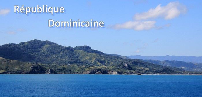
Ce sont mes derniers souvenirs de voyage à l'étranger, c'était avant … avant que la pandémie de la Covid-19 ne s'abatte sur notre planète et contrarie (en autre !) nos désirs de voyages loin de chez nous. Un récit à propos d'une dernière escale dans les Caraïbes, elle date du début mars et c'était donc en République Dominicaine. Ce carnet aborde principalement le souvenir d'une échappée le long d'une « route » hors des sentiers battus, dans le nord de l'île. Une région bien moins fréquentée et donc moins connue que les très courus sites balnéaires de cette grande île tropicale. Un récit qui est également l'occasion pour moi de partager dans une seconde partie quelques autres souvenirs de voyage en Rep. Dom. Ils sont un peu plus anciens et concernent quelques uns des incontournables sites à visiter de la destination.
--
L'escale approche. Peu à peu, la côte se fait plus nette, le soleil a fait disparaître la nébulosité et la plage d'Amber Cove apparaît dans toute sa beauté.
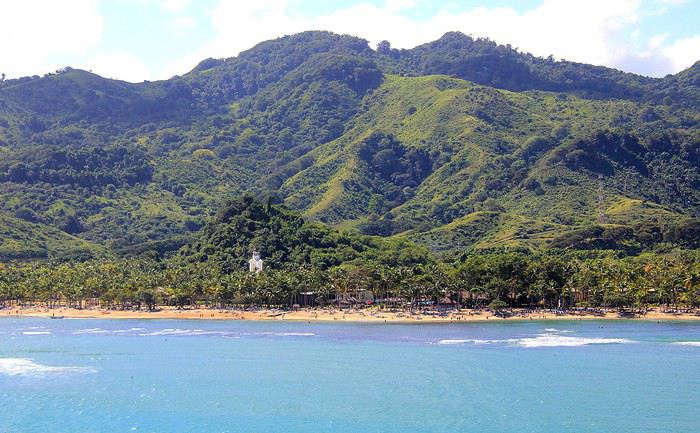
Le trio qui fait le charme des îles tropicales est bien présent sous nos yeux : des eaux bleues, du sable clair bordé d'une palmeraie et un versant verdoyant qui en impose en surplomb du rivage. Un coquet clocher aux tonalités jaune et rose bonbon émerge au-dessus de cette étendue de palmes. Pour afficher la nationalité de l'île, les couleurs sont hissées haut. On reconnaît les carrés rouge et bleu séparés d'une croix blanche du drapeau de la République Dominicaine.
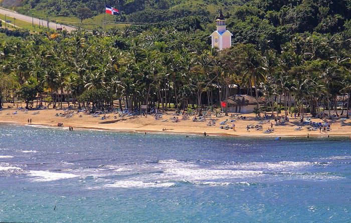
Nous sommes précisément sur la côte nord de l'île, dans la région de l'ancienne ville coloniale espagnole de Puerto Plata.
Un dernier coup d’œil sur la jolie baie encadrée de promontoires rocheux en fond de décor et bordée d'une langue de terre au vert lumineux qui défile juste sous nos yeux.
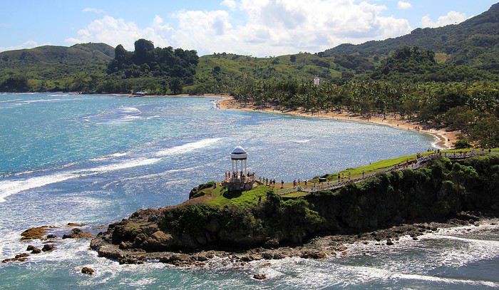
A peine débarqués du navire, on embarque à nouveau … mais sur un tout autre moyen de transport, finie la navigation, on prend place maintenant sur un drôle de véhicule hybride. Un genre de machine à grosses roues, dans un style intermédiaire entre camion et bus d'aventures tout-terrain. De simples banquettes font offices de sièges, quant aux dossiers et aux montants métalliques, ils sont tous rembourrés et capitonnés … On le comprend vite, la route, enfin la piste qui s'annonce pour cette virée risque d'être chaotique. Pas de doute, il ne doit pas s'agir d'un long ruban de bitume très tranquille !
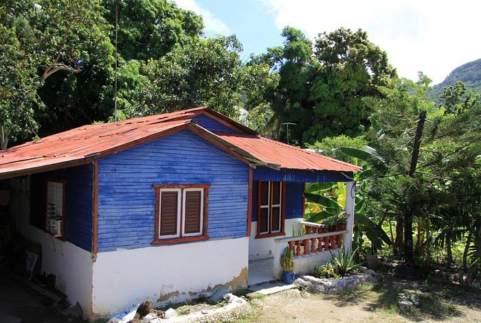
Pour l'instant nous traversons la paisible petite ville de Maimon. Une agglomération sans grand intérêt si ce n'est d'avoir un aperçu de la vie quotidienne locale. Des enfants bruyants jouent dans la cour de l'école et quelques habitantes font leurs achats dans les boutiques, la plupart sont de simples maisons/cases comme d'ailleurs beaucoup d'habitations. En voici deux exemples assez représentatifs du style de l'habitat local. Une simple maison recouverte de tôles ondulées mais dont les murs extérieurs sont agrémentés d'une teinte bleutée. C'est un aspect des plus courants dans la petite cité.
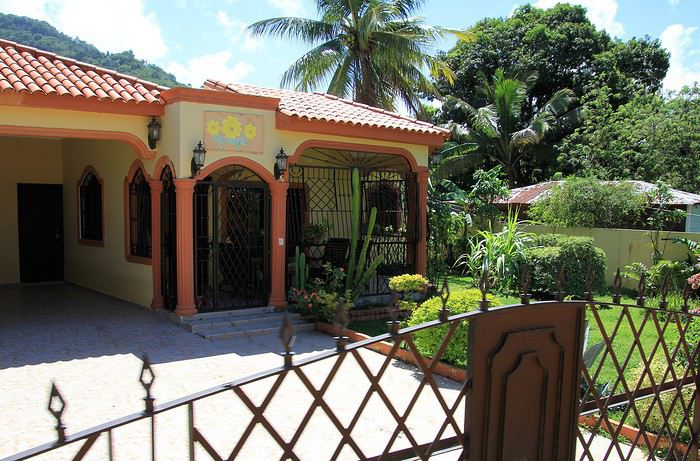
Plus loin, nous passons devant une maison un peu plus cossue : un propret jardinet et des grilles ouvragées entourent cette demeure plus élaborée et dont on imagine le meilleur confort intérieur.
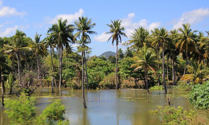
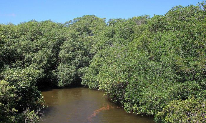
Passons la périphérie urbaine, place à la campagne. On le constate dès le début du trajet, les terrains aux abords de la voie sont détrempés voire inondés. Le chauffeur, sympa, nous informe que de récentes et fortes intempéries ont quelque peu endommagé la piste que nous devons emprunter … Au fond de cette baie, le courant et les torrents ont charrié des quantités de branchages, certains sont encore là, amassés au bord du rivage bordé de mangrove.
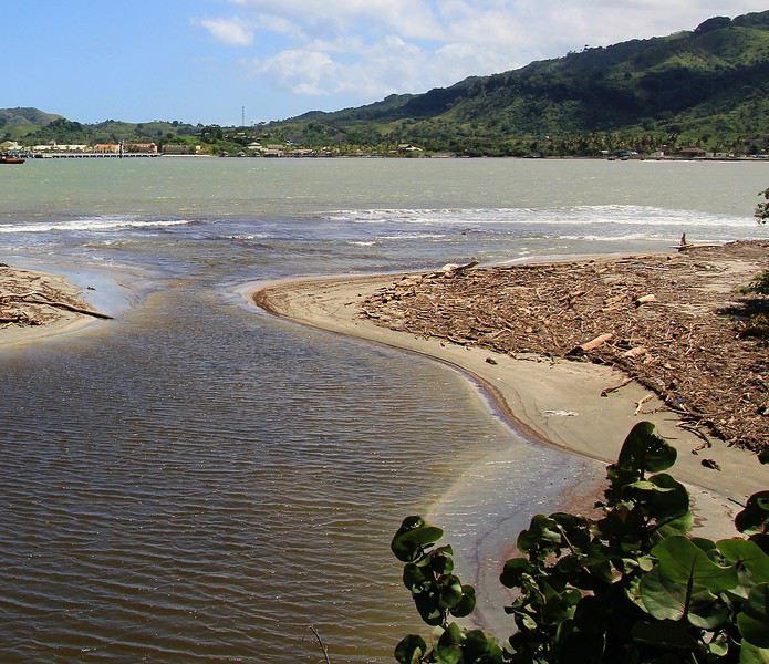
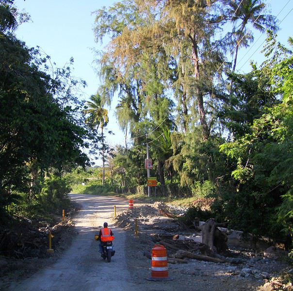
Sur ce tronçon, un torrent a emporté une partie de la route, le passage se fait désormais sur une seule voie constituée de terre battue.
To the Top West End
In this time of general travel-journal scarcity, I’m stepping up to tell you about a far-too-short getaway to the Top West End, a local term for the very northern part of Western Australia, right on the border ( ;) ) with the Northern Territory.
As usual, I didn’t manage to keep it short, but this time I’ve got photos to go with it!
August 2020. Since the opportunities to explore the world are extremely limited right now, all we (R&X) can do is explore our own island! Well, just a part of it, because with the state borders still closed, we’re stuck in Western Australia (WA).
Luckily, we’re pretty fortunate because this state is huge: over 2.5 million km² (that’s more than four times the size of France or 1.5 times Quebec). What’s more, stretching over 20 degrees of latitude between the Antarctic Ocean and the Timor Sea, you’ll find climates ranging from Mediterranean to arid to tropical. That’s actually why we decided to head as far north as possible. Sick of the endless rainy winter in Perth, bring on the heat of the Kimberley... way up Nooorth!
Friday. At the airport, the main terminal was closed (not enough flights), so we ended up in the annex (where flights to the various mines usually depart from). There was no crowd at the gate, and in this huge, single departure lounge, empty seats were plentiful. Only three flights were listed on the screens for the rest of the morning: the first to Coondewanna (?), the second to Darwin, and ours to Kununurra (code KNX).
A cool breeze swept through the half-open corridors along the runways. At the top of the walkway leading to the Fokker 100 (the Airbuses and Boeings are now parked!), a flight attendant greeted us with a basket full of sanitary masks. We were actually the only masked passengers (the staff weren’t wearing them either). With zero Covid-19 cases in WA at the time, the only rule was to maintain social distancing—something pretty hard to do on a full plane!
It was also my first time wearing a mask—it felt weird, pretty uncomfortable, and after a while, painful behind the ears. I really feel for those who have to wear one all day, every day. The flight lasted three long hours, but luckily, I had a good book. From the window, I watched an endless expanse of salt lakes in all shapes and sizes—round, elongated, gray, white, sometimes blue and green—and an infinity of winding, capricious meanders, along with long straight lines that led nowhere. The last half-hour got more interesting as rocky, swollen formations and long, sloping plateaus appeared. Against the vast ochre landscape, green patches became more frequent.
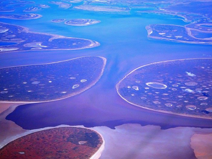
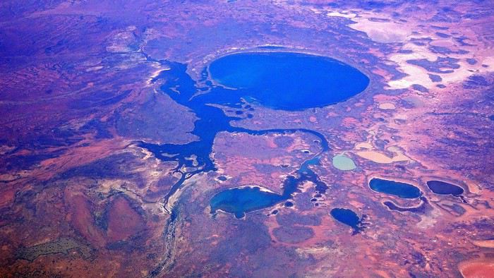
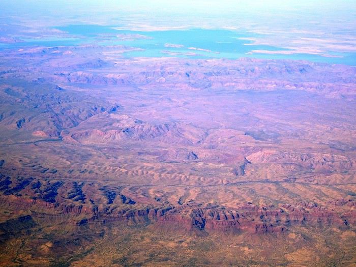
Just before landing, rows of green fields briefly appeared, along with an surprisingly wide river—but we were already rolling down the tarmac. A few hangars, a myriad of small, stationary planes, and a tiny terminal topped with a sign: “Welcome to Kununurra.”
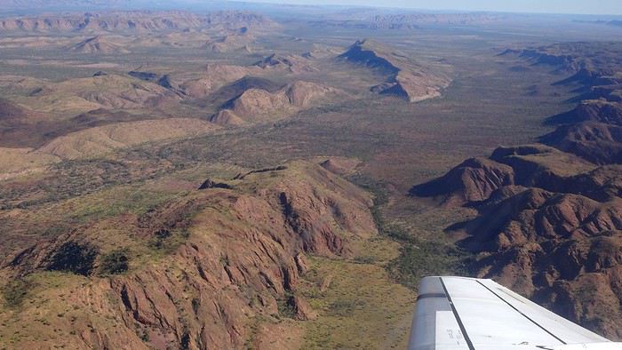
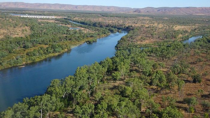
We wanted heat, and here it was—34°C the moment we stepped off the plane! We felt alive again and totally ridiculous in our jeans and sweaters. We quickly grabbed our suitcase and picked up the 4x4 we’d rented—more out of necessity, since only that type of vehicle can access the national parks we planned to visit.
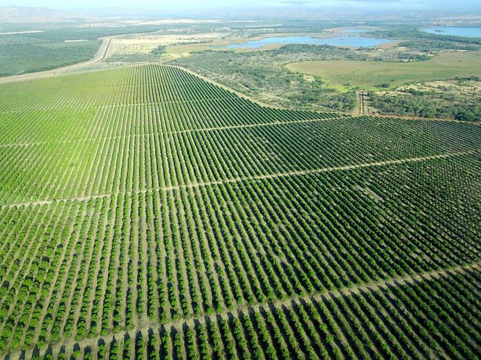
Just four kilometers separated us from Kununurra, a town of 5,000 people founded in 1961 during the construction of the Lake Argyle Dam and the development of the Ord River Irrigation Area Scheme (more on that later). On the horizon, mountain ranges (a bit of an exaggeration, since we know Mt. Meharry, WA’s highest ‘mountain,’ doesn’t even reach 1,250 meters!) and closer to the road, a few irrigation canals cutting through stretches of bush, then a huge park overlooking a small lake lined with reeds.
A row of baobabs (yes, there are baobabs in Australia too!), a series of motels with immaculate lawns, a gas station, and there’s the main street leading to the town center—that is, the parking lots of the two supermarkets, the bottleshop, the pub, the Town Hall, the municipal pool, and the Tourist Office (already closed!), and at the next roundabout, another park, the Presbyterian church, and a few other shops. In short, two or three green blocks that you can explore in no time.
One road leads to the small industrial area and one of the town’s three or four campgrounds, while another heads toward the residential neighborhoods, which look just like the typical suburbs you find in any Australian city—except with tropical vegetation. We stocked up at Coles, an identical copy of the one near our place, and—surprise—the prices were practically the same.
We checked into one of the motels. The receptionist listed the town’s three or four restaurants, insisting that it’s always better to book a table. She recommended the Pump House, a bit outside town on the lake’s edge. “Best spot to watch the sunset, but hurry up.” she told us. It was only 5:00 PM!
When we got there half an hour later, the place was packed, and the sun had already disappeared behind a row of trees! Sure enough, we’d see a few days later that the sunset can be a stunning spectacle—if you wait a bit for the sky (especially if it’s cloudy) to blaze and reflect in the lake’s calm waters. A little disappointed, we headed back into town, where we easily found the other lively spot in town: the pub (nothing like an old English pub). Above the long L-shaped bar, several giant screens (thankfully muted) were broadcasting live footy, rugby league, etc. In one corner, players circled the pool table, while in another, customers were digging into plates of the day’s special. Instead of rooms, there were various patios where groups of friends and coworkers (easily recognizable by the fluoro vests they were still wearing) were gathered. We found a table under a mango tree—unfortunately, a little too close to the guitarist strumming his entire Country Music repertoire, complete with Keith Urban-style tremolos. Guaranteed culture shock!
Since it’s the custom here, we called the Country Club to book a table before the kitchen closed! The CC is the town’s—and even the region’s—fancy spot. Dark decor, modern furniture, dim lighting, and the air conditioning blasting. The twenty or so customers had taken refuge on the vast terrace, lit by torches. The view of the tall eucalyptus trees, illuminated by spotlights shifting from red to blue, was breathtaking.
The menu was minimal, but the grilled salmon was excellent, and the Pavlova (the meringue dessert Kiwis and Aussies have been arguing over since 1906) with melon and watermelon was absolutely divine.
It wasn’t even 9:00 PM, and we were already in bed. Had we already adopted the Top West End’s chicken schedule?!
To be continued... Journal dedicated to Attila
As usual, I didn’t manage to keep it short, but this time I’ve got photos to go with it!
August 2020. Since the opportunities to explore the world are extremely limited right now, all we (R&X) can do is explore our own island! Well, just a part of it, because with the state borders still closed, we’re stuck in Western Australia (WA).
Luckily, we’re pretty fortunate because this state is huge: over 2.5 million km² (that’s more than four times the size of France or 1.5 times Quebec). What’s more, stretching over 20 degrees of latitude between the Antarctic Ocean and the Timor Sea, you’ll find climates ranging from Mediterranean to arid to tropical. That’s actually why we decided to head as far north as possible. Sick of the endless rainy winter in Perth, bring on the heat of the Kimberley... way up Nooorth!
Friday. At the airport, the main terminal was closed (not enough flights), so we ended up in the annex (where flights to the various mines usually depart from). There was no crowd at the gate, and in this huge, single departure lounge, empty seats were plentiful. Only three flights were listed on the screens for the rest of the morning: the first to Coondewanna (?), the second to Darwin, and ours to Kununurra (code KNX).
A cool breeze swept through the half-open corridors along the runways. At the top of the walkway leading to the Fokker 100 (the Airbuses and Boeings are now parked!), a flight attendant greeted us with a basket full of sanitary masks. We were actually the only masked passengers (the staff weren’t wearing them either). With zero Covid-19 cases in WA at the time, the only rule was to maintain social distancing—something pretty hard to do on a full plane!
It was also my first time wearing a mask—it felt weird, pretty uncomfortable, and after a while, painful behind the ears. I really feel for those who have to wear one all day, every day. The flight lasted three long hours, but luckily, I had a good book. From the window, I watched an endless expanse of salt lakes in all shapes and sizes—round, elongated, gray, white, sometimes blue and green—and an infinity of winding, capricious meanders, along with long straight lines that led nowhere. The last half-hour got more interesting as rocky, swollen formations and long, sloping plateaus appeared. Against the vast ochre landscape, green patches became more frequent.
Just before landing, rows of green fields briefly appeared, along with an surprisingly wide river—but we were already rolling down the tarmac. A few hangars, a myriad of small, stationary planes, and a tiny terminal topped with a sign: “Welcome to Kununurra.”
We wanted heat, and here it was—34°C the moment we stepped off the plane! We felt alive again and totally ridiculous in our jeans and sweaters. We quickly grabbed our suitcase and picked up the 4x4 we’d rented—more out of necessity, since only that type of vehicle can access the national parks we planned to visit.
Just four kilometers separated us from Kununurra, a town of 5,000 people founded in 1961 during the construction of the Lake Argyle Dam and the development of the Ord River Irrigation Area Scheme (more on that later). On the horizon, mountain ranges (a bit of an exaggeration, since we know Mt. Meharry, WA’s highest ‘mountain,’ doesn’t even reach 1,250 meters!) and closer to the road, a few irrigation canals cutting through stretches of bush, then a huge park overlooking a small lake lined with reeds.
A row of baobabs (yes, there are baobabs in Australia too!), a series of motels with immaculate lawns, a gas station, and there’s the main street leading to the town center—that is, the parking lots of the two supermarkets, the bottleshop, the pub, the Town Hall, the municipal pool, and the Tourist Office (already closed!), and at the next roundabout, another park, the Presbyterian church, and a few other shops. In short, two or three green blocks that you can explore in no time.
One road leads to the small industrial area and one of the town’s three or four campgrounds, while another heads toward the residential neighborhoods, which look just like the typical suburbs you find in any Australian city—except with tropical vegetation. We stocked up at Coles, an identical copy of the one near our place, and—surprise—the prices were practically the same.
We checked into one of the motels. The receptionist listed the town’s three or four restaurants, insisting that it’s always better to book a table. She recommended the Pump House, a bit outside town on the lake’s edge. “Best spot to watch the sunset, but hurry up.” she told us. It was only 5:00 PM!
When we got there half an hour later, the place was packed, and the sun had already disappeared behind a row of trees! Sure enough, we’d see a few days later that the sunset can be a stunning spectacle—if you wait a bit for the sky (especially if it’s cloudy) to blaze and reflect in the lake’s calm waters. A little disappointed, we headed back into town, where we easily found the other lively spot in town: the pub (nothing like an old English pub). Above the long L-shaped bar, several giant screens (thankfully muted) were broadcasting live footy, rugby league, etc. In one corner, players circled the pool table, while in another, customers were digging into plates of the day’s special. Instead of rooms, there were various patios where groups of friends and coworkers (easily recognizable by the fluoro vests they were still wearing) were gathered. We found a table under a mango tree—unfortunately, a little too close to the guitarist strumming his entire Country Music repertoire, complete with Keith Urban-style tremolos. Guaranteed culture shock!
Since it’s the custom here, we called the Country Club to book a table before the kitchen closed! The CC is the town’s—and even the region’s—fancy spot. Dark decor, modern furniture, dim lighting, and the air conditioning blasting. The twenty or so customers had taken refuge on the vast terrace, lit by torches. The view of the tall eucalyptus trees, illuminated by spotlights shifting from red to blue, was breathtaking.
The menu was minimal, but the grilled salmon was excellent, and the Pavlova (the meringue dessert Kiwis and Aussies have been arguing over since 1906) with melon and watermelon was absolutely divine.
It wasn’t even 9:00 PM, and we were already in bed. Had we already adopted the Top West End’s chicken schedule?!
To be continued... Journal dedicated to Attila
Conseils pour un voyage en Crète et Santorin English translation pending
Nous projetons un voyage Crète puis Santorin en septembre2021
Pourriez vous nous donner des conseils
merci d'avance
Louer une voiture avec tente de toit aux États-Unis English translation pending
tout est dans le titre ...
est-il facile de louer une voiture , pas forcément 4*4 avec une tente de toit aus States pour réduire le cout logement en hotel et toujours pouvoir se caser dans les zones en tension ? (pour 2 !)
merci !
Cartographie des régions moustiquogènes du Canada English translation pending
Cartographie des régions moustiquogènes au Canada?
A quelques amis qui ne connaissent du Canada que quelques grandes villes et qui m’interrogeaient sur la question des moustiques (y-a-t-il une carte des moustiques? etc...) j’ai apporté la réponse suivante
Non il n’y a pas de cartes des moustiques mais ... ...comme partout ailleurs, au Canada les moustiques aiment les zones humides or le Canada détient quelque chose comme un quart des zones humides de la planète soit environ 14 % de la surface du Pays et près de 1,3 million de kilomètres carrés. …ce qui constitue évidemment un énorme potentiel moustiques
La carte des zones humides de l’Atlas du Canada est donc ce qui se rapproche le plus d’une ‘’carte des moustiques’’
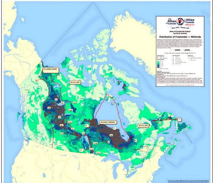
Ce document reconnaît 6 principaux degrés croissants de zônes humides: blanc verdâtre, vert tendre, vert moyen, vert sombre, bleu et bistre. Dans le blanc verdâtre on a moins de 5% de zônes humides. Dans le bistre: on a plus de 65% de zônes humides
ce n’est pas compliqué de l’interpréter…plus la couleur est foncée (du blanc verdâtre au bistre) plus on est haut dans l’échelle moustiques et on voit bien la corrélation qui existe entre les couleurs foncées Les Terres Basses de la Baie d’ Hudson ainsi que les Plaines Intérieures
J’y ai indexé ( de 1 à 22) les principaux secteurs qui ont fait l’objet dans le passé ( XIXème, XXème siècle, ) ou dans les années plus récentes de récits, de témoignages sur les attaques épiques de moustiques...Des récit souvent de personnalités.
Si l’on s’en tient aux itinéraires touristiques habituels tels que les villes, le lac Saint Jean, les Parcs des Rocheuses…. on aura normalement pas d’horribles histoires de moustiques à raconter à son retour de vacances .
Par contre si l’on veut vivre la vraie Aventure canadienne, le grand voyage en canoe qui séduit de plus en plus et qui concerne souvent les zones ‘’moustiquogènes’’ il faut bien se préparer.
Pour un aperçu ouvrir : ‘’ Témoignages ‘’ ….. c’est un peu lourd !
https://docs.google.com/document/d/e/2PACX-1vQUGIZ-d2unnPr1ogdhN457eGa4Aknh8pFWAFB0IivgL05VUAvR-MXDZqjRDCL22YKXp28__3KHAa3w/pub
à disposition pour commentaires éventuels...
A quelques amis qui ne connaissent du Canada que quelques grandes villes et qui m’interrogeaient sur la question des moustiques (y-a-t-il une carte des moustiques? etc...) j’ai apporté la réponse suivante
Non il n’y a pas de cartes des moustiques mais ... ...comme partout ailleurs, au Canada les moustiques aiment les zones humides or le Canada détient quelque chose comme un quart des zones humides de la planète soit environ 14 % de la surface du Pays et près de 1,3 million de kilomètres carrés. …ce qui constitue évidemment un énorme potentiel moustiques
La carte des zones humides de l’Atlas du Canada est donc ce qui se rapproche le plus d’une ‘’carte des moustiques’’
Ce document reconnaît 6 principaux degrés croissants de zônes humides: blanc verdâtre, vert tendre, vert moyen, vert sombre, bleu et bistre. Dans le blanc verdâtre on a moins de 5% de zônes humides. Dans le bistre: on a plus de 65% de zônes humides
ce n’est pas compliqué de l’interpréter…plus la couleur est foncée (du blanc verdâtre au bistre) plus on est haut dans l’échelle moustiques et on voit bien la corrélation qui existe entre les couleurs foncées Les Terres Basses de la Baie d’ Hudson ainsi que les Plaines Intérieures
J’y ai indexé ( de 1 à 22) les principaux secteurs qui ont fait l’objet dans le passé ( XIXème, XXème siècle, ) ou dans les années plus récentes de récits, de témoignages sur les attaques épiques de moustiques...Des récit souvent de personnalités.
Si l’on s’en tient aux itinéraires touristiques habituels tels que les villes, le lac Saint Jean, les Parcs des Rocheuses…. on aura normalement pas d’horribles histoires de moustiques à raconter à son retour de vacances .
Par contre si l’on veut vivre la vraie Aventure canadienne, le grand voyage en canoe qui séduit de plus en plus et qui concerne souvent les zones ‘’moustiquogènes’’ il faut bien se préparer.
Pour un aperçu ouvrir : ‘’ Témoignages ‘’ ….. c’est un peu lourd !
https://docs.google.com/document/d/e/2PACX-1vQUGIZ-d2unnPr1ogdhN457eGa4Aknh8pFWAFB0IivgL05VUAvR-MXDZqjRDCL22YKXp28__3KHAa3w/pub
à disposition pour commentaires éventuels...
Formalités spécifiques et destinations actuellement autorisées (ou pas) pour les voyageurs européens English translation pending
Frontières ouvertes ou fermées, visas délivrés ou pas, formalités spécifiques et autres particularités dues à la crise sanitaire. Un tour d'horizon actualisé quotidiennement par Action-Visas pour les Français et Européens souhaitant partir en voyage à l'étranger.
Lire la suite...
Trek le long des bisses valaisans en Suisse English translation pending
Samedi 11 juillet, je prends le train depuis mon domicile dans le canton de Vaud, direction Brigue et de là avec le car postal, je rejoins Blatten pour embarquer dans la télécabine qui m'emporte jusqu'à l'altitude de 2089 mètres au village de vacances de Belalp.
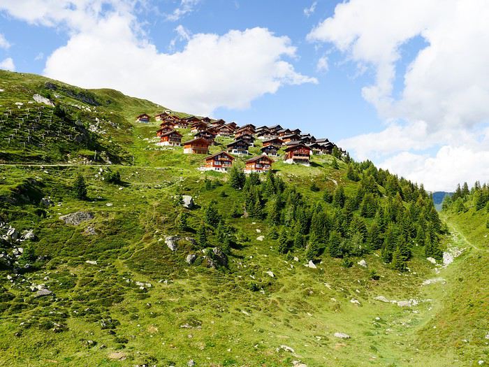
Le lendemain, dimanche 12 juillet, j'entame la 1ère étape d'un trek de 9 jours le long des bisses valaisans de la rive droite en suivant le guide réalisé par Armand Dussex et publié en 2018 aux éditions Rossolis, Bussigny, Vaud, Suisse 1er bisse ou suone en haut valaisan: le Nessjeri qui capte l'eau dans le Chelchbach, au pied du Grisighorn au dessus de Belalp
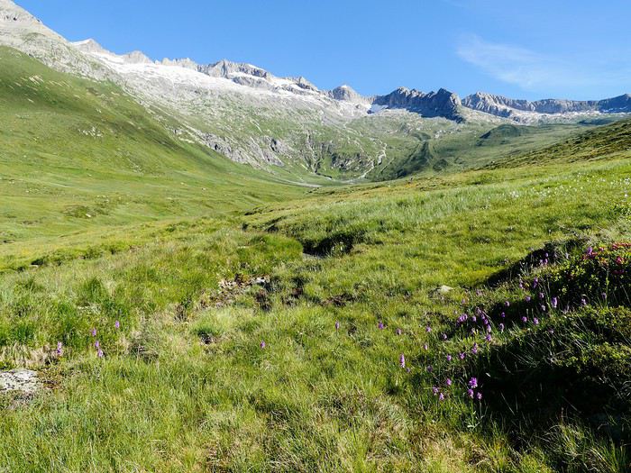
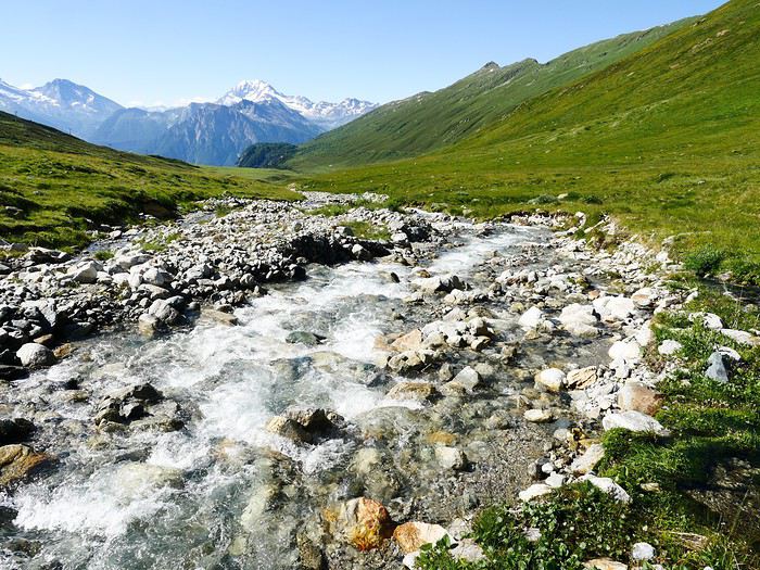
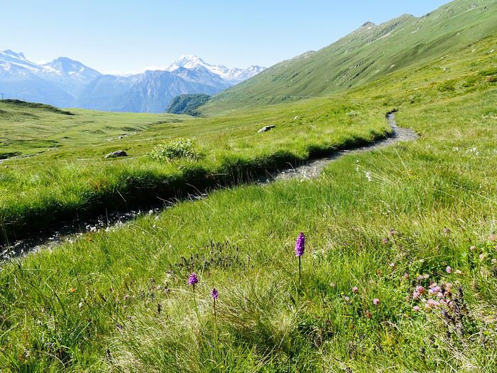
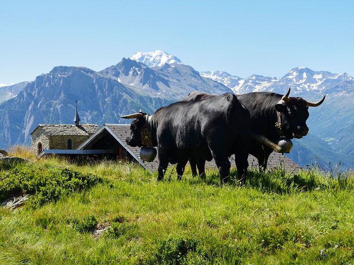
2ème bisse: Obersta connu déjà en 1435; il prend son eau dans le Mundbach et prend fin dans le Milchbach à l'est de Birgisch. Un bisse est un système d'irrigation qui va chercher l'eau dans la partie supérieure d'un torrent et qui détourne une partie de son eau pour la faire suivre à flanc coteau un cours qui permet aux villages d'altitude flanqués sur le flanc de montagnes peu "arrosées" de profiter de l'eau des glaciers qui naturellement file tout droit vers la plaine.
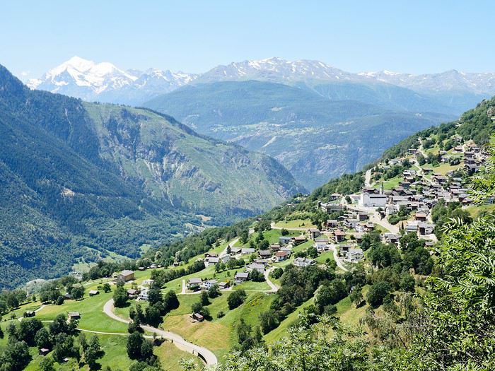
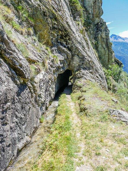
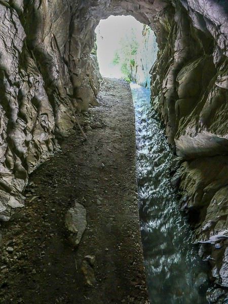
Comme on le voit, le trajet du bisse est parfois directement creuser dans le rocher pour éviter la difficulté de le faire suivre la pente d'une falaise abrupte... A suivre...
Le lendemain, dimanche 12 juillet, j'entame la 1ère étape d'un trek de 9 jours le long des bisses valaisans de la rive droite en suivant le guide réalisé par Armand Dussex et publié en 2018 aux éditions Rossolis, Bussigny, Vaud, Suisse 1er bisse ou suone en haut valaisan: le Nessjeri qui capte l'eau dans le Chelchbach, au pied du Grisighorn au dessus de Belalp
2ème bisse: Obersta connu déjà en 1435; il prend son eau dans le Mundbach et prend fin dans le Milchbach à l'est de Birgisch. Un bisse est un système d'irrigation qui va chercher l'eau dans la partie supérieure d'un torrent et qui détourne une partie de son eau pour la faire suivre à flanc coteau un cours qui permet aux villages d'altitude flanqués sur le flanc de montagnes peu "arrosées" de profiter de l'eau des glaciers qui naturellement file tout droit vers la plaine.
Comme on le voit, le trajet du bisse est parfois directement creuser dans le rocher pour éviter la difficulté de le faire suivre la pente d'une falaise abrupte... A suivre...