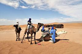
I’m just at the very beginning of my research, so I’m coming straight to you for some info. I’d like to visit Morocco to discover a bit of the country.
I’ve just found out about the Toubkal circuit, which I’d love to do in January/February. I’m open to going independently with a tent, food, etc., and also open to whatever other possibilities this circuit offers that I don’t know about yet... Could you share any random tips or info? I’d also love to hear your opinions?
What I like about this circuit is that it’s fairly accessible and seems interesting for many reasons.
I’ll leave it to you to share your thoughts—thanks in advance for your help! 🙂
Wishing you all lots of exciting plans for the new year ahead!
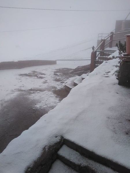
Hi there, there might be snow, especially at the mountain passes in January and February.
If that's the case, it's better to head to the Adrar Yagour plateau where you can see rock carvings on the plateau, a bit like the Vallée des Merveilles in the Mercantour near Nice.
To get to Adrar Yagour, once again, if it's not possible to cross the Toubkal pass, start from Setti Fatma and go up to Ouigrène—just be careful, as the trail from this village isn't easy to find.
Even though I was equipped with a GPS, a 1:50,000 memory card, and a paper topographic map (the one from the Spanish publisher Piolet), I still went in circles.
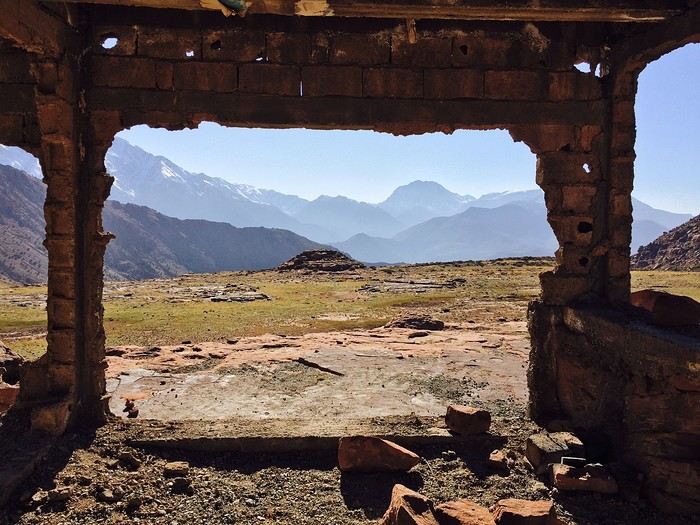
Otherwise, if the weather allows, the classic route to the Toubkal pass is to start from Imlil, follow the narrowing valley, and reach the pass at over 3,000 meters.
Then descend to Lake Imlil, which is really beautiful, and continue down to Amzouzarne.
From there, you can take a trail that loops back toward the Oukaïmeden ski resort and the Ourika Valley, returning to Setti Fatma—there are plenty of shared taxis to Marrakech.
Alternatively, from Imlil, you can go on foot or by car to Tachedirt, then climb to the pass and descend toward the Ourika Valley and Setti Fatma—this is a 3-day option.
Hi, there’s likely to be snow, especially at the mountain passes in January and February.
If that’s the case, it’s better to head to the Adrar Yagour plateau where you can see rock carvings on the plateau, a bit like the Vallée des Merveilles in the Nice Mercantour.
.
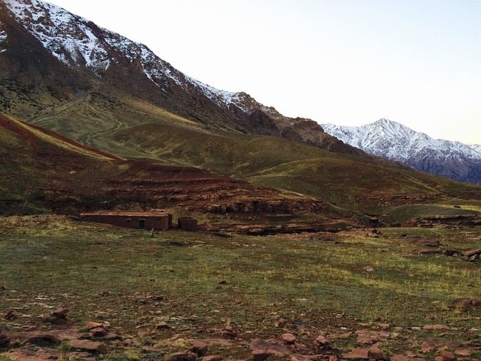
Good suggestion indeed, but the Yagour plateau is at 2,700m.
In January/February, there’s also a high risk of snow. Just go prepared. In a tent, it can get *freezing*—right now it’s -5/-7 at night. So bring a sleeping bag, gloves, fleece, ski pants, etc...
No need to go to Setti-Fatma to get there. You can reach it easily from the village of Tizi Oucheg.
Thanks for giving me something to think about🙂 I’ll take a closer look at all of this! Gotta consider the time factor and logistics, all that stuff....
In January/February there’s also a high risk of snow. Just make sure you’re well equipped. In a tent, it can get *really* cold—right now it’s -5/-7 at night. So bring a sleeping bag, gloves, fleece, ski pants, etc...
.
Good evening, thanks for the reply.
Since you live there, are the High Atlas passes snow-covered?
In January/February there’s also a high risk of snow. Just make sure you’re well equipped. In a tent, it can get *freezing*—right now it’s -5/-7 at night. So bring a sleeping bag, gloves, fleece, ski pants, etc...
.
Good evening, thanks for the reply.
Since you live there, are the High Atlas passes snow-covered?
Hi Mathews and happy new year!
Yes, it snowed these last two days—finally!
Here’s a photo a friend sent me this morning; he lives on the road to Oukaimeden.
I’m only at 1,000 meters, so no snow for us. But it’s not exactly warm—13/15 °C during the day and 4 °C in the evening.
There was a group I hosted who went up to the Yagour Plateau in February.
They slept in a shepherd’s hut, were really well equipped with sleeping bags, etc., and still came back frozen.
While it’s all relative, yes, I can handle the cold—as long as I have the right gear, of course. I’ve actually built up my kit over time through trips and experiences. I’ve camped in -15 to -20°C for several days... but that doesn’t make me an expert either . THAT SAID, your feedback has given me pause. Since this would be my first time in Morocco, and I’d obviously want to explore different spots, a bit of star-shaped trekking over a few days sounds perfect. I think I’m reworking the plan—logistics will be lighter. If you’ve got any tips or recommendations for good winter hiking bases that aren’t too snowy, I’m all ears! Thanks so much for your thoughtfulness, by the way😎
Thanks to Louvilunne for the photos.
The terrain is a bit tough and rugged for star-shaped hiking, so it takes time to get around.
From Setti Fatma to Ouigrène, it still took me a few hours even though the distance looks short on the map.
Thanks for your feedback and the photos! Well, as I quickly mentioned to Mathews, I’m looking for a base in the Atlas Mountains so I can do 2 or 3 day hikes—snow or no snow—but one thing’s for sure, no flat terrain 😎. I’m dropping the tent idea and keeping logistics light.
If you’ve got any suggestions, don’t hesitate! 🙂
I don’t know if I was clear enough when I mentioned "star-shaped" hikes. The idea is that I stay at a base, find solid accommodation, and can go on a few day hikes from there on foot. I think what you mentioned requires road travel if I’m not mistaken. So, yeah, I’m looking for a nice place to stay overnight and go hiking during the day. I don’t know if it’s doable, but that’s the plan. 😇
I’ve just discovered the Toubkal circuit and I’d like to do it next January/February. I’m open to going self-sufficient with a tent, food, etc., and also curious about other possibilities this route might offer that I’m not yet aware of... Any random tips or info you could share? I’d also love to hear your thoughts!
Hi,
First off, if you can, aim for February—the weather is usually better then. Clearer skies, less rain, and longer days.
I don’t have any firsthand itineraries to share for the Toubkal area, and my experience in the M’goun region is too old to be useful.
I’d recommend checking out what Martin Pierre offers. I highly recommend his route descriptions for their precision, detailed mapping, and coverage of treks and hikes in multiple countries, including Morocco. I’ve done several of his treks and hikes in France, Nepal, and Ladakh, and they’re the best I’ve found.
The treks in the Toubkal area tend to be long—around 12 or 13 days—but I think it’s possible to do just small sections, staying in the existing refuges and using local transport to complete a loop.
I’ve shared two links below, but you’ll see there are many more options across the High Atlas and other mountain ranges in Morocco.
Hi, I don’t know if you’ve found the info you were looking for about your trip? I’ve been to Morocco three times, but not yet to Toubkal... However, I have a friend who’s a guide there and sent me photos with quite a bit of snow at that summit last week, and he was accompanying tourists, so it’s doable. I’m not sure if you’d like to ask for a guide’s help with organizing and accompanying you, but I can give you his contact.
Sorry for the late reply. Why not head to Imlil? There are quite a few day hikes you can do there. I don’t know if you’ve already left, but make sure to pack some warm layers! It’s really freezing right now—1 degree in the morning. Brrr...
Nous envisageons de faire le Toubkal début octobre et je souhaiterai savoir si vous connaissez des guides? Si il faut le réserver à l'avance ou si nous pouvons…
Je cherche des compagnon (s) de randonnée pour faire le Djebel Toubkal en août. 4000 et quelques, c'est plus facile en groupe et plus sympa surtout. C'est pas…
Bonjour,
Nous souhaitons faire le trek de 4 jours reliant Mestia à Ushguli sans agence. Il est précisé dans les descriptifs qu'il existe des hébergement à chaque étape, mais on ne trouve pas d'info sur ces hébergements. Quelqu'un a-t-il des infos et un avis sur ce parcours?
We're planning to trek in Peru and Bolivia and would love to find some local agencies.
If you know any, could you share details on prices and, of course, the names of the agencies?
Which trek would you recommend?
Elocine
Je pars en autonomie totale sur un trek au Maroc (10jrs) Imilchil - Aghbalou.
Trouve t-on des cartouches gaz à vis (Coleman, Primus) à Marrakech (adresse) ou villages entre Imilchil - Aghbalou ?
Si non , trouve-t-on des cartouches Butagaz pour camping-gaz (petit volume 230 gr ...)
Merci d' avance pour vos réponses
Hello, I’d like to embark on a little trip in my home country, Switzerland. I’ll start walking from La Cure, heading toward Le Noirmont first, then I’ll improvise my route—but it’ll probably follow the French border... at least as far as Lac de Joux.
I’ll decide day by day how much farther to go after that. My goal is to stay in nature as much as possible, wander around for as long as I can, and restock food in villages or towns along the way.
I’m thinking of mostly camping, but we’ll see if I end up in a hotel or another campsite depending on my route.
I’d love to reach La Chaux-de-Fonds on foot... maybe even Delémont.
The whole thing should take about a week, give or take.
I’ll be bringing my dog, and I’m preparing for this as soon as I’m ready.
Any tips to make sure everything goes smoothly for us? Things I should know—or avoid? What about shepherds with their flocks of sheep? And isn’t hunting season open right now?
I’m not sure if what I’m planning is even doable, which is why I’m asking around.
This’ll be my first time doing something like this—wandering in nature *and* with a dog. I’m really excited for this adventure... and I need it. Thanks!
We’re really keen on ecosystems and want to hike in "natural" ancient forests—not planted woods or areas heavily degraded by human activity. Travel guides (like Lonely Planet) don’t provide much info on this. Could you point us to the most interesting spots?
Thanks in advance for your tips.
We wish you happy holidays and a fantastic 2026, full of discoveries!
Claire and Albert
Hi, this might not be the right section, but I’d like to know if it’s possible to start mountaineering with another person without necessarily hiring a guide. We’ve done quite a bit of hiking but not mountaineering—we’ll just do a half-day glacier course. After that, we were thinking of starting with La Grande Motte and the Pointe de la Traversière, which were recommended to us. Honestly, for things like roping up and knots, I’ll learn at home with lots of videos and a book.
Hi,
I don’t know Switzerland at all and was wondering if Vallée des Joux and especially Dent de Vaulion are packed early in the morning or late in the afternoon in July and September?
If so, do you have any quieter spots to recommend in the area, or in Luxembourg (yes, I know it’s not the same country 😉)?
Thanks a lot!
I’m starting this thread—lots of travelers here have done this trek.
When RMS is mentioned, it’s this agency: Ruwenzori Mountaineering Services (with an *s*), because there’s another one online called Ruwenzori Mountaineering Service (no *s*).
Their site:
www.rwenzorimountaineeringservices.com/
From what I gather, it’s the local mountain guide agency certified by the government?
Jaimerais savoir si quelqu'un aurait fait des treks sur le Ruwenzori et combien ça coute en moyenne, les infrastructures, les paysages la sécurité sur les lieux, merci beaucoup. J'attends avec impatience vos réponses.
We’re leaving in 9 days for a two-week trip to Madeira, mainly to hike.
From my research, I’ve found that since last year, access to most trails—and systematically for the most popular ones—is now paid. You have to pay an access fee of 4.50 € per person per classified hike in 2026, and even 10.50 € for the most iconic hike: Pico Arieiro to Pico Ruivo. When paying, you also have to choose a day and a 30-minute time slot for your start time. Of course, this reservation is neither changeable nor refundable, even if the weather that day is terrible.
Personally, given the massive influx of tourists to the island in recent years, I don’t mind paying a fee to help maintain the trails. Similarly, setting a limit on the number of people who can hike them per day is certainly preferable to preserve this priceless heritage.
However, what’s much less fair is that in reality, most of the available spots are reserved: 1/ for Madeira residents (which is normal); 2/ for "economic operators" (meaning local tour operators). For example, if you’re a non-resident (independent tourist), no booking is possible for the Pico Arieiro hike for an early morning start before September! So, unfortunately, we’ll have to skip this hike.
It’s the same issue for Ponta de São Lourenço, the 25 Fontes, Pico Ruivo... in short, all the most popular hikes. Oh well, we’ll skip those too!
So my question is: which hikes do you recommend where we won’t face the huge crowds that the others get? And where we can book the day before for the next day, taking the weather into account?
Finally, a quick accommodation question: we’ve booked the first week in Funchal, but I haven’t decided yet for the second week. Do you have any advice on where to stay in the south or north, preferably avoiding overly concrete-heavy and touristy spots?
I’m reposting about the logistics for Samaria Gorge.
I’d love to get recent info, especially about whether it’s possible to park my car in Omalos, do the hike, and then catch a bus back to my vehicle.
In theory, it’s doable, but when you check the KTEL website, there aren’t any feasible schedules listed. If anyone has recently organized this with reliable, verified details, I’d really appreciate it. Thanks in advance!
Hi there,
We’re flying from Montreal to Lyon this August to go hiking in the French Alps. We’ve rented a car and will be staying at campgrounds. We’re planning to do day hikes and want to stay a few days in one spot, do a few hikes, then move on to our next camping spot. Could you share your favorite spots or any recommendations for places to spend a few days with great hikes?
A few details:
We arrive in early August and leave in early September.
We’re looking for day hikes (or shorter), moderate difficulty, with a cumulative elevation gain of no more than 1000m, and of course, beautiful scenery!
We’d prefer not to drive too much—maybe it’s best not to head too far south and deal with unnecessary heat?
Along the same lines, if you know of any great campgrounds where we can start our hike directly without needing the car, we’d love to hear your suggestions!
Bonjour
Souhaitant faire de la randonnée sur cette île, je voudrais d'abord savoir quelle serait la période la plus favorable sachant que j'avais passé quelques jours en novembre 2018 pas pour cette activité mais plus pour une simple découverte de l'île et le temps n'était pas top notamment en montagne. Donc peut on choisir une organisation en étoile sachant que je louerai un véhicule avec éventuellement 2 points d'hébergement.
Je n'envisage pas d'intégrer une structure mais de partir à 2 et de s'organiser sauf si vous me conseillez une agence locale ou un guide local. Enfin même si je compte me procurer les différents supports, carte et topo guide plus gps je vous remercie de bien vouloir me communiquer les randos à faire en priorité
Merci beaucoup pour vos informations
I’m planning to do the Mercantour crossing following the Randoxygène route in mid-July.
I’m used to hiking in the mountains, but I sometimes get vertigo, for example on ridges with drops on both sides. I wanted to check if there are any T4 or T3-T4 sections and find out if there are any very exposed passages—and if so, where—so I can plan an alternative route.
Can anyone give me some info on this?
Thanks!
I’m planning a trip around Cap Corse and the AGRIATES in 2026, from May 8th to 15th (there are still 2 spots left, by the way! Just DM me if you're interested).
I’d love to know which hikes are worth prioritizing in the AGRIATES. We’ll be staying in SALECCIA for two days as our base—what should we focus on from there?
A round trip to IGNHU beach? Any other suggestions?
For Ostricano, I think it’s too far for a round trip...
Thanks for your tips!
Have a great day,
Anie, Toulouse
I’d like to get some info about the GR10 Pyrenees traverse. I need help planning the daily stages and accommodations—my wife isn’t an experienced hiker but walks a lot, so I’d like to schedule shorter walking days and thus a longer overall trip in terms of number of days.
Could anyone give me some help and advice?
Best regards,
New to this forum, I’m planning a pretty big project for 2028.
I’m heading to Nepal to do a trek from Kathmandu all the way to Everest Base Camp (a cool 5,300 m 😄).
This trek is a bit special because even though I’ll be part of a group, I’m going solo (so far, no problem—I’m used to it). But it’s my first real trek, and it’s also a humanitarian one: once I reach base camp, I’ll stay an extra week to help clean up the waste left by tens of thousands of climbers! Since I’m originally from South America, from two countries that share the Andes, I have a deep respect for mountains—they fascinate me. So Everest… it’s kind of the trip of a lifetime!
So, a little question for those who’ve done treks to Everest before… any tips for good mental preparation (I’m already working on the physical side)?
Hi there, I’m planning the Annapurna Circuit for March 2027 and I’m looking for a local agency with a local guide—preferably French-speaking—to arrange this trek for us. Any suggestions? Thanks
Hello!
We’re spending a few days in Toraja country at the end of May. We’d love to do a day trek—taking our time—on a route that’s stunning in terms of scenery, but not a level 5 in difficulty!
Any suggestions you can share, please?
Thanks in advance
I’d like to do the Mare a Mare Sud in May over 4 days. I’ve found quite a few places to stay along the route, but I’m stuck on the start and finish.
I’ll be arriving by plane on Sunday evening and would like to start pretty early on Monday morning. Ideally, accommodation right at the trailhead (Alzu di Gallina) would be amazing, but I can’t find anything. Any tips?
Also, for the transfer from Figari Airport to Porto Vecchio or Alzu di Gallina?
At the end, I’d like to pick up a rental car—any advice on that too?
I’m traveling solo by plane to Catania in May and plan to hike the northern side of Etna, starting from Linguaglossa where I’ll arrive by bus. After that, I’d love some info on how to get up to Piano Provenzana (shuttles or hitchhiking), since it seems there’s no public transport except in the summer. Can you sleep there in a free or cheap refuge, or camp? And how far up can you go without having to hire a guide? Thanks in advance. Bernard.
Bonjour a tous,
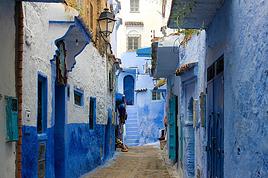
je pars en voyage au Maroc en aout et nous allons commencer par nous arrêter a Chefchaouen(nous sommes en voiture).
Ma question: quelqu'un peut il m'indiquer un itinéraire de rando en boucle d'entre 5 et 7 jours aux départ de Chefchaouen dans le parc de Talassemtane passant si possible par le pont de dieux?Ou un guide papier qui en reunis quelques uns?
Nous privilégions le camping sauvage et les gites.
Merci d'avance
Hi there, for those who’ve been recently—is it possible to find other solo travelers in March on the island to share transport or room costs? It doesn’t seem easy to travel on a budget.
If you have any recommendations for simple lodgings or places with dorms, I’d love to hear them.
For those who’ve done multi-day treks while moving around: do you need to bring your own sleeping bag? I’d love to hear about itineraries you’ve done without a guide, just with a map and GPS.
Thanks, and have a great day!
Hi everyone!
We’re planning a 15-day road trip to Scotland this summer, specifically to explore and hike on Lewis and Harris—places we’ve never been before. We’ve visited other islands on previous road trips in Scotland (we usually go in April for a week). This would be our first time in Scotland in the summer and for 15 days. We’re looking at late August to early September.
I’m currently drafting the itinerary. We’d be crossing from Ullapool and were thinking of spending 3 nights on Harris and 4 nights on Lewis.
Does that sound balanced to you? Is it better to keep the same accommodation on Harris and the same on Lewis to explore the area? I’d love to hear about any past experiences you’ve had on these islands.
Thanks!
Hi there, I’m trying to leave for 15 days very soon to São Vicente. I’m either looking to join an agency or figure things out on my own to go hiking on one of these islands or both. From what I’ve seen, it’s not easy to organize with local transport, so it gets expensive. Can I use the services of a small local agency? I’m looking for the simplest way to hike for several days. Also, how do you get from São Vicente to São Nicolau? Thanks in advance and have a great day!
Aichatou
I’ve been wanting to do this for several years, and this year’s the one. Next September, I’ll be trekking in Tusheti (Georgia), from Omalo to Shatili.
Of course, I won’t be renting a vehicle that’d just sit unused. No problem getting to Pshaveli, but from there to Omalo, it’s a dirt road (still the case?)
There must be some form of public transport since there are so many guesthouses, and not all travelers come in a 4x4.
If any of you have been to Omalo, could you confirm that these shared transports exist and how often they run?
we’re planning a trip to Yellowstone and hoping to do a three-day backcountry hike if we get a permit.
if any of you have done this before, could you let me know if it’s possible to find water along the way? And if we can transport it, are we allowed to use a stove?