Bonjours à tous,
Avec au moins un amis nous voulons faire du 6 mai au 2 juin une boucle dans l'amérique de l'ouest!
La première partie correspond aux grands parcs (de las vegas jusqu'a Seattle)
Ensuite comme "2eme partie" redescendre la cote Pacifique jusqu'a Los angeles pour enfin revenir à Las vegas.
Le programme:
J106-maiMontreal--> Las vegas
J207-maiLas vegas--> Grand Canyon
J308-maiGrand Canyon--> Coral Pink
J409-maiCoral Pink--> Bryce Canyon
J510-maiBryce Canyon--> Capitol Reef
J611-maiCapitol Reef--> Monument valley
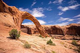
J712-maiMonument valley--> Canyonlands
J813-maiCanyonlands--> Flaming Gorge
J914-maiFlaming Gorge--> Grand Teton
J1015-maiGrand Teton--> Yellowstone
J1116-maiYellowstone--> Yellowstone
J1217-maiYellowstone--> Yellowstone
J1318-maiYellowstone--> Seattle
J1419-maiSeattle
J1520-maiSeattle--> Olympic National parc
J1621-maiOlympic National Parc--> Cressent City
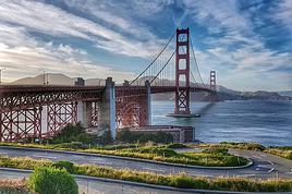
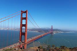
J1722-maiCressent City--> San Francisco
J1823-maiSan Francisco
J1924-maiSan Francisco
J2025-maiSan Francisco--> Malibu
J2126-maiMalibu--> Los Angeles
J2227-maiLos Angeles
J2328-maiLos Angeles--> Park Yosemite
J2429-maiPark Yosemite
J2530-maiPark Yosemite--> Death Valley
J2631-maiDeath Valley--> Las vegas
J2701-juinLas vegas(tour de Lake meaf)
J2802-juinLas vegasMontréal
Les cartes:
1ère partie: de Las vegas à Olympic National Parc (pret de Seattle)
http://maps.google.fr/maps?f=d&hl=fr&geocode=9137226217260276092, 35.552197, -113.352803%3B5849999018480486772, 36.037910, -112.121990%3B526813687861542682, 37.035535, -112.734941%3B4789283817137691522, 37.211490, -112.958210%3B13999805591947156330, 37.628960, -112.173140%3B6702316920067638617, 37.850710, -111.027170%3B12126664005344896362, 38.308273, -111.290027%3B10587412535558599147, 37.010454, -110.169000%3B16247763260834854008, 38.474840, -109.740980%3B3611127346731022068, 38.453460, -109.821840%3B7199149388837893078, 38.572706, -109.654485%3B13181576728595404721, 38.768400, -109.588590%3B14947234488475370765, 40.369515, -109.330645%3B224545241922135170, 40.895787, -109.514322%3B11936855544383895379, 44.005910, -110.679040%3B10977800491046766316, 44.515600, -109.095410%3B14562217284070904037, 44.703461, -110.593960%3B6858537080430449075, 44.646360, -110.856250%3B2789643931419968159, 47.605980, -122.340100%3B13743054300133011342, 48.116170, -123.446950&saddr=Las+Vegas, +NV, +USA&daddr=AZ-66+%4035.552197, +-113.352803+to:S+Entrance+Rd+%4036.037910, +-112.121990+to:Sand+Dunes+Rd+%4037.035535, +-112.734941+to:Zion+Mount+Carmel+Hwy+%4037.211490, +-112.958210+to:UT-63+%4037.628960, +-112.173140+to:Burr+Trail+Rd%2FCR-1668+%4037.850710, +-111.027170+to:UT-24+%4038.308273, +-111.290027+to:US-163+%4037.010454, +-110.169000+to:UT-313+%4038.474840, +-109.740980+to:Grand+View+Point+Rd+%4038.453460, +-109.821840+to:UT-279+%4038.572706, +-109.654485+to:Arches+Entrance+Rd+%4038.768400, +-109.588590+to:US-40+%4040.369515, +-109.330645+to:Little+Alabama+Rd%2FNF-157+%4040.895787, +-109.514322+to:US-191%2FUS-287%2FUS-89+%4044.005910, +-110.679040+to:US-14%2FUS-16%2FYellowstone+Ave+%4044.515600, +-109.095410+to:Norris+Canyon+Rd+%4044.703461, +-110.593960+to:Grand+Loop+Rd+%4044.646360, +-110.856250+to:Alaskan+Way+Viaduct%2FWA-99+N+%4047.605980, +-122.340100+to:W+8th+St+%4048.116170, +-123.446950+to:47.713458, -124.414673&mra=mi&mrcr=17&mrsp=21&sz=10&via=1, 11, 17&sll=47.718077, -124.233398&sspn=0.413917, 1.2854&ie=UTF8&ll=42.085994, -123.244629&spn=1.826345, 5.141602&z=8
2ème partie: De Olympic National parc à Las vegas
http://maps.google.fr/maps?f=d&hl=fr&geocode=17461792687036748886, 47.707420, -124.413860%3B9710024326779286401, 41.775960, -124.185400%3B6323887982724151444, 40.805820, -124.138630%3B8440849624483734545, 34.865000, -120.414430%3B2172742818539915609, 34.034980, -118.703372%3B1019078547450457347, 37.751740, -119.785100%3B13025311082430242339, 37.939630, -119.136120%3B1856097064190997666, 36.479870, -116.869320%3B16104112102402555340, 36.225480, -115.996140%3B17135078653606546651, 36.171410, -115.132860%3B12745636549054618180, 36.506270, -114.428470%3B14635190605269914930, 36.024710, -114.798090%3B16635630307090444832, 36.038320, -115.019240&saddr=US-101+%4047.707420, +-124.413860&daddr=US-101+S+%4041.775960, +-124.185400+to:US-101+S+%4040.805820, +-124.138630+to:San+Francisco, +CA, +USA+to:E+Clark+Ave+%4034.865000, +-120.414430+to:Malibu+Canyon+Rd+%4034.034980, +-118.703372+to:Los+Angeles+to:Big+Oak+Flat+Rd+%4037.751740, +-119.785100+to:CA-120%2FTioga+Pass+Rd+%4037.939630, +-119.136120+to:CA-190+%4036.479870, +-116.869320+to:NV-160+%4036.225480, +-115.996140+to:I-515+S+%4036.171410, +-115.132860+to:S+Moapa+Valley+Blvd%2FNV-169+%4036.506270, +-114.428470+to:Lakeshore+Rd%2FNV-166+%4036.024710, +-114.798090+to:36.146747, -115.142212&mra=dme&mrcr=9&mrsp=14&sz=8&via=4, 10, 12, 13&sll=35.670685, -113.80188&sspn=1.999172, 5.141602&ie=UTF8&ll=41.574361, -115.708008&spn=14.719196, 41.132813&z=5
Est ce que cet itinéraire est réalisable dans le temps que nous avons prévu? Avez vous des conseils, ou des lieux que je n'ai pas encore prévu? ou des lieux à éviter?
Toutes les informations concernant ce voyage, peuvent m'etre utile.
Je vous remercie
Sylvain
Original post