Nous comptons faire une partie de la provence à vélo chargé . Pourquoi pas le Lubéron. Et nous serons en camping. le problème c'est que les cotes je ne suis pas habituée car d'habitude on fait plutôt des chemins de halage ou des voies vertes. Pouvez vous me donner des renseignements à ce sujet ainsi que des bonnes adresses de camping et des idées sympas de visite . Merci beaucoup.
Anne 😊
BERNARD "Aucun conseil n'est plus loyal que celui qui se donne sur le navire en péril.
Voiture : Invention ingénieuse, permettant de contenir 110 chevaux dans le moteur et un âne au volant.
bjr tu as le site :veloenluberon avec tous les renseignements et denivelles ;j'ai fait le tour complet +des variantes c'est tres beau à faire mais evitez la periode estivale , chaleut et trop de monde;le mieux c'est avril mai ;bon trip dans le sud!
Sur ce même site, le dépliant sur les hébergements est en fait assez incomplet, et en tout cas pas du tout exhaustif.
Pour les dénivelées, n'étant pas du tout adeptes des montées en vélo, on te dira à notre retour. Pour le moment, cela nous inquiète un peu, notamment suite à notre dernière sortie d'une semaine en Normandie, ou on en avait bavé dans les montées.
Merci pour la réponse.
Je vous souhaite un bon périple et suis très intéréssée par votre témoignage au retour car vous êtes comme nous apparemment pas très adeptes des montées!!!!!!
A bientôt de vous lire
Anne
😎
il y a un topo guide très très bien fait sur le lubéron à vélo mais il y a beaucoup de relief, ce sont essentiellement des montées et des descentes. A vous d'adapter le nombre de kms/jour et de ne pas trop vous charger. Et surtout.......... ne pas le faire l'été où il fait beaucoup trop chaud.
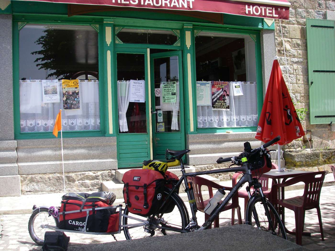
bonsoir, j'ai fais le tour du Luberon en 2008 avec sacoches , ça monte un peu en faite c'est des montagnes russe!!!! mais rien de insurmontable , on a opter pour des petits Hôtels pas cher
on est partis en avril le matin un peu frais , aller courage 😎 Barbie
il n'y a qu'une chose qui puisse rendre un rêve impossible, c'est la peur d'échouer
Salut! Je ne veux pas te décourager, mais je garde un souvenir galères du Lubéron. Une vrais suivis de montes et descends, en très courtes distances, (changement de vitesse constantes, de coup! ça devenais chient!!!). Le bords de petites routes en pas très bon état, donc, je me trouvais (des moments) à rouler écarté du bord de route, pas toujours signalé et comme cerise: le vent en contre.
Quelque Kms avant Banon le camping plus moche et cher que j'ai vu de ma vie. De coup je laisse tomber le Lubéron et je suivis mon trajet ailleurs.
Il y a des très beaux coins là-bà, mais moi je n'ai pas eu de chance......
Si tu es toujours motivé, je crois que dans la guide: France à vélo, de Lonley Planet il y a un chapitre Lubéron, elle est epuissé, mais tu peux toujours la trouver dans une bibliothèque publique.
Il y a 5 ans que je me suis remise au vélo et moi aussi j'affirmais que je ne ferai jamais le Ventoux !!!!!!!!!!!!!!!!!!!!!!!!!! ALors ne jure de rien. Le plus beau ce sont les gorges de la bourne entre orange et le ventoux.
De retour du tour du Lubéron à vélo, en partant de Cavaillon, dans le sens contraire des aiguilles d'une montre.
C'est clairement très vallonné. Sur le dépliant, on voit quelques grosses montées, en particulier après Forcalquier, mais finalement ces montées ne sont pas trop raides et passent bien, en y allant doucement.
Par contre, on rencontre fréquemment de petites côtes, somme toute raides. Ma femme en a fini quelques unes à pied.
A noter que, sur 6 jours, nous avons fait 2 jours à près de 800 m de dénivelée positive, ce qui commence à faire pas mal. Et tous les jours ça monte et descend. Plus de 3000m de dénivelée au total.
Pour nous : 1er jour : +360 m, -250m
2ème jour : +785 m, -560 m
3ème jour : +475 m, -445 m
4ème jour : +795 m, -790 m
5ème jour (jour de pluie, petite étape) : +120 m, - 285 m
6ème jour : +580 m, -740 m
Le total des montées diffère de celui des descentes car je n'ai pas toujours pensé à déclencher l'enregistrement de l'altimètre au départ des étapes, mais cela donne un bon aperçu de ce à quoi s'attendre : pas que du plat, loin de là.
Au final, ça passe même en n'étant pas trop sportif, mais il vaut mieux éviter d'être trop chargé, et avoir des vitesses sur le vélo adaptées aux côtes (pas de vélo de ville). Et savoir garder le moral quand, en pédalant à 6 km/h dans les montées, tu te fais doubler allègrement.
Les routes sont très majoritairement bonnes et roulantes, avec peu de fréquentation. Le paysage nous a paru plus monotone qu'en rando à pied (sauf les premier et dernier jours), et pour trouver intérêt à ce tour, il faut absolument prendre le temps de visiter les villages.
Après Forcalquier, l'itinéraire passe par un col relativement élevé, puis descend sur Cereste. Ce qui est curieux : vu l'effort de cette longue montée, il vaut mieux monter encore un peu pour aller sur Vachères (très beau village), puis descendre via Oppédète : très beau aussi : aller au bout du village pour une belle vue sur les gorges. Si vous êtes sous tente, cela vaut le coup de s'arrêter dans ce village, et de faire la rando pédestre des gorges. Si non, l'absence d'hébergement pose problème pour y séjourner.
Au final, une sortie agréable, mais pas exceptionnelle, à faire sans doute au printemps pour éviter les grosses chaleurs et voir la nature en fleurs.
PS : a priori, on peut planter la tente en camping sauvage tous les jours, si on sait se faire discret.
Lauricath, non je t'assure une chose est sûre c'est qu'on ne fera pas le ventoux. Notre formule c'est pas d'aller plus haut mais de découvrir tranquillement et en visitant. le ventoux à vélo c'est pas pour nous
😊
Anneb
Merci beaucoup minifamille pour vos conseils précieux, on aimerait savoir combien de kilomètres vous faisiez par jour. C'est super sympa d'avoir pris le temps de nous répondre. On est obligé de le faire en août alors il fera chaud et on voudrait visiter car c'est une région que l'on ne connait pas.
😏
Anneb
Merci marie 31 ça c'est toujours génial d'avoir des adresses de campings sympas.
Combien de kilomètres faisiez vous par jour car nous ferons ça en Août alors la chaleur.....
🙂
anneb
Peux-tu me donner ton mail perso pour t'envoyer un intinéraire dans le Luberon de Manosque à Manosque. J'ai essayé en vain de le passer sur ce forum mais je suis un peu nul en informatique. J'avais établi cet itinéraire pour quelqu'un de ce forum et je l'ai retrouvé dans mes archives. Tu en feras ce que tu veux.
Je suis du coin, je connais pas mal le Luberon mais pas trop les hébergements car je n'y dors bien sûr jamais.
Salut!! Je vois que tu te inquiète par la chaleur, en effet le plus pratique c'est de rouler très tôt le matin, vers 7-8h. Avant midi ce arrêter dans une jolie village, chose de manger et la visiter en attendant que la chaleur descente, vers 16h, et là tu recomence a rouler. Mais il me semble, je crois.....que il faisait moins chaud que dans le sud, sud (Camargue, Nice, etc).
Si ma réponse ta vraiment découragé, (désolé)....tu as déjà pensé à La Drôme?? très joli, pas très- très touristique et pas cher!!! (en comparations des autres régions, bien sûr).
OUi, pas problème! Mais malheureusement je suis arrivée dans cette région a la fin du voyage, alors, je pas beaucoup parcouru.
De Montélimar D540 tu passe par Bordeaux, petite ville très joli, où on mange très bien au Bar-Hotel. Là tu te prepars a monter le col de la Chaudière, 1000mts et poussières, en descendat tu as un vu très belle de la ville de Saillans, pas très loin il y a des camping, très sympa ses propieters; mais je ne pourrais pas te dire où exactement.
J'aurais voulu arriver a Die, que on dit que est très beaux, aussi....;
je te raconte un peu plus demain, je ne me rappel pas trop et il faudrais que je cherche mon carnet de route.....
Bon pour le Ventoux c'est comme tu veux mais si tu me connaissais tu te dirais que tu peux vraiment le faire C'était une très belle aventure.
Concernant le Lubéron je trouve que c'est de la folie de le faire en plein mois d'Août du fait de la chaleur.
Connais tu le site suivant : www.veloloisirluberon.com/ ? Il est excessivement bien fait et tu trouves tout ce qui est nécessaire pour préparer ton circuit.
SI vous avez le matériel de camping à porter, je vous conseille de ne pas dépasser les 40 kms/jours. Cela vous permet de visiter tranquillement, ne pas rouler en pleine cagnasse etc....
Pour le topo guide je trouve que l'idéal est celui édité par CHAMINA dans sa série randonnée itinérante en vélo : Le lubéron
Salut! bon!... je continue, on étais où? ahhhh, si! Drome
Tu peux passer par le gorge de l'echaris, il y a aussi, ou est la même route, je ne sais plus, la route de trente pas, que si etais un vrais merveille, un des souvenir plus inoubliables, et sur cette chemin il y a un camping super: vraiment pas cher, impecable, le patrons très aimables, et il y a aussi, un toboggan aquatique!!!!!! je me suis éclaté!!!
En effet, je suis suivi la départemental: 540, 61, 64.
Une chose sûr... ça sent par tout la lavande, avec des éclat de fenouil, un vrais délice.....
Comme j'ai te déjà dit, mon parcours dans la région a été court mais bon!!
J'espère que mes petite infos aient été utiles. Et tu nous raconteras tes aventures, Bon route!!!
Salut,
en réponse a alexia, oui c'est les gorges de trente pas on arrive par le col de la Sausse , le spectacle est grandiose la descente magnifique!!!!
et juste avant de arriver dans le village de Saint Ferréol Trente Pas il y a le camping , si non je conseille vivement l'auberge des Trente Pas , pas cher du tout , mais il faut réserver , des gens très sympa et on mange très, très bien!!!
bon voyage Barbie
il n'y a qu'une chose qui puisse rendre un rêve impossible, c'est la peur d'échouer
Lauricath, Merci beaucoup pour tes renseignements.
Je connais déjà le site indiqué et je viens d'acheter le guide chamina qui est effectivement très bien fait.
On sera bien obligés de le faire en aoùt car on n'a pas d'autres vacances.....
anneb
😏
Drôme, Lubéron ou ailleurs, le secret de la montée à vélo (et surtout quand on est chargé et peu entraîné) c'est la patience. Petit plateau, trouver un rythme de pédalage confortable, pas en force mais pas frénétique non plus, un rythme qu'on puisse garder pendant des heures. Adapter sa respiration au rythme du pédalage : inspirer sur 3 coups de pédale, expirer sur 3 coups de pédale; si ça devient plus raide, passer à une inspiration tous les 2 coups de pédale... Penser à boire fréquemment, toutes les quelques minutes si le soleil tape. Une fois qu'on a trouvé son rythme, la plus longue des montées n'est plus qu'une méditation.
Si on a l'habitude de rouler moins chargé, ne pas hésiter à se forcer à rouler franchement moins vite que d'habitude, au moins les 2-3 premiers jours. Chercher à lutter contre ce poids supplémentaire est le plus sûr moyen de se faire mal aux genoux. Au contraire, accepter sa condition de poids lourd sous-motorisé.
Tout ça est plus facile à gérer sur une longue montée régulière que sur des successions de courtes montées/descentes. Mais le principe reste le même.
Votre discussion m'a donné envie. Du coup, nous partons fin mars quelques jours pour faire une partie du lubéron ( du 23 au 27) et un peu du plateau du vaucluse (gorges de la nesque)
Mon souci : est ce que les campings seront ouverts ?
Les gorges de la nesque c'est géant. Je les ai faites l'an passé après l'ascension du ventoux à vélo. C'est absolument magnifique, c'est vraiment à faire à vélo.
Du coup je serai bien intéréssée par ton retour d"experience fin mars. serez vous en vélo chargé ?
Merci pour tout cela
😉
anneb
Nous serons chargés. En fait, c'est un petit test pour le matos que nous avons acheté pour notre voyage en norvege, cet été. Tout y sera pour l'autonomie compléte : remorques, sacoches, tente... et une bonne journée rando dans le colorado de Rustrel.
Sauf problème météo important, vous aurez bientot mes impressions.
C'est vraiment gentil de nous avoir fait partager ton petit périple à travers le Lubéron. Je te souhaite une super rando en Norvège et merci encore
Anneb
Voyager à vélo › France › Provence-Côte d'Azur · 3 replies
Exceptionnellement, je crée un sujet séparé, car cette fois-ci il est consacré à la France. En mai, nous avons passé une semaine en Provence, plus précisément…
Voyager à vélo › France › Provence-Côte d'Azur · 17 replies
Mon mari et moi avons déjà fait 2 voyages en vélo, le premier Autriche-Slovénie (et petit passage en croatie et allemagne), le second était de Vienne à la…
Voyager à vélo › France › Provence-Côte d'Azur · 7 replies
J'envisage dans les semaines a venir, de faire une virée d'environ huit jours dans le Luberon.Qulqu'un dans ce forum y a t-il déja posé ses roues? Quel…
Voyager à vélo › France › Provence-Côte d'Azur · 6 replies
Moi et mon épouse avons réalisé en juin dernier notre première expérience de cyclo-camping en France et avons adoré l'aventure. Pour la première tentative,…
Voyager à vélo › France › Provence-Côte d'Azur · 6 replies
Mercredi matin depart pour une petite virèe dans le LUBERON,, quelqun aurait il de bons conseils a me donner (camping, bivouac, resto)depart de sisteron,,…
Je souhaite faire Morlaix Brest ( via Roscoff et la littoral V45) nous commencerons à rouler le 16 aout pour 13 jours (avec des pauses visites iles , surf etc..) Est ce qu'il y a beaucoup de circulation à cette époque de l'année car j'ai 2 enfants de11 et 13 ans et on n'aime pas rouler au milieu des voitures (on a déjà fait velomaritime ; Caen - Cherbourg, loire : Orléans- Saumur, Velodyssée : Nantes - Royans, les canaux : nivernais , bourgogne etc ... et il y avait beaucoup de voies réservées aux vélos ce qui n'est pas le cas sur cet itinéraire).
Merci de votre aide si vous avez déjà parcourue cet itinéraire fin aout.
Virginie
Ca y est j'ai mon billet d'avion, départ mi novembre, retour mi-mars.
arrivée santiago et je repars depuis Buenos Aires.
J'ai deja été dans le sud de l'argentine, notamment le parc torres del Paine, et j'ai très envie d'y retourner pour faire le grand W, j'avais fait le petit.
Je souhaite aussi randonner qq foois et pourquoi pas faire un sommet. Je grimpe et je fais occasionnellement de l'alpinisme, donc ce sera avec un guide de toute façon.
Je compte démarrer vers temuco au chili, j'ai dans l'idée d'aller vers les lac, puis prendre la careterra austral.
Je sais pas si je vais aller jusqu'à Ushuaia, parait que cela vaut pas tant que cela la peine, à part pour dire qu'on a été au bout de la terre.
j'ai vu vite fait qu'il y'avait des lac en Argentine.
Je n'ai pas d'itinéraire précis. Mais ce que je souhiaterai, c'est qu'une fois arriver le plus au sud de mon vooayage, faire une mini croisière pour voir des annimaux.
Des conseils pour cela?
qu'avez vous pris comme sac de couchage? un 0 degré suffit?
et ultime question, réchaud à essence ou est-ce que je peux m'en sortir avec mon réchaud gaz?
Cet été nous prévoyons de pédaler sur l'EV 19 qui longe la Meuse de Langres jusqu'à Rotterdam.
Mon questionnement concerne le retour jusqu'à Nantes.
Savez vous quel est le meilleur retour possible? J'en appelle à vos expériences.
Je voyais que Flixbus ne prenait pas les vélos.
En train, je pense que c'est possible avec de multiples petits trains.
On se questionnait aussi sur l'existence d'un bateau qui irait de Rotterdam jusqu'à St Nazaire et qui pourrait charger des passagers avec vélos.
Toutes vos expériences partagées nous seront bien utiles et nous vous en remercions.
Bonne soirée
Hi there,
I’ve been road cycling for several years, and I’m about to switch to gravel in the next few days—I’m waiting for my bike, which should arrive this week.
I’m planning a bikepacking trip in a few weeks along the Véloroute V81, also known as the Vélosud, from Biarritz to Le Barcarès.
Has anyone here already done this route? Any info is welcome, whether it’s about the route itself, gear, or accommodation. I’ll prioritize staying with locals as much as possible. On that note, I just signed up for the brand-new site *Guidon et Couette* ((www.guidon-et-couette.fr)), which offers free accommodation between cyclists across the country, but there’s almost no one listed along my route!
Thanks in advance.
Laurent.
I’m planning to build a new touring bike.
I want to prioritize lightness.
That said, I’m tempted by a suspension fork that could offer some comfort on rougher roads.
The recent appearance of gravel suspension forks on the market might meet my needs—at least on paper.
I’m particularly considering the RockShox Rudy Ultimate XPLR fork.
Unlike MTB forks, its travel is short: either 30 mm or 40 mm.
It weighs 1400 g, which is 400/500 g more than a steel fork.
Any thoughts or real-world feedback on this?
I’m also wondering about the durability of magnesium (lower leg) for long-distance bike touring.
And what’s the impact of skipping the manufacturer-recommended maintenance every 50 and 200 hours? That’s bound to happen on a long trip unless you carry extra gear.
More generally, how reliable are these kinds of forks?
Hi everyone,
I wanted to share with you the incredible feat my friend José, who’s 72 years old, is currently undertaking. He left Auterive near Toulouse on Monday, May 18, 2026, on his non-electric bike, heading for the North Cape in Norway!
You can follow his route on the link below—he’s currently in Sweden:
https://thierry-thomas.travelmap.net/jose-de-toulouse-a-nord-cap-2026
You can zoom in on the map and click on each stopover town to see the photos
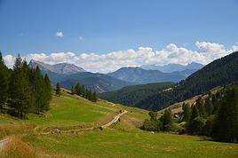
I’m making an exception and creating a separate post this time, since it’s all about France. In May, we spent a week in Provence, specifically in the Luberon, exploring the cycling routes *Autour du Luberon à Vélo*, the *Véloroute du Calavon* (part of EuroVelo 8), and the shorter *Les Ocres à Vélo* route. Together, they gave us an amazing journey through rolling hills, vineyards, lavender fields still green in spring, and some of the most stunning landscapes in southern France.
It was, of course, the perched villages that impressed us the most. We visited Gordes, Roussillon, Bonnieux, Lacoste, Lourmarin, Ménerbes, Oppède-le-Vieux, Cucuron, and Lauris. Many of them are among the most beautiful villages in Provence, and it’s hard not to agree with that reputation.
One interesting point is the route of EuroVelo 8 in this part of the region. The official path mainly follows the old railway line of the *Véloroute du Calavon*, which is very comfortable and safe. But in our opinion, cyclists traveling EuroVelo 8 around the Mediterranean would discover even more treasures if the route passed through villages like Bonnieux, Lacoste, or Oppède-le-Vieux.
We were also pleasantly surprised by how safe cycling felt. Most of the route takes small local roads, but traffic is light, drivers are respectful, and road design really takes cyclists into account. It’s one of those places where you can ride peacefully even without separated bike lanes.
Our full story:
Around Luberon by bicycle - the most beautiful villages of Provence
You can also find all our cycling travel stories on the forum:
Cycling Thread - Europe’s most beautiful bike routes
Hi there, we’re a group of 4 cyclists looking to get from Treviso in Italy to Munich with our 4 non-folding bikes. It seems complicated! Are there any solutions? Thanks so much.
hello fellow cycling enthusiasts
here’s a travel journal of the cycling tour through the Rhône-Alpes Auvergne region by Claudio
zouli
it was the plan
http://cbandiera.free.fr/parcours/auvergne-Ralpes/
the trip was completed
story being posted online soon
1100 km in 11 days
beautiful and varied regions
Hi there, we’re planning a Munich to Venice bike trip at the end of June 2026. Getting back from Venice to Toulouse by train with 4 bikes isn’t straightforward. What return options have others who’ve done this trip chosen? Any tips or great deals would be much appreciated. Thanks a bunch! !
Hi everyone,
Happy owner of a Pegasus Estremo bike with a Rohloff hub, which is giving me trouble with the SF11-NCX-FT-E-LITE 700C TS 300/0 fork (serial number TD01329060). It’s starting to show its age, and I’d like to repair it to extend the life of my beloved bike.
The suspension is gone, and there’s an oil leak from the seals.
Does anyone know how to repair it? Where can I find parts that are about fifteen years old? Or where to find an identical replacement fork? Just to clarify, the Magura HS11 brakes are mounted using Firm Tech, meaning they’re on pivots behind the fork, facing the frame.
Hi, I'd like to know if anyone has done this route recently or has reliable info.
Does the track exist, and most importantly, is there sand (for biking)?
Any info is welcome.
Cheers,
diego ambilobe: mangaoka, manondro, ramena
vohemar sambava: masondrono, tanambao
Hi there,
New to bike touring,
I’d love to start with a section of the Via Rhona to explore and share (route to be decided).
Looking forward to exchanging tips!
I’m landing in Madagascar with a buddy before the end of April 2026. We’re planning to bike around for about twenty days or so. We don’t have a specific goal other than exploring the country and meeting the locals.
Ideally, we’d prefer a loop route starting from Antananarivo with a good chunk of it along the coast. On the bike side, we’re used to riding 6 to 8 hours a day, depending on the needs, encounters, and mood 😉 Any feedback or tips from trips around this length?
A big thank you to Lazarou for all the info you share in this forum!
I'm passionate about Morocco, which I cycled through back in 2009.
Last year, my wife and I explored the High Atlas by tandem. Completely smitten, we're heading back in April (Anti Atlas) and May (High and Middle Atlas), still on our tandem.
Do you have any info on the track between Amezri and Ali Ait Nito? Are the river crossings in the Tessaout still there? It's not easy to navigate with a loaded tandem... especially if the river level is high due to this year's heavy snowmelt!
Thanks in advance for any tips you might have, and best wishes for health in this new year!
Claudio specializes in the route of the Savoie lakes
Here are his travels
Between Bornes, Chartreuse, the Savoie foothills, and Dauphiné
Five lakes: Léman, Annecy, Paladru, Aiguebelette, Bourget, not to mention a few ponds along the way
Plenty of accommodation options: camping, hotels, and more...
A lovely route not far from his place
Rural and quite peaceful
A road cycling route created by Serge B...
Tout d'abord... bonne année ! De belles routes à vous en 2017 !
Je voyage depuis quelques années avec un VTT de très bonne qualité mais équipé de freins à disques hydrauliques. Je vis (pédale) avec l'inquiétude d'avoir une panne (fuite, bulle d'air, chaleur qui fait que le liquide...). Mon vélociste me dit qu'il est impossible de les changer pour des V brakes.
Qu'en pensez-vous ? Est-ce que je prends un gros risque à continuer (seule) avec ces freins ? D'avance je vous remercie pour vos bonnes idées.
First post here to share a quick recap of our west-to-east bike trip along Algeria’s coast in January 2025.
It was just the two of us—my partner and I—with French passports and not a word of Arabic. No friends or welcoming hosts in the country.
Under those conditions, we’d strongly advise against going.
Our original plan was to follow the coast from Algiers to Tunis. We ended up cycling from Algiers to Béjaia, then took the train from Béjaia to Annaba (with a stop in Constantine), and finally biked to the border.
We were tailed by police the whole way—whether on our bikes, on the train, or even on foot while exploring towns. On top of that, we couldn’t wild camp and were limited to the few state-approved hotels that accept foreigners. Under those circumstances, connecting with locals was especially tough.
With such an omnipresent and intrusive police presence, we’d definitely recommend against this destination for bike touring. A really sad situation that completely cuts you off from the local population...
We’d been warned, we went to check it out, and we weren’t disappointed!
Hi there,
I’m planning the route to cycle from Lille to Nordkapp with my partner.
Duration: 3 months, from May 1st to July 31st, 2026.
In the attached details below, I need to add some "non-riding" days (rest days, basically).
So I’m looking to "shorten" the trip by taking ferries or trains for some stretches. Which areas could I skip?
Thanks in advance for your great tips.
Have a good evening.
https://www.komoot.com/fr-fr/collection/4023980/-lille-cap-nord-1er-mai-au-31-juillet-2026?ref=collection
I’m planning to bike back from Poland this summer. Does anyone know a way to ship it there without having to take it apart? Otherwise, it’s a real hassle to fine-tune all the settings before departure!
Thanks in advance.
Hi, has anyone recently bought Primus or Butagaz gas, possibly puncture-style, in Dubrovnik or the surrounding area? Same question for Albania... thanks. aichatou
Just a few words about the loop I did by bike in Yunnan.
Entry and exit
I entered China through the Sino-Vietnamese border crossing at Lào Cai / Hekou under the 30-day visa exemption currently available to French nationals and others.
The process was simple and quick. A Chinese police officer even helped me complete my electronic pre-registration at a computer kiosk. I wasn’t aware this formality was required—it’s similar to Thailand’s TM6.
No issues with the bike.
I left the country via the Sino-Laotian border crossing at Mohan / Boten.
The atmosphere was a bit chaotic there, but again, no problems with the bike.
The timing
I visited Yunnan in February 2026.
Weather-wise, at higher altitudes (between 1,500 and 2,000 meters), it was around ten degrees at night and in the mornings, and around twenty degrees at the hottest part of the day.
I had two days of rain, so I took the bus to keep moving. Otherwise, clear blue skies.
Culturally, Chinese New Year fell on February 17th (and the 15 days following), right in the middle of my trip. Because of this, my take on the traffic might be off.
Accommodation and food
I always found a hotel to stay in for prices ranging from 8 to 15 €. Except in Kunming (the capital), where many hotels were fully booked (Chinese New Year). I ended up at a 100 € hotel with great value for money.
A bowl of noodles costs about 1.5 € on average.
Onboard electronics
Since my smartphone doesn’t support eSIMs, I subscribed to a China plan with my carrier. Otherwise, for much cheaper, Alipay offers eSIMs for foreigners that allow access to services usually blocked for Chinese users (WhatsApp, Facebook, etc.).
An internet connection is essential for paying with Alipay or WeChat, as this payment method is widespread.
I only managed to use Alipay.
Either way, always carry cash because sometimes there’s no signal, or the merchant only accepts WeChat.
Also, it’s best to bring a power adapter when you arrive rather than struggling to find one.
Traffic and roads
The Chinese aren’t reckless drivers. They follow traffic rules and watch out for cyclists. This is slightly less true in Xishuangbanna (the region bordering Myanmar and Laos).
In urban areas, there are almost always wide bike lanes, separated from other roads, where bikes, electric mini-scooters, and scooters share the space pretty harmoniously.
The roads are in great condition, and traffic is generally manageable—even light—except for one stretch (Eshan -> Yangwu).
Most traffic is absorbed by expressways, China’s equivalent of highways: toll roads that are off-limits to slow vehicles.
You’re never far from these expressways; sometimes you even ride alongside them, which can be noisy at times.
The climbs are usually reasonable, around 5% to 6%. From what I remember, the steepest section was between Menglun and Mengla, with gradients of 8% to 10%, sometimes more.
Riding at these altitudes—though modest—took a bit of getting used to.
The route
I didn’t plan anything in advance. My only goal was to reach Kunming. I don’t know why, but just hearing the name of that city, like Yunnan, always felt dreamy to me.
Hi! I’m planning to visit the Stockholm Archipelago by bike in early April.
Do you know if the boats will be running between the different islands at that time of year? For those who’ve already been, all your tips and recommendations are welcome—accommodation, etc. Also, do you know where I can rent a bike in Stockholm? Thanks so much in advance for your help!
Hello there, pedal-powered Young Boys!
Claudio (still from Faverges)
dreaming about a cycling getaway in Italy from Faverges (train all the way to Turin)
from Turin down to Venice along the Po River and back via the Padana (Alta Italia da attraversare – Northern Italy to cross)
The tricky part is getting from Chioggia to Venice.
I read it’s possible by hopping on a boat from island to island,
but it sounds a bit stressful.
Has anyone already tackled this route?
I’m currently looking for a bike to do my first bike trip across France, with the ultimate goal of cycling through Latin America. I’ve got a lot of questions and I’d love to hear if you have any answers or advice to share.
First off, I’ve been through this before with hiking. I want to get top-quality gear right away. When I started hiking, I ended up buying everything three times—first beginner gear, then intermediate, then expert, etc.
For biking, I’d prefer to skip that process and invest right now in a bike that could ideally handle Latin America.
I’ve set a total max budget of around 5000 € (roughly 4000–4500 € for the bike and the rest for accessories: panniers, helmet, cycling shorts, etc.).
So, I’ve got quite a few questions:
* I’ve read in several places that some people recommend buying the bike directly in Latin America. Since I need a first bike to train in Europe, would it be better to buy an entry-level bike in France (and sell it before the big departure)? Or is it preferable to start right away with my final bike to get used to it? Is buying it there just to save a bit of money?
* For a long-term trip (around six months) in Latin America, is it better to go for a gravel bike or a mountain bike?
* Should I buy a new bike or a refurbished one? Even more so given that I’m planning a long trip—could a refurbished bike end up causing more breakdowns?
If you have any advice on models, technical features to prioritize, or recommended sellers or resellers, I’d love to hear it. I’m a total beginner—I’ve only just started watching videos and reading up on the subject, and all the technical specs are new to me!
Calling all travelers.
We’ll be landing at Lyon Airport and want to bike to La Verpillière train station (with panniers and camping gear, etc.) to catch a TER to Voreppe.
What’s the safest route for this bike trip?
Thanks in advance
hi,
I'm planning a recumbent bike trip from the Pyrenees to Greece. On the EuroVelo 8 route, it doesn't specify the path through the Alps.
Are there any experienced cyclists here who can tell me where they go to avoid climbing too high?
Also, is there another traveler/bike forum better suited for broadening the responses?
thanks