Bonjour tous le monde, J'ai besoin d'avoir quelques infos sur le voyage à vélo en Algérie.
Alors pour commencer je suis née en France mais je possède la double nationalité Française et Algérienne ce qui peut m'avantager.
Je voudrait faire le tour de l'Algérie à vélo en partant de chez moi c'est à dire du nord de la France il faudra aller jusqu'en Espagne et prendre le bateau.
Une fois en Algérie l'idée serait de faire le tour de l'Algérie en commençant mon voyage à partir de Octobre ce qui va me permettre d'avoir des températures plus clémente une fois en Algérie.
Les quelques questions sont:
-Savez vous si quelqu'un à deja fait le tour de l'Algérie à vélo? ( je sait que dans les années 80 certaines personnes l'ont faites mais maintenant la situation n'est plus la même)
-Le pays est il réellement sécuriser? (barrages, check point, contrôle routier fréquents pour éviter tous risques terroristes)
-Est il possible de camper? (Je sait qu'en Algérie il n'est pas commun de voyager à vélo et de faire du camping sauvage mais comme j'ai toujours dit durant mes voyages à vélo: Pas vu, pas visité durant la nuit 😄)
-Faut il pour un Français même de double nationalité Algérienne avoir un guide pour les parc nationaux dans le sud du pays?
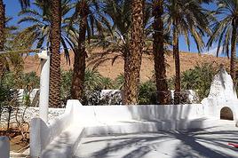
Le voyage en Algérie dévrait commencer de Oran pour rejoindre en roulant vers l'Ouest et le Sud, puis de Tamanrasset remonter vers Batna et terminer à Alger ou je souhaite prendre le bateau pour revenir sur Marseille.
Oui aucun problème pour faire le tour de l'Algérie si tu es algérien et parle un peu la langue.
Prévois bien tes étapes et évite de camper à proximité des villes.
Je l'ai fait plusieurs fois en voiture ou à pieds lors de randonnées du nord au sud.🙂
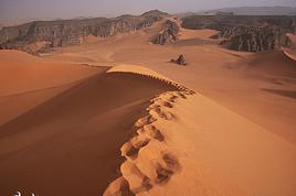
"When I saw the Hoggar Mountains, my jaw dropped. If you think of Bryce, or Canyonlands National Park, you're close, but the Hoggar Mountains are more spectacular." David Ball, Empire of sands
Bonjour voyageur 1606,
Dit moi tu est aussi d'origine Algérienne?
Tu n'a donc eu aucun problème pour circuler du Nord au Sud?
J'avait l'idée de m'éloigner des villes pour être tranquille et ne pas être visiter pendant les nuits, sinon de temps au autres je pense bien m'arrêter dans certaines villes pour faire le pleins de nourritures mais aussi me reposer. Alors partir de Oran pour rejoindre Béchar, puis de Béchar aller à Ain Salah pour après descendre jusque Tamanrasset. Je voudrait aller faire un petit tour aux alentours de Tamanrasset genre L'Asekrem etc. Après je repart en direction du Tassili Najer pour rejoindre Biskra, Batna, Constantine et longer la côte jusque Alger.
Tu pense que cela est possible pour un Algérien mais bien sur je roule à vélo. Sa reste un voyage à vélo il y aura cette proximité avec la route qui peut me faciliter en cas de problème et justement en prenant pas mal de précaution pour le camping c'est à dire ne pas être vu pour ne pas être visiter pendant la nuit je pense que cela peut le faire.
En dehors de sa y'a t-il vraiment beaucoup de contrôle de police sur la route? (ce qui peut être une bonne choses pour moi)
Et puis même sans parler un mot d'arabes tu pense que cela est possible?
Dit moi tu est aussi d'origine Algérienne?
Tu n'a donc eu aucun problème pour circuler du Nord au Sud?
Aucun souci du moment que tu as la nationalité algérienne. La liberté totale.
J'avait l'idée de m'éloigner des villes pour être tranquille et ne pas être visiter pendant les nuits, sinon de temps au autres je pense bien m'arrêter dans certaines villes pour faire le pleins de nourritures mais aussi me reposer
Oui c'est la bonne strategie, evites de camper a proximité des agglomérations pour éviter les curieux.
Dans les petits villages tu pourras dormir chez les habitants qui se feront un plaisir de t’héberger.
Alors partir de Oran pour rejoindre Béchar, puis de Béchar aller à Ain Salah pour après descendre jusque Tamanrasset. Je voudrait aller faire un petit tour aux alentours de Tamanrasset genre L'Asekrem etc. Après je repart en direction du Tassili Najer pour rejoindre Biskra, Batna, Constantine et longer la côte jusque Alger.
Les routes au nord sont très fréquentées par les voitures et les camions qui conduisent comme des fous. Il faut etre prudent , moi je te conseillerais quand c'est possible de prendre les petites routes ou les pistes et pas les grands axes routiers.
En dehors de sa y'a t-il vraiment beaucoup de contrôle de police sur la route? (ce qui peut être une bonne choses pour moi)
Oui il y aura beaucoup de contrôle au nord mais sans problème, prend ta carte nationale algérienne. Au sud beaucoup moins.
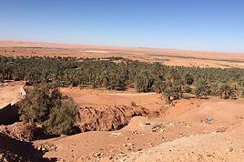
Entre Tam et Djanet c'est 700 kms de pistes quasiment sans possibilité de ravitaillement, tu compte faire comment ? Tu peux louer les services d'un 4*4 accompagnateur sur cette portion.
Et puis même sans parler un mot d'arabes tu pense que cela est possible?
C'est plus facile si tu pouvais parler un peu arabe mais bon beaucoup d’algériens parlent français.
Voici le site d'un cycliste etranger qui a traversé la cote algérienne en vélo il y a juste quelques semaines , mais en tant qu'etranger il a été escorté durant la traversee:
onebikeoneworld.com/home/
onebikeoneworld.com/...ian-police-presence/
"When I saw the Hoggar Mountains, my jaw dropped. If you think of Bryce, or Canyonlands National Park, you're close, but the Hoggar Mountains are more spectacular." David Ball, Empire of sands
Alors une fois à Tam je pensait aller un tour ou une boucle dans les montagnes jusque l'hermitage du père après sa je comptait reprendre la route et non pas la piste mais après en ce qui concerne la piste c'est faisable à partir du moment ou je peut trouver quelqu'un ou une agence de tourisme qui peut me déposer des colis a certains point de passage enfin l'idée serait surtout d'aller jusque l'hermitage du père et après retourner sur la route principale pour traverser le tassili N'ajjer enfin le voyage se fera au fur et à mesure du voyage, des possibilités.
Maintenant très honnêtement qu'est ce qu'il en est du terrorisme en Algérie?
Je sait que les villes, les routes sont sécurisés mais il se peut qu'il y ait des foyers terroristes à certains endroits? Peut tu m'en dire un peu plus à ce sujet?
Et pour finir la température en journée dans le sud de L'Algérie entre Novembre et Décembre?
Merci pour toutes les infos vraiment.
Alors une fois à Tam je pensait aller un tour ou une boucle dans les montagnes jusque l'hermitage du père après sa je comptait reprendre la route et non pas la piste mais après en ce qui concerne la piste c'est faisable à partir du moment ou je peut trouver quelqu'un ou une agence de tourisme qui peut me déposer des colis a certains point de passage enfin l'idée serait surtout d'aller jusque l'hermitage du père et après retourner sur la route principale pour traverser le tassili N'ajjer enfin le voyage se fera au fur et à mesure du voyage, des possibilités.
Il n'y a pas de route goudronnée entre Tam et Djanet, après l'Assekrem tu continues sur la piste pour aller au Tassili , c'est la N55 (non goudronnée, 700 kms - Tam-Assekrem-Ideles-Bordj ek haouas-Djanet). Ca va pas être évident de demander à distance à une agence de te déposer les colis sur la piste. Mais tout est possible.
Maintenant très honnêtement qu'est ce qu'il en est du terrorisme en Algérie?
Je sait que les villes, les routes sont sécurisés mais il se peut qu'il y ait des foyers terroristes à certains endroits? Peut tu m'en dire un peu plus à ce sujet?
Il y a quelques résidus terroristes en Kabylie, à la frontière tunisienne, et frontières avec les pays du sahel. Mais tu es loin de tout ces endroits. Le risque en tant qu'algérien est quasi nul, tu ne les intéresses pas.....😉
Jamais eu de problèmes en 10 ans de voyages du nord au sud et de l'est à l'ouest.
Et pour finir la température en journée dans le sud de L'Algérie entre Novembre et Décembre?
Températures douces la journée entre 20 et 25° , mais froides la nuit ( ça peut descendre à 0° ). Prévoir un bon duvet.😉
C'est ou ta photo en vélo ? 🙂
"When I saw the Hoggar Mountains, my jaw dropped. If you think of Bryce, or Canyonlands National Park, you're close, but the Hoggar Mountains are more spectacular." David Ball, Empire of sands
Alors la photo en vélo c'était au Kazakstan dans l'Ouest du pays.
Vraiment en grand merci pour les infos que tu m'a donner. Cela me permettra de partir plus confiant.
Eventuellement si j'ai d'autres questions serait-il possible de revenir vers toi pour quelques renseignements?
Merci.
Pour la N55 j'ai une petite idée, sur mon vélo je peut transporte l'équivalent de 20L d'eau en moyenne, c'était le cas au Kazakstan ou encore en Ouzbékistan ou au mois de Juillet il fesait entre 5O et 55 degrés alors la en hiver si les températures se situe entre 20 et 25 degrés sa sera jouable.
Pour la nourriture je peut prendre en moyenne pour 5 a 6 jours de nourritures donc il me faudra à un moment un ravitaillement alors soit ont me ramène un colis sur la route ou bien je m'arrange avec quelqu'un pour me le déposer au bout du 2 ème ou 3 ème jours de piste sur la N55 en fonction de mon avancer (après il y a le téléphone portable pour communiquer et je pense bien qu'en Algérie il est facile de trouver du réseaux). Dans tous les cas c'est possible après il me faudra voir une fois sur place a Tamanrasset histoire de faire des contacts.
Je peut te dire que rouler dans le sahara en été serait de la folie, j'ai déjà expérimenter les pistes Kazak et Ouzbek en été au mois d'Aout quand la température monte à 55 degrés c'est horrible, sans oublier le vent de face et les petites tempête de sable. L'hiver sera bien plus clément pour le sud de l'Algérie.
Pour le duvet et le matériels de bivouac pas de soucis descendre en dessous de zéro est jouable surtout que j'ai le bonne équipement pour sa.
Le sahara est connut pour afficher des températures très chaude et insupportable l'été et froide la nuit (climat continentale) alors ayant déjà traverser ce genre de pays j'ai une idée de ce qui m'attend.
Je sait que sa va être dur mais bon, c'est l'Algérie que je veut découvrir.
Je suis allé 2 fois en Algérie à vélo, mais ça remonte ( 1990 et 1993 ).
Pays absolument génial avec les gens, si tu n'y es jamais allé sur ta bicyclette tu vas être invité tout le temps, surtout en zone rurale.
Dans les petites villes où tu ne sais où loger tu vas directement au hammam : en plus d'un bon décrassage tu y seras logé gracieusement après la fermeture, c'est la coutume.
Un peu d'arabe facilite la vie, mais c'est pas essentiel.
Des amis l'ont traversée d'ouest en est il y a 2 ans : tout s'est bien passé mais ils ont eu droit à pas mal d'escortes et à une " prise en charge " par les autorités un peu pesante parfois. Pour toi, en tant que binational, je ne sais pas, surtout si tu ne parles pas arabe.
A ma connaissance toute la zone sud du pays ( globalement au sud de Ghardaïa ) nécessitait toujours encore récemment un accord préalable et la présence d'un guide pour tout déplacement individuel, en tout cas pour les Européens. J'ai peut-être raté un épisode et ça a pu changer depuis.
Cordialement,
Bonjour Levelo, apparement il te faut un guide pour les déplacements dans le sud du pays: parc national Tamanrasset et peut être bien sur la N55 mais la je ne suis pas sur.
Pour un Algérien même dans un parc national il te faudra un guide comme tous le monde ce qui me semble normale mais pour circuler sur la route, en présentant ton passeport Algérien il te sera plus facile de circuler et même de te rendre à Tamanrasset sans forcement prouver que tu est déjà un guide avec toi, tu peut y aller sans forcement avoir reserver et une fois sur place si le guide s'impose à toi ou le fait de devoir passer par une agence alors tu reserve ou tu programme. En faite comme j'ai pu le comprendre dans mes petites recherches une fois que tu roule en Algérie avec les papiers Algériens alors les choses sont beaucoup moins compliquer, c'est ton pays alors tu est libre de circuler comme un Français en France mis à part qu'il y a des restrictions dans les parc nationaux par mesure de sécurité ce qui me semble logique.
J'ai de la famille sur Alger et sur Biskra, j'ai déjà essayer de poser la question, ils n'ont pas réussit à me comprendre.
Leurs dire je vient avec mon vélo pour faire le tour de l'Algérie afin de connaitre un peu mieux mes origines et le pays de mon père sa leur semble incompréhensible, fou.
C'est la raison pour laquelle je suis ici pour discuter de se sujet.
En principe les infos que j'ai eu:
-Pour un Algérien aucun soucis pour circuler dans le pays librement mis à part zone militariser ect. (donc avec mon passeport Algérien c'est ok).
-Pas mal de contrôle de police sur les routes spécialement dans le nord et le milieu du pays aussi dans le sud mais moins, ce sont surtout les frontières qui sont contrôler pour éviter toutes infiltrations de terrorisme dans le pays.
Un amis me disait qu'il peut y en avoir des contrôles tous les 10 ou 15 km à certains endroits et à chaque entrées dans une villes.
-Le pays est sécuritaire maintenant il reste des résidus de terroristes mais dans des endroits qui sont justement sous extrêmes contrôle policier.
-Approvisionnement en eau je pense que sa sera OK car les points d'eau sont repérable sur les cartes et je peut transporter une grosse quantité d'eau avec moi.
-Le camping sauvage et praticable mais comme dans tous les pays du monde, sans exceptions, on s'éloigne des villes et on prend les mesures nécessaires pour ne pas être vu ce qui permet d'éviter les visites nocturnes.
-Pour finir ne pas s'aventurer dans le sud du pays en pleines été, c'est la raison pour laquelle je compte me rendre la bas pour l'hiver.
Je pense que les mesures de sécurité ne peuvent qu'être respecter maintenant pour celui qui peut me donner d'autres infos je suis preneur.
UN GRAND MERCI.
Oui, l'hiver est la seule saison pour pédaler confortablement dans le sud !
Je me suis retrouvé une fois à pédaler dans le Souf ( du côté d'El Oued ) en plein été et il y faisait vraiment très très chaud... La route au sud de Biskra qui monte dans dans les Aurès par les gorges de Ghoufi est grandiose. Celle de l'ouest aussi : Béchar, Tamghit, Beni Abbes, Timimoun. Tu dois certainement savoir que la région du M'Zab autour de Ghardaïa est assez tendue depuis quelques temps.
Pour l'eau tu peux aussi te ravitailler avec les camions, ils disposent toujours d'une réserve.
En tant que binational tu auras effectivement certainement plus de facilités pour te déplacer sans encombres.
Encore une fois avec ton vélo tu vas être accueilli partout !
Bon voyage à toi.
Levelo.
............ou bien je m'arrange avec quelqu'un pour me le déposer au bout du 2 ème ou 3 ème jours de piste sur la N55 en fonction de mon avancer (après il y a le téléphone portable pour communiquer et je pense bien qu'en Algérie il est facile de trouver du réseaux)
Attention dans le sud et notamment cette partie le réseau n'est présent qu' proximité des villages, Après Ideles il n'y y a plus de reseau avant Bordj el haouass.
Tu vas donc rouler pendant des centaines de kilomètres sans avoir de réseau téléphonique.🙂
"When I saw the Hoggar Mountains, my jaw dropped. If you think of Bryce, or Canyonlands National Park, you're close, but the Hoggar Mountains are more spectacular." David Ball, Empire of sands
Voilà j'habite au Liban depuis 3 ans... j'ai déja fait durant l'été 2017 le voyage de Tripoli à Venise à vélo en solo sur 4 semaines avec des parties en…
Je prévois de faire le tour de la Méditerranée à vélo. Il est prévu de passer par l'Afrique du Nord, mais cela semble un peu compliqué. Visa + voyage en…
Je pars en voyage à vélo avec ma copine pour un petit tour de la mediterranée et on envisage passer par le nord de l'Afrique - du Maroc à la Tunisie. Avant…
Vu les difficultés de randonner en Algérie et d'obtenir un visa, je lance un appel si quelqu'un connait un club, association... de cyclos algérien ou personnes…
Ca y est j'ai mon billet d'avion, départ mi novembre, retour mi-mars.
arrivée santiago et je repars depuis Buenos Aires.
J'ai deja été dans le sud de l'argentine, notamment le parc torres del Paine, et j'ai très envie d'y retourner pour faire le grand W, j'avais fait le petit.
Je souhaite aussi randonner qq foois et pourquoi pas faire un sommet. Je grimpe et je fais occasionnellement de l'alpinisme, donc ce sera avec un guide de toute façon.
Je compte démarrer vers temuco au chili, j'ai dans l'idée d'aller vers les lac, puis prendre la careterra austral.
Je sais pas si je vais aller jusqu'à Ushuaia, parait que cela vaut pas tant que cela la peine, à part pour dire qu'on a été au bout de la terre.
j'ai vu vite fait qu'il y'avait des lac en Argentine.
Je n'ai pas d'itinéraire précis. Mais ce que je souhiaterai, c'est qu'une fois arriver le plus au sud de mon vooayage, faire une mini croisière pour voir des annimaux.
Des conseils pour cela?
qu'avez vous pris comme sac de couchage? un 0 degré suffit?
et ultime question, réchaud à essence ou est-ce que je peux m'en sortir avec mon réchaud gaz?
Cet été nous prévoyons de pédaler sur l'EV 19 qui longe la Meuse de Langres jusqu'à Rotterdam.
Mon questionnement concerne le retour jusqu'à Nantes.
Savez vous quel est le meilleur retour possible? J'en appelle à vos expériences.
Je voyais que Flixbus ne prenait pas les vélos.
En train, je pense que c'est possible avec de multiples petits trains.
On se questionnait aussi sur l'existence d'un bateau qui irait de Rotterdam jusqu'à St Nazaire et qui pourrait charger des passagers avec vélos.
Toutes vos expériences partagées nous seront bien utiles et nous vous en remercions.
Bonne soirée
Je souhaite faire Morlaix Brest ( via Roscoff et la littoral V45) nous commencerons à rouler le 16 aout pour 13 jours (avec des pauses visites iles , surf etc..) Est ce qu'il y a beaucoup de circulation à cette époque de l'année car j'ai 2 enfants de11 et 13 ans et on n'aime pas rouler au milieu des voitures (on a déjà fait velomaritime ; Caen - Cherbourg, loire : Orléans- Saumur, Velodyssée : Nantes - Royans, les canaux : nivernais , bourgogne etc ... et il y avait beaucoup de voies réservées aux vélos ce qui n'est pas le cas sur cet itinéraire).
Merci de votre aide si vous avez déjà parcourue cet itinéraire fin aout.
Virginie
Hi there,
I’ve been road cycling for several years, and I’m about to switch to gravel in the next few days—I’m waiting for my bike, which should arrive this week.
I’m planning a bikepacking trip in a few weeks along the Véloroute V81, also known as the Vélosud, from Biarritz to Le Barcarès.
Has anyone here already done this route? Any info is welcome, whether it’s about the route itself, gear, or accommodation. I’ll prioritize staying with locals as much as possible. On that note, I just signed up for the brand-new site *Guidon et Couette* ((www.guidon-et-couette.fr)), which offers free accommodation between cyclists across the country, but there’s almost no one listed along my route!
Thanks in advance.
Laurent.
I’m planning to build a new touring bike.
I want to prioritize lightness.
That said, I’m tempted by a suspension fork that could offer some comfort on rougher roads.
The recent appearance of gravel suspension forks on the market might meet my needs—at least on paper.
I’m particularly considering the RockShox Rudy Ultimate XPLR fork.
Unlike MTB forks, its travel is short: either 30 mm or 40 mm.
It weighs 1400 g, which is 400/500 g more than a steel fork.
Any thoughts or real-world feedback on this?
I’m also wondering about the durability of magnesium (lower leg) for long-distance bike touring.
And what’s the impact of skipping the manufacturer-recommended maintenance every 50 and 200 hours? That’s bound to happen on a long trip unless you carry extra gear.
More generally, how reliable are these kinds of forks?
Hi everyone,
I wanted to share with you the incredible feat my friend José, who’s 72 years old, is currently undertaking. He left Auterive near Toulouse on Monday, May 18, 2026, on his non-electric bike, heading for the North Cape in Norway!
You can follow his route on the link below—he’s currently in Sweden:
https://thierry-thomas.travelmap.net/jose-de-toulouse-a-nord-cap-2026
You can zoom in on the map and click on each stopover town to see the photos
I’m making an exception and creating a separate post this time, since it’s all about France. In May, we spent a week in Provence, specifically in the Luberon, exploring the cycling routes *Autour du Luberon à Vélo*, the *Véloroute du Calavon* (part of EuroVelo 8), and the shorter *Les Ocres à Vélo* route. Together, they gave us an amazing journey through rolling hills, vineyards, lavender fields still green in spring, and some of the most stunning landscapes in southern France.
It was, of course, the perched villages that impressed us the most. We visited Gordes, Roussillon, Bonnieux, Lacoste, Lourmarin, Ménerbes, Oppède-le-Vieux, Cucuron, and Lauris. Many of them are among the most beautiful villages in Provence, and it’s hard not to agree with that reputation.
One interesting point is the route of EuroVelo 8 in this part of the region. The official path mainly follows the old railway line of the *Véloroute du Calavon*, which is very comfortable and safe. But in our opinion, cyclists traveling EuroVelo 8 around the Mediterranean would discover even more treasures if the route passed through villages like Bonnieux, Lacoste, or Oppède-le-Vieux.
We were also pleasantly surprised by how safe cycling felt. Most of the route takes small local roads, but traffic is light, drivers are respectful, and road design really takes cyclists into account. It’s one of those places where you can ride peacefully even without separated bike lanes.
Our full story:
Around Luberon by bicycle - the most beautiful villages of Provence
You can also find all our cycling travel stories on the forum:
Cycling Thread - Europe’s most beautiful bike routes
Hi there, we’re a group of 4 cyclists looking to get from Treviso in Italy to Munich with our 4 non-folding bikes. It seems complicated! Are there any solutions? Thanks so much.
hello fellow cycling enthusiasts
here’s a travel journal of the cycling tour through the Rhône-Alpes Auvergne region by Claudio
zouli
it was the plan
http://cbandiera.free.fr/parcours/auvergne-Ralpes/
the trip was completed
story being posted online soon
1100 km in 11 days
beautiful and varied regions
Hi there, we’re planning a Munich to Venice bike trip at the end of June 2026. Getting back from Venice to Toulouse by train with 4 bikes isn’t straightforward. What return options have others who’ve done this trip chosen? Any tips or great deals would be much appreciated. Thanks a bunch! !
Hi everyone,
Happy owner of a Pegasus Estremo bike with a Rohloff hub, which is giving me trouble with the SF11-NCX-FT-E-LITE 700C TS 300/0 fork (serial number TD01329060). It’s starting to show its age, and I’d like to repair it to extend the life of my beloved bike.
The suspension is gone, and there’s an oil leak from the seals.
Does anyone know how to repair it? Where can I find parts that are about fifteen years old? Or where to find an identical replacement fork? Just to clarify, the Magura HS11 brakes are mounted using Firm Tech, meaning they’re on pivots behind the fork, facing the frame.
Hi, I'd like to know if anyone has done this route recently or has reliable info.
Does the track exist, and most importantly, is there sand (for biking)?
Any info is welcome.
Cheers,
diego ambilobe: mangaoka, manondro, ramena
vohemar sambava: masondrono, tanambao
Hi there,
New to bike touring,
I’d love to start with a section of the Via Rhona to explore and share (route to be decided).
Looking forward to exchanging tips!
I’m landing in Madagascar with a buddy before the end of April 2026. We’re planning to bike around for about twenty days or so. We don’t have a specific goal other than exploring the country and meeting the locals.
Ideally, we’d prefer a loop route starting from Antananarivo with a good chunk of it along the coast. On the bike side, we’re used to riding 6 to 8 hours a day, depending on the needs, encounters, and mood 😉 Any feedback or tips from trips around this length?
A big thank you to Lazarou for all the info you share in this forum!
I'm passionate about Morocco, which I cycled through back in 2009.
Last year, my wife and I explored the High Atlas by tandem. Completely smitten, we're heading back in April (Anti Atlas) and May (High and Middle Atlas), still on our tandem.
Do you have any info on the track between Amezri and Ali Ait Nito? Are the river crossings in the Tessaout still there? It's not easy to navigate with a loaded tandem... especially if the river level is high due to this year's heavy snowmelt!
Thanks in advance for any tips you might have, and best wishes for health in this new year!
Claudio specializes in the route of the Savoie lakes
Here are his travels
Between Bornes, Chartreuse, the Savoie foothills, and Dauphiné
Five lakes: Léman, Annecy, Paladru, Aiguebelette, Bourget, not to mention a few ponds along the way
Plenty of accommodation options: camping, hotels, and more...
A lovely route not far from his place
Rural and quite peaceful
A road cycling route created by Serge B...
Tout d'abord... bonne année ! De belles routes à vous en 2017 !
Je voyage depuis quelques années avec un VTT de très bonne qualité mais équipé de freins à disques hydrauliques. Je vis (pédale) avec l'inquiétude d'avoir une panne (fuite, bulle d'air, chaleur qui fait que le liquide...). Mon vélociste me dit qu'il est impossible de les changer pour des V brakes.
Qu'en pensez-vous ? Est-ce que je prends un gros risque à continuer (seule) avec ces freins ? D'avance je vous remercie pour vos bonnes idées.
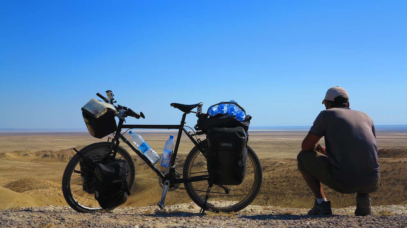
First post here to share a quick recap of our west-to-east bike trip along Algeria’s coast in January 2025.
It was just the two of us—my partner and I—with French passports and not a word of Arabic. No friends or welcoming hosts in the country.
Under those conditions, we’d strongly advise against going.
Our original plan was to follow the coast from Algiers to Tunis. We ended up cycling from Algiers to Béjaia, then took the train from Béjaia to Annaba (with a stop in Constantine), and finally biked to the border.
We were tailed by police the whole way—whether on our bikes, on the train, or even on foot while exploring towns. On top of that, we couldn’t wild camp and were limited to the few state-approved hotels that accept foreigners. Under those circumstances, connecting with locals was especially tough.
With such an omnipresent and intrusive police presence, we’d definitely recommend against this destination for bike touring. A really sad situation that completely cuts you off from the local population...
We’d been warned, we went to check it out, and we weren’t disappointed!
Hi there,
I’m planning the route to cycle from Lille to Nordkapp with my partner.
Duration: 3 months, from May 1st to July 31st, 2026.
In the attached details below, I need to add some "non-riding" days (rest days, basically).
So I’m looking to "shorten" the trip by taking ferries or trains for some stretches. Which areas could I skip?
Thanks in advance for your great tips.
Have a good evening.
https://www.komoot.com/fr-fr/collection/4023980/-lille-cap-nord-1er-mai-au-31-juillet-2026?ref=collection
I’m planning to bike back from Poland this summer. Does anyone know a way to ship it there without having to take it apart? Otherwise, it’s a real hassle to fine-tune all the settings before departure!
Thanks in advance.
Hi, has anyone recently bought Primus or Butagaz gas, possibly puncture-style, in Dubrovnik or the surrounding area? Same question for Albania... thanks. aichatou
Just a few words about the loop I did by bike in Yunnan.
Entry and exit
I entered China through the Sino-Vietnamese border crossing at Lào Cai / Hekou under the 30-day visa exemption currently available to French nationals and others.
The process was simple and quick. A Chinese police officer even helped me complete my electronic pre-registration at a computer kiosk. I wasn’t aware this formality was required—it’s similar to Thailand’s TM6.
No issues with the bike.
I left the country via the Sino-Laotian border crossing at Mohan / Boten.
The atmosphere was a bit chaotic there, but again, no problems with the bike.
The timing
I visited Yunnan in February 2026.
Weather-wise, at higher altitudes (between 1,500 and 2,000 meters), it was around ten degrees at night and in the mornings, and around twenty degrees at the hottest part of the day.
I had two days of rain, so I took the bus to keep moving. Otherwise, clear blue skies.
Culturally, Chinese New Year fell on February 17th (and the 15 days following), right in the middle of my trip. Because of this, my take on the traffic might be off.
Accommodation and food
I always found a hotel to stay in for prices ranging from 8 to 15 €. Except in Kunming (the capital), where many hotels were fully booked (Chinese New Year). I ended up at a 100 € hotel with great value for money.
A bowl of noodles costs about 1.5 € on average.
Onboard electronics
Since my smartphone doesn’t support eSIMs, I subscribed to a China plan with my carrier. Otherwise, for much cheaper, Alipay offers eSIMs for foreigners that allow access to services usually blocked for Chinese users (WhatsApp, Facebook, etc.).
An internet connection is essential for paying with Alipay or WeChat, as this payment method is widespread.
I only managed to use Alipay.
Either way, always carry cash because sometimes there’s no signal, or the merchant only accepts WeChat.
Also, it’s best to bring a power adapter when you arrive rather than struggling to find one.
Traffic and roads
The Chinese aren’t reckless drivers. They follow traffic rules and watch out for cyclists. This is slightly less true in Xishuangbanna (the region bordering Myanmar and Laos).
In urban areas, there are almost always wide bike lanes, separated from other roads, where bikes, electric mini-scooters, and scooters share the space pretty harmoniously.
The roads are in great condition, and traffic is generally manageable—even light—except for one stretch (Eshan -> Yangwu).
Most traffic is absorbed by expressways, China’s equivalent of highways: toll roads that are off-limits to slow vehicles.
You’re never far from these expressways; sometimes you even ride alongside them, which can be noisy at times.
The climbs are usually reasonable, around 5% to 6%. From what I remember, the steepest section was between Menglun and Mengla, with gradients of 8% to 10%, sometimes more.
Riding at these altitudes—though modest—took a bit of getting used to.
The route
I didn’t plan anything in advance. My only goal was to reach Kunming. I don’t know why, but just hearing the name of that city, like Yunnan, always felt dreamy to me.
Hi! I’m planning to visit the Stockholm Archipelago by bike in early April.
Do you know if the boats will be running between the different islands at that time of year? For those who’ve already been, all your tips and recommendations are welcome—accommodation, etc. Also, do you know where I can rent a bike in Stockholm? Thanks so much in advance for your help!
Hello there, pedal-powered Young Boys!
Claudio (still from Faverges)
dreaming about a cycling getaway in Italy from Faverges (train all the way to Turin)
from Turin down to Venice along the Po River and back via the Padana (Alta Italia da attraversare – Northern Italy to cross)
The tricky part is getting from Chioggia to Venice.
I read it’s possible by hopping on a boat from island to island,
but it sounds a bit stressful.
Has anyone already tackled this route?
I’m currently looking for a bike to do my first bike trip across France, with the ultimate goal of cycling through Latin America. I’ve got a lot of questions and I’d love to hear if you have any answers or advice to share.
First off, I’ve been through this before with hiking. I want to get top-quality gear right away. When I started hiking, I ended up buying everything three times—first beginner gear, then intermediate, then expert, etc.
For biking, I’d prefer to skip that process and invest right now in a bike that could ideally handle Latin America.
I’ve set a total max budget of around 5000 € (roughly 4000–4500 € for the bike and the rest for accessories: panniers, helmet, cycling shorts, etc.).
So, I’ve got quite a few questions:
* I’ve read in several places that some people recommend buying the bike directly in Latin America. Since I need a first bike to train in Europe, would it be better to buy an entry-level bike in France (and sell it before the big departure)? Or is it preferable to start right away with my final bike to get used to it? Is buying it there just to save a bit of money?
* For a long-term trip (around six months) in Latin America, is it better to go for a gravel bike or a mountain bike?
* Should I buy a new bike or a refurbished one? Even more so given that I’m planning a long trip—could a refurbished bike end up causing more breakdowns?
If you have any advice on models, technical features to prioritize, or recommended sellers or resellers, I’d love to hear it. I’m a total beginner—I’ve only just started watching videos and reading up on the subject, and all the technical specs are new to me!
Calling all travelers.
We’ll be landing at Lyon Airport and want to bike to La Verpillière train station (with panniers and camping gear, etc.) to catch a TER to Voreppe.
What’s the safest route for this bike trip?
Thanks in advance
hi,
I'm planning a recumbent bike trip from the Pyrenees to Greece. On the EuroVelo 8 route, it doesn't specify the path through the Alps.
Are there any experienced cyclists here who can tell me where they go to avoid climbing too high?
Also, is there another traveler/bike forum better suited for broadening the responses?
thanks