Bonjour à tous!!
Voila cette année on fait le 4eme road trip de notre vie au usa ;) et j'ai besoin de votre aide pour quelques étapes
si vous avez quelques petites idées pour etoffer😉
Voici ce qu'on a prévu de faire:
J1 Paris > Denver
J2 Denver > Hot Sulphur Springs J'hésite entre partir par Boulder et arriver dans les rocky mountains par sheeps lake pour faire la trail ridge road OU passer par golden gate canyon state park donc par la scenic road 119, 72 et 7 pour atteindre estes park la trail ridge road
J3 Hot Sulphur Springs > Gunnison :breckenbridge, leadville (villes fantomes dans le coin mais je ne connais pas encore si quelqu'un à des infos? )
J4 Gunnison > Monticello Visite de Black canyon of gunnison à montrose et je ne sais pas trop ce qu'il y a d'autre a voir sur la route jusqu'à Monticello
J5 Monticello > Moab parc des arches
J6 Moab > Moab retour dans le parc
J7 Moab> Monticello Dead horse point puis Island in the Sky de Canyonlands trail dans le parc (je ne sais pas encore lesquels si quelqu'un à des idées)
J8 Monticello > Bicknell Natural bridge Monument et capitol reefnational park
J9 Bicknell > Kanb bryce canyon
J10 Kanab > Page lake powell
J11 Page> Williams Horse shoes bend si pas fait de la veille Antelope canyon Williams
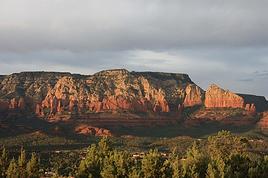
J12 Willians > Payson: Sedona et apres je seche
J13 Payson > Tucson apache trail
J14 Tucson > Lordsburg: Shakespeare ghost town tombstone
J15 Lordsburg > Alamogordo: White sand dunes
J16 Alamogordo > Santa fe: three rivers Petroglyph Site Tularosa, Lincoln la ville de Billy the kid, passage par Roswell, grand quivira, santa fé
J17 Santa fe > Pueblo Bandelier national monument, Chimayo historical marker, rio grande gorge bridge et apres?
J18 Pueblo > Denver Garden of the gods, colorado springs
J19 Denver > denver
J20 Denver > Paris
S'arreter Leadville tres sympa visiter avec un saloon tres rustique....apres Leadville a Buena-Vista en ville prendre a droite ( attention c est tres mal signaler ) la direction de Cotton Wood pass , vue magnifique en haute du pass ( continental divide ) descendre en direction de Taylor Lake , en bas au niveau du lac prendre a droite et aller voir Tincup puis demi tour et prendre la route direction Almont .... Prenez a droite a Almont ( 135 North) et aller visiter Crested-Butte, de Crested-Butte prendre direction Kebler Pass , avant le sommet du pass prendre a gauche vers Ohio Pass ( vues magnifiques sur Castle Mountain ) descendre la superbe Ohio creek road et rejoindre la Highway 135 south qui vous mene a Gunnison..
Cotton Wood Pass route goudronnee en montant de Buena-Vista , en terre apres le sommet pour la descente vers Taylor...
Kebler pass en partie goudronnee
Ohio pass en terre des deux cotes
Ces routes et cols sont faisables en ete avec un vehicule normal ( tres attention quand meme en haut de Cotton Wood et sur Ohio pass , bi g drop off et tres "rocky ")
Dommage de loger à Monticello mais de ne pas prévoir la visite de la partie The Needles de Canyonlands.
Island in the Sky de Canyonlands trail dans le parc (je ne sais pas encore lesquels si quelqu'un à des idées)
Mesa Arch, White Rim Trail, False Kiva ...
9 Bicknell > Kanb bryce canyon
Je ne logerais pas à Kanab mais plutôt à Tropic ou à proximité de Bryce.
J10 Kanab > Page lake powell
Toadstool Hoodoos en route
J12 Willians > Payson: Sedona et apres je seche
Le passage à Sedona est un peu court
J13 Payson > Tucson apache trail
Tucson: Saguaro National Park, Mission San Xavier...
J14 Tucson > Lordsburg: Shakespeare ghost town tombstone
Chiricahua National Monument ?
J16 Alamogordo > Santa fe: three rivers Petroglyph Site Tularosa, Lincoln la ville de Billy the kid, passage par Roswell, grand quivira, santa fé
J17 Santa fe > Pueblo Bandelier national monument, Chimayo historical marker, rio grande gorge bridge et apres?
Chargé... Tent Rock est à ne pas manquer à proximité de Santa Fe
Je pense que le circuit est un peu chargé... Il y a sans doute des endroits que vous avez fait (Bryce ? Grand Canyon ? Page ? ) où il serait possible de ne pas repasser cette fois-ci pour être plus cool et approfondi dans le reste?
Merci à vous 2 pour votre aide, tout les hotels sont déjà réserver. Bryce nous voulons le refaire car la derniere fois nous n'avions pas eu la possibilité de descendre faire le trail certains disent qu'ils faut le faire dans le sens inverse pour de plus belles photos? Nous ne faisons pas le grand canyon car nous l'avons déjà fait et personnellement j'ai était un peu deçu...
Itat qu'entend tu par le passage à Sedona est un peu court?
Alamogordo à santa fé est un peu chargé mais on veut vraiment faire c'est point 😏
En faite la seule parti que nous n'avons pas fait est le début donc de denver dans les rocky mountain où je me demande si je passe par Boulder ou pas et le nouveau mexique ;)
Merci encore pour vos réponse!!
Mais tu ne peux et ne veux rien changer, ça va être compliqué !!!
Ce n'est pas que je ne peux ou je ne veux rien changer!!!! je demande juste de l'aide pour savoir ce qu'il y a à voir dans les coins ou je serai !! des trails ou autres...
Comme par exemple au début si passé par boulder est judicieux ou pas ou si l'autre route est plus belle, ...
dans le sens où tu ne pourras pas y faire grand chose
Pour sedona à part des photos lol dans l'année 2012 on etait passé par là mais on s'est trompé de route et on s'est retrouvé dans un autre parc qui était très mignons donc on a fait le trail de ce parc je me souviens plus du nom ;)
L'été dernier, nous avons fait l'itinéraire suivant en partant de Denver :
Denver > Peak to Peak scenic Byway (Black Hawk > Nederland > Chapel on the Rock)> Estes Park > Rocky Mountain NP > Trail Ridge Road > Grand Lake (en 3 jours).
Grand Lake (visite) > Georgetown (promenade en train à vapeur + visite du centre-ville) > Leadville (1 jour)
le trail de bryce , tu veux faire lequel et dans quel sens?
pour sedona, nousavions passé 3 nuits en 2010 car il y a en effet beaucoup de randos à fairesi tu veux decouvrir le site, à mon gout c'est à pied le mieux,
si tu as peu de tems tu devras selectionner quelques randos pas trop longues et en fonction de la meteo...
bonjour
pour cete etape, peux tu me dire si tu avais reservé à l'avance le bateau, où tu prends les billets où et quelle durée était necessaire?
as tu fais une rando autour du black canyon? ou des arrets aux points de vue?
Gunnison > Curecanti NRA (magnifique promenade en bateau + balade) > Black Canyon of the Gunnison > Montrose (1 jour)
sais tu ouùoù on peux voir des villes fantomes entre vernal, fruita, montrose, durango, gs dunes, santa fe ou en remontant vers blanding?
Il est nécessaire de réserver le bateau. Si nous ne l'avions pas fait, nous n'aurions pas eu de place. Nous avons réservé la promenade du matin. Nous avons téléphoné en Mai ou en Juin, je ne me souviens plus exactement à quelle date nous avons réservé. Allez sur le site officiel du Curecanti NRA : www.nps.gov/cure Sur la colonne de droite, cliquez sur "Morrow Point Boat Tours". Vous verrez une vidéo. La promenade dure 1 h 30. Nous avons pris celle qui démarre à 10 h. Lors des manœuvres, au départ, on doit tous porter un gilet de sauvetage, mais après on peut l'enlever et on peut se déplacer sur le bateau. La promenade est commentée. C'est splendide. On ne voit pas le temps passer. Il faut partir de votre hôtel de bonne heure parce qu'il faut le temps d'arriver jusqu'à l'embarcadère. Il y a pas mal de marches à descendre et, ensuite, on longe la rivière pour aller jusqu'à l'embarcadère.
C'est l'après-midi que nous sommes allés sur la rive sud du Black Canyon of the Gunnison. Il y a des balades qui mènent aux différents points de vue + une randonnée au bout jusqu'à Warner Point. Un des points de vue que j'ai préférés, c'était le "Painted Wall". Nous sommes retournés à ce point de vue en fin de journée. Pour vous organiser, vous pouvez regarder le plan en allant sur le site officiel du Black Canyon of the Gunnison : www.nps.gov/blca vous cliquez sur "View Park Map" (en bas à gauche) et vous pouvez grossir le plan.
Je n'ai pas vu une véritable ville fantôme.
Si votre circuit passe du côté du parc du Yellowstone, à Cody, il y a une reconstitution d'une rue avec des maisons telles qu'elles existaient à l'époque des pionniers, notamment, une école, saloon ... "Old Trail Town". Nous l'avons visitée, c'était intéressant.
Dans l'Etat du Colorado, au nord-est de Gunnison, pas loin de Crested Butte, il y a "Gothic", ancienne ville minière qui est devenue une ville fantôme, mais, maintenant, des étudiants y travaillent. Elle est un centre de recherches biologiques et on ne peut pas entrer à l'intérieur des maisons.
Un site authentique, qui est vraiment historique et dont je recommande la visite, c'est le mine d'or de Mollie Kathleen à Cripple Creek (www.goldminetours.com).
Coucou et encore merci de votre aide!!
Nous avons beaucoup de route mais ça nous convient comme ça ;) on a déjà fait 3 road trip le 1er à 4800km en 2011, le 2eme 6500km en 2012, le 3eme à 5600km en 2013 ^_^ et on arrive à bien s'en sortir on fait environ 2h de route au matin (sans compter dans les parcs) et 2h voir 2h30 l'aprem, on arrive bien a visiter les parcs et à profiter sans problème, bon en meme temps on a pas d'enfants ça ne sera pas pareil si on retourne au USA dans quelques années :)
Alors pour Bryce je parle de de commencer cette boucle par sunrise point ou sunset point?
Pour sedona je ne pense pas qu'on va faire un trail trop long..
du coté de Gunnison: J3Hot Sulphur Springs > Gunnison Nous ne passerons pas par Vail car nous l'avons déjà vu sur un précédent road trip, breckenbridge, leadville l'une des dernières villes minières. Je sais qu'il y a un trail et des villes fantomes dans le coin et je suis en train de chercher. Nous dormons à Gunnison
J4 Gunnison > monticello Visite de Black canyon of gunnison à montrose (on avait juste vu "l'overlook" dans un précédent road trip)
Pour les villes fantômes moi dans le colorado j'avais été voir animas fork, et cette petite liste de wikipédia m'avait aidé, http://fr.wikipedia.org/wiki/Liste_des_villes_fant%C3%B4mes_du_Colorado pour après faut faire une recherche sur internet car certaines villes soit disant fantome que j'ai visité été semi fantome 🤪 des gens vivaient en face
Aprés 2 nuits à vernal et la visite de dinosaur au moins dans la partie praticable sans difficulté jusque harper, on pense partir tot le matin vers national monument, faire 1 ou 2 randos :
monument canyon trail jusque kissing couple ou independance monument et window rock trail si on a le temps et qqs points de vue ...faut il aller jusque devils kitchen area ? et rentrer dormir à gd junction.
j'ai regardé pour le Morrow Point Boat Tours, il est possible de le faire à 12H30...
penses tu qu'il soit possible, en ayant dormi à grand junction la veille, d'aller directement prendre le bateau (j ai peur que 10H soit juste!?) à 12H30 puis faire les points de vue du black canyon en revenant sur montrose...
aprés la nuit à montrose, on veut descendre tranquillement par la 550 et silverton jusque mesa verde où nous aimerions reservé nos billets de visite pour le lendemain et peut etre faire 1 ou 2 points de vue le soir avec les belles couleurs du coucher ... quel points de vue? j'y travaille...
cela te parait il realisable?
Nous n'avons pas fait de randonnées dans Colorado NM. Nous avons traversé tout le parc sur la Rim Rock Drive, de l'entrée ouest jusqu'à Devil's Kitchen et nous avons admiré les points de vue en fin de journée jusqu'au coucher du soleil ainsi que le lendemain matin de bonne heure. Nous avons dormi à Fruita.
Effectivement, si vous dormez à Grand Junction, ne réservez pas la promenade en bateau qui part le matin. En plus du trajet en voiture, il faut le temps de descendre à la rivière et aller jusqu'à l'embarcadère.
Si vous prenez la promenade en bateau qui part à 12 h 30, elle se terminera à 14 h. Vous serez de retour au parking environ 3/4 d'heure après. Vous arriverez aux premiers points de vue sur le Black Canyon of The Gunnison vers 16 h.
C'est jouable en été parce que le soleil se couche assez tard.
Je vais revoir mes photos et je reprendrai la discussion demain.
La route entre Montrose et Gunnison ( highway 50 ) est en travaux et cela va durer tout l ete ....hier par exemple 50mn d arret .....a prendre en consideration , et en Aout il fait nuit a 7h15pm
Oui mais pour aller visiter Black Canyon en partant de Gunnison il vous faut aller a Montrose 😛 l entree du parc etant a quelques miles a L' Est de Montrose .....vous aurez donc a passer les travaux sur la highway 50...( Si vous comptez faire la visite du Parc le matin et ensuite la ballade en bateau a 12h30 : Vous allez etre bloques deux fois dans les travaux )
Tes informations sont effectivement à prendre en considération. Les travaux se situent sur quel tronçon de la highway 50 ? Le parking où on stationne pour prendre le bateau se situe à l'ouest du Visitor Center de Lake Fork.
En prenant une marge de sécurité d'une heure, il faudrait donc que Bibigreen ne parte pas après 8 h 30 de Grand Junction. De Grand Junction jusqu'au parking où on stationne la voiture ("Pine Creek trail, Gunnison"), Google maps indique 1 h 51. En prenant une marge de sécurité d'une heure, cela ferait un trajet de presque 3 h. Il faut compter environ 3/4 d'heure pour aller jusqu'à l'embarcadère et, compte tenu du fait qu'il faut arriver 1/4 d'heure avant le départ du bateau (le temps de faire l'appel et de donner les gilets de sauvetage), il faut donc partir de Grand Junction au moins 4 heures avant le départ du bateau. Pour le pique-nique, il serait utile de faire les courses la veille au supermarché de Grand Junction.
Nous y étions mi-juillet, le soleil se couchait vers 20 h 30. Pour le mois d'août, tout dépend si on y séjourne début ou fin août. En utilisant le site http://www.sunrisesunset.com/usa/ il est indiqué qu'à Gunnison, début août, le soleil se couche vers 20 h 15 et, fin août, vers 19 h 40.
Comme le bateau sera de retour à 14 h. Bibigreen sera de retour au parking environ 3/4 d'heure plus tard. Du parking jusqu'au Visitor Center de la rive sud du Black Canyon of The Gunnison, on avait mis un peu moins d'une heure. Si on compte une heure de plus au cas où il y aurait une attente d'une heure sur ce tronçon pour cause de travaux, Bibigreen arriverait un peu avant 17 h. Cela lui laisserait environ 2 heures pour les balades et points de vue au Black Canyon of the Gunnison en fin de journée.
Oui pour l'entrée du parc on sera obligé de passer par la hwy 50.. on se levera plus tot ;) par contre nous on ne fait pas la visite en bateau on descend sur Monticello après
Tu n avais mentionner nulle part que tu ne faisais pas la ballade en bateau....
Pour les heures coucher du soleil Hyancinthe tu oublies : les montagnes et la profondeur du canyon ....
Pour la promenade en bateau "Morrow Point boat tour", c'est possible tout l'été, sauf le mardi. Comme bluemesa nous informe qu'il y a des travaux sur la highway 50, il faut donc prendre une marge de sécurité d'environ 1 heure pour le trajet en voiture et compter à peu près 3/4 d'heure pour aller jusqu'à l'embarcadère. Et puis, il faut y être 1/4 d'heure avant le départ du bateau (le temps de faire l'appel et de donner les gilets de sauvetage).
On a beaucoup aimé aussi la balade qui mène à l'embarcadère et, si ça vous intéresse, vous pouvez vous attabler au bord du sentier pour pique-niquer (une table, des bancs et un toit en bois pour vous abriter du soleil).
Par ailleurs, sur le trajet entre le parking du "boat tours" et la rive sud du Black Canyon of the Gunnison, il y a une petite station-service, une boutique et un petit bureau de poste.
Concernant le temps dont vous disposerez sur la rive sud du Black Canyon of the Gunnison, tout dépendra de l'heure du coucher du soleil. Il sera différent si vous y êtes en début ou fin août. Vous pouvez utiliser ce site : http://www.sunrisesunset.com/usa/ et indiquant comme lieu "Gunnison, Colorado" et la date de votre séjour.
Je pense que vous aurez le temps de faire toutes les petites balades qui mènent aux points de vue. Le seul que vous n'aurez peut-être pas le temps de faire, c'est "Warner Point". C'est celui qui est situé tout au bout de la rive et la marche pour y accéder est plus longue. Mon coup de cœur est le "Painted Wall".
Quand on fait les points de vue du Black Canyon of the Gunnison, rive sud, on est en haut du canyon. Et, début août, le soleil se couche plus tard que fin août.
Je n'ai mentionné nulle part non plus que je la faisait lol🤪
Bibigreen le fait par contre on se melange un peu les pinceaux 😏
Nous ne somme pas trop ballade en bateau pour nous on fera une ballade dans black canyon puis on partira sur la route pour descendre à Monticello (faut que je regarde ce qu'on va faire apres BC of Gunnisson)
idealement quelle est la meilleure heure pour les points de vue sur le canyon ?
et si je comprends, avec les travaux, j ai qd meme interet de concentrer le black canyon et le bateau dans la meme journée?
ou ce serait mieux le bateau 1 jr, nuit à montrose et le lendemain matin le black canyon?
jy serais le 10 aout...
ps: je vais telephoner pour voir si il ya la dispo pour le bateau car je n'ai pas trouvé de lien internet
Pour réserver la promenade en bateau, on avait téléphoné. Le numéro de téléphone est sur le site officiel du Curecanti NRA. Il est également sur la photo que je joins.
Magnifique, merci de m'avoir fait decouvrir ce site, que je suis impatiente d'arpenter...
avais tu fait aussi la suite de la route 550 entre montrose et durango, puis jusque mesa verde ? je pense qu'on doit prévoir quelques arrets...c'est pour cela que j'hesite à aller à black canyon le matin de cette étape, on va essayer de concentrer sur 1 jr...
sinon, un peu plus loin as tu eu l'occasion de ralier santa fe à blanding, on pense faire le detour par alamosa et tent rocks peut etre bandelier park puis fin d'apres midi monument valley...est ce envisageable ?
Nous n'avons pas fait la route qui va vers Durango. Mesa Verde et Durango sont prévus lors de notre prochain circuit, ainsi que le Nouveau-Mexique.
L'été dernier, notre itinéraire était le suivant : Denver > Peak to Peak scenic Byway > Estes Park > Rocky Mountain NP > Grand Lake > Georgetown > Leadville > Twin Lakes > Florissant Fossil Beds NM > Manitou Springs > Garden of the Gods > Cripple Creek > Buena Vista > Salida > Crested Butte > Irwin Lake > Gothic > Gunnison > Curecanti NRA > Black Canyon of The Gunnison > route 92 (rive nord de Morrow Point Reservoir) > route 133 > Carbondale > Aspen > Maroon Bells > Carbondale > I-70 > Colorado NM > scenic 128 > Fisher Towers > Moab > Dead Horse State Park au coucher du soleil > Moab > Negro Bill Canyon le matin > Canyonlands partie nord > Moab > Canyonlands partie sud > Monticello > Natural Bridges NM > Monument Valley > Canyon de Chelly ...
Super!! merci pour les photos ça étoffe un peu mon trajet ;)
donc je partirai de mon hotel de Gunnisson > Blue mesa reservoir > pine creek trail > Morrow point reservoir > black canyon of gunnisson et apres je descend sur monticello
Salut Bri! moi je l'ai fait la route de Montrose à Durango, je suis passé par Animas forks ville abandonné (attention route non carrossable et très rocailleuse), Silverton ville typique de montagne avec le train à vapeur, puis Durango j'ai dormi sur Durango, le lendemain Mesa verde
Oui, les beaux sites ne manquent pas dans le coin. Et sur votre itinéraire, avant Gunnison, nous avons aimé le centre-ville de Leadville ainsi que son passionnant musée sur les mines. Nous avons pique-niqué à Twin Lakes.
Si vous avez le temps, vous pouvez aller à Crested Butte qui est une jolie petite ville. On a aimé également les environs de Gothic (montagnes, lac Irwin et fleurs sauvages quand on y était mi-juillet). Je joins des photos prises entre Crested Butte et Gothic.
Au nord de Monticello, nous avons visité "The Needles" (partie sud de Canyonlands) et, au sud-ouest : Natural Bridges NM.
l'occasion de ralier santa fe à blanding, on pense faire le detour par alamosa et tent rocks peut etre bandelier park puis fin d'apres midi monument valley...est ce envisageable ?
Je ne suis pas sûr de comprendre
Tu comptes faire dans la journée : Santa Fe - Alamosa (Great Sand Dunes ??) - Tent Rocks - peut être Bandelier - Monument Valley en fin d'après-midi puis nuit à Blanding
Si tel est le cas c'est totalement irréaliste ....Tu aurais besoin de 3 jours pour faire tout ça.
oui en effet il y a erreur, deja je pensais à los alamos ( et je ne sais pas si il y a interet à y passer?) et pour santa fe on aura eu la veille pour profiter de la ville, jusqu au soir, aprés y avoir dormi, on pense quitter assez tot la ville pour rejoindre blanding...
quel serait le meilleur itineraire?
ps: on dort à taos la nuit précédent l'étape de santa fe
ps2: ton site est un excellent outil pour la préparation
Los Alamos, non, pas grand intérêt, mais Bandelier juste à côté, site très intéressant.
La visite de Monument Valley est prévu ce même jour ? Si non, alors il est possible en partant tôt de faire Tent Rocks le matin puis Bandelier en début d'après-midi puis route vers Blanding.
Pour notre prochain circuit qui passera par le Nouveau-Mexique, on pensait prévoir Bandelier NM sur le trajet entre Taos et Santa Fe.
En utilisant Google maps, on voit que vous aurez beaucoup de temps de trajet pour aller de Santa Fe à Blanding. Si vous prévoyez Kasha-Katuwe Tent Rocks + Bandelier NM, Google maps indique au moins 8 h 30 de route pour aller de Santa Fe à Blanding en passant par ces deux sites
Je pense que vous allez vous relayer au volant, mais cela fait quand même beaucoup de route.
c'est notre hesitation... profiter de tent rocks et bandelier ... ou faire 1 des 2 sites , voir ni l'un ni l'autre et aller voir le coucher du soleil à monument valley... ?
Grande hesitation ! et j'ai realisé aussi gràce à hyacinthe qu'en aout les jours raccourcissent (nos 2 précedents voyage étaient en juillet)... trés pratique d'avoir les heures de lever et coucher du soleil afin de saisir pour la photo les meilleures heures!
Pour Bandelier NM, ce serait en faisant un crochet sur le trajet entre Taos et Santa Fe.
Concernant Kasha-Katuwe Tent Rocks NM, en faisant un aller-retour si vous dormez 2 nuits à Santa Fe.
L'été dernier, nous sommes retournés à Monument Valley au coucher du soleil, mais ce n'était pas top parce que le soleil jouait à cache-cache avec les nuages.
Ce n'est pas simple de tout combiner. D'un autre côté, comme on ne réussit pas à tout visiter, cela fait toujours une bonne raison de retourner dans l'Ouest.
Hi there,
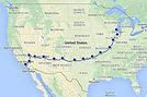
We're thinking of driving Route 66 from Chicago to LA in fall 2027 or spring 2028 for about a month.
From what I've found, it doesn't exist everywhere anymore, but that's okay! We're happy to take detours along the way. We're open to visiting less touristy or even completely off-the-beaten-path spots.
Are there any websites dedicated to this road trip?
I'd love any tips and advice for this journey—accommodations, vehicle rental, the pros and cons.
Thanks in advance!
Hi fellow travelers, do you think there’s a real benefit to spending 2-3 days in Yosemite when I’ll already be spending a week in Banff and Jasper in the Canadian Rockies? Won’t it feel a bit redundant? I’m asking because Yosemite is expensive (I’d go with an agency from SF, staying in a cabin, since I’ll be solo and without a car) and apparently packed.
Thanks for your feedback!
Hello! The itinerary is pretty much set for August 2026. Yeah, I know it’s gonna be *super* hot. But it’s the only time we can get away.
So, here’s the plan: Montpellier-CDG-Dallas.
Stay from July 31 to August 26, 2026:
Car rental – check,
Hotels – check,
Itinerary – almost check,
Photo gear – check,
Budget – check, 🤪
Meal planning – meh, we’ll see...
Walmart, of course, for the cooler when we arrive.
And now, without too much detail...
Fort Worth:
The Longhorns and the Stockyards;
JR’s ranch (for the missus);
Medal of Honor Museum – Arlington.
Houston and NASA Space Center:
See the Gulf of Mexico/America.
San Antonio and the missions.
Fort Stockton for an overnight stop.
El Paso via Guadalupe Mountains:
El Paso and White Sands.
Tucson and the Pima Air & Space Museum:
Tombstone, Bisbee.
Phoenix:
Still working on the program.
Sedona:
Round trip around the area via Flagstaff and Williams, or the Grand Canyon (already done) – we’ll decide on the spot.
Albuquerque:
Santa Fe,
Turquoise Trail,
Los Alamos.
Amarillo via Route 66:
Old Route 66 in the city;
Big Texas Ranch Steak 😏.
Dallas:
JFK Museum;
Perot Museum;
West End district.
And through it all – the road, the road, and more road!!!
We’ll adapt day by day based on our mental and physical state (we’re not exactly spring chickens).
Hello!
We’ll be arriving in Montreal on October 21st for a 3-day stay.
After that, we’re heading to Sherbrooke to visit our daughter, who’s studying at the university there. We’ll spend 3 days with her, and then, since she has a break that week, we’re taking her along for 3 days in Quebec City.
We’ve planned to visit Montmorency Falls and Île d'Orléans.
I’d love to hear what route you’d recommend for the drive from Sherbrooke to Quebec City—we’ll have the whole day to take it easy.
If you have any other recommendations, I’m all ears!
A little disappointed that the fall colors will be over by then, but the dates couldn’t be helped. Thanks in advance for your tips!
Hello everyone,
We’ve planned a trip (retired couple) for late August to the first half of September in Western Canada.
Classic itinerary: arrival in Calgary, Banff, Jasper, Clearwater, Whistler, Vancouver Island, departure from Vancouver.
I know you can’t see into the future any better than I can, so I’m obviously not asking what the wildfire situation will be like in a month...
But if any of you could let me know if, CURRENTLY, there are major difficulties—not just for locals, of course, but for tourists as well?
We’re hesitating between taking the chance or canceling what we still can.
We’re not young anymore and don’t have the flexibility we once did...
A thousand thanks to those of you on the ground or with contacts there who can help us make this decision!
A friend is renting a car for an upcoming trip during the All Saints' holiday.
Nowadays, all rental cars come with GPS, but do you know if you can use it without paying for the GPS rental? I have no idea since I always use my own!
After our first trip as a young couple to the West in 2007 (yes, that doesn’t make us any younger!), we’re planning to go back in 2028, but this time as a family of four! (We have two boys who’ll be 5½ and 13 years old in the summer of 2028.)
Our plan is to combine a few big cities (SF and LA, maybe San Diego) with national parks and state parks, mostly!
Ideally, we’d like to leave at the end of June and head back to France around July 19–20, so we can enjoy the first week of the Olympic Games in Los Angeles.
Since we already did the "loop" in 2007, there are must-see places we absolutely want to revisit—and especially share with our kids: Bryce Canyon, Yosemite, and above all, the Grand Canyon, which is still the most incredible thing I’ve ever seen on Earth!
On the other hand, some places didn’t leave a big impression on us for various reasons, so we’re not making them a priority: Antelope Canyon, Monument Valley, for example.
We’re planning ahead, but might as well be smart about it😏
Do you have any tips for a fun and doable itinerary over about 20–25 days with kids, without rushing?
hi everyone
I’m planning a world trip and I’m looking for great tips on accommodation in the United States.
Do you have any good deals to share, please?
thanks
Hello everyone! Really damaged due to flooding caused by runoff after forest fires (a total mess!), does anyone in this friendly forum have any updates on the Apache Trail between Apache Junction and Roosevelt Dam? Is there still a section of the road that’s tough to navigate?
We're leaving at the end of June and will be driving the route between Buffalo and Cody. We’ve already booked our accommodations and a rodeo in Cody, but during the day, we’ll be driving between the two and I’m unsure about the itinerary.
Which route do you think is the most pleasant, interesting, or scenic between:
- The northern route via Highway 14 with Sheridan, Lowell, etc.
- The southern route with Highways 16/20/14, passing by Loaf Mountain Overlook, Powder River Pass, Ten Sleep Canyon...
We’ll be in a car, so we should be able to drive on any road.
Thanks for your input!
I’m almost done planning our September road trip. After our 3-night visit to Sequoia, we’ll have a stopover night in Coalinga (to break up the drive). We’ll be staying two nights in Monterey and would like to stop along the way to visit one side of Pinnacles National Park. We’re torn between the West entrance and the East entrance, and we’d like to do a short hike of no more than 2 hours since we don’t want to arrive too late in Monterey.
This park is split into two distinct zones with no connection between them, and the mileage from Coalinga to Monterey is pretty much the same for both. Which area do you recommend visiting—east or west? And which route is the most scenic?
I’ve spotted two short hikes:
- East: Moses Spring to Rim Trail Loop
- West: Balconies Cliffs Cave Loop
Has anyone been there, or do you have another hike to suggest?
Thanks in advance, and have a great afternoon!
Marcalamar 🙂
Hi everyone! 🙂
Just a quick question about King Canyon and Sequoia National Park.
Before our night in Miramonte, we plan to visit King Canyon. The next stop will be two nights in Three Rivers to explore Sequoia National Park. I wanted to go all the way to Roaring River Falls on the King Canyon Scenic Byway and then turn back to head to Miramonte. Since we’re coming from Oakhurst, Google Maps says it’s 300 km and 5 hours of driving. Since we also want to hike to see the sequoias (Big Stump Area and Grand Grove) before tackling the King Canyon Scenic Byway, the timing’s going to be tight. How far do you recommend going before turning back to miss as few points of interest as possible on the King Canyon Scenic Byway? Thanks for your advice, and have a great evening!
Marcalamar 🙂
Hi everyone!
After years of hoping, waiting, planning, then changing, saving, and searching for the best possible route... we're FINALLY off this summer for a 5-week road trip in the West.
I had planned a trip to Colorado in 2021 but canceled due to COVID, so with time passing and my eldest’s high school graduation approaching fast, I figured it was now or never!
Anyway, the itinerary has been modified and extended to please everyone (I’m no longer the only one making decisions!!)
Here’s our final route:
Day 1 - 7/12/2026 - Brussels / Los Angeles
Day 2 - 7/13/2026 - Los Angeles
Day 3 - 7/14/2026 - Los Angeles
Day 4 - 7/15/2026 - Los Angeles
Day 5 - 7/16/2026 - Los Angeles
Day 6 - 7/17/2026 - Los Angeles / Kingman
Day 7 - 7/18/2026 - Kingman / Grand Canyon
Day 8 - 7/19/2026 - Grand Canyon / Page
Day 9 - 7/20/2026 - Page
Day 10 - 7/21/2026 - Page / Monument Valley
Day 11 - 7/22/2026 - Monument Valley / Durango
Day 12 - 7/23/2026 - Durango
Day 13 - 7/24/2026 - Durango
Day 14 - 7/25/2026 - Durango
Day 15 - 7/26/2026 - Durango / Glenwood Springs
Day 16 - 7/27/2026 - Glenwood Springs
Day 17 - 7/28/2026 - Glenwood Springs / Moab
Day 18 - 7/29/2026 - Moab
Day 19 - 7/30/2026 - Moab
Day 20 - 7/31/2026 - Moab
Day 21 - 8/1/2026 - Moab
Day 22 - 8/2/2026 - Moab / Vernal
Day 23 - 8/3/2026 - Vernal / Grand Teton
Day 24 - 8/4/2026 - Grand Teton
Day 25 - 8/5/2026 - Grand Teton / Cody
Day 26 - 8/6/2026 - Cody / Yellowstone
Day 27 - 8/7/2026 - Yellowstone
Day 28 - 8/8/2026 - Yellowstone
Day 29 - 8/9/2026 - Yellowstone
Day 30 - 8/10/2026 - Yellowstone / Salt Lake City
Day 31 - 8/11/2026 - Salt Lake City / Bryce Canyon
Day 32 - 8/12/2026 - Bryce Canyon / Zion
Day 33 - 8/13/2026 - Zion
Day 34 - 8/14/2026 - Zion
Day 35 - 8/15/2026 - Zion / Las Vegas
Day 36 - 8/16/2026 - Las Vegas
Day 37 - 8/17/2026 - Las Vegas / Los Angeles
Day 38 - 8/18/2026 - Los Angeles
Day 39 - 8/19/2026 - Los Angeles / Brussels
Day 40 - 8/20/2026 - Brussels / Home
We’ll be alternating between house swaps, motels, and campgrounds. I’ve booked all the accommodations (except the campground at Bryce since sunset bookings open only 14 days in advance) and the first activities, as well as the most touristy ones.
I’m currently putting together my day-by-day roadbook and having some trouble planning certain days, like in LA or Las Vegas. Choosing hikes isn’t easy either—it’s tough to decide!
We’re really excited but could definitely use your help with choices and optimizations!!
Hello.
I’d like to travel along I-15N from San Diego to Las Vegas with my mom, who’s 67. We’ve explored Northern California and the California Coast over the past two years and now want to continue through the desert.
There are several attractions along the way:
- Mormon Rocks
- Desert Discovery Center and visit the Old Woman meteorite
- Joshua Tree National Park
- Mojave Desert
- Mojave National Preserve
- Anza-Borrego Desert State Park
- Silverwood Lake
My mom has back issues that prevent her from hiking or walking on trails with elevation changes. Is it possible to visit these places by car, or are the routes flat enough?
I’d love for her to experience the desert with an itinerary adapted to her condition. I’m also open to other points of interest that aren’t mentioned. We have 3-4 days for the trip, so we’re not in a rush—just want to explore.
I’d love to take a road trip and visit Nova Scotia. I’d appreciate some info on the best cities to see and the most interesting spots. The trip should last about 10 to 15 days, staying in hotels or motels. Thanks in advance!
We’re being relocated to Saint Pierre and Miquelon.
We’ll be taking the flight from Nantes to Montreal and then from Montreal to Saint Pierre.
Could you recommend a hotel near the departure terminal that allows dogs?
Hi,
My 16-year-old son is flying to Grand Rapids with other kids his age. There’s a layover in Detroit. There’s no unaccompanied minor service available. Is it pretty easy to navigate Detroit Airport to catch the connecting flight to Grand Rapids (domestic flight)? There are several of them who speak English well.
Thanks for your replies,
Good evening, everyone! 🙂
Just a few last questions to wrap up our Lake Tahoe visit plans.
**Parking:**
We’d like to walk to Eagle Falls and then Eagle Lake. I’ve spotted two parking lots that seem close to each other and give access to the trailhead. Where and how do we pay for entry to Emerald Bay State Park and Inspiration Point?
**Viewpoints on the East Side:**
Are most of the viewpoints (Balancing Rock, Granite Cave, Bonsai Rock, etc.) right by the road, or do you have to hike to reach them?
**Donner Memorial State Park:**
Is it worth making a detour to Truckee to visit this park and the Truckee historic downtown?
Hi there. I'm shocked by the price of the Upper Antelope Canyon tour—$175 for less than an hour… You might say, "if you can’t afford it…" But the real question is whether it’s really worth it, because $350 for two makes me feel like I’m getting ripped off. For those who’ve done both Lower and Upper, can you tell me if the price difference is really justified? Thanks
Hi everyone! 🙂
As you can see, we're heading back from September 6th to the 27th.
Everything’s booked for September—flights, accommodations, and the car. As I plan, I’ll be asking the experts for help. This is our second trip to California, but most of the stops are new to us.
We’ll start directly from San Francisco to our first overnight stop, Davis, before heading to Lassen Volcanic Park for 4 nights. Our flight lands at 12:50 PM.
Here’s our itinerary:
Day 1: Davis – overnight stop
Day 2: Red Bluff – exploring Lassen Volcanic Park (scenic drive to Lake Helen)
Day 3: Susanville – scenic drive through the park via the South Entrance, points of interest, and hikes
Day 4: Susanville – Cinder Cone and Painted Dunes hike
Day 5: Susanville – Warner Valley (hikes)
Day 6: South Lake Tahoe
Day 7: South Lake Tahoe
Day 8: Mammoth Lake
Day 9: Mammoth Lake
Day 10: El Portal via Tioga Road
Day 11: El Portal
Day 12: El Portal
Day 13: Oakhurst
Day 14: Miramonte
Day 15: Three Rivers
Day 16: Three Rivers
Day 17: Coalinga
Day 18: Monterey
Day 19: Monterey
Day 20: San Francisco
Day 21: San Francisco
Day 22: Departure
For hikes in Lassen Volcanic Park, I’ve planned:
Bumpass Hell, Cold Boiling Lake (Day 2)
Paradise Meadow (maybe not going all the way), Devastated Area, and the loop around Reflection and Manzanita Lakes (Day 3)
Cinder Cone and Painted Dunes (Day 4)
Devil’s Kitchen and Boiling Spring Lake (Day 5)
I’ve read there are trails to access the trailheads for Cinder Cone (11 km) and Warner Valley. Are these easy trails for an SUV?
Are there any other must-see spots or things we shouldn’t miss?
That’s where I’m at for now. Thanks for your replies, and have a great evening!
Marcalamar 🙂
I’m a total USA addict. I’ve already done several road trips, including the East Coast and West Coast.
I’m here today because I’m planning to go back for another road trip on the West Coast. Possibly with one of my sisters and a couple of friends. It’s still just a plan for now, but I’m working on an itinerary in the meantime. Ideally, I’d leave in 2026, but I don’t have the exact dates yet—maybe April-May or September-October.
My last trip to the West Coast was in September 2014. We went for 2 weeks, but this time it’d be 3 weeks. What made me want to go back was simply a colleague who just left today. As I’m writing this, he’s on the plane. I’m so happy for him, but now all I can think about is going back.
Since I recently went to NY, I noticed that prices have really gone up. I assume the same is true for the West Coast? For 2 people over 3 weeks, what budget should I expect? We’re the type to watch our spending and find great tips.
I think we’ll arrive in San Francisco like the first time and leave from either Los Angeles or Las Vegas.
Thanks for advising me on the booking—should I reserve a room in the hotel or go for a cabin for the best view?
Should I get breakfast or not?
What do you think of the restaurant?
Hello, if the off-the-beaten-path enthusiasts are still around 😉, I’d love some info on tackling these trails. I’m not super familiar with the rules, risks, or what to expect—I’m looking for firsthand experience from folks who’ve done it on their own once or multiple times.
Hi everyone!
I’m planning a week-long family trip to NYC in October 2026. The focus is on museums and soaking up the New York vibe. I’ve been checking Airbnb, but the prices in Manhattan are through the roof. Since I don’t know NYC well, is it "wise" to look outside Manhattan? Any neighborhoods you’d recommend?
After our first trip to the West, we’d love to go back to see other must-see spots!
The stay would be from May 11 to 20, 2026—it’s short, but hey...
M11: Lyon to Las Vegas (overnight in Vegas)
T12: Route 66 – overnight in Grand Canyon (GC)
W13: Visit GC – overnight in Page
Th14: Visit Antelope Canyon / Horseshoe Bend – overnight in Monument Valley (MV)
F15: Visit MV – overnight in Moab
Sa16: Visit Arches / Dead Horse Point – overnight in Bryce
Su17: Visit Bryce – overnight in Zion
M18: Visit Zion / Valley of Fire – overnight in Vegas
Tu19: Return flight
What do you think? Could we add one more night somewhere? We’re not big hikers, so we’ll mostly explore the parks using shuttles.
Also, we’re all set—passports are good. Do you think one classic Visa card and one premium Visa card will be enough for coverage?
Thanks so much for your feedback, and happy holidays!
Hi North America forum crew,
Just a little post that might interest some of you:
Travelers to the United States | Photo Now Mandatory Upon Entry and Exit | La Presse


 Bonjour Héloïse,
 Bonsoir Bri,
 Voilà une photo d'un point du vue du Black Canyon of the Gunnison ("the Painted Wall") en fin de journée :


 Oui, les beaux sites ne manquent pas dans le coin. Et sur votre itinéraire, avant Gunnison, nous avons aimé le centre-ville de Leadville ainsi que son passionnant musée sur les mines. Nous avons pique-niqué à Twin Lakes.