Hi Emma,
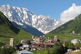
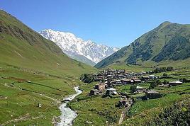
There’s a trail (in 2012 it was like that) that goes all the way to Ushgulli.
From Mestia to Ushgulli, it’s 46 km.
You’ll find several treks starting from Mestia (the Chalati Glacier trek, Cross Peak, etc.).
Hi there,
Thanks for your reply.
I’m leaving next week and plan to start the trek on May 10th. The stages are roughly Mestia/Zhabeshi, Zhabeshi/Adishi, Adishi/Khalde, Khalde/Ushguli over 4 days. Fingers crossed the weather holds!
I’ve heard you can get maps at the tourist office in Mestia if it’s open. I already tried contacting them via email and WhatsApp but no response. Did you enjoy the trek?
Hi,
You’ll still get quite a bit of rain. And the evenings will be chilly.
After Ushguli, the Zagari Pass was closed (snow).
I haven’t done these treks—I’ve planned them for this autumn, but I’m going back with my 4x4.
Two friendly guides: *Les Peuples du Monde* and *Explore Georgia*—the latter is more into motorbikes and 4x4s, with lots of great tips on rentals, etc.
Travailler, étudier et vivre à l'étranger › Géorgie · 2 replies
Mon mari et moi devons partir 2 mois (minimum) en Georgie. Pour l'instant, c'est programmé pour avril-mai. Nous allons travaillé tous les deux sur un film…
Trouve-t-on facilement du café soluble "nature" dans les épiceries géorgiennes et arméniennes ou est-il plus prudent de faire mon stock avant de partir? Je me…
Nous souhaitons faire le trek de 4 jours reliant Mestia à Ushguli sans agence. Il est précisé dans les descriptifs qu'il existe des hébergement à chaque étape,…
Bonjour Amis Voyageurs,
Je rentre d'un voyage d'une semaine en Azerbaïdjan effectué tant dans Baku que dans les principaux spots à visiter dans le pays.
Contrairement à ce qu'annonce le "Conseil aux Voyageurs" du Ministère des Affaires Étrangères, on voyage partout en toute sécurité, les azerbaïdjanais sont adorables avec les étrangers, et la police absolument bienveillante.
Il suffit simplement de respecter les lois du pays comme partout, pour ne pas être inquiété.
Je recommande vivement la visite de ce magnifique pays.
Antoine
Hi,
We’re supposed to go to Oman from October 17th to 30th for a 4x4 road trip. We’d already bought our flight tickets before the war started... We’re looking for recent traveler feedback from anyone who’s been there lately. Obviously, we plan to avoid areas around American military bases as well as the Salalah, Duqm, Musandam regions, and the border with Yemen.
Thanks in advance for your input.
lili
We had planned a road trip to Jordan in March 2026. Unfortunately, the Americans decided otherwise the week before. Since Jordanian Airlines wasn’t canceling flights, we were able to reschedule ours (for up to one year max). I opted for October 2026, hoping for the best...
Since then, I’ve been scouring forums for info but haven’t found anything.
So, has anyone traveled to Jordan recently?
Can anyone currently there give us an update on the situation?
Basically, I’m looking for any info.
Looking forward to hearing from you.
Hello, we’re two senior couples who often travel with a guide and driver. For this trip to Oman, though, we’d like (for various reasons) to have a fixed base and visit the must-sees with a local guide but on a hub-and-spoke basis. Do you think that’s possible, and what would be the best place to stay?
We’ll be in Oman for 7 days in March 2026.
Thanks in advance for your suggestions.
Hi there,
This year we want to go to Georgia. We have a ticket to Istanbul and would prefer to avoid an Istanbul/Tbilisi flight to see a bit of Turkey, which I love.
I found a train from Ankara to Kars (25h): why not?
But how do we cross the border: which town? Is it easy (or not)?
I’m leaning toward Batumi, but I’m not sure about anything—thanks for your tips!
Thanks for your insights
I’m planning a two-week trip to Iran in September and I’m reaching out for some valuable tips....
After doing a bit of research, I’ve sketched out a rough itinerary.
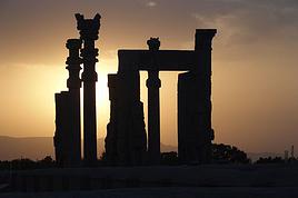
I plan to spend 2–3 days in Tehran, then head down to Isfahan for 4–5 days with an overnight stop in Kashan. After that, I’m thinking of going to Shiraz for 2–3 days, including a visit to Persepolis.
Then back to Tehran with a 2-day stop in Yazd.
What do you think? Is this doable? Are there any other must-see spots?
The north, with Tabriz and Masuleh, also caught my eye, but what should I cut to fit them in?
If you have any recommendations for high-quality, authentic hotels, I’d love to hear them.
And one last (silly) question—I’m a smoker (unfortunately!), so is it allowed for women to smoke in Iran? If so, under what conditions?
Thanks in advance for your help, and I’m all ears for any advice!
hi,
do we absolutely have to get the ETA before traveling to Israel these days?
some people say it’s not mandatory, others say it is.
any feedback, please?
thanks
Hey everyone!
A comeback after so many years... but my question is simple:
"Has anyone wandered around these two countries recently? (The posts and travel journals I’ve read are a bit dated.) I’m planning a trip for late spring—one I had mapped out for 2023 but never got to do.
For any info on transportation, border crossings, cost of living, and interesting hostel/GH addresses, thanks in advance! 😉
Hi,
We’ve got flight tickets for a two-week trip to Georgia from April 8th to 23rd.
Should we go ahead with our trip or postpone it to September, given what’s been happening in the Persian Gulf since late February 2026?
Are there any impacts in Georgia?
Thanks for your help
Hi there, I’d like to spend a few days in these two countries. How many days do you recommend? Any ideas for things to see? Which airline should I take to go from one to the other? I think there are no more direct flights? Thanks
Hi,
We’re heading to Asia this summer, and to avoid arriving in the middle of the night, we’ve decided to stop over in Dubai for a day and a half on the way there and back. Any ideas for activities during this super-hot period? Bonus points if they’re reasonably priced 🙂 Which neighborhood is best to stay in?
Thanks in advance, and have a great day!
Bruno
We visited the northern/northeast part of Oman, the most touristy area, last February over 11 days there. It’s a great time to go because the temperatures are pleasant and there aren’t too many tourists, even though the country is only just starting to develop its image. 11 days was enough for us to see the essentials, but you can always extend your stay depending on what you want.
2 days in Muscat, 2 days in the desert—we would’ve happily stayed longer—2 days in the mountains, 3 days in the wadis, and the rest for the cities, villages, and the coast.
Oman offers stunning landscapes and a genuinely warm welcome. We always felt safe, never experienced any malicious looks or gestures.
As usual for our trips, we chose to organize everything ourselves but with a guide to better explore and soak up the local culture.
The point of my post isn’t to recount our journey but to encourage and reassure anyone considering this destination.
If I can be of help, I’m happy to answer your questions based on what I know.
Living in Amman, Jordan, I’d like to visit Jerusalem and the surrounding areas during the Christmas season.
I’d love to hear your thoughts on:
- the security conditions in Israel/Palestine,
- sightseeing in Jerusalem during the Christmas period.
Hi! If anyone has been to Georgia recently and could tell me if it's feasible to travel around the country using public transport. My itinerary would be Kutaisi (my arrival airport), Tbilisi, Mestia, Ushguli, Batumi, and back to Kutaisi (departure airport) in ten days. My flight arrives late at night, around 1 AM—would it be possible to take a taxi to get to the city center?
Any advice is welcome, and regarding the language, can you get by with English? Thanks in advance.
Hi everyone, I’m married to a Kurd from Iraq, and we’re heading to Kurdistan in November with our two-and-a-half-year-old son. Even though I’m really excited about this trip and happy to go, I’m a bit nervous because as a European woman, I feel like there’s nothing to do and I have this image of a dangerous country… To put my mind at ease, I’d love to chat with other Europeans who’ve been there. Thanks! !
Hi there
Does anyone know if it's allowed to use a drone (under 250 g) in Oman?
If so, is there any registration required for the device?
Thanks in advance for your feedback.
Laurent
Hi there,
We’re traveling from 12/23/2025 to 1/9/2025 in Oman.
However, our flight lands in Dubai.
So I’m looking for a car rental company that allows crossing the border into the Sultanate of Oman.
Thanks for your recommendations!
I think I saw there’s also the option of vehicles with rooftop tents…
Hello... nothing new for several
years now...
Can you go there independently from the rest of the country? Any recent experiences, either in Kurdistan or the rest of Iraq?
Thanks a lot
Hi, we’re traveling to Georgia soon and want to go to Azerbaijan. I’m having trouble finding info on crossing the border.
Is it possible to do it by car or train? Are the land borders between the two countries open? Or do we have to fly?
Thanks in advance
Since I had trouble finding up-to-date info, here’s an update on some key points for Jordan/Egypt ferries as of August 2025.
Right now, AB Maritime is the only company still operating ferries. Other companies sometimes mentioned (Jordan Sinaï Hotel and Tour, Sinaï Ferry, etc.) have stopped running (no response by phone or email, and confirmed on-site).
On the Jordanian side, the fast ferry doesn’t leave from the port of Aqaba but from Tala Bay (20 km further south). There’s supposedly a slow ferry that departs in the evening from Aqaba port (according to a taxi driver), but I couldn’t find any info about it.
Currently, there’s one ferry per day in each direction for Aqaba/Taba and another for Aqaba/Nuweiba. But the schedules aren’t great for backpackers—and they’re not the same every day.
On the Jordanian side at Tala Bay, you access the port by walking through a large resort, go through border control before boarding the ferry (+ luggage check). You have to pay the exit tax of 10 JOD (12 €) to "someone sitting on a bench in front"!!! It’s true—you need to ask who to pay, or customs won’t let you through without the magic coupon.
Oddly, I arrived early and managed to take a different ferry than the one I’d booked online by insisting (it wasn’t open for online reservations).
I bought the ticket on the AB Maritime website. Confirmation by email was brief. Then you have to find another person outside the port who has the passenger list and will give you the actual ticket. (What a joy this organization is!) Luckily, everyone’s really friendly with tourists.
On the Egyptian side, arrival in Taba isn’t in Taba itself but at Taba Heights (20 km further south), in a hotel zone. Immigration can be more or less quick depending on your place in the queue at the single office... (free Sinai visa or paid Egypt visa). And outside... nothing. Nothing: no exchange bureau, no ATM, no drink or SIM vendor... A nightmare. No bus station. One or two taxis at prohibitive prices. Personally, I walked about fifteen minutes to the Strand Hotel to find someone who could actually help me (ATM out of service in that big resort). From there, two bus companies currently operate: Webus in small vans but you have to book at least 2 days in advance (frequent, fast, reasonable prices) or GoBus with large buses (only one per day, even cheaper). They head south to Nuweiba, Sharm El Sheikh, etc. A taxi from Taba to Sharm was quoted at 120 USD at the port exit!
For me, the ferry and GoBus schedules didn’t align at all. If I’d known about Webus earlier, I could’ve saved 6 hours of waiting...
On another note, a Taiwanese traveler I met also mentioned that the Hurghada-Sharm El Sheikh ferry is no longer running.
Basically, these border crossings and ferries are more suited to organized tours than backpackers, but it’s still doable.
Hello everyone,
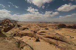
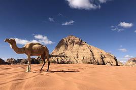
We’re just back from a wonderful adventure exploring Wadi Rum.
We spent 3 days and 2 unforgettable nights there. Our guide, Mohamad, introduced us to the desert—its beauty, its mysteries—with rare skill, kindness, and generosity. We hiked through breathtakingly beautiful places, slept in a Bedouin tent and under the stars, enjoyed delicious meals, and shared moments of incredible quality.
Mohamad honored us by sharing songs, poems, and stories, and introducing us to his family. His humor, life philosophy, and empathy will stay with us forever.
Without a doubt, one of the most beautiful experiences we’ve ever had.
Mohamad’s contact details can be shared via private message.
I’m also happy to provide any info about this unforgettable trip.
Michèle
So happy to be back with you all that I’m rushing to share my trip report!
We chose to stay exactly 14 days to avoid paying for a visa. As a result, we didn’t have time to explore the south—we’ll be back because Oman is a great destination in January. Temperatures were a perfect 25–27°C during the day. No rain for us, but it can happen.
We bought the *Évasion Oman* guidebook. We started with the Jebels (the mountains), abandoned villages, then the desert, wadis along the coast, and finished in the capital. For us, it was easier to go from cold (2,000 meters, after all) to hot before returning to our freezing Normandy in January.
The people were incredibly welcoming and lovely. We camped in natural camping areas where you can make a fire (free, no facilities or water). Easy to find—just search "camping" on Google Maps (an essential app). We traveled as a group of five and rented a 4x4 seven-seater from Europcar before leaving (price included our insurance): 800 euros for 14 days. Essential for getting everywhere, as there are lots of dirt tracks. We brought our camping gear from France since the baggage allowance is 30 kg. Oh, and also two liters of rum and a box of white wine—also essential.
Food was tricky if you don’t like spicy dishes or just chicken. You have to eat at international restaurants, which cost about the same as back home. We’d packed vacuum-sealed meat for the first three days and a few cans. For beaches, stick to the ones marked on Google for swimming—otherwise, they can be dirty and full of oil.
We arrived at 6:30 AM, bought a SIM card (make sure to remove yours before arriving and tape it to the back of your phone), exchanged money (not great rates at the airport—better in malls or souks; no exchanges in banks), and picked up the car. Then we headed to a Carrefour supermarket, but it was closed. We drove to Jebel Al Akhdar, the Sayq Plateau, where we found markets along the way. There are also bazaar shops where you can get gas bottles—they’re everywhere in mid-sized towns. There are even hypermarkets.
We hiked the well-marked old Sayq trail (red and white markings). Our return was improvised. We camped on the plateau and got cold—bring 0°C sleeping bags! The next day, we visited the abandoned villages of Wadi Bani Habib: juniper forests, canyon viewpoints. Then Birkat Al Maws on the way down—a beautiful palm grove. Next, Nizwa Hotel. The beds were really hard there—ask to see the rooms and test the beds before booking. There’s always availability, with prices starting at 35 euros for two.
On the third day, we went to Jebel Shams. Hiked along the canyon starting from Ghul, then descended. Camped on the road to Balha Fortress, which we visited the next morning (stunning!). Then we explored Nizwa before heading to the Wahiba Desert. Camped along the way, then drove to our accommodation: two days in the desert. We found the Thousand Nights Camp 40% cheaper a month before. Note: you have to leave by 1 PM in a convoy to reach the hotel.
On the sixth day, we hiked in the desert on our own because the activity prices were outrageous.
On the seventh day, we headed to a wadi, Bani Khalid, then to Sur, a seaside hotel. We booked just one room for five of us—hotel apartments are huge, and since we had our camping mattresses, it wasn’t a problem to set up in the living room. There’s even a kitchen. In cities, camping spots are poorly located—near intersections, etc.
Beach time and sightseeing on the eighth day, then we drove to the white sand beach in Fins, where we stayed for two nights (we left the tents set up but empty). This was our favorite campsite—go all the way to the end of the road, there’s a small cove and a stunning spot.
On the ninth day, we visited Wadi Shab and the Salma Plateau to find the tombs. The hike up from Fins was way too long—probably better to take the route suggested in the guidebook for a round trip. Meh, no one really enjoyed it.
On the tenth day, we went to Wadi Al Arbiyyin and drove to Seeb Al Mouj to book a diving trip. Stayed at Al Ferdous Hotel Apartments until the end—well-located for visiting Muscat and a great value. Just make sure to check the room first, as some beds are very hard and others aren’t.
Eleventh day: diving and beach time.
Twelfth day: visited the Grand Mosque (unlucky—first day it became paid, and not just a little: 8 OMR). Then explored the old city.
Thirteenth day: the Grand Opera and beach at The Village, where we found a great pizzeria: pizzawifi.com.
Fourteenth day: And that’s it—back home, thrilled to have discovered this magical country. We’ll be back!
4 jours de balnéaire dans cet endroit vraiment curieux me permettaient de souffler il y a 15 ans après avoir crapahuté en Asie ou en Afrique : me baigner dans une eau clair et propre et amoindrir le jet lag était mon but ; voir aussi un peu ce mirage au milieu du désert attisait ma curiosité...Et puis Dubai s'est développé et depuis j'y vais une fois par an 15 jours sans m'ennuyer !! Mon budget routard ne m'empêche pas de profiter de ce qui me plait dans un voyage : découvrir des cultures, de l'architecture, des plages aux eaux turquoises.
Je partage ici mes adresses pour ceux qui aiment la simplicité et l'envie d'être étonné !
Dubai s'étale sur 50km de long. Je reste dans le quartier historique de Bur qui est très "indien" et qui est séparé par un bras de mer de Deira le quartier plus "arabe/africain".
On passe d'une rive à l'autre avec des abras, petits bateaux en bois typique qui circule toute la journée. Mon hôtel se trouve à 4 minutes de la station de bus Al Ghubaiba, 5 mn du métro Al Ghubaiba et 6 mn de la station de bateau Al Ghubaiba !!! On se déplace facilement depuis ce point et le soir c'est animé on sort en toute sécurité, peu de touristes mais surtout la classe moyenne composée de ceux qui ont fait et font Dubai.
- transports :
...pour y aller : je pars avec Emirates car en prenant le vol de 21h30, dans l'avion je dors avec une musique douce dans le casque , j'atterris à 6h35, je change 200 euros quand j'ai récupéré ma valise, je vais me changer dans les toilettes, je prend un taxi direction l'hotel , j'y dépose ma valise et je file à la plage !
...sur place : j'achète une NOL carte, l'argentée, qui sert à prendre bus, métro et bateau, selon mes besoins et ma consommation, je la recharge au fur et à mesure, valable 2 ans.
... taxis : équipés de compteur fiable, quand ils sont roses ce sont des femmes au volant, prix aéroport/hotel : 12 euros ...On en trouve partout, ils ne râlent pas quand on fait des trajets courts , entre 15h et 16h plus compliqué car c'est la relève.
- meilleures périodes :
pour moi c'est avril-mai et octobre -novembre : pas trop chaud pour se promener mais assez pour se baigner ! Attention à la climatisation votre pire ennemi...elle est partout y compris les arrêts de bus...Un grand foulard ou un paréo pour se couvrir gorge et tête car passer de 32° à 16° quand on rentre dans un mall , un bus ou un taxi c'est assez violent !
- hôtel :
je vais au Grand Astoria (Fahidi Street) car le rapport qualité/ prix /emplacement est bien. Très propre je prend sans petit déjeuner car près de la station de bus il y a un grand hypermarché Carrefour où j'achète de quoi petit déjeuner+eaux+lait de chamelle+pique nique...
Il y a 2 discothèques en bas prévoir des boule quiés pour s'endormir avant 2 heures du matin..Wifi médiocre il faut changer le mot de passe tous les 2 jours...personnel adorable. Chambre avec télévision (4 chaines indiennes+BBC) un set bouilloire tasses avec sachet thé café et un mini bar.
- Bur Dubai : "mon quartier"
Le matin on peut voir des enfants en uniforme qui attendent le bus pour l'école accompagnés par leur mère ou père issus de la 2e génération de migrants et bien installés ici...
Ils parlent anglais, arabe et leur langue maternelle, ils ont une éducation poussée et sont trés recherchés d'après les annonces que je vois dans les journaux locaux mis à disposition dans le hall de l'hôtel. Des Etats Unis au Moyen Orient en passant par Singapour et l'Afrique du sud ils ont un bel avenir et sont le soir accompagnés pour une balade en famille par leurs parents et grands parents qui ont permis à Dubai de se développer. Le long du creek quand je prend un thé ou m'assoie il est fréquent que les voisins de banc vous demandent d'où vous êtes...Ici le monde entier se croise, on discute même avec un anglais basique, c'est sympa et convivial, le "take care" ponctue le bavardage quand l'un ou l'autre reprend son chemin...
Bur est un quartier avec des visites possibles , super quand on n'a pas envie de bouger: le long du creek (le bras de mer) se trouve un ensemble de maisons reconstituées qui forme un musée "al shindagha museum". On achète un ticket qui permet de visiter l'ensemble des maisons qui ont chacune une thématique liée à l'histoire des 7 émirats dont Dubai est l'un d'eux. Cela prend une journée mais si à l'heure du déjeuner vous stoppez les visites il y a plein de restaurants pour toutes les bourses dans le quartier dont certain au bord de l'eau.
En partant à l'opposé on arrive dans le quartier "al seef" qui est la reconstruction à l'ancienne de ce qu'était Dubai au départ : un petit port de pêcheur de perle. Jolie architecture avec des boutiques de souvenirs , ma préférée c'est l'épicerie iranienne où l'on trouve du chocolat au lait de chamelle, du citron noir et des friandises à la rose, pistache, abricot confits, etc...
On se promène dans ce quartier tranquille même en temps que femme seule, des toilettes gratuites un peu partout, des bancs de bois ou de pierre ! Le soir un petit vent on peut y manger ou prendre un verre, quelques tours en face, pas les plus belles...
- restaurants :
Dans Bur il y a tous ces restaurants qui représentent les régions de l'Inde mais aussi le sous continent indien...mes adresses :
en face de l 'hôtel le Paklyari , un pakistanais : excellent mutton byriani à 5 euros ,
sur le creek (vers les musées)un restaurant népalais : tout y est bon,
au bord de l eau à al seef le Nablus, super cadre...
En face à Deira le restaurant italien du Rotana au 18e étage...y aller 1/2 avant le coucher du soleil vue super sur le creek et la skyline : la pizza à la truffe est à 24 euros ! On peut y aller en taxi depuis Bur et après diner se faire déposer en taxi à al seef et rentrer à pied le long du creek
pour un trés bon thali le Kathhiyawadi à 10mn à pied du métro Burjuman
et ma dernière découverte : le Bordomavi (arrêt de bus rashid al hadees masjid1)...un des serveurs est algérien francophone...on peut se baigner sur la petite plage avec douche/toilettes et partir déjeuner dans ce restaurant (57 euros à 2 avec entrée plat dessert boisson) cadre tranquille dans un petit port de pêche. Photo sympa avec port typique et loin derrière toutes les tours modernes !
- boire un verre au coucher du soleil :
la terrasse du Concorde Creek View (Bur) (vue creek)et le Canopy by Hilton (al seef) (vue creek et skyline) où l'on peut avoir un forfait piscine à la journée incluant repas et boisson
- lassi : à coté de l'hôtel bonnes glaces et lassi au SreeRaj Lassi bar
* à noter : partout tout est emportable y compris les restes, pratique pour faire un pique nique le lendemain.
- marché :
un endroit à ne pas manquer le waterfront market : c'est une halle immense où les locaux viennent acheter poissons, viandes, fruits légumes : ça vient du monde entier. J'adore y acheter du poisson , crevettes et seiches et dans le restaurant au bord de l 'eau Yahya on vous prépare le tout comme vous voulez (grillé, en sauce, frit etc...) avec salade, houmous, taboulé, riz etc...
Je m'y arrête facilement car c'est sur le trajet entre "ma" plage et l'hôtel. Je fais mes provisions de fruits (miam les mangues !!)et dans le supermarché Lulu à l'étage du dessus j'achète yaourt, eau, etc...Je peux me charger puisque un taxi (que l on trouve à la sortie de la porte principale) me déposera devant l'hotel !
- plage :
ma favorite : Al Mamzar Park (15mn de trajet/9euros) un ensemble de 4 plages surveillées avec douches, toilettes on paie 1.50 euros à l'entrée. Sur la plage n° 2 transats et parasols à louer et sur la plage n° 3 il y a des tables avec bancs en pierre surmontées de grands parasols et c'est gratuit. Lundi et mercredi réservés aux femmes ! J'arrive à 8h à l'ouverture, je m'installe et vais marcher 1h le long de l'eau où je vois étoile de mer, poissons colorés, oiseaux, plus rarement petite méduse...Du 2 pièces au burkini on se baigne comme on veut !! Il y a toutes les tailles toutes les formes toutes les langues...Comme partout à Dubai pas de regards de travers, pas de jugement, on se sourie, on se salue j'aime voir les femmes joyeuses et bien en chair les jours pour femme, elles jouent du darbouka et chantent, les indiennes font leur yoga et restent sur la tête, quelques chinoises font du tai chi...Moi je lis pas mal et nage assez loin jusqu'aux limites des bouées. Des maitres nageurs veillent ...C'est surveillé à terre aussi et quand un conducteur de 4x4 est venu me faire les gros yeux parce que je servais du whisky dans une bouteille en plastique à ma mère, je l'ai obligé à sentir : c'était du thé à la menthe... Confus il a aussitôt appelé en what s app son frère prof de sport à Poitiers pour que celui ci fasse des excuses en français ! Le week end le parc est plein de groupe qui viennent faire des barbecue dans le parc
c'est joyeux ça piaille et chante dans toutes les langues !
Quand je rentre vers 13h30 selon mes envies je me fais déposer au waterfront market pour déjeuner du poisson ou au restaurant de thali.
Pour se faire plaisir on peut aussi aller sur la plage de Kite beach (arrêt bus abu manara masjid)
et la partie de plage SoleMio propose transat confortable, serviette moelleuse et parasol pour 80 euros à 2 en 1ere ligne...En y allant le matin tot vous avez l'impression d'être seul au monde avec en fond à gauche la fameuse tour de l hôtel burj el Arab...Le week end très fréquenté...
On peut aussi prendre des forfaits journées dans certains hotels avec des chaises transats serviettes accès piscine et crédit pour un déjeuner. J'ai tenté le Ritz Carlton pas mal, (170 euros à 2 la journée). Déjeuner correct, on est au milieu des grandes tours qui s'éclairent, superbe vue sur la roue au coucher du soleil.
Plein de plage gratuites bien sûr comme dans le quartier de La Mer qui est à voir plus pour sa déco que pour la plage .
- même si les visites principales consistent pour moi à marcher le nez en l'air à observer les tours à DIFC (super) rentrer dans la magnifique bibliothèque Mohamed bin Rashid (à la sortie du métro Creek), déambuler dans les souks en passant par le little India à Bur et la mosquée iranienne ou les souks aux épices ( côté Deira) tôt quand il y a peu de monde,
une visite à Abu Dhabi vaut la peine...Prendre le bus Bur-Abu Dhabi (payable avec la nol card en le prenant tôt on voit le soleil se lever dans le désert), à l'arrivée acheter ticket de bus pour le Louvre, traverser en passant par la passerelle qui enjambe l'autoroute et attendre le bus... Après la visite du musée prendre un taxi pour la grande mosquée, visite puis de là reprendre un taxi pour la gare routière et retour. Journée entière bien remplie !
Le soir j'aime prendre le métro, qui est essentiellement aérien, et passer entre les tours immenses éclairées me donnent l'impression d'être dans un film de science fiction...manquent les taxis volants (c'est en projet !)
Sharjah l'émirat le plus proche, a aussi un magnifique musée orientaliste et depuis la gare maritime de Bur plusieurs bateau vont en 1/2 heure à Sarjah à proximité de l'aquarium et du musée maritime.
- achat :
J'achète des épices à thé indien (chaï), de l'encens, du chocolat au lait de chamelle, des friandises iraniennes et du tissus dans les boutiques indiennes qui vendent les saris et le tissu au mètre puis je demande à un tailleur de me faire des chemises, tunique, etc...
Quelques boutiques vendent des boutons et autres passementeries pour agrémenter.
- mall :
pour attirer les clients , les propriétaires de mall (grands centres commerciaux) imaginent des choses folles (piste de ski au Dubai Emirates à voir une fois) de jolis souks en bois (Madinat)
des aquariums géants au Dubai mall, où l'on peut dès le coucher du soleil aller voir le balai des fontaines aux eaux dansantes sur des airs populaires du monde entier au pied de la plus haute tour du monde...En bas de celle ci un excellent restaurant irakien : Samad Al Iraki où le serveur de thé est tunisien francophone ! Le mall ibn battuta est original on peut y aller directement au retour d'abu dhabi en bus par exemple. Dans les mall on trouve de quoi se restaurer et s'y promener pour (enfin) voir des autochtones ....sans intérêt réel...Les mall sont desservis par le métro alors que les bus longent le bord de mer. Dans le mall Burjuman au rez de chaussée on trouve un cyber café avec possibilité d'imprimer.
Pour aider à la préparation quelques sites :Visit Dubai - Site Officiel de l'Office de Tourisme de Dubai
Autorité des routes et des transports (RTA) - RTA Services
"mais qu'est ce que tu fais toi à Dubai ?" mon entourage s'étonne... oui j'aime les voyages dans des pays où je passe sur des routes défoncées dans des bus qui tombent en panne, je dors dans des lieux avec moustiques et cafards où on crève de chaud et d'humidité mais finalement même loin de cette manière de voyager il y a un parfum d'exotisme à Dubai. Il y en a pour tous les goûts et toutes les bourses si on passe la barrière de l'achat du billet qui est autour de 680 euros (surement moins cher avec escale). Dubai c'est se reposer, se baigner, s'étonner, bavarder, goûter... Des vacances en toute sécurité dans un lieu propre sans incivilité et en tant que femme ça fait du bien de relâcher son attention, du coup on revient en pleine forme et apaisé !
En espérant que mon retour d'expérience serve ... j'y retourne en avril 2025 si mon témoignage est lu je ferais un complément d'information car j'envisage de visiter le quartier des galeries, d'aller au marché aux puces...J'ai repéré une nouvelle plage...Ah....tant de choses à voir encore !!
Bonne découverte,
Laurence
ps : n'hésitez pas à enrichir mon témoignage sur la même tonalité...je prend vos précieux conseils et suggestions !
Hi everyone!
I’m giving this a shot, hoping to get some answers that can help clear things up.
We’re planning a trip to Oman in February and want to rent a car.
The catch is we probably won’t have received our international driving permits in time.
After some research, we still can’t figure out if there are any rental companies that only require a French license...
or possibly a certified translation of it.
Given that the French license is recognized in Oman, we’re hoping for some advice.
Any tips would be hugely appreciated, and thanks in advance to those who can help!
Best regards,
Olyana