Hello.
I’m a 56-year-old man who’s done several treks in Nepal and elsewhere. Also passionate about photography.
I’m looking for one or more people to form a group for a trek in Nepal. The trek is the Annapurna and Manaslu circuit (24 days), including a stop at Tilicho Lake. I’ve got a great itinerary and the local company seems solid. The price is around $1600.
I’ll be in Nepal from April 5 to May 12, 2026, so the trek would need to happen within those dates.
Daniel, Québec, Canada
Travel on foot (hiking)
Pour ceux qui aiment intégrer la randonnée pédestre dans leurs voyages. Conseils, suggestions, équipement, etc.
Showing 31–60 of 15,601 discussions.
Many threads here are in French, the community’s main language. English translations are added over time.
Hi there,
Could anyone give me some tips on 2-day treks in these areas? We're heading there in November...
Thanks so much!
Hi there, my partner and I want to hike the GR34 over several years, in stages of 8 to 10 days of walking during May or June.
We're 53 and 55, pretty fit, and used to hiking.
Our goal is to complete the whole trail starting from Mont Saint-Michel, but maybe some sections aren’t worth it?
So I’ve got a few questions about logistics:
- backpack size and what essentials to pack
- where to sleep affordably (camping, hotels, or a mix?)
Thanks for your tips!
Hi there,
We’re planning to hike the GRR2 this summer with a local agency that offers a self-guided south-to-north route. We’re active and hike regularly, but we’ve never done a trek just the two of us without a guide.
I’d love to know if this trail has any dangerous areas? Drop-offs? Are there spots where it’s easy to lose the path?
I’ve seen that some agencies offer a GPS app—does the signal even reach everywhere inland? 🤪
Thanks! 😄
Looking forward to hearing from you! !
Hi there,
I’m planning to do the Zanskar crossing from Lamayuru to Darcha in August 2026.
I know the route has changed quite a bit in recent years, and I’m struggling to find reliable info on whether it’s possible to do this trek independently with just two people—sleeping and eating with locals each day.
I’m also open to hiring a muleteer or going through an agency, so I’d love any recent and trustworthy recommendations on that too.
Thanks in advance,
Jean-Marc
Hi there,
I’d like to spend a week in the Dolomites (4 days of trekking and a few day hikes). Unfortunately, it’ll be in August (no choice). My questions are:
- For a first time in the Dolomites, which 4-day trek should I pick? I’d love the most spectacular and varied landscapes possible. Around 1,000m elevation gain per day.
- Is it busier the first or last week of August?
- Will it still feel "quiet" while hiking? Not like a conga line in August...?
Thanks so much for your help! !
Thanks so much for your help! !
Hey everyone,
My plan for next November is to head back (yet again) to the Annapurnas to complete a route I’d always promised myself I’d do one day. Here’s the breakdown:
1. Start from Sikles and join the Annapurna Circuit by first going through Kori, then the Namun La (or Namun Bhanjyang). It’s a bit of a forgotten route, and I haven’t found much info on it—no .gpx files or firsthand accounts. Still, I’ve roughly mapped it out using different sources.
2. After that, I plan to head up to Phu to do the direct Phu Pass/Naar Pass traverse to Naar. It’s doable in 2 days, but why not in 1 if the weather’s good and I set off early enough?
3. Finally, I’ll head toward the Mesokanto North Pass (after a short camp at Tilicho North BC) to descend the entire Gandaki Valley down to Nayapul.
I’m obviously looking for any tips or feedback (if you’ve got any), and maybe a travel buddy who’s up for a little off-the-beaten-path adventure. 😄
Bonjour
Je voudrai savoir si un d'entre vous est déjà parti avec l'association de tourisme solidaire Double Sens et si il/elle peut me faire partager son sentiment sur cette assos. Peut être en réponse privée pour éviter toute publicité positive ou négative ? Merci par avance
Je voudrai savoir si un d'entre vous est déjà parti avec l'association de tourisme solidaire Double Sens et si il/elle peut me faire partager son sentiment sur cette assos. Peut être en réponse privée pour éviter toute publicité positive ou négative ? Merci par avance
hi,
we’d like to do a trek in Nepal, and we’re thinking of the Annapurna Circuit—it’s cheaper than the Everest trek.
Our plan is to do it without a guide or porter. We’re used to the mountains, not so much to high altitude, but if we acclimate well, there’s no reason it should go wrong ;)
No guide = handling permits, transport, and accommodation on our own...
So my question is: is it possible to book lodges in advance before departure? Or, even better, day by day?
I’ve read some older posts, so I’m asking again to get up-to-date info on what’s happening now. We’re planning to go mid-November 2026 or March 2027.
Thanks for your tips! :)
Hi everyone. I’ve been dreaming of this trek since my first trip to Nepal: either joining an existing group (I’m 70, so the pace will be adjusted accordingly...), or organizing it myself with the same guide who accompanied me on the Annapurna Circuit and in Mustang (putting together a group of 2 or 3 people). Who’s interested??? Jules. Agnes
I’m heading to Nepal at the end of April 2026 with my brother, the two kids, and my mom.
My mom is 75, in good shape, she walks but isn’t a big sports enthusiast. My daughter is 16, she’s not really into hiking but with the right vibe, she’ll step up.
I’m looking for a 5-6 day trek that’s not too difficult—around 4-5 hours of walking and 500-600m of elevation gain per day. What’s our goal?
Well, like everyone, we’d love something not too crowded. We want to experience Nepali village life away from the main routes—terraced fields, all that. Some encounters, authenticity, sharing... And if we can catch a glimpse of some high peaks, even better.
Any suggestions?
je désire faire le GR 34 cet été avec mon fils de 17 ans.le point de départ serait le Mont St Michel en tablant
sur une vingtaine de km/jour.nous allons privilégier la toile de tente.
si une personne l'a déja, peut elle me renseigner sur la difficulté de cette rando, sur la facilité à trouver
des campings en bordure du GR, sur la moyenne / jour .
Hi there,
I’d like to visit several islands in the Cyclades in late June - early July 2026 for about 15 days.
Stay 3 to 4 days on each one and do some hiking.
Your suggestions are welcome—islands, accommodation, hikes, or anything else.
Thanks in advance.
Twizzle
Hi, how did you all organize your luggage for your excursions?
For example, if we plan a hike to Palccoyo by taxi, can the driver keep our suitcases and then drive us to Puno?
Thanks for your feedback. »
Hi,
Could recent travelers let me know the price for the 2D/1N trek in the rice terraces when booking directly on-site upon arrival? Is it possible to join a group? Thanks for your replies, best regards
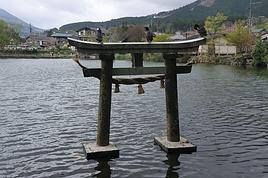
La randonnée depuis Misfat AA et Bilad Sayt par le W9a, W10 par Ras Al Haraq et W8 a été récemment refaite et balisée très clairement en vert, chemin bien construit, bon le W8 reste aérien (le W8 est à l'ombre l'après midi). On trouve de l'eau aux cols juste avant et après le Ras Al Haraq, qui offre la meilleure vue. Le fléchage commence en descente vers la palmeraie à l'entrée de Misfat AA. A Bilad Sayt le début est cache par un chantier.
Sur la crête, le W10 à l'ouest de l'intersection avec le W9a n'est qu'une trace indistincte, en partie seulement balisée par des cairns. Il faut contourner les sommets rocheux par le Sud. C'est lent et accidenté mais sans problème majeur. On trouve un bâtiment avec de l'eau 20 minutes avant le dernier col ou on butte sur les falaises du Jbel Shams. A ce stade, le W10 descend sur les pentes Nord pour continuer sur des vires étroites, très aventureux car non balise. Je n'ai pas continué. De ce col, on peut redescendre hors sentier plus directement vers Misfat AA, très aventureux aussi.
Pour le retour, piste vers le col de Shorfet Al Alamin (il y a un canal avec de l'eau en chemin) (c'est à l'ombre le matin) puis sentiers W10h et W9. Le W9 n'est qu'une trace pas un sentier, mais il est très clairement balisé.
Cela donne un circuit de 3 jours (le but est de camper sur le haut pour les vues, le coucher et le lever du jour) ou 4 jours tranquilles.
La Al Hamra GH est un bon logement avant et après.
Hi everyone! 😊
I’m currently working on a school project about hiking, and I’d really love to hear about your experiences. I’ve put together a short survey (3 minutes max) to better understand hikers’ habits.
👉 Survey link: forms.gle/JyJi8MWKy6aKZyy...
Your participation would help me so much, and all responses will remain anonymous. A huge thank you in advance to anyone who takes the time to fill it out! 🙏 Happy hiking to all! 🦥🌿
P.S.: I’ll delete this post if it doesn’t fit the forum rules.
Bonjour
lors de notre séjour à Luang Prabang, nous envisageons un « trek »de 2 à 3 jours, mais nous hésitons entre 2 formules :
- organisé par une agence ? En connaissez vous qui proposent des formules que je qualifierais « d’authentiques » ? et restent à des tarifs « raisonnables »
- partir en solo ? Trouve-t-on facilement des transports en commun pour s’éloigner de 80 à 150 km de Luang Prabang, sans passer la journée sur la route, et pouvoir randonner dans quelques villages ? (la location de voiture nous semble assez onéreuse et les conditions de circulation aléatoires.)
Avez-vous quelques conseils à me donner sur une direction à privilégier par rapport à Luang Prabang ? Nord, Est, Ouest, Sud ?
Merci de votre aide Christian
bonjour, je cherche les infos sur les transports possibles jusqu' a ilam puis Phidim à partir de KTM ainsi que des infos sur cette traversée, j'ai trouvé le pdf mais pas les retours de ceux qui ont essayé...bonne journée, Aichatou
Hola à toutes et tous. Bonne soirée
Je reviens de Sententon. ça y est, je suis remis. Belle, belle ile faite dans les 2 sens.
La traversée que je pourrais appeler la "Traversée du Fou" en référence à une autre bien connue. c'est celle de Tarrafal à Ponta-do-Sol que j'ai faite en 4,5 sans speeder comme Gonzalez.
Puis celle que l'on pourrait appeler la "Diagonale du Grogue", c'est la N-S de la Ribeira do Paul au Phare de Janela en passant par Cova, Pico-da-Cruz-Silvao. Un jour et demi totalement agréable et pour finir cette visite de l'ile en supreme beauté.
A mon sens voici les 7 musts de l'ile:
-la plus belle bordeira - la bordeira do norte
-le plus fantastique - la montee de Joao do Bento-Orgueiro
-le plus agreable - la vereda Cova/Pico da Cruz/Silvao
-le plus surfait - le chemin cotier du Nord
-le plus beau pavé - la Ribeira de Penede dans sa partie basse
-le plus pénible - Figueira de Cima-Chupador
-le plus dur - la montee au Salto Preto
Et ce qui est indispensable pour un hiker, faire le plateau du Norte. Je n'a malheureusement pu aller au Tope de Coroa, mon seul jour de pluie, mais bien, et le Tope couvert et invisible de la journée. Voila mes premières remarques. Je suis á disposition pour ceux qui veulent faire les memes traversees. Je suis en train de mettre les articles de l'itinéraire sur mon blog. Je vais un mettre qq1 ici. Mais comme ce n'est pas toptop le traitement de texte sur un forum sans le code HTML, je ne sais pas ce que cela va rendre. En attendant vous pouvez aller ici --> cap-vert. Cela devrait interesser le hiker. Bye
Et ce qui est indispensable pour un hiker, faire le plateau du Norte. Je n'a malheureusement pu aller au Tope de Coroa, mon seul jour de pluie, mais bien, et le Tope couvert et invisible de la journée. Voila mes premières remarques. Je suis á disposition pour ceux qui veulent faire les memes traversees. Je suis en train de mettre les articles de l'itinéraire sur mon blog. Je vais un mettre qq1 ici. Mais comme ce n'est pas toptop le traitement de texte sur un forum sans le code HTML, je ne sais pas ce que cela va rendre. En attendant vous pouvez aller ici --> cap-vert. Cela devrait interesser le hiker. Bye
Hi,
I’m planning the Switzerland-Paris hike for 2026. If any of you know a route where I can stay with locals or in other lodging (no camping), I’d really appreciate your tips.
Thanks!
M Brunner
Hello,
We’re planning a family trip (4 strong hikers, all adults) to Kashmir-Ladakh in August 2026!
We’d like to explore and do some treks—challenging but without technical difficulty (we’re not mountaineers).
To start, do you have any tips or recommendations for 4- to 6-day treks in Himalayan landscapes? Which town or village should we start from? We’ll figure out how to get there later. Should we hire a local guide?
We’re just starting to organize, so we’re open to all your advice. Is it possible to spend a few days in a monastery?
Thanks so much for your replies! See you soon,
Laurent
I want to do sections of the Collioure-Cadaqués trail. I plan to stay in Collioure first to hike the paths on the French side using the bus. Speaking of which, I’m wondering if it’ll be easy to find a seat on the buses at the end of April, beginning of May.
After that, I’ll head to Figueres to do sections of the trail on the Spanish side. I’m worried the buses might not be too crowded at the end of April.
Here’s what I’m interested in: Llanca - Port de la Selva: Figueres - Llanca by train in the morning and Port de la Selva - Figueres on the way back Port de la Selva - Cadaqués: Figueres - Port de la Selva in the morning and Cadaqués - Figueres on the return trip
I’d also like to go to Cadaqués from Figueres as a day trip. I’m concerned about how busy this route might be at the end of April.
I’m wondering if I need to get tickets in advance and where to buy them.
Hi there,
We’re planning a two-week couple’s trip hopping between the Cape Verde islands at the end of November 2025.
Our arrival and departure airport will be on the island of SAL.
We’ve got some hikes lined up.
Based on your experiences, what recommendations and suggestions do you have?
Thanks in advance for your valuable tips!
Is wild camping possible? Are there campsites and places to restock along the way, and is water available?
Thanks for your answers!
Pierrick
Hi, has anyone been to the Api Himal region recently? Can you do the trek staying in lodges or tea houses in 2025? Thanks, Aichatou
Hi,
I was wondering if this forum is still active. The last discussions seem to be from several years ago?...
If so, I’m looking for information on these hikes—the **Tour de l'Aubrac** in 8 days and the **Chemin de Stevenson** in 12 days...
Lists of accommodations with:
- Locations
- Prices
- Capacity (how many people they can host)
The stages— I’d like to do these routes with a group of 8 to 10 people. Thanks in advance... Jean-Claude BOULET Email: marcheur117@gmail.com Phone: 06 67 49 28 22 Residence: Royan 17, Charente-Maritime
The stages— I’d like to do these routes with a group of 8 to 10 people. Thanks in advance... Jean-Claude BOULET Email: marcheur117@gmail.com Phone: 06 67 49 28 22 Residence: Royan 17, Charente-Maritime
Hi there,
We’re spending a month in northern Vietnam this coming November and we’d love to do some day hikes around the village of Mu Cang Chai to see the famous spiral terraced rice fields. We’ll most likely be staying in Mu Cang Chai itself and we don’t have a car.
It’s really tough to find a route online. Any tips would be great.
Thanks in advance.
Bonsoir.
Je me doute que le sujet a été maintes et maintes fois aborder mais je trouve pas clairement réponses a mes questions😊.
Je suis en se moment entrain de me renseigner pour effectuer les treks des 3 cols avec une partie des itinéraires adjacent a savoir, ebc, kala patthar, gokyo ri et peut être chukung ri. Je compte faire se trek a cheval sur avril et mai.
Mais j'ai quelques questions.
niveau difficulté je pense avoir le physique pour, étant sportif et habitué des randonnée en montagne en France, mais y'a t'il un entrainement spécifique? a savoir que j'ai fait l’Annapurna base camp sans aucune difficultés l'année dernière .
est il faisable sans guide ? J'admet préférer me passer d'un guide et de porteur pour pouvoir être vraiment libre de mes mouvements, est ce de la folie ou sa se fait ? c'est surtout le passage du cho la et du renjo la qui me font me poser des questions (plus niveau itinéraire et risque de se perdre plutôt que le coté sécurité).
enfin, je me pose la question de la durée, je suis plutôt un marcheur rapide mais je compte prendre mon temps pour bien m'acclimater et profiter pour glandouiller un peu dans ces paysages🙂 (d'ailleurs habiter 90% de l'année a 2000m d'altitude a il une influence sur le mam ?) combien de temps faut il prévoir pour le trek pour être large, quitte a devoir passer 2-3 jours a trainer au alentour de lukla-namche? je pensais prévoir 20 jours, sa vous parait bon ?
merci de m'avoir lu et je m'excuse d'avance pour les fautes d’orthographe. Si d'autre questions me viennent je les posterais sur ce topic.
merci
Hi there,
I’m ready to set off on the Peaks of the Balkans trek from June 18 to July 3.
I’m used to long distances, elevation gain, and self-sufficiency.
The last thing holding me back is overcrowding.
Have any of you done it recently? Could you give me some insight on that and any other tips that might be useful?
I’ll be arriving in Tirana, and any advice on getting to Theth would be a huge help too.
Thanks for your replies.
Alain