Skip to content
Alpes-de-Haute-Provence

Travel guide

Alpes-de-Haute-Provence

★ 3 · last edited Aug 6, 2020 · 2 versions

This is essentially the hinterland of the Provençal coast. Quieter and pleasant in summer, it offers stunning landscapes and natural sites, including some of the most popular parks in the South of France, such as the Luberon, the Verdon, and the Mercantour. There are also plenty of old villages and historical sites to discover throughout the department.

Overview of Alpes-de-Haute-Provence
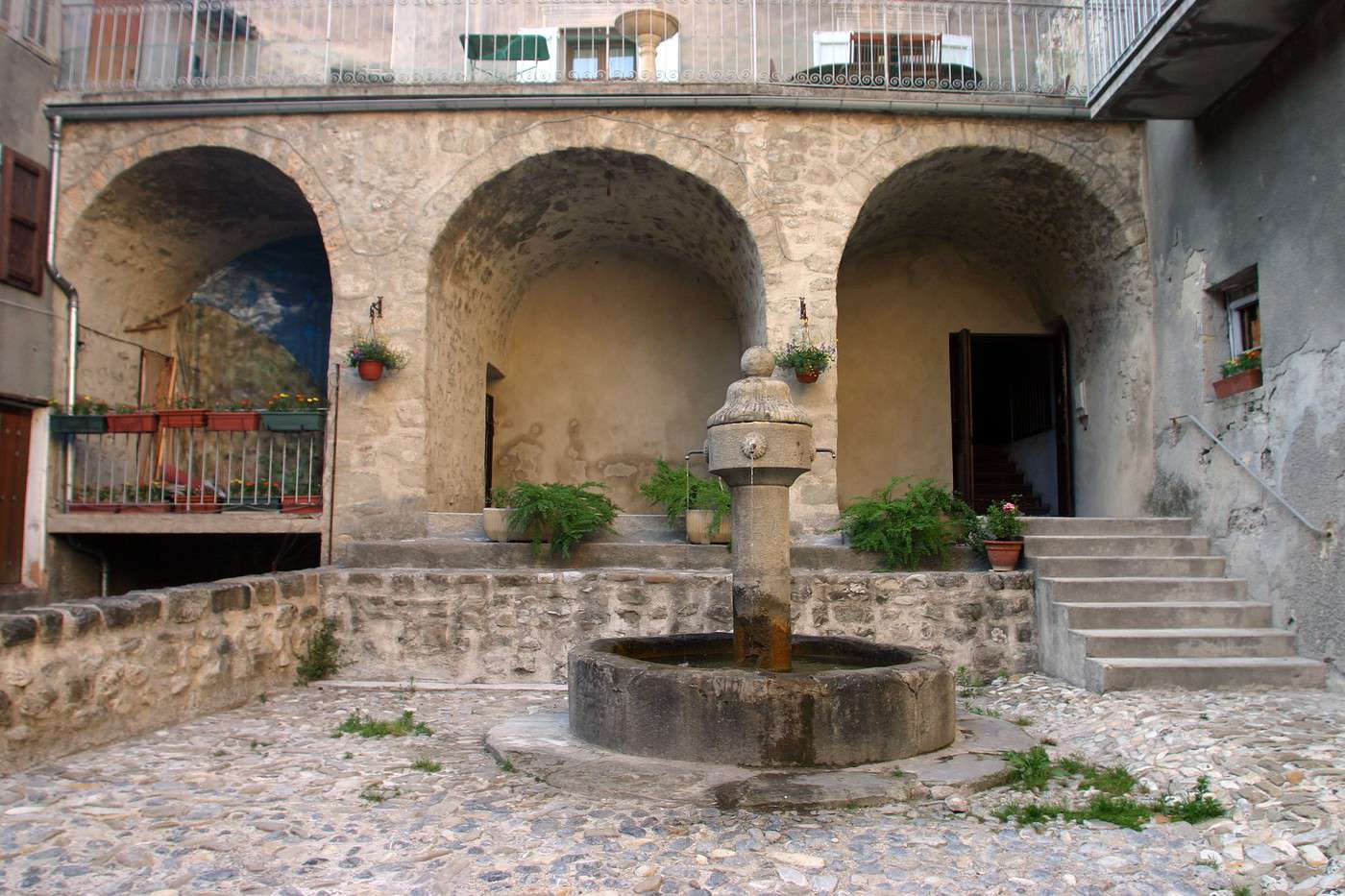
Annot, Alpes de Haute-Provence, France
Annot, Alpes de Haute-Provence, France · © VoyageForum

Key Facts

  • Type of place: department.
  • Tourist interest: (recommended).
  • Location:
  • Local time: Heure : Alpes-de-Haute-Provence
  • Department code: 04.
  • Bordering departments:
  • Sub-prefectures: Barcelonnette, Castellane, Forcalquier.
  • Number of municipalities: 198.
  • Population: 163,915 inhabitants (2017)
  • Area: 6,925 km².
  • Density: 23 inhabitants/km².
  • Highest point:
  • Lowest point:
  • Coastline: 0 km, no maritime access.
  • Interests (out of ): Nature ; Culture ; Relaxation-holidays

History of Alpes-de-Haute-Provence

Geography and Environment

Culture and Economy

What to See

This is essentially the hinterland of the Provençal coast. Quieter and pleasant in summer, it offers stunning landscapes and natural sites, including some of the most popular parks in the South of France, such as the Luberon, the Verdon, and the Mercantour. There are also plenty of old villages and historical sites to discover throughout the department.

What to Do

Climate and Weather

Transport

Getting There

Getting Around

Accommodation

Food

Further Information

Annot

A charming village with narrow medieval streets and houses, nestled between the Verdon and the Mercantour.

Overview of Annot

A charming village with narrow medieval streets and houses, nestled between the Verdon and the Mercantour.

Key details

  • Type of place: village.
  • Tourist interest: (worth seeing).
  • Location:
  • Distances:
  • Local time: Heure : 18097.
  • Population: 1,054 inhabitants (2014).
  • Area: 29.8 km².
  • Altitude: from 599 to 1,638 m.

History of Annot

Climate and weather in Annot

What to see and do

In the surrounding area

Transport

Getting there

Getting around

Accommodation

Food

Useful addresses

Further information

View guide page: Annot

Barcelonnette

This small town in the Ubaye Valley is known for its "Mexican villas," built by locals who made their fortune in Mexico during the 19th century. Several ski resorts surround it (Pra Loup, Sauze, Sainte-Anne).

Overview of Barcelonnette

This small town in the Ubaye Valley is known for its "Mexican villas," built by locals who made their fortune in Mexico during the 19th century. Several ski resorts surround it (Pra Loup, Sauze, Sainte-Anne).

Key Facts

  • Type of place: small town.
  • Tourist interest: (worth a stop if you are in the area).
  • Location:
  • Distances:
  • Local time: Heure : 18098.
  • Population: 2,698 inhabitants (2014).
  • Area: 16.42 km².
  • Altitude: from 1,115 to 2,680 m.

History of Barcelonnette

Climate and Weather in Barcelonnette

What to See and Do

In the Surrounding Area

Getting Around

How to Get There

Getting Around Locally

Where to Stay

Where to Eat

Useful Addresses

Further Information

View guide page: Barcelonnette

Castellane

This rather pretty town is the least populated sub-prefecture in France, with fewer than 2,000 inhabitants. It serves as one of the gateways to the Verdon Gorge.

Introduction to Castellane

This rather pretty town is the least populated sub-prefecture in France, with fewer than 2,000 inhabitants. It serves as one of the gateways to the Verdon Gorge.

Key Facts

  • Type of place: village.
  • Tourist interest: (worth a stop if you are in the area).
  • Location:
  • Distances:
  • Local time: Heure : 18099.
  • Population: 1,541 inhabitants (2014).
  • Area: 117.79 km².
  • Altitude: from 639 to 1,761 m.

History of Castellane

What to see and do in Castellane

In the surrounding area

Climate and weather in Castellane

Transport

Getting there

Getting around

Accommodation

Eating

Useful addresses

Further information

View guide page: Castellane

Colmars-les-Alpes

A charming and historic fortified village designed by Vauban, featuring ramparts and small forts at the gateway to the Ubaye valley.

Overview of Colmars-les-Alpes

A charming and historic fortified village designed by Vauban, featuring ramparts and small forts at the gateway to the Ubaye valley.

Key Facts

  • Type of place: village.
  • Tourist interest: (worth seeing).
  • Location:
  • Distances:
  • Local time: Heure : 18100.
  • Population: 398 inhabitants (2014).
  • Area: 81.82 km².
  • Altitude: from 1,175 to 2,747 m.

History of Colmars-les-Alpes

What to See and Do

In the Surrounding Area

Climate and Weather

Transportation

Getting There

Getting Around

Accommodation

Food

Useful Addresses

Further Information

View guide page: Colmars-les-Alpes

Cruis

Charming small village with old houses and narrow streets surrounded by lavender fields.

Overview of Cruis

It's a charming small village with old houses and narrow streets surrounded by lavender fields.

Key details

  • Type of place: village.
  • Tourist interest: (worth a stop if you are in the area).
  • Location:
  • Distances:
  • Local time: Heure : 18101.
  • Population: 646 inhabitants (2014).
  • Area: 36.47 km².
  • Altitude: from 575 to 1,732 m.

History of Cruis

Climate and weather in Cruis

What to see and do

In the surrounding area

Transport

Getting there

Getting around

Accommodation

Eating

Useful addresses

Further information

View guide page: Cruis

Digne-les-Bains

The departmental prefecture has a historic center. It is also home to the Alexandra David-Néel Museum.

Overview of Digne

The departmental prefecture has a historic center. It is also home to the Alexandra David-Néel Museum.

Key Facts

  • Type of place: small town.
  • Tourist interest: (worth a stop if you are in the area).
  • Location:
  • Distances:
  • Local time: Heure : 18103.
  • Population: 16,304 inhabitants (2014).
  • Area: 117 km².
  • Altitude: from 524 to 1,731 m.

History of Digne-les-Bains

What to see and do in Digne

In the surrounding area

Climate and weather in Digne

Transportation

Getting there

Getting around

Accommodation

Dining

Useful addresses

Further information

View guide page: Digne-les-Bains

Entrevaux

This stunning fortified medieval village, built on high ground, is one of the "Most Beautiful Villages of France".

Overview of Entrevaux

This stunning fortified medieval village, built on high ground, is one of the "Most Beautiful Villages of France".

Key Facts

  • Type of place: village.
  • Tourist interest: (worth seeing).
  • Location:
  • Distances:
  • Local time: Heure : 18104.
  • Population: 880 inhabitants (2014).
  • Area: 60.37 km².
  • Altitude: from 414 to 1,541 m.

History of Entrevaux

What to see and do in Entrevaux

In the surrounding area

Climate and weather in Entrevaux

Transport

Getting there

Getting around

Accommodation

Eating

Useful addresses

Further information

View guide page: Entrevaux

Espace Lumière

This is the name given to the combination of the Pra Loup and Val d'Allos resorts, making it one of the region's main ski areas.

Overview of the Resort

This is the name given to the combination of the Pra Loup and Val d'Allos resorts, making it one of the region's main ski areas.

Key Details

  • Tourist interest: (worth seeing).
  • Mountain range: Southern Alps.
  • Associated resorts: 2.
  • Altitude: from 1,500 to 2,575 m.

Environment

Climate and Weather

Precautions

Facilities and Activities

Ski Area

  • Opening period:
  • Number of slopes: 81.
  • Length of slopes: 180 km.
  • Cross-country ski trails:

Other Winter Activities

Summer Activities

Practical Information

  • Location:
  • How to get there:
  • Distances:

Accommodation and Dining

Events

What to See and Do Nearby

  1. == In Addition
View guide page: Espace Lumière

Forcalquier

This sub-prefecture has a citadel, several churches and chapels, and a few old buildings.

Overview of Forcalquier

This sub-prefecture has a citadel, several churches and chapels, and a few old buildings.

Key Details

  • Type of place: small town.
  • Tourist interest: (worth a stop if you are in the area).
  • Location:
  • Distances:
  • Local time: Heure : 18106.
  • Population: 4,910 inhabitants (2014).
  • Area: 42.76 km².
  • Altitude: from 397 to 904 m.

History of Forcalquier

What to See and Do in Forcalquier

In the Surrounding Area

Climate and Weather in Forcalquier

Transportation

Getting There

Getting Around

Accommodation

Dining

Useful Addresses

Further Information

View guide page: Forcalquier

Lurs

A charming hilltop village overlooking the Durance River, with old stone houses and narrow streets.

Overview of Lurs

It's a charming hilltop village overlooking the Durance River, with old stone houses and narrow streets.

Key details

  • Type of place: village.
  • Tourist interest: (worth a stop if you are in the area).
  • Location:
  • Distances:
  • Local time: Heure : 18107.
  • Population: 374 inhabitants (2014)
  • Area: 22.48 km².
  • Altitude: from 340 to 621 m.

History of Lurs

What to see and do in Lurs

In the surrounding area

Climate and weather in Lurs

Transport

Getting there

Getting around

Accommodation

Eating

Useful addresses

Further information

View guide page: Lurs

Mane

Old houses, sloping streets, fortifications, and a citadel overlooking the surrounding countryside make this town one of the most beautiful in the region.

Overview of Mane

Old houses, sloping streets, fortifications, and a citadel overlooking the surrounding countryside make this town one of the most beautiful in the region.

Key Details

  • Type of place: village.
  • Tourist interest: (worth seeing).
  • Location:
  • Distances:
  • Local time: Heure : 18108.
  • Population: 1,376 inhabitants (2014)
  • Area: 22 km².
  • Altitude: from 386 to 868 m.

History of Mane

What to See and Do in Mane

In the Surrounding Area

Climate and Weather in Mane

Transportation

Getting There

Getting Around

Where to Stay

Where to Eat

Useful Addresses

Further Information

View guide page: Mane

Manosque

The most populous town in the Alpes de Haute-Provence department has an old urban centre.

Overview of Manosque

The most populous town in the Alpes de Haute-Provence department has an old urban centre.

Key facts

  • Type of place: small town.
  • Tourist interest: (worth a stop if you are in the area).
  • Location:
  • Distances:
  • Local time: Heure : 18109.
  • Population: 21,941 inhabitants (2014).
  • Area:
  • Altitude: from 279 to 730 m.

History of Manosque

What to see and do in Manosque

In the surrounding area

Climate and weather in Manosque

Transport

Getting there

Getting around

Accommodation

Eating

Useful addresses

Further information

View guide page: Manosque

Moustiers-Sainte-Marie

Surrounded by towering cliffs, the village is especially notable for its unique setting.

Overview of Moustiers

Surrounded by towering cliffs, the village is especially notable for its unique setting.

Key facts

  • Type of place: village.
  • Tourist interest: (worth seeing).
  • Location:
  • Distances:
  • Local time: Heure : 18110.
  • Population: 686 inhabitants (2014).
  • Area: 87.97 km².
  • Altitude: from 474 to 1,729 m.

History of Moustiers-Sainte-Marie

What to see and do in Moustiers

In the surrounding area

Climate and weather in Moustiers

Transport

Getting there

Getting around

Accommodation

Eating out

Useful addresses

Further information

View guide page: Moustiers-Sainte-Marie

Riez

This village in the Verdon region boasts a rich history, from Roman ruins to its medieval town center.

Overview of Riez

This village in the Verdon boasts a rich history, from Roman ruins to its medieval town center.

Key details

  • Type of place: village.
  • Tourist interest: (worth a stop if you are in the area).
  • Location:
  • Distances:
  • Local time: Heure : 18111.
  • Population: 1,825 inhabitants (2014).
  • Area: 40 km².
  • Altitude: from 473 to 680 m.

History of Riez

What to see and do in Riez

In the surrounding area

Climate and weather in Riez

Transportation

Getting there

Getting around

Accommodation

Dining

Useful addresses

Additional information

View guide page: Riez

Seyne-les-Alpes

This high-altitude village features old houses, several religious buildings, and fortifications. You can also ski at the small resorts located within its territory.

Overview of Seyne

This high-altitude village features old houses, several religious buildings, and fortifications. You can also ski at the small resorts located within its territory.

Key Facts

  • Type of place: village.
  • Tourist interest: (worth a stop if you are in the area).
  • Location:
  • Distances:
  • Local time: Heure : 18112.
  • Population: 1,365 inhabitants (2014).
  • Area: 84.27 km².
  • Altitude: from 1,079 to 2,720 m.

History of Seyne-les-Alpes

What to see and do in Seyne

In the surrounding area

Climate and weather in Seyne

Transport

Getting there

Getting around

Accommodation

Food

Useful addresses

Further information

View guide page: Seyne-les-Alpes

Simiane-la-Rotonde

This is a stunning hilltop village with a rich historical heritage, particularly from the medieval era.

Overview of Simiane-la-Rotonde

This is a stunning hilltop village with a rich historical heritage, particularly from the medieval era.

Key Facts

  • Type of place: village.
  • Tourist interest: (worth seeing).
  • Location:
  • Distances:
  • Local time: Heure : 18113.
  • Population: 590 inhabitants (2014)
  • Area: 67.86 km².
  • Altitude: from 456 to 1,113 m.

History of Simiane-la-Rotonde

What to See and Do in Simiane

In the Surrounding Area

Climate and Weather in Simiane

Transport

Getting There

Getting Around

Accommodation

Food

Useful Addresses

Additional Information

View guide page: Simiane-la-Rotonde

Sisteron

At the gateway to Provence, the town boasts a fine citadel and an old centre.

Overview of Sisteron

At the gateway to Provence, the town boasts a fine citadel and an old centre.

Key facts

  • Type of place: small town.
  • Tourist interest: (worth seeing).
  • Location:
  • Distances:
  • Local time: Heure : 18114.
  • Population: 7,281 inhabitants (2014).
  • Area: 50.21 km².
  • Altitude: from 448 to 1,145 m.

History of Sisteron

What to see and do in Sisteron

In the surrounding area

Climate and weather in Sisteron

Transport

Getting there

Getting around

Accommodation

Food

Useful addresses

Further information

View guide page: Sisteron

Verdon Gorge

Stunning landscapes form one of Europe’s most beautiful canyons. These gorges, and the Verdon Regional Nature Park they belong to, are a major tourist hotspot attracting climbing, hiking, rafting, canoeing, canyoning, bungee jumping, paragliding, and fly-fishing enthusiasts.

Overview of the Verdon Gorge

Stunning landscapes form one of Europe’s most beautiful canyons. These gorges, and more broadly the Verdon Regional Nature Park they belong to, are a major tourist hotspot attracting climbing, hiking, rafting, canoeing, canyoning, bungee jumping, paragliding, and fly-fishing enthusiasts.

Key facts

  • Tourist interest: (must-see or highly recommended).
  • Features:
  • Location:
  • Length:
  • Depth: from 250 to 700 m.
  • Altitude:

Environment

Wildlife and flora

Precautions

What to see and do

In the area

Climate and weather

Transport

Getting there

Getting around

Sleep

Eat

Useful addresses

Further reading

View guide page: Verdon Gorge

Lake Allos

At 2,220 metres in the Mercantour Park, Allos is the largest high-altitude lake in Europe. A destination for fishing and hiking.

Overview of the lake

At 2,220 metres in the Mercantour Park, Allos is the largest high-altitude lake in Europe. A destination for fishing and hiking.

Key details

  • Tourist interest: (worth seeing).
  • Features: high-altitude lake.
  • Surface area: 0.6 km².
  • Altitude: 2,230 m.

Environment

Precautions

What to see and do

Practical information

  • Location:
  • How to get there:
  • Distances:

Sleeping and eating

Nearby attractions

Additional information

View guide page: Lake Allos

Verdon Regional Nature Park

A stunning park spanning departments 04 and 83, offering numerous outdoor activities. This is also where the famous Verdon Gorge is located.

Overview of the park

A stunning park spanning departments 04 and 83, offering numerous outdoor activities. This is also where the famous Verdon Gorge are located.

Key details

  • Tourist interest: (recommended).
  • Characteristics:
  • Location:
  • Area: 1 796 km².
  • Altitude:

Environment

Wildlife and flora

Precautions

What to see and do

In the surrounding area

Climate and weather

Transport

Getting there

Getting around

Accommodation

Food

Useful addresses

Additional information

View guide page: Verdon Regional Nature Park

Something wrong or out of date? Report this page