

Travel guide
Provence-Côte d'Azur
Marseille, Nice, Avignon, Cannes, Provence, the Luberon, and more—this region is synonymous with holidays and relaxation for many. Between the Mediterranean and the first Alpine foothills, it’s also rich in natural and cultural discoveries.
Introduction to Provence-Alpes-Côte d'Azur
Overview
Key Facts
- Type of place: tourist region.
- Location: on the Mediterranean coast, in the southeast of the country, bordering Italy.
- Local time:
- Administrative region: Provence-Alpes-Côte d'Azur (prefecture: Marseille).
- Departments: Alpes de Haute-Provence (04), Hautes-Alpes (05), Alpes-Maritimes (06), Bouches-du-Rhône (13), Var (83), and Vaucluse (84).
- Main cities: Aix-en-Provence, Avignon, Gap, Marseille, Nice, Toulon...
- Population: 5,031,000 inhabitants (2017).
- Area: 31,400 km².
- Density: 160 inhabitants/km².
- Highest point:
- Lowest point: sea level.
- Coastline:
Tourism
Marseille, Nice, Avignon, Cannes, Saint-Tropez, Provence, the Luberon—this entire region is synonymous with holidays and relaxation for many. Between the Mediterranean and the first Alpine ranges, it is also rich in both natural and cultural discoveries.
Where to get information?
Departmental Tourism Committees
Travel Essentials
- Backpacker daily budget:
- Best for accommodation:
- Best for getting around:
- Best time for climate/crowds/prices:
- Interests (rated ): Nature ; Adventure ; Culture ; Relaxation-holidays
- Website:
Geography and Environment of Provence-Côte d'Azur
Geography of the Region
Natural Areas, Wildlife and Flora

Climate and Weather in Provence-Côte d'Azur
Climate Overview

Best Time to Visit Provence-Côte d'Azur
| Jan. | Feb. | Mar. | Apr. | May | Jun. | Jul. | Aug. | Sep. | Oct. | Nov. | Dec. | |
|---|---|---|---|---|---|---|---|---|---|---|---|---|
| Inland climate | ||||||||||||
| Coastal climate |
: very favorable | : favorable | : moderately favorable | : unfavorable.
Sea Temperature Throughout the Year
Generally, from May to the end of October, the water temperature is most pleasant.
| Jan. | Feb. | Mar. | Apr. | May | Jun. | Jul. | Aug. | Sep. | Oct. | Nov. | Dec. | |
|---|---|---|---|---|---|---|---|---|---|---|---|---|
| Cannes | 13 | 12 | 13 | 14 | 16 | 20 | 22 | 23 | 22 | 19 | 16 | 14 |
Climate and Weather by Location
Coast (Marseille)
Inland (Gap)
Additional Information
What to See in Provence-Alpes-Côte d'Azur
Apart from Briançon and Mont-Dauphin, which are indirectly listed as UNESCO sites under the "Major Vauban Sites Network", the PACA region has three sites inscribed on the World Heritage list: Bouches-du-Rhône: Arles ★★★ (1981) Thanks to its Roman and…
Things to Do in Provence-Alpes-Côte d'Azur
Interests (rated ★★★★ ) : Nature ★★★ ; Culture ★★★★ ; Relaxation-Holidays ★★★★ Interest level for each department: Nature Culture Relaxation-Holidays Alpes-de-Haute-Provence ★★★★ ★★ ★★ Hautes-Alpes ★★★★ ★ / ★★ ★★ Alpes-Maritimes ★★★ ★★★★ ★★★ Bouches-du-Rhône…
Other practical information for Provence-Côte d'Azur
Luggage and equipment to bring
Budget
Precautions
Opening hours
Laundromats
Local tourist offices
Alpes-de-Haute-Provence
This is essentially the hinterland of the Provençal coast. Quieter and pleasant in summer, it offers stunning landscapes and natural sites, including some of the most popular parks in the South of France, such as the Luberon, the Verdon, and the Mercantour. There are also plenty of old villages and historical sites to discover throughout the department.

Annot, Alpes de Haute-Provence, France · © VoyageForum
View guide page: Alpes-de-Haute-ProvenceOverview of Alpes-de-Haute-Provence
Key Facts
- Type of place: department.
- Tourist interest: (recommended).
- Location:
- Local time:
- Department code: 04.
- Bordering departments:
- Prefecture: Digne-les-Bains.
- Sub-prefectures: Barcelonnette, Castellane, Forcalquier.
- Number of municipalities: 198.
- Population: 163,915 inhabitants (2017)
- Area: 6,925 km².
- Density: 23 inhabitants/km².
- Highest point:
- Lowest point:
- Coastline: 0 km, no maritime access.
- Interests (out of ): Nature ; Culture ; Relaxation-holidays
History of Alpes-de-Haute-Provence
Geography and Environment
Culture and Economy
What to See
This is essentially the hinterland of the Provençal coast. Quieter and pleasant in summer, it offers stunning landscapes and natural sites, including some of the most popular parks in the South of France, such as the Luberon, the Verdon, and the Mercantour. There are also plenty of old villages and historical sites to discover throughout the department.
What to Do
Climate and Weather
Transport
Getting There
Getting Around
Accommodation
Food
Further Information
Annot
A charming village with narrow medieval streets and houses, nestled between the Verdon and the Mercantour.
View guide page: AnnotOverview of Annot
A charming village with narrow medieval streets and houses, nestled between the Verdon and the Mercantour.
Key details
- Type of place: village.
- Tourist interest: (worth seeing).
- Location:
- Distances:
- Local time: .
- Population: 1,054 inhabitants (2014).
- Area: 29.8 km².
- Altitude: from 599 to 1,638 m.
- Website: http://www.annot-tourisme.com
History of Annot
Climate and weather in Annot
What to see and do
In the surrounding area
Transport
Getting there
Getting around
Accommodation
Food
Useful addresses
Further information
Barcelonnette
This small town in the Ubaye Valley is known for its "Mexican villas," built by locals who made their fortune in Mexico during the 19th century. Several ski resorts surround it (Pra Loup, Sauze, Sainte-Anne).
View guide page: BarcelonnetteOverview of Barcelonnette
This small town in the Ubaye Valley is known for its "Mexican villas," built by locals who made their fortune in Mexico during the 19th century. Several ski resorts surround it (Pra Loup, Sauze, Sainte-Anne).
Key Facts
- Type of place: small town.
- Tourist interest: (worth a stop if you are in the area).
- Location:
- Distances:
- Local time: .
- Population: 2,698 inhabitants (2014).
- Area: 16.42 km².
- Altitude: from 1,115 to 2,680 m.
- Website: http://www.barcelonnette.com
History of Barcelonnette
Climate and Weather in Barcelonnette
What to See and Do
In the Surrounding Area
Getting Around
How to Get There
Getting Around Locally
Where to Stay
Where to Eat
Useful Addresses
Further Information
Castellane
This rather pretty town is the least populated sub-prefecture in France, with fewer than 2,000 inhabitants. It serves as one of the gateways to the Verdon Gorge.
View guide page: CastellaneIntroduction to Castellane
This rather pretty town is the least populated sub-prefecture in France, with fewer than 2,000 inhabitants. It serves as one of the gateways to the Verdon Gorge.
Key Facts
- Type of place: village.
- Tourist interest: (worth a stop if you are in the area).
- Location:
- Distances:
- Local time: .
- Population: 1,541 inhabitants (2014).
- Area: 117.79 km².
- Altitude: from 639 to 1,761 m.
History of Castellane
What to see and do in Castellane
In the surrounding area
Climate and weather in Castellane
Transport
Getting there
Getting around
Accommodation
Eating
Useful addresses
Further information
Colmars-les-Alpes
A charming and historic fortified village designed by Vauban, featuring ramparts and small forts at the gateway to the Ubaye valley.
View guide page: Colmars-les-AlpesOverview of Colmars-les-Alpes
A charming and historic fortified village designed by Vauban, featuring ramparts and small forts at the gateway to the Ubaye valley.
Key Facts
- Type of place: village.
- Tourist interest: (worth seeing).
- Location:
- Distances:
- Local time: .
- Population: 398 inhabitants (2014).
- Area: 81.82 km².
- Altitude: from 1,175 to 2,747 m.
History of Colmars-les-Alpes
What to See and Do
In the Surrounding Area
Climate and Weather
Transportation
Getting There
Getting Around
Accommodation
Food
Useful Addresses
Further Information
Cruis
Charming small village with old houses and narrow streets surrounded by lavender fields.
View guide page: CruisOverview of Cruis
It's a charming small village with old houses and narrow streets surrounded by lavender fields.
Key details
- Type of place: village.
- Tourist interest: (worth a stop if you are in the area).
- Location:
- Distances:
- Local time: .
- Population: 646 inhabitants (2014).
- Area: 36.47 km².
- Altitude: from 575 to 1,732 m.
- Website: https://www.cruis.fr
History of Cruis
Climate and weather in Cruis
What to see and do
In the surrounding area
Transport
Getting there
Getting around
Accommodation
Eating
Useful addresses
Further information
Digne-les-Bains
The departmental prefecture has a historic center. It is also home to the Alexandra David-Néel Museum.
View guide page: Digne-les-BainsOverview of Digne
The departmental prefecture has a historic center. It is also home to the Alexandra David-Néel Museum.
Key Facts
- Type of place: small town.
- Tourist interest: (worth a stop if you are in the area).
- Location:
- Distances:
- Local time: .
- Population: 16,304 inhabitants (2014).
- Area: 117 km².
- Altitude: from 524 to 1,731 m.
History of Digne-les-Bains
What to see and do in Digne
In the surrounding area
Climate and weather in Digne
Transportation
Getting there
Getting around
Accommodation
Dining
Useful addresses
Further information
Entrevaux
This stunning fortified medieval village, built on high ground, is one of the "Most Beautiful Villages of France".
View guide page: EntrevauxOverview of Entrevaux
This stunning fortified medieval village, built on high ground, is one of the "Most Beautiful Villages of France".
Key Facts
- Type of place: village.
- Tourist interest: (worth seeing).
- Location:
- Distances:
- Local time: .
- Population: 880 inhabitants (2014).
- Area: 60.37 km².
- Altitude: from 414 to 1,541 m.
- Website: http://tourisme-entrevaux.fr
History of Entrevaux
What to see and do in Entrevaux
In the surrounding area
Climate and weather in Entrevaux
Transport
Getting there
Getting around
Accommodation
Eating
Useful addresses
Further information
Espace Lumière
This is the name given to the combination of the Pra Loup and Val d'Allos resorts, making it one of the region's main ski areas.
View guide page: Espace LumièreOverview of the Resort
This is the name given to the combination of the Pra Loup and Val d'Allos resorts, making it one of the region's main ski areas.
Key Details
- Tourist interest: (worth seeing).
- Mountain range: Southern Alps.
- Associated resorts: 2.
- Altitude: from 1,500 to 2,575 m.
Environment
Climate and Weather
Precautions
Facilities and Activities
Ski Area
- Opening period:
- Number of slopes: 81.
- Length of slopes: 180 km.
- Cross-country ski trails:
Other Winter Activities
Summer Activities
Practical Information
- Location:
- Website: https://www.valdallos.com
- How to get there:
- Distances:
Accommodation and Dining
Events
What to See and Do Nearby
- == In Addition
Forcalquier
This sub-prefecture has a citadel, several churches and chapels, and a few old buildings.
View guide page: ForcalquierOverview of Forcalquier
This sub-prefecture has a citadel, several churches and chapels, and a few old buildings.
Key Details
- Type of place: small town.
- Tourist interest: (worth a stop if you are in the area).
- Location:
- Distances:
- Local time: .
- Population: 4,910 inhabitants (2014).
- Area: 42.76 km².
- Altitude: from 397 to 904 m.
History of Forcalquier
What to See and Do in Forcalquier
In the Surrounding Area
Climate and Weather in Forcalquier
Transportation
Getting There
Getting Around
Accommodation
Dining
Useful Addresses
Further Information
Lurs
A charming hilltop village overlooking the Durance River, with old stone houses and narrow streets.
View guide page: LursOverview of Lurs
It's a charming hilltop village overlooking the Durance River, with old stone houses and narrow streets.
Key details
- Type of place: village.
- Tourist interest: (worth a stop if you are in the area).
- Location:
- Distances:
- Local time: .
- Population: 374 inhabitants (2014)
- Area: 22.48 km².
- Altitude: from 340 to 621 m.
- Website: http://www.lurs.fr
History of Lurs
What to see and do in Lurs
In the surrounding area
Climate and weather in Lurs
Transport
Getting there
Getting around
Accommodation
Eating
Useful addresses
Further information
Mane
Old houses, sloping streets, fortifications, and a citadel overlooking the surrounding countryside make this town one of the most beautiful in the region.
View guide page: ManeOverview of Mane
Old houses, sloping streets, fortifications, and a citadel overlooking the surrounding countryside make this town one of the most beautiful in the region.
Key Details
- Type of place: village.
- Tourist interest: (worth seeing).
- Location:
- Distances:
- Local time: .
- Population: 1,376 inhabitants (2014)
- Area: 22 km².
- Altitude: from 386 to 868 m.
- Website: https://www.mane-en-provence.com
History of Mane
What to See and Do in Mane
In the Surrounding Area
Climate and Weather in Mane
Transportation
Getting There
Getting Around
Where to Stay
Where to Eat
Useful Addresses
Further Information
Manosque
The most populous town in the Alpes de Haute-Provence department has an old urban centre.
View guide page: ManosqueOverview of Manosque
The most populous town in the Alpes de Haute-Provence department has an old urban centre.
Key facts
- Type of place: small town.
- Tourist interest: (worth a stop if you are in the area).
- Location:
- Distances:
- Local time: .
- Population: 21,941 inhabitants (2014).
- Area:
- Altitude: from 279 to 730 m.
- Website: http://www.ville-manosque.fr/n-ot
History of Manosque
What to see and do in Manosque
In the surrounding area
Climate and weather in Manosque
Transport
Getting there
Getting around
Accommodation
Eating
Useful addresses
Further information
Moustiers-Sainte-Marie
Surrounded by towering cliffs, the village is especially notable for its unique setting.
View guide page: Moustiers-Sainte-MarieOverview of Moustiers
Surrounded by towering cliffs, the village is especially notable for its unique setting.
Key facts
- Type of place: village.
- Tourist interest: (worth seeing).
- Location:
- Distances:
- Local time: .
- Population: 686 inhabitants (2014).
- Area: 87.97 km².
- Altitude: from 474 to 1,729 m.
- Website: http://www.moustiers.eu/
History of Moustiers-Sainte-Marie
What to see and do in Moustiers
In the surrounding area
Climate and weather in Moustiers
Transport
Getting there
Getting around
Accommodation
Eating out
Useful addresses
Further information
Riez
This village in the Verdon region boasts a rich history, from Roman ruins to its medieval town center.
View guide page: RiezOverview of Riez
This village in the Verdon boasts a rich history, from Roman ruins to its medieval town center.
Key details
- Type of place: village.
- Tourist interest: (worth a stop if you are in the area).
- Location:
- Distances:
- Local time: .
- Population: 1,825 inhabitants (2014).
- Area: 40 km².
- Altitude: from 473 to 680 m.
- Website: http://www.ville-riez.fr
History of Riez
What to see and do in Riez
In the surrounding area
Climate and weather in Riez
Transportation
Getting there
Getting around
Accommodation
Dining
Useful addresses
Additional information
Seyne-les-Alpes
This high-altitude village features old houses, several religious buildings, and fortifications. You can also ski at the small resorts located within its territory.
View guide page: Seyne-les-AlpesOverview of Seyne
This high-altitude village features old houses, several religious buildings, and fortifications. You can also ski at the small resorts located within its territory.
Key Facts
- Type of place: village.
- Tourist interest: (worth a stop if you are in the area).
- Location:
- Distances:
- Local time: .
- Population: 1,365 inhabitants (2014).
- Area: 84.27 km².
- Altitude: from 1,079 to 2,720 m.
History of Seyne-les-Alpes
What to see and do in Seyne
In the surrounding area
Climate and weather in Seyne
Transport
Getting there
Getting around
Accommodation
Food
Useful addresses
Further information
Simiane-la-Rotonde
This is a stunning hilltop village with a rich historical heritage, particularly from the medieval era.
View guide page: Simiane-la-RotondeOverview of Simiane-la-Rotonde
This is a stunning hilltop village with a rich historical heritage, particularly from the medieval era.
Key Facts
- Type of place: village.
- Tourist interest: (worth seeing).
- Location:
- Distances:
- Local time: .
- Population: 590 inhabitants (2014)
- Area: 67.86 km².
- Altitude: from 456 to 1,113 m.
- Website: http://www.simiane-la-rotonde.fr
History of Simiane-la-Rotonde
What to See and Do in Simiane
In the Surrounding Area
Climate and Weather in Simiane
Transport
Getting There
Getting Around
Accommodation
Food
Useful Addresses
Additional Information
Sisteron
At the gateway to Provence, the town boasts a fine citadel and an old centre.
View guide page: SisteronOverview of Sisteron
At the gateway to Provence, the town boasts a fine citadel and an old centre.
Key facts
- Type of place: small town.
- Tourist interest: (worth seeing).
- Location:
- Distances:
- Local time: .
- Population: 7,281 inhabitants (2014).
- Area: 50.21 km².
- Altitude: from 448 to 1,145 m.
- Website: http://www.sisteron-tourisme.fr
History of Sisteron
What to see and do in Sisteron
In the surrounding area
Climate and weather in Sisteron
Transport
Getting there
Getting around
Accommodation
Food
Useful addresses
Further information
Verdon Gorge
Stunning landscapes form one of Europe’s most beautiful canyons. These gorges, and the Verdon Regional Nature Park they belong to, are a major tourist hotspot attracting climbing, hiking, rafting, canoeing, canyoning, bungee jumping, paragliding, and fly-fishing enthusiasts.
View guide page: Verdon GorgeOverview of the Verdon Gorge
Stunning landscapes form one of Europe’s most beautiful canyons. These gorges, and more broadly the Verdon Regional Nature Park they belong to, are a major tourist hotspot attracting climbing, hiking, rafting, canoeing, canyoning, bungee jumping, paragliding, and fly-fishing enthusiasts.
Key facts
- Tourist interest: (must-see or highly recommended).
- Features:
- Location:
- Length:
- Depth: from 250 to 700 m.
- Altitude:
- Website: http://www.lesgorgesduverdon.fr
Environment
Wildlife and flora
Precautions
What to see and do
In the area
Climate and weather
Transport
Getting there
Getting around
Sleep
Eat
Useful addresses
Further reading
Lake Allos
At 2,220 metres in the Mercantour Park, Allos is the largest high-altitude lake in Europe. A destination for fishing and hiking.
View guide page: Lake AllosOverview of the lake
At 2,220 metres in the Mercantour Park, Allos is the largest high-altitude lake in Europe. A destination for fishing and hiking.
Key details
- Tourist interest: (worth seeing).
- Features: high-altitude lake.
- Surface area: 0.6 km².
- Altitude: 2,230 m.
Environment
Precautions
What to see and do
Practical information
- Location:
- Website: https://www.valdallos.com
- How to get there:
- Distances:
Sleeping and eating
Nearby attractions
Additional information
Verdon Regional Nature Park
A stunning park spanning departments 04 and 83, offering numerous outdoor activities. This is also where the famous Verdon Gorge is located.
View guide page: Verdon Regional Nature ParkOverview of the park
A stunning park spanning departments 04 and 83, offering numerous outdoor activities. This is also where the famous Verdon Gorge are located.
Key details
- Tourist interest: (recommended).
- Characteristics:
- Location:
- Area: 1 796 km².
- Altitude:
- Website: http://parcduverdon.fr
Environment
Wildlife and flora
Precautions
What to see and do
In the surrounding area
Climate and weather
Transport
Getting there
Getting around
Accommodation
Food
Useful addresses
Additional information
Hautes-Alpes
Sparsely populated and nestled in the mountains, the Hautes-Alpes combine nature (Queyras, Écrins...), heritage (Briançon, Fort Queyras, etc.), and year-round outdoor activities with numerous ski resorts. In short, a paradise for ecotourism enthusiasts.

Abbaye Notre-Dame de Boscodon, Hautes-Alpes, France · © VoyageForum 
Montgenèvre, Hautes-Alpes, France · © VoyageForum
View guide page: Hautes-AlpesOverview of the Hautes-Alpes
Key facts
- Type de lieu: department.
- Intérêt touristique: (recommended).
- Localisation:
- Heure locale:
- Code département: 05.
- Départements limitrophes:
- Préfecture: Gap.
- Sous-préfectures: Briançon.
- Nombre de communes: 167.
- Population: 141,284 inhabitants (2017).
- Superficie: 5,549 km².
- Densité: 25 inhabitants/km².
- Point le plus haut: Barre des Écrins (4,102 m).
- Point le plus bas: Ribiers (470 m).
- Littoral: 0 km, no coastline.
- Intérêts (on ): Nature ; Culture / ; Relaxation-holidays
- Site internet: http://www.hautes-alpes.net
History of the Hautes-Alpes
Geography and environment
Culture and economy
What to see in the Hautes-Alpes
Sparsely populated and nestled in the mountains, the Hautes-Alpes combine nature (Queyras, Écrins...), heritage (Briançon, Fort Queyras, etc.), and year-round outdoor activities with numerous ski resorts. In short, a paradise for ecotourism enthusiasts.
What to do in the Hautes-Alpes
Climate and weather
Given its average altitude, the department has a mountain climate—cold (even very cold in the highest areas) and fairly dry throughout the year. However, sunshine is abundant, and day/night temperature differences are significant. While winters can be harsh, summers remain very pleasant without excessive temperatures.
Transport
Getting there
Getting around
Accommodation
Food
Additional information
Gap
It is the capital of the Hautes-Alpes department. The town is dominated by a pretty château and its park: the Domaine de Charance.
View guide page: GapOverview of Gap
It is the capital of the Hautes-Alpes department. The town is dominated by a pretty château and its park: the Domaine de Charance.
Key facts
- Type of place: small town.
- Tourist interest: (worth a stop if you are in the area).
- Location:
- Distances:
- Local time: .
- Population: 40,225 inhabitants (2014).
- Area: 110.43 km².
- Altitude: from 625 to 2,361 m.
- Website: http://www.gap-tourisme.fr
History of Gap
What to see and do in Gap
In the surrounding area
Climate and weather in Gap
Transport
Getting there
Getting around
Accommodation
Eating
Useful addresses
Further information
Boscodon Abbey
Located near the town of Crots, this is a 12th-century abbey and one of the most visited monuments in the department.
View guide page: Boscodon AbbeyOverview of the Abbey
Located near the town of Crots, this is a 12th-century abbey and one of the most visited monuments in the department.
- Tourist interest: (worth seeing).
History of the Abbey
What to See and Do
Practical Information
- Location:
- Address: Boscodon, 05200 Crots.
- Opening hours:
- Price:
- Website: http://www.abbayedeboscodon.eu
- How to get there:
Nearby Attractions
Additional Information
Argentière-la-Bessée
This commune south of Briançon is home to old silver mines that can be visited.
View guide page: Argentière-la-BesséeOverview of Argentière
This commune south of Briançon is home to old silver mines that can be visited.
Key details
- Type of place: small town.
- Tourist interest: (worth a stop if you are in the area).
- Location:
- Distances:
- Local time: .
- Population: 2,317 inhabitants (2014).
- Area: 64.55 km².
- Altitude: from 945 to 3,243 m.
- Website: http://ville-argentiere.fr
History of Argentière-la-Bessée
What to see and do in Argentière
In the surrounding area
Climate and weather in Argentière
Transport
Getting there
Getting around
Accommodation
Food
Useful addresses
Further information
Briançon
The highest town in the E.U. at 1,326 m above sea level. It boasts significant military heritage, notably due to Vauban, part of whose French works are UNESCO-listed. The Serre Chevalier ski resort is partly within the town. It is the highest town in the E.U.…
Embrun
This small town between Gap and Briançon has a beautiful cathedral and a few other interesting civil or religious buildings.
View guide page: EmbrunOverview of Embrun
This small town between Gap and Briançon has a beautiful cathedral and a few other interesting civil or religious buildings.
Key Facts
- Type of place: small town.
- Tourist interest: (worth a stop if you are in the area).
- Location:
- Distances:
- Local time: .
- Population: 6,150 inhabitants (2014).
- Area: 36.39 km².
- Altitude: from 778 to 2,800 m.
- Website: http://www.ville-embrun.fr
History of Embrun
What to see and do in Embrun
In the surrounding area
Climate and weather in Embrun
Transport
Getting there
Getting around
Accommodation
Food
Useful addresses
Further information
The White Forest
One of the main ski resorts in the department following the merger of Vars and Risoul.
View guide page: The White ForestOverview of the resort
It is one of the main ski resorts in the region following the merger of Vars and Risoul.
Key facts
- Tourist interest: (worth seeing).
- Mountain range: Alps.
- Associated resorts: 2.
- Altitude: from 1,650 to 2,750 m.
Environment
Climate and weather
Precautions
Facilities and activities
Ski area
- Opening period:
- Number of slopes: 119.
- Length of slopes: 185 km.
- Cross-country ski trails: 7 km.
Other winter activities
Summer activities
Practical information
- Location:
- Website: http://www.vars.com/hiver
- How to get there:
- Distances:
Accommodation and dining
Events
What to see and do nearby
- == Further information
Fort Queyras
In the municipality of Château-Ville-Vieille, this is a medieval fortress perched in the heart of the Queyras region.
View guide page: Fort QueyrasOverview
In the municipality of Château-Ville-Vieille, this is a medieval fortress perched in the heart of the Queyras region.
- Tourist interest: (worth seeing).
History of Fort Queyras
What to see and do
Practical information
- Location:
- Address: 05350 Château-Ville-Vieille.
- Opening hours:
- Price:
- Website:
- How to get there:
Nearby attractions
Additional information
La Grave
It's one of the "most beautiful villages in France," with tourism focused on skiing, mountaineering, and hiking.
View guide page: La GraveOverview of La Grave
It's one of the "most beautiful villages in France," with tourism focused on skiing, mountaineering, and hiking.
Key Details
- Type of place: village.
- Tourist interest: (worth a stop if you are in the area).
- Location:
- Distances:
- Local time: .
- Population: 487 inhabitants (2014).
- Area: 127 km².
- Altitude: from 1,135 to 3,983 m.
- Website: https://www.lagrave-lameije.com
History of La Grave
What to See and Do in La Grave
In the Surrounding Area
Climate and Weather in La Grave
Transportation
Getting There
Getting Around
Accommodation
Dining
Useful Addresses
- == Additional Information
Les Orres
In the south of the Hautes-Alpes department, it is one of the main winter sports resorts in the area.
View guide page: Les OrresOverview of the resort
In the south of the Hautes-Alpes department, it is one of the main winter sports resorts in the area.
Key details
- Tourist interest: (worth a stop if you are in the area).
- Mountain range: Southern Alps.
- Associated resorts:
- Altitude: from 1,650 to 2,720 m
Environment
Climate and weather
Precautions
Facilities and activities
Ski area
- Opening period:
- Number of slopes: 37.
- Length of slopes: 100 km.
- Cross-country ski trails: 40 km.
Other winter activities
Summer activities
Practical information
- Location:
- Website: https://www.lesorres.com
- How to get there:
- Distances:
Accommodation and dining
Events
What to see and do nearby
Additional information
Dévoluy Massif
This small mountain range north of Gap is home to several ski resorts like SuperDévoluy and La Joue du Loup. You can also go climbing here.
View guide page: Dévoluy MassifOverview of the Dévoluy Massif
This small mountain range north of Gap is home to several ski resorts like SuperDévoluy and La Joue du Loup. You can also go climbing here.
Key Facts
- Tourist interest: (worth a stop if you are in the area).
- Characteristics:
- Massif: Alps.
- Area: 185 km².
- Summit: L'Obiou (2,789 m).
Environment
Wildlife and flora
Population and economic activity
Precautions
Climate and weather
What to see and do
Practical information
- Location:
- Distances:
- Website: http://www.devoluy.com
Getting there
Getting around
Accommodation and dining
Nearby attractions
Further reading
Mont-Dauphin
A small fortified village designed by Vauban and listed as a UNESCO World Heritage site.
View guide page: Mont-DauphinOverview of Mont-Dauphin
A small fortified village designed by Vauban and listed as a UNESCO World Heritage site.
Key Facts
- Type of place: village.
- Tourist interest: (worth seeing).
- Location:
- Distances:
- Local time: .
- Population: 151 inhabitants (2014).
- Area: 0.58 km².
- Altitude: from 898 to 1,035 m.
- Website: http://www.montdauphin-vauban.fr
History of Mont-Dauphin
What to See and Do in Mont-Dauphin
In the Surrounding Area
Climate and Weather in Mont-Dauphin
Transportation
Getting There
Getting Around
Accommodation
Dining
Useful Addresses
Further Information
Montgenèvre
This fortified village on the Italian border is also a ski resort—and even the oldest in France.
View guide page: MontgenèvreOverview of the resort
This fortified village on the Italian border is also, and above all, a ski resort—and even the oldest in France.
Key facts
- Tourist interest: (worth a stop if you are in the area).
- Mountain range: Alps.
- Associated resorts: none.
- Altitude: from 1,860 to 2,650 m.
Environment
Climate and weather
Precautions
Facilities and activities
Ski area
- Opening period:
- Number of slopes: 49.
- Length of slopes: 90 km.
- Cross-country ski trails: 77 km.
Other winter activities
Summer activities
Practical information
- Location:
- Website: http://www.montgenevre.com
- How to get there:
- Distances:
Accommodation and dining
Events
What to see and do nearby
Additional information
Orcières-Merlette
One of the main ski resorts located in the Écrins National Park.
View guide page: Orcières-MerletteOverview of the resort
It is one of the main ski resorts located in the Écrins National Park.
Key details
- Tourist interest: (worth a stop if you are in the area).
- Mountain range: Southern Alps.
- Associated resorts:
- Altitude: from 1,850 to 2,725 m.
Environment
Climate and weather
Precautions
Facilities and activities
Ski area
- Opening period:
- Number of slopes: 51.
- Slope length: 100 km.
- Cross-country ski trails: 43 km.
Other winter activities
Summer activities
Practical information
- Location:
- Website: http://www.orcieres.com
- How to get there:
- Distances:
Accommodation and dining
Events
What to see and do nearby
Additional information
Saint-Véran
This charming little village in the Queyras Park, at over 2,000 metres above sea level, is one of the highest municipalities in Europe. It has a nearby ski resort.
View guide page: Saint-VéranOverview of Saint-Véran
This charming little village in the Queyras Park, at over 2,000 metres above sea level, is one of the highest municipalities in Europe. It has a nearby ski resort.
Key facts
- Type of place: village.
- Tourist interest: (worth a stop if you are in the area).
- Location:
- Distances:
- Local time: .
- Population: 249 inhabitants (2014).
- Area: 44.75 km².
- Altitude: from 1,756 to 3,175 m.
- Website: http://www.saintveran.com
History of Saint-Véran
What to see and do in Saint-Véran
In the surrounding area
Climate and weather in Saint-Véran
Transport
Getting there
Getting around
Accommodation
Food
Useful addresses
Further information
Serre Chevalier
Located in the municipality of Briançon and its neighboring areas, Serre Chevalier is the largest winter sports resort in the Southern Alps.
View guide page: Serre ChevalierOverview of the resort
Located in the municipality of Briançon and its neighboring areas, Serre Chevalier is the largest winter sports resort in the Southern Alps.
Key facts
- Tourist interest: (worth seeing).
- Mountain range: Southern Alps.
- Associated resorts:
- Altitude: from 1,200 to 2,830 m.
Environment
Precautions
Climate and weather
Facilities and activities
Ski area
- Opening period:
- Number of slopes: 100.
- Length of slopes: 250 km.
- Cross-country ski trails: 35 km.
Other winter activities
Summer activities
Practical information
- Location:
- Website: https://www.serre-chevalier.com
- How to get there:
- Distances:
Accommodation and dining
Events
What to see and do nearby
Additional information
Durance
This river, originating in the Hautes-Alpes department, offers excellent opportunities for rafting and kayaking.
View guide page: DuranceOverview of the river
This river, originating in the Hautes-Alpes department, offers excellent opportunities for rafting and kayaking.
Key points
- Tourist interest: (worth a stop if you are in the area).
- Characteristics:
- Length: 323 km.
- Altitude: from 2,300 to 24 m.
Environment
What to see and do
Practical information
- Location:
- Website:
- How to get there:
Accommodation and dining
Nearby attractions
Additional information
Lake Serre-Ponçon
Europe's third-largest artificial lake. Several lakeside towns have developed its shores into leisure bases.
View guide page: Lake Serre-PonçonOverview of the lake
Europe's third-largest artificial lake. Several lakeside towns have developed its shores into leisure bases.
Key facts
- Tourist interest: (worth a stop if you are in the area).
- Characteristics: artificial lake.
- Surface area: 28 km2.
- Altitude: 780 m.
Environment
Precautions
What to see and do
Practical information
- Location:
- Website: https://www.serreponcon-tourisme.com
- How to get there:
- Distances:
Sleeping and eating
What to see nearby
Additional information
Écrins National Park
Straddling the Hautes-Alpes and Isère departments, this stunning park boasts numerous high peaks and glaciers. It is home to populations of chamois, ibex, and occasionally wolves. Naturally, skiing, mountaineering, and hiking are popular activities here.…
Queyras Regional Nature Park
Backed by the Italian border, this is a mountainous area with many peaks over 3,000 metres, passes, lakes, and stunning landscapes. Skiing, mountaineering, and hiking are popular activities here.
View guide page: Queyras Regional Nature ParkOverview of the park
Backed by the Italian border, this is a mountainous area with many peaks over 3,000 metres, passes, lakes, and stunning landscapes. Skiing, mountaineering, and hiking are popular activities here.
Key facts
- Tourist interest: (recommended).
- Features:
- Location:
- Opening period:
- Area: 614 km².
- Altitude:
- Website: http://www.pnr-queyras.fr
Environment
Wildlife and flora
Precautions
What to see and do
In the surrounding area
Climate and weather
Transport
Getting there
Getting around
Accommodation
Food
Useful addresses
Further information
Saorge
A small medieval village dominated by a 17th-century Franciscan monastery.
View guide page: SaorgeOverview of Saorge
A small medieval village dominated by a 17th-century Franciscan monastery.
Key Details
- Type of place: village.
- Tourist interest: (worth seeing).
- Location:
- Distances:
- Local time: .
- Population: 449 inhabitants (2014).
- Area: 86.78 km².
- Altitude: from 319 to 2,680 m.
- Website: http://www.saorge.fr
History of Saorge
What to See and Do in Saorge
In the Surrounding Area
Climate and Weather in Saorge
Transportation
Getting There
Getting Around
Accommodation
Dining
Useful Addresses
Further Information
Alpes-Maritimes
Nice, Cannes, Antibes-Juan les Pins, Menton, Mougins, Saint-Paul de Vence, and many other renowned spots give this département a chic appeal that has long attracted visitors. Beyond the pleasures of the beach (and often the nightlife), you can still find…
Bouches-du-Rhône
Synonymous with Provence and the South of France, Bouches-du-Rhône boasts some of the region’s top tourist spots, including cities like Aix-en-Provence, Arles, and Marseille, as well as the must-see Baux-de-Provence, the stunning Calanques, the Alpilles Natural Park, and the unique Camargue. More than enough to fill a trip...

Aix-en-Provence, Bouches-du-Rhône, France · © VoyageForum
View guide page: Bouches-du-RhôneOverview
Key facts
- Type de lieu: department.
- Localisation: at the heart of the Mediterranean coast.
- Code département: 13.
- Départements limitrophes: Gard, Var, Vaucluse.
- Préfecture: Marseille.
- Sous-préfectures: Aix-en-Provence, Arles, Istres.
- Nombre de communes: 119.
- Population: 2,024,062 inhabitants (2017).
- Superficie: 5,087 km².
- Densité: 398 inhabitants/km².
- Point le plus haut: Pic de Bertagne (1,041 m).
- Point le plus bas: sea level.
- Littoral:
- Intérêts (on ): Nature / ; Culture ; Relaxation-holidays
- Site internet: https://www.myprovence.fr
History of Bouches-du-Rhône
Geography and environment
Culture and economy
What to see in Bouches-du-Rhône
Synonymous with Provence and the South of France, Bouches-du-Rhône boasts some of the region’s top tourist spots, including cities like Aix-en-Provence, Arles, Marseille, and the must-see Les Baux-de-Provence, along with the stunning Calanques, the Alpilles Regional Nature Park, and the unique Camargue. More than enough to fill a trip...
What to do in Bouches-du-Rhône
Climate and weather
The department has a Mediterranean climate with various microclimates. Broadly speaking, summers are very hot and dry, winters are mild, and there’s a risk of heavy rainfall in spring and autumn. As for the wind, the mistral blows nearly 100 days a year in the region.
Sea temperature throughout the year
| Jan. | Feb. | Mar. | Apr. | May | Jun. | Jul. | Aug. | Sep. | Oct. | Nov. | Dec. | |
|---|---|---|---|---|---|---|---|---|---|---|---|---|
| Bouches-du-Rhône | 13 | 12 | 13 | 14 | 16 | 20 | 22 | 23 | 22 | 19 | 16 | 14 |
Transport
Getting there
Getting around
Accommodation
Food
Additional resources
Marseille
Unique in its kind, both in atmosphere and tourist attractions, the capital of Bouches-du-Rhône is a must-visit destination in the region.
Overview of Marseille
Neighbourhoods of Marseille
History, Culture and Society of Marseille
Marseille Cuisine
Marseille Climate and Weather
What to See in Marseille
Things to Do in Marseille
Tips for Marseille
Flying to Marseille
Getting to Marseille by Land or Sea
Getting Around Marseille
Accommodation in Marseille
Other practical information for Marseille
Living in Marseille
View guide page: MarseilleFurther information
Overview of Marseille
Preview temporarily unavailable.
Neighbourhoods of Marseille
Preview temporarily unavailable.
History, Culture and Society of Marseille
Preview temporarily unavailable.
Marseille Cuisine
Preview temporarily unavailable.
Marseille Climate and Weather
Preview temporarily unavailable.
What to See in Marseille
Preview temporarily unavailable.
Things to Do in Marseille
Preview temporarily unavailable.
Tips for Marseille
Preview temporarily unavailable.
Flying to Marseille
Preview temporarily unavailable.
Getting to Marseille by Land or Sea
Preview temporarily unavailable.
Getting Around Marseille
Preview temporarily unavailable.
Accommodation in Marseille
Preview temporarily unavailable.
Other practical information for Marseille
Preview temporarily unavailable.
Living in Marseille
Preview temporarily unavailable.
Mediterranean Archaeology Museum
Preview temporarily unavailable.
Marseille Natural History Museum
Preview temporarily unavailable.
Arles
Thanks to its Roman and Romanesque monuments, the city is a UNESCO World Heritage site. It also hosts many "traditional" Provençal festivals. Thanks to its Roman and Romanesque monuments, the city is a UNESCO World Heritage site. It also hosts many…
Montmajour Abbey
Located on the outskirts of Arles, this is a very beautiful 10th-century Benedictine abbey.
View guide page: Montmajour AbbeyOverview of the Abbey
Located on the outskirts of Arles, this is a very beautiful 10th-century Benedictine abbey.
- Tourist interest: (worth seeing).
History of the Abbey
What to See and Do
Practical Information
- Location:
- Address: Route de Fontvieille, 13200 Arles.
- Opening hours:
- Price:
- Website: http://www.abbaye-montmajour.fr
- How to get there:
Nearby Attractions
Additional Information
Aix-en-Provence
North of Marseille, the city boasts a stunning architectural heritage and a historic centre. North of Marseille , the city boasts a stunning architectural heritage and a historic centre that visitors greatly appreciate. Type of place: city. Tourist interest :…
Les Baux-de-Provence
Listed among the "Most Beautiful Villages of France", this perched commune in the Alpilles draws large crowds eager to discover its historical heritage. Les Baux-de-Provence is one of the most visited spots in the PACA region. Listed among the "Most Beautiful…
Carry-le-Rouet
It’s a seaside resort around thirty kilometres west of Marseille.
View guide page: Carry-le-RouetOverview of Carry-le-Rouet
Carry-le-Rouet is a seaside resort located around thirty kilometres west of Marseille.
Key facts
- Type of place: small town.
- Tourist interest: (worth a stop if you are in the area).
- Distances:
- Local time: .
- Population: 5,908 inhabitants (2014).
- Area: 10 km².
- Altitude: sea level.
- Website: http://www.otcarrylerouet.fr
History of Carry-le-Rouet
What to see and do
In the surrounding area
Climate and weather
The local climate is typically Mediterranean, very sunny, with mild winters and hot, dry summers. Rainfall occurs in autumn, particularly around October-November. The wind is often present and can sometimes blow in gusts.
Sea temperature throughout the year
| Jan. | Feb. | Mar. | Apr. | May | Jun. | Jul. | Aug. | Sep. | Oct. | Nov. | Dec. | |
|---|---|---|---|---|---|---|---|---|---|---|---|---|
| Carry-le-Rouet | 13 | 12 | 13 | 14 | 16 | 20 | 22 | 23 | 22 | 19 | 16 | 14 |
Transport
Getting there
Getting around
Accommodation
Food
Useful addresses
Further information
Cassis
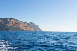
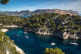
Southeast of Marseille, this charming little port is known for its stunning calanques, which you can also explore (preferably off-season) on boat trips.
View guide page: CassisOverview of Cassis
Southeast of Marseille, the charming little port of Cassis is known for its stunning calanques, which you can also explore (preferably off-season) on boat trips.
Key facts
- Type de lieu: small town.
- Intérêt touristique: (worth seeing).
- Localisation: in the calanques southeast of Marseille, in the Bouches-du-Rhône department.
- Distances:
- Heure locale: .
- Population: 7,333 inhabitants (2014).
- Superficie: 26.86 km².
- Altitude: sea level.
- Site internet: https://www.ot-cassis.com
History of Cassis
What to see and do in Cassis
Between cliffs and calanques, the town of Cassis is built around its pretty little fishing port.
Mediterranean Museum of Popular Arts and Traditions of Cassis
In a former 17th-century presbytery with collections on archaeology, fine arts, and ethnography.
In a former 17th-century presbytery with collections on archaeology, fine arts, and ethnography.
Climate and weather in Cassis
The town has a typically Mediterranean climate, with plenty of sunshine, mild winters, and hot, dry summers. Rainfall occurs mainly in autumn, particularly in October and November. The wind is also a common feature and can sometimes blow in strong gusts.
Sea temperature throughout the year
| Jan. | Feb. | Mar. | Apr. | May | Jun. | Jul. | Aug. | Sep. | Oct. | Nov. | Dec. | |
|---|---|---|---|---|---|---|---|---|---|---|---|---|
| Cassis | 13 | 12 | 13 | 14 | 16 | 20 | 22 | 23 | 22 | 19 | 16 | 14 |
Getting around
How to get there
How to get around
Where to stay
Where to eat
Useful addresses
Nearby
Cap Canaille and Soubeyrannes Cliffs
Between Cassis and La Ciotat, these are some of Europe’s highest sea cliffs, dropping up to 400 m into the Mediterranean.
Between Cassis and La Ciotat, these are some of Europe’s highest sea cliffs, dropping up to 400 m into the Mediterranean.
Calanques National Park
This stunning coastal area stretches over twenty kilometres from the south of Marseille to La Ciotat via Cassis. A must-visit for tourism, the calanques can be explored on foot or by boat. The location is also ideal for diving and climbing.
This stunning coastal area stretches over twenty kilometres from the south of Marseille to La Ciotat via Cassis. A must-visit for tourism, the calanques can be explored on foot or by boat. The location is also ideal for diving and climbing.
Further reading
Mediterranean Museum of Popular Arts and Traditions of Cassis
Preview temporarily unavailable.
Fontvieille
This large village not far from Arles is where Daudet wrote "Letters from My Windmill." You can still see the windmill and the Daudet Museum.
View guide page: FontvieilleOverview of Fontvieille
Fontvieille is the town not far from Arles where Daudet wrote "Letters from My Windmill." You can still see this windmill and the Daudet Museum.
Key Facts
- Type of place: small town.
- Tourist interest: (worth a stop if you are in the area).
- Location: a few kilometers northeast of Arles, in the Bouches-du-Rhône department.
- Distances:
- Local time: .
- Population: 3,619 inhabitants (2014).
- Area: 40.18 km².
- Altitude: from 0 to 245 m.
- Website: http://fontvieille-provence.fr
History of Fontvieille
What to See and Do in Fontvieille
Apart from a few chapels and Roman ruins, the town is best known for "its" Daudet windmill and a few others perched on hills around its outskirts.
Alphonse Daudet Museum
A museum dedicated to the author of "Letters from My Windmill," located in the Château de Montauban, where he was welcomed several times during his life.
A museum dedicated to the author of "Letters from My Windmill," located in the Château de Montauban, where he was welcomed several times during his life.
In the Surrounding Area
Climate and Weather in Fontvieille
Transportation
Getting There
Getting Around
Accommodation
Dining
Useful Addresses
Further Information
Alphonse Daudet Museum
Preview temporarily unavailable.
La Ciotat
La Ciotat is a fishing port, an old town centre, and above all, its surroundings are well worth a detour, with calanques (coves), some of Europe’s highest cliffs (Cap Canaille), beaches, and diving opportunities.
View guide page: La CiotatOverview of La Ciotat
La Ciotat is a fishing port, an old town centre, and above all, its surroundings are well worth a detour, with calanques (coves), some of Europe’s highest cliffs (Cap Canaille), beaches, and diving opportunities.
Key Facts
- Type de lieu: small town.
- Intérêt touristique: (worth seeing).
- Localisation: at the end of the calanques when coming from Marseille, in the Bouches-du-Rhône department.
- Distances:
- Heure locale: .
- Population: 35,631 inhabitants (2014).
- Superficie: 31.46 km².
- Altitude: sea level.
- Site internet: http://www.laciotat.info
History of La Ciotat
What to See and Do in La Ciotat
Ciotaden Museum
A discovery of the city's cultural, religious, traditional, and economic heritage, along with its maritime history, the invention of cinematography, and pétanque.
A discovery of the city's cultural, religious, traditional, and economic heritage, along with its maritime history, the invention of cinematography, and pétanque.
Climate and Weather in La Ciotat
The local climate is typically Mediterranean, very sunny, with mild winters and hot, dry summers. Rainfall occurs in autumn, particularly around October-November. The wind is often present and can sometimes blow in gusts.
Sea Temperature Throughout the Year
| Jan. | Feb. | Mar. | Apr. | May | Jun. | Jul. | Aug. | Sep. | Oct. | Nov. | Dec. | |
|---|---|---|---|---|---|---|---|---|---|---|---|---|
| La Ciotat | 13 | 12 | 13 | 14 | 16 | 20 | 22 | 23 | 22 | 19 | 16 | 14 |
Transport
Getting There
Getting Around
Accommodation
Eating Out
Useful Addresses
Nearby
Cap Canaille and Soubeyrannes Cliffs
Between Cassis and La Ciotat, these are some of Europe’s highest sea cliffs, dropping up to 400 m into the Mediterranean.
Between Cassis and La Ciotat, these are some of Europe’s highest sea cliffs, dropping up to 400 m into the Mediterranean.
Calanques National Park
This stunning coastal area stretches over twenty kilometres from the south of Marseille to La Ciotat via Cassis. A must-visit for tourism, the calanques can be explored on foot or by boat. The location is also ideal for diving and climbing.
This stunning coastal area stretches over twenty kilometres from the south of Marseille to La Ciotat via Cassis. A must-visit for tourism, the calanques can be explored on foot or by boat. The location is also ideal for diving and climbing.
Further Reading
Ciotaden Museum
Preview temporarily unavailable.
Martigues
Between the sea and the Étang de Berre, the town is mainly known for its two beaches, including Carro Beach, which is famous for windsurfing.
View guide page: MartiguesOverview of Martigues
Between the sea and the Étang de Berre, the town of Martigues is mainly known for its two beaches, including Carro Beach, which is famous for windsurfing.
Key Facts
- Type de lieu: small town.
- Intérêt touristique: (worth a stop if you are in the area).
- Localisation: not far from Marseille, between the sea and the Étang de Berre, in the Bouches-du-Rhône department.
- Distances:
- Heure locale: .
- Population: 48,870 inhabitants (2014).
- Superficie: 71.44 km².
- Altitude: sea level.
- Site internet: http://www.martigues-tourisme.com
History of Martigues
What to See and Do in Martigues
Musées de Martigues:
Gnidzaz Cinematheque
A combined cinema and museum showcasing the history and prehistory of film through screenings and collections.
A combined cinema and museum showcasing the history and prehistory of film through screenings and collections.
Martigues History Gallery
Through written documents, photographs, models, and interactive terminals, the gallery traces the key stages in the city's evolution.
Through written documents, photographs, models, and interactive terminals, the gallery traces the key stages in the city's evolution.
Small Museum of Carro
It traces the life through the ages of the inhabitants of the fishing village-port of Carro, now part of Martigues.
It traces the life through the ages of the inhabitants of the fishing village-port of Carro, now part of Martigues.
In the Surrounding Area
Climate and Weather in Martigues
The town has a typical Mediterranean climate, with plenty of sunshine, mild winters, and hot, dry summers. Rainfall occurs in autumn, particularly in October and November. The wind is quite common and can sometimes blow in gusts.
Transportation
Getting There
Getting Around
Accommodation
Dining
Useful Addresses
Additional Information
Ziem Museum
Preview temporarily unavailable.
Small Museum of Carro
Preview temporarily unavailable.
Gnidzaz Cinematheque
Preview temporarily unavailable.
Martigues History Gallery
Preview temporarily unavailable.
Saint-Rémy-de-Provence
In the heart of the Alpilles, the town offers visitors beautiful mansions and old streets. The surrounding countryside, which inspired many artists (including Van Gogh), is also well worth discovering.


View guide page: Saint-Rémy-de-ProvenceOverview of Saint-Rémy-de-Provence
In the heart of the Alpilles, Saint-Rémy-de-Provence offers visitors beautiful mansions and old streets. The surrounding countryside, which inspired many artists (including Van Gogh), is also well worth discovering.
Key Facts
- Type of place: small town.
- Tourist interest: (worth seeing).
- Location: in the Alpilles Regional Nature Park of the Bouches-du-Rhône department.
- Distances:
- Local time: .
- Population: 9,612 inhabitants (2016).
- Area: 89.09 km².
- Altitude: from 7 to 392 m.
- Website: http://www.saintremy-de-provence.com
History of Saint-Rémy-de-Provence
What to See and Do
Glanum
These are the archaeological remains of what was once a Greek and later a Roman city near Saint-Rémy-de-Provence.
These are the archaeological remains of what was once a Greek and later a Roman city near Saint-Rémy-de-Provence.
Museums in Saint-Rémy-de-Provence:
Alpilles Museum
Its aim is to help visitors better understand the current landscapes—both natural and human—of this part of Provence known as the Alpilles.
Its aim is to help visitors better understand the current landscapes—both natural and human—of this part of Provence known as the Alpilles.
Estrine Museum
A tribute to Vincent van Gogh, who lived in Saint-Rémy de Provence, this museum features a multimedia space dedicated to the life and work of the painter.
A tribute to Vincent van Gogh, who lived in Saint-Rémy de Provence, this museum features a multimedia space dedicated to the life and work of the painter.
In the Surrounding Area
Alpilles Regional Nature Park
In the north of the department, it consists of the Alpilles massif, where you can hike. Several tourist spots like Les Baux or Saint-Rémy de Provence are located within its boundaries.
In the north of the department, it consists of the Alpilles massif, where you can hike. Several tourist spots like Les Baux or Saint-Rémy de Provence are located within its boundaries.
Climate and Weather
Transport
Getting There
Getting Around
Accommodation
Eating Out
Useful Addresses
Further Information
Alpilles Museum
Preview temporarily unavailable.
Estrine Museum
Preview temporarily unavailable.
Saintes-Maries-de-la-Mer
This Camargue commune at the mouth of the Rhône is internationally renowned for the annual Gypsy pilgrimage held here.

View guide page: Saintes-Maries-de-la-MerOverview of Saintes-Maries-de-la-Mer
This Camargue commune at the mouth of the Rhône is internationally renowned for the annual Gypsy pilgrimage held here.
Key facts
- Type of place: small town.
- Tourist interest: (worth a stop if you are in the area).
- Location: in Camargue in the Bouches-du-Rhône department.
- Distances:
- Local time: .
- Population: 2,683 inhabitants (2014).
- Area: 374.61 km² (third-largest commune in France).
- Altitude: sea level.
- Website: http://www.saintesmaries.com
History of Saintes-Maries-de-la-Mer
What to see and do
Pilgrimages of Saintes-Maries-de-la-Mer:
In the surrounding area
Camargue Regional Nature Park
La Camargue est située dans le delta du Rhône avec l'étang du Vaccarès en son centre. Plate et humide la zone abrite nombre d'espèces d'oiseaux (notamment dans la réserve ornithologique de Pont du Gau) et surtout les fameuses manades qui sont ces élevages de taureaux ou de chevaux de races locales.
La Camargue est située dans le delta du Rhône avec l'étang du Vaccarès en son centre. Plate et humide la zone abrite nombre d'espèces d'oiseaux (notamment dans la réserve ornithologique de Pont du Gau) et surtout les fameuses manades qui sont ces élevages de taureaux ou de chevaux de races locales.
Climate and weather
The commune has a typically Mediterranean climate, with plenty of sunshine, mild winters, and hot, dry summers. Rainfall occurs mainly in autumn, particularly around October–November. The wind is also a common feature and can sometimes blow in strong gusts.
Sea temperature throughout the year
| Jan. | Feb. | Mar. | Apr. | May | Jun. | Jul. | Aug. | Sep. | Oct. | Nov. | Dec. | |
|---|---|---|---|---|---|---|---|---|---|---|---|---|
| Saintes-Maries | 13 | 12 | 13 | 14 | 16 | 20 | 22 | 23 | 22 | 19 | 16 | 14 |
Transport
Getting there
Getting around
Accommodation
Food
Useful addresses
Further information
Salon-de-Provence
An ancient town dominated by the largest medieval castle in Provence, the Château de l'Empéri.
View guide page: Salon-de-ProvenceOverview of Salon-de-Provence
Salon-de-Provence is an ancient town dominated by the largest medieval castle in Provence, the Château de l'Empéri.
Key details
- Type de lieu: small town.
- Intérêt touristique: (worth a stop if you are in the area).
- Distances:
- Heure locale: .
- Population: 44,187 inhabitants (2014).
- Superficie: 70.30 km².
- Altitude: from 53 to 325 m.
- Site internet: http://www.visitsalondeprovence.com
History of Salon-de-Provence
What to see and do
Musées de Salon-de-Provence:
Nostradamus's House
Discover the house where he lived from 1547 to 1566 and wrote his famous prophecies.
Discover the house where he lived from 1547 to 1566 and wrote his famous prophecies.
Empéri Museum
Housed in the former archbishops' castle of Arles, this museum features collections dedicated to French military history from Louis XIV to the Great War.
Housed in the former archbishops' castle of Arles, this museum features collections dedicated to French military history from Louis XIV to the Great War.
In the surrounding area
Climate and weather
Transport
Getting there
Getting around
Accommodation
Food
Useful addresses
Further information
Nostradamus's House
Preview temporarily unavailable.
Empéri Museum
Preview temporarily unavailable.
Marseille Soap Museum
Preview temporarily unavailable.
Sausset-les-Pins
Bordering Carry-le-Rouet, this fishing port is also a seaside resort.
View guide page: Sausset-les-PinsOverview of Sausset-les-Pins
Bordering Carry-le-Rouet, the fishing port of Sausset-les-Pins is also a seaside resort.
Key Facts
- Type of place: small town.
- Tourist interest: (worth a stop if you are in the area).
- Location: on the coast of Bouches-du-Rhône, right next to Carry-le-Rouet.
- Distances:
- Local time: .
- Population: 7,639 inhabitants (2014)
- Area: 12.1 km².
- Altitude: sea level.
- Website:
History of Sausset-les-Pins
What to See and Do in Sausset-les-Pins
In the Surrounding Area
Climate and Weather in Sausset
The town has a typically Mediterranean climate, very sunny, with mild winters and hot, dry summers. Rainfall occurs in autumn, particularly around October-November. The wind is often present and can sometimes blow in gusts.
Sea Temperature Throughout the Year
| Jan. | Feb. | Mar. | Apr. | May | Jun. | Jul. | Aug. | Sep. | Oct. | Nov. | Dec. | |
|---|---|---|---|---|---|---|---|---|---|---|---|---|
| Sausset | 13 | 12 | 13 | 14 | 16 | 20 | 22 | 23 | 22 | 19 | 16 | 14 |
Transportation
Getting There
Getting Around
Accommodation
Dining
Useful Addresses
Further Information
Tarascon
Separated from Beaucaire (Gard) by the Rhône, the town is home to the charming Château du Roi René, dating from the 15th century.

View guide page: TarasconOverview of Tarascon
Separated from Beaucaire (Gard) by the Rhône, the town of Tarascon is home to the charming Château du Roi René, dating from the 15th century.
Key facts
- Type de lieu: small town.
- Intérêt touristique: (worth a stop if you are in the area).
- Localisation: in the Bouches-du-Rhône department, facing Beaucaire (30), from which it is separated only by the Rhône.
- Distances:
- Heure locale: .
- Population: 14,583 inhabitants (2014).
- Superficie: 73.97 km².
- Altitude: from 3 to 200 m.
- Site internet: http://www.tarascon.fr
History of Tarascon
What to see and do in Tarascon
Tarascon Castle
Also known as the Château du Roi René, this 15th-century reconstruction is the main attraction in the town. Its interior architecture and state of preservation make it one of the finest medieval castles in France.
Also known as the Château du Roi René, this 15th-century reconstruction is the main attraction in the town. Its interior architecture and state of preservation make it one of the finest medieval castles in France.
In the surrounding area
Climate and weather in Tarascon
Transport
Getting there
Getting around
Accommodation
Food
Useful addresses
Further information
Tarascon Castle
Preview temporarily unavailable.
Cap Canaille and Soubeyrannes Cliffs
Between Cassis and La Ciotat, these are some of Europe’s highest sea cliffs, dropping up to 400 m into the Mediterranean.
View guide page: Cap Canaille and Soubeyrannes CliffsOverview of the Site
Between Cassis and La Ciotat, these are some of the highest sea cliffs in Europe, reaching nearly 400 m in height.
Key Details
- Type of place: cliff.
- Tourist interest: (worth seeing).
- Features:
- Height: up to 394 m.
- Altitude: sea level.
Environment
Precautions
What to See and Do
Climate and Weather
The site has a typical Mediterranean climate—very sunny, with mild winters and hot, dry summers. Rainfall occurs in autumn, particularly around October-November. The wind is often present and can sometimes blow in gusts.
Practical Information
- Location:
- Website:
- How to get there:
- Distances:
Accommodation and Dining
Nearby Attractions
Additional Information
Sainte-Baume Massif
Straddling two departments (Var and Bouches-du-Rhône), this small massif is popular with hikers.
View guide page: Sainte-Baume MassifOverview of the Sainte-Baume Massif
Straddling two departments (Var and Bouches-du-Rhône), this small massif is popular with hikers.
Key facts
- Tourist interest: (worth seeing).
- Characteristics:
- Massif:
- Area: around 500 km².
- Summit: Joug de l'Aigle (1,148 m).
Site environment
Wildlife and flora
Population and economic activity
Precautions
Climate and weather
What to see and do
Practical information
- Location:
- Distances:
- Website:
Getting there
Getting around
Accommodation and dining
Nearby attractions
Further reading
Mont Sainte-Victoire
Located near Aix-en-Provence, Mont Sainte-Victoire was immortalised by the painter Cézanne in many of his works. Today, it is primarily a spot for walks, hikes, climbing, and paragliding.
View guide page: Mont Sainte-VictoireOverview of Mont Sainte-Victoire
Located near Aix-en-Provence, Mont Sainte-Victoire was immortalised by the painter Cézanne in many of his works. Today, it is primarily a spot for walks, hikes, climbing, and paragliding.
Key facts
- Tourist interest: (worth a stop if you are in the area).
- Features:
- Massif:
- Area: 160 km².
- Summit: Pic des Mouches (1,011 m).
Site environment
Wildlife and flora
Population and economic activity
Precautions
Climate and weather
What to see and do
Practical information
- Location:
- Distances:
- Website:
Getting there
Getting around
Accommodation and dining
Nearby attractions
Further reading
Alpilles Regional Nature Park
In the north of the department, it consists of the Alpilles massif, where you can hike. Several tourist spots like Les Baux or Saint-Rémy de Provence are located within its boundaries.
View guide page: Alpilles Regional Nature ParkOverview of the Alpilles Park
In the north of the department, it consists of the Alpilles massif, where you can hike. Several tourist spots like Les Baux or Saint-Rémy-de-Provence are located within its boundaries.
Key facts
- Tourist interest: (worth seeing).
- Features:
- Area: 510 km².
- Altitude:
Environment
Landscape of the park
Wildlife and flora
Precautions
Climate and weather
What to see and do
Practical information
- Location:
- Website: http://www.parc-alpilles.fr
- How to get there:
- Distances:
Accommodation and dining
What to see nearby
Additional information
Camargue Regional Nature Park
La Camargue est située dans le delta du Rhône avec l'étang du Vaccarès en son centre. Plate et humide la zone abrite nombre d'espèces d'oiseaux (notamment dans la réserve ornithologique de Pont du Gau) et surtout les fameuses manades qui sont ces élevages de taureaux ou de chevaux de races locales.
View guide page: Camargue Regional Nature ParkPrésentation de la Camargue
La Camargue est située dans le delta du Rhône avec l'étang du Vaccarès en son centre. Plate et humide la zone abrite nombre d'espèces d'oiseaux (notamment dans la réserve ornithologique de Pont du Gau) et surtout les fameuses manades qui sont ces élevages de taureaux ou de chevaux de races locales.
Repères
- Intérêt touristique: (recommended).
- Caractéristiques:
- Localisation:
- Superficie: 857 km2.
- Altitude: niveau de la mer.
- Site internet: http://www.parc-camargue.fr
Environnement
Physionomie du site
Faune et flore
Précautions
À voir, à faire
Dans les environs
Climat et météo
Le climat de la Camargue est typiquement méditerranéen, très ensoleillé, avec des hivers doux et des étés chauds et secs. De la pluie en automne, notamment vers octobre-novembre. Quant au vent, il est plutôt présent et peut souffler parfois en rafales.
Transports
S'y rendre
S'y déplacer
Dormir
Manger
En complément
Ventabren
A small, typically Provençal town with its narrow streets and clustered old houses. You can also see the impressive Roquefavour Aqueduct, built in the 19th century.
View guide page: VentabrenIntroduction to Ventabren
Ventabren is a small, typically Provençal town with its narrow streets and clustered old houses. You can also see the impressive Roquefavour Aqueduct, built in the 19th century.
Key Facts
- Type de lieu: small town.
- Intérêt touristique: (worth a stop if you are in the area).
- Localisation: in the Bouches-du-Rhône department, not far from Aix-en-Provence.
- Distances:
- Heure locale: .
- Population: 5,067 inhabitants (2014).
- Superficie: 28.5 km².
- Altitude: from 59 to 286 m.
- Website: http://www.ventabren.fr
History of Ventabren
What to See and Do in Ventabren
The village of Ventabren is typically Provençal with its narrow streets and clustered old houses.
In the Surrounding Area
Climate and Weather in Ventabren
Transportation
Getting There
Getting Around
Accommodation
Dining
Useful Addresses
Further Information
Roquefavour Aqueduct
Preview temporarily unavailable.
Calanques National Park
Preview temporarily unavailable.
Glanum
Preview temporarily unavailable.
Var
The sea, renowned seaside resorts, charming small towns (Fayence, Tourtour, Gassin, etc.), and a hinterland perfect for walks—whether in the Massif des Maures or the Esterel—make Var a complete holiday destination. Add to that two iconic natural sites, the…
Vaucluse
With Avignon, the "famous and chic" village of Gordes, and the Luberon, Vaucluse has at least three major attractions. But beyond these, there are also other towns and natural sites worth exploring... Ansouis, Vaucluse, France · © VoyageForum Type…
Something wrong or out of date? Report this page