
Travel guide · Canada
Atlantic Provinces
This region includes Prince Edward Island, New Brunswick, Nova Scotia, and Newfoundland and Labrador—a vast, sparsely populated territory rich in natural beauty.
Introducing the Atlantic Provinces
Overview
This region includes Prince Edward Island, New Brunswick, Nova Scotia, and Newfoundland and Labrador, a vast, sparsely populated territory rich in natural beauty.
Key Facts
- Type of place: tourist region.
- Location: This is the entire eastern part of the country, between Quebec and the Atlantic Ocean.
- Local time: The whole region is on "Atlantic Time" (), except for the island of Newfoundland, which is on a specific time zone with half an hour less than the rest of the Atlantic Provinces.
- Main cities:
- Population:
- Area:
- Highest point:
- Lowest point: sea level.
- Coastline:
Tourism
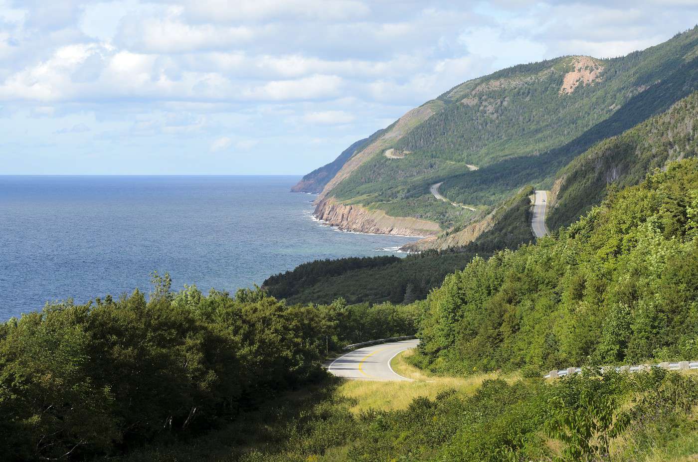
These picturesque territories boast spectacular coastal landscapes. New Brunswick will introduce you to the Acadian people, the oldest Francophone community in North America. Nova Scotia has a rich cultural and natural heritage, including the famous Cabot Trail, a scenic tourist route with stunning panoramas. Meanwhile, Prince Edward Island is known for its long beaches, sand dunes, and red soil. Finally, Newfoundland and Labrador, discovered by the Vikings around the year 1000, remains a lesser-known destination. Yet its coastal fishing villages and rugged cliffs are well worth the detour.
Travel Essentials
- Destination: ideal for beginner travelers.
- By air:
- Backpacker daily budget:
- Best for accommodation:
- Best way to get around:
- Risks:
- Best time for climate/crowds/prices:
- Interests (out of ): Nature ; Adventure /; Culture ; Relaxation/Holidays .
- Website:
Geography and Environment of the Atlantic Provinces
Geography of the Region
Natural Areas
Wildlife and Flora
Climate and Weather in the Atlantic Provinces
Climate Overview
Best Climate Period for the Atlantic Provinces
| Jan. | Feb. | Mar. | Apr. | May | Jun. | Jul. | Aug. | Sep. | Oct. | Nov. | Dec. | |
|---|---|---|---|---|---|---|---|---|---|---|---|---|
| Climate |
: very favourable | : favourable | : moderately favourable | : unfavourable.
Sea Temperature Throughout the Year
It’s really only in the heart of summer that the water temperature is "acceptable" for swimming.
| Jan. | Feb. | Mar. | Apr. | May | Jun. | Jul. | Aug. | Sep. | Oct. | Nov. | Dec. | |
|---|---|---|---|---|---|---|---|---|---|---|---|---|
| Halifax | 1 | 1 | 1 | 1 | 5 | 9 | 14 | 16 | 14 | 11 | 8 | 3 |
Climate and Weather by Province
New Brunswick
Nova Scotia
Prince Edward Island
Newfoundland and Labrador
Additional Information
Culture, Society, and Customs of the Atlantic Provinces
Key Historical Dates
Arts and Architecture
Society
Population
Economy
Customs and Traditions
Local Traditions
Regional Languages
Festivals and Celebrations
Books, Films, and Music
What to See in the Atlantic Provinces
The Atlantic Provinces have 7 sites inscribed on the UNESCO World Heritage list. Joggins Fossil Cliffs ★ (2008) These coastal cliffs on the west coast are a UNESCO World Heritage Site due to the significant number of fossils they contain. Grand Pré ★ (2012)…
Things to Do in the Atlantic Provinces
Travel Themes
- Interests (out of ): Nature ; Adventure / ; Culture ; Relaxation-holidays .
Nature-Adventure
Culture
Relaxation-Holidays
Beaches and Seaside Resorts

Water Activities
Diving:
Water Sports:
Sailing:
Hiking
Hiking
Cycling
Horseback Riding
Outdoor Sports
Golf
Hunting and Fishing
Whitewater
Climbing and Mountain
Other Activities
Skiing and Winter Activities
Cultural Life and Activities
Nightlife and Going Out
Travel and suggested itineraries in the Atlantic Provinces
Best times to visit
Finding the best time to visit means balancing weather conditions with crowds and the most attractive prices for travel and on-site costs.
| Jan. | Feb. | Mar. | Apr. | May | Jun. | Jul. | Aug. | Sep. | Oct. | Nov. | Dec. | |
|---|---|---|---|---|---|---|---|---|---|---|---|---|
| Climate | ||||||||||||
| Avoid crowds | ||||||||||||
| Low prices |
: very favourable | : favourable | : moderately favourable | : unfavourable.
Some itinerary ideas
Must-see
Offbeat
Family-friendly
By duration
Other practical information for the Atlantic Provinces
Luggage and equipment to bring
Budget
Precautions
Consulates
Time difference
Opening hours
Laundromats
Local tourist offices
French language use
Atlantic Provinces
New Brunswick
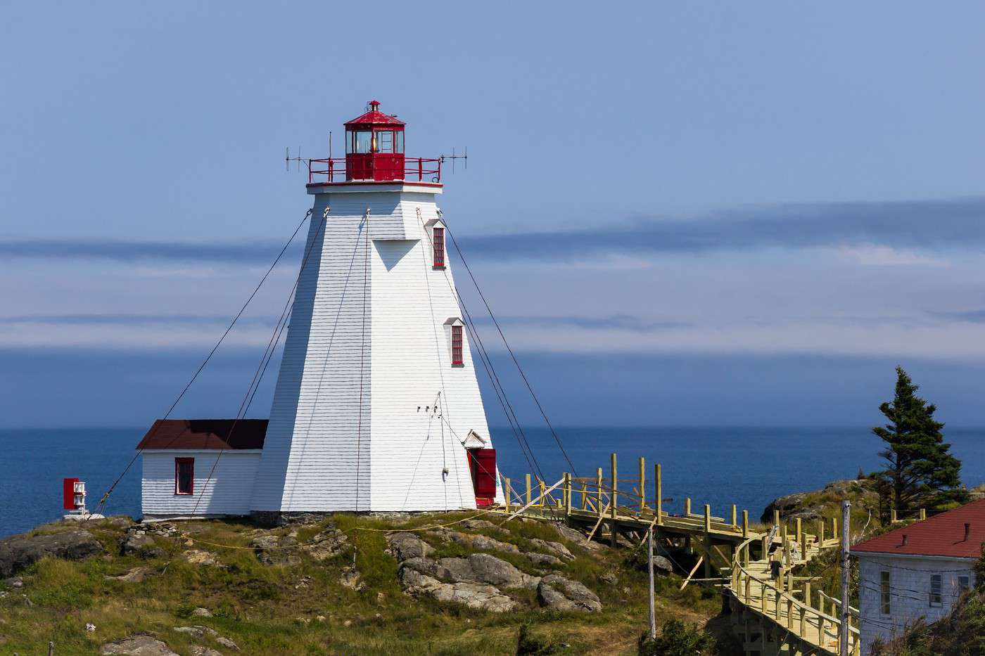
Officially bilingual, French-English, New Brunswick still preserves Acadian culture. This is one of the province's attractions, which also capitalizes on its beautiful landscapes, beaches, thirty or so national or provincial parks, and outdoor activities enjoyed year-round.
Nova Scotia
The province boasts a rich cultural heritage, particularly Acadian, but above all natural. The latter is best discovered via the famous Cabot Trail, a scenic route stretching over 250 km with stunning panoramas, great hiking opportunities, and several fishing villages where Acadian culture remains very much alive.
Prince Edward Island
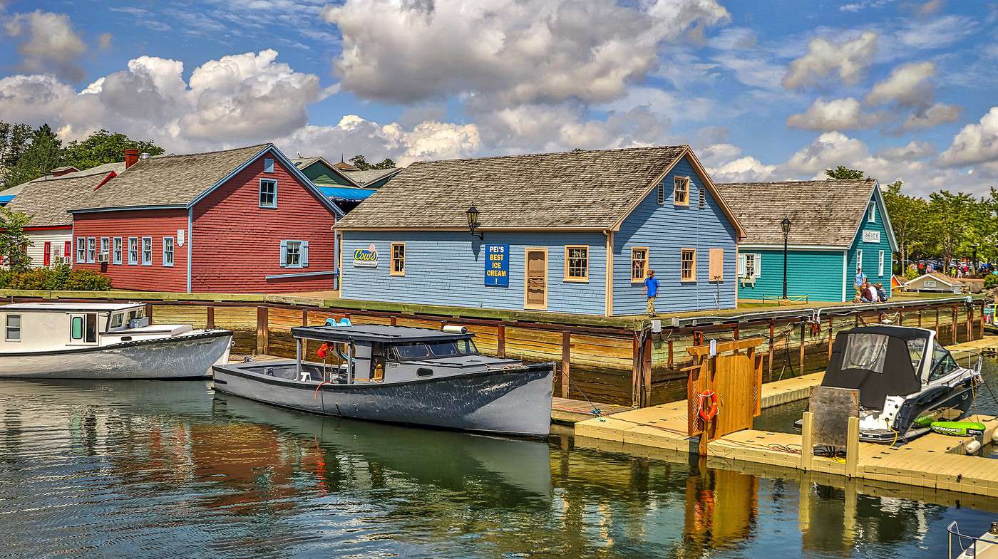
The smallest of Canada's provinces has developed its tourism sector around its beaches and dune landscapes. It's the Prince Edward Island National Park, on the north coast, that remains its main attraction and draws the most visitors.
Newfoundland and Labrador
At Canada's easternmost edge, these lands—wild and nearly empty in Labrador, more populated in Newfoundland—are nature destinations par excellence. The region boasts several parks and vast untouched spaces, perfect for off-the-beaten-path exploration, especially in the province's northernmost part.
New Brunswick
Officially bilingual (French-English), New Brunswick keeps Acadian culture alive. This is one of the province’s attractions, along with its stunning landscapes, thirty national and provincial parks, and year-round outdoor activities.
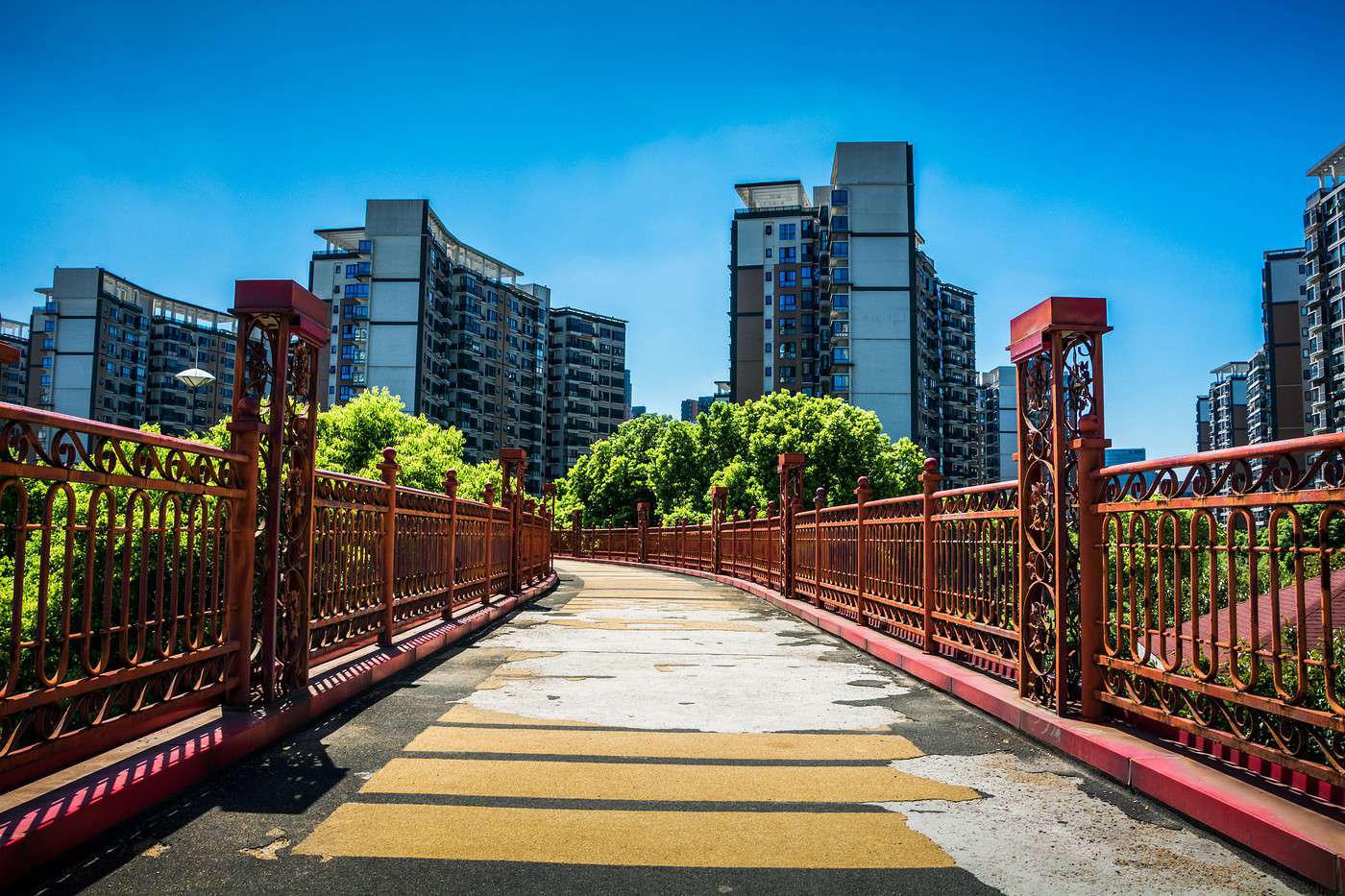
Fredericton, Nouveau-Brunswick, Canada · © VoyageForum
View guide page: New BrunswickOverview
Officially bilingual (French-English), New Brunswick keeps Acadian culture alive. This is one of the province’s attractions, along with its stunning landscapes, beaches, thirty national and provincial parks (including Fundy National Park), and year-round outdoor activities.
Key facts
- Type of place: province.
- Location:
- Local time: . The province is on "Atlantic Time."
- Capital: Fredericton.
- Population: 756,000 (2016).
- Area: 73,908 km².
- Density: 10 inhabitants/km².
- Highest point:
- Lowest point: sea level.
- Coastline:
- Highlights (out of ): Nature ; Adventure ; Culture ; Relaxation/holidays .
- Website:
Main cities
Tourist attractions
Cities and heritage
Beaches and coastline
Nature and activities
Climate and weather in New Brunswick
Fredericton
A lively city, the provincial capital also has a small historic centre.
View guide page: FrederictonOverview of Fredericton
A lively city, the provincial capital also has a small historic centre.
Key Facts
- Type of place: city.
- Tourist interest: (worth seeing).
- Location:
- Distances:
- Local time: .
- Population: 56,224 (2011).
- Area: 131.67 km².
- Altitude:
- Website: www.tourismfredericton
History of Fredericton
What to see and do in Fredericton
In the surrounding area
Climate and weather in Fredericton
Transport
Getting there
Getting around
Accommodation
Eating out
Useful addresses
- == Further information
Grand Manan
A retreat beloved by writers and artists.
View guide page: Grand MananOverview of Grand Manan
A retreat beloved by writers and artists.
Key Facts
- Type of place: island.
- Tourist interest: (worth seeing).
- Location:
- Local time:
- Main locality:
- Population: 2,377 inhabitants (2011).
- Area: 150.86 km².
- Density:
- Highest point:
- Coastline:
- Website: www.grandmanannb.com
History of Grand Manan
Island Environment
Wildlife and Flora
Precautions
What to See and Do on Grand Manan
Nearby
Climate and Weather on Grand Manan
Transportation
Getting There
Getting Around
Accommodation
Dining
Useful Addresses
- == Additional Information
Hartland
This village in the western part of the province is home to the world's longest covered bridge. Built in 1901, it spans 390 metres.
View guide page: HartlandOverview of Hartland
This village in the western part of the province is home to the world's longest covered bridge. Built in 1901, it spans 390 metres.
Landmarks
- Type of place: village.
- Tourist interest: (worth a stop if you are in the area).
- Location:
- Distances:
- Local time: .
- Population: 947 (2006).
- Area: 9.63 km².
- Altitude:
- Website: http://www.town.hartland.nb.ca
History of Hartland
What to see and do in Hartland
In the surrounding area
Climate and weather in Hartland
Transportation
Getting there
Getting around
Accommodation
Food
Useful addresses
- == Additional information
Moncton
The largest urban area in New Brunswick. The small town of Shediac, just a few kilometres away, serves as the city's seaside resort, thanks in particular to its Parlee Beach.
View guide page: MonctonOverview of Moncton
It is the largest urban area in New Brunswick. The small town of Shediac, just a few kilometres away, serves as the city's seaside resort, thanks in particular to its Parlee Beach.
Key Facts
- Type of place: city.
- Tourist interest: (worth a stop if you are in the area).
- Location:
- Distances:
- Local time: .
- Population: 71,889 (2016).
- Area: 141.17 km².
- Altitude:
- Website: http://www.moncton.ca
History of Moncton
What to See and Do in Moncton
In the Surrounding Area
Climate and Weather in Moncton
Transportation
Getting There
Getting Around
Accommodation
Eating Out
Useful Addresses
Further Information
Saint Andrews
A seaside resort on the Bay of Fundy, near the American border. It has a few buildings from the late 18th century. You can take whale-watching cruises from the town.
View guide page: Saint AndrewsOverview of Saint Andrews
It's a seaside resort on the Bay of Fundy, near the American border. It has a few buildings from the late 18th century. You can take whale-watching cruises from the town.
Key Facts
- Type of place: small town.
- Tourist interest: (worth a stop if you are in the area).
- Location:
- Distances:
- Local time: .
- Population: 1,889 inhabitants (2012).
- Area: 8.35 km².
- Altitude: sea level.
- Website: http://standrewsbythesea.ca
History of Saint Andrews
What to See and Do in Saint Andrews
Nearby
Climate and Weather in Saint Andrews
Transportation
Getting There
Getting Around
Accommodation
Dining
Useful Addresses
Further Information
Acadian Historical Village
A costumed re-enactment of Acadian life from 1770 to 1949, set in a village of around sixty buildings.
View guide page: Acadian Historical VillageOverview of the Acadian Historical Village
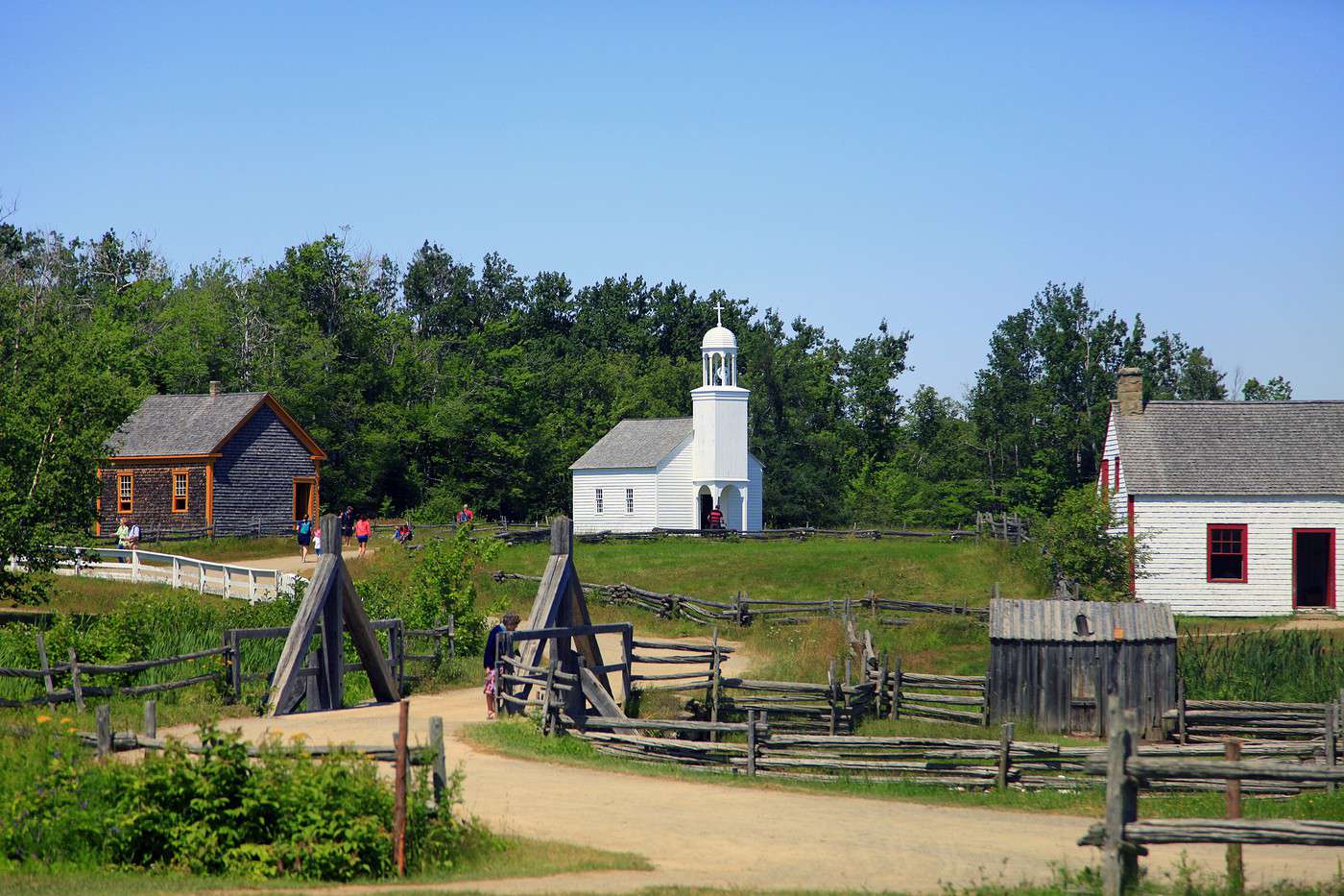
This is a costumed re-enactment of Acadian life from 1770 to 1949, set in a village of around sixty buildings.
- Tourist interest: (worth seeing).
History of the Acadian Historical Village
What to see and do
Practical information
- Location:
- Address: 5 rue Du Pont, Bertrand, NB E1W 0E1, Canada.
- Opening hours:
- Admission:
- Website: http://www.vhanb.ca
- How to get there:
Nearby attractions
Fundy National Park
Forests, stunning rock formations like the Hopewell Rocks, the sea, and the world's highest tides (16 m) make this coastal park a must-visit for landscapes and hiking.
View guide page: Fundy National ParkOverview of Fundy National Park
Forests, stunning rock formations like the Hopewell Rocks, the sea, and the world's highest tides (16 m) define this coastal park. It’s a prime destination for landscapes and hiking.
Key Facts
- Type of place: national park.
- Tourist interest: (recommended).
- Features:
- Local time:
- Annual visitors: 327,500 (2016).
- Area: 205.9 km².
- Altitude:
Environment
Park Landscape
Wildlife and Flora
Climate
Precautions
What to See
What to Do
Practical Information
- Location:
- Distances:
- Opening period:
- Rates:
- Website: www.pc.gc.ca
Getting There
Getting Around
Sleeping and Eating
Nearby Attractions
Further Reading
Kouchibouguac National Park
This coastal reserve protects the dunes, marshes, and several islets along this stretch of coastline. While bears, lynx, and cougars can be spotted here, the area is best known for its birdlife.
View guide page: Kouchibouguac National ParkOverview of Kouchibouguac National Park
This coastal reserve protects the dunes, marshes, and several islets along this stretch of coastline. While bears, lynx, and cougars can be spotted here, the area is best known for its birdlife.
Key Facts
- Type of place: national park.
- Tourist interest: (worth a stop if you are in the area).
- Features:
- Local time:
- Annual visitors: 169,000 visitors (2016).
- Area: 198.7 km².
- Altitude: sea level
Environment
Landscape of the Park
Wildlife and Flora
Climate and Weather
Precautions
What to See
What to Do
Practical Information
- Location:
- Distances:
- Opening period:
- Rates:
- Website: www.pc.gc.ca
Getting There
Getting Around
Accommodation and Dining
Nearby Attractions
Additional Information
Kings Landing
Historic village near Fredericton depicting rural life and housing from 1780 to 1910.
View guide page: Kings LandingOverview of Kings Landing
The site is an open-air museum. It is a reconstruction of an English-speaking historic village in the area around Fredericton. It depicts rural life and housing from 1780 to 1910.
- Tourist interest: (worth seeing).
History of Kings Landing
What to see and do in Kings Landing
Practical information
- Location:
- Address: 5804 NB-102, Prince William, NB E6K 0A5, Canada.
- Opening hours:
- Admission:
- Website: kingslanding.nb.ca
- How to get there:
What to see nearby
- == In addition
Appalachian Trail
Stretching over 3,000 km, this hiking trail starts in Maine (USA), crosses New Brunswick before continuing into Quebec.
View guide page: Appalachian TrailOverview of the Appalachian Trail
Stretching over 3,000 km, this hiking trail starts in Maine (USA), crosses New Brunswick before continuing into Quebec.
Key Points
- Type of place: trek or hike.
- Tourist interest: (worth a stop if you are in the area).
- Features:
- Location:
- Local time:
- Website: http://www.appalachiantrail.org
Environment of the Appalachian Trail
Wildlife and flora
What to see and do
Nearby
Treks and hikes
Characteristics
- Endpoints:
- Length: 3,514.81 km.
- Duration:
- Minimum altitude: sea level.
- Maximum altitude:
- Elevation gain:
- Difficulties:
- Best season:
Routes
Climate
Precautions
Getting there
Accommodation
Food
Further reading
Nova Scotia
The province boasts a rich cultural heritage, particularly Acadian, but its natural beauty stands out most. This is best discovered firsthand along the famous Cabot Trail, a scenic 250+ km route offering stunning panoramas, great hiking opportunities, and several fishing villages where Acadian culture remains very much alive.
Cabot Trail, Nouvelle-Écosse, Canada · © VoyageForum
View guide page: Nova ScotiaOverview
The province boasts a rich cultural heritage, particularly Acadian, but its natural beauty stands out most. This is best discovered firsthand along the famous Cabot Trail, a scenic 250+ km route offering stunning panoramas, great hiking opportunities, and several fishing villages where Acadian culture remains very much alive.
Key Facts
- Type of place: province.
- Location:
- Local time: . The province follows "Atlantic Time."
- Capital: Halifax
- Population: 940,600 (2014).
- Area: 55,283 km².
- Density: 17 inhabitants/km².
- Highest point:
- Lowest point: sea level.
- Coastline:
- Highlights (out of ): Nature ; Adventure ; Culture ; Relaxation/Holidays / .
- Website:
Major Cities
Tourist Attractions
Cities and Heritage
Beaches and Coastal Areas
Nature and Activities
Climate and Weather in Nova Scotia
Joggins Fossil Cliffs
These coastal cliffs on the west coast are a UNESCO World Heritage Site due to the significant number of fossils they contain.
View guide page: Joggins Fossil CliffsOverview of the Joggins Fossil Cliffs
These coastal cliffs on the west coast are a UNESCO World Heritage Site due to the significant number of fossils they contain.
Key Facts
- Type of place: fossil field.
- Tourist interest: (worth a stop if you are in the area).
- Features:
- Location:
- Area: 6.89 km².
- Altitude:
- Website: http://jogginsfossilcliffs.net
Environment of the Fossil Field
Wildlife and Flora
What to See and Do
Nearby
Climate
Precautions
Getting There
Sleeping and Eating
- == In Addition
Baddeck
A small lakeside resort village near the sea on Cape Breton Island. You can visit a museum dedicated to Graham Bell, the inventor of the telephone. It’s also the starting point of the Cabot Trail.
View guide page: BaddeckOverview of Baddeck
It’s a small lakeside resort village near the sea on Cape Breton Island. You can visit a museum dedicated to Graham Bell, the inventor of the telephone. It’s also the starting point of the Cabot Trail.
Key Details
- Type of place: village.
- Tourist interest: (worth seeing).
- Location:
- Distances:
- Local time: .
- Population: 769 (2011).
- Area:
- Altitude:
- Website: http://visitbaddeck.com/
History of Baddeck
What to See and Do in Baddeck
Nearby
Climate and Weather in Baddeck
Transportation
Getting There
Getting Around
Accommodation
Dining
Useful Addresses
Additional Information
Grand Pré
This village is considered the historical heart of Acadia and is a UNESCO World Heritage Site.
View guide page: Grand PréOverview of Grand Pré
This village is considered the historical heart of Acadia and is a UNESCO World Heritage Site.
Key Facts
- Type of place: village.
- Tourist interest: (worth a stop if you are in the area).
- Location:
- Distances:
- Local time: .
- Population:
- Area: 13.23 km².
- Altitude: sea level.
- Website: http://www.visitezgrandpre.ca
History of Grand Pré
What to See and Do in Grand Pré
Nearby
Climate and Weather in Grand Pré
Transportation
Getting There
Getting Around
Accommodation
Food
Useful Addresses
- == Additional Information
Louisbourg
This village in Cape Breton County is known for its 18th-century French fortress, which is used, among other things, for historical reenactments.
View guide page: LouisbourgOverview of Louisbourg
This village in Cape Breton County is known for its 18th-century French fortress, which is used, among other things, for historical reenactments.
Key Facts
- Type of place: village.
- Tourist interest: (recommended).
- Location:
- Distances:
- Local time: .
- Population: 1,265 (2016).
- Area: 3.3 km².
- Elevation: sea level.
- Website: http://louisbourg.ca
History of Louisbourg
What to See and Do in Louisbourg
Nearby
Climate and Weather in Louisbourg
Transportation
Getting There
Getting Around
Accommodation
Food
Useful Addresses
- == Additional Information
Lunenburg
This fishing port on the south shore of Nova Scotia is a UNESCO World Heritage site thanks to its historic centre and unique architecture.
View guide page: LunenburgOverview of Lunenburg
This fishing port on the south shore of Nova Scotia is a UNESCO World Heritage site thanks to its historic centre and unique architecture.
Key Facts
- Type of place: small town.
- Tourist interest: (worth seeing).
- Location:
- Distances:
- Local time: .
- Population: 2,317 inhabitants (2012).
- Area: 4.01 km².
- Altitude: sea level.
- Website: https://www.explorelunenburg.ca
History of Lunenburg
What to See and Do in Lunenburg
In the Surrounding Area
Climate and Weather in Lunenburg
Transportation
Getting There
Getting Around
Accommodation
Food
Useful Addresses
- == Additional Information
Peggys Cove
A few kilometres southwest of Halifax, this small fishing port is a rather touristy spot for its seaside landscapes and lighthouse.
View guide page: Peggys CoveOverview of Peggys Cove
A few kilometres southwest of Halifax, this small fishing port is a rather touristy spot for its seaside landscapes and lighthouse.
Key details
- Type of place: village.
- Tourist interest: (recommended).
- Location:
- Distances:
- Local time: .
- Population: 640 inhabitants (2012).
- Area:
- Altitude: sea level.
- Website: http://www.peggyscoveregion.com
History of Peggys Cove
What to see and do in Peggys Cove
In the surrounding area
Climate and weather in Peggys Cove
Transport
Getting there
Getting around
Accommodation
Eating
Useful addresses
- == Additional information
Cape Breton Highlands National Park
At the tip of the province, the area boasts stunning landscapes and a rich local wildlife (birds, moose, seals, whales...). Hiking is a popular activity here.
View guide page: Cape Breton Highlands National ParkOverview of the national park
At the tip of the province, the area boasts stunning landscapes and a rich local wildlife (birds, moose, seals, whales...). Hiking is a popular activity here.
Key facts
- Type of place: national park.
- Tourist interest: (recommended).
- Features:
- Local time:
- Annual visitors: 303,000 visitors (2016).
- Area: 949 km².
- Altitude:
Environment
Landscape of the park
Wildlife and flora
Climate
Precautions
What to see
What to do
Practical information
- Location:
- Distances:
- Opening period:
- Rates:
- Website: www.pc.gc.ca
Getting there
Getting around
Sleeping and eating
Nearby attractions
- == En complément
Kejimkujik National Park
Forests and lakes define this natural area, which is also home to several Mi'kmaq petroglyph sites.
View guide page: Kejimkujik National ParkOverview of Kejimkujik National Park
Forests and lakes define this natural area, which is also home to several Mi'kmaq petroglyph sites.
Key Facts
- Type de lieu: national park.
- Intérêt touristique: (worth seeing).
- Caractéristiques:
- Heure locale:
- Fréquentation annuelle: 36,000 visitors (2016).
- Superficie: 403.7 km².
- Altitude:
Environment
Landscape of the Park
Wildlife and Flora
Climate and Weather
Precautions
What to See
What to Do
Practical Information
- Localisation:
- Distances:
- Période d'ouverture:
- Tarifs:
- Site internet: www.pc.gc.ca
Getting There
Getting Around
Accommodation and Dining
Nearby Attractions
- == En complément
Cabot Trail
This scenic tourist route of over 250 km loops around the northern part of Nova Scotia in Cape Breton County. It offers stunning views, great hikes, and a chance to explore several fishing villages where Acadian culture remains very much alive, such as in Chéticamp.
View guide page: Cabot TrailOverview of Cabot Trail
This scenic tourist route of over 250 km loops around the northern part of Nova Scotia in Cape Breton County. It offers stunning views, great hikes, and a chance to explore several fishing villages where Acadian culture remains very much alive, such as in Chéticamp.
Key Details
- Type of place: scenic route.
- Tourist interest: (recommended).
- Theme:
- Location:
- Local time:
- Main towns:
- Length: 298 km.
- Altitude:
- Website: http://www.cabottrail.com
The Route
What to See and Do
Itinerary
Nearby Attractions
Climate and Weather on Cabot Trail
Getting Around
How to Get There
Getting Around
Accommodation
Food
Additional Information
Liverpool (Canada)
Between Halifax and Yarmouth. A small town that’s both "historic" and seaside, with several pleasant beaches nearby.
View guide page: Liverpool (Canada)Overview of Liverpool
Between Halifax and Yarmouth. It’s a small town that’s both "historic" and seaside, with several pleasant beaches nearby.
Key Details
- Type of place: small town.
- Tourist interest: (worth a stop if you are in the area).
- Location:
- Distances:
- Local time: .
- Population: 2,563 (2012).
- Area: 3.48 km².
- Altitude: sea level.
- Website: www.novascotia.com
History of Liverpool
What to See and Do in Liverpool
Nearby
Climate and Weather in Liverpool
Transportation
Getting There
Getting Around
Accommodation
Dining
Useful Addresses
- == Additional Information
Yarmouth (Canada)
Between sea and lakes, this town in the far southwest and its surroundings have become a popular tourist spot in Nova Scotia.
View guide page: Yarmouth (Canada)Overview of Yarmouth
Between sea and lakes, this town in the far southwest and its surroundings have become a popular tourist spot in Nova Scotia.
Key facts
- Type of place: small town.
- Tourist interest: (worth a stop if you are in the area).
- Location:
- Distances:
- Local time: .
- Population: 6,518 (2016).
- Area: 10.56 km².
- Elevation: sea level.
History of Yarmouth
What to see and do in Yarmouth
In the area
Climate and weather in Yarmouth
Getting around
Getting there
Getting around
Accommodation
Food
Useful addresses
Further information
Halifax (Canada)
The largest urban area in the Atlantic Provinces is a dynamic port and the economic and cultural hub of the region. The city boasts some beautiful historic buildings, a mid-18th-century citadel, and several urban parks. There are also plenty of forests and small lakes on its outskirts for hiking and canoeing.
Overview of Halifax
Halifax Climate and Weather
What to See in Halifax
Things to Do in Halifax
Flying to Halifax
Getting to Halifax by Land or Sea
Getting Around Halifax
Accommodation and Dining in Halifax
Living in Halifax
View guide page: Halifax (Canada)Further information
Overview of Halifax
Overview of Halifax
The largest urban area in the Atlantic Provinces is a dynamic port and the economic and cultural hub of the region. The city boasts several beautiful historic buildings, a citadel dating from the mid-18th century, and numerous urban parks. There are also plenty of forests and small lakes on its outskirts for hiking and canoeing.
Key Facts
- Type of place: large city.
- Tourist interest: (recommended).
- Location:
- Distances:
- Local time: .
- Population: 316,701 inhabitants and approximately 400,000 for the metropolitan area (2016).
- Area: 234.72 km².
- Altitude: from 0 to 292 m.
- Website: http://www.destinationhalifax.com
History of Halifax
Useful Addresses
- Tourist Office:
Services
- Local agencies:
- Banks:
- Hospital:
- Internet:
- Laundromats:
- Vehicle rental:
- Post office:
Halifax Climate and Weather
Climate Overview
Best Time to Visit Halifax
| Jan. | Feb. | Mar. | Apr. | May | Jun. | Jul. | Aug. | Sep. | Oct. | Nov. | Dec. | |
|---|---|---|---|---|---|---|---|---|---|---|---|---|
| Climate |
Current Climate and Forecast
Additional Information
Flying to Halifax
Halifax Airport
Airport details
- Name: Halifax Stanfield International Airport.
- IATA code: YHZ
- Hub:
- Number of terminals:
- Annual passenger capacity:
- Passenger traffic: 3,908,799 (2016).
- Distance from city centre:
- Website: https://halifaxstanfield.ca
Services
Sleeping at the airport
Transport to the city centre
Other nearby airports
From the rest of the country or the USA
From Europe
From elsewhere
Additional information
Prince Edward Island
Canada’s smallest province has built its tourism sector around its beaches and dune landscapes. It is Prince Edward Island National Park, on the north coast, that remains its main attraction and draws the most visitors.

Charlottetown, Île du Prince-Édouard, Canada · © VoyageForum
View guide page: Prince Edward IslandOverview
Canada’s smallest province has built its tourism sector around its beaches and dune landscapes. It is Prince Edward Island National Park, on the north coast, that remains its main attraction and draws the most visitors.
Key Facts
- Type of place: province.
- Location:
- Local time: . The entire island is on "Atlantic Time."
- Capital: Charlottetown
- Population: 146,933 inhabitants (2016).
- Area: 5,660 km².
- Density: 26 inhabitants/km²
- Highest point:
- Lowest point: sea level.
- Coastline:
- Highlights (out of ): Nature ; Adventure ; Culture ; Relaxation-holidays / .
- Website:
Main Cities
Tourist Attractions
Cities and Heritage
Beaches and Seaside
Nature and Activities
Climate and Weather in Prince Edward Island
Charlottetown
The capital of Canada’s smallest province boasts some fine Victorian-era buildings.
View guide page: CharlottetownOverview of Charlottetown
The capital of Canada’s smallest province boasts some fine Victorian-era buildings.
Key facts
- Type of place: small town.
- Tourist interest: (worth a stop if you are in the area).
- Location:
- Distances:
- Local time: .
- Population: 34,562 (2012).
- Area: 44.33 km².
- Altitude: sea level.
- Website: http://www.discovercharlottetown.com
History of Charlottetown
What to see and do in Charlottetown
In the surrounding area
Climate and weather in Charlottetown
Getting around
Getting there
Getting around
Where to stay
Where to eat
Useful addresses
Further reading
Green Gables
This is the "heritage farm-museum" from the late 19th century belonging to novelist Lucy Maud Montgomery.
View guide page: Green GablesOverview of Green Gables
This is the "heritage farm-museum" from the late 19th century belonging to novelist Lucy Maud Montgomery.
- Tourist interest: (worth a stop if you are in the area).
History of Green Gables
What to see and do
Practical information
- Location:
- Address: 8619 Cavendish Rd, Cavendish, PE C0A 1M0, Canada.
- Opening hours:
- Admission fee:
- Website: www.pc.gc.ca
- How to get there:
Nearby attractions
- == In addition
Prince Edward Island National Park
This coastal park with its beaches and dunes is well-known among sea fishing enthusiasts, and also features some charming little harbours nearby.
View guide page: Prince Edward Island National ParkOverview of Prince Edward Island National Park
This coastal park with its beaches and dunes is well-known among sea fishing enthusiasts, and also features some charming little harbours nearby.
Key Details
- Type of place: national park.
- Tourist interest: (worth seeing).
- Features:
- Local time:
- Area: 27 km².
- Altitude:
Environment
Landscape of the Park
Wildlife and Vegetation
Climate and Weather
Precautions
What to See
What to Do
Practical Information
- Location:
- Distances:
- Opening period:
- Rates:
- Website: www.pc.gc.ca
Getting There
Getting Around
Accommodation and Dining
Nearby Attractions
- == In addition
Newfoundland and Labrador
At the far east of Canada, these lands—wild and nearly empty in Labrador, more populated in Newfoundland—are prime nature destinations. There are several parks and vast untouched areas, perfect for off-the-beaten-path exploration, especially in the northernmost part of the province.
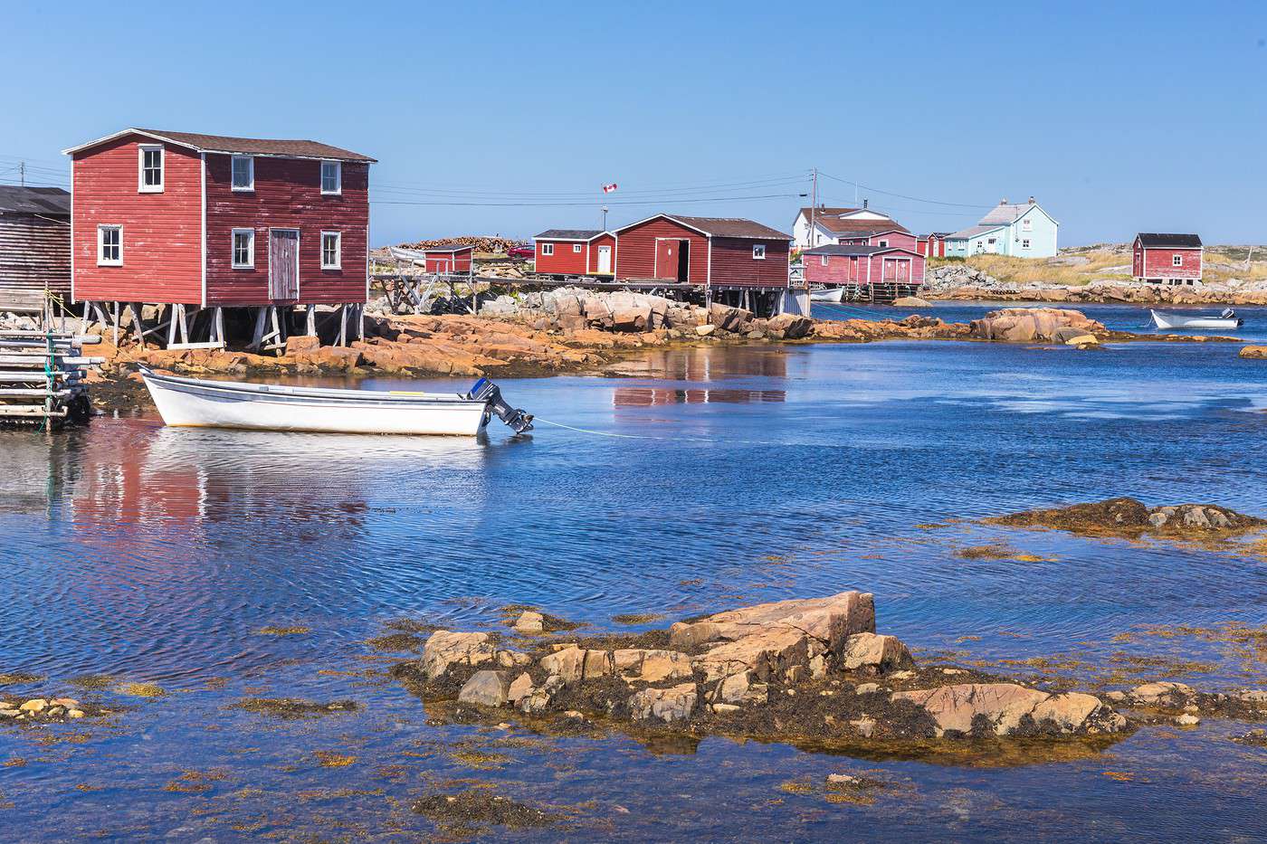
Fogo Island, Terre-Neuve et Labrador, Canada · © VoyageForum
View guide page: Newfoundland and LabradorOverview
At the far east of Canada, these lands—wild and nearly empty in Labrador, more populated in Newfoundland—are prime nature destinations. There are several parks and vast untouched areas, perfect for off-the-beaten-path exploration, especially in the northernmost part of the province.
Key Facts
- Type of place: province.
- Location:
- Local time: While most of Labrador follows "Atlantic Time" (), the island of Newfoundland and the small adjacent part of Labrador have their own time zone at UTC-3:30 (UTC-4 for the rest of the province), creating a half-hour difference between the two zones.
- Capital: St. John’s
- Population:
- Area:
- Density:
- Highest point:
- Lowest point:
- Coastline:
- Highlights (out of ): Nature ; Adventure ; Culture /; Relaxation/Holidays .
- Website:
Major Cities
Tourist Attractions
Cities and Heritage
Beaches and Coastal Areas
Nature and Activities
Climate and Weather in Newfoundland and Labrador (St. John’s)
Gros Morne National Park
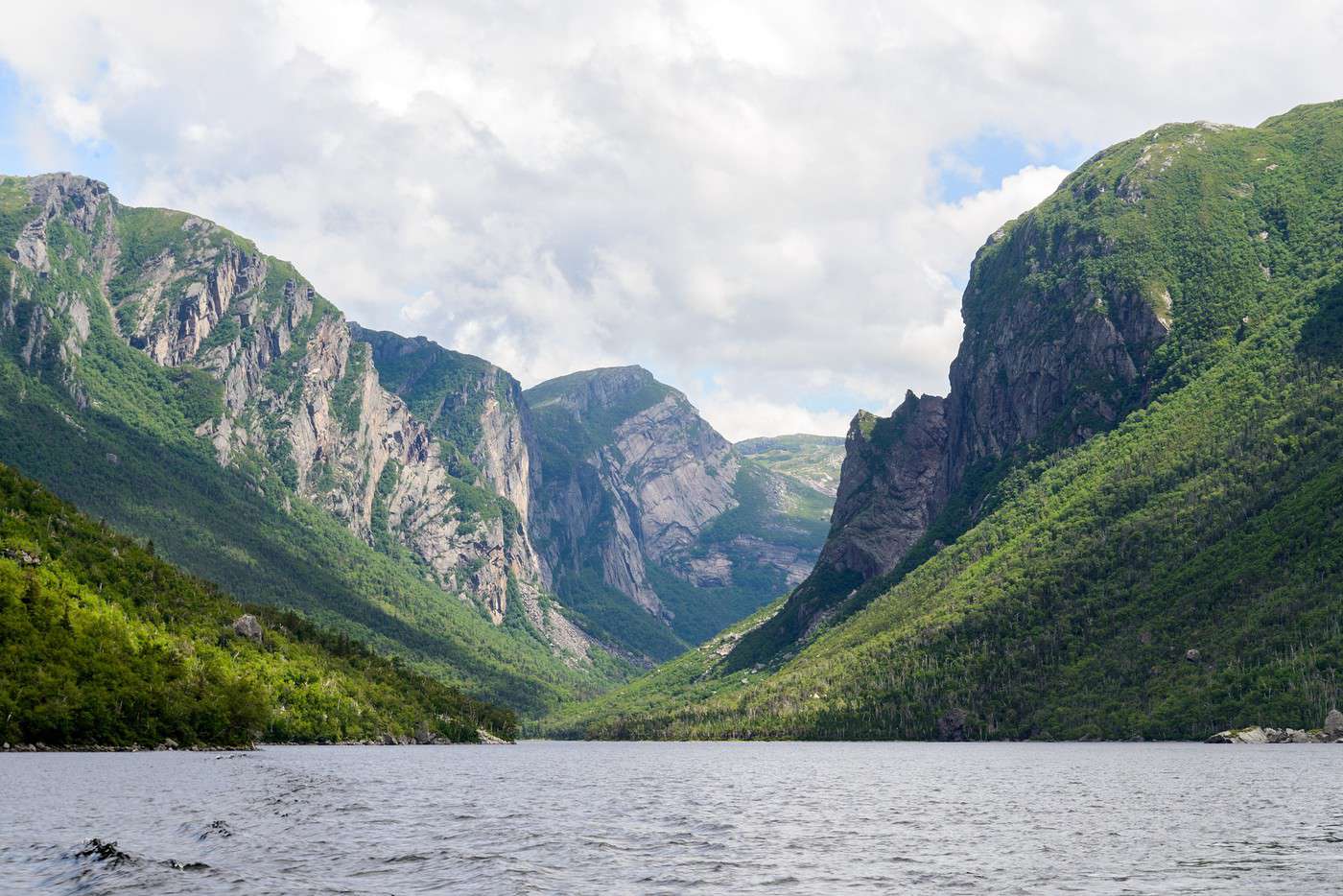
A stunning UNESCO-listed coastal park. Hiking is a highlight here.
View guide page: Gros Morne National ParkOverview of Gros Morne National Park
It’s a stunning UNESCO-listed coastal park. Hiking is a highlight here.
Key facts
- Type of place: national park.
- Tourist interest: (recommended).
- Features:
- Local time:
- Annual visitors: 244,000 (2016).
- Area: 1,805 km².
- Altitude:
Environment
Landscape of the park
Wildlife and vegetation
Climate
Precautions
What to see
What to do
Practical information
- Location:
- Distances:
- Opening period:
- Rates:
- Website: www.pc.gc.ca
Getting there
Getting around
Accommodation and dining
Nearby attractions
- == En complément
Fogo Island
A beautiful, sparsely populated island with a wild feel, off the coast of Newfoundland.
View guide page: Fogo IslandOverview of Fogo Island
It's a beautiful, sparsely populated island with a wild feel, located off the coast of Newfoundland.
Key Facts
- Type of place: island.
- Tourist interest: (worth seeing).
- Location:
- Local time:
- Main locality: Fogo Island (same as the island).
- Population: 2,244 inhabitants (2016).
- Area:
- Highest point:
- Coastline:
- Website: http://www.townoffogoisland.ca
History of Fogo Island
Island Environment
Wildlife and Flora
Precautions
What to See and Do on Fogo Island
In the Surrounding Area
Climate and Weather on Fogo Island
Transportation
Getting There
Getting Around
Accommodation
Dining
Useful Addresses
- == Additional Information
Burin Peninsula
The long peninsula, like the rest of Newfoundland’s south coast, is a remote and wild area with just a few small villages where you can enjoy off-the-beaten-path outdoor activities.
View guide page: Burin PeninsulaOverview of the Burin Peninsula
The long peninsula, like the rest of Newfoundland’s south coast, is a remote and wild area with just a few small villages where you can enjoy off-the-beaten-path outdoor activities.
Landmarks
- Type of place: peninsula.
- Tourist interest: (worth seeing).
- Location:
- Local time: .
- Area:
- Altitude:
- Website: tourismetnl.ca
Environment of the Burin Peninsula
Wildlife and flora
What to see and do
In the surrounding area
Climate
Precautions
Transportation
Getting there
Getting around
Sleeping and eating
- == En complément
Port au Port Peninsula
This small peninsula in the west is home to the province’s main Acadian community. Traditions remain very much alive here.
View guide page: Port au Port PeninsulaOverview of the Port au Port Peninsula
This small peninsula in the west is home to the province’s main Acadian community. Traditions remain very much alive here.
Key details
- Type of place: peninsula.
- Tourist interest: (worth a stop if you are in the area).
- Location:
- Local time: .
- Area:
- Altitude:
- Website:
Environment of the peninsula
Wildlife and flora
What to see and do
In the surrounding area
Climate
Precautions
Transportation
Getting there
Getting around
Sleeping and eating
- == In addition
Port aux Basques
This large southwestern town is primarily the port for ferries to and from Newfoundland.
View guide page: Port aux BasquesOverview of Port aux Basques
This large southwestern town is primarily the port for ferries to and from Newfoundland.
Key Facts
- Type of place: small town.
- Tourist interest: (worth a stop if you are in the area).
- Location:
- Distances:
- Local time: .
- Population: 4,170 inhabitants (2012).
- Area: 38.77 km².
- Altitude: sea level.
- Website: http://www.portauxbasques.ca
History of Port aux Basques
What to See and Do in Port aux Basques
In the Surrounding Area
Climate and Weather in Port aux Basques
Transportation
Getting There
Getting Around
Accommodation
Dining
Useful Addresses
Additional Information
Red Bay
The archaeological site of this 16th-century Basque whaling station in Labrador is now a UNESCO World Heritage Site.
View guide page: Red BayOverview of Red Bay
The archaeological site of this 16th-century Basque whaling station in Labrador is now a UNESCO World Heritage Site.
- Tourist interest: (worth a stop if you are in the area).
- Features:
- Area: 1.58 km².
- Altitude: sea level.
History of Red Bay
What to see and do
Practical information
- Location:
- Address: Red Bay National Historic Site, NL A0K 4K0, Canada.
- Opening hours:
- Admission:
- Website: www.pc.gc.ca
- How to get there:
Nearby attractions
- == En complément
Torngat Mountains National Park
This vast park of mountains and fjords in northern Labrador is the most recently established in the country, created in 2008. It’s home to a rich variety of wildlife (bears, moose, wolves, birds, whales...) and offers trekking, mountaineering, and kayaking.
View guide page: Torngat Mountains National ParkOverview of Torngat Mountains National Park
This vast park of mountains and fjords in northern Labrador is the most recently established in the country, created in 2008. It’s home to a rich variety of wildlife (bears, moose, wolves, birds, whales...) and offers opportunities for trekking, mountaineering, and kayaking.
Key details
- Type of place: national park.
- Tourist interest: (worth seeing).
- Features:
- Local time:
- Annual visitors:
- Area: 9,700 km².
- Altitude:
Environment
Landscape of the park
Wildlife and flora
Climate and weather
Precautions
What to see
What to do
Practical information
- Location:
- Distances:
- Opening period:
- Rates:
- Website: www.pc.gc.ca
Getting there
Getting around
Accommodation and dining
Nearby attractions
- == En complément
Terra-Nova National Park
This small coastal park in Newfoundland offers hiking and kayaking.
View guide page: Terra-Nova National ParkOverview of Terra-Nova National Park
This small coastal park in Newfoundland offers hiking and kayaking.
Key Facts
- Type of place: national park.
- Tourist interest: (worth seeing).
- Features:
- Local time:
- Annual visitors: 39,700 visitors (2016).
- Area: 399.9 km².
- Altitude:
Environment
Landscape of the Park
Wildlife and Flora
Climate
Precautions
What to See
What to Do
Practical Information
- Location:
- Distances:
- Opening period:
- Rates:
- Website: www.pc.gc.ca
Getting There
Getting Around
Sleeping and Eating
Nearby Attractions
- == In addition
St. John's (Canada)
The provincial capital is also the oldest city in North America, with some remnants of its past still visible. There are a few beaches, small fishing villages like Petty Harbour, and opportunities for whale watching (or iceberg spotting) in the surrounding area.
View guide page: St. John's (Canada)Overview of St. John's
The provincial capital is also the oldest city in North America, with some remnants of its past still visible. There are a few beaches, small fishing villages like Petty Harbour, and opportunities for whale watching (or iceberg spotting) in the surrounding area.
Key Facts
- Type of place: city.
- Tourist interest: (worth a stop if you are in the area).
- Location:
- Distances:
- Local time: .
- Population: 108,860 inhabitants (2016).
- Area: 446 km².
- Altitude: sea level.
- Website: http://destinationstjohns.com
History of St. John's
What to See and Do in St. John's
In the Surrounding Area
Climate and Weather in St. John's
Transportation
Getting There
Getting Around
Accommodation
Dining
Useful Addresses
Further Information
Anse aux Meadows
It was on this "point" of Newfoundland that the remains of a Viking colony dating back to approximately the year 1000 were discovered. This archaeological site is a UNESCO World Heritage Site, and a reconstruction of the site can be visited.
View guide page: Anse aux MeadowsOverview of Anse aux Meadows
It was on this "point" of Newfoundland that the remains of a Viking colony dating back to approximately the year 1000 were discovered. This archaeological site is a UNESCO World Heritage Site, and a reconstruction of the site can be visited.
- Tourist interest: (worth seeing).
- Features:
- Area:
- Altitude: sea level.
History of Anse aux Meadows
What to see and do
Practical information
- Location:
- Address: Division No. 9, Subd. D, NL A0K 2X0, Canada.
- Opening hours:
- Admission:
- Website: www.pc.gc.ca
- How to get there:
Nearby attractions
- == En complément
Mistaken Point Reserve
This ecological reserve in southern Newfoundland is home to a vast number of fossils, earning it a place on the UNESCO World Heritage list.
View guide page: Mistaken Point ReserveOverview of the Reserve
This ecological reserve in southern Newfoundland is home to a vast number of fossils, earning it a place on the UNESCO World Heritage list.
Key Facts
- Type of place: nature reserve.
- Tourist interest: (worth a stop if you are in the area).
- Features:
- Local time:
- Area: 5.7 km².
- Altitude:
Environment
Landscape of the Reserve
Wildlife and Flora
Climate and Weather
Precautions
What to See
What to Do
Practical Information
- Location:
- Distances:
- Opening period:
- Rates:
- Website:
Getting There
Getting Around
Accommodation and Dining
Nearby Attractions
- == En complément
Something wrong or out of date? Report this page