Skip to content
Loire

Travel guide

Loire

★ 2 · last edited Dec 11, 2019

For its landscapes, hiking opportunities, and skiing, the Forez and the Pilat Natural Park are the department’s top attractions.

Overview of the Loire
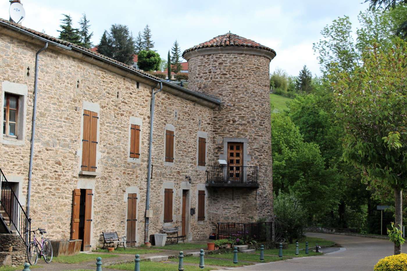
Chartreuse de Sainte-Croix en Jarez, Loire, France
Chartreuse de Sainte-Croix en Jarez, Loire, France · © VoyageForum

Key Facts

  • Type of place: department.
  • Location:
  • Local time: Heure : Loire
  • Department code: 42.
  • Bordering departments:
  • Sub-prefectures: Montbrison, Roanne.
  • Number of municipalities: 326.
  • Population: 757,305 inhabitants (2014).
  • Area: 4,781 km².
  • Density: 158 inhabitants/km².
  • Highest point: Pierre-sur-Haute (1,634 m).
  • Lowest point:
  • Coastline: 0 km, no maritime access.
  • Highlights (out of ): Nature ; Culture / ; Relaxation-holidays

Climate and Weather

Tourism

For its landscapes, hiking opportunities, and skiing, the Forez and the Pilat Natural Park are the department’s top attractions.
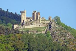
Sainte-Croix-en-Jarez Charterhouse

This is a beautiful religious complex from the 13th century in the village of the same name.

Overview of the monastery

This is a beautiful religious complex from the 13th century in the village of the same name.

  • Tourist interest: (worth a stop if you are in the area).

History of the monastery

What to see and do

Practical information

  • Location:
  • Address: Aux Portes, 42800 Sainte-Croix-en-Jarez.
  • Opening hours:
  • Price:
  • How to get there:

Nearby attractions

  1. == En complément
View guide page: Sainte-Croix-en-Jarez Charterhouse

Firminy

This town is best known for housing the largest number of works by the architect Le Corbusier, whose creations have been UNESCO-listed since 2016.

Overview of Firminy

This town is best known for housing the largest number of works by the architect Le Corbusier, whose creations have been UNESCO-listed since 2016.

Key Facts

  • Type of place: small town.
  • Tourist interest: (worth a stop if you are in the area).
  • Location:
  • Distances:
  • Local time: Heure : 19743.
  • Population: 16,931 inhabitants (2014).
  • Area: 10.45 km².
  • Altitude: from 446 to 800 m.

History of Firminy

What to See and Do in Firminy

In the Surrounding Area

Climate and Weather in Firminy

Transportation

Getting There

Getting Around

Accommodation

Dining

Useful Addresses

Further Information

View guide page: Firminy

Roanne

A sub-prefecture and one of the largest urban areas in the region, though not particularly touristy.

Overview of Roanne

It is a sub-prefecture and one of the largest urban areas in the region. However, it is not particularly touristy.

Key Facts

  • Type of place: small town.
  • Tourist interest: (worth a stop if you are in the area).
  • Location:
  • Distances:
  • Local time: Heure : 19744.
  • Population: 35,200 inhabitants (2014).
  • Area: 16.1 km².
  • Altitude: from 257 to 304 m.

History of Roanne

What to See and Do in Roanne

In the Surrounding Area

Climate and Weather in Roanne

Transportation

Getting There

Getting Around

Accommodation

Eating Out

Useful Addresses

Further Information

View guide page: Roanne

Saint-Étienne

Departmental prefecture, Saint-Étienne offers a more or less historic center. Introduction to Saint-Étienne Climate and Weather in Saint-Étienne What to See in Saint-Étienne Things to Do in Saint-Étienne Getting to Saint-Étienne Getting Around Saint-Étienne Sleeping and Eating in Saint-Étienne Living in Saint-Étienne

Additional Information

View guide page: Saint-Étienne

Introduction to Saint-Étienne

Overview of Saint-Étienne

Prefecture of the department, Saint-Étienne offers a more or less historic centre.

Key Facts

  • Type of place: large city.
  • Tourist interest: (worth a stop if you are in the area).
  • Location:
  • Distances:
  • Local time: Heure : 19745.
  • Population: 170,761 inhabitants and around 520,000 for the urban area (2014).
  • Area: 79.97 km².
  • Altitude: from 422 to 1,117 m.

History of Saint-Étienne

Useful Addresses

  • Tourist Office:

Services

  • Local agencies:
  • Banks:
  • Hospital:
  • Internet:
  • Laundries:
  • Vehicle rental:
  • Post office:
View guide page: Introduction to Saint-Étienne

Climate and Weather in Saint-Étienne

Climate Overview

Best Time to Visit Saint-Étienne

Jan.Feb.Mar.Apr.MayJun.Jul.Aug.Sep.Oct.Nov.Dec.
Climate

Climate and Forecast

Further Information

View guide page: Climate and Weather in Saint-Étienne

What to See in Saint-Étienne

Overview

Sites, Monuments, and Architectural Ensembles

Religious Buildings

Museums

Parks and Gardens

In the Surrounding Area

Some interesting sites to see around Saint-Étienne:

Château de Rochebaron, Haute-Loire, France
Rochebaron Castle
Perched on a rocky outcrop in the Monts du Forez, these are the remains of a medieval fortress dating from the 12th century.
Le Puy en Velay, Haute-Loire, France
Le Puy-en-Velay
It is the prefecture of Haute-Loire with an interesting city centre. However, Le Puy is best known as the starting point for one of the four main routes of the Way of St. James.
Lyon, Rhône, France
Lyon
The regional prefecture and France's third-largest city, Lyon is a pleasant and lively place. Among other things, it boasts a stunning historic centre, which is also a UNESCO World Heritage site.
Parc naturel régional du Pilat, Loire, France
Pilat Regional Nature Park
One of the oldest French parks, straddling the Loire and Rhône departments. Visitors come year-round to enjoy outdoor sports, including hiking and alpine or cross-country skiing in the "Haut Pilat Nordic Area" (42).

Additional Information

View guide page: What to See in Saint-Étienne

Getting to Saint-Étienne

By air

Since 2018, Saint-Étienne no longer has an airport open to commercial flights. It is now—and quite logically—the nearby Lyon (70 km away) that handles the city's air service.

By land

By bus

By train

Distances

View guide page: Getting to Saint-Étienne

Pilat Regional Nature Park

One of the oldest French parks, straddling the Loire and Rhône departments. Visitors come year-round to enjoy outdoor sports, including hiking and alpine or cross-country skiing in the "Haut Pilat Nordic Area" (42).

Overview of the park

One of the oldest French parks, straddling the Loire and Rhône departments. Visitors come year-round to enjoy outdoor sports, including hiking and alpine or cross-country skiing in the "Haut Pilat Nordic Area" (42).

Key facts

  • Tourist interest: (worth seeing).
  • Features:
  • Area: 700 km².
  • Altitude:

Environment

Landscape of the park

Wildlife and flora

Climate and weather

Precautions

What to see and do

Practical information

  • Location:
  • How to get there:
  • Distances:

Accommodation and dining

Nearby attractions

  1. == En complément
View guide page: Pilat Regional Nature Park

Chalmazel-Jeansagnière

A small commune northwest of Saint-Étienne in the Monts du Forez. While it’s also known for its castle, the main attraction is skiing.

Overview of Chalmazel-Jeansagnière

This is a small commune northwest of Saint-Étienne in the Monts du Forez. While it’s also known for its castle, the main draw is skiing.

Key details

  • Type of place: village.
  • Tourist interest: (worth a stop if you are in the area).
  • Location:
  • Distances:
  • Local time: Heure : 23413.
  • Population: 451 inhabitants (2016).
  • Area: 53.39 km²
  • Altitude: from 740 to 1,600 m.

History of Chalmazel-Jeansagnière

What to see and do

In the surrounding area

Climate and weather

Getting around

How to get there

Getting around

Where to stay

Where to eat

Useful addresses

  1. == Additional information
View guide page: Chalmazel-Jeansagnière

Something wrong or out of date? Report this page