last edited Dec 11, 2019
Overview of Ireland
Location Map of Ireland
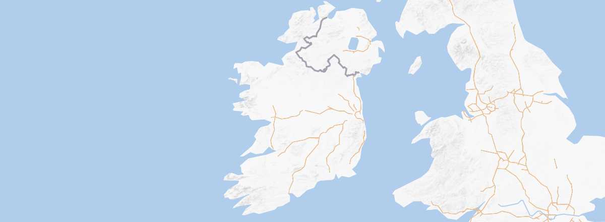 Ireland
Open the interactive map
Ireland
Open the interactive map
Quick Overview
Ireland (the island) is made up of the Republic of Ireland (Éire in Gaelic) in the south and Northern Ireland (sometimes incorrectly also called Ulster) in the north. The former is independent (and predominantly Catholic), while the latter is part of Great Britain (with a Protestant majority).
Despite its relatively modest size, the island boasts a diverse range of landscapes, including mountain ranges, moorlands, lakes, cliffs, and rugged coastlines—one of its main tourist attractions. For centuries, Ireland supplied emigrants to countries like the United States, but in recent decades, the territory has welcomed many migrants, particularly from Eastern Europe. This shift was driven by the country’s strong economic growth in the 1990s and 2000s, though this trend has since slowed, making Ireland less attractive in this regard...
Key Facts
- Type de lieu: country.
- Localisation: northwest of the European continent, in the North Atlantic.
- Latitude/longitude: 53.00' N, 8.00' W.
- Heure locale:
- Capitale: Dublin
- Nature de l'état: parliamentary democracy.
- Langues officielles: Gaelic and English.
- Monnaie: euro.
- Population: 5,068,050 inhabitants (2018).
- Superficie: 70,273 km².
- Densité: 72 inhabitants/km².
- Point le plus haut: Carrauntoohil (1,041 m).
- Point le plus bas: sea level.
- Littoral: 1,448 km.
- Conduite: on the left.
Tourism
With 11.2 million visitors in 2018, Ireland is one of Europe’s most visited countries, though short stays or extended weekends (particularly in Dublin) are increasingly replacing longer discovery trips.
Unsurprisingly, British visitors make up the largest group (40%), followed by Americans (many of Irish descent tracing their roots), Germans, and French. In 2015, 505,000 French visitors explored the country.
Travel Essentials
- Destination: for beginner travelers.
- By plane: France-Dublin for 90 €/230 round trip.
- Entry requirements: ID card or passport.
- Currency to bring: euros.
- Exchange rate:
- Daily "backpacker" budget: 45 € to 80 per person.
- Accommodation: camping and youth hostels, plus B&Bs occasionally.
- Getting around: car or bus + bike.
- Risks: none health-wise and very low security risks.
- Best time (climate/crowds/prices): from late April to early October, avoiding school holidays or long weekends—so primarily May-June and September-early October.
- Intérêts (out of ): Nature ; Adventure ; Culture ; Relaxation/Holidays
Addresses in France
- Tourist Office: available online for both the Republic of Ireland and Northern Ireland.
- Irish Cultural Centre: 5 rue des Irlandais, 75005 Paris. Tel.: +33 1 58 52 10 30.
Addresses in Belgium, Switzerland, and Quebec
Socio-Economic Statistics
- "Quality of life": 4/188 (2018 ranking)
- GDP per capita: $73,200 (2018)
- Average monthly income:
- Inflation: +0.3% (2017)
- "Official" unemployment: 6.7% (2017)
- Population below poverty line: 8.2% (2013)
- Life expectancy: 81 years (2018)
- Migration rate per 1,000 inhabitants: +4 (2017)
- Population growth: +1.11% (2018)
- Literacy rate: 100% (2019)
- Urban population: 63.2% (2018)
- Press freedom: 16/180 (2018 ranking)
- Political regime: democracy (6/167 in 2018)
Sources: World Bank, Human Development Indicators, RSF, The Economist, The World Factbook