Je voulais savoir si tu avais contacté les Dodson pour faire ton périple dans CBS. Que proposent-ils ? J'ai regardé aussi le tour d'Orionide au départ de Kanab, les horaires sont différents et c'est en petite voiture. Je suis encore perplexe.
Merci d'avance.
Bonjour,
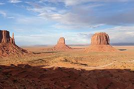
Oui, j'ai contacté et réservé une visite avec les Dodson. Je sais qu'on partira normalement fort tôt, mais la "voiture" dont parle Orionide ne me tente pas (chacun ses goûts). Les Dodson proposent de s'adapter à ton rythme, tes envies, et surtout à la météo. Donc il faut les recontacter la veille pour avoir les dernières possibilités. Tu peux toujours réserver et annuler ensuite (on ne paie qu'au moment même). Je te donnerai plus de renseignements après cette journée (dont j'attends beaucoup), mais si tu as d'autres questions avant, n'hésite pas. J'ai aussi réservé à nouveau chez Kens tour pour Antelope Canyon Lower... et je viens de réserver aussi une visite de Monument Valley (pour en voir un peu plus que l'an dernier).
mais la "voiture" dont parle Orionide ne me tente pas (chacun ses goûts).
c'est un ATV , donc effectivement ça remue, il n'y a pas de vitres et ça fait plus de bruit que dans un habitacle de voiture classique. C'est une conduite plus sportive, plus ludique mais bon je comprends que tout le monde n'aime pas mais je trouvais ça une alternative intéressante à la visite des lieux par la famille Dodson.
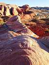
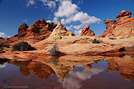
Bonjour Annaïck (je viens de t’écrire un long message et il s’est effacé… zut ; je recommence). Comme promis je viens te donner mon avis sur la visite avec les Dodson (faite hier). Je te conseille vraiment de réserver cette visite. Steve était notre guide, et nous étions seuls (mon mari et moi) avec lui. Nous avons eu beaucoup de chance avec la météo : soleil, nuages blancs, un peu de vent (donc pas trop chaud) et comme il avait beaucoup plu les jours précédents (plusieurs pistes sont fermées, plusieurs trails sont vraiment déconseillés), il y avait de l’eau dans les pot holes (joli pour les photos). J’avais eu le permis online pour CBS donc nous sommes allés à Cottonwood Cove. 2h de piste, puis 4h sur place (4.5km et beaucoup de photos), puis retour avec mini arrêt de 15 minutes à Paw Hole (donc nous n’avons vu que les « buttes »). Nous avons démarré de chez les Dodson à 7h (6h AZ time) et nous étions de retour à 14h (AZ time). J’ai trouvé que c’était intense et magnifique. Ce matin, par contre, j’ai relu quelques compte rendus et j’ai vu que plusieurs avaient fait Paw Hole plus longtemps et aussi White Pocket le même jour. Donc je ne sais pas pourquoi nous n’avons pas eu cette chance. Peut-être parce que la météo n’est vraiment pas belle pour le moment (orages tous les jours, parfois le matin, parfois l’après-midi). Donc, je te conseillerais de demander exactement ce qui est prévu dans la visite (combien de temps, quels endroits…). Si tu as d’autres questions, n’hésite pas. Je ferai peut-être un carnet plus tard avec plus de détails (et des photos). Ça se termine pour nous. Snif… Bons préparatifs.
Nous avons également visité Coyote Buttes South avec Steve Dodson. Nous y étions le 16 Juillet. Notre RV avait été fixé initialement à 6 h à Paria Oupost.
La veille, dans son mail, le guide nous a prévnus qu'il reportait le RV à 7 h, du fait qu'on venait de Page, Arizona.
Avant le voyage, dans mon mail de réservation, j'avais dit que nous souhaitions visiter CBS + White Pocket. C'était OK, mais on devait se contacter la veille afin que le guide confirme si la visite pouvait bien avoir lieu en fonction de la météo du jour.
Il n'avait pas plu les jours précédents, il n'y avait pas de problèmes pour la piste, la visite était confirmée
Nous avons visité Cottonwood Cove. Nous avons adoré, c'était absolument magnifique. Vous parlez d'eau dans les pot holes. Nous n'avons pas vu d'eau.
J'ai demandé à Steve si on allait ensuite à White Pocket. Il m'a répondu "non, parce qu'il fait trop chaud."
Après le pique-nique à l'ombre des arbres, près de la voiture, nous avons repris la piste. Nous sommes passés proche de Paw Hole, mais nous ne nous sommes pas arrêtés.
La veille, en fin d'après-midi, il faisait à peu près 43°c du côté de Marble Canyon. En plus, il y avait un vent chaud quand nous étions sur "Navajo Bridge".
Compte tenu du fait que la température augmentait dans l'après-midi, Steve Dodson a préféré annuler la visite de White Pocket.
Ce qui est prévu à la réservation n'est pas forcément maintenu. Cela dépend de la météo.
Merci Christine de ces précisions. Pour nous ce n'est pas la chaleur qui a joué, mais peut-être les pluies et l'orage qui pouvait arriver. Je trouve juste un peu dommage qu'on ne nous l'ait pas clairement dit. J'avais aussi bien demandé par mail avant et reconfirmé... Ceci dit, cela reste un merveilleux moment!
Merci Christine de ces précisions. Pour nous ce n'est pas la chaleur qui a joué, mais peut-être les pluies et l'orage qui pouvait arriver. Je trouve juste un peu dommage qu'on ne nous l'ait pas clairement dit. J'avais aussi bien demandé par mail avant et reconfirmé... Ceci dit, cela reste un merveilleux moment!
Pour nous aussi, la visite de Coyote Buttes South a été un merveilleux moment. Nous ne savions pas où donner de la tête, tellement c'était beau. J'ai fait presque 200 photos, et mon mari a dû en faire autant. Il y avait une belle luminosité et je suis contente des couleurs.
Lors d'un autre circuit, j'aimerais visiter White Pocket. Ce sera une bonne raison de revenir dans le coin. De toute manière, il y a de quoi faire dans la région, les merveilles ne manquent pas.
Oui, l'été, il y a des risques d'orages. Lors de ce road trip (du 24 juin au 20 juillet), nous n'en avons eu que deux :
- à Oatman et sur la route jusqu'à Kingman ;
- et un autre, qui était violent, avec des branches qui voltigeaient, en arrivant sur Phoenix.
Merci Christine pour les précisions concernant l'heure, maintenant je suis sûre de m'y retrouver😊.
J'ai une question à propos de l'eau, ça peut paraître bête mais comment tu gères la quantité d'eau que tu transportes, il y en a dans la voiture mais quand tu pars en randonnée, tu prends quoi?
Quand j'ai parlé de "camel bag " à mon mari il a légèrement "ricané".🤪... il faut dire qu'il déteste les sacs à dos, donc j'ai pensé à des bouteilles isothermes, c'est mieux que des bouteilles en plastique non?
Moi non plus je ne suis pas du tout habituée aux sacs à dos, j'ai un sac en bandoulière dans lequel je mets l'eau, l'appareil photo et les trucs habituels, donc c'est à portée de main, dans un sac à dos il faut sans arrêt le poser, chercher...... et pourtant je vois tout le monde avec un sac, j'imagine que pour grimper sur les rochers c'est plus facile😛.
Autre chose pour Zion, j'ai lu et imprimé des cartes concernant la balade d'Observation Point mais par le haut, celle qui est indiquée sur Joe's Guide to Zion National Park, je voudrais savoir si tu l'as déjà fait ou si tu connais quelqu'un qui l'a fait , savoir si c'est facile à trouver et à faire comme il le dit si bien.
J'ai hâte de lire ton carnet!!!
Pour l'eau, nous avons utilisé le système "camel bag", surtout pour les filles lors du circuit durant lequel elles avaient une dizaine d'années. Je souhaitais qu'elles boivent régulièrement sans avoir besoin de poser le sac à dos.
Maintenant, nous n'utilisons plus ce système, mais nous avons toujours un sac à dos. A l'intérieur, j'emporte ma gourde en aluminium, un nécessaire à pharmacie, une cape de pluie et, éventuellement, un sweat-shirt + un zoom de rechange pour les gros plans d'animaux ou de fleurs. Je porte mon appareil photo en bandoulière. Ma banane est autour de ma taille ou dans mon sac à dos.
Pour la quantité d'eau, cela dépend de la température et de la durée de la randonnée. A certains endroits, il y a des fontaines d'eau potable mises à la disposition des randonneurs. Et l'eau qui coule de la roche sur des sites naturels peut être buvable en cas de besoin.
Pour connaître la quantité d'eau, tu peux demander conseil aux rangers du Visitor Center.
Si tu ne souhaites pas emporter un sac à dos, tu pourrais mettre des bouteilles isothermes sur une ceinture.
Je relisais mes posts et je voulais savoir si en arrivant de Muir Woods on tombe sur l'embranchement qui mène à Conzelman Road, je voulais y aller à pied mais si on arrive par là en voiture autant le faire en arrivant, est-ce qu'il faut se contenter des deux points de vue qu'il y a
l'un après l'autre ou faut-il continuer jusqu'à Marin County?
Merci .
Bonxsoifr Annaick
Comme il est preferablde de fairfe Muir Woods tot a cause du stationnement, alors en revenant de Muir Woods, prenez la sortie juste avant de retraverser le GGB, restex bien a droite pour ne pas manquer la sortie.
Selon le moment de la journee, montez directement tout en haut de la colline la ou il y a les Bunkers. Faites les arrets en descendant ainsi vous n'avez pas besoin de traverser la route chaque fois. Les places cde stationnement sont tres militees, attention de ne pas stationner hors des endroits prevus.
Vouus pouvez bien sur stationner en bas dans le petit parking et monter a pied, 5 Kms aller retour🤪
Cordialement
Alex
http://durandale2.blogspot.com/
How heavy do I journey on the way,
When what I seek (my weary travel’s end)
Shakespeare sonnet 50, vers 1- 2.
J'ai repéré sur une carte et c'est ouvert le lundi mais jusqu'à 15H30, je ne sais pas si nous arriverons en temps et en heure, on peut faire la balade quand même.
Pendant que j'y suis, est-ce qu'il vaut mieux faire le trail Navajo Loop/ Queen Gardens dans ce sens ou dans l'autre, Thibaud sur son site dit qu'il vaut mieux le faire comme ça si on manque de souffle😕 mais dans la plupart des comptes rendus que je lis , les gens partent de Queen Gardens donc je ne sais plus trop🤪.
Quand je vois les feux qu'il y a sur la route , je me fais du souci.........j'espère que ce sera fini d'ici là, surtout pour les habitants .
Meme si on ne peux pas rentrer dans le phare, on peut aller jusqu'à l'entrée du tunnel qui y mene.
Ca fait une petite ballade tres sympa quand même.
Il y a aussi les points de vue de la battery Mandel, en allant sur le Nord.
Pour BRYCE, perso j'ai toujours fait dans le sens de la descente de NAVAJO pour finir par QUEENS...
C'est surtout parceque je trouve fabuleuse la descente de NAVAJO par Sunset point, qu'on apprecie plus en descendant qu'en montant.
C'est vrai aussi que la remontée est moins rude par Queens Garden.
Moi non plus je ne suis pas du tout habituée aux sacs à dos, j'ai un sac en bandoulière dans lequel je mets l'eau, l'appareil photo et les trucs habituels, donc c'est à portée de main, dans un sac à dos il faut sans arrêt le poser, chercher...... et pourtant je vois tout le monde avec un sac, j'imagine que pour grimper sur les rochers c'est plus facile😛.
Justement, c'est tout l'intérêt du camel bag, enfin de la poche à eau que tu mets dans le sac à dos.
ça te permet de boire très régulièrement à petites gorgées sans rien avoir à sortir de ton sac. Tu mets une poche de 3 litres et il en existe même de plus grandes. Et puis, le contenant est nettement plus léger qu'une gourde.
Bonjour Annaick,
A Bry ce canyon, si vous avez le temps faite le Peek-A-Boo trail.
Descendre d'un cote ou de l'autre, comme on dit chez-nous:
C'est six de l'un ou une demi douzaine de l'autre🤪
Cordialement
Alex
http://durandale2.blogspot.com/
How heavy do I journey on the way,
When what I seek (my weary travel’s end)
Shakespeare sonnet 50, vers 1- 2.
Comme je manque aussi de souffle, je me dis que je peux te faire part de mon expérience pour Bryce. Nous avons fait la descente dans l'amphithéâtre dans le sens Navajo Loop (et directement vers la droite à la première fourche, je n'avais rien lu à ce sujet) et remontée par Queen Garden, en allant vraiment doucement pour la remontée (ce n'est vraiment qu'à la fin que c'est difficile).
Pendant que j'y suis, est-ce qu'il vaut mieux faire le trail Navajo Loop/ Queen Gardens dans ce sens ou dans l'autre, Thibaud sur son site dit qu'il vaut mieux le faire comme ça si on manque de souffle😕 mais dans la plupart des comptes rendus que je lis , les gens partent de Queen Gardens donc je ne sais plus trop🤪.
Descendre d'un cote ou de l'autre, comme on dit chez-nous:
C'est six de l'un ou une demi douzaine de l'autre🤪
chez nous c'est plutôt bonnet blanc et blanc bonnet🙂 que deux hommes politiques ont popularisé dans la première moitié du XXème siècle…
mais il y a plein d'autres équivalents
et à propos de différences qui n'en sont pas vraiment et qui ne valent pas la peine que l'on se fâche ou même que l'on s'y étende trop longuement...les cinéphiles et les amoureux de la comédie musicale américaine et de son histoire se souviennent peut-être avoir vu le couple mythique Fred Astaire Ginger Rogers dans leur numéro de claquettes sur patins à roulettes sous le prétexte de prononciations divergentes :
Fred Astaire and Ginger Rogers - Let's Call The Whole Thing
un morceau d'anthologie !
pour les francophones les paroles sont là :
FRED ASTAIRE - LET'S CALL THE WHOLE THING OFF LYRI
Suite des "Rencontres insolites avec des grizzlys, chercheurs d'or et autres dans l'Ouest Américain" (26 février 2009)
Bonjour Jean-Paul,
Right on😎
Il en est de meme pour ceux qui coupent les cheveux en quatre (Hair Splitting)
les Americains disent plutot : Either que Either😕 et Neither plutot que Neither🤪
Les Anglais c'est le contraire😊😉
La sauce est en securite😏
Cordialement
Alex
http://durandale2.blogspot.com/
How heavy do I journey on the way,
When what I seek (my weary travel’s end)
Shakespeare sonnet 50, vers 1- 2.
Sommes de jeunes retraités habitués aux voyages et projetons un autotour aux grands parcs de l'ouest début octobre 08. Rien que du classique mais petites…
Voyager avec des enfants › États-Unis · 12 replies
Avec mon copain, nous prévoyons de partir avec notre fils de 18 mois, 15/ 20 jours faire un périple Boston-Nouvelle Angleterre puis une petite semaine à New…
Je me rends en Floride du 15 au 29 février 2020, Je suis donc preneuse de vous conseils de visites, de mises en garde, de conseils, de folies:) Par ailleurs,…
Nous partons cet été à 3 familles de quatre personnes aux USA et j’aurais voulu savoir si on peut louer et conduire un minibus de 15 places avec le permis B.…
Bonjour tout le monde, nous voici rentrés d'un RT USA organisé par nos soins du 31/07/2026 au 26/08/2026.
La destination : Le Sud-Ouest USA avec le Texas, l'Arizona et le Nouveau-Mexique. 7000 kilomètres effectués à la louche.
L'Auto : Une Chevrolet Equinoxe pour deux en passant par BSP Auto et Avis. Et dedans 2 valises, un sac de voyage, deux valises cabines, la glacière de chez Walmart, le matos photos et les bouteilles d'eau (pack de 40).
Le trajet : Dallas DFW, Fort Worth, Houston, Austin, San Antonio, Alpine, El Paso, Tucson, Sedona, Albuquerque, Amarillo et Dallas pour finir avec départ sur DFW.
Les voyageurs : Deux séniors bien avancés dans l'âge (73 et 75) mais toujours en activité (pas épuisante physiquement) (pour rester vivants et financer les voyages), autonomes physiquement à 100%, intellectuellement beaucoup moins, passionnés des USA, pays où tout est possible, plus marcheurs que randonneurs, plutôt hôtels à partir de 3 étoiles que motels de bord de route, plutôt restos Italiens que nourriture US, adeptes des arrêts fréquents pour les photos, plutôt musées que rien, Plutôt sieste que marches forcées. Pas trop râleurs, juste ce qu'il faut pour rester français au pays du grand Satan qu'ils disent.
Pas trés doués pour les langues, Anglais des rues (mais bien pratique), Espagnol nul pour moi hormis : " Hola ! Una Cerveza por Favor ! " Cela fait court. Madame comprend tout mais refuse de parler.
Le coût du RT : Environ 12 000 euros avec les vols AF, Auto, Essence, cadeaux, visites et tutti quanti. Bien maitrisé puisque 13500 euros prévus au départ.
Le bilan positif : Un régal avec les longues routes à perte de vue. Des Musées à découvrir. Le constat de la présence Hispanique et de son Histoire importante dans ce secteur de l'Amérique. Des locaux adorables. Des touristes plus ou moins sympas. Un accent Texan abominable et difficile à comprendre. Des stations Gas qui sont de véritables magasins avec nourriture préparée et autre alcools vendus en Arizona et Nouveau-Mexique et des employés au top ! Toujours prêts à rigoler !
Le bilan négatif : La chaleur tout au long du séjour...43° sur Dallas en fin de séjour. Impossible de sortir dans les rues. Beaucoup de "Homeless" dans les rues de l'Hyper Centre de Dallas. Les breakfasts Hôtel toujours les mêmes. On s'y fait.
Donc, positif certes mais le concept commence à fatiguer. Il se pourrait que le modèle RT autonome soit repensé pour le prochain. SI celui qui est en haut nous prête vie.
Pour la suite, attendons les premières photos triées et passées à la moulinette.
Hello! The itinerary is pretty much set for August 2026. Yeah, I know it’s gonna be *super* hot. But it’s the only time we can get away.
So, here’s the plan: Montpellier-CDG-Dallas.
Stay from July 31 to August 26, 2026:
Car rental – check,
Hotels – check,
Itinerary – almost check,
Photo gear – check,
Budget – check, 🤪
Meal planning – meh, we’ll see...
Walmart, of course, for the cooler when we arrive.
And now, without too much detail...
Fort Worth:
The Longhorns and the Stockyards;
JR’s ranch (for the missus);
Medal of Honor Museum – Arlington.
Houston and NASA Space Center:
See the Gulf of Mexico/America.
San Antonio and the missions.
Fort Stockton for an overnight stop.
El Paso via Guadalupe Mountains:
El Paso and White Sands.
Tucson and the Pima Air & Space Museum:
Tombstone, Bisbee.
Phoenix:
Still working on the program.
Sedona:
Round trip around the area via Flagstaff and Williams, or the Grand Canyon (already done) – we’ll decide on the spot.
Albuquerque:
Santa Fe,
Turquoise Trail,
Los Alamos.
Amarillo via Route 66:
Old Route 66 in the city;
Big Texas Ranch Steak 😏.
Dallas:
JFK Museum;
Perot Museum;
West End district.
And through it all – the road, the road, and more road!!!
We’ll adapt day by day based on our mental and physical state (we’re not exactly spring chickens).
Hello!
We’ll be arriving in Montreal on October 21st for a 3-day stay.
After that, we’re heading to Sherbrooke to visit our daughter, who’s studying at the university there. We’ll spend 3 days with her, and then, since she has a break that week, we’re taking her along for 3 days in Quebec City.
We’ve planned to visit Montmorency Falls and Île d'Orléans.
I’d love to hear what route you’d recommend for the drive from Sherbrooke to Quebec City—we’ll have the whole day to take it easy.
If you have any other recommendations, I’m all ears!
A little disappointed that the fall colors will be over by then, but the dates couldn’t be helped. Thanks in advance for your tips!
Hello everyone,
We’ve planned a trip (retired couple) for late August to the first half of September in Western Canada.
Classic itinerary: arrival in Calgary, Banff, Jasper, Clearwater, Whistler, Vancouver Island, departure from Vancouver.
I know you can’t see into the future any better than I can, so I’m obviously not asking what the wildfire situation will be like in a month...
But if any of you could let me know if, CURRENTLY, there are major difficulties—not just for locals, of course, but for tourists as well?
We’re hesitating between taking the chance or canceling what we still can.
We’re not young anymore and don’t have the flexibility we once did...
A thousand thanks to those of you on the ground or with contacts there who can help us make this decision!
A friend is renting a car for an upcoming trip during the All Saints' holiday.
Nowadays, all rental cars come with GPS, but do you know if you can use it without paying for the GPS rental? I have no idea since I always use my own!
After our first trip as a young couple to the West in 2007 (yes, that doesn’t make us any younger!), we’re planning to go back in 2028, but this time as a family of four! (We have two boys who’ll be 5½ and 13 years old in the summer of 2028.)
Our plan is to combine a few big cities (SF and LA, maybe San Diego) with national parks and state parks, mostly!
Ideally, we’d like to leave at the end of June and head back to France around July 19–20, so we can enjoy the first week of the Olympic Games in Los Angeles.
Since we already did the "loop" in 2007, there are must-see places we absolutely want to revisit—and especially share with our kids: Bryce Canyon, Yosemite, and above all, the Grand Canyon, which is still the most incredible thing I’ve ever seen on Earth!
On the other hand, some places didn’t leave a big impression on us for various reasons, so we’re not making them a priority: Antelope Canyon, Monument Valley, for example.
We’re planning ahead, but might as well be smart about it😏
Do you have any tips for a fun and doable itinerary over about 20–25 days with kids, without rushing?
We went as a family to Mount Rushmore in 2023, where my son bought a multi-function pocket knife like the one below with his name engraved—'NOAH'.
Unfortunately, he just lost it, and he was really attached to it. So, if there’s a kind soul passing by Mount Rushmore who could bring one back for me (I’d obviously cover all costs), that would be amazing for my son.
hi everyone
I’m planning a world trip and I’m looking for great tips on accommodation in the United States.
Do you have any good deals to share, please?
thanks
Hello everyone! Really damaged due to flooding caused by runoff after forest fires (a total mess!), does anyone in this friendly forum have any updates on the Apache Trail between Apache Junction and Roosevelt Dam? Is there still a section of the road that’s tough to navigate?
We're leaving at the end of June and will be driving the route between Buffalo and Cody. We’ve already booked our accommodations and a rodeo in Cody, but during the day, we’ll be driving between the two and I’m unsure about the itinerary.
Which route do you think is the most pleasant, interesting, or scenic between:
- The northern route via Highway 14 with Sheridan, Lowell, etc.
- The southern route with Highways 16/20/14, passing by Loaf Mountain Overlook, Powder River Pass, Ten Sleep Canyon...
We’ll be in a car, so we should be able to drive on any road.
Thanks for your input!
I’m almost done planning our September road trip. After our 3-night visit to Sequoia, we’ll have a stopover night in Coalinga (to break up the drive). We’ll be staying two nights in Monterey and would like to stop along the way to visit one side of Pinnacles National Park. We’re torn between the West entrance and the East entrance, and we’d like to do a short hike of no more than 2 hours since we don’t want to arrive too late in Monterey.
This park is split into two distinct zones with no connection between them, and the mileage from Coalinga to Monterey is pretty much the same for both. Which area do you recommend visiting—east or west? And which route is the most scenic?
I’ve spotted two short hikes:
- East: Moses Spring to Rim Trail Loop
- West: Balconies Cliffs Cave Loop
Has anyone been there, or do you have another hike to suggest?
Thanks in advance, and have a great afternoon!
Marcalamar 🙂
Hi everyone! 🙂
Just a quick question about King Canyon and Sequoia National Park.
Before our night in Miramonte, we plan to visit King Canyon. The next stop will be two nights in Three Rivers to explore Sequoia National Park. I wanted to go all the way to Roaring River Falls on the King Canyon Scenic Byway and then turn back to head to Miramonte. Since we’re coming from Oakhurst, Google Maps says it’s 300 km and 5 hours of driving. Since we also want to hike to see the sequoias (Big Stump Area and Grand Grove) before tackling the King Canyon Scenic Byway, the timing’s going to be tight. How far do you recommend going before turning back to miss as few points of interest as possible on the King Canyon Scenic Byway? Thanks for your advice, and have a great evening!
Marcalamar 🙂
Hi everyone!
After years of hoping, waiting, planning, then changing, saving, and searching for the best possible route... we're FINALLY off this summer for a 5-week road trip in the West.
I had planned a trip to Colorado in 2021 but canceled due to COVID, so with time passing and my eldest’s high school graduation approaching fast, I figured it was now or never!
Anyway, the itinerary has been modified and extended to please everyone (I’m no longer the only one making decisions!!)
Here’s our final route:
Day 1 - 7/12/2026 - Brussels / Los Angeles
Day 2 - 7/13/2026 - Los Angeles
Day 3 - 7/14/2026 - Los Angeles
Day 4 - 7/15/2026 - Los Angeles
Day 5 - 7/16/2026 - Los Angeles
Day 6 - 7/17/2026 - Los Angeles / Kingman
Day 7 - 7/18/2026 - Kingman / Grand Canyon
Day 8 - 7/19/2026 - Grand Canyon / Page
Day 9 - 7/20/2026 - Page
Day 10 - 7/21/2026 - Page / Monument Valley
Day 11 - 7/22/2026 - Monument Valley / Durango
Day 12 - 7/23/2026 - Durango
Day 13 - 7/24/2026 - Durango
Day 14 - 7/25/2026 - Durango
Day 15 - 7/26/2026 - Durango / Glenwood Springs
Day 16 - 7/27/2026 - Glenwood Springs
Day 17 - 7/28/2026 - Glenwood Springs / Moab
Day 18 - 7/29/2026 - Moab
Day 19 - 7/30/2026 - Moab
Day 20 - 7/31/2026 - Moab
Day 21 - 8/1/2026 - Moab
Day 22 - 8/2/2026 - Moab / Vernal
Day 23 - 8/3/2026 - Vernal / Grand Teton
Day 24 - 8/4/2026 - Grand Teton
Day 25 - 8/5/2026 - Grand Teton / Cody
Day 26 - 8/6/2026 - Cody / Yellowstone
Day 27 - 8/7/2026 - Yellowstone
Day 28 - 8/8/2026 - Yellowstone
Day 29 - 8/9/2026 - Yellowstone
Day 30 - 8/10/2026 - Yellowstone / Salt Lake City
Day 31 - 8/11/2026 - Salt Lake City / Bryce Canyon
Day 32 - 8/12/2026 - Bryce Canyon / Zion
Day 33 - 8/13/2026 - Zion
Day 34 - 8/14/2026 - Zion
Day 35 - 8/15/2026 - Zion / Las Vegas
Day 36 - 8/16/2026 - Las Vegas
Day 37 - 8/17/2026 - Las Vegas / Los Angeles
Day 38 - 8/18/2026 - Los Angeles
Day 39 - 8/19/2026 - Los Angeles / Brussels
Day 40 - 8/20/2026 - Brussels / Home
We’ll be alternating between house swaps, motels, and campgrounds. I’ve booked all the accommodations (except the campground at Bryce since sunset bookings open only 14 days in advance) and the first activities, as well as the most touristy ones.
I’m currently putting together my day-by-day roadbook and having some trouble planning certain days, like in LA or Las Vegas. Choosing hikes isn’t easy either—it’s tough to decide!
We’re really excited but could definitely use your help with choices and optimizations!!
Hello.
I’d like to travel along I-15N from San Diego to Las Vegas with my mom, who’s 67. We’ve explored Northern California and the California Coast over the past two years and now want to continue through the desert.
There are several attractions along the way:
- Mormon Rocks
- Desert Discovery Center and visit the Old Woman meteorite
- Joshua Tree National Park
- Mojave Desert
- Mojave National Preserve
- Anza-Borrego Desert State Park
- Silverwood Lake
My mom has back issues that prevent her from hiking or walking on trails with elevation changes. Is it possible to visit these places by car, or are the routes flat enough?
I’d love for her to experience the desert with an itinerary adapted to her condition. I’m also open to other points of interest that aren’t mentioned. We have 3-4 days for the trip, so we’re not in a rush—just want to explore.
I’d love to take a road trip and visit Nova Scotia. I’d appreciate some info on the best cities to see and the most interesting spots. The trip should last about 10 to 15 days, staying in hotels or motels. Thanks in advance!
We’re being relocated to Saint Pierre and Miquelon.
We’ll be taking the flight from Nantes to Montreal and then from Montreal to Saint Pierre.
Could you recommend a hotel near the departure terminal that allows dogs?
Hi,
My 16-year-old son is flying to Grand Rapids with other kids his age. There’s a layover in Detroit. There’s no unaccompanied minor service available. Is it pretty easy to navigate Detroit Airport to catch the connecting flight to Grand Rapids (domestic flight)? There are several of them who speak English well.
Thanks for your replies,
Good evening, everyone! 🙂
Just a few last questions to wrap up our Lake Tahoe visit plans.
**Parking:**
We’d like to walk to Eagle Falls and then Eagle Lake. I’ve spotted two parking lots that seem close to each other and give access to the trailhead. Where and how do we pay for entry to Emerald Bay State Park and Inspiration Point?
**Viewpoints on the East Side:**
Are most of the viewpoints (Balancing Rock, Granite Cave, Bonsai Rock, etc.) right by the road, or do you have to hike to reach them?
**Donner Memorial State Park:**
Is it worth making a detour to Truckee to visit this park and the Truckee historic downtown?
Hi there. I'm shocked by the price of the Upper Antelope Canyon tour—$175 for less than an hour… You might say, "if you can’t afford it…" But the real question is whether it’s really worth it, because $350 for two makes me feel like I’m getting ripped off. For those who’ve done both Lower and Upper, can you tell me if the price difference is really justified? Thanks
Hi everyone! 🙂
As you can see, we're heading back from September 6th to the 27th.
Everything’s booked for September—flights, accommodations, and the car. As I plan, I’ll be asking the experts for help. This is our second trip to California, but most of the stops are new to us.
We’ll start directly from San Francisco to our first overnight stop, Davis, before heading to Lassen Volcanic Park for 4 nights. Our flight lands at 12:50 PM.
Here’s our itinerary:
Day 1: Davis – overnight stop
Day 2: Red Bluff – exploring Lassen Volcanic Park (scenic drive to Lake Helen)
Day 3: Susanville – scenic drive through the park via the South Entrance, points of interest, and hikes
Day 4: Susanville – Cinder Cone and Painted Dunes hike
Day 5: Susanville – Warner Valley (hikes)
Day 6: South Lake Tahoe
Day 7: South Lake Tahoe
Day 8: Mammoth Lake
Day 9: Mammoth Lake
Day 10: El Portal via Tioga Road
Day 11: El Portal
Day 12: El Portal
Day 13: Oakhurst
Day 14: Miramonte
Day 15: Three Rivers
Day 16: Three Rivers
Day 17: Coalinga
Day 18: Monterey
Day 19: Monterey
Day 20: San Francisco
Day 21: San Francisco
Day 22: Departure
For hikes in Lassen Volcanic Park, I’ve planned:
Bumpass Hell, Cold Boiling Lake (Day 2)
Paradise Meadow (maybe not going all the way), Devastated Area, and the loop around Reflection and Manzanita Lakes (Day 3)
Cinder Cone and Painted Dunes (Day 4)
Devil’s Kitchen and Boiling Spring Lake (Day 5)
I’ve read there are trails to access the trailheads for Cinder Cone (11 km) and Warner Valley. Are these easy trails for an SUV?
Are there any other must-see spots or things we shouldn’t miss?
That’s where I’m at for now. Thanks for your replies, and have a great evening!
Marcalamar 🙂
I’m a total USA addict. I’ve already done several road trips, including the East Coast and West Coast.
I’m here today because I’m planning to go back for another road trip on the West Coast. Possibly with one of my sisters and a couple of friends. It’s still just a plan for now, but I’m working on an itinerary in the meantime. Ideally, I’d leave in 2026, but I don’t have the exact dates yet—maybe April-May or September-October.
My last trip to the West Coast was in September 2014. We went for 2 weeks, but this time it’d be 3 weeks. What made me want to go back was simply a colleague who just left today. As I’m writing this, he’s on the plane. I’m so happy for him, but now all I can think about is going back.
Since I recently went to NY, I noticed that prices have really gone up. I assume the same is true for the West Coast? For 2 people over 3 weeks, what budget should I expect? We’re the type to watch our spending and find great tips.
I think we’ll arrive in San Francisco like the first time and leave from either Los Angeles or Las Vegas.
Thanks for advising me on the booking—should I reserve a room in the hotel or go for a cabin for the best view?
Should I get breakfast or not?
What do you think of the restaurant?
Hello, if the off-the-beaten-path enthusiasts are still around 😉, I’d love some info on tackling these trails. I’m not super familiar with the rules, risks, or what to expect—I’m looking for firsthand experience from folks who’ve done it on their own once or multiple times.
Hi everyone!
I’m planning a week-long family trip to NYC in October 2026. The focus is on museums and soaking up the New York vibe. I’ve been checking Airbnb, but the prices in Manhattan are through the roof. Since I don’t know NYC well, is it "wise" to look outside Manhattan? Any neighborhoods you’d recommend?
After our first trip to the West, we’d love to go back to see other must-see spots!
The stay would be from May 11 to 20, 2026—it’s short, but hey...
M11: Lyon to Las Vegas (overnight in Vegas)
T12: Route 66 – overnight in Grand Canyon (GC)
W13: Visit GC – overnight in Page
Th14: Visit Antelope Canyon / Horseshoe Bend – overnight in Monument Valley (MV)
F15: Visit MV – overnight in Moab
Sa16: Visit Arches / Dead Horse Point – overnight in Bryce
Su17: Visit Bryce – overnight in Zion
M18: Visit Zion / Valley of Fire – overnight in Vegas
Tu19: Return flight
What do you think? Could we add one more night somewhere? We’re not big hikers, so we’ll mostly explore the parks using shuttles.
Also, we’re all set—passports are good. Do you think one classic Visa card and one premium Visa card will be enough for coverage?
Thanks so much for your feedback, and happy holidays!
Hi North America forum crew,
Just a little post that might interest some of you:
Travelers to the United States | Photo Now Mandatory Upon Entry and Exit | La Presse
I assume many of you already know, but the America the Beautiful annual pass, which was $80, will increase to $250 starting January 1, 2026.
So if you're planning to travel before the end of December 2026, it's in your best interest to buy your pass in December 2025, since it will still cost $80 and be valid until the end of December 2026 if you purchase it in December 2025.
This price increase only applies to non-U.S. residents.
Additionally, for those who planned to visit just one park, a $100 surcharge per person will apply to access a list of 11 national parks...
For example, if there are 4 of you in a car, you’ll have to pay $35 + $400,
which comes to $435 to visit one of the 11 parks on the list (I don’t have all of them... Bryce, Zion, Grand Canyon, Yellowstone, Grand Teton, etc.).
Total madness.
The goal is to push people who only visit one park into buying the annual pass.
Last point: free entry days are over for non-residents!