Biking (MTB) along the canal between the two seas (France)
Preamble: Since this is my first time traveling by bike with a GPS, here are my initial impressions, which will help understand how I’ll use it during the trip.
I was won over by the EVADEO GPS from the Institut Géographique National, which allows for road navigation and hiking. And I couldn’t resist the 2008 version, which has a BIKE mode. http://www.evadeo.fr/ However, I’ve been disappointed time and again. Maybe I’m too demanding, or is it my lack of experience? I admit it’s a technological marvel, but I expected to be more convinced: - Indoors (even in a car), the screen is readable, but as soon as you’re outside, you can’t see anything. Too bad you have to seek shade to check the info. So, I don’t see the point of getting a bike mount since the sun makes the screen unreadable (of course, I set the brightness to maximum). - First, let’s look up my town: Valence d’Agen (5,000 inhabitants). The Evadeo doesn’t know it. It only knows Valence 82, whereas Via Michelin, for example, does. Too bad, since there are enough towns named Valence that it should distinguish them by their full names. I hope the database doesn’t come from the IGN. - First guidance in PEDESTRIAN MODE IN THE CITY to the train station. Perfect—the street names display, and I arrive at my destination. However, the GPS doesn’t know about the pedestrian underpass under the railway (which has existed for years). This makes me think that in another city, I could end up taking a huge detour if the Evadeo only knows the roads. Confirmation: I want to go (on foot) from Sotteville-lès-Rouen to the city center of Rouen (rue du Gros Horloge). I start the GPS in the parking lot of a supermarket (I go in circles for a while so it can locate me), and there’s no route indication until I step onto the edge of a road. Then, the green line shows me the way. Does the Evadeo only know roads? Yet, for this route, it takes me through a pedestrian path? It’s true that it’s an old road (but I don’t think it’s by chance). - BIKE MODE: I want to go from Valence d’Agen to Moissac. It makes me take the N113 (sorry, now it’s a departmental road) when there’s a bike path parallel to it, just 300 meters away. Disastrous! Reassure me and tell me it’s not always like this. That it’s not a scam. That the bike mode isn’t just a car mode that avoids highways and also refuses to give routes for trips over 100 km. - Okay, I download the 1:25,000 maps of my area: No better. My house, which is 10 years old, isn’t on it. What’s the point of displaying "compilation 2006" if the data isn’t from that year? I try the HIKING mode. There’s no guidance. Too bad—when I reach a dead end (at someone’s private property) while I’m very close to my destination, it doesn’t tell me how to get there (this time, I must really be too demanding). So, I turn around. Of course, if I had stayed on the roads, I would have arrived (but what’s the point?). - To cheer myself up, I try ROAD NAVIGATION. I want to go to Piquepoule, a hamlet in Lot-et-Garonne. Impossible to enter it in the "Go to" function. The Evadeo doesn’t know it. Yet, it’s marked on my 1:200,000 paper map, and this hamlet is on the Evadeo’s base maps. I have to search for it by trial and error on the screen, moving, zooming, moving, zooming out… What’s the point of advertising a database of 1,700,000 place names? This time, I hope someone will tell me I don’t know how to use it and explain how to do it. I must say that I also find the user manual on the EVADEO Primo DVD really light...
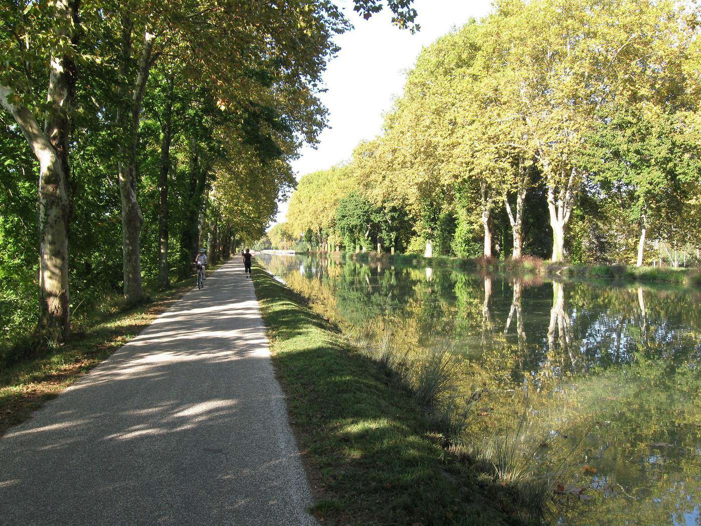
Monday, June 9, 2008 – Valence d’Agen 8:30 AM to Fourques sur Garonne 4:30 PM – 99 km I planned to follow the lateral canal to the Garonne until it flows into the river, then join the bike path from Sauveterre de Guyenne to Bordeaux, where I think I’ll make my second stop before finally reaching the Arcachon Basin and its many bike paths. The weather forecast predicts rain and low temperatures for the coming days, so I’m forced to bring appropriate clothing. I’m still surprised that my bike and its load weigh 30 kg, even though I’m not bringing a tent or sleeping bag. But I can’t go on an adventure without supplies (or water). I inflated my front tire to 2.5 bars and the rear to 2.8 for the best rolling/comfort compromise. I don’t recognize my MTB, which I use every day to go to work. Luckily, I’m not going to the mountains! After stopping at the Banque Postale ATM, I reach the canal where Valence d’Agen welcomes tourists to its marina. The towpath, now transformed into a bike path, is very smooth, and my cruising speed stabilizes at 20 km/h thanks to the macadam. Of course, that’s not the same as the average speed, which is closer to 12 due to breaks, route searches, or accommodation stops and meal breaks. Quickly, I see the cooling towers of the Golfech nuclear power plant: http://www.ville-golfech.fr/pageLibre00010811.html Only one releases a plume of steam that mixes with the clouds, the other electricity production unit being shut down for maintenance. After 10 km, the greenway changes banks. My first "dancing" climb onto the bridge reassures me about the good distribution of my load. A little further, I leave Tarn-et-Garonne for Lot-et-Garonne, thus leaving Midi-Pyrénées to enter Aquitaine. (Living on the border between two regions can cause some problems, for example, establishments that are close but depend on the Toulouse or Bordeaux academy have different school holiday periods. Annoying when you have children in school on both sides). My first stray dog is a German Shepherd. It also spotted me and decides to disappear into the tall grass. Is it to avoid me or to surprise me better? I speed up a little and don’t see it again. After only 20 km, my right knee hurts a bit. I’m not worried because this feeling usually goes away. Here’s the nautical stop at Montalembert, and I enjoy this pleasant spot for a moment under some hazy sun. Beds of poppies and other so-called wildflowers have been created. The signage for the "Tous à vélo" (Everyone on Bikes) event on June 6 and 7 hasn’t been removed. We’re in the town of Boé: http://www.ville-boe.fr/...ement/villedeau.html Residential and commercial area before Agen. Having been a victim of an ad, I decide to stop at DECATHLON to buy a cycling jersey and shorts on sale. I then have to lock my bike and leave the plastic bag (Go Sport) that I use to put clothes over my already full panniers in the locker. The shorts are really too heavy with their multiple layers of fabric for comfort, and I’m afraid I’ll be too hot in them. I settle for buying rain pants to replace my K-way pants, which are too short and I’ve been using for 20 years. I took advantage of my time in the fitting room to change into shorts, but as I come out, a few drops fall. Luckily, the sun will come back. Passing by the recycling center, I see a class of pre-teens all in fluorescent vests on a field trip. Maybe that’s what they call a "green class"! After this 12 km detour, I’m back on the canal. In any case, this break made my knee pain disappear. Here’s Agen and its basin, used today by a rowing club. Pleasant walk on its magnificent canal bridge spanning the Garonne. Pedestrians can then go back up the river and return to the city center via the footbridge reserved for them opposite the Passage d’Agen. Since Toulouse, the lateral canal to the Garonne (193 km) keeps getting closer to and farther from the river. But it’s in Agen that it crosses it for the only time. And it’s impressive to see boats navigating 10 meters above the Garonne using this 580-meter-long stone canal bridge: http://www.ot-agen.org/...isite_pont-canal.asp I pass the Agen lock and find myself in unknown territory. It’s the first time I’ve gone this far northwest, having been drawn to the southeast during my previous trips (or pushed by the wind—see Chapter 2, 09/2007). In fact, due to lack of signage, I take the wrong bank and find myself on a dirt path until the next bridge. It’s only after 40 km that I pass my first cyclist. I see more, but the greenway is not very busy at this time. Obviously, the chances of crossing paths are much greater than seeing a cyclist going in the same direction. I’d even say that the probability of seeing a bike going in the same direction at the same speed is zero. So here I am, riding at 23 km/h, protected by trees on both sides, when my hip starts to hurt. Like many people these days, it’s my right side that’s bothering me. I take advantage of a clearing to eat some cookies and the well-ripened Golden apple I brought. But it suffered from the trip. If I had been on a bus, I would have said the "bus bruised it," but here, it turned brown in my handlebar bag. I overlook the canal where some pleasure boats pass. I wonder how it was possible to tow boats with horses or oxen given the height difference and especially the presence of all these trees on the embankment. But the diameter of their trunks tells me they’re recent. Back on the path, I reach Buzet sur Baïse: http://www.albret-tourisme.com/...rticle.php?storyid=9 Crossroads of river navigation between the Canal, the Baïse, the Garonne, and the Lot. I was surprised not to have seen any cherries (many cherry trees are bare after the storms), but finally, I can taste a few, though I can’t reach the ripest ones. The sky darkens, and the cool wind makes me replace my shorts with my hiking pants. Ouch! I need my bike clip, but it’s at the bottom of a pannier (since I left in cycling gear). I improvise with a tall grass stem to avoid chain grease until the evening. This time, many cherries are within reach, but they’re just bigger than peas and tangy. They’re "guignes" or wild cherries that blackbirds love. Even if they’re a bit bitter, I enjoy them. I’ll have to reach my 75th km before a road bike passes me. I arrive in Lagruère, where the canal has come so close to the Garonne that it follows its shape. I ask at the Canal Café: http://www.linternaute.com/...-cafe-du-canal.shtml What pastries can they offer me? But since they don’t have any left, I enjoy a "dame blanche" (vanilla ice cream with chocolate sauce and whipped cream) on the terrace dock. Arriving at Pont sur Sable, I look for accommodation. I follow the sign to the Auberge la Mijotière. Although the gate is open, the establishment seems abandoned, and there’s no price displayed. I prefer not to know what’s cooking there. I go back to the canal and ask the hostess at the nautical base, who, although no longer supposed to act as the tourist office, directs me to a guest room in Fourques sur Garonne. A lady welcomes me with an accent I assume is English. She tells me her name is Fiona, her husband John, and that they’re Scots who have been living in France for 5 years (she teaches English, and they find living in France even better than vacationing here). I ask if Fiona is a Scottish name. "Yes, it comes from Gaelic and means blonde or beautiful," she adds, "I’m the other Fiona" (she’s brunette and not particularly pretty). A few minutes after me, a couple from Marseille arrives and will occupy the other guest room. On vacation heading to Brittany, they left the highway so the man wouldn’t miss the soccer match. France is playing at 6 PM in the European Cup. Decidedly, I’m being pursued. During my previous trip, it was the Rugby World Cup (see Chapter 2, 09/07). After the homemade kir, we share a meal with their English friends who have just welcomed their children from Canada, whom they picked up in Toulouse and brought in 5 days on their houseboat. Excellent dinner around duck magret or barbecue, dessert with homemade cherry liqueur and cinnamon. 12-year-old whisky just before the rain leads us to help Fiona clear the table (well, us French, because the others don’t seem bothered). I recommend it for the warm welcome and homemade cooking: http://www.fionas-bb.com/
Tuesday, June 10 – Fourques sur Garonne 9:00 AM to Sauveterre de Guyenne 5:00 PM – 62 km The rain stopped this morning, but the trees along the canal still drop a few big drops. And after just a few km, it starts raining. I’ll be able to try my poncho bought in Moissac (where so many pilgrims stop on the way to St Jacques de Compostelle). I try to cover the handlebars and the back of the saddle, but it’s not easy. Already, it gets caught on my odometer mount, causing a small hole. Luckily, the rain is very light, and I can remove it. I still decide to take shelter in Couthures sur Garonne to see the GENS DE GARONNE show. It features sets and filmed actors telling the life of the village. I can’t reveal all the tricks to keep the surprise, but I recommend going with your life jacket and holding on tight when the great flood of 1952 is retold, after the even more terrible one of 1930. By the way, it’s forbidden to leave the room during the show: http://www.gensdegaronne.com/.../i/gensdegaronne.pdf Unfortunately, at the end of the show, it’s raining harder, and I decide to wait at the Maison des Gens de Garonne while reading the Marianne weekly that a colleague gave me. An unexpected article by Matthieu Grimpet: "Welcome to the Ch’tis: an illusion, a memory that could turn into a nightmare: This film reinforces the French in the inner cages where they like to take refuge in bad weather. Denying reality, a national sport since Alésia. In whining, the French see kindness. In clichés, humor… In the vulgarity of tradition. In the union of anxieties, solidarity. In the bad French chewed by poorly fed welfare recipients, a centuries-old patois." Maybe a bit too critical? But I don’t regret having escaped the wave of over 10 million admissions. Yet, my wife and children went twice (the first time, the cinema was full). I have to wait until after 1 PM to be able to hit the road without rain. I want to return to the canal by the same path, but as soon as I leave the village, I realize I’ve taken the wrong turn. It’s time to turn on my GPS. I ask it to take me to Meilhan sur Garonne, the next town on the canal. I follow its directions but, thinking I recognize the canal behind the characteristic line of trees, I leave the road for a grassy path that leads me to the banks… of the Garonne. I turn around and follow the instructions. However, a little further, I understand that the GPS is going to make me take a detour to find a bridge. Seeing another tree-lined path, I take a road blocked by a concrete post lying across and, progressing through the mud, I find the expected bike path after the embankment. I think I see a seagull, which would predict bad weather on the Atlantic coast. But it’s a gray heron gliding above the canal. Here’s the first signpost on the greenway: Agen 72 km and Castets en Dorthe 15 km in my direction. I must have arrived in Gironde, the department of bike paths. But what surprises me is that it’s called D809. Maybe a way to make them known to GPS? I fear that the departmental designation might cause confusion and that a motorist might take it. In any case, it explains the differences in signage from one department to another. Yet, this greenway has national importance. Especially since, in the long term, it will connect Bordeaux to Sète. It would have been wise to standardize the signage. I pass the nautical stop at Fontet, where a "port" was created by digging a basin connected to the canal. I arrive in Castets en Dorthe and can finally see the end of the canal, which flows into the Garonne via two locks. A Voies Navigables de France employee manages the traffic lights and locks from his observation cabin. A pleasure boat arrives to access the canal. The lockage is long due to the significant elevation change. http://www.canal-du-midi.org/...stets_en_dorthe.aspx It’s 3 PM, and Fiona’s breakfast, though it kept me going until now, is now a distant memory. I eat 3 cereal bars, telling myself that my bike actually runs on biofuels. But you shouldn’t joke about that. The Swiss Jean Ziegler, former UN rapporteur, just declared, "Agrofuels are a crime against humanity," and in France, this crime pays. Since they’ve become competitive, they continue to receive subsidies while causing famine in the poorest countries. Not to mention deforestation (for example, in Indonesia) with massive fires to plant palm trees, from which oil is extracted for diesel. Since the greenway ends here, this is where I planned to start my GPS (it’s useless along the canal and doesn’t know bike paths). In BIKE mode, it shows me the shortest way to Sauveterre de Guyenne while avoiding major roads. With the sun, I can’t see the screen, so I put it in my handlebar bag and listen to the lady announcing, "In 100 meters, turn right," "At the roundabout, take the second exit." This avoids having to constantly unfold a map. Be careful—a simple jolt, and the voice can disappear with a simple press of the on/off button. I understand why phones require two buttons to unlock the keypad. From now on, I’ll put the GPS in the outer mesh pocket of the bag. I cross the Garonne, and at the second intersection where I’m supposed to go straight, the road is blocked for construction. This is starting badly. What should I do—turn right or left? No, on a bike, I can pass. I go along the construction site and then cross a railway crossing also blocked. Here I am in the middle of the vineyards, where workers are busy around the taut wires that will guide the growth and support the future bunches. But as I expected when leaving the valley, I have to climb a series of hills, and I don’t think the GPS takes altitude into account. Of course, descents follow the climbs, and this allows me to reach 46 km/h, but the hills are tough with the loaded MTB, and I miss the flatness of the towpath. I walk a few sections beside the bike, and to taunt me, a sign announces the Jalabert vineyard. Cleverly, the GPS makes me avoid major roads, and here I am at the entrance to Sauveterre de Guyenne, where I spot the start of the bike path I’ll take tomorrow. (A map is associated with this link to locate my route over 6 days) http://www.sauveterre-de-guyenne.com/...ction/3/62/lang, fr/ Very pretty Bastide in the Entre-deux-Mers vineyard. But it only has one hotel, which is full tonight. It’s at the tourist office that a very helpful young man (too bad he has smoker’s breath) finally, after several phone calls, finds me a guest room. However, I won’t be able to dine there. I have the choice between SuperU and Petit Casino for some shopping. For once, I choose the small one (that’s also what soft modes of transport are about: different behavior). A sesame seed baguette, a Caprice des Dieux, cookies, and BIO CASINO soy dessert, fruit nectar, and compote pouches from CASINO (the compote travels much better than fruit—that’s the only thing I forgot to bring). And here I am a bit more loaded. Luckily, the coordinates are indicated on the guesthouse brochure. For the first time, I’m going to enter a latitude and longitude to be guided: 44.6985249—I’m almost between the Equator and the Pole. This temperate climate latitude is particularly suitable for vineyards. - 0.0506830—I’m practically on the Greenwich meridian. But does this minus correspond to East or West longitude, which my GPS requires? I hesitate and try West. I visualize the route, which doesn’t take me to the right village. No, of course, progression goes from East to West like time zones. I enter 0.0506830 East longitude. And off I go! Another climb, then a small descent, and 3 km from Sauveterre, the GPS declares I’ve arrived. I still have to go 200 meters to reach the guesthouse: http://www.moulindestleger.com/pages/indexpag.html The owner is interested in my GPS experience because he’s just started his business and is part of the Vélo Entre Deux Mers label. For me, the small coordinate difference between GPS devices isn’t a problem. He gives me a brochure: tourist map of the Voie Verte Bordeaux-Toulouse (sorry, I couldn’t find an online link to show you a map. I don’t think one exists). His guesthouse is listed among the good bike addresses. "Finally, a map I can display in my room," I tell him. The only thing missing is the connection between Sauveterre and Fontet (on the canal), shown here as a dotted line. Maybe a Toulouse-Sète map will exist in a few years? For now, it doesn’t seem to be moving much on the southern side. It’s a charming house with a lovely park crossed by a stream. The green room (where I slept) is luxurious and must be very pleasant in hot weather. But it’s not recommended for people sensitive to humidity in cooler temperatures. After tasting cherries and raw broad beans from the garden at the hostess’s invitation—she enjoys them with salt—I was able to dine in the sun and receive the (daily) visit from the squirrel, which also enjoys cherries. Too bad I’m in the Bordeaux region and can’t enjoy a glass of wine with my cheese sandwich.
Wednesday, June 11 – Sauveterre de Guyenne 8:45 AM to Arès 5:00 PM After breakfast with my hosts (I still have some trouble with this polysemous word that can mean both the host and the guest) and a pleasant conversation, I join the bike path that leads to Bordeaux. Built about fifteen years ago on the route of an old railway line, the Roger Lapebie path: http://www.tourisme-gironde.fr/...yclable_latresne.asp is smooth and very well secured. At each intersection, a layout allows cyclists to yield and cross intersections in the best conditions. Conversely, at each property exit and even fields, residents are warned and must let bikes pass. Yet, apart from a few walkers with their dogs, the place isn’t very busy. It must be said that the day starts in the mist. Decidedly, this year, summer is taking its time. And I have to go 15 km to see my first bike and 25 km to cross several. Certainly, Bordeaux residents escaping to the countryside. As my odometer reaches 200 km, I arrive at the bike station in Créon: http://www.tourisme-creonnais.fr/index.php?id=50 It’s the first bike station in France. You can get your bike repaired or rent one. The Créon tourist office, located in the middle of the Roger Lapebie path (winner of the Tour in 1937), offers many activities around cycling. I chat for a moment with the hostess and congratulate Gironde as the ambassador of Vélo Entre Deux Mers. I mention that the accommodations along the path will become really interesting (for now, making a stop on a 50 km bike path?) when it’s connected to the canal path. She confirms that the budget has been approved. I quickly arrive in Lastresne, where the bike path ends. The Gare restaurant comes just in time at 11:50 AM—I won’t be late for lunch. Oh, I am! I go for a single dish: chicken supreme with langoustines and scallops. Only one raindrop will disturb my lunch on the terrace. My arrival in Bordeaux is less poetic with the truck traffic. It’s a bus that wins the prize for passing the closest to me. It’s hot, and as the sun comes out, I choose to hide in the shade of the alley formed between the NORAUTO store and KIABI to switch to shorts and a T-shirt. I follow the GPS directions, which allows me to cross Bordeaux calmly. Here I am on the Pont de Pierre, and the white facades lined up along the Garonne shine in the sun. It’s magnificent, and I approve of their UNESCO World Heritage classification. The metro I cross, which also uses the Pont de Pierre, doesn’t break the charm. It’s elegant and discreet thanks to ground-level power supply. No cables spoil the decor. The system was difficult to develop (because the voltage must only be established when the tram is present), but it’s a success: http://www.tramway-bordeaux.veoliaenvironnement.com/ However, since the tram has priority, other users have to wait a long time at the lights near the bridge. I reach the left bank and pass the busy shopping street St Catherine. I pass the General Council and the ice rink. My GPS turns what could have been a chore into a pleasant visit. Except when the noise drowns out its instructions. No panic—it recalculates the route and makes me take the next right, which is one-way except for bikes (it’s very clever). I’m even tempted to continue on the bike path I’m on. It invites me to turn to take the right direction (which forces me to cross a dividing hedge)—without it, I would have gone straight. Here’s Mérignac and its airport, which welcomes me with deafening noise, hundreds of liters of kerosene (untaxed http://lesverts.fr/article.php3?id_article=2319) turning into greenhouse gases. Further on is the military base where a magnificent fighter jet is displayed by the roadside. It must be a Mirage IV interceptor (I’m not an expert): http://fr.wikipedia.org/...:Mirage_IVP_-_CF.jpg 370,000 flight hours from 1964 to 2005 (I won’t brag about it). Here I am on the D106. I can turn off my GPS now—it’s straight ahead to Arès. I buy some cherries and enjoy them in the providential shade of a lone tree next to a chapel. The sun is at its zenith and starting to heat up. I power on my phone (it can sometimes be useful) and call the vacation center reception to make sure there’s room in one of my works council’s cottages. Arriving in St Jean d’Illac, the sun is still shining, but it’s raining. I ignore the shop fronts that could have offered me shelter, convinced it’s just a few drops. Strangely, the middle school is located in the middle of nowhere. An area where pines were cut down to build it in the middle of the pine forest. I get honked at violently by a truck. I understand there’s a bike path on the other side (for the students). But how do I get there? A ditch prevents me from accessing it. It’s filled with stagnant water. I walk along it for a while, then find a shallower spot where my wheels don’t sink too much into the mud. Effort for little reward: the path ends quickly. For its last 30 km, the D106 turns into a highway limited to 110 km/h. I’m not proud and ride on the far right of the pseudo emergency lane. I even doubt that this road is allowed for bikes. Yet, no signs prohibit them. Plus, the sky is very dark on the horizon. Luckily, I’ll escape the rain. I’ll only suffer a few splashes from cars on the still-wet road. I arrive at the vacation village just before the reception closes. I don’t take the time to settle into my cottage, put on my swimsuit, and head to the lagoon. Just then, a man who seems to have arrived by bike is putting on a wetsuit, goggles, and a swim cap. Contrast with me, arriving with my 50x30 cm beach towel. Even if it rained, the water doesn’t seem cold to me. It’s great to be able to swim in this seawater pool. Since the Arcachon Basin is very flat, it’s not uncommon for the water to recede very far. For kids, this avoids having to go to the Lacanau Ocean beach (with its dangers). Here, they can even try their first glide on Optimist sailboats. Amazing day where I was lucky to avoid the rain (while in Gers, for example, people suffered floods) and even got sunburned on my arms (luckily, I brought a sample packet of moisturizing cream). Well, it’s just a big hole in the sand filled with stagnant seawater with mud and algae, which can only be renewed at high tide through a trap. Equivalent systems are used for salt harvesting, fry farming, and samphire cultivation: http://pagesperso-orange.fr/algues/salicorne.htm After a good shower, I can enjoy the cooked meal service and the evening card game. One of the vacationers offered to play guitar and perform manouche jazz songs, and I won 3 hands of belote at this musical terrace. Strange—the couple I was playing against insisted that you can shuffle cards in belote. What’s certain is that after mixing, no one has a good hand. My partner, responsible for the entertainment, offers me to join the next day’s excursion since there’s still room on the bus. I hesitate because the weather is uncertain. I had planned to enjoy the bike paths along the coast through the pines to reach Soulac. Then take the ferry to cross the Gironde and continue to Saumur. Where we’re invited to a wedding the following weekend (the bike would have then returned on the car). But my wife dissuaded me. She prefers that we leave together with our 3 children. It must be said that we have to stay with the bride’s grandmother, whom we don’t know, and it’s better not to arrive in disarray. And then, it’s a bit the role of the mother-wife to bring the explorer-child-man back home.
Thursday, June 12 – 0 km by bike, 150 km by bus. With all the shutters closed, the day wakes me up well before the alarm, and this allows me to discover that the alarm function works even when my phone is off (I naively thought it had to be on). I can even write my postcards before leaving. Departure at 8 AM under the sun for this discovery of the Médoc. Gironde is our largest department. Of the 120,000 hectares devoted to vineyards, 12,000 are in the Médoc. It’s the territory of the most extensive appellation we’re going to discover. We’re very lucky because our guide lives in the village of Margaux, and one of her children works at Château Margaux. This first growth is so famous that many think they’ve drunk wine from this estate. But it’s unlikely because a bottle costs 200 € and up to 500 € for great years. Especially since 99.5% of the production goes to export. Yet, the prestige is a bit artificial because it dates from the classification organized for the 1855 Universal Exhibition and will never be questioned. Only one change was made to the great growths with the entry of Mouton-Rothschild in 5th position in 1973 (it had to have strong backing). In fact, you shouldn’t confuse the Margaux appellation with Château Margaux. For the former, we’ll discover the production of an artisanal growth. And even in this small estate covering only a small area, not all the harvest can claim the Margaux appellation. Only the vines rooted in gravel (pebbles torn from the Pyrenees and brought by the Garonne 2 million years ago) have the right. The nearby vineyard located in more clayey soil will have to settle for the Haut-Médoc appellation. We can appreciate the difference during the tasting generously accompanied by cheeses. For the latter, we’ll have to content ourselves with a view of the park and the château. (To be allowed to visit, it’s better to arrive by helicopter). Château Margaux is the first to have decided to bury its cellar (supposedly because of the risk of radioactivity). Under a superb lawn the size of a football field and under high surveillance rest the precious bottles. We drive through the vineyards, and I’m surprised that the estates are so close and numerous. A few hundred meters separate one château from another. Sometimes it’s a simple building, but often it’s magnificent châteaux with parks, and our guide knows all the names as well as those of the successive owners. Even for those who aren’t interested in wine, the visit is pleasant. Here’s the little Versailles, then the sumptuous gardens of one of the Rothschild châteaux. Here, a dozen gardeners work all year because the owner only wants to consume vegetables from his estate. This brings us to the lunch break in a village restaurant. Here, 100 to 200 people every noon (only the main dish is served at the table). You can recognize several bottling teams by their burgundy "bleus." It’s now that, with their trucks, they’ll do the bottling of the new vintage from estate to estate. After waiting in line and a hearty meal, we resume our visit. Many people are busy pruning the vines. It should be remembered that originally, it’s a vine, and it can grow 8 cm in 24 hours. You can enter the vineyards with machinery at any time of the year because the soil is very draining. This is important for the sugar content of the grapes, which shouldn’t be waterlogged. Moreover, it’s forbidden to water the vines. However, you can chaptalize the wine (add sugar before fermentation to increase the alcohol level) or, if it contains too much water, remove it by osmosis. We cross the railway line where the TGV (Train of the Great Vineyards) runs. Then we head towards the estuary to reach the Château de la Tour de By. Our visit starts outside. Here, as in other estates, a rosebush has been kept before each row of vines. It was the early warning system that would catch mildew first. When the rosebush was affected by the fungus, the vines had to be treated quickly. Divided into two groups of about twenty, we take the circular staircase to reach the top of the tower in the middle of the vineyard: http://www.la-tour-de-by.com/ It’s an old lighthouse, and we have a magnificent view of the Gironde. Here, the estuary is 12 km wide, and it’s impressive, a bit like the sea had phagocytized the Garonne. We see the dredger that works year-round to allow the largest ships to pass. We visit the cellar where this Cru Bourgeois is still aged in wooden vats. I spot bottles from 1959 in the cellar (my birth year, it’s true I’m getting older) and don’t dare ask the price. We finish with the tasting. This circuit ends with the visit to the "Noisetine du Médoc," a confectionery made of a hazelnut coated in a delicious caramelized syrup. Accompanied by a glass of wine, we taste the artisanal products presented by a playful hostess who tells us the story of her bosses’ small company. I buy a small bag of Noisetine that I can bring back by bike. It will weigh less in my panniers than a Château Margaux, which would have lightened my wallet much more. The return by bus is calm. The animator (my belote partner) takes care to call the cooked meal service to warn them we’ll be a bit late. But I’m not very hungry and will content myself with a composed salad. Screening of the excellent comedy "I Do" with Charlotte Gainsbourg and Alain Chabat on a giant screen. Too bad the bottom of the screen is hidden by the first spectators, but I don’t fail to thank my works council through the feedback form for the quality of my short stay.
Friday, June 13 – Arès 9:15 AM to Bazas 5:00 PM – 102 km No need for an alarm even if I can’t leave until after 9 AM when reception opens. In any case, I need to get busy packing everything on the bike, doing the dishes, and cleaning. Luckily, when I arrived, they gave me a dose of disinfectant detergent and a wipe (they’ve thought of everything). I quickly find the bike path along the Arcachon Basin. Inaugurated in 1988, it was built on the route of the old railway line. For its 20th anniversary, it’s carrying me well, but I suppose it’s been renovated. I have confirmation when I come across a section under widening work. Today, it’s the departmental road 802. It’s also one of the 4 paths to St Jacques de Compostelle. The one taken by Bretons, Normans, and English who landed in Soulac. I reach Andernos, where I get off my bike to cross the very busy market. I continue to Biganos, where I have to take the direction of Mios-Bazas. It’s easy to follow a bike path. But it gets complicated when two have to cross and there’s no signage. I go along the path that crosses Biganos several times (taking the opportunity to buy 250g of bigarreaux cherries), ask for help in vain, and finally take the road to Mios to, after passing under the Arcachon railway line, find a path reserved for bikes. But this path makes a 90° turn and seems to take me towards the Ocean when I want to go inland. In reality, the bike path makes a detour visible on the map at the level of Facture: http://www.tourisme-gironde.fr/...les_gironde_2008.pdf to go find a footbridge that crosses the A66. Arriving in Mios, the signs reappear. There are the bike paths of the Arcachon Basin, the one from Mios to Bazas, and between the two, it’s the path to nowhere! Here I am in the Landes and Gascogne Natural Park. I’m in the middle of the pines without a soul in sight for kilometers. Except for a brunette carrying her handbag on her left shoulder and her phone in her right hand, who seems to have stepped out of another setting. Then I see a primary school class enjoying the picnic of their bike outing. More unexpectedly, a 206 comes towards me straddling the pavement and the shoulder. It’s a young man asking if I’ve seen a girl who ran out of gas and is coming back along the path. I understand better and reassure him that he’ll find her in a few kilometers. Crossing a road, I see an old gas station turned into a video library fast-food. I’m in Salles on the road between Mios and Belin-Beliet. Since it’s noon, I think it’s a sign from fate and turn around to treat myself to a Landes kebab. No Arabic bread, fries, or lamb, but duck gizzards, salad, and a tomato-based sauce. I considered returning to Fiona’s but given my progress, I give up on that option. Here I am again in the middle of the pines. If the word "lande" today evokes the pine forest, originally it designated a deserted, unhealthy, and barren region except for the best-drained parts near watercourses. The stagnant waters in winter rotted everything that had managed to germinate there. It was only through the practice of slash-and-burn, burning the large heather and impenetrable gorse, that shepherds were able to conquer certain areas. It was with the arrival of the railway, which allowed the transport of stones non-existent in the region, that circulation routes could be created and the land drained. Maritime pines were then planted, used for building carpentry, parquet floors, mine timber, telegraph poles, packaging fiber, and papermaking. On this Friday the 13th, I think of all the gullible people (of which I’m sometimes one) who will participate in this voluntary tax that is the lottery. I don’t think it brings good luck because this time, I won’t escape the rain. I’ve already swapped my shorts and sandals for my hiking pants and sneakers, and soon I’ll put on the poncho or take shelter under an oak tree. But the big drops falling from the leaves make my bell ring. Further on, I cross 7 or 8 retirees who have put on their K-way (yellow: the preferred color of cyclists), and I seem to feel a spray of fine droplets, but it’s a cloud of midges hitting my hood. The storm isn’t far. I’m not very proud, and I count the seconds between the lightning and the thunder. Since the speed of light is 300,000 km/s, I see the lightning at the moment the bolt strikes. The speed of sound being 300 m/s, it reaches me after a few seconds. Each second adds 300 m to the distance separating me from the impact. Luckily, the storm isn’t very close, its intensity is low, and it’s moving away. In the end, I’m hardly wet when I arrive in Bazas. I discover this episcopal city that has preserved a medieval rampart on a Gallo-Roman foundation: http://www.ville-bazas.fr/hishisto.htm I spot a guest room above a restaurant at the entrance to the pedestrian street before going to the Tourist Office. "I’m looking for a place to sleep." "You want to go to the municipal accommodation," asks a young lady about to write my name in a register. "Ah, but you’re not a pilgrim, you don’t have a credencial (route book that gets stamped at each stage)." Too bad—I could have been lodged at a lower cost. Wanting to stay in the city center, I return to the Indigo restaurant: http://www.petitfute.com/...nt_DP033_14_171.html The owner gives me the keys to the room after allowing me to leave my bike in the hallway between the entrance and the stairs. I’ll only talk to him for less than 3 minutes in total. As you can see, the welcome can be very different from one guest room to another. It must be said that he’s a restaurateur, and I’ll find him in front of the stoves of his very nice establishment without him speaking to me more. Since it’s a waitress who will bring me my scallop salad and then my tarte tatin. The room is like the restaurant, and I even benefit from DTT, which is unusual for me. I happen to catch the report about the family traveling around the world to discover social innovations broadcast on France 5: http://www.reussirmavie.net/...-d-espoir-_a154.html Laurent and Marie-Hélène de Cherisey left for fourteen months with their five children to meet those who act for the planet and for people.
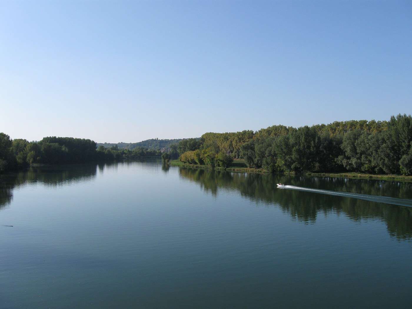
Saturday, June 14 – Bazas 8:15 AM to Valence d’Agen 6:00 PM – 131 km Not another word exchanged with my hosts, I prepare my own breakfast in an adjoining room. I understand why he talked to me about rusks. In fact, there are slices of toast and cookies that will accompany the tea. The fruits aren’t really in season: a pear eaten right away (it’s easier at the table) and an apple for the road. The advantage is that I slam the door (leaving the key) and leave early. Lots of freshness and humidity. The sky is crisscrossed with trails left by planes. That’s not a good sign for the weather. Indeed, at high altitude, it’s cold, down to -50°C, and the water vapor from the engines turns to ice. If this white line persists, it means the air is saturated with humidity, and it won’t be nice weather. We observe a similar phenomenon on the cooling towers of nuclear power plants. If the plume of steam rises quickly from the cooling tower, like swallowed by the sky, good weather is assured. If it struggles to come out, puffing, it’s bad weather. At the exit of Bazas, I decide not to follow the sign that invites motorists to go to La Réole. But to take the other departmental road that passes through Pondaurat and will make me cross fewer contour lines (on the map) to reach the canal. After all the same some climbs and more descents, I join in 1h15 and 21 km the lateral canal to the Garonne at Puybarban: http://city.zorgloob.com/...17&lib=PUYBARBAN This must be where they filmed Cohnare the Barbarian. No, it’s Conan the Barbarian. I cross the Gravilla bridge and find myself on the greenway at Kilometer Point 185.5. I’m 8 km past Castets en Dorthe (end of the canal). I’ll take advantage of the VNF plates indicating the KP on each bridge to validate my odometer. The totalizer indicates 400 km, and the path changes banks. Being in the shade, I appreciate my leggings and jersey (you’ve noticed I’m sensitive to the cold). But here’s the nautical stop at Fontet and its port bathed in sun. This deserves a break, especially since 3 plane trees offer me their fruit. It’s delicious. I make a young boy taste them, who doesn’t seem convinced. Here, the lawns, flowerbeds, and swimming basin invite river boaters or campers to enjoy the amenities. There’s even a laundry service that comes here. A poster for the blood donation barge that goes from town to town on the canal. The English at Fiona’s told me they moored next to it during their stop in Valence d’Agen. This makes me think that as soon as I have 458 €, I could return my Body Donation form to Medicine. That’s what the Toulouse Rangueil Faculty of Medicine asks to participate in operating costs. In the end, it’s cheaper than a burial. A small ad: Will exchange 12,000 m² land in a hamlet (31) worth 80,000 € for a riverboat! I leave this pleasant place and wonder where I put my sunglasses? Actually, I have them on my nose. To my right, the canal; to my left, the Garonne, which keeps its ochre color. I feel a deep calm brought by the slow flow of the waters. Finally, a cyclist with luggage—I’m no longer alone traveling on the greenway. At his pace, he looks foreign. Shorts, unbuttoned shirt, and helmet—he must be English. I consider riding with him, but several factors dissuade me: he’s young, less loaded, and has narrow tires. Especially, I need to take my third pee break. With the coolness and the fact that I drink, I stop every 10 km. I could be accused of potomania. A urologist has just denounced this trend that consists of saying you need to drink 1.5 liters of water a day. For him, the water provided by food is sufficient. This isn’t new. Twenty years ago, a colleague called us potomaniacs when, after a morning of work, we drank several glasses of water at lunch. Finally, I find him further on and decide to follow him at a distance. This forces me to ride between 23 and 25 km/h. I could keep this pace for 1 hour but not all day. And then it’s too fast to enjoy the environment: a coypu crossing the middle of the canal indifferent to our passage, a pretty boat with a paddle wheel, this magnificent Moët & Chandon barge. A little jewel on the water: http://www.moet-chandon.co.uk/...vial-magazine-fr.htm Luckily, he stops to consult a signpost; I start a conversation. He wants to stop in Agen, then Toulouse, then do the Canal du Midi, return to Bordeaux by train to go back to England, and only has 4 days. That’s what justifies his pace. I show him on my super brochure the route I’ve taken. He finds this map very good; he only has a road map. But I can’t give it to him—until now, I didn’t know it existed, and I don’t think I can get another one. I hesitate to offer him accommodation, but I don’t think my wife would appreciate it, especially since tonight my son is participating in a concert. He leaves me saying we’ll see each other again, but I doubt it.
In a side alley leading to a house, I see the backside of a woman squatting in front of an Alfa Romeo Spider. She and her husband see me. I avoid greeting them, but we exchange a smile that the sufficient distance between us allows. You have to relieve yourself of natural needs. Then a tractor equipped with a sweeper removes the leaves and branches that have fallen on the bike path. I won’t see that in Lot-et-Garonne or Tarn-et-Garonne. Further on, a beautiful weeder with a hand sprayer treats the paths next to a lock. Decidedly, the canal is getting beautiful for the arrival of summer. On this Saturday, tourists are increasing in number on board boats rented for the week and preparing their cruise. The diesel will be billed based on the number of hours the engines have run. I return to the Canal Café where the photos of bruschettas had caught my eye. It’s a large slice of toasted bread garnished like a pizza: http://www.goosto.fr/...zarella-10009160.htm I choose the one with three cheeses with a salad.
I find myself in Lot-et-Garonne, and the signs disappear. Not even a KP on the bridges. You wonder if it’s still Voies Navigables de France. Then Tarn-et-Garonne and only one sign: Leisure Base of St Nicolas de la Grave (at the confluence of the Tarn and the Garonne) and Moissac. And I arrive without incident at my home after 509 pleasant km. I now know that from Valence d’Agen, I can reach one of the two ends of the lateral canal to the Garonne (Castets en Dorthe or Toulouse) in one day. I can only invite you to enjoy this greenway. For a day, a weekend, or for the holidays. It doesn’t require any special skills; you just need to want to. Thanks to the regions and departments to which I will not fail to send my impressions. Apologies to hikers and joggers who regret no longer being able to tread the earth. My excuses to the IGN whose GPS was finally useful to me. Even if I still dream of a GPS with a second database including bike paths and pedestrian crossings.
I was won over by the EVADEO GPS from the Institut Géographique National, which allows for road navigation and hiking. And I couldn’t resist the 2008 version, which has a BIKE mode. http://www.evadeo.fr/ However, I’ve been disappointed time and again. Maybe I’m too demanding, or is it my lack of experience? I admit it’s a technological marvel, but I expected to be more convinced: - Indoors (even in a car), the screen is readable, but as soon as you’re outside, you can’t see anything. Too bad you have to seek shade to check the info. So, I don’t see the point of getting a bike mount since the sun makes the screen unreadable (of course, I set the brightness to maximum). - First, let’s look up my town: Valence d’Agen (5,000 inhabitants). The Evadeo doesn’t know it. It only knows Valence 82, whereas Via Michelin, for example, does. Too bad, since there are enough towns named Valence that it should distinguish them by their full names. I hope the database doesn’t come from the IGN. - First guidance in PEDESTRIAN MODE IN THE CITY to the train station. Perfect—the street names display, and I arrive at my destination. However, the GPS doesn’t know about the pedestrian underpass under the railway (which has existed for years). This makes me think that in another city, I could end up taking a huge detour if the Evadeo only knows the roads. Confirmation: I want to go (on foot) from Sotteville-lès-Rouen to the city center of Rouen (rue du Gros Horloge). I start the GPS in the parking lot of a supermarket (I go in circles for a while so it can locate me), and there’s no route indication until I step onto the edge of a road. Then, the green line shows me the way. Does the Evadeo only know roads? Yet, for this route, it takes me through a pedestrian path? It’s true that it’s an old road (but I don’t think it’s by chance). - BIKE MODE: I want to go from Valence d’Agen to Moissac. It makes me take the N113 (sorry, now it’s a departmental road) when there’s a bike path parallel to it, just 300 meters away. Disastrous! Reassure me and tell me it’s not always like this. That it’s not a scam. That the bike mode isn’t just a car mode that avoids highways and also refuses to give routes for trips over 100 km. - Okay, I download the 1:25,000 maps of my area: No better. My house, which is 10 years old, isn’t on it. What’s the point of displaying "compilation 2006" if the data isn’t from that year? I try the HIKING mode. There’s no guidance. Too bad—when I reach a dead end (at someone’s private property) while I’m very close to my destination, it doesn’t tell me how to get there (this time, I must really be too demanding). So, I turn around. Of course, if I had stayed on the roads, I would have arrived (but what’s the point?). - To cheer myself up, I try ROAD NAVIGATION. I want to go to Piquepoule, a hamlet in Lot-et-Garonne. Impossible to enter it in the "Go to" function. The Evadeo doesn’t know it. Yet, it’s marked on my 1:200,000 paper map, and this hamlet is on the Evadeo’s base maps. I have to search for it by trial and error on the screen, moving, zooming, moving, zooming out… What’s the point of advertising a database of 1,700,000 place names? This time, I hope someone will tell me I don’t know how to use it and explain how to do it. I must say that I also find the user manual on the EVADEO Primo DVD really light...
Monday, June 9, 2008 – Valence d’Agen 8:30 AM to Fourques sur Garonne 4:30 PM – 99 km I planned to follow the lateral canal to the Garonne until it flows into the river, then join the bike path from Sauveterre de Guyenne to Bordeaux, where I think I’ll make my second stop before finally reaching the Arcachon Basin and its many bike paths. The weather forecast predicts rain and low temperatures for the coming days, so I’m forced to bring appropriate clothing. I’m still surprised that my bike and its load weigh 30 kg, even though I’m not bringing a tent or sleeping bag. But I can’t go on an adventure without supplies (or water). I inflated my front tire to 2.5 bars and the rear to 2.8 for the best rolling/comfort compromise. I don’t recognize my MTB, which I use every day to go to work. Luckily, I’m not going to the mountains! After stopping at the Banque Postale ATM, I reach the canal where Valence d’Agen welcomes tourists to its marina. The towpath, now transformed into a bike path, is very smooth, and my cruising speed stabilizes at 20 km/h thanks to the macadam. Of course, that’s not the same as the average speed, which is closer to 12 due to breaks, route searches, or accommodation stops and meal breaks. Quickly, I see the cooling towers of the Golfech nuclear power plant: http://www.ville-golfech.fr/pageLibre00010811.html Only one releases a plume of steam that mixes with the clouds, the other electricity production unit being shut down for maintenance. After 10 km, the greenway changes banks. My first "dancing" climb onto the bridge reassures me about the good distribution of my load. A little further, I leave Tarn-et-Garonne for Lot-et-Garonne, thus leaving Midi-Pyrénées to enter Aquitaine. (Living on the border between two regions can cause some problems, for example, establishments that are close but depend on the Toulouse or Bordeaux academy have different school holiday periods. Annoying when you have children in school on both sides). My first stray dog is a German Shepherd. It also spotted me and decides to disappear into the tall grass. Is it to avoid me or to surprise me better? I speed up a little and don’t see it again. After only 20 km, my right knee hurts a bit. I’m not worried because this feeling usually goes away. Here’s the nautical stop at Montalembert, and I enjoy this pleasant spot for a moment under some hazy sun. Beds of poppies and other so-called wildflowers have been created. The signage for the "Tous à vélo" (Everyone on Bikes) event on June 6 and 7 hasn’t been removed. We’re in the town of Boé: http://www.ville-boe.fr/...ement/villedeau.html Residential and commercial area before Agen. Having been a victim of an ad, I decide to stop at DECATHLON to buy a cycling jersey and shorts on sale. I then have to lock my bike and leave the plastic bag (Go Sport) that I use to put clothes over my already full panniers in the locker. The shorts are really too heavy with their multiple layers of fabric for comfort, and I’m afraid I’ll be too hot in them. I settle for buying rain pants to replace my K-way pants, which are too short and I’ve been using for 20 years. I took advantage of my time in the fitting room to change into shorts, but as I come out, a few drops fall. Luckily, the sun will come back. Passing by the recycling center, I see a class of pre-teens all in fluorescent vests on a field trip. Maybe that’s what they call a "green class"! After this 12 km detour, I’m back on the canal. In any case, this break made my knee pain disappear. Here’s Agen and its basin, used today by a rowing club. Pleasant walk on its magnificent canal bridge spanning the Garonne. Pedestrians can then go back up the river and return to the city center via the footbridge reserved for them opposite the Passage d’Agen. Since Toulouse, the lateral canal to the Garonne (193 km) keeps getting closer to and farther from the river. But it’s in Agen that it crosses it for the only time. And it’s impressive to see boats navigating 10 meters above the Garonne using this 580-meter-long stone canal bridge: http://www.ot-agen.org/...isite_pont-canal.asp I pass the Agen lock and find myself in unknown territory. It’s the first time I’ve gone this far northwest, having been drawn to the southeast during my previous trips (or pushed by the wind—see Chapter 2, 09/2007). In fact, due to lack of signage, I take the wrong bank and find myself on a dirt path until the next bridge. It’s only after 40 km that I pass my first cyclist. I see more, but the greenway is not very busy at this time. Obviously, the chances of crossing paths are much greater than seeing a cyclist going in the same direction. I’d even say that the probability of seeing a bike going in the same direction at the same speed is zero. So here I am, riding at 23 km/h, protected by trees on both sides, when my hip starts to hurt. Like many people these days, it’s my right side that’s bothering me. I take advantage of a clearing to eat some cookies and the well-ripened Golden apple I brought. But it suffered from the trip. If I had been on a bus, I would have said the "bus bruised it," but here, it turned brown in my handlebar bag. I overlook the canal where some pleasure boats pass. I wonder how it was possible to tow boats with horses or oxen given the height difference and especially the presence of all these trees on the embankment. But the diameter of their trunks tells me they’re recent. Back on the path, I reach Buzet sur Baïse: http://www.albret-tourisme.com/...rticle.php?storyid=9 Crossroads of river navigation between the Canal, the Baïse, the Garonne, and the Lot. I was surprised not to have seen any cherries (many cherry trees are bare after the storms), but finally, I can taste a few, though I can’t reach the ripest ones. The sky darkens, and the cool wind makes me replace my shorts with my hiking pants. Ouch! I need my bike clip, but it’s at the bottom of a pannier (since I left in cycling gear). I improvise with a tall grass stem to avoid chain grease until the evening. This time, many cherries are within reach, but they’re just bigger than peas and tangy. They’re "guignes" or wild cherries that blackbirds love. Even if they’re a bit bitter, I enjoy them. I’ll have to reach my 75th km before a road bike passes me. I arrive in Lagruère, where the canal has come so close to the Garonne that it follows its shape. I ask at the Canal Café: http://www.linternaute.com/...-cafe-du-canal.shtml What pastries can they offer me? But since they don’t have any left, I enjoy a "dame blanche" (vanilla ice cream with chocolate sauce and whipped cream) on the terrace dock. Arriving at Pont sur Sable, I look for accommodation. I follow the sign to the Auberge la Mijotière. Although the gate is open, the establishment seems abandoned, and there’s no price displayed. I prefer not to know what’s cooking there. I go back to the canal and ask the hostess at the nautical base, who, although no longer supposed to act as the tourist office, directs me to a guest room in Fourques sur Garonne. A lady welcomes me with an accent I assume is English. She tells me her name is Fiona, her husband John, and that they’re Scots who have been living in France for 5 years (she teaches English, and they find living in France even better than vacationing here). I ask if Fiona is a Scottish name. "Yes, it comes from Gaelic and means blonde or beautiful," she adds, "I’m the other Fiona" (she’s brunette and not particularly pretty). A few minutes after me, a couple from Marseille arrives and will occupy the other guest room. On vacation heading to Brittany, they left the highway so the man wouldn’t miss the soccer match. France is playing at 6 PM in the European Cup. Decidedly, I’m being pursued. During my previous trip, it was the Rugby World Cup (see Chapter 2, 09/07). After the homemade kir, we share a meal with their English friends who have just welcomed their children from Canada, whom they picked up in Toulouse and brought in 5 days on their houseboat. Excellent dinner around duck magret or barbecue, dessert with homemade cherry liqueur and cinnamon. 12-year-old whisky just before the rain leads us to help Fiona clear the table (well, us French, because the others don’t seem bothered). I recommend it for the warm welcome and homemade cooking: http://www.fionas-bb.com/
Tuesday, June 10 – Fourques sur Garonne 9:00 AM to Sauveterre de Guyenne 5:00 PM – 62 km The rain stopped this morning, but the trees along the canal still drop a few big drops. And after just a few km, it starts raining. I’ll be able to try my poncho bought in Moissac (where so many pilgrims stop on the way to St Jacques de Compostelle). I try to cover the handlebars and the back of the saddle, but it’s not easy. Already, it gets caught on my odometer mount, causing a small hole. Luckily, the rain is very light, and I can remove it. I still decide to take shelter in Couthures sur Garonne to see the GENS DE GARONNE show. It features sets and filmed actors telling the life of the village. I can’t reveal all the tricks to keep the surprise, but I recommend going with your life jacket and holding on tight when the great flood of 1952 is retold, after the even more terrible one of 1930. By the way, it’s forbidden to leave the room during the show: http://www.gensdegaronne.com/.../i/gensdegaronne.pdf Unfortunately, at the end of the show, it’s raining harder, and I decide to wait at the Maison des Gens de Garonne while reading the Marianne weekly that a colleague gave me. An unexpected article by Matthieu Grimpet: "Welcome to the Ch’tis: an illusion, a memory that could turn into a nightmare: This film reinforces the French in the inner cages where they like to take refuge in bad weather. Denying reality, a national sport since Alésia. In whining, the French see kindness. In clichés, humor… In the vulgarity of tradition. In the union of anxieties, solidarity. In the bad French chewed by poorly fed welfare recipients, a centuries-old patois." Maybe a bit too critical? But I don’t regret having escaped the wave of over 10 million admissions. Yet, my wife and children went twice (the first time, the cinema was full). I have to wait until after 1 PM to be able to hit the road without rain. I want to return to the canal by the same path, but as soon as I leave the village, I realize I’ve taken the wrong turn. It’s time to turn on my GPS. I ask it to take me to Meilhan sur Garonne, the next town on the canal. I follow its directions but, thinking I recognize the canal behind the characteristic line of trees, I leave the road for a grassy path that leads me to the banks… of the Garonne. I turn around and follow the instructions. However, a little further, I understand that the GPS is going to make me take a detour to find a bridge. Seeing another tree-lined path, I take a road blocked by a concrete post lying across and, progressing through the mud, I find the expected bike path after the embankment. I think I see a seagull, which would predict bad weather on the Atlantic coast. But it’s a gray heron gliding above the canal. Here’s the first signpost on the greenway: Agen 72 km and Castets en Dorthe 15 km in my direction. I must have arrived in Gironde, the department of bike paths. But what surprises me is that it’s called D809. Maybe a way to make them known to GPS? I fear that the departmental designation might cause confusion and that a motorist might take it. In any case, it explains the differences in signage from one department to another. Yet, this greenway has national importance. Especially since, in the long term, it will connect Bordeaux to Sète. It would have been wise to standardize the signage. I pass the nautical stop at Fontet, where a "port" was created by digging a basin connected to the canal. I arrive in Castets en Dorthe and can finally see the end of the canal, which flows into the Garonne via two locks. A Voies Navigables de France employee manages the traffic lights and locks from his observation cabin. A pleasure boat arrives to access the canal. The lockage is long due to the significant elevation change. http://www.canal-du-midi.org/...stets_en_dorthe.aspx It’s 3 PM, and Fiona’s breakfast, though it kept me going until now, is now a distant memory. I eat 3 cereal bars, telling myself that my bike actually runs on biofuels. But you shouldn’t joke about that. The Swiss Jean Ziegler, former UN rapporteur, just declared, "Agrofuels are a crime against humanity," and in France, this crime pays. Since they’ve become competitive, they continue to receive subsidies while causing famine in the poorest countries. Not to mention deforestation (for example, in Indonesia) with massive fires to plant palm trees, from which oil is extracted for diesel. Since the greenway ends here, this is where I planned to start my GPS (it’s useless along the canal and doesn’t know bike paths). In BIKE mode, it shows me the shortest way to Sauveterre de Guyenne while avoiding major roads. With the sun, I can’t see the screen, so I put it in my handlebar bag and listen to the lady announcing, "In 100 meters, turn right," "At the roundabout, take the second exit." This avoids having to constantly unfold a map. Be careful—a simple jolt, and the voice can disappear with a simple press of the on/off button. I understand why phones require two buttons to unlock the keypad. From now on, I’ll put the GPS in the outer mesh pocket of the bag. I cross the Garonne, and at the second intersection where I’m supposed to go straight, the road is blocked for construction. This is starting badly. What should I do—turn right or left? No, on a bike, I can pass. I go along the construction site and then cross a railway crossing also blocked. Here I am in the middle of the vineyards, where workers are busy around the taut wires that will guide the growth and support the future bunches. But as I expected when leaving the valley, I have to climb a series of hills, and I don’t think the GPS takes altitude into account. Of course, descents follow the climbs, and this allows me to reach 46 km/h, but the hills are tough with the loaded MTB, and I miss the flatness of the towpath. I walk a few sections beside the bike, and to taunt me, a sign announces the Jalabert vineyard. Cleverly, the GPS makes me avoid major roads, and here I am at the entrance to Sauveterre de Guyenne, where I spot the start of the bike path I’ll take tomorrow. (A map is associated with this link to locate my route over 6 days) http://www.sauveterre-de-guyenne.com/...ction/3/62/lang, fr/ Very pretty Bastide in the Entre-deux-Mers vineyard. But it only has one hotel, which is full tonight. It’s at the tourist office that a very helpful young man (too bad he has smoker’s breath) finally, after several phone calls, finds me a guest room. However, I won’t be able to dine there. I have the choice between SuperU and Petit Casino for some shopping. For once, I choose the small one (that’s also what soft modes of transport are about: different behavior). A sesame seed baguette, a Caprice des Dieux, cookies, and BIO CASINO soy dessert, fruit nectar, and compote pouches from CASINO (the compote travels much better than fruit—that’s the only thing I forgot to bring). And here I am a bit more loaded. Luckily, the coordinates are indicated on the guesthouse brochure. For the first time, I’m going to enter a latitude and longitude to be guided: 44.6985249—I’m almost between the Equator and the Pole. This temperate climate latitude is particularly suitable for vineyards. - 0.0506830—I’m practically on the Greenwich meridian. But does this minus correspond to East or West longitude, which my GPS requires? I hesitate and try West. I visualize the route, which doesn’t take me to the right village. No, of course, progression goes from East to West like time zones. I enter 0.0506830 East longitude. And off I go! Another climb, then a small descent, and 3 km from Sauveterre, the GPS declares I’ve arrived. I still have to go 200 meters to reach the guesthouse: http://www.moulindestleger.com/pages/indexpag.html The owner is interested in my GPS experience because he’s just started his business and is part of the Vélo Entre Deux Mers label. For me, the small coordinate difference between GPS devices isn’t a problem. He gives me a brochure: tourist map of the Voie Verte Bordeaux-Toulouse (sorry, I couldn’t find an online link to show you a map. I don’t think one exists). His guesthouse is listed among the good bike addresses. "Finally, a map I can display in my room," I tell him. The only thing missing is the connection between Sauveterre and Fontet (on the canal), shown here as a dotted line. Maybe a Toulouse-Sète map will exist in a few years? For now, it doesn’t seem to be moving much on the southern side. It’s a charming house with a lovely park crossed by a stream. The green room (where I slept) is luxurious and must be very pleasant in hot weather. But it’s not recommended for people sensitive to humidity in cooler temperatures. After tasting cherries and raw broad beans from the garden at the hostess’s invitation—she enjoys them with salt—I was able to dine in the sun and receive the (daily) visit from the squirrel, which also enjoys cherries. Too bad I’m in the Bordeaux region and can’t enjoy a glass of wine with my cheese sandwich.
Wednesday, June 11 – Sauveterre de Guyenne 8:45 AM to Arès 5:00 PM After breakfast with my hosts (I still have some trouble with this polysemous word that can mean both the host and the guest) and a pleasant conversation, I join the bike path that leads to Bordeaux. Built about fifteen years ago on the route of an old railway line, the Roger Lapebie path: http://www.tourisme-gironde.fr/...yclable_latresne.asp is smooth and very well secured. At each intersection, a layout allows cyclists to yield and cross intersections in the best conditions. Conversely, at each property exit and even fields, residents are warned and must let bikes pass. Yet, apart from a few walkers with their dogs, the place isn’t very busy. It must be said that the day starts in the mist. Decidedly, this year, summer is taking its time. And I have to go 15 km to see my first bike and 25 km to cross several. Certainly, Bordeaux residents escaping to the countryside. As my odometer reaches 200 km, I arrive at the bike station in Créon: http://www.tourisme-creonnais.fr/index.php?id=50 It’s the first bike station in France. You can get your bike repaired or rent one. The Créon tourist office, located in the middle of the Roger Lapebie path (winner of the Tour in 1937), offers many activities around cycling. I chat for a moment with the hostess and congratulate Gironde as the ambassador of Vélo Entre Deux Mers. I mention that the accommodations along the path will become really interesting (for now, making a stop on a 50 km bike path?) when it’s connected to the canal path. She confirms that the budget has been approved. I quickly arrive in Lastresne, where the bike path ends. The Gare restaurant comes just in time at 11:50 AM—I won’t be late for lunch. Oh, I am! I go for a single dish: chicken supreme with langoustines and scallops. Only one raindrop will disturb my lunch on the terrace. My arrival in Bordeaux is less poetic with the truck traffic. It’s a bus that wins the prize for passing the closest to me. It’s hot, and as the sun comes out, I choose to hide in the shade of the alley formed between the NORAUTO store and KIABI to switch to shorts and a T-shirt. I follow the GPS directions, which allows me to cross Bordeaux calmly. Here I am on the Pont de Pierre, and the white facades lined up along the Garonne shine in the sun. It’s magnificent, and I approve of their UNESCO World Heritage classification. The metro I cross, which also uses the Pont de Pierre, doesn’t break the charm. It’s elegant and discreet thanks to ground-level power supply. No cables spoil the decor. The system was difficult to develop (because the voltage must only be established when the tram is present), but it’s a success: http://www.tramway-bordeaux.veoliaenvironnement.com/ However, since the tram has priority, other users have to wait a long time at the lights near the bridge. I reach the left bank and pass the busy shopping street St Catherine. I pass the General Council and the ice rink. My GPS turns what could have been a chore into a pleasant visit. Except when the noise drowns out its instructions. No panic—it recalculates the route and makes me take the next right, which is one-way except for bikes (it’s very clever). I’m even tempted to continue on the bike path I’m on. It invites me to turn to take the right direction (which forces me to cross a dividing hedge)—without it, I would have gone straight. Here’s Mérignac and its airport, which welcomes me with deafening noise, hundreds of liters of kerosene (untaxed http://lesverts.fr/article.php3?id_article=2319) turning into greenhouse gases. Further on is the military base where a magnificent fighter jet is displayed by the roadside. It must be a Mirage IV interceptor (I’m not an expert): http://fr.wikipedia.org/...:Mirage_IVP_-_CF.jpg 370,000 flight hours from 1964 to 2005 (I won’t brag about it). Here I am on the D106. I can turn off my GPS now—it’s straight ahead to Arès. I buy some cherries and enjoy them in the providential shade of a lone tree next to a chapel. The sun is at its zenith and starting to heat up. I power on my phone (it can sometimes be useful) and call the vacation center reception to make sure there’s room in one of my works council’s cottages. Arriving in St Jean d’Illac, the sun is still shining, but it’s raining. I ignore the shop fronts that could have offered me shelter, convinced it’s just a few drops. Strangely, the middle school is located in the middle of nowhere. An area where pines were cut down to build it in the middle of the pine forest. I get honked at violently by a truck. I understand there’s a bike path on the other side (for the students). But how do I get there? A ditch prevents me from accessing it. It’s filled with stagnant water. I walk along it for a while, then find a shallower spot where my wheels don’t sink too much into the mud. Effort for little reward: the path ends quickly. For its last 30 km, the D106 turns into a highway limited to 110 km/h. I’m not proud and ride on the far right of the pseudo emergency lane. I even doubt that this road is allowed for bikes. Yet, no signs prohibit them. Plus, the sky is very dark on the horizon. Luckily, I’ll escape the rain. I’ll only suffer a few splashes from cars on the still-wet road. I arrive at the vacation village just before the reception closes. I don’t take the time to settle into my cottage, put on my swimsuit, and head to the lagoon. Just then, a man who seems to have arrived by bike is putting on a wetsuit, goggles, and a swim cap. Contrast with me, arriving with my 50x30 cm beach towel. Even if it rained, the water doesn’t seem cold to me. It’s great to be able to swim in this seawater pool. Since the Arcachon Basin is very flat, it’s not uncommon for the water to recede very far. For kids, this avoids having to go to the Lacanau Ocean beach (with its dangers). Here, they can even try their first glide on Optimist sailboats. Amazing day where I was lucky to avoid the rain (while in Gers, for example, people suffered floods) and even got sunburned on my arms (luckily, I brought a sample packet of moisturizing cream). Well, it’s just a big hole in the sand filled with stagnant seawater with mud and algae, which can only be renewed at high tide through a trap. Equivalent systems are used for salt harvesting, fry farming, and samphire cultivation: http://pagesperso-orange.fr/algues/salicorne.htm After a good shower, I can enjoy the cooked meal service and the evening card game. One of the vacationers offered to play guitar and perform manouche jazz songs, and I won 3 hands of belote at this musical terrace. Strange—the couple I was playing against insisted that you can shuffle cards in belote. What’s certain is that after mixing, no one has a good hand. My partner, responsible for the entertainment, offers me to join the next day’s excursion since there’s still room on the bus. I hesitate because the weather is uncertain. I had planned to enjoy the bike paths along the coast through the pines to reach Soulac. Then take the ferry to cross the Gironde and continue to Saumur. Where we’re invited to a wedding the following weekend (the bike would have then returned on the car). But my wife dissuaded me. She prefers that we leave together with our 3 children. It must be said that we have to stay with the bride’s grandmother, whom we don’t know, and it’s better not to arrive in disarray. And then, it’s a bit the role of the mother-wife to bring the explorer-child-man back home.
Thursday, June 12 – 0 km by bike, 150 km by bus. With all the shutters closed, the day wakes me up well before the alarm, and this allows me to discover that the alarm function works even when my phone is off (I naively thought it had to be on). I can even write my postcards before leaving. Departure at 8 AM under the sun for this discovery of the Médoc. Gironde is our largest department. Of the 120,000 hectares devoted to vineyards, 12,000 are in the Médoc. It’s the territory of the most extensive appellation we’re going to discover. We’re very lucky because our guide lives in the village of Margaux, and one of her children works at Château Margaux. This first growth is so famous that many think they’ve drunk wine from this estate. But it’s unlikely because a bottle costs 200 € and up to 500 € for great years. Especially since 99.5% of the production goes to export. Yet, the prestige is a bit artificial because it dates from the classification organized for the 1855 Universal Exhibition and will never be questioned. Only one change was made to the great growths with the entry of Mouton-Rothschild in 5th position in 1973 (it had to have strong backing). In fact, you shouldn’t confuse the Margaux appellation with Château Margaux. For the former, we’ll discover the production of an artisanal growth. And even in this small estate covering only a small area, not all the harvest can claim the Margaux appellation. Only the vines rooted in gravel (pebbles torn from the Pyrenees and brought by the Garonne 2 million years ago) have the right. The nearby vineyard located in more clayey soil will have to settle for the Haut-Médoc appellation. We can appreciate the difference during the tasting generously accompanied by cheeses. For the latter, we’ll have to content ourselves with a view of the park and the château. (To be allowed to visit, it’s better to arrive by helicopter). Château Margaux is the first to have decided to bury its cellar (supposedly because of the risk of radioactivity). Under a superb lawn the size of a football field and under high surveillance rest the precious bottles. We drive through the vineyards, and I’m surprised that the estates are so close and numerous. A few hundred meters separate one château from another. Sometimes it’s a simple building, but often it’s magnificent châteaux with parks, and our guide knows all the names as well as those of the successive owners. Even for those who aren’t interested in wine, the visit is pleasant. Here’s the little Versailles, then the sumptuous gardens of one of the Rothschild châteaux. Here, a dozen gardeners work all year because the owner only wants to consume vegetables from his estate. This brings us to the lunch break in a village restaurant. Here, 100 to 200 people every noon (only the main dish is served at the table). You can recognize several bottling teams by their burgundy "bleus." It’s now that, with their trucks, they’ll do the bottling of the new vintage from estate to estate. After waiting in line and a hearty meal, we resume our visit. Many people are busy pruning the vines. It should be remembered that originally, it’s a vine, and it can grow 8 cm in 24 hours. You can enter the vineyards with machinery at any time of the year because the soil is very draining. This is important for the sugar content of the grapes, which shouldn’t be waterlogged. Moreover, it’s forbidden to water the vines. However, you can chaptalize the wine (add sugar before fermentation to increase the alcohol level) or, if it contains too much water, remove it by osmosis. We cross the railway line where the TGV (Train of the Great Vineyards) runs. Then we head towards the estuary to reach the Château de la Tour de By. Our visit starts outside. Here, as in other estates, a rosebush has been kept before each row of vines. It was the early warning system that would catch mildew first. When the rosebush was affected by the fungus, the vines had to be treated quickly. Divided into two groups of about twenty, we take the circular staircase to reach the top of the tower in the middle of the vineyard: http://www.la-tour-de-by.com/ It’s an old lighthouse, and we have a magnificent view of the Gironde. Here, the estuary is 12 km wide, and it’s impressive, a bit like the sea had phagocytized the Garonne. We see the dredger that works year-round to allow the largest ships to pass. We visit the cellar where this Cru Bourgeois is still aged in wooden vats. I spot bottles from 1959 in the cellar (my birth year, it’s true I’m getting older) and don’t dare ask the price. We finish with the tasting. This circuit ends with the visit to the "Noisetine du Médoc," a confectionery made of a hazelnut coated in a delicious caramelized syrup. Accompanied by a glass of wine, we taste the artisanal products presented by a playful hostess who tells us the story of her bosses’ small company. I buy a small bag of Noisetine that I can bring back by bike. It will weigh less in my panniers than a Château Margaux, which would have lightened my wallet much more. The return by bus is calm. The animator (my belote partner) takes care to call the cooked meal service to warn them we’ll be a bit late. But I’m not very hungry and will content myself with a composed salad. Screening of the excellent comedy "I Do" with Charlotte Gainsbourg and Alain Chabat on a giant screen. Too bad the bottom of the screen is hidden by the first spectators, but I don’t fail to thank my works council through the feedback form for the quality of my short stay.
Friday, June 13 – Arès 9:15 AM to Bazas 5:00 PM – 102 km No need for an alarm even if I can’t leave until after 9 AM when reception opens. In any case, I need to get busy packing everything on the bike, doing the dishes, and cleaning. Luckily, when I arrived, they gave me a dose of disinfectant detergent and a wipe (they’ve thought of everything). I quickly find the bike path along the Arcachon Basin. Inaugurated in 1988, it was built on the route of the old railway line. For its 20th anniversary, it’s carrying me well, but I suppose it’s been renovated. I have confirmation when I come across a section under widening work. Today, it’s the departmental road 802. It’s also one of the 4 paths to St Jacques de Compostelle. The one taken by Bretons, Normans, and English who landed in Soulac. I reach Andernos, where I get off my bike to cross the very busy market. I continue to Biganos, where I have to take the direction of Mios-Bazas. It’s easy to follow a bike path. But it gets complicated when two have to cross and there’s no signage. I go along the path that crosses Biganos several times (taking the opportunity to buy 250g of bigarreaux cherries), ask for help in vain, and finally take the road to Mios to, after passing under the Arcachon railway line, find a path reserved for bikes. But this path makes a 90° turn and seems to take me towards the Ocean when I want to go inland. In reality, the bike path makes a detour visible on the map at the level of Facture: http://www.tourisme-gironde.fr/...les_gironde_2008.pdf to go find a footbridge that crosses the A66. Arriving in Mios, the signs reappear. There are the bike paths of the Arcachon Basin, the one from Mios to Bazas, and between the two, it’s the path to nowhere! Here I am in the Landes and Gascogne Natural Park. I’m in the middle of the pines without a soul in sight for kilometers. Except for a brunette carrying her handbag on her left shoulder and her phone in her right hand, who seems to have stepped out of another setting. Then I see a primary school class enjoying the picnic of their bike outing. More unexpectedly, a 206 comes towards me straddling the pavement and the shoulder. It’s a young man asking if I’ve seen a girl who ran out of gas and is coming back along the path. I understand better and reassure him that he’ll find her in a few kilometers. Crossing a road, I see an old gas station turned into a video library fast-food. I’m in Salles on the road between Mios and Belin-Beliet. Since it’s noon, I think it’s a sign from fate and turn around to treat myself to a Landes kebab. No Arabic bread, fries, or lamb, but duck gizzards, salad, and a tomato-based sauce. I considered returning to Fiona’s but given my progress, I give up on that option. Here I am again in the middle of the pines. If the word "lande" today evokes the pine forest, originally it designated a deserted, unhealthy, and barren region except for the best-drained parts near watercourses. The stagnant waters in winter rotted everything that had managed to germinate there. It was only through the practice of slash-and-burn, burning the large heather and impenetrable gorse, that shepherds were able to conquer certain areas. It was with the arrival of the railway, which allowed the transport of stones non-existent in the region, that circulation routes could be created and the land drained. Maritime pines were then planted, used for building carpentry, parquet floors, mine timber, telegraph poles, packaging fiber, and papermaking. On this Friday the 13th, I think of all the gullible people (of which I’m sometimes one) who will participate in this voluntary tax that is the lottery. I don’t think it brings good luck because this time, I won’t escape the rain. I’ve already swapped my shorts and sandals for my hiking pants and sneakers, and soon I’ll put on the poncho or take shelter under an oak tree. But the big drops falling from the leaves make my bell ring. Further on, I cross 7 or 8 retirees who have put on their K-way (yellow: the preferred color of cyclists), and I seem to feel a spray of fine droplets, but it’s a cloud of midges hitting my hood. The storm isn’t far. I’m not very proud, and I count the seconds between the lightning and the thunder. Since the speed of light is 300,000 km/s, I see the lightning at the moment the bolt strikes. The speed of sound being 300 m/s, it reaches me after a few seconds. Each second adds 300 m to the distance separating me from the impact. Luckily, the storm isn’t very close, its intensity is low, and it’s moving away. In the end, I’m hardly wet when I arrive in Bazas. I discover this episcopal city that has preserved a medieval rampart on a Gallo-Roman foundation: http://www.ville-bazas.fr/hishisto.htm I spot a guest room above a restaurant at the entrance to the pedestrian street before going to the Tourist Office. "I’m looking for a place to sleep." "You want to go to the municipal accommodation," asks a young lady about to write my name in a register. "Ah, but you’re not a pilgrim, you don’t have a credencial (route book that gets stamped at each stage)." Too bad—I could have been lodged at a lower cost. Wanting to stay in the city center, I return to the Indigo restaurant: http://www.petitfute.com/...nt_DP033_14_171.html The owner gives me the keys to the room after allowing me to leave my bike in the hallway between the entrance and the stairs. I’ll only talk to him for less than 3 minutes in total. As you can see, the welcome can be very different from one guest room to another. It must be said that he’s a restaurateur, and I’ll find him in front of the stoves of his very nice establishment without him speaking to me more. Since it’s a waitress who will bring me my scallop salad and then my tarte tatin. The room is like the restaurant, and I even benefit from DTT, which is unusual for me. I happen to catch the report about the family traveling around the world to discover social innovations broadcast on France 5: http://www.reussirmavie.net/...-d-espoir-_a154.html Laurent and Marie-Hélène de Cherisey left for fourteen months with their five children to meet those who act for the planet and for people.
Saturday, June 14 – Bazas 8:15 AM to Valence d’Agen 6:00 PM – 131 km Not another word exchanged with my hosts, I prepare my own breakfast in an adjoining room. I understand why he talked to me about rusks. In fact, there are slices of toast and cookies that will accompany the tea. The fruits aren’t really in season: a pear eaten right away (it’s easier at the table) and an apple for the road. The advantage is that I slam the door (leaving the key) and leave early. Lots of freshness and humidity. The sky is crisscrossed with trails left by planes. That’s not a good sign for the weather. Indeed, at high altitude, it’s cold, down to -50°C, and the water vapor from the engines turns to ice. If this white line persists, it means the air is saturated with humidity, and it won’t be nice weather. We observe a similar phenomenon on the cooling towers of nuclear power plants. If the plume of steam rises quickly from the cooling tower, like swallowed by the sky, good weather is assured. If it struggles to come out, puffing, it’s bad weather. At the exit of Bazas, I decide not to follow the sign that invites motorists to go to La Réole. But to take the other departmental road that passes through Pondaurat and will make me cross fewer contour lines (on the map) to reach the canal. After all the same some climbs and more descents, I join in 1h15 and 21 km the lateral canal to the Garonne at Puybarban: http://city.zorgloob.com/...17&lib=PUYBARBAN This must be where they filmed Cohnare the Barbarian. No, it’s Conan the Barbarian. I cross the Gravilla bridge and find myself on the greenway at Kilometer Point 185.5. I’m 8 km past Castets en Dorthe (end of the canal). I’ll take advantage of the VNF plates indicating the KP on each bridge to validate my odometer. The totalizer indicates 400 km, and the path changes banks. Being in the shade, I appreciate my leggings and jersey (you’ve noticed I’m sensitive to the cold). But here’s the nautical stop at Fontet and its port bathed in sun. This deserves a break, especially since 3 plane trees offer me their fruit. It’s delicious. I make a young boy taste them, who doesn’t seem convinced. Here, the lawns, flowerbeds, and swimming basin invite river boaters or campers to enjoy the amenities. There’s even a laundry service that comes here. A poster for the blood donation barge that goes from town to town on the canal. The English at Fiona’s told me they moored next to it during their stop in Valence d’Agen. This makes me think that as soon as I have 458 €, I could return my Body Donation form to Medicine. That’s what the Toulouse Rangueil Faculty of Medicine asks to participate in operating costs. In the end, it’s cheaper than a burial. A small ad: Will exchange 12,000 m² land in a hamlet (31) worth 80,000 € for a riverboat! I leave this pleasant place and wonder where I put my sunglasses? Actually, I have them on my nose. To my right, the canal; to my left, the Garonne, which keeps its ochre color. I feel a deep calm brought by the slow flow of the waters. Finally, a cyclist with luggage—I’m no longer alone traveling on the greenway. At his pace, he looks foreign. Shorts, unbuttoned shirt, and helmet—he must be English. I consider riding with him, but several factors dissuade me: he’s young, less loaded, and has narrow tires. Especially, I need to take my third pee break. With the coolness and the fact that I drink, I stop every 10 km. I could be accused of potomania. A urologist has just denounced this trend that consists of saying you need to drink 1.5 liters of water a day. For him, the water provided by food is sufficient. This isn’t new. Twenty years ago, a colleague called us potomaniacs when, after a morning of work, we drank several glasses of water at lunch. Finally, I find him further on and decide to follow him at a distance. This forces me to ride between 23 and 25 km/h. I could keep this pace for 1 hour but not all day. And then it’s too fast to enjoy the environment: a coypu crossing the middle of the canal indifferent to our passage, a pretty boat with a paddle wheel, this magnificent Moët & Chandon barge. A little jewel on the water: http://www.moet-chandon.co.uk/...vial-magazine-fr.htm Luckily, he stops to consult a signpost; I start a conversation. He wants to stop in Agen, then Toulouse, then do the Canal du Midi, return to Bordeaux by train to go back to England, and only has 4 days. That’s what justifies his pace. I show him on my super brochure the route I’ve taken. He finds this map very good; he only has a road map. But I can’t give it to him—until now, I didn’t know it existed, and I don’t think I can get another one. I hesitate to offer him accommodation, but I don’t think my wife would appreciate it, especially since tonight my son is participating in a concert. He leaves me saying we’ll see each other again, but I doubt it.
In a side alley leading to a house, I see the backside of a woman squatting in front of an Alfa Romeo Spider. She and her husband see me. I avoid greeting them, but we exchange a smile that the sufficient distance between us allows. You have to relieve yourself of natural needs. Then a tractor equipped with a sweeper removes the leaves and branches that have fallen on the bike path. I won’t see that in Lot-et-Garonne or Tarn-et-Garonne. Further on, a beautiful weeder with a hand sprayer treats the paths next to a lock. Decidedly, the canal is getting beautiful for the arrival of summer. On this Saturday, tourists are increasing in number on board boats rented for the week and preparing their cruise. The diesel will be billed based on the number of hours the engines have run. I return to the Canal Café where the photos of bruschettas had caught my eye. It’s a large slice of toasted bread garnished like a pizza: http://www.goosto.fr/...zarella-10009160.htm I choose the one with three cheeses with a salad.
I find myself in Lot-et-Garonne, and the signs disappear. Not even a KP on the bridges. You wonder if it’s still Voies Navigables de France. Then Tarn-et-Garonne and only one sign: Leisure Base of St Nicolas de la Grave (at the confluence of the Tarn and the Garonne) and Moissac. And I arrive without incident at my home after 509 pleasant km. I now know that from Valence d’Agen, I can reach one of the two ends of the lateral canal to the Garonne (Castets en Dorthe or Toulouse) in one day. I can only invite you to enjoy this greenway. For a day, a weekend, or for the holidays. It doesn’t require any special skills; you just need to want to. Thanks to the regions and departments to which I will not fail to send my impressions. Apologies to hikers and joggers who regret no longer being able to tread the earth. My excuses to the IGN whose GPS was finally useful to me. Even if I still dream of a GPS with a second database including bike paths and pedestrian crossings.
 There’s this brochure you can pick up at tourist offices,
but no site lets you view it online.
I managed to scan it (not in color) and had the file hosted on MaBul.ORG: