Biking (MTB) along the Canal between the Two Seas (France)
FR

Translated into English.

Original post
FA
Why bike (MTB) along the canal between the Two Seas: the lateral canal of the Garonne from Bordeaux to Toulouse, and the Midi Canal from Toulouse to the Mediterranean?

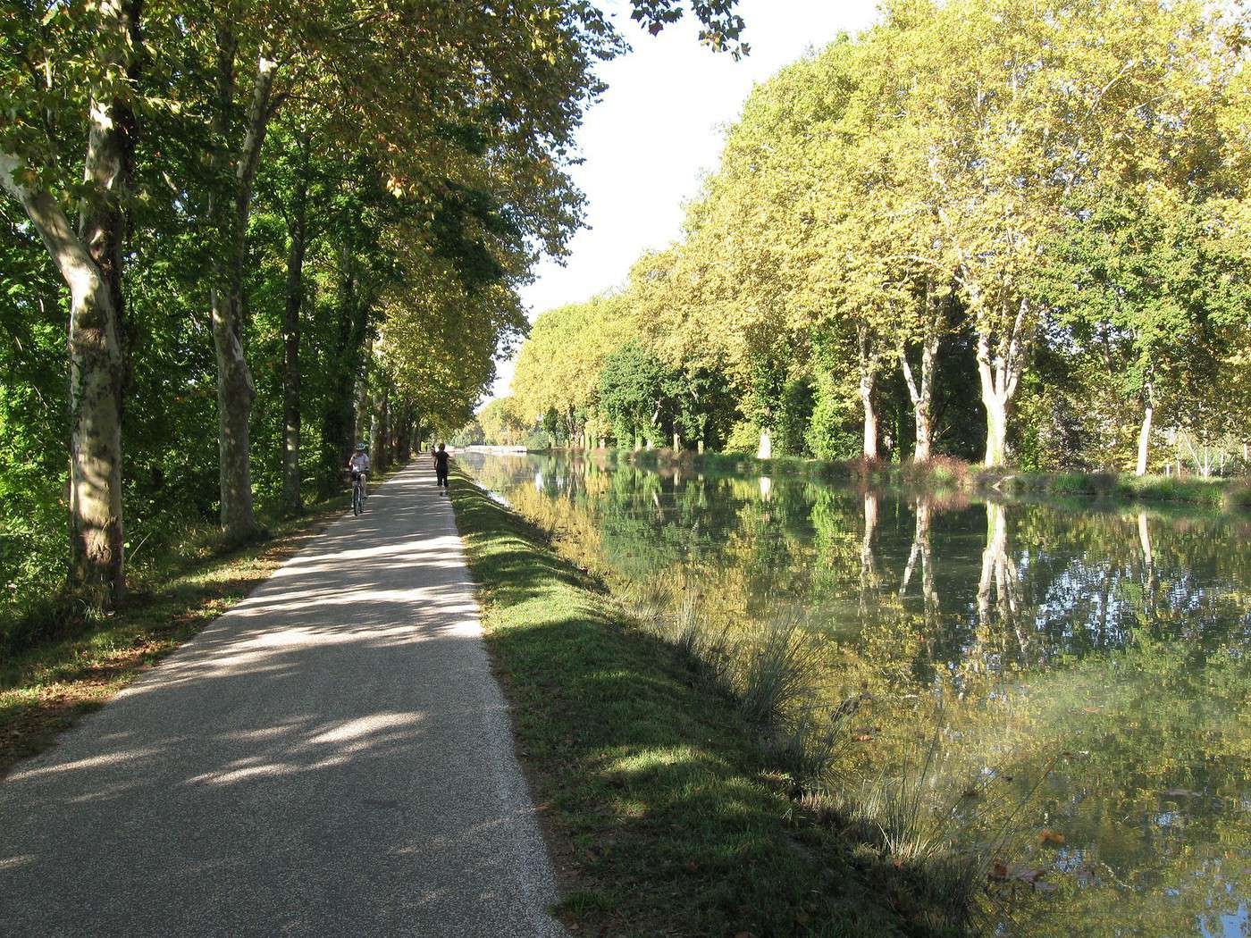
This canal was created to connect the Mediterranean to the Atlantic without going around Spain, and along its entire length, there’s an old towpath (used to pull barges). Since this path is closed to traffic (except for service vehicles from Voies Navigables de France), no cars drive on it—it’s dangerous, noisy, and polluting. The Canal between the Two Seas was built for transporting goods, so it passes through many towns you can explore without dealing with traffic. You can stock up on supplies or spend the night. You’ll discover the varied landscapes of the countryside, always in the serenity brought by the calm and slow flow of the canal’s water. Most of the time, you’ll be in the shade of trees planted to stabilize the banks with their roots. All you have to do is follow this blue—or rather green—ribbon without needing to consult a map. But the biggest advantage is that it’s flat! Of course, on the Canal du Midi, water flows from the watershed divide at Naurouze eastward to the Mediterranean and westward to Toulouse. On the lateral canal of the Garonne, water flows toward Bordeaux. But this slope is almost imperceptible, which is a huge plus when you want to travel by bike for several days with luggage.

When I say "bike," I really mean MTB because, while the towpath has been replaced in some places by a paved bike path, it mostly resembles a dirt trail—sometimes smooth, sometimes rocky, and often cluttered with roots from the magnificent trees lining it. Since the canal was classified as a UNESCO World Heritage site, improvements have been underway, but it won’t be tomorrow that you’ll be able to ride from Bordeaux to Sète on a road bike. And I’m afraid the first sections of the path will be worn out before the rest is finished. You might even run into construction work for this bike path. That’s what happened to me during the spring of 2007.

Sunday, 03/11 – Valence d'Agen 08:15 to Toulouse (Rangueil) 16:30 97 km in 8h15 (6h on the bike) I started on the recently paved path along the lateral canal of the Garonne. The first locks appeared, and as I approached Moissac, the path turned into a billiard table until Castelsarrasin. After the Cousteau port, I was back on the classic dirt towpath with its rocks, roots, and nutria holes. But not for long—soon, I hit ruts left by backhoes and bulldozers, which, fortunately, were resting for the Sunday. A pile of rubble taller than me blocked the entire width of the path. I didn’t want to turn back to find the previous bridge and ride on the other bank, which was just as impassable (dense grass). It wasn’t easy to carry a bike with full panniers, so I lifted it over several mounds. I kept going, sometimes on foot, unsure how far the construction extended. Another bulldozer—luckily, the ground was dry. The work went all the way to Montech, making the path impassable. I recommend taking the N113, which runs parallel (that’s what I did on the way back). In Montech, the famous water slope was at rest, waiting for tourists. For many kilometers, I was back on the traditional towpath. The closer I got to Toulouse, the better the surface became, and the more cyclists and pedestrians I saw—until the city center, where there was nonstop bike traffic, especially students heading to Rangueil.

Monday, 03/12 – Rangueil 09:10 to Revel 16:30 86 km in 7h20 (5h30 on the bike) As soon as you reach Toulouse, you make a 90° turn to follow the connection between the lateral canal and the Canal du Midi. Heading east, you pass the barge selling the famous Toulouse violet souvenirs. A real bike path has been built for 50 km to Port Lauragais. It’s a true joy for Toulousains and travelers. Restrooms have been installed or shared with highway rest areas, allowing you to refill water (of course, bikes are banned from ASF rest areas, but cleverly placed racks let you secure your bike and walk in). At Port Lauragais, it’s another rest area shared by highway users, cyclists, and boaters. You’ll find a cafeteria, restaurant, hotel, and a shop selling regional souvenirs. But the real pleasure is reaching the watershed divide at Naurouze, where water flows toward the Mediterranean on one side and the Atlantic on the other. There, I decided to leave the Canal du Midi, which continues toward Castelnaudary with a much rougher towpath, to follow the *Rigole* that feeds the canal with water from the Saint-Ferréol basin. For me, it was like returning to the source—a bit like a pilgrimage in honor of the brilliant Pierre-Paul Riquet, the designer of this magnificent work. I followed the service trail along the *Rigole*. It’s actually a variant of the GR 653, leading to Revel alongside this artificial waterway. It’s fed by water from the Montagne Noire, and I was worried about a steep climb. But that wasn’t the case—the *Rigole* winds for 40 km, flowing gently under the trees. It was better than a dream: a smooth dirt path with the crunch of pine needles under the wheels, where I only crossed paths with a few fishermen... And to soothe sore buns, the last kilometers were on packed earth—a paradise (ATVs, stay away!). More walkers and cyclists appeared there.

Tuesday, 03/13 After a restful night in Revel, I started the morning with a walk around Lake Saint-Ferréol. A very pleasant 10 km hike, but I don’t recommend it for mountain bikers unless you’re used to mountain terrain and have strong calves. Otherwise, you can take the road—there are at least two hotels near the lake. In the afternoon, I began the return trip to Tarn-et-Garonne via the same path, with the same pleasure.

Total: 378 km of suffering and bliss, for which I must thank the departmental and regional councils for their funding, Voies Navigables de France for maintenance, and the volunteers who mark the hiking trails. And don’t you think you’re exaggerating a bit with your 378 km of bliss and the paradise of the *Rigole*?

Okay, fine—it wasn’t always idyllic. Sometimes the path was downright *pierrique*... but I had great weather, and the landscapes were so beautiful (water, sun, vegetation). In the rain or mud, it would’ve been less fun. What does *pierrique* even mean?

*Pierrique* is worse than rocky. I know a Pierrick, and he’s tough. And why *Facteur4*?

It’s France’s goal to reduce greenhouse gas emissions by a factor of 4 by 2050. I’m doing my part by biking to work 3 out of 4 times. And your cassoulet?

Guilty as charged. I ate the best cassoulet of my life at the Hôtel du Midi in Revel. But it was very productive in methane. My stomach hurt so much I couldn’t sleep and ended up writing my postcards between 3 and 4 AM. So many great memories!
Facteur4 : Objectif pour 2050 de diviser par 4 l'émission de gaz à effet de serre.
FA Facteur4 Regular ·
Great news! The towpath between Valence d'Agen and Agen has been turned into a bike path. It's completely doable on a road bike, even a racing one. So much so that you can now go from Castelsarrasin to Agen—and even 25 km beyond—without leaving the pavement. Soon, the same will be true between Castelsarrasin and Montech. Thanks to the departments, regions, and European subsidies.
Facteur4 : Objectif pour 2050 de diviser par 4 l'émission de gaz à effet de serre.
MA MajusC00L Regular ·
I’ll join in the applause too!

I won’t get the chance to go back anytime soon, but last year I endured a muddy nightmare on that stretch and had to bail out near Golfech to reach Agen via the main highway.
Darryl -- https://twitter.com/Cycl0pathe
YA Yannick33 ·
Hi there!

I read your post with interest because I’m planning to ride the lateral canal and then the Canal du Midi, starting Monday, June 26. I’ve noted that a hybrid bike will be more suitable than my road bike... Could you tell me, for an average cyclist with panniers and a small backpack, what kind of pace you can expect along this canal? Does 80 km per day seem reasonable to aim for? Thanks in advance! Yannick
CH Christofen Regular ·
Hi there! We just got back yesterday from the canal. Actually, we only did the stretch from Seuil de Naurouze to Agde. Our average on the canal was around 50 miles/day. Make sure to inflate your tires well because of the plane tree roots, and expect to eat some mud. Small details: at Km 225 at the Livron structure, you can't pass by bike. 3 km before Agde, at the "danger no entry" sign, don’t insist—take a right onto a small paved road, keeping the canal on your left, and you’ll arrive in AGDE. Bring the book *Le Canal du Midi à Vélo* by Philippe Calas—it’s super handy for knowing which bank to take since nothing is marked, and especially for water points.
ou il y a une volonté, il y a un chemin.
FA Facteur4 Regular ·
It's always nice to know that the time spent writing up information is useful to others. 80 km a day seems doable if you've got a bit of training. Don't forget it's all flat and the bike path section has been extended. But for 80 km a day, you shouldn't be too loaded down. I could've suggested a stop in Valence d'Agen, but I might not be around. Personally, I wouldn't recommend a backpack. It makes you sweat from constant rubbing on your back. Instead, add a handlebar bag—it lets you load up the front a bit and avoids "wheelies."

Happy trails!
Facteur4 : Objectif pour 2050 de diviser par 4 l'émission de gaz à effet de serre.
YA Yannick33 ·
Hi there, and thanks so much for your reply! I’m actually starting from Hure (33) and taking the lateral canal of the Garonne. I was thinking of making my first stop in Agen—do you know of a nice, reasonably priced hotel in that city? After that, I plan to stop in Toulouse, then take it easier with stops in Castelnaudary, Trèbes, Capestang, and finally Sète. What do you think? Thanks again for your help! Yannick PS: I bought a really good book about biking the Canal du Midi...
FA Facteur4 Regular ·
This project seems viable to me. I don’t know much about the hotels in Agen since I don’t use them. Safe travels
Facteur4 : Objectif pour 2050 de diviser par 4 l'émission de gaz à effet de serre.
NA Nanou82 ·
Left from Toulouse and went as far as Carcassonne (106 km), then Capestang, and on the third day to Sète. Not much of interest between Béziers and Sète except for the arrival at the Étang de Thau, which is beautiful. But the path is paved from Béziers to Agde, then downright rough and ugly after that. On the other hand, a real pleasure from Toulouse to Béziers. I’m not too happy that the path is gradually being paved, and I hope they’ll just stick to the areas around the towns.

I’m reading your comments with interest because I’ll be biking from Montauban to Bordeaux soon.
RA Rando07 ·
Hi there, in May my wife and I spent 15 days cycling from Bordeaux to Toulouse to Sète. We don’t bike much during the year, we camped, and did stages of 50 to 65 km/day. Pure bliss. And as mentioned above, while it’s nice to ride on pavement, we much prefer dirt trails—even if the grass is a bit tall sometimes and roots block the path. It’s less monotonous. We preferred the Canal du Midi over the Canal de Garonne. We also ate a delicious cassoulet in Castelnaudary that was so well digested that we cycled 40 km after lunch that day just to work it off! We mostly ride along towpaths, and France alone has plenty to keep us busy. Happy cycling to everyone!
l'ardéchois
SY Sylvania ·
Hi, We’d like to bike from Bordeaux to Toulouse along the towpath (Latresne - Cambes - Cadillac - St Macaire). Can anyone tell me if it’s bike-friendly? Especially the stretch between Latresne and La Réole.

Thanks
OF OFamily ·
Hello, We’d like to cycle from Bordeaux to Toulouse following the towpath (Latresne - Cambes - Cadillac - Saint-Macaire). Can anyone tell me if it’s bikeable? Especially the stretch between Latresne and La Réole.

Thanks

I know the area along the Garonne between Latresne and Langoiran a little, and I’m afraid there are only bits of paths, poorly maintained and really hard to follow. Doesn’t seem like a great idea to start from Bordeaux :(
MA Mapu ·
Honestly, I really enjoyed your account of the canal. I'm no pro, far from it, but I've got this itch to just take off with my bike, get a good breath of fresh air, and reading your story just makes me even more excited about my plan. I'm short on time and money, but I managed to put together a little 3-day trip (better things to come) between Toulouse and Millau. I'm slowly getting equipped—I couldn't tell you the brand, price, weight of my derailleur, saddle, panniers, or the captain's age. But hey, just looking at the maps, the accommodation options (mostly camping), the greenways, and the quiet back roads with hardly any cars, I'm already off in my own world.
LA Lamoskita Regular ·
some rideable sections also between Podensac and Barsac and between St-Macaire and St-Pierre-d'Aurillac

then from Castets-en-Dorthe it's better to follow the canal—the route is clearer. However, don’t hesitate to take a detour to Barie on the Garonne side
FA Facteur4 Regular ·
Hi, I haven’t done it yet and I don’t know the area, but it’s on my to-do list. There’s a greenway between Créon and Sauveterre-de-Guyenne. Maybe even closer to Bordeaux: http://troisv.amis-nature.org/spip.php?article19 http://www.mairie-creon.fr/unevievelo2007.pdf That could be a good option starting from Bordeaux. After the Roger Labèpie greenway in Sauveterre, take the departmental road to Castets-en-Dorthe to start the lateral canal to the Garonne all the way to Toulouse. If you do it, let me know—I’d like to do it in the opposite direction in September.
Facteur4 : Objectif pour 2050 de diviser par 4 l'émission de gaz à effet de serre.
FA Facteur4 Regular ·
In July, I stayed in Portiragnes and took the opportunity to ride part of the canal by mountain bike. From Portiragnes to Béziers, there’s a real bike path that lets you cover 17 km to reach the hometown of the brilliant Pierre-Paul Riquet. Then, by crossing the Béziers canal bridge, where the canal overlooks the Orb, you arrive at the impressive Fonserannes Seven Locks. It takes 5 minutes to walk alongside them, 2 minutes by bike, and up to an hour to pass through them by boat in the best-case scenario.

In the opposite direction, there’s a 15 km dirt path that takes you from Portiragnes to Agde, where you’ll discover the surprising Libron structure. After that, to continue toward Sète, a simple road map isn’t enough. After the round lock in Agde, you might be tempted, like the boats, to follow the Hérault River, but you’ll quickly find yourself on a trail that disappears. You’ll need a guide to tell you to cross the Hérault via the Agde bridge and take the road toward Marseillan to find the canal again at the edge of town. But very quickly, the towpath turns into a narrow track through the reeds along the bank. Sometimes the bank has collapsed, and you really have to be determined to keep going. You’ll need to lift your bike onto the embankment, get it over barbed wire, and enter the natural area. It takes courage when you’ve got luggage!
Facteur4 : Objectif pour 2050 de diviser par 4 l'émission de gaz à effet de serre.
FA Facteur4 Regular ·
I had planned to follow the Canal latéral à la Garonne by mountain bike toward Bordeaux and then enjoy the cycle paths around the Arcachon Basin. But given the weather forecast—persistent northwesterly winds all week—I decided to reverse course and head for the Mediterranean instead.

Monday, 09/03/07 – Valence d’Agen 08:00 to Rangueil 14:00, 95 km For the first part of the route, which I’ve already described, see Chapter 1 (03/07). After reaching Castelsarrasin on a lovely cycle path, I was surprised six months later to encounter more construction on the stretch between Castelsarrasin and Montech. The cycle path had been created, but some sections were unfinished, while others were still under way—almost as if technical issues were preventing completion or the work was being done reluctantly. For example, when you arrive under a bridge, the pavement just stops because the machinery can’t fit underneath. I came across a truck dumping gravel and followed the access road to an old canal house. The owner greeted me poorly, eventually admitting that my mistake was due to the ongoing work (I’d already noticed on previous trips that this man did everything he could to discourage people from passing in front of his house along the canal). Further on, I had to follow a detour for the construction of a road bridge, where a walker kindly pointed me in the right direction and even offered me water. These minor inconveniences didn’t stop me from completing my first leg in 6 hours (it took 10:15 in March 2007). I had the wind at my back and had minimized my breaks. I was supposed to be at INSA Toulouse by 3 PM to register my daughter (she was doing an internship at AIRBUS).

Tuesday, 09/04 – Rangueil 08:45 to Castelnaudary 16:00, 73 km A light morning rain started falling as I was loading my bike. I decided to wait a bit under the porch of the student residence where my daughter has her studio. That’s when it’s useful to have brought a book (*The Canal du Midi and the Navigable Waterways from the Atlantic to the Mediterranean*, Éditions Ouest-France), even if it weighs 570 g—not insignificant on a bike. Once the rain stopped, I found the cycle path connecting Toulouse to Port Lauragais. I’d barely gone a few kilometers when I felt something off with the pedals. My left pedal had come loose. I pulled out my multi-head wrench (6–15 mm) and tightened it. Twenty kilometers later, it was loose again. This time, I used my screwdriver as a lever to tighten it more. The lightweight aluminum wrench didn’t hold up, and I ended up with two pieces—but at least the pedal was tight. With no time constraints, I took a few detours near the canal. I admired the *clocher mur* (wall bell tower) of the church in Villenouvelle (one of the most beautiful in the Toulouse region) and, by chance, passed a small motorcycle shop where I borrowed a 14 mm wrench to finish tightening the pedal assembly. I admired the village of Saint-Rome, with its houses in different architectural styles, but only got a glimpse over the surrounding wall—visits weren’t allowed. I pushed on to Villefranche-de-Lauragais, where I enjoyed the daily special at the *Auberge de la Pradelle* for 12 €. I rejoined the canal, then left it again to climb on foot to Montferrand, where a beautiful fortified gate remains. From this height, I admired the panorama over the Lauragais region and the Montagne Noire, and discovered the aeronautical beacon built in 1927 to guide Aéropostale pilots. Back on the Canal du Midi at the *écluse de l’Océan*, I followed the water-divide stretch to the *écluse de la Méditerranée* along the towpath on the right bank until Castelnaudary. (You’d have to reach Béziers to find pavement again—there’s a cycle path to Portiragnes.) I chose to stay (room for 45 €) at the *Hôtel Restaurant la Maison du Cassoulet* and, of course, took the half-board option (60 € total). I wasn’t the only one storing my bike in the small space under the stairs. I recognized an elderly couple (I’d soon join their ranks) whom I’d passed on the canal; they were staying in the hotel across the street (50 € for the room), but it was under the same ownership. At 7:35 PM, I went down for dinner (service started at 7:30 PM) and waited half an hour to be served a piping-hot cassoulet that I then had to let cool (I didn’t have a plate). The whole time, the waiter turned away customers. I wasn’t the only one wanting to dine at *la Maison du Cassoulet* in Castelnaudary. Maybe not the best plan! It didn’t leave a great culinary memory, though it didn’t upset my stomach like the one in Revel (Ch. 1). The room was fine—it had been recently renovated (after being taken over by the owners of the hotel across the street). For the first time, I set foot in a cybercafé. Cyber, yes—café? There was indeed a coffee maker (like at home) and a fridge with non-alcoholic drinks. For 3.80 €, I got an hour of internet access, and for 1.20 €, a can of soda. I checked the weather, which still predicted a northwesterly wind of about 15 km/h. I’d continue with a favorable wind. It was this wind that helped me, identifiable by the ripples it formed when it blew in the same direction as the canal’s flow (in my case, after the *seuil de Naurouze*) and by small waves when it blew against it (before the *seuil de Naurouze*). When real waves started forming on the canal, that was a bad sign. Don’t laugh! At the port of Castelnaudary, there’s the largest basin on the canal (to supply the quadruple lock at Saint-Roch). They had to create a wooded island to break up the mini-storms that were tossing the lightest boats onto the quay and sinking the most heavily loaded ones.

Wednesday, 09/05 – Castelnaudary 09:00 to Capendu 17:00, 73 km Leaving the town center, I followed the basin on the left bank. But houses had been built right up to the edge, leaving only a 30–40 cm passage to get through. Some English tourists about to refuel their boat had to let me pass before accessing the diesel pump. It’s better to stay on the right bank when coming from the *seuil de Naurouze*. You just have to make a small detour to go around the workshop hangar of CROWN BLUE LINE, which connects to the basin by water. Boats from this company are everywhere on the canal. You’ll find many of them in the “port” of La Tamarissière, which they created on the canal after Portiragnes. There, many Germans and Swiss leave their cars in a secure parking lot to rent a boat for about 2000 €/week (95 € to have your car transported to your destination). But the English are the most numerous on the canal. Are they coming for the sun? Do they have more purchasing power, or do they appreciate our heritage more than we do? Probably all three. It was an Englishman who wrote the first book (*The Canal Between Two Seas* by L.T.C. Rolt, Euromapping) that sparked my passion for the canal. I decided to visit Saint-Papoul, 6 km away, to admire the former cathedral, following the GR7 trail that runs along the canal before crossing the village. I covered part of the distance by bike, then decided to leave it tied to a tree. After a 3 km walk, I admired the cloister, though it’s less beautiful than the one in Moissac. The advantage of traveling in this season is that you can pick blackberries, figs, and, further south, a few grapes. Back on the towpath, I overtook the same three cyclists I’d seen after Toulouse. They were women, the youngest of whom must have been in her fifties. They were enjoying coffee from a thermos. They’d left their car in Agde and taken the train to Toulouse. They confirmed they’d made this choice because of the wind. Having “lost” 2.5 hours visiting Saint-Papoul, I was worried I’d arrive too late at the crêperie at *l’écluse d’Herminis*. I got there at 2 PM and was happy to learn they served food all day. I opted for a buckwheat galette with egg, ham, and homemade *pipérade*, along with a bottle of cider. What a great idea to have turned this lockkeeper’s house into a crêperie! You can eat here while enjoying the charm of the canal: sunshine, trees, greenery, and calm water. I savored the moment, especially since the waitress told me the place would be closed the following week after a season where she worked from 6 AM to 11 PM every day using fresh ingredients. I complimented her, only regretting that she used ready-made chocolate (like other crêperies) for the chocolate-banana crêpe I had for dessert. My next pedal strokes took me through Carcassonne, which was a bit frustrating because you can’t see the fortifications at all from the canal. Maybe I’ll stop there on the way back. The canal passes through the lower town, and there’s a tricky little passage between two almost vertical walls with puddles and mud. I admired a man suspended by a harness, trimming the embankment opposite with a brush cutter. Arriving at the SNCF train station, you have to switch to the right bank to continue. Further on, while I was resting in the shade of the plane trees, I saw four young boys on bikes pass by. They didn’t speak French, and I was surprised to see them alone. I saw them again later with four adults at the guesthouse where I was staying. They were from Venezuela, but I never found out the context of their canal visit. The next day, two of the kids seemed eager to leave and took out their bikes with an adult before breakfast. I was surprised that none of them noticed one of the bikes had a flat tire—it was obvious when the boy got on the mountain bike, the tire was completely squashed. Maybe they weren’t used to riding bikes? While they were having breakfast, I walked over carrying the bike. The two boys watched me with wide eyes. With my limited English, I made sure they had what they needed to repair and inflate the tire before leaving. Thanks to the internet-savvy cyclists who told me about the guesthouse: *Relais Occitan*, Domaine de Beauvoir, Route de Capendu, 11800 Marseillette, +33 4 68 79 12 67 http://perso.orange.fr/relais.occitan/ 17 € including sheets and breakfast (not a B&B). This was the best memory of my trip. I was able to sleep in a *foudre* (a large wine barrel) that had been converted into a room. You access it via a small wooden staircase and have two beds, a chair, and lighting. Instead of Bordeaux, I slept lulled by the lingering scents of Corbières or Minervois wines. The village of Capendu is 2 km away. I walked there and circled it without finding an open restaurant (I’d have better luck on the way back). This allowed me to enjoy the recently redone roads as I climbed to the church perched on a small rocky outcrop, adding charm to the place. Back after 6 or 7 km, I settled for some cookies and a small pouch of applesauce (very practical, though it creates waste like all single-serve packaging). Though the owner offered to fix me a plate of pasta, I thanked him, reminding him that I’d eaten very well at the Herminis crêperie.

Thursday, 09/06 – Capendu 09:00 to Gruissan 17:00, 86 km I started the day with breakfast in the sun, enjoying fig jam. I couldn’t resist asking the guesthouse owner for the recipe: Cut 1 kg of ripe figs in half. Let them macerate overnight with 600 g of sugar. Cook for 40 minutes (longer for larger quantities) with almonds. Skim if necessary. I recommend pouring it hot into jars, sealing them, and turning them upside down. As it cools, a vacuum will form without needing paraffin to preserve it. You need to take the left bank of the towpath at the *écluse de Marseillette*. My attention was caught by an electrical box. It was an ELECTRA charging station for electric cruise boats, a project led by the *Réseau Aquitain Véhicules Électriques* and supported by the *Association Française Bateau Électrique*. That’s when it hit me—I’d never imagined doing the canal in a *pénichette* (houseboat). Maximum authorized speed: 8 km/h (on a bike, you double that with ease). Long waits at the locks (they’re closed from 12 to 1 PM). In fact, the canal is a celebration of slowness. You shouldn’t *do* the canal—you should *discover* it and its surroundings. And now I’m considering doing it again in retirement, on an electric boat… For now, I pedaled and overtook two young women. One, with a generous build (she filled out her cycling outfit well), gave me a big smile and said that, after all, I wasn’t going any faster than they were. It was the tortoise and the hare principle—my sightseeing made me lose the time I’d gained. They wanted to go as far as Sète, and I told them that after Agde, the path was really rough (see Ch. 2, 08/07). I crossed at the *écluse de l’Aiguille* to switch to the right bank. Between Argens and Paraza, the towpath is replaced by a departmental road. The Château de Ventenac-Minervois caught my eye, and I decided to have lunch at *Le Grilladou*, which offered couscous for 10 € every Thursday at noon. A pleasant spot—though located in the village, the restaurant has a large terrace under mulberry-plane trees. I opted for the carafe of red wine (included). Here, everything tastes like wine—even the water, served in a wine bottle, drunk from wine glasses, and almost the color of it, especially in my little chipped carafe, still haloed with Minervois. And all of it digests quite well. However, I quickly realized that the more you eat, the less you pedal, and I had to forget the large plate for the next 15 km under the midday heat. Having explored the end of the Canal du Midi this summer (Ch. 2), at Kilometer Point 169, I turned right toward Sallèles-d’Aude to follow the *canal de jonction* toward the *Canal de la Robine*. Here, the locks have been automated, and for a while, umbrella pines replaced the plane trees on the towpath. Used to suffering from the bumps caused by the latter’s roots every time you don’t lift your butt to use your legs as shock absorbers, I realized that pine roots are worse—more gnarled and harder to avoid. I covered about ten kilometers before the *canal de jonction* flowed into the Aude River, where boats travel a short kilometer before descending into the *Canal de la Robine*. That’s when I regretted not preparing my itinerary better. I’d bought IGN maps of the Agen-Bordeaux-Arcachon area but had to leave them behind, contenting myself with some info on the Canal du Midi (thanks to Philippe Calas’s website) and a few tips from internet users for restaurants and accommodations. But since I hadn’t studied the *Canal de la Robine* route—where everything is designed for boats but nothing for pedestrians or cyclists—I found myself in the vineyards and, for the first time, felt in difficulty. On foot through the brush, I reached the bed of the Aude, but it was useless—I had to find the towpath of the *Canal de la Robine* (older than the Canal du Midi). I returned to the *épanchoir de Gailhousty* (a beautiful structure) to see that the point where I saw the boats turning offered no way to cross in sight. Only a railway bridge, seemingly inaccessible, loomed about thirty meters above the Aude. Fortunately, I spotted a marked mountain bike trail indicating Narbonne. I followed it through the bushes and climbed to the railway level. The end of the path was made of ballast, and I preferred to finish on foot, having little skill for off-roading, especially with a loaded bike. I reached the shiny railway tracks under the sun—an indication they weren’t abandoned. I crossed the bridge without lingering (as the saying goes). Once on the other bank, after what felt like a hundred meters, I had the choice between a steep ramp or a concrete staircase. I can carry my bike up stairs, but when it’s loaded, I don’t feel up to it. I decided to empty my panniers and proceeded in two stages. At the next imposing structure, which connects the Aude to the *Canal de la Robine*, I found the towpath, which was quickly marked as a cycle path to Narbonne. What a pleasure to discover this beautiful city and cross its center along the canal, avoiding traffic. I stopped at the tourist office to pick up a map of the cycle paths. Oddly, the hostess didn’t ask me which department I was from (I would have been proud to say I’d arrived by bike). A nice surprise—continuing toward Port-la-Nouvelle, I found the coastal cycle path leading to Narbonne Plage, passing through Gruissan. That’s where I decided to stay in a holiday village run by my works council. This route sometimes takes a small stretch of road and gravel paths but mainly follows a very pleasant cycle path, though it lacks signposts. I passed a large group of teenagers on a school outing, and they tended to think the whole path was reserved for them. What a treat to be able to swim in Gruissan’s saltwater lagoon. I appreciated cooling off even more after a 327 km journey to reach the Mediterranean.

Friday, 09/07 and Saturday, 09/08 – Gruissan, 88 km I started these two rest days with an 8 AM to 12 PM hike in the *massif de la Clape*, followed by a swim. In the afternoon, I visited Gruissan village and then the port, where I checked the weather at *L’Argonaute* (a cybercafé named after the sailboat that offers cruises in high latitudes) for 1 € per 10 minutes (non-discounted—better to use the free connection at the tourist office or the harbor master’s office). Good weather and a northwesterly wind—I’d have to wait until Thursday to leave with a favorable wind and risk being caught by rain. I confirmed this weather on the TV at the holiday village bar. I watched the news, and the first four stories were about rugby. It was the first match of the World Cup for France, who were favorites. The entertainment team planned to broadcast TF1 on the big screen and a movie on TV. Don’t ask me if the match was good—I watched the DVD I’d bought for the occasion: *Don’t Worry, I’m Fine*, a great film about a father’s love for his children. Don’t think I’d have preferred a soccer match or that I’m anti-sport. I’m for sport and against competition. For me, the only way to play soccer is the African way: as soon as a player scores a goal, they switch to the opposing team. All the hype around these events reminds me of Roman times, when people demanded “bread and circuses!” or makes me think that the opium of the people isn’t religion anymore—it’s competitive sports.

On Saturday, I decided to return via the cycle path to the *Canal de la Robine* and go all the way to its end at Port-la-Nouvelle—the only seaport accessible by freshwater sailors. I saw a few rowers (curious to be moving backward). The wind blew as usual in the region, and the contrast was stark between shady areas where you got cold and sunny spots where the sun warmed you intensely. The canal runs alongside the Île Sainte-Lucie nature reserve, a hiking spot offering a mix of lagoons, ponds, blue skies, and sea scents, along with its wildlife. But I decided to continue to Sigean, where I enjoyed a few minutes of wind reversal in the Perpignan area and spotted some pink flamingos. On the way back, I passed a boat speeding along the canal. The woman at the helm and the shirtless man standing didn’t seem to know why the speed limit was 8 km/h. It’s to prevent *batillage* (waves from the wake eroding the banks, gradually washing away the soil held by vegetation). I wrote my last postcards (not easy with the wind) and prepared my bike.

Sunday, 09/09 – Gruissan 08:45 to Capendu 18:15, 82 km 9:30 to cover 82 km isn’t great. Usually, my cruising speed varies between 15 and 20 km/h depending on the state of the towpath, but I couldn’t exceed 10 before reaching the *Canal de la Robine*. There, I passed about 200 cyclists (I saw bib number 189) on a family outing. Canals and big cities always make a good combination. They must have come from Narbonne. A young girl on a city bike, followed by what was surely her mother and father, came toward me. Surprisingly, the man was carrying a mountain bike in a sort of backpack, probably so his daughter could switch bikes. It seemed to be a 24-inch one, and it didn’t seem to bother him while pedaling. Further on, I picked up the pace to catch up with a runner. I told him he was running at 15 km/h. He said he could keep that up for a marathon. Still, with this headwind, you’ve got to be tough. After picking some figs from a providential tree, I arrived in Narbonne, where I’d spotted a water point. Above the canal, the market seemed lively, and the pedestrian bridge over it was crowded. I didn’t linger, having reserved the *foudre* for the evening, stopping often to eat my cookies and, as a luxury on a bike, a peach I’d carefully wrapped. I found the railway bridge where I did the same transfer and the *canal de jonction*. I arrived at the Canal du Midi, still busy with boats. This time, I enjoyed the restaurant in Capendu, where I had mussels served piping hot (unlike the ones I’d eaten in Gruissan).

Monday, 09/10 – Capendu 08:15 to Rangueil 19:15, 128 km This would be the longest leg, and even if the wind wasn’t as strong as in Narbonne, it would also be the hardest. Fortunately, the canal was always calm and friendly. Here, everyone says hello—unlike in everyday life (a fitting description). Not wanting to cross Carcassonne along the canal, I decided prematurely to switch to the left bank, which I should have done in front of the train station. I took advantage of a bridge, thinking I was near Carcassonne, but after 2 or 3 km, I found myself blocked by a watercourse fed by the canal and had to turn back (the kind of mistake you’d rather avoid on a long trip). Avoiding the muddy banks, I crossed Carcassonne on the boulevards. I was back in traffic and its horrors. I’d almost forgotten how disgusting diesel exhaust fumes are (that sour smell), and few people do anything to stop it. I found the climber struggling with his brush cutter just 200 meters further than on my outbound trip. Arriving at the Herminis lock crêperie, I saw the owner taking down the string lights. I was surprised he was dismantling them when the weather was so nice and his website said the closure was set for the first September rains. He told me he was too tired to continue and also had the right to enjoy the good weather. I wished him a good rest. Further on, I enjoyed a few moments of happiness on the terrace of the restaurant at the port of Bram. I sat at the sun-shade boundary because the little north wind was still chilly. In this paradise of calm, light, and greenery, I savored a *farandole* of pasta (white, orange, green, and black) in carbonara sauce—the daily special. Sure, 12 € is a lot for bacon and cream, but it was also worth it for the presentation, the elegance of the tablecloths, and the cutlery. At a bend where the wind was partially blocked, I managed to exceed 15 km/h and even more on the downhill after a lock. Alas, I had to brake to avoid crashing into ropes I saw at the last moment against the light. Some English tourists were letting boats coming the opposite way through the lock and, unable to tie up to the bollards already in use, had stretched ropes between the trees and their boat. “Sorry!” Even here, there are traffic jams. For the first time, I exceeded 100 km and had to walk with the bike a few times to relax my muscles and snack without losing time. How to stay motivated to the end? First, have good motivation. In my case, free accommodation at my daughter’s apartment (except I pay the rent) and finding some mental occupations. For example, four couples decided to name their daughter Sarah (Mr. and Mrs. Fermi, Lenti, Vigote)—I didn’t find the fourth. I used the painted markings on the cycle path between Port Lauragais and Toulouse to check my odometer’s accuracy (by the end of the trip, I couldn’t stop looking at it). After cross-referencing (not always easy between two locks), I determined the reading was 2% too high. Not bad. On my 406, it was 6%, and on my 407, it’s 1% (manufacturers are allowed to indicate speed in excess but never below).

Tuesday, 09/11 – Rangueil 08:45 to Valence d’Agen 18:15, 103 km Before leaving Toulouse, I went to the tourist office (too bad for the extra kilometers) to buy *Lait de Cocagne* as a gift. It’s a body lotion with pastel oil, with a soft plant scent (like baby lotion). It’s slightly tinted blue to recall that pastel, once used as a dye after drying the leaves and shaping them into balls (*cocagne*), made the Lauragais region wealthy. I’d barely left the Canal du Midi at the twin bridges to join the *Canal latéral à la Garonne* when clouds covered the blue sky, as if signaling my passage to the west. Advantage over the Canal du Midi: out of 95 km, I’d do over 60 on a paved path. This lets you fully enjoy the landscape without having to watch for the best (or least bad) track, scanning every centimeter for stones or roots to avoid. Too bad the *Canal latéral* offers less variety in landscapes and engineering works. Apart from the *pente d’eau* in Montech and the *pont canal* in Moissac (which you absolutely mustn’t miss), it’s mostly the passing trains that offer a bit of distraction. But for now, it was the delicious blackberries that caught my attention. Much more abundant than on the Canal du Midi, thanks to the rainfall but especially the lower traffic. Rediscovering my gatherer’s instinct, I spotted the red fruits. That’s why we were given the ability to see colors—to quickly distinguish ripe fruit. A faculty herbivores or carnivores like dogs don’t have, as they see in black and white. We’re not about to lose this ability, as in our society, it’s vital not to confuse red and green at intersections. And while I’m a supporter of the team in green, my friends will forgive me (or congratulate me) for having beaten up a supporter in red or even the referee (after all, he’s in black), but it would be stupid to hit a green one (colorblind people abstain). It was only about thirty kilometers before Montech that I found the dirt path, then gravel at a spot where the trees were still too young to protect me from the wind, so I walked beside the bike. That’s where I rediscovered the kindness of people on the canal. A cyclist asked if I had a problem. I told him I’d been riding against the wind for three days, and he understood I was a bit winded. Upon arriving in Montech, I found the greenway, which I wouldn’t leave until my town. Oddly, it avoids the port, one of the most pleasant spots on the route, making cyclists take a 50-meter detour on the road—though it does offer the chance to stop at the ice cream parlor-restaurant, which, at 3 PM, wasn’t open. Still, it would be almost the only establishment I’d pass. This contrasts sharply with the Canal du Midi, where boaters and cyclists constantly mingle, with such crowds that accidents are a risk. Following the ribbon of asphalt, I passed the locks of Montech and found myself stuck on a peninsula. I tried in vain to continue on the left bank (the wrong one) to access the road bridge still under construction. No way to cross to the other bank. I had to turn back. Though there were no signs, you have to take the road along the *pente d’eau* to find the cycle path. I hope signs will be put up to indicate directions, distances, and businesses, as well as to invite people to discover the surrounding sites. I’ll write to the *Conseil Général* to congratulate them and suggest this. It would be a shame if the investment made: Department: 1,118,140 € Europe: 525,000 € Region: 194,430 € State: 194,430 € TOTAL: 2,100,000 € (excluding tax) For the Lamagistère-Brouzidou section in Tarn-et-Garonne wasn’t followed by promotion and maintenance (there are already cracks in the pavement in Valence d’Agen). Arriving in Castelsarrasin at *Port Cousteau*, I saw the final work connecting the cycle path through the town. Then, to Moissac, there were many walkers along the canal, as usual since this development. I finished the 313 km return in three days, much less pleasant than the outbound trip but still with good weather.

Notes: Mountain bike (if you want to see it, I described it on the VELOTAF forum, as I also use it to commute to work: http://www.velotaf.com/index.php?showtopic=952&st=0&p=25666&#entry25666) Weight: 19 kg without luggage, 24 kg with. I don’t understand why a 25% increase in bike weight changes the feel completely. With 5 kg more, the mountain bike is less maneuverable and seems much heavier. It becomes impossible to maintain momentum on climbs. Yet with me on it, the total rolling weight only increased by 6%. Maybe someone can explain this to me? In the meantime, I’ll continue to prefer towpaths, which are almost flat.

It took me almost as long to tell my trip as it did to do it. If some parts didn’t interest you, remember that they might have caught someone else’s attention. If others interested no one, I’m sorry. I hope I’ve inspired some of you to embark on this little adventure. Regarding accommodation costs, which may seem high, compare them to the expenses for the same trip by car. According to ViaMichelin, Valence d’Agen to Gruissan is 254 km in 2h30. Fuel: 23 € (I agree with them—I spend 0.10 € per km on gas) Tolls: 18 € (not mandatory) But what’s mandatory and what Michelin seems to forget (like most people) is the investment, wear and tear, maintenance, and insurance. My car costs me 0.30 €/km (http://www.velotaf.com/index.php?showtopic=437&st=140&p=31641&#entry31641) So 254 * 0.30 = 76 € Whereas I spent: hotel 45 € + guesthouse 17 € = 62 € Not counting pollution (which is priceless)…
Facteur4 : Objectif pour 2050 de diviser par 4 l'émission de gaz à effet de serre.
KI Kitouetremi Regular ·
Hi there,

Thanks so much for these super detailed descriptions—they’re really valuable for someone like me who’s considering these routes. Don’t hesitate to keep updating as the construction work progresses!

See you around!
La vie est plus belle à Vélo
VA Vasyvasy ·
Thanks Facteur 4 for your valuable info. Could you recommend some budget-friendly accommodations like gîtes d’étape or guest rooms between Tonneins and Sète? I’m planning stages of about 70–80 km. I’m thinking of doing it in August, taking my time for a few visits. My wife and I are on a tandem MTB. Last year, we did the Nantes–Brest canal, then the Crozon peninsula, rode down to Larmor-Baden, and finished with a week on Belle-Île-en-Mer. It was amazing, and I can share some tips on the route. Happy New Year—may you crush those trails on your bike!
Yves C
PA Pabalo ·
I just got back from a little ride

toulouse mazamet toulouse bordeaux toulouse (700 km and three days of rest in 7 days of riding)

for lodging: wild camping (when you're exhausted, a patch of thick grass feels like a first-class latex mattress) then the "nature" experience includes a next-gen trendy wake-up call: two squirrels being curious right above our heads at 9 AM perfect, breakfast served directly with the guests (oh crap, I thought I was a cow for a second)

seriously though, the roots-style trip reveals a ton of surprises

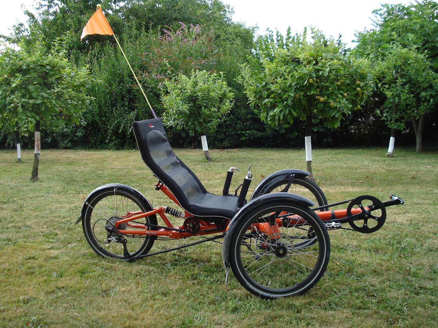
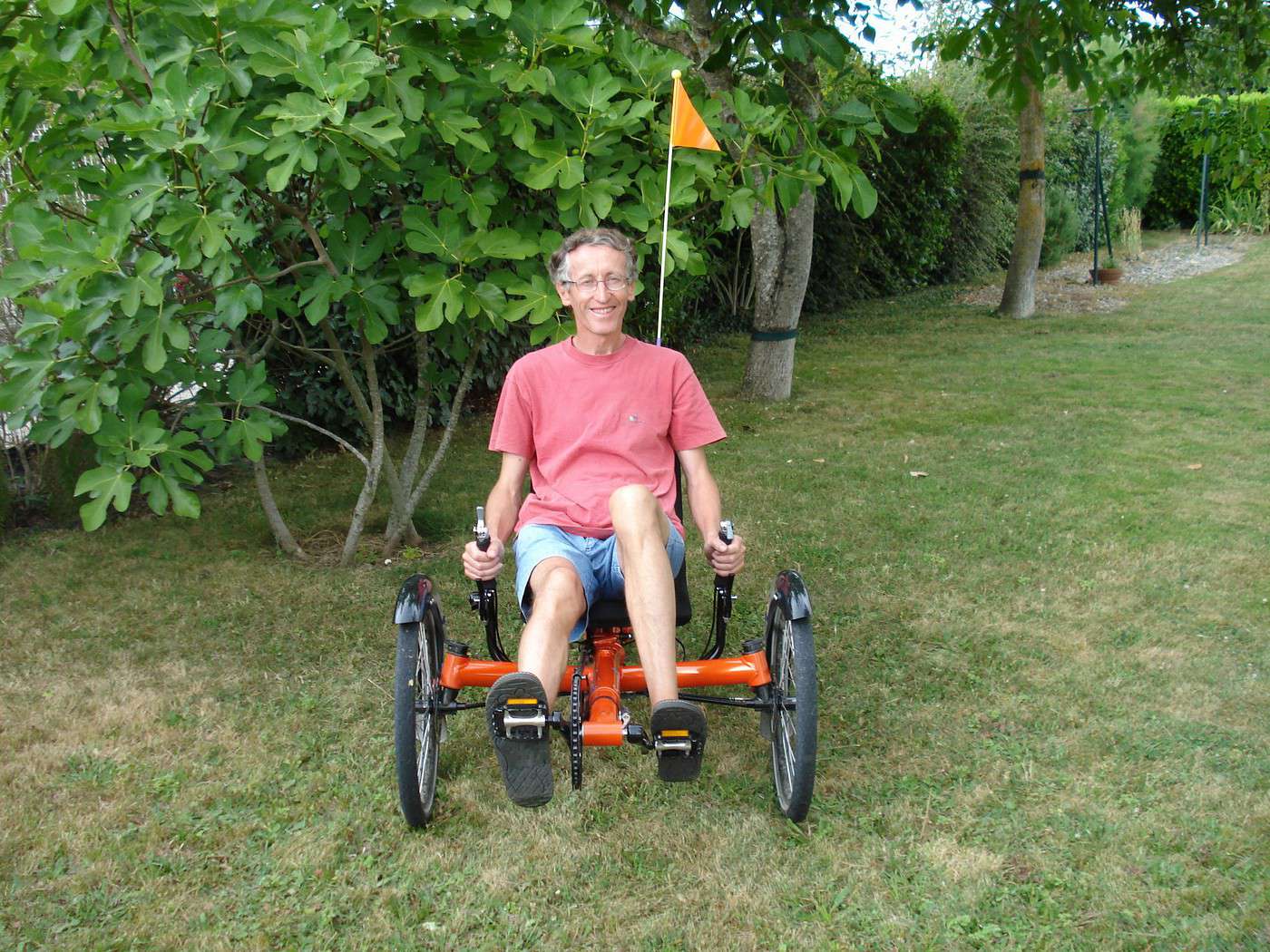
good news: from Toulouse to Bordeaux, the green route is completely doable on a road bike without any issues (we also had a recumbent bike for the luggage)

otherwise, Toulouse to 25 km from Bordeaux in one day (left at 11 AM, arrived at 1 AM) and I'm not a mega athlete—it's just that recumbent bikes are MAGICAL

so stop asking about daily km expectations—take a week to cross from the Atlantic to the Mediterranean (even though it's totally possible to do it in two days)

I'll post my travel journal in a few days

thsuss
FA Facteur4 Regular ·
Preamble: Since this is my first time traveling by bike with a GPS, here are my initial impressions, which will help understand how I’ll use it during the trip.

I was won over by the EVADEO GPS from the Institut Géographique National, which allows for road navigation and hiking. And I couldn’t resist the 2008 version, which has a BIKE mode. http://www.evadeo.fr/ However, I’ve been disappointed time and again. Maybe I’m too demanding, or is it my lack of experience? I admit it’s a technological marvel, but I expected to be more convinced: - Indoors (even in a car), the screen is readable, but as soon as you’re outside, you can’t see anything. Too bad you have to seek shade to check the info. So, I don’t see the point of getting a bike mount since the sun makes the screen unreadable (of course, I set the brightness to maximum). - First, let’s look up my town: Valence d’Agen (5,000 inhabitants). The Evadeo doesn’t know it. It only knows Valence 82, whereas Via Michelin, for example, does. Too bad, since there are enough towns named Valence that it should distinguish them by their full names. I hope the database doesn’t come from the IGN. - First guidance in PEDESTRIAN MODE IN THE CITY to the train station. Perfect—the street names display, and I arrive at my destination. However, the GPS doesn’t know about the pedestrian underpass under the railway (which has existed for years). This makes me think that in another city, I could end up taking a huge detour if the Evadeo only knows the roads. Confirmation: I want to go (on foot) from Sotteville-lès-Rouen to the city center of Rouen (rue du Gros Horloge). I start the GPS in the parking lot of a supermarket (I go in circles for a while so it can locate me), and there’s no route indication until I step onto the edge of a road. Then, the green line shows me the way. Does the Evadeo only know roads? Yet, for this route, it takes me through a pedestrian path? It’s true that it’s an old road (but I don’t think it’s by chance). - BIKE MODE: I want to go from Valence d’Agen to Moissac. It makes me take the N113 (sorry, now it’s a departmental road) when there’s a bike path parallel to it, just 300 meters away. Disastrous! Reassure me and tell me it’s not always like this. That it’s not a scam. That the bike mode isn’t just a car mode that avoids highways and also refuses to give routes for trips over 100 km. - Okay, I download the 1:25,000 maps of my area: No better. My house, which is 10 years old, isn’t on it. What’s the point of displaying "compilation 2006" if the data isn’t from that year? I try the HIKING mode. There’s no guidance. Too bad—when I reach a dead end (at someone’s private property) while I’m very close to my destination, it doesn’t tell me how to get there (this time, I must really be too demanding). So, I turn around. Of course, if I had stayed on the roads, I would have arrived (but what’s the point?). - To cheer myself up, I try ROAD NAVIGATION. I want to go to Piquepoule, a hamlet in Lot-et-Garonne. Impossible to enter it in the "Go to" function. The Evadeo doesn’t know it. Yet, it’s marked on my 1:200,000 paper map, and this hamlet is on the Evadeo’s base maps. I have to search for it by trial and error on the screen, moving, zooming, moving, zooming out… What’s the point of advertising a database of 1,700,000 place names? This time, I hope someone will tell me I don’t know how to use it and explain how to do it. I must say that I also find the user manual on the EVADEO Primo DVD really light...

Monday, June 9, 2008 – Valence d’Agen 8:30 AM to Fourques sur Garonne 4:30 PM – 99 km I planned to follow the lateral canal to the Garonne until it flows into the river, then join the bike path from Sauveterre de Guyenne to Bordeaux, where I think I’ll make my second stop before finally reaching the Arcachon Basin and its many bike paths. The weather forecast predicts rain and low temperatures for the coming days, so I’m forced to bring appropriate clothing. I’m still surprised that my bike and its load weigh 30 kg, even though I’m not bringing a tent or sleeping bag. But I can’t go on an adventure without supplies (or water). I inflated my front tire to 2.5 bars and the rear to 2.8 for the best rolling/comfort compromise. I don’t recognize my MTB, which I use every day to go to work. Luckily, I’m not going to the mountains! After stopping at the Banque Postale ATM, I reach the canal where Valence d’Agen welcomes tourists to its marina. The towpath, now transformed into a bike path, is very smooth, and my cruising speed stabilizes at 20 km/h thanks to the macadam. Of course, that’s not the same as the average speed, which is closer to 12 due to breaks, route searches, or accommodation stops and meal breaks. Quickly, I see the cooling towers of the Golfech nuclear power plant: http://www.ville-golfech.fr/pageLibre00010811.html Only one releases a plume of steam that mixes with the clouds, the other electricity production unit being shut down for maintenance. After 10 km, the greenway changes banks. My first "dancing" climb onto the bridge reassures me about the good distribution of my load. A little further, I leave Tarn-et-Garonne for Lot-et-Garonne, thus leaving Midi-Pyrénées to enter Aquitaine. (Living on the border between two regions can cause some problems, for example, establishments that are close but depend on the Toulouse or Bordeaux academy have different school holiday periods. Annoying when you have children in school on both sides). My first stray dog is a German Shepherd. It also spotted me and decides to disappear into the tall grass. Is it to avoid me or to surprise me better? I speed up a little and don’t see it again. After only 20 km, my right knee hurts a bit. I’m not worried because this feeling usually goes away. Here’s the nautical stop at Montalembert, and I enjoy this pleasant spot for a moment under some hazy sun. Beds of poppies and other so-called wildflowers have been created. The signage for the "Tous à vélo" (Everyone on Bikes) event on June 6 and 7 hasn’t been removed. We’re in the town of Boé: http://www.ville-boe.fr/...ement/villedeau.html Residential and commercial area before Agen. Having been a victim of an ad, I decide to stop at DECATHLON to buy a cycling jersey and shorts on sale. I then have to lock my bike and leave the plastic bag (Go Sport) that I use to put clothes over my already full panniers in the locker. The shorts are really too heavy with their multiple layers of fabric for comfort, and I’m afraid I’ll be too hot in them. I settle for buying rain pants to replace my K-way pants, which are too short and I’ve been using for 20 years. I took advantage of my time in the fitting room to change into shorts, but as I come out, a few drops fall. Luckily, the sun will come back. Passing by the recycling center, I see a class of pre-teens all in fluorescent vests on a field trip. Maybe that’s what they call a "green class"! After this 12 km detour, I’m back on the canal. In any case, this break made my knee pain disappear. Here’s Agen and its basin, used today by a rowing club. Pleasant walk on its magnificent canal bridge spanning the Garonne. Pedestrians can then go back up the river and return to the city center via the footbridge reserved for them opposite the Passage d’Agen. Since Toulouse, the lateral canal to the Garonne (193 km) keeps getting closer to and farther from the river. But it’s in Agen that it crosses it for the only time. And it’s impressive to see boats navigating 10 meters above the Garonne using this 580-meter-long stone canal bridge: http://www.ot-agen.org/...isite_pont-canal.asp I pass the Agen lock and find myself in unknown territory. It’s the first time I’ve gone this far northwest, having been drawn to the southeast during my previous trips (or pushed by the wind—see Chapter 2, 09/2007). In fact, due to lack of signage, I take the wrong bank and find myself on a dirt path until the next bridge. It’s only after 40 km that I pass my first cyclist. I see more, but the greenway is not very busy at this time. Obviously, the chances of crossing paths are much greater than seeing a cyclist going in the same direction. I’d even say that the probability of seeing a bike going in the same direction at the same speed is zero. So here I am, riding at 23 km/h, protected by trees on both sides, when my hip starts to hurt. Like many people these days, it’s my right side that’s bothering me. I take advantage of a clearing to eat some cookies and the well-ripened Golden apple I brought. But it suffered from the trip. If I had been on a bus, I would have said the "bus bruised it," but here, it turned brown in my handlebar bag. I overlook the canal where some pleasure boats pass. I wonder how it was possible to tow boats with horses or oxen given the height difference and especially the presence of all these trees on the embankment. But the diameter of their trunks tells me they’re recent. Back on the path, I reach Buzet sur Baïse: http://www.albret-tourisme.com/...rticle.php?storyid=9 Crossroads of river navigation between the Canal, the Baïse, the Garonne, and the Lot. I was surprised not to have seen any cherries (many cherry trees are bare after the storms), but finally, I can taste a few, though I can’t reach the ripest ones. The sky darkens, and the cool wind makes me replace my shorts with my hiking pants. Ouch! I need my bike clip, but it’s at the bottom of a pannier (since I left in cycling gear). I improvise with a tall grass stem to avoid chain grease until the evening. This time, many cherries are within reach, but they’re just bigger than peas and tangy. They’re "guignes" or wild cherries that blackbirds love. Even if they’re a bit bitter, I enjoy them. I’ll have to reach my 75th km before a road bike passes me. I arrive in Lagruère, where the canal has come so close to the Garonne that it follows its shape. I ask at the Canal Café: http://www.linternaute.com/...-cafe-du-canal.shtml What pastries can they offer me? But since they don’t have any left, I enjoy a "dame blanche" (vanilla ice cream with chocolate sauce and whipped cream) on the terrace dock. Arriving at Pont sur Sable, I look for accommodation. I follow the sign to the Auberge la Mijotière. Although the gate is open, the establishment seems abandoned, and there’s no price displayed. I prefer not to know what’s cooking there. I go back to the canal and ask the hostess at the nautical base, who, although no longer supposed to act as the tourist office, directs me to a guest room in Fourques sur Garonne. A lady welcomes me with an accent I assume is English. She tells me her name is Fiona, her husband John, and that they’re Scots who have been living in France for 5 years (she teaches English, and they find living in France even better than vacationing here). I ask if Fiona is a Scottish name. "Yes, it comes from Gaelic and means blonde or beautiful," she adds, "I’m the other Fiona" (she’s brunette and not particularly pretty). A few minutes after me, a couple from Marseille arrives and will occupy the other guest room. On vacation heading to Brittany, they left the highway so the man wouldn’t miss the soccer match. France is playing at 6 PM in the European Cup. Decidedly, I’m being pursued. During my previous trip, it was the Rugby World Cup (see Chapter 2, 09/07). After the homemade kir, we share a meal with their English friends who have just welcomed their children from Canada, whom they picked up in Toulouse and brought in 5 days on their houseboat. Excellent dinner around duck magret or barbecue, dessert with homemade cherry liqueur and cinnamon. 12-year-old whisky just before the rain leads us to help Fiona clear the table (well, us French, because the others don’t seem bothered). I recommend it for the warm welcome and homemade cooking: http://www.fionas-bb.com/

Tuesday, June 10 – Fourques sur Garonne 9:00 AM to Sauveterre de Guyenne 5:00 PM – 62 km The rain stopped this morning, but the trees along the canal still drop a few big drops. And after just a few km, it starts raining. I’ll be able to try my poncho bought in Moissac (where so many pilgrims stop on the way to St Jacques de Compostelle). I try to cover the handlebars and the back of the saddle, but it’s not easy. Already, it gets caught on my odometer mount, causing a small hole. Luckily, the rain is very light, and I can remove it. I still decide to take shelter in Couthures sur Garonne to see the GENS DE GARONNE show. It features sets and filmed actors telling the life of the village. I can’t reveal all the tricks to keep the surprise, but I recommend going with your life jacket and holding on tight when the great flood of 1952 is retold, after the even more terrible one of 1930. By the way, it’s forbidden to leave the room during the show: http://www.gensdegaronne.com/.../i/gensdegaronne.pdf Unfortunately, at the end of the show, it’s raining harder, and I decide to wait at the Maison des Gens de Garonne while reading the Marianne weekly that a colleague gave me. An unexpected article by Matthieu Grimpet: "Welcome to the Ch’tis: an illusion, a memory that could turn into a nightmare: This film reinforces the French in the inner cages where they like to take refuge in bad weather. Denying reality, a national sport since Alésia. In whining, the French see kindness. In clichés, humor… In the vulgarity of tradition. In the union of anxieties, solidarity. In the bad French chewed by poorly fed welfare recipients, a centuries-old patois." Maybe a bit too critical? But I don’t regret having escaped the wave of over 10 million admissions. Yet, my wife and children went twice (the first time, the cinema was full). I have to wait until after 1 PM to be able to hit the road without rain. I want to return to the canal by the same path, but as soon as I leave the village, I realize I’ve taken the wrong turn. It’s time to turn on my GPS. I ask it to take me to Meilhan sur Garonne, the next town on the canal. I follow its directions but, thinking I recognize the canal behind the characteristic line of trees, I leave the road for a grassy path that leads me to the banks… of the Garonne. I turn around and follow the instructions. However, a little further, I understand that the GPS is going to make me take a detour to find a bridge. Seeing another tree-lined path, I take a road blocked by a concrete post lying across and, progressing through the mud, I find the expected bike path after the embankment. I think I see a seagull, which would predict bad weather on the Atlantic coast. But it’s a gray heron gliding above the canal. Here’s the first signpost on the greenway: Agen 72 km and Castets en Dorthe 15 km in my direction. I must have arrived in Gironde, the department of bike paths. But what surprises me is that it’s called D809. Maybe a way to make them known to GPS? I fear that the departmental designation might cause confusion and that a motorist might take it. In any case, it explains the differences in signage from one department to another. Yet, this greenway has national importance. Especially since, in the long term, it will connect Bordeaux to Sète. It would have been wise to standardize the signage. I pass the nautical stop at Fontet, where a "port" was created by digging a basin connected to the canal. I arrive in Castets en Dorthe and can finally see the end of the canal, which flows into the Garonne via two locks. A Voies Navigables de France employee manages the traffic lights and locks from his observation cabin. A pleasure boat arrives to access the canal. The lockage is long due to the significant elevation change. http://www.canal-du-midi.org/...stets_en_dorthe.aspx It’s 3 PM, and Fiona’s breakfast, though it kept me going until now, is now a distant memory. I eat 3 cereal bars, telling myself that my bike actually runs on biofuels. But you shouldn’t joke about that. The Swiss Jean Ziegler, former UN rapporteur, just declared, "Agrofuels are a crime against humanity," and in France, this crime pays. Since they’ve become competitive, they continue to receive subsidies while causing famine in the poorest countries. Not to mention deforestation (for example, in Indonesia) with massive fires to plant palm trees, from which oil is extracted for diesel. Since the greenway ends here, this is where I planned to start my GPS (it’s useless along the canal and doesn’t know bike paths). In BIKE mode, it shows me the shortest way to Sauveterre de Guyenne while avoiding major roads. With the sun, I can’t see the screen, so I put it in my handlebar bag and listen to the lady announcing, "In 100 meters, turn right," "At the roundabout, take the second exit." This avoids having to constantly unfold a map. Be careful—a simple jolt, and the voice can disappear with a simple press of the on/off button. I understand why phones require two buttons to unlock the keypad. From now on, I’ll put the GPS in the outer mesh pocket of the bag. I cross the Garonne, and at the second intersection where I’m supposed to go straight, the road is blocked for construction. This is starting badly. What should I do—turn right or left? No, on a bike, I can pass. I go along the construction site and then cross a railway crossing also blocked. Here I am in the middle of the vineyards, where workers are busy around the taut wires that will guide the growth and support the future bunches. But as I expected when leaving the valley, I have to climb a series of hills, and I don’t think the GPS takes altitude into account. Of course, descents follow the climbs, and this allows me to reach 46 km/h, but the hills are tough with the loaded MTB, and I miss the flatness of the towpath. I walk a few sections beside the bike, and to taunt me, a sign announces the Jalabert vineyard. Cleverly, the GPS makes me avoid major roads, and here I am at the entrance to Sauveterre de Guyenne, where I spot the start of the bike path I’ll take tomorrow. (A map is associated with this link to locate my route over 6 days) http://www.sauveterre-de-guyenne.com/...ction/3/62/lang, fr/ Very pretty Bastide in the Entre-deux-Mers vineyard. But it only has one hotel, which is full tonight. It’s at the tourist office that a very helpful young man (too bad he has smoker’s breath) finally, after several phone calls, finds me a guest room. However, I won’t be able to dine there. I have the choice between SuperU and Petit Casino for some shopping. For once, I choose the small one (that’s also what soft modes of transport are about: different behavior). A sesame seed baguette, a Caprice des Dieux, cookies, and BIO CASINO soy dessert, fruit nectar, and compote pouches from CASINO (the compote travels much better than fruit—that’s the only thing I forgot to bring). And here I am a bit more loaded. Luckily, the coordinates are indicated on the guesthouse brochure. For the first time, I’m going to enter a latitude and longitude to be guided: 44.6985249—I’m almost between the Equator and the Pole. This temperate climate latitude is particularly suitable for vineyards. - 0.0506830—I’m practically on the Greenwich meridian. But does this minus correspond to East or West longitude, which my GPS requires? I hesitate and try West. I visualize the route, which doesn’t take me to the right village. No, of course, progression goes from East to West like time zones. I enter 0.0506830 East longitude. And off I go! Another climb, then a small descent, and 3 km from Sauveterre, the GPS declares I’ve arrived. I still have to go 200 meters to reach the guesthouse: http://www.moulindestleger.com/pages/indexpag.html The owner is interested in my GPS experience because he’s just started his business and is part of the Vélo Entre Deux Mers label. For me, the small coordinate difference between GPS devices isn’t a problem. He gives me a brochure: tourist map of the Voie Verte Bordeaux-Toulouse (sorry, I couldn’t find an online link to show you a map. I don’t think one exists). His guesthouse is listed among the good bike addresses. "Finally, a map I can display in my room," I tell him. The only thing missing is the connection between Sauveterre and Fontet (on the canal), shown here as a dotted line. Maybe a Toulouse-Sète map will exist in a few years? For now, it doesn’t seem to be moving much on the southern side. It’s a charming house with a lovely park crossed by a stream. The green room (where I slept) is luxurious and must be very pleasant in hot weather. But it’s not recommended for people sensitive to humidity in cooler temperatures. After tasting cherries and raw broad beans from the garden at the hostess’s invitation—she enjoys them with salt—I was able to dine in the sun and receive the (daily) visit from the squirrel, which also enjoys cherries. Too bad I’m in the Bordeaux region and can’t enjoy a glass of wine with my cheese sandwich.

Wednesday, June 11 – Sauveterre de Guyenne 8:45 AM to Arès 5:00 PM After breakfast with my hosts (I still have some trouble with this polysemous word that can mean both the host and the guest) and a pleasant conversation, I join the bike path that leads to Bordeaux. Built about fifteen years ago on the route of an old railway line, the Roger Lapebie path: http://www.tourisme-gironde.fr/...yclable_latresne.asp is smooth and very well secured. At each intersection, a layout allows cyclists to yield and cross intersections in the best conditions. Conversely, at each property exit and even fields, residents are warned and must let bikes pass. Yet, apart from a few walkers with their dogs, the place isn’t very busy. It must be said that the day starts in the mist. Decidedly, this year, summer is taking its time. And I have to go 15 km to see my first bike and 25 km to cross several. Certainly, Bordeaux residents escaping to the countryside. As my odometer reaches 200 km, I arrive at the bike station in Créon: http://www.tourisme-creonnais.fr/index.php?id=50 It’s the first bike station in France. You can get your bike repaired or rent one. The Créon tourist office, located in the middle of the Roger Lapebie path (winner of the Tour in 1937), offers many activities around cycling. I chat for a moment with the hostess and congratulate Gironde as the ambassador of Vélo Entre Deux Mers. I mention that the accommodations along the path will become really interesting (for now, making a stop on a 50 km bike path?) when it’s connected to the canal path. She confirms that the budget has been approved. I quickly arrive in Lastresne, where the bike path ends. The Gare restaurant comes just in time at 11:50 AM—I won’t be late for lunch. Oh, I am! I go for a single dish: chicken supreme with langoustines and scallops. Only one raindrop will disturb my lunch on the terrace. My arrival in Bordeaux is less poetic with the truck traffic. It’s a bus that wins the prize for passing the closest to me. It’s hot, and as the sun comes out, I choose to hide in the shade of the alley formed between the NORAUTO store and KIABI to switch to shorts and a T-shirt. I follow the GPS directions, which allows me to cross Bordeaux calmly. Here I am on the Pont de Pierre, and the white facades lined up along the Garonne shine in the sun. It’s magnificent, and I approve of their UNESCO World Heritage classification. The metro I cross, which also uses the Pont de Pierre, doesn’t break the charm. It’s elegant and discreet thanks to ground-level power supply. No cables spoil the decor. The system was difficult to develop (because the voltage must only be established when the tram is present), but it’s a success: http://www.tramway-bordeaux.veoliaenvironnement.com/ However, since the tram has priority, other users have to wait a long time at the lights near the bridge. I reach the left bank and pass the busy shopping street St Catherine. I pass the General Council and the ice rink. My GPS turns what could have been a chore into a pleasant visit. Except when the noise drowns out its instructions. No panic—it recalculates the route and makes me take the next right, which is one-way except for bikes (it’s very clever). I’m even tempted to continue on the bike path I’m on. It invites me to turn to take the right direction (which forces me to cross a dividing hedge)—without it, I would have gone straight. Here’s Mérignac and its airport, which welcomes me with deafening noise, hundreds of liters of kerosene (untaxed http://lesverts.fr/article.php3?id_article=2319) turning into greenhouse gases. Further on is the military base where a magnificent fighter jet is displayed by the roadside. It must be a Mirage IV interceptor (I’m not an expert): http://fr.wikipedia.org/...:Mirage_IVP_-_CF.jpg 370,000 flight hours from 1964 to 2005 (I won’t brag about it). Here I am on the D106. I can turn off my GPS now—it’s straight ahead to Arès. I buy some cherries and enjoy them in the providential shade of a lone tree next to a chapel. The sun is at its zenith and starting to heat up. I power on my phone (it can sometimes be useful) and call the vacation center reception to make sure there’s room in one of my works council’s cottages. Arriving in St Jean d’Illac, the sun is still shining, but it’s raining. I ignore the shop fronts that could have offered me shelter, convinced it’s just a few drops. Strangely, the middle school is located in the middle of nowhere. An area where pines were cut down to build it in the middle of the pine forest. I get honked at violently by a truck. I understand there’s a bike path on the other side (for the students). But how do I get there? A ditch prevents me from accessing it. It’s filled with stagnant water. I walk along it for a while, then find a shallower spot where my wheels don’t sink too much into the mud. Effort for little reward: the path ends quickly. For its last 30 km, the D106 turns into a highway limited to 110 km/h. I’m not proud and ride on the far right of the pseudo emergency lane. I even doubt that this road is allowed for bikes. Yet, no signs prohibit them. Plus, the sky is very dark on the horizon. Luckily, I’ll escape the rain. I’ll only suffer a few splashes from cars on the still-wet road. I arrive at the vacation village just before the reception closes. I don’t take the time to settle into my cottage, put on my swimsuit, and head to the lagoon. Just then, a man who seems to have arrived by bike is putting on a wetsuit, goggles, and a swim cap. Contrast with me, arriving with my 50x30 cm beach towel. Even if it rained, the water doesn’t seem cold to me. It’s great to be able to swim in this seawater pool. Since the Arcachon Basin is very flat, it’s not uncommon for the water to recede very far. For kids, this avoids having to go to the Lacanau Ocean beach (with its dangers). Here, they can even try their first glide on Optimist sailboats. Amazing day where I was lucky to avoid the rain (while in Gers, for example, people suffered floods) and even got sunburned on my arms (luckily, I brought a sample packet of moisturizing cream). Well, it’s just a big hole in the sand filled with stagnant seawater with mud and algae, which can only be renewed at high tide through a trap. Equivalent systems are used for salt harvesting, fry farming, and samphire cultivation: http://pagesperso-orange.fr/algues/salicorne.htm After a good shower, I can enjoy the cooked meal service and the evening card game. One of the vacationers offered to play guitar and perform manouche jazz songs, and I won 3 hands of belote at this musical terrace. Strange—the couple I was playing against insisted that you can shuffle cards in belote. What’s certain is that after mixing, no one has a good hand. My partner, responsible for the entertainment, offers me to join the next day’s excursion since there’s still room on the bus. I hesitate because the weather is uncertain. I had planned to enjoy the bike paths along the coast through the pines to reach Soulac. Then take the ferry to cross the Gironde and continue to Saumur. Where we’re invited to a wedding the following weekend (the bike would have then returned on the car). But my wife dissuaded me. She prefers that we leave together with our 3 children. It must be said that we have to stay with the bride’s grandmother, whom we don’t know, and it’s better not to arrive in disarray. And then, it’s a bit the role of the mother-wife to bring the explorer-child-man back home.

Thursday, June 12 – 0 km by bike, 150 km by bus. With all the shutters closed, the day wakes me up well before the alarm, and this allows me to discover that the alarm function works even when my phone is off (I naively thought it had to be on). I can even write my postcards before leaving. Departure at 8 AM under the sun for this discovery of the Médoc. Gironde is our largest department. Of the 120,000 hectares devoted to vineyards, 12,000 are in the Médoc. It’s the territory of the most extensive appellation we’re going to discover. We’re very lucky because our guide lives in the village of Margaux, and one of her children works at Château Margaux. This first growth is so famous that many think they’ve drunk wine from this estate. But it’s unlikely because a bottle costs 200 € and up to 500 € for great years. Especially since 99.5% of the production goes to export. Yet, the prestige is a bit artificial because it dates from the classification organized for the 1855 Universal Exhibition and will never be questioned. Only one change was made to the great growths with the entry of Mouton-Rothschild in 5th position in 1973 (it had to have strong backing). In fact, you shouldn’t confuse the Margaux appellation with Château Margaux. For the former, we’ll discover the production of an artisanal growth. And even in this small estate covering only a small area, not all the harvest can claim the Margaux appellation. Only the vines rooted in gravel (pebbles torn from the Pyrenees and brought by the Garonne 2 million years ago) have the right. The nearby vineyard located in more clayey soil will have to settle for the Haut-Médoc appellation. We can appreciate the difference during the tasting generously accompanied by cheeses. For the latter, we’ll have to content ourselves with a view of the park and the château. (To be allowed to visit, it’s better to arrive by helicopter). Château Margaux is the first to have decided to bury its cellar (supposedly because of the risk of radioactivity). Under a superb lawn the size of a football field and under high surveillance rest the precious bottles. We drive through the vineyards, and I’m surprised that the estates are so close and numerous. A few hundred meters separate one château from another. Sometimes it’s a simple building, but often it’s magnificent châteaux with parks, and our guide knows all the names as well as those of the successive owners. Even for those who aren’t interested in wine, the visit is pleasant. Here’s the little Versailles, then the sumptuous gardens of one of the Rothschild châteaux. Here, a dozen gardeners work all year because the owner only wants to consume vegetables from his estate. This brings us to the lunch break in a village restaurant. Here, 100 to 200 people every noon (only the main dish is served at the table). You can recognize several bottling teams by their burgundy "bleus." It’s now that, with their trucks, they’ll do the bottling of the new vintage from estate to estate. After waiting in line and a hearty meal, we resume our visit. Many people are busy pruning the vines. It should be remembered that originally, it’s a vine, and it can grow 8 cm in 24 hours. You can enter the vineyards with machinery at any time of the year because the soil is very draining. This is important for the sugar content of the grapes, which shouldn’t be waterlogged. Moreover, it’s forbidden to water the vines. However, you can chaptalize the wine (add sugar before fermentation to increase the alcohol level) or, if it contains too much water, remove it by osmosis. We cross the railway line where the TGV (Train of the Great Vineyards) runs. Then we head towards the estuary to reach the Château de la Tour de By. Our visit starts outside. Here, as in other estates, a rosebush has been kept before each row of vines. It was the early warning system that would catch mildew first. When the rosebush was affected by the fungus, the vines had to be treated quickly. Divided into two groups of about twenty, we take the circular staircase to reach the top of the tower in the middle of the vineyard: http://www.la-tour-de-by.com/ It’s an old lighthouse, and we have a magnificent view of the Gironde. Here, the estuary is 12 km wide, and it’s impressive, a bit like the sea had phagocytized the Garonne. We see the dredger that works year-round to allow the largest ships to pass. We visit the cellar where this Cru Bourgeois is still aged in wooden vats. I spot bottles from 1959 in the cellar (my birth year, it’s true I’m getting older) and don’t dare ask the price. We finish with the tasting. This circuit ends with the visit to the "Noisetine du Médoc," a confectionery made of a hazelnut coated in a delicious caramelized syrup. Accompanied by a glass of wine, we taste the artisanal products presented by a playful hostess who tells us the story of her bosses’ small company. I buy a small bag of Noisetine that I can bring back by bike. It will weigh less in my panniers than a Château Margaux, which would have lightened my wallet much more. The return by bus is calm. The animator (my belote partner) takes care to call the cooked meal service to warn them we’ll be a bit late. But I’m not very hungry and will content myself with a composed salad. Screening of the excellent comedy "I Do" with Charlotte Gainsbourg and Alain Chabat on a giant screen. Too bad the bottom of the screen is hidden by the first spectators, but I don’t fail to thank my works council through the feedback form for the quality of my short stay.

Friday, June 13 – Arès 9:15 AM to Bazas 5:00 PM – 102 km No need for an alarm even if I can’t leave until after 9 AM when reception opens. In any case, I need to get busy packing everything on the bike, doing the dishes, and cleaning. Luckily, when I arrived, they gave me a dose of disinfectant detergent and a wipe (they’ve thought of everything). I quickly find the bike path along the Arcachon Basin. Inaugurated in 1988, it was built on the route of the old railway line. For its 20th anniversary, it’s carrying me well, but I suppose it’s been renovated. I have confirmation when I come across a section under widening work. Today, it’s the departmental road 802. It’s also one of the 4 paths to St Jacques de Compostelle. The one taken by Bretons, Normans, and English who landed in Soulac. I reach Andernos, where I get off my bike to cross the very busy market. I continue to Biganos, where I have to take the direction of Mios-Bazas. It’s easy to follow a bike path. But it gets complicated when two have to cross and there’s no signage. I go along the path that crosses Biganos several times (taking the opportunity to buy 250g of bigarreaux cherries), ask for help in vain, and finally take the road to Mios to, after passing under the Arcachon railway line, find a path reserved for bikes. But this path makes a 90° turn and seems to take me towards the Ocean when I want to go inland. In reality, the bike path makes a detour visible on the map at the level of Facture: http://www.tourisme-gironde.fr/...les_gironde_2008.pdf to go find a footbridge that crosses the A66. Arriving in Mios, the signs reappear. There are the bike paths of the Arcachon Basin, the one from Mios to Bazas, and between the two, it’s the path to nowhere! Here I am in the Landes and Gascogne Natural Park. I’m in the middle of the pines without a soul in sight for kilometers. Except for a brunette carrying her handbag on her left shoulder and her phone in her right hand, who seems to have stepped out of another setting. Then I see a primary school class enjoying the picnic of their bike outing. More unexpectedly, a 206 comes towards me straddling the pavement and the shoulder. It’s a young man asking if I’ve seen a girl who ran out of gas and is coming back along the path. I understand better and reassure him that he’ll find her in a few kilometers. Crossing a road, I see an old gas station turned into a video library fast-food. I’m in Salles on the road between Mios and Belin-Beliet. Since it’s noon, I think it’s a sign from fate and turn around to treat myself to a Landes kebab. No Arabic bread, fries, or lamb, but duck gizzards, salad, and a tomato-based sauce. I considered returning to Fiona’s but given my progress, I give up on that option. Here I am again in the middle of the pines. If the word "lande" today evokes the pine forest, originally it designated a deserted, unhealthy, and barren region except for the best-drained parts near watercourses. The stagnant waters in winter rotted everything that had managed to germinate there. It was only through the practice of slash-and-burn, burning the large heather and impenetrable gorse, that shepherds were able to conquer certain areas. It was with the arrival of the railway, which allowed the transport of stones non-existent in the region, that circulation routes could be created and the land drained. Maritime pines were then planted, used for building carpentry, parquet floors, mine timber, telegraph poles, packaging fiber, and papermaking. On this Friday the 13th, I think of all the gullible people (of which I’m sometimes one) who will participate in this voluntary tax that is the lottery. I don’t think it brings good luck because this time, I won’t escape the rain. I’ve already swapped my shorts and sandals for my hiking pants and sneakers, and soon I’ll put on the poncho or take shelter under an oak tree. But the big drops falling from the leaves make my bell ring. Further on, I cross 7 or 8 retirees who have put on their K-way (yellow: the preferred color of cyclists), and I seem to feel a spray of fine droplets, but it’s a cloud of midges hitting my hood. The storm isn’t far. I’m not very proud, and I count the seconds between the lightning and the thunder. Since the speed of light is 300,000 km/s, I see the lightning at the moment the bolt strikes. The speed of sound being 300 m/s, it reaches me after a few seconds. Each second adds 300 m to the distance separating me from the impact. Luckily, the storm isn’t very close, its intensity is low, and it’s moving away. In the end, I’m hardly wet when I arrive in Bazas. I discover this episcopal city that has preserved a medieval rampart on a Gallo-Roman foundation: http://www.ville-bazas.fr/hishisto.htm I spot a guest room above a restaurant at the entrance to the pedestrian street before going to the Tourist Office. "I’m looking for a place to sleep." "You want to go to the municipal accommodation," asks a young lady about to write my name in a register. "Ah, but you’re not a pilgrim, you don’t have a credencial (route book that gets stamped at each stage)." Too bad—I could have been lodged at a lower cost. Wanting to stay in the city center, I return to the Indigo restaurant: http://www.petitfute.com/...nt_DP033_14_171.html The owner gives me the keys to the room after allowing me to leave my bike in the hallway between the entrance and the stairs. I’ll only talk to him for less than 3 minutes in total. As you can see, the welcome can be very different from one guest room to another. It must be said that he’s a restaurateur, and I’ll find him in front of the stoves of his very nice establishment without him speaking to me more. Since it’s a waitress who will bring me my scallop salad and then my tarte tatin. The room is like the restaurant, and I even benefit from DTT, which is unusual for me. I happen to catch the report about the family traveling around the world to discover social innovations broadcast on France 5: http://www.reussirmavie.net/...-d-espoir-_a154.html Laurent and Marie-Hélène de Cherisey left for fourteen months with their five children to meet those who act for the planet and for people.

Saturday, June 14 – Bazas 8:15 AM to Valence d’Agen 6:00 PM – 131 km Not another word exchanged with my hosts, I prepare my own breakfast in an adjoining room. I understand why he talked to me about rusks. In fact, there are slices of toast and cookies that will accompany the tea. The fruits aren’t really in season: a pear eaten right away (it’s easier at the table) and an apple for the road. The advantage is that I slam the door (leaving the key) and leave early. Lots of freshness and humidity. The sky is crisscrossed with trails left by planes. That’s not a good sign for the weather. Indeed, at high altitude, it’s cold, down to -50°C, and the water vapor from the engines turns to ice. If this white line persists, it means the air is saturated with humidity, and it won’t be nice weather. We observe a similar phenomenon on the cooling towers of nuclear power plants. If the plume of steam rises quickly from the cooling tower, like swallowed by the sky, good weather is assured. If it struggles to come out, puffing, it’s bad weather. At the exit of Bazas, I decide not to follow the sign that invites motorists to go to La Réole. But to take the other departmental road that passes through Pondaurat and will make me cross fewer contour lines (on the map) to reach the canal. After all the same some climbs and more descents, I join in 1h15 and 21 km the lateral canal to the Garonne at Puybarban: http://city.zorgloob.com/...17&lib=PUYBARBAN This must be where they filmed Cohnare the Barbarian. No, it’s Conan the Barbarian. I cross the Gravilla bridge and find myself on the greenway at Kilometer Point 185.5. I’m 8 km past Castets en Dorthe (end of the canal). I’ll take advantage of the VNF plates indicating the KP on each bridge to validate my odometer. The totalizer indicates 400 km, and the path changes banks. Being in the shade, I appreciate my leggings and jersey (you’ve noticed I’m sensitive to the cold). But here’s the nautical stop at Fontet and its port bathed in sun. This deserves a break, especially since 3 plane trees offer me their fruit. It’s delicious. I make a young boy taste them, who doesn’t seem convinced. Here, the lawns, flowerbeds, and swimming basin invite river boaters or campers to enjoy the amenities. There’s even a laundry service that comes here. A poster for the blood donation barge that goes from town to town on the canal. The English at Fiona’s told me they moored next to it during their stop in Valence d’Agen. This makes me think that as soon as I have 458 €, I could return my Body Donation form to Medicine. That’s what the Toulouse Rangueil Faculty of Medicine asks to participate in operating costs. In the end, it’s cheaper than a burial. A small ad: Will exchange 12,000 m² land in a hamlet (31) worth 80,000 € for a riverboat! I leave this pleasant place and wonder where I put my sunglasses? Actually, I have them on my nose. To my right, the canal; to my left, the Garonne, which keeps its ochre color. I feel a deep calm brought by the slow flow of the waters. Finally, a cyclist with luggage—I’m no longer alone traveling on the greenway. At his pace, he looks foreign. Shorts, unbuttoned shirt, and helmet—he must be English. I consider riding with him, but several factors dissuade me: he’s young, less loaded, and has narrow tires. Especially, I need to take my third pee break. With the coolness and the fact that I drink, I stop every 10 km. I could be accused of potomania. A urologist has just denounced this trend that consists of saying you need to drink 1.5 liters of water a day. For him, the water provided by food is sufficient. This isn’t new. Twenty years ago, a colleague called us potomaniacs when, after a morning of work, we drank several glasses of water at lunch. Finally, I find him further on and decide to follow him at a distance. This forces me to ride between 23 and 25 km/h. I could keep this pace for 1 hour but not all day. And then it’s too fast to enjoy the environment: a coypu crossing the middle of the canal indifferent to our passage, a pretty boat with a paddle wheel, this magnificent Moët & Chandon barge. A little jewel on the water: http://www.moet-chandon.co.uk/...vial-magazine-fr.htm Luckily, he stops to consult a signpost; I start a conversation. He wants to stop in Agen, then Toulouse, then do the Canal du Midi, return to Bordeaux by train to go back to England, and only has 4 days. That’s what justifies his pace. I show him on my super brochure the route I’ve taken. He finds this map very good; he only has a road map. But I can’t give it to him—until now, I didn’t know it existed, and I don’t think I can get another one. I hesitate to offer him accommodation, but I don’t think my wife would appreciate it, especially since tonight my son is participating in a concert. He leaves me saying we’ll see each other again, but I doubt it.

In a side alley leading to a house, I see the backside of a woman squatting in front of an Alfa Romeo Spider. She and her husband see me. I avoid greeting them, but we exchange a smile that the sufficient distance between us allows. You have to relieve yourself of natural needs. Then a tractor equipped with a sweeper removes the leaves and branches that have fallen on the bike path. I won’t see that in Lot-et-Garonne or Tarn-et-Garonne. Further on, a beautiful weeder with a hand sprayer treats the paths next to a lock. Decidedly, the canal is getting beautiful for the arrival of summer. On this Saturday, tourists are increasing in number on board boats rented for the week and preparing their cruise. The diesel will be billed based on the number of hours the engines have run. I return to the Canal Café where the photos of bruschettas had caught my eye. It’s a large slice of toasted bread garnished like a pizza: http://www.goosto.fr/...zarella-10009160.htm I choose the one with three cheeses with a salad.

I find myself in Lot-et-Garonne, and the signs disappear. Not even a KP on the bridges. You wonder if it’s still Voies Navigables de France. Then Tarn-et-Garonne and only one sign: Leisure Base of St Nicolas de la Grave (at the confluence of the Tarn and the Garonne) and Moissac. And I arrive without incident at my home after 509 pleasant km. I now know that from Valence d’Agen, I can reach one of the two ends of the lateral canal to the Garonne (Castets en Dorthe or Toulouse) in one day. I can only invite you to enjoy this greenway. For a day, a weekend, or for the holidays. It doesn’t require any special skills; you just need to want to. Thanks to the regions and departments to which I will not fail to send my impressions. Apologies to hikers and joggers who regret no longer being able to tread the earth. My excuses to the IGN whose GPS was finally useful to me. Even if I still dream of a GPS with a second database including bike paths and pedestrian crossings.
Facteur4 : Objectif pour 2050 de diviser par 4 l'émission de gaz à effet de serre.
FA Facteur4 Regular ·
Saturday 02/08/08 Valence d’Agen 08:15 Canal latéral à la Garonne to Montech, secondary canal to Montauban, return to Valence d’Agen 18:30 116 km

Exactly 200 years ago, Montauban, a city bitter about losing its status as an administrative capital under the Ancien Régime, secured from Napoleon (passing through between Spain and Paris) the creation of a new department. This is how, in 1808, the Tarn-et-Garonne was born, drawn by the Emperor’s hand by taking a small territory from the five neighboring departments. https://fr.wikipedia.org/wiki/Histoire_de_Tarn-et-Garonne

When the Canal latéral à la Garonne (1828–1856) was built as an extension of the Canal du Midi (1662–1683), Montauban wasn’t any luckier, as this canal linking Toulouse to the Atlantic doesn’t pass through it. The city had a secondary canal built, which in 11 km allows navigation from Montech to Montauban, then descending to the Tarn via a final lock.

I start the greenway at the port of Valence d’Agen, where there’s a certain buzz. Volunteers are finishing setting up the decorations and sound and light equipment for the 15th edition of *Au fil de l’eau, une histoire*: https://www.youtube.com/watch?v=WCOIn9Ekim0 A stunning living fresco with 450 actors telling the story of the 20th century along the canal. After 20 km, I leave the bike path to join the lively Saturday and Sunday market in Moissac. I can’t resist 200 g of 4-grain raisin shortbread from the organic farm *l’Écureuil* in Goudourville. I enjoy it while crossing the Tarn on the majestic canal bridge: http://tourisme.moissac.fr/contenu.php?page=17 I pass through Castelsarrasin, where the Port Cousteau is packed with boats. Its naval workshop is active, which is very rare on the canal. I reach Montech, its marina, and its water slope: http://www.cdg82.fr/montech3d/index.html I need to switch banks to access the connecting canal to Montauban. Here I am on land for towpath nostalgics. It’s not bad when, like here, there aren’t too many root stones or coypu holes. Still, I’ll remind you that I wouldn’t have made my June trip (all the way to Arès) if the path hadn’t been paved. With the rain forecasted by the weather, I wouldn’t have risked biking through mud with a loaded bike. I pass the *Camping du Canal*, which offers a stopover for 5 € for hikers. After a few locks, I admire the barge *Saint-Louis*, which offers cruises between Montauban and Agen or Agen and Castets-en-Dorthe: http://www.saintlouisbarge.com/home/ After 11 km on this secondary canal, I arrive at the marina in Montauban. It’s impossible to go further along the lock that, under the railway, descends into the Tarn. For safety reasons, continuing isn’t allowed. I follow the fence and reach a 1.50 m high, 1.70 m wide underground passage. It’s easier to cross these 30 m in the dark lying on the bike than walking. I cross the Tarn on one of the three bridges and reach the city center. I can’t resist the sight of the restaurant *le SAMPA*, stretching its terrace along the *allées du Consul-Dupuis*, where the market is held under the plane trees. The shaded spot is very pleasant, and I choose a Quercy salad (foie gras, duck breast, and gizzard). At 1 p.m., I take the same route back. My backside suffers on the first part, especially since the heat is intense in the sections where the trees are absent or too young to provide the much-appreciated shade in summer. A good break at former neighbors’ (whom I greet here) in Castelsarrasin with a beer and dark chocolate, and I only have 25 km left to get home and enjoy a nice shower.
Facteur4 : Objectif pour 2050 de diviser par 4 l'émission de gaz à effet de serre.
FA Facteur4 Regular ·
I’d love to share this amazing project—the Bordeaux-Toulouse greenway. Soon, you’ll be able to travel between the two cities without ever leaving the bike path. Unfortunately, I couldn’t find any website to show you the route.

There’s this brochure you can pick up at tourist offices, but no site lets you view it online. I managed to scan it (not in color) and had the file hosted on MaBul.ORG: http://apu.mabul.org/up/apu/2008/09/25/img-142718uipfi.png By zooming in, you can follow the dotted line from Bordeaux to Lastresne (start of the Roger Lapèbie path) and the solid line all the way to Sauveterre-de-Guyenne (50 km of bike path on the route of an old railway). The dotted line shows the future connection with the bike path along the Canal Latéral à la Garonne, which will meet at Fontet. Finally, the solid line continues to Toulouse, where only 18 km between Montech and Grisolles are missing—they’ll be paved very soon. Don’t hesitate to take advantage of this way to travel far from cars in a green setting, and help spread the word about THE BORDEAUX-TOULOUSE GREENWAY.
Facteur4 : Objectif pour 2050 de diviser par 4 l'émission de gaz à effet de serre.
FA Facteur4 Regular ·
To complete this overview of the canal between the Two Seas, here’s a link to a map of the Canal du Midi. This time in color, since the original document is in A4 format (easy to scan): First part from Toulouse to Carcassonne http://apu.mabul.org/...15522464faf.png.html 31 miles of paved bike path, followed by the towpath in dirt with more or less rocks and roots. Second part from Carcassonne to Sète http://apu.mabul.org/...1611519kgcy.png.html Dirt and more dirt (even along the connecting canal and the Canal de la Robine, which crosses Narbonne)—only 11 miles of pavement from Béziers to Portiragnes.
Facteur4 : Objectif pour 2050 de diviser par 4 l'émission de gaz à effet de serre.
FA Facteur4 Regular ·
772 km in 9 days

I wanted to reach the Mediterranean at the beginning of September to enjoy the last beautiful days of summer. But my wife, who’s part of the organizing committee, wouldn’t have appreciated me missing the Fêtes de Valence d’Agen, which take place every year around that time. After the traditional neighborhood meals and the parade of floats, the 2008 edition ended spectacularly with the election of Miss Tarn-et-Garonne and a fireworks display. The evening was particularly successful, with performances by singers, musicians, and a magician between the two rounds of the 12 candidates, along with the presence of the previous Miss Tarn-et-Garonne, Miss Languedoc, and Alexandra Rosenfeld (Miss France and Miss Europe 2006). Too bad my wife couldn’t attend the show—she was helping the Misses get dressed and climb the very high first step to access the stage. Still, sometimes you’d love to see behind the scenes and the hidden side of the spectacle.

Monday, 15/09/08 – Valence d’Agen 09:30 to Rangueil 16:30 – 95 km The weather forecast on Sunday predicted rain starting Wednesday with a southeast wind (which I’d be facing head-on), so I’m not sure if I’ll reach my goal: CAP D’AGDE. I’m considering cutting my trip short by redoing Tuesday the Rigole de la Plaine, which feeds the Canal des Deux Mers from the Saint-Ferréol basin, which I discovered in March 2007 (see the very beginning of this thread by clicking on 1 to go back to page 1): http://www.ladepeche.fr/article/2008/09/25/477570-Rando-autour-du-lac-et-du-musee-Pierre-Paul-Riquet-a-Saint-Ferreol.html I could visit the brand-new Pierre-Paul Riquet Museum: http://www.museecanaldumidi.fr./ Then head back to Toulouse to spend a rainy Wednesday visiting the Claude Nougaro exhibition: http://www.midipyrenees.fr/AgendaDetails.asp?i=288&univers=2&sX_Menu_selectedID=F3FA9C82 And finally, go see the tandem bike we crossed paths with during a family outing. It pairs a recumbent cyclist with one sitting upright: http://www.cycleszen.com/Pinotour1.htm Maybe I’ll try it out near the Capitole for a couple of laps: http://www.cyclable.com/ Back on the greenway I love so much. After 15 km and a first dead nutria on the pavement, I reach the footbridge that lets bikes access the Saint-Nicolas-de-la-Grave leisure base: http://www.stnicolasdelag.online.fr/loisirs.htm Then, after 20 km, I reach Moissac, where it’s a bit tricky to follow the canal. You either have to climb a small staircase or take a detour to avoid it, which forces you to cross the main road leading to Castelsarrasin. I recommend taking a right at the first roundabout after the bike path to follow the Tarn River and reconnect with the lateral canal to the Garonne at the lock that lets boats descend into the Tarn. (Unless you want to do some sightseeing in the town center—see the link in my August 2008 story). I then run into a Voies Navigables de France (VNF) employee on his electric PEUGEOT scooter, and I can finally ask him about the reliability of the vehicle. He tells me he’s ridden over 6,000 km without any issues, just by having the battery serviced annually. I stop by the VNF office to ask for a copy of the map of the Southwest river basin that’s displayed by the canal. They kindly give me one (you should be able to get it at the Bordeaux and Toulouse tourist offices or from VNF Direction Interrégionale du Sud-Ouest, 2 Port Saint-Étienne, 31073 TOULOUSE CEDEX 7). I still haven’t found an online link to this brochure to share with you. It lets you visualize (in 1x0.60m) the navigable link between the Atlantic and the Mediterranean, and even the state of the towpath along the lateral canal to the Garonne (though it doesn’t account for the recent bike path) and the Canal du Midi. It shows the ports and locks (including those on the Lot and Baïse rivers). Here’s the national map instead: http://www.vnf.fr/vnf/img/cms/Tourisme_et_domaine/carte%202008%20france_200807241627.pdf where you can zoom in on the Southwest. (If the link doesn’t work, copy and paste it into your browser.)

As usual, I get off my bike on the canal bridge in Moissac. To avoid riding on the gravel surface, stretch my legs by walking, and enjoy the view overlooking the Tarn. A hiker in a Gitanes cap, equipped with leather saddlebags front and back, is deep in conversation with an elderly man wearing a cycling cap. He’s just biked the Canal du Midi with a friend and is finishing the trip solo to Bordeaux. I’m happy to tell him he’ll have a fantastic bike path all the way to Castets-en-Dorthe (see my previous post on the Bordeaux-Toulouse greenway). Unlike what his bike guide—only two years old—says. The retiree asks him if he’s bringing any medicine for his trip. I reply that when you’re biking, you don’t get sick, and Alain Guillou wouldn’t say otherwise: http://www.guillou.com/velo/kilidry.htm Actually, I did bring a tube of anti-inflammatory (which turned out to be useless) just in case my right side started hurting again. Wow! Almost a page and a half for 20 km… I’ll speed up a bit and avoid telling you again about Port Cousteau in Castelsarrasin and the water slope in Montech, where after 40 km the paved path temporarily ends. I still won’t be able to eat at the port restaurant in Montech (closed on Mondays). I settle at a picnic table to eat some cookies and the figs I picked before leaving. I’m right near the school, and is it the bike path effect? Lots of kids are biking by, along with moms picking up students. Others come to eat at the next table, but only a few stay seated because of a wasp that wants to join the meal. Back on the dirt path, the 18 km feel long before I find the pavement again (you get used to the comfort quickly). Finally, leaving Tarn-et-Garonne for Haute-Garonne, the path becomes bikeable again. A few kilometers before Toulouse, I notice my left pedal is loose again. This time, I won’t break my aluminum wrench and just tighten it moderately. I’ll stop downtown at the http://www.movimento.coop/ workshop by the canal. No luck—it’s closed on Mondays. I’ll have better luck when I reach the Institut National des Sciences Appliquées, where I’ll sleep in my daughter’s apartment. Two young guys are tinkering with bikes at the INSA bike club and lend me a sturdy wrench. Thanks to them, no more pedal problems for the rest of the trip. The previous tightening at the Villenouvelle motorcycle shop (see the 09/07 story) lasted a year.

Tuesday, 16/09 – Rangueil 09:00 to Marseillette 18:00 – 125 km (See the Canal du Midi scan link at the end of page 1) The INSA buildings line the canal, and I’m immediately swept up in a stream of cyclists heading to class or work in all sorts of outfits, from sportswear to suits or high heels. With my cycling suit, cap, and thin wool gloves, I stand out next to those in shorts. Yet it’s chilly, and some are pulling up their collars. Still, a few kilometers are enough to warm me up. I reach a section under construction. A worker invites us to ride on the shoulder while he helps lay plastic sheeting under the new surface. I assume it’s to prevent cracks from bank subsidence and tree roots. He confirms that’s the purpose of the geotextile. The crowd thins as I move away from Toulouse on this path, which in 50 km leads to Port Lauragais. I catch up to a couple who seem to be speaking English. Hello! “Hello,” the woman replies. Where are you going? No answer from the man. Where are you going to? “Narbonne,” he says. Canal Robine, good! I say as I ride off. Then I stop and pull out my map. I need to explain to them that they’ll have to cross the Aude River on the railway bridge (see 09/07). No way I can remember how to say “bridge” in English… With this slight tailwind, I leave the bike path to return to the Canal du Midi towpath after the Océan lock. Here I am at the watershed divide. Monday night’s weather forecast predicted rain for Thursday, so I won’t climb to Saint-Ferréol. I continue toward Agde, and after the Méditerranée lock, I reach Ségala, the first village in the Aude. A man and woman are setting up tables on the terrace of the guinguette Le Riquet. Hello, what do you offer? Since I get no response, I glance at the board and ask what the daily special is. Finally, the woman asks the cook. Since it doesn’t appeal to me, I ask if it’s possible to have the guinguette menu. “Yes, just give us time to finish setting the table” (it’s just noon). Can I leave my bike here? “No, over there,” she says, pointing to the canal bank (in the sun). Does it bother you here? “Yes, because of the flowers” (leftovers in the planters). Fine! If I’m bothering you, I’ll go eat elsewhere, I say as I hop back on my bike. Unlike their welcoming website: http://www.lerelaisderiquet.com/bar-restaurant-randonnee-11.html where the snack is supposedly open at all hours, cyclists don’t seem very welcome (even though I was their only customer at the time). The 17 km to Castelnaudary don’t scare me. It’s the cassoulet I might have trouble digesting while biking. Here I am in front of the large basin, where several small restaurants have set up their terraces. I choose a light meal at La Cave du Canal: http://www.couleur-lauragais.fr/cave-castelnaudary/index.html The terrace is small, and the two shaded tables are already taken. I ask a young woman of Indian origin if I can sit next to her. She gladly agrees, wishing me bon appétit. Funny for me, since last weekend I was dressed as a maharajah to parade on our elephant float. I opt for the three-goat tapas for 5 € and a glass of Minervois for 2 €. In France, we lament the lower bar attendance due to the smoking ban and rising prices. The habit of keeping people who come for a meal separate might also explain this decline. Abroad, it’s normal to sit at a stranger’s table for lunch, mixed with people who are just having a drink. This conviviality is more successful. I reach the staircase of four locks at Saint-Roch, fed by the Castelnaudary basin. I follow the building of La Couchée, the first one coming from Toulouse, where passengers of the horse-drawn mail barge spent the night. http://www.canalmidi.com/aufildlo/barcpost.html Due to a relatively steep slope, it will take 17 locks to reach Carcassonne. It’s better to travel by bike then. I’ll stop at the 15th, Herminis lock, where I hope to enjoy a crêpe: http://www.canalmidi.com/herminis.html But it’s already closed for the winter; I can only get a vanilla cone. Time is passing, and I prefer to call to reserve the barrel where I slept last year. Unfortunately, the number is no longer assigned. The owner had told me he was selling, but I hoped the Relais Occitan would keep the same number. I’ll learn later that France Telecom refused despite the agreement of the former and new owners. Here I am below Carcassonne, and there’s still mud on the towpath. Fortunately, some planks let you cross the puddles (as long as you stay on them). This stage is long, and despite the short duration of my stops, it’s already 6 PM when I arrive in Marseillette. I still have to ride 2 km on the road to Capendu, hoping to find reasonably priced accommodation. The new owner tells me the barrel is free, but it was time I arrived because a group of cyclists is circling around. We’re in an old wine cellar, and one of the barrels has been turned into a bedroom. Don’t imagine a vertical barrel but a horizontal one with a door created in it. You access it via a small ladder—see the exterior and interior photos (2 beds) on the site (minimum comfort). The group of cyclists has reserved the dormitories set up in the two former vats. One of them is entirely tiled. With shared showers and restrooms, this makes up the hostel part. There are also several guest rooms on the property: http://www.relaisoccitan.com/index_fr.html The group consists of Belgians and two French people from Cahors, also coming from Toulouse. But they did the trip in two days without luggage. They’re followed by a van driven by one of their fathers. They admit they’re not in the same league as me. After a much-appreciated shower, I still have to walk 2 km to reach the Capendu restaurant. On foot, to change things up and work up an appetite. The return with a lamp will aid digestion. The only grill-pizzeria in Capendu is called iciX (you have to imagine a knife and fork in the X). I ask the friendly owner if he serves on the terrace. He says yes but worries I’ll be cold. I reply that after 125 km by bike and 2 on foot, I should be fine, and I remember his moules marinières are served very hot. Still true this time, but I have a better memory of the previous ones. This time, they’re large mussels, and I much prefer the small ones. Back at the Domaine de Beauvoir just before nightfall. That’s when the Belgians get into their minibus to go to iciX (well, over there). I’ll always be one step ahead of them. I pick up reading Philippe Calas’s Canal du Midi guide (he’s a teacher from Portiragnes passionate about the subject—I recommend his latest book, *Le Canal du Midi vu du ciel*, which I just got for my birthday). The lighting in the barrel is a bit dim. I use my headlamp to read a chapter before closing my eyes. I’m woken up by the cyclists returning, who, despite their efforts to be discreet, have to pass in front of the barrel to go to the restrooms. I’m grateful they don’t use the main lighting, as the wood of the vat has dried, and light can get in. The electrical setup wasn’t designed for collective use. I fall back asleep until 07:15. I immediately put on my cycling gear to go shave, as a long stage awaits me if I want to reach Cap d’Agde before Thursday’s rain. After washing up, I check my watch. It’s 03:30—I mixed up the 3 and the 7! Damn watch that displays seconds in huge numbers and hours and minutes in tiny ones. At the same time (as they say), I can’t complain—it was given to me with a clothing order. I go back to bed fully dressed. To escape the morning chill, breakfast is finally served in a small room. The Belgians join me, and I finish my cup of tea standing to make room for the last one.

Wednesday, 17/09 – Marseillette 09:00 to Béziers 17:00 – 88 km I wanted to leave earlier but had to pick up my book while waiting for breakfast to be served. The advantage is it’s a bit less chilly by the canal banks. Someone says “excuse me.” I move out of the smoothest track and am surprised to be passed by a young man on a large unicycle. He speeds by in balance with just a tiny backpack. I wonder how he passes under the trees with low branches on this stretch. I reach the Aiguille lock, where a crocodile welcomes boaters. The lockkeeper displays his wood sculptures. I get distracted and continue on the wrong bank. I turn around immediately, saving two cyclists from making the same mistake (I remind you there are no signs). After the Argentdouble spillway, I stop under a bridge where last year I saw an otter on the other bank. The vegetation has spread around the bridge pier, but no sign of the little carnivore. Further on, I catch up to a couple who left Toulouse. The man struggles to pull his trailer, even though it’s a narrow model with just one wheel. Indeed, the towpath is too rough to ride side by side. I tell them they might have done better on the lateral canal to the Garonne. They were told it’s prettier. I disagree, but it’s much smoother. I can have lunch at La Grillade du Château in Ventenac-Minervois: http://www.chateaudeventenacminervois.com/index.php?page=accueil There’s something reassuring about redoing the same stages, but above all, it saves time. Scallops with walnuts, and off I go again. At Le Somail, where an old cellar has been turned into a secondhand bookstore: http://gourgues.julien.9online.fr/ Where the beautiful barge *Tamata* has been converted into a floating grocery store: http://www.luxe-motor.com/description_115.htm. I find the man with his trailer waiting for his wife to have lunch. He took a road portion. Before the Cesse canal bridge, the Belgian van is waiting for the cyclists for a picnic. They called to set a meeting point with the driver, but they’re late. The wind has picked up and is slowing our progress. The minibus is a mobile bar, and its driver-server offers me a choice of many drinks. Unexpectedly, I’m offered a cold shandy and a pleasant break. I’ll reach Kilometer Point 169, where the Jonction Canal lets you cross Narbonne via the Robine Canal. Taking a right, I followed it last year. But I don’t remember if a bridge lets you cross to continue along the Canal du Midi. I hope I don’t have to go back to the previous bridge to change banks. I’m happy to find a small arched stone bridge to continue. Its uneven cobblestones let me almost touch the crew of a barge I greet. They’re much less happy. Even though they’ve removed everything that sticks out, the rear cabin won’t fit under the bridge. They’re filling the hold by pumping water from the canal to lower the waterline. Here I am in unknown territory, and this is where the canal changes character. Umbrella pines replace the plane trees, and the canal has been dug into ochre earth, the trench evoking a canyon with a bit of a Western feel. I’m on the longest reach, which from the Argens lock to the Fonseranes locks covers 54 km at a constant level. A feat in the time of the Sun King. But constant altitude doesn’t mean a straight line. The canal makes such bends that from one meander to the next, you can have a headwind and then almost a tailwind. For example, between Argeliers and Capestang, it’s 11 km by road and 16 by canal:

But when you love it, you don’t count. I enter the Hérault with a headwind slowing my progress. I can’t take shelter in the 170 m of the Malpas tunnel (“bad passage” because of deaths from cave-ins) that Riquet had dug through the Ensérune mountain. Since on a bike you have to go over it. It took all his determination, wanting his work to pass through his hometown of Béziers, for the first time in history a navigation canal to go underground: http://www.canaldumidi.com/Galeries/Image.php?gal=galerie_5&vue=37 A small climb lets me reach the Malpas house, where you can find many books about the canal, documentation about the region, but no friendliness. I still appreciate this break and start thinking I won’t be able to reach Cap d’Agde tonight with this wind. Here are the seven Fonseranes locks descending to Béziers and its magnificent canal bridge over the Orb: http://www.canalmidi.com/aufildlo/fonceran.html. I turn toward the train station and the city center in search of a hotel. Between the too-expensive and the too-ugly, I finally push open the door of the Hôtel ALMA just as the hostess is taking out the trash. Is it the effect of her charm, her friendly welcome, or the room price (40 € including breakfast)? I succumb to the argument of the bike storage room opening onto the street, whose key she gives me along with my room key. If all the women from Béziers are as welcoming, I understand why the specialty of Béziers is *envies* (just like Caen’s is beds and Vienna’s is “what are they?”). Actually, the room offers just enough comfort and has a tiny TV with poor reception. A good shower to forget I stopped here forced by the wind. And here I am in the city center (where it’s not windy) and the nearby Allées Pierre-Paul Riquet. Isn’t it natural that I go pay my respects to the statue of the master? Isn’t it he who, by paying his workers monthly (including holidays and bad weather days), paying the sick and injured, invented social security? I choose a Chinese restaurant. I’m surprised that here, where the ILO (International Labour Organization) is king, I don’t come across an internet café where I could confirm the rain for tomorrow. The TV weather forecast gives me hope that it won’t rain until the afternoon, letting me reach my destination before. A show about Sarah Palin, the Republican candidate for U.S. vice president, catches my attention. This woman, mayor of Wasilla and then governor of Alaska, a hunting and fishing enthusiast and member of the gun lobby, advocates opening natural reserves to oil drilling. She wants creationism taught in schools. Neanderthals and Cro-Magnons must be turning in their graves, and even more so Lucy, betrayed by a woman. Sarah probably thinks God created animals for humans to kill, oil to pollute the planet, and that he’ll eliminate all humanities (thanks, Claude) in one day. I then understand why the U.S. refused to ratify the Kyoto Protocol. It’s scary that the decisions of the most powerful country are made based on religion. Because no matter who’s elected, they won’t escape it… Let’s hope the Democratic candidate knocks it out of the park, at the very least.

Thursday, 18/09 – Béziers 09:00 to Cap d’Agde 11:00 – 41+17 km No rain, I just have to let the descent from the cathedral overlooking the city carry me to the canal. First, 15 km of paved path take me to Portiragnes. Then dirt and the Cassafières marina, which you have to go around to follow the towpath. But it’s always nice to see pleasure boats. I could have stopped here on the barge *Béatrice* moored on the canal: http://www.bateau-beatrice.com/chambres_hotes.htm But it would have cost more, and I wouldn’t have wanted to stop so close to the end. I cross paths with a young woman with a heavily loaded bike. Unfortunately, in the dim light under a bridge. She seems foreign, but I can’t confirm it without details on her equipment. The vineyards are never far from the canal between the Two Seas, and I can’t resist tasting a small bunch of grapes before arriving in Agde. I follow the signs for Cap d’Agde, avoiding the city center. But they lead me to the N112, a highway forbidden to bikes. That’s where I would have needed my GPS in bike mode. It would have guided me on the old road via the center. I’m on the D32E, but on my 1:100,000 map, there are two. Bad luck—I’m on the one farther from Cap d’Agde and on the wrong side of the Grau (estuary or channel in Occitan) of the Hérault, developed into a port over a long stretch. The locals I ask confirm this. I have to go back to Agde or cross. One recommends the Mi-Mi ferry, the other his competitor. They save you the other bank for 1 € (1.50 € with a bicycle). Mi-Mi helps me load my loaded bike and gives me detailed directions to reach La Rouquille beach, next to which is my works council’s vacation center. But I have to ask for directions several times. Even after stopping at the tourist office and getting a map. Built starting in 1969, the port now offers 1 km of quay and has become France’s top tourist resort. The avenues spread out like tentacles, and it’s not easy to find your way. Thankfully, I didn’t attempt this adventure last night. I would have been exhausted before reaching my goal. From my place, Cap d’Agde seemed so accessible from Agde that I didn’t bother preparing the route. I get the key from the hostess, who offers to accompany me. Thinking it’s unnecessary, I start wandering through a maze of 200 cleverly arranged cottages to avoid facing each other. I’d even have trouble finding it again after settling in, for example, when coming back from ready-made meals. The sign for my neighborhood sends me in the opposite direction of my lodging. Nearby, there’s another social tourism center and then the naturist village. But to access it, you have to show ID (which must not be easy once fully tanned), as the entrance is guarded. Cap d’Agde was born from a series of volcanic eruptions a million years ago. Agde, the last link in the Auvergne volcano chain, was nicknamed by Marco Polo the black pearl of the Mediterranean. In the afternoon, 17 km let me discover part of Cap d’Agde. The sky is overcast, and after following the beaches and then the cliffs, the underwater trail near the aquarium, I visit the port where many tourists gather. After the Richelieu jetty and the Île aux Pêcheurs, I’m in a large technical area where people are busy around boats in dry dock, with the smell of resin and paint. The port center with its shops attracts crowds. While enjoying a violet ice cream, I run into the Belgians and their bikes. They slept in Colombiers (before Béziers) and are about to reach Sète by road before returning by minibus and train for the two French.

Friday, 19/09 – 70 km I also want to go to Sète, but by the canal. Confirming that the towpath is impassable for the last 10 km, as I wrote in September 2007. It’s only 8 km to Agde. You might think there’s a bike path between it and Cap d’Agde. But not really—there are sections converging toward AQUALAND. After crossing the city, I have to take the Marseillan road to find the canal again. I’m caught up by a noise and the smell of wine must. It’s a tractor with a trailer loaded with grapes that, after several trips, contains juice starting to ferment. Before taking the towpath toward the Thau lagoon, I check if you can follow the Hérault, which boats take for 1 km. After a final lock, they pass through the middle of the Bagnas ponds for the last 10 km of the Canal du Midi to end their journey in the Thau basin, where Sète opens the door to the Rhône Canal, winding through the heart of the Camargue. This bank is passable (unlike the other one I tried last year). I can now guide anyone who wants to follow the canal to the end. Coming from Toulouse, you arrive at Agde’s port. Cross the road to the right of the round lock, follow the Canalet descending into the Hérault. At the entrance to the city center, cross the river by the only bridge and immediately left on the Marseillan road, take the valley path along the Hérault to the canal. There you’ve caught up with me. Before covering the last kilometers, I put on (for the first and last time of the trip) my closed shoes because I’m afraid of riding through the tall grass and reeds that made me give up (in 2007) further down the towpath. This time, from the Bagnas lockkeeper’s house, I climb onto the embankment to cross the nature reserve. It only rained a little last night, but the tall grass bends under the weight of the drops and wipes itself on me. So you can easily go to the end of the Canal du Midi. Just close the gates behind you that limit the movements of the free-roaming horses. By slightly dominating the canal, you can also observe birds. After the wastewater treatment plant by lagooning: http://www.thau-agglo.fr/IMG/pdf/STEP_de_Marseillan.pdf an installation in Charente-Maritime for those who prefer images: http://www.quotidiendurable.com/news/epuration-naturelle-la-station-de-lagunage-de-rochefort the towpath resumes, very rocky. The pretext of the nature reserve for not maintaining the canal banks seems fallacious to me. Because it’s crossed by a railway and a busy road. But it might be necessary to fence above the path to give the animals their tranquility. Many small boats are moored on the last meters, and the barge *L’Impressionniste* is sailing toward the Thau lagoon. A herring gull waits for my arrival at the Onglous point. It only takes off calmly when I’m a meter away (it’s seen plenty of tourists before). The Onglous lighthouse indicates the canal entrance for barges that have attempted the adventure of crossing the large basin. For the Canal du Midi, it’s the terminus. Although the point juts far into the water, I can’t see either the oyster beds or the city of Sète, too far away. That’s when I realize that, too happy to ride without luggage, I forgot my map of the area. What a pain! Luckily, a map of the lagoon is displayed at the sailing school. Otherwise, I would have taken the Marseillan road in the wrong direction. Before leaving, I have to replace one of the Rilsan collars holding my saddlebags (the original metal hooks have come loose long ago). I quickly find a sign for Sète but without a kilometer indication. I don’t know if it’s 6 or 8 km. Sète times the N112 is allowed for bikes. It’s straight, bordered by a blond sand beach. Several kilometers of camper vans parked, then a bus of young Savoyards starting the school year well with a trip to the sun. When I think some find the Canal du Midi monotonous! Here, even bordered by the sea and fine sand, I find the kilometers less pleasant. Luckily, I’m distracted by a couple on recumbent tricycles I cross paths with. They’re sheltered behind plexiglass windshields. This type of bike lets you not waste energy fighting the wind. It’s twice seven kilometers I have to cover. Which gives an idea of the size of the basin. After constantly staying right to not bother traffic, my front wheel finally goes down onto the previous layer of pavement. By reflex, I turn my handlebars left to get back on the road, but my front tire refuses to climb the few centimeters of asphalt laterally, and I almost fall. While I escaped the traps on the 240 km of the Canal du Midi, I almost got caught by the N112. The last kilometers of beach are under construction. Machines are moving thousands of cubic meters of sand to recreate dikes and stabilize the sand with fenced plantings. The bike path starting from Sète will also be extended. Good news because for now, I’m diverted onto the expressway. Finally, here’s Sète, piles of colorful fabrics or beach shelters set up on the sand. No, they’re the sails of kitesurfers preparing for a competition. Naively, I thought these boards pulled by a kite were called sky surf. At the tourist office, I get a map for one euro. Even if it’s very nice, it’s surprising to have to pay for it. But I’m not against it to avoid waste. It’s the grilled sardines displayed at a small restaurant on the old port that immediately attract me. The owner invites me to share the table (the only shaded spot) of a woman who chose the same menu. It’s an opportunity to chat, and she encourages me to be more convincing in getting my wife to join my bike trips. She makes my mouth water talking about a project for a trans-European greenway, from the Atlantic to the Urals (from Cap Ferret to Yekaterinburg). It would be an ideal retirement project for me. Unfortunately, the closer I get to retirement, the farther it seems. A bit like if I were pedaling on a treadmill moving in the opposite direction. And to think there are so many unemployed people waiting for a job. After all these small boats on the canal, the ships are really impressive. I decide to walk up to Mont Saint-Clair. At this hour, the slopes are steep under the sun. The view of the harbor, canals, city, Mediterranean, and lagoon is magnificent. A local leaves free access to his tower to dominate the scenery by a few more meters. Feel free to leave a donation for the upkeep of the place (I leave a few cents). I choose the path suggested to visitors on the map to go back down. Before finding my bike and the kilometers of beach, I buy an apple and walnut tartlet and an apple turnover. The international kitesurfing competition is underway. But the surfer seems to be waiting for a signal to perform, I suppose, a required trick. Several minutes pass, and one of my pastries doesn’t survive. I finally understand that the wind is wrong or insufficient, and the competition is suspended. The return by road is a bit tough. That’s why I undertake all my trips on roads forbidden to cars.

Saturday, 20/09 – 0 km It’s Heritage Weekend, and up early, I hope the museum opens at 9 AM: http://www.capdagde.com/le_musee_de_l_ephebe-modele01-691-FR-decouverte.html The region is rich in history. The sea and the river have secretly preserved its traces. The Ephèbe Museum is the first dedicated exclusively to underwater and subaquatic archaeology. Thanks to enthusiasts (ADRAMAR association) and the DRASSM (Department of Underwater and Subaquatic Archaeological Research), locating wrecks and recovering objects have allowed “fishing” collections of navigation objects, weapons, amphorae, tableware, metal ingots, and precious objects never reaching their destination. At 08:50, I’m the first visitor to enter the rooms. The discoverers (the name given to those who find a wreck) have uncovered treasures attesting to the passage of Greek, Etruscan, and Roman civilizations in this territory where the Hérault allows exchanges between the sea and the land. Then I go enjoy another treasure of the region: sun and beach. The Mediterranean is only 17°C, and I find it more pleasant to swim in the calm morning before the temperature difference between air and water creates a thermal breeze. Since I’m taking the road back tomorrow, I planned not to ride today and am a bit bored this afternoon at the institution. It’s not for lack of means to do activities (tennis court, pétanque, ping-pong table…) but rather people. At this time, the vacation village is filled with retirees, and the young people who arrived for the weekend are currently enjoying the beach. Hard to believe you can get bored in Cap d’Agde, where almost every weekend has an event. This weekend it’s the 8th GTI Tuning (entry 15 €), but I don’t like this kind of event—even wrapped up, cars remain polluting and destructive. I could have succumbed to the old-fashioned charm of the (free) VW Beetle meeting last weekend: http://www.cox-toujours.com/accueil.html but there too, I find the childish side of the little boy playing with toy cars. I decide to put a coin in the pool table and immediately regret it, feeling the air conditioning hit my neck. In this season, is it really necessary to run it? It would be enough to open the bay windows to enjoy the pleasant outside temperature. Besides, all the doors are open, and it infuriates me to waste energy like this. Luckily, after winning the game (I played alone), I find an excellent book in the free-access library: http://www.decitre.fr/livres/Eloge-de-la-lecture.aspx/9782701132426 Far from opposing “useful” reading and leisure reading, the author affirms that it’s something that builds us by choosing elements that allow us to live better and know ourselves better: http://www.troczone.com/produit-655366.html http://chiffonnette.over-blog.net/article-5645009.html At 5 PM, when the bar opens, I order a dark beer and am surprised to be served a PELFORTH when the menu only offers one dark beer: LAO BIA from fair trade. That’s what motivated my request (usually, I prefer blondes). I get it by specifying my request. Palm flower sap 34%, malt wort, sugarcane juice, hops, yeast—this beer is marketed by ARTISANS DU MONDE. The sap of the sugar palm flower, harvested on the Mekong islands, gives it a particular flavor, slightly caramelized, bitter, and herbal. Though certain I want to support fair trade, http://fr.wikipedia.org/wiki/Commerce_%C3%A9quitable I wonder if it’s ecologically reasonable to choose a beer made on the other side of the world. After all, the lovely Lille beer http://www.pelforth.fr/ served spontaneously by the bartender is “necessarily” fair because it’s brewed in the land of the Declaration of the Rights of Man and less greedy in transport. Happy consumers who don’t ask themselves all these questions and will choose for taste or effect. In the latter case, I recommend PELFORTH. I remember an afternoon around age 18 when, after drinking two with friends, I struggled to start my 125 until someone told me I’d left the lock on the rear wheel of my motorcycle.

Sunday, 21/09 – Cap d’Agde 08:00 to Marseillette 18:30 – 117 km My 6 AM alarm lets me leave at 8 AM after packing and cleaning, without forgetting to return the book I unfortunately didn’t finish. Little traffic until Agde, where I’m stopped for several minutes by the level crossing barrier. I hesitate to pass in front of the car whose exhaust fumes I’m breathing but fear bothering it when I start slowly on the railway track. What justifies that in Agde the barriers go down long before a train passes? Certainly because it’s about to leave the nearby station. If I were from here, I’d ask the SNCF. But it seems several problems relate to it: http://www.herault-tribune.com/index.php?p=p01&Ar_Id=2459&action=view Not a soul along the canal until I reach the paved section between Portiragnes and Béziers. There I meet many bikes and a rollerblader. Is there a cause-and-effect relationship? In Béziers, as in Toulouse, barges have been turned into homes. More original here, a hair salon. It’s almost a shame (unless you’ve never seen water pass over a river) to cross the Orb canal bridge because you can’t admire its piers and arches. But I get a view of the cathedral, and on this Sunday, a pretty silhouette of a rower stands out against the water. Here, because of the wind that bothered boat maneuvers, they preferred planting cypress trees that provide a screen in all seasons. But it’s the plane tree that’s truly the king of the canal. Curiously, its planting wasn’t planned originally. But it quickly proved essential for stabilizing the banks and especially limiting evaporation. Without its protective shade, the canal’s water consumption would be much higher. More surprisingly, with its non-rotting leaves, it ensures the bottom’s watertightness, limiting loss by infiltration. The downside is it requires regularly dredging the bottom. Further on, I come across a dredger and a barge firmly moored to the trees, forcing me to pass higher. I gradually catch up to an elderly cyclist with tied-back hair, in shorts with brown socks and shoes—I first think it’s a man. But it’s a grandmother keeping a brisk pace to follow her husband, and it takes me a while to pass her after overtaking her wife. They ride fast enough that if I stop to take off my jacket and walk up the Malpas tunnel hill, they pass me. When I reach the woman’s height again, I say: “Luckily your husband stopped for a bathroom break, or he wouldn’t be waiting for you.” The barge *EUROPODYSSEE*, a reception place, offers two-month break stays for troubled adolescents and young adults: http://pagesperso-orange.fr/voyages.en.peniche/ After 50 km, it’s almost noon when I arrive in Capestang, where the staff of the restaurant *La Batelière* is finishing their meal. It takes me 45 minutes to have lunch with Roquefort tagliatelle and a glass of wine. I make my next gastronomic stop on a terrace in HOMPS: pineapple, raspberry, and passion fruit ice cream with red fruit coulis and whipped cream. The Russian cigarette that goes with it is quickly smoked, and I decide to start on the Sète *zézettes* (the only souvenir I could bring back for weight reasons) by eating only the broken ones. I could let others taste the rest… When I arrive at the Relais Occitan, no one answers the doorbell. But I’m not surprised to find the owners on the cellar roof replacing tiles, as the work was underway. They let me settle in alone for my fourth night in the barrel. I won’t have to walk back from the Capendu restaurant because they come to have a beer to cool off while waiting for pizzas and offer to take me back. I then confirm they’re not from the area (I suspected it when the woman talked about a barrel for the barrel). He had a business in Sotteville-lès-Rouen (where my parents still live), and she was in the medico-social field. They now devote themselves to the property acquired a year ago.

Monday, 22/09 – Marseillette 08:45 to Rangueil 18:30 – 121 km I had expressed the wish to leave at 8 AM, but they preferred to understand that I wanted breakfast at 8 AM. After a day on the roof, they want to rest, and I think they changed their lifestyle to stop rushing. After Trèbes (10 km), where there’s always a concentration of camper vans (certainly to get closer to Carcassonne), I climb onto the Fresquel canal bridge, which also carries the road. I’m then 100 meters above sea level. 130 km after leaving the Mediterranean, that’s what you call a gentle slope. An elderly woman asks me, “Do you speak French?” “Have you seen a boat in the lock?” I reply that I didn’t notice. “You have to look at the boats, they’re beautiful!” I could have replied that I’d seen hundreds in a week. But she’s already turned away to argue with her husband during their unmooring maneuver. I arrive at the fortified medieval city (23 km), where to calm cyclists and make them realize they’re arriving in town, a sign indicates the end of the bike path. But I haven’t seen any path, and this morning very few cyclists. I’ve mostly met walkers with their dogs, joggers, women walking and talking. I always hesitate about the strategy to adopt when approaching pedestrians. A bell ring seems aggressive, and I reserve it for paved paths where I ride faster and have priority. I prefer, while slowing down, to rely on the rustling of leaves, the cracking of a branch, or the crunching of gravel. But none are effective when I arrive behind a grandmother with a sore ankle moving very slowly. Then I say the magic word *Bonjour*, which opens the way… I finally cross paths with cyclists—a fully loaded man and a woman carrying the camera (the weight of the photos, the shock of the evils). Crossing Carcassonne, I reconnect with civilization by riding along the canal street: ADMR car, ANPE sign—things I didn’t miss. At 11 AM, I’ve only done 30 km. I’m less energetic than yesterday, certainly because of the overcast weather. Near the Béteille lock, I notice my odometer isn’t working. The vibrations made it lose electrical contact with its mount (1 or 2 km that won’t be counted). As last year, I have lunch on the terrace of the Bram port (40 km), but the site seems less enchanting. It’s less nice out, and I pull my chair to enjoy a small triangle of sun. What idea to open the parasol in this weather? I hesitate to order the house cassoulet, but there’s a 20-minute wait, and that’s all the time I need to have salmon tagliatelle. After 60 km, I arrive in Castelnaudary, and the basin’s dimensions are more impressive arriving this way. http://fr.wikipedia.org/wiki/Image:Castelnaudary_canal_midi.jpg A young woman passes me quickly. I confirm she’s making a local trip when I cross paths with her later in the opposite direction. At 3 PM, after the Méditerranée lock, I’m on the watershed reach that extends 5 km to the Océan lock. This is the Naurouze threshold, the highest point (190 m) of the Canal du Midi: http://fr.wikipedia.org/wiki/Canal_du_Midi#Localisation_et_profil_du_canal I just have to “let myself” glide toward the Atlantic. Only 50 km left to Toulouse. And since they’ll be on pavement, I’ll put a little oil on my chain. It’s so full of dust that not a drop remains. The metal is completely bare, abraded by dirt particles. I start by removing the dirt stuck to my chainrings with the paper napkins I kept from restaurant meals. That’s when I understand why my chain sometimes jumps without shifting gears. I have some teeth missing on my large chainring. When I push hard to start a climb or cross an intersection before a car arrives, it’s a very unpleasant feeling that no longer lets me trust my accelerations. Of course, it didn’t bother me on this route where I never push hard. I’ll have to change my chainrings… Thanks to the trash cans available on the bike path at every access to the highway rest areas. (I remind you that you can’t go there by bike, but the passage is provided for pedestrians to access the restrooms.) Despite nearly 200 km not being paved, I managed to cover the 240 km of the Canal du Midi in 2 days. So I offer you the economical formula: just one night in the barrel for 17 €.

Tuesday, 23/09 – Rangueil 08:45 to Valence d’Agen 16:15 – 99 km I want to take advantage of being in the Pink City to see the free Claude Nougaro exhibition. But the Maison des Pyrénées only opens at 10 AM. Same for the Cyclable store, and I don’t want to wait an hour when I have nearly 100 km to cover. At Place du Capitole, I discover that I missed Mobility Week by one day: http://www.fra.cityvox.fr/guide_toulouse/bougez-autrement-a-toulouse_3503309/PageNews Too bad! I could have tried all sorts of bikes at Place du Capitole. But you can’t be both at the sea and in the city. Well, yes! By using a modern means of transport. If I had gone to Cap d’Agde by car or motorcycle, I could have come back in time. The problem is I had no desire to go with a vehicle. It wouldn’t even have occurred to me. I decide to go see the nearby Canal de Brienne: http://fr.wikipedia.org/wiki/Image:Toulouse_canal_de_Brienne.JPG Its purpose is to connect the Canal du Midi with the upstream part of the Garonne above the Bazacle dam. It connects with the Garonne at the Saint-Pierre lock. It’s no longer used for navigation but serves to supply water to the lateral canal to the Garonne. It’s only 1.7 km long, and here I am at the mouth port. This is where the twin bridges have become triplets, one opening access to the Canal du Midi, another to the Canal de Brienne, and the newest to the Canal de Garonne, which I join for the return trip. http://septdeniersweb.free.fr/ses%20alentours/alentours_ponts_jumeaux.htm Open windows to adventure, I see them as invitations to travel. In a year, I will have covered the entire canal between the Two Seas (round trip): lateral to the Garonne toward Bordeaux with its secondary canal serving Montauban, the Midi with its link to the Robine Canal, and finally the Canal de Brienne (all without a single flat tire). Yet I’m ready to do it again. Maybe with you if you’re tempted by soft mobility. It’s really not difficult since I did it. Remember I struggled to pass the elderly couple, and they caught up with me after a very short break. I first ride along an industrial zone where the fences have been tagged over a long stretch. Some drawings are artistic—not only do they make sense, but they’re beautiful. Unfortunately, some also want to leave their mark, and it degenerates. This year, there are tags on the bike path and even on the trees! I reach the Lalande rowing club. The Toulouse Aviron Sport et Loisir was created in 1982 by about thirty rowers disappointed by the ALL-COMPETITION policy followed by their clubs: http://www.avironfrance.asso.fr/Actualite/ActualiteDocs/TASLJeunesTalents1.pdf Students are discovering the activity. Changing banks, I follow some cyclists who are soon stopped by a huge dump truck filling up with rubble. I’m stunned. It’s the bike path that’s being torn apart, lifted by a conveyor belt. It was in good condition, though. We go around the truck and arrive at the construction site. The cyclists continue on the road. I hope the path isn’t closed to traffic. I’d be in a bad spot continuing on the road—besides, I don’t have a road map. The pages I tore from my road guide, I lent to a Belgian couple biking the canal on a tandem, and they didn’t send them back. It’s for this kind of surprise that I didn’t want to leave Toulouse later. Luckily, the worker lets me pass. I ride on a plastic sheet as wide as the path that will be covered with asphalt. Actually, I prefer to walk on the side to avoid damaging it. It’s the same as on the way there on the other side of Toulouse. This time, I note the characteristics on a roll: Code Product PB4 6341 CIDEX 100 SB 6D Solutions, 17 Place Xavier Ricard, 69110 Sainte-Foy-lès-Lyon: http://www.6dsolutions.com/htfr/frameset.htm It looks like a thick plasticized sheet containing fiberglass in 70 m rolls, 3.05 m wide. I hope the Haute-Garonne General Council will share its experience with all other departments. In any case, I congratulate it for its commitment to making bike paths durable. I just wonder if they reuse the rubble to incorporate it back. I’m back on the pavement when I cross paths with the barge *La Naïade*, gleaming, recently repainted in Voies Navigables de France colors: white, navy blue, and sea green, like the lockkeepers’ T-shirts: http://www.vnf.fr/vnf/img/cms/Tourisme_et_domainehidden/brochure_200704191604.pdf Maybe we’ll see freight transport again tomorrow? Unlikely due to the small size. Widening the canal is also impossible because of the magnificent structures classified as UNESCO World Heritage. Here, I can greet the two VNF employees at length (they respond heartily, proud of their vessel). On the Canal du Midi, I hesitate to take a hand off to greet boaters for fear of being unseated by a root or stone. On that note, I arrive at the only part of the lateral canal that isn’t yet paved. But it will soon be a memory. The place is little frequented, and at a weir, I surprise a young woman lost in thought watching the water from the bridge. She turns to me with a smile that admits her being caught in total abandonment. I think a man would be incapable of offering such a defenseless smile. I arrive in Grisolles, where a superb American truck named Route 66 is parked. Further on, I find the pruning team I met on the way there. They’re having a snack, and I can chat with them. I find you in the same area as a week ago when I passed in the other direction. “Well, we’ve moved a few kilometers.” For me, coming back from Cap d’Agde, it seems very close! They confirm that the bike path construction will follow theirs. Soon, you’ll be able to ride the entire lateral canal to the Garonne on asphalt. I then cross paths with a Spaniard who, after the Camino de Santiago, is following the canal from Moissac to then (like the English) reach Spain via Narbonne. We chat in Shakespeare’s language in front of my canal map. He’s very friendly, but this time, I don’t want to miss lunch. It’s 12:30 when I arrive at the pretty Montech marina, and I can finally eat on the terrace of the restaurant *La Maison de l’Éclusier* with a view of the boats. The restaurant is very beautiful, and the Tarn-et-Garonne General Council did well to grant a subsidy of 14,443 € in 2006 for its realization. I enjoy a beautifully presented Southwest salad followed by a crème brûlée. Only 44 km left to my home and my little family.

Epilogue I take my MTB to the grandpa who runs the only bike shop left in Valence d’Agen. He tells me that for my triple chainring, it will hold, but it’s my completely worn chain that needs changing, along with the cassette. Since my bike has given 18 years of loyal service, I have him do the repair. Reading the newspaper *La Décroissance*, to which I subscribe: http://www.ladecroissance.net/ I understand why I love biking so much. Thanks to an article by David Dutech, a student from Poitiers, I thank him and quote him: “I think that practicing an adventure sport like cycle touring is an excellent way to develop an emotional relationship with the environment and make the individual more autonomous. I have unforgettable memories of mountain landscapes that I was able to admire during long cycling outings, which I was introduced to quite young because my father was a cyclist. I have equally fantastic memories of hiking on the rocky paths of the alpine pastures, even closer to nature. But biking seems to me to have an even greater and underutilized potential to attract the general public, in the sense that it transports you. You’re carried by the saddle and the inertia of the rolling, but it’s an intelligent sport because the body isn’t inactive like in a car or on a motorcycle—here, it’s the cyclist’s energy that creates the movement. Even without being a great athlete, you can have fun on a bike. Pedaling is indeed one of the most fun and joyful gestures there is. The act of pressing on the pedals, dominating a mechanical element, gives the sensation of feeling your body live, which builds self-confidence. Moreover, the technical gesture of pedaling is a kind of metaphor for life: there are ups, there are downs, but the important thing is never to stay down, to always start going up again (lifting the knees). The bike is one of the rare technical mechanics that allows the human body’s autonomization; it offers a real relationship with the environment, in direct contact with natural elements (wind, heat, rain, smells) whereas in a car we’re completely cut off from them… To summarize, the bike has multiple interests, whether ecological, philosophical, or psychological; it brings back the notion of physical effort where modern technology does everything to distance us from it. On the contrary, on a bike, you soak up the scenery and humbly feel like you belong to your environment. Each pedal stroke is a Lilliputian step that will lead us to a destination that sometimes resembles the promised land. In this sense, biking develops a form of spirituality and self-control: the gesture is so repetitive that the mind wanders, it enjoys scrutinizing every corner of the landscape or reminiscing about good times. This labor of pedaling gives us a great philosophy lesson: no, life isn’t about pressing a button to blast off like Supersonic; movement has an energetic value and a meaning; you have to accept not always living in ease, even if biking often only requires moderate efforts…”
Facteur4 : Objectif pour 2050 de diviser par 4 l'émission de gaz à effet de serre.
EZ Eze Globetrotter ·
Thanks for these detailed reports—they’ll be really useful for our trip from Trèbes to Agen in late May/early June, though for us, it’ll be on foot.

Actually, during our first pilgrimage to Santiago, we walked along the Canal du Midi twice: once when arriving in Agde from Sète, and again from Marseillette to Trèbes. We were following the Piémont Pyrénéen route and promised ourselves we’d come back to this canal someday. Thanks for your contribution.
Nos parcours jacquaires et romieux ICI
JU Juju83var ·
Well done and thanks for sharing your adventure story (such a detailed account!...)🙂 It really helps to plan ahead for a trip like this.

It takes courage and a lot of motivation to tackle such journeys! But what an adventure!

Keep it up! !
FA Facteur4 Regular ·
Traveling is always a pleasure, and I’ll remind you it’s all flat. For the stories, it’s a bit tougher—I sometimes post them online two months later. But my goal is to raise awareness and see the Greenway between the Two Seas grow. I don’t understand why no local authority promotes it. I’m campaigning for a multilingual website dedicated to it, with accommodations, tourist sites, and businesses. I’ll be writing to the departments, regions, and ministries again. Reviving it through green tourism seems like such an obvious move!
Facteur4 : Objectif pour 2050 de diviser par 4 l'émission de gaz à effet de serre.
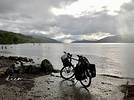
JU Juju83var ·
It's great to want to promote this cycling/waterway route. 🙂 If green tourism were as developed as "low-cost" tourism... everything would be better! People prefer vacations without making the slightest effort, wanting a lot for cheap. On the other hand, I think France has a poor value-for-money ratio for services, which means instead of keeping our tourists in France, they go abroad... too bad. (I know what I'm talking about since I have experience in tourism.)

See you soon... and happy rides! !😉
FA Facteur4 Regular ·
I wanted to take advantage of the forecasted weather to return to the Two Seas Canal and discover the Canal from Sète to the Rhône. While many internet users share their bike trips along the Canal du Midi, there’s almost no information about this canal that extends barge navigation toward the Rhône. Is the route uninteresting or impassable? http://ronfleur.r.o.pic.centerblog.net/cml9nkmu.jpg

Wednesday, March 18, 2009 – Valence d’Agen 9:30 AM to Rangueuil 5:00 PM, 95 km Even though I packed warm and rain clothes, my MTB weighs 30 kg. The first few meters feel tough, especially since my derailleur refuses to work even though the gears shifted fine yesterday on my way home from work. Am I going to have to delay my departure? Turns out the straps I used to secure plastic bags with clothes over the rear rack were pressing down on the panniers. One of them was interfering with the gear cable’s curve, preventing the derailleur from working. I adjust the cable housing to free it up.

Here I am on the paved bike path along the lateral canal to the Garonne. Don’t worry, I won’t describe the canal between the Two Seas again. You can refer to previous accounts, maybe starting from page 1. What’s changed, unfortunately, are some trees felled by the storm on January 23, 2009, for example, at the exit of Castelsarrasin. Plus, red marks on the few chestnut trees in the area worry me. Have they decided to remove them?

The weather is so nice that I imagine having lunch on the terrace of the lockkeeper’s house restaurant in Montech. But the tables haven’t been set out, so I prefer to eat in the sun at the picnic area after the road bridge. I realize I forgot my compote pouches to go with my cookies. Luckily, my lunch was light because after Montech, the bike path still isn’t finished. It’s under construction, and the passage is blocked by a mound of dirt. I keep following the canal anyway and come across excavators stabilizing the banks with large rocks brought in by a barge. Thankfully, it hadn’t rained because I have to ride through ruts, jostled by the tracks left by the caterpillar treads in the dirt. I quickly get warm and switch to a T-shirt, shorts, and sandals for the rest of the afternoon. There are about fifteen kilometers left to finish the bike route in Tarn-et-Garonne. The cost of this section between Montech and Pompignan: 1 million euros (half covered by the Department, a quarter by the Region, and a quarter by the State).

Then I find gravel on the last stretch of Haute-Garonne to be paved so the Greenway can be completed, allowing a ride from Bordeaux to Toulouse without leaving the bike path. Once the Fontet->Sauveterre de Guyenne connection is made to join the Roger Lapèbie path, it’ll be done.

On this Wednesday, rowing clubs are out, and I’ll finish this pleasant first stage on pavement. Only a gnat in my eye, despite my sunglasses, bothers me. A sharp sting and the feeling of not seeing anything forces me to stop immediately. As I approach Toulouse, I’m tempted to follow a group of young cyclists starting a training session. This forces me to leave my cruising speed of nearly 20 km/h to reach 23, then 27. I follow them for a few minutes until they stop, surrounded by their coaches. My bell rings don’t seem to make them understand I want to pass. I almost have to stop and squeeze between the bikes. Furious that cyclists aren’t more aware of the nuisance they cause, I snap, “Where do you think you are?” One of the coaches replies, “On the canal.” So I add, “It’s a bike path, not a parking lot!”

Here I am at the port of Toulouse, and bad news—the Movimento bike shop is permanently closed. A sign says: *We were waiting for customers!* No luck last time when I wanted them to tighten my pedal, it was their day off (Monday), and today when I would’ve asked them to adjust my derailleur, it’s over. It’s annoying because it keeps clicking on some gears, and my screwdriver adjustments haven’t improved anything. The small Casino nearby is still open, and I can buy compote pouches and a few odds and ends to complete dinner at my daughter’s. After my dry lunch, I crave fresh produce, and strawberries catch my eye. But since they’re imported: http://www.vous-avez-dit-durable.org/...dale-%C3%A9cologique

I opt for kiwis grown in the Southwest instead. Unfortunately, the season must be over because they’re labeled New Zealand. So I buy two apples produced in France, though they must’ve spent the winter in cold storage.

Thursday, March 19 – Rangueuil 9:00 AM to Marseillette-Capendu 6:30 PM, 124 km I’ve barely covered 5 km along the Canal du Midi when I come across a dredger that’s started work. Further on, a storage of soft mud is secured by a wire fence. Better not step in there unless you’re a fan of quicksand. After 50 km of pavement, I arrive at Port Lauragais, and as soon as I leave Haute-Garonne for the Aude department, the towpath becomes dirt, stones, and roots. After the Naurouze watershed, I reach the Ségala, and since it’s 12:15 PM, I decide to give the Relais le Riquet another chance. Same invitation to leave my bike in the sun, but I negotiate with the young man to store it by the restaurant entrance. It won’t bother anyone since the terrace is being redone. The owner confirms it’ll be operational next week but adds that maybe it’ll snow then. Inside, after ordering grilled magret, I chat with a friendly 84-year-old woman. She tells me that in summer, cyclists sleep in an unused barn with straw, without bothering the owner who lives in Toulouse. She asks the restaurateur’s son to come open a stuck door in her house. Solidarity still exists in the countryside. Before hitting the road again, the sun invites me to reapply sunscreen and lip balm. A few roots later, the latter gets ejected from the side pocket of my handlebar bag as I arrive a little too fast.

In Castelnaudary, there’s a contrast between the Crown Blue Line boats huddled together, still in winter mode, and the first swimmers. Two young guys, trying to impress a group of teenagers, jump into the canal water. Luckily, I hadn’t planned to eat here. The restaurant terraces facing the port are under construction, and everything seems closed. Further on, I discover that the Herminis lock crêperie won’t open until June! I finally reach the Occitan relay where I’d like to sleep in the barrel like before. I ask a man sitting on a mat on the ground if he knows where the owners are. He replies that he’s right in front of me. I didn’t recognize him because he’s grown part of his beard, and I don’t remember him wearing glasses in September. But most of all, he’s started replacing the beams in the cellar because, to his dismay, rainwater running down the wall rotted one end of the old ones. Plus, he’s suffering from double sciatica, forcing him to drag himself around. That’s what you call working yourself to death. No way to sleep in the cellar under construction—it’d be too cold anyway. So I sleep in one of the guest rooms for a bit more money. Not feeling up to going out for dinner, I make do with cookies, compote, and tea offered by the owner.

Friday, March 20 – Marseillette 8:30 AM to Agde 5:30 PM, 97 km Waking up early as usual, after packing my things, I head to the kitchen where breakfast is served. Luckily, it’s not closed, and I take refuge there since I didn’t turn on the heaters in my room, just adding a second blanket to sleep. While waiting for breakfast, which I didn’t dare ask for before 8:00 AM, I find some cocoa powder and add hot water from the kettle. I browse the many tourist brochures available. Actually, the owner, bringing me mine, tells me that the couple in another room ordered theirs for 7:00 AM.

I’m glad I used my lock, even though it was completely unnecessary in the locked cellar, because I can’t find my keyring in any of my pockets. It’s on the floor in the room (next to where I’d set my bag). Second false start—I’m missing a glove (rust-colored). I find it on the floor tile. I put on my gel saddle cover. Why didn’t I use it before, since its weight added to my load? Not out of masochism, but to test my new saddle bought for 10 € at Lidl. It’s an MTB saddle with integrated gel but narrow and thus lighter than the comfort model offered at the same price. I now know I can do long rides with it on the road and even on trails, so I don’t need to bring the cover, even if it’s a plus on the Canal du Midi.

Here too, they suffered from the storm, and the towpath is still littered with small wood debris. I break many small branches, hoping none will break a spoke. I reach the Aiguille, where the lockkeeper must have plenty of wood to add to his sculpture collection. He’s displaying an elephant. I’m then tempted to take a small road along the canal on the other bank, then continue despite the dead-end sign. The path stops at a company’s access. Not wanting to turn back, I continue on the grass along a trail beside the canal. The trees force me to get off the saddle and bend down. The passage is very narrow, and there’s almost no dirt between the trees and the bank. Passing through a pile of floating debris extracted from the canal, I reach the Puichéric lock.

But on the peninsula side, and I only have to cross on the lockkeeper’s footbridge. Not only is it forbidden, but it can be dangerous. My panniers don’t fit between the railing and the control box for opening the gates, which is operated with a crank: http://yanous.com/...g/Canal/Ecluse02.jpg I have to lift them to get them over. As always when pushing a bike, the handlebars twist, and my front wheel falls right into the gap between the two gates, pulled by the weight of the front bag and almost into the canal. I manage to free it and cross the second half of the footbridge with difficulty. I recommend not leaving the towpath by following the directions (see “the right side”) on Philippe Calas’s website: http://www.canalmidi.com/vtt.html (don’t close this webpage—you’ll get pleasant background music)

After a few kilometers to recover from my emotions, I arrive at La Redorte and get off to walk on the stones of the spillway: http://photomaniak.com/...anchoirLaRedorte.jpg A woman walking her dog asks if I know it’s a listed historic monument. I tell her yes. The Argent-Double spillway was completed in 1694 according to Vauban’s plans. This technical and architectural stone structure, composed of 11 arches, allows the canal to discharge excess water and empty the reaches during shutdowns into the Argent-Double River. This spillway was built out of necessity since it wasn’t included in the initial works. Floods from the Argent-Double largely flowed into the Canal, and branches and sand deposits clogged its bed, hindering navigation. In 1996, the entire Canal du Midi was listed as a UNESCO World Heritage Site, and the Argent-Double Spillway was registered as a Historic Monument. We walk a few hundred meters together, and she tells me that when she was a nurse’s aide, her passion for the canal was born from meeting a hospitalized teacher. The teacher suggested discovering the canal by bike. They descended the mountain channel, then the plain channel, then the canal with old bikes and rudimentary camping gear. At one point, they preferred falling into brambles to falling into the canal and finished an 80 km stage with burst blisters on their backsides. Less courageous and knowing I’ll have to follow many meanders, I decide to take the D11 from Homps to head straight to Capestang. That’s cheating! But since I’ve already covered this area twice, I allow myself to avoid extra kilometers and alternating headwinds and tailwinds. How lucky drivers are to ride on asphalt! I must not pollute enough to have that right. With the wind’s help, I reach 30 km/h, and even the uphill sections seem minor with the favorable wind. At noon, I arrive in Capestang, where I plan to meet the canal and the tourist restaurant. I start climbing toward the town center and think that for the canal, I’d better go down and find myself back at my starting point on the D11, discovering the Relais Bleu nearby where I have a hearty family-style lunch on the terrace. I rejoin the canal at its first intersection with the road. The trees have no leaves, so I fully enjoy the sun. The only shade is from the plane tree trunks, but it hides the roots, and I’m caught off guard, barely able to distinguish them with my sunglasses. I reach the Malpas tunnel and, after crossing the Ensérune hill, while the wind had been favorable until then, dead leaves are blown toward me. As usual, arriving in Béziers, I face a headwind. I greet a kindergarten class on a walk. I pass a very colorful building, the Zinga Zanga, which seems to be a cultural space: http://www.ville-beziers.fr/...es/fiche.cfm?num=455 At the city exit, I find the bike path to Portiragnes and retired cyclists hurrying home, exhausted by the onshore wind. After about fifteen kilometers, I take the towpath that will lead me to the round lock of Agde. The wind becomes strong and very cold, and at 4:00 PM, I put on my hat and gloves. At Port Cassafières, I regain some strength. The barge *Béatrice*, a bed and breakfast, isn’t moored there. I can only check the rates, too expensive for a solo traveler. I arrive at the Agde tourist office before it closes and choose the Hôtel La Galiote: http://www.lagaliote.fr/index.php for its two stars and single room at 35 € in the off-season. It’s located on the banks of the Hérault in the former bishop’s residence of Agde. But the Dutch owner, settled here for 23 years, tells me she can only rent me a room for 45 €. It has the advantage of a terrace I won’t use and a view of the bell tower-dungeon: http://www.sports-sante.com/...rault/cathedrale.jpg I don’t recommend this room No. 7 where water runs constantly in the toilet, the radiators make noise, the shutters don’t close, a bedside lamp doesn’t work, the TV is too small for the room (unless you watch it standing), the curtains are gray, and the showerhead is clogged. Positive points: the bed and breakfast, during which I learn that in season, people are willing to sleep in the hallways.

Later, I call the Cap d’Agde tourist office, and the staff can’t tell me how stars are awarded: http://www.hotelaparis.com/blog/etoiles-hotel.html

Not more reassuring: http://www.vie-publique.fr/...-bientot-renove.html

After checking the weather online (unfavorable northeast wind) at a computer service shop and buying some cookies, I want to get the IGN walking map at 1/100,000 scale No. 66, which continues from mine that stops at Sète. But for its new edition, the National Geographic Institute has redone the division and numbering. I’d be forced to buy new maps sold here for 10 € each. I give up and get a BLAY map at 1/150,000 scale (less detailed) but laminated and cheaper.

Saturday, March 21 – Agde 9:00 AM to Aigues-Mortes 5:00 PM, 80 km I retrieve my bike from a garage the hotel let me use for free. I’m very close to the Hérault, which barges use for a while to continue on the Canal du Midi. I know it’s useless to try to follow the towpath, which disappears quickly after the Bagnas lock. I stay on the embankment to cross the nature reserve. But horse breeders took advantage of the winter to reinforce the fences. Last summer, it was enough to loosen a wire loop to swing the fence and put it back after passing. Today, it’s impossible to untwist by hand. I’m forced to climb over. It’s tricky to approach the barbed wire while lifting my MTB. It gets caught, and I’m stuck for a moment with my arms in the air (I’d appreciate not traveling alone here. By the way, I suggested to my colleagues to join me in discovering the canal, but it’s hard to match schedules). I climb over the barbed wire and ride to the next obstacle. Here, it’s cleverer—a pallet on its side acts as a gate. Just release the latch and swing it. To prevent animals from passing, it’s hidden like an arena refuge with other pallets held vertical by stakes. Hard to squeeze through with the panniers.

I arrive at the end of the Canal du Midi and head toward Sète. At the roundabout, the road is blocked, and I end up in a boat maintenance and guarding company. Here, speedboats are stacked on three levels like in a supermarket. They explain that the Sète road isn’t closed—it’s the new road that isn’t open yet. The N112 is set back from the coast to create a new beach development and the bike path that will connect Agde to Sète. I quickly come across the construction site and hesitate to follow the cars taking the detour. Since I passed here last year, I don’t take much risk following the beach on the old route, even if some sand slows my progress. I quickly find the part of the path already completed and cross paths with two Koreans on heavily loaded bikes. I would’ve liked to chat with them, but we just smile as we meet at the same time as a group with a stroller and a grandpa on a bike.

At the Sète tourist office, they can’t give me any information about bike access to the canal toward the Rhône. The mystery deepens, though the hostess says she often gets questions about it. Luckily, along the way, I asked a mountain biker who told me about pleasant rides there, accessing it at a footbridge in Frontignan Plage. The hostess confirms I’ll find the Canal from Sète to the Rhône there but must first take the N112.

That’s what I’ll do, as I assume if I follow it from the port, I’ll be blocked by warehouses or other industrial buildings. First, I’ll regain some strength nearby on the covered terrace of L’Horloge Marina: http://www.linternaute.com/...horloge-marina.shtml A small, very decorated restaurant with as many clocks as time zones and maybe more African masks in the restrooms (not to be missed). First come, first served, though my marinière mussels aren’t very hot. I then face a short stretch of the N112 after putting the bright yellow cover on my front bag and letting some of my poncho of the same color flutter at the back. Then a bike path serves the holiday villages of Frontignan Plage. The wind is strong, and I’m surprised to see cyclists in T-shirts (though they have a tailwind) while I’m bundled up. I reach the bridge over the canal and can finally discover it.

The towpath of the Canal from Sète to the Rhône is, like the others, off-limits to all vehicles (except those of Voies Navigables de France). But in addition to the white circle with a red border, a second one has a bicycle symbol. That’s why there’s so little information about biking along this canal! Yet the path is wide and very drivable. In fact, the first meters are frequented by many cars to access an activity site this weekend. And I cross paths with a few cyclists who confirm I can go as far as Palavas-les-Flots and La Grande-Motte. Then only seagulls keep me company. I barely disturb their sunbathing digestion after they gorged on mussels. The bivalves proliferate on the riprap of the banks in the calm waters. Countless shells attest to their demise. While I understand the idea of building canals through land with elevation changes making their construction difficult, I’m surprised this canal was created through water, even if it’s flat (only 3 locks to descend from the Rhône). On this bank, the path is a few meters wide; on the other, it’s sometimes just a brick wall securing barge navigation. Strange this hydraulic path through water: http://2.bp.blogspot.com/...Yp8JQ/s640/canal.JPG

After covering 90 km along the lateral canal to the Garonne and 240 along the Canal du Midi, the scenery change is brutal. First, the canal and path are wider, and in the first part, there’s no vegetation. I’m in the middle of salt ponds: not a tree for kilometers, and it’s a bit sad. But you won’t trip on a root—the gravel path is much smoother. Despite the size, the first boats I meet are pleasure craft, moored—a Dutch and a German one, neat and tidy, contrasting with a Latin “Horizonte” in rainbow colors and chaos: http://www.trekearth.com/...ance/photo819989.htm

Between Palavas-les-Flots and La Grande-Motte, there’s a bit more vegetation and some pink flamingos. http://accel10.mettre-put-idata.over-blog.com/...-du-rhone-a-sete.jpg

http://www.sports-sante.com/...c/flamants-roses.jpg

I face the wind and take refuge in a ditch to have my snack. I finally pass a pusher, the *SIRIUS*, with its heavily loaded barge. I’m surprised to hear a diesel engine running at the front. Maybe it’s the cargo ventilation system. I pass a club where young people are having trouble launching their rowboats. After hesitating at the intersection with the Lunel canal, I reach Aigues-Mortes. The magnificent ramparts surrounding the city for 1,634 meters are the reward for my journey. They were financed by a tax of one denier per pound of merchandise after Louis IX built a causeway-dike as the only land access between Aigues-Mortes and the mainland. The salt marsh now extends over 10,800 hectares of wild land where seawater, after being pumped, circulates for 5 months and gradually concentrates to allow crystallization on salt tables. The collected salt is then stored in *camelles*, real salt mountains over 20 meters high and 400 meters long. In 1240, Saint Louis decided to build a city at the gates of his kingdom to open access to the Mediterranean. It would be Aigues-Mortes in a land of marshes, sand, and water. Seven centuries later, its fortifications dominate the Camargue, offering one of the best-preserved medieval architectural ensembles in France (as they say, salt preserves). http://www.web-provence.com/.../aigues-mortes-1.htm http://upload.wikimedia.org/...is-Aigues-Mortes.jpg I dine very close to Place Saint-Louis at *La Tora* with bull gardianne. But I chose a hotel outside (cheaper). You can have breakfast early there because the bar is the meeting place for hunters and fishermen. http://www.ot-aiguesmortes.fr/HOTELS/LEscale.htm

Sunday, March 22 – Aigues-Mortes 8:30 AM to Beaucaire-Tarascon 5:00 PM, 60 km + 10 in town One of the bar customers is tasked with opening the garage where I retrieve my bike. After a few hundred meters, there’s a canal intersection, and I can’t pass. I spot a road bridge that lets me return to the towpath on the other bank. I then understand that Aigues-Mortes is served by a canal branch. I pass the *SIRIUS* again, which will unfortunately be the only freight transport. A decree from May 2, 1956, prohibits bicycle traffic. I owe it respect since I was born in ’59. But I continue on a path that becomes less smooth. I hesitate to turn back to go to the other bank where cars drive on a small road, as my drivable path disappears into the grass, which seems mowed. A walking couple advises me to change banks at Gallician to avoid wild bulls, then cross back at Franquevaux to avoid the lock and enter Saint-Gilles from the right side. But the second bridge doesn’t exist on the map, and indeed, it’s cut off. I’ll take the next one. The north wind slows my progress—luckily, I planned a short, touristy stage. I couldn’t miss Saint-Gilles, its abbey church, and the crypt of the saint with my name. First, I discover the vegetable gardens benefiting from the Rhône’s alluvium (and its pollution). They’re delimited by a hodgepodge of sheet metal, car hoods, planks, and anything to block the wind. On this Sunday, the market is lively. I buy spring rolls that tempt me but would be hard to dip in the sauce in the little packet. I search in vain for a wind-sheltered spot next to the abbey church and finish my meal with a large piece of Saint-Gilloise tart. http://www.art-roman.net/stgilles/stgilles.htm A woman ensures presence and surveillance inside the church (I admire such devotion but still wonder how a rational mind can believe). Access to the crypt is free, and the stone staircase bears the marks of thousands of pilgrims who’ve worn a wide groove in the steps. It’s immense and forms a lower church with 3 naves. It houses the tomb of Gilles, the local hermit who gave it its name.

Heading toward Beaucaire, there are more and more trees, but they’re insufficient to protect me from the strengthening wind. I avoid a hole that’s almost half the width of the bank. I stop to place a vertical branch to make it more visible. It’s the only one I’ll encounter. No reason to ban traffic. I hear roars that I attribute to off-road motorcycles, but as I approach, I discover remote-controlled speedboats. The pilots, with their remotes, take advantage of a canal branch and its concrete banks to race at full speed.

In Beaucaire, the tourist office is closed, and despite a sign listing hotels, I can’t find any except one above my budget. I decide to go to Tarascon. To do this, I just have to cross the *con* bridge! I’ll have to circle for a while to find the Hôtel du Viaduc after the train station. After showering, I get the idea to take my bike to return to the town center, though it’s very close. This lets me tour the city: http://www.web-provence.com/villes/tarascon.htm without finding many open restaurants (or even an internet café). I end up at *Foot +* (ironically) eating at a kebab place, then choose to turn on my only headlamp in red behind my head to return.

I now know you can bike along the Canal from Sète to the Rhône. But I’m disappointed not to have enjoyed the Camargue’s magnificent summer landscapes. When all the salt marshes are colored pink by algae and small crustaceans that I suppose give flamingos their color. What to do now? Since you can’t bike along the Rhône and the weather forecast predicts bad weather except in the Southeast: continue in that direction. What’s certain is that I won’t go greet a military buddy in Lyon because a strong north wind is still forecast.

Monday, March 23 – Tarascon 9:30 AM to Aix-en-Provence 4:00 PM, 90 km. It’s surprising how easily you cross departments. After Hérault and Gard, I’m tackling the wild boar. That’s the idea that comes to me when I see the Bouches-du-Rhône’s outline (though it’d fit the Ardennes better). Too bad their numbers won’t appear on license plates anymore. It’s thanks to registrations that, on vacations with my parents, I learned to know and love our departments. Such a decision shouldn’t be made without considering the cultural factor. I buy the Michelin map of Bouches-du-Rhône and Var and go to the tourist office, which opens at 9:00 AM. A friendly Tarascon native welcomes me, but despite his goodwill, he can’t give me a bike route on the Via Michelin site. I thought that option was available. So I choose secondary roads that, on my map, lead to Aix-en-Provence. A delight: Pushed by the north wind, I ride between olive trees and flowering peach trees on departmental roads where, mostly, a bike lane (brown pavement) has been created. Thanks to the Bouches-du-Rhône General Council. If all France’s roads were like this, we could reconcile cars and bikes. The D17 takes me to Maussane-les-Alpilles. A squirrel is panicked when a dump truck passes me with a roar. For a moment, I fear it’ll turn back and throw itself under its wheels. I arrive in Mouriès, the first olive-growing village: http://www.chambresdhotes.org/...es/Detailed/226.html To take a break from the wind, I sit at a bar counter and order hot chocolate, but no luck—it’s an open house to bring in buckets of sand (work in progress). The D10 runs alongside barracks that seem deserted for hundreds of meters. It’s the Miramas military camp. Then offers a pleasant view of the Étang de Berre, its Beau Rivage port, and... its refinery. At my request, the accommodation service at the tourist office suggests the cheapest hotel in Aix-en-Provence. There are no rooms under 50 €. I still give my credit card number to make the reservation right away since I can park my bike in the inner courtyard. http://www.aix-en-provence.com/hotelpaul/ The Hôtel Paul isn’t very modern, nor is the decor. The only trendy things are the energy-saving bulbs that, after warming up, deliver a dim light. Too bad these stars of the Grenelle Environment are a mess: http://www.wat.tv/...ion-1j69x_k6os_.html

Aix-en-Provence is always lively, and you can get lost in its pedestrian shopping streets. Here, they don’t hesitate to put out terraces. The wind is there, but so is the sun... As at each stage, I call my wife to tell her where I am. She exclaims, “If you keep going, you’ll go see Jacquot!” She guessed my intention to surprise an old colleague who now lives in Saint-Raphaël. But I’ll have to face the N7 for over 100 km. On the map, I didn’t find another obvious route. Ah! It’s become the D7—already less worrying...

Tuesday, March 24 – Aix-en-Provence 8:00 AM to Saint-Raphaël 5:00 PM, 135 km. Leaving the hotel, I let myself be carried down the boulevards following “all directions” signs amid heavy traffic. While the day before, visiting the city on foot, I’d spotted the N7’s start, today I get lost, guided by signs and even passersby I ask to direct me toward the A8 highway heading to Saint-Raphaël. I end up asking a gas station cashier, who advises me to return to the city center. I redo the circuit that, like yesterday, with clever loops, takes me to the tourist office. Finally, I find my direction after 40 minutes of nothing. I suppose with these 7 km of stress, many would’ve already filled their biking day. Many clouds over Montagne Sainte-Victoire; in Rousset, I pass a roadside restaurant *NPA* (I suppose *Nowhere Else*), which could become the anti-capitalists’ meet-up. After 24 km, finally a sign: Saint-Maximin 20 km, Saint-Raphaël 102. It’s not the time for *Trenet*—it’s not 10:00 AM, and the N7 is mine. To make nothing easier, over 100 km, I’ll encounter less than 1 km of bike facilities. I have to ride to the right of the road markings when there’s a bit of pavement or on those dotted white lines to stay as far as possible from cars and trucks. Luckily, the Mistral forecast at 70 km/h pushes me for most of the route, and I reach 56 km/h for the first time in a descent (without pedaling). But sometimes, from 40 or 50 km/h, my bike wobbles a lot, certainly due to a crosswind. I take refuge in a McDonald’s for a light meal (the problem is that an hour after fast food, you’re hungry again). Further on, I think I’ll give up when gusts push me onto the sidewalk or guardrail. Even when I lock my wheels by braking, I keep being pushed (luckily to the right) while skidding on the gravel. There it is! I’ve understood why the Canal from Sète to the Rhône is off-limits to bikes. I’m drunk on wind and consider stopping. Sheltered behind a building, I manage to unfold my map. After Le Muy, where I’ll have tea, the road turns slightly south, which will let me no longer have a crosswind.

Arriving in Fréjus, it eases, and I cross my first bike. Now I have to find my friend’s home using his address. I ask a retiree at a bus shelter. He’s a very urban Englishman who even offers me his map from the tourist office. But I don’t want to leave him without it and regret it a few kilometers later when I ask passersby for a Saint-Raphaël street while still in Fréjus. He lives in the upper part of the city (near the golf course) and enjoys a superb view. Most of the residence’s studios belong to a tourism company. You can rent one for at least 2 nights. That’s what I do. At dinner (which he prepared with his partner), we discuss his pleasant living conditions. Unfortunately, work isn’t the same. He works on a customer service phone plateau all day. Spied on by his boss, who ensures he doesn’t spend too much time with a customer and tries to sell them a new service. Timed breaks: he even goes to get a colleague who stayed too long in the restroom! Him, helpful and loving human contact, is disgusted by this new job. That’s what happens when you replace the Public Service with the race for profitability. That’s what people wanted by voting UMP, and apparently, they want more for the European elections. I’ll make another choice: http://www.partipourladecroissance.net/?p=2922 But for this vote, you have to get involved by printing your ballot (you’ll understand the campaign isn’t funded by multinationals), as well as the posters for the electoral panels.

Wednesday, March 25 Tourism on foot between Saint-Raphaël and Fréjus under the sun with a bit of wind, I park my bike in front of the police station next to the office where I get a map and can check my emails and train schedules for free. For the first time, I decide to return by train. The young woman at the station ticket counter tells me I’ll have to put my bike in a cover (sold, for example, at Décathlon). That seems impossible to me to disassemble it and fit my panniers and luggage. I worry about the fine if I don’t. She says I’ll see with the conductor. I still ask for a ticket. While preparing it, she sees the bike option appear for 10 € because this train has a baggage car. Great! I pay the supplement, relieved. I can have dinner peacefully at my friends’ because the next day, after packing and returning the keys to my rental, I’ll just have to coast down to the station with my loaded bike around 10:00 AM.

Thursday, March 26 – Saint-Raphaël to Valence d’Agen, 681 km by train Funny to note that with my detours, I only did 692 km on the way out. Certainly, the Corail TEOZ doesn’t take the shortest route as it serves Toulon, Marseille, Nîmes, Montpellier, etc., before reaching Toulouse in 586 km, where I’ll take a TER for 95 km (against 90 by bike). Above all, it goes much faster—7 hours against 7 days. In the end, the 73 € (+10) ticket seems less expensive when you’ve done the trip by your own strength. For every machine we use, we should at least once do the same work by our own strength. Speaking of strength, I lack it to lift my 30 kg bike through the narrow door while climbing the two large steps to access the Corail car. I ask the conductor to help me. He says I have to manage alone (it’s in the rules) and ends up helping reluctantly, which causes my handlebars to twist, though it would’ve been simple if we each took an end. I still have to tilt the bike to hang it on the baggage car’s hook. A rail holds the rear wheel to stabilize it. A quick lock, and I’ll travel serenely. Later, I ask why they don’t open the baggage car’s access hatch. The conductors tell me it’s reserved for the disabled. Others will tell you they don’t have the key, even for a tandem. In fact, the trip will last 9 hours because we’ll stay 2 hours in Agde station (memories) due to a fire on the tracks. No compensation because it wasn’t SNCF’s fault. Much easier to load the bike (for free) in the TER at platform height. A few cycling commuters are returning from work. I chat with one, praising the Greenway parallel to the railway and its upcoming extension along the canal from Montech to Montauban, where he lives.

Epilogue: I see that Via Michelin does offer bike routes: 130 km between Aix-en-Provence and Saint-Raphaël (avoiding the D7) against 120 for the car route. I return to the grandpa (see previous trip) who runs the only remaining bike shop in Valence d’Agen. I tell him about the difficulties I have shifting gears after he changed the sprockets and chain and that it seems the chain isn’t tight enough. He shortens it and adjusts the derailleur and shifter for free but tells me I’ll need to change the latter soon. I thank him and find a more responsive and lively bike. Ready for new adventures...
Facteur4 : Objectif pour 2050 de diviser par 4 l'émission de gaz à effet de serre.
LA Languedoc11 Regular ·
What a great story packed with info!!! And also about the connecting canal—even for me, who lives not far from it near Narbonne... If you're ever in the area, hit me up! We’d be happy to host you. See you! 😉
Quitter le "avoir" pour trouver l' "être"...

http://voiliercorbieres.over-blog.com/ http://canoekayak.over-blog.com ( définitivement arrété mais conservé)
FA Facteur4 Regular ·
Thanks so much for this lovely invitation, but my current project will take me away from the Aude region. I’m going to take advantage of my daughter’s exchange at the University of Sherbrooke to visit her and bike the Quebec Green Route: http://www.routeverte.com/rv/index.php?page=carte

I’ll still be sharing my upcoming stories with you: - My first work trip by bike. - My first spins on a recumbent tricycle. I still hope to post them here soon.

And I’ll definitely get in touch later—you’ve made me want to return to the Canal de la Robine! I also want to give a shout-out to Marcus, a Brit I guided during the recumbent tricycle test ride last Sunday between Port Lauragais and the start of the Aude section of the Canal du Midi. He was heading to Carcassonne and then Narbonne.

Too bad the towpath doesn’t allow tricycles or two-wheeled trailers.
Facteur4 : Objectif pour 2050 de diviser par 4 l'émission de gaz à effet de serre.
LA Languedoc11 Regular ·
You’ll find my thoughts on the canal in the article "MTB route along the Canal des Deux Mers from Marmande to Sète." We’ve just returned from a little walking trip between the junction of the connecting canal above Sallèles and toward Capestang. The path is in pretty good condition, except that before crossing the bridge under the Minervois road before Argeliers, there are two huge roots where some riders must get quite a scare and/or lose a few "teeth" from their chainrings (no signage, yet there’s a real potential danger here... 🏴‍☠️). That’s part of the adventure, I guess!

I’m thinking about the tandem we saw—a recumbent rider with one seated—and I have no idea how they managed that little trap... As for doing it with a two-wheeled trailer, it’s still doable, though pretty annoying. I wouldn’t dare comment on a tricycle...

I’ll definitely check out your upcoming stories and let’s stay in touch! You can always reach me at the email address I sent you directly. @+ happy trails!
Quitter le "avoir" pour trouver l' "être"...

http://voiliercorbieres.over-blog.com/ http://canoekayak.over-blog.com ( définitivement arrété mais conservé)
FA Facteur4 Regular ·
I commute daily with my MTB and regularly use it for vacations (see previous posts). My manager selected me for a two-week assignment in Bordeaux, so I thought I’d use a mode of transport that aligns with my values and lets me combine work with pleasure. Since I live 170 km from Bordeaux, biking there wouldn’t have crossed my mind if the Greenway along the Garonne lateral canal didn’t exist. It offers me 110 km of continuous paved bike path from my home in Valence d’Agen to Castets-en-Dorthe, where the canal flows into the Garonne.

This was possible because: - My assignment involved testing a new version of a software application (used across several company sites) and didn’t require transporting equipment. All I had to bring were my brain cells (they really don’t weigh much) and a scientific calculator, which I ended up not needing since Windows provides one. - My travel expenses are reimbursed as a flat rate (no receipts required). I’m entitled to the value of the train ticket from Valence d’Agen to Bordeaux minus 15%, as my employer secured this discount with the agency where they book SNCF tickets. - My task started at the beginning of the week and ended at the end, allowing me to travel over the weekend.

However, the 49 € per night hotel allowance in Bordeaux didn’t make it easy to find a place. After searching online, I found one 3 km from my workplace in Talence: http://www.booking.com/...C_2poCFdVM5QodfRFJ3g which almost fits the budget (44 € on Sunday, 52 € other days). I was pleasantly surprised to find, in addition to the bathroom and TV, a kitchenette where I could prepare dinner and breakfast (it’s possible to eat in the dining room, but I don’t recommend it: frozen pastries and powdered fruit juice—TROPICO). Another advantage: I was allowed to bring my bike into the room. The downside: the front desk isn’t open 24/7. On Sundays, you must arrive before 8 PM. A big challenge: covering 170 km in a day and arriving before the hostess leaves. While you can sometimes choose vacation dates based on the weather, work isn’t like that. Rain is forecast for both Tarn-et-Garonne and Gironde. Plus, I’ve had a rhinopharyngitis for a week (which will last 15 days), and this weekend, I’ve lost my voice. So, I decide to take my bike but travel by train. I could’ve left it behind and walked from the hotel to work, using public transport in Bordeaux. Under no circumstances would I have rented a car (which I was entitled to).

Sunday, April 26, 2009: 162 km by train, 10 km by bike The train leaves Valence d’Agen at 5:56 PM and is scheduled to arrive in Bordeaux at 7:34 PM. That’s cutting it very close to be at the TENEO Suites in Talence by 8 PM. I call, and the hostess gives me the door code and the code for the locker where I’ll find an envelope with my room key. Phew—I was worried that if I’d biked, I might’ve arrived too late to access the room I’d already paid for. Indeed, to book online, you must provide a credit card number, and whether you show up or not, the first night is charged immediately. But that’s also what allows the hostess to share the codes. The only other Sunday train leaves at 7:41 PM. You have to wait 2 hours in Agen to arrive at 11:30 PM. And that’s only if they stop in my village—it’s the General Council that pays for that (for Toulouse, there are 3 Sunday trains). It’s still just as difficult to load a loaded bike onto the Corail carriage, where SNCF graciously provides a bike compartment. Fortunately, a young man spontaneously helps me lift it up the narrow wagon door. Then, tilting my MTB, he places the front wheel in the designated hook, and the rear wheel fits into the slot to prevent the suspended bike from swaying. I thank him. The TER arrives in Bordeaux 10 minutes late, and I prefer to call the hotel to confirm I have the right code. I turn on my GPS, which guides me to the hotel. In bike mode, it seems to select streets with bike lanes. But on these side streets, cars are sometimes parked straddling the sidewalk and the road, blocking the bike lane. The hostess is still there, even though it’s past 8 PM. She’s closing out the computer system and isn’t very welcoming (later, I’ll notice she’s much friendlier with women than with men). My bike barely fits in the elevator, saving me from climbing three flights of stairs.

Monday, April 27 to Thursday, April 30 A 3 km bike path takes me to work. But the first part is odd. Cars also drive on the path and are allowed to go onto the central median where the tram runs to pass bikes. The tram tracks are marked by metal curbs, as seen in the top-left photo: http://portrait.sebrieu.com/public/bordeau...au_bordeaux.jpg When traffic gets heavy, the opposite happens: bicycles go onto the tram tracks to pass cars. At first, I thought Bordeaux was quite inventive in sharing road space between trams, cars, and bikes. Then I called the city’s “Monsieur Vélo,” who responded with near-military precision. Actually, from my hotel, it wasn’t a bike path at all. In this boulevard, where the tram occupies the central part, there’s a single lane on each side with bike symbols painted to alert drivers, who are indeed allowed to go onto the central lane to pass cyclists. However, bikes are prohibited from riding on the tram’s right-of-way. It’s less appealing than I thought. I was impressed by the number of bike paths in the Bordeaux Urban Community and even more by the planned projects: http://www.lacub.com/service/images/velo/L..._verso_2008.pdf http://www.lacub.com/..._pistescyclables.asp (these brochures were given to me at the tourist office) I also appreciated the bike lanes on Bordeaux’s boulevards, which keep you from rubbing shoulders with cars, even if they don’t protect you from exhaust fumes. You can ride along the entire ring of boulevards around the city. The developments along the Garonne quays are also impressive. The second phase was inaugurated on May 23 with the “Family Sports Space,” featuring volleyball and soccer courts on sand, and a Basque pelota fronton: http://www.bordeaux.fr/ebx/portals/ebx.por...ard&id=1581 A lovely invitation to relax, which you can discover by coming via the Roger Lapébie path (50 km from Sauveterre de Guyenne) or arriving from the ocean via the path from Lacanau, with more long-distance connections to come.

On Monday, it’s 1 km of boulevard and 2 km of bike path that take me, guided by my GPS, to my assignment. I lock my bike to the pillar of the overhang leading to the security post. I present my ID to get a magnetic access badge. The hostess tells me that tomorrow I won’t be able to leave my bike here and will have to put it in the parking lot. I reply that there’s no way I’m leaving it in the rain. She says that if she allows it, scooters will also park in front of the entrance and validates my access to the underground garage. With my badge, I get automatic door access for service cars, a few motorcycles, scooters, and bikes to stay dry.

As Boris Vian said: What proves that by protesting When it’s still time You can end up Getting Accommodations.

Truth be told, this week I’m living like a king: In the morning, I have breakfast while listening to the latest hits on TNT. I realize they cut the music videos and play the same sequences every day (quickly gets old). I ride leisurely on a pleasant path while cars hunch over. I park my bike sheltered from the elements and theft. I zone out all day in front of the computer, doing calculations and trying to find flaws in the new software. I take a nice lunch break at the company cafeteria. In the late afternoon, I stop by Casino or a sandwich shop, and if the rain allows, I dive into traffic toward the center or the quays. In the evening, I dine in my little apartment, whose balcony overlooks the 7-screen cinema complex and the boulevards where trams glide by.

We’re now at the three-day weekend, for which I’ve booked at the Family House in Arcachon. Since I have free access to the office where I’m testing the software according to an established protocol, I’ve been able to come in early every morning and am allowed to leave at 3 PM this Thursday. Fortunately, because it’ll take me almost 4 hours to cover the 60 km between Talence and Arcachon: http://www.viamichelin.fr/viamichelin/fra/...eraryFuelType=0

First, my GPS insists heavily on sending me onto the highway, making me take detours and doubt whether I’d set it to bike mode. Then, 3 hours of light rain accompany me. It’s not easy with rain gear and a 30 kg bike that’s “soaking wet.”

Friday, May 1 In the morning, a 15 km walk lets me discover Arcachon and the Abatilles spring under a gray but rain-free sky. The town is very spread out and pleasant. http://www.arcachon-nostalgie.com/.../SourceAbatilles.htm

On this Labor Day, we’re treated to 6 oysters and bouquets as an appetizer. I’m seated with a couple and three women traveling alone. At 49, I’m the youngster in this period when the family house of my works council is occupied by retirees. The crowd gets younger over the weekend.

In the afternoon, I decide to go to the Teich ornithological reserve, and the director advises me not to take the slightly inland bike path but to follow the coast to enjoy the basin: http://www.tourisme-gironde.fr/...cyclable_bassin.aspx I try to follow the coastal path, which is very difficult—even impossible—without a guide. Indeed, the Arcachon Basin’s shores are constantly cut by oyster farms, small harbors, or channels. You regularly have to leave the coast for the road and find the right spot to return to it. As I finish skirting clarification basins, a sign for the coastal path invites me to return to the shore. The path is narrow between dredging embankments and shrubs. Hard to navigate on foot, even harder with a bike in hand. I struggle forward, nearly falling into a ditch, only to end up almost back at my starting point without my bike clips (probably caught on some branches). On the verge of giving up, I meet a group of walkers, one of whom, a local, offers to guide me. We walk a few hundred meters, and I feel bad for taking him away from his family or friends. He finally shows me a small gap in the embankment leading to the coastal path (you really have to know it). A few more difficult sections, and I arrive in the ornithological area, set up for walking and biking. The reserve is much busier during spring and fall migrations. But the site is pleasant, and I cross paths with many visitors there to observe birds: http://www.parc-ornithologique-du-teich.com/ I decide to return to Arcachon via the bike path, which is easy to find near the train station. However, there are no direction signs. A rectangular sign indicates Le Teich 1.5 km, La Teste 11 km. That must have seemed so obvious to the person who put it up. For a foreigner, the two names are already similar! Coming from the Teich reserve, I guess the direction to follow and ride on the pleasant bike path until the next intersection between two paths, where a still-rectangular sign indicates Arcachon 8.5 km. I choose to go left and ride a few kilometers on a smooth path. At a roundabout, the road signs don’t bode well, and since I didn’t bring a road map or GPS to travel light, I choose the most plausible direction. After a 10 km loop, I find myself in front of the same Arcachon 8.5 km sign. I give up trying my luck to the right, assuming that every time two bike paths cross, there won’t be any more signs. I take the road, and at every intersection, directional signs are present. I conclude that bikes don’t pollute enough to deserve information.

Saturday, May 2: Arcachon 9 AM to 5 PM, 102 km

I used my wanderings from the day before to locate the dock and the boat schedules for crossing the basin between Arcachon and Cap Ferret. One way: 7 €, round trip: 11.50 €, bike: 3.50 € per crossing. You’ve guessed that my goal is to ride the bike path around the basin: http://randovtt33.free.fr/...-cyclable_bassin.pdf I quickly pay the 10.50 € as many travelers and cyclists are about to board the ferry. But I’m the only one with panniers, and the captain asks me to remove them (they only contain the cold meal the director hastily prepared so I wouldn’t miss the 9 AM ferry, loaded with cereal bars and other snacks). I explain it’s not possible because they’re secured with zip ties, and I help him lift my MTB above the cabin of his small boat: http://www.uba-bateau-arcachon.com/ I cross sitting at the back of the boat, my back to the sun, which announces a beautiful day with its thousand reflections on the calm waters of the basin. Cyclists helping each other makes unloading easier, and we ride together for a while to reach the path. I leave them to visit the typical oyster-farming village of L’Herbe: http://expos.contexte-photo.com/...LAGE_OSTREICOLE_.htm The path is very pleasant under the pines, and the limited number of intersections and sufficient signs reduce the chances of getting lost. The pine forest is a natural forest because, without human intervention, holm oak would dominate here. But enough is preserved so that birds that destroy the pine processionary caterpillar can nest. Without this precaution, the pines would be ravaged by the caterpillars’ larvae, which suck the sap from their needles. However, the pine is essential for stabilizing the coastline and, together with marram grass, helps retain the dunes. Here I am at Grand Crohot, and I lock my bike, which isn’t great for crossing the dune, to go barefoot and picnic on the beach. This weekend, many surfers enjoy waves generously fed by the northwest wind. It slows my progress, and I give up going to Lacanau Ocean, where I would’ve found the path from Lacanau that skirts the lake. I cut through at Le Porge to find it again: http://randovtt33.free.fr/...-cyclable_bassin.pdf With the wind at my back and under the sun, I return toward the basin. All this whets my appetite, and it’s at the children’s playground in Arès that I start my second picnic. I see a tandem pass by, and even rarer, a recumbent tricycle. I don’t realize at the time that there’s a specialized shop nearby: http://www.optima-cycles.com/...din_veloscouches.htm How silly of me to have passed so close on a Saturday! (Even though it’s between two holidays, I’m still kicking myself.) http://velocouchegirondin.over-blog.com/article-27977709.html (turn on the sound). To finish my loop, I skip the maze-like path and take the road along the basin from Le Teich. There, I have to deal with heavy traffic, and I’m increasingly bothered by pretentious 4x4s. Back at the Family House, the director confirms there’s a signage problem on the paths and that it’s already been reported.

Sunday, May 3: Arcachon 9:15 AM to Talence 5:15 PM, 110 km For the return, I don’t want to take the N250, which has become the D1250. But there’s only one bike path connecting the coast to Bordeaux, and it starts from Lacanau, far to the north. Too bad for me, who needs to go from the south of the Arcachon Basin to the south of Bordeaux. Since I have the whole day, I start with a basin tour in the opposite direction of yesterday, up to Arès. Then, at Le Porge, I cut through the D5 to join the greenway at Saumos: http://randovtt33.free.fr/...bordeaux_lacanau.pdf I’m greeted by a sign: « Bordeaux-Lacanau bike path. The Gironde General Council welcomes you » but with very few direction and distance signs. I then cross many Bordeaux residents out for a Sunday ride. Before Saint-Médard-en-Jalles, I take advantage of a path heading toward the center to leave the greenway, which reaches Bordeaux at its far north.

But with no more information, it stops, and here I am somewhere in the countryside. My GPS comes to the rescue: direction Talence. But it soon starts acting up: « At the roundabout, take the second exit. » I comply. « Turn left and make a U-turn in the dead end. » « Turn left. » Which would send me back to the roundabout I just came from!!! I keep going without listening and eventually reach the ring boulevards, where it guides me again on bike-friendly roads. And so, a sunny weekend ends in the comfort of my apartment hotel.

Monday, May 4 to Thursday, May 7 This second week goes just as comfortably, minus the rain. Which allows me to go downtown in the evenings. I’m stunned to see a young woman—not pedaling but driving—a bike taxi. She’ll get muscular or change jobs. Phew! There’s electric assistance: http://www.cycloville.com/ You’d have to be really lazy to get carted around at 1 € for pickup plus 1 € per km per person. Still, it’s better than being dragged in a rickshaw (or “anvil,” as I understand it). On the quays, I discover the “Bordeaux City Boat,” renamed Bacchus: http://www.qype.fr/...rdeaux/photos/588286 And further on, a huge ocean liner docked. Tourists are let loose in the city center for a few hours to spend their money. But just with the magnificent white stone facades and the water mirror, they’ve already gotten their money’s worth: http://img.1.vacanceo.net/classic/211227.jpg

Thursday, May 7: Talence to Fourques-sur-Garonne, 88 km For the return, I’ve planned a stop at Fiona’s, whose B&B details I’ve already shared. I ask the GPS to take me to Castets-en-Dorthe, where the greenway along the Garonne lateral canal begins. It guides me along 55 km of departmental roads. Here, the N113 has been renamed D1113. Smarter than 813, especially for businesses that had chosen to take the national road’s name. As I explained, I don’t have a mount to attach my EVADEO to the handlebars. I think it’s a useless investment because in the sun, you can’t see anything on the GPS screen. I just listen to the instructions. The problem is that the voice is often drowned out by traffic noise, and when I reach a roundabout in Langon, I don’t understand whether to take the first, second, or third exit, which leads me onto a bridge over the Garonne. I know my destination doesn’t require changing banks, so I stop and check the GPS (I only have the Bordeaux and Arcachon maps, which don’t cover this area). Since it recalculates the route constantly, after this bridge, it suggests a few kilometers of detour to reach Castets-en-Dorthe, where I know I can cross back, having already used its bridge. After a few kilometers, the voice tells me to take the next right, and I comply when the beep indicates the intersection. But what’s supposed to be a departmental road seems very narrow, and the pavement turns into a dirt path. I continue because I see a church steeple, which I assume is Castets-en-Dorthe’s. The path is rough, and I prefer to walk beside my bike. Since I see the bridge, I’m not worried, even though I can’t access it from this side. I arrive at its pier near the bank and pass under the deck to find the ramp. Unfortunately, with recent rains, the banks are muddy, and my tires and sandals sink in. After about 30 km on the bike path, I arrive in Fourques-sur-Garonne and take care to change shoes before entering the Scottish woman’s home, where I’ve booked. Usually, she doesn’t host on Thursdays because she teaches English in the evenings, but it’s the eve of a holiday. The welcome is always warm, but the room and meal prices have gone up since June 2008. That’s the price of success. The rain conveniently falls at night, allowing us to dine outside.

Friday, May 8: Fourques-sur-Garonne 8:45 AM to Valence d’Agen 2:45 PM, 85 km After a hearty breakfast, I get back on the greenway. I catch up to a road bike that seems to be spinning but is only going 23 km/h. It’s a man getting back into biking after years of jogging, and he’s easing back in. We ride side by side for several kilometers, chatting without bothering anyone or fearing motorized vehicles. A couple of cyclists who camped near the canal struggle to pack up in the morning humidity. Fortunately, the sun returns, and I take a pleasant break in Buzet-sur-Baïse, where a magnificent nautical halt has been created. I enjoy the picnic tables set up under wisteria and honeysuckle arbors: http://www.af3v.org/...e-VVV-.html?voie=188 Around Nérac, still far from home, I cross paths with a smiling cyclist. With his round, black-rimmed glasses, I don’t recognize him, but he calls out, « How’s it going, Gilles! » I think he’s a colleague but feel silly for not recognizing someone so enthusiastic to see me. Later, I learn it was my former unit director. In Saint-Jean-de-Thurac, a picnic area set up for motorists sees increased use with the greenway’s creation. A couple of loaded cyclists stop for lunch. I can’t resist striking up a conversation, even though it’s difficult. These English travelers, who left Spain, crossed the Pyrenees over mountains and valleys, reached the Mediterranean, and are heading west via the Canal du Midi and the Garonne Canal. Compared to them, I’m just a joker. Since they want to reach the Atlantic coast and follow it to Spain, I tell them how to join the Bazas-Mios path, which will take them to the Arcachon Basin. I offer them the rest of my almond croquants, made in the Tarn. I don’t need them anymore—I’ve arrived!

Total: 587 km mixing work and pleasure. And 3 months to write the story.

It’s true that I first wrote to the Gironde General Council:

To the President of the Gironde General Council cc: Departmental Tourism Committee, af3v, CyclotransEurope Secretary of State for Tourism

Subject: Bike paths

I use my bicycle every day of the year to commute from home to work. It’s not much of a feat since the trip is only 6 km under pleasant riding conditions. (For info, I own a car that I leave 95% of the time for my wife and kids, and a motorcycle with which I’ve ridden 250 km in the past year.) I also go on bike vacations. To inspire others and show how easy it is to travel hundreds of kilometers, I’ve documented my various trips on VoyageForum: http://voyageforum.com/v.f?post=1000920#1000920

I’ve ridden along the Garonne Lateral Canal and the Canal du Midi several times. I know how different it is to ride a loaded bike (30 kg) on a dirt towpath with stones and roots versus a paved path. So, I congratulate your department for its contribution to the superb Greenway Between Two Seas. However, I’m surprised that the connection between the Roger Lapébie path and this one hasn’t been completed yet. I’m also surprised that so little publicity has been given to such an achievement: the ability to go from Bordeaux to Toulouse through a magnificent green and water landscape without ever being exposed to cars.

A multilingual website should be dedicated to it, with information on accommodations, restaurants, bike rentals and repairs, monuments, tourist sites, and a presentation of the villages along the route. This site should be complemented by the same information on signs along the route, by creating restaurants (crêperies, snack bars) and hostels in former lockkeeper houses, and by a bike rental shop (including recumbent bikes and trikes—provided obstacles preventing other vehicles from accessing the path leave enough room for two-wheeled trailers and wheelchairs) in Bordeaux, Toulouse, and Sète. The goal is to attract foreign tourists (some are willing to come off-season) and create tourism-related jobs.

A year ago (http://voyageforum.com/v.f?post=1865871#1865871), I went from Valence d’Agen to Castets-en-Dorthe along the Garonne lateral canal. Then, via departmental roads, I reached Sauveterre de Guyenne, where I took the Lapébie path to Bordeaux. There, I had to take the D106, which fortunately has a wide shoulder, to go to Arès, where I wanted to stay.

For the return, I used the bike path along the basin and wanted to use the one leading to Bazas to then return via the canal. I made this route choice thanks to the superb brochures distributed by the tourist offices. However, on this map, there’s continuity between the two paths, which isn’t the case on the ground. There’s the Arcachon Basin path, the Mios-Bazas path, and between them, no-man’s-land with no signs.

This year, I took a new step by biking to a work assignment.

My employer sent me on a two-week mission to Talence, where I could enjoy the bike paths. I noticed the creativity in sharing road space between trams, cars, and bikes. I also appreciated the bike lanes on Bordeaux’s boulevards, which keep you from rubbing shoulders with cars, even if they don’t protect you from exhaust fumes. I’m impressed by the developments along the quays and the CUB’s bike route projects.

Taking advantage of its proximity, I went to Arcachon for the weekend via the D650 (a bike path between it and southern Bordeaux would be nice).

After exploring the town on foot (15 km), I wanted to go to the ornithological reserve by bike via the coastal path. Despite a few signs, it’s impossible to do without a guide, which makes sense given how the shore is cut by oyster farms and boat channels. I was able to take it to enjoy the reserve’s pleasant discovery.

For the return, I preferred using the bike paths, but there were no signs there either. Near the train station (a landmark), I found the bike path with a rectangular sign indicating Le Teich 1.5 km, La Teste 11 km, but no direction.

Arriving in La Teste, I finally saw a sign for Arcachon 8.5 km, still with no direction.

After riding about 10 km on bike paths, I ended up in the same place in front of the same sign. Not wanting to do another loop, I returned via the road, which does have directional signs. It’s true that if we want to save the planet, we must absolutely prevent cars from driving extra kilometers in the wrong direction.

But we must also provide signs for bikes. Imagine someone with a 20 km range who sets off on your bike paths, gets lost, and returns exhausted. Not only will they feel misled, but next time, they’ll drive.

It’s unfortunate, but the fact that several bike paths cross is a disadvantage. We should be able to distinguish long-distance paths, for example, painted green, from local service paths with only a white bike symbol, avoiding very short sections (they’re counterproductive) and, above all, putting up directional signs at every intersection.

The next day, I took the ferry with my bike to Cap Ferret and, enjoying superb asphalt ribbons under the pines, rode up to Le Porge without needing to open my map. This proves that in this area, the signs are sufficient. Then I went back down to Andernos. To finish my basin tour (102 km), at Le Teich, I took the D650 to avoid (which is unfortunate) the path maze.

Finally, to return to Talence after the basin path, I used the Lacanau-Bordeaux path, which made me ride 110 km.

I’m ready to ride twice as far to take a route away from cars, but please, put up signs!

I have no ties to Gironde, but I like to say it’s the cycling department. I hope you can take my comments into account to improve its use.

It should be noted that if you have a GPS with a bike mode, it doesn’t know about bike paths. Indeed, the databases only include the road network. For example, if I ask it to go from Valence d’Agen to Moissac in bike mode, it sends me on the N113 (sorry, D813), even though 300 m away, there’s the magnificent Greenway along the Garonne lateral canal.

Looking forward to your response, Mr. President of the General Council, best regards.

Here’s a link to the response: https://docs.google.com/leaf?id=0B5Wo-jFYctQfZmY5MmNkYTMtMTdlMy00OWQ1LTk2OTctNWNlNDViOTFkYjk2&hl=en&pli=1&authkey=CIS2yPoI

Rereading my previous stories, I realize many links no longer work. They have a short lifespan. Either their target no longer exists, or the address has been slightly modified. Fortunately, I can correct them (if I find the time and courage), even if someone has replied to my message. It’s a bit shocking but practical.
Facteur4 : Objectif pour 2050 de diviser par 4 l'émission de gaz à effet de serre.
FA Facteur4 Regular ·
My wish came true since there's now a dedicated website for the Greenway between the Two Seas: www.canal-et-voie-verte.com Still a work in progress, this site will gather lots of useful info. It’ll let you order the "Voie Verte Bordeaux-Toulouse by Bike" map I got at the Tourist Office, as well as the "Voie Verte and Path Toulouse-Sète by Bike" map. This makes me think the site was created on the initiative of the Aquitaine and Midi-Pyrénées regions, though it’s not explicitly stated. All that’s left is to convince the Aude department to help extend the bike path and add signage (distance, accommodations, dining, and tourist sites) along the route. All this info is so helpful for travelers—just like what I appreciated during the 1,570 km I rode on Quebec’s Route Verte. Photos here: http://picasaweb.google.com/GillesROULAND I can’t wait to see signs like "Bordeaux-Toulouse 250 km" or "Toulouse-Sète 220 km"—and maybe one day, a bike path from Toulouse to Paris...
Facteur4 : Objectif pour 2050 de diviser par 4 l'émission de gaz à effet de serre.
FA Facteur4 Regular ·
This summer, I took advantage of the long Bastille Day weekend to rent a recumbent tricycle in Toulouse:

http://www.cyclable.com/...php?products_id=685_

After taking the train, I first stopped in Moissac to attend http://www.anneenougaro.com/?p=283 after participating in a few Soundpainting workshops.

The next TER train took me to Toulouse. After a short walk from the station to the city center, I reached my destination.

The rental shop finished adjusting the tricycle and gave me plenty of advice. After paying the deposit, they handed me the brand-new Scorpion (they also lent me a lock and a spare inner tube).

The first spins around town were impressive—so close to the ground amid traffic. Luckily, the seller had told me that in Toulouse, bikes are allowed to ride in bus lanes. But when stopped behind a bus, your nose is right next to the disgusting exhaust pipe. To avoid that, you can squeeze to the right of the bus, but then you get hit with the hot air from the AC. It’s tempting to move forward a bit, but that risks getting squashed if the vehicle turns right. A must-have is an orange flag on a tall "mast" to increase visibility.

In any case, I felt much more at ease once I reached the Canal du Midi bike path, and I enjoyed the late afternoon gliding along this ribbon of asphalt, alternating between thrilling speed bursts and leisurely strolls by the water without worrying about balance.

The smooth surface let me fully appreciate the advantages of three wheels. In town, though, the uneven roads made it more of a drawback. I took a detour on the path to visit the Cité de l’Espace.

Early the next morning, I set off on the 50 km of bike paths connecting Toulouse to Port Lauragais:

http://www.haute-garonne.fr/..._gne_juin2009_02.pdf

The morning cool was pleasant and attracted many cyclists to this route. Though pedaling in a reclined position wasn’t uncomfortable, it didn’t generate as much power—especially since it engages different muscles than a regular bike. I was overtaken by road bikes that also had the advantage of being lighter.

I thought that if the wind picked up, I might regain the advantage.

But on the first climb, even with a gentle slope, I realized the 24 gears didn’t help me tackle hills quickly, and I’d have to settle for slow ascents.

Since my rental tricycle didn’t have mirrors (essential due to its width), I only noticed at the last minute that I was being caught up by an identical SCORPION—except this one was black.

I figured that with practice, you could climb faster. But its owner admitted it was mostly thanks to his clipless pedals. He confirmed that this type of vehicle isn’t great for hills and that he’d invested in electric assist for real climbs.

I reached Port Lauragais, where I chatted with Marcus, a Brit heading to Narbonne via the canal. I gave him some tips for crossing the Aude (see 06/09/07).

For my part, I abandoned the Canal du Midi as soon as I entered the Aude department, where it becomes barely rideable because the General Council still refuses to contribute to the bike path.

I chose to follow the Rigole de la Plaine, a 40 km winding route that feeds water into the canal from a reservoir collecting water from the Montagne Noire (see 03/07 at the very start of my stories).

It’s a lovely path with a gentle incline, and I didn’t feel the slope was a disadvantage with the tricycle.

The real issue was the ruts left by other users—only wide enough for one wheel, leaving the other two either in the grass or on gravel.

When the Voies Navigables de France vehicles left two tracks, the middle wheel ended up in tall grass that bent under the frame and seat (avoid if you’re allergic to pollen).

Still, nothing stopped the tricycle’s progress—only traction could be an issue on steep gravelly slopes. Slowing down was enough to handle roots or potholes. The only real problem was the posts set up to block cars but allow bikes through—if the gap was too narrow, you needed enough width for a wheelchair. Sometimes, though, you could duck under a barrier.

One thing’s for sure: a regular bike would’ve been faster. Lunch came early, and I enjoyed the terrace at the Lac de Lenclas restaurant—photo here:

http://soleado-music.com/...w=article&id=180

before heading back to Toulouse.

Too bad, because that’s where the well-maintained section starts (check the map link, eastern part)—a gorgeous path on compacted sand. I hadn’t realized on my first trip to Revel, but it’s now obvious on the map: the Aude section isn’t maintained at all, while the Haute-Garonne part is superb. It’s frustrating to see how decentralization plays out. Our old national roads probably wouldn’t exist if they hadn’t been built before becoming departmental roads. Their upkeep varies wildly from one General Council to another. I’ll say it again: major bike routes should be managed by the state.

The next day, I tackled the classic 90 km from Toulouse to Valence d’Agen.

The bike path was almost 100% flat and paved—only some construction near Montech.

When I reached Castelsarrasin, I happily stopped to take part in a survey by the General Council for users of the Route Verte. It confirmed Tarn-et-Garonne’s commitment to the project.

There wasn’t enough space on the questionnaire for all my comments and suggestions. While filling it out (under their umbrella table), I let two students try the Scorpion, telling them they wouldn’t often get the chance to ride a recumbent tricycle. I gave them my business card with the Voyage Forum website, inviting them to read my travel stories along the Canal des Deux Mers. I hoped this would make them more invested in their seasonal job by showing the real-world use of the Voie Verte.

I stopped again after Moissac to chat with other surveyors, and their manager gave me a large folded map of Tarn-et-Garonne’s departmental roads—useful for my road bike (a PEUGEOT I bought in 1982).

Back home, I let my wife and kids try the tricycle.

They loved the fun aspect. It’s easier to maneuver than a regular bike thanks to the stability from the three wheels and low center of gravity. When stopping, you can lift the back using the two powerful disc brakes on the front wheels. For my wife and niece (visiting us), it was a bit trickier due to their height. Though the rental model had an adjustable chainstay to change the boom length, I couldn’t shorten it enough because the inner tube hadn’t been cut (it’s trimmed based on the buyer’s height). Since the Scorpion was brand new, the rental shop hadn’t shortened it yet. I had to improvise an extension for the seat, and even with a cushion on the backrest, they had to pedal in a very reclined position.

The next day, I attempted the climb up Castels hill to the chapel at the top. The ascent was painfully slow, and I’m not sure if practice would let me use bigger gears. On the plus side, you can climb very slowly without zigzagging desperately like on a regular bike. You can even stop mid-hill thanks to the parking brakes on the front wheels and restart smoothly.

The downhill, though, was pure karting fun. The switchbacks were devoured at high speed, steering with a slight brake on the inner wheel to fully enjoy the stability.

On the last day of the rental, we headed to Rangueil to move my daughter’s furniture out of her student apartment (she’s leaving for four months at the Université de Sherbrooke in Quebec). No need to put the Scorpion in the trailer—it fit in the trunk since it’s a folding model (though I can’t imagine traveling with it on the train, even with a loaded bike, it’s not simple).

While my wife, daughter, and niece started packing the apartment, I rode the tricycle from the university to the city center via the canal—easy to get back into the groove.

The seller told me I could deduct the rental cost (45 €/day) from the purchase price, even if I bought it a year later. I’m afraid I’ll need to save up longer.

To return to Rangueil, I rented a VélôToulouse for the first time. A young woman helped me use the automated kiosk. The bike I "chose" barely had brakes but rolled. That’s something, at least. But the three gears didn’t allow for much speed. I found the bike awkward. Apparently, these rental systems have boosted cycling enthusiasm, but personally, I think they’d dampen my own (the CYCLABLE shop had warned me). Even the basket on the handlebars couldn’t fit the box of VAUDE panniers I’d just bought to visit my daughter in Quebec in September with my MTB (luckily, I’d brought two bungee cords).

After some organizing to fit four people and the apartment’s contents into the 406 station wagon (super practical—you can even fit a single mattress between the two roof bars), plus the small trailer, we headed home.

I was won over by this vehicle on the canal bike path and am considering buying one for retirement.

I loved the karting sensations on the descents but much less the slow progress on climbs.

On trails, the ruts left by other users only fit one wheel—the other two end up in grass or gravel. Traction can easily fail on gravelly climbs (two-wheel drive would solve this, but you’d need a differential). On the road, the width makes it tricky to merge with traffic. However, cars and trucks seem to respect this type of bike more, often mistaking it for a vehicle for people with disabilities. They stop behind and move into the left lane to pass.

In short, I can picture myself perfectly on paved greenways but not on roads. Ideally, to go from the Arcachon Basin to Sète without leaving the bike path...
Facteur4 : Objectif pour 2050 de diviser par 4 l'émission de gaz à effet de serre.
VE Veroenvoyage ·
Hello! I’ve been reading your bike travel stories and I really admire your courage! I can’t wait to have the chance to do more bike trips myself. I think exploring a region by bike is so much more enjoyable. I’m a Québécoise traveling in Bordeaux for a year for my studies. I’ve only been developing my passion for biking for about a year now.

I had a few questions. I’m planning to do the Bordeaux-Toulouse route from May 13 to 17, 2010. For the winds, would it be better to do the opposite, Toulouse-Bordeaux? Even though the Greenway Map is a huge help, I’d love to hear your thoughts. I noticed you stayed in Sauveterre-de-Guyenne and Fourques-sur-Garonne, though the latter isn’t on the greenway map. Also, I’m not sure where to stop for the night—I was thinking of doing about 70 km/day. One stop in Moissac, one in Damazan, and another in La Réole. Does this route seem doable to you? Do you have any better suggestions for gîtes?

Thanks so much!

P.S.: When I return to Québec, you’ve inspired me to explore the Route Verte. I already know a small part of it in the Laurentians, since that’s where I live, but I’d love to do more. I went to Gaspésie last summer, but I have to say, biking around it must be amazing! Your photos are gorgeous :)
FA Facteur4 Regular ·
I’m so glad my stories could be helpful to you! My courage is pretty limited since I chose to ride along the Canal between the Two Seas, which is necessarily very gentle in slope. It actually takes more out of me to write about it. I remembered discussing wind direction before but couldn’t find the thread on this site. I found it on the Routard forum: http://www.routard.com/..._le_sens_du_vent.htm The wind usually blows from the northwest, following the Garonne River, so it should be at your back. Fourques-sur-Garonne is indeed on the map here: http://www.canal-et-voie-verte.com/La-carte Your plan is totally doable, and I hope you get great weather! I’ll reach out via private message to give you more details.

I’m especially touched by your message because it was through my daughter’s studies in Quebec that I discovered your beautiful province. I’m also flattered you think my photos are amazing. Here too, my courage only stretched to following the St. Lawrence and the Atlantic (the flattest but also the most populated part), and I didn’t have the energy to write about my trip—it’d take me a year! You’re lucky to have VéloQuébec working on your Route Verte with government support. That’s what gave me the confidence to take on this 1,570 km adventure. What’s really surprising is that on all your roads, there are direction signs like Route 132 East for driving toward the Atlantic in Gaspésie, but almost never any signs on the bike path (Route Verte No. 1).

See you soon.
Facteur4 : Objectif pour 2050 de diviser par 4 l'émission de gaz à effet de serre.
FA Facteur4 Regular ·
Since I’m not bringing a camera to save on weight, I usually just illustrate my stories with internet links. Unfortunately, they sometimes stop working. To give you an idea of the landscapes you can discover along the Canal de Garonne, here are a few photos: arriving from Castelsarrasin, from the Tarn via the Moissac canal bridge, from the Pont Napoléon, and then heading toward Valence d’Agen.
Facteur4 : Objectif pour 2050 de diviser par 4 l'émission de gaz à effet de serre.
BA Bartabas33 Regular ·
Hi, I'm really interested in doing Bordeaux–Toulouse. I was wondering if it's possible to do Bordeaux–Golfesh in one day, or if that's where my parents' second home is, 3 km from the 113. I was also wondering if it's doable in size 35 shoes. Thanks for the tips!
BA Bartabas33 Regular ·
I also wanted to say that I share your vision of biking—I now only get around by bike. I’ve ditched the car and even TV for much longer. Thanks for sharing your travel stories!
JU Juju83var ·
hi Facteur4! 🙂 we’ve already shared a few discussions last year... anyway, time flies, and I still want to do the Canal du Midi just as much! I just wanted to tell you how much I admire the fact that you share your passion for the Canal du Midi and the Canal de Garonne with so much enthusiasm! Thanks so much!
FA Facteur4 Regular ·
Hi there, If you're up for some sport, you can cover the 170 km between Bordeaux and Golfech in a day since there’s no elevation and you’re more likely to have a tailwind. I assume you’re talking about 35 mm tire width. If you take the shortest route, you’ll ride on departmental roads until Castets-en-Dorthe. From there, you’ll join the greenway along the Canal de Garonne, with almost the entire route on a gorgeous paved bike path. It’s even easier to do Golfech to Toulouse in a day, with just a bit of very rideable dirt road.

Happy trails!
Facteur4 : Objectif pour 2050 de diviser par 4 l'émission de gaz à effet de serre.
FA Facteur4 Regular ·
Thanks and looking forward to meeting up on the Voie Verte between the Two Seas!
Facteur4 : Objectif pour 2050 de diviser par 4 l'émission de gaz à effet de serre.
BA Bartabas33 Regular ·
Thanks for the quick reply! I’m definitely planning to start with the Lapébie trail, which I know well. I’m thinking of heading to Toulouse first to scope out a small group project and gauge the difficulty to figure out the minimum skill level needed.

After that, the Canal du Midi seems like a good solo ride to tackle next, but from what I’ve gathered, it’s a bit trickier—wider tires are a must, at least I’d assume so.

I was also wondering if it gets too monotonous after a while, given the limited number of turns.
FA Facteur4 Regular ·
Taking the Lapèbie trail is great! But it will make the route longer. After that, you’ll need to take some local roads to reach the canal. For the Canal du Midi, you’ll need a mountain bike (MTB) or a hybrid bike (VTC). The difficulty level isn’t high—you just need to be able to stay in the saddle for hours. Some find this greenway a bit monotonous. It’s true it was less so when there were ruts, but back then, it was impossible to do Bordeaux–Golfech in a day. Personally, I’ve never gotten bored along the canal. What wears me out quickly is the noise, danger, and pollution from cars on the roads.
Facteur4 : Objectif pour 2050 de diviser par 4 l'émission de gaz à effet de serre.
BA Bartabas33 Regular ·
Totally agree, personally I’m really nervous on the back roads where cars pass me at at least 90 km/h and get way too close—I’d rather take the longer route on the trail. It seemed really odd when you went through Saint-Jean-d’Illac to get to the Bassin. When I go to Andernos, I double the distance but take the bike path from Lacanau; the dual carriageway is way too dangerous and not pleasant at all.
FA Facteur4 Regular ·
Absolutely, the bike path that starts north of Bordeaux is really pleasant. I can't wait for the path connecting the south of Bordeaux to Arcachon to be completed—it's still in the planning stages. Don’t hesitate to contact local authorities to push for its construction. We should also support associations that work on bike paths and greenways. Here are the two I’m a member of: http://transeuropeenne.free.fr/index.html

http://www.af3v.org/index.php and the associated map: http://au5v.free.fr/carte/Voies-Vertes-France.html You can see the existing and upcoming paths in Bordeaux on it.

Sounds good for using *tu*. We could meet up when you’re in Golfech. We could explore part of your route together. Message me privately to set a date...
Facteur4 : Objectif pour 2050 de diviser par 4 l'émission de gaz à effet de serre.
BA Bartabas33 Regular ·
No worries, I’ll hit you up with the date when I get motivated. I’m putting together a loop for this summer: Bordeaux, Mimizan, Saint-Sever, Tarbes, Sainte-Marie-de-Campan, Saint-Bertrand-de-Comminges, Toulouse, then back to Bordeaux—about 8 to 10 days. Could change though. Thanks for the maps and the local orgs!
FA Facteur4 Regular ·
I’ve been advocating for daily bike use and long-distance cycling, intuitively feeling it’s good for health, the environment, and not harmful to society. The numbers actually exceed my expectations:

http://www.voirie-pour-tous.info/Dossier-Economie-du-velo.html

Beyond the obvious non-invasive tourism that creates local jobs, cycling can bring. According to the evaluation method recommended by the WHO, every kilometer cycled by a French person saves our nation 1.21 €. So, I wonder what we’re waiting for to build the necessary infrastructure in cities and greenways in the countryside, allowing people to cross France by bike in complete peace. I’m planning to write to the national "Monsieur Vélo" about this. Maybe a slogan or even a poem could wake people up:

Biking is vital And cars are harmful Biking is vital Can you see me? Can you hear me? In your bubble Writing it in the paper Is fundamental to me Biking is vital Along the Greenways Discovering France It’s my quest for the Grail Biking is vital Riding from Germinal To Pluviôse You can do it if you dare Biking is vital If you prefer planes It’ll be for the Earth The final bouquet
Facteur4 : Objectif pour 2050 de diviser par 4 l'émission de gaz à effet de serre.

Similar discussions

You might also like