Discussions similar to: Spitzberg kayak 80ème parallèle Svalbard Groenland
FR

7 similar discussions in English

Kayaking in Greenland - Disko Bay: Circumnavigation of Arve Princess Island
After two rather rainy kayaking experiences in Alaska at the end of summer in recent years, we chose a slightly drier destination for this late August 2018: the west coast of Greenland. The temperature will certainly be a bit colder, especially at this time of year, but we’re betting on a beautiful end to the season. According to temperature charts, it should be around 5 to 10°C with a few night frosts. The tundra will already have its autumn colors, and by the end of the trip, we might be lucky enough to see the northern lights when the nights get darker.

We’re setting off as a group of three in two inflatable double-seater kayaks (Gumotex) brought from France. The plan is to spend two weeks circumnavigating Arve Princess Island, located north of Ilulissat in Disko Bay, with a possible boat drop-off at the southern tip of the island.

This seems like a fairly classic route in the area—we found several descriptions online (thanks to the authors). With their help and Google Earth, we identified all potential campsites and entered their coordinates into a GPS. The western part of the island, facing the bay, seems ideal for whale watching, while the more rugged eastern side offers access to several glacial walls. We’re somewhat familiar with the area from two winter expeditions on skis and pulkas.

Plus, the commitment is limited due to the island’s proximity to several small villages, including Qeqertaq, Oqaatsut, and even Ilulissat. In fact, we saw fishing boats almost every day. The distance suits us well: 200 kilometers in 16 full days on site, which should leave some leeway in case of bad weather or for hiking.

We booked our flights in June with Air Greenland to Ilulissat for the last week of August and the first week of September. On both the outbound and return trips, we stayed overnight in Copenhagen. The France-Copenhagen flight was with Air France.

We were allowed 3 x 20 kg in the hold. Each kayak with its accessories fits into a 20 kg bag; the last hold bag is for shared gear: tent, stoves, dry bags… We only brought 1.5 kg of semolina for food. In the end, we had 61 kg of gear, and no excess baggage was charged.

Individual gear (clothes and sleeping bags…) was distributed in the cabin luggage.

For the boat transfer, we contacted an agency: Blue Jay, which gave us a number to call upon arrival.

Day 0: Wednesday, August 22 Departure day. After work, I drove from Gap to Marseille’s Marignane Airport for the first leg of the trip to Copenhagen. I enjoyed the rather mild local temperatures: 35°C in the shade. After a layover in Paris, I arrived at the Copenhagen hotel, located two train stops from the airport, where my companions were already settled. No issues—everyone was on time with their luggage.

Day 1 The flight to Greenland was at 9 AM. We had a layover in Kangerlussuaq, where we changed planes, then stopped in Aasiaat before reaching Ilulissat Airport at 3 PM under beautiful sunshine.

We called Blue Jay for the boat transfer: they could take us to the island as early as 6 PM; otherwise, we’d have to wait until the next day. That left us 3 hours to prepare our gear and, most importantly, do our shopping for the two-week trip—it seemed tight, but we gave it a shot.

A quick taxi ride took us to Pisiffik, where we easily found everything we needed: bread, butter, cheese, cold cuts, rice, pasta, jam, muesli… There was no C fuel or methylated spirits for the stoves, but this time we knew the trick: at Stark, a bit uphill from the town, we found the precious liquids. Two hours later, we filled our dry bags and containers with our purchases, and by 5:30 PM, we met Klaus, the Blue Jay manager, directly at the port.

The vacation seemed to truly begin as we sped by boat through the icebergs toward Arve Princess Island. Forty-five minutes later, we spotted a beach lined with rocks where Klaus dropped us off quickly (he had another transfer to make right after).
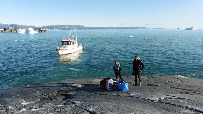
Here we were on the island, in the middle of nowhere, with all our luggage and food to organize, the tent to set up, and the kayaks to inflate—just 10 hours after leaving the Copenhagen hotel. We got to work, bothered by the flies. Despite our head nets, it was barely tolerable—there were so many of them. They swarmed by the dozens into every bag we opened. It was quite mild: 10°C.

Everything was ready by evening, and we were very happy to have completed all these transfers (planes and boat in a single day) as we slipped into our sleeping bags.
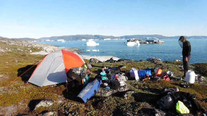
During the night, the wind picked up, and we went out several times to check the tent and kayak anchors. We noticed how bright it was—it was still quite twilight even at 1 AM.

Day 2 5:30 AM wake-up—the south wind was still strong, but since we were heading north, we decided to give it a try anyway.

This was also the moment we loaded the kayaks: since there were only three of us for two double-seater kayaks, we filled the hatch of one kayak, which allowed us to fit all our food. It would have been very difficult if there had been four of us for two kayaks.

Finally, we set off north along the western coast of the island. The conditions were far from ideal—the sea was rough, and the kayaks had a lot of wind resistance. But the main problem was the spray skirt: the gear on deck weighed it down, and the skirt kept coming off… We’d have to deal with it. Barely underway, and whales were already breaking the surface—it was our first time seeing them, and we were very impressed. Too bad the wind didn’t allow for longer contemplation; stopping paddling was impossible with such strong gusts.

We passed a few headlands and even considered stopping due to the conditions. To find some semblance of shelter, we had to hug the coast closely without cutting across the numerous bays, which significantly lengthened the journey. But as the morning went on, the wind died down, and the sea calmed. We spotted several whales and our first seals. It was almost pleasant during the picnic break. By late afternoon, we reached Kangerup Sarqâ Bay, where we had identified a great campsite with a very large beach and a river. But the wind had shifted—it was now coming from the north, making the last hour difficult due to fatigue and headwinds.

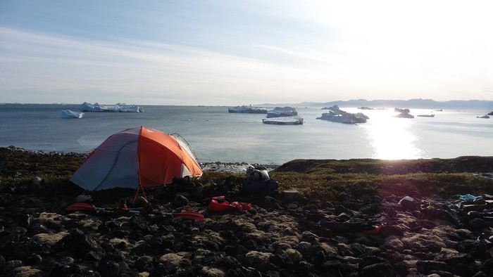
The campsite was ideal and beautiful, facing numerous icebergs grounded in the bay.
The GPS alerted us to another major drawback of inflatable kayaks: their slowness. It took us 7.5 hours of actual paddling (excluding breaks) to cover 28 km, averaging 3.7 km/h—somewhat disappointing. But we knew this before leaving, and once again, we’d have to make do!

Day 3 Surprise: at 6 AM wake-up, it was raining, foggy, with a south wind, and the sea was choppy even in the bay. It seemed wise to skip paddling, even though stopping on the second day was tough on morale. We went back to sleep, especially since the travel fatigue and the harsh conditions of the previous day had taken their toll.

At 11 AM, the navigation conditions weren’t any better—at the ends of the bay, we saw huge waves crashing onto the rocks, and giving up for the day became obvious. However, the rain had stopped, so we set off for a hike along the large lake bordering the bay. The wind hadn’t let up, and it was quite cold.

The tundra was starting to take on its autumn colors, and the contrast between the white lichens and the red vegetation was stunning. At the lake, we took out the fishing rods and quickly caught two beautiful Arctic char over 50 cm long.

As the afternoon wore on, the sun seemed closer. Along the beach, we gathered driftwood (mostly old planks) to cook our catch in foil over a fire. Eating our own food in such a beautiful place next to a good fire was comforting after the day’s setback.
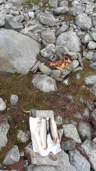


In the middle of the night, an Arctic fox entered the tent’s rear awning. It seemed barely intimidated when we shooed it away with loud shouts and then with stones.

Day 4 6:15 AM wake-up—3°C. We were on the water by 8 AM. The wind had dropped significantly, but the sea was shrouded in fog, and it was very cold in these damp conditions.
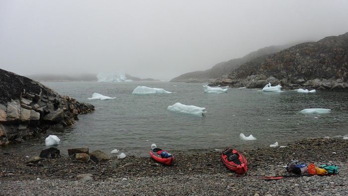


We passed the bay’s headland, Kangea, and headed toward the abandoned village of Agpat. The atmosphere was very austere—we hugged black rocks in fog that limited visibility to 50 meters, revealing large icebergs as we went.
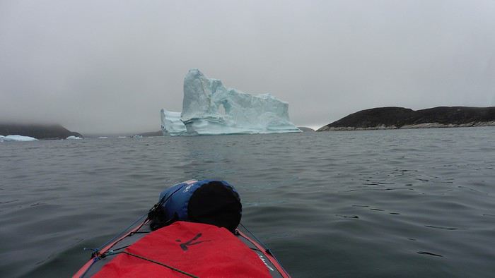
Suddenly, the water’s surface stirred in front of my kayak, and a huge gray back emerged from the sea. The collision was inevitable, but the whale seemed to understand and dove immediately, passing under the kayak and resurfacing a few meters away. I felt the kayak rock in the white foam and quickly paddled to escape the turbulence. What an emotion!

A light wind began to clear the fog, and the sun made beautiful appearances. Despite the cold, we stopped to visit the abandoned village, which left a strange impression. All the houses were still in good condition and wide open—some must have been very spacious in their time. We went back to sea, and in front of the large Kaangerdluk Bay, we hesitated—the headwind was strong, and large waves split the water. The next beach, from the island of Nua where we stopped to think, was over 8 km away. It was barely 2 PM, but caution led us to stop here for the day. We had covered 12 km—exactly the distance needed to stay on schedule. The afternoon was spent hiking on the island’s hills and gathering mussels and wood.
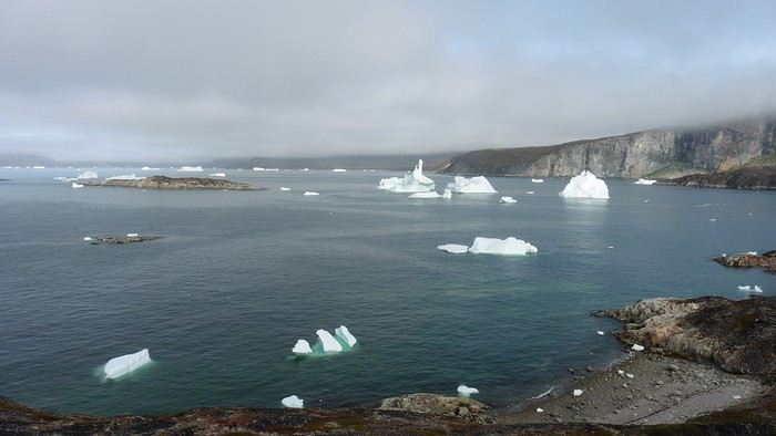


In the evening, we cooked these large Greenlandic mussels over a wood fire and savored them under the beautiful evening light. The weather was now fine, but the thermometer read -5°C in the sun…

Day 5 Bright sunshine, a glassy sea, and -8°C at 6 AM. Everything was green for setting off, even if putting on damp kayaking gear was a bit unpleasant in the cold. It was the first time we’d paddled on a flat sea since the start of the trip, and our average speed increased slightly.
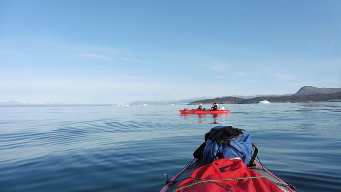


We entered the Smallesund Strait, marking the end of the island’s west coast. We were close to the large Torssukatak Fjord, where two glaciers flow. The access pass to the fjord was very narrow, and numerous ice chunks blocked access to the beaches. The wind had picked up and was now hitting us head-on (again). Just before entering the fjord, we landed on a steep beach made of large pebbles on Oqaitsut Island. It was very cold with the wind, and moving forward became difficult. We decided to stop for the day both because of the conditions and because the next campsite was far away, given how rugged the fjord was.
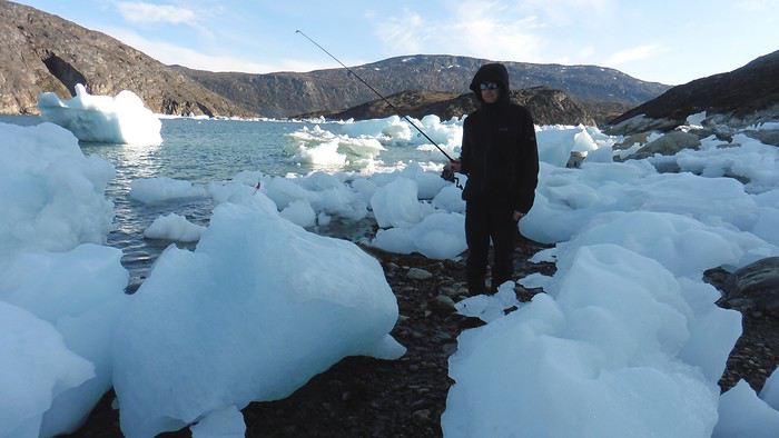
We eventually found a flat spot for the tent despite the steep slope. Even with the wind, the weather was beautiful, and we set off on foot for the northeastern cape of the island, overlooking the fjord. The view was far-reaching and exceptional—up close, the large fjord filled with ice and its steep granite cliffs, and in the distance, the ice cap and glacial walls.
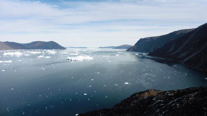
We spotted the village of Qeqertaq, whose network we could pick up, allowing us to check the weather forecast, which was rather good. While securing the kayaks in the evening, I noticed the strange behavior of one kayak at the end of the stage was due to the loss of the skeg—impossible to know where it detached. We’d have to do without it.

Day 6 Still that icy headwind from the northeast. We set off anyway for a long stage to reach the large pass connecting the Torssukatak and Ata Fjords.
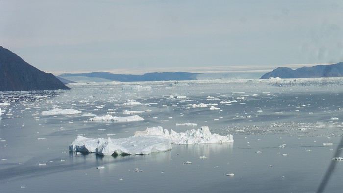
We advanced laboriously along the high cliffs of the fjord’s southern shore. They faced due north and blocked the sun. We felt the cold and dampness of the rock. It was really cold, especially in the extremities. We picnicked on the western cape of Qeqertakavasak Island. The cold didn’t allow us to stop for more than 20 minutes… But the wind dropped, and the sea was now very smooth. It was heavily cluttered with ice between the icebergs and old pack ice. The goal was to reach the large rocky promontory of Anapnuna, wedged between the Kujatdleq and Kangilerngata Glaciers, but the ice made progress difficult. We stopped to gain height on a small island and spot a passage of open water, but all we saw was white—passing seemed impossible. The currents were very complex, and entire sections of ice were being swept in one direction and then another at an impressive speed.
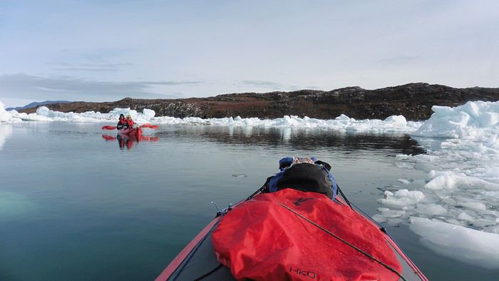


We wandered through this labyrinth until landing on a beach on the small island of Takissut, where we set up camp, exhausted from the 30 km covered and the vigilance required by the abundance of ice. The place was sublime under the evening sun—we were surrounded by ice and mountains, with the Kangilerngata Glacier in the distance. The summer contrasts were striking between the water, icebergs, sky, and flaming tundra—all colors were represented. Absolute calm reigned.
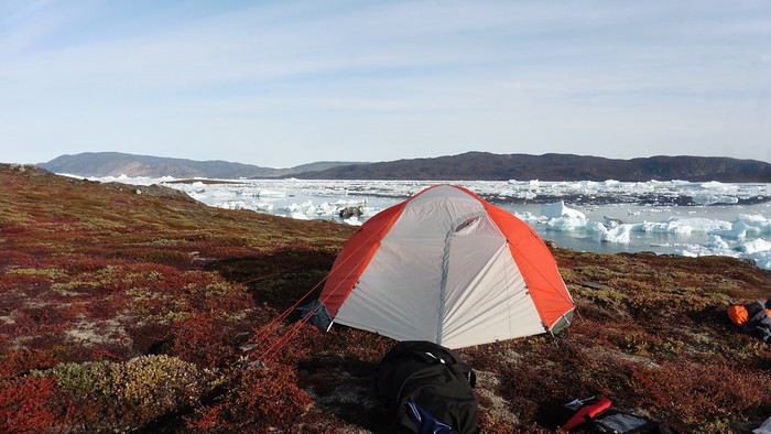
The lack of drinking water at this spot wasn’t too much of a constraint: as soon as we arrived on the beach, we placed containers under the icebergs stranded in the intertidal zone. They were all full by the time we finished setting up.

Day 7 We had to change our plans: we wouldn’t reach the rocky promontory, too well protected by the ice. We set off under the sun for Igdluluarssuit Island. Although we had spotted a passage just before launching, we quickly found ourselves surrounded by ice. It was everywhere, and finding water to paddle became complicated. We tried to force our way in every direction, even retracing our steps. Everything moved at an impressive speed—we were in the middle of a whirlpool of ice.
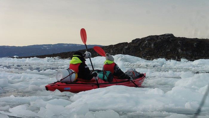
The tension rose, and each boat had its share of big scares. I was trapped against ice floes that dragged me toward an iceberg—the pressure on the kayak was enormous; it was going to capsize or puncture! But with a few strong strokes and paddling against the ice, I managed to free myself from the trap. Barely 10 minutes later, my companions were sandwiched perpendicularly between two icebergs that were closing in. The situation was desperate—the kayak was bending and twisting more and more, but with some strong paddle strokes, it finally freed itself. After these particularly unpleasant moments, we were completely blocked. The drifting ice floes had tightened, and the kayaks were no longer even in the water… The only solution: wait with the kayaks on these floes, which were too thin to walk on (even though we didn’t try). Within minutes, the situation cleared—a waterway opened, and we rushed into it. We paddled with one goal: find a larger pool of water. After going back and forth, our path took shape—we had to force the passage several times, attacking the ice directly with the kayaks, and finally, we escaped the worst of the labyrinth. We reached land on the west side of the island and saw that the rest would be easier. To reach the island, we just had to cross the Arsiviup Ikera Strait, which was lightly cluttered. We reached the eastern cape of the island, ideal for camping, even though we had only paddled for 3 hours. We set up camp and hiked to the island’s summit, which overlooks the entire pass and the glaciers.
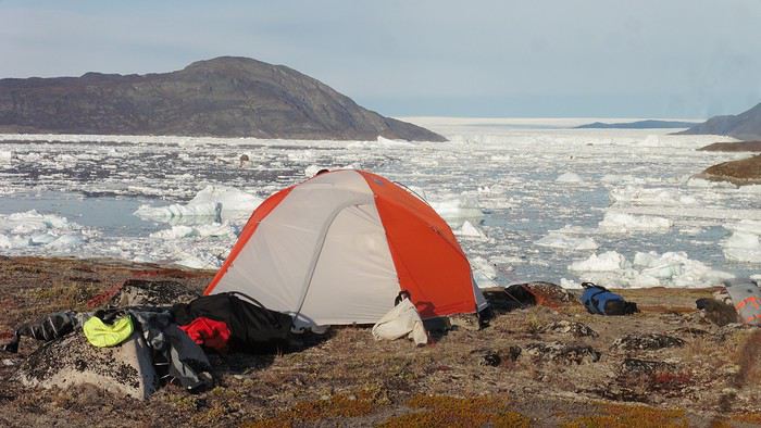
Everything was magnificent, no matter the direction. At 2 PM, we were at the summit—the beauty of the place and the picnic facing the glacier in the sun without wind made us forget the near-disaster from a few hours earlier. It would be impossible to approach the glacier by kayak, but from our summit on foot, it seemed so close, and contemplating it safely on solid ground was a great moment.
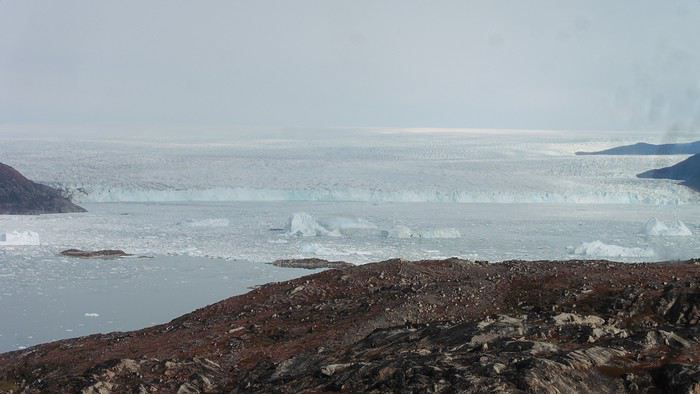
The pass was incredibly complex—everything was in motion, and an impassable passage could become open water within minutes. We were delighted when we returned to camp. A slightly lost whale among the ice accompanied us along the shore. The place was truly beautiful, but the temperature dropped again under the clear sky, preventing us from eating outside.

Day 8 Clear and cold at wake-up: -9°C. The sea had frozen in many places. We hesitated about the rest of the trip—should we start heading back to Ilulissat or linger in the pass, especially to approach the Eqi Glacier? After the incidents of the previous day, we decided to think carefully and paddled to the southern cape of our island to check the ice conditions toward Eqi. The weather had clouded over in the meantime, and the sky was quite gray. At the cape, we spotted the glacier’s wall, still 15 km away.
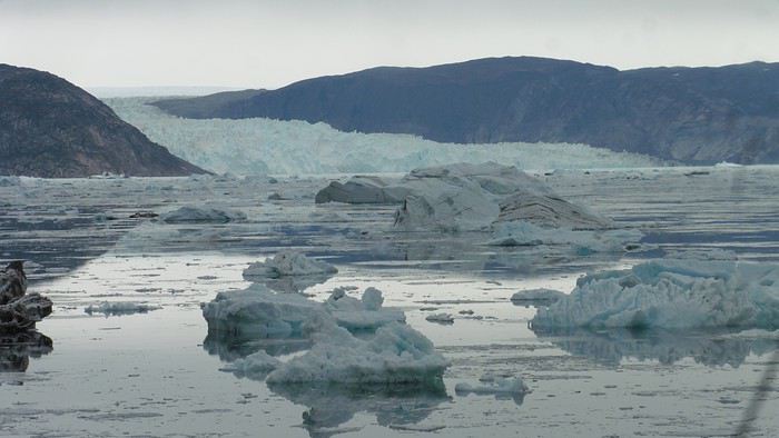


The fjord was quite cluttered, but it seemed passable. However, there was no guarantee the view would be much better 1 km from the glacier than 15 km away, especially since the front was quite active and therefore dangerous. We decided to head south without passing by the glacier. The cold temperatures encountered in the pass also motivated us to move away from the glaciers and the ice cap. We navigated under a threatening sky but without wind. The kayaks cut through the thin layer of ice on the surface with a crinkling paper sound. We reached the Ata campsite in the late afternoon after 5 hours of rowing without a single break…
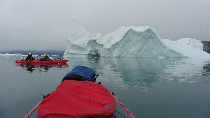
The wind had picked up, and we discovered a nice surprise: a refuge with a table and a comfortable bench lined with mattresses. Facing the worsening weather, we settled in comfortably. The kerosene stove was too complex for our three brains—we couldn’t get it started, too bad, as it was 0°C inside. The rest of the afternoon was spent fishing in the large lake, where we landed a beautiful Arctic char, more than enough for three. A good night’s sleep without the risk of foxes or the sound of a tent shaking in the wind.

Day 9 6 AM wake-up to the sound of rain hitting the cabin. The decision was made looking out the window—wind, rain, and fog obscured the sea: we went back to sleep.

New wake-up, and the rain had stopped—we could go out and stock up on fish. We set off on foot toward the lake, following its western shore. It was very overcast, and the wind encouraged us to keep moving. We made our way to a smaller lake at the end of the large one, where we caught a huge Arctic char. A small clearing brightened the picnic, and we headed back to our cabin.

This 20 km hike kept us busy all day: walking on slippery scree and the micro-relief of the peat bogs took time.

Day 10 The sky was clear, but a light south wind made paddling intense. We set off southeast to reach the opposite shore of the fjord. It was very cold, and it was impossible to stop paddling for even a moment without immediately losing ground due to the wind. We crossed the Kangerluarsuk Fjord. I recognized the cape I had reached on skis in the winter of 2017. We found a nice campsite on the southern shore of the fjord: Uiartag. It wasn’t even noon, but facing this headwind, we preferred to stop here rather than exhaust ourselves for a few extra kilometers. Like the previous ones, this campsite was very comfortable: the ground was covered with a thick layer of lichens and mosses, very pleasant to lie on.
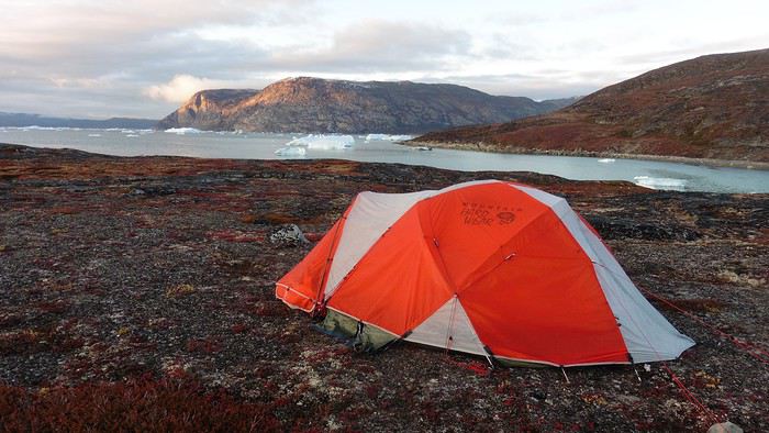
We set off on a hike to the heights of the cape, where the weather alternated between large clearings and snow showers. We noticed the loss of the thermometer, poorly attached to the backpack. On the way back, in the small bay of our beach, a whale swam calmly 10 meters from the shore—a beautiful surprise.
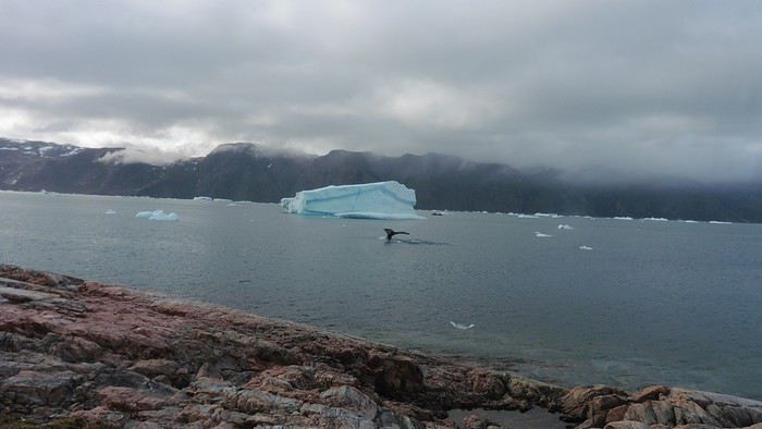
The sky cleared completely, and the temperature dropped as night approached.
Open
Departure airport for Rivages du Monde cruise to Greenland
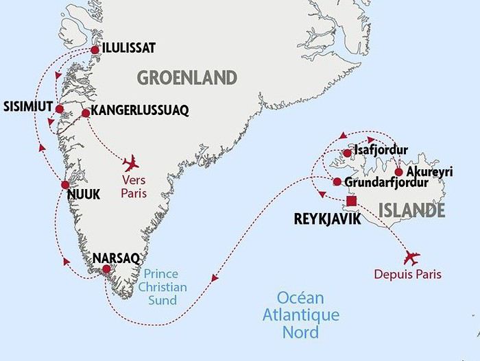
Hi everyone, In a month, I’m heading to Greenland with Rivages du Monde. My question is: which airport do we fly out of to get to Iceland—Orly or Roissy? Thanks to anyone who’s already traveled with this tour operator for this destination and can let me know. Have a great day
Open
Review of a disappointing cruise with Rivages du Monde in Iceland and Greenland


Hello everyone,

The itinerary was tempting, and we decided to take this cruise with friends. It also gave us a chance to discover this company, which offers many river cruises in a French-speaking atmosphere. The boat is only rated 3 stars, so we knew we wouldn’t have the same comfort or services as usual, but we accepted that. After all, the price is half that of a cruise with Ponant in the same area.

From the booking stage, this company was unlike any other. We later learned that Rivages du Monde isn’t a shipowner but just a service provider.

It operates in a somewhat outdated, old-fashioned, or even backward way, depending on how you see it. Information about the cruise, excursions, and the boat comes in the form of a very brief PDF. Documents, quotes, and invoices are sent by mail.

There’s no personal account on the company’s website, no passenger form to fill out, and no online check-in.

Fifteen days before the balance was due, I received the invoice with its share of surprises. I had to send my credit card details by mail (well, why not?), or pay by check.

The bad surprise was a fuel surcharge. The good one was that we were upgraded from category 3 to category 7, moving from deck 6 to deck 4. Since the information was so lacking, I had no idea what the benefits of this upgrade would be. I almost complained and asked to keep the cabin I had chosen, but I read in some comments that cabins on deck 6 were to be avoided due to loud creaking. So I said nothing.

Booking excursions, which had to be paid at the same time as the balance, was strongly recommended before departure. They were reserved by filling out an A4 sheet after reading a 3- or 4-line description in the PDF. The duration of the excursion and the departure time weren’t indicated. No information about disembarkation—would it be at the dock or by tender?

The boat. The MS Astoria is the oldest passenger ship in the world. Built in 1948, it started its career as a transatlantic liner until 1960. Often restored, it has retained an old-fashioned, vintage charm... or so the ads say. In the end, it didn’t look that old, as it had been modified and refurbished so much. Only its original bell remains in a display case. Its vintage look is more visible on the outside than inside. The outdoor decks are spacious, great for sightseeing. There weren’t too many passengers for the size of the ship. Inside, it’s not very modern or beautiful, but it was decent. A pleasant surprise—it handled the sea better than we expected.

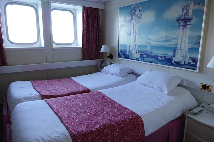
The cabin was outdated and small, as we expected—no desk, no sofa, and two portholes that made it very bright. Well-equipped with new storage furniture, it even had a fridge. The bathroom would have been spacious if it didn’t have a bidet. The bed had a board instead of a proper base, but the mattress was good, and we slept well the whole cruise. Don’t look too closely at the finishing details, but overall, it was better than I expected. On deck 4, the cabin creaked a little at night, but it didn’t bother us. The cabins are different sizes on the plan, but in reality, they all have the same surface area.

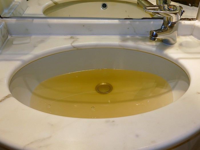
Note the strange color of the hot water.


The buffet was tiny, with few choices and very basic, ordinary dishes. A few mixed industrial salads, some fresh salad and cold cuts. For the main course, chicken, pork, some kind of minced meat, or fish. Then potatoes, rice, pasta, or steamed vegetables (always the same ones). For dessert, flavorless pastries in various colors or fresh melon and watermelon salad. That was the sad, single menu for the entire cruise at the buffet. Note that the buffet was only open for 2 hours at lunchtime and 1 hour in the afternoon for a snack.

Tea, coffee, and water were available all day.

The restaurant. The table was nicely set and pretty, but the meals weren’t much better than at the buffet. The “beef fillet in pastry” was like boiled beef stew—it fell apart easily (even though we asked for it rare or at least medium-rare). The “asparagus velouté” was actually leek soup with “hay” that crunched under your teeth. The poire belle Hélène or profiteroles were sad, distant relatives of the well-known desserts—very skimpy. And those were just a few examples.

Drinks were included with meals: still or sparkling bottled water, white, red, or rosé wine, coffee, tea, or herbal tea.

The bar. The servers were nice but far from having the class and know-how you find on other cruise lines. We wanted to try the cocktails, but only once. The margarita was warm, with bottled chemical lemon, no ice, and no salt. The caipirinha was brown! And later, we noticed that in the Singapore Sling, they replaced the Champagne with soda!!! What a skill set!!!

The lectures were very popular. Almost all passengers eagerly attended the talks by the two naturalists.

The musical entertainment was French variety—good-natured and friendly most of the time. A little classical music, chamber music so sad it made you sleepy. Nothing like the pianos and violins you find elsewhere... (Princess or HAL).

The shows. With very limited resources, the dancers did their best. The outfits were very revealing in certain strategic areas, and that was the rule for all themes.

The “red vests.” The atmosphere on board was more like a company outing than a cruise. There was a lot of staff to run the excursions desk, assist and supervise passengers during stops, or act as guides during excursions. These “red vests” behaved like they were on a summer camp—they had a great time and gathered as often as possible to laugh and have fun. They didn’t hesitate to roll their eyes behind passengers’ backs. But the “group leaders” became very authoritarian and directive when addressing passengers.

One evening, our friend asked a “red vest” about the excursion time the next day. That was top-secret information, impossible to get (I’ll come back to that). The “red vest” replied that they wouldn’t tell him because, by the next day, he would have forgotten anyway. That shows the level of respect this staff had for the passengers.

Also worth noting: among the passengers was a man in a wheelchair. For the entire cruise, he couldn’t go ashore. No one ever offered to help his wife get him off the ship.

My perception of this cruise is inevitably shaped by my past experiences. Some passengers shared my opinion, but others were completely satisfied with everything and found the food good. They also swallowed all the bad excuses, cooked up with a security sauce, without question—reassured and delighted that “everything” was done for “their safety,” which is the most important thing, isn’t it?

To be continued—the stops and the organization, even more pitiful than the hospitality...
Open
Spitsbergen – A Night with the Walruses at Lågøya
Spitsbergen, 80° North latitude. An archipelago lost at the edge of the world, northeast of Greenland, the last lands before the pole. I’m on board the *Grigoriy Mikheev*, a Russian ship from the Murmansk Polar Research Institute. Russian flag, Russian crew. Chartered by OceanWide Expeditions.

Open
Spitsbergen – A Night with the Walruses on Lågøya
Spitsbergen, 80° North latitude. A lost archipelago on the edge of the world, northeast of Greenland, the last lands before the pole. I’m aboard the *Grigoriy Mikheev*, a Russian ship from the Murmansk Polar Research Institute. Russian flag, Russian crew. Chartered by OceanWide Expeditions.

Last night, we were stuck in drifting pack ice in the long Hinlopen Strait. This incident led to an unforgettable barbecue and party on the ship’s foredeck, but we had to abandon our plan to head south and circle Spitsbergen. This summer, there’s too much ice in the strait, and it’s too thick. At dawn, the tide turned, allowing us to break free and head north again. The ship is now moving slowly through sea ice density that satellite maps estimate at around five-tenths. Our progress is punctuated by dull thuds: the ship’s bow constantly shoves and fractures enormous ice floes.

At breakfast, Tarik, our expedition leader, informs us that our program will be significantly altered. Since we can’t cross the strait, we’ll turn back and head north. To kick off our Plan B, Tarik plans a landing tonight on the small island of Låg (Lågøya), at 80°10' North. Last summer, he saw a large walrus colony there and hopes we’ll find them again. The weather is perfect—glorious sunshine—and walruses are truly addicted to sunbathing on the beaches.

We’ve now exited the strait and are sailing far from the coast. In case the walrus colony is there, we don’t want the ship’s approach to scare them into the water before we even see them. So, we scan the shore methodically with binoculars. We pass several bays, round a cape, and examine several shorelines littered with driftwood, but no walruses in sight. Several times, clusters of large rounded rocks trigger false alarms… but no, they’re just rocks…

Suddenly, Tarik spots them through his binoculars! On an isolated peninsula, our expedition leader’s highly trained eye has picked out, among those brown masses, the shape and white color of the enormous tusks of what he calls "the heavyweights of the Arctic!" Now, fifteen or twenty pairs of binoculars are pointed in the indicated direction… Sure enough, I see them now! They’re there, huge, sprawled in the sun on the beach. Without Tarik’s sharp eye, we might have missed them. They’re so tightly packed together that they really look like a mass of brown rocks. Only the white, saber-shaped tusks and the occasional furtive movements hint that they’re animals.

It’s 11 PM, and on the deck of the *Grigoriy Mikheev*, as you can imagine, excitement has ramped up several notches. Several of us have already rushed to our cabins to gear up, pulling on boots and life jackets in anticipation of a landing that promises to be absolutely amazing. Tarik reins in our enthusiasm a bit: Okay, so we were lucky to find them, but now we need to think about how to approach them. Not that they’re dangerous—at least not on land… Their enormous bulk and their pseudo-feet (flippers) only allow for very limited mobility. But when they feel threatened, their first instinct is to head for the water, where their perfect ease keeps them safe. So, the challenge will be not to scare them off, to avoid them bolting into the water in the first few seconds! That’s exactly what would happen if we arrived by Zodiac right in front of them.

So, Tarik decides we’ll make a wide detour to land on the other side of the peninsula where they are. From there, we’ll leave the Zodiacs on the beach and cross the peninsula on foot, about a kilometer and a half. That way, we’ll approach the herd from behind. This approach will also keep us downwind of them. There you go—with a few precautions, they shouldn’t hear us coming or catch our scent.

Everyone is geared up now and practically bursting with impatience… While the Zodiacs are being lowered into the water, Tarik and Delphine recap the approach rules: absolute silence, communication only by signs, no dragging feet on the rocks, watch your step, and strict coordination with slow movements.

Here we go… we’re off now! Spray flying from the Zodiac’s bow, icy air whipping our faces, gloves gripping the side ropes, freezing splashes, pure emotion… Ahh, I love this! We describe a wide curve offshore to round the peninsula. Ahead of us, the magnificent landscape of this intensely blue sea unfolds, with the hills of Lågøya and, in the distance, the ice-covered mountains of Nordaustlandet under the sun. It’s midnight now. In July, at 80 degrees North, the sun is just like midday.

This navigation takes us far from the walruses, on the other side of the cape. Easy landing on a shoreline of large pebbles covered in giant seaweed brought in by the currents. They look like long strips of plastic—sometimes translucent, sometimes white, beige, or orange. In places, there are huge tangled layers of it. Our boots sink into this material, which gives off a strong iodine smell. Unfortunately, there’s also some plastic waste—fishing floats and net debris. Seeing this here is crazy… A little farther on, in a cove, tides and storms have piled up numerous tree trunks from Siberia.

We begin crossing the peninsula on foot, staying close together. We’re walking on a nearly deserted polar tundra. We’re only ten degrees of latitude from the North Pole here. The violent winds and extreme temperatures that dominate this island for nine months of the year allow only a few rare plants to grow, close to the ground, between the rocks. In places, rocks are covered with large patches of black lichen.

Gérard, rifle slung over his shoulder, constantly scans the terrain. Tarik and Delphine are also very vigilant. We know no one ever lands here, and although this environment isn’t ideal for bears, you never know—better to be cautious. The terrain is mostly flat, but whenever a small rise blocks our view, Gérard moves ahead and only signals us to proceed when he’s sure there’s no "big man in fur" (tradition dictates we don’t name the polar bear).

After a few hundred meters, we find an enormous whale vertebra. Judging by the state of the bone, it’s likely a relic from the whaling era that ravaged this area in the 17th century and all over northern Spitsbergen. A little farther on, the remains of a grave catch our attention. The only human trace on this remote island, this burial is surely very old, also likely dating from the whalers’ time. But this whaler’s final resting place didn’t shelter him for long—there’s not much left, just a piece of skull and a few broken bones. Due to the permafrost, the body could only be buried a few dozen centimeters deep, between some planks held in place by large stones. This makeshift grave was probably ravaged by a bear shortly after the burial. Several stone blocks are overturned, the planks are broken open. We only linger for a minute to pay our respects to this whaler, whose poor remains now merge with the mineral landscape.

A slight rise bulges in the center of the peninsula, and here we are at the highest point. If our orientation is correct, we’re heading straight for the walrus colony. A moment of emotion… my heart’s pounding. Yes, they’re there, about three hundred meters ahead of us! They haven’t moved since we spotted them from the *Grigoriy Mikheev*’s deck. They’re sprawled in a heap, packed tightly together in the sun, on the shingle beach. The light breeze blowing in our faces confirms we’re on the right track—not to be sniffed out from afar by the big beasts.

By signs, Tarik tells us we’ll approach slowly, in stages, moving about thirty meters at a time, making as little noise as possible with our boots, then freezing completely for a minute or two, crouching down to let them forget us. This strategy proves excellent. We’re now less than a hundred meters away, and it doesn’t seem like our presence is perceived as a threat by the "heavyweights of the Arctic." At this distance, let’s not kid ourselves: we’re certainly spotted, but our way of approaching must seem reassuring—or at least manageable—since they’re only a few meters from the water and know they could dash into it in seconds if they felt the need.

We now advance in shorter stages—twenty meters at a time, then just ten, crouching, then freezing like statues, our breathing nearly held from emotion and concentration. We’re now thirty meters from the mastodons. Our presence must be starting to stress them because they’re moving more. While still sprawled against each other, some suddenly rear up on their flipper-feet, grunting and snorting like monstrous pigs. Their head shakes make their two enormous ivory sabers sway. They jab them into the fat of their neighbors, who in turn stir and emit irritated snorts.

At Tarik’s signal, we move a few more meters, "on velvet paws"… We’re right there now. I hold my breath, throat tight… Intense emotion, a fantastic spectacle—these enormous Arctic animals sprawled in the sun, with the magnificent backdrop of snow-covered mountains across the sound. I think to myself: *I’m here… this can’t be real!* It’s nearly 2 AM now, the air is crystal clear, and the Arctic sun bathes this scene in what might be the most beautiful light I’ve ever seen. We’re about fifteen meters away now. Tarik signals that we won’t go any closer. The walruses are still lying down, but occasionally, our close presence and the clicking of cameras trigger bouts of agitation that ripple through the herd, causing some jostling. They’re so tightly packed and tangled that it’s a bit hard to count them. In the end, we tally sixteen, plus one "little one," half-crushed in the general mass.

Seen from here, they’re truly impressive! The "sumo wrestlers of the Arctic!" According to Tarik, they must weigh about a ton—slightly more for the males than the females—and the "little one" must already be around 200 kg. When the weather’s nice like today, they love sprawling on the beaches to soak up the sun.

Walruses are marvels of Arctic adaptation. They can modify their blood circulation depending on thermal conditions. They withstand extreme cold by directing most of their circulation to vital organs (heart, lungs) and minimizing peripheral blood flow (skin and limbs) to prevent heat loss. Conversely, when they sunbathe, they direct most of their blood flow to the skin, turning themselves into true solar collectors.

At this latitude, there’s practically no difference in sunlight between day and night. Noon or midnight, the sun’s angle barely changes. Walruses make the most of these fair-weather phases by sprawling in the sun 23 hours out of 24… Enough to make siesta lovers dream, right? Twenty-three hours of lounging… and the twenty-fourth for eating!

And when we say "eating," what a feast! The proverb *"Who sleeps dines"* is fully justified here: when a walrus decides to feed, it gulps down between 50 and 60 kg of shellfish in an hour! Its food consists of large bivalve mollusks, which it tears from the seabed with its tusks and sucks up nonstop! A 50 kg meal certainly justifies a 23-hour nap for digestion, right? And speaking of digestion—it’s what the "big guys" in front of us are doing right now! You might wonder how we know this… Well, I’ll tell you: if you were here, downwind (or should I say *down the winds!*) of these marine giants, you’d have no doubt! Pfft… what flatulence! I can confirm that today’s scent is called *"Morsanus, from the North"* (*"Because I’m worth it!"*). Mmm, yeah… Tarik, you had a great idea putting us upwind… at least *they* can’t smell us, but we sure can!

But… heepp! Delphine discreetly signals to get our attention—she’s just spotted something: in the smooth water of the bay, a small V-shaped ripple runs along the beach, then turns toward the shore… So the colony wasn’t complete on the beach… Here’s an 800 kg bather stepping ashore now, right before our astonished eyes! She lifts her head and stays like that for a long moment, her enormous tusks half out of the water. She looks exhausted, resting a bit before coming out. Or more likely, she’s hesitating to climb onto the beach because she’s seen us… The shapeless head stays still for a moment, then violently snorts like a clogged drain! A misshapen head where you can’t make out anything that usually makes a head! No eyes, no ears, no mouth… A sort of monstrous cabbage! But the temptation to join the warmth of the "sunbathers" is too strong! Here’s our pachyderm bather climbing the few meters of the shore and sprawling right in the middle of her companions, who greet her with jostling, grunts, and tusk jabs! Then everything settles back into order—800 kg of fat and flesh added to the fifteen or so tons of local biomass. Welcome to the club!

It seems the walruses have gotten a bit used to us now. They’re moving and grunting much less. I realize it wasn’t obvious to approach them like this without scaring them into the water… It’s thanks to Tarik and Delphine’s advice that we managed it. It’s also, let’s be honest, because we’re all passionate here, and there’s been total discipline and cohesion from the start of this approach.

It’s past 2 AM now—time to head back… We’ll leave them to their wild world, to their life at the beginning of the world. We’re happy to have disturbed them as little as possible and not to have disrupted their nap too much. We leave stealthily, first backing up a few meters, then turning around and crossing the peninsula again, walking slowly, avoiding making noise with our boots as long as we’re still close.

We find the Zodiacs on the shoreline with the giant kelp. The sea is like a lake—easy boarding. We make another wide loop to round the cape, passing offshore. The sharp cold stings my cheeks and ears again—I put my hat back on. The cold—I hadn’t thought about it at all during our encounter with the walruses. In the Zodiac, with the engine noise, no one speaks. The faces and smiles are those of men and women who’ve just crossed an inner frontier—the one that separates dream from reality. But tonight, that frontier was porous, and the dream entered reality.

We return to the *Grigoriy Mikheev*, waiting at anchor. It’s past 3 AM, but I don’t feel any fatigue. A few minutes later, I’m in my bunk, rocked by a gentle swell and the hum of the engines. In the soft warmth of the blanket, a strange sleep overtakes me… A sleep filled with luminous, icy landscapes, with large beasts bearing saber-like tusks. Large beasts that sleep, snore, snort, grunt, and jostle in their sleep… in *my* sleep. An unforgettable memory. It was July 2004, in Spitsbergen.

Chris51.
Open
My first trip to Iceland, over 50 years ago.
My first trip to Iceland, in 1974.

Yes, you might be surprised: my first trip to Iceland dates back to July 1974. It’s been a little over 50 years since I first set foot on Icelandic soil. I was 23 years old. At the time, I was a geography student. I had just earned my bachelor’s degree and was finishing my master’s (what we’d now call a "master’s 2") in physical geography, with two specialties: glaciology and volcanology. In both fields, professors showed us slides of Iceland—glaciers and volcanoes—and in tutorials, we worked on maps and documents related to the physical geography of Iceland. So there you have it: ice and fire, in Icelandic « ís og eldur », I learned that year that it was Iceland’s national motto, and that’s what drew me there for my first big trip.

Iceland in 1974 was very different from today. It wasn’t a common destination. There were practically no tourists or tourist infrastructure. Some sites now famous and overcrowded were only accessible after hours of hiking on rough, unmarked trails. GPS didn’t exist, but I had managed to get local 1:100,000 maps that were pretty well done. I took my time to circle the entire island, camping in the wild. Most of my meager budget went toward the flight ticket and renting a Volkswagen "Beetle."

There were no paved roads in the country except in central Reykjavík and the main street of Akureyri. What’s now called Route 1 was everywhere dirt and gravel, pretty bumpy in places. According to my maps, this road didn’t allow for a full loop around Iceland: a section of about a hundred kilometers was missing on the south coast. But when I arrived in that area, I learned at a gas station that the last missing section had just been completed, finally allowing a full loop without backtracking. It was the section crossing the vast Skeiðarársandur, southwest of Vatnajökull. The new road was just a bulldozer track through this black ash desert. We crossed the multiple channels of the sandur on long single-lane wooden bridges. On these long pilings, the road was made of roughly nailed thick planks that made an awful racket when the car drove over them.

A nasty surprise: the cost of living. The difference with France seemed huge—everything was two to three times more expensive than back home. Prices were way beyond my tiny budget, and I wondered how I’d manage to get by.

The Icelanders back then were very different from today. From the start, I felt like a real outsider, ostracized, even outright rejected. Several times, when I asked for permission to pitch my small tent near a farm, the door would slam shut as soon as I asked (in English). Without a word… *Bam!*

So I struggled to feed myself, lacking money. I mostly bought loaves of sliced bread and corn flakes (unknown in France at the time), which I ate with cold, sugary milk. It was the cheapest and most filling thing I could find.

In Reykjavík, my only luxury was daring to enter a snack bar. There, I’d treat myself to a coffee or tea, having quickly learned that after paying for a cup once, you could go back to the counter and have it refilled as much as you wanted. I dreaded being asked if I wanted something to eat because I couldn’t afford it. Luckily, no one asked. So, alone in my corner, I’d pull out my loaf of sliced bread from my backpack and make sandwiches with the contents of the two plastic bottles on every table—one red, one yellow: ketchup and sweet mustard. I avoided the sideways glances from other customers. I’d eat my sandwiches and leave, both full and warmed up.

One time, near Selfoss, I saw a truck stop by the road and pick up two large aluminum cans left at the end of a farm track. A little further down the road, two more similar cans. I realized these cans were there to be collected by… well, I didn’t know who. No one in sight for miles. So, I’ll admit it: I stopped and opened one of those large cans, which contained a dairy product—a kind of very dense, compact white cheese (I later learned it was skyr). I scooped a nice layer from the top, smoothed the surface with my spoon, and carefully closed the can again. Yes, I know it wasn’t right, but that was over fifty years ago, and I can admit it now since the statute of limitations has surely passed, right? Another time, I boiled a piece of dried fish, hard as wood, for a long time on my camping stove—fish I’d taken from huge outdoor drying racks by the side of the road. On the road heading north from Reykjavík, the Akranes underwater tunnel didn’t exist yet. To get to Borgarnes and Snæfellsnes, you had to go around Hvalfjörður. Following the shore of this long fjord, I stumbled upon a whaling station in full operation. Intrigued by the plumes of steam and the sounds of machinery from the road, I stopped, and surprisingly, no one stopped me from entering the vast platform where workers were butchering a large whale. I’ll never forget the acrid smell of those huge piles of meat and bones, fat and guts, the screams of saws and winches, the steam from the boilers… A monstrous, hallucinatory sight that would shape a major interest for the rest of my life: whales.

At the end of my journey, I spent three days in the Westman Islands. The famous eruption of the Eldfell volcano had happened just months earlier, in 1973, and was barely over. Visiting Heimaey was one of the goals of my trip to Iceland, given my volcanology studies. Part of the fishing port was filled in by lava flows, and the entrance channel was reduced to just a few meters wide. Most of the village was covered by a layer of black, hot ash eight to ten meters thick. I walked on the roofs of houses—every now and then, a chimney or skylight would stick out. In the rain, this hot ash released intense steam; you couldn’t see twenty meters ahead. It felt like being in a giant outdoor sauna. The entire population had been evacuated during the eruption, but some residents were starting to return. Bulldozers and excavators were gradually clearing this gigantic mass of ash, street by street, layer by layer, avoiding demolishing the buried houses. A constant stream of trucks dumped these millions of tons of ash into the sea from a cliff. To finish clearing the houses, it was done with shovels and wheelbarrows, and this task was left to the homeowners. One day, I had the chance to lend a hand (or rather, a shovel) to a couple finishing clearing their house. They offered to let me pitch my tent near their place, on a thick layer of warm ash (I’d never experienced such comfort through my sleeping mat), and I’ll never forget that they gave me a big bowl of delicious soup they’d just made. The best meal I had during that trip. The next day, climbing the volcano, which was still smoking and spewing furiously, I nearly suffocated from sulfur dioxide and almost melted the soles of my shoes. So it was during this initiatory trip, 50 years ago, that my addiction to Iceland was born. The following year in Paris, by sheer chance—and perhaps helped by the magic of my amazing Kodachrome slides—I met a young woman who would become my wife. Very quickly, she became as hooked as I was on "the island of the world’s creation" (as I called it back then), and later, it was often her who’d say, "So… how about going back to Iceland this year?" We went back many times, in every season, summer and winter, and in every region of the country. And every time, when the plane starts its descent toward Keflavík Airport, we look at each other like kids invited to a birthday party, discovering the cake buffet… "Here we are… we’re back!"

Our travel conditions changed a lot afterward. With a better budget but still traveling independently, renting well-equipped 4x4s that let us go almost anywhere, at our own pace, including the highlands of the country’s interior. But always taking our time, dedicating each trip to fully exploring one region rather than rushing through kilometers. And leaving time for beautiful hikes or simply doing nothing—sitting at a viewpoint and just watching, observing the wild nature, in contemplative mode… Always staying with locals in the countryside, preferably on real farms with animals, thanks to an association of farmers offering accommodations. We speak fluent English and have learned a few common Icelandic phrases and expressions over time. With a bit of experience, we developed our little techniques for starting interesting conversations with Icelanders… who, thankfully, are no longer as distant as they were in 1974! We even made friends there.

We particularly loved the rugged, wild Iceland—not necessarily the desolate highlands of the interior, but rather the isolated regions where a few very old families still cling to their land and roots. With a soft spot for the Snæfellsnes Peninsula and especially the Westfjords, the "Vestfirðir," as the Icelanders call them. But we also love the Northeast, and even the far Northeast, so remote and where almost no one goes. Over time, we’ve done a lot of reading. We’ve learned a great deal about Iceland—its painful history, its tormented geography, its economy, its incredible medieval literature (the Sagas), and some quirks of its culture. And we greatly appreciate its contemporary authors, whose books fill several shelves in our library.

In 2008, on a return trip to Iceland, we went to the Westman Islands, to Heimaey. I hadn’t been back since my first trip in 1974, right after the Eldfell eruption. It was a pilgrimage for me, so many years later! An emotional moment seeing the huge frozen lava flow again. On the trails now set up to explore this vast chaos, people have put up signs indicating the names of the streets buried under the lava and the nature of the crushed buildings fifteen meters below. Plaques mark the locations of public buildings—here was the school, down there was the hospital… The part of the town that was under ash has been cleared, but not entirely—two streets were left partially buried, probably to show tourists. The volcano is still hot at the top. We climbed it, but this time I didn’t melt my soles.

We often talk about Iceland. We still call it "the island of the world’s creation" and tell our traveler friends how much this country fascinated and enchanted us. Those who’ve never been find it a bit odd, but everyone who’s been there understands.

You may have noticed I’m talking about it in the past tense… Indeed, I’ll admit that for several years now, we haven’t been back to Iceland, and I don’t think we’ll return. What we see on social media and in the news puts us off a bit. Mass tourism has arrived, and many developments have been made—not always for the best. Now, with two and a half million visitors a year, Iceland welcomes nearly six times its population. Tourism has become a key source of income for Icelanders. Good for them, maybe, but we don’t like it at all. We’re a bit wild, perhaps. And besides… the world is vast… We loved Iceland passionately, but we’ve always been inveterate travelers in general. So over the past fifty years, we’ve certainly explored all of Iceland’s regions, but also in the North Atlantic—the beautiful Norway, the stunning Lofoten Islands, the Shetland archipelago, the rugged and grand Faroe Islands, and then further north in the Arctic—the icy Greenland, Svalbard at the edge of the world, and even the Sjuøyane, the last islands before the North Pole, with small groups of enthusiasts and scientists on expedition ships. And many other regions of the world, but always with a taste for slightly offbeat places, both in terms of landscapes and nature and ways of life. Central Asia, the Azores, Peru, Bolivia, the Andes, Chile, Argentina, the vast Patagonia, Tierra del Fuego… and other little secret gems we won’t reveal. Not even on Voyage Forum.

But everywhere—yes, I mean everywhere—wherever you are, wherever you go, there’s always a moment when you think of Iceland…

Chris 51 - November 2025.
Open
Collaborative travel journal for lovers of the American West!
Hi everyone!

So, I’m putting into action an idea I had two years ago... I’m inviting anyone who’s interested to help build a beautiful collaborative project—a shared travel journal!!!

The concept: one post =

a photo you’ve taken in the American West that means something to you and your thoughts on that photo or about it: where and when it was taken, the story behind it, why it’s special to you...

Grab your pens!!!! (And I hope this doesn’t flop, but if it does, at least I’ll have tried!!!)

And I’ll kick things off in the next post!
Open

You might also like