Hi,
We bought the MSR bike tent model (2-person + large awning that can fit 2 bikes) back in 2005. It’s served us really well, especially during a year-long trip in Africa. Now, one of the poles is broken, and we’d love to replace it since that’s the only issue with the tent—we still love it! The poles are 9.35 mm in diameter, with 8 sections of 49 cm and 2 sections of 28 cm. Total length when assembled: 416 cm. Actually, two large sections are broken: one straight and one curved. It’s a pain to find replacements since this model is no longer sold anywhere.
Would anyone have this model lying around unused and be willing to sell me a pole?
11 similar discussions in English
It's all in the title—I'm 70, and I've been traveling by bike (tent and camp stove) for five years now. Statistically, how many more years do I have left to plan my destinations and see (almost) everything?
Question is half realistic, half humorous.
To keep it simple: how old are you, fellow senior cyclists still on the road? And what are your biggest challenges?
Personally, I'm in good physical shape, though my cruising speed has dropped from 3–4 km/h over the past five years.
But arthritis (hip) is starting to make it tricky to swing my leg over the frame.
After two rather rainy kayaking experiences in Alaska at the end of summer in recent years, we chose a slightly drier destination for this late August 2018: the west coast of Greenland. The temperature will certainly be a bit colder, especially at this time of year, but we’re betting on a beautiful end to the season. According to temperature charts, it should be around 5 to 10°C with a few night frosts. The tundra will already have its autumn colors, and by the end of the trip, we might be lucky enough to see the northern lights when the nights get darker.
We’re setting off as a group of three in two inflatable double-seater kayaks (Gumotex) brought from France. The plan is to spend two weeks circumnavigating Arve Princess Island, located north of Ilulissat in Disko Bay, with a possible boat drop-off at the southern tip of the island.
This seems like a fairly classic route in the area—we found several descriptions online (thanks to the authors). With their help and Google Earth, we identified all potential campsites and entered their coordinates into a GPS. The western part of the island, facing the bay, seems ideal for whale watching, while the more rugged eastern side offers access to several glacial walls. We’re somewhat familiar with the area from two winter expeditions on skis and pulkas.
Plus, the commitment is limited due to the island’s proximity to several small villages, including Qeqertaq, Oqaatsut, and even Ilulissat. In fact, we saw fishing boats almost every day. The distance suits us well: 200 kilometers in 16 full days on site, which should leave some leeway in case of bad weather or for hiking.
We booked our flights in June with Air Greenland to Ilulissat for the last week of August and the first week of September. On both the outbound and return trips, we stayed overnight in Copenhagen. The France-Copenhagen flight was with Air France.
We were allowed 3 x 20 kg in the hold. Each kayak with its accessories fits into a 20 kg bag; the last hold bag is for shared gear: tent, stoves, dry bags… We only brought 1.5 kg of semolina for food. In the end, we had 61 kg of gear, and no excess baggage was charged.
Individual gear (clothes and sleeping bags…) was distributed in the cabin luggage.
For the boat transfer, we contacted an agency: Blue Jay, which gave us a number to call upon arrival.
Day 0: Wednesday, August 22 Departure day. After work, I drove from Gap to Marseille’s Marignane Airport for the first leg of the trip to Copenhagen. I enjoyed the rather mild local temperatures: 35°C in the shade. After a layover in Paris, I arrived at the Copenhagen hotel, located two train stops from the airport, where my companions were already settled. No issues—everyone was on time with their luggage.
Day 1 The flight to Greenland was at 9 AM. We had a layover in Kangerlussuaq, where we changed planes, then stopped in Aasiaat before reaching Ilulissat Airport at 3 PM under beautiful sunshine.
We called Blue Jay for the boat transfer: they could take us to the island as early as 6 PM; otherwise, we’d have to wait until the next day. That left us 3 hours to prepare our gear and, most importantly, do our shopping for the two-week trip—it seemed tight, but we gave it a shot.
A quick taxi ride took us to Pisiffik, where we easily found everything we needed: bread, butter, cheese, cold cuts, rice, pasta, jam, muesli… There was no C fuel or methylated spirits for the stoves, but this time we knew the trick: at Stark, a bit uphill from the town, we found the precious liquids. Two hours later, we filled our dry bags and containers with our purchases, and by 5:30 PM, we met Klaus, the Blue Jay manager, directly at the port.
The vacation seemed to truly begin as we sped by boat through the icebergs toward Arve Princess Island. Forty-five minutes later, we spotted a beach lined with rocks where Klaus dropped us off quickly (he had another transfer to make right after).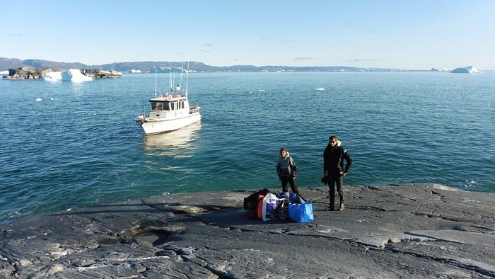
Here we were on the island, in the middle of nowhere, with all our luggage and food to organize, the tent to set up, and the kayaks to inflate—just 10 hours after leaving the Copenhagen hotel. We got to work, bothered by the flies. Despite our head nets, it was barely tolerable—there were so many of them. They swarmed by the dozens into every bag we opened. It was quite mild: 10°C.
Everything was ready by evening, and we were very happy to have completed all these transfers (planes and boat in a single day) as we slipped into our sleeping bags.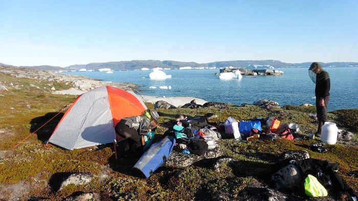
During the night, the wind picked up, and we went out several times to check the tent and kayak anchors. We noticed how bright it was—it was still quite twilight even at 1 AM.
Day 2 5:30 AM wake-up—the south wind was still strong, but since we were heading north, we decided to give it a try anyway.
This was also the moment we loaded the kayaks: since there were only three of us for two double-seater kayaks, we filled the hatch of one kayak, which allowed us to fit all our food. It would have been very difficult if there had been four of us for two kayaks.
Finally, we set off north along the western coast of the island. The conditions were far from ideal—the sea was rough, and the kayaks had a lot of wind resistance. But the main problem was the spray skirt: the gear on deck weighed it down, and the skirt kept coming off… We’d have to deal with it. Barely underway, and whales were already breaking the surface—it was our first time seeing them, and we were very impressed. Too bad the wind didn’t allow for longer contemplation; stopping paddling was impossible with such strong gusts.
We passed a few headlands and even considered stopping due to the conditions. To find some semblance of shelter, we had to hug the coast closely without cutting across the numerous bays, which significantly lengthened the journey. But as the morning went on, the wind died down, and the sea calmed. We spotted several whales and our first seals. It was almost pleasant during the picnic break. By late afternoon, we reached Kangerup Sarqâ Bay, where we had identified a great campsite with a very large beach and a river. But the wind had shifted—it was now coming from the north, making the last hour difficult due to fatigue and headwinds.
The campsite was ideal and beautiful, facing numerous icebergs grounded in the bay.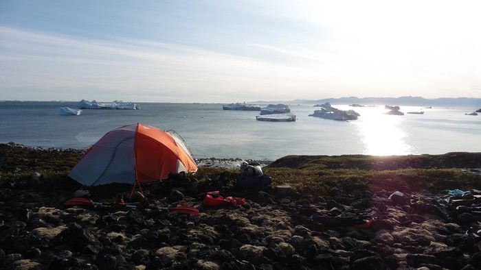
The GPS alerted us to another major drawback of inflatable kayaks: their slowness. It took us 7.5 hours of actual paddling (excluding breaks) to cover 28 km, averaging 3.7 km/h—somewhat disappointing. But we knew this before leaving, and once again, we’d have to make do!
Day 3 Surprise: at 6 AM wake-up, it was raining, foggy, with a south wind, and the sea was choppy even in the bay. It seemed wise to skip paddling, even though stopping on the second day was tough on morale. We went back to sleep, especially since the travel fatigue and the harsh conditions of the previous day had taken their toll.
At 11 AM, the navigation conditions weren’t any better—at the ends of the bay, we saw huge waves crashing onto the rocks, and giving up for the day became obvious. However, the rain had stopped, so we set off for a hike along the large lake bordering the bay. The wind hadn’t let up, and it was quite cold.
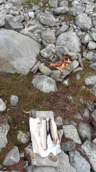
The tundra was starting to take on its autumn colors, and the contrast between the white lichens and the red vegetation was stunning. At the lake, we took out the fishing rods and quickly caught two beautiful Arctic char over 50 cm long.
As the afternoon wore on, the sun seemed closer. Along the beach, we gathered driftwood (mostly old planks) to cook our catch in foil over a fire. Eating our own food in such a beautiful place next to a good fire was comforting after the day’s setback.
In the middle of the night, an Arctic fox entered the tent’s rear awning. It seemed barely intimidated when we shooed it away with loud shouts and then with stones.
Day 4 6:15 AM wake-up—3°C. We were on the water by 8 AM. The wind had dropped significantly, but the sea was shrouded in fog, and it was very cold in these damp conditions.
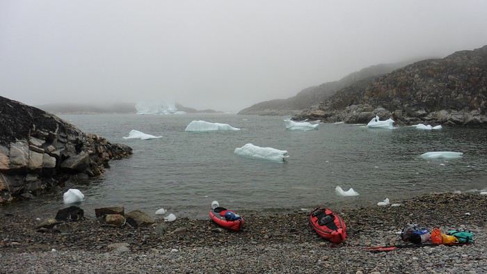
We passed the bay’s headland, Kangea, and headed toward the abandoned village of Agpat. The atmosphere was very austere—we hugged black rocks in fog that limited visibility to 50 meters, revealing large icebergs as we went.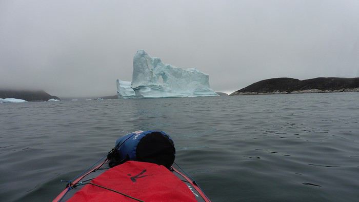
Suddenly, the water’s surface stirred in front of my kayak, and a huge gray back emerged from the sea. The collision was inevitable, but the whale seemed to understand and dove immediately, passing under the kayak and resurfacing a few meters away. I felt the kayak rock in the white foam and quickly paddled to escape the turbulence. What an emotion!
A light wind began to clear the fog, and the sun made beautiful appearances. Despite the cold, we stopped to visit the abandoned village, which left a strange impression. All the houses were still in good condition and wide open—some must have been very spacious in their time. We went back to sea, and in front of the large Kaangerdluk Bay, we hesitated—the headwind was strong, and large waves split the water. The next beach, from the island of Nua where we stopped to think, was over 8 km away. It was barely 2 PM, but caution led us to stop here for the day. We had covered 12 km—exactly the distance needed to stay on schedule. The afternoon was spent hiking on the island’s hills and gathering mussels and wood.
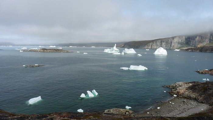
In the evening, we cooked these large Greenlandic mussels over a wood fire and savored them under the beautiful evening light. The weather was now fine, but the thermometer read -5°C in the sun…
Day 5 Bright sunshine, a glassy sea, and -8°C at 6 AM. Everything was green for setting off, even if putting on damp kayaking gear was a bit unpleasant in the cold. It was the first time we’d paddled on a flat sea since the start of the trip, and our average speed increased slightly.
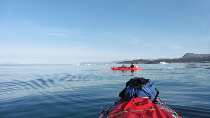
We entered the Smallesund Strait, marking the end of the island’s west coast. We were close to the large Torssukatak Fjord, where two glaciers flow. The access pass to the fjord was very narrow, and numerous ice chunks blocked access to the beaches. The wind had picked up and was now hitting us head-on (again). Just before entering the fjord, we landed on a steep beach made of large pebbles on Oqaitsut Island. It was very cold with the wind, and moving forward became difficult. We decided to stop for the day both because of the conditions and because the next campsite was far away, given how rugged the fjord was.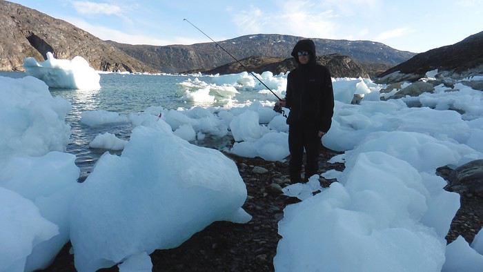
We eventually found a flat spot for the tent despite the steep slope. Even with the wind, the weather was beautiful, and we set off on foot for the northeastern cape of the island, overlooking the fjord. The view was far-reaching and exceptional—up close, the large fjord filled with ice and its steep granite cliffs, and in the distance, the ice cap and glacial walls.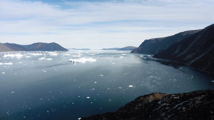
We spotted the village of Qeqertaq, whose network we could pick up, allowing us to check the weather forecast, which was rather good. While securing the kayaks in the evening, I noticed the strange behavior of one kayak at the end of the stage was due to the loss of the skeg—impossible to know where it detached. We’d have to do without it.
Day 6 Still that icy headwind from the northeast. We set off anyway for a long stage to reach the large pass connecting the Torssukatak and Ata Fjords.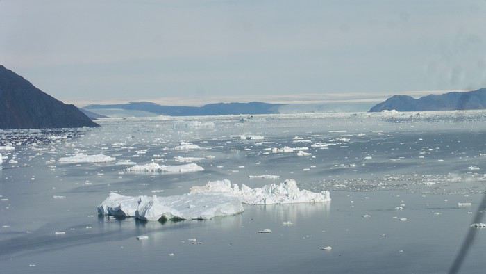
We advanced laboriously along the high cliffs of the fjord’s southern shore. They faced due north and blocked the sun. We felt the cold and dampness of the rock. It was really cold, especially in the extremities. We picnicked on the western cape of Qeqertakavasak Island. The cold didn’t allow us to stop for more than 20 minutes… But the wind dropped, and the sea was now very smooth. It was heavily cluttered with ice between the icebergs and old pack ice. The goal was to reach the large rocky promontory of Anapnuna, wedged between the Kujatdleq and Kangilerngata Glaciers, but the ice made progress difficult. We stopped to gain height on a small island and spot a passage of open water, but all we saw was white—passing seemed impossible. The currents were very complex, and entire sections of ice were being swept in one direction and then another at an impressive speed.
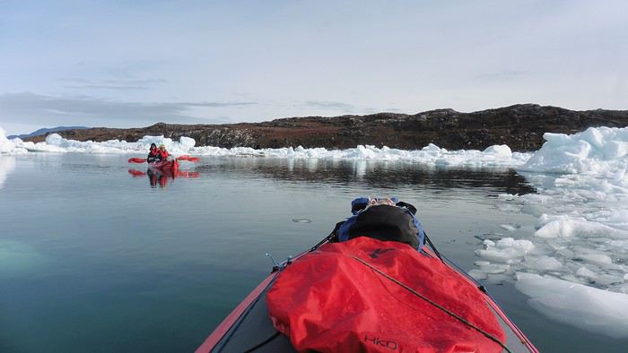
We wandered through this labyrinth until landing on a beach on the small island of Takissut, where we set up camp, exhausted from the 30 km covered and the vigilance required by the abundance of ice. The place was sublime under the evening sun—we were surrounded by ice and mountains, with the Kangilerngata Glacier in the distance. The summer contrasts were striking between the water, icebergs, sky, and flaming tundra—all colors were represented. Absolute calm reigned.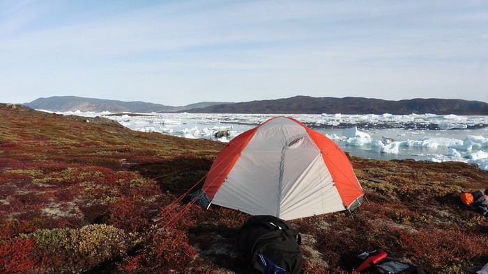
The lack of drinking water at this spot wasn’t too much of a constraint: as soon as we arrived on the beach, we placed containers under the icebergs stranded in the intertidal zone. They were all full by the time we finished setting up.
Day 7 We had to change our plans: we wouldn’t reach the rocky promontory, too well protected by the ice. We set off under the sun for Igdluluarssuit Island. Although we had spotted a passage just before launching, we quickly found ourselves surrounded by ice. It was everywhere, and finding water to paddle became complicated. We tried to force our way in every direction, even retracing our steps. Everything moved at an impressive speed—we were in the middle of a whirlpool of ice.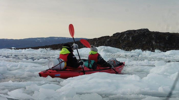
The tension rose, and each boat had its share of big scares. I was trapped against ice floes that dragged me toward an iceberg—the pressure on the kayak was enormous; it was going to capsize or puncture! But with a few strong strokes and paddling against the ice, I managed to free myself from the trap. Barely 10 minutes later, my companions were sandwiched perpendicularly between two icebergs that were closing in. The situation was desperate—the kayak was bending and twisting more and more, but with some strong paddle strokes, it finally freed itself. After these particularly unpleasant moments, we were completely blocked. The drifting ice floes had tightened, and the kayaks were no longer even in the water… The only solution: wait with the kayaks on these floes, which were too thin to walk on (even though we didn’t try). Within minutes, the situation cleared—a waterway opened, and we rushed into it. We paddled with one goal: find a larger pool of water. After going back and forth, our path took shape—we had to force the passage several times, attacking the ice directly with the kayaks, and finally, we escaped the worst of the labyrinth. We reached land on the west side of the island and saw that the rest would be easier. To reach the island, we just had to cross the Arsiviup Ikera Strait, which was lightly cluttered. We reached the eastern cape of the island, ideal for camping, even though we had only paddled for 3 hours. We set up camp and hiked to the island’s summit, which overlooks the entire pass and the glaciers.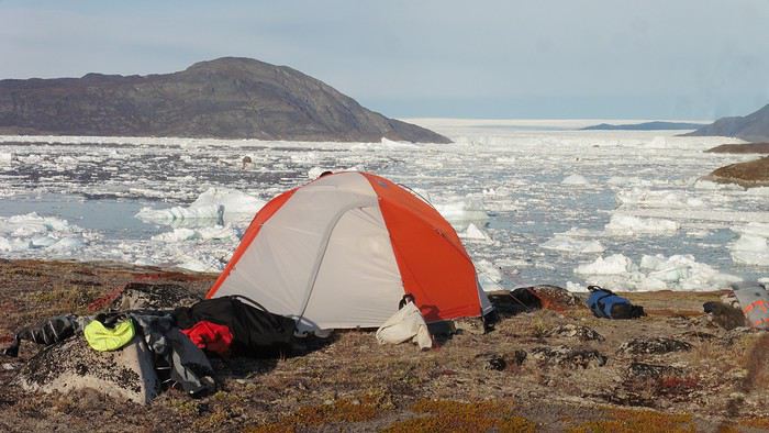
Everything was magnificent, no matter the direction. At 2 PM, we were at the summit—the beauty of the place and the picnic facing the glacier in the sun without wind made us forget the near-disaster from a few hours earlier. It would be impossible to approach the glacier by kayak, but from our summit on foot, it seemed so close, and contemplating it safely on solid ground was a great moment.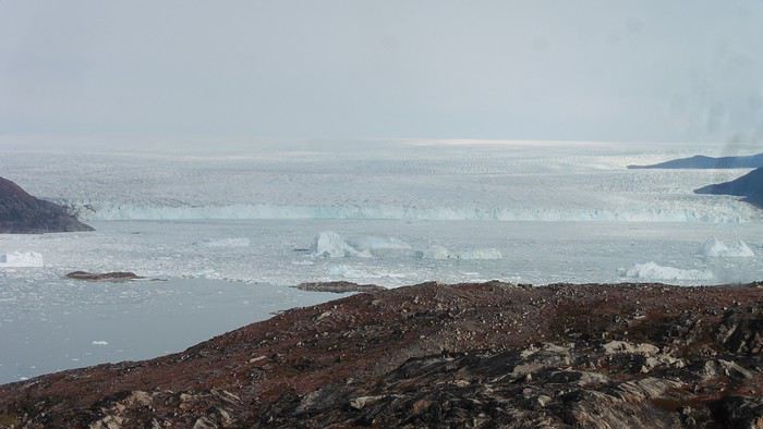
The pass was incredibly complex—everything was in motion, and an impassable passage could become open water within minutes. We were delighted when we returned to camp. A slightly lost whale among the ice accompanied us along the shore. The place was truly beautiful, but the temperature dropped again under the clear sky, preventing us from eating outside.
Day 8 Clear and cold at wake-up: -9°C. The sea had frozen in many places. We hesitated about the rest of the trip—should we start heading back to Ilulissat or linger in the pass, especially to approach the Eqi Glacier? After the incidents of the previous day, we decided to think carefully and paddled to the southern cape of our island to check the ice conditions toward Eqi. The weather had clouded over in the meantime, and the sky was quite gray. At the cape, we spotted the glacier’s wall, still 15 km away.
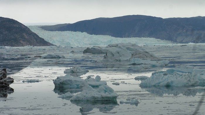
The fjord was quite cluttered, but it seemed passable. However, there was no guarantee the view would be much better 1 km from the glacier than 15 km away, especially since the front was quite active and therefore dangerous. We decided to head south without passing by the glacier. The cold temperatures encountered in the pass also motivated us to move away from the glaciers and the ice cap. We navigated under a threatening sky but without wind. The kayaks cut through the thin layer of ice on the surface with a crinkling paper sound. We reached the Ata campsite in the late afternoon after 5 hours of rowing without a single break…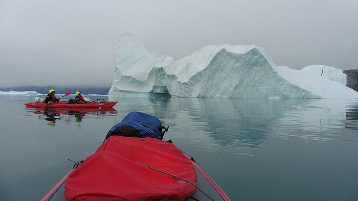
The wind had picked up, and we discovered a nice surprise: a refuge with a table and a comfortable bench lined with mattresses. Facing the worsening weather, we settled in comfortably. The kerosene stove was too complex for our three brains—we couldn’t get it started, too bad, as it was 0°C inside. The rest of the afternoon was spent fishing in the large lake, where we landed a beautiful Arctic char, more than enough for three. A good night’s sleep without the risk of foxes or the sound of a tent shaking in the wind.
Day 9 6 AM wake-up to the sound of rain hitting the cabin. The decision was made looking out the window—wind, rain, and fog obscured the sea: we went back to sleep.
New wake-up, and the rain had stopped—we could go out and stock up on fish. We set off on foot toward the lake, following its western shore. It was very overcast, and the wind encouraged us to keep moving. We made our way to a smaller lake at the end of the large one, where we caught a huge Arctic char. A small clearing brightened the picnic, and we headed back to our cabin.
This 20 km hike kept us busy all day: walking on slippery scree and the micro-relief of the peat bogs took time.
Day 10 The sky was clear, but a light south wind made paddling intense. We set off southeast to reach the opposite shore of the fjord. It was very cold, and it was impossible to stop paddling for even a moment without immediately losing ground due to the wind. We crossed the Kangerluarsuk Fjord. I recognized the cape I had reached on skis in the winter of 2017. We found a nice campsite on the southern shore of the fjord: Uiartag. It wasn’t even noon, but facing this headwind, we preferred to stop here rather than exhaust ourselves for a few extra kilometers. Like the previous ones, this campsite was very comfortable: the ground was covered with a thick layer of lichens and mosses, very pleasant to lie on.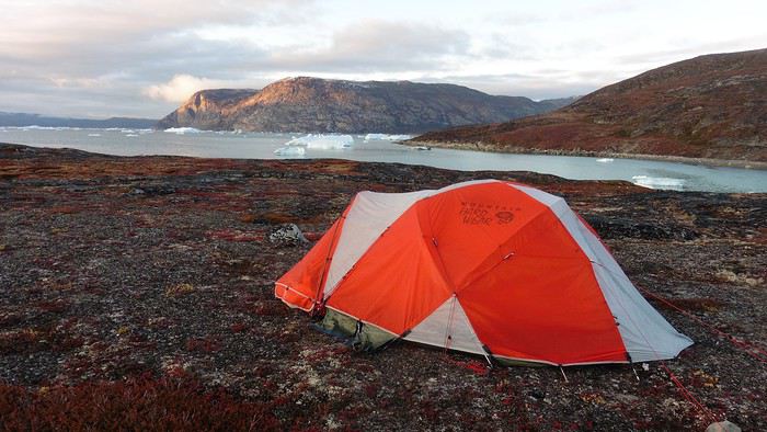
We set off on a hike to the heights of the cape, where the weather alternated between large clearings and snow showers. We noticed the loss of the thermometer, poorly attached to the backpack. On the way back, in the small bay of our beach, a whale swam calmly 10 meters from the shore—a beautiful surprise.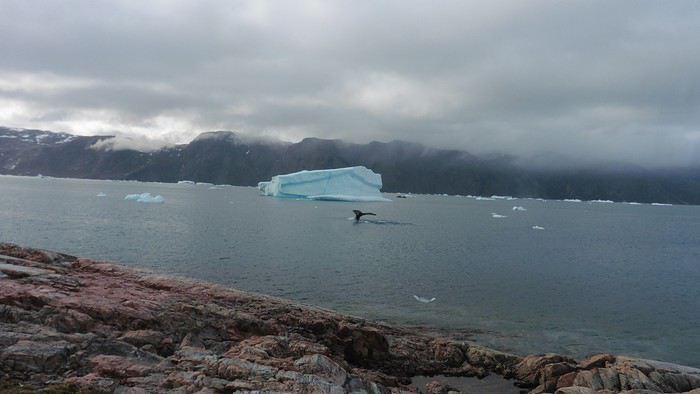
The sky cleared completely, and the temperature dropped as night approached.
We’re setting off as a group of three in two inflatable double-seater kayaks (Gumotex) brought from France. The plan is to spend two weeks circumnavigating Arve Princess Island, located north of Ilulissat in Disko Bay, with a possible boat drop-off at the southern tip of the island.
This seems like a fairly classic route in the area—we found several descriptions online (thanks to the authors). With their help and Google Earth, we identified all potential campsites and entered their coordinates into a GPS. The western part of the island, facing the bay, seems ideal for whale watching, while the more rugged eastern side offers access to several glacial walls. We’re somewhat familiar with the area from two winter expeditions on skis and pulkas.
Plus, the commitment is limited due to the island’s proximity to several small villages, including Qeqertaq, Oqaatsut, and even Ilulissat. In fact, we saw fishing boats almost every day. The distance suits us well: 200 kilometers in 16 full days on site, which should leave some leeway in case of bad weather or for hiking.
We booked our flights in June with Air Greenland to Ilulissat for the last week of August and the first week of September. On both the outbound and return trips, we stayed overnight in Copenhagen. The France-Copenhagen flight was with Air France.
We were allowed 3 x 20 kg in the hold. Each kayak with its accessories fits into a 20 kg bag; the last hold bag is for shared gear: tent, stoves, dry bags… We only brought 1.5 kg of semolina for food. In the end, we had 61 kg of gear, and no excess baggage was charged.
Individual gear (clothes and sleeping bags…) was distributed in the cabin luggage.
For the boat transfer, we contacted an agency: Blue Jay, which gave us a number to call upon arrival.
Day 0: Wednesday, August 22 Departure day. After work, I drove from Gap to Marseille’s Marignane Airport for the first leg of the trip to Copenhagen. I enjoyed the rather mild local temperatures: 35°C in the shade. After a layover in Paris, I arrived at the Copenhagen hotel, located two train stops from the airport, where my companions were already settled. No issues—everyone was on time with their luggage.
Day 1 The flight to Greenland was at 9 AM. We had a layover in Kangerlussuaq, where we changed planes, then stopped in Aasiaat before reaching Ilulissat Airport at 3 PM under beautiful sunshine.
We called Blue Jay for the boat transfer: they could take us to the island as early as 6 PM; otherwise, we’d have to wait until the next day. That left us 3 hours to prepare our gear and, most importantly, do our shopping for the two-week trip—it seemed tight, but we gave it a shot.
A quick taxi ride took us to Pisiffik, where we easily found everything we needed: bread, butter, cheese, cold cuts, rice, pasta, jam, muesli… There was no C fuel or methylated spirits for the stoves, but this time we knew the trick: at Stark, a bit uphill from the town, we found the precious liquids. Two hours later, we filled our dry bags and containers with our purchases, and by 5:30 PM, we met Klaus, the Blue Jay manager, directly at the port.
The vacation seemed to truly begin as we sped by boat through the icebergs toward Arve Princess Island. Forty-five minutes later, we spotted a beach lined with rocks where Klaus dropped us off quickly (he had another transfer to make right after).
Here we were on the island, in the middle of nowhere, with all our luggage and food to organize, the tent to set up, and the kayaks to inflate—just 10 hours after leaving the Copenhagen hotel. We got to work, bothered by the flies. Despite our head nets, it was barely tolerable—there were so many of them. They swarmed by the dozens into every bag we opened. It was quite mild: 10°C.
Everything was ready by evening, and we were very happy to have completed all these transfers (planes and boat in a single day) as we slipped into our sleeping bags.
During the night, the wind picked up, and we went out several times to check the tent and kayak anchors. We noticed how bright it was—it was still quite twilight even at 1 AM.
Day 2 5:30 AM wake-up—the south wind was still strong, but since we were heading north, we decided to give it a try anyway.
This was also the moment we loaded the kayaks: since there were only three of us for two double-seater kayaks, we filled the hatch of one kayak, which allowed us to fit all our food. It would have been very difficult if there had been four of us for two kayaks.
Finally, we set off north along the western coast of the island. The conditions were far from ideal—the sea was rough, and the kayaks had a lot of wind resistance. But the main problem was the spray skirt: the gear on deck weighed it down, and the skirt kept coming off… We’d have to deal with it. Barely underway, and whales were already breaking the surface—it was our first time seeing them, and we were very impressed. Too bad the wind didn’t allow for longer contemplation; stopping paddling was impossible with such strong gusts.
We passed a few headlands and even considered stopping due to the conditions. To find some semblance of shelter, we had to hug the coast closely without cutting across the numerous bays, which significantly lengthened the journey. But as the morning went on, the wind died down, and the sea calmed. We spotted several whales and our first seals. It was almost pleasant during the picnic break. By late afternoon, we reached Kangerup Sarqâ Bay, where we had identified a great campsite with a very large beach and a river. But the wind had shifted—it was now coming from the north, making the last hour difficult due to fatigue and headwinds.
The campsite was ideal and beautiful, facing numerous icebergs grounded in the bay.
The GPS alerted us to another major drawback of inflatable kayaks: their slowness. It took us 7.5 hours of actual paddling (excluding breaks) to cover 28 km, averaging 3.7 km/h—somewhat disappointing. But we knew this before leaving, and once again, we’d have to make do!
Day 3 Surprise: at 6 AM wake-up, it was raining, foggy, with a south wind, and the sea was choppy even in the bay. It seemed wise to skip paddling, even though stopping on the second day was tough on morale. We went back to sleep, especially since the travel fatigue and the harsh conditions of the previous day had taken their toll.
At 11 AM, the navigation conditions weren’t any better—at the ends of the bay, we saw huge waves crashing onto the rocks, and giving up for the day became obvious. However, the rain had stopped, so we set off for a hike along the large lake bordering the bay. The wind hadn’t let up, and it was quite cold.
The tundra was starting to take on its autumn colors, and the contrast between the white lichens and the red vegetation was stunning. At the lake, we took out the fishing rods and quickly caught two beautiful Arctic char over 50 cm long.
As the afternoon wore on, the sun seemed closer. Along the beach, we gathered driftwood (mostly old planks) to cook our catch in foil over a fire. Eating our own food in such a beautiful place next to a good fire was comforting after the day’s setback.
In the middle of the night, an Arctic fox entered the tent’s rear awning. It seemed barely intimidated when we shooed it away with loud shouts and then with stones.
Day 4 6:15 AM wake-up—3°C. We were on the water by 8 AM. The wind had dropped significantly, but the sea was shrouded in fog, and it was very cold in these damp conditions.
We passed the bay’s headland, Kangea, and headed toward the abandoned village of Agpat. The atmosphere was very austere—we hugged black rocks in fog that limited visibility to 50 meters, revealing large icebergs as we went.
Suddenly, the water’s surface stirred in front of my kayak, and a huge gray back emerged from the sea. The collision was inevitable, but the whale seemed to understand and dove immediately, passing under the kayak and resurfacing a few meters away. I felt the kayak rock in the white foam and quickly paddled to escape the turbulence. What an emotion!
A light wind began to clear the fog, and the sun made beautiful appearances. Despite the cold, we stopped to visit the abandoned village, which left a strange impression. All the houses were still in good condition and wide open—some must have been very spacious in their time. We went back to sea, and in front of the large Kaangerdluk Bay, we hesitated—the headwind was strong, and large waves split the water. The next beach, from the island of Nua where we stopped to think, was over 8 km away. It was barely 2 PM, but caution led us to stop here for the day. We had covered 12 km—exactly the distance needed to stay on schedule. The afternoon was spent hiking on the island’s hills and gathering mussels and wood.
In the evening, we cooked these large Greenlandic mussels over a wood fire and savored them under the beautiful evening light. The weather was now fine, but the thermometer read -5°C in the sun…
Day 5 Bright sunshine, a glassy sea, and -8°C at 6 AM. Everything was green for setting off, even if putting on damp kayaking gear was a bit unpleasant in the cold. It was the first time we’d paddled on a flat sea since the start of the trip, and our average speed increased slightly.
We entered the Smallesund Strait, marking the end of the island’s west coast. We were close to the large Torssukatak Fjord, where two glaciers flow. The access pass to the fjord was very narrow, and numerous ice chunks blocked access to the beaches. The wind had picked up and was now hitting us head-on (again). Just before entering the fjord, we landed on a steep beach made of large pebbles on Oqaitsut Island. It was very cold with the wind, and moving forward became difficult. We decided to stop for the day both because of the conditions and because the next campsite was far away, given how rugged the fjord was.
We eventually found a flat spot for the tent despite the steep slope. Even with the wind, the weather was beautiful, and we set off on foot for the northeastern cape of the island, overlooking the fjord. The view was far-reaching and exceptional—up close, the large fjord filled with ice and its steep granite cliffs, and in the distance, the ice cap and glacial walls.
We spotted the village of Qeqertaq, whose network we could pick up, allowing us to check the weather forecast, which was rather good. While securing the kayaks in the evening, I noticed the strange behavior of one kayak at the end of the stage was due to the loss of the skeg—impossible to know where it detached. We’d have to do without it.
Day 6 Still that icy headwind from the northeast. We set off anyway for a long stage to reach the large pass connecting the Torssukatak and Ata Fjords.
We advanced laboriously along the high cliffs of the fjord’s southern shore. They faced due north and blocked the sun. We felt the cold and dampness of the rock. It was really cold, especially in the extremities. We picnicked on the western cape of Qeqertakavasak Island. The cold didn’t allow us to stop for more than 20 minutes… But the wind dropped, and the sea was now very smooth. It was heavily cluttered with ice between the icebergs and old pack ice. The goal was to reach the large rocky promontory of Anapnuna, wedged between the Kujatdleq and Kangilerngata Glaciers, but the ice made progress difficult. We stopped to gain height on a small island and spot a passage of open water, but all we saw was white—passing seemed impossible. The currents were very complex, and entire sections of ice were being swept in one direction and then another at an impressive speed.
We wandered through this labyrinth until landing on a beach on the small island of Takissut, where we set up camp, exhausted from the 30 km covered and the vigilance required by the abundance of ice. The place was sublime under the evening sun—we were surrounded by ice and mountains, with the Kangilerngata Glacier in the distance. The summer contrasts were striking between the water, icebergs, sky, and flaming tundra—all colors were represented. Absolute calm reigned.
The lack of drinking water at this spot wasn’t too much of a constraint: as soon as we arrived on the beach, we placed containers under the icebergs stranded in the intertidal zone. They were all full by the time we finished setting up.
Day 7 We had to change our plans: we wouldn’t reach the rocky promontory, too well protected by the ice. We set off under the sun for Igdluluarssuit Island. Although we had spotted a passage just before launching, we quickly found ourselves surrounded by ice. It was everywhere, and finding water to paddle became complicated. We tried to force our way in every direction, even retracing our steps. Everything moved at an impressive speed—we were in the middle of a whirlpool of ice.
The tension rose, and each boat had its share of big scares. I was trapped against ice floes that dragged me toward an iceberg—the pressure on the kayak was enormous; it was going to capsize or puncture! But with a few strong strokes and paddling against the ice, I managed to free myself from the trap. Barely 10 minutes later, my companions were sandwiched perpendicularly between two icebergs that were closing in. The situation was desperate—the kayak was bending and twisting more and more, but with some strong paddle strokes, it finally freed itself. After these particularly unpleasant moments, we were completely blocked. The drifting ice floes had tightened, and the kayaks were no longer even in the water… The only solution: wait with the kayaks on these floes, which were too thin to walk on (even though we didn’t try). Within minutes, the situation cleared—a waterway opened, and we rushed into it. We paddled with one goal: find a larger pool of water. After going back and forth, our path took shape—we had to force the passage several times, attacking the ice directly with the kayaks, and finally, we escaped the worst of the labyrinth. We reached land on the west side of the island and saw that the rest would be easier. To reach the island, we just had to cross the Arsiviup Ikera Strait, which was lightly cluttered. We reached the eastern cape of the island, ideal for camping, even though we had only paddled for 3 hours. We set up camp and hiked to the island’s summit, which overlooks the entire pass and the glaciers.
Everything was magnificent, no matter the direction. At 2 PM, we were at the summit—the beauty of the place and the picnic facing the glacier in the sun without wind made us forget the near-disaster from a few hours earlier. It would be impossible to approach the glacier by kayak, but from our summit on foot, it seemed so close, and contemplating it safely on solid ground was a great moment.
The pass was incredibly complex—everything was in motion, and an impassable passage could become open water within minutes. We were delighted when we returned to camp. A slightly lost whale among the ice accompanied us along the shore. The place was truly beautiful, but the temperature dropped again under the clear sky, preventing us from eating outside.
Day 8 Clear and cold at wake-up: -9°C. The sea had frozen in many places. We hesitated about the rest of the trip—should we start heading back to Ilulissat or linger in the pass, especially to approach the Eqi Glacier? After the incidents of the previous day, we decided to think carefully and paddled to the southern cape of our island to check the ice conditions toward Eqi. The weather had clouded over in the meantime, and the sky was quite gray. At the cape, we spotted the glacier’s wall, still 15 km away.
The fjord was quite cluttered, but it seemed passable. However, there was no guarantee the view would be much better 1 km from the glacier than 15 km away, especially since the front was quite active and therefore dangerous. We decided to head south without passing by the glacier. The cold temperatures encountered in the pass also motivated us to move away from the glaciers and the ice cap. We navigated under a threatening sky but without wind. The kayaks cut through the thin layer of ice on the surface with a crinkling paper sound. We reached the Ata campsite in the late afternoon after 5 hours of rowing without a single break…
The wind had picked up, and we discovered a nice surprise: a refuge with a table and a comfortable bench lined with mattresses. Facing the worsening weather, we settled in comfortably. The kerosene stove was too complex for our three brains—we couldn’t get it started, too bad, as it was 0°C inside. The rest of the afternoon was spent fishing in the large lake, where we landed a beautiful Arctic char, more than enough for three. A good night’s sleep without the risk of foxes or the sound of a tent shaking in the wind.
Day 9 6 AM wake-up to the sound of rain hitting the cabin. The decision was made looking out the window—wind, rain, and fog obscured the sea: we went back to sleep.
New wake-up, and the rain had stopped—we could go out and stock up on fish. We set off on foot toward the lake, following its western shore. It was very overcast, and the wind encouraged us to keep moving. We made our way to a smaller lake at the end of the large one, where we caught a huge Arctic char. A small clearing brightened the picnic, and we headed back to our cabin.
This 20 km hike kept us busy all day: walking on slippery scree and the micro-relief of the peat bogs took time.
Day 10 The sky was clear, but a light south wind made paddling intense. We set off southeast to reach the opposite shore of the fjord. It was very cold, and it was impossible to stop paddling for even a moment without immediately losing ground due to the wind. We crossed the Kangerluarsuk Fjord. I recognized the cape I had reached on skis in the winter of 2017. We found a nice campsite on the southern shore of the fjord: Uiartag. It wasn’t even noon, but facing this headwind, we preferred to stop here rather than exhaust ourselves for a few extra kilometers. Like the previous ones, this campsite was very comfortable: the ground was covered with a thick layer of lichens and mosses, very pleasant to lie on.
We set off on a hike to the heights of the cape, where the weather alternated between large clearings and snow showers. We noticed the loss of the thermometer, poorly attached to the backpack. On the way back, in the small bay of our beach, a whale swam calmly 10 meters from the shore—a beautiful surprise.
The sky cleared completely, and the temperature dropped as night approached.
A travel journal—it’s been a while!
I must say, my personal situation has "changed a bit" since my last journals (my 3 kids are grown up + a divorce finalized in early 2021). So, no more long-haul family trips; now I’m focusing on multi-day hikes for my vacations. I found a hiking buddy in 2021 to join me on the Laugavegur trek in Iceland, but this year, no one was available.
That’s how the idea of a solo trek in Lapland took root—a region I’ve been dreaming about ever since I read Marie Lefevre’s 2012 journal on the topic.
Marie, who I hiked with for the first time in 2015 during my very first multi-day trek, and whom I can never thank enough for sharing her knowledge and saving me so much time.
To build my confidence for this solo trek, I hiked around Cantal in May (okay, I’m capable of spending nights alone in the middle of nowhere without being overly terrified) and camped in the Mercantour in July, where a massive storm made me realize I still had room for improvement in managing wet conditions...
After some research, I bought 2 Nylofume bags—large, ultra-lightweight ones to protect my gear in my backpack—and a set of 4 Aloksak bags in different sizes for my passport, camera, battery, etc. (and I’m so glad I did!!)
Well, I think I’m all set...
My 16/08 - Day 1 - Ritsem – Gisuris (well, almost) Wed 17/08 – Day 2 - Partly in the tent + minimal progress toward Gisuris Thu 18/08 – Day 3 - Gisuris – Laddejakha (23 km) Fri 19/08 – Day 4 – Laddejakha – Arasluokta (13 km) Sat 20/08 - Day 5 - Arasluokta – Staloluokta (12 km) Sun 21/08 – Day 6 - Staloluokta – Duottar (18 km) Mon 22/08 Day 7 - Duottar – Dareluoppal (10 km) Sammarlappa (15.3 km) Tue 23/08 - Day 8 - Sammarlappa – Tarrekaise (12 km) + halfway to Tarrekaise-Nunjes (approx. 3 km) Wed 24/08 – Day 9 – Finish Tarrekaise-Nunjes (approx. 4 km) Kvikkjokk (12.6 km) Thu 25/08 and Fri 26/08 – Around Kvikkjokk Food and gear summary
I’d been watching this ultra-light travel movement or trend for a while.
So I gave it a try—goodbye to the 5 panniers and rear racks.
A 15L saddle bag for clothes and a stove cookset.
Two cages on the fork blades: 2x5L—mattress on one side, tent on the other.
A 5L frame bag for miscellaneous items: battery, camera, small bits and pieces.
And one on the handlebar for the sleeping bag.
I tested it this summer on a crossing from Valence to Perpignan via the Massif Central.
My conclusions: The obvious advantage is the reduced weight. In total, I had 12 kg on the bike, which makes climbing in the mountains much easier. Another benefit I hadn’t considered is the significantly lower wind resistance compared to a traditional setup—you really feel it when the wind’s against you. Of course, it’s not all perfect... For example, it’s impossible to carry a food stock. You buy just enough before each meal or go to a restaurant! You also have to accept a more spartan comfort level at stops.
In conclusion, I think for summer trips in regions where resupplying is easy, it’s an interesting option—especially if there’s significant elevation gain. On the other hand, it doesn’t allow for enough autonomy, so some trips are off the table.
I took the opportunity to replace my tent. Given the prices of lightweight gear, I went with Decathlon. For 150 €, I chose the MT900 tent/tarp (D4 model). https://www.decathlon.fr/p/tente-tarp-de-trekking-1-place-ultra-legere-et-ultra-compacte-mt900/343262/c193c382m8968612 Not the easiest to set up (at first) and it’s not freestanding. You can sit up inside, which isn’t common for this type of shelter. We’ll see how it holds up over time.
On the bike side, I swapped my Shimano 11/34 cassette for an 11/40. Even though Shimano doesn’t recommend it with a 105 derailleur and a 46/30 double chainring, it works really well. The only limit is avoiding the 46/40 gear ratio.
After our amazing experience in the Lofoten Islands in summer 2023, I suggested to Jean Marie another trek I’d been wanting to do for a long time: the Skye Trail in Scotland.
A few photos of this stunning island and he was sold and ready to go.
The route is available on the excellent WalkHighlands site HERE (there’s also a Cicerone guide on the subject). And since I thought it was a shame it avoided the Black Cuillins, I added a 3-day detour in that area.
We took advantage of the May bank holidays in 2024, partly to avoid the peak tourist season and also the midge period—because for some reason, mosquitoes love me 😠!!
27/04 – Day 1 – Transfer to Skye and start of the trek: Rubha Hunish - Flodigarry 28/04 – Day 2 – Flodigarry – just before the Old Man of Storr 29/04 – Day 3 – Old Man of Storr – Portree, then bus to Sligachan 30/04 - Day 4 - Sligachan - Glenbrittle campsite via the Fairy Pools 01/05 – Day 5 – Round trip to Sgùrr na Banachdich from Glenbrittle campsite 02/05 – Day 6 – Round trip to Coire Lagan and walk on the Rubh an Dùnain peninsula 03/05 – Day 7 – Return (hitchhiking) to Sligachan campsite and hike in the Red Cuillins 04/05 – Day 8 – Resuming the Skye Trail – Sligachan – Elgol 05/05 – Day 9 – Elgol – Somewhere on the climb to Bla Bheinn 06/05 – Day 10 – Somewhere on the climb to Bla Bheinn - Broadford 07/05 – Day 11 – Visit to the Armadale Castle and park 08 & 09/05 – Return to Glasgow, visit the city, and return flight And here’s the summary
Hi everyone,
So glad this forum is back up! Here’s a recap of our three little weeks in the Azores in August 2024, camping on Terceira, Flores/Corvo, and São Miguel, with a special focus on the camping side—something I struggled to find info on before we left.
As others have mentioned, a trip to the Azores isn’t something you can improvise last-minute, especially in August. The rental car fleet is limited, so prices go up as availability drops, and vacation rentals/hotels are scarce. Plus, inter-island flights and ferries aren’t exactly frequent. I picked our destination in mid-April, and there were already few rental car options left (some local companies had nothing), and no accommodations on Flores for our dates—or only very expensive ones requiring multiple location changes. Since we love camping, we decided to bring our gear without really knowing what to expect.
Flight with TAP (426 €): Outbound: Lyon → Lisbon → Terceira Return: São Miguel → Lisbon (9-hour stopover for a quick visit) → Lyon
Inter-island flights with SATA: Terceira → Flores (via Horta): 87 € Flores → São Miguel: 90 €
I rented all three cars from the same local company, Ilha Grande—they weren’t picky about the car’s condition. For a Clio (or similar): Terceira (4 days): 461 € Flores (5 days): 623 € São Miguel (8 days): 730 €
Weather: The first two weeks were gorgeous—blue skies, no rain, and even hotter than we expected, around 30°C (temperatures barely dropped at night). The last week of August brought more fine rain (mostly at night) and temps between 20 and 25°C (a light jacket was nice in the mornings and evenings).
TERCEIRA: A great introduction! When I looked at what each island had to offer, Terceira wasn’t at the top of my list, but flying into Terceira cut costs and fit our schedule well, so we spent 4 days there. It turned out to be a lovely start.
For camping, we stayed at Salga Campismo in Porto Judeu, 20 minutes from the airport. We discovered that the island’s campsites were packed with locals—extended families or groups of friends having big, festive gatherings with barbecues and long tables. They spend their summers camping instead of at home, and some even commute to work from there. They had huge tents for sleeping, plus tarps for cooking and relaxing—way more gear than the tourists. Since the week of August 15th is peak vacation time (like in France), we struggled to find a spot, and the nights were pretty noisy. This was the only campsite of the trip with numbered pitches. It’s right by the ocean, next to natural pools. Facilities were decent, with hot showers and picnic tables. Lots of shaded spots. Cost: 4 € per small tent + 2 € per person. Electrical outlets were free (20 € deposit). During our explorations, we passed by Cinco Ribeiras campsite (west coast), which seemed similar.
Camping gas: Always ask the campsite reception if any travelers left a gas canister before buying a new one! Before the trip, I emailed each island’s tourism office, and they gave me addresses for Campingaz bottles. On Terceira, No. 13 Rua João Vaz Corte Real in Angra do Heroísmo (an agricultural store in the industrial zone). CV300 cartridge: 10 €. Note: The tourism office gave me the name of the neighboring store, which didn’t carry that brand.
Fridge: No fridges at any campsite on any island. We had a foldable cooler and found bags of crushed ice in supermarkets’ fish sections.
Things to see: Key takeaway: Do the must-see spots early in your stay in case the weather doesn’t cooperate. We were lucky and saw all the viewpoints without clouds—apparently not always the case!
Our main visits/hikes on Terceira: Miradouro Serra do Cume (a must—*the* iconic Terceira photo)
Furnas do Enxofre (free): Few fumaroles, but a pretty 1 km walk through moss and endemic plants. Hike PRC01 TER – Misterios Negros (some acrobatic sections, but a very scenic path). Monte Brasil + Angra do Heroísmo: Lovely town. Hike PR02 TER – Baía da Agualva: Nice, but not much shade (along the coast). Quatro Ribeiras: Church and swimming in natural pools. Biscoitos natural pools: Too touristy (but still free).
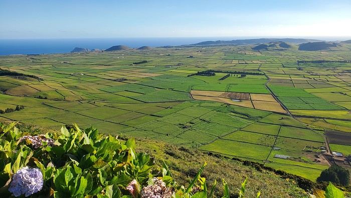
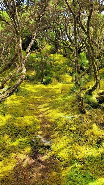
FLORES: Our favorite! This was the island I *had* to visit, and we weren’t disappointed—no mass tourism, just stunning nature.
For camping, we chose Santa Cruz campsite. Unlike Terceira, it was only tourists here. Very little shade, but ocean views. Modern facilities with hot showers, clotheslines, and a charging station. A big area with picnic tables, each with a barbecue and sink, all sheltered. Right across from gorgeous natural pools. FREE (you can leave a tip for the caretaker).
For Campingaz, the campsite manager stores canisters and gear left by campers. Otherwise, you can find them at Movipesca.
During a hike, we passed by Fajã Grande campsite (campsites here double as picnic spots for everyone). It’s terraced, with no shade, but very clean facilities and a small bar/restaurant nearby. Natural pools across the street. When we stopped by midday, there were only a few tents. Fajã Grande felt even quieter than Santa Cruz, with just one supermarket.
We also picnicked at Ponta Delgada campsite in the north. Impeccable facilities, lots of picnic tables with barbecues. Empty when we were there. A bit out of the way.
Rental car or not on Flores? Given the high cost, I really debated whether we needed a car. In Santa Cruz, the port, airport, and supermarkets are walkable, and the most famous hikes are one-way, not loops. So I contacted a taxi (the tourism office emails a list of drivers—they don’t wait for customers; you have to call). Prices were around 20 € for Santa Cruz to Fajã Grande, for example. That means you could take several taxi trips before the rental car (over 100 €/day) pays off. But it does mean planning your route and schedule in advance, leaving little room for spontaneity. The taxi I contacted was already booked solid in July, so I decided to keep the car and adjust our hikes to make loops. (FYI, we’re in our 50s, two couples splitting costs—maybe a different calculation if we were 25!) No regrets—it gave us way more freedom.
Our main visits/hikes:
Hike (amazing): Poço da Ribeira do Ferreiro (the iconic waterfalls) → Fajã Grande → Poço do Bacalhau (swim in the waterfall) → Aldeia da Cuada → Poço da Ribeira do Ferreiro. Hike PR04: Loop from Miradouro da Fajã de Lopo Vaz, then down to the beach via the trail. Return along the pebble beach before climbing back up. Worth it, but the descent and ascent are steep.
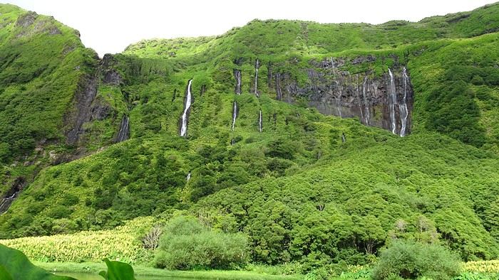 By car: Miradouro do Portal (great view of the coast to Fajã Grande) – Rocha dos Bordões (basalt columns) – Miradouro das Lagoas Rasa e Funda (a must) – Miradouro da Fajã do Conde.
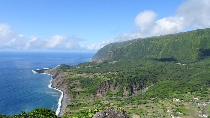 Hike: Miradouro das Lagoas Funda e Comprida, Lagoa Negra, Seca e Branda, Lagoa Branca. A bit muddy and not as memorable as other hikes. The best part (a must) is the view from the starting miradouro.
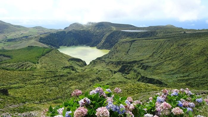
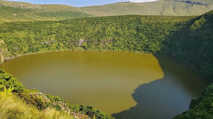
By car: The north of the island.
CORVO: Stunning!!
No spots left on the ferry (12 seats), so we took a tourist zodiac (booked a few weeks ahead by email, but there were still spots the day of—several boats make the trip). On the way out, we cruised along Flores’ coast to see waterfalls and caves. On the return, they looked for dolphins (we saw some! 🙂 ). Boat price: 35 € per person. At Corvo, minibuses shuttle between the port and the top of the caldera (10 € round-trip per person). Lots of people just stop at the viewpoint when the shuttle arrives, so we weren’t too crowded on the caldera hike. But it’s too tight on time to walk back down to the port. If you really want to, I think you’d need to stay overnight. All boats spend the same amount of time on the island.
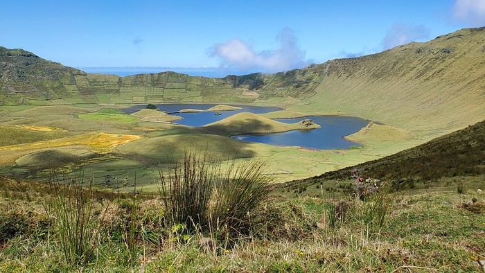
SÃO MIGUEL: Back to civilization—but not just that! São Miguel is way more touristy than the other islands (though still nothing compared to other destinations), but it’s worth it for all the natural sites.
For camping, to avoid long drives, we started at Sete Cidades campsite on the west side. A big, free, terraced campsite with some shade. We were there the last week of August, when crowds start thinning, so there was space—a mix of tourists and locals. A few picnic tables with barbecues. For facilities, one side for men, one for women, each with one toilet (cleaned regularly) and three outdoor cold showers (swimsuits recommended). You can charge your phone in the caretaker’s hut.
After exploring the west, we moved to Furnas for the rest of the trip. We arrived on a Friday night, and the campsite was packed with locals spending the weekend. It emptied out Sunday afternoon. A large, shady campsite with several bathroom blocks (hot showers). There’s a restaurant, but only two picnic tables. Cost: 3.5 € per small tent + 3.5 € per person.
Campingaz: We bought canisters at Decathlon in Ponta Delgada (next to Decathlon, there’s a big shopping center for groceries). Didn’t ask at Sete Cidades, but at Furnas, there was a closet full of gas bottles of all sizes left by campers.
Main visits/hikes: Sete Cidades and the surrounding lakes (lots of viewpoints and short hikes): Beautiful.
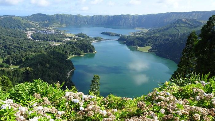
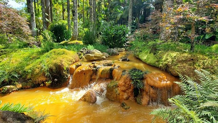
Swimming in the hot springs at Ponta da Ferraria (west side of the island).

Furnas: The lake, fumaroles, and parks (like Terra Nostra).
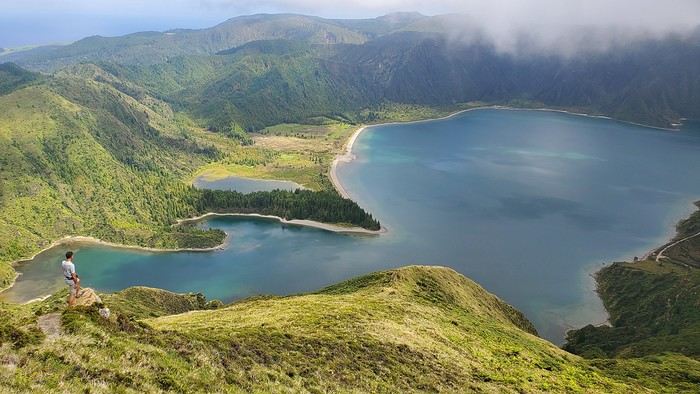
Lagoa do Fogo (gorgeous).
Gorreana tea factory (nice hike through the tea fields + guided tour), Ribeira Grande, Ermida de Nossa Senhora da Paz. The east coast and Ribeira dos Caldeirões park. Ponta Delgada.
Final thoughts: The Azores are a fantastic discovery for nature lovers—lakes, waterfalls, and tranquility. Almost all sites are accessible without hiking (though it’s a shame not to). The “miradouros” (viewpoints) have parking, often with toilets and picnic tables (always very clean), which helps protect nature. Camping is totally doable and really enjoyable! Our only disappointment: Not finding good fruits and veggies (except for São Miguel’s delicious but expensive pineapples).
If you have any questions, I’d be happy to help! Christine
So glad this forum is back up! Here’s a recap of our three little weeks in the Azores in August 2024, camping on Terceira, Flores/Corvo, and São Miguel, with a special focus on the camping side—something I struggled to find info on before we left.
As others have mentioned, a trip to the Azores isn’t something you can improvise last-minute, especially in August. The rental car fleet is limited, so prices go up as availability drops, and vacation rentals/hotels are scarce. Plus, inter-island flights and ferries aren’t exactly frequent. I picked our destination in mid-April, and there were already few rental car options left (some local companies had nothing), and no accommodations on Flores for our dates—or only very expensive ones requiring multiple location changes. Since we love camping, we decided to bring our gear without really knowing what to expect.
Flight with TAP (426 €): Outbound: Lyon → Lisbon → Terceira Return: São Miguel → Lisbon (9-hour stopover for a quick visit) → Lyon
Inter-island flights with SATA: Terceira → Flores (via Horta): 87 € Flores → São Miguel: 90 €
I rented all three cars from the same local company, Ilha Grande—they weren’t picky about the car’s condition. For a Clio (or similar): Terceira (4 days): 461 € Flores (5 days): 623 € São Miguel (8 days): 730 €
Weather: The first two weeks were gorgeous—blue skies, no rain, and even hotter than we expected, around 30°C (temperatures barely dropped at night). The last week of August brought more fine rain (mostly at night) and temps between 20 and 25°C (a light jacket was nice in the mornings and evenings).
TERCEIRA: A great introduction! When I looked at what each island had to offer, Terceira wasn’t at the top of my list, but flying into Terceira cut costs and fit our schedule well, so we spent 4 days there. It turned out to be a lovely start.
For camping, we stayed at Salga Campismo in Porto Judeu, 20 minutes from the airport. We discovered that the island’s campsites were packed with locals—extended families or groups of friends having big, festive gatherings with barbecues and long tables. They spend their summers camping instead of at home, and some even commute to work from there. They had huge tents for sleeping, plus tarps for cooking and relaxing—way more gear than the tourists. Since the week of August 15th is peak vacation time (like in France), we struggled to find a spot, and the nights were pretty noisy. This was the only campsite of the trip with numbered pitches. It’s right by the ocean, next to natural pools. Facilities were decent, with hot showers and picnic tables. Lots of shaded spots. Cost: 4 € per small tent + 2 € per person. Electrical outlets were free (20 € deposit). During our explorations, we passed by Cinco Ribeiras campsite (west coast), which seemed similar.
Camping gas: Always ask the campsite reception if any travelers left a gas canister before buying a new one! Before the trip, I emailed each island’s tourism office, and they gave me addresses for Campingaz bottles. On Terceira, No. 13 Rua João Vaz Corte Real in Angra do Heroísmo (an agricultural store in the industrial zone). CV300 cartridge: 10 €. Note: The tourism office gave me the name of the neighboring store, which didn’t carry that brand.
Fridge: No fridges at any campsite on any island. We had a foldable cooler and found bags of crushed ice in supermarkets’ fish sections.
Things to see: Key takeaway: Do the must-see spots early in your stay in case the weather doesn’t cooperate. We were lucky and saw all the viewpoints without clouds—apparently not always the case!
Our main visits/hikes on Terceira: Miradouro Serra do Cume (a must—*the* iconic Terceira photo)
Furnas do Enxofre (free): Few fumaroles, but a pretty 1 km walk through moss and endemic plants. Hike PRC01 TER – Misterios Negros (some acrobatic sections, but a very scenic path). Monte Brasil + Angra do Heroísmo: Lovely town. Hike PR02 TER – Baía da Agualva: Nice, but not much shade (along the coast). Quatro Ribeiras: Church and swimming in natural pools. Biscoitos natural pools: Too touristy (but still free).
FLORES: Our favorite! This was the island I *had* to visit, and we weren’t disappointed—no mass tourism, just stunning nature.
For camping, we chose Santa Cruz campsite. Unlike Terceira, it was only tourists here. Very little shade, but ocean views. Modern facilities with hot showers, clotheslines, and a charging station. A big area with picnic tables, each with a barbecue and sink, all sheltered. Right across from gorgeous natural pools. FREE (you can leave a tip for the caretaker).
For Campingaz, the campsite manager stores canisters and gear left by campers. Otherwise, you can find them at Movipesca.
During a hike, we passed by Fajã Grande campsite (campsites here double as picnic spots for everyone). It’s terraced, with no shade, but very clean facilities and a small bar/restaurant nearby. Natural pools across the street. When we stopped by midday, there were only a few tents. Fajã Grande felt even quieter than Santa Cruz, with just one supermarket.
We also picnicked at Ponta Delgada campsite in the north. Impeccable facilities, lots of picnic tables with barbecues. Empty when we were there. A bit out of the way.
Rental car or not on Flores? Given the high cost, I really debated whether we needed a car. In Santa Cruz, the port, airport, and supermarkets are walkable, and the most famous hikes are one-way, not loops. So I contacted a taxi (the tourism office emails a list of drivers—they don’t wait for customers; you have to call). Prices were around 20 € for Santa Cruz to Fajã Grande, for example. That means you could take several taxi trips before the rental car (over 100 €/day) pays off. But it does mean planning your route and schedule in advance, leaving little room for spontaneity. The taxi I contacted was already booked solid in July, so I decided to keep the car and adjust our hikes to make loops. (FYI, we’re in our 50s, two couples splitting costs—maybe a different calculation if we were 25!) No regrets—it gave us way more freedom.
Our main visits/hikes:
Hike (amazing): Poço da Ribeira do Ferreiro (the iconic waterfalls) → Fajã Grande → Poço do Bacalhau (swim in the waterfall) → Aldeia da Cuada → Poço da Ribeira do Ferreiro. Hike PR04: Loop from Miradouro da Fajã de Lopo Vaz, then down to the beach via the trail. Return along the pebble beach before climbing back up. Worth it, but the descent and ascent are steep.
By car: Miradouro do Portal (great view of the coast to Fajã Grande) – Rocha dos Bordões (basalt columns) – Miradouro das Lagoas Rasa e Funda (a must) – Miradouro da Fajã do Conde.
Hike: Miradouro das Lagoas Funda e Comprida, Lagoa Negra, Seca e Branda, Lagoa Branca. A bit muddy and not as memorable as other hikes. The best part (a must) is the view from the starting miradouro.By car: The north of the island.
CORVO: Stunning!!
No spots left on the ferry (12 seats), so we took a tourist zodiac (booked a few weeks ahead by email, but there were still spots the day of—several boats make the trip). On the way out, we cruised along Flores’ coast to see waterfalls and caves. On the return, they looked for dolphins (we saw some! 🙂 ). Boat price: 35 € per person. At Corvo, minibuses shuttle between the port and the top of the caldera (10 € round-trip per person). Lots of people just stop at the viewpoint when the shuttle arrives, so we weren’t too crowded on the caldera hike. But it’s too tight on time to walk back down to the port. If you really want to, I think you’d need to stay overnight. All boats spend the same amount of time on the island.
SÃO MIGUEL: Back to civilization—but not just that! São Miguel is way more touristy than the other islands (though still nothing compared to other destinations), but it’s worth it for all the natural sites.
For camping, to avoid long drives, we started at Sete Cidades campsite on the west side. A big, free, terraced campsite with some shade. We were there the last week of August, when crowds start thinning, so there was space—a mix of tourists and locals. A few picnic tables with barbecues. For facilities, one side for men, one for women, each with one toilet (cleaned regularly) and three outdoor cold showers (swimsuits recommended). You can charge your phone in the caretaker’s hut.
After exploring the west, we moved to Furnas for the rest of the trip. We arrived on a Friday night, and the campsite was packed with locals spending the weekend. It emptied out Sunday afternoon. A large, shady campsite with several bathroom blocks (hot showers). There’s a restaurant, but only two picnic tables. Cost: 3.5 € per small tent + 3.5 € per person.
Campingaz: We bought canisters at Decathlon in Ponta Delgada (next to Decathlon, there’s a big shopping center for groceries). Didn’t ask at Sete Cidades, but at Furnas, there was a closet full of gas bottles of all sizes left by campers.
Main visits/hikes: Sete Cidades and the surrounding lakes (lots of viewpoints and short hikes): Beautiful.
Swimming in the hot springs at Ponta da Ferraria (west side of the island).
Furnas: The lake, fumaroles, and parks (like Terra Nostra).
Lagoa do Fogo (gorgeous).
Gorreana tea factory (nice hike through the tea fields + guided tour), Ribeira Grande, Ermida de Nossa Senhora da Paz. The east coast and Ribeira dos Caldeirões park. Ponta Delgada.
Final thoughts: The Azores are a fantastic discovery for nature lovers—lakes, waterfalls, and tranquility. Almost all sites are accessible without hiking (though it’s a shame not to). The “miradouros” (viewpoints) have parking, often with toilets and picnic tables (always very clean), which helps protect nature. Camping is totally doable and really enjoyable! Our only disappointment: Not finding good fruits and veggies (except for São Miguel’s delicious but expensive pineapples).
If you have any questions, I’d be happy to help! Christine
Hi,
We crossed the Pyrenees by e-bike last July, from Bayonne to Perpignan, taking small roads as close to the border as possible (25 mountain passes in 10 days). It was an absolute delight, and we can share tips with anyone interested in this experience.
Hey there, VoyageForum!!!
I’ve combed through this site up, down, and sideways to plan our two-month road trip across the American Southwest during the summer of 2022, so it only feels right to give back and revive the USA travel journal section—helping others prep, travel, or relive their own memories! 😏
A quick intro to the stars of this trip is coming soon... in an upcoming post!
Table of Contents:
Road trip introduction Day 1 & 2: the days we double-checked all our papers... Day 3 & 3 bis: The day we discovered Denver... Day 4: The day of the race, the carriage, and the little one’s cough... Day 5: the day the road trip truly began... Day 6 & 6 bis: the day of Nature’s first wonders... Day 7: the day the sky fell on our heads... Day 8 & 8 bis: the day we saw ghosts... Day 9: the day we climbed the mountain... Day 10: the day the theme song from "The Last Picture Show" played on loop in my head... Day 11: the day we lived like Native Americans... Day 12: the day we left civilization behind... Day 13 & 13 bis: the day we explored another planet... Day 14 & 14 bis: the day Caro reunited with HER rocks... Day 15 & 15 bis: the day of the fantastic ride... Day 16: the day we cooled off in Lake Powell... Day 17: the day the Colorado River’s meanders were all ours... Day 18: the day we dipped our feet in the Colorado... Day 19: the day the guys discovered true vastness... Day 20 & 20 bis: the day we covered a few acres of Route 66 before sunset... Day 21: the day the credit card said stop... right before the STRIP... Day 22: the day we finally discovered Cirque du Soleil... Day 23: the day we returned to calm... well, almost... Day 24: the day we reached our home base for 6 nights: Saint George Day 25: the day we should’ve explored Yant Flat... Day 26: the day it was 13°C at Cedar Breaks... Day 27: the day we explored The Narrows in Zion NP... Day 28: the day we discovered Snow Canyon... Day 29: the day we hiked to the "SUBWAY"... Day 30: the day we encountered the abyss—from the north this time... Day 31: the day we arrived in a place where dreams begin... Kanab... Day 32: the day we discovered the first treasures along House Rock Valley... 2nd part: the second part of the journey... Day 33: the day we discovered a magical place... Edmaier's Secret... Day 34: the day Cottonwood Road didn’t open up to us... Day 35: the day of the classic Queen’s Garden + Navajo Loop—and another event that became a classic... Day 36: the second day in Bryce... pure bliss!!! Day 37: the day we swam at the foot of Calf Creek Falls... Day 38: the day we took the Burr Trail, even with storms lurking... Day 39: The day of the goblins... Day 40: the day we enjoyed the peaceful Capitol Reef NP... Day 41: the day of the Rim Overlook and another letdown... Day 42: the day we arrived in... Moab... Day 43: the first day in Arches National Park... Day 44: the day of the Fisher Towers... Day 45: the day of Bow Tie & Corona Arches... Day 46: The day of Shafer Trail + Potash Road... Day 47: The second day in Arches NP... Day 48: the day we discovered Colorado NM in a flash... Day 49: the day of Black Canyon... Day 50: the day we passed through Durango before falling for Silverton... Day 51: the day we went through Ouray and ended up in Gunnison... Day 52: the day of Kebler Pass and arriving at the hot springs... Day 53: the day of hot springs II, then the road back to Denver... Day 54: the last day... Day 55: back home and the RECAP...
Who are you? Where are you from? Where are you going?
Like last year at this time, a post about bike travel ideas.
How many of us are preparing a trip planned for this year? Probably a lot.
What’s yours—the one you’ve been dying to do for so long, maybe too long? For us, it’s a modest PARIS-MARATHON by bike, followed by MARATHON-ATHENS on foot in June 2010. And you?
May the passion keep growing before, during, and after! Happy planning and safe travels to everyone.
Hi,
First off, I just want to say how happy I am that the forum’s back up. It really means a lot. When it went down, I realized how much time I spent here and how much I valued this space for sharing. :) Hopefully, it’ll regain its momentum.
Anyway, I’m starting a thread. I’d like to get a saddle bag. I’m working on making my touring bike more versatile. It’s currently set up with racks for panniers, but for shorter rides, I’d like to remove the racks and switch to "bike-packing" mode. I’ll also be using a lighter set of wheels.
Long story short, I’d love to hear about your experiences with saddle bags you’ve used. This way, I can make an informed choice before buying.
Thanks!
Matt