Discussions Orionide took part in
About 1,514 results.
More options
Many results are in French, the community’s main language. English translations are added over time.
Search results
Back from the GR 20
Hi everyone,
Last July, we crossed the Isle of Beauty from north to south along the famous GR 20.
We chose to complete it in 16 stages, finishing with a relaxing day in Porto-Vecchio.
It’s certainly a physical challenge but also a wonderful human adventure. We’d dreamed of doing it, we did it, and we really don’t regret taking the plunge.
I won’t go into detail about each stage or all the preparation because I’ve already covered it here: GR 20 recap in 16 stages.
But I wanted to share a few photos with you and maybe inspire you to take the plunge like we did.
If you have any questions, I’ll be happy to answer them as best I can.
The northern stages (the toughest ones): lots of elevation gain, rocky landscapes, beautiful lakes, breathtaking viewpoints, and technical sections. Every minute counts—time feels thicker in the north! The southern stages: less rocky, lower altitude, more forested, but still with their own challenges.
A few photos to give you an idea:
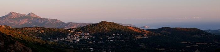
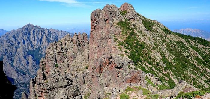
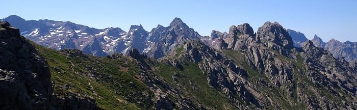
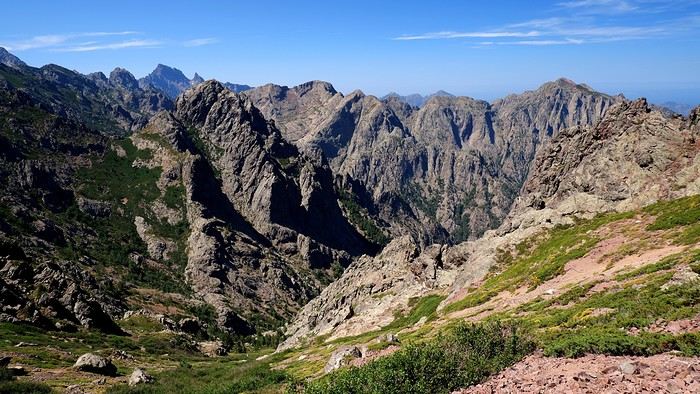
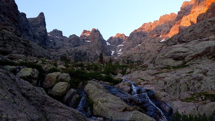
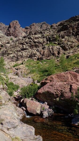
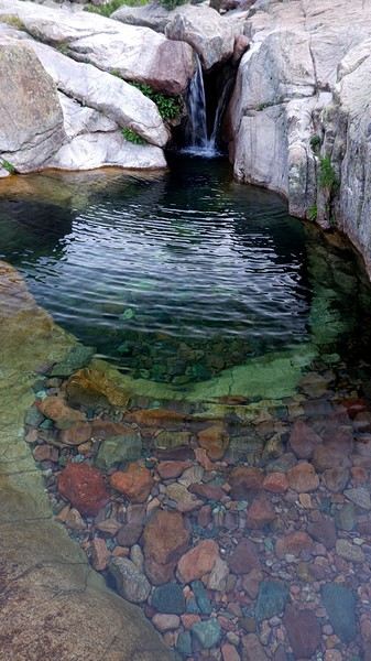
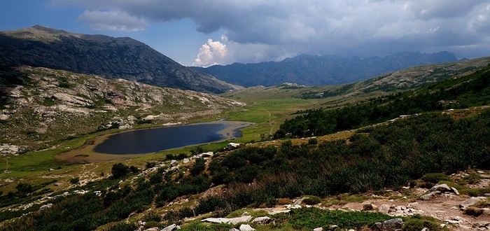
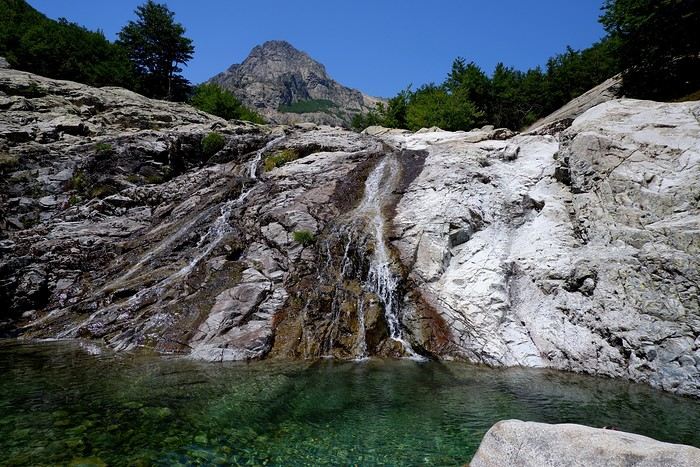
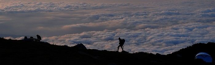
The northern stages (the toughest ones): lots of elevation gain, rocky landscapes, beautiful lakes, breathtaking viewpoints, and technical sections. Every minute counts—time feels thicker in the north! The southern stages: less rocky, lower altitude, more forested, but still with their own challenges.
A few photos to give you an idea:
Trek in Norway: Jotunheimen and Dovrefjell, you’ll adapt to the rain...
In the summer of 2026, we packed our backpacks again to wander around Jotunheimen National Park in Norway.
We’d never heard of this park just a few months earlier—we discovered it by following threads online.
It’s billed as the most mountainous park in the country, which really appealed to us after scrapping our original plan further north.
Unfortunately, it’s also the most crowded, which immediately made it less appealing! The presence of the highest peak in the Scandinavian Alps and the "famous" Bessengen ridge (famous because it’s apparently well-known across the country) probably has a lot to do with that.
Since we’d managed to avoid the crowds on the Kungsleden trails by camping away from the huts and timing our hike to miss the biggest groups of walkers, we figured we had the formula down and gave in to the call of the Norwegian mountains.
It’s the most mountainous park, sure, but also quite challenging in terms of progress, as we’d soon discover during the trek. And with uncooperative weather, we got the winning combo of a demanding hike. But I’m getting ahead of myself...
For the end of the trip, we planned a few days in Dovrefjell National Park—these two parks are easily connected by public transport—to see something different and, most importantly, to try and spot the musk oxen that live there.
My 04/08 - Arrival in Oslo Wed 05/08 - Bygdin – Torfinsbu Thu 06/08 - Torfinsbu - Gjendebu Fri 07/08 - Gjendebu - Fondsbu Sat 08/08 - Day hike to Slotafjellet Sun 09/08 - Day hike to Lake Kvitevatnet Mon 10/08 - Fondsbu - Gjendebu Tue 11/08 - Gjendebu - Before the Bessengen ridge Wed 12/08 - Bessengen ridge – Maurvangen campsite Thu 13/08 - Knutshoe ridge Fri 14/08 - Bus transfer to Spiterstulen hut via Lom Sat 15/08 - Day hike to Galdhøpiggen Sun 16/08 to Wed 19/08: Dovrefjell End of the trip and wrap-up
We’d never heard of this park just a few months earlier—we discovered it by following threads online.
It’s billed as the most mountainous park in the country, which really appealed to us after scrapping our original plan further north.
Unfortunately, it’s also the most crowded, which immediately made it less appealing! The presence of the highest peak in the Scandinavian Alps and the "famous" Bessengen ridge (famous because it’s apparently well-known across the country) probably has a lot to do with that.
Since we’d managed to avoid the crowds on the Kungsleden trails by camping away from the huts and timing our hike to miss the biggest groups of walkers, we figured we had the formula down and gave in to the call of the Norwegian mountains.
It’s the most mountainous park, sure, but also quite challenging in terms of progress, as we’d soon discover during the trek. And with uncooperative weather, we got the winning combo of a demanding hike. But I’m getting ahead of myself...
For the end of the trip, we planned a few days in Dovrefjell National Park—these two parks are easily connected by public transport—to see something different and, most importantly, to try and spot the musk oxen that live there.
My 04/08 - Arrival in Oslo Wed 05/08 - Bygdin – Torfinsbu Thu 06/08 - Torfinsbu - Gjendebu Fri 07/08 - Gjendebu - Fondsbu Sat 08/08 - Day hike to Slotafjellet Sun 09/08 - Day hike to Lake Kvitevatnet Mon 10/08 - Fondsbu - Gjendebu Tue 11/08 - Gjendebu - Before the Bessengen ridge Wed 12/08 - Bessengen ridge – Maurvangen campsite Thu 13/08 - Knutshoe ridge Fri 14/08 - Bus transfer to Spiterstulen hut via Lom Sat 15/08 - Day hike to Galdhøpiggen Sun 16/08 to Wed 19/08: Dovrefjell End of the trip and wrap-up
Getaway to Norway in 2027: What to do around the Lofoten Islands?
Hi there,
We’re three adults planning a trip to Norway in May 2027. What do you recommend for the Lofoten Islands? We’d prefer to group the places to visit (flights, rental car...??).
Thanks!
We’re three adults planning a trip to Norway in May 2027. What do you recommend for the Lofoten Islands? We’d prefer to group the places to visit (flights, rental car...??).
Thanks!
Our experience in the American West with a French-speaking guide
Hey everyone!
We just finished 9 days in the American West and wanted to share our experience because we had an amazing time.
I know some of you might ask, why use an agency? Honestly, we didn’t really feel like doing all the driving and planning, especially since we didn’t know the area at all. And since our English isn’t great, having French-speaking guides was a big comfort.
We found Emmanuelle and Isabelle, and wow, they were fantastic. It was just the two of us with them, so it was a truly VIP, ultra-personalized experience. They treated us like royalty from start to finish. These two live in Las Vegas and know the region like the back of their hand. They told us they’ve spent over 15 years exploring every corner of the American West, and it really shows. Their knowledge of geology, park history, and local anecdotes is just impressive. It’s nothing like someone reciting a memorized script. They answer all your questions and really adapt to what you want to see or do.
What we really loved: the vehicle was super comfortable, and the little details made a difference—like snacks and even a homemade cake! Though, to be fair, we devoured the cake right away, so that counts.
Since they know the sites inside out, they took us at the right times to avoid crowds. So we could enjoy peaceful picnics at Grand Canyon viewpoints without being packed in with 200 people. Plus, on top of the must-see spots, they showed us some hidden gems that were absolutely stunning—places we never would’ve found on our own. They’re true locals who know all the best tips.
The service was really personalized. They adapted to our pace and preferences, and we could stop whenever we wanted to take photos. It’s the luxury of being in a small private group—you’re not just a number on a big bus. In short, we really felt like we were traveling with friends rather than professional guides. Everything’s included in the price (hotel pickup, meals, park entries, etc.), so the value for money is fair.
We loved it so much that we’re already planning to come back next year to explore other areas with them. I think we’ve caught the American West bug—it’s all we can think about, and we can’t wait to return.
If you’re looking for a French-speaking tour with real personalized service and guides who know the region like no one else, we highly recommend them. We had unforgettable moments. They also design road trips for those who don’t want a guide. And they handled our hotel reservations in Las Vegas too. If you want genuine advice from friendly locals, we’re giving them a 200% recommendation!
We just finished 9 days in the American West and wanted to share our experience because we had an amazing time.
I know some of you might ask, why use an agency? Honestly, we didn’t really feel like doing all the driving and planning, especially since we didn’t know the area at all. And since our English isn’t great, having French-speaking guides was a big comfort.
We found Emmanuelle and Isabelle, and wow, they were fantastic. It was just the two of us with them, so it was a truly VIP, ultra-personalized experience. They treated us like royalty from start to finish. These two live in Las Vegas and know the region like the back of their hand. They told us they’ve spent over 15 years exploring every corner of the American West, and it really shows. Their knowledge of geology, park history, and local anecdotes is just impressive. It’s nothing like someone reciting a memorized script. They answer all your questions and really adapt to what you want to see or do.
What we really loved: the vehicle was super comfortable, and the little details made a difference—like snacks and even a homemade cake! Though, to be fair, we devoured the cake right away, so that counts.
Since they know the sites inside out, they took us at the right times to avoid crowds. So we could enjoy peaceful picnics at Grand Canyon viewpoints without being packed in with 200 people. Plus, on top of the must-see spots, they showed us some hidden gems that were absolutely stunning—places we never would’ve found on our own. They’re true locals who know all the best tips.
The service was really personalized. They adapted to our pace and preferences, and we could stop whenever we wanted to take photos. It’s the luxury of being in a small private group—you’re not just a number on a big bus. In short, we really felt like we were traveling with friends rather than professional guides. Everything’s included in the price (hotel pickup, meals, park entries, etc.), so the value for money is fair.
We loved it so much that we’re already planning to come back next year to explore other areas with them. I think we’ve caught the American West bug—it’s all we can think about, and we can’t wait to return.
If you’re looking for a French-speaking tour with real personalized service and guides who know the region like no one else, we highly recommend them. We had unforgettable moments. They also design road trips for those who don’t want a guide. And they handled our hotel reservations in Las Vegas too. If you want genuine advice from friendly locals, we’re giving them a 200% recommendation!
Exploring Senja Island and the Lofoten Archipelago
Hi everyone,
We traveled to Norway in the summer of 2025, from July 17 to 29, to visit Senja Island and the Lofoten archipelago with a rental car. The common thread of these twelve days was clearly hiking, along with a few visits and experiences, and nights spent in a tent or in the car (which made it possible). We chose Narvik Airport for both arrival and departure for several complementary reasons: the desire to visit nearby Senja Island, slightly more affordable airfare, and finally, the rental price of the vehicle—especially the car model we were looking for. We only made one reservation, for the first campsite, as sleeping in a tent made things much easier. But we had the whole structure of the trip planned, a flexible outline that could adapt to the weather conditions we’d encounter. Senja Island isn’t part of the Lofoten archipelago, and during the early stages of planning this trip, we hadn’t planned to visit it. But its relative proximity to Narvik Airport and, above all, its unique geography definitely made us change our minds. We arrived in Evenes, where Narvik Airport is located, nearly 60 km from the city itself. Our first stop was 40 km further in Bjerkvik on the way to Senja, where there’s a Rema 1000 (a very common supermarket chain in Norway). We needed to buy some food and a gas cartridge for our stove. I’d emailed the store manager beforehand, who told me they didn’t sell them but that the two gas stations in the village were likely to have some in stock.
It was only at the Esso station that I found what I needed, but unfortunately, only one cartridge. Luckily, we quickly realized that most campsites (like in Iceland) have a shared kitchen with hotplates. That single small cartridge was just enough for the few nights we spent outside of campsites... We got our first taste of Norway’s characteristic landscapes:
When we arrived at the Senja campsite, it was already 9:30 PM. A sign announced it was full, but luckily, I’d booked it 10 days earlier. By 10:30 PM, as we settled in to eat, it was still broad daylight, and the thermometer read 25°C—despite being at a latitude of 69° North! We went to bed around midnight, exhausted but under the light of a sun that was still very much present. Thanks to Earth’s tilted axis. We’d anticipated this by buying opaque sleep masks because, yes, at this time of year, it’s daylight all the time.
Friday, July 18:
Today, we planned two hikes on the island and a few stops along the way. The map clearly shows that the deepest fjords are in the north and west. Due to time and accessibility, we focused on the northern part of the island. Our first stop was at the viewing platform in Bergbotn:

Then we headed toward Skaland, the starting point for our first hike. Along the way, we found plenty of reasons to stop—especially since, on this first day of travel, our thirst for Nordic landscapes was far from quenched.

The town of Skaland is very practical: free parking, picnic tables for after the hike, and a Joker convenience store right next door. Our goal was the summit of Husfjellet: 670 m of elevation gain, between 8 and 9 km in length, and an estimated 4 hours and 30 minutes.
This hike offers two major viewpoints. The first overlooks the Bergsoyan islands to the west:

At the summit, the view shifts to the Steinfjorden fjord:

You can even clearly see the "Devil’s Teeth," which we’d see from below later:

In total, the hike took us 4 hours and 30 minutes, including all the breaks. We treated ourselves to an ice cream in Skaland to recharge for the next hike. We hit the road again and stopped at Tungeneset to get a closer look at the Devil’s Teeth:

We continued to Fjordgard, the starting point for our second hike. Fjordgard isn’t very welcoming. There was a time when you could park right at the start of the hike up Mount Segla. Now, everything’s blocked off, and locals have even taken to blocking all possible parking spots nearby. You now have to park outside the town at a paid parking lot (90 NOK for 3 hours), adding an extra 2 km (round trip) of walking. Still, that was just a minor inconvenience because the hike that followed quickly made us forget all about it. The hike is fairly short (2 hours) but still has 520 m of elevation gain. This hike was a stark contrast to the first. This morning, we had sweeping views of the vast landscape. Here, Mount Segla, perched on the edge of the cliff, dominates the foreground:


For those prone to vertigo, it might be best to stay at the foot of the mountain, as the trail climbs right along the cliff edge. And from that point on, you quickly understand what verticality really means...

In total, we took 2 hours and 50 minutes, including breaks and the extra walk to the parking lot. The day was already well underway, and with 1,200 m of cumulative elevation gain, it was time to find a spot to eat and sleep. Since we hadn’t made any reservations, we’d planned to bivouac for the night. We weren’t too picky—just practical—so we decided to sleep in the car at the parking lot for tomorrow morning’s hike, just 5 km from Fjordgard.
We traveled to Norway in the summer of 2025, from July 17 to 29, to visit Senja Island and the Lofoten archipelago with a rental car. The common thread of these twelve days was clearly hiking, along with a few visits and experiences, and nights spent in a tent or in the car (which made it possible). We chose Narvik Airport for both arrival and departure for several complementary reasons: the desire to visit nearby Senja Island, slightly more affordable airfare, and finally, the rental price of the vehicle—especially the car model we were looking for. We only made one reservation, for the first campsite, as sleeping in a tent made things much easier. But we had the whole structure of the trip planned, a flexible outline that could adapt to the weather conditions we’d encounter. Senja Island isn’t part of the Lofoten archipelago, and during the early stages of planning this trip, we hadn’t planned to visit it. But its relative proximity to Narvik Airport and, above all, its unique geography definitely made us change our minds. We arrived in Evenes, where Narvik Airport is located, nearly 60 km from the city itself. Our first stop was 40 km further in Bjerkvik on the way to Senja, where there’s a Rema 1000 (a very common supermarket chain in Norway). We needed to buy some food and a gas cartridge for our stove. I’d emailed the store manager beforehand, who told me they didn’t sell them but that the two gas stations in the village were likely to have some in stock.
It was only at the Esso station that I found what I needed, but unfortunately, only one cartridge. Luckily, we quickly realized that most campsites (like in Iceland) have a shared kitchen with hotplates. That single small cartridge was just enough for the few nights we spent outside of campsites... We got our first taste of Norway’s characteristic landscapes:
When we arrived at the Senja campsite, it was already 9:30 PM. A sign announced it was full, but luckily, I’d booked it 10 days earlier. By 10:30 PM, as we settled in to eat, it was still broad daylight, and the thermometer read 25°C—despite being at a latitude of 69° North! We went to bed around midnight, exhausted but under the light of a sun that was still very much present. Thanks to Earth’s tilted axis. We’d anticipated this by buying opaque sleep masks because, yes, at this time of year, it’s daylight all the time.
Friday, July 18:
Today, we planned two hikes on the island and a few stops along the way. The map clearly shows that the deepest fjords are in the north and west. Due to time and accessibility, we focused on the northern part of the island. Our first stop was at the viewing platform in Bergbotn:
Then we headed toward Skaland, the starting point for our first hike. Along the way, we found plenty of reasons to stop—especially since, on this first day of travel, our thirst for Nordic landscapes was far from quenched.
The town of Skaland is very practical: free parking, picnic tables for after the hike, and a Joker convenience store right next door. Our goal was the summit of Husfjellet: 670 m of elevation gain, between 8 and 9 km in length, and an estimated 4 hours and 30 minutes.
This hike offers two major viewpoints. The first overlooks the Bergsoyan islands to the west:
At the summit, the view shifts to the Steinfjorden fjord:
You can even clearly see the "Devil’s Teeth," which we’d see from below later:
In total, the hike took us 4 hours and 30 minutes, including all the breaks. We treated ourselves to an ice cream in Skaland to recharge for the next hike. We hit the road again and stopped at Tungeneset to get a closer look at the Devil’s Teeth:
We continued to Fjordgard, the starting point for our second hike. Fjordgard isn’t very welcoming. There was a time when you could park right at the start of the hike up Mount Segla. Now, everything’s blocked off, and locals have even taken to blocking all possible parking spots nearby. You now have to park outside the town at a paid parking lot (90 NOK for 3 hours), adding an extra 2 km (round trip) of walking. Still, that was just a minor inconvenience because the hike that followed quickly made us forget all about it. The hike is fairly short (2 hours) but still has 520 m of elevation gain. This hike was a stark contrast to the first. This morning, we had sweeping views of the vast landscape. Here, Mount Segla, perched on the edge of the cliff, dominates the foreground:
For those prone to vertigo, it might be best to stay at the foot of the mountain, as the trail climbs right along the cliff edge. And from that point on, you quickly understand what verticality really means...
In total, we took 2 hours and 50 minutes, including breaks and the extra walk to the parking lot. The day was already well underway, and with 1,200 m of cumulative elevation gain, it was time to find a spot to eat and sleep. Since we hadn’t made any reservations, we’d planned to bivouac for the night. We weren’t too picky—just practical—so we decided to sleep in the car at the parking lot for tomorrow morning’s hike, just 5 km from Fjordgard.
What about crossing the Lofoten Islands on foot?
While planning a trip to the LOFOTEN for summer 2023 using the excellent guide *Hiking in the Lofoten*, we discovered this trek.
Sure, it’s rated as difficult, but it lets you cross the LOFOTEN on foot from north to south in 11 stages, covering 160 km and 9,193 m of elevation gain (or the reverse, of course).
So, it’s a multi-day hike, with wild camping, and no need to rent a car. Perfect...
What’s making us hesitate a bit are the island transfers (okay, I’ll admit, the difficulty is also a factor for me). These transfers require taking public transport and/or hitchhiking. But the stages are designed with this in mind, and the transfers are well explained. Plus, water isn’t an issue, and you can resupply several times, which helps keep the pack weight down.
For Jean Marie, my partner, this will be his first multi-day trek, but he’s an experienced and hardy hiker. As for me, even though I’m not as tough, I’ve already done some multi-day hikes. So, we should complement each other well.
So, are we going for it? Sold!!
Here’s the trek map: HERE
03/08 – Day 1 - Delp – Sandsletta 04/08 - Day 2 – Sandsletta – Svolvaer 05/08 - Day 3 – Svolvaer – Kleppstad + transfer to the start of Day 4 06/08 – Day 4 – Vikjorda hamlet – Store Lake 07/08 – Day 5 – Store Lake – Leknes - Transfer to Napp on Flakstadøya Island 08/08 – Day 6 – Napp – Nusfjord 09/08 – Day 7 – Nusfjord – Ramberg 10/08 – Day 8 – Ramberg – Selfjord Bay (Moskenesøya Island) 11/08 – Day 9 - Selfjord – Bunes Beach 12/08 – Day 10 - Bunes Beach - Krokvatnet Lake 13/08 – Day 11 - Krokvatnet Lake – Moskenes (campsite) and round trip to Å by bus 14/08 – Day 12 – Hike up Reinebringen – Reine – Tour of Agvatnet Lake 15/08 – Return to Bodø - flight back to France on 16/08 And here’s the inevitable recap
Sure, it’s rated as difficult, but it lets you cross the LOFOTEN on foot from north to south in 11 stages, covering 160 km and 9,193 m of elevation gain (or the reverse, of course).
So, it’s a multi-day hike, with wild camping, and no need to rent a car. Perfect...
What’s making us hesitate a bit are the island transfers (okay, I’ll admit, the difficulty is also a factor for me). These transfers require taking public transport and/or hitchhiking. But the stages are designed with this in mind, and the transfers are well explained. Plus, water isn’t an issue, and you can resupply several times, which helps keep the pack weight down.
For Jean Marie, my partner, this will be his first multi-day trek, but he’s an experienced and hardy hiker. As for me, even though I’m not as tough, I’ve already done some multi-day hikes. So, we should complement each other well.
So, are we going for it? Sold!!
Here’s the trek map: HERE
03/08 – Day 1 - Delp – Sandsletta 04/08 - Day 2 – Sandsletta – Svolvaer 05/08 - Day 3 – Svolvaer – Kleppstad + transfer to the start of Day 4 06/08 – Day 4 – Vikjorda hamlet – Store Lake 07/08 – Day 5 – Store Lake – Leknes - Transfer to Napp on Flakstadøya Island 08/08 – Day 6 – Napp – Nusfjord 09/08 – Day 7 – Nusfjord – Ramberg 10/08 – Day 8 – Ramberg – Selfjord Bay (Moskenesøya Island) 11/08 – Day 9 - Selfjord – Bunes Beach 12/08 – Day 10 - Bunes Beach - Krokvatnet Lake 13/08 – Day 11 - Krokvatnet Lake – Moskenes (campsite) and round trip to Å by bus 14/08 – Day 12 – Hike up Reinebringen – Reine – Tour of Agvatnet Lake 15/08 – Return to Bodø - flight back to France on 16/08 And here’s the inevitable recap
Finding camping gear near Denver or Yellowstone
Hi,
I’m heading out soon to visit Grand Teton, Yellowstone, and Olympic NP, which means I’ll be camping—a topic I’m totally new to.
For me, just the camping part feels like a big adventure, even a challenge.
I was wondering if it’s easy to find camping gear in Denver or along the way to Grand Teton, especially at Walmart, or if it’d be smarter to buy everything in France? Are there other stores where I can pick up the essentials if Walmart isn’t an option?
I was wondering if it’s easy to find camping gear in Denver or along the way to Grand Teton, especially at Walmart, or if it’d be smarter to buy everything in France? Are there other stores where I can pick up the essentials if Walmart isn’t an option?
Feedback on 3-week itinerary: Atlantic Coast - Spanish Basque Country - Northern Spain
Hello everyone,
So, summer 2025 is when I turn 40, and to mark the occasion, I had the idea of doing a road trip through Northern Spain. Since I’ll be traveling with my two kids (9 and 6½ years old), I’m tied to school holidays, but I’m hoping the northern regions of Spain are a little less crowded than the Costa Brava.
We’d leave from Lyon to reach the Atlantic coast, head down to the Basque Country, cross the Spanish border, and then visit: Cantabria - Asturias - Galicia. It’s not exactly around the corner—I’ve seen that it’s about 1,500 km (one way) from Lyon to Galicia. But for this adventure, I’ve got 3 to 3½ weeks. The twist would be doing it in an electric car, stopping for 2-3 days here and there before moving on (alternating between wild camping and hotels). Why electric? Because it’s my company car, and my employer covers the charging and toll costs. Over 3 weeks of vacation, that adds up to big savings.
Question: Do you think this plan is doable? Aside from the charging stops, does the route seem too ambitious for 3 weeks with two kids? And in July/August, are these regions not too packed?
Thanks for your feedback and experiences!
So, summer 2025 is when I turn 40, and to mark the occasion, I had the idea of doing a road trip through Northern Spain. Since I’ll be traveling with my two kids (9 and 6½ years old), I’m tied to school holidays, but I’m hoping the northern regions of Spain are a little less crowded than the Costa Brava.
We’d leave from Lyon to reach the Atlantic coast, head down to the Basque Country, cross the Spanish border, and then visit: Cantabria - Asturias - Galicia. It’s not exactly around the corner—I’ve seen that it’s about 1,500 km (one way) from Lyon to Galicia. But for this adventure, I’ve got 3 to 3½ weeks. The twist would be doing it in an electric car, stopping for 2-3 days here and there before moving on (alternating between wild camping and hotels). Why electric? Because it’s my company car, and my employer covers the charging and toll costs. Over 3 weeks of vacation, that adds up to big savings.
Question: Do you think this plan is doable? Aside from the charging stops, does the route seem too ambitious for 3 weeks with two kids? And in July/August, are these regions not too packed?
Thanks for your feedback and experiences!
The "Must-Sees" of the American West
This adventure began during Covid... Yep, Covid turned a lot of things upside down, but most of all, it kept us cooped up for a few months and stopped us from traveling for a while—even longer for a die-hard fan of the American West like me.
While borders were closed, I started imagining what an ideal itinerary might look like—one that would string together all the Southwest must-sees in just two weeks, during the best time of year: September and October. When the U.S. announced in September 2021 that borders would reopen in the coming weeks, I regained hope and began scouting flight tickets for a departure in September 2022.
But here’s the thing: tackling solo hikes, each one tougher than the last, right in the heart of the Wilderness, could be a risky—even reckless—endeavor for a father of three. After a quick chat with some virtual friends who are just as passionate about the Southwest as I am, with good physical condition and nearly the same list of must-visit spots, Franck and his brother Sullivan were in! 🙂
In November, we snagged flight tickets from Nice to San Francisco for the modest sum of 400 €, and a few days later, I booked a Toyota Tacoma pickup for 840 € !
It’s not cheap for just 15 days, and a pickup isn’t exactly ideal for luggage, but the prices for full-size 4x4s have become totally outrageous! Due to border closures, rental companies had to offload a lot of these big 4x4s, which tourists love. Then, supply and demand did the rest !
Franck and I spent the winter and spring trying to cram the equivalent of three weeks of hikes into two. But even with physical limits, we had to stay reasonable! Three to four months before departure, we entered the lotteries for different must-see spots: The Subway, Coyote Buttes North (home to the famous Wave), and Coyote Buttes South (CBS).
The Wave is the holy grail for any Southwest enthusiast. Since 2015, we’ve tried our luck with the online and on-site lotteries about ten times, but the spots are unfortunately limited: just 20 per day. A glimmer of hope, though—since early 2022, that number has increased to 64 people allowed per day, with 48 spots awarded via the online lottery.
After all three of us tried our luck for The Wave, on June 1st at exactly 5 PM, I got an email that started with, "Congratulations! You were successful in the Coyote Buttes North (The Wave) September 2022 Permit Lottery at Coyote Buttes North (The Wave)...". At 5:01 PM, I called Franck, whose dream it’s been for over 20 years—ever since the first photos were published in a travel magazine! He didn’t believe me when I told him, and I had to forward the email for him to finally accept the unbelievable: we were going to The Wave and all the incredible spots scattered across the protected area of Coyote Buttes North.
I’ve already been to Coyote Buttes South twice, but there are areas I couldn’t explore in the middle of summer because they were too remote. So, I had no trouble letting my buddies convince me to go back for a third time. Plus, given how hard it is to access, we had no trouble securing a permit online as long as we logged in at exactly 8 PM on the dot!
For The Subway, all three of us struck out. No big deal—we won at CBN and CBS!
Among the sites to visit, there are two that I’m particularly attached to because I know my chances of wanting to see them again are slim. The first is Angel Arch, one of the most legendary arches in the Southwest, due to its remoteness from any trace of civilization. To get there, the recommended hike is Upper Salt Creek, and you’re looking at a 50 km round-trip in an area with no water (in September) and populated by bears.
The second site is the Hopi Salt Trail, in Navajo land, which, after a very tough hike, lets you marvel at the turquoise-blue waters of the Little Colorado before it meets the Colorado River. The Hopi Salt Trail is, like The Wave, the holy grail for any Southwest enthusiast, and the windows of opportunity to see the water in that magical color are very short each year. For this, you have to monitor the Little Colorado’s gauges downstream from Cameron: if the level stays at its lowest for 10 consecutive days—meaning no rain—you can hope for turquoise water. The ideal period rarely exceeds 30 days a year, and it’s usually in June that all the stars align.
But unfortunately, one month before departure, while the flow rate at Cameron looked promising, several storms in September dashed our hopes of doing the Hopi Salt Trail, even at the end of the road trip.
We still had two consolation prizes, though:
After a last-minute cancellation, while keeping an eye out for available spots for The Subway, it turned out that three spots opened up exactly on the day we’d planned to go—so we rushed to grab them!! Regarding the 4x4 rental, the prices for full-size models dropped by several hundred dollars, and we ended up finding a Chevrolet Tahoe for less than $1000. A steal and a serious boost in comfort, so we could store all our gear and food without worry!
Here’s the initial plan in a perfect world: D1 The White Domes - Camping D2 Sunrise at The White Domes - The Subway D3 Coyote Buttes North D4 Coyote Buttes South - White Pocket D5 Wahweap Hoodoos - Sidestep Canyon - Colourful Canyon - White Rocks - Sunset at Yellow Rock D6 Broken Bow Arch - Reflection Canyon D7 Coyote Gulch D8 The Volcano (or The Oasis - Zebra Slot Canyon if the weather’s good) - North Caineville Mesa D9 The Needles: Squaw Canyon - Lost Canyon combo - Druid Arch - Chesler Park D10 Upper Salt Creek Day 1 - Camping D11 Upper Salt Creek Day 2 D12 Hopi-Navajo Territory: Ha Ho No Geh Canyon, Coal Mine Canyon, Bends of the Little Colorado D13 Grand Canyon: South Kaibab Trail and Bright Angel Trail D14 Upper East Zion: East Temple Loop, Jughandle Arch, Center of the Universe, and Checkerboard Mesa Summit And several backup options in case of bad weather, including Spencer Trail, West Cove, and Buffington Pockets.
Enough talking—time for action!
While borders were closed, I started imagining what an ideal itinerary might look like—one that would string together all the Southwest must-sees in just two weeks, during the best time of year: September and October. When the U.S. announced in September 2021 that borders would reopen in the coming weeks, I regained hope and began scouting flight tickets for a departure in September 2022.
But here’s the thing: tackling solo hikes, each one tougher than the last, right in the heart of the Wilderness, could be a risky—even reckless—endeavor for a father of three. After a quick chat with some virtual friends who are just as passionate about the Southwest as I am, with good physical condition and nearly the same list of must-visit spots, Franck and his brother Sullivan were in! 🙂
In November, we snagged flight tickets from Nice to San Francisco for the modest sum of 400 €, and a few days later, I booked a Toyota Tacoma pickup for 840 € !
It’s not cheap for just 15 days, and a pickup isn’t exactly ideal for luggage, but the prices for full-size 4x4s have become totally outrageous! Due to border closures, rental companies had to offload a lot of these big 4x4s, which tourists love. Then, supply and demand did the rest !
Franck and I spent the winter and spring trying to cram the equivalent of three weeks of hikes into two. But even with physical limits, we had to stay reasonable! Three to four months before departure, we entered the lotteries for different must-see spots: The Subway, Coyote Buttes North (home to the famous Wave), and Coyote Buttes South (CBS).
The Wave is the holy grail for any Southwest enthusiast. Since 2015, we’ve tried our luck with the online and on-site lotteries about ten times, but the spots are unfortunately limited: just 20 per day. A glimmer of hope, though—since early 2022, that number has increased to 64 people allowed per day, with 48 spots awarded via the online lottery.
After all three of us tried our luck for The Wave, on June 1st at exactly 5 PM, I got an email that started with, "Congratulations! You were successful in the Coyote Buttes North (The Wave) September 2022 Permit Lottery at Coyote Buttes North (The Wave)...". At 5:01 PM, I called Franck, whose dream it’s been for over 20 years—ever since the first photos were published in a travel magazine! He didn’t believe me when I told him, and I had to forward the email for him to finally accept the unbelievable: we were going to The Wave and all the incredible spots scattered across the protected area of Coyote Buttes North.
I’ve already been to Coyote Buttes South twice, but there are areas I couldn’t explore in the middle of summer because they were too remote. So, I had no trouble letting my buddies convince me to go back for a third time. Plus, given how hard it is to access, we had no trouble securing a permit online as long as we logged in at exactly 8 PM on the dot!
For The Subway, all three of us struck out. No big deal—we won at CBN and CBS!
Among the sites to visit, there are two that I’m particularly attached to because I know my chances of wanting to see them again are slim. The first is Angel Arch, one of the most legendary arches in the Southwest, due to its remoteness from any trace of civilization. To get there, the recommended hike is Upper Salt Creek, and you’re looking at a 50 km round-trip in an area with no water (in September) and populated by bears.
The second site is the Hopi Salt Trail, in Navajo land, which, after a very tough hike, lets you marvel at the turquoise-blue waters of the Little Colorado before it meets the Colorado River. The Hopi Salt Trail is, like The Wave, the holy grail for any Southwest enthusiast, and the windows of opportunity to see the water in that magical color are very short each year. For this, you have to monitor the Little Colorado’s gauges downstream from Cameron: if the level stays at its lowest for 10 consecutive days—meaning no rain—you can hope for turquoise water. The ideal period rarely exceeds 30 days a year, and it’s usually in June that all the stars align.
But unfortunately, one month before departure, while the flow rate at Cameron looked promising, several storms in September dashed our hopes of doing the Hopi Salt Trail, even at the end of the road trip.
We still had two consolation prizes, though:
After a last-minute cancellation, while keeping an eye out for available spots for The Subway, it turned out that three spots opened up exactly on the day we’d planned to go—so we rushed to grab them!! Regarding the 4x4 rental, the prices for full-size models dropped by several hundred dollars, and we ended up finding a Chevrolet Tahoe for less than $1000. A steal and a serious boost in comfort, so we could store all our gear and food without worry!
Here’s the initial plan in a perfect world: D1 The White Domes - Camping D2 Sunrise at The White Domes - The Subway D3 Coyote Buttes North D4 Coyote Buttes South - White Pocket D5 Wahweap Hoodoos - Sidestep Canyon - Colourful Canyon - White Rocks - Sunset at Yellow Rock D6 Broken Bow Arch - Reflection Canyon D7 Coyote Gulch D8 The Volcano (or The Oasis - Zebra Slot Canyon if the weather’s good) - North Caineville Mesa D9 The Needles: Squaw Canyon - Lost Canyon combo - Druid Arch - Chesler Park D10 Upper Salt Creek Day 1 - Camping D11 Upper Salt Creek Day 2 D12 Hopi-Navajo Territory: Ha Ho No Geh Canyon, Coal Mine Canyon, Bends of the Little Colorado D13 Grand Canyon: South Kaibab Trail and Bright Angel Trail D14 Upper East Zion: East Temple Loop, Jughandle Arch, Center of the Universe, and Checkerboard Mesa Summit And several backup options in case of bad weather, including Spencer Trail, West Cove, and Buffington Pockets.
Enough talking—time for action!
Tour de l'Islande en 15 jours avec un petit van
Bonjour ,
Nous avons loué un petit van à 2 et nous projetons de faire le tour de l’Islande en 15 jours en partant de Reyjkavik.
En terme de matériel nous avons pensé aux vêtements de pluie , duvet 5 degrés (en espérant que ce soit suffisant dans le van..) pour le moment.
Je voudrais prendre appui sur ceux qui ont déjà voyagé là bas l’été pour connaître les indispensables à prendre avec nous (accessoires..) et les bons plans et conseils spécifiques qu’on ne trouverait pas en farfouillant sur le Lonely (endroits , expériences à faire , bons plans etc..)
Mes questions sont assez générales , je vous remercie pour vos conseils / anecdotes / astuces 😉
Nous avons loué un petit van à 2 et nous projetons de faire le tour de l’Islande en 15 jours en partant de Reyjkavik.
En terme de matériel nous avons pensé aux vêtements de pluie , duvet 5 degrés (en espérant que ce soit suffisant dans le van..) pour le moment.
Je voudrais prendre appui sur ceux qui ont déjà voyagé là bas l’été pour connaître les indispensables à prendre avec nous (accessoires..) et les bons plans et conseils spécifiques qu’on ne trouverait pas en farfouillant sur le Lonely (endroits , expériences à faire , bons plans etc..)
Mes questions sont assez générales , je vous remercie pour vos conseils / anecdotes / astuces 😉
Séjour de 5 mois aux îles Canaries
Bonjour
Il y a 2 ans, nous avons séjourné 6 semaines à Ténérife et nous avons adoré.
Si Covid19 le permet, nous projetons retourner aux Canaries pour y séjourner 5 mois ( de novembre à avril ), et nous voulons diviser notre séjour sur 3 îles: Lanzarote, Fuerteventura et Gran Canaria.
Selon votre expérience, en termes de mois, comment devrions-nous diviser notre séjour par île?
Merci pour vos commentaires et suggestions
Lucie
Bromont, Québec
Il y a 2 ans, nous avons séjourné 6 semaines à Ténérife et nous avons adoré.
Si Covid19 le permet, nous projetons retourner aux Canaries pour y séjourner 5 mois ( de novembre à avril ), et nous voulons diviser notre séjour sur 3 îles: Lanzarote, Fuerteventura et Gran Canaria.
Selon votre expérience, en termes de mois, comment devrions-nous diviser notre séjour par île?
Merci pour vos commentaires et suggestions
Lucie
Bromont, Québec
Que visiter en 10 jours en Islande
Bonjour
Je pars en Islande 10 jours, fin juillet/début août.
Que visiter car il y a beaucoup de choses merveilleuses à voir. Que prioriser.
J'aimerais bien 3/4 jours du côté des fjors du Nord Ouest, que je pourrais inclure dans mon itinéraire.
Bref qu'en pensez vous ?
Bien cordialement
Myriam
Deux semaines à Gran Canaria
Bonjour,
Nous partons à Gran Canaria du 2 au 16 juillet. Nous avons des jumeaux de 8 ans et nous aimons les randonnées (plutôt faciles et pas trop longues avec les enfants) mais aussi la découverte des villages et sites intéressants. Nous n’aimons pas trop la plage mais sommes prêts à y passer 3-4 jours pour faire plaisir aux enfants. Nous hésitons entre deux possibilités : passer une semaine à Gran Canaria (plutôt le nord et le centre) puis prendre le ferry pour Fuerteventura ou rester 2 semaines à Gran Canaria. L’idée serait alors de rester 5-6 nuits près de Guia, 3-4 nuits près de Tejeda et 3-4 à Maspalomas pour les enfants. La deuxième option est plus raisonnable au niveau du coût (le trajet en ferry est relativement cher) et on n’a pas forcément de courir d’un endroit à l’autre mais on a un peu peur que deux semaines sur une ile soit un peu trop long. Qu’en pensez-vous ? Merci déjà de vos réponses
Nous partons à Gran Canaria du 2 au 16 juillet. Nous avons des jumeaux de 8 ans et nous aimons les randonnées (plutôt faciles et pas trop longues avec les enfants) mais aussi la découverte des villages et sites intéressants. Nous n’aimons pas trop la plage mais sommes prêts à y passer 3-4 jours pour faire plaisir aux enfants. Nous hésitons entre deux possibilités : passer une semaine à Gran Canaria (plutôt le nord et le centre) puis prendre le ferry pour Fuerteventura ou rester 2 semaines à Gran Canaria. L’idée serait alors de rester 5-6 nuits près de Guia, 3-4 nuits près de Tejeda et 3-4 à Maspalomas pour les enfants. La deuxième option est plus raisonnable au niveau du coût (le trajet en ferry est relativement cher) et on n’a pas forcément de courir d’un endroit à l’autre mais on a un peu peur que deux semaines sur une ile soit un peu trop long. Qu’en pensez-vous ? Merci déjà de vos réponses
Itinéraire un mois sur la côte ouest de l'Australie (de Darwin à Perth)
Bonjour,
En pleine préparation de notre 3eme visite de l'Australie: ce sera cette fois-ci de Darwin à Perth. Au vue des prix des 4x4, hélas cela se fera en van aménagé, à moins que vous n ayez un bon plan!
Nous arrivons à Darwin le 18 septembre et repartirons de Perth le 14 avril ce qui nous laisse 26/27 jours sur place.
Alors, sans pouvoir faire les kimberleys (hélas!!!) - je lis que certaines choses sont tout de meme accessibles en van (comme Emma Gorge, Argyle, Bungle Bungle, Derby) les connaisseurs qu en pensez vous? -, il nous faudra aussi faire l'impasse sur le Francois Perron NP. Les autres sites sont tous accessibles ou presque ensuite par des routes +/- goudronnées, vrai?
Le circuit habituel Litchfeld, Kakadu, Broome, Karijini, Cape Range, Exmouth, Kalbari, Pinnacles, Pemberton... en 26 jours ca nous laisse le temps de profiter et d'en faire plus mais quoi? Voir pour passer par Uluru???!! (ou favoriser l'avion), pousser vers Kalgoorlie en y faisant une boucle pour profiter du début de l Outback et des champs en fleurs à cette époque la?...
quant au "camping", sur la cote Est, difficile de dormir gratuitement malgré le wikicamp. Savez vous si l application est fiable? Ici dans l'ouest, Est-il facile de dormir dans le van aménagé ou mieux vaut il se tourner vers des campings payants?
Vols et van réserves ... j'adore tellement ce pays que j ai envie de tout y voir!!! lol
Merci :-)
En pleine préparation de notre 3eme visite de l'Australie: ce sera cette fois-ci de Darwin à Perth. Au vue des prix des 4x4, hélas cela se fera en van aménagé, à moins que vous n ayez un bon plan!
Nous arrivons à Darwin le 18 septembre et repartirons de Perth le 14 avril ce qui nous laisse 26/27 jours sur place.
Alors, sans pouvoir faire les kimberleys (hélas!!!) - je lis que certaines choses sont tout de meme accessibles en van (comme Emma Gorge, Argyle, Bungle Bungle, Derby) les connaisseurs qu en pensez vous? -, il nous faudra aussi faire l'impasse sur le Francois Perron NP. Les autres sites sont tous accessibles ou presque ensuite par des routes +/- goudronnées, vrai?
Le circuit habituel Litchfeld, Kakadu, Broome, Karijini, Cape Range, Exmouth, Kalbari, Pinnacles, Pemberton... en 26 jours ca nous laisse le temps de profiter et d'en faire plus mais quoi? Voir pour passer par Uluru???!! (ou favoriser l'avion), pousser vers Kalgoorlie en y faisant une boucle pour profiter du début de l Outback et des champs en fleurs à cette époque la?...
quant au "camping", sur la cote Est, difficile de dormir gratuitement malgré le wikicamp. Savez vous si l application est fiable? Ici dans l'ouest, Est-il facile de dormir dans le van aménagé ou mieux vaut il se tourner vers des campings payants?
Vols et van réserves ... j'adore tellement ce pays que j ai envie de tout y voir!!! lol
Merci :-)
Périple de Perth à Darwin en août et location de van ou camping-car
Bonjour les voyageurs,
Nous sommes une famille de 4 personnes et avons l'intention de nous de Perth à Darwin en août 2020.
Nous sommes preneurs de tout récits, infos, lieux magiques, location van ou camping car pour notre périple.
Merci pour votre retour
Climat et activités pour un voyage à Fuerteventura en février
Bonjour à tous !
Je voudrais réserver un séjour d’une semaine à fuerteventura pour le mois de février ! Nous sommes un couple avec un enfant de 4 ans ...
Quel est le climat à cette période ? Peut on se baigner ? Quelles sont les activités sympa à faire en famille ?
Merci beaucoup pour vos retours
Je voudrais réserver un séjour d’une semaine à fuerteventura pour le mois de février ! Nous sommes un couple avec un enfant de 4 ans ...
Quel est le climat à cette période ? Peut on se baigner ? Quelles sont les activités sympa à faire en famille ?
Merci beaucoup pour vos retours
Voyage Fuerteventura - Lanzarote + une autre île aux Canaries fin février
Bonjour à toutes et tous
Voilà, je viens chercher des conseils afin de préparer mon voyage aux îles Canaries fin février je vais atterrir le 26 à Fuerteventura , j’ai réservé une nuit pas trop loin de l’aéroport et je dois maintenant faire le programme pour les deux semaines, c’est là que je vais avoir besoin de votre expérience.
Je pensais faire deux ou trois iles, Fuerteventura Lanzarote et éventuellement une troisième ile pensez-vous que visiter trois iles en deux semaines est faisable.
Concernant Fuerteventura, pensez vous que l’on puisse y passer une semaine, nous sommes plutôt attiré par les balades et découvertes que par la bronzette, baignade Est il bien de réserver une chambre 2/3 jours dans le sur de l’ile et 2/3 jours dans le.nord et de rayonner avec une voiture Lanzarotte mérite combien de jours sur place à votre avis, et où se baser pour avoir accès aux principaux points d’interêt de l’ile
Concernant une éventuelle 3 eme île , laquelle me recommanderiez vous? Avec bien sûr un accès pas trop compliqué depuis Fuerteventura
Voilà n’hesitez pas à commenter et même à me proposer quelque chose de différent
Merci d’avance
Voilà, je viens chercher des conseils afin de préparer mon voyage aux îles Canaries fin février je vais atterrir le 26 à Fuerteventura , j’ai réservé une nuit pas trop loin de l’aéroport et je dois maintenant faire le programme pour les deux semaines, c’est là que je vais avoir besoin de votre expérience.
Je pensais faire deux ou trois iles, Fuerteventura Lanzarote et éventuellement une troisième ile pensez-vous que visiter trois iles en deux semaines est faisable.
Concernant Fuerteventura, pensez vous que l’on puisse y passer une semaine, nous sommes plutôt attiré par les balades et découvertes que par la bronzette, baignade Est il bien de réserver une chambre 2/3 jours dans le sur de l’ile et 2/3 jours dans le.nord et de rayonner avec une voiture Lanzarotte mérite combien de jours sur place à votre avis, et où se baser pour avoir accès aux principaux points d’interêt de l’ile
Concernant une éventuelle 3 eme île , laquelle me recommanderiez vous? Avec bien sûr un accès pas trop compliqué depuis Fuerteventura
Voilà n’hesitez pas à commenter et même à me proposer quelque chose de différent
Merci d’avance
Conseils pour campings en Islande (en van)
Bonjour à tous,
Je prépare un séjour en Islande pour Avril/Mai 2020, pendant 15 jours avec un van.
Voici une carte prévisionnelle des spots que l'on aimerait voir.

Avez-vous des conseils de campings sympas à recommander, ou au contraire des campings que nous devrions mieux éviter ?
Merci beaucoup !
Je prépare un séjour en Islande pour Avril/Mai 2020, pendant 15 jours avec un van.
Voici une carte prévisionnelle des spots que l'on aimerait voir.
Avez-vous des conseils de campings sympas à recommander, ou au contraire des campings que nous devrions mieux éviter ?
Merci beaucoup !
Vent à Tenerife ou Grand Canarie fin janvier
bonjour,
nous avons en projet un voyage soit à Ténérife soit à grand Canaria fin janvier début février, quel est l'endroit ou il fera le plus chaud et surtout où il y aura le moins de vent?
les côtes au vent sont elles toujours à l'est (et sous le vent à l'ouest donc?) en hiver?
Accès routiers aux parcs nationaux en Australie
Bonjour à tous,
Nous sommes actuellement en Australie. Bous avons prévus de louer une voiture dans 2 semaines pour aller dans les parcs nationaux. On est tombé sur un type hyper hautain nous disant que les routes ne sont pas macadamisees, qu on va se tuer avec les animaux, ... et qu on aurait de toute façon jamais de voiture avec ce projet. On veut juste avoir accès aux parcs nationaux et ensuite randonner. Donc je ne vois pas le soucis.
Ma question est donc : est-ce que la plupart des parcs sont accessibles par des routes revêtues ?
Il me semble que oui mais je fais appel aux connaisseurs. Je ne prévois pas de faire du 4x4 dans le Bush, juste accéder aux parcs.
Merci de m enlever le doute que ce crétinisme m a mis en tete :)
Ma question est donc : est-ce que la plupart des parcs sont accessibles par des routes revêtues ?
Il me semble que oui mais je fais appel aux connaisseurs. Je ne prévois pas de faire du 4x4 dans le Bush, juste accéder aux parcs.
Merci de m enlever le doute que ce crétinisme m a mis en tete :)