Discussions Rechampir took part in
7 results on this page.
More options
Many results are in French, the community’s main language. English translations are added over time.
Search results
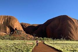
Mosquitoes and Spiders in the Red Centre
Hi,
I'm planning a trip to this region in November. My initial plan was Adelaide-Darwin by van, but I'm worried about those critters. I'm now considering staying in hotels instead, but for the Red Centre, camping is more practical... if we overlook those pests.
What do you think? Thanks.
Exploring Senja Island and the Lofoten Archipelago
Hi everyone,
We traveled to Norway in the summer of 2025, from July 17 to 29, to visit Senja Island and the Lofoten archipelago with a rental car. The common thread of these twelve days was clearly hiking, along with a few visits and experiences, and nights spent in a tent or in the car (which made it possible). We chose Narvik Airport for both arrival and departure for several complementary reasons: the desire to visit nearby Senja Island, slightly more affordable airfare, and finally, the rental price of the vehicle—especially the car model we were looking for. We only made one reservation, for the first campsite, as sleeping in a tent made things much easier. But we had the whole structure of the trip planned, a flexible outline that could adapt to the weather conditions we’d encounter. Senja Island isn’t part of the Lofoten archipelago, and during the early stages of planning this trip, we hadn’t planned to visit it. But its relative proximity to Narvik Airport and, above all, its unique geography definitely made us change our minds. We arrived in Evenes, where Narvik Airport is located, nearly 60 km from the city itself. Our first stop was 40 km further in Bjerkvik on the way to Senja, where there’s a Rema 1000 (a very common supermarket chain in Norway). We needed to buy some food and a gas cartridge for our stove. I’d emailed the store manager beforehand, who told me they didn’t sell them but that the two gas stations in the village were likely to have some in stock.
It was only at the Esso station that I found what I needed, but unfortunately, only one cartridge. Luckily, we quickly realized that most campsites (like in Iceland) have a shared kitchen with hotplates. That single small cartridge was just enough for the few nights we spent outside of campsites... We got our first taste of Norway’s characteristic landscapes:
When we arrived at the Senja campsite, it was already 9:30 PM. A sign announced it was full, but luckily, I’d booked it 10 days earlier. By 10:30 PM, as we settled in to eat, it was still broad daylight, and the thermometer read 25°C—despite being at a latitude of 69° North! We went to bed around midnight, exhausted but under the light of a sun that was still very much present. Thanks to Earth’s tilted axis. We’d anticipated this by buying opaque sleep masks because, yes, at this time of year, it’s daylight all the time.
Friday, July 18:
Today, we planned two hikes on the island and a few stops along the way. The map clearly shows that the deepest fjords are in the north and west. Due to time and accessibility, we focused on the northern part of the island. Our first stop was at the viewing platform in Bergbotn:

Then we headed toward Skaland, the starting point for our first hike. Along the way, we found plenty of reasons to stop—especially since, on this first day of travel, our thirst for Nordic landscapes was far from quenched.

The town of Skaland is very practical: free parking, picnic tables for after the hike, and a Joker convenience store right next door. Our goal was the summit of Husfjellet: 670 m of elevation gain, between 8 and 9 km in length, and an estimated 4 hours and 30 minutes.
This hike offers two major viewpoints. The first overlooks the Bergsoyan islands to the west:

At the summit, the view shifts to the Steinfjorden fjord:

You can even clearly see the "Devil’s Teeth," which we’d see from below later:

In total, the hike took us 4 hours and 30 minutes, including all the breaks. We treated ourselves to an ice cream in Skaland to recharge for the next hike. We hit the road again and stopped at Tungeneset to get a closer look at the Devil’s Teeth:

We continued to Fjordgard, the starting point for our second hike. Fjordgard isn’t very welcoming. There was a time when you could park right at the start of the hike up Mount Segla. Now, everything’s blocked off, and locals have even taken to blocking all possible parking spots nearby. You now have to park outside the town at a paid parking lot (90 NOK for 3 hours), adding an extra 2 km (round trip) of walking. Still, that was just a minor inconvenience because the hike that followed quickly made us forget all about it. The hike is fairly short (2 hours) but still has 520 m of elevation gain. This hike was a stark contrast to the first. This morning, we had sweeping views of the vast landscape. Here, Mount Segla, perched on the edge of the cliff, dominates the foreground:


For those prone to vertigo, it might be best to stay at the foot of the mountain, as the trail climbs right along the cliff edge. And from that point on, you quickly understand what verticality really means...

In total, we took 2 hours and 50 minutes, including breaks and the extra walk to the parking lot. The day was already well underway, and with 1,200 m of cumulative elevation gain, it was time to find a spot to eat and sleep. Since we hadn’t made any reservations, we’d planned to bivouac for the night. We weren’t too picky—just practical—so we decided to sleep in the car at the parking lot for tomorrow morning’s hike, just 5 km from Fjordgard.
We traveled to Norway in the summer of 2025, from July 17 to 29, to visit Senja Island and the Lofoten archipelago with a rental car. The common thread of these twelve days was clearly hiking, along with a few visits and experiences, and nights spent in a tent or in the car (which made it possible). We chose Narvik Airport for both arrival and departure for several complementary reasons: the desire to visit nearby Senja Island, slightly more affordable airfare, and finally, the rental price of the vehicle—especially the car model we were looking for. We only made one reservation, for the first campsite, as sleeping in a tent made things much easier. But we had the whole structure of the trip planned, a flexible outline that could adapt to the weather conditions we’d encounter. Senja Island isn’t part of the Lofoten archipelago, and during the early stages of planning this trip, we hadn’t planned to visit it. But its relative proximity to Narvik Airport and, above all, its unique geography definitely made us change our minds. We arrived in Evenes, where Narvik Airport is located, nearly 60 km from the city itself. Our first stop was 40 km further in Bjerkvik on the way to Senja, where there’s a Rema 1000 (a very common supermarket chain in Norway). We needed to buy some food and a gas cartridge for our stove. I’d emailed the store manager beforehand, who told me they didn’t sell them but that the two gas stations in the village were likely to have some in stock.
It was only at the Esso station that I found what I needed, but unfortunately, only one cartridge. Luckily, we quickly realized that most campsites (like in Iceland) have a shared kitchen with hotplates. That single small cartridge was just enough for the few nights we spent outside of campsites... We got our first taste of Norway’s characteristic landscapes:
When we arrived at the Senja campsite, it was already 9:30 PM. A sign announced it was full, but luckily, I’d booked it 10 days earlier. By 10:30 PM, as we settled in to eat, it was still broad daylight, and the thermometer read 25°C—despite being at a latitude of 69° North! We went to bed around midnight, exhausted but under the light of a sun that was still very much present. Thanks to Earth’s tilted axis. We’d anticipated this by buying opaque sleep masks because, yes, at this time of year, it’s daylight all the time.
Friday, July 18:
Today, we planned two hikes on the island and a few stops along the way. The map clearly shows that the deepest fjords are in the north and west. Due to time and accessibility, we focused on the northern part of the island. Our first stop was at the viewing platform in Bergbotn:
Then we headed toward Skaland, the starting point for our first hike. Along the way, we found plenty of reasons to stop—especially since, on this first day of travel, our thirst for Nordic landscapes was far from quenched.
The town of Skaland is very practical: free parking, picnic tables for after the hike, and a Joker convenience store right next door. Our goal was the summit of Husfjellet: 670 m of elevation gain, between 8 and 9 km in length, and an estimated 4 hours and 30 minutes.
This hike offers two major viewpoints. The first overlooks the Bergsoyan islands to the west:
At the summit, the view shifts to the Steinfjorden fjord:
You can even clearly see the "Devil’s Teeth," which we’d see from below later:
In total, the hike took us 4 hours and 30 minutes, including all the breaks. We treated ourselves to an ice cream in Skaland to recharge for the next hike. We hit the road again and stopped at Tungeneset to get a closer look at the Devil’s Teeth:
We continued to Fjordgard, the starting point for our second hike. Fjordgard isn’t very welcoming. There was a time when you could park right at the start of the hike up Mount Segla. Now, everything’s blocked off, and locals have even taken to blocking all possible parking spots nearby. You now have to park outside the town at a paid parking lot (90 NOK for 3 hours), adding an extra 2 km (round trip) of walking. Still, that was just a minor inconvenience because the hike that followed quickly made us forget all about it. The hike is fairly short (2 hours) but still has 520 m of elevation gain. This hike was a stark contrast to the first. This morning, we had sweeping views of the vast landscape. Here, Mount Segla, perched on the edge of the cliff, dominates the foreground:
For those prone to vertigo, it might be best to stay at the foot of the mountain, as the trail climbs right along the cliff edge. And from that point on, you quickly understand what verticality really means...
In total, we took 2 hours and 50 minutes, including breaks and the extra walk to the parking lot. The day was already well underway, and with 1,200 m of cumulative elevation gain, it was time to find a spot to eat and sleep. Since we hadn’t made any reservations, we’d planned to bivouac for the night. We weren’t too picky—just practical—so we decided to sleep in the car at the parking lot for tomorrow morning’s hike, just 5 km from Fjordgard.
Plutôt Rotorua ou Tongariro? (voyage en Nouvelle-Zélande)
Bonjour,
je commence mes recherches pour un voyage en NZ en novembre.
J'ai bien compris que la météo est très changeante donc je pensais plutôt passer plusieurs jours sur un même site pour avoir plus de chances de faire les sorties et randos, au cas où une journée ou 2 seraient moches... et ne pas perdre trop de temps en déplacements.
Quels seraient les points forts/inconvénients qui feraient que vous choisiriez quelques jours vers le Tongariro, ou au contraire vers Rotorua ?
Tout le monde parle de Tongariro Alpine Crossing et Northern Circuit, mais en regardant les cartes de plus près, on voit plein d'autres sentiers, les connaissez-vous ? Je veux dire que si je peux éviter de suivre le flot de touristes, ça ne me dérange pas... 😉 même si pour voir certains sites (lacs Émeraude par ex.) je ne pourrai pas y couper.
Ne serait-il pas possible de rayonner depuis une seule ville, en faisant des A/R (avec nuit au même endroit à chaque fois) plutôt qu'une boucle ou une rando avec navette obligatoire au bout ?
De même, n'étant pas équipée pour le camping, le Northern circuit bien qu'il ait l'air superbe ne me convient pas vu qu'il y a plusieurs nuits en refuge sommaire...
Voilà mes premiers éléments de réflexion. Dans l'attente de vous lire... un grand merci. Sophie
Quels seraient les points forts/inconvénients qui feraient que vous choisiriez quelques jours vers le Tongariro, ou au contraire vers Rotorua ?
Tout le monde parle de Tongariro Alpine Crossing et Northern Circuit, mais en regardant les cartes de plus près, on voit plein d'autres sentiers, les connaissez-vous ? Je veux dire que si je peux éviter de suivre le flot de touristes, ça ne me dérange pas... 😉 même si pour voir certains sites (lacs Émeraude par ex.) je ne pourrai pas y couper.
Ne serait-il pas possible de rayonner depuis une seule ville, en faisant des A/R (avec nuit au même endroit à chaque fois) plutôt qu'une boucle ou une rando avec navette obligatoire au bout ?
De même, n'étant pas équipée pour le camping, le Northern circuit bien qu'il ait l'air superbe ne me convient pas vu qu'il y a plusieurs nuits en refuge sommaire...
Voilà mes premiers éléments de réflexion. Dans l'attente de vous lire... un grand merci. Sophie
Itinéraire trois semaines en Nouvelle-Zélande en pleine saison avec un van
Bonjour,
Nous arriverons le 15 janvier pour 3 semaines en espérant une météo favorable, bien qu'on la sache capricieuse. Nous avons choisi de louer un van chez Spaceship afin de privilégier la facilité de conduite plutôt que le confort à l'étape. Notre itinéraire est ambitieux, nous verrons bien si nous le tenons. Nous avons privilégié les paysages plutôt que les villes, la faune ou les populations : il faut faire des choix. île du nord : Auckland-Russel-Cap Reinga-Coromandel-Rotorua-Oreiko-Pacific Coast Highway jusqu'à Wairoa-Taupo- île du sud : Malborough-Abel Tasman-Saint Arnaud (Nelson Lakes National Park)-Punakaiki-Wanaka (crochet par le sommet Arthur's pass si possible)-Te Anau (Milford et Doubtful Sounds)-Curio Bay-Dunedin-Mont Cook-Christchurch (si possible l'autre côté d'Arthur'spass).
ça fait beaucoup de route mais on a repéré les temps sur Mappy et Via Michelin. On verra bien, on a toute la souplesse nécessaire avec le van.
On peut donc échanger avec les futurs partants ou ceux qui sont rentrés. ça fait 2 mois que j'ai demandé mon permis international, il parait qu'il en faut 3... Je vais me pencher sur NZeta en espérant que l'appli est maintenant au point.
Nous arriverons le 15 janvier pour 3 semaines en espérant une météo favorable, bien qu'on la sache capricieuse. Nous avons choisi de louer un van chez Spaceship afin de privilégier la facilité de conduite plutôt que le confort à l'étape. Notre itinéraire est ambitieux, nous verrons bien si nous le tenons. Nous avons privilégié les paysages plutôt que les villes, la faune ou les populations : il faut faire des choix. île du nord : Auckland-Russel-Cap Reinga-Coromandel-Rotorua-Oreiko-Pacific Coast Highway jusqu'à Wairoa-Taupo- île du sud : Malborough-Abel Tasman-Saint Arnaud (Nelson Lakes National Park)-Punakaiki-Wanaka (crochet par le sommet Arthur's pass si possible)-Te Anau (Milford et Doubtful Sounds)-Curio Bay-Dunedin-Mont Cook-Christchurch (si possible l'autre côté d'Arthur'spass).
ça fait beaucoup de route mais on a repéré les temps sur Mappy et Via Michelin. On verra bien, on a toute la souplesse nécessaire avec le van.
On peut donc échanger avec les futurs partants ou ceux qui sont rentrés. ça fait 2 mois que j'ai demandé mon permis international, il parait qu'il en faut 3... Je vais me pencher sur NZeta en espérant que l'appli est maintenant au point.
Camping-car ou voiture et logement en Nouvelle-Zélande
J'ai besoin de vos conseils .... Départ dans 8 jours pour 5 à 6 semaines en Nouvelle Zélande et toujours pas décidé quel moyen de transport et logement choisir.
Pensez-vous qu'il est raisonnable d'attendre l'arrivée pour choisir, ou les prix seront encore plus élevés ?
Itinéraire de 3 semaines en Nouvelle-Zélande
Bonjour à tous,
Je viens ici chercher vos avis éclairés qui m’ont bien aidé pour d’autres voyages 😉
Je sais que le sujet a été traité de nombreuses fois sur d’autres itinéraires, mais j’ai du mal à me faire mon avis, après avoir fait des recherches sur le forum et différents sites, sur le mien. Nous souhaitons partir avec ma compagne pour notre voyage de noces en Nouvelle Zélande, début 2019, probablement février, pour 3 semaines (enfin nous aurons 22 jours, donc 18 sur place… arg ça commence déjà à baisser 😐) Après les premières recherches, nous pensons arriver à Auckland, et repartir de Christchurch, mais cela est bien entendu encore parfaitement modifiable. Nous avions pensé à louer un camper van avec sanitaire, mais j’ai l’impression qu’il y a pas mal de restrictions par rapport aux emplacements où dormir. Et est-ce bien adapté à notre itinéraire.
Rentrons dans le vif du sujet. L’idée générale était la suivante : arrivée à Auckland, passer un peu de temps là-bas visiter, et pour récupérer du trajet / décalage horaire. Départ ensuite pour Rotorura, visite du parc, de la ville / musée qui a l’air intéressant sur la culture Maori. Ensuite, trajet jusqu’au parc de Tongarino, et trek Alpine crossing. Puis trajet jusqu’à Wellington pour traverser vers l’île du sud, direction le parc national d’Abel Tasman. Visiblement sympa à faire en Kayak, mais combien de temps faut-il y consacrer. Suite du voyage, direction le Mont Cook. Alors j’ai lu plein de chose sur cette région, mais je n’arrive pas à savoir ce qu’il faut privilégier… Glacier Franz Joseph, glacier Fox, une rando ailleurs à la journée, un survol en hélicoptère (cher, mais peut être que ça vaut le coût)… ou autre ?
Enfin, avant de prendre la direction de ChristChurch, nous aurions voulu faire le Milford Track. Probablement parce que cette rando semble mythique. Mais vaut-elle vraiment d’y consacrer tout ce temps, étant donné la durée « courte » du voyage ? J’avoue que j’en ai toujours entendu que du bien, et que cela m’attire beaucoup, mais peut-être faisons nous fausse route. Puis retour à Christchurch, avec une étape à Twizel
Pour résumer, cela pourrait donner quelque chose comme ça : J1 : Auckland J2 : Auckand J3 : Auckland - Rotorura J4 : Rotorura - Tongarino J5 : Tongarino Alpine Crossing J6 : Tongarino - Welginton J7 : Welington - Tasman J8 : Abel Tasman J9 : Abel Tasman J10 : Tasman - Mont Cook J11 : Mont Cook J12 : Mont cook - Milford J13 : Milford Track J14 : Milford Track J15 : Milford Track J16 : Milford Track J17 : Milford - Twizel J18 : Twizel - Christchurch
J'ai peur de me planter complètement, par rapport aux temps de trajet d'un point à un autre...
Qu’en pensez vous, est-ce que ça ne fait pas trop courir, est ce que le campervan semble adapté ? avez-vous d’autres suggestions ?
Je suis tout ouï, j’attends vos avis d’experts 🙂 Merci d'avance
Matthias
Je viens ici chercher vos avis éclairés qui m’ont bien aidé pour d’autres voyages 😉
Je sais que le sujet a été traité de nombreuses fois sur d’autres itinéraires, mais j’ai du mal à me faire mon avis, après avoir fait des recherches sur le forum et différents sites, sur le mien. Nous souhaitons partir avec ma compagne pour notre voyage de noces en Nouvelle Zélande, début 2019, probablement février, pour 3 semaines (enfin nous aurons 22 jours, donc 18 sur place… arg ça commence déjà à baisser 😐) Après les premières recherches, nous pensons arriver à Auckland, et repartir de Christchurch, mais cela est bien entendu encore parfaitement modifiable. Nous avions pensé à louer un camper van avec sanitaire, mais j’ai l’impression qu’il y a pas mal de restrictions par rapport aux emplacements où dormir. Et est-ce bien adapté à notre itinéraire.
Rentrons dans le vif du sujet. L’idée générale était la suivante : arrivée à Auckland, passer un peu de temps là-bas visiter, et pour récupérer du trajet / décalage horaire. Départ ensuite pour Rotorura, visite du parc, de la ville / musée qui a l’air intéressant sur la culture Maori. Ensuite, trajet jusqu’au parc de Tongarino, et trek Alpine crossing. Puis trajet jusqu’à Wellington pour traverser vers l’île du sud, direction le parc national d’Abel Tasman. Visiblement sympa à faire en Kayak, mais combien de temps faut-il y consacrer. Suite du voyage, direction le Mont Cook. Alors j’ai lu plein de chose sur cette région, mais je n’arrive pas à savoir ce qu’il faut privilégier… Glacier Franz Joseph, glacier Fox, une rando ailleurs à la journée, un survol en hélicoptère (cher, mais peut être que ça vaut le coût)… ou autre ?
Enfin, avant de prendre la direction de ChristChurch, nous aurions voulu faire le Milford Track. Probablement parce que cette rando semble mythique. Mais vaut-elle vraiment d’y consacrer tout ce temps, étant donné la durée « courte » du voyage ? J’avoue que j’en ai toujours entendu que du bien, et que cela m’attire beaucoup, mais peut-être faisons nous fausse route. Puis retour à Christchurch, avec une étape à Twizel
Pour résumer, cela pourrait donner quelque chose comme ça : J1 : Auckland J2 : Auckand J3 : Auckland - Rotorura J4 : Rotorura - Tongarino J5 : Tongarino Alpine Crossing J6 : Tongarino - Welginton J7 : Welington - Tasman J8 : Abel Tasman J9 : Abel Tasman J10 : Tasman - Mont Cook J11 : Mont Cook J12 : Mont cook - Milford J13 : Milford Track J14 : Milford Track J15 : Milford Track J16 : Milford Track J17 : Milford - Twizel J18 : Twizel - Christchurch
J'ai peur de me planter complètement, par rapport aux temps de trajet d'un point à un autre...
Qu’en pensez vous, est-ce que ça ne fait pas trop courir, est ce que le campervan semble adapté ? avez-vous d’autres suggestions ?
Je suis tout ouï, j’attends vos avis d’experts 🙂 Merci d'avance
Matthias
Patagonie hors du commun?
Bonjour,
Je me demande si les paysages sont différents de ceux que je connais déjà : j'ai l'impression que la Patagonie, ce sont surtout des paysages de haute montagne comme on peut en voir dans les Alpes, ou bien qui font penser à la Laponie. L'Atacama par exemple, c'est vraiment particulier. Je me demande si le voyage en vaut le prix. J'ai peur d'être déçu come je l'ai été au Québec.
Je me demande si les paysages sont différents de ceux que je connais déjà : j'ai l'impression que la Patagonie, ce sont surtout des paysages de haute montagne comme on peut en voir dans les Alpes, ou bien qui font penser à la Laponie. L'Atacama par exemple, c'est vraiment particulier. Je me demande si le voyage en vaut le prix. J'ai peur d'être déçu come je l'ai été au Québec.