Posts by Marati
About 2,153 results.
More options
Search results
South Africa in safari mode: February/March 2026
Hi Pascale,
What a great discovery for me, iSimangaliso! I’d missed Michel’s various stories about it, and I’m about to catch up on that...
Like others, back in 2016, we had countless rhino sightings in Hluhluwe—over twenty, if I remember right. On the other hand, we were pretty unlucky in the iMfolozi area, which looked like it had been hit by a wildfire not long before.
Mpila Camp was a real highlight for us. It just goes to show how much wildlife encounters can shape your memories of the parks you visit!
What a great discovery for me, iSimangaliso! I’d missed Michel’s various stories about it, and I’m about to catch up on that...
Like others, back in 2016, we had countless rhino sightings in Hluhluwe—over twenty, if I remember right. On the other hand, we were pretty unlucky in the iMfolozi area, which looked like it had been hit by a wildfire not long before.
Mpila Camp was a real highlight for us. It just goes to show how much wildlife encounters can shape your memories of the parks you visit!
A Bold Combo: Southern Peru, Bolivia, and Northern Chile
Day 21: Tebenquiche Lagoon - Santiago
For our last morning in SPA, we head to the Tebenquiche Lagoon via an endless, smooth dirt road.
We arrive around 9 AM at the Tebenquiche Lagoon, where swimming is theoretically possible, but with water at 12°C in winter, takers will be few and far between!
Unfortunately, we have to wait nearly an hour since the site only opens at 10 AM!
When the site staff finally arrive, they explain that the previous day’s rain might have affected the lagoons’ purity. Since we didn’t anticipate this late opening, we have to cut our visit short.
Despite the rain the day before, the few lagoons have a stunning turquoise blue color in a "salt desert" atmosphere.


This is the lagoon where swimming is possible, but the cold makes it nearly impossible—unless you fancy catching a nasty cold...
 The salt concretions blend beautifully with the lagoons’ pure blue!

Then, we just have time for lunch at the restaurant, enjoying a final Amaretto Sour before catching a bus to Calama.
In Calama, I take the opportunity to buy a few high-quality shirts at great prices—back to Latin American rates, not the typical American prices you find in the SPA region...
At the end of the day, we take a domestic flight to Santiago. The next morning, another flight to Madrid before the 7th and final leg of the trip, heading to Marseille.
Wrap-Up
In the end, three countries crossed, three very different vibes, but we loved all three regions we visited. The route was designed for diversity and stunning landscapes, and we got exactly that—even if the cold was sometimes a bit harsh.
The number of sites visited makes it feel like a very active trip, but we didn’t really feel that way during our journey, probably because the itinerary perfectly matched how we love to travel—packing every day (or almost) with unforgettable sights.
Thanks again to Bibouns for daring to try this slightly crazy route one day to see the best of three countries in just three weeks... and for convincing me to attempt the same kind of bold program...
This trip ranks in the top 3 for each of us, though not necessarily in first place—our first month-long trip to South Africa had a very special flavor...
Thanks for bringing this travel journal to life, and see you soon for new adventures! Just 4 days left until Los Angeles for a truly active trip exploring the Grand Canyon and beyond in Utah and Arizona...
For our last morning in SPA, we head to the Tebenquiche Lagoon via an endless, smooth dirt road.
We arrive around 9 AM at the Tebenquiche Lagoon, where swimming is theoretically possible, but with water at 12°C in winter, takers will be few and far between!
Unfortunately, we have to wait nearly an hour since the site only opens at 10 AM!
When the site staff finally arrive, they explain that the previous day’s rain might have affected the lagoons’ purity. Since we didn’t anticipate this late opening, we have to cut our visit short.
Despite the rain the day before, the few lagoons have a stunning turquoise blue color in a "salt desert" atmosphere.
This is the lagoon where swimming is possible, but the cold makes it nearly impossible—unless you fancy catching a nasty cold...
The salt concretions blend beautifully with the lagoons’ pure blue!Then, we just have time for lunch at the restaurant, enjoying a final Amaretto Sour before catching a bus to Calama.
In Calama, I take the opportunity to buy a few high-quality shirts at great prices—back to Latin American rates, not the typical American prices you find in the SPA region...
At the end of the day, we take a domestic flight to Santiago. The next morning, another flight to Madrid before the 7th and final leg of the trip, heading to Marseille.
Wrap-Up
In the end, three countries crossed, three very different vibes, but we loved all three regions we visited. The route was designed for diversity and stunning landscapes, and we got exactly that—even if the cold was sometimes a bit harsh.
The number of sites visited makes it feel like a very active trip, but we didn’t really feel that way during our journey, probably because the itinerary perfectly matched how we love to travel—packing every day (or almost) with unforgettable sights.
Thanks again to Bibouns for daring to try this slightly crazy route one day to see the best of three countries in just three weeks... and for convincing me to attempt the same kind of bold program...
This trip ranks in the top 3 for each of us, though not necessarily in first place—our first month-long trip to South Africa had a very special flavor...
Thanks for bringing this travel journal to life, and see you soon for new adventures! Just 4 days left until Los Angeles for a truly active trip exploring the Grand Canyon and beyond in Utah and Arizona...
A bold combo: Southern Peru, Bolivia, and Northern Chile
Then we head north.
The sun comes back along the way. Good thing, because a swim is planned in the warm waters flowing in the river.
There’s an option to bathe in the thermal waters of Puritama, but at over $20 for entry, that’s pricey for a small heated pool.
So there’s a free alternative: park 4 km further down, then follow the Rio Puritama to different swimming spots.
That’s what we do!
The canyon setting is stunning. The whole trail is maintained to let people walk through the heart of the vegetation.
 What a contrast between the ochre colors of the canyon and these multiple green and yellow reeds, adapted to the river’s warm waters, growing abundantly at the bottom of the canyon.
 We eventually find a double waterfall that tempts us. The water might not be as hot as in the thermal baths, but it stays lukewarm, around 30°C.
An amazing moment in total tranquility!
 Everyone, or nearly, is in swimsuits and in the water!!
On the way back, we’ll only run into a couple swimming a bit further down.
We’re really sad because it’s our last night in our BnB before getting closer to Santiago, which marks the end of our journey...
There’s an option to bathe in the thermal waters of Puritama, but at over $20 for entry, that’s pricey for a small heated pool.
So there’s a free alternative: park 4 km further down, then follow the Rio Puritama to different swimming spots.
That’s what we do!
The canyon setting is stunning. The whole trail is maintained to let people walk through the heart of the vegetation.
What a contrast between the ochre colors of the canyon and these multiple green and yellow reeds, adapted to the river’s warm waters, growing abundantly at the bottom of the canyon.
We eventually find a double waterfall that tempts us. The water might not be as hot as in the thermal baths, but it stays lukewarm, around 30°C.An amazing moment in total tranquility!
Everyone, or nearly, is in swimsuits and in the water!!On the way back, we’ll only run into a couple swimming a bit further down.
We’re really sad because it’s our last night in our BnB before getting closer to Santiago, which marks the end of our journey...
A bold combo: Southern Peru, Bolivia, and Northern Chile
Day 20: Rainbow Valley and bathing in the Rio Puritama
Like 99% of people, I’d planned to visit the El Tatio geysers today. But after chatting with some French travelers in Bolivia, they told us they were really disappointed with El Tatio compared to Geysir in Iceland.
Since we’d already been underwhelmed by Geysir—especially next to the amazing geysers in Yellowstone—we figured we wouldn’t put ourselves through a 3:30 AM wake-up just to see some "weak" geysers that paled in comparison to what we’d already seen...
I guess the fatigue from this "slightly" adventurous trip had also worn down our motivation!
When we woke up, it was raining. Surprising for a region known for its aridity, and right in the middle of the dry season! I hadn’t even thought to check the weather since we arrived.
So, another change of plans! No swimming in Laguna Baltinache—we’re heading to Rainbow Valley instead.
The road there is definitely worth the detour.
 A few more great encounters along the way.

 There are two areas to explore in Rainbow Valley: the first has about ten petroglyphs to find, and the second is the rainbow valley itself. When we arrived, it started raining—almost a first for the trip!
Thanks to the map handed out at the entrance, we easily found the different petroglyphs.
 We then got back in the car to head to the valley’s most famous section, home to the multicolored rocks that gave the valley its name.
The walk was in the rain, then even under small hailstones. The gray sky really made the valley’s different rock colors stand out, even if it didn’t show up well in photos.

 There’s even a mini slot canyon—or maybe a micro slot canyon—at the end of the valley.
 The weather got really bad, so we headed back to San Pedro de Atacama.
On the way back to SPA, we passed through a snowy pass. We realized we were lucky to have done Laguna Miscanti and Piedra Rojas yesterday, because the access roads had likely been closed again due to snow!!
 Back in SPA for lunch at a restaurant to warm up a bit. The main street was flooded, and we had to walk through the mud. That’s the downside of the "Wild West" vibe...


Like 99% of people, I’d planned to visit the El Tatio geysers today. But after chatting with some French travelers in Bolivia, they told us they were really disappointed with El Tatio compared to Geysir in Iceland.
Since we’d already been underwhelmed by Geysir—especially next to the amazing geysers in Yellowstone—we figured we wouldn’t put ourselves through a 3:30 AM wake-up just to see some "weak" geysers that paled in comparison to what we’d already seen...
I guess the fatigue from this "slightly" adventurous trip had also worn down our motivation!
When we woke up, it was raining. Surprising for a region known for its aridity, and right in the middle of the dry season! I hadn’t even thought to check the weather since we arrived.
So, another change of plans! No swimming in Laguna Baltinache—we’re heading to Rainbow Valley instead.
The road there is definitely worth the detour.
A few more great encounters along the way.
There are two areas to explore in Rainbow Valley: the first has about ten petroglyphs to find, and the second is the rainbow valley itself. When we arrived, it started raining—almost a first for the trip!Thanks to the map handed out at the entrance, we easily found the different petroglyphs.
We then got back in the car to head to the valley’s most famous section, home to the multicolored rocks that gave the valley its name.The walk was in the rain, then even under small hailstones. The gray sky really made the valley’s different rock colors stand out, even if it didn’t show up well in photos.
There’s even a mini slot canyon—or maybe a micro slot canyon—at the end of the valley.
The weather got really bad, so we headed back to San Pedro de Atacama.On the way back to SPA, we passed through a snowy pass. We realized we were lucky to have done Laguna Miscanti and Piedra Rojas yesterday, because the access roads had likely been closed again due to snow!!
Back in SPA for lunch at a restaurant to warm up a bit. The main street was flooded, and we had to walk through the mud. That’s the downside of the "Wild West" vibe...A bold combo: Southern Peru, Bolivia, and Northern Chile
the Argentine Puna, near the border, which holds two gems: the Cono de Arita and, above all, the Campo de Piedra Pómez !!
An area I wanted to explore along with the Salta region, combined with Iguazu Falls, but over two weeks, it felt a bit short (though maybe not for everyone ). Now that I have a bit more time, I’m thinking, "Too far (long transport), too expensive, too physically demanding (and the AMS?) ..." Anyway, I’m considering pairing Iguazu Falls with Brazil instead...
Originally, the first trip I wanted to take in South America was the Argentine Puna, starting from Salta. But the difficulties getting to Salta, and especially the lack of reliable 4x4 rental options, wore down my motivation. Apparently, the most reliable 4x4 rentals are on the Chilean side, around Calama. So I thought the best plan was to start the road trip in Chile, in Calama, and cross one of the two passes.
I’ll admit I was a bit put off this summer when I saw there could be heavy snowfall, enough to block access to Argentina... It’s still a real gamble to plan a three-week road trip without being sure you can even start it 😕 !
An area I wanted to explore along with the Salta region, combined with Iguazu Falls, but over two weeks, it felt a bit short (though maybe not for everyone ). Now that I have a bit more time, I’m thinking, "Too far (long transport), too expensive, too physically demanding (and the AMS?) ..." Anyway, I’m considering pairing Iguazu Falls with Brazil instead...
Originally, the first trip I wanted to take in South America was the Argentine Puna, starting from Salta. But the difficulties getting to Salta, and especially the lack of reliable 4x4 rental options, wore down my motivation. Apparently, the most reliable 4x4 rentals are on the Chilean side, around Calama. So I thought the best plan was to start the road trip in Chile, in Calama, and cross one of the two passes.
I’ll admit I was a bit put off this summer when I saw there could be heavy snowfall, enough to block access to Argentina... It’s still a real gamble to plan a three-week road trip without being sure you can even start it 😕 !
A bold combo: Southern Peru, Bolivia, and Northern Chile
As Pascale says, it's still just as magical!
We really did string together the most beautiful spots in the region, and with sunshine too!
We really did string together the most beautiful spots in the region, and with sunshine too!
A bold combo: Southern Peru, Bolivia, and Northern Chile
To think you were a hair's breadth away from adding a fourth country to your trip!
I'm speechless at the beauty of all these photos—what an amazing journey 🙂
Thanks for taking the time to keep this magical travel journal going
You’re not wrong—if we’d had 4-5 more days, I would’ve happily ventured into the most remote part of the Argentine puna, near the border, which holds two gems: the Cono de Arita and, most of all, the Campo de Piedra Pómez !! And thank *you* for keeping the journal alive 🙂
I'm speechless at the beauty of all these photos—what an amazing journey 🙂
Thanks for taking the time to keep this magical travel journal going
You’re not wrong—if we’d had 4-5 more days, I would’ve happily ventured into the most remote part of the Argentine puna, near the border, which holds two gems: the Cono de Arita and, most of all, the Campo de Piedra Pómez !! And thank *you* for keeping the journal alive 🙂
Some trips are born twice - Peru April - May 2025
Some really beautiful photos of the Sacsayhuamán site!
About the photos of Peruvian women with alpacas, I have a strong feeling we unintentionally contributed to the baby alpaca’s discomfort... There were two adults and one little one 😕
A bold combo: Southern Peru, Bolivia, and Northern Chile
Since the afternoon isn’t over yet, we treat ourselves to Quebrada del Diablo, a canyon with rocks straight out of Utah!
Before heading into the canyon, we make a little detour to a charming little church.

 You can explore Quebrada del Diablo on foot or by mountain bike—it must be a blast by bike!
The canyon walls aren’t quite on the same scale as what you’d find in the Southwest, but we still love it!

 At the end of the canyon, only Rachel and I have the energy to climb up to the viewpoint to catch the sunset with a breathtaking view of the sculpted rocks.

 We end the evening at a restaurant, sipping cocktails—the happy hour is just too tempting...
Before heading into the canyon, we make a little detour to a charming little church.
You can explore Quebrada del Diablo on foot or by mountain bike—it must be a blast by bike!The canyon walls aren’t quite on the same scale as what you’d find in the Southwest, but we still love it!
At the end of the canyon, only Rachel and I have the energy to climb up to the viewpoint to catch the sunset with a breathtaking view of the sculpted rocks.
We end the evening at a restaurant, sipping cocktails—the happy hour is just too tempting...A bold combo: Southern Peru, Bolivia, and Northern Chile
After leaving the main site, we head east to gain a bit of elevation over the salt flat, and we're rewarded with a beautiful panoramic view.

 After exiting the Salar, we continue another ten kilometers or so toward Argentina to reach the Tuyaito lagoon, which is free to access and has a lovely milky-blue color.

The Argentine border isn’t far now, following this road heading east.


But we turn back and head down toward Socaire, which is home to a very beautiful church.
 We then descend back to SPA with a very brief stop at the Tebenquiche lagoon, located in the heart of a vast expanse of land that’s certainly salty and unsuitable for any vegetation.

After a first "pond" right next to the guardhouse at the entrance, we continue to the Tebenquiche lagoon, which was really disappointing, at least in the middle of the day. Bland color, lack of surrounding relief, and it mostly gives the impression of drying up. The trail boundaries, which you definitely shouldn’t cross, are in fact quite far from the lagoon... A flop for us.

After exiting the Salar, we continue another ten kilometers or so toward Argentina to reach the Tuyaito lagoon, which is free to access and has a lovely milky-blue color.The Argentine border isn’t far now, following this road heading east.
But we turn back and head down toward Socaire, which is home to a very beautiful church.
We then descend back to SPA with a very brief stop at the Tebenquiche lagoon, located in the heart of a vast expanse of land that’s certainly salty and unsuitable for any vegetation.After a first "pond" right next to the guardhouse at the entrance, we continue to the Tebenquiche lagoon, which was really disappointing, at least in the middle of the day. Bland color, lack of surrounding relief, and it mostly gives the impression of drying up. The trail boundaries, which you definitely shouldn’t cross, are in fact quite far from the lagoon... A flop for us.
A daring combo: Southern Peru, Bolivia, and Northern Chile
Day 19 - 07/30: Lagunas and Quebrada del Diablo
This morning, we head towards the Argentine border to see some high-altitude lagoons and the Salar Aguas Calientes.
A few weeks ago, this area saw heavy snowfall, making the roads impassable. It’s only been a few days since the Salar reopened to tourists.
To visit the Miscanti and Miñiques lagoons, prior booking is required, but you still need to show up an hour early in Socaire to pick up the right paperwork.
The high plateaus are covered in tufts of grasses stretching as far as the eye can see.
 Along the way, we spot some vicuñas, protected due to the extreme fineness of their wool.
 We arrive at 8:30 AM at the Miscanti checkpoint. When I step out of the car to ask about opening hours, I can’t help but snap a few shots of this extraordinary environment.
 Inside the building, I see three officials drinking coffee and having a bite. They politely tell me—while shoving a smartphone in my face—that the gate won’t open until 9 AM. So, we wait...
At 8:55 AM, other tourists arrive and ask the same questions we did, getting the same answer.
8:59 AM, still all at coffee.
9 AM sharp, they finally get up from their chairs and start testing their walkie-talkies.
9:01 AM, the woman in charge of stamping our paper decides to brush her teeth.
9:02 AM, luckily she didn’t follow the recommended 3-minute brushing time. She finally stamps our paper...
Conclusion: there are definitely worse officials than some French ones...
Anyway, we *did* come for the Miscanti and Miñiques lagoons.
Miscanti is stunning, nestled among snow-capped mountains with lingering snow patches.


 We then head back to the parking lot and make our way to the Miñiques lagoon, which is a bit more ordinary.
 Next up: the Salar de Aguas Calientes and its Piedra Roja.
There are still significant remnants of the recent snowfall, forcing us to drive on a single lane in some spots. Luckily, there aren’t many people out this early in the morning.
We arrive at one of the must-see spots in the SPA region.
It’s crowded, but everything is organized to manage the flow of tourists. A first for us—we discover trails with clearly marked one-way directions!! And anyone going the wrong way risks being kicked out...
The Salar de Aguas Calientes, half-frozen, reveals a palette of pastel hues. What a landscape! Despite the cold, we soak it all in...
 When we reach the red rock area, the contrast is breathtaking. Absolutely stunning!

After walking the full length of Piedra Roja, we head back toward the parking lot.

This morning, we head towards the Argentine border to see some high-altitude lagoons and the Salar Aguas Calientes.
A few weeks ago, this area saw heavy snowfall, making the roads impassable. It’s only been a few days since the Salar reopened to tourists.
To visit the Miscanti and Miñiques lagoons, prior booking is required, but you still need to show up an hour early in Socaire to pick up the right paperwork.
The high plateaus are covered in tufts of grasses stretching as far as the eye can see.
Along the way, we spot some vicuñas, protected due to the extreme fineness of their wool.
We arrive at 8:30 AM at the Miscanti checkpoint. When I step out of the car to ask about opening hours, I can’t help but snap a few shots of this extraordinary environment.
Inside the building, I see three officials drinking coffee and having a bite. They politely tell me—while shoving a smartphone in my face—that the gate won’t open until 9 AM. So, we wait...At 8:55 AM, other tourists arrive and ask the same questions we did, getting the same answer.
8:59 AM, still all at coffee.
9 AM sharp, they finally get up from their chairs and start testing their walkie-talkies.
9:01 AM, the woman in charge of stamping our paper decides to brush her teeth.
9:02 AM, luckily she didn’t follow the recommended 3-minute brushing time. She finally stamps our paper...
Conclusion: there are definitely worse officials than some French ones...
Anyway, we *did* come for the Miscanti and Miñiques lagoons.
Miscanti is stunning, nestled among snow-capped mountains with lingering snow patches.
We then head back to the parking lot and make our way to the Miñiques lagoon, which is a bit more ordinary.
Next up: the Salar de Aguas Calientes and its Piedra Roja.There are still significant remnants of the recent snowfall, forcing us to drive on a single lane in some spots. Luckily, there aren’t many people out this early in the morning.
We arrive at one of the must-see spots in the SPA region.
It’s crowded, but everything is organized to manage the flow of tourists. A first for us—we discover trails with clearly marked one-way directions!! And anyone going the wrong way risks being kicked out...
The Salar de Aguas Calientes, half-frozen, reveals a palette of pastel hues. What a landscape! Despite the cold, we soak it all in...
When we reach the red rock area, the contrast is breathtaking. Absolutely stunning!After walking the full length of Piedra Roja, we head back toward the parking lot.
A bold combo: Southern Peru, Bolivia and Northern Chile
Given how late it already is, we have to give up on the canyon and the Los Achaches viewpoint and head straight to the most famous spot for sunset.
To get there, we need to leave the main area of Valle de la Luna and make a half-hour loop to this point that overlooks the entire valley.

It’s really crowded—we’re at one of the must-see spots in the SPA region!
The photos speak for themselves...
The low-angle sun, just before it dips below the horizon, turns the rocks red.
The panoramic viewpoint Caro View definitely lived up to all its hype!

To get there, we need to leave the main area of Valle de la Luna and make a half-hour loop to this point that overlooks the entire valley.
It’s really crowded—we’re at one of the must-see spots in the SPA region!
The photos speak for themselves...
The low-angle sun, just before it dips below the horizon, turns the rocks red.
The panoramic viewpoint Caro View definitely lived up to all its hype!
A bold combo: Southern Peru, Bolivia, and Northern Chile
Day 18 - 07/29: Death Valley and Moon Valley
The Wild West vibe isn’t just palpable in town—it’s all around San Pedro de Atacama too.
To prove it, we head to Death Valley. Parking at the upper lot, a deserted but paid spot, we’re first treated to a viewpoint that reminds us of our beloved Southwest, with wind-sculpted rocks and massive sand dunes. Stunning...
 We start our tour by following the rim, in a desert atmosphere, with this huge sand dune just begging to be raced down!
 As we move forward, the angle on the sculpted rocks slowly shifts.
A quick photo break for those who want one.
 Once at the end, since—unusually—everything isn’t strictly regulated by the Chilean authorities, we improvise a loop by sliding down to the bottom of the dunes!
Some daredevils go solo, while others play it safe by holding hands.

The reward is at the end of the effort. The icing on the cake? We’re almost completely alone throughout the hike. A far cry from what we’ll face in the afternoon.
There’s also the option to take the car on a trail winding through the canyon floor. We don’t pass it up!
 It’s already late when we head back to town for lunch.
So it’s only around 3:30 PM that we make our way to Moon Valley, and it’s a bit of a letdown. While we thought we’d enjoy the site until sunset, around 6:15 PM, we’re hit with staggered closing times for each spot, ranging from 4:45 PM to 5:15 PM. A real bureaucratic mess—enough to put anyone off! Either way, the closing times are way too early to fully enjoy it...
We head to the valley’s main dune first.
 As I’m moving away from the main viewpoint to get some perspective, a park employee chases after me and scolds me for taking the trail in the wrong direction!
Turns out there’s a one-way system on the trails, as if people can’t cross paths without Chilean authorities stepping in—creating a real sense of oppression and frustration...
So we’re forced to take a loop of over a kilometer just to get back to our famous dune from a better angle!!
 You’ve got to admit, all that pristine sand on its slope makes it gorgeous...
We then get back in the car and drive to the end of the trail in search of Las Tres Marías.
Along the way, we pass through landscapes that inspired the name Moon Valley.
 And here we are at the viewpoint for Las Tres Marías.

The Wild West vibe isn’t just palpable in town—it’s all around San Pedro de Atacama too.
To prove it, we head to Death Valley. Parking at the upper lot, a deserted but paid spot, we’re first treated to a viewpoint that reminds us of our beloved Southwest, with wind-sculpted rocks and massive sand dunes. Stunning...
We start our tour by following the rim, in a desert atmosphere, with this huge sand dune just begging to be raced down!
As we move forward, the angle on the sculpted rocks slowly shifts.A quick photo break for those who want one.
Once at the end, since—unusually—everything isn’t strictly regulated by the Chilean authorities, we improvise a loop by sliding down to the bottom of the dunes!Some daredevils go solo, while others play it safe by holding hands.
The reward is at the end of the effort.
The icing on the cake? We’re almost completely alone throughout the hike. A far cry from what we’ll face in the afternoon.There’s also the option to take the car on a trail winding through the canyon floor. We don’t pass it up!
It’s already late when we head back to town for lunch.So it’s only around 3:30 PM that we make our way to Moon Valley, and it’s a bit of a letdown. While we thought we’d enjoy the site until sunset, around 6:15 PM, we’re hit with staggered closing times for each spot, ranging from 4:45 PM to 5:15 PM. A real bureaucratic mess—enough to put anyone off! Either way, the closing times are way too early to fully enjoy it...
We head to the valley’s main dune first.
As I’m moving away from the main viewpoint to get some perspective, a park employee chases after me and scolds me for taking the trail in the wrong direction!Turns out there’s a one-way system on the trails, as if people can’t cross paths without Chilean authorities stepping in—creating a real sense of oppression and frustration...
So we’re forced to take a loop of over a kilometer just to get back to our famous dune from a better angle!!
You’ve got to admit, all that pristine sand on its slope makes it gorgeous...We then get back in the car and drive to the end of the trail in search of Las Tres Marías.
Along the way, we pass through landscapes that inspired the name Moon Valley.
And here we are at the viewpoint for Las Tres Marías.A Bold Combo: Southern Peru, Bolivia, and Northern Chile
Just before the border crossing between Bolivia and Chile, we stop at Laguna Verde and Laguna Blanca.
Laguna Verde isn’t very green, but it’s worth the detour since it sits at the foot of Volcán Licancabur, which peaks at 6,000 m, and is highly symbolic for Bolivians. You can climb to the summit, but it’s a serious athletic challenge—you have to reach the top before 9 AM because the wind picks up around 11 AM, making the summit extremely harsh!
 The last Bolivian attraction is Laguna Blanca, half-frozen, set in a stunning landscape. One of our favorites!!


Crossing the border on the Bolivian side is a simple formality.
After saying goodbye to Janeth and Carlos, we take a shuttle (15$ pp for a 40-minute ride!) that’s supposed to take us to San Pedro de Atacama, Chile.
But what we forgot was the Chilean customs checkpoint after a few kilometers on the road. We end up waiting a good hour before getting another stamp, then our bags go through a scanner. It’s like airport security! One girl even had rocks hidden in her backpack confiscated. They don’t mess around when it comes to entering Chile !
The minibus ride gives us time to reflect on this short crossing of the Sud Lípez.
So, we loved these 48 hours in this very high-altitude region, but in the middle of July, given the extreme temperatures, 48 hours were more than enough. The lack of heating is tough to handle, especially when the cold cuts through your clothes and chills your feet.
As for the landscapes and lagoons, these two days were exceptional in terms of the number of spots visited and the natural spectacle. The Salar de Uyuni definitely ranks among our favorite sites of the trip, just behind Machu Picchu, and the 6-7 lagoons we visited quenched my thirst for lagoons in the Sud Lípez.
Of course, this short stay might leave a few regrets, but it mostly makes me want to come back and explore further in a more forgiving season.
Since this was our last trip as a group of five, I don’t regret at all keeping it to a condensed version of the Sud Lípez—it’ll let us discover a new region of the world, in a new country, one that just hearing the name transports us far away. Of course, I’m talking about the Atacama Desert!
The descent to San Pedro de Atacama is quick, and stepping off the bus, we get a thermal shock—30°C difference between the -12°C in the morning and the 20°C in the afternoon!!
San Pedro instantly charms us. Its typical little houses, the dirt roads giving it a Wild West vibe, the lively streets, and the cleanliness. Sure, it’s not the most authentic Chilean experience, but we love it!
After picking up our new rental SUV and lunch washed down with an Amaretto Sour—the best aperitif we’ve had since the start of the trip—we head to Pukará de Quitor.
Pukará de Quitor is a site of ruins from a fortress built by the Atacameños. It’s known for being quiet, and we can confirm...
By gaining some elevation along a well-marked trail, we’re treated to a stunning view of Licancabur through a stone doorway.

A view of the surrounding badlands as shadows stretch in the late afternoon,
 but the day isn’t over yet—at 8 PM, we head out for an astronomy tour with SPACE. Just looking up at the sky, you can tell that stargazing from San Pedro is going to be a unique experience. Almost no light pollution!
More and more agencies offer astro tours, but they’re just pale copies of the original, SPACE, run by a guy from Lorraine, Alain. He’s an astrophotographer turned astronomer, an asteroid discoverer, and super knowledgeable about all the technical details you can imagine!! Extremely passionate and fascinating to listen to.
Why is it the best? While other tours use telescopes with 20-30 cm mirrors, Alain let us observe the stars through four telescopes, the largest of which has a 150 cm diameter. A beast worth a cool 1.4 million euros on the market, but he built it himself for "only" 400,000 € !!

This first evening in Chile was perfect, and we fell asleep dreaming of stars, asteroids... and me, a little bit of ochre rocks and desert landscapes, because tomorrow we’ll return to the source with a day dedicated to scenery worthy of the Southwest...
Laguna Verde isn’t very green, but it’s worth the detour since it sits at the foot of Volcán Licancabur, which peaks at 6,000 m, and is highly symbolic for Bolivians. You can climb to the summit, but it’s a serious athletic challenge—you have to reach the top before 9 AM because the wind picks up around 11 AM, making the summit extremely harsh!
The last Bolivian attraction is Laguna Blanca, half-frozen, set in a stunning landscape. One of our favorites!!Crossing the border on the Bolivian side is a simple formality.
After saying goodbye to Janeth and Carlos, we take a shuttle (15$ pp for a 40-minute ride!) that’s supposed to take us to San Pedro de Atacama, Chile.
But what we forgot was the Chilean customs checkpoint after a few kilometers on the road. We end up waiting a good hour before getting another stamp, then our bags go through a scanner. It’s like airport security! One girl even had rocks hidden in her backpack confiscated. They don’t mess around when it comes to entering Chile !
The minibus ride gives us time to reflect on this short crossing of the Sud Lípez.
So, we loved these 48 hours in this very high-altitude region, but in the middle of July, given the extreme temperatures, 48 hours were more than enough. The lack of heating is tough to handle, especially when the cold cuts through your clothes and chills your feet.
As for the landscapes and lagoons, these two days were exceptional in terms of the number of spots visited and the natural spectacle. The Salar de Uyuni definitely ranks among our favorite sites of the trip, just behind Machu Picchu, and the 6-7 lagoons we visited quenched my thirst for lagoons in the Sud Lípez.
Of course, this short stay might leave a few regrets, but it mostly makes me want to come back and explore further in a more forgiving season.
Since this was our last trip as a group of five, I don’t regret at all keeping it to a condensed version of the Sud Lípez—it’ll let us discover a new region of the world, in a new country, one that just hearing the name transports us far away. Of course, I’m talking about the Atacama Desert!
The descent to San Pedro de Atacama is quick, and stepping off the bus, we get a thermal shock—30°C difference between the -12°C in the morning and the 20°C in the afternoon!!
San Pedro instantly charms us. Its typical little houses, the dirt roads giving it a Wild West vibe, the lively streets, and the cleanliness. Sure, it’s not the most authentic Chilean experience, but we love it!
After picking up our new rental SUV and lunch washed down with an Amaretto Sour—the best aperitif we’ve had since the start of the trip—we head to Pukará de Quitor.
Pukará de Quitor is a site of ruins from a fortress built by the Atacameños. It’s known for being quiet, and we can confirm...
By gaining some elevation along a well-marked trail, we’re treated to a stunning view of Licancabur through a stone doorway.
A view of the surrounding badlands as shadows stretch in the late afternoon,
but the day isn’t over yet—at 8 PM, we head out for an astronomy tour with SPACE. Just looking up at the sky, you can tell that stargazing from San Pedro is going to be a unique experience. Almost no light pollution!More and more agencies offer astro tours, but they’re just pale copies of the original, SPACE, run by a guy from Lorraine, Alain. He’s an astrophotographer turned astronomer, an asteroid discoverer, and super knowledgeable about all the technical details you can imagine!! Extremely passionate and fascinating to listen to.
Why is it the best? While other tours use telescopes with 20-30 cm mirrors, Alain let us observe the stars through four telescopes, the largest of which has a 150 cm diameter. A beast worth a cool 1.4 million euros on the market, but he built it himself for "only" 400,000 € !!
This first evening in Chile was perfect, and we fell asleep dreaming of stars, asteroids... and me, a little bit of ochre rocks and desert landscapes, because tomorrow we’ll return to the source with a day dedicated to scenery worthy of the Southwest...
A bold combo: Southern Peru, Bolivia, and Northern Chile
Day 17 - 07/28: On the way to San Pedro de Atacama, Chile
At 4,300 meters above sea level, the nights are freezing and windy. The wisest thing to do is wait for sunrise before crawling out of your sleeping bag. The problem for us, though, is that we have to stick to the tour schedule. And what’s planned for us is watching the sunrise in a geothermal area, Sol de Mañana. So we have to wake up at 4:45 AM to have breakfast and leave our lodging—clean but *very* spartan—without regret. After an hour on the rough road, where we nearly hit 5,000 meters again, in a Landcruiser where the heating must’ve been an optional extra, we arrive at Sol de Mañana to "enjoy" the geysers, fumaroles, and bubbling mud pools. Well, almost everyone—Rachel threw up during the night (raw veggies washed with water or the soup?) and the cold keeps Laetitia from stepping out of the 4x4. Janeth says it’s -12 to -15°C, not counting the wind chill that cuts right through us!


 Maxime and Tim can only last 5 minutes outside before their extremities start freezing...
Only Janeth and I wander around the different areas and capture the sunrise.

The next stop is the Polques hot springs, by the Chalviri lagoon. Quite a few people take the plunge in their swimsuits, even though it’s still around -5°C.
Knowing we’d only have 20-30 minutes in the water—timing is everything—none of us were tempted by the experience... A bit of a letdown for me, since I would’ve loved to relax in the hot springs for an hour or so, like I did in Iceland last summer. 😕

 The road then takes us through the Salvador Dalí Desert.
Janeth explains that it was named after the striking resemblance between the barren landscapes, wind-sculpted rock formations, and the backdrops of Dalí’s paintings. We take her word for it and soak in these unique views !
 Right next to it, the color variations of the surrounding mountains—from ochre to red—add to this special atmosphere, especially since the reliefs and contrasts aren’t yet washed out by the harsh midday light!


At 4,300 meters above sea level, the nights are freezing and windy. The wisest thing to do is wait for sunrise before crawling out of your sleeping bag. The problem for us, though, is that we have to stick to the tour schedule. And what’s planned for us is watching the sunrise in a geothermal area, Sol de Mañana. So we have to wake up at 4:45 AM to have breakfast and leave our lodging—clean but *very* spartan—without regret. After an hour on the rough road, where we nearly hit 5,000 meters again, in a Landcruiser where the heating must’ve been an optional extra, we arrive at Sol de Mañana to "enjoy" the geysers, fumaroles, and bubbling mud pools. Well, almost everyone—Rachel threw up during the night (raw veggies washed with water or the soup?) and the cold keeps Laetitia from stepping out of the 4x4. Janeth says it’s -12 to -15°C, not counting the wind chill that cuts right through us!
Maxime and Tim can only last 5 minutes outside before their extremities start freezing...
Only Janeth and I wander around the different areas and capture the sunrise.The next stop is the Polques hot springs, by the Chalviri lagoon. Quite a few people take the plunge in their swimsuits, even though it’s still around -5°C.
Knowing we’d only have 20-30 minutes in the water—timing is everything—none of us were tempted by the experience... A bit of a letdown for me, since I would’ve loved to relax in the hot springs for an hour or so, like I did in Iceland last summer. 😕
The road then takes us through the Salvador Dalí Desert.Janeth explains that it was named after the striking resemblance between the barren landscapes, wind-sculpted rock formations, and the backdrops of Dalí’s paintings. We take her word for it and soak in these unique views !
Right next to it, the color variations of the surrounding mountains—from ochre to red—add to this special atmosphere, especially since the reliefs and contrasts aren’t yet washed out by the harsh midday light!A Bold Combo: Southern Peru, Bolivia, and Northern Chile
This even earned us an exasperated remark from a family member wondering why people always want to go down to the bottom of a canyon when they're at the top (where the view is beautiful), and why they always want to climb to the top of a mountain when they're at the bottom LOL...
That reminds me of a Paul Mirabel sketch Wink
Are you suggesting she’s a sketch? I wouldn’t have dared... I know Paul Mirabel’s sketch—it’s great—and I swear I didn’t use it for inspiration when writing !!
That reminds me of a Paul Mirabel sketch Wink
Are you suggesting she’s a sketch? I wouldn’t have dared... I know Paul Mirabel’s sketch—it’s great—and I swear I didn’t use it for inspiration when writing !!
Some trips are born twice - Peru April - May 2025
Hi Carmen,
That view from Inkawatana is really amazing!! I didn’t know you could go even higher. What a shame 😕
A bold combo: Southern Peru, Bolivia, and Northern Chile
 We then arrive at the Siloli Desert and its well-known Stone Tree.
 Right next to the Stone Tree, there are a few other rock formations with patches of snow, sculpted by the wind, on the ground.

The last lagoon of the day, undoubtedly the most beautiful, is Laguna Colorada. This lagoon is famous for its striking colors and pink flamingos, but we can’t really enjoy walking around it because a terrible icy wind has picked up and is cutting through our four layers of clothing!
It’s really unbearable over time, even for me—I’m usually fine with the cold... We don’t forget that we’re still at 4,300 meters above sea level!

The red color of the lagoon comes from microscopic red algae, though the shade is much less intense than what you see online. Janeth explains that the water’s color changes depending on the light, time of day, and weather.

We then head to our accommodation, which is freezing too 🏴☠️, due to the lack of heating and even electricity for a good part of the day! At 4,300 meters in the middle of winter, we knew what to expect...
At dinner, several of us are eating very lightly because of stomach issues. For the night, while we’re all shivering from the cold and the night promises to be long, Janeth kindly offers us hot water bottles, which help us fall asleep with a bit of warmth, feeling a little more cheerful 😊.
A daring combo: Southern Peru, Bolivia, and Northern Chile
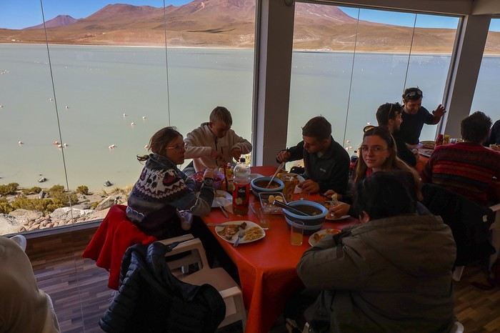
The picnic break, sheltered from the wind, feels great. Our plates are full, and Janeth, as usual, shares her vast knowledge about the Lipez region, Bolivian society, social movements, and the country's economic challenges.
Several lagoons follow one after another: Laguna Chiarcota (or Laguna Negra) and Laguna Honda, with a few lovely encounters along the way
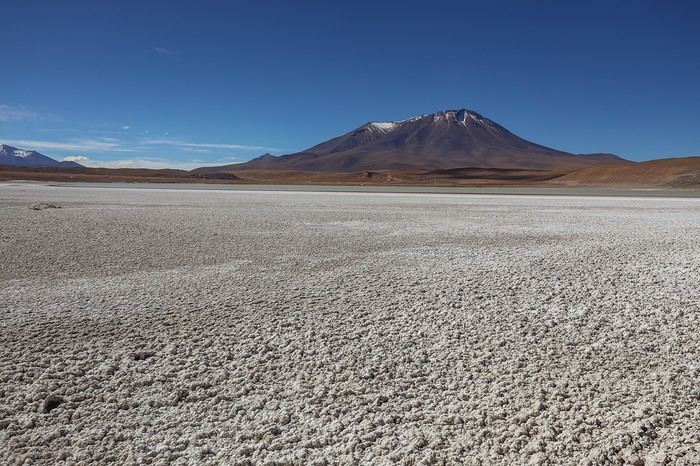
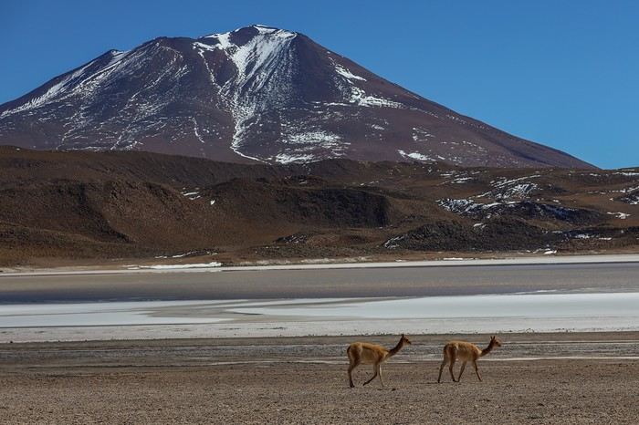
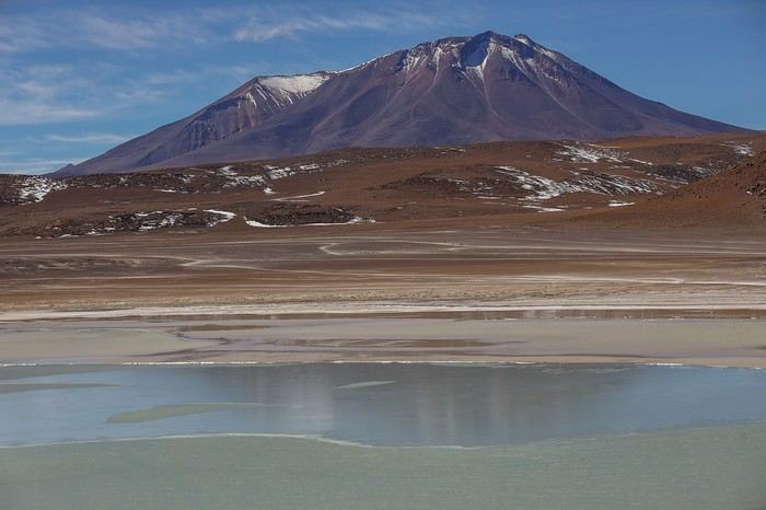
The lagoon waters create some beautiful reflections.
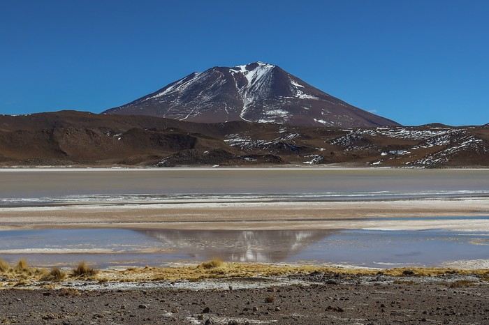 Every time we step out of the car, we’re reminded of the altitude, the wind exposure, and the wild, harsh nature of the Southern Lipez for vegetation
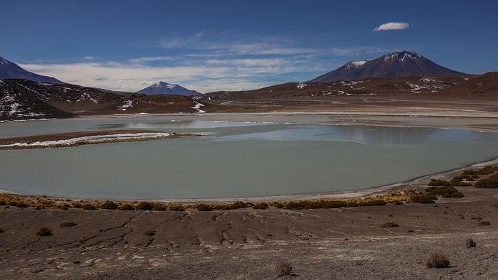 The breathtaking landscapes keep coming, and the kilometers fly by without a hint of boredom!
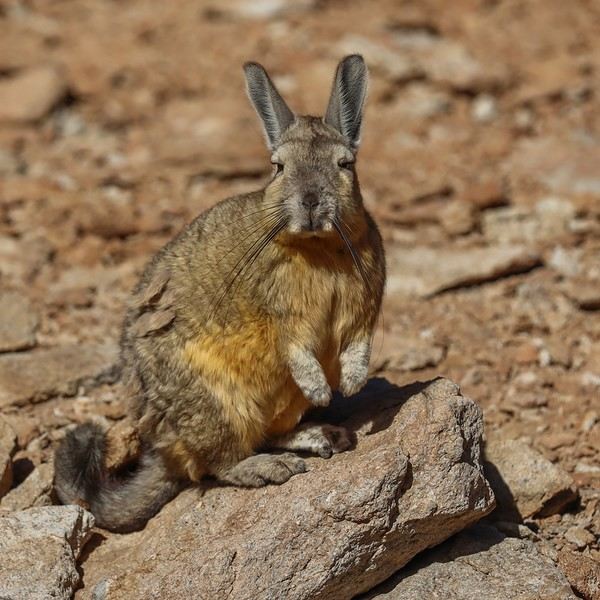
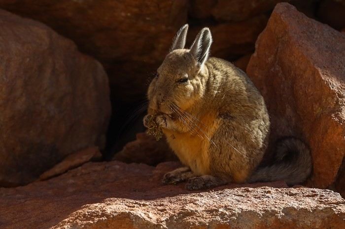
We then head into the Canyon de las Vizcachas, where we spot several viscachas—rabbit-like creatures. The canyon lives up to its name...
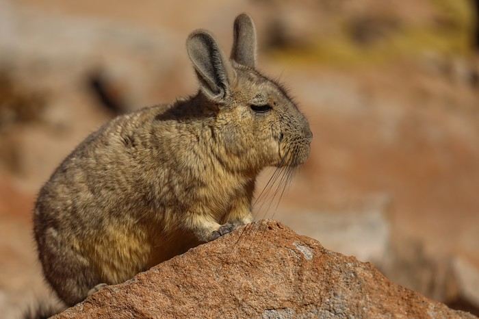 The two specimens we’re lucky enough to see aren’t shy at all! Though, to be fair, we’re not alone in the canyon, and these poor rabbits must see a parade of tourist 4x4s!
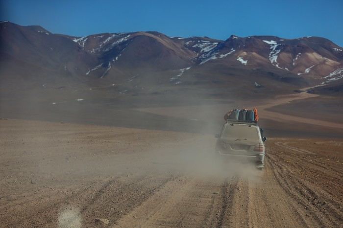
 On the way to the Siloli Desert, when we see the outside of other 4x4s, we finally understand why our roof luggage is wrapped in tarps !!
Several lagoons follow one after another: Laguna Chiarcota (or Laguna Negra) and Laguna Honda, with a few lovely encounters along the way
The lagoon waters create some beautiful reflections.
Every time we step out of the car, we’re reminded of the altitude, the wind exposure, and the wild, harsh nature of the Southern Lipez for vegetation
The breathtaking landscapes keep coming, and the kilometers fly by without a hint of boredom!We then head into the Canyon de las Vizcachas, where we spot several viscachas—rabbit-like creatures. The canyon lives up to its name...
The two specimens we’re lucky enough to see aren’t shy at all! Though, to be fair, we’re not alone in the canyon, and these poor rabbits must see a parade of tourist 4x4s!
On the way to the Siloli Desert, when we see the outside of other 4x4s, we finally understand why our roof luggage is wrapped in tarps !!A Bold Combo: Southern Peru, Bolivia, and Northern Chile
Day 16 - 07/27: Crossing the Lipez and the lagoons
A long day on the dirt road awaits us to reach our destination, right next to Laguna Colorado, not far from the Chilean border.
We continue to encounter herds of alpacas.
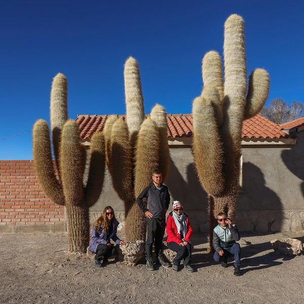
The journey is punctuated by various stops. First, San Juan, where we buy cactus beer. The village’s main attraction is this alignment of remarkable cacti with enormous arms, as thick as tree trunks!
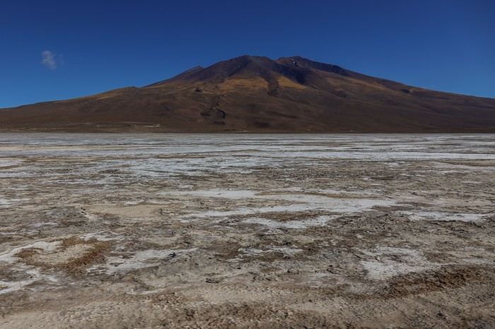
 A little further south, we cross the Salar de Chiguana, the little brother of the Salar de Uyuni, which also borders the Chilean frontier.
It’s surrounded by volcanic formations and mountain ranges, adding depth to the shots. The colors of this raw salt flat are much more diverse than those of the Salar de Uyuni.
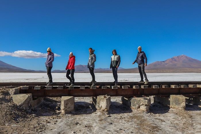
When we follow a railway track, a photo stop is a must.
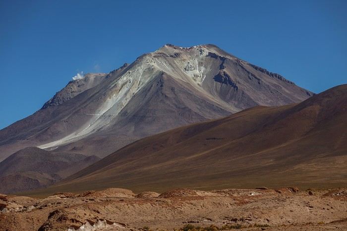
The road then leads us to a viewpoint overlooking the Ollague volcano, which peaks at an altitude of 5,870 meters.
It’s one of the most active volcanoes in the entire Western Cordillera, and from the belvedere, we can see a plume of smoke rising from it.
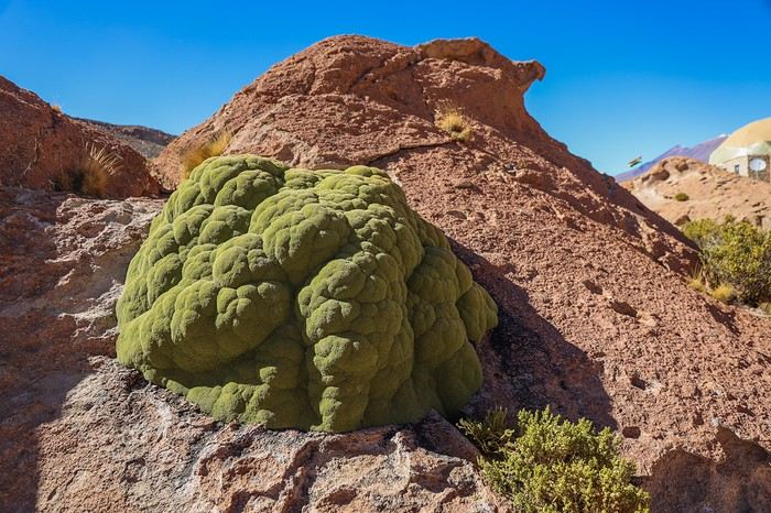
The belvedere’s appeal isn’t limited to the view of the volcano. Janeth takes us to see an Azorella compacta, a plant adapted to the extreme cold and dry conditions of the Andes. It looks like moss, yet it’s a great fuel source.
Janeth explains that in the past, Bolivians used it a lot for heating in winter. Since it grows very slowly—about 1 mm per year (!!)—authorities decided to protect it. The specimen we’re looking at is over a thousand years old! It really puts things into perspective...
I was expecting a tourist highway on the route, but in the end, there are at most five to ten 4x4s at each stop.
The landscapes are stunning. As the day goes on, we gain altitude and enter the lagoon area.
The first one we encounter is Laguna Canapa. The contrast is striking between the blue of the lagoon, the white borax edges, and the ochre mountains. The pink dots visible from afar are the famous pink flamingos of the Altiplano.
The surrounding mountains, almost devoid of vegetation, frame this glacial oasis in the middle of the desert .
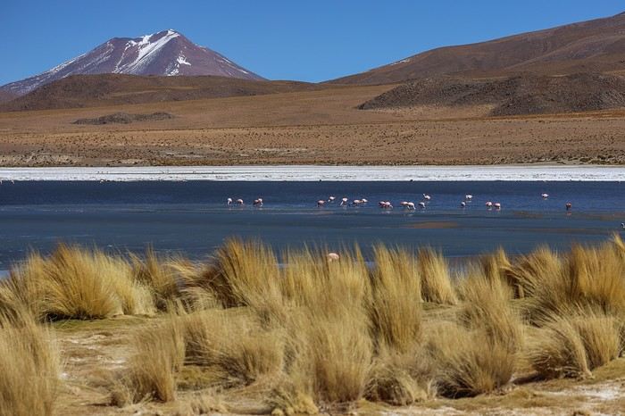
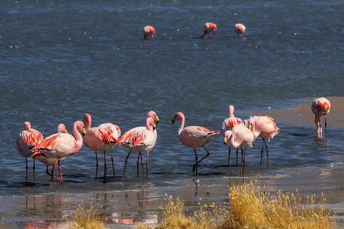
Even though it’s not the ideal season, we’re lucky to see many pink flamingos. The juveniles are easy to spot thanks to their gray plumage speckled with white.
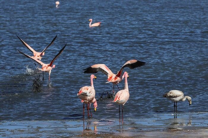
A few flamingos have the great idea to treat us to a low flyby.
When we arrive at Laguna Hedionda, we’re pretty happy to see a building overlooking the water. Not that we enjoy seeing concrete in the heart of natural sites, but it’s almost noon, and we’re getting hungry! As expected, Janeth tells us the building has all the amenities—lunchroom and restrooms. It’s clear that everything, from the infrastructure to the organization, is designed to give tourists a hassle-free experience with all the tour operators!
Before sitting down to eat, Janeth lets us wander along Laguna Hedionda while Carlos prepares the meal and sets the table.
Unlike the bright blue of Laguna Canapa, the water here is a grayish blue.
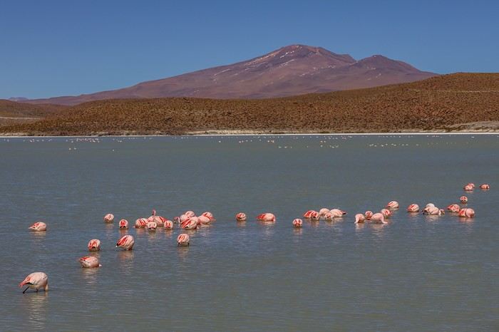
But when it comes to flamingos, there’s no comparison! We’re treated to a feast for the eyes, with specimens in every corner of the lagoon and highly concentrated colonies in some spots—visually stunning!
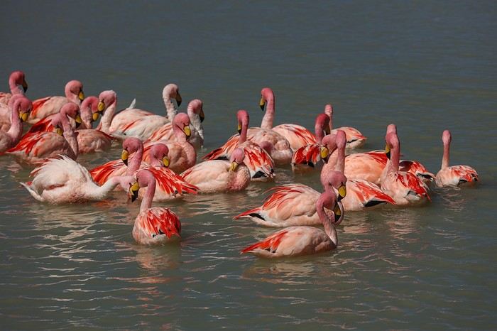
Hats are still a must—you’d think it’s cold and windy in southern Lipez !
A long day on the dirt road awaits us to reach our destination, right next to Laguna Colorado, not far from the Chilean border.
We continue to encounter herds of alpacas.
The journey is punctuated by various stops. First, San Juan, where we buy cactus beer. The village’s main attraction is this alignment of remarkable cacti with enormous arms, as thick as tree trunks!
A little further south, we cross the Salar de Chiguana, the little brother of the Salar de Uyuni, which also borders the Chilean frontier.It’s surrounded by volcanic formations and mountain ranges, adding depth to the shots. The colors of this raw salt flat are much more diverse than those of the Salar de Uyuni.
When we follow a railway track, a photo stop is a must.
The road then leads us to a viewpoint overlooking the Ollague volcano, which peaks at an altitude of 5,870 meters.
It’s one of the most active volcanoes in the entire Western Cordillera, and from the belvedere, we can see a plume of smoke rising from it.
The belvedere’s appeal isn’t limited to the view of the volcano. Janeth takes us to see an Azorella compacta, a plant adapted to the extreme cold and dry conditions of the Andes. It looks like moss, yet it’s a great fuel source.
Janeth explains that in the past, Bolivians used it a lot for heating in winter. Since it grows very slowly—about 1 mm per year (!!)—authorities decided to protect it. The specimen we’re looking at is over a thousand years old! It really puts things into perspective...
I was expecting a tourist highway on the route, but in the end, there are at most five to ten 4x4s at each stop.
The landscapes are stunning. As the day goes on, we gain altitude and enter the lagoon area.
The first one we encounter is Laguna Canapa. The contrast is striking between the blue of the lagoon, the white borax edges, and the ochre mountains. The pink dots visible from afar are the famous pink flamingos of the Altiplano.
The surrounding mountains, almost devoid of vegetation, frame this glacial oasis in the middle of the desert .
Even though it’s not the ideal season, we’re lucky to see many pink flamingos. The juveniles are easy to spot thanks to their gray plumage speckled with white.
A few flamingos have the great idea to treat us to a low flyby.
When we arrive at Laguna Hedionda, we’re pretty happy to see a building overlooking the water. Not that we enjoy seeing concrete in the heart of natural sites, but it’s almost noon, and we’re getting hungry! As expected, Janeth tells us the building has all the amenities—lunchroom and restrooms. It’s clear that everything, from the infrastructure to the organization, is designed to give tourists a hassle-free experience with all the tour operators!
Before sitting down to eat, Janeth lets us wander along Laguna Hedionda while Carlos prepares the meal and sets the table.
Unlike the bright blue of Laguna Canapa, the water here is a grayish blue.
But when it comes to flamingos, there’s no comparison! We’re treated to a feast for the eyes, with specimens in every corner of the lagoon and highly concentrated colonies in some spots—visually stunning!
Hats are still a must—you’d think it’s cold and windy in southern Lipez !