Posts by Orionide
About 3,435 results.
More options
Search results
Back from the GR 20
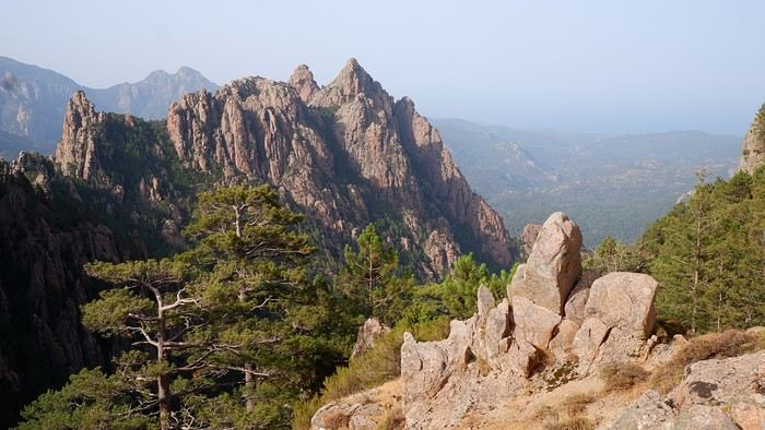
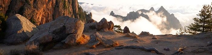
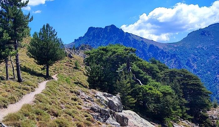
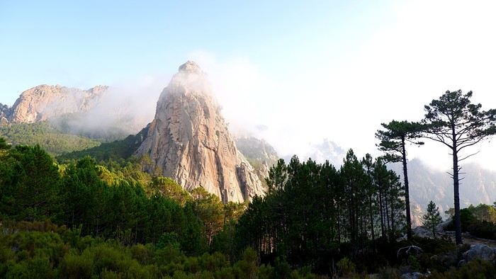
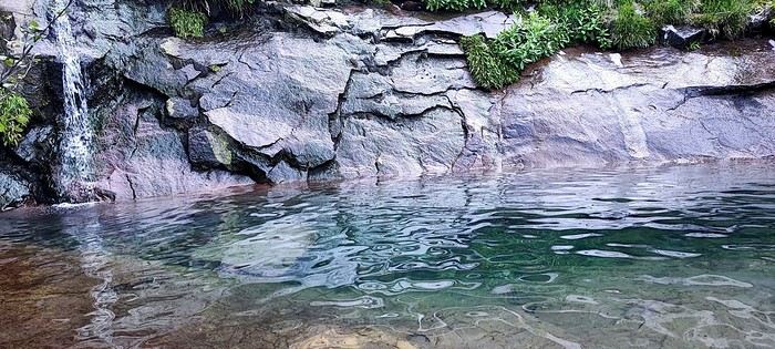
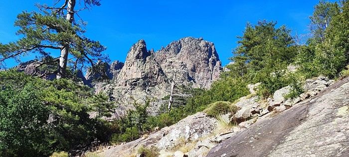
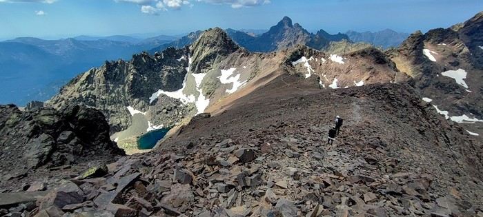
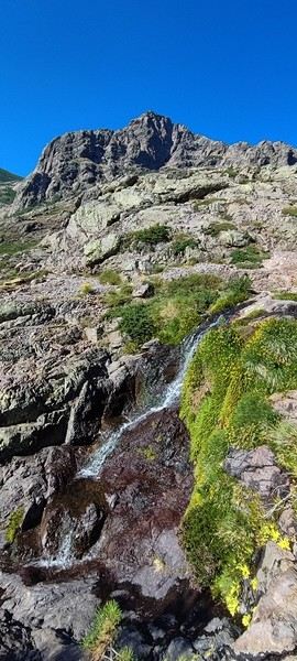
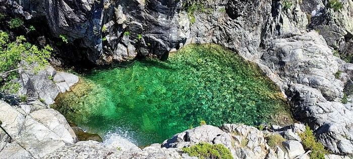
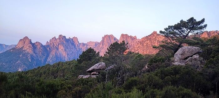
Back from the GR 20
Hi everyone,
Last July, we crossed the Isle of Beauty from north to south along the famous GR 20.
We chose to complete it in 16 stages, finishing with a relaxing day in Porto-Vecchio.
It’s certainly a physical challenge but also a wonderful human adventure. We’d dreamed of doing it, we did it, and we really don’t regret taking the plunge.
I won’t go into detail about each stage or all the preparation because I’ve already covered it here: GR 20 recap in 16 stages.
But I wanted to share a few photos with you and maybe inspire you to take the plunge like we did.
If you have any questions, I’ll be happy to answer them as best I can.
The northern stages (the toughest ones): lots of elevation gain, rocky landscapes, beautiful lakes, breathtaking viewpoints, and technical sections. Every minute counts—time feels thicker in the north! The southern stages: less rocky, lower altitude, more forested, but still with their own challenges.
A few photos to give you an idea:
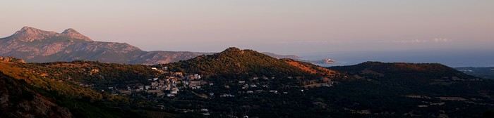
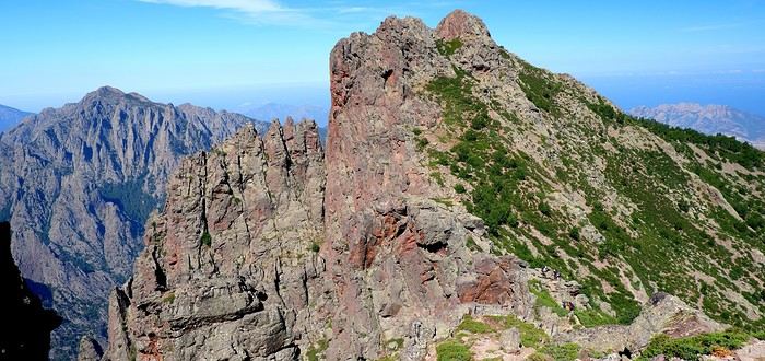
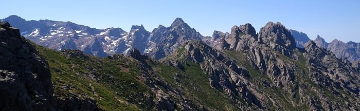
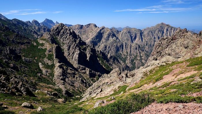
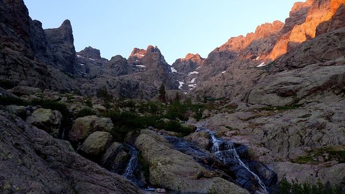
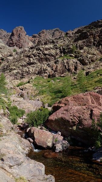
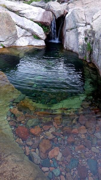
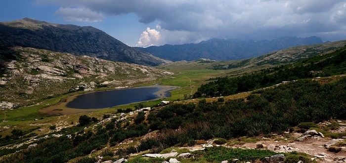
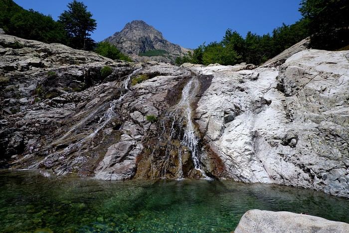
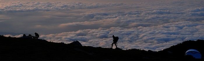
The northern stages (the toughest ones): lots of elevation gain, rocky landscapes, beautiful lakes, breathtaking viewpoints, and technical sections. Every minute counts—time feels thicker in the north! The southern stages: less rocky, lower altitude, more forested, but still with their own challenges.
A few photos to give you an idea:
Exploring Senja Island and the Lofoten Archipelago
You've taught me something, Laure! I had no idea that on the newer versions of Maps.me, you can download GPX files directly—that's news to me. I'll update the app; it'll save me some time.
Trek in Norway: Jotunheimen and Dovrefjell, you'll adapt to the rain...
Hi Laure,
You really did escape, if only for a few days, the heatwave this summer 😉 In the end, the long-awaited sunny spells—though mostly partial and fleeting—look great in your photos. And it’s always a little joy to see them appear. On the trails, was it mostly international hikers or did you mainly meet Norwegians?
You really did escape, if only for a few days, the heatwave this summer 😉 In the end, the long-awaited sunny spells—though mostly partial and fleeting—look great in your photos. And it’s always a little joy to see them appear. On the trails, was it mostly international hikers or did you mainly meet Norwegians?
Hiking on Senja Island and the Lofoten Archipelago
Hello,
I don’t know the KML format or Maps.me—why not just use Visorando?
I think it’s just because we all have our little habits and preferences The advantage of Maps.me is that I can integrate tracks from lots of different apps like Visorando, Wikilocs, AltitudeRando, AllTrails, etc. I download the GPX files from hikes on those sites, convert them, and then just click on them—they automatically appear in Maps.me. I can also add bookmarks (where to picnic, camp, etc.). The only downside is that I often have to print out the route descriptions from the downloaded tracks since they come from so many different sites. Anyway, it’s just one method among many…
I don’t know the KML format or Maps.me—why not just use Visorando?
I think it’s just because we all have our little habits and preferences The advantage of Maps.me is that I can integrate tracks from lots of different apps like Visorando, Wikilocs, AltitudeRando, AllTrails, etc. I download the GPX files from hikes on those sites, convert them, and then just click on them—they automatically appear in Maps.me. I can also add bookmarks (where to picnic, camp, etc.). The only downside is that I often have to print out the route descriptions from the downloaded tracks since they come from so many different sites. Anyway, it’s just one method among many…
Trek in Norway: Jotunheimen and Dovrefjell, you’ll adapt to the rain...
Hi Laure,
Great to see another update from you about a hike in these Nordic regions!
Great to see another update from you about a hike in these Nordic regions!
Trip to Norway in 2027: What to do around the Lofoten Islands?
Hi,
I’d written a review about these islands plus Senja Island. Our trip lasted 12 days. I’d gone into detail here if you’re interested: https://jeveuxcamperauxlofoten.blogspot.com/
I’d written a review about these islands plus Senja Island. Our trip lasted 12 days. I’d gone into detail here if you’re interested: https://jeveuxcamperauxlofoten.blogspot.com/
Hiking on Senja Island and the Lofoten Archipelago
Hi,
I had downloaded all the GPX tracks using the code provided by the Rother guide. I convert them to KML format and then integrate them into Maps.me (a free app for offline maps). If you don’t get the guide, you can also find plenty of tracks on Visorando, for example. Same process—I download them, transfer them to Maps.me, and once you're there, you just follow the track on your smartphone.
I had downloaded all the GPX tracks using the code provided by the Rother guide. I convert them to KML format and then integrate them into Maps.me (a free app for offline maps). If you don’t get the guide, you can also find plenty of tracks on Visorando, for example. Same process—I download them, transfer them to Maps.me, and once you're there, you just follow the track on your smartphone.
Hiking on Senja Island and the Lofoten Archipelago
Thanks Cyril !
Review of our trip in the American West with a French-speaking guide
Okay, I know some will ask, why use an agency? Honestly, we didn’t really feel like doing all the driving and planning, especially since we didn’t know the area at all. And since our English isn’t great, having French-speaking guides was a big comfort for us
But in August 2015, you wrote
We’re heading out for a 3-week road trip in September—it’s our sixth trip—and we’re doing a loop starting from Los Angeles. We’ve planned quite a few off-road tracks... it’s getting harder to find AWD vehicles, let alone 4x4s
Good catch, Kimy6791
This smells like self-promotion... especially since the profile’s first name matches one of the organizers’.
But in August 2015, you wrote
We’re heading out for a 3-week road trip in September—it’s our sixth trip—and we’re doing a loop starting from Los Angeles. We’ve planned quite a few off-road tracks... it’s getting harder to find AWD vehicles, let alone 4x4s
Good catch, Kimy6791
This smells like self-promotion... especially since the profile’s first name matches one of the organizers’.
Exploring Senja Island and the Lofoten Archipelago
Thanks Muriel for your feedback.
Roaming around Senja Island and the Lofoten Archipelago
This is our last full day in Norway, and our schedule is pretty packed. After doing some final shopping (mostly souvenirs) in downtown Svolvær, we thought we’d squeeze in one last hike before hitting the road to the Evenes campsite, just minutes from the airport.
But we’re taking it easy in the morning—on the road, too. We have a picnic in front of a gorgeous landscape, we dawdle, we soak in the views, we chat, and we almost feel like lounging in a deck chair…
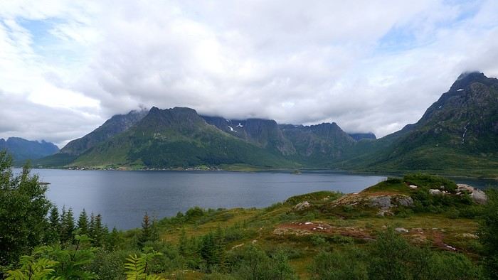
With the low cloud ceiling, our planned hike gets scrapped as soon as we pull into the parking lot. The afternoon’s already well underway, and the 2.5-hour trek would probably have us arriving at the campsite pretty late. No big deal—we’d spotted a charming little beach near Trollskarholmen just before arriving, and we head there to relax (no swimming) for half an hour. The colors, despite the overcast sky, are still stunning.
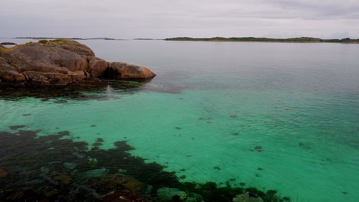
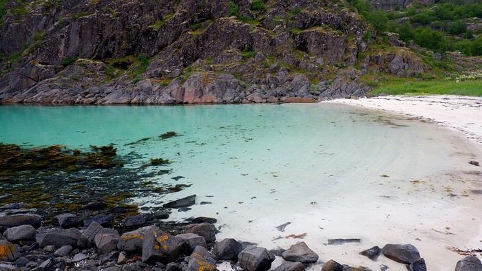
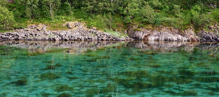
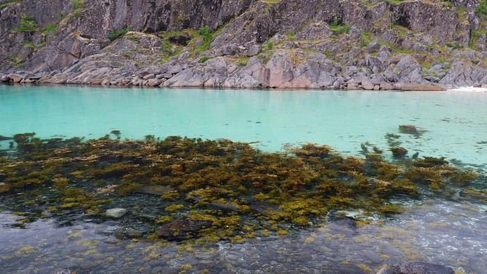
We’re back on the Fv868, which we’d already explored a week ago when the Hurtigruten passed by:
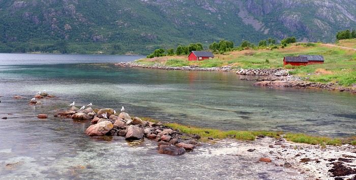
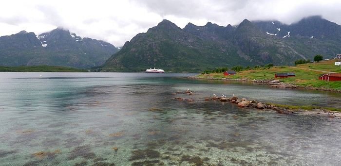
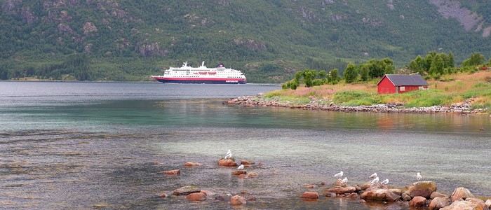
We arrive at the Evenes campsite in the early evening, not without first scouting out the car wash station attached to the gas pump between the campsite and the airport. The campsite was full that night—right by the Ofotfjord and just 5 minutes from the airport.
For our last day (just a morning, really): Nothing special, except we spent over an hour thoroughly cleaning the car before returning it to the airport parking lot. Watch out—don’t arrive too late at the car wash station, as it’s pretty popular, and it’s only one car at a time!
That’s it—I’ve finished this travel journal. For everything related to the organizational side of this trip (flights, car rental, insurance, accommodations, guides, budget details, etc.), I’ve laid it all out on the homepage of my blog here: https://jeveuxcamperauxlofoten.blogspot.com/ I’d read that Norway was a super expensive destination, and the budgets mentioned in some travel journals and blogs almost made us reconsider. But traveling the way we did, we actually managed pretty well—12 days cost us 2800 € all in (even souvenirs). Sure, we didn’t pay for the return flight (just taxes), and we didn’t stay in any hotels, but we treated ourselves to a few nice experiences: a Nordic bath and sauna, the Viking Museum, the Ice Bar in Svolvær, and a really good restaurant. For the rest—and what lets you truly appreciate the Lofoten’s most beautiful offerings—let’s not forget that hiking is free.
With the low cloud ceiling, our planned hike gets scrapped as soon as we pull into the parking lot. The afternoon’s already well underway, and the 2.5-hour trek would probably have us arriving at the campsite pretty late. No big deal—we’d spotted a charming little beach near Trollskarholmen just before arriving, and we head there to relax (no swimming) for half an hour. The colors, despite the overcast sky, are still stunning.
We’re back on the Fv868, which we’d already explored a week ago when the Hurtigruten passed by:
We arrive at the Evenes campsite in the early evening, not without first scouting out the car wash station attached to the gas pump between the campsite and the airport. The campsite was full that night—right by the Ofotfjord and just 5 minutes from the airport.
For our last day (just a morning, really): Nothing special, except we spent over an hour thoroughly cleaning the car before returning it to the airport parking lot. Watch out—don’t arrive too late at the car wash station, as it’s pretty popular, and it’s only one car at a time!
That’s it—I’ve finished this travel journal. For everything related to the organizational side of this trip (flights, car rental, insurance, accommodations, guides, budget details, etc.), I’ve laid it all out on the homepage of my blog here: https://jeveuxcamperauxlofoten.blogspot.com/ I’d read that Norway was a super expensive destination, and the budgets mentioned in some travel journals and blogs almost made us reconsider. But traveling the way we did, we actually managed pretty well—12 days cost us 2800 € all in (even souvenirs). Sure, we didn’t pay for the return flight (just taxes), and we didn’t stay in any hotels, but we treated ourselves to a few nice experiences: a Nordic bath and sauna, the Viking Museum, the Ice Bar in Svolvær, and a really good restaurant. For the rest—and what lets you truly appreciate the Lofoten’s most beautiful offerings—let’s not forget that hiking is free.
Exploring Senja Island and the Lofoten Archipelago
I confirm, Guillaume, it’s definitely a must-experience.
However, we often thought it was quite a challenging destination...
From Hoven to Svolvaer: In the morning, we’re greeted by a completely different view of the “shark fin.” The night was peaceful on this stretch of road, and you can tell this part of the archipelago is less crowded than the south. Mount Hoven stands out for its isolation—it’s the only promontory in the area: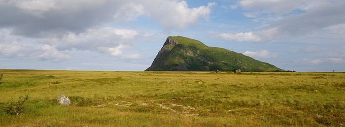 Between last night’s dinner and this morning’s breakfast, we can’t say we didn’t take our time admiring this mountain. It’s time to climb up there to see the surroundings from a new angle.
The parking lot at the trailhead costs 100 kroner, but if you park 30 meters farther at the golf course parking lot and grab a drink, the spot is free. It ends up being the same thing, but you get a drink out of it.
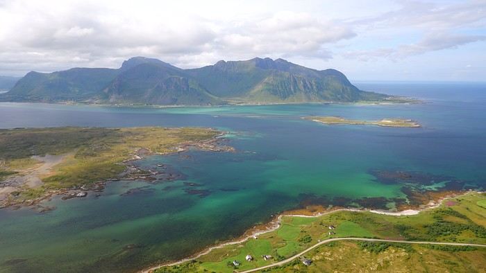
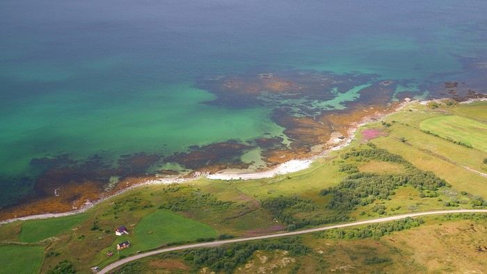
Climbing to the top of the mountain is pretty easy, and the view—both over the marshes and the sea with its shades of blue—is, once again, stunning:
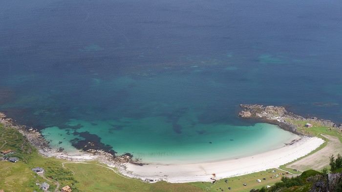
The beautiful Hovsika beach below:
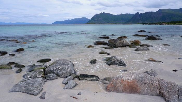
Summary: The hike was supposed to take 1h45, and that’s exactly how long it took us, including breaks. We’ve seen some incredible landscapes from above since the start of this trip, and even though they’ve become familiar, we never get tired of them. Afterward, we had a picnic on the gorgeous Gimsoy beach, parking at the grocery store lot on the other side of the road:
Since this hike didn’t take much time or energy, we planned another one in Svolvaer. Even if the sky was getting cloudy, the clouds stayed high enough. The hike that kept us busy for most of the afternoon was the one leading to the top of Mount Floya (590 m). Since it was Sunday in Svolvaer, many locals were out with their families on the trail. Note: The parking lot at the trailhead is paid. Like in Reine, the first few hundred meters involve climbing steps built by Sherpas, followed by a steep grassy trail. As we climbed higher, the view of Svolvaer changed and became more expansive:
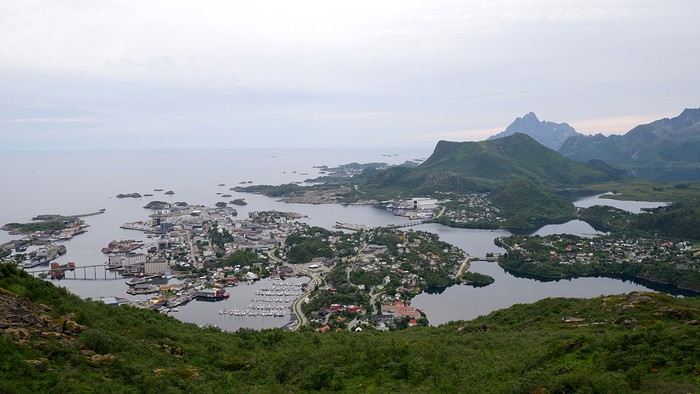
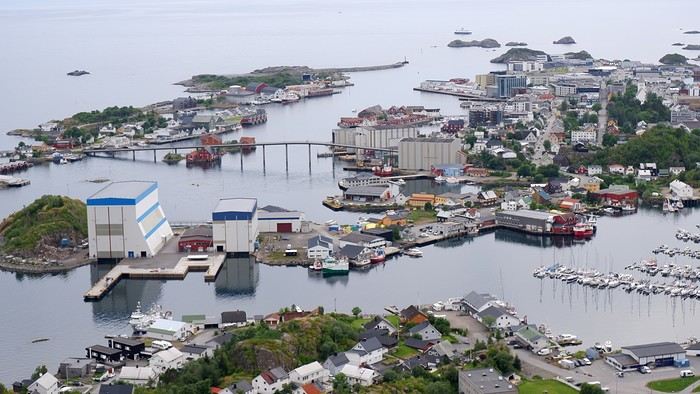 After a sustained effort, we reached the summit, and it’s at the very end that the full view of Svolvaer opens up. All that’s left is to walk along the ridge trail:
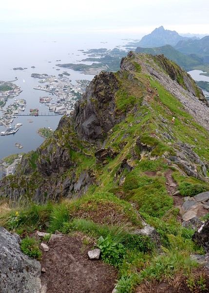
The view is amazing, though the light wasn’t ideal. Still, we can see why this hike is so popular.
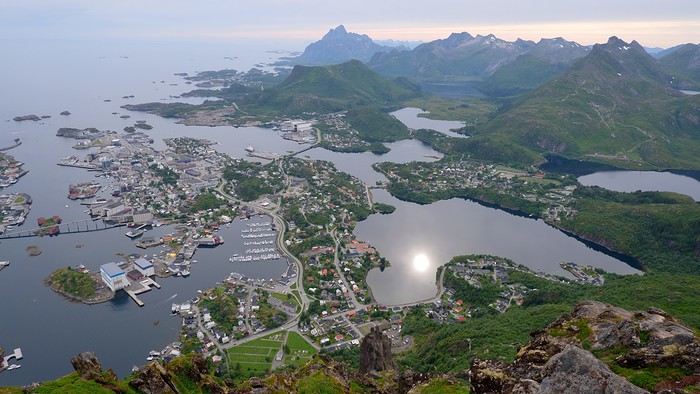
Today, once again, we matched the time estimates from the hike description—it took us exactly 3 hours to complete. It’s a pretty sporty hike but still family-friendly. We even saw quite a few young kids. And the view of Svolvaer and the surrounding area is absolutely worth the effort. Back at sea level, we headed to Hammerstadt Camping for a well-deserved shower and then returned to town. Tonight, we’re dining at one of the best restaurants in the Lofoten for the only time during our stay: Borsen Spiseri. We weren’t disappointed at all—given how rare it was for us to go out, we savored every second. For two people, the cost was just over 200 € for a menu (starter, main course, dessert) plus an aperitif and a glass of wine each. Side note: We skipped the whale dish. Afterward, we noticed that over the days, the sun has been getting lower on the horizon in the evenings, and the light takes on the hues of a sunset:
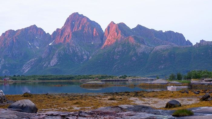
If you want the GPX tracks for the hikes and more photos and descriptions, check it out here: From Hoven to Svolvaer
From Hoven to Svolvaer: In the morning, we’re greeted by a completely different view of the “shark fin.” The night was peaceful on this stretch of road, and you can tell this part of the archipelago is less crowded than the south. Mount Hoven stands out for its isolation—it’s the only promontory in the area:
Between last night’s dinner and this morning’s breakfast, we can’t say we didn’t take our time admiring this mountain. It’s time to climb up there to see the surroundings from a new angle.
The parking lot at the trailhead costs 100 kroner, but if you park 30 meters farther at the golf course parking lot and grab a drink, the spot is free. It ends up being the same thing, but you get a drink out of it.
Climbing to the top of the mountain is pretty easy, and the view—both over the marshes and the sea with its shades of blue—is, once again, stunning:
The beautiful Hovsika beach below:
Summary: The hike was supposed to take 1h45, and that’s exactly how long it took us, including breaks. We’ve seen some incredible landscapes from above since the start of this trip, and even though they’ve become familiar, we never get tired of them. Afterward, we had a picnic on the gorgeous Gimsoy beach, parking at the grocery store lot on the other side of the road:
Since this hike didn’t take much time or energy, we planned another one in Svolvaer. Even if the sky was getting cloudy, the clouds stayed high enough. The hike that kept us busy for most of the afternoon was the one leading to the top of Mount Floya (590 m). Since it was Sunday in Svolvaer, many locals were out with their families on the trail. Note: The parking lot at the trailhead is paid. Like in Reine, the first few hundred meters involve climbing steps built by Sherpas, followed by a steep grassy trail. As we climbed higher, the view of Svolvaer changed and became more expansive:
After a sustained effort, we reached the summit, and it’s at the very end that the full view of Svolvaer opens up. All that’s left is to walk along the ridge trail:The view is amazing, though the light wasn’t ideal. Still, we can see why this hike is so popular.
Today, once again, we matched the time estimates from the hike description—it took us exactly 3 hours to complete. It’s a pretty sporty hike but still family-friendly. We even saw quite a few young kids. And the view of Svolvaer and the surrounding area is absolutely worth the effort. Back at sea level, we headed to Hammerstadt Camping for a well-deserved shower and then returned to town. Tonight, we’re dining at one of the best restaurants in the Lofoten for the only time during our stay: Borsen Spiseri. We weren’t disappointed at all—given how rare it was for us to go out, we savored every second. For two people, the cost was just over 200 € for a menu (starter, main course, dessert) plus an aperitif and a glass of wine each. Side note: We skipped the whale dish. Afterward, we noticed that over the days, the sun has been getting lower on the horizon in the evenings, and the light takes on the hues of a sunset:
If you want the GPX tracks for the hikes and more photos and descriptions, check it out here: From Hoven to Svolvaer
Hiking on Senja Island and the Lofoten Archipelago
Today’s planned hike comes at just the right time—following the coastline, it’ll keep us from ending up in the heights with our view obscured by clouds. This is the route from Eggum to Unstad. That said, the rain that’s bound to show up will probably force us to turn back, so we might have to switch to Plan B.
So we set off this morning toward Eggum without being sure we’ll complete the walk. The parking is paid—or rather, the road leading to the site is. Oddly enough, you have to drop money into a box, but no receipt is given in return. You can also pay directly at the café next to the parking lot.
Note that on a promontory overlooking the parking area, you can check out the remains of an old German radar installation from World War II.
Before heading out on the hike, we double-check that our rain gear is in the bag—the clouds have never looked so threatening!
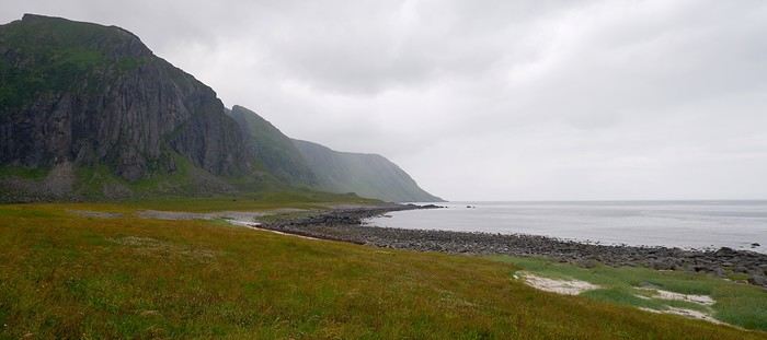
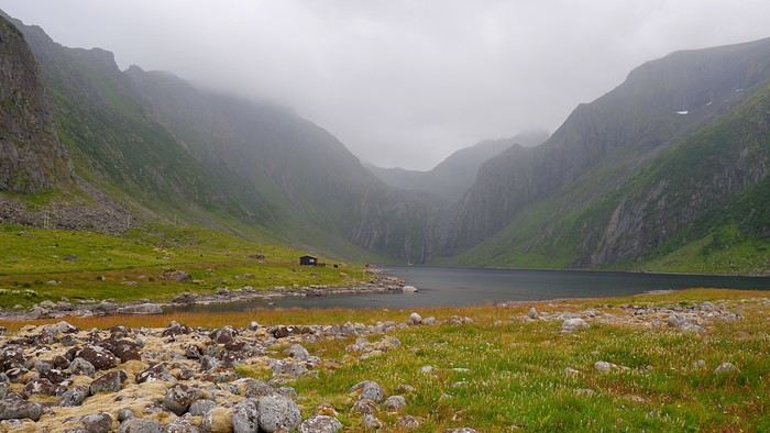
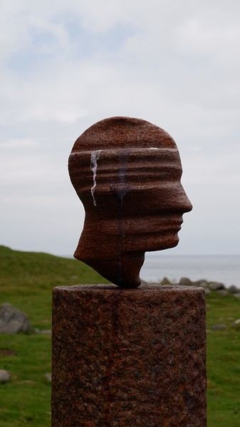
After 20 minutes, we come across Markus Raetz’s sculpture—unsurprisingly, though I’d say *almost* unsurprisingly, since we expected it to be bigger. Nope, it’s actually life-sized. When you walk around it, the perspective changes completely because the head appears upside down. The artist invites everyone to occasionally shift their viewpoint to better understand the world around them.
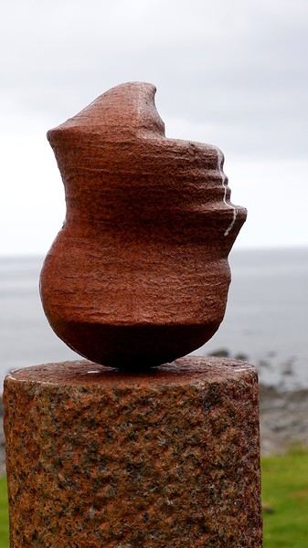
The inevitable rain arrives after an hour of walking, in the form of a curtain crashing down on us. We have no choice but to turn back, and as we feared, we won’t make it to Unstad, which was supposed to be the endpoint of this hike.
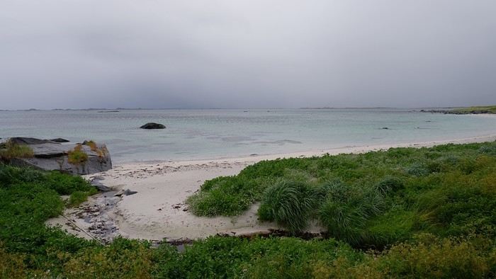
We’ll even have our picnic in the car—the poor table inside the café was already taken. Plan B, which we had up our sleeve, now takes over: a visit to the Lofotr Viking Museum, just 10 minutes by car from Eggum. We’ll spend 3 hours there and were pleasantly surprised. Admission is around 20 € per person. You can download (for free) an audio guide onto your smartphone, so don’t hesitate to bring your headphones. There are 2 large exhibition halls plus a cinema room. The rest is spread out over several hectares. You’ll see, among other things, a large reconstructed farm with artisans working right in front of you. A 1.5 km walk away, you can try your hand at axe throwing, archery, or even take a (short) ride in a longship. Bonus: the sky clears up, which is great since we wander around as much outside as inside in this museum! Though entirely reconstructed, the museum was actually the site of a Viking farm, and excavations are still ongoing. You’ll learn all about this in the short introductory film in the cinema room.
When we leave the museum, the afternoon is already well underway, and we head toward our next campsite.
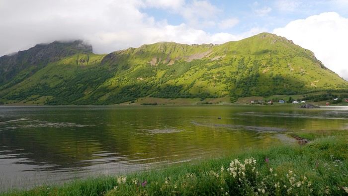
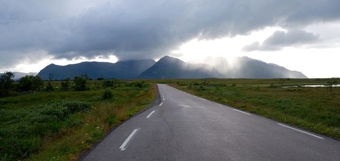
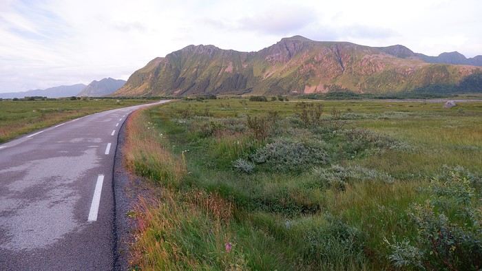
You can see the sky has shed most of the clouds that were weighing it down. We look for a spot to spend our second consecutive night camping and find our perfect spot on a tiny parking lot along Fv 862, not far from where we’ll start our hike tomorrow. The only downside is that we’ll be surrounded by marshes. We’ll sleep in the car. The mountain Hoven, seen here and which we’ll climb tomorrow, is nicknamed the "shark fin," and you can easily see why!
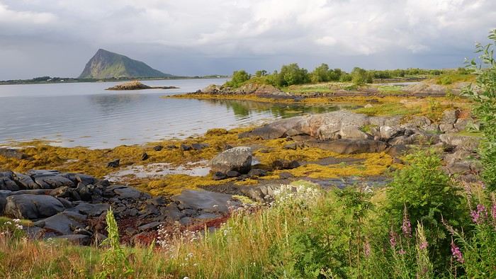
The sun and clouds help create a beautiful scene:
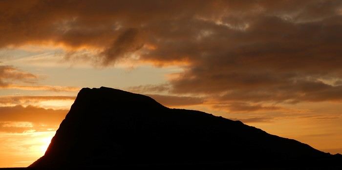
At the end of the day, the sky ignites:
If you’d like more details—photos, maps, GPS tracks, etc.—I’ve laid it all out here: From Eggum to Hoven
So we set off this morning toward Eggum without being sure we’ll complete the walk. The parking is paid—or rather, the road leading to the site is. Oddly enough, you have to drop money into a box, but no receipt is given in return. You can also pay directly at the café next to the parking lot.
Note that on a promontory overlooking the parking area, you can check out the remains of an old German radar installation from World War II.
Before heading out on the hike, we double-check that our rain gear is in the bag—the clouds have never looked so threatening!
After 20 minutes, we come across Markus Raetz’s sculpture—unsurprisingly, though I’d say *almost* unsurprisingly, since we expected it to be bigger. Nope, it’s actually life-sized. When you walk around it, the perspective changes completely because the head appears upside down. The artist invites everyone to occasionally shift their viewpoint to better understand the world around them.
The inevitable rain arrives after an hour of walking, in the form of a curtain crashing down on us. We have no choice but to turn back, and as we feared, we won’t make it to Unstad, which was supposed to be the endpoint of this hike.
We’ll even have our picnic in the car—the poor table inside the café was already taken. Plan B, which we had up our sleeve, now takes over: a visit to the Lofotr Viking Museum, just 10 minutes by car from Eggum. We’ll spend 3 hours there and were pleasantly surprised. Admission is around 20 € per person. You can download (for free) an audio guide onto your smartphone, so don’t hesitate to bring your headphones. There are 2 large exhibition halls plus a cinema room. The rest is spread out over several hectares. You’ll see, among other things, a large reconstructed farm with artisans working right in front of you. A 1.5 km walk away, you can try your hand at axe throwing, archery, or even take a (short) ride in a longship. Bonus: the sky clears up, which is great since we wander around as much outside as inside in this museum! Though entirely reconstructed, the museum was actually the site of a Viking farm, and excavations are still ongoing. You’ll learn all about this in the short introductory film in the cinema room.
When we leave the museum, the afternoon is already well underway, and we head toward our next campsite.
You can see the sky has shed most of the clouds that were weighing it down. We look for a spot to spend our second consecutive night camping and find our perfect spot on a tiny parking lot along Fv 862, not far from where we’ll start our hike tomorrow. The only downside is that we’ll be surrounded by marshes. We’ll sleep in the car. The mountain Hoven, seen here and which we’ll climb tomorrow, is nicknamed the "shark fin," and you can easily see why!
The sun and clouds help create a beautiful scene:
At the end of the day, the sky ignites:
If you’d like more details—photos, maps, GPS tracks, etc.—I’ve laid it all out here: From Eggum to Hoven
Hiking around Senja Island and the Lofoten Archipelago
Oh yeah, totally 😎
We almost missed the Offersøykammen hike, which wasn’t listed in the Rother Top 10, but it turned out to be a really nice surprise.
Hiking on Senja Island and the Lofoten Archipelago
It’s official—the mild weather that had been with us since the start of this trip has definitely packed up and left. Fortunately, the cloud layer looks high enough, and no precipitation is forecast. But let’s be honest, the light is a whole different story now.
Today’s first hike will take us to the summit of Offersøykammen. Parking is pretty straightforward—there’s a large lot along the E10 called the Skreda area. The actual trailhead is 600 meters from this parking spot. Instead of walking along the busy E10, it’s better to take the small road to the right that leads to Lofoten Base Camp, then cross over when you’re facing the trailhead sign.
Our expectation for the day: We figured this hike would be pretty low-key, so we wouldn’t run into many people…
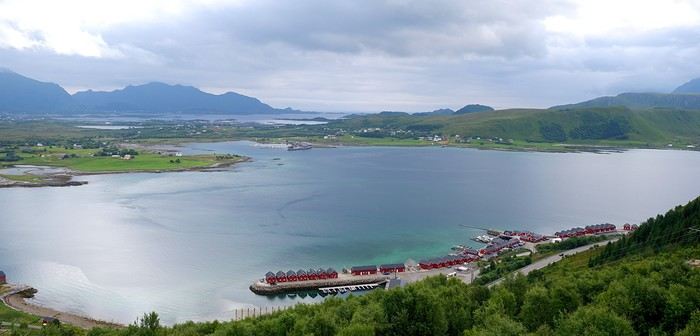
A few minutes later, looking back, we could already see we’d climbed quite a bit from Lofoten Base Camp:
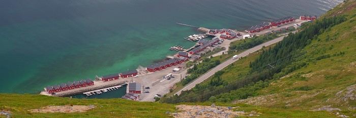
Once past the tree line, we hit a very rocky section that kept us climbing just as much. And we were surprised to find quite a few people ahead of us, either going up or coming down from the summit. The Scandinavians (who were the majority) aren’t fooled—this summit is accessible in a relatively short but intense time and is pretty stunning, even with overcast weather.
In the distance, you can see Haukland Beach and the Mannen summit, where we’ll head next: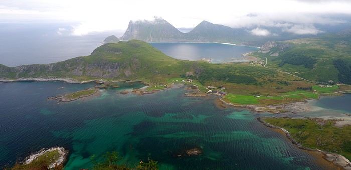
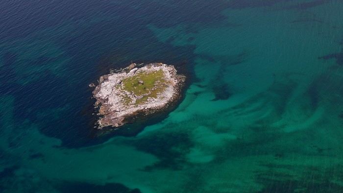
Summary: 436 m elevation gain, 2.5 hours round trip including a picnic break. It’s easy to see why it’s so popular—the effort-to-reward ratio is definitely in favor of the latter.
In the early afternoon, we head to our second hike of the day: the one that takes us to the Mannen summit. Watch out—all the nearby parking spots are paid. Even the local farmers are cashing in on the situation by charging tourists. One of them even tried (and failed) to charge us 10 € just for making a simple U-turn. Situations like this make me do the opposite of what’s expected, even if it means a few extra hundred meters of walking…
Back to the hike itself: We walk along Haukland Beach, then start a gentle climb before turning north (to our left) onto the trail. The summit is at 390 m, and the last stretch follows a ridge. We didn’t get the long-distance views I’ve seen on some sites, but given the weather, we can’t complain. Haukland Beach with the Mannen summit looking pretty socked in:
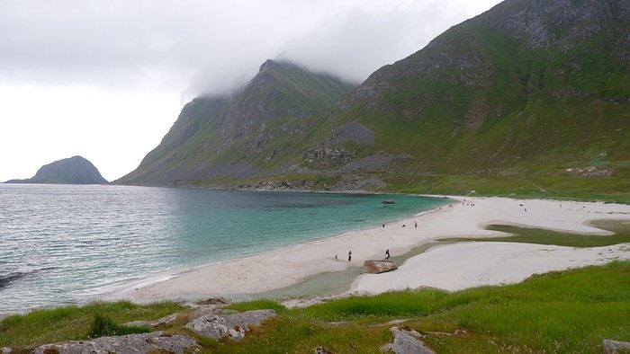
At the summit: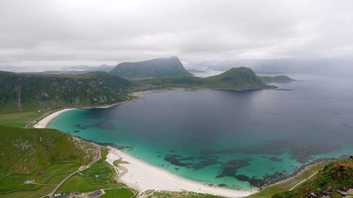
The clouds stuck around on the way down, and things didn’t improve:
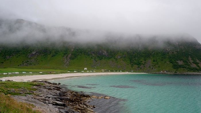
Summary: We took 2.5 hours—it was supposed to be crowded, but today’s weather must’ve kept some hikers away.
We take advantage of a good downpour to duck into a really nice beachside bar with big picture windows, offering a great view. Tonight, we’ll camp on a small road near Eggum to be closer for tomorrow’s hike.
Today’s first hike will take us to the summit of Offersøykammen. Parking is pretty straightforward—there’s a large lot along the E10 called the Skreda area. The actual trailhead is 600 meters from this parking spot. Instead of walking along the busy E10, it’s better to take the small road to the right that leads to Lofoten Base Camp, then cross over when you’re facing the trailhead sign.
Our expectation for the day: We figured this hike would be pretty low-key, so we wouldn’t run into many people…
A few minutes later, looking back, we could already see we’d climbed quite a bit from Lofoten Base Camp:
Once past the tree line, we hit a very rocky section that kept us climbing just as much. And we were surprised to find quite a few people ahead of us, either going up or coming down from the summit. The Scandinavians (who were the majority) aren’t fooled—this summit is accessible in a relatively short but intense time and is pretty stunning, even with overcast weather.
In the distance, you can see Haukland Beach and the Mannen summit, where we’ll head next:
Summary: 436 m elevation gain, 2.5 hours round trip including a picnic break. It’s easy to see why it’s so popular—the effort-to-reward ratio is definitely in favor of the latter.
In the early afternoon, we head to our second hike of the day: the one that takes us to the Mannen summit. Watch out—all the nearby parking spots are paid. Even the local farmers are cashing in on the situation by charging tourists. One of them even tried (and failed) to charge us 10 € just for making a simple U-turn. Situations like this make me do the opposite of what’s expected, even if it means a few extra hundred meters of walking…
Back to the hike itself: We walk along Haukland Beach, then start a gentle climb before turning north (to our left) onto the trail. The summit is at 390 m, and the last stretch follows a ridge. We didn’t get the long-distance views I’ve seen on some sites, but given the weather, we can’t complain. Haukland Beach with the Mannen summit looking pretty socked in:
At the summit:
The clouds stuck around on the way down, and things didn’t improve:
Summary: We took 2.5 hours—it was supposed to be crowded, but today’s weather must’ve kept some hikers away.
We take advantage of a good downpour to duck into a really nice beachside bar with big picture windows, offering a great view. Tonight, we’ll camp on a small road near Eggum to be closer for tomorrow’s hike.
Wandering on Senja Island and the Lofoten Archipelago
Thursday, July 24:
From Nesland to Nusfjord: Statistically speaking, 12 consecutive days of blue skies was pure fantasy. What had to happen, happened—today the sky is overcast. We opt for a hike close to the water, following the coast between Nesland and Nusfjord. The starting point, Nesland, looks more like a hamlet scattered with houses than a village:
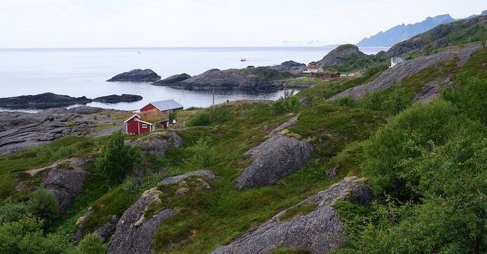
The advantage of starting from this village is that the parking is free and empty today. Even though the sky is gray, visibility isn’t bad at all. Contrary to what we might have imagined, the hike is pretty confusing because so many obvious paths have been worn into the ground by successive walkers that we sometimes end up turning back to find the main trail.
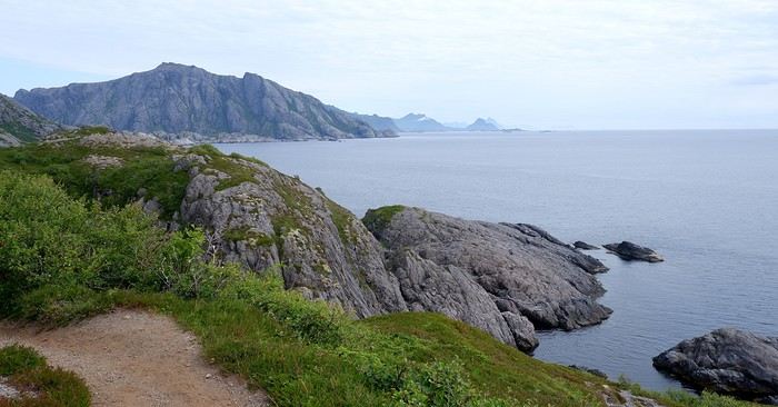
Good news: the sky is clearing up...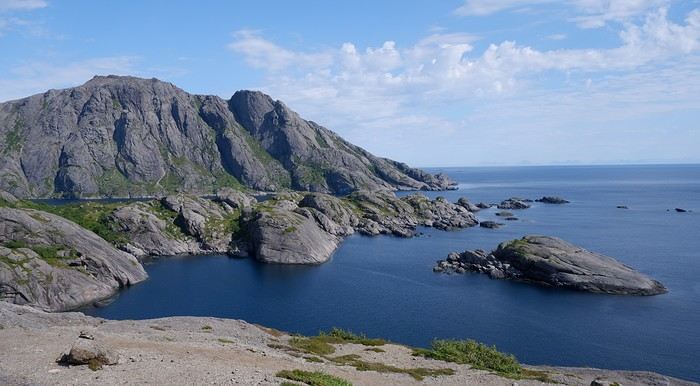
We have a picnic along the way, scanning the sea since it’s not uncommon to spot some marine mammals—but no luck this time. We approach the (small) town of Nusfjord, spotting a few well-placed *rorbuers* that blend right into the scenery:
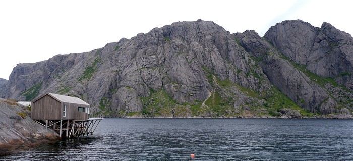
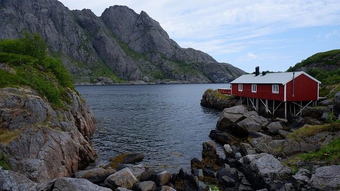
Nusfjord is a real open-air museum. Some houses display objects, paintings, and explanatory panels about the history of fishing. One house even has a cinema room showing archival footage. All the entries are free.
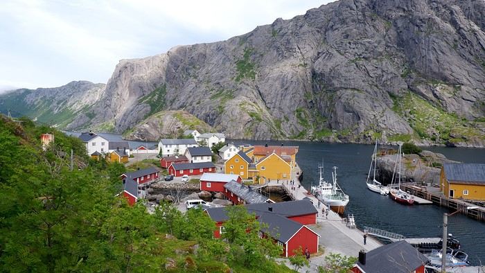
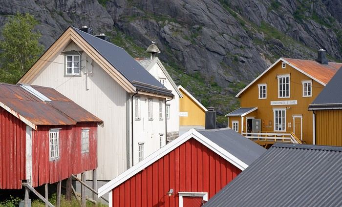
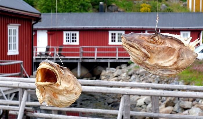
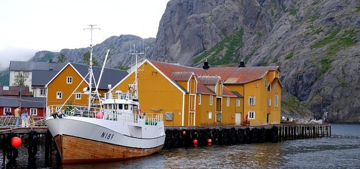
Before leaving, we stop at the Landhandleriet café, which sits in the middle of a small square, and take the opportunity to grab a bite. On the way back to Nesland, we get different views. The sun joins in and gives us some lovely light:
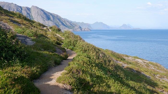
Summary: The hike was supposed to take 4 hours, but we ended up taking 7.5 hours with all the breaks, visiting Nusfjord, and the few detours in the morning. Elevation gain: 490 m, including a section with big rocks to negotiate and a 7–8 m high ladder. The hike doesn’t offer any breathtaking aerial views, but the village of Nusfjord is definitely worth a visit and has a great aesthetic. To wrap up, there were quite a few people in Nusfjord (many arrive on organized tours), but it was still very manageable. On the hiking trail, though, we only crossed paths with about 10 people max. Which we didn’t mind at all! Tonight, we’re spending a second night at Lofoten Beach Camp. The sky clouds over again in the evening, and for the first time since arriving in Norway, we eat under the shelter next to the campsite kitchen. As always, more details about this day—maps, GPX track, photos, etc.—on my post here: From Nesland to Nusfjord
From Nesland to Nusfjord: Statistically speaking, 12 consecutive days of blue skies was pure fantasy. What had to happen, happened—today the sky is overcast. We opt for a hike close to the water, following the coast between Nesland and Nusfjord. The starting point, Nesland, looks more like a hamlet scattered with houses than a village:
The advantage of starting from this village is that the parking is free and empty today. Even though the sky is gray, visibility isn’t bad at all. Contrary to what we might have imagined, the hike is pretty confusing because so many obvious paths have been worn into the ground by successive walkers that we sometimes end up turning back to find the main trail.
Good news: the sky is clearing up...
We have a picnic along the way, scanning the sea since it’s not uncommon to spot some marine mammals—but no luck this time. We approach the (small) town of Nusfjord, spotting a few well-placed *rorbuers* that blend right into the scenery:
Nusfjord is a real open-air museum. Some houses display objects, paintings, and explanatory panels about the history of fishing. One house even has a cinema room showing archival footage. All the entries are free.
Before leaving, we stop at the Landhandleriet café, which sits in the middle of a small square, and take the opportunity to grab a bite. On the way back to Nesland, we get different views. The sun joins in and gives us some lovely light:
Summary: The hike was supposed to take 4 hours, but we ended up taking 7.5 hours with all the breaks, visiting Nusfjord, and the few detours in the morning. Elevation gain: 490 m, including a section with big rocks to negotiate and a 7–8 m high ladder. The hike doesn’t offer any breathtaking aerial views, but the village of Nusfjord is definitely worth a visit and has a great aesthetic. To wrap up, there were quite a few people in Nusfjord (many arrive on organized tours), but it was still very manageable. On the hiking trail, though, we only crossed paths with about 10 people max. Which we didn’t mind at all! Tonight, we’re spending a second night at Lofoten Beach Camp. The sky clouds over again in the evening, and for the first time since arriving in Norway, we eat under the shelter next to the campsite kitchen. As always, more details about this day—maps, GPX track, photos, etc.—on my post here: From Nesland to Nusfjord
Exploring Senja Island and the Lofoten Archipelago
Wednesday, July 23:
We’ve got another azure-blue sky today, and according to the local forecast, it’ll most likely be the last one. So, we’re planning another full-day hike that doesn’t start too far from a place called Marka. From the Moskenes campsite, we pass by the village of Hamnøy again and stop at the “Lofoten Bakeri” bakery, where three pistachio rolls (better than the cinnamon ones, in our opinion) will round out our breakfast. We take the opportunity to snap a few more photos before hitting the road:
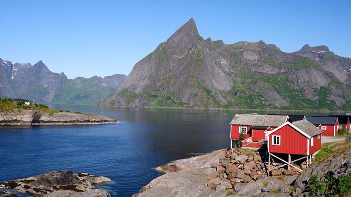
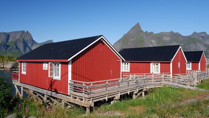
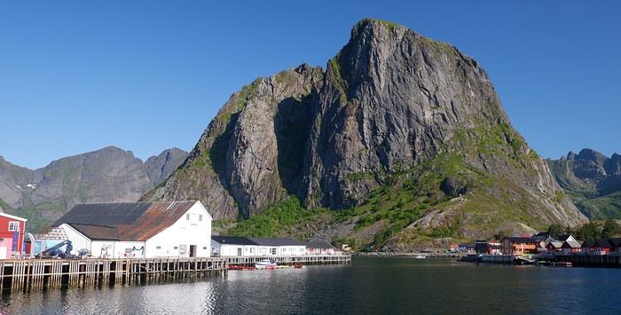
After running a few errands, it’s time to tackle today’s hike, where we’re hoping to have a picnic with a stunning viewpoint—it’s the Kvalvika hike. There are two possible starting points for this hike: either the Torsfjorden parking lot or the one at Marka. The first was full, so we set off from the second. That worked out well since it was our original plan anyway. To do a loop without backtracking, we’ll have to walk 4 km along the road. Since it’s barely trafficked, it’s not really an issue... We start the hike at 11:15 AM. At the beginning, the landscape is classic mountain terrain—it feels like we’re hiking at 1,500 meters above sea level, even though we’re only a few meters above it:
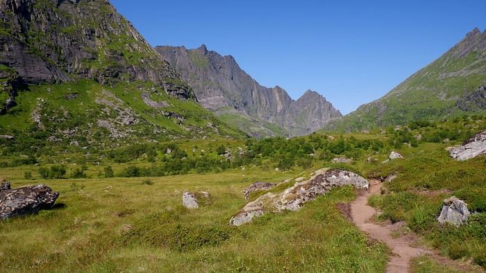
Next, we reach the edge of a high-altitude lake called Agotvanet. The trail skirting it on the right is quite rocky, making progress relatively slow.
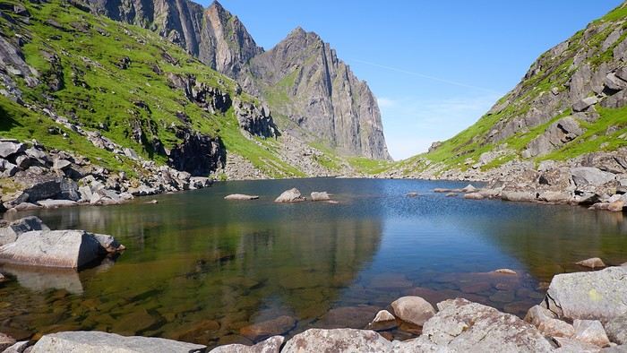
Though the walking isn’t easy on this stretch, the path is clear, and we know that once we get past it, a gorgeous view of Vestervika Beach awaits...
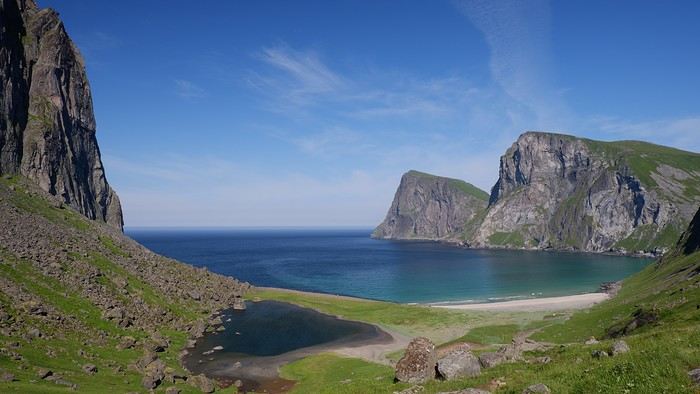
The arrival at this much-anticipated view lives up to our expectations, and we quickly notice the beach is completely deserted. Since it’s already early afternoon, the spot seems perfect for a picnic.
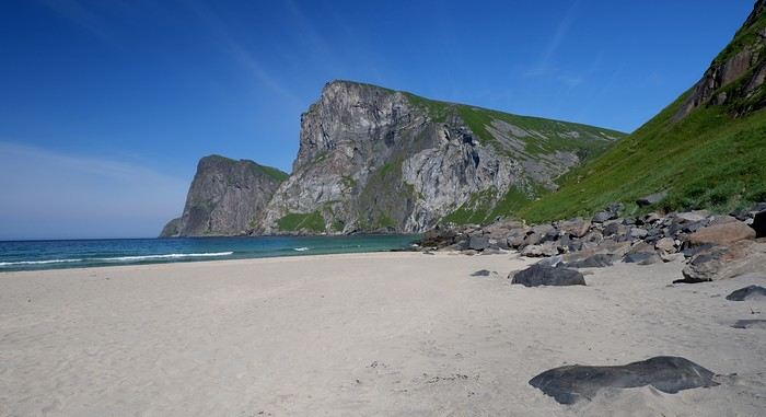
We continue toward the second beach of the day, but the route isn’t as easy as it seems—we have to cross “Cow’s Hell.” We first try going over the top, but a steep drop discourages us. So, we cross near the beach, helped by a chain anchored to the rock. After this tricky passage, we spot Nordvika Beach:
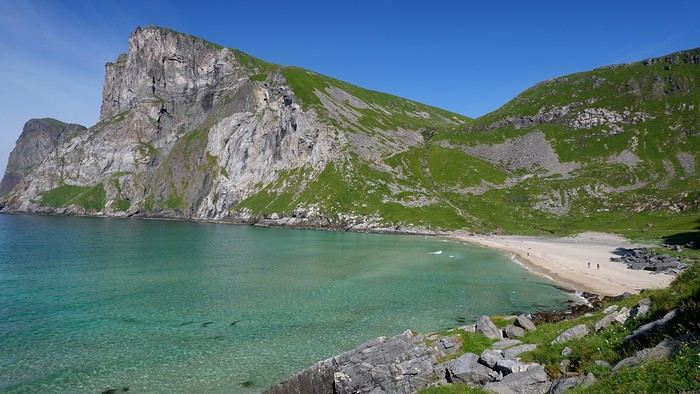
Just as beautiful but a bit busier, since the access from the first parking lot is easier, of course. Across from us, the summit of Ryten (543m) is also the focus of a great hike, but to avoid backlighting, it’s best to do it in the morning. After a break and a dip (yes, really...) in the crystal-clear water, we slowly make our way back down to the first parking lot. To avoid some muddy sections, improvements have been made:
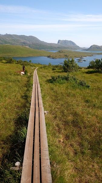
When we get back to the car, it’s 5:30 PM. So, the loop took us 6 hours with 360 meters of elevation gain. Another enchanting hike in a varied natural setting. The Lofoten Islands in the sun bring out the superlatives, and we’re almost running out of them. We take a few more shots near our parking spot before leaving:
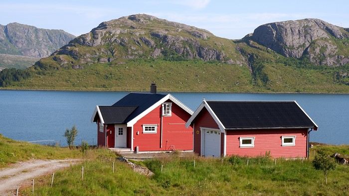
More info on this page if you're interested: Kvalvika
We’ve got another azure-blue sky today, and according to the local forecast, it’ll most likely be the last one. So, we’re planning another full-day hike that doesn’t start too far from a place called Marka. From the Moskenes campsite, we pass by the village of Hamnøy again and stop at the “Lofoten Bakeri” bakery, where three pistachio rolls (better than the cinnamon ones, in our opinion) will round out our breakfast. We take the opportunity to snap a few more photos before hitting the road:
After running a few errands, it’s time to tackle today’s hike, where we’re hoping to have a picnic with a stunning viewpoint—it’s the Kvalvika hike. There are two possible starting points for this hike: either the Torsfjorden parking lot or the one at Marka. The first was full, so we set off from the second. That worked out well since it was our original plan anyway. To do a loop without backtracking, we’ll have to walk 4 km along the road. Since it’s barely trafficked, it’s not really an issue... We start the hike at 11:15 AM. At the beginning, the landscape is classic mountain terrain—it feels like we’re hiking at 1,500 meters above sea level, even though we’re only a few meters above it:
Next, we reach the edge of a high-altitude lake called Agotvanet. The trail skirting it on the right is quite rocky, making progress relatively slow.
Though the walking isn’t easy on this stretch, the path is clear, and we know that once we get past it, a gorgeous view of Vestervika Beach awaits...
The arrival at this much-anticipated view lives up to our expectations, and we quickly notice the beach is completely deserted. Since it’s already early afternoon, the spot seems perfect for a picnic.
We continue toward the second beach of the day, but the route isn’t as easy as it seems—we have to cross “Cow’s Hell.” We first try going over the top, but a steep drop discourages us. So, we cross near the beach, helped by a chain anchored to the rock. After this tricky passage, we spot Nordvika Beach:
Just as beautiful but a bit busier, since the access from the first parking lot is easier, of course. Across from us, the summit of Ryten (543m) is also the focus of a great hike, but to avoid backlighting, it’s best to do it in the morning. After a break and a dip (yes, really...) in the crystal-clear water, we slowly make our way back down to the first parking lot. To avoid some muddy sections, improvements have been made:
When we get back to the car, it’s 5:30 PM. So, the loop took us 6 hours with 360 meters of elevation gain. Another enchanting hike in a varied natural setting. The Lofoten Islands in the sun bring out the superlatives, and we’re almost running out of them. We take a few more shots near our parking spot before leaving:
More info on this page if you're interested: Kvalvika
Exploring Senja Island and the Lofoten Archipelago
Hi Muriel,
Yes, gloomy weather—even when you're prepared for it in these parts—can really affect how we feel. Especially since this area is best explored by hiking, and what’s more, at high altitudes to take in all those viewpoints.
Yes, gloomy weather—even when you're prepared for it in these parts—can really affect how we feel. Especially since this area is best explored by hiking, and what’s more, at high altitudes to take in all those viewpoints.
Roaming around Senja Island and the Lofoten Archipelago
Thanks Nathalie for stopping by this travel journal.