Results for "parapente+|+3+>+98"
1947 results found.
Infirmière sur l'île de la Réunion English translation pending
Bonjour à tous
Pour le mois d'octobre je serais sur l'île de la reunion. Trouver un boulot d'infirmière n'est apparemment pas trop difficile surtout que je suis ouverte à tous les services et également libéral. J'ai vu pas mal de job sur Saint Paul. Est ce une ville agréable à vivre, pour y travailler, pour trouver une voiture, un logement et des amis.... Faites moi part de vos expériences et si vous avez un logement à me proposer pour octobre, ça peut m'intéresser! Merci A bientôt 😛
Itinéraire et astuce entre Montpellier et Barcelone à vélo? English translation pending
Bonjour à tous!
Je prévois de réaliser une virée à vélo pour mi-juillet, départ de Montpellier (voir Perpignan) jusqu´a Barcelone. Je compte rouler environ 60 km par jour, ayant une vingtaine de jours a ma disposition de facon a profiter du chemin et des rencontres; munie de quoi dormir dans un camping ou dans le champ d´un paysan charitable... Si quelqu´un pouvait donc m´indiquer un itinéraire agréable longant la côte et offrant des routes et des paysages agréables... Je vous en remercie d´avance.
Oliver
Je prévois de réaliser une virée à vélo pour mi-juillet, départ de Montpellier (voir Perpignan) jusqu´a Barcelone. Je compte rouler environ 60 km par jour, ayant une vingtaine de jours a ma disposition de facon a profiter du chemin et des rencontres; munie de quoi dormir dans un camping ou dans le champ d´un paysan charitable... Si quelqu´un pouvait donc m´indiquer un itinéraire agréable longant la côte et offrant des routes et des paysages agréables... Je vous en remercie d´avance.
Oliver
Ascension du Jbel Toubkal (Maroc) English translation pending
Bonjour à tous,
Je compte faire l'ascension du Toubkal avec un ami vers la mi-juin. Je souhaiterais la faire sans guide et savoir si il est possible de la faire en une journée pour personne assez endurante. Ca m'étonnerait étant donné qu'il s'agit d'un 4000 mais je demande quand même (on sait jamais).
Et où est ce que je pourrais me procurer une carte détaillé à Marrakech?
Merci d'avance!
Je compte faire l'ascension du Toubkal avec un ami vers la mi-juin. Je souhaiterais la faire sans guide et savoir si il est possible de la faire en une journée pour personne assez endurante. Ca m'étonnerait étant donné qu'il s'agit d'un 4000 mais je demande quand même (on sait jamais).
Et où est ce que je pourrais me procurer une carte détaillé à Marrakech?
Merci d'avance!
Tour de l'île de la Réunion English translation pending
bonjour,
nous avons decidé de faire le tour de l'ile de la reunion, nous recherchons quelques conseils pour organiser notre voyage. savez vous si la vie est chère ?
en attente de vos réponse
cordialement
sandra
nous avons decidé de faire le tour de l'ile de la reunion, nous recherchons quelques conseils pour organiser notre voyage. savez vous si la vie est chère ?
en attente de vos réponse
cordialement
sandra
Trek de l'ascension du Toubkal en autonomie (Maroc) English translation pending
Salut à tous!!!
Voilà avec mon amie, nous partons au maroc du 6 au 13 mai 2008, ne connaissant pas la région de l'atlas nous avons décidé de tenter l'ascension du mont Toubkal depuis Imlil, mais sans guide ni muletier juste en binôme, nous sommes bien equipés niveau carte et materiel et avons l'habitude de la haute montagne, d'apres ce que j'ai lu, la plupart d'entre vous a deja realisé cette rando mais souvent organisé par l'intermediaire de guides depuis imlil ou ailleurs! D'où ma question est ce que quelqu'un a déjà tenté cette aventure sans guide ni muletier? le balisage de la piste est il correct? faut il reserver au refuge du Toubkal avant de s'y rendre (au mois de mai) et enfin derniere question à cette periode de l'année, est il possible de rencontrer de la neige sur les versants du Toubkal (histoire qu'on prévoit le materiel adèquat, piolets, crampons......mais s'il n'etait pas necessaire, pour eviter de se le trimballer pour rien...) Voilà toutes vos experiences sont bonnes à prendre, ainsi que vos conseils sur d'autres trekks dans la région, on aimerait marcher 3-4 jours dans cette région donc si vous avez de bonnes alternatives, nous sommes preneurs 😉, nous sommes juste arrêtés pour le moment sur l'ascension du Toubkal (qui d'apres mes recherches peut s'effectuer en 2 jours pour bons marcheurs).
Merci à vous
Voilà avec mon amie, nous partons au maroc du 6 au 13 mai 2008, ne connaissant pas la région de l'atlas nous avons décidé de tenter l'ascension du mont Toubkal depuis Imlil, mais sans guide ni muletier juste en binôme, nous sommes bien equipés niveau carte et materiel et avons l'habitude de la haute montagne, d'apres ce que j'ai lu, la plupart d'entre vous a deja realisé cette rando mais souvent organisé par l'intermediaire de guides depuis imlil ou ailleurs! D'où ma question est ce que quelqu'un a déjà tenté cette aventure sans guide ni muletier? le balisage de la piste est il correct? faut il reserver au refuge du Toubkal avant de s'y rendre (au mois de mai) et enfin derniere question à cette periode de l'année, est il possible de rencontrer de la neige sur les versants du Toubkal (histoire qu'on prévoit le materiel adèquat, piolets, crampons......mais s'il n'etait pas necessaire, pour eviter de se le trimballer pour rien...) Voilà toutes vos experiences sont bonnes à prendre, ainsi que vos conseils sur d'autres trekks dans la région, on aimerait marcher 3-4 jours dans cette région donc si vous avez de bonnes alternatives, nous sommes preneurs 😉, nous sommes juste arrêtés pour le moment sur l'ascension du Toubkal (qui d'apres mes recherches peut s'effectuer en 2 jours pour bons marcheurs).
Merci à vous
Vivre et travailler à Sainte Clotilde de la Réunion English translation pending
Bonjour,
SVP comment est la ville de Ste Clotilde?:belle, bonne à vivre, à y travailler, bonne ambiance, loisir, à prox. des plages, poluée, loyer coûteux, est ce qu'avec 2300E net de salaire mensuel, on peut bien y vivre?
Merci d'avance pour vos info. ANT1
Merci d'avance pour vos info. ANT1
Itinéraire Argentine-Paraguay-Bolivie English translation pending
bon, je continue à chercher comment organiser plus ou moins mon voyage en amérique du Sud
je me demande si je ne pourrais pas faire une sorte de boucle en partant de Bariloche en Argentine
mais comme je sais que les distances sont très grandes, j'ai besoin de votre avis pour savoir si c'est faisable ou si je vais m'épuiser dans les transports
et puis, je ne suis pas contre le fait de prendre l'avion une fois ou deux (dépend des prix) y'a peut-être des endroits où il vaut mieux prendre le bus pour le paysage?? et d'autres endroits où on ne loupe rien si on prend l'avion? je sais pas
voilà donc je pense faire (mais rien de sûr, je m'adapterai aussi à ce que la vie va mettre sur mon chemin)
Bariloche
Bahia Blanca ou Mar del plata? je sais pas si ça vaut le coup?
Buenos aires (2 jours)
Iguaçu (2 jours)
Asuncion (1 jours)
Sucre (1 jour)
Cochabamba (8 jours chez les indiens)
Potosi (1 jour)
Humahuaca (je voudrais y être pour le carnaval : 2 ou 3 jours?)
San Salvador de Jujuy
Salta
après, je sais pas : soit retour direct à Bariloche ? soit m'arréter ailleurs? faut aussi que j'appelle Nicobry pour en savoir plus et me faire une idée plus précise de ce que je peux faire
qu'en pensez-vous? j'ai souligné les endroits où je veux absolument me rendre
je voudrais faire ça en 3 semaines si possible(dont une que je passerai à Cochabamba) mais j'ai peur que ça fasse beaucoup
à voir, je vais sûrement réfléchir encore en fonction de vos réponses
je me demande si je ne pourrais pas faire une sorte de boucle en partant de Bariloche en Argentine
mais comme je sais que les distances sont très grandes, j'ai besoin de votre avis pour savoir si c'est faisable ou si je vais m'épuiser dans les transports
et puis, je ne suis pas contre le fait de prendre l'avion une fois ou deux (dépend des prix) y'a peut-être des endroits où il vaut mieux prendre le bus pour le paysage?? et d'autres endroits où on ne loupe rien si on prend l'avion? je sais pas
voilà donc je pense faire (mais rien de sûr, je m'adapterai aussi à ce que la vie va mettre sur mon chemin)
Bariloche
Bahia Blanca ou Mar del plata? je sais pas si ça vaut le coup?
Buenos aires (2 jours)
Iguaçu (2 jours)
Asuncion (1 jours)
Sucre (1 jour)
Cochabamba (8 jours chez les indiens)
Potosi (1 jour)
Humahuaca (je voudrais y être pour le carnaval : 2 ou 3 jours?)
San Salvador de Jujuy
Salta
après, je sais pas : soit retour direct à Bariloche ? soit m'arréter ailleurs? faut aussi que j'appelle Nicobry pour en savoir plus et me faire une idée plus précise de ce que je peux faire
qu'en pensez-vous? j'ai souligné les endroits où je veux absolument me rendre
je voudrais faire ça en 3 semaines si possible(dont une que je passerai à Cochabamba) mais j'ai peur que ça fasse beaucoup
à voir, je vais sûrement réfléchir encore en fonction de vos réponses
Pérou-Bolivie: itinéraire de six semaines English translation pending
Bonjouur à toutes t à tous,
Nous partons pour 6 semaines toute la famille (2 enfants de 13 et 15 ans) et aimerions avoir des commentaires sur notre itinéraire Pérou-Bolivie du 1 juillet au 12 août.
Est-il réaliste pour nous 4 ou trop ambitieux? Aussi tous conseils concernant le voyage avec ados et ou sur les choix de sites ou régions à visiter seraient apréciés.
Alors voici :
J. 1-2 Lima Visite sommaire de la ville Miraflores Visite de l’église et le monastère de San Francisco Cathédrale – Musée Pedro de Osma et musée national de Antropologia
J. 3-4 En route vers Ica (5h) Musée régional Laguna de Huacachina (couché à Huacachina)
J. 5-6 En route vers Nazca Excursion au cimetière de momies de Chauchilla Lignes de Nazca
J. 7-8-9 Aréquipa Monasterio Santa Catalina La Compagnia
J. 10-11 Le canyon de colca
J. 12 Arequipa vers Puno (5h) Visite sommaire de la ville
J. 13 Puno La catédrale
J. 13-14 Ile Taquile
J. 15 Puno vers Copacabana (Bolivie) (7h)
J. 16-17 Copacabana vers La Paz (3h)
J. 18 La Paz
J. 19-20 Sucre Los Museos universatario Le couvent et l’église de la Recoleta
J. 21 Sucre vers Potosi
J. 22 Potosi La visite des mines
J. 23 Potosi vers Uyuni (6h) bus de jour
J. 24-25 Uyuni J. 25–26–27–28 Le Salar et le sud Lipez Tupiza – S – Juan
J. 29 Tupiza vers Cochabamba (avion)
J. 30 Cochabamba
J. 31 Cochabamba Rurrenabaque (avion)
J. 32-33-34 Rurrenabaque
J. 35 Rurrenabaque La Paz (avion)
J. 36-37 Puno – Sillustani (pérou)
J. 38-39-40- Cuzco – Pisac – Machu – Picchy
J. 42 Lima - retour
Nous partons pour 6 semaines toute la famille (2 enfants de 13 et 15 ans) et aimerions avoir des commentaires sur notre itinéraire Pérou-Bolivie du 1 juillet au 12 août.
Est-il réaliste pour nous 4 ou trop ambitieux? Aussi tous conseils concernant le voyage avec ados et ou sur les choix de sites ou régions à visiter seraient apréciés.
Alors voici :
J. 1-2 Lima Visite sommaire de la ville Miraflores Visite de l’église et le monastère de San Francisco Cathédrale – Musée Pedro de Osma et musée national de Antropologia
J. 3-4 En route vers Ica (5h) Musée régional Laguna de Huacachina (couché à Huacachina)
J. 5-6 En route vers Nazca Excursion au cimetière de momies de Chauchilla Lignes de Nazca
J. 7-8-9 Aréquipa Monasterio Santa Catalina La Compagnia
J. 10-11 Le canyon de colca
J. 12 Arequipa vers Puno (5h) Visite sommaire de la ville
J. 13 Puno La catédrale
J. 13-14 Ile Taquile
J. 15 Puno vers Copacabana (Bolivie) (7h)
J. 16-17 Copacabana vers La Paz (3h)
J. 18 La Paz
J. 19-20 Sucre Los Museos universatario Le couvent et l’église de la Recoleta
J. 21 Sucre vers Potosi
J. 22 Potosi La visite des mines
J. 23 Potosi vers Uyuni (6h) bus de jour
J. 24-25 Uyuni J. 25–26–27–28 Le Salar et le sud Lipez Tupiza – S – Juan
J. 29 Tupiza vers Cochabamba (avion)
J. 30 Cochabamba
J. 31 Cochabamba Rurrenabaque (avion)
J. 32-33-34 Rurrenabaque
J. 35 Rurrenabaque La Paz (avion)
J. 36-37 Puno – Sillustani (pérou)
J. 38-39-40- Cuzco – Pisac – Machu – Picchy
J. 42 Lima - retour
Présentation de Mar del Plata en Argentine (ou le début d’un discret Eldorado?) English translation pending
Janvier 2007
M'sieurs, Dames, bonjour !
La ville balnéaire de Mar del Plata (Province de Buenos Aires), située à 404 kilomètres au Sud de Buenos Aires - Capital, sur l'océan Atlantique, compte une population permanente de +/- 600.000 habitants mais reçoit chaque année près de 6 millions de touriste (à majorité en provenance d'argentine). Pourquoi a-t-elle été jusqu'ici si peu connue ou visitée par des étrangers ? Une chose est certaine, cette ville appelée anciennement "le Deauville", "le Biarritz" ou le "San Sebastian" argentin, connait depuis deux ans un afflux d'investissements et de capitaux étrangers... et de ce fait les bonnes affaires se font de plus en plus rares !
Si le marché immobilier américain et européen sont pour le moment en berne ou en ralentissement, ici certains groupes économiques internationaux (notamment espagnols) profitent d'une politique de change favorable (euro > Dollar U.S.) pour y investir en masse, et l'État n'est pas en reste. Une nouvelle gare routière (bus) et ferroviaire (tout en un seul complexe) verra le jour (début des travaux février 2007). Un nouvel Hôtel 5 étoiles avec 220 chambres, 3 restaurants en hauteur, et un centre de convention d'une capacité de plus de 8.000 personnes se construiront durant les 3 prochaines années su l’avenida ALBERDI situé entre la municipalité et les plages. (Une avenue à retenir). Ce qui contribuera à confirmer la deuxième place au niveau national comme ville organisatrice de colloques et conventions.
Mais aussi la remise en état de quelques bâtiments classiques et historiques de Mar del Plata, comme : l'hôtel Provincial, l'institut Unzué (situé en se dirigeant vers le nord de la ville, sur le boulevard maritime à hauteur de la calle Rio Negro), accompagné de quelques travaux d'infrastructures telles que : la remise en état des plages et la construction de digues (au nord de l'avenida Constitución jusqu'au parc Camet), … (Impossible ici de tout énumérer).
J’allais oublier …le projet d'une ligne de train grande vitesse qui mettrait Mar del Plata à 2h30 / 3 heures de Buenos Aires Capital ; Un rêve ? Non une réalité, l'État a reçu des propositions concrètes d'investisseurs privés étrangers ! Une aubaine qui a de quoi faire rêver plus d'un gouvernement ...
Aujourd'hui la crise est archivée, et comme tout pays qui sort d'une grande crise... son économie va à fond la caisse.
(Ma) Conclusion :
Si Mar del Plata est très prisée des touristes, elle est surtout à vivre tout le reste de l’année.
Si vous évitez les périodes d’affluence, cette ville est un régal, car vous bénéficiez des infrastructures, avec la foule en moins. C’est pour cela aussi qu’elle est appelée par les Argentins « La Ciudad Feliz » (la ville heureuse), car bon nombre de retraités y vivent en y savourant l’arrière saison (un peu comme Nice, il y a peu).
Par infrastructure, j’entends : transports urbains, de très nombreuses liaisons vers Buenos-Aires capital, nombreux commerces de proximité, théâtres, cinémas et festivals (ciné, livres, gastronomie, etc), …Sans parler de ses nombreux restaurants où l’on y mange à gogo pour pas cher (hors saison c’est encore moins cher).
Mais pour les dynamiques (jeunes et moins jeunes) il y a aussi toutes les possibilités de sports : Surf, parapente, golf, pêche, …
Le pied, quoi. Mais Chuuuut, ne le dites à personne 😉
Pour les voyageurs de V.F. :
Distances de Mar del Plata. Buenos Aires 404 Km. Resistencia 1.473 Km. Catamarca 1.145 Km. Río Gallegos 2.510 Km. Claromecó 313 Km. San Bernardo 194 Km. Córdoba 1.120 Km. San Luis 1.333 Km. Corrientes 1.445 Km. Salta 2.017 Km. Formosa 1.695 Km. San Clemente 234 Km. Jujuy 2.114 Km. Sta. Clara del Mar 18 Km. La Plata 363 Km. San Juan 1.529 Km. Mar de Ajó 190 Km. Santa Fé 879 Km. Mendoza 1.447 Km. Santa Rosa 746 Km. Miramar 45 Km. Santa Teresita 217 Km. Monte Hermoso 406 Km. Stgo. Del Estero 1.549 Km. Necochea 125 Km. Tucumán 1.714 Km. Neuquén 1.012 Km. Ushuaia 3.101 Km. Paraná 909 Km. Viedma 754 Km. Pinamar 134 Km. Villa Gesell 113 Km. Posadas 1.434 Km. Rawson 1.273 Km. Rosario 700 Km. Bon voyage 🙂
M'sieurs, Dames, bonjour !
La ville balnéaire de Mar del Plata (Province de Buenos Aires), située à 404 kilomètres au Sud de Buenos Aires - Capital, sur l'océan Atlantique, compte une population permanente de +/- 600.000 habitants mais reçoit chaque année près de 6 millions de touriste (à majorité en provenance d'argentine). Pourquoi a-t-elle été jusqu'ici si peu connue ou visitée par des étrangers ? Une chose est certaine, cette ville appelée anciennement "le Deauville", "le Biarritz" ou le "San Sebastian" argentin, connait depuis deux ans un afflux d'investissements et de capitaux étrangers... et de ce fait les bonnes affaires se font de plus en plus rares !
Si le marché immobilier américain et européen sont pour le moment en berne ou en ralentissement, ici certains groupes économiques internationaux (notamment espagnols) profitent d'une politique de change favorable (euro > Dollar U.S.) pour y investir en masse, et l'État n'est pas en reste. Une nouvelle gare routière (bus) et ferroviaire (tout en un seul complexe) verra le jour (début des travaux février 2007). Un nouvel Hôtel 5 étoiles avec 220 chambres, 3 restaurants en hauteur, et un centre de convention d'une capacité de plus de 8.000 personnes se construiront durant les 3 prochaines années su l’avenida ALBERDI situé entre la municipalité et les plages. (Une avenue à retenir). Ce qui contribuera à confirmer la deuxième place au niveau national comme ville organisatrice de colloques et conventions.
Mais aussi la remise en état de quelques bâtiments classiques et historiques de Mar del Plata, comme : l'hôtel Provincial, l'institut Unzué (situé en se dirigeant vers le nord de la ville, sur le boulevard maritime à hauteur de la calle Rio Negro), accompagné de quelques travaux d'infrastructures telles que : la remise en état des plages et la construction de digues (au nord de l'avenida Constitución jusqu'au parc Camet), … (Impossible ici de tout énumérer).
J’allais oublier …le projet d'une ligne de train grande vitesse qui mettrait Mar del Plata à 2h30 / 3 heures de Buenos Aires Capital ; Un rêve ? Non une réalité, l'État a reçu des propositions concrètes d'investisseurs privés étrangers ! Une aubaine qui a de quoi faire rêver plus d'un gouvernement ...
Aujourd'hui la crise est archivée, et comme tout pays qui sort d'une grande crise... son économie va à fond la caisse.
(Ma) Conclusion :
Si Mar del Plata est très prisée des touristes, elle est surtout à vivre tout le reste de l’année.
Si vous évitez les périodes d’affluence, cette ville est un régal, car vous bénéficiez des infrastructures, avec la foule en moins. C’est pour cela aussi qu’elle est appelée par les Argentins « La Ciudad Feliz » (la ville heureuse), car bon nombre de retraités y vivent en y savourant l’arrière saison (un peu comme Nice, il y a peu).
Par infrastructure, j’entends : transports urbains, de très nombreuses liaisons vers Buenos-Aires capital, nombreux commerces de proximité, théâtres, cinémas et festivals (ciné, livres, gastronomie, etc), …Sans parler de ses nombreux restaurants où l’on y mange à gogo pour pas cher (hors saison c’est encore moins cher).
Mais pour les dynamiques (jeunes et moins jeunes) il y a aussi toutes les possibilités de sports : Surf, parapente, golf, pêche, …
Le pied, quoi. Mais Chuuuut, ne le dites à personne 😉
Pour les voyageurs de V.F. :
Distances de Mar del Plata. Buenos Aires 404 Km. Resistencia 1.473 Km. Catamarca 1.145 Km. Río Gallegos 2.510 Km. Claromecó 313 Km. San Bernardo 194 Km. Córdoba 1.120 Km. San Luis 1.333 Km. Corrientes 1.445 Km. Salta 2.017 Km. Formosa 1.695 Km. San Clemente 234 Km. Jujuy 2.114 Km. Sta. Clara del Mar 18 Km. La Plata 363 Km. San Juan 1.529 Km. Mar de Ajó 190 Km. Santa Fé 879 Km. Mendoza 1.447 Km. Santa Rosa 746 Km. Miramar 45 Km. Santa Teresita 217 Km. Monte Hermoso 406 Km. Stgo. Del Estero 1.549 Km. Necochea 125 Km. Tucumán 1.714 Km. Neuquén 1.012 Km. Ushuaia 3.101 Km. Paraná 909 Km. Viedma 754 Km. Pinamar 134 Km. Villa Gesell 113 Km. Posadas 1.434 Km. Rawson 1.273 Km. Rosario 700 Km. Bon voyage 🙂
Golf en Thaïlande English translation pending
salut a tous
pouvez vous m'éclairer sur le golf en thailande? On m'a dit que c'est terrible et pas cher?
Avis sur circuit sud Pérou/Bolivie English translation pending
Bonjour à tous!
Voilà, ma moitié et moi même envisageons de partir du 28 juin au 28 juillet 2007. Je prépare actuellement le circuit grâce aux guides et aux conseils que je lis ici mais j'ai besoin d'aide.... 😕 Voici donc le détail:
1. Arrivée à Lima 2. Lima 3. Bus pour Pisco 4. Islas Ballestas + bus de nuit pour Arequipa 5. Arequipa 6 & 7. Randonnée alentour (d'ailleurs si vous avez quelques suggestions pour de bonnes ballades sans passer par une agence, sanchant que nous ne sommes pas des pro, je prends!) 8. Cuzco par avion 9. Cuzco 10. Cuzco & Sacsahuaman 11. Chinchero, Pisac, Ollantaytambo 12. Machu Picchu 13. Bus vers Puno 14. Île Taquile (ou Amantani) et îles flotantes 15. Bus pour Copacabana 16. Bus pour la Paz 17. La Paz 18. Bus pour Oruro 19. Bus de nuit pour Uyuni 20, 21, 22, 23: Salar & Sud Lipez 24. Bus pour Potosi 25. Potosi 26. Bus vers Sucre 27. Sucre 28. Bus vers La Paz 29. La Paz 30. Vol retour
Qu'en pensez-vous??? On voudrait faire plein de choses mais aussi avoir le temps de trainer un peu et de rencontrer des gens alors toute proposition de modification est la bienvenue: en ce qui concerne les moyens de transport utilisés, les étapes....
Merci d'avance pour vos précieux conseils!!!!!!!! 🙂
Voilà, ma moitié et moi même envisageons de partir du 28 juin au 28 juillet 2007. Je prépare actuellement le circuit grâce aux guides et aux conseils que je lis ici mais j'ai besoin d'aide.... 😕 Voici donc le détail:
1. Arrivée à Lima 2. Lima 3. Bus pour Pisco 4. Islas Ballestas + bus de nuit pour Arequipa 5. Arequipa 6 & 7. Randonnée alentour (d'ailleurs si vous avez quelques suggestions pour de bonnes ballades sans passer par une agence, sanchant que nous ne sommes pas des pro, je prends!) 8. Cuzco par avion 9. Cuzco 10. Cuzco & Sacsahuaman 11. Chinchero, Pisac, Ollantaytambo 12. Machu Picchu 13. Bus vers Puno 14. Île Taquile (ou Amantani) et îles flotantes 15. Bus pour Copacabana 16. Bus pour la Paz 17. La Paz 18. Bus pour Oruro 19. Bus de nuit pour Uyuni 20, 21, 22, 23: Salar & Sud Lipez 24. Bus pour Potosi 25. Potosi 26. Bus vers Sucre 27. Sucre 28. Bus vers La Paz 29. La Paz 30. Vol retour
Qu'en pensez-vous??? On voudrait faire plein de choses mais aussi avoir le temps de trainer un peu et de rencontrer des gens alors toute proposition de modification est la bienvenue: en ce qui concerne les moyens de transport utilisés, les étapes....
Merci d'avance pour vos précieux conseils!!!!!!!! 🙂
Visites sur l'Ile de la Réunion pour huit jours English translation pending
Bonjour
nous projetons de partir 15 jours.
8 jrs à la réunion pour "barouder" un peu
8 jrs à maurice pour plonger et farnienter.
Nous avons l'habitude de partir avec NF .... mais là, j'hésite ..... Quel endroit à la réunion ??? non loin de la mer et non loin des "sites touristiques" dans les terres.
Puis ensuite, Maurice mais là je pense que le choix de l'hôtel va être plus facile car en dehors de la plongée... nous ne pensons pas faire grand chose de plus.
Nous attendons donc vos avis pour la Réunion !!!
Merci
Nous avons l'habitude de partir avec NF .... mais là, j'hésite ..... Quel endroit à la réunion ??? non loin de la mer et non loin des "sites touristiques" dans les terres.
Puis ensuite, Maurice mais là je pense que le choix de l'hôtel va être plus facile car en dehors de la plongée... nous ne pensons pas faire grand chose de plus.
Nous attendons donc vos avis pour la Réunion !!!
Merci
Endroit sympathique et facile à retrouver à Bangkok pour rencontre English translation pending
ben voila j'ai crée un post pour une rencontre sur bangkok le 8 juillet qui est maintenant dans la section entre deux voyage> rencontre> "apero-rencontre le 8 juillet sur bangkok"
Seulement pour ceux qui veulent venir, je n'ai pas d'endroit à proposer car je ne connais RIEN. Je ne cherche pas a faire un doublon de l'autre post, mais si les résidents ou habitués pouvant m'indiquer un endroit sympa et facile à trouver (pour pouvoir parler et prendre un verre) ce serait sympa.
Je supprimerais ce post après ou le déplacera dans la bonne section si celle-ci n'est pas la bonne.
Toutes personnes qui est sur bangkok le 8 ou habitant sur place est bien sûr le bienvenu !
merci de vos bonnes adresses.
A+
Seulement pour ceux qui veulent venir, je n'ai pas d'endroit à proposer car je ne connais RIEN. Je ne cherche pas a faire un doublon de l'autre post, mais si les résidents ou habitués pouvant m'indiquer un endroit sympa et facile à trouver (pour pouvoir parler et prendre un verre) ce serait sympa.
Je supprimerais ce post après ou le déplacera dans la bonne section si celle-ci n'est pas la bonne.
Toutes personnes qui est sur bangkok le 8 ou habitant sur place est bien sûr le bienvenu !
merci de vos bonnes adresses.
A+
Les Saintes ou Bouillante en Guadeloupe English translation pending
Bonjour,
Je pars en guadeloupe 😎 en avril et j'hésite entre 2 destinations, que me conseillez vous? Les saintes ou bouillante? Je pars avec un organisme faire de la plongée.
De plus, qu'en est-il du chikungunya en Guadeloupe?
Merci
Lilicop.
Je pars en guadeloupe 😎 en avril et j'hésite entre 2 destinations, que me conseillez vous? Les saintes ou bouillante? Je pars avec un organisme faire de la plongée.
De plus, qu'en est-il du chikungunya en Guadeloupe?
Merci
Lilicop.
Koh Samui en ULM? English translation pending
Nous partons le 16 Mars pour 17 jours en Thaïlande la première semaine en circuit organisé …je sais !la honteeee « classique » mais c’est la premiére fois que nous allons en Taillande : Bangkok / Damnoen Saduak/ Palais Royal/ Ayuthaya/Sukhothai/Chiang Rai/Triangle d’Or/Chiang Mai/Mae Sae/retour à Bangkok.
Et la deuxiéme semaine …nous avons refusé Pattaya et avons demandé Koh Samui à l’ Hotel
Jungle Park.
Quelqu’un sait-il s’il y a un club d’ULM à SAMUI ou puis trouver les coordonnées?
Quelqu’un sait-il si on peut louer un bateau ou voilier pour faire du cabotage autour de l’ile, histoire de ne pas mourir d’avoir rêvé, mais de ne pas avoir osé le faire.
Merci à vous.😉
Dalat au Vietnam English translation pending
Beaucoup d'entre vous, par manque de temps, délaisse la ville de Dalat, parmi vos étapes de visite.
Pour ceux qui ont du temps, voici un aperçu de ce que vous pouvez attendre de voir, la ville la plus fleurie du monde. Une rose que vous achetez à Paris a une grande chance d'être cultivée dans cette ville.

Bon voyage
Pour ceux qui ont du temps, voici un aperçu de ce que vous pouvez attendre de voir, la ville la plus fleurie du monde. Une rose que vous achetez à Paris a une grande chance d'être cultivée dans cette ville.
Bon voyage
Budget pour un mois à Madagascar English translation pending
a tous ceux et celles qui sont partis à madagascar, quel budget me conseillez vous pour 1 mois d'aventure?
Bons plans pour l'Afrique du Sud? English translation pending
Bonjour,
Je suis résident au gabon, et veux partir les 15 derniers jours de 12/05 en afrique du sud. Je cherche à me poser ds un coin sympa et rayonner tout autour...
Quelqu'un a til des bons plans et des conseils???
Je suis résident au gabon, et veux partir les 15 derniers jours de 12/05 en afrique du sud. Je cherche à me poser ds un coin sympa et rayonner tout autour...
Quelqu'un a til des bons plans et des conseils???
Sports aériens en Thaïlande English translation pending
Attention : par "voler" je veux parler de la pratique des sports aériens 😉
Après le patinage, la sauna aux herbes dans un temple et la piscine de la guest-house, pour ceux qui souhaitent découvrir la Thaïlande sous un angle différent, il existe quelques aéro-clubs. Ce n'est pas la France où on trouve un terrain tous les 50 km, mais c'est le pays du Sud-Est asiatique où l'aviation générale est la plus développée.
Le plus important se trouve près de Chonburi : http://www.thaiflyingclub.com/ et il y en a un autre à Chiang Mai : http://www.cmflyingclub.com/
Si vous avez votre licence de pilote privé (PPL) à jour, vous pouvez faire un vol de lâché et ensuite vous ballader dans tous le pays et pratiquer ainsi votre phraséo anglaise. Si vous n'avez pas de licence, vous pouvez faire un baptême de l'air au cours duquel vous pourrez découvrir des paysages fabuleux.
Après le patinage, la sauna aux herbes dans un temple et la piscine de la guest-house, pour ceux qui souhaitent découvrir la Thaïlande sous un angle différent, il existe quelques aéro-clubs. Ce n'est pas la France où on trouve un terrain tous les 50 km, mais c'est le pays du Sud-Est asiatique où l'aviation générale est la plus développée.
Le plus important se trouve près de Chonburi : http://www.thaiflyingclub.com/ et il y en a un autre à Chiang Mai : http://www.cmflyingclub.com/
Si vous avez votre licence de pilote privé (PPL) à jour, vous pouvez faire un vol de lâché et ensuite vous ballader dans tous le pays et pratiquer ainsi votre phraséo anglaise. Si vous n'avez pas de licence, vous pouvez faire un baptême de l'air au cours duquel vous pourrez découvrir des paysages fabuleux.
Infos la route entre la France et le Népal? English translation pending
Bonjour à tous, Je suis actuellement en train de préparer un voyage en camionnette entre la France et le Népal. Nous passerons par l'Italie, la Croatie, la Serbie, le Montenegro, la Bulgarie, la Turquie, l'Iran, le Pakistan et l'Inde. Le départ est prévu pour le mois de septembre ou Octobre... Notre équipe rassemble pour l'instant 6 personnes: David, un artiste plastique qui a un projet humanitaire au Népal; Magalie et Jérémy, membres actifs de l'association Indreni qui s'occupe d'un orphelinat à Katmandou; Allen, un voyageur Algérien; et Alex, qui reviendra surement par l' autre coté de la terre; Ben, photographe. Il nous manque donc deux personnes pour que "le convoi de l'humanité" puisse lever l' encre. Avis donc, a toutes personnes ayant un projet humanitaire, de voyage ou d'étude, etc... contacter moi! (bourses possibles, si on s'y prend maintenant) La camionnette sera peinte de l'itinéraire pour que le contact puisse ce faire facilement avec les populations locales... Le master roule au diesel et est en exelent état... Merci a tous pour toutes infos et suggestions a propo d' un tel voyage...
Ville de Pune (Inde) English translation pending
Qq'un pourrait me dire si ça vaut la coup d'y aller ! Et c'est où exactement ?
Merci !!!!
Merci !!!!
Entre l'Alsace et la Provence English translation pending
Bonjour à tous,
Que me suggérez-vous pour passer de l'Alsace à la Provence ? Je cherche un itinéraire intéressant et suis hésitante.
De Paris (quelques jours) - Champagne (Reims et environs, Epernay) - Alsace (de Strasbourg à Colmar, route des vins) - ?? Suisse (Lauzanne, Genève), Franche-Comté pour Besançon ou retour sur Bourgogne pour Dijon et les vins ?? - Annecy (semble très intéressant), Mont-Blanc - Rhones-Alpes (pour Grenoble) - Alpes et Provence (pour presque tout !!)
Votre avis s.v.p.
Je suis attirée surtout par les beaux paysages et les villages typiques. Les villes m'intéressent lorsque les attraits touristiques ne devraient pas être manqués.
Aussi, le Mont Blanc (montés en téléphériques, Aiguille du Midi et Mer de Glace) est-il le meilleur endroit pour savourer une vision époustouflante des Alpes ? Est-ce trop touristique ?
Merci infiniement, Isabelle
Que me suggérez-vous pour passer de l'Alsace à la Provence ? Je cherche un itinéraire intéressant et suis hésitante.
De Paris (quelques jours) - Champagne (Reims et environs, Epernay) - Alsace (de Strasbourg à Colmar, route des vins) - ?? Suisse (Lauzanne, Genève), Franche-Comté pour Besançon ou retour sur Bourgogne pour Dijon et les vins ?? - Annecy (semble très intéressant), Mont-Blanc - Rhones-Alpes (pour Grenoble) - Alpes et Provence (pour presque tout !!)
Votre avis s.v.p.
Je suis attirée surtout par les beaux paysages et les villages typiques. Les villes m'intéressent lorsque les attraits touristiques ne devraient pas être manqués.
Aussi, le Mont Blanc (montés en téléphériques, Aiguille du Midi et Mer de Glace) est-il le meilleur endroit pour savourer une vision époustouflante des Alpes ? Est-ce trop touristique ?
Merci infiniement, Isabelle
Accommodation in Pokhara
Hi everyone!
I’m planning a short visit to Pokhara around mid-February 2027 (it’ll be my 4th time in Nepal 😊, over 40 years!). I’d like to book a room in advance rather than looking when I arrive. I’ve checked a bit on Bxxking.com and see lots of options. I’m used to scoping out the surroundings of places listed, just to avoid ending up in areas that are either unappealing or far from everything.
So, I see quite a few offers around the lake (Lakeside?), but every time I check what it looks like, the streets seem really uninviting. It’s kind of like a construction site with buildings everywhere… Nothing like Bhaktapur (for example) or even Thamel, where the streets seem way more pleasant.
Could anyone give me some advice?
Also, I don’t really get the impression that Pokhara is worth a visit of several days. The lake, sure, but once you’ve seen it—what else is there?
I’m planning a short visit to Pokhara around mid-February 2027 (it’ll be my 4th time in Nepal 😊, over 40 years!). I’d like to book a room in advance rather than looking when I arrive. I’ve checked a bit on Bxxking.com and see lots of options. I’m used to scoping out the surroundings of places listed, just to avoid ending up in areas that are either unappealing or far from everything.
So, I see quite a few offers around the lake (Lakeside?), but every time I check what it looks like, the streets seem really uninviting. It’s kind of like a construction site with buildings everywhere… Nothing like Bhaktapur (for example) or even Thamel, where the streets seem way more pleasant.
Could anyone give me some advice?
Also, I don’t really get the impression that Pokhara is worth a visit of several days. The lake, sure, but once you’ve seen it—what else is there?
Come discover the island of Madeira with me
Introduction
We arrived on the island of Madeira (Portugal) at the beginning of May 2023 and stayed for 5 weeks.
This island is renowned for its rich cultural heritage, its famous hikes through lush landscapes, and its seaside resorts. It offers an unforgettable experience for nature lovers.
In this travel journal, you’ll find a list of the many activities we did during our stay to explore the different attractions of this magnificent island.
These attractions are categorized to make it easier to search based on your interests, if needed.
Videos are included throughout the summary. Please click on the image to start the video.
To jump to a specific post, here are the appropriate links:
HIKES:
Calheta - PR19 Caminho Real do Paúl do Mar Santana - Ribeiro Frio - PR11 Vereda dos Balcões Sao Vicente - Gingas - PR16 Levada Fajã do Rodrigues Rabaçal - PR6.1 Levada do Risco & PR6 Levada das 25 fontes Rabaçal - PR6.2 Levada do Alecrim & PR6.3 Vereda da Lagoa do Vento Caniçal - PR8 Vereda da Ponta de São Lourenço São Jorge - PR18 Levada do Rei Ponta do Sol - PR7 modified - Levada Nova & Levada do Moinho Machico - PR5 Vereda das Funduras Funchal - PR1 Vereda do Areeiro (Pico do Areeiro to Pico Ruivo) Funchal - PR1 Vereda do Areeiro (Pico Ruivo to Pico do Areeiro) Funchal - PR1.2 Vereda do Pico Ruivo (outbound) Funchal - PR1.2 Vereda do Pico Ruivo (return) Porto Moniz - Fanal Forest Porto Moniz - PR14 Levada dos Cedros Ribeira Brava - PR17 Caminho do Pináculo e Folhadal (Encumeada) Ribeira Brava - PR17 Caminho do Pináculo e Folhadal (Lombo do Mouro) Ribeira Brava - PR17 Caminho do Pináculo e Folhadal (Bica da Cana) Santana - PR9 Levada do Caldeirão Verde Lamaceiros - Levada Ribeira da Janela Ribeiro Frio - PR10 Levada do Furado Tabua - Levada da Nova (Eastern Sector) Tabua - Levada da Nova (Western Sector) Boa Morte - Levada do Norte Verada da Levada do Facho - Levada do Norte (South) Vale Paraiso - Levada da Serra do Faial Porto Moniz - PR13 Vereda do Fanal Referta - Levada do Castelejo Porto da Cruz - Levada do Castelejo Estanquinhos - Pico Ruivo do Paul da Serra Boaventura - Levada de Cima & Levada da Acha Grande
SEASIDE RESORTS & NATURAL POOLS:
Natural pools of Seixal Seixal Naval Club Seaside Resort - Natural pool Natural pools of Porto Moniz Funchal - Lido Seaside Resort Santana - Foz da Ribeira do Faial Seaside Resort Câmara de Lobos - Salinas Seaside Resort Porto Moniz - Aquário/Cachalote Natural Pools Funchal - Doca do Cavacas Seaside Resort Funchal - Ponta Gorda Seaside Resort Caniço - Roca Mar Hotel Seaside Resort Caniço - Lido Galoma Seaside Resort Calhau de São Jorge Seaside Resort Ribeira Brava Seaside Resort
BEACHES:
São Jorge Beach Calheta Beach Seixal - Laje Beach (Jamaica) Porto de Seixal Beach Caniço - Reis Magos Beach Machico - Machico Beach (Banda d'Além) Machico - São Roque Beach Machico - Ribeira Natal Beach Caniçal - Prainha Beach Porto da Cruz - Alagoa Beach
TOWNS:
Stroll through the town of Ponta do Sol Stroll through the town of Câmara de Lobos Stroll through the town of Ribeira Brava Stroll through the town of Funchal Funchal - Wicker toboggan ride Stroll through the town of Machico Stroll through the town of Santana Stroll through the town of São Vicente São Vicente Caves Park
VIEWPOINTS:
Calheta Region Ponta do Sol Region Ribeira Brava Region Câmara de Lobos Region Funchal Region Santa Cruz Region Porto Moniz Region São Vicente Region Santana Region Machico Region On the road in Madeira
WATERFALLS ALONG THE WAY
Ponta do Sol - Anjos Waterfall Sao Vicente - Água d'Alto Waterfall Seixal - Córrego da Furna Waterfall
We arrived on the island of Madeira (Portugal) at the beginning of May 2023 and stayed for 5 weeks.
This island is renowned for its rich cultural heritage, its famous hikes through lush landscapes, and its seaside resorts. It offers an unforgettable experience for nature lovers.
In this travel journal, you’ll find a list of the many activities we did during our stay to explore the different attractions of this magnificent island.
These attractions are categorized to make it easier to search based on your interests, if needed.
Videos are included throughout the summary. Please click on the image to start the video.
To jump to a specific post, here are the appropriate links:
HIKES:
Calheta - PR19 Caminho Real do Paúl do Mar Santana - Ribeiro Frio - PR11 Vereda dos Balcões Sao Vicente - Gingas - PR16 Levada Fajã do Rodrigues Rabaçal - PR6.1 Levada do Risco & PR6 Levada das 25 fontes Rabaçal - PR6.2 Levada do Alecrim & PR6.3 Vereda da Lagoa do Vento Caniçal - PR8 Vereda da Ponta de São Lourenço São Jorge - PR18 Levada do Rei Ponta do Sol - PR7 modified - Levada Nova & Levada do Moinho Machico - PR5 Vereda das Funduras Funchal - PR1 Vereda do Areeiro (Pico do Areeiro to Pico Ruivo) Funchal - PR1 Vereda do Areeiro (Pico Ruivo to Pico do Areeiro) Funchal - PR1.2 Vereda do Pico Ruivo (outbound) Funchal - PR1.2 Vereda do Pico Ruivo (return) Porto Moniz - Fanal Forest Porto Moniz - PR14 Levada dos Cedros Ribeira Brava - PR17 Caminho do Pináculo e Folhadal (Encumeada) Ribeira Brava - PR17 Caminho do Pináculo e Folhadal (Lombo do Mouro) Ribeira Brava - PR17 Caminho do Pináculo e Folhadal (Bica da Cana) Santana - PR9 Levada do Caldeirão Verde Lamaceiros - Levada Ribeira da Janela Ribeiro Frio - PR10 Levada do Furado Tabua - Levada da Nova (Eastern Sector) Tabua - Levada da Nova (Western Sector) Boa Morte - Levada do Norte Verada da Levada do Facho - Levada do Norte (South) Vale Paraiso - Levada da Serra do Faial Porto Moniz - PR13 Vereda do Fanal Referta - Levada do Castelejo Porto da Cruz - Levada do Castelejo Estanquinhos - Pico Ruivo do Paul da Serra Boaventura - Levada de Cima & Levada da Acha Grande
SEASIDE RESORTS & NATURAL POOLS:
Natural pools of Seixal Seixal Naval Club Seaside Resort - Natural pool Natural pools of Porto Moniz Funchal - Lido Seaside Resort Santana - Foz da Ribeira do Faial Seaside Resort Câmara de Lobos - Salinas Seaside Resort Porto Moniz - Aquário/Cachalote Natural Pools Funchal - Doca do Cavacas Seaside Resort Funchal - Ponta Gorda Seaside Resort Caniço - Roca Mar Hotel Seaside Resort Caniço - Lido Galoma Seaside Resort Calhau de São Jorge Seaside Resort Ribeira Brava Seaside Resort
BEACHES:
São Jorge Beach Calheta Beach Seixal - Laje Beach (Jamaica) Porto de Seixal Beach Caniço - Reis Magos Beach Machico - Machico Beach (Banda d'Além) Machico - São Roque Beach Machico - Ribeira Natal Beach Caniçal - Prainha Beach Porto da Cruz - Alagoa Beach
TOWNS:
Stroll through the town of Ponta do Sol Stroll through the town of Câmara de Lobos Stroll through the town of Ribeira Brava Stroll through the town of Funchal Funchal - Wicker toboggan ride Stroll through the town of Machico Stroll through the town of Santana Stroll through the town of São Vicente São Vicente Caves Park
VIEWPOINTS:
Calheta Region Ponta do Sol Region Ribeira Brava Region Câmara de Lobos Region Funchal Region Santa Cruz Region Porto Moniz Region São Vicente Region Santana Region Machico Region On the road in Madeira
WATERFALLS ALONG THE WAY
Ponta do Sol - Anjos Waterfall Sao Vicente - Água d'Alto Waterfall Seixal - Córrego da Furna Waterfall
Campervan Road Trips: Freedom and Adventure in New Zealand
Ah! New Zealand, the ultimate road trip destination. If you've been dreaming of trying out a campervan adventure, it's definitely one of the best places in the world to take the plunge. With its diverse landscapes—white sand beaches, volcanoes, glaciers, fjords, and glacial lakes—the country also boasts top-notch infrastructure for campers, making it ideal for campervan circuits, even for beginners!
Why is New Zealand the perfect country for your first campervan trip?
Safe and Scenic Roads
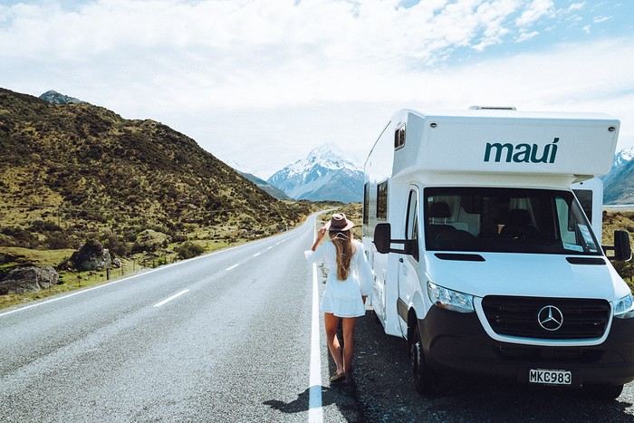
New Zealand offers a well-maintained road network, usually not too busy outside major cities. This is a huge plus if you're new to driving a campervan. The routes often feature spectacular viewpoints. You'll also find a vast network of campgrounds, and while freedom camping is regulated, there are still plenty of spots where you can sleep for free. Speed limits are reasonable, and the driving culture is pretty relaxed.
Adapted Infrastructure
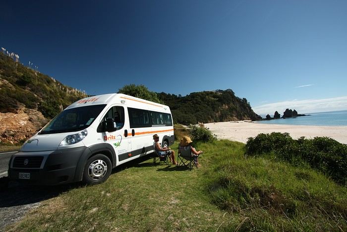
There are plenty of campervan rental companies offering different models, from converted vans to large family motorhomes. You'll find rental depots in major cities (Auckland, Christchurch, Queenstown), along with shuttle services between the airport and the depot. Campgrounds in New Zealand, whether private or managed by the Department of Conservation (DOC), are easy to find and well-marked. Plus, since New Zealand is a country of campers, you'll often get helpful tips from the locals.
Diverse and Accessible Landscapes
Beaches, volcanoes, deep fjords, or subtropical forests—you can experience a completely different setting in just a few hours of driving. No need to be a 4x4 expert: most roads leading to these stunning sites are campervan-friendly. This variety of landscapes, combined with easy access, makes New Zealand a top choice for a first road trip experience.
The Most Beautiful Places to Discover in a Campervan
To give you an idea, here’s a selection of must-see spots to inspire your next adventure.
1. The Coromandel Peninsula (North Island)
Just a few hours from Auckland, the Coromandel Peninsula is famous for its white sand beaches, hot springs, and lush vegetation. Hot Water Beach is a must-visit—dig your own "thermal bath" on the shore at low tide. You’ll easily find campgrounds by the ocean, perfect for your first taste of campervan life.
2. Rotorua and the Geothermal Wonders (North Island)
A little further south, Rotorua is the geothermal heart of New Zealand. Geysers, bubbling pools, and sulfur lakes with amazing colors—there’s no shortage of things to do. It’s also a major hub for Māori culture. Take the time to visit a traditional village or watch a haka performance. In the evening, relax at a campground with natural hot pools.
3. Tongariro National Park (North Island)
A UNESCO World Heritage site, this volcanic park is a paradise for hikers, especially with the famous Tongariro Alpine Crossing. Even if you're not an experienced hiker, you can enjoy stunning views from the roads or short marked trails. The campgrounds in the area will immerse you in a postcard-worthy setting.
4. Abel Tasman, Coastal Gem (South Island)
After taking the ferry from Wellington to Picton, head to Abel Tasman National Park. Its golden beaches, crystal-clear waters, and coastal trails are perfect for unwinding. One of the perks of a campervan is exploring at your own pace, choosing spots near the beaches or deeper in the forest.
5. Punakaiki and the Pancake Rocks (South Island)
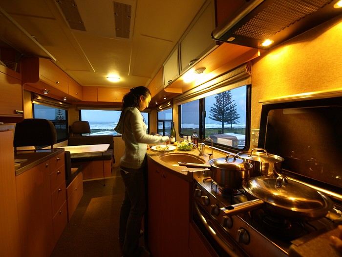
As you drive along the West Coast’s thick rainforests and wild beaches, stop at Punakaiki to see the Pancake Rocks—surprising rock formations that look like stacks of pancakes. A marked trail runs along the coast, letting you watch waves crash into the "blowholes" (marine geysers). Spending the night at a seaside campground, lulled by the sound of waves, is an experience not to be missed.
6. The Franz Josef and Fox Glaciers (South Island)
Further south, the glacier region is a must for lovers of breathtaking landscapes. You can admire the icy giants from a distance on an easy trail or take a helicopter to fly over them—or even walk on them. The campgrounds in Franz Josef or Fox Glacier let you wake up in an alpine atmosphere, contrasting with the lush vegetation around you.
7. Queenstown and Wanaka (South Island)
Queenstown, on the shore of a sparkling lake surrounded by majestic peaks, is known as the adventure capital: bungee jumping, paragliding, rafting—anything’s possible. If you prefer a quieter vibe, Wanaka is just as charming, with its beautiful lake and accessible walks. The road between these two towns is stunning, with plenty of perfect spots for a picnic stop.
8. Te Anau and Milford Sound (South Island)
New Zealand’s fjords are world-famous. Te Anau is the gateway to exploring Milford Sound or, for something wilder, Doubtful Sound. A cruise through these deep fjords, surrounded by towering cliffs, is one of the highlights of any trip to New Zealand. Staying overnight in a campervan in Te Anau saves you a long round trip in a day and lets you set off at dawn for more adventures.
9. Lake Tekapo and Mount Cook (South Island)
In the heart of the Southern Alps, Lake Tekapo charms with its unique turquoise color and its picturesque church by the water. The area is known for its starry skies (it’s an International Dark Sky Reserve). Mount Cook, the country’s highest peak, stands majestically in the background. Several campgrounds offer views of these mountains.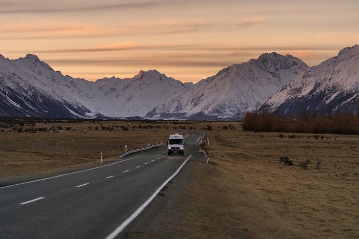
Practical Tips for a Successful Campervan Road Trip
Where to start? Between choosing the right vehicle, the best time to go, parking rules, and tips for where to sleep, here are our practical tips to plan your road trip stress-free.
Duration and Itinerary Choices
Less than 15 days: Focus on one island to avoid spending too much time on the road.
More than 15 days: Consider a North-South combo with a one-way trip (e.g., Auckland to Christchurch).
Book Early
In peak season (November to March), demand is high, especially for family-sized vehicles. Book your campervan ideally 6 to 8 months in advance.
Opt for full insurance to avoid high excess fees and hassles in case of issues. Standard bank insurance rarely covers campervans.
Choosing the Right Vehicle
Watch out for campervans over 3 years old—they can be "tired" in terms of both equipment and driving. If your budget allows, go for a newer model for better reliability and comfort.
Check the depot’s opening hours for pick-up. If you arrive late or after a long trip, it’s better to spend the first night in accommodation rather than driving straight away.
Where to Spend the Night
Freedom camping: Allowed in some remote areas but heavily regulated. Fines for breaking the rules can reach $200. Use comprehensive apps to identify legal spots and avoid penalties!
Basic campsites / DOC: Basic facilities but often in idyllic settings. These are campgrounds managed by the Department of Conservation, perfect for getting close to nature.
Private campgrounds: More expensive but offer hot showers, electricity, playgrounds for kids, pools, and laundry. Ideal for recharging—both your campervan’s batteries and your own.
Respect Nature
New Zealand is known for its pristine landscapes. Manage your waste, use designated dumping areas, and follow local signage. New Zealanders care deeply about keeping their environment clean and warmly welcome responsible tourists. For support, consider a local French-speaking agency like Frogs, which can help with administrative steps, planning your itinerary, and of course, renting a campervan.
Why is New Zealand the perfect country for your first campervan trip?
Safe and Scenic Roads
New Zealand offers a well-maintained road network, usually not too busy outside major cities. This is a huge plus if you're new to driving a campervan. The routes often feature spectacular viewpoints. You'll also find a vast network of campgrounds, and while freedom camping is regulated, there are still plenty of spots where you can sleep for free. Speed limits are reasonable, and the driving culture is pretty relaxed.
Adapted Infrastructure
There are plenty of campervan rental companies offering different models, from converted vans to large family motorhomes. You'll find rental depots in major cities (Auckland, Christchurch, Queenstown), along with shuttle services between the airport and the depot. Campgrounds in New Zealand, whether private or managed by the Department of Conservation (DOC), are easy to find and well-marked. Plus, since New Zealand is a country of campers, you'll often get helpful tips from the locals.
Diverse and Accessible Landscapes
Beaches, volcanoes, deep fjords, or subtropical forests—you can experience a completely different setting in just a few hours of driving. No need to be a 4x4 expert: most roads leading to these stunning sites are campervan-friendly. This variety of landscapes, combined with easy access, makes New Zealand a top choice for a first road trip experience.
The Most Beautiful Places to Discover in a Campervan
To give you an idea, here’s a selection of must-see spots to inspire your next adventure.
1. The Coromandel Peninsula (North Island)
Just a few hours from Auckland, the Coromandel Peninsula is famous for its white sand beaches, hot springs, and lush vegetation. Hot Water Beach is a must-visit—dig your own "thermal bath" on the shore at low tide. You’ll easily find campgrounds by the ocean, perfect for your first taste of campervan life.
2. Rotorua and the Geothermal Wonders (North Island)
A little further south, Rotorua is the geothermal heart of New Zealand. Geysers, bubbling pools, and sulfur lakes with amazing colors—there’s no shortage of things to do. It’s also a major hub for Māori culture. Take the time to visit a traditional village or watch a haka performance. In the evening, relax at a campground with natural hot pools.
3. Tongariro National Park (North Island)
A UNESCO World Heritage site, this volcanic park is a paradise for hikers, especially with the famous Tongariro Alpine Crossing. Even if you're not an experienced hiker, you can enjoy stunning views from the roads or short marked trails. The campgrounds in the area will immerse you in a postcard-worthy setting.
4. Abel Tasman, Coastal Gem (South Island)
After taking the ferry from Wellington to Picton, head to Abel Tasman National Park. Its golden beaches, crystal-clear waters, and coastal trails are perfect for unwinding. One of the perks of a campervan is exploring at your own pace, choosing spots near the beaches or deeper in the forest.
5. Punakaiki and the Pancake Rocks (South Island)
As you drive along the West Coast’s thick rainforests and wild beaches, stop at Punakaiki to see the Pancake Rocks—surprising rock formations that look like stacks of pancakes. A marked trail runs along the coast, letting you watch waves crash into the "blowholes" (marine geysers). Spending the night at a seaside campground, lulled by the sound of waves, is an experience not to be missed.
6. The Franz Josef and Fox Glaciers (South Island)
Further south, the glacier region is a must for lovers of breathtaking landscapes. You can admire the icy giants from a distance on an easy trail or take a helicopter to fly over them—or even walk on them. The campgrounds in Franz Josef or Fox Glacier let you wake up in an alpine atmosphere, contrasting with the lush vegetation around you.
7. Queenstown and Wanaka (South Island)
Queenstown, on the shore of a sparkling lake surrounded by majestic peaks, is known as the adventure capital: bungee jumping, paragliding, rafting—anything’s possible. If you prefer a quieter vibe, Wanaka is just as charming, with its beautiful lake and accessible walks. The road between these two towns is stunning, with plenty of perfect spots for a picnic stop.
8. Te Anau and Milford Sound (South Island)
New Zealand’s fjords are world-famous. Te Anau is the gateway to exploring Milford Sound or, for something wilder, Doubtful Sound. A cruise through these deep fjords, surrounded by towering cliffs, is one of the highlights of any trip to New Zealand. Staying overnight in a campervan in Te Anau saves you a long round trip in a day and lets you set off at dawn for more adventures.
9. Lake Tekapo and Mount Cook (South Island)
In the heart of the Southern Alps, Lake Tekapo charms with its unique turquoise color and its picturesque church by the water. The area is known for its starry skies (it’s an International Dark Sky Reserve). Mount Cook, the country’s highest peak, stands majestically in the background. Several campgrounds offer views of these mountains.
Practical Tips for a Successful Campervan Road Trip
Where to start? Between choosing the right vehicle, the best time to go, parking rules, and tips for where to sleep, here are our practical tips to plan your road trip stress-free.
Duration and Itinerary Choices
Less than 15 days: Focus on one island to avoid spending too much time on the road.
More than 15 days: Consider a North-South combo with a one-way trip (e.g., Auckland to Christchurch).
Book Early
In peak season (November to March), demand is high, especially for family-sized vehicles. Book your campervan ideally 6 to 8 months in advance.
Opt for full insurance to avoid high excess fees and hassles in case of issues. Standard bank insurance rarely covers campervans.
Choosing the Right Vehicle
Watch out for campervans over 3 years old—they can be "tired" in terms of both equipment and driving. If your budget allows, go for a newer model for better reliability and comfort.
Check the depot’s opening hours for pick-up. If you arrive late or after a long trip, it’s better to spend the first night in accommodation rather than driving straight away.
Where to Spend the Night
Freedom camping: Allowed in some remote areas but heavily regulated. Fines for breaking the rules can reach $200. Use comprehensive apps to identify legal spots and avoid penalties!
Basic campsites / DOC: Basic facilities but often in idyllic settings. These are campgrounds managed by the Department of Conservation, perfect for getting close to nature.
Private campgrounds: More expensive but offer hot showers, electricity, playgrounds for kids, pools, and laundry. Ideal for recharging—both your campervan’s batteries and your own.
Respect Nature
New Zealand is known for its pristine landscapes. Manage your waste, use designated dumping areas, and follow local signage. New Zealanders care deeply about keeping their environment clean and warmly welcome responsible tourists. For support, consider a local French-speaking agency like Frogs, which can help with administrative steps, planning your itinerary, and of course, renting a campervan.
From Caño Cristales to Tayrona Park
After about 12 hours of flying from Toulouse (via Paris), we landed in Bogotá six years after our first trip to Colombia. This time, our journey will be very different, with only this stop in the Colombian capital in common.
Our travel itinerary
Bogotá / La Macarena (Caño Cristales) / Villa de Leyva / Barichara / San Gil / Girón / Mompox / Ciénaga and the Santa Marta lagoon / Minca / Los Naranjos (Tayrona Park) / Bogotá.
Step 1: Bogotá (and Nemecon)
Bogotá (1/3)
This morning, we had a meet-up with Flora from Aventure Colombia, who helped me organize one of our stops, a few transfers, and tomorrow’s day trip, the program of which I changed at the last minute after deciding to skip the visit to the Salt Cathedral of Zipaquirá. Flora is a kind and lovely person, always available, and she did everything to answer my questions and give me advice.
She’s a local contact I highly recommend. Flora can help you plan your trip, whether you want a fully organized tour or, like us, just need assistance with a specific stop or one or more transfers between cities.
We left Flora after setting a meet-up for our return to Bogotá in a month. As we walked out of her agency, we headed to the wonderful Gold Museum, located just a hundred meters away. I was excited to revisit this amazing museum.
Note: Free entry for those over 60, regardless of nationality. Just show your passport.
Like six years ago, I was amazed by its museography, the beauty of the pieces on display, and that breathtaking shamanic room.
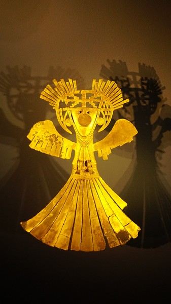
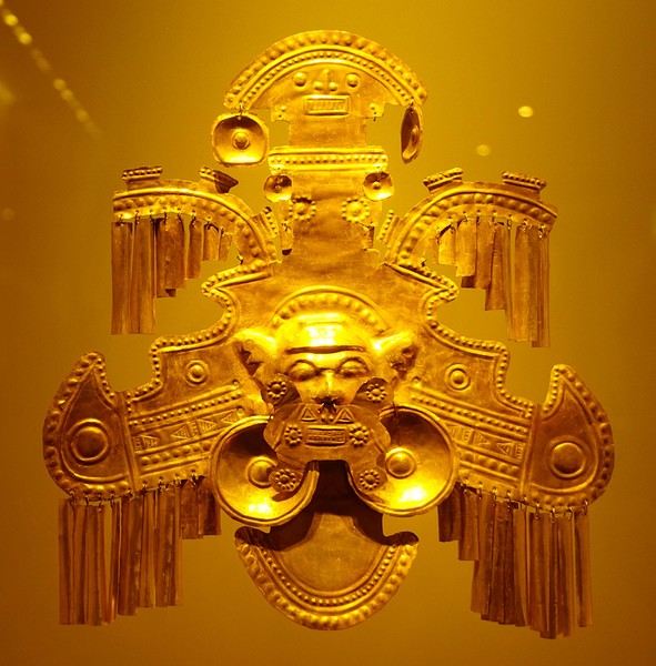
About two hours later, we decided to walk (careful, it’s a climb!) to the Monserrate cable car (3152m). Long wait to buy tickets and board the cable car! Once we arrived, a few raindrops, an impressive panoramic view of Bogotá’s vastness, a quick visit to the basilica (a pilgrimage site for Colombians), a walk through the tourist market, and at the top, plenty of small restaurants where we had our first Colombian meal. After our hearty lunch, we were lucky to see the sun return! No line for the descent. We then headed back to the hotel because Justine wanted to rest and recover from the trip. As for me, I continued my walk. I discovered a really nice craft market recommended by Flora, Pasaje Rivas, returned to Bolívar Square, and wandered through different streets, including the main pedestrian avenue (Calle 7), where there’s always something to see.
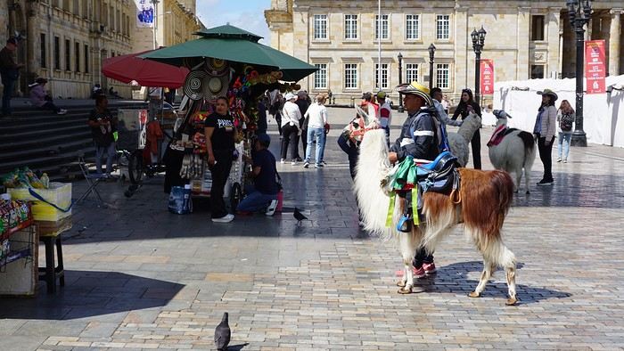
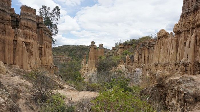
Tomorrow, a change of scenery as we head out for a hike in a small desert (Desierto de Chueca), located about 2 hours from Bogotá in the village of Nemecon. For this outing from Bogotá, with Flora’s help, we booked a car with a driver for the day. Flora also took care of booking the guide (since the site can only be visited with one). Nemecon (2/3) Today, we went to Nemecon to hike about 7.5 km in the ‘Desert of Checua.’ It’s nothing like sandy deserts! Instead, it’s geological formations sculpted by time, wind, and water. After two hours on the road—almost one of them spent navigating traffic jams with cars, trucks, buses, and a continuous flow of motorcycles on either side of our taxi—we reached Nemecon! The village center is really (too?) quiet. We met up with Deisy and headed toward the ‘desert,’ about twenty minutes away on a bumpy dirt road. Once there, a quick briefing, and off we went! Deisy didn’t stop talking (in Spanish) for over 3 hours!!! She told us so much about her region (flower farming, water management, traditions, songs, etc.), the origin of the site, and even mentioned Antonio Banderas, who filmed *The 33* in the village’s salt mine (the story of the survival of 33 Chilean miners after a collapse in their copper and gold mine). One hour of walking to reach the site, one hour to explore it, and one hour to return.
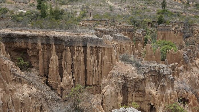
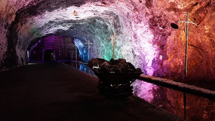
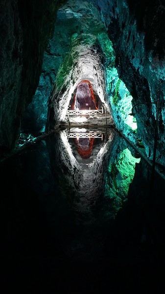
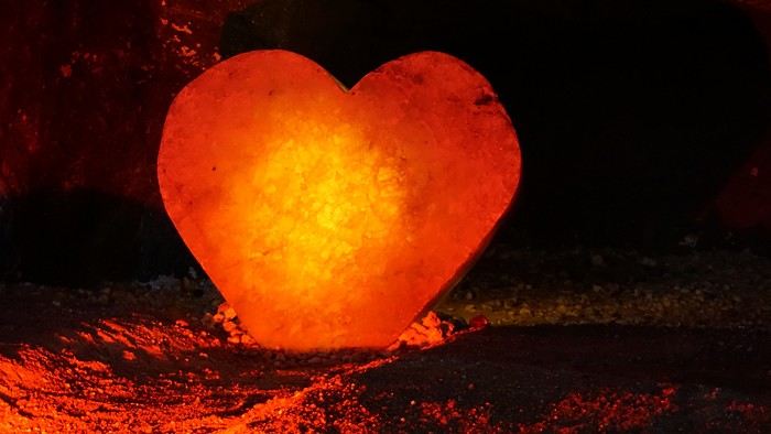
The advantage of this non-stop chatter was that it forced us to brush up on our Spanish at lightning speed. I even wondered if the effort to concentrate wasn’t more exhausting than the physical effort! Especially since on the way back, I got an oral quiz. Deisy wanted to make sure I remembered some of the information she’d given me during the visit: why is this rock white, that one red, and that one black? Back in the village, we had lunch at a restaurant recommended by Deisy before visiting the Nemecon salt mine. Before entering, a guide spent a good half-hour explaining the origin of the salt and the presence of many fossils in the area. Again, concentrating was tough because all the comments were exclusively in Spanish! An hour and a half wandering through the tunnels with a ‘lovely miner’s helmet’ on our heads!
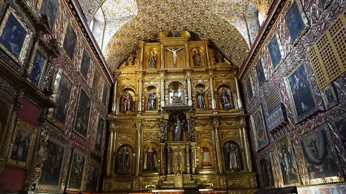
We met our driver at the mine entrance. The return to Bogotá was a bit faster, but traffic in the city center was still heavy! We arrived in front of our hotel between 8:00 and 8:30 PM. It’s been a pretty intense start to the trip! Tonight, our legs are tired. Hopefully, tomorrow will be a bit more relaxed! Bogotá (3/3) We started the day by visiting the Santa Clara Church Museum, located next to the presidential palace. Alejandra (from the local agency ‘Gaia Tours Colombia,’ which organized our stay in Caño Cristales (La Macarena)) had recommended this visit for its rich mural paintings.
A few hundred meters further, after crossing the Plaza Mayor again, we visited the cultural complex housing the Botero Museum, the Mint Museum, and the Bank of the Republic Art Museum. Note that entry is free for all three museums. Botero Museum: There are fewer works by Botero here than in the Medellín museum, but more paintings and sculptures by other artists, all from Botero’s private collection (donated to Colombia). Mint Museum: We limited ourselves to visiting one room (on Flora’s advice) where three gold and gemstone monstrances and a Christ with a crown of emerald thorns are displayed. Photos are not allowed. Art Museum: We visited two temporary exhibitions. Lunchtime came quickly. We had a good meal at a reasonably priced small restaurant in the La Candelaria micro-district, near the Chorro de Quevedo square. We decided to spend the afternoon wandering the streets and alleys of the historic center to discover local street art.
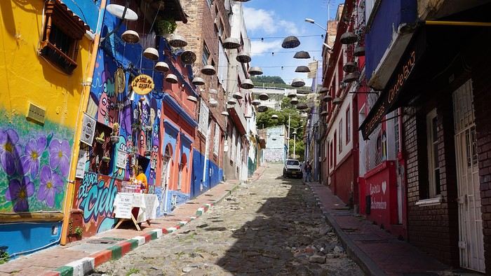
We also passed through very lively pedestrian streets. I also decided to revisit Pasaje Rivas to show Justine all the shops selling more or less artisanal products. Tomorrow morning, we fly to La Macarena at 10:30 AM. Not to dance (you’d be surprised if I told you we were going to take a South American dance class, right?!), but to visit the fabulous Caño Cristales, a river naturally colored by aquatic plants. The planned program includes hiking, horseback riding, canoeing, and swimming among these plants. This site was long inaccessible because the area was controlled by the FARC. Access and tourism development became possible after agreements and amnesty measures between the Colombian government and paramilitary groups. As in other regions, former FARC members have been able to transition into various tourism-related activities.
About two hours later, we decided to walk (careful, it’s a climb!) to the Monserrate cable car (3152m). Long wait to buy tickets and board the cable car! Once we arrived, a few raindrops, an impressive panoramic view of Bogotá’s vastness, a quick visit to the basilica (a pilgrimage site for Colombians), a walk through the tourist market, and at the top, plenty of small restaurants where we had our first Colombian meal. After our hearty lunch, we were lucky to see the sun return! No line for the descent. We then headed back to the hotel because Justine wanted to rest and recover from the trip. As for me, I continued my walk. I discovered a really nice craft market recommended by Flora, Pasaje Rivas, returned to Bolívar Square, and wandered through different streets, including the main pedestrian avenue (Calle 7), where there’s always something to see.
Tomorrow, a change of scenery as we head out for a hike in a small desert (Desierto de Chueca), located about 2 hours from Bogotá in the village of Nemecon. For this outing from Bogotá, with Flora’s help, we booked a car with a driver for the day. Flora also took care of booking the guide (since the site can only be visited with one). Nemecon (2/3) Today, we went to Nemecon to hike about 7.5 km in the ‘Desert of Checua.’ It’s nothing like sandy deserts! Instead, it’s geological formations sculpted by time, wind, and water. After two hours on the road—almost one of them spent navigating traffic jams with cars, trucks, buses, and a continuous flow of motorcycles on either side of our taxi—we reached Nemecon! The village center is really (too?) quiet. We met up with Deisy and headed toward the ‘desert,’ about twenty minutes away on a bumpy dirt road. Once there, a quick briefing, and off we went! Deisy didn’t stop talking (in Spanish) for over 3 hours!!! She told us so much about her region (flower farming, water management, traditions, songs, etc.), the origin of the site, and even mentioned Antonio Banderas, who filmed *The 33* in the village’s salt mine (the story of the survival of 33 Chilean miners after a collapse in their copper and gold mine). One hour of walking to reach the site, one hour to explore it, and one hour to return.
The advantage of this non-stop chatter was that it forced us to brush up on our Spanish at lightning speed. I even wondered if the effort to concentrate wasn’t more exhausting than the physical effort! Especially since on the way back, I got an oral quiz. Deisy wanted to make sure I remembered some of the information she’d given me during the visit: why is this rock white, that one red, and that one black? Back in the village, we had lunch at a restaurant recommended by Deisy before visiting the Nemecon salt mine. Before entering, a guide spent a good half-hour explaining the origin of the salt and the presence of many fossils in the area. Again, concentrating was tough because all the comments were exclusively in Spanish! An hour and a half wandering through the tunnels with a ‘lovely miner’s helmet’ on our heads!
We met our driver at the mine entrance. The return to Bogotá was a bit faster, but traffic in the city center was still heavy! We arrived in front of our hotel between 8:00 and 8:30 PM. It’s been a pretty intense start to the trip! Tonight, our legs are tired. Hopefully, tomorrow will be a bit more relaxed! Bogotá (3/3) We started the day by visiting the Santa Clara Church Museum, located next to the presidential palace. Alejandra (from the local agency ‘Gaia Tours Colombia,’ which organized our stay in Caño Cristales (La Macarena)) had recommended this visit for its rich mural paintings.
A few hundred meters further, after crossing the Plaza Mayor again, we visited the cultural complex housing the Botero Museum, the Mint Museum, and the Bank of the Republic Art Museum. Note that entry is free for all three museums. Botero Museum: There are fewer works by Botero here than in the Medellín museum, but more paintings and sculptures by other artists, all from Botero’s private collection (donated to Colombia). Mint Museum: We limited ourselves to visiting one room (on Flora’s advice) where three gold and gemstone monstrances and a Christ with a crown of emerald thorns are displayed. Photos are not allowed. Art Museum: We visited two temporary exhibitions. Lunchtime came quickly. We had a good meal at a reasonably priced small restaurant in the La Candelaria micro-district, near the Chorro de Quevedo square. We decided to spend the afternoon wandering the streets and alleys of the historic center to discover local street art.
We also passed through very lively pedestrian streets. I also decided to revisit Pasaje Rivas to show Justine all the shops selling more or less artisanal products. Tomorrow morning, we fly to La Macarena at 10:30 AM. Not to dance (you’d be surprised if I told you we were going to take a South American dance class, right?!), but to visit the fabulous Caño Cristales, a river naturally colored by aquatic plants. The planned program includes hiking, horseback riding, canoeing, and swimming among these plants. This site was long inaccessible because the area was controlled by the FARC. Access and tourism development became possible after agreements and amnesty measures between the Colombian government and paramilitary groups. As in other regions, former FARC members have been able to transition into various tourism-related activities.
4x4 Expeditions in Southern Africa
Hi there,
Here’s a quick summary of six trips across Southern Africa, covering South Africa, Namibia, Botswana, Zimbabwe, and more. I traveled for a total of 23 months, over 100,000 km, and crossed 9 countries from South Africa to Tanzania. To do this, I bought an old Land Cruiser—a 1989 BJ 75 with a long chassis and a 3.4L turbo engine—which I converted into a bush camper set up for self-sufficiency in Africa: dual fuel tanks (235 L total) plus 2 x 20-liter jerry cans of diesel, 2 spare tires, a compressor, a toolbox with repair gear, a 50-liter water tank plus 2 x 30-liter and 2 x 10-liter jerry cans, a roof tent, multiple storage boxes, a sturdy roof rack, and even a paramotor. I also packed a first-aid kit and shipped the camper to South Africa by freight. My son joined me for part of the journey.
Key countries and highlights: South Africa in every direction, including its wildlife parks; in Namibia, the classics like Etosha, Fish River, Sossusvlei, Kaudum, but especially Damaraland and Kaokoland; in Botswana, a full loop of the Okavango, crossing the Makgadikgadi Pan, Moremi Park, the Linyanti River; and a tour of Zimbabwe with its national parks. During the last trip in 2020, due to COVID, we found refuge on a 250 km² Namibian farm with its own wildlife reserve. While crossing Damaraland and Kaokoland, we were completely self-sufficient, with supplies for over a month and 130 L of water.
In South Africa and Namibia, one issue that surprised us was the fences stretching for millions of kilometers along the tracks. Namibia is one and a half times the size of France but has a population of only about 2.5 million, mostly concentrated in a dozen small towns of 10,000 to 50,000 people—except for the capital, Windhoek (296,000). Paradoxically, compared to France, the space for freedom is extremely limited. Everything is private and requires payment. Even the Namib Desert is fenced... and you need a permit just to pick up a rock! For someone used to wild camping, it can get frustrating. Sometimes we ignored the rules, but the best solution is to ask a farmer (a real one, like a sheep or cattle rancher—not the ones with 3-meter electrified fences, which are lodges or private reserves) if you can camp on their land.
To truly enjoy freedom in Namibia, you need to venture into the northwest, along the Skeleton Coast, in Damaraland and Kaokoland. However, it’s essential to know your vehicle inside out, be a good mechanic, bring spare parts, and plan for potential breakdowns. Take care of your ride because a major issue out there can be a matter of survival. My motto: "Don’t break down, don’t break down, don’t break down..." Safari pros only venture into this region with two 4x4s. In Messum Crater, we met a couple waiting for rescue (thanks to a satellite device from their rental company) after their driveshaft broke. Keep in mind that in these areas, you’ll cover about 80 km in 8 hours.
Here are some of the issues we faced: a broken rear suspension leaf, several broken bolts on the front leaf springs, the spare tire mount breaking multiple times (replaced on the spot), a cracked water radiator in 1998 causing overheating and a seized valve stem in its guide, plus a bent rocker arm (field repair, valve adjustment, damaged head gasket, daily radiator refills, and a scratched cylinder—engine fully rebuilt upon return). Five roof rack mounts broke and were repaired at a technical high school in South Africa. The battery mount also broke (fixed with a steel plate found on the trail). The fuel filter clogged several times (changed or cleaned on the spot). A huge impact on the windshield from a piece of coal falling from a power plant supply truck (temporary repair with Araldite). The brake master cylinder failed in Marienfluss (repaired, seals replaced in Tsumeb). Multiple flat tires from acacia thorns. The rear door latch broke (homemade aluminum rod repair in Franschhoek). The voltmeter and ammeter failed (repaired on the spot). During the freight trip, despite locking the doors and having a partition between the front and back, someone managed to get in through the small side window, forced open the locks on two accessible storage boxes, and stole my tools (replaced later). A ball joint on the paramotor frame came loose mid-flight, damaging the wing and propeller (propeller shipped from France, homemade repair).
Health issues on the way to Tanzania: a painful sciatica and many sleepless nights (cortisone injection in Dodoma).
Kaokoland, Namibia—the northwest region: https://youtu.be/DzGepFsrnZs
Damaraland: https://youtu.be/DITQj8NvLZ4
Botswana: https://youtu.be/TEvDG0S62hg
Kaudom and Mohembo Parks: https://youtu.be/wq_Yf7jNLhw
Here’s a quick summary of six trips across Southern Africa, covering South Africa, Namibia, Botswana, Zimbabwe, and more. I traveled for a total of 23 months, over 100,000 km, and crossed 9 countries from South Africa to Tanzania. To do this, I bought an old Land Cruiser—a 1989 BJ 75 with a long chassis and a 3.4L turbo engine—which I converted into a bush camper set up for self-sufficiency in Africa: dual fuel tanks (235 L total) plus 2 x 20-liter jerry cans of diesel, 2 spare tires, a compressor, a toolbox with repair gear, a 50-liter water tank plus 2 x 30-liter and 2 x 10-liter jerry cans, a roof tent, multiple storage boxes, a sturdy roof rack, and even a paramotor. I also packed a first-aid kit and shipped the camper to South Africa by freight. My son joined me for part of the journey.
Key countries and highlights: South Africa in every direction, including its wildlife parks; in Namibia, the classics like Etosha, Fish River, Sossusvlei, Kaudum, but especially Damaraland and Kaokoland; in Botswana, a full loop of the Okavango, crossing the Makgadikgadi Pan, Moremi Park, the Linyanti River; and a tour of Zimbabwe with its national parks. During the last trip in 2020, due to COVID, we found refuge on a 250 km² Namibian farm with its own wildlife reserve. While crossing Damaraland and Kaokoland, we were completely self-sufficient, with supplies for over a month and 130 L of water.
In South Africa and Namibia, one issue that surprised us was the fences stretching for millions of kilometers along the tracks. Namibia is one and a half times the size of France but has a population of only about 2.5 million, mostly concentrated in a dozen small towns of 10,000 to 50,000 people—except for the capital, Windhoek (296,000). Paradoxically, compared to France, the space for freedom is extremely limited. Everything is private and requires payment. Even the Namib Desert is fenced... and you need a permit just to pick up a rock! For someone used to wild camping, it can get frustrating. Sometimes we ignored the rules, but the best solution is to ask a farmer (a real one, like a sheep or cattle rancher—not the ones with 3-meter electrified fences, which are lodges or private reserves) if you can camp on their land.
To truly enjoy freedom in Namibia, you need to venture into the northwest, along the Skeleton Coast, in Damaraland and Kaokoland. However, it’s essential to know your vehicle inside out, be a good mechanic, bring spare parts, and plan for potential breakdowns. Take care of your ride because a major issue out there can be a matter of survival. My motto: "Don’t break down, don’t break down, don’t break down..." Safari pros only venture into this region with two 4x4s. In Messum Crater, we met a couple waiting for rescue (thanks to a satellite device from their rental company) after their driveshaft broke. Keep in mind that in these areas, you’ll cover about 80 km in 8 hours.
Here are some of the issues we faced: a broken rear suspension leaf, several broken bolts on the front leaf springs, the spare tire mount breaking multiple times (replaced on the spot), a cracked water radiator in 1998 causing overheating and a seized valve stem in its guide, plus a bent rocker arm (field repair, valve adjustment, damaged head gasket, daily radiator refills, and a scratched cylinder—engine fully rebuilt upon return). Five roof rack mounts broke and were repaired at a technical high school in South Africa. The battery mount also broke (fixed with a steel plate found on the trail). The fuel filter clogged several times (changed or cleaned on the spot). A huge impact on the windshield from a piece of coal falling from a power plant supply truck (temporary repair with Araldite). The brake master cylinder failed in Marienfluss (repaired, seals replaced in Tsumeb). Multiple flat tires from acacia thorns. The rear door latch broke (homemade aluminum rod repair in Franschhoek). The voltmeter and ammeter failed (repaired on the spot). During the freight trip, despite locking the doors and having a partition between the front and back, someone managed to get in through the small side window, forced open the locks on two accessible storage boxes, and stole my tools (replaced later). A ball joint on the paramotor frame came loose mid-flight, damaging the wing and propeller (propeller shipped from France, homemade repair).
Health issues on the way to Tanzania: a painful sciatica and many sleepless nights (cortisone injection in Dodoma).
Kaokoland, Namibia—the northwest region: https://youtu.be/DzGepFsrnZs
Damaraland: https://youtu.be/DITQj8NvLZ4
Botswana: https://youtu.be/TEvDG0S62hg
Kaudom and Mohembo Parks: https://youtu.be/wq_Yf7jNLhw
Où iriez-vous "sur un coup de tête"? English translation pending
Admettons que vous traversiez une période très difficile de votre vie, et que des fois, pour aller mieux, la solution c'est de partir loin, se ressourcer, etc.
On est l'hiver, donc ça limite.
Vous avez des sous de côté mais c'est pas non plus le Pérou.
Vous iriez où, là comme ça ?
On est l'hiver, donc ça limite.
Vous avez des sous de côté mais c'est pas non plus le Pérou.
Vous iriez où, là comme ça ?
Aperçu de la Tarentaise English translation pending
Je rentre d'un séjour alpin qui s'est déroulé en Tarentaise du 13 au 20 juillet 2019.
Servi par une météo estivale, j'ai pu parcourir de nombreux sentiers de randonnée, alliant sport et contemplation.
Voici résumées, les ballades que j'ai effectuées.
Le col du Grand Renard au départ des Arcs
Dimanche, de bon matin, je quitte mon logement situé à proximité de l'arrêt du funiculaire à destination de Bourg-Saint-Maurice.
Une montée progressive jusqu'aux derniers immeubles de la station conduit à un chemin forestier ombragé.
Passage à côté d'Arcs 1950 puis élévation le long d'une piste jusqu'à un lac. De temps en temps, une clairière permet de profiter de la vue sur le massif voisin qui forme la frontière avec l'Italie.

Le sentier se poursuit agréablement dans les résineux et au lieu-dit le Pré Saint-Esprit il amorce une élévation en direction du massif en longeant le lit du ruisseau de l'Arc. Je dépasse la station et domine rapidement le lac de la Montée.
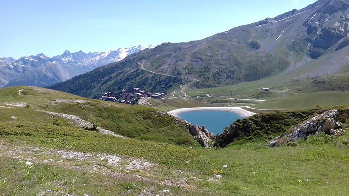
À main droite, les dents du Peigne et le col des Frettes brillent au soleil et exposent leur carapace de schistes
Un randonneur de rencontre me demande de le photographier. Echange de bons procédés.
Le sentier continue jusqu'au col de Grand Renard au pied des aiguilles Grive et Rousse. La descente s'effectue par un sentier caillouteux. Des chèvres paissent sous la garde vigilante de deux patous.
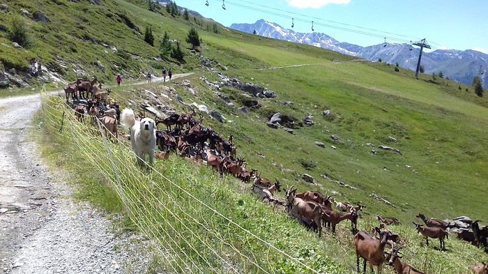
J'envie au passage le propriétaire de ce joli chalet avec vue été comme hiver sur la vallée de la Tarentaise.
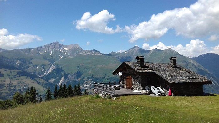
Avec 18 km de sentier et de rocaille pour 948 m de dénivelées positive et négative, ce premier contact avec le massif s'avère plutôt concluant.
De Bourg-Saint-Maurice au fort du Truc
Le ciel s'étant couvert, je choisis d'effectuer une randonnée en partant du fond de la vallée. Je descends en voiture jusqu'à Bourg-Saint-Maurice qui sera le point de départ dans le haut de la ville. Je parcours quelques rues avant d'arriver au ruisseau du Nantes, dont je suis le lit jusqu'à affronter un sentier très raide qui s'élève dans les sous-bois prodiguant une ombre généreuse.
Partir de 800 m dans une ancienne vallée glaciaire c'est affronter les versants abruptes sculptés par l'érosion des glaciers. Je dépasse les petits hameaux du Replat et du Grand Replat. Le fort du Truc a été bâti à la fin du XIXème siècle. Il pouvait accueillir 220 soldats. Situé à 1570 m juste au dessus de Bourg-Saint-Maurice il interdisait l'accès depuis le col de petit Saint-Bernard ainsi que la vallée de l'Isère en amont du bourg. Il protégeait également la batterie de Vulmix. Désarmé en 1915 (l'Italie a rejoint le camp des alliés), il rejouera son rôle efficacement en 1940. L'essentiel du Fort est enterré. Sont visibles les galeries de circulation protégées par des remparts.
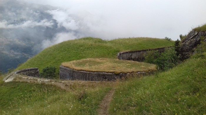
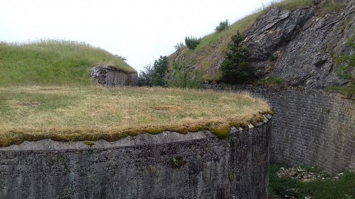
Quelques lacets plus tard, je découvre un superbe panorama englobant le fort et Bourg-Saint-Maurice.
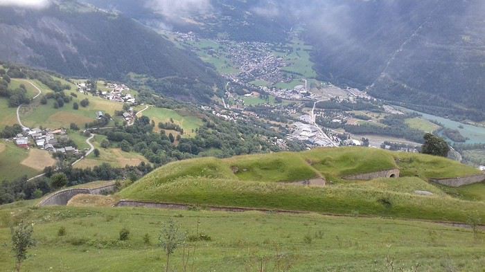
La vue s'étend vers la Haute Maurienne...
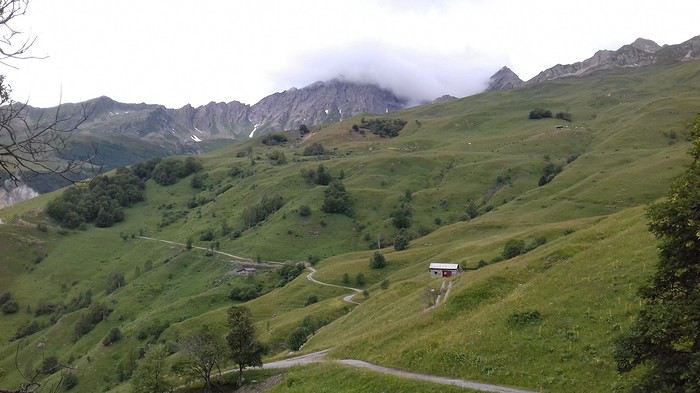
...et les Arcs
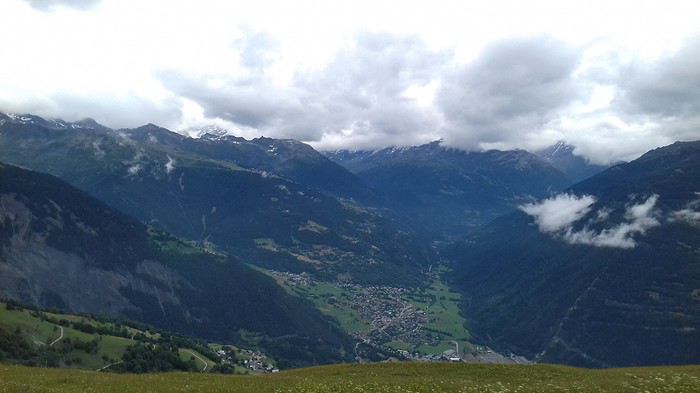
Le sentier se poursuit dans les alpages en direction du fort de la Platte que je prévois de visiter ultérieurement. Le site d'envol de parapentes, constitue le point culminant de cette boucle Le hameau de Grandville offre sa petite chapelle.
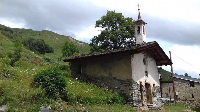
Je descends tantôt dans les prés, tantôt sur le chemin. Quelques fermes isolées agrémentent le parcours. Un sentier creux en pente raide procure un itinéraire jusqu'au Villaret.
 La suite du séjour dans un prochain message.
Le col du Grand Renard au départ des Arcs
Dimanche, de bon matin, je quitte mon logement situé à proximité de l'arrêt du funiculaire à destination de Bourg-Saint-Maurice.
Une montée progressive jusqu'aux derniers immeubles de la station conduit à un chemin forestier ombragé.
Passage à côté d'Arcs 1950 puis élévation le long d'une piste jusqu'à un lac. De temps en temps, une clairière permet de profiter de la vue sur le massif voisin qui forme la frontière avec l'Italie.
Le sentier se poursuit agréablement dans les résineux et au lieu-dit le Pré Saint-Esprit il amorce une élévation en direction du massif en longeant le lit du ruisseau de l'Arc. Je dépasse la station et domine rapidement le lac de la Montée.
À main droite, les dents du Peigne et le col des Frettes brillent au soleil et exposent leur carapace de schistes
Un randonneur de rencontre me demande de le photographier. Echange de bons procédés.
Le sentier continue jusqu'au col de Grand Renard au pied des aiguilles Grive et Rousse. La descente s'effectue par un sentier caillouteux. Des chèvres paissent sous la garde vigilante de deux patous.
J'envie au passage le propriétaire de ce joli chalet avec vue été comme hiver sur la vallée de la Tarentaise.
Avec 18 km de sentier et de rocaille pour 948 m de dénivelées positive et négative, ce premier contact avec le massif s'avère plutôt concluant.
De Bourg-Saint-Maurice au fort du Truc
Le ciel s'étant couvert, je choisis d'effectuer une randonnée en partant du fond de la vallée. Je descends en voiture jusqu'à Bourg-Saint-Maurice qui sera le point de départ dans le haut de la ville. Je parcours quelques rues avant d'arriver au ruisseau du Nantes, dont je suis le lit jusqu'à affronter un sentier très raide qui s'élève dans les sous-bois prodiguant une ombre généreuse.
Partir de 800 m dans une ancienne vallée glaciaire c'est affronter les versants abruptes sculptés par l'érosion des glaciers. Je dépasse les petits hameaux du Replat et du Grand Replat. Le fort du Truc a été bâti à la fin du XIXème siècle. Il pouvait accueillir 220 soldats. Situé à 1570 m juste au dessus de Bourg-Saint-Maurice il interdisait l'accès depuis le col de petit Saint-Bernard ainsi que la vallée de l'Isère en amont du bourg. Il protégeait également la batterie de Vulmix. Désarmé en 1915 (l'Italie a rejoint le camp des alliés), il rejouera son rôle efficacement en 1940. L'essentiel du Fort est enterré. Sont visibles les galeries de circulation protégées par des remparts.
Quelques lacets plus tard, je découvre un superbe panorama englobant le fort et Bourg-Saint-Maurice.
La vue s'étend vers la Haute Maurienne...
...et les Arcs
Le sentier se poursuit dans les alpages en direction du fort de la Platte que je prévois de visiter ultérieurement. Le site d'envol de parapentes, constitue le point culminant de cette boucle Le hameau de Grandville offre sa petite chapelle.
Je descends tantôt dans les prés, tantôt sur le chemin. Quelques fermes isolées agrémentent le parcours. Un sentier creux en pente raide procure un itinéraire jusqu'au Villaret.
La suite du séjour dans un prochain message.Two weeks with a friend in southern Kazakhstan
Hello everyone!
I’m back from two weeks in southern Kazakhstan. I went with a friend, and we organized everything ourselves. We came back enchanted by this trip: stunning landscapes, lots of animals seen in the parks, and above all, top-notch hospitality and welcome... All of this makes me really want to go back and explore the other countries in the region. In the meantime, I’m sharing the story of these two weeks of travel... Don’t hesitate if you have any questions. And if you want more practical info and/or see more photos, you can check out my blog: https://smilingaroundtheworld.com/category/kazakhstan/
Day 1: First Kazakh steps in Shymkent
So here we are in Kazakhstan for two weeks. We had an excellent flight with Air Astana, which instantly made it into my top 3 best airlines! From the airport, the service was top-notch, with very friendly staff who went out of their way to ensure we both got vegetarian meals (my order hadn’t been taken into account when booking the tickets online). The flight to Nur-Sultan (the new name for the capital, formerly Astana, renamed last month in honor of the resigning president) was three-quarters empty, and we each got to stretch out over three seats. We were given an incredible travel kit, including a reversible sleep mask with phosphorescent writing: “Do not disturb” or “Wake me for meals.” Awesome! As for the lighting in the plane, I think the interior cycled through every color to simulate evening, early night, pitch-black night, and then dawn. It was even a bit surreal—those lights and everyone’s glowing masks ^^ The flight was a bit early and too short for us to sleep well, but it was still pleasant :-)
Upon arriving in Nur-Sultan, the atmosphere was a bit colder. There was staff everywhere, and we were under heavy surveillance. A camera even filmed us as we entered the terminal. We got our passports stamped and settled in to wait for our second flight. We eventually realized we were waiting in the wrong place... We were still in the international terminal, while our next flight was domestic. We finally found the right spot—saved! We started our trip in Shymkent, in the south of the country. We dropped our bags at the City Hostel, a super modern youth hostel offering double rooms. The decor is industrial-style, with very high ceilings—we loved it. When we arrived, it was too early for check-in, so we just left our luggage and went for a walk around the neighborhood. There was quite a bit of traffic, and the avenues were very wide. Despite that, there was also a lot of greenery and green spaces, which lightened things up a bit.
We had lunch (pizza + smoothie) on the top floor of a shopping mall, then headed to the pre-Russian quarter, a much quieter area with its little streets and individual houses.
Back at the hostel, after checking in, we treated ourselves to a two-hour nap—it felt great! In the late afternoon, we set out to find the Salman Bazaar. It wasn’t easy to organize—we realized Shymkent isn’t a very touristy destination—but we eventually managed with the help of the hostel receptionist, who called us a taxi. This bazaar is huge and has everything you could need for daily life: clothes, food, household products, toys... We did some shopping for dinner, then took another taxi to Independence Park, inaugurated in 2011 for the 20th anniversary of Kazakhstan’s independence. We really liked this park—it’s very wooded, and the late afternoon light was, as always, beautiful and pleasant... In the center, a large monument resembles the center of a yurt.
We then walked back to the hostel via Independence Square and several parks. We wanted to grab a drink along the way but didn’t find anything inspiring—oh well. We had dinner at the hostel and went straight to bed. Tomorrow, we’re getting up early... We’re heading out for two days to explore Aksou-Jabagly National Park. This park is famous for its landscapes at this time of year—it should be in full bloom, especially with tulips. We’ll see!
Days 2 & 3: Canyon, tulips, and wildlife in Aksou-Jabagly Park
Located two hours from Shymkent, Aksou-Jabagly Park is reputed to be one of the most beautiful in the region. We took a taxi from Shymkent, and upon arrival, we were warmly welcomed by Ruslan and his mother. They live at the entrance to the reserve, at the foot of the mountains, in a house surrounded by poplars. The setting is exceptional, and we immediately fell in love with the place. For our first day, we set off to explore the Aksou Canyon. Ruslan arranged a 4x4 with a driver and a ranger. The ranger speaks a few words of English, and with Coralie’s few words of Russian, we should manage! After a “viewpoint” stop, the road turns into a dirt track. It’s rained a lot lately, and the track is sometimes very muddy—at one point, we even had to cross a river. Four-wheel drive was definitely needed! The ranger pointed out some marmots by the side of the path—they were adorable.
We finally arrived at “Inspector’s House No. 1,” which overlooks the canyon. The view is magnificent, with high cliffs, wildflowers, conifers, and the Aksou River winding far below. While the driver chatted with the inspector, we descended to the bottom of the canyon with the ranger. The tulips I’d been hoping for were there—I was so happy! There were red, yellow, and even bicolor ones...
At the bottom of the canyon, we took a little break by the river. “Aksou” means “white waters” in Kazakh—the water does indeed have a very special color, a blue that’s both very light and very intense, like some South American lagoons. It bubbles around the rocks. The climb back up was easier than we feared. Once at the top, we continued along the canyon. The perspective changed as we progressed, and we never got tired of the view... Eagles circled above us.
After about 2 km, the driver picked us up, and we continued to a small kiosk at the foot of the mountains, where we had a picnic. Ruslan’s mother had prepared vegetarian “lunch boxes”—it was delicious and felt good to eat. However, it had gotten noticeably colder, so we put our jackets and scarves back on! After the meal, the driver walked off with a bucket—we figured he was going mushroom picking with Inspector No. 2, who had a house nearby.
We enjoyed the spot a bit longer while the driver gathered mushrooms, and then we headed back toward Ruslan’s place. Or so we thought... The return trip turned out to be quite long—the park wasn’t as deserted as it seemed, and the driver stopped every five minutes to chat with people we passed. At one point, we ran into Inspector No. 2 on horseback—it looked like there was a problem with a car further ahead... The driver and ranger bolted out of the car, headed toward the other vehicle, and we heard raised voices... When they came back, we tried to figure out what had happened, but no luck. We stopped again at Inspector No. 1’s house (are you following?), and they made us get out, telling us Inspector No. 2 needed the car for a few minutes... They left us stranded with Inspector No. 1, who went home, leaving us in the garden :-D We kept busy with the puppies, and I even took a little nap in the sun... Three-quarters of an hour later, we finally left—we didn’t fully understand what happened and never found out!
We got back (almost) without stopping to Ruslan’s house. Our room was ready, and we settled in quickly before dinner. It was already 6:30 PM, even though we were supposed to be back by 4 PM. Mushroom picking really slows things down ^^ Ruslan’s mother had prepared a delicious meal: vegetable soup, raw vegetable salad, and a mushroom, carrot, and potato stew. We loved it!
We spent the rest of the evening planning the rest of our trip while sipping tea. At one point, Ruslan and his mother signaled that there were wild boars right across from us—we could see them clearly! There were three adults and three piglets. We also took a little walk in the garden, watched the sunset, I did some blogging, and Coralie read... A lovely evening, and an equally lovely ten-hour night! The next morning, after a good breakfast, we set off on foot into the park. The trail starts right next to Ruslan’s house—so convenient! Today, we were with another ranger, two Germans (brother and sister), and their English-speaking guide (who didn’t guide much). We walked on a dirt road—there were even more tulips than yesterday, and the snow-capped mountains in the distance were stunning. After 5 km, we reached a small cabin, then continued another kilometer to Kishy Kaindy, a viewpoint overlooking the Jabagly River waterfalls (Jabagly means “year-old foal”). It was spectacular! We stayed a good while admiring this natural wonder. Like yesterday, the ranger didn’t rush us at all—it was really nice. We also saw eagles and an ibex perched on a ridge.
We had a picnic at the cabin before heading back the same way we came. This time, the snow-capped peaks were facing us—so beautiful! We picked up our bags and said goodbye to Ruslan’s mother. She was really happy today because her granddaughter was there. She told us she was a “babushka”—I understood that! Ruslan then drove us to Turar Ryskulov, where we took a shared taxi back to Shymkent.
In Shymkent, we struggled a bit with our Airbnb. We waited half an hour for the person who was supposed to let us in, then discovered the Wi-Fi wasn’t working—but we had a lot of bookings to make that evening. The lady finally lent us a Kazakh SIM card with data, which Coralie put in her phone in “hotspot” mode so I could get some internet too. All of that took nearly two hours. Phew! We then rushed to do some shopping at the supermarket. On the way back, some lights caught my eye—it was a pedestrian street all decorated with a funfair next to it. It was very lively, and we spent a good while strolling and people-watching! The rest of our evening was studious, between preparing dinner and booking our next stops.
Day 4: Turkestan, Yasawi Mausoleum, and Sauran ruins
This morning, after one last stroll in Shymkent, we headed to Turkestan. When we arrived at the bus station, we were told the next bus was in nearly three hours, but there were minibuses leaving when full. The system was well-oiled, and in just fifteen minutes, our minibus was ready to go. We each had a seat (and one for our luggage since there’s no trunk!), and the minibus was quite new—nothing like Madagascar ;-)
The trip went well despite a few driving scares—the driver was going a bit fast for my liking! Along the road, the fields were full of poppies—so pretty. When we arrived, we headed straight to the Edem hotel, where we wouldn’t be staying (we had a train to Almaty at midnight) but where we wanted to leave our luggage for the day. They agreed easily—great! Once we’d dropped off our bags and suitcases, we started our visits.
We began with the architectural gem and largest pilgrimage site in Kazakhstan: the mausoleum of Khodja Ahmad Yasawi, a great Sufi sage. Yasawi’s original tomb was already a pilgrimage site when Tamerlane ordered the construction of a larger mausoleum in 1390. It’s decorated with white and blue tiles and has a turquoise dome (currently under renovation). The main facade, unfinished at Tamerlane’s death, was left in earth with visible scaffolding. Impressive! The site is UNESCO-listed. Inside, the main hall displays a large cauldron, and other small rooms showcase plates, ancient coins, belts... Yasawi’s tomb is visible via two adjacent corridors.
We then strolled through the park, which includes many other mausoleums and tombs. We visited the old baths, the Friday Mosque, and then the history museum. The underground mosque, where Yasawi’s cell is located (where he retreated at the end of his life), was unfortunately closed for renovations.
We then went back to the Edem hotel to have them call us a taxi, and we set off to visit the ancient fortress of Sauran. This Silk Road city, once prosperous, is now reduced to ruins, with thousands of poppies blooming between them. High walls once surrounded a bustling and pleasant city. Many foundations remain visible. The place is vast, quiet, almost deserted, and imbued with a certain melancholy... The deep red poppies swayed in the wind, between the remnants of this city, reminding us how fleeting things are.
Back in Turkestan, we had dinner at the Edem hotel’s restaurant (we had to thank them somehow ;-)) and then rushed to the station to catch our train... 18 hours of travel awaited us to Almaty!
Day 5: From Turkestan to Almaty, 18 hours by train across the Kazakh steppe
We traveled from Turkestan to Almaty by train. We booked our tickets the day before departure, and only six seats were left: three in second class, not together at all, and three in first class, also not together but in the same carriage. We opted for first class! It was more expensive, but for such a long trip, a little comfort wouldn’t hurt... We wondered if we’d manage to switch cabins to be together, but it resolved itself: when we boarded, the conductor/carriage chief immediately noticed we weren’t together. He literally kicked a young man out of his berth so we could travel in the same cabin. We felt bad for the young man, even though he seemed to take it well... we thanked him with dried fruit (and I can confirm he took it well—the next day, he came to chat with us). In any case, we were really happy to have our own little cabin for this long journey, especially since we were the only foreigners and the only women in the carriage.
Eighteen hours by train might seem long, but these long trips while traveling aren’t wasted time—they’re the breathing space of the journey. They’re the essential moments for digesting what we’ve already experienced and preparing for future discoveries. They’re also privileged moments for reflection. Traveling slowly, to the rhythm of the train, means falling asleep in Turkestan’s outskirts, lulled by the train’s rocking and creaking, and waking up in the steppe. It’s feeling the train slow down and stop, stepping onto the platform for a moment, and watching the women sell food to passengers. It’s taking the time to write, read, think. It’s chatting with our neighbors and, despite the language barrier, managing to communicate a little. It’s picnicking at the little table in our cabin, with the landscape rolling by outside, and listening to music. It’s feeling privileged, imagining ourselves on the Orient Express or the Trans-Siberian. Reminding ourselves that one day, one day for real, we’ll take that Trans-Siberian. And smiling, thinking that in the meantime, in a few months, there’ll be the Trans-Canadian...
Days 6 & 7: Almaty, the “little apple”
The former capital of Kazakhstan, Almaty is known as the most Western and lively city in the country. At first, we had a bit of trouble identifying the city center—it’s more spread out and less dense than what we’re used to in Europe—but once we got our bearings, we really enjoyed strolling along the wide avenues lined with cafés and in the few pedestrian streets. The city’s emblem is the apple, which you’ll find in various forms around the city, from benches to statues to fountains. The original apple, from which all the apples we know today descend, is said to come from the mountains of Kazakhstan.
For nature, Almaty is a pretty green city. It has large parks, like Panfilov Park, which houses the Zenkov Cathedral. Some streets are also very tree-lined, so much so that they almost look like gardens. Often, high mountains peek out from behind the streets...
For shopping, traditional boutiques sit alongside big international brands. We really liked the Green Bazaar, a large market that sells everything. The food section was great, with stalls of pickled vegetables, dried fruits, and beautifully stacked fresh fruits... A feast for the eyes and lots of temptations for me!
For culture, Almaty has several museums. We visited two: the Fine Arts Museum and the National Museum. Both are housed in very Soviet-looking buildings on the outside, but the Fine Arts Museum turned out to be quite modern inside, with a pleasant museography. The National Museum, on the other hand, has stayed true to its roots ^^ Just walking through it was an experience in itself. And we did quite a bit of shopping there... The hall is a giant shop with lots of handicrafts—we treated ourselves.
The Arasan Baths are a must in Almaty. They’re said to be among the most beautiful baths in Central Asia... Architecturally, I didn’t find them amazing (nothing like Budapest’s, for example), but wow, did it feel good to relax there after a day of sightseeing! I happily moved between the sauna, hammam, and Russian sauna, with a preference for the latter—less dry than a traditional sauna and less humid than the hammam. You can buy bundles of leaves to slap yourself (or get slapped) with to boost circulation. The prices are very affordable too... On a weekday evening, we paid 1,800 tenge, or 4.5 euros, for an hour. Note that they add 20 minutes for changing, so you really get a full hour in the baths.
For restaurants, we didn’t try many because we preferred to limit our food budget by cooking ourselves. However, we did try and highly recommend Daredzhani, a great Georgian restaurant where we feasted. We didn’t know Georgian cuisine before, but we really liked it—vegetables cooked in various ways, cheese-filled breads, potato and/or egg-filled breads, and very thin fruit pastes made from grapes. We actually ate there twice because it was so good! We also loved Coffee Delia, where you can enjoy delicious pastries in a very cozy setting.
Besides being a pleasant place to live, Almaty is also a great base for exploring the surrounding area, and we were happy to stay eight days to discover more of the region!
Days 7, 8 & 9: Getting green around Almaty: Kok Tobe, Shymbulak, Medeo, and Big Almaty Lake
During our stay in Almaty, we used a rather unusual means of transport several times: the cable car! Here, it’s called a "gondola," and it allowed us to gain some altitude and breathe in the fresh mountain air surrounding Almaty ;-)
First cable car ride: Kok Tobe. The cable car starts in the city center and takes you to the top of a hill overlooking Almaty. At the top, it’s fairground vibes with an upside-down house, a Ferris wheel, rides, and the inevitable eagle trainer... There’s even a little corner dedicated to the Beatles, complete with music and a statue!
Second ride: Shymbulak. This time, you take a bus to Medeo, then three cable cars to the top of the mountain, at 3,200 meters altitude. Shymbulak is the largest ski resort in Central Asia. We went there to hike, but there was still snow and skiers, so we settled for admiring the view... With the blue sky and sun we had, it was gorgeous! We then treated ourselves to tea on the terrace—chalet vibes... At Paul’s, we weren’t completely out of place ;-)
Before taking the bus back, we stopped by Medeo, where there’s a large ice rink. With 10,000 m², it can host a thousand skaters in winter! This season, it’s closed; part of it is used as a go-kart track, and the other as a landing strip for paragliders.
Located an hour’s drive from the city center, Big Almaty Lake reveals itself at the last moment, around a bend, nestled in a setting of mountains and greenery. With the recent cold snap, it’s frozen, and the edges are snowy—a beautiful winter atmosphere! The ice was starting to melt, though—we could hear the water moving underneath, and when Coralie tried to walk on the ice, it collapsed under her feet. Unfortunately, it’s impossible to walk around it—a ranger keeps an eye out and blocks the adventurous (including us ;-)).
Days 10 & 11: Excursions around Almaty: Charyn Canyon, Issyk, and Turgen
Almaty’s tourism office is very active and organizes outings on weekends and holidays. We went to Charyn Canyon and then to Issyk and Turgen. A great way to discover the Almaty area at a modest cost (the outing costs about 6,000 tenge, or 15 euros per person).
Formed over millennia by erosion and wind, Charyn Canyon is reminiscent of the Colorado and the Grand Canyon. The most touristy part we visited is called the Valley of Castles, referring to the rock formations that resemble towers. We first walked along the ridge, where there are many viewpoints, then descended into the canyon. A three-kilometer walk leads to the banks of the Charyn River. The place seems to be a favorite relaxation spot for Kazakh families, who picnic, play ball, sunbathe... There’s also a hotel, bungalows, yurts, and a restaurant. Issyk is famous for its burial mounds and its Golden Man—maybe even a Golden Woman—found there. A small museum displays some artifacts. A little further on is Issyk Lake, once dried up but now reappearing... Whether naturally or not isn’t very clear!
As for Turgen, it’s a natural park known for its gorges and waterfalls. We didn’t have time to explore it in detail, but the bus drove through some beautiful landscapes, and we still walked to Bear Waterfall. It’s not incredible, but it’s still a nice little hike.
Besides the practical side of these organized excursions from Almaty, we appreciated being able to do an activity that Kazakhs do on weekends. During the Issyk/Turgen excursion, we really hit it off with Karina, a young student dragged there on vacation by her mother. She’s currently studying computer science at the best university in Astana and hopes to go to Europe eventually... A brilliant young woman, and a chance for us to chat in English ;-)
Days 12 & 13: The spectacular landscapes of Altyn-Emel Park
The last stop on our Kazakhstan trip was Altyn-Emel Park. This park is quite hard to access, so we opted for a car with a driver for two days—pure luxury!
Our driver’s name is Andrei. We met him at 7 AM outside our apartment on Wednesday morning. He doesn’t speak English, but a young man from the agency we booked through was also there, and we went over the itinerary together before leaving with Andrei.
Our first stop was Tamgaly Tas, two hours from Almaty. It’s a site where you can see 16th-century petroglyphs depicting Buddha. The place is also known for climbing—there were lots of young people harnessed up and/or climbing. It’s right in the middle of the Kazakh countryside, and we had a bit of trouble finding it!
Even with the language barrier, Andrei turned out to be very friendly. He suggested photo stops from time to time, didn’t rush us, and pointed out animals he saw... We even backed up on the road to see and help a tortoise cross!
It took another two and a half hours to reach Bashi, the “gateway” village to Altyn-Emel Park. After a quick stop at the rangers’, we arrived at the hotel. Our guidebook mentioned modest guesthouses, but things are changing... The hotel is large, brand new, and still being expanded. It reminded me of some Chinese hotels in Laos.
We had a quick lunch with Andrei—he explained that he’s a truck driver normally, delivering clothes and fabrics between Kazakhstan, Afghanistan, and Russia. He also showed us photos of his wife and son and told us he’s recently become a grandfather! We then headed to the park, grabbing a ranger on the way. Like in Aksou-Jabagly, he was dressed in full military gear. We first headed toward the Katutau Mountains. The rocks are reddish, sculpted by wind and erosion—the place reminded us a bit of Charyn Canyon. We had some “free time” to explore—we didn’t need to be told twice... Meanwhile, Andrei and the ranger chatted nonstop—it looked like they’d hit it off!
We got back in the car and continued along the track to the Aktau Mountains. Change of scenery! The mountains weren’t red anymore but white... Or so they appeared from afar. When we got closer, we realized they were actually multicolored, striped with yellow, pink, and ochre veins... It was magnificent, even more so with the late afternoon light. We had time to explore on our own again, and we walked with delight in this almost dreamlike landscape. We thought we’d made the right choice coming here ;-) We made one last stop before heading back to see a 700-year-old willow. It’s in an oasis where other tourists were camping—very tempting... I got the coordinates of their guide for next time ;-) The way back was in beautiful light, between sunset and a distant storm. Nature even treated us to a gorgeous sunset!
It was past 8 PM when we got back to the hotel, but our dinner was still waiting for us. We ate with Andrei, chatted a bit with a Polish woman who spoke both Russian and French (we put her to work chatting with Andrei ;-)), and then had a quiet evening with Wi-Fi, a shower, and reading in our room.
The next day, after breakfast, we met up with the same ranger and headed toward the singing dunes. These dunes are supposed to make a sound when you slide down their slopes. I was more than skeptical, but okay! When we arrived, we discovered a beautiful landscape—the main dune is gigantic, and when we reached the top, the view was extraordinary: it was the first time I’d seen a dune in the desert, snow-capped mountains, and a river all in one glance! A group of Chinese tourists was ahead of us on the dune, but they turned back quickly, and we were alone. After studying the terrain, I chose a slope that seemed good, and I started sliding down on my bottom... Quickly, I heard and felt a strong vibration, which turned into a hum. The dune really sings! It’s completely crazy... We did several tests—the most effective was sliding down side by side. But it works as long as there aren’t too many tourists doing it and the dune has time to rebuild between slides... There are about thirty singing dunes in the world. This phenomenon, already described by Marco Polo, comes from the synchronous movement of sand grains, which must be very round and covered with a varnish called “desert glaze”...
Covered in sand but delighted, we headed back to Bashi. The ranger stopped at a small spring so we could wash up, but it was almost dry. Along the way, we also saw the “Oshaktas,” a place where Genghis Khan’s expedition is said to have camped in 1219 during his conquest of Central Asia. The stones were apparently used to support the cauldron where food was prepared. A little further on, the ranger made us stop: there were antelopes!!! We saw one up close and a herd further away.
When we got back to the hotel, I took a quick shower to get rid of the sand—I felt like I had it everywhere! We had a quick lunch and then hit the road back to Almaty. Andrei drove very well, had a nice playlist, and I let myself be lulled while watching the landscape roll by outside...
For our last night in Kazakhstan, we booked a yurt in the hills above Almaty, not far from Medeo. For one night, we pretended to be nomads... The bed was a bit hard, and the air was a bit chilly, but we loved it! And the welcome was kind, the meal very good—only downside: the horse milk and camel milk, still warm... I almost threw up. Well, it was an experience, and all of this beautifully concluded our Kazakh stay!
I’m back from two weeks in southern Kazakhstan. I went with a friend, and we organized everything ourselves. We came back enchanted by this trip: stunning landscapes, lots of animals seen in the parks, and above all, top-notch hospitality and welcome... All of this makes me really want to go back and explore the other countries in the region. In the meantime, I’m sharing the story of these two weeks of travel... Don’t hesitate if you have any questions. And if you want more practical info and/or see more photos, you can check out my blog: https://smilingaroundtheworld.com/category/kazakhstan/
Day 1: First Kazakh steps in Shymkent
So here we are in Kazakhstan for two weeks. We had an excellent flight with Air Astana, which instantly made it into my top 3 best airlines! From the airport, the service was top-notch, with very friendly staff who went out of their way to ensure we both got vegetarian meals (my order hadn’t been taken into account when booking the tickets online). The flight to Nur-Sultan (the new name for the capital, formerly Astana, renamed last month in honor of the resigning president) was three-quarters empty, and we each got to stretch out over three seats. We were given an incredible travel kit, including a reversible sleep mask with phosphorescent writing: “Do not disturb” or “Wake me for meals.” Awesome! As for the lighting in the plane, I think the interior cycled through every color to simulate evening, early night, pitch-black night, and then dawn. It was even a bit surreal—those lights and everyone’s glowing masks ^^ The flight was a bit early and too short for us to sleep well, but it was still pleasant :-)
Upon arriving in Nur-Sultan, the atmosphere was a bit colder. There was staff everywhere, and we were under heavy surveillance. A camera even filmed us as we entered the terminal. We got our passports stamped and settled in to wait for our second flight. We eventually realized we were waiting in the wrong place... We were still in the international terminal, while our next flight was domestic. We finally found the right spot—saved! We started our trip in Shymkent, in the south of the country. We dropped our bags at the City Hostel, a super modern youth hostel offering double rooms. The decor is industrial-style, with very high ceilings—we loved it. When we arrived, it was too early for check-in, so we just left our luggage and went for a walk around the neighborhood. There was quite a bit of traffic, and the avenues were very wide. Despite that, there was also a lot of greenery and green spaces, which lightened things up a bit.
We had lunch (pizza + smoothie) on the top floor of a shopping mall, then headed to the pre-Russian quarter, a much quieter area with its little streets and individual houses.
Back at the hostel, after checking in, we treated ourselves to a two-hour nap—it felt great! In the late afternoon, we set out to find the Salman Bazaar. It wasn’t easy to organize—we realized Shymkent isn’t a very touristy destination—but we eventually managed with the help of the hostel receptionist, who called us a taxi. This bazaar is huge and has everything you could need for daily life: clothes, food, household products, toys... We did some shopping for dinner, then took another taxi to Independence Park, inaugurated in 2011 for the 20th anniversary of Kazakhstan’s independence. We really liked this park—it’s very wooded, and the late afternoon light was, as always, beautiful and pleasant... In the center, a large monument resembles the center of a yurt.
We then walked back to the hostel via Independence Square and several parks. We wanted to grab a drink along the way but didn’t find anything inspiring—oh well. We had dinner at the hostel and went straight to bed. Tomorrow, we’re getting up early... We’re heading out for two days to explore Aksou-Jabagly National Park. This park is famous for its landscapes at this time of year—it should be in full bloom, especially with tulips. We’ll see!
Days 2 & 3: Canyon, tulips, and wildlife in Aksou-Jabagly Park
Located two hours from Shymkent, Aksou-Jabagly Park is reputed to be one of the most beautiful in the region. We took a taxi from Shymkent, and upon arrival, we were warmly welcomed by Ruslan and his mother. They live at the entrance to the reserve, at the foot of the mountains, in a house surrounded by poplars. The setting is exceptional, and we immediately fell in love with the place. For our first day, we set off to explore the Aksou Canyon. Ruslan arranged a 4x4 with a driver and a ranger. The ranger speaks a few words of English, and with Coralie’s few words of Russian, we should manage! After a “viewpoint” stop, the road turns into a dirt track. It’s rained a lot lately, and the track is sometimes very muddy—at one point, we even had to cross a river. Four-wheel drive was definitely needed! The ranger pointed out some marmots by the side of the path—they were adorable.
We finally arrived at “Inspector’s House No. 1,” which overlooks the canyon. The view is magnificent, with high cliffs, wildflowers, conifers, and the Aksou River winding far below. While the driver chatted with the inspector, we descended to the bottom of the canyon with the ranger. The tulips I’d been hoping for were there—I was so happy! There were red, yellow, and even bicolor ones...
At the bottom of the canyon, we took a little break by the river. “Aksou” means “white waters” in Kazakh—the water does indeed have a very special color, a blue that’s both very light and very intense, like some South American lagoons. It bubbles around the rocks. The climb back up was easier than we feared. Once at the top, we continued along the canyon. The perspective changed as we progressed, and we never got tired of the view... Eagles circled above us.
After about 2 km, the driver picked us up, and we continued to a small kiosk at the foot of the mountains, where we had a picnic. Ruslan’s mother had prepared vegetarian “lunch boxes”—it was delicious and felt good to eat. However, it had gotten noticeably colder, so we put our jackets and scarves back on! After the meal, the driver walked off with a bucket—we figured he was going mushroom picking with Inspector No. 2, who had a house nearby.
We enjoyed the spot a bit longer while the driver gathered mushrooms, and then we headed back toward Ruslan’s place. Or so we thought... The return trip turned out to be quite long—the park wasn’t as deserted as it seemed, and the driver stopped every five minutes to chat with people we passed. At one point, we ran into Inspector No. 2 on horseback—it looked like there was a problem with a car further ahead... The driver and ranger bolted out of the car, headed toward the other vehicle, and we heard raised voices... When they came back, we tried to figure out what had happened, but no luck. We stopped again at Inspector No. 1’s house (are you following?), and they made us get out, telling us Inspector No. 2 needed the car for a few minutes... They left us stranded with Inspector No. 1, who went home, leaving us in the garden :-D We kept busy with the puppies, and I even took a little nap in the sun... Three-quarters of an hour later, we finally left—we didn’t fully understand what happened and never found out!
We got back (almost) without stopping to Ruslan’s house. Our room was ready, and we settled in quickly before dinner. It was already 6:30 PM, even though we were supposed to be back by 4 PM. Mushroom picking really slows things down ^^ Ruslan’s mother had prepared a delicious meal: vegetable soup, raw vegetable salad, and a mushroom, carrot, and potato stew. We loved it!
We spent the rest of the evening planning the rest of our trip while sipping tea. At one point, Ruslan and his mother signaled that there were wild boars right across from us—we could see them clearly! There were three adults and three piglets. We also took a little walk in the garden, watched the sunset, I did some blogging, and Coralie read... A lovely evening, and an equally lovely ten-hour night! The next morning, after a good breakfast, we set off on foot into the park. The trail starts right next to Ruslan’s house—so convenient! Today, we were with another ranger, two Germans (brother and sister), and their English-speaking guide (who didn’t guide much). We walked on a dirt road—there were even more tulips than yesterday, and the snow-capped mountains in the distance were stunning. After 5 km, we reached a small cabin, then continued another kilometer to Kishy Kaindy, a viewpoint overlooking the Jabagly River waterfalls (Jabagly means “year-old foal”). It was spectacular! We stayed a good while admiring this natural wonder. Like yesterday, the ranger didn’t rush us at all—it was really nice. We also saw eagles and an ibex perched on a ridge.
We had a picnic at the cabin before heading back the same way we came. This time, the snow-capped peaks were facing us—so beautiful! We picked up our bags and said goodbye to Ruslan’s mother. She was really happy today because her granddaughter was there. She told us she was a “babushka”—I understood that! Ruslan then drove us to Turar Ryskulov, where we took a shared taxi back to Shymkent.
In Shymkent, we struggled a bit with our Airbnb. We waited half an hour for the person who was supposed to let us in, then discovered the Wi-Fi wasn’t working—but we had a lot of bookings to make that evening. The lady finally lent us a Kazakh SIM card with data, which Coralie put in her phone in “hotspot” mode so I could get some internet too. All of that took nearly two hours. Phew! We then rushed to do some shopping at the supermarket. On the way back, some lights caught my eye—it was a pedestrian street all decorated with a funfair next to it. It was very lively, and we spent a good while strolling and people-watching! The rest of our evening was studious, between preparing dinner and booking our next stops.
Day 4: Turkestan, Yasawi Mausoleum, and Sauran ruins
This morning, after one last stroll in Shymkent, we headed to Turkestan. When we arrived at the bus station, we were told the next bus was in nearly three hours, but there were minibuses leaving when full. The system was well-oiled, and in just fifteen minutes, our minibus was ready to go. We each had a seat (and one for our luggage since there’s no trunk!), and the minibus was quite new—nothing like Madagascar ;-)
The trip went well despite a few driving scares—the driver was going a bit fast for my liking! Along the road, the fields were full of poppies—so pretty. When we arrived, we headed straight to the Edem hotel, where we wouldn’t be staying (we had a train to Almaty at midnight) but where we wanted to leave our luggage for the day. They agreed easily—great! Once we’d dropped off our bags and suitcases, we started our visits.
We began with the architectural gem and largest pilgrimage site in Kazakhstan: the mausoleum of Khodja Ahmad Yasawi, a great Sufi sage. Yasawi’s original tomb was already a pilgrimage site when Tamerlane ordered the construction of a larger mausoleum in 1390. It’s decorated with white and blue tiles and has a turquoise dome (currently under renovation). The main facade, unfinished at Tamerlane’s death, was left in earth with visible scaffolding. Impressive! The site is UNESCO-listed. Inside, the main hall displays a large cauldron, and other small rooms showcase plates, ancient coins, belts... Yasawi’s tomb is visible via two adjacent corridors.
We then strolled through the park, which includes many other mausoleums and tombs. We visited the old baths, the Friday Mosque, and then the history museum. The underground mosque, where Yasawi’s cell is located (where he retreated at the end of his life), was unfortunately closed for renovations.
We then went back to the Edem hotel to have them call us a taxi, and we set off to visit the ancient fortress of Sauran. This Silk Road city, once prosperous, is now reduced to ruins, with thousands of poppies blooming between them. High walls once surrounded a bustling and pleasant city. Many foundations remain visible. The place is vast, quiet, almost deserted, and imbued with a certain melancholy... The deep red poppies swayed in the wind, between the remnants of this city, reminding us how fleeting things are.
Back in Turkestan, we had dinner at the Edem hotel’s restaurant (we had to thank them somehow ;-)) and then rushed to the station to catch our train... 18 hours of travel awaited us to Almaty!
Day 5: From Turkestan to Almaty, 18 hours by train across the Kazakh steppe
We traveled from Turkestan to Almaty by train. We booked our tickets the day before departure, and only six seats were left: three in second class, not together at all, and three in first class, also not together but in the same carriage. We opted for first class! It was more expensive, but for such a long trip, a little comfort wouldn’t hurt... We wondered if we’d manage to switch cabins to be together, but it resolved itself: when we boarded, the conductor/carriage chief immediately noticed we weren’t together. He literally kicked a young man out of his berth so we could travel in the same cabin. We felt bad for the young man, even though he seemed to take it well... we thanked him with dried fruit (and I can confirm he took it well—the next day, he came to chat with us). In any case, we were really happy to have our own little cabin for this long journey, especially since we were the only foreigners and the only women in the carriage.
Eighteen hours by train might seem long, but these long trips while traveling aren’t wasted time—they’re the breathing space of the journey. They’re the essential moments for digesting what we’ve already experienced and preparing for future discoveries. They’re also privileged moments for reflection. Traveling slowly, to the rhythm of the train, means falling asleep in Turkestan’s outskirts, lulled by the train’s rocking and creaking, and waking up in the steppe. It’s feeling the train slow down and stop, stepping onto the platform for a moment, and watching the women sell food to passengers. It’s taking the time to write, read, think. It’s chatting with our neighbors and, despite the language barrier, managing to communicate a little. It’s picnicking at the little table in our cabin, with the landscape rolling by outside, and listening to music. It’s feeling privileged, imagining ourselves on the Orient Express or the Trans-Siberian. Reminding ourselves that one day, one day for real, we’ll take that Trans-Siberian. And smiling, thinking that in the meantime, in a few months, there’ll be the Trans-Canadian...
Days 6 & 7: Almaty, the “little apple”
The former capital of Kazakhstan, Almaty is known as the most Western and lively city in the country. At first, we had a bit of trouble identifying the city center—it’s more spread out and less dense than what we’re used to in Europe—but once we got our bearings, we really enjoyed strolling along the wide avenues lined with cafés and in the few pedestrian streets. The city’s emblem is the apple, which you’ll find in various forms around the city, from benches to statues to fountains. The original apple, from which all the apples we know today descend, is said to come from the mountains of Kazakhstan.
For nature, Almaty is a pretty green city. It has large parks, like Panfilov Park, which houses the Zenkov Cathedral. Some streets are also very tree-lined, so much so that they almost look like gardens. Often, high mountains peek out from behind the streets...
For shopping, traditional boutiques sit alongside big international brands. We really liked the Green Bazaar, a large market that sells everything. The food section was great, with stalls of pickled vegetables, dried fruits, and beautifully stacked fresh fruits... A feast for the eyes and lots of temptations for me!
For culture, Almaty has several museums. We visited two: the Fine Arts Museum and the National Museum. Both are housed in very Soviet-looking buildings on the outside, but the Fine Arts Museum turned out to be quite modern inside, with a pleasant museography. The National Museum, on the other hand, has stayed true to its roots ^^ Just walking through it was an experience in itself. And we did quite a bit of shopping there... The hall is a giant shop with lots of handicrafts—we treated ourselves.
The Arasan Baths are a must in Almaty. They’re said to be among the most beautiful baths in Central Asia... Architecturally, I didn’t find them amazing (nothing like Budapest’s, for example), but wow, did it feel good to relax there after a day of sightseeing! I happily moved between the sauna, hammam, and Russian sauna, with a preference for the latter—less dry than a traditional sauna and less humid than the hammam. You can buy bundles of leaves to slap yourself (or get slapped) with to boost circulation. The prices are very affordable too... On a weekday evening, we paid 1,800 tenge, or 4.5 euros, for an hour. Note that they add 20 minutes for changing, so you really get a full hour in the baths.
For restaurants, we didn’t try many because we preferred to limit our food budget by cooking ourselves. However, we did try and highly recommend Daredzhani, a great Georgian restaurant where we feasted. We didn’t know Georgian cuisine before, but we really liked it—vegetables cooked in various ways, cheese-filled breads, potato and/or egg-filled breads, and very thin fruit pastes made from grapes. We actually ate there twice because it was so good! We also loved Coffee Delia, where you can enjoy delicious pastries in a very cozy setting.
Besides being a pleasant place to live, Almaty is also a great base for exploring the surrounding area, and we were happy to stay eight days to discover more of the region!
Days 7, 8 & 9: Getting green around Almaty: Kok Tobe, Shymbulak, Medeo, and Big Almaty Lake
During our stay in Almaty, we used a rather unusual means of transport several times: the cable car! Here, it’s called a "gondola," and it allowed us to gain some altitude and breathe in the fresh mountain air surrounding Almaty ;-)
First cable car ride: Kok Tobe. The cable car starts in the city center and takes you to the top of a hill overlooking Almaty. At the top, it’s fairground vibes with an upside-down house, a Ferris wheel, rides, and the inevitable eagle trainer... There’s even a little corner dedicated to the Beatles, complete with music and a statue!
Second ride: Shymbulak. This time, you take a bus to Medeo, then three cable cars to the top of the mountain, at 3,200 meters altitude. Shymbulak is the largest ski resort in Central Asia. We went there to hike, but there was still snow and skiers, so we settled for admiring the view... With the blue sky and sun we had, it was gorgeous! We then treated ourselves to tea on the terrace—chalet vibes... At Paul’s, we weren’t completely out of place ;-)
Before taking the bus back, we stopped by Medeo, where there’s a large ice rink. With 10,000 m², it can host a thousand skaters in winter! This season, it’s closed; part of it is used as a go-kart track, and the other as a landing strip for paragliders.
Located an hour’s drive from the city center, Big Almaty Lake reveals itself at the last moment, around a bend, nestled in a setting of mountains and greenery. With the recent cold snap, it’s frozen, and the edges are snowy—a beautiful winter atmosphere! The ice was starting to melt, though—we could hear the water moving underneath, and when Coralie tried to walk on the ice, it collapsed under her feet. Unfortunately, it’s impossible to walk around it—a ranger keeps an eye out and blocks the adventurous (including us ;-)).
Days 10 & 11: Excursions around Almaty: Charyn Canyon, Issyk, and Turgen
Almaty’s tourism office is very active and organizes outings on weekends and holidays. We went to Charyn Canyon and then to Issyk and Turgen. A great way to discover the Almaty area at a modest cost (the outing costs about 6,000 tenge, or 15 euros per person).
Formed over millennia by erosion and wind, Charyn Canyon is reminiscent of the Colorado and the Grand Canyon. The most touristy part we visited is called the Valley of Castles, referring to the rock formations that resemble towers. We first walked along the ridge, where there are many viewpoints, then descended into the canyon. A three-kilometer walk leads to the banks of the Charyn River. The place seems to be a favorite relaxation spot for Kazakh families, who picnic, play ball, sunbathe... There’s also a hotel, bungalows, yurts, and a restaurant. Issyk is famous for its burial mounds and its Golden Man—maybe even a Golden Woman—found there. A small museum displays some artifacts. A little further on is Issyk Lake, once dried up but now reappearing... Whether naturally or not isn’t very clear!
As for Turgen, it’s a natural park known for its gorges and waterfalls. We didn’t have time to explore it in detail, but the bus drove through some beautiful landscapes, and we still walked to Bear Waterfall. It’s not incredible, but it’s still a nice little hike.
Besides the practical side of these organized excursions from Almaty, we appreciated being able to do an activity that Kazakhs do on weekends. During the Issyk/Turgen excursion, we really hit it off with Karina, a young student dragged there on vacation by her mother. She’s currently studying computer science at the best university in Astana and hopes to go to Europe eventually... A brilliant young woman, and a chance for us to chat in English ;-)
Days 12 & 13: The spectacular landscapes of Altyn-Emel Park
The last stop on our Kazakhstan trip was Altyn-Emel Park. This park is quite hard to access, so we opted for a car with a driver for two days—pure luxury!
Our driver’s name is Andrei. We met him at 7 AM outside our apartment on Wednesday morning. He doesn’t speak English, but a young man from the agency we booked through was also there, and we went over the itinerary together before leaving with Andrei.
Our first stop was Tamgaly Tas, two hours from Almaty. It’s a site where you can see 16th-century petroglyphs depicting Buddha. The place is also known for climbing—there were lots of young people harnessed up and/or climbing. It’s right in the middle of the Kazakh countryside, and we had a bit of trouble finding it!
Even with the language barrier, Andrei turned out to be very friendly. He suggested photo stops from time to time, didn’t rush us, and pointed out animals he saw... We even backed up on the road to see and help a tortoise cross!
It took another two and a half hours to reach Bashi, the “gateway” village to Altyn-Emel Park. After a quick stop at the rangers’, we arrived at the hotel. Our guidebook mentioned modest guesthouses, but things are changing... The hotel is large, brand new, and still being expanded. It reminded me of some Chinese hotels in Laos.
We had a quick lunch with Andrei—he explained that he’s a truck driver normally, delivering clothes and fabrics between Kazakhstan, Afghanistan, and Russia. He also showed us photos of his wife and son and told us he’s recently become a grandfather! We then headed to the park, grabbing a ranger on the way. Like in Aksou-Jabagly, he was dressed in full military gear. We first headed toward the Katutau Mountains. The rocks are reddish, sculpted by wind and erosion—the place reminded us a bit of Charyn Canyon. We had some “free time” to explore—we didn’t need to be told twice... Meanwhile, Andrei and the ranger chatted nonstop—it looked like they’d hit it off!
We got back in the car and continued along the track to the Aktau Mountains. Change of scenery! The mountains weren’t red anymore but white... Or so they appeared from afar. When we got closer, we realized they were actually multicolored, striped with yellow, pink, and ochre veins... It was magnificent, even more so with the late afternoon light. We had time to explore on our own again, and we walked with delight in this almost dreamlike landscape. We thought we’d made the right choice coming here ;-) We made one last stop before heading back to see a 700-year-old willow. It’s in an oasis where other tourists were camping—very tempting... I got the coordinates of their guide for next time ;-) The way back was in beautiful light, between sunset and a distant storm. Nature even treated us to a gorgeous sunset!
It was past 8 PM when we got back to the hotel, but our dinner was still waiting for us. We ate with Andrei, chatted a bit with a Polish woman who spoke both Russian and French (we put her to work chatting with Andrei ;-)), and then had a quiet evening with Wi-Fi, a shower, and reading in our room.
The next day, after breakfast, we met up with the same ranger and headed toward the singing dunes. These dunes are supposed to make a sound when you slide down their slopes. I was more than skeptical, but okay! When we arrived, we discovered a beautiful landscape—the main dune is gigantic, and when we reached the top, the view was extraordinary: it was the first time I’d seen a dune in the desert, snow-capped mountains, and a river all in one glance! A group of Chinese tourists was ahead of us on the dune, but they turned back quickly, and we were alone. After studying the terrain, I chose a slope that seemed good, and I started sliding down on my bottom... Quickly, I heard and felt a strong vibration, which turned into a hum. The dune really sings! It’s completely crazy... We did several tests—the most effective was sliding down side by side. But it works as long as there aren’t too many tourists doing it and the dune has time to rebuild between slides... There are about thirty singing dunes in the world. This phenomenon, already described by Marco Polo, comes from the synchronous movement of sand grains, which must be very round and covered with a varnish called “desert glaze”...
Covered in sand but delighted, we headed back to Bashi. The ranger stopped at a small spring so we could wash up, but it was almost dry. Along the way, we also saw the “Oshaktas,” a place where Genghis Khan’s expedition is said to have camped in 1219 during his conquest of Central Asia. The stones were apparently used to support the cauldron where food was prepared. A little further on, the ranger made us stop: there were antelopes!!! We saw one up close and a herd further away.
When we got back to the hotel, I took a quick shower to get rid of the sand—I felt like I had it everywhere! We had a quick lunch and then hit the road back to Almaty. Andrei drove very well, had a nice playlist, and I let myself be lulled while watching the landscape roll by outside...
For our last night in Kazakhstan, we booked a yurt in the hills above Almaty, not far from Medeo. For one night, we pretended to be nomads... The bed was a bit hard, and the air was a bit chilly, but we loved it! And the welcome was kind, the meal very good—only downside: the horse milk and camel milk, still warm... I almost threw up. Well, it was an experience, and all of this beautifully concluded our Kazakh stay!