Results for "bivouac+ou+campement"
8858 results found.
Marrakech to Merzouga loop in one week
Hi everyone,
We’re planning a trip to Morocco in February 2026. We already know the country a bit, including the desert where we were lucky enough to take part in a rally.
This time, we’d like to explore the Merzouga dunes as a family. We’ll be renting a car in Marrakech and we’re looking for advice on the best stops to make the most of the drive.
We’re still undecided about the return route: should we go back through the Valley of the Roses (and maybe see the gorges if we don’t have time on the way there) or take the Draa Valley for a change?
Here’s our rough itinerary:
Day 1: Arrival in Marrakech in the evening – Overnight stay there
Day 2: Drive east – Overnight in Skoura? Boumalne? Further on?
Day 3: Drive with a stop at the Dadès or Todra Gorges – Overnight in Merzouga
Day 4: Desert day – Overnight in Merzouga
Day 5: Return drive (Draa Valley or back through the Valley of the Roses / Route of the 1000 Kasbahs?) – Overnight in Agdz? Ouarzazate?
Day 6: Drive back to Marrakech with a stop at Aït Ben Haddou / Fint Oasis – Overnight in Marrakech
Day 7–8: Marrakech then departure
If any of you have suggestions on timing, the most enjoyable stops, or feedback on these routes, I’d love to hear your tips. Thanks in advance!
Day 1: Arrival in Marrakech in the evening – Overnight stay there
Day 2: Drive east – Overnight in Skoura? Boumalne? Further on?
Day 3: Drive with a stop at the Dadès or Todra Gorges – Overnight in Merzouga
Day 4: Desert day – Overnight in Merzouga
Day 5: Return drive (Draa Valley or back through the Valley of the Roses / Route of the 1000 Kasbahs?) – Overnight in Agdz? Ouarzazate?
Day 6: Drive back to Marrakech with a stop at Aït Ben Haddou / Fint Oasis – Overnight in Marrakech
Day 7–8: Marrakech then departure
If any of you have suggestions on timing, the most enjoyable stops, or feedback on these routes, I’d love to hear your tips. Thanks in advance!
Exploring Senja Island and the Lofoten Archipelago
Hi everyone,
We traveled to Norway in the summer of 2025, from July 17 to 29, to visit Senja Island and the Lofoten archipelago with a rental car. The common thread of these twelve days was clearly hiking, along with a few visits and experiences, and nights spent in a tent or in the car (which made it possible). We chose Narvik Airport for both arrival and departure for several complementary reasons: the desire to visit nearby Senja Island, slightly more affordable airfare, and finally, the rental price of the vehicle—especially the car model we were looking for. We only made one reservation, for the first campsite, as sleeping in a tent made things much easier. But we had the whole structure of the trip planned, a flexible outline that could adapt to the weather conditions we’d encounter. Senja Island isn’t part of the Lofoten archipelago, and during the early stages of planning this trip, we hadn’t planned to visit it. But its relative proximity to Narvik Airport and, above all, its unique geography definitely made us change our minds. We arrived in Evenes, where Narvik Airport is located, nearly 60 km from the city itself. Our first stop was 40 km further in Bjerkvik on the way to Senja, where there’s a Rema 1000 (a very common supermarket chain in Norway). We needed to buy some food and a gas cartridge for our stove. I’d emailed the store manager beforehand, who told me they didn’t sell them but that the two gas stations in the village were likely to have some in stock.
It was only at the Esso station that I found what I needed, but unfortunately, only one cartridge. Luckily, we quickly realized that most campsites (like in Iceland) have a shared kitchen with hotplates. That single small cartridge was just enough for the few nights we spent outside of campsites... We got our first taste of Norway’s characteristic landscapes: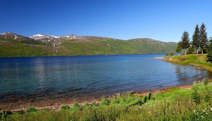
When we arrived at the Senja campsite, it was already 9:30 PM. A sign announced it was full, but luckily, I’d booked it 10 days earlier. By 10:30 PM, as we settled in to eat, it was still broad daylight, and the thermometer read 25°C—despite being at a latitude of 69° North! We went to bed around midnight, exhausted but under the light of a sun that was still very much present. Thanks to Earth’s tilted axis. We’d anticipated this by buying opaque sleep masks because, yes, at this time of year, it’s daylight all the time.
Friday, July 18:
Today, we planned two hikes on the island and a few stops along the way. The map clearly shows that the deepest fjords are in the north and west. Due to time and accessibility, we focused on the northern part of the island. Our first stop was at the viewing platform in Bergbotn:
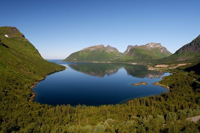
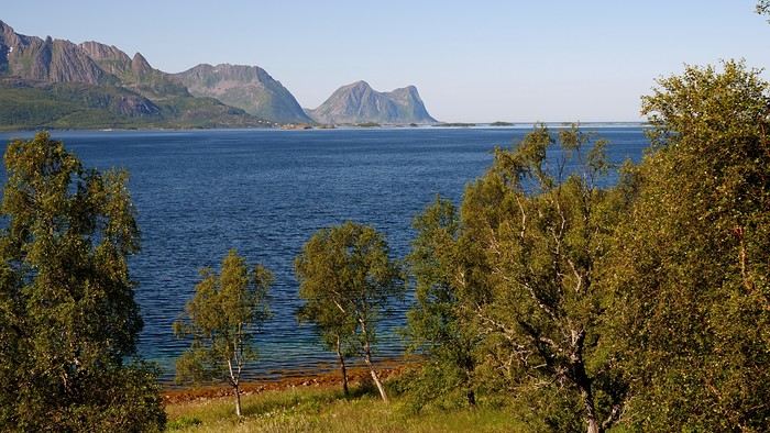
Then we headed toward Skaland, the starting point for our first hike. Along the way, we found plenty of reasons to stop—especially since, on this first day of travel, our thirst for Nordic landscapes was far from quenched.
The town of Skaland is very practical: free parking, picnic tables for after the hike, and a Joker convenience store right next door. Our goal was the summit of Husfjellet: 670 m of elevation gain, between 8 and 9 km in length, and an estimated 4 hours and 30 minutes.
This hike offers two major viewpoints. The first overlooks the Bergsoyan islands to the west:
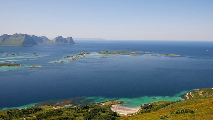
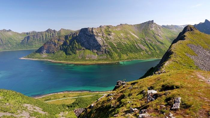
At the summit, the view shifts to the Steinfjorden fjord:
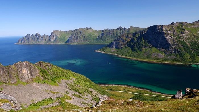
You can even clearly see the "Devil’s Teeth," which we’d see from below later:
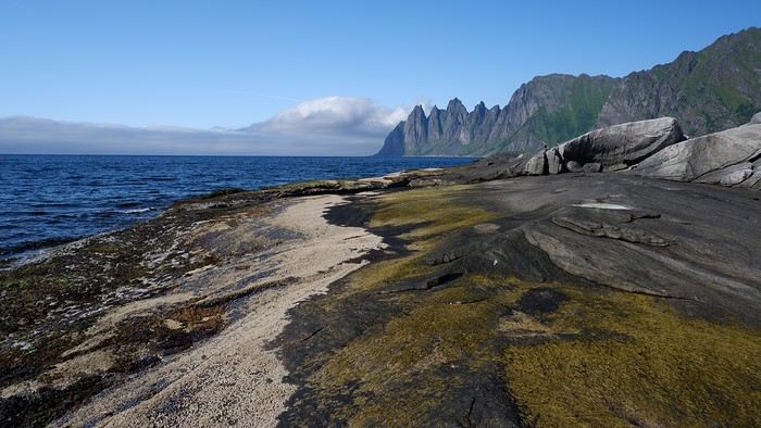
In total, the hike took us 4 hours and 30 minutes, including all the breaks. We treated ourselves to an ice cream in Skaland to recharge for the next hike. We hit the road again and stopped at Tungeneset to get a closer look at the Devil’s Teeth:
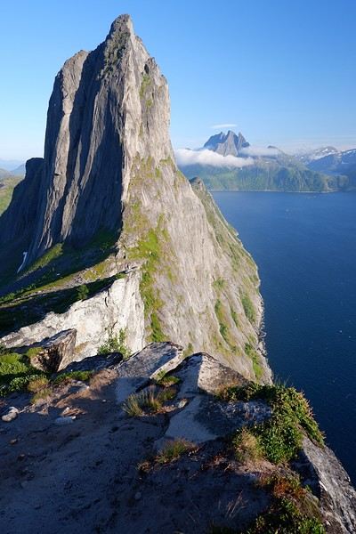
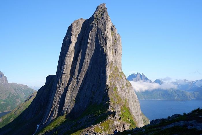
We continued to Fjordgard, the starting point for our second hike. Fjordgard isn’t very welcoming. There was a time when you could park right at the start of the hike up Mount Segla. Now, everything’s blocked off, and locals have even taken to blocking all possible parking spots nearby. You now have to park outside the town at a paid parking lot (90 NOK for 3 hours), adding an extra 2 km (round trip) of walking. Still, that was just a minor inconvenience because the hike that followed quickly made us forget all about it. The hike is fairly short (2 hours) but still has 520 m of elevation gain. This hike was a stark contrast to the first. This morning, we had sweeping views of the vast landscape. Here, Mount Segla, perched on the edge of the cliff, dominates the foreground:
For those prone to vertigo, it might be best to stay at the foot of the mountain, as the trail climbs right along the cliff edge. And from that point on, you quickly understand what verticality really means...
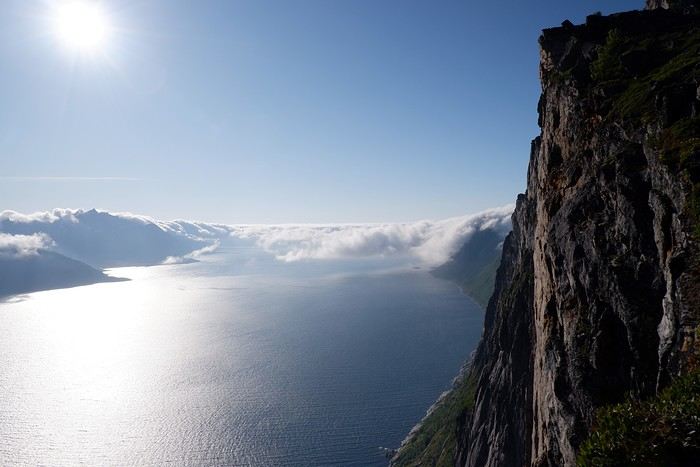
In total, we took 2 hours and 50 minutes, including breaks and the extra walk to the parking lot. The day was already well underway, and with 1,200 m of cumulative elevation gain, it was time to find a spot to eat and sleep. Since we hadn’t made any reservations, we’d planned to bivouac for the night. We weren’t too picky—just practical—so we decided to sleep in the car at the parking lot for tomorrow morning’s hike, just 5 km from Fjordgard.
We traveled to Norway in the summer of 2025, from July 17 to 29, to visit Senja Island and the Lofoten archipelago with a rental car. The common thread of these twelve days was clearly hiking, along with a few visits and experiences, and nights spent in a tent or in the car (which made it possible). We chose Narvik Airport for both arrival and departure for several complementary reasons: the desire to visit nearby Senja Island, slightly more affordable airfare, and finally, the rental price of the vehicle—especially the car model we were looking for. We only made one reservation, for the first campsite, as sleeping in a tent made things much easier. But we had the whole structure of the trip planned, a flexible outline that could adapt to the weather conditions we’d encounter. Senja Island isn’t part of the Lofoten archipelago, and during the early stages of planning this trip, we hadn’t planned to visit it. But its relative proximity to Narvik Airport and, above all, its unique geography definitely made us change our minds. We arrived in Evenes, where Narvik Airport is located, nearly 60 km from the city itself. Our first stop was 40 km further in Bjerkvik on the way to Senja, where there’s a Rema 1000 (a very common supermarket chain in Norway). We needed to buy some food and a gas cartridge for our stove. I’d emailed the store manager beforehand, who told me they didn’t sell them but that the two gas stations in the village were likely to have some in stock.
It was only at the Esso station that I found what I needed, but unfortunately, only one cartridge. Luckily, we quickly realized that most campsites (like in Iceland) have a shared kitchen with hotplates. That single small cartridge was just enough for the few nights we spent outside of campsites... We got our first taste of Norway’s characteristic landscapes:
When we arrived at the Senja campsite, it was already 9:30 PM. A sign announced it was full, but luckily, I’d booked it 10 days earlier. By 10:30 PM, as we settled in to eat, it was still broad daylight, and the thermometer read 25°C—despite being at a latitude of 69° North! We went to bed around midnight, exhausted but under the light of a sun that was still very much present. Thanks to Earth’s tilted axis. We’d anticipated this by buying opaque sleep masks because, yes, at this time of year, it’s daylight all the time.
Friday, July 18:
Today, we planned two hikes on the island and a few stops along the way. The map clearly shows that the deepest fjords are in the north and west. Due to time and accessibility, we focused on the northern part of the island. Our first stop was at the viewing platform in Bergbotn:
Then we headed toward Skaland, the starting point for our first hike. Along the way, we found plenty of reasons to stop—especially since, on this first day of travel, our thirst for Nordic landscapes was far from quenched.
The town of Skaland is very practical: free parking, picnic tables for after the hike, and a Joker convenience store right next door. Our goal was the summit of Husfjellet: 670 m of elevation gain, between 8 and 9 km in length, and an estimated 4 hours and 30 minutes.
This hike offers two major viewpoints. The first overlooks the Bergsoyan islands to the west:
At the summit, the view shifts to the Steinfjorden fjord:
You can even clearly see the "Devil’s Teeth," which we’d see from below later:
In total, the hike took us 4 hours and 30 minutes, including all the breaks. We treated ourselves to an ice cream in Skaland to recharge for the next hike. We hit the road again and stopped at Tungeneset to get a closer look at the Devil’s Teeth:
We continued to Fjordgard, the starting point for our second hike. Fjordgard isn’t very welcoming. There was a time when you could park right at the start of the hike up Mount Segla. Now, everything’s blocked off, and locals have even taken to blocking all possible parking spots nearby. You now have to park outside the town at a paid parking lot (90 NOK for 3 hours), adding an extra 2 km (round trip) of walking. Still, that was just a minor inconvenience because the hike that followed quickly made us forget all about it. The hike is fairly short (2 hours) but still has 520 m of elevation gain. This hike was a stark contrast to the first. This morning, we had sweeping views of the vast landscape. Here, Mount Segla, perched on the edge of the cliff, dominates the foreground:
For those prone to vertigo, it might be best to stay at the foot of the mountain, as the trail climbs right along the cliff edge. And from that point on, you quickly understand what verticality really means...
In total, we took 2 hours and 50 minutes, including breaks and the extra walk to the parking lot. The day was already well underway, and with 1,200 m of cumulative elevation gain, it was time to find a spot to eat and sleep. Since we hadn’t made any reservations, we’d planned to bivouac for the night. We weren’t too picky—just practical—so we decided to sleep in the car at the parking lot for tomorrow morning’s hike, just 5 km from Fjordgard.
Is it possible to do the Tour du Mont Lozère while camping?
Is wild camping possible? Are there campsites and places to restock along the way, and is water available?
Thanks for your answers!
Pierrick
Itinerary ideas for a week in Morocco
Hi everyone, I’ve given my 18-year-old daughter a week in Morocco in February. I’d like to mix a bit of Marrakech (or elsewhere) with a hotel and pool, plus a trip into the desert with some beautiful dunes.
How can I structure this without making the journeys too long? Is it possible to do Marrakech to the south in 2 days, stopping at lovely spots along the way? Just to clarify, I’d prefer not to rent a car, and my daughter isn’t very "adventurous."
Thanks in advance for your replies and tips!
Backpacking itinerary in Tunisia
Hi there,
I'm urgently planning a trip to Tunisia in November, backpacker-style (no agency, no guide or taxi, public transport, youth hostels or small hotels, local restaurants). I'm not interested in the beach, and I like to take my time at archaeological sites and museums (twice as long as the average visitor). I'm aiming for about two weeks, give or take.
First, I'm trying to roughly outline a route/schedule so I can book my flight as soon as possible (no desert in the south this time—I went there years ago and want to stay independent). I’ve sketched out the following itinerary, knowing that apparently, there are quite a few towns without budget-friendly hotels (even on Airbnb), which means I’ll be staying longer where they’re available. Three questions: 1. Does this seem reasonable overall (time spent in each city)? 2. Should I add other cities, maybe in the northwest? 3. For hotels, in November, is it better to scout options on booking sites first, then book on the spot for cheaper rates (no site commission + possible negotiation)? Also, are hotels not listed online and found randomly on-site much cheaper?
ROUGH ITINERARY (order to be confirmed)
TUNIS 5 days (cheap accommodations: 13 or 19 €) 2 days: Medina, souks, Bardo Museum, Royal Mausoleum of Tourbet El Bey, Zitouna Mosque (exterior) 1 day: Sidi Bou Said 1 day: Carthage 1 day: A-R Dougga (bus to Tebersouk 2h + taxi) – pack a picnic + option: hike to Zaghouan (750m+, 10km round trip) – worth it? Doable alone?
KAIROUAN 2 days (very expensive room: 40-50 €!) Great Mosque, Medina, Three Doors Mosque, medieval cemetery, Sidi Sahbi Mosque...
SOUSSE 3 days (room 15 €) 2 days: Medina, archaeological museum, Port El Kantaoui, the Ribat (fortress), Contemporary Art Museum Dar Am Taïeb, Dar Essid (17th-century traditional house) 1 day: A-R El Jem (60km away) + option: 1 day A-R Monastir? Worth it? + option: 1 day A-R Mahdia (or 2 days sleeping there)?
OPTIONS -> Gabes to mix things up? But is it easy to find cheap lodging and get around/visit alone? -> Other sights or stops to sleep: Sfax, El Kef, others? -> Kerkenna Islands (easy accommodation?)
Thanks for your thoughts and opinions on these options. Once I’ve adjusted the duration, I’ll book my tickets for early November! (By the way, do you think I should arrive and depart from two different airports?)
I'm urgently planning a trip to Tunisia in November, backpacker-style (no agency, no guide or taxi, public transport, youth hostels or small hotels, local restaurants). I'm not interested in the beach, and I like to take my time at archaeological sites and museums (twice as long as the average visitor). I'm aiming for about two weeks, give or take.
First, I'm trying to roughly outline a route/schedule so I can book my flight as soon as possible (no desert in the south this time—I went there years ago and want to stay independent). I’ve sketched out the following itinerary, knowing that apparently, there are quite a few towns without budget-friendly hotels (even on Airbnb), which means I’ll be staying longer where they’re available. Three questions: 1. Does this seem reasonable overall (time spent in each city)? 2. Should I add other cities, maybe in the northwest? 3. For hotels, in November, is it better to scout options on booking sites first, then book on the spot for cheaper rates (no site commission + possible negotiation)? Also, are hotels not listed online and found randomly on-site much cheaper?
ROUGH ITINERARY (order to be confirmed)
TUNIS 5 days (cheap accommodations: 13 or 19 €) 2 days: Medina, souks, Bardo Museum, Royal Mausoleum of Tourbet El Bey, Zitouna Mosque (exterior) 1 day: Sidi Bou Said 1 day: Carthage 1 day: A-R Dougga (bus to Tebersouk 2h + taxi) – pack a picnic + option: hike to Zaghouan (750m+, 10km round trip) – worth it? Doable alone?
KAIROUAN 2 days (very expensive room: 40-50 €!) Great Mosque, Medina, Three Doors Mosque, medieval cemetery, Sidi Sahbi Mosque...
SOUSSE 3 days (room 15 €) 2 days: Medina, archaeological museum, Port El Kantaoui, the Ribat (fortress), Contemporary Art Museum Dar Am Taïeb, Dar Essid (17th-century traditional house) 1 day: A-R El Jem (60km away) + option: 1 day A-R Monastir? Worth it? + option: 1 day A-R Mahdia (or 2 days sleeping there)?
OPTIONS -> Gabes to mix things up? But is it easy to find cheap lodging and get around/visit alone? -> Other sights or stops to sleep: Sfax, El Kef, others? -> Kerkenna Islands (easy accommodation?)
Thanks for your thoughts and opinions on these options. Once I’ve adjusted the duration, I’ll book my tickets for early November! (By the way, do you think I should arrive and depart from two different airports?)
Warnings About the Vosges Massif Crossing with TopoGuide ref. 502
Hi there,
This August, I hiked the Vosges section (Vosges massif) of the GR5 (Lauterbourg-Wissembourg-gr53-gr5-Belfort) using the TopoGuide "Traversée du Massif des Vosges" (ref 502, April 2024 edition). My experience was partly ruined by a few things I feel I should share here to help others avoid the same pitfalls—or at least disappointments.
Having used "TopoGuide" books before, I’d always trusted them for organizing treks lasting several weeks, or even months.
Beyond the satisfactory mapping (reproductions of IGN 1:25,000 maps), these guides include route descriptions that are usually enough to find your way. On that point, I have no serious criticism of the Vosges crossing guide.
In addition to the route details, the guide provides "average" time estimates for traveling from point A to point B—useful info for gauging effort and planning likely stages. However, I eventually realized I couldn’t rely on these time estimates. I’d assumed they were calculated by the FFRP, considering that 100m of positive elevation gain roughly equals 1km on flat terrain, with an average walking speed of 4km/h. So, I’d recommend anyone using this guide to recalculate all the time estimates to avoid nasty surprises on tight stages. 🤪
Another key feature of the guide, in my opinion, is its info on accommodation options—especially budget-friendly ones suited for long-distance hikers on a tight budget. A section called "préparation des étapes" includes a table with a column meant to highlight "refuges" and "gîtes d'étapes." That column had me feeling optimistic: these budget accommodations were listed as plentiful along the route. After all, we were in the territory of the famous Club Vosgien—it made sense there’d be plenty of hiker-friendly lodging options. The reality on the ground was quite different. The TopoGuide wasn’t really to blame here, except that a serious warning wouldn’t have hurt. First, regarding the "refuges," most were run by associations. With rare exceptions, the volunteers only opened them on weekends. You can’t really blame people for not volunteering on weekdays, but it makes things tricky when the info about weekend-only openings often turns out to be wrong. As for the "gîtes d'étape," I was mostly disappointed when I was told that a place was booked for weeks: the vast majority of what was listed as a "gîte d'étape" turned out to be "gîtes ruraux." The advice here? If you don’t want to—or can’t—camp, double-check all the accommodation details before you set off. It’s time-consuming and tedious, but if you can, camping is still the best option. 😐 On a brighter note, during the first part of my trip, I came across several cabins that offered alternatives to camping. 🙂
P.S.: Even the youth hostel in Saverne was closed in the middle of August... 😕
Having used "TopoGuide" books before, I’d always trusted them for organizing treks lasting several weeks, or even months.
Beyond the satisfactory mapping (reproductions of IGN 1:25,000 maps), these guides include route descriptions that are usually enough to find your way. On that point, I have no serious criticism of the Vosges crossing guide.
In addition to the route details, the guide provides "average" time estimates for traveling from point A to point B—useful info for gauging effort and planning likely stages. However, I eventually realized I couldn’t rely on these time estimates. I’d assumed they were calculated by the FFRP, considering that 100m of positive elevation gain roughly equals 1km on flat terrain, with an average walking speed of 4km/h. So, I’d recommend anyone using this guide to recalculate all the time estimates to avoid nasty surprises on tight stages. 🤪
Another key feature of the guide, in my opinion, is its info on accommodation options—especially budget-friendly ones suited for long-distance hikers on a tight budget. A section called "préparation des étapes" includes a table with a column meant to highlight "refuges" and "gîtes d'étapes." That column had me feeling optimistic: these budget accommodations were listed as plentiful along the route. After all, we were in the territory of the famous Club Vosgien—it made sense there’d be plenty of hiker-friendly lodging options. The reality on the ground was quite different. The TopoGuide wasn’t really to blame here, except that a serious warning wouldn’t have hurt. First, regarding the "refuges," most were run by associations. With rare exceptions, the volunteers only opened them on weekends. You can’t really blame people for not volunteering on weekdays, but it makes things tricky when the info about weekend-only openings often turns out to be wrong. As for the "gîtes d'étape," I was mostly disappointed when I was told that a place was booked for weeks: the vast majority of what was listed as a "gîte d'étape" turned out to be "gîtes ruraux." The advice here? If you don’t want to—or can’t—camp, double-check all the accommodation details before you set off. It’s time-consuming and tedious, but if you can, camping is still the best option. 😐 On a brighter note, during the first part of my trip, I came across several cabins that offered alternatives to camping. 🙂
P.S.: Even the youth hostel in Saverne was closed in the middle of August... 😕
Swedish Lapland - Padjelantaledden solo trek
A travel journal—it’s been a while!
I must say, my personal situation has "changed a bit" since my last journals (my 3 kids are grown up + a divorce finalized in early 2021). So, no more long-haul family trips; now I’m focusing on multi-day hikes for my vacations. I found a hiking buddy in 2021 to join me on the Laugavegur trek in Iceland, but this year, no one was available.
That’s how the idea of a solo trek in Lapland took root—a region I’ve been dreaming about ever since I read Marie Lefevre’s 2012 journal on the topic.
Marie, who I hiked with for the first time in 2015 during my very first multi-day trek, and whom I can never thank enough for sharing her knowledge and saving me so much time.
To build my confidence for this solo trek, I hiked around Cantal in May (okay, I’m capable of spending nights alone in the middle of nowhere without being overly terrified) and camped in the Mercantour in July, where a massive storm made me realize I still had room for improvement in managing wet conditions...
After some research, I bought 2 Nylofume bags—large, ultra-lightweight ones to protect my gear in my backpack—and a set of 4 Aloksak bags in different sizes for my passport, camera, battery, etc. (and I’m so glad I did!!)
Well, I think I’m all set...
My 16/08 - Day 1 - Ritsem – Gisuris (well, almost) Wed 17/08 – Day 2 - Partly in the tent + minimal progress toward Gisuris Thu 18/08 – Day 3 - Gisuris – Laddejakha (23 km) Fri 19/08 – Day 4 – Laddejakha – Arasluokta (13 km) Sat 20/08 - Day 5 - Arasluokta – Staloluokta (12 km) Sun 21/08 – Day 6 - Staloluokta – Duottar (18 km) Mon 22/08 Day 7 - Duottar – Dareluoppal (10 km) Sammarlappa (15.3 km) Tue 23/08 - Day 8 - Sammarlappa – Tarrekaise (12 km) + halfway to Tarrekaise-Nunjes (approx. 3 km) Wed 24/08 – Day 9 – Finish Tarrekaise-Nunjes (approx. 4 km) Kvikkjokk (12.6 km) Thu 25/08 and Fri 26/08 – Around Kvikkjokk Food and gear summary
I must say, my personal situation has "changed a bit" since my last journals (my 3 kids are grown up + a divorce finalized in early 2021). So, no more long-haul family trips; now I’m focusing on multi-day hikes for my vacations. I found a hiking buddy in 2021 to join me on the Laugavegur trek in Iceland, but this year, no one was available.
That’s how the idea of a solo trek in Lapland took root—a region I’ve been dreaming about ever since I read Marie Lefevre’s 2012 journal on the topic.
Marie, who I hiked with for the first time in 2015 during my very first multi-day trek, and whom I can never thank enough for sharing her knowledge and saving me so much time.
To build my confidence for this solo trek, I hiked around Cantal in May (okay, I’m capable of spending nights alone in the middle of nowhere without being overly terrified) and camped in the Mercantour in July, where a massive storm made me realize I still had room for improvement in managing wet conditions...
After some research, I bought 2 Nylofume bags—large, ultra-lightweight ones to protect my gear in my backpack—and a set of 4 Aloksak bags in different sizes for my passport, camera, battery, etc. (and I’m so glad I did!!)
Well, I think I’m all set...
My 16/08 - Day 1 - Ritsem – Gisuris (well, almost) Wed 17/08 – Day 2 - Partly in the tent + minimal progress toward Gisuris Thu 18/08 – Day 3 - Gisuris – Laddejakha (23 km) Fri 19/08 – Day 4 – Laddejakha – Arasluokta (13 km) Sat 20/08 - Day 5 - Arasluokta – Staloluokta (12 km) Sun 21/08 – Day 6 - Staloluokta – Duottar (18 km) Mon 22/08 Day 7 - Duottar – Dareluoppal (10 km) Sammarlappa (15.3 km) Tue 23/08 - Day 8 - Sammarlappa – Tarrekaise (12 km) + halfway to Tarrekaise-Nunjes (approx. 3 km) Wed 24/08 – Day 9 – Finish Tarrekaise-Nunjes (approx. 4 km) Kvikkjokk (12.6 km) Thu 25/08 and Fri 26/08 – Around Kvikkjokk Food and gear summary
What are some good trekking routes in the Vosges?
hi there
I live near Dole, so not too far away, and I sometimes go hiking (Camino de Santiago, Saint-Guilhem-le-Désert, etc.), and I’d love it if someone could suggest a trek in the Vosges—I really don’t know the area well. (Yeah, I know, I’m a little embarrassed about that.)
If you could recommend a nice route.
Arrival by car or train, doesn’t matter.
Thanks so much!
My experience hiking the Mercantour independently
I wanted to share an incredible experience I had recently that really left an impression on me: hiking the Mercantour independently. It’s an absolutely stunning mountain range, with varied landscapes that go from lush forests to rocky ridges, passing through high-altitude lakes with unbelievable colors. I chose a one-week route, sleeping under the stars in a bivouac.
It was a pretty demanding adventure, with significant elevation changes and sometimes unpredictable weather. But every effort was rewarded with breathtaking views. I was lucky enough to spot marmots, chamois, and even ibex in the distance. It’s truly a total immersion in nature!
A little tip for those tempted by the adventure: plan your route and gear carefully. Independence requires good preparation. I particularly appreciated having a good water filtration system and lightweight cookware. And for safety, aside from a map and compass (or GPS), I never leave without my two-way radio. In these remote areas where there’s no mobile signal, it’s a real safety net in case of trouble or just to communicate with other hikers if you’re in a group. It can really make a difference!
If any of you have already hiked in the Mercantour or have questions about my experience, don’t hesitate to ask. I’d love to chat with you about this beautiful range or other hiking destinations.
See you on the trails! 🙂
It was a pretty demanding adventure, with significant elevation changes and sometimes unpredictable weather. But every effort was rewarded with breathtaking views. I was lucky enough to spot marmots, chamois, and even ibex in the distance. It’s truly a total immersion in nature!
A little tip for those tempted by the adventure: plan your route and gear carefully. Independence requires good preparation. I particularly appreciated having a good water filtration system and lightweight cookware. And for safety, aside from a map and compass (or GPS), I never leave without my two-way radio. In these remote areas where there’s no mobile signal, it’s a real safety net in case of trouble or just to communicate with other hikers if you’re in a group. It can really make a difference!
If any of you have already hiked in the Mercantour or have questions about my experience, don’t hesitate to ask. I’d love to chat with you about this beautiful range or other hiking destinations.
See you on the trails! 🙂
4 weeks in a camper van in Portugal: any tips?
We're thinking of visiting Portugal, either in November or next April. We'd rent a camper van for 4 weeks and try to see as much of this beautiful country as possible! Any tips or ideas??
Thanks :)
Boat trip on the Pangalanes Canal from Toamasina to Manakara
Hi there, I’m looking for info on whether it’s feasible to travel the Pangalanes Canal by boat from Toamasina to Manakara. I know the canal is poorly maintained with some sections that aren’t navigable. This is my 5th trip to Madagascar. Thanks for any tips!
Tips for horseback trekking in Mongolia/Kazakhstan/Kyrgyzstan
Hey there, fellow travelers!
I’m planning a multi-month trek across Central Asia starting April/May 2025, blending horseback travel, hiking, and stops of a few weeks if the opportunity arises. Craving adventure, nature, horse contact, human connections, and culture. I’ve got decent endurance from camping and medium/long-haul trips, but this would be my first project of this scale—especially with horses and in such sparsely populated regions.
With an eye toward a well-prepared expedition that still leaves plenty of room for intuition, I’m casting my message in a bottle: + Tips for self-sufficient horseback prep (I plan to do some intensive training in Europe before departure, then start my journey on-site with an agency like Cheval d'Aventure for the first few weeks) + Suggestions for community development/solidarity projects I could join for a few weeks or months along the way + Travel buddy(ies) interested in joining me for part of the adventure (especially for self-sufficient horseback travel), or recommendations on how to find these companions + Any other kind of info is obviously welcome!
Thanks in advance for your invaluable help—and maybe see you for a stretch of the road together!
Antoine.
I’m planning a multi-month trek across Central Asia starting April/May 2025, blending horseback travel, hiking, and stops of a few weeks if the opportunity arises. Craving adventure, nature, horse contact, human connections, and culture. I’ve got decent endurance from camping and medium/long-haul trips, but this would be my first project of this scale—especially with horses and in such sparsely populated regions.
With an eye toward a well-prepared expedition that still leaves plenty of room for intuition, I’m casting my message in a bottle: + Tips for self-sufficient horseback prep (I plan to do some intensive training in Europe before departure, then start my journey on-site with an agency like Cheval d'Aventure for the first few weeks) + Suggestions for community development/solidarity projects I could join for a few weeks or months along the way + Travel buddy(ies) interested in joining me for part of the adventure (especially for self-sufficient horseback travel), or recommendations on how to find these companions + Any other kind of info is obviously welcome!
Thanks in advance for your invaluable help—and maybe see you for a stretch of the road together!
Antoine.
7-day itinerary in Morocco, starting from Agadir
Hi there,
I’m heading to Morocco in early September for a week, and I could use some advice on an itinerary. I’ll be renting a car, and I generally like pretty packed itineraries. That said, is this one manageable, or is it TOO packed—maybe even unworkable? I usually like to hit the road by 6 AM.
Are there any stops that are way too rushed? Any suggestions for the route or places to see along the way?
Thanks to anyone who replies! :)
Best,
Day 1 Agadir → Taroudant Taroudant → Ait Benhaddou Day 2 Ait Benhaddou → Ouarzazate Ouarzazate → Zagora, overnight in the desert (is it better to stop and take a tour in Zagora, or keep going to M’Hamid?)
Day 3 Desert excursion, then head to Skoura
Day 4 Skoura → Ouzoud
Day 5 Ouzoud → Marrakech
Day 6 Marrakech → Essaouira
Day 7 Essaouira → Agadir
Thanks!
I’m heading to Morocco in early September for a week, and I could use some advice on an itinerary. I’ll be renting a car, and I generally like pretty packed itineraries. That said, is this one manageable, or is it TOO packed—maybe even unworkable? I usually like to hit the road by 6 AM.
Are there any stops that are way too rushed? Any suggestions for the route or places to see along the way?
Thanks to anyone who replies! :)
Best,
Day 1 Agadir → Taroudant Taroudant → Ait Benhaddou Day 2 Ait Benhaddou → Ouarzazate Ouarzazate → Zagora, overnight in the desert (is it better to stop and take a tour in Zagora, or keep going to M’Hamid?)
Day 3 Desert excursion, then head to Skoura
Day 4 Skoura → Ouzoud
Day 5 Ouzoud → Marrakech
Day 6 Marrakech → Essaouira
Day 7 Essaouira → Agadir
Thanks!
Summer itinerary in western Crete
Hi there,
I’m reaching out for your advice on a Crete itinerary. We’re a group of 3 (2 adults and 1 teen) and will be traveling for 13 days / 12 nights in early August. To enjoy the trip without rushing too much, we’ve decided to focus on the western part of the island. Before diving into the details of our planned route, here’s a bit about how we like to travel. We’re big fans of hiking, bivouacking in the Pyrenees, or bike touring. We’re well aware that Crete is a popular summer destination, but we’d like to avoid overly crowded spots while still trying to visit places we consider "must-sees"—or at least those we’re eager to discover. For activities, hiking might be tricky due to the heat, but we’re thinking of water-based fun and historical visits: snorkeling, windsurfing or paddleboarding, gorges, and so on. For accommodations, we’ll mix it up between guesthouses, hotels, and private rentals.
Here’s what we’re considering: Day 1: Arrival in the evening in Heraklion – Night in Heraklion. Day 2: Head to Chania / Night in Chania - 3 nights in Falassarna (exploring Balos and the surrounding area) - 3 nights in Paleochora (discovering Elafonissi and nearby) - 3 nights in Sougia (day trip by ferry to Loutro, Agia Roumeli) Then, return to Rethymnon in the morning by road and spend our last night there (after checking various guides and forums, the ferry option seems a bit too restrictive, so we’re planning to drive back to Heraklion for our flight at the end of the day).
I’m a bit unsure—should we dedicate more time to the northern part of the island? What do you think? Thanks in advance for your valuable tips! Stéphanie
I’m reaching out for your advice on a Crete itinerary. We’re a group of 3 (2 adults and 1 teen) and will be traveling for 13 days / 12 nights in early August. To enjoy the trip without rushing too much, we’ve decided to focus on the western part of the island. Before diving into the details of our planned route, here’s a bit about how we like to travel. We’re big fans of hiking, bivouacking in the Pyrenees, or bike touring. We’re well aware that Crete is a popular summer destination, but we’d like to avoid overly crowded spots while still trying to visit places we consider "must-sees"—or at least those we’re eager to discover. For activities, hiking might be tricky due to the heat, but we’re thinking of water-based fun and historical visits: snorkeling, windsurfing or paddleboarding, gorges, and so on. For accommodations, we’ll mix it up between guesthouses, hotels, and private rentals.
Here’s what we’re considering: Day 1: Arrival in the evening in Heraklion – Night in Heraklion. Day 2: Head to Chania / Night in Chania - 3 nights in Falassarna (exploring Balos and the surrounding area) - 3 nights in Paleochora (discovering Elafonissi and nearby) - 3 nights in Sougia (day trip by ferry to Loutro, Agia Roumeli) Then, return to Rethymnon in the morning by road and spend our last night there (after checking various guides and forums, the ferry option seems a bit too restrictive, so we’re planning to drive back to Heraklion for our flight at the end of the day).
I’m a bit unsure—should we dedicate more time to the northern part of the island? What do you think? Thanks in advance for your valuable tips! Stéphanie
Camino del Cid: picking up our car in Burgos
Hi,
We’re planning to start the Camino del Cid from Vivar del Cid (Burgos) to Atienza in April.
How can we get back and pick up our car, which we left in Burgos? I haven’t found any info on this.
Thanks for your tips!
7 days in Morocco in February: Marrakech - desert - Marrakech
Hi everyone,
Two adults and two kids—we’re thinking about a 7-day trip to Morocco in mid-February. Our flights would arrive in Marrakech at 3 PM on February 13th and depart at 7 AM on the 20th. We’ve based our itinerary on travel blogs, but we’re not experts, so we’d love your advice.
February 13th: Arrival in Marrakech at 3 PM. Settle in and explore the city. Night in Marrakech.
February 14th: Full day and evening in Marrakech.
February 15th: Drive via Teoulet to Aït Ben Haddou (~3.5 hours), visit the site. In the mid-afternoon, drive (~45 minutes) to Ouarzazate. Spend the rest of the day and night in Ouarzazate.
February 16th: Morning in Ouarzazate, then drive (~3 hours) to Foum Zguid. Night in Foum Zguid.
February 17th: Early departure (~2-hour drive) from Foum Zguid to Erg Chegaga with a guide. Desert experience and bivouac. Night in Erg Chegaga.
February 18th: Sunrise at Erg Chegaga, return to Foum Zguid where the car will be parked. Drive to an intermediate stop. We’re not sure what to do at this point—any recommendations? Is there a better option than heading back to Ouarzazate? Night at this intermediate stop.
February 19th: Return to Marrakech, sightseeing, and night near Marrakech airport.
February 20th: Early transfer for a 7 AM flight.
Questions:
Do these travel times seem realistic? Any suggestions for a smoother trip or interesting stops without adding days? Is Foum Zguid a good choice for visiting the desert? What temperatures should we expect in the desert, especially at night? We’d really appreciate your feedback. Thanks!
Two adults and two kids—we’re thinking about a 7-day trip to Morocco in mid-February. Our flights would arrive in Marrakech at 3 PM on February 13th and depart at 7 AM on the 20th. We’ve based our itinerary on travel blogs, but we’re not experts, so we’d love your advice.
February 13th: Arrival in Marrakech at 3 PM. Settle in and explore the city. Night in Marrakech.
February 14th: Full day and evening in Marrakech.
February 15th: Drive via Teoulet to Aït Ben Haddou (~3.5 hours), visit the site. In the mid-afternoon, drive (~45 minutes) to Ouarzazate. Spend the rest of the day and night in Ouarzazate.
February 16th: Morning in Ouarzazate, then drive (~3 hours) to Foum Zguid. Night in Foum Zguid.
February 17th: Early departure (~2-hour drive) from Foum Zguid to Erg Chegaga with a guide. Desert experience and bivouac. Night in Erg Chegaga.
February 18th: Sunrise at Erg Chegaga, return to Foum Zguid where the car will be parked. Drive to an intermediate stop. We’re not sure what to do at this point—any recommendations? Is there a better option than heading back to Ouarzazate? Night at this intermediate stop.
February 19th: Return to Marrakech, sightseeing, and night near Marrakech airport.
February 20th: Early transfer for a 7 AM flight.
Questions:
Do these travel times seem realistic? Any suggestions for a smoother trip or interesting stops without adding days? Is Foum Zguid a good choice for visiting the desert? What temperatures should we expect in the desert, especially at night? We’d really appreciate your feedback. Thanks!
Exploring Mauritania by 4x4 in February 2025
I’m proposing to team up for two weeks in Mauritania in February.
Round-trip flight Paris/Nouakchott with RAM is around 500 €. Departure around 28/01, return around 13/02.
On the ground, I’m organizing a grand tour of Mauritania with a guide I know who’s very reliable. We’ll be in a 4x4, alternating between bivouacs and small hostels. A really diverse itinerary. The circuit price is a maximum of 1200 €. Mauritanian visa: 55 €.
I already know Mauritania—it’s a low-tourism, safe, and friendly country. A chance to discover a real desert with real nomads! However, the ‘hotel’ services are basic! So I’m looking for adaptable travel companions, easy-going, and preferably with a good sense of humor.
I’m in the senior age range, but I’ve got nothing against younger folks 😊.
If you’d like to share this amazing adventure, get in touch with me.
Round-trip flight Paris/Nouakchott with RAM is around 500 €. Departure around 28/01, return around 13/02.
On the ground, I’m organizing a grand tour of Mauritania with a guide I know who’s very reliable. We’ll be in a 4x4, alternating between bivouacs and small hostels. A really diverse itinerary. The circuit price is a maximum of 1200 €. Mauritanian visa: 55 €.
I already know Mauritania—it’s a low-tourism, safe, and friendly country. A chance to discover a real desert with real nomads! However, the ‘hotel’ services are basic! So I’m looking for adaptable travel companions, easy-going, and preferably with a good sense of humor.
I’m in the senior age range, but I’ve got nothing against younger folks 😊.
If you’d like to share this amazing adventure, get in touch with me.
Voyage dans le Sud marocain à Pâques 2021 avec enfants de 7 et 10 ans English translation pending
Bonjour à tous,
Nous avons pensé au Maroc pour un premier grand voyage à l'étranger en famille. Nous pensons que ce pays permettra à nos enfants de découvrir de nouveaux horizons en nous épargnant de trop longues heures d'avion. J'y suis allé jeune mais serais incapable de dire si l'itinéraire auquel j'ai pensé peut se faire sans que cela soit la course. L'idée est donc de partir une douzaine de jours max avec une arrivée à Marrakech puis location de voiture pour commencer l'itinérance:
J1: arrivée Marrakech J2: Marrakech J3: rejoindre Skoura en passant voir les cascades d'Ouzoud J4: Vallée des Roses / Vallée des Dades J5: Tineghir/ Gorges du Todra J6: Merzouga ou Erg Chebbi (nuit en bivouac dans le désert) J7: nuit à Tamnougalt en passant par Ouarzazate dans la journée J8: Ait Benhadou J9: dernière nuit à Marrakech J10: retour en France
Je me suis inspiré de pas mal de commentaires et carnets de voyage mais ne suis pas sûr de moi sur ce coup là. Nous souhaitons acheter nos billets prochainement pour profiter de tarifs avantageux. Je suis bien sûr preneur de vos suggestions sur les loueurs de voitures, hôtels, restos ou étapes insolites. Nous souhaitons avant tout prendre le temps plutôt que multiplier les sites à "visiter".
Merci d'avance à ceux qui prendront le temps de me répondre.
Benjamin
Nous avons pensé au Maroc pour un premier grand voyage à l'étranger en famille. Nous pensons que ce pays permettra à nos enfants de découvrir de nouveaux horizons en nous épargnant de trop longues heures d'avion. J'y suis allé jeune mais serais incapable de dire si l'itinéraire auquel j'ai pensé peut se faire sans que cela soit la course. L'idée est donc de partir une douzaine de jours max avec une arrivée à Marrakech puis location de voiture pour commencer l'itinérance:
J1: arrivée Marrakech J2: Marrakech J3: rejoindre Skoura en passant voir les cascades d'Ouzoud J4: Vallée des Roses / Vallée des Dades J5: Tineghir/ Gorges du Todra J6: Merzouga ou Erg Chebbi (nuit en bivouac dans le désert) J7: nuit à Tamnougalt en passant par Ouarzazate dans la journée J8: Ait Benhadou J9: dernière nuit à Marrakech J10: retour en France
Je me suis inspiré de pas mal de commentaires et carnets de voyage mais ne suis pas sûr de moi sur ce coup là. Nous souhaitons acheter nos billets prochainement pour profiter de tarifs avantageux. Je suis bien sûr preneur de vos suggestions sur les loueurs de voitures, hôtels, restos ou étapes insolites. Nous souhaitons avant tout prendre le temps plutôt que multiplier les sites à "visiter".
Merci d'avance à ceux qui prendront le temps de me répondre.
Benjamin
Traversée du Bugey à vélo English translation pending
Raid pour les amateurs de petites routes, un peu de Gravel, et pas mal de grimpettes. Intérêt de ne pas trop charger la mule.
1ère étape Amberieu = Ordonnaz : 40 km et 800 m de dénivelée
2 étape Ordonnaz = Les Plans d Hotonnes 50 km et 1400 de dénivelée
3 éme étape = retour sur Annecy 60 km et 400 m
Nuit en bivouac: cette fois j ai préféré le Tarp (2x3 m) au sursac
Départ de la gare SNCF d amberieu en Bugey> Vaux en bugey par d27a
> Puis D60a annoncée barrée mais passe facile en velo
> Souclin , d99
>
> Crochet par d73 puis combe de maitant ( gravel) pensant trouver de l eau. Finalement j arrive a ordonnaz et je trouve l eau aux WC de l eglise et a au cimetière (mieux pour remplir)
> Bivouac dans la forêt au-dessus de la d94
> Fin 1ère étape 35 km environ (2 secteurs non goudronnés)
>
> 2eme étape : descente à contrevoz, montée à armix , premilieu, midi a l etang de premilieu, d53, puis secteur pavé vers vaux st Sulpice, arrivée à Hauteville par les étangs puis terrain de sport. Ravito A hauteville ( commerces)
> Contre la montre jusqu'au a champdor, col du cuvillat, valromey puis montée vers les plan d hotonne que je commence à découvrir par ses WC pour la flotte. Route champêtre vers la ferme de la tour, puis pr a travers le plateau du retort, quelques poussettes mais ça roule plutôt bien, on apprécie de ne pas être trop chargé ( j ai qd même quelques litres de flotte)
> J échoue dans un bois à cote de la ferme du turmet ( proche grange a lucien) poussette pour s ecarter du gr ( me méfie des quads )
>
> Début 3ème étape par gr509 , parking raimont, proche cuvillat, descente vers genissiat sans ou lier le sublime belvedaire du catray. Vue à 180.
> Retour via usinens, desingy, sillingy, annecy(gare ter) Le bugey se prête bien au bivouac et il y a mille itinéraires possibles, le plus difficile est de bien anticiper pour la flotte. Contactez moi si questions.
Retour d’itinérance vélo de Tarbes à l’océan le long de l‘Adour et du Gave English translation pending
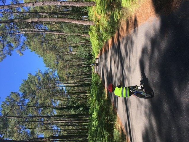
Bonjour,
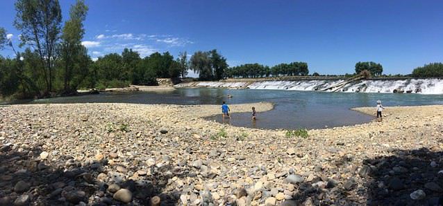
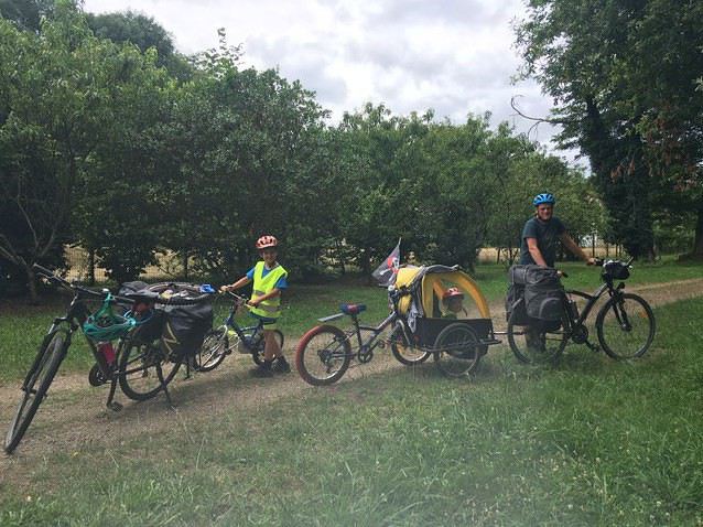
Je mets ce post car je n’avais pas trouvé trop d infos sur le net sur ce circuit. Nous rentrons de 2 semaines d itinérance en vélo avec : - une première partie en famille (5&7ans) de Tarbes jusqu à seignosse: nous avons suivi à peu près les sentiers de l adour jusqu à saint sever, puis voie cyclable de la Chalosse jusqu à Dax, pour finir par couper direction Soustons puis seignosse (plage!). Nous étions en mix bivouac/camping avec carriole et follow me
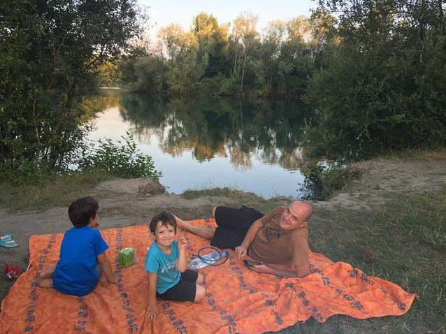
- une deuxième partie de Seignosse à Tarbes où nous avons suivi le gave cette fois-ci. Nous nous sommes délestés à Saint Vincent de Tyrosse des enfants et de beaucoup de matos pr un retour rapide à 2 (a l hôtel) par peyrehorade, Orthez, Pau, Lourdes, Tarbes. D Orthez à Lourdes, nous avons suivi la Véloroute du Piémont v81 qui est très chouette.
Ça fait une boucle d environ 400km quasi plat, ce qui est parfait pour nos gambettes ! Si vous voulez des infos, n hésitez pas à poser vos questions ou à m envoyer un mp.
Bonne balade/voyage à vous !
Randonnée 4/5 jours en Pyrénées-Orientales peu fréquentée? English translation pending
bonjour amis de la montagne!
Apres des heures à chercher sur la toile sans decouverte enthousiasmante, je vous sollicite!
Nous recherchons une rando de 4/5 jours en pyrénées orientales cet été (jusque là tout va bien...) mais sans les hordes de touristes! Le tour du Canigou ou du Carlit semblent super mais un peu l'autoroute aussi...
Nous souhaitons dormir dans de petits refuges, et evidemment des vues epoustouflantes en chemin ;) Nous sommes de bons marcheurs!
Des idées??!!
Un grand merci par avance! Caro
Nous souhaitons dormir dans de petits refuges, et evidemment des vues epoustouflantes en chemin ;) Nous sommes de bons marcheurs!
Des idées??!!
Un grand merci par avance! Caro
Avis sur rando itinérante dans les Hautes-Pyrénées English translation pending
bonsoir
je prévois une randonnée itinérante dans les Hautes Pyrénées pendant 2 semaines fin juillet début août, avec mes jeunes garçons. Le Massif de Néouvielle et de Gavarnie semblent s'imposer à moi pour l'instant, mais je redoute la forte affluence. Nous allons bivouaquer, alors autant en profiter et trouver des coins tranquilles. (Si je plante la tente sur une autoroute de randonneurs, le dépaysement ne sera pas vraiment assuré !)
Est-ce possible en cette saison, ou illusoire, dans ces deux zones ? ou bien faut-il se rendre dans d'autres zones des Pyrénées moins fréquentées ? Pour faire plaisir à mes enfants, mon cahier des charges est le suivant : voir des glaciers (!), des marmottes, des ours (bon là, faut pas exagérer !), si possible des Isards, des sommets pointus (!), aller en Espagne, voir des lacs et des cascades. Et pas trop de monde, vous l'aurez compris.
auriez-vous des avis ? (je prévois environ 8 kms par jour)
merci !
Quelques campings à me conseiller en Bretagne? English translation pending
Bonjour à tous
Cet été je pédale en France : en Bretagne et Loire-Atlantique. En gros : Redon - Carhaix par le Canal de Nantes à Brest direction Concarneau puis le littoral Sud, quelques îles, golfe du Morbihan Guérande - Pornic.
Les tarifs stratosphériques de certains campings m'affolent un peu. Il est vrai que je pars à la mauvaise période : fin juillet - mi août...
Quant aux tarifs cyclos, j'en ai trouvé quelques uns mais à partir de la presqu'île de Rhuys et jusqu'à Pornic je sèche un peu... il reste l'option bivouac mais dans les coins très touristiques, je préfère éviter et surtout pouvoir me "poser" afin de me donner le temps de visiter :)
Avez vous des campings à me conseiller - toute catégories confondues - pour leur accueil, leur confort et/ou leurs tarifs, de Port Navalo à Pornic (où j'ai déjà réservé un hébergement).
Merci !
Cet été je pédale en France : en Bretagne et Loire-Atlantique. En gros : Redon - Carhaix par le Canal de Nantes à Brest direction Concarneau puis le littoral Sud, quelques îles, golfe du Morbihan Guérande - Pornic.
Les tarifs stratosphériques de certains campings m'affolent un peu. Il est vrai que je pars à la mauvaise période : fin juillet - mi août...
Quant aux tarifs cyclos, j'en ai trouvé quelques uns mais à partir de la presqu'île de Rhuys et jusqu'à Pornic je sèche un peu... il reste l'option bivouac mais dans les coins très touristiques, je préfère éviter et surtout pouvoir me "poser" afin de me donner le temps de visiter :)
Avez vous des campings à me conseiller - toute catégories confondues - pour leur accueil, leur confort et/ou leurs tarifs, de Port Navalo à Pornic (où j'ai déjà réservé un hébergement).
Merci !
Espagne: bivouaquer à la limite du parc national d'Aigüestortes (Encantas) English translation pending
Bonjour à tous,
J'aimerais faire quelques jours d'itinérances dans le parc national d'aiguestortes (encantas) cet été. J'ai bien lu qu'il est interdit de bivouaquer dans le parc.
Mais peut on bivouaquer entre la limite du parc et la limite de la zone de protection ? (j'ai pris la carte sur le site officiel du parc lien ci-dessous) https://www.miteco.gob.es/es/red-parques-nacionales/nuestros-parques/aiguestortes/2014_oapn_fre_tcm30-60072.pdf
Exemple de bivouac dans le secteur entre la limite du parc et de la zone de protection. - du refuge de Colomèrs, ou de Restanca ou au parking de Cavallers...
Autrement, savez vous si les refuges acceptent le bivouac si on prend le repas du soir ? - Refuge Colomèrs - Refuge Ventosa.
Merci d'avance pour vos conseils,
Bonne randonnée à tous.
J'aimerais faire quelques jours d'itinérances dans le parc national d'aiguestortes (encantas) cet été. J'ai bien lu qu'il est interdit de bivouaquer dans le parc.
Mais peut on bivouaquer entre la limite du parc et la limite de la zone de protection ? (j'ai pris la carte sur le site officiel du parc lien ci-dessous) https://www.miteco.gob.es/es/red-parques-nacionales/nuestros-parques/aiguestortes/2014_oapn_fre_tcm30-60072.pdf
Exemple de bivouac dans le secteur entre la limite du parc et de la zone de protection. - du refuge de Colomèrs, ou de Restanca ou au parking de Cavallers...
Autrement, savez vous si les refuges acceptent le bivouac si on prend le repas du soir ? - Refuge Colomèrs - Refuge Ventosa.
Merci d'avance pour vos conseils,
Bonne randonnée à tous.
Voyager à pied et en solo au sud du Portugal English translation pending
Bonjour,
Je suis en train de préparer un voyage en solo au Portugal. Plus précisément au Sud du Portugal pour le mois d'Août. L'idée étant d'arriver à Lisbonne et puis de faire la côte sud pourquoi pas jusqu'à Faro. J'ai beaucoup de temps devant moi donc je ne prévois pas une date précise de retour. J'ai plusieurs questions car je souhaite faire ce voyage en solo et à pied (avec transports type bus ou train si il faut). Je vais rester 3/4 jours à Lisbonne car j'adore cette ville mais ensuite j'aimerais aller plus dans les petits villages et campagne, un voyage plutôt nature en perspective. Je ne suis pas une grande connaisseuse de rando mais j'adore ça et j'aimerais en faire, peut-être en bivouac. Je précise que je voyage en tente. Je pense privilégier, le camping (sauvage ou non), des auberges ou chez l'habitant.
- Est-ce que le Portugal est un pays "sûr" pour voyager seule? J'ai le sentiment que oui mais si bous avez des retours d'expériences. - Je n'ai pas de parcours précis pour le moment alors si vous avez des suggestions plutôt "nature"/campagne, je suis très preneuse de ce genre d'infos. - Est-ce qu'il est facile (et pas trop cher) de voyager en bus ou train? - Est-ce qu'il est facile de faire du camping sauvage au Portugal? - Est-ce que vous avez des plans de nuit chez l'habitant?
Je pense que c'est déjà pas mal de questions pour une première approche.
J'espère vous lire bientôt et pouvoir pourquoi vous croiser sur la route :)
Je vous remercie
Leïla
Je suis en train de préparer un voyage en solo au Portugal. Plus précisément au Sud du Portugal pour le mois d'Août. L'idée étant d'arriver à Lisbonne et puis de faire la côte sud pourquoi pas jusqu'à Faro. J'ai beaucoup de temps devant moi donc je ne prévois pas une date précise de retour. J'ai plusieurs questions car je souhaite faire ce voyage en solo et à pied (avec transports type bus ou train si il faut). Je vais rester 3/4 jours à Lisbonne car j'adore cette ville mais ensuite j'aimerais aller plus dans les petits villages et campagne, un voyage plutôt nature en perspective. Je ne suis pas une grande connaisseuse de rando mais j'adore ça et j'aimerais en faire, peut-être en bivouac. Je précise que je voyage en tente. Je pense privilégier, le camping (sauvage ou non), des auberges ou chez l'habitant.
- Est-ce que le Portugal est un pays "sûr" pour voyager seule? J'ai le sentiment que oui mais si bous avez des retours d'expériences. - Je n'ai pas de parcours précis pour le moment alors si vous avez des suggestions plutôt "nature"/campagne, je suis très preneuse de ce genre d'infos. - Est-ce qu'il est facile (et pas trop cher) de voyager en bus ou train? - Est-ce qu'il est facile de faire du camping sauvage au Portugal? - Est-ce que vous avez des plans de nuit chez l'habitant?
Je pense que c'est déjà pas mal de questions pour une première approche.
J'espère vous lire bientôt et pouvoir pourquoi vous croiser sur la route :)
Je vous remercie
Leïla
Tour de France à vélo par les plus beaux itinéraires... English translation pending
Je prépare le tour de France à vélo que je prévois pour l'été 2021.
En effet j'habite à Annemasse (a coté de Geneve) et je prévois de faire pour commencer la route des grandes Alpes, ensuite d'accomplir l’ EuroVélo 8 de Menton a le Perthus, aprés de rouler toutes les Pyrénées d’est en ouest par les cols et d'arriver aux alentours de Saint Jean-de-Luz, je decide après de longer la côte atlantique par la Vélodyssée EuroVélo 1, de rejoindre la Vélomaritime EuroVélo 4, j’arriverais alors aux alentours de calais, et là s'engendre le retour...
Mes questions sont :
1 ; L'itinéraire EuroVélo 8 est-il approprié pour rouler sur des petits axes et avoir un super point de vue sur la Méditerranée ? Sinon quel itinéraire me conseiller vous ?
2 ; Quel serait l’itinéraire recommander pour traverser les Pyrénées en passant par les plus gros cols, et sans trop rouler sur les gros axes ?
3 ; Arrivant dans les hauts de France, quel itinéraire des plus vallonnées me permette de rentrer à Annemasse, en traversant la France, sans rouler sur les gros axes, avec des paysages ?
4 ; Est-il intéressant à longer les nombreux km de côtes Atlantique, où il y a des itinéraires plus attrayants en passant peut-être plus dans les terres de la France ?
Pour info, j’ai fait en solitaire en mode bivouac le tour du Mont-Blanc, la route des grandes Alpes, les petites routes du soleil.
Si mes itinéraires ne sont pas conseillés, je suis actuellement en train de tout planifier, et je peux changer.
C’est le voyage de ma vie, merci de vos réponses.
Mes questions sont :
1 ; L'itinéraire EuroVélo 8 est-il approprié pour rouler sur des petits axes et avoir un super point de vue sur la Méditerranée ? Sinon quel itinéraire me conseiller vous ?
2 ; Quel serait l’itinéraire recommander pour traverser les Pyrénées en passant par les plus gros cols, et sans trop rouler sur les gros axes ?
3 ; Arrivant dans les hauts de France, quel itinéraire des plus vallonnées me permette de rentrer à Annemasse, en traversant la France, sans rouler sur les gros axes, avec des paysages ?
4 ; Est-il intéressant à longer les nombreux km de côtes Atlantique, où il y a des itinéraires plus attrayants en passant peut-être plus dans les terres de la France ?
Pour info, j’ai fait en solitaire en mode bivouac le tour du Mont-Blanc, la route des grandes Alpes, les petites routes du soleil.
Si mes itinéraires ne sont pas conseillés, je suis actuellement en train de tout planifier, et je peux changer.
C’est le voyage de ma vie, merci de vos réponses.
Causses et Mont Lozère par les pistes English translation pending
Bonjour, nous partons à quatre qui avons une bonne expérience du voyage à vélo par des pistes un peu partout sur la planète. Nous voudrions faire une sortie de 10 jours entre les différents causses, l'Aigoual, le mont Lozère et la Margeride.
Par exemple, on aimerait passer le plus près possible de la crête du mont Lozère de l'est à l'ouest, faire un maximum de montées et descentes à partir des différentes rivières, Tarn, Jonte, Dourbie et d'autres sur les différents causses, Méjean, Noir, Larzac, Sauverette, Bégon....
On aimerait si c'est possible trouver des pistes même si nous roulerons aussi sur goudron, cependant nous serons avec vélo de voyage avec sacoches et pas en VTT, donc pas de pistes trop techniques.
D'autre part les conditions de bivouac sont restrictives dans le parc des Cévennes qui englobe tous ces coins, votre expérience nous intéresse.
Nous prenons toutes vos expériences et conseils pour faire évoluer notre parcours.
Merci par avance
Luc
Sélectionner les activités à faire à la Réunion English translation pending
Bonjour à tous,
Je pars à la Réunion en janvier 2021 (oui je suis en avance). J'ai pris mes billets d'avion avec Air France, ma voiture de location chez jumbo car et pense prendre plusieurs airbnb répartis sur le territoire.
Je sais qu'il y a 1000 choses à faire mais je ne sais pas par où commencer... Le Piton des Neiges c'est sûr mais quoi d'autres ? Des idées de randonnées qui sortent un peu de l'ordinaire mais plutôt cool ?
Sinon je suis fan fan fan de plongée et aimerait beaucoup plonger là-bas, avec des requins si possible. Avez-vous des clubs à recommander ? J'ai déjà des plongées requin à mon actif je n'y vais pas à l'aveugle. Après si c'est déconseillé vivement, je n'irais pas :)
Autre chose qui sort des sentiers battus ? Bref toutes les recommandations sont bonnes à prendre merci !
Bonne journée :)
Je pars à la Réunion en janvier 2021 (oui je suis en avance). J'ai pris mes billets d'avion avec Air France, ma voiture de location chez jumbo car et pense prendre plusieurs airbnb répartis sur le territoire.
Je sais qu'il y a 1000 choses à faire mais je ne sais pas par où commencer... Le Piton des Neiges c'est sûr mais quoi d'autres ? Des idées de randonnées qui sortent un peu de l'ordinaire mais plutôt cool ?
Sinon je suis fan fan fan de plongée et aimerait beaucoup plonger là-bas, avec des requins si possible. Avez-vous des clubs à recommander ? J'ai déjà des plongées requin à mon actif je n'y vais pas à l'aveugle. Après si c'est déconseillé vivement, je n'irais pas :)
Autre chose qui sort des sentiers battus ? Bref toutes les recommandations sont bonnes à prendre merci !
Bonne journée :)
Avons-nous raté le contact lors de nos voyages? English translation pending
Je me pose la question. Personnellement, nous n’avons pas logé chez l’habitant, plutôt dans des hôtels où des appartements. On passait quand même plusieurs jours sur place, pas plus d’un endroit aux 1-2 semaines. Malgré tout, je regarde mes photos avec nostalgie tout en me demandant pourquoi je n’ai pas réussi à être en contact avec les gens du pays. Merci à tous de partager vos impressions!
Du Makalu au Kangchenjunga: 29 jours de trek dans l'est du Népal (recherche de compagnons) English translation pending
Recherche de compagnons
Le projet : trek de 29 jours enchaînant le camp de base du Makalu, le Lumbha Sambha La, et les camps de base nord puis sud du Kangchenjunga. Hormis le camp de base du Makalu, ce trek traverse plusieurs zones à accès restreint, et donc exige un permis soumis à la constitution d’un groupe d’au moins 2 trekkeurs accompagnés par un guide officiel.
Début : 03/11/20 depuis Khadbari (près de Tumlingtar), Vallée d’Arun. Fin : 01/12/20 à Hapukhola, d’où transport disponible vers Phidim, puis Ilam.
Objectif : constituer un groupe de 2 à 4 trekkeurs, avec un guide et 1 ou 2 porteurs pour la logistique (tentes, nourriture, cuisine…). En option porteur additionnel si un trekkeur le souhaite pour porter ses propres affaires.
Les candidats doivent avoir une expérience avérée de : - trekking sur longue durée (plus de 15 jours d’affilée). - longues journées de marche (8 h à 9h30), hormis des demi-journées de relâche dans certains villages (a priori Hongon, Thudam, Olangchung Gola). - l’acclimatation à la haute altitude (par exemple, trek des 3 cols du Khumbu). Bivouac requis entre Phemathang (Vallée de Barun) et Ghunsa, jusqu’à 11 j (hormis quelques villages avec possibilité d'hébergement). Ensuite, hébergements possibles en lodge. L'accès au camp de base du Makalu dispose de lodges (rustiques) à toutes les étapes.
Ce trek de 29 jours nécessite : - le billet du parc Makalu Barun (3 000 Rs). - le permis Zone à accès restreint pour la région du Sankuwasabha (20$ / 7 j). - le permis Zone à accès restreint pour la région de Taplejung (2 x 20$ / 7 j). - le billet de la zone de préservation du Kangchenjunga (2 000 Rs). L’obtention des permis pour zones à accès restreint induira un coût supplémentaire de 50 à 100$ / personne, en sus de la rémunération du guide, des porteurs, et des coûts alimentaires.
Possibles sorties depuis : - Olangchung Gola (après le Lumbha Sambha La, avant le Kangchenjunga), au 18e jour. - Ghunsa (après le Nango La), au 20e jour. - Ghunsa (au retour de Pang Pema), au 24e jour.
Du fait de la zone délicate entre Phemathang (Vallée de Barun) et Honggon, le guide devra être originaire de la Vallée de l’Arun dans son cours supérieur, par exemple les villages de Hatiya, Honggon, Chepuwa, Guthigumba, Chyamthang. Donc a priori de l'ethnie Lhomi. Mieux encore s’il a l’expérience du franchissement du Lumbha Sambha La.
Au cours de ce trek, opportunité d'ascension de points hauts, par exemple : - Makalu Pattar (5795 m). - Dhromo Ri (5915 m).
A ce jour, 4 personnes se sont déjà montrées intéressées (cf. annonce sur TrekkingPartners).
Ce projet est évidemment conditionné par l'évolution de l'épidémie Covid-19 (ouverture des frontières, transport aérien, reprise d'activités au Népal). Visibilité sans doute pas avant août ou septembre pour le Népal.
Fabrice59 ans, marcheur endurant, mais à un rythme normal (en ligne avec les temps de marche des livres-guides de trekking). 2017 : 28 j de trek autour des Manaslu et Annapurnas. Guide uniquement pour Tour du Manaslu. 2018 : 25 j de trek enchaînant Pikey Peak, 3 cols, Lukla - Tumlingtar. Ni guide, ni porteur.
Le projet : trek de 29 jours enchaînant le camp de base du Makalu, le Lumbha Sambha La, et les camps de base nord puis sud du Kangchenjunga. Hormis le camp de base du Makalu, ce trek traverse plusieurs zones à accès restreint, et donc exige un permis soumis à la constitution d’un groupe d’au moins 2 trekkeurs accompagnés par un guide officiel.
Début : 03/11/20 depuis Khadbari (près de Tumlingtar), Vallée d’Arun. Fin : 01/12/20 à Hapukhola, d’où transport disponible vers Phidim, puis Ilam.
Objectif : constituer un groupe de 2 à 4 trekkeurs, avec un guide et 1 ou 2 porteurs pour la logistique (tentes, nourriture, cuisine…). En option porteur additionnel si un trekkeur le souhaite pour porter ses propres affaires.
Les candidats doivent avoir une expérience avérée de : - trekking sur longue durée (plus de 15 jours d’affilée). - longues journées de marche (8 h à 9h30), hormis des demi-journées de relâche dans certains villages (a priori Hongon, Thudam, Olangchung Gola). - l’acclimatation à la haute altitude (par exemple, trek des 3 cols du Khumbu). Bivouac requis entre Phemathang (Vallée de Barun) et Ghunsa, jusqu’à 11 j (hormis quelques villages avec possibilité d'hébergement). Ensuite, hébergements possibles en lodge. L'accès au camp de base du Makalu dispose de lodges (rustiques) à toutes les étapes.
Ce trek de 29 jours nécessite : - le billet du parc Makalu Barun (3 000 Rs). - le permis Zone à accès restreint pour la région du Sankuwasabha (20$ / 7 j). - le permis Zone à accès restreint pour la région de Taplejung (2 x 20$ / 7 j). - le billet de la zone de préservation du Kangchenjunga (2 000 Rs). L’obtention des permis pour zones à accès restreint induira un coût supplémentaire de 50 à 100$ / personne, en sus de la rémunération du guide, des porteurs, et des coûts alimentaires.
Possibles sorties depuis : - Olangchung Gola (après le Lumbha Sambha La, avant le Kangchenjunga), au 18e jour. - Ghunsa (après le Nango La), au 20e jour. - Ghunsa (au retour de Pang Pema), au 24e jour.
Du fait de la zone délicate entre Phemathang (Vallée de Barun) et Honggon, le guide devra être originaire de la Vallée de l’Arun dans son cours supérieur, par exemple les villages de Hatiya, Honggon, Chepuwa, Guthigumba, Chyamthang. Donc a priori de l'ethnie Lhomi. Mieux encore s’il a l’expérience du franchissement du Lumbha Sambha La.
Au cours de ce trek, opportunité d'ascension de points hauts, par exemple : - Makalu Pattar (5795 m). - Dhromo Ri (5915 m).
A ce jour, 4 personnes se sont déjà montrées intéressées (cf. annonce sur TrekkingPartners).
Ce projet est évidemment conditionné par l'évolution de l'épidémie Covid-19 (ouverture des frontières, transport aérien, reprise d'activités au Népal). Visibilité sans doute pas avant août ou septembre pour le Népal.
Fabrice59 ans, marcheur endurant, mais à un rythme normal (en ligne avec les temps de marche des livres-guides de trekking). 2017 : 28 j de trek autour des Manaslu et Annapurnas. Guide uniquement pour Tour du Manaslu. 2018 : 25 j de trek enchaînant Pikey Peak, 3 cols, Lukla - Tumlingtar. Ni guide, ni porteur.