Results for "Picos+|+9+>+206"
3110 results found.
Bons plans en Guyane française English translation pending
Salut,
Je compte me rendre en Guyane française dans les semaines qui viennent. Je suis un fan de poissons tropicaux et j'aimerai aller un peu explorer les cours d'eau de la région... Je suis à la recherche de bons plans (logement, transport, exploration...).
Si vous avez des conseils (vaccins, matériel...), je suis preneur.
Bien amicalement,
Nico
Je compte me rendre en Guyane française dans les semaines qui viennent. Je suis un fan de poissons tropicaux et j'aimerai aller un peu explorer les cours d'eau de la région... Je suis à la recherche de bons plans (logement, transport, exploration...).
Si vous avez des conseils (vaccins, matériel...), je suis preneur.
Bien amicalement,
Nico
Bons plans au Honduras? English translation pending
Bonjour,
Je suis en train de préparer mon voyage pour le mois de décembre ou janvier. Le Honduras me semble une destination intéressante.
J'aimerais savoir quels sont les endroits à me pas manquer au Honduras.
Merci Beaucoup!!
Je suis en train de préparer mon voyage pour le mois de décembre ou janvier. Le Honduras me semble une destination intéressante.
J'aimerais savoir quels sont les endroits à me pas manquer au Honduras.
Merci Beaucoup!!
Cherche recettes mexicaines et péruviennes English translation pending
je recherche des recettes mexicaines et péruviennes!!!!!
Kirghizistan: le Pamir-Alay Kirghiz English translation pending
Bonjour, cette fois la je m'adresse a vous pour demander des infos...
est-ce que qqn a fait le Pamir-ALAY Kirghiz, cta- vers Daraout Korgon et le coin vers Sary Tach?
je cherche des infos car j'aimerais le faire aussi mais dans les guides y a presque rien sur le trajet ( et moi je n'ai pas de Lonely planet ou il y asurement qqch la dessus)
toute info est bienvenue....
est-ce que qqn a fait le Pamir-ALAY Kirghiz, cta- vers Daraout Korgon et le coin vers Sary Tach?
je cherche des infos car j'aimerais le faire aussi mais dans les guides y a presque rien sur le trajet ( et moi je n'ai pas de Lonely planet ou il y asurement qqch la dessus)
toute info est bienvenue....
Quoi voir dans les rocheuses canadiennes? English translation pending
Bonjour à tous!
Je serai à Vancouver début juillet et je souhaite me rendre ensuite à Calgary! J'avais d'abord pensé au train, mais on me la déconseillé. Donc se sera en voiture.
Question: que faut il absolument voir comme parc, village, etc. entre ces deux villes ?
merci g.
Je serai à Vancouver début juillet et je souhaite me rendre ensuite à Calgary! J'avais d'abord pensé au train, mais on me la déconseillé. Donc se sera en voiture.
Question: que faut il absolument voir comme parc, village, etc. entre ces deux villes ?
merci g.
Sud du Cameroun English translation pending
bonjour, 😛
j'aimerais savoir si le sud du est agreable à visiter.
combien de temps vaut-il prevoir?
les chose à ne pas rater etc...
nous partons le 1er decembre 2004 pour 1 mois et 15j alors si vous connessez des bonnes adresses, n'hesitez pas.
merci 🙂
mon adresse email:echangesdanslobjectif@hotmail.com
j'aimerais savoir si le sud du est agreable à visiter.
combien de temps vaut-il prevoir?
les chose à ne pas rater etc...
nous partons le 1er decembre 2004 pour 1 mois et 15j alors si vous connessez des bonnes adresses, n'hesitez pas.
merci 🙂
mon adresse email:echangesdanslobjectif@hotmail.com
Paradisus Varadero English translation pending
Bonsoir à tous,
Mes parents envisagent de partir à l'hôtel PARADISUS VARADERO.
Pouvez vous me dire si l'hôtel est aussi bien qu'indiqué sur la brochure de Kuoni ?
Merci d'avance pour vos renseignements.
A bientôt. Bye.
Mes parents envisagent de partir à l'hôtel PARADISUS VARADERO.
Pouvez vous me dire si l'hôtel est aussi bien qu'indiqué sur la brochure de Kuoni ?
Merci d'avance pour vos renseignements.
A bientôt. Bye.
Carte des lignes aeriennes argentines English translation pending
Redevenons serieux de temps a autres !
Voici surement une info qui vous aidera (vous inconditionels des vols aeriens ....a bas l avion, vive le bus ! )
La carte ( datée d aout 2003 ...deja un an, mais bon ! ) de tous les vols au depart d Aeroparque ainsi que tous les vols transversaux province - province .
Imprimez la, et accrochez la au dessus de votre ordi...comme ca fini les questions " existe t'il un vol entre Santa Nitouche et Puerto Crado ? "
Voici deja la liste de tous les aeroports d'Argentine avec leurs codes IATA, si la ville que vous cherchez n est pas sur cette liste c est qu il n y a pas de vols reguliers.
Aeroparque AEP Alto Río Senguerr ARR Bahia Blanca BHI C.Rivadavia CRD Chapelco CPC Concordia COC Córdoba COR Corrientes CNQ Cutral Co CUT El Bolson EHL El Calafate FTE El Maitén EMX Esquel EQS Ezeiza EZE Formosa FMA Gob. Gregores Goya OYA Gral. Pico GPO Gral. Roca GNR J. San Martín JSM Junín JNI La Rioja IRJ Malargüe LGS Mar del Plata MDQ Mendoza MDZ Merlo MLR Necochea NEC Neuquén NQN R. Saenz Peña PRQ Paraná PRA Paso de los Libres AOL Perito Moreno PMQ Posadas PSS Pt. Deseado PDU Pt. Iguazú IGR Pt. Madryn PMY Reconquista RCQ Resistencia RES Río Cuarto RCU Río Gallegos RGL Río Grande RGA Río Mayo RDY Río Turbio RYO Rosario ROS S.C.Bariloche BRC S.F.Catamarca CTC Salta SLA San Fernando FDO GGS San Juan UAQ San Luis LUQ S.M. Tucumán TUC San Rafael AFA S.S. de Jujuy JUJ Santa Cruz RZA Santa Rosa RSA San Julián ULA Santa Fé SFN Sta. Teresita SST Sgo. del Estero SDE Tandil TDL Tartagal TTG Trelew REL Ushuaia USH Viedma VDM Villa Gesell VLG Va. Mercedes/ Va.Reynolds VME
Pour la carte d Argentine veuillez vous connecter sur :
http://www.aeropuertosarg.com.ar/Rutas_Aereas/rutasaereas.html
Ciao che ! Herge !
Voici surement une info qui vous aidera (vous inconditionels des vols aeriens ....a bas l avion, vive le bus ! )
La carte ( datée d aout 2003 ...deja un an, mais bon ! ) de tous les vols au depart d Aeroparque ainsi que tous les vols transversaux province - province .
Imprimez la, et accrochez la au dessus de votre ordi...comme ca fini les questions " existe t'il un vol entre Santa Nitouche et Puerto Crado ? "
Voici deja la liste de tous les aeroports d'Argentine avec leurs codes IATA, si la ville que vous cherchez n est pas sur cette liste c est qu il n y a pas de vols reguliers.
Aeroparque AEP Alto Río Senguerr ARR Bahia Blanca BHI C.Rivadavia CRD Chapelco CPC Concordia COC Córdoba COR Corrientes CNQ Cutral Co CUT El Bolson EHL El Calafate FTE El Maitén EMX Esquel EQS Ezeiza EZE Formosa FMA Gob. Gregores Goya OYA Gral. Pico GPO Gral. Roca GNR J. San Martín JSM Junín JNI La Rioja IRJ Malargüe LGS Mar del Plata MDQ Mendoza MDZ Merlo MLR Necochea NEC Neuquén NQN R. Saenz Peña PRQ Paraná PRA Paso de los Libres AOL Perito Moreno PMQ Posadas PSS Pt. Deseado PDU Pt. Iguazú IGR Pt. Madryn PMY Reconquista RCQ Resistencia RES Río Cuarto RCU Río Gallegos RGL Río Grande RGA Río Mayo RDY Río Turbio RYO Rosario ROS S.C.Bariloche BRC S.F.Catamarca CTC Salta SLA San Fernando FDO GGS San Juan UAQ San Luis LUQ S.M. Tucumán TUC San Rafael AFA S.S. de Jujuy JUJ Santa Cruz RZA Santa Rosa RSA San Julián ULA Santa Fé SFN Sta. Teresita SST Sgo. del Estero SDE Tandil TDL Tartagal TTG Trelew REL Ushuaia USH Viedma VDM Villa Gesell VLG Va. Mercedes/ Va.Reynolds VME
Pour la carte d Argentine veuillez vous connecter sur :
http://www.aeropuertosarg.com.ar/Rutas_Aereas/rutasaereas.html
Ciao che ! Herge !
Gosuslugi with biometrics: for SIM cards and banks, among others.
Gosuslugi / Госуслуги is the Russian administrative portal. EBS / ЕБС is the unified biometric system.
Since 2025, foreigners (residents or not) must have a biometric profile in addition to a Gosuslugi profile to obtain SIM cards and open a bank account.
Administrative services are mostly centralized in MFCs, МФЦ (Multi-Functional Center), nicknamed "My Documents" Мои документы.
A non-resident foreigner can register with the pension fund, which provides a social security number, SNILS / СНИЛС. To do this, you must present your passport and a notarized translation at an MFC. The SNILS can be issued on the spot or within a maximum of five days. If not issued immediately, you receive a receipt, and the deadline is communicated by the administrative agent. You return to the MFC after the deadline to collect the certificate with the SNILS.
Once the SNILS is obtained, you revisit an MFC counter to register on the Gosuslugi portal. You must present your passport and notarized translation again, along with a phone number and email. The Gosuslugi portal authenticates users with three pieces of data: SNILS, email or phone number, and password. The agent creates the profile and completes the initial email and SMS confirmations on your phone.
After the Gosuslugi profile is active, you register on the biometric portal. If last year’s law centralization measures are fully implemented, you can do this at any MFC; otherwise, you go to a SBERBANK (or VTB) branch. Again, as always for foreigners, you must present your passport with its translation and show your open Gosuslugi profile on your phone. The employee records your voice (reading a series of numbers) and takes a photo of your face.
After that, you can go to a telecom agency to buy a SIM card. The staff will take your passport details with the translation and your Gosuslugi profile info. Then, they’ll take a photo with their webcam, which is verified by the online EBS biometric portal. However, procedures may vary depending on the provider (Megafon, MTS, Beeline), and some employees may not be familiar with the process.
Potential delays can be caused by network maintenance or slowdowns due to peaks in administrative activity.
I’ll illustrate this process as I experienced it in February and April 2025 in the next post. Just need to gather the photos I took on the spot.
Since 2025, foreigners (residents or not) must have a biometric profile in addition to a Gosuslugi profile to obtain SIM cards and open a bank account.
Administrative services are mostly centralized in MFCs, МФЦ (Multi-Functional Center), nicknamed "My Documents" Мои документы.
A non-resident foreigner can register with the pension fund, which provides a social security number, SNILS / СНИЛС. To do this, you must present your passport and a notarized translation at an MFC. The SNILS can be issued on the spot or within a maximum of five days. If not issued immediately, you receive a receipt, and the deadline is communicated by the administrative agent. You return to the MFC after the deadline to collect the certificate with the SNILS.
Once the SNILS is obtained, you revisit an MFC counter to register on the Gosuslugi portal. You must present your passport and notarized translation again, along with a phone number and email. The Gosuslugi portal authenticates users with three pieces of data: SNILS, email or phone number, and password. The agent creates the profile and completes the initial email and SMS confirmations on your phone.
After the Gosuslugi profile is active, you register on the biometric portal. If last year’s law centralization measures are fully implemented, you can do this at any MFC; otherwise, you go to a SBERBANK (or VTB) branch. Again, as always for foreigners, you must present your passport with its translation and show your open Gosuslugi profile on your phone. The employee records your voice (reading a series of numbers) and takes a photo of your face.
After that, you can go to a telecom agency to buy a SIM card. The staff will take your passport details with the translation and your Gosuslugi profile info. Then, they’ll take a photo with their webcam, which is verified by the online EBS biometric portal. However, procedures may vary depending on the provider (Megafon, MTS, Beeline), and some employees may not be familiar with the process.
Potential delays can be caused by network maintenance or slowdowns due to peaks in administrative activity.
I’ll illustrate this process as I experienced it in February and April 2025 in the next post. Just need to gather the photos I took on the spot.
Need help organizing a trip to Cape Verde during Carnival
Hi everyone,
After a year where I’ve worked way too much and with a house under renovation, it’s become essential to take a breather. My contract ends on 01/30, and I’ll try to find a new client for early March, so overall, let’s go somewhere in February!
I thought Réunion with the full trek around the Mafate cirque for reconnecting with Nature would be perfect, but since it’s cyclone season, it wasn’t such a great idea. Then came the idea that Southeast Asia could fulfill the peace-and-beach vibe, especially Cambodia with its cultural past, but the flight ticket price and a chat with a friend made me change my mind—and boom, Cape Verde popped up, with Santo Antão for hiking and São Vicente for culture and the beach.
So I bought a ticket a week ago, and oh, what a coincidence—it’s during Carnival!
Except now, I don’t know if it’s reality or just exhaustion talking, but I feel like I’m making a mess of things.
I’ve traveled a lot without even booking the first night, but this time, I pre-booked 2 nights in Mindelo (though one of them ended up canceling itself).
But the main issue is that I arrive on Monday, 02/09 at 6 PM and leave on Sunday, 02/22 at 11 AM, and there’s a little hiccup in the logical organization—actually, several hiccups—since I don’t really have any organization right now, and that’s where I need help
Because Carnival is in full swing from 02/15 to 02/17, right in the middle of my trip, so the logic of my visit to Santo Antão isn’t clicking for me. Plus, I just checked, and there’s zero accommodation available in Mindelo from 02/15 to 02/18 😕
So I don’t know: should I skip Carnival, should I forget about planning and just wing it once I’m there, should I stay on São Vicente after Carnival (because I read Montaganrd’s trip report, and he made São Vicente sound like a rock !), or should I keep in mind the option of heading to Santiago afterward and buying a return flight to Paris from Praia?
I need help 🏴☠️
Where to stay to explore the Spanish Basque Country and Navarre?
Hello,
After a road trip in Quebec in 2025, we’re looking for a destination this year (around September 20th to October 10th) where we can settle in 2 or 3 spots and explore the area without having to drive 200 km every day to see something. I’ve had my eye on northeastern Spain for a while, and I thought of the Basque Country and its hinterland (Rioja? Navarre?) to avoid too many kilometers from Belgium. Bilbao and San Sebastián seem like must-sees, and beyond that, we love the vibe of small ports, medieval old towns (like Onati), hiking in beautiful landscapes, and cycling on greenways. I also spotted the Bardenas Reales, but it might be too far from a home base—unless we make it an extra stop... Based on this, can you recommend where it’d be interesting to set up base? Have a great evening, Claire
After a road trip in Quebec in 2025, we’re looking for a destination this year (around September 20th to October 10th) where we can settle in 2 or 3 spots and explore the area without having to drive 200 km every day to see something. I’ve had my eye on northeastern Spain for a while, and I thought of the Basque Country and its hinterland (Rioja? Navarre?) to avoid too many kilometers from Belgium. Bilbao and San Sebastián seem like must-sees, and beyond that, we love the vibe of small ports, medieval old towns (like Onati), hiking in beautiful landscapes, and cycling on greenways. I also spotted the Bardenas Reales, but it might be too far from a home base—unless we make it an extra stop... Based on this, can you recommend where it’d be interesting to set up base? Have a great evening, Claire
Waterways Around the World: January 2026 Photo Contest
The first theme of 2026 is:
"Waterways Around the World".
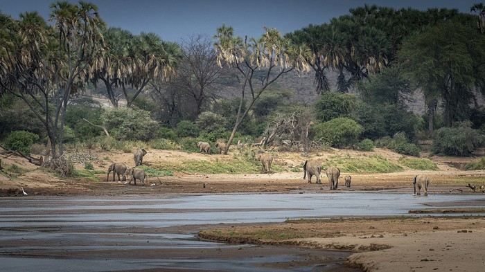
Water is present almost everywhere on our blue planet, so I’ve narrowed the theme down to waterways—rivers, streams, brooks, and the like.
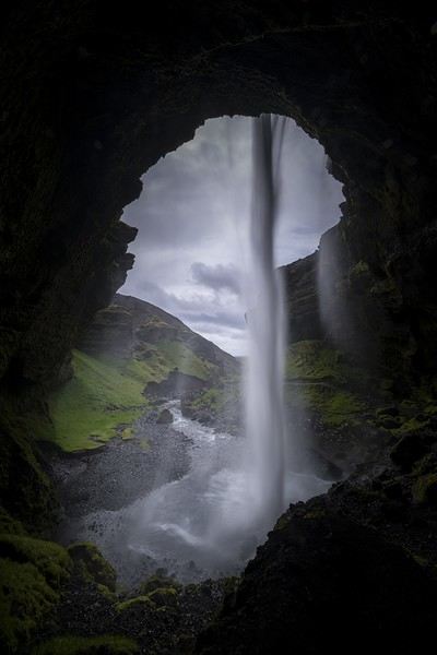
Seas, oceans, lakes, or other stagnant waters won’t be considered for this month’s theme 😅. However, waterfalls and cascades are very welcome 😊!
Practical details:
**Participation** Each VF member can submit up to 3 photos, until Sunday, January 25th at 11:59 PM Paris time. Each photo must be posted in a separate message, with its number (1, 2, or 3). Don’t forget to add a little explanation (commentary, location, etc.).
**Voting** Each VF member can vote for the 3 photos they consider the best, based on their own criteria and the theme.
Voting will take place from Monday, January 26th to Saturday, January 31st at 11:59 PM Paris time.
Photos should be ranked in order of preference: - 1st photo: 3 points - 2nd photo: 2 points - 3rd photo: 1 point
The winner is the photographer whose photo receives the most points.
Results will be published on February 1st. In case of a tie, the number of first-place votes will decide. The winner will have the honor of organizing February 2026’s contest.
Photos that have already been nominated (1st, 2nd, or 3rd place) in another contest are not eligible to participate in this one.
This thread is exclusively for contest photo submissions. All discussions, comments, and chit-chat should take place in the thread: here
Water is present almost everywhere on our blue planet, so I’ve narrowed the theme down to waterways—rivers, streams, brooks, and the like.
Seas, oceans, lakes, or other stagnant waters won’t be considered for this month’s theme 😅. However, waterfalls and cascades are very welcome 😊!
Practical details:
**Participation** Each VF member can submit up to 3 photos, until Sunday, January 25th at 11:59 PM Paris time. Each photo must be posted in a separate message, with its number (1, 2, or 3). Don’t forget to add a little explanation (commentary, location, etc.).
**Voting** Each VF member can vote for the 3 photos they consider the best, based on their own criteria and the theme.
Voting will take place from Monday, January 26th to Saturday, January 31st at 11:59 PM Paris time.
Photos should be ranked in order of preference: - 1st photo: 3 points - 2nd photo: 2 points - 3rd photo: 1 point
The winner is the photographer whose photo receives the most points.
Results will be published on February 1st. In case of a tie, the number of first-place votes will decide. The winner will have the honor of organizing February 2026’s contest.
Photos that have already been nominated (1st, 2nd, or 3rd place) in another contest are not eligible to participate in this one.
This thread is exclusively for contest photo submissions. All discussions, comments, and chit-chat should take place in the thread: here
One or More Towers: December Photo Contest
I suggest we compete with photos of towers. No magic tricks or potter’s wheels—we’re talking about "tour" as in the feminine noun. So, a kind of tall building, round, square, or polygonal, or a high structure that could be metallic, or a flat-topped bell tower (campanile), or a high-rise building (building)...
You can find them almost everywhere in the world and from all eras.
The tower(s) must be the main subject of the photo.
Examples:
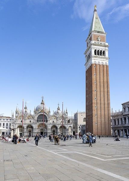
The first photo, which is Saint Mark’s Square (with the Campanile), won’t be accepted.
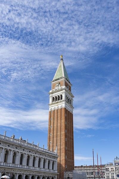
The second one, where the Campanile tower is the main subject, will be accepted.
 Have fun and surprise us! Photos of computer towers are excluded 😏
Have fun and surprise us! Photos of computer towers are excluded 😏Comoros again: trip report
Well, I still feel a bit lonely about this destination—no requests for info, no travel journals, or trip reports since I last posted over a year ago. A little disheartening.
That said, I did cross paths with slightly more tourists this time. Not a ton, but enough to notice compared to my last stay. Beyond that, not much has changed—the people are just as lovely, and every interaction, whether at the market, in the medinas, in town, or in the countryside, was positive. It was so pleasant; my "alert meter" stayed at zero the whole time (which is pretty different from some other places I visit now and then). The roads outside the cities remain dangerous, and the accident rate seems high. Best to drive during the day and take it easy (on some rough stretches, you don’t really have a choice anyway). The scattered plastic and metal waste hasn’t magically disappeared, and it’s still pretty discouraging to see the most beautiful beaches surrounded by empty bottles, straws, diapers, and rusted carcasses of an old Xantia or a skeletal Espace. When it’s not on the beach itself (since those are cleaned), it’s just a few meters away. Usually, there’s not much in the water or close to shore—the seabeds are gorgeous, with coral and a wide variety of scaly friends... But stepping back onto the hardened lava, you dodge a chip bag or a shriveled battery. Such a paradox. Honestly, it’s like this almost everywhere except on hotel beaches or those far from human settlements. But otherwise, in places like Chomoni, Bouni, Itsandra, Moya, and Domoni (on Anjouan), Nioumachoua (on Mohéli, and even on the nearby islets), it’s hard to ignore. And it unfortunately tarnishes the beauty of these otherwise stunning spots.
That said, you can still find secluded micro-bays, protected and remote, where this isn’t an issue. And where there are hotels—like in Petite Itsandra in Moroni, in front of Laka Lodge in Nioumachoua, Trou du Prophète, or even Chomoni (though the surrounding areas are so littered...)—the beaches are cleaned, so...
So why go? Why still love it despite all this? Well, first, the Comorians themselves—that’s already essential and probably the main reason. Then there’s the breathtaking topography: the imposing Karthala, the dizzying peaks and cliffs of Anjouan, vast ravines, a tortured geology covered in lush nature, and Mohéli, much more serene and gentle, blanketed in spice plants and trees with names that make you dream, like an open-air spice market. The flora across the islands—the fields, trees, scents: clove trees, cinnamon trees, lychee, mango, cardamom, nutmeg, vanilla, coconut palms, banana trees, coffee plants, cocoa... A profusion of green dotted with red, white, and yellow berries and flowers... The seabeds are stunning in many places, and there are some beautiful beaches/oceanfront spots, especially near Trou du Prophète (but not only there). The history and culture—between traditional festivals, but especially the medinas with their staircases, covered passages, palaces, and mosques that create Escher-like constructions. I love wandering through them for hours, stumbling upon an unlikely shop, a more or less philosophical saying like "pain is a warning," "a promise is a debt," or the less original "little by little, the bird makes its nest." A grocery store, women negotiating freshly caught fish (usually tuna, immediately cut and ready to sell), kids playing, old men playing checkers, a call to prayer... In Moroni, Mutsamudu, and Domoni, I spent most of my "urban" time.
If anyone’s interested—though given the hype about Comoros on the forum, I doubt it—but if you need info on accommodation across the three islands, some restaurants, or sites to visit, don’t hesitate to ask.
This message is another message in a bottle (one more, if I dare...) for the Comoros destination.
That said, I did cross paths with slightly more tourists this time. Not a ton, but enough to notice compared to my last stay. Beyond that, not much has changed—the people are just as lovely, and every interaction, whether at the market, in the medinas, in town, or in the countryside, was positive. It was so pleasant; my "alert meter" stayed at zero the whole time (which is pretty different from some other places I visit now and then). The roads outside the cities remain dangerous, and the accident rate seems high. Best to drive during the day and take it easy (on some rough stretches, you don’t really have a choice anyway). The scattered plastic and metal waste hasn’t magically disappeared, and it’s still pretty discouraging to see the most beautiful beaches surrounded by empty bottles, straws, diapers, and rusted carcasses of an old Xantia or a skeletal Espace. When it’s not on the beach itself (since those are cleaned), it’s just a few meters away. Usually, there’s not much in the water or close to shore—the seabeds are gorgeous, with coral and a wide variety of scaly friends... But stepping back onto the hardened lava, you dodge a chip bag or a shriveled battery. Such a paradox. Honestly, it’s like this almost everywhere except on hotel beaches or those far from human settlements. But otherwise, in places like Chomoni, Bouni, Itsandra, Moya, and Domoni (on Anjouan), Nioumachoua (on Mohéli, and even on the nearby islets), it’s hard to ignore. And it unfortunately tarnishes the beauty of these otherwise stunning spots.
That said, you can still find secluded micro-bays, protected and remote, where this isn’t an issue. And where there are hotels—like in Petite Itsandra in Moroni, in front of Laka Lodge in Nioumachoua, Trou du Prophète, or even Chomoni (though the surrounding areas are so littered...)—the beaches are cleaned, so...
So why go? Why still love it despite all this? Well, first, the Comorians themselves—that’s already essential and probably the main reason. Then there’s the breathtaking topography: the imposing Karthala, the dizzying peaks and cliffs of Anjouan, vast ravines, a tortured geology covered in lush nature, and Mohéli, much more serene and gentle, blanketed in spice plants and trees with names that make you dream, like an open-air spice market. The flora across the islands—the fields, trees, scents: clove trees, cinnamon trees, lychee, mango, cardamom, nutmeg, vanilla, coconut palms, banana trees, coffee plants, cocoa... A profusion of green dotted with red, white, and yellow berries and flowers... The seabeds are stunning in many places, and there are some beautiful beaches/oceanfront spots, especially near Trou du Prophète (but not only there). The history and culture—between traditional festivals, but especially the medinas with their staircases, covered passages, palaces, and mosques that create Escher-like constructions. I love wandering through them for hours, stumbling upon an unlikely shop, a more or less philosophical saying like "pain is a warning," "a promise is a debt," or the less original "little by little, the bird makes its nest." A grocery store, women negotiating freshly caught fish (usually tuna, immediately cut and ready to sell), kids playing, old men playing checkers, a call to prayer... In Moroni, Mutsamudu, and Domoni, I spent most of my "urban" time.
If anyone’s interested—though given the hype about Comoros on the forum, I doubt it—but if you need info on accommodation across the three islands, some restaurants, or sites to visit, don’t hesitate to ask.
This message is another message in a bottle (one more, if I dare...) for the Comoros destination.
Itinerary and transportation in Santo Antão
Hi there, I’m planning a trip to Santo Antão with some hiking (for me) but not for my partner. I’d love some help figuring out if my plan is doable in terms of time and transportation:
- Day 1 – Arrival by boat from Mindelo, then aluguer to Cova (and overnight nearby)
- Day 2 – Hike to Paul / aluguer for my partner
- Day 3 – Aluguer to Ponta do Sol
- Days 4 & 5 – Ponta do Sol
- Day 6 – Hike to Cruzinha / aluguer for my partner (overnight in Cruzinha)
- Day 7 – Aluguer (or taxi) to Xoxo (overnight in Xoxo)
- Day 8 – Aluguer to Porto Novo + boat to Mindelo
Does this plan make sense with the local transport options? For accommodations, I’d love any suggestions you might have. Thanks so much for your help!
Does this plan make sense with the local transport options? For accommodations, I’d love any suggestions you might have. Thanks so much for your help!
Planning a summer trip to 4 Cape Verde islands
Hello,
We’ve booked our tickets for July—there’ll be 4 of us, maybe 6 (all in our sixties). We’d like to visit 4 islands: Arrival in Praia on July 8th Return from São Vicente on July 29th
Between those dates, I’m not sure how to split our time across each island. We’ll definitely spend at least a week on Santo Antão. We’re planning to visit Santiago, Fogo, São Vicente, and Santo Antão. We’re looking for easy hikes, diving, sightseeing, and a little beach time (but not too much). How do you think we should divide the 3 weeks among the islands? Is 3 days in Fogo enough? Are guides essential, and can we easily find them on the spot? Should we rent a car, given we won’t just be hiking?
Thanks in advance for your advice, tips, warnings, and anything else you can share… and I’ve still got plenty more questions! Valéry
We’ve booked our tickets for July—there’ll be 4 of us, maybe 6 (all in our sixties). We’d like to visit 4 islands: Arrival in Praia on July 8th Return from São Vicente on July 29th
Between those dates, I’m not sure how to split our time across each island. We’ll definitely spend at least a week on Santo Antão. We’re planning to visit Santiago, Fogo, São Vicente, and Santo Antão. We’re looking for easy hikes, diving, sightseeing, and a little beach time (but not too much). How do you think we should divide the 3 weeks among the islands? Is 3 days in Fogo enough? Are guides essential, and can we easily find them on the spot? Should we rent a car, given we won’t just be hiking?
Thanks in advance for your advice, tips, warnings, and anything else you can share… and I’ve still got plenty more questions! Valéry
Tips for a 3-week itinerary from north to south Vietnam
Hello everyone,
I’m planning my upcoming trip from North to South Vietnam for May 2026. There’ll be two couples in their sixties and older... I’ve received proposals from three agencies with a driver and French-speaking guide. The one I’ve chosen, which is often mentioned in this forum, suggests this itinerary, and I’d love to hear your thoughts: HANOI, arrival on 04/29/26, 2 nights BAC HA, 1 night HA GIANG, 1 night NAM DAM, 1 night DONG VAN, 1 night BAO LAC, 1 night BA BE, 1 night HANOI, 1 night NINH BINH, 2 nights HALONG BAY (BAI TULONG), 1 night HUE, 2 nights HOI AN, 3 nights SAIGON, 1 night CAN THO, 1 night SAIGON, 1 night I’d like to know if the stop in Nam Dam is worth staying overnight or if we should just visit and continue to Dong Van. Also, would it make more sense to fly from Hoi An to Can Tho and finish with 2 nights in Saigon instead? That’s what I’d like your input on. Thanks in advance, and have a great summer! 🌞 Monique
I’m planning my upcoming trip from North to South Vietnam for May 2026. There’ll be two couples in their sixties and older... I’ve received proposals from three agencies with a driver and French-speaking guide. The one I’ve chosen, which is often mentioned in this forum, suggests this itinerary, and I’d love to hear your thoughts: HANOI, arrival on 04/29/26, 2 nights BAC HA, 1 night HA GIANG, 1 night NAM DAM, 1 night DONG VAN, 1 night BAO LAC, 1 night BA BE, 1 night HANOI, 1 night NINH BINH, 2 nights HALONG BAY (BAI TULONG), 1 night HUE, 2 nights HOI AN, 3 nights SAIGON, 1 night CAN THO, 1 night SAIGON, 1 night I’d like to know if the stop in Nam Dam is worth staying overnight or if we should just visit and continue to Dong Van. Also, would it make more sense to fly from Hoi An to Can Tho and finish with 2 nights in Saigon instead? That’s what I’d like your input on. Thanks in advance, and have a great summer! 🌞 Monique
USA Road Trip 2023 - Part 1
In January 2023, we started our second road trip across the United States. We stayed from January to mid-March, which gave us plenty of time to visit several cities, attractions, and parks in multiple states.
This travel journal will be split into two parts due to the considerable number of places we visited.
This first journal covers the following states: Ohio, Indiana, Missouri, Oklahoma, Texas, New Mexico, Arizona, Nevada, and California, and takes you through the outbound leg of our road trip.
The second journal will showcase the attractions we visited on the return trip, which mainly follows the famous Highway 1 along the Pacific coast.
So, I invite you to keep reading this first journal, which serves as a long recap to help you discover the various attractions we explored throughout this road trip.
Videos are included throughout the recap. Please click on the image to start the video.
Here are the links to jump to a specific post:
OHIO:
WinterLand - Christmas Lights at Cleveland Public Square Lake View Cemetery - Cleveland - Part 1 Lake View Cemetery - Cleveland - Part 2 Stroll through Columbus Upper Falls to Lower Falls via Buckeye Trail - Hocking Hills State Park – Logan Cedar Falls & Whispering Falls Hiking Trail - Hocking Hills State Park – Logan Ash Cave Hiking Trail - Hocking Hills State Park – Logan Exploring Cincinnati
INDIANA:
Visiting Indianapolis
MISSOURI:
Exploring St. Louis
OKLAHOMA:
Catoosa Blue Whale Discovering Tulsa Exploring Oklahoma City
TEXAS:
Exploring Shamrock Discovering McLean Exploring Amarillo
NEW MEXICO:
Ancestral Sites Trail - Pecos National Historical Park Discovering Santa Fe The Santuario de Chimayó Stroll through Los Cerrillos Walk through the village of Madrid San Francisco de Asis Catholic Church & The Bottle House - Golden Albuquerque Murals 66 Diner - Albuquerque Stroll through Old Town (Albuquerque) Rinconada Canyon Trail - Petroglyph National Monument Mesa Point Trail - Boca Negra Canyon - Petroglyph National Monument Macaw Trail - Boca Negra Canyon - Petroglyph National Monument Cliff Base Trail - Boca Negra Canyon - Petroglyph National Monument Piedras Marcadas Canyon - Petroglyph National Monument Sandstone Bluffs & Ventana Natural Arch - El Malpais National Monument
ARIZONA:
Stewart's Petrified Wood Shop – Holbrook Stroll through Holbrook Discovering Joseph City Exploring Winslow Grand Falls (The "Chocolate Falls") – Leupp Island Trail - Walnut Canyon National Monument Rim Trail - Walnut Canyon National Monument Wukoki Pueblo Trail – Wupatki National Monument Wupatki Pueblo Trail – Wupatki National Monument Doney Mountain Trail – Wupatki National Monument Citadel & Nalakihu Pueblos Trail – Wupatki National Monument Lomaki & Box Canyon Pueblos Trail – Wupatki National Monument Discovering Flagstaff On the way to Sedona Slide Rock State Park – Sedona Midgley Bridge Trail – Wilson Canyon – Sedona Tlaquepaque Arts & Shopping Village Walking Tour - Sedona Chapel of the Holy Cross - Sedona Hiking at Cathedral Rock - Sedona Hiking the Bell Rock Trail - Sedona Hiking the Airport Loop Trail - Sedona Amitabha Stupa and Peace Park - Sedona Hiking the Boynton Canyon Vortex Trail - Sedona Hiking the Devil's Bridge Trail - Sedona Hiking the Birthing Cave Trail - Sedona Bell Rock Inn - Sedona On the roads of Sedona - Part 1 On the roads of Sedona - Part 2 Keyhole Sink Hiking Trail - Kaibab National Forest Discovering Williams Exploring Ash Fork Discovering Kingman Ramada by Wyndham Kingman Davis Camp Park - Bullhead City Discovering Yucca Lake Havasu Boardwalk Tour A duck catches a lobster – Lake Havasu Boardwalk
CALIFORNIA:
Exploring Needles Discovering Goffs Discovering Amboy Visiting the famous Bagdad Cafe - Newberry Springs Exploring Barstow Vehicles from Hell (Mad Max Cars) - Barstow Peggy Sue's 50's Diner - Yermo Liberty Sculpture Park - Yermo Lake Dolores Water Park - Newberry Springs ZZYZX Road - Mojave National Preserve Alien Fresh Jerky - Baker Kelso Dunes Trail - Mojave National Preserve Hole-in-the-Wall Rings Trail - Mojave National Preserve Visiting Mitchell Caverns - Mojave National Preserve Dante's View - Death Valley National Park Zabriskie Point - Death Valley National Park Golden Canyon - Death Valley National Park Artists Drive & Artists Palette - Death Valley National Park Devil's Golf Course - Death Valley National Park Natural Bridge Trail - Death Valley National Park Badwater Basin - Death Valley National Park Harmony Borax Works - Death Valley National Park Devil's Cornfield - Death Valley National Park Mesquite Flat Sand Dunes - Death Valley National Park Mosaic Canyon Trail - Death Valley National Park On the road - Death Valley National Park
NEVADA:
Cleveland Clinic Lou Ruvo Center for Brain Health - Las Vegas Exploring Downtown Las Vegas SlotZilla Zipline - Fremont Street Experience – Downtown Las Vegas Viva Vision Light Show 1 - Fremont Street Experience - Downtown Las Vegas Viva Vision Light Show 2 - Fremont Street Experience - Downtown Las Vegas Viva Vision Light Show 3 - Fremont Street Experience - Downtown Las Vegas Viva Vision Light Show 4 - Fremont Street Experience - Downtown Las Vegas Free Live Music – Fremont Street Experience - Downtown Las Vegas Chucky – Fremont Street Experience - Downtown Las Vegas Las Vegas Strip - Part 1 Las Vegas Strip - Part 2 Las Vegas Strip - Part 3 Las Vegas Strip - Part 4 Las Vegas Strip - Part 5 Tom Devlin's Monster Museum - Boulder City Hoover Dam Lake Mead - Lakeview Overlook - Boulder City Nelson Ghost Town - Searchlight
CALIFORNIA:
Scenic Route through Joshua Tree National Park via the North Entrance Hidden Valley Trail - Joshua Tree National Park Barker Dam Trail - Joshua Tree National Park Cap Rock Trail - Joshua Tree National Park Keys View Trail - Joshua Tree National Park Hall of Horrors Trail - Joshua Tree National Park Skull Rock Trail - Joshua Tree National Park Arch Rock Trail - Joshua Tree National Park Cholla Cactus Garden Trail - Joshua Tree National Park Lone Pine - Owens Valley Miss Alabama & Shark Fin - Alabama Hills - Owens Valley Lone Ranger Canyon - Alabama Hills - Owens Valley Mobius Arch Loop Trail (Heart Arch & Lathe Arch) - Alabama Hills - Owens Valley Eye of the Alabama Hills Arch - Alabama Hills - Owens Valley Boot & Cyclops Arches - Alabama Hills - Owens Valley One Mile Arch, Bowling Ball and Pins & Gunga Din Area - Alabama Hills - Owens Valley Whitney Portal Arch Trailhead - Alabama Hills - Owens Valley Fish Rocks & Trona Pinnacles - Mojave Desert Red Cliffs Trail - Red Rock Canyon State Park Hagen Canyon Nature Trail - Red Rock Canyon State Park Tour of Historic Downtown Tehachapi View of the Tehachapi Loop – Monolith César E. Chávez National Monument – Keene Discovering Bakersfield Kern County Museum – Bakersfield Bravo Farms, Tree House & Petting Zoo - Traver Walking Tour of Kingsburg Exploring Fresno Simonian Farms & Soul Consoling Japanese Internment Tower - Fresno Duncan Ceramic Products (iLoveToCreate) - Fresno Walking Tour of Modesto Wat Dhammararam Buddhist Temple - Stockton Walking Tour of Stockton Discovering Stockton University of the Pacific - Stockton Visiting Lodi Sutter's Fort State Historic Park - Sacramento California State Capitol - Sacramento Walking Tour - Sacramento Walking Tour - Winters Walking Tour - Napa The Chandelier Tree In Drive-Thru Tree Park - Leggett One Log House - Garberville Grandfather Tree - Piercy The Living Chimney Tree - Avenue of the Giants Stephens Grove Loop Trail - Avenue of the Giants Gould Grove Nature Loop Trail - Avenue of the Giants Fleishmann Grove Trail - Avenue of the Giants Mahan Plaque Trail - Avenue of the Giants Founders Grove Nature Loop Trail - Avenue of the Giants Eternal Tree House & Immortal Tree - Avenue of the Giants Drury-Chaney Loop Trail - Avenue of the Giants Walking Tour - Redcrest
COMING UP NEXT:
USA Road Trip 2023 - Part 2
This travel journal will be split into two parts due to the considerable number of places we visited.
This first journal covers the following states: Ohio, Indiana, Missouri, Oklahoma, Texas, New Mexico, Arizona, Nevada, and California, and takes you through the outbound leg of our road trip.
The second journal will showcase the attractions we visited on the return trip, which mainly follows the famous Highway 1 along the Pacific coast.
So, I invite you to keep reading this first journal, which serves as a long recap to help you discover the various attractions we explored throughout this road trip.
Videos are included throughout the recap. Please click on the image to start the video.
Here are the links to jump to a specific post:
OHIO:
WinterLand - Christmas Lights at Cleveland Public Square Lake View Cemetery - Cleveland - Part 1 Lake View Cemetery - Cleveland - Part 2 Stroll through Columbus Upper Falls to Lower Falls via Buckeye Trail - Hocking Hills State Park – Logan Cedar Falls & Whispering Falls Hiking Trail - Hocking Hills State Park – Logan Ash Cave Hiking Trail - Hocking Hills State Park – Logan Exploring Cincinnati
INDIANA:
Visiting Indianapolis
MISSOURI:
Exploring St. Louis
OKLAHOMA:
Catoosa Blue Whale Discovering Tulsa Exploring Oklahoma City
TEXAS:
Exploring Shamrock Discovering McLean Exploring Amarillo
NEW MEXICO:
Ancestral Sites Trail - Pecos National Historical Park Discovering Santa Fe The Santuario de Chimayó Stroll through Los Cerrillos Walk through the village of Madrid San Francisco de Asis Catholic Church & The Bottle House - Golden Albuquerque Murals 66 Diner - Albuquerque Stroll through Old Town (Albuquerque) Rinconada Canyon Trail - Petroglyph National Monument Mesa Point Trail - Boca Negra Canyon - Petroglyph National Monument Macaw Trail - Boca Negra Canyon - Petroglyph National Monument Cliff Base Trail - Boca Negra Canyon - Petroglyph National Monument Piedras Marcadas Canyon - Petroglyph National Monument Sandstone Bluffs & Ventana Natural Arch - El Malpais National Monument
ARIZONA:
Stewart's Petrified Wood Shop – Holbrook Stroll through Holbrook Discovering Joseph City Exploring Winslow Grand Falls (The "Chocolate Falls") – Leupp Island Trail - Walnut Canyon National Monument Rim Trail - Walnut Canyon National Monument Wukoki Pueblo Trail – Wupatki National Monument Wupatki Pueblo Trail – Wupatki National Monument Doney Mountain Trail – Wupatki National Monument Citadel & Nalakihu Pueblos Trail – Wupatki National Monument Lomaki & Box Canyon Pueblos Trail – Wupatki National Monument Discovering Flagstaff On the way to Sedona Slide Rock State Park – Sedona Midgley Bridge Trail – Wilson Canyon – Sedona Tlaquepaque Arts & Shopping Village Walking Tour - Sedona Chapel of the Holy Cross - Sedona Hiking at Cathedral Rock - Sedona Hiking the Bell Rock Trail - Sedona Hiking the Airport Loop Trail - Sedona Amitabha Stupa and Peace Park - Sedona Hiking the Boynton Canyon Vortex Trail - Sedona Hiking the Devil's Bridge Trail - Sedona Hiking the Birthing Cave Trail - Sedona Bell Rock Inn - Sedona On the roads of Sedona - Part 1 On the roads of Sedona - Part 2 Keyhole Sink Hiking Trail - Kaibab National Forest Discovering Williams Exploring Ash Fork Discovering Kingman Ramada by Wyndham Kingman Davis Camp Park - Bullhead City Discovering Yucca Lake Havasu Boardwalk Tour A duck catches a lobster – Lake Havasu Boardwalk
CALIFORNIA:
Exploring Needles Discovering Goffs Discovering Amboy Visiting the famous Bagdad Cafe - Newberry Springs Exploring Barstow Vehicles from Hell (Mad Max Cars) - Barstow Peggy Sue's 50's Diner - Yermo Liberty Sculpture Park - Yermo Lake Dolores Water Park - Newberry Springs ZZYZX Road - Mojave National Preserve Alien Fresh Jerky - Baker Kelso Dunes Trail - Mojave National Preserve Hole-in-the-Wall Rings Trail - Mojave National Preserve Visiting Mitchell Caverns - Mojave National Preserve Dante's View - Death Valley National Park Zabriskie Point - Death Valley National Park Golden Canyon - Death Valley National Park Artists Drive & Artists Palette - Death Valley National Park Devil's Golf Course - Death Valley National Park Natural Bridge Trail - Death Valley National Park Badwater Basin - Death Valley National Park Harmony Borax Works - Death Valley National Park Devil's Cornfield - Death Valley National Park Mesquite Flat Sand Dunes - Death Valley National Park Mosaic Canyon Trail - Death Valley National Park On the road - Death Valley National Park
NEVADA:
Cleveland Clinic Lou Ruvo Center for Brain Health - Las Vegas Exploring Downtown Las Vegas SlotZilla Zipline - Fremont Street Experience – Downtown Las Vegas Viva Vision Light Show 1 - Fremont Street Experience - Downtown Las Vegas Viva Vision Light Show 2 - Fremont Street Experience - Downtown Las Vegas Viva Vision Light Show 3 - Fremont Street Experience - Downtown Las Vegas Viva Vision Light Show 4 - Fremont Street Experience - Downtown Las Vegas Free Live Music – Fremont Street Experience - Downtown Las Vegas Chucky – Fremont Street Experience - Downtown Las Vegas Las Vegas Strip - Part 1 Las Vegas Strip - Part 2 Las Vegas Strip - Part 3 Las Vegas Strip - Part 4 Las Vegas Strip - Part 5 Tom Devlin's Monster Museum - Boulder City Hoover Dam Lake Mead - Lakeview Overlook - Boulder City Nelson Ghost Town - Searchlight
CALIFORNIA:
Scenic Route through Joshua Tree National Park via the North Entrance Hidden Valley Trail - Joshua Tree National Park Barker Dam Trail - Joshua Tree National Park Cap Rock Trail - Joshua Tree National Park Keys View Trail - Joshua Tree National Park Hall of Horrors Trail - Joshua Tree National Park Skull Rock Trail - Joshua Tree National Park Arch Rock Trail - Joshua Tree National Park Cholla Cactus Garden Trail - Joshua Tree National Park Lone Pine - Owens Valley Miss Alabama & Shark Fin - Alabama Hills - Owens Valley Lone Ranger Canyon - Alabama Hills - Owens Valley Mobius Arch Loop Trail (Heart Arch & Lathe Arch) - Alabama Hills - Owens Valley Eye of the Alabama Hills Arch - Alabama Hills - Owens Valley Boot & Cyclops Arches - Alabama Hills - Owens Valley One Mile Arch, Bowling Ball and Pins & Gunga Din Area - Alabama Hills - Owens Valley Whitney Portal Arch Trailhead - Alabama Hills - Owens Valley Fish Rocks & Trona Pinnacles - Mojave Desert Red Cliffs Trail - Red Rock Canyon State Park Hagen Canyon Nature Trail - Red Rock Canyon State Park Tour of Historic Downtown Tehachapi View of the Tehachapi Loop – Monolith César E. Chávez National Monument – Keene Discovering Bakersfield Kern County Museum – Bakersfield Bravo Farms, Tree House & Petting Zoo - Traver Walking Tour of Kingsburg Exploring Fresno Simonian Farms & Soul Consoling Japanese Internment Tower - Fresno Duncan Ceramic Products (iLoveToCreate) - Fresno Walking Tour of Modesto Wat Dhammararam Buddhist Temple - Stockton Walking Tour of Stockton Discovering Stockton University of the Pacific - Stockton Visiting Lodi Sutter's Fort State Historic Park - Sacramento California State Capitol - Sacramento Walking Tour - Sacramento Walking Tour - Winters Walking Tour - Napa The Chandelier Tree In Drive-Thru Tree Park - Leggett One Log House - Garberville Grandfather Tree - Piercy The Living Chimney Tree - Avenue of the Giants Stephens Grove Loop Trail - Avenue of the Giants Gould Grove Nature Loop Trail - Avenue of the Giants Fleishmann Grove Trail - Avenue of the Giants Mahan Plaque Trail - Avenue of the Giants Founders Grove Nature Loop Trail - Avenue of the Giants Eternal Tree House & Immortal Tree - Avenue of the Giants Drury-Chaney Loop Trail - Avenue of the Giants Walking Tour - Redcrest
COMING UP NEXT:
USA Road Trip 2023 - Part 2
Come discover the Gaspésie with me
Introduction
In this travel journal, you’ll find a list of all the activities we did during our road trip through the Gaspésie.
Videos are embedded throughout the summary. Just click on the image to start the video.
To jump to a specific post, here are the relevant links:
Gaspé - Forillon National Park - Interpretation Center Gaspé - Forillon National Park - Mont-Saint-Alban Trail Gaspé - Forillon National Park - La Chute Trail Gaspé - Forillon National Park - Les Graves Trail Percé - Rivière-aux-Émeraudes Waterfall Percé - Bonaventure Island National Park Percé - Hike at the Foot of Percé Rock Percé Geopark - Suspended Glass Platform Percé Geopark - Magic Forest Loop Percé Geopark - Belvedere Trails Percé Geopark - Springs and Les Pieds Croches Trails Percé Geopark - Crevasse Trail Percé Geopark - Grande Coupe Trail Percé Geopark - Grotto Path Bonaventure - Le Malin de la Rivière Bonaventure Maria - Grand Sault Waterfall Carleton-sur-Mer - Les Saults Waterfall - Éperlan Trail Matapédia - Two Rivers Belvedere Saint-Alexis-de-Matapédia - Dream Horizon Belvedere Saint-André-de-Restigouche - Heart of the Plateaus Belvedere Saint-André-de-Restigouche - Picot Waterfalls Saint-Alexis-de-Matapédia - Robitaille Stream Waterfalls Trail Saint-Alexandre-des-Lacs - Philomène Waterfall Saint-Ulric - Ti-Mé Waterfall
In this travel journal, you’ll find a list of all the activities we did during our road trip through the Gaspésie.
Videos are embedded throughout the summary. Just click on the image to start the video.
To jump to a specific post, here are the relevant links:
Gaspé - Forillon National Park - Interpretation Center Gaspé - Forillon National Park - Mont-Saint-Alban Trail Gaspé - Forillon National Park - La Chute Trail Gaspé - Forillon National Park - Les Graves Trail Percé - Rivière-aux-Émeraudes Waterfall Percé - Bonaventure Island National Park Percé - Hike at the Foot of Percé Rock Percé Geopark - Suspended Glass Platform Percé Geopark - Magic Forest Loop Percé Geopark - Belvedere Trails Percé Geopark - Springs and Les Pieds Croches Trails Percé Geopark - Crevasse Trail Percé Geopark - Grande Coupe Trail Percé Geopark - Grotto Path Bonaventure - Le Malin de la Rivière Bonaventure Maria - Grand Sault Waterfall Carleton-sur-Mer - Les Saults Waterfall - Éperlan Trail Matapédia - Two Rivers Belvedere Saint-Alexis-de-Matapédia - Dream Horizon Belvedere Saint-André-de-Restigouche - Heart of the Plateaus Belvedere Saint-André-de-Restigouche - Picot Waterfalls Saint-Alexis-de-Matapédia - Robitaille Stream Waterfalls Trail Saint-Alexandre-des-Lacs - Philomène Waterfall Saint-Ulric - Ti-Mé Waterfall
Flights to Salt Lake City or Jackson Hole
Hi there,
We're planning to visit Yellowstone between mid and late September (yes, I'm leaving it to the last minute for bookings...). I was initially planning to arrive and depart from Salt Lake City, which I’d also like to explore. It turns out that flights to SLC are 300 € more expensive than flights to Jackson Hole, even though the connection goes through... SLC! I’ve checked on several comparison sites from different locations, and these prices remain pretty consistent.
Does anyone know what it would cost if I skip the connection to Jackson Hole from SLC to take advantage of the cheaper fare and then fly back from JH instead?
Thanks in advance!
Sylvain.
We're planning to visit Yellowstone between mid and late September (yes, I'm leaving it to the last minute for bookings...). I was initially planning to arrive and depart from Salt Lake City, which I’d also like to explore. It turns out that flights to SLC are 300 € more expensive than flights to Jackson Hole, even though the connection goes through... SLC! I’ve checked on several comparison sites from different locations, and these prices remain pretty consistent.
Does anyone know what it would cost if I skip the connection to Jackson Hole from SLC to take advantage of the cheaper fare and then fly back from JH instead?
Thanks in advance!
Sylvain.
Join me in discovering Gran Canaria
Introduction
We stayed on the island of Gran Canaria during the first three months of 2024. It’s the third Canary Island we’ve visited, after Tenerife and Lanzarote.
We rented an apartment in Temisas. By staying in the same place for such a long period, the total price dropped by 50%.
We also rented a vehicle to make getting around the island easier.
Why the Canary Islands, and Gran Canaria in particular? For its pleasant climate, the nature and diversity of its landscapes, the charming villages, and especially the beauty of its many beaches.
In this travel journal, you’ll find a list of the many activities we did during our stay to explore the different attractions of this island.
These attractions are categorized to make it easier to find what interests you.
Videos are included throughout the summary. Click on the image to start the video.
To jump to a specific post, here are the relevant links:
HIKES:
Roque Nublo Maspalomas Dunes - Part 1 Maspalomas Dunes - Part 2 Los Azulejos de Veneguera Barranco de Las Vacas Ventana del Bentayga (Arco del Aserrador) Caves of the King Ventana de Morro (Ventana de la Ganifa) The Dog of Bentayga Cave of the Four Doors Ventana del Nublo Artenera - Caves of Acusa Seca Temisas - El Gigante Cave Fortress of Ansite Puerto de Las Nieves - Roque de Las Nieves Temisas - Cuevas de la Audiencia Roque Bentayga Guayadeque Ravine (Guayadeque Hermitage) Guayadeque Ravine (Cueva de Bartalo) El Zumacal - Barranco Tauco Casablanca Dam (Los Dolores Dam) Ayagaures - La Angostura Dam & Gambuesa Dam Santa Brígida - Alonso Ravine & Centennial Dragon Tree Pino Santo Hike in the Azuaje Ravine Gáldar - Red Lands of Samarrita Tejeda - Charco de La Paloma Bandama Boiler (Camino Borde de Caldera Bandama) Teror - Alamo Ravine Trail – SL-4 Telde - Calasio Caves Special Natural Reserve of Los Tilos de Moya Los Azulejos - Charco de Las Aneas Fataga Ravine Arinaga Military Battery Trail Maspalomas - Las Fuentes and del Canizo Ravines Mogán - Tauro Mountain Trail Tamabada - Llanos de La Mimbre & Sobre la Cueva Viewpoints Trail Hike to the Coronadero Arch via Barranco Hondo Barranco de Silva - Hike to the Jerez Caves Gáldar - Samson Cave - La Atalaya Peak Agaete - Roque Guayedra and Guayedra Ravine Artenara - Caballero Caves Arucas - Bufadero Salt Flats Barranco de Pino Gordo - Natural Pools Telde - Los Cernícalos Ravine Las Cruces - Toba Caves & Picón Puerto de Las Nieves - Moro Cave Agüimes - Morros de Ávila Caves Juncalillo del Sur - Laguna & Salinas de Abajo Caves of Camino de San Felipe Cruz de Tejeda, Cruz Chico and Degollada Viewpoint Hike on the Patalavaca Circuit Motor Grande - Puerto Rico Arch El Montañón - Los Hornos Dam Seafront Walk - Amadores Beach – Puerto Rico Beach Las Niñas Dam El Hornillo - Omega & Omicron Caves Arteara Necropolis Mogán - El Mulato Dam Las Garzas - El Regante Dam La Plata Route - Cho Flores Dam & El Charco Hondo Vega de Acusa - La Candelaria Dam Candelaria Hermitage – Acusa Seca Viewpoint Valsequillo de Gran Canaria – Roque La Vela Ayagaures Dam – GC-602 Lomo del Palo - Monte Pavón Trail Lugar La Laguna - Levada Fataga Dam & Ravine
BEACHES:
Mogán Beach Taurito Beach Tauro Beach Amadores Beach Puerto Rico Beach Anfi del Mar Beach Patalavaca Beach Meloneras Beach Maspalomas Beach English Beach (Playa del Inglés) Las Burras Beach San Agustin Beach Las Alcaravaneras Beach Las Canteras Beach (La Cicer) Las Canteras Beach (La Puntilla) Las Canteras Beach (Santa Catalina) Aquamarina Beach El Agujero - Bocabarranco Beach Hoya Del Pozo Beach Hoya Del Pozo Beach - Lizard with amputated tail El Cabron Beach Ojos de Garza Beach El Burrero Beach
NATURAL POOLS:
Charco Azul - El Risco Agaete Salt Flats Charco de Los Espejos - Sardina del Norte Natural Pools of Punta de Gáldar Snorkeling in the natural pool of Punta de Gáldar Natural Pool La Furnia o El Clavo - Gáldar Natural Pool of Los Dos Roques Emiliano Natural Pool - El Agujero Natural Pool of El Agujero Natural Pools of Roque Prieto Natural Pool El Altillo Los Charcones de Bañaderos – Arucas Natural Pools of El Charco de Las Palomas – Arucas Natural Pools of La Laja - Las Palmas de Gran Canaria Cueva de la Reina Mora - La Garita Natural Pools of Castillo del Romeral
TOWNS:
Center
Santa Brigida Vega de San Mateo Tejeda Artenara Vallesco Teror
Southwest
Santa Lucia de Tirajana Fataga San Bartolomé de Tirajana Puerto de Mogán La Aldea de San Nicolas
North
Arucas Firgas Moya Santa Maria de Guia Gáldar Agaete Puerto de Las Nieves
East
Vegueta - Las Palmas de Gran Canaria Triana - Las Palmas de Gran Canaria Ciudad Jardin - Las Palmas de Gran Canaria Canteras - Las Palmas de Gran Canaria Telde Valsequillo de Gran Canaria Ingenio Agüimes Temisas
VIEWPOINTS:
GC-60 Route (or nearby) GC-210 Route (or nearby) GC-210 Route between the tunnel and La Aldea de San Nicolás GC-215 & GC-65 Routes (or nearby) GC-200 Route (or nearby) GC-130 Route (or nearby) & GC-605 GC-70 Route (or nearby) & GC-21 Sheep herd on GC-70 Route GC-150, GC-240, GC-305, GC-350 & GC-301 Routes GC-606, GC-295, GC-231 and GC-41 Routes (or nearby) Viewpoints – GC-1 Route (or nearby) Viewpoints - Las Palmas de Gran Canaria Viewpoints - GC-2, GC-21, GC-15, GC-216 and GC-132 Routes (or nearby) Viewpoints - GC-503 & GC-217 Routes Viewpoints - GC-604, GC-505, GC-132, GC-42 and GC-802 Routes
MISCELLANEOUS:
San Rafael Aqueduct - Telde Abandoned San Rafael Estate - La Higuera Cenobio de Valerón La Cesta - Tejeda Puerto de la Aldea Scenic Route GC-671 to El Espinillo Scenic Route GC-607 to El Chorrillo The Galdar Cube (Santiago Quarry) Scenic Route GC-504 to Ayagaures Abandoned seaside resort in the Azuaje Ravine El Bufadero de La Garita – Telde GC-505 Route Abandoned Finca Las Haciendas (Los Mocanes) – Las Vegas de Valsequillo Ruins of San Juan Battery - Las Palmas de Gran Canaria Viera y Clavijo Canarian Botanical Garden - Las Palmas de Gran Canaria Tenefé Salt Flats Los Pérez, Lugarejos & Las Hoyas Dams Monte Pavón, Gran Canaria’s little Ireland Valleseco Lagoon Recreational Area Climbing - Fataga Ravine Surfing – El Agujero El Cairete Restaurant - Carrizal de Tejeda Paragliding flight observation - Los Giles La Cuevita Ayagaures Restaurant Statues and Murals - Cruce de Arinaga Aviation Monument (Las Majoreras) & Murals – Carrizal Artistic recycling by Antonio Peñita - Ojos de Garza Rainbows
We stayed on the island of Gran Canaria during the first three months of 2024. It’s the third Canary Island we’ve visited, after Tenerife and Lanzarote.
We rented an apartment in Temisas. By staying in the same place for such a long period, the total price dropped by 50%.
We also rented a vehicle to make getting around the island easier.
Why the Canary Islands, and Gran Canaria in particular? For its pleasant climate, the nature and diversity of its landscapes, the charming villages, and especially the beauty of its many beaches.
In this travel journal, you’ll find a list of the many activities we did during our stay to explore the different attractions of this island.
These attractions are categorized to make it easier to find what interests you.
Videos are included throughout the summary. Click on the image to start the video.
To jump to a specific post, here are the relevant links:
HIKES:
Roque Nublo Maspalomas Dunes - Part 1 Maspalomas Dunes - Part 2 Los Azulejos de Veneguera Barranco de Las Vacas Ventana del Bentayga (Arco del Aserrador) Caves of the King Ventana de Morro (Ventana de la Ganifa) The Dog of Bentayga Cave of the Four Doors Ventana del Nublo Artenera - Caves of Acusa Seca Temisas - El Gigante Cave Fortress of Ansite Puerto de Las Nieves - Roque de Las Nieves Temisas - Cuevas de la Audiencia Roque Bentayga Guayadeque Ravine (Guayadeque Hermitage) Guayadeque Ravine (Cueva de Bartalo) El Zumacal - Barranco Tauco Casablanca Dam (Los Dolores Dam) Ayagaures - La Angostura Dam & Gambuesa Dam Santa Brígida - Alonso Ravine & Centennial Dragon Tree Pino Santo Hike in the Azuaje Ravine Gáldar - Red Lands of Samarrita Tejeda - Charco de La Paloma Bandama Boiler (Camino Borde de Caldera Bandama) Teror - Alamo Ravine Trail – SL-4 Telde - Calasio Caves Special Natural Reserve of Los Tilos de Moya Los Azulejos - Charco de Las Aneas Fataga Ravine Arinaga Military Battery Trail Maspalomas - Las Fuentes and del Canizo Ravines Mogán - Tauro Mountain Trail Tamabada - Llanos de La Mimbre & Sobre la Cueva Viewpoints Trail Hike to the Coronadero Arch via Barranco Hondo Barranco de Silva - Hike to the Jerez Caves Gáldar - Samson Cave - La Atalaya Peak Agaete - Roque Guayedra and Guayedra Ravine Artenara - Caballero Caves Arucas - Bufadero Salt Flats Barranco de Pino Gordo - Natural Pools Telde - Los Cernícalos Ravine Las Cruces - Toba Caves & Picón Puerto de Las Nieves - Moro Cave Agüimes - Morros de Ávila Caves Juncalillo del Sur - Laguna & Salinas de Abajo Caves of Camino de San Felipe Cruz de Tejeda, Cruz Chico and Degollada Viewpoint Hike on the Patalavaca Circuit Motor Grande - Puerto Rico Arch El Montañón - Los Hornos Dam Seafront Walk - Amadores Beach – Puerto Rico Beach Las Niñas Dam El Hornillo - Omega & Omicron Caves Arteara Necropolis Mogán - El Mulato Dam Las Garzas - El Regante Dam La Plata Route - Cho Flores Dam & El Charco Hondo Vega de Acusa - La Candelaria Dam Candelaria Hermitage – Acusa Seca Viewpoint Valsequillo de Gran Canaria – Roque La Vela Ayagaures Dam – GC-602 Lomo del Palo - Monte Pavón Trail Lugar La Laguna - Levada Fataga Dam & Ravine
BEACHES:
Mogán Beach Taurito Beach Tauro Beach Amadores Beach Puerto Rico Beach Anfi del Mar Beach Patalavaca Beach Meloneras Beach Maspalomas Beach English Beach (Playa del Inglés) Las Burras Beach San Agustin Beach Las Alcaravaneras Beach Las Canteras Beach (La Cicer) Las Canteras Beach (La Puntilla) Las Canteras Beach (Santa Catalina) Aquamarina Beach El Agujero - Bocabarranco Beach Hoya Del Pozo Beach Hoya Del Pozo Beach - Lizard with amputated tail El Cabron Beach Ojos de Garza Beach El Burrero Beach
NATURAL POOLS:
Charco Azul - El Risco Agaete Salt Flats Charco de Los Espejos - Sardina del Norte Natural Pools of Punta de Gáldar Snorkeling in the natural pool of Punta de Gáldar Natural Pool La Furnia o El Clavo - Gáldar Natural Pool of Los Dos Roques Emiliano Natural Pool - El Agujero Natural Pool of El Agujero Natural Pools of Roque Prieto Natural Pool El Altillo Los Charcones de Bañaderos – Arucas Natural Pools of El Charco de Las Palomas – Arucas Natural Pools of La Laja - Las Palmas de Gran Canaria Cueva de la Reina Mora - La Garita Natural Pools of Castillo del Romeral
TOWNS:
Center
Santa Brigida Vega de San Mateo Tejeda Artenara Vallesco Teror
Southwest
Santa Lucia de Tirajana Fataga San Bartolomé de Tirajana Puerto de Mogán La Aldea de San Nicolas
North
Arucas Firgas Moya Santa Maria de Guia Gáldar Agaete Puerto de Las Nieves
East
Vegueta - Las Palmas de Gran Canaria Triana - Las Palmas de Gran Canaria Ciudad Jardin - Las Palmas de Gran Canaria Canteras - Las Palmas de Gran Canaria Telde Valsequillo de Gran Canaria Ingenio Agüimes Temisas
VIEWPOINTS:
GC-60 Route (or nearby) GC-210 Route (or nearby) GC-210 Route between the tunnel and La Aldea de San Nicolás GC-215 & GC-65 Routes (or nearby) GC-200 Route (or nearby) GC-130 Route (or nearby) & GC-605 GC-70 Route (or nearby) & GC-21 Sheep herd on GC-70 Route GC-150, GC-240, GC-305, GC-350 & GC-301 Routes GC-606, GC-295, GC-231 and GC-41 Routes (or nearby) Viewpoints – GC-1 Route (or nearby) Viewpoints - Las Palmas de Gran Canaria Viewpoints - GC-2, GC-21, GC-15, GC-216 and GC-132 Routes (or nearby) Viewpoints - GC-503 & GC-217 Routes Viewpoints - GC-604, GC-505, GC-132, GC-42 and GC-802 Routes
MISCELLANEOUS:
San Rafael Aqueduct - Telde Abandoned San Rafael Estate - La Higuera Cenobio de Valerón La Cesta - Tejeda Puerto de la Aldea Scenic Route GC-671 to El Espinillo Scenic Route GC-607 to El Chorrillo The Galdar Cube (Santiago Quarry) Scenic Route GC-504 to Ayagaures Abandoned seaside resort in the Azuaje Ravine El Bufadero de La Garita – Telde GC-505 Route Abandoned Finca Las Haciendas (Los Mocanes) – Las Vegas de Valsequillo Ruins of San Juan Battery - Las Palmas de Gran Canaria Viera y Clavijo Canarian Botanical Garden - Las Palmas de Gran Canaria Tenefé Salt Flats Los Pérez, Lugarejos & Las Hoyas Dams Monte Pavón, Gran Canaria’s little Ireland Valleseco Lagoon Recreational Area Climbing - Fataga Ravine Surfing – El Agujero El Cairete Restaurant - Carrizal de Tejeda Paragliding flight observation - Los Giles La Cuevita Ayagaures Restaurant Statues and Murals - Cruce de Arinaga Aviation Monument (Las Majoreras) & Murals – Carrizal Artistic recycling by Antonio Peñita - Ojos de Garza Rainbows
Come discover the island of Madeira with me
Introduction
We arrived on the island of Madeira (Portugal) at the beginning of May 2023 and stayed for 5 weeks.
This island is renowned for its rich cultural heritage, its famous hikes through lush landscapes, and its seaside resorts. It offers an unforgettable experience for nature lovers.
In this travel journal, you’ll find a list of the many activities we did during our stay to explore the different attractions of this magnificent island.
These attractions are categorized to make it easier to search based on your interests, if needed.
Videos are included throughout the summary. Please click on the image to start the video.
To jump to a specific post, here are the appropriate links:
HIKES:
Calheta - PR19 Caminho Real do Paúl do Mar Santana - Ribeiro Frio - PR11 Vereda dos Balcões Sao Vicente - Gingas - PR16 Levada Fajã do Rodrigues Rabaçal - PR6.1 Levada do Risco & PR6 Levada das 25 fontes Rabaçal - PR6.2 Levada do Alecrim & PR6.3 Vereda da Lagoa do Vento Caniçal - PR8 Vereda da Ponta de São Lourenço São Jorge - PR18 Levada do Rei Ponta do Sol - PR7 modified - Levada Nova & Levada do Moinho Machico - PR5 Vereda das Funduras Funchal - PR1 Vereda do Areeiro (Pico do Areeiro to Pico Ruivo) Funchal - PR1 Vereda do Areeiro (Pico Ruivo to Pico do Areeiro) Funchal - PR1.2 Vereda do Pico Ruivo (outbound) Funchal - PR1.2 Vereda do Pico Ruivo (return) Porto Moniz - Fanal Forest Porto Moniz - PR14 Levada dos Cedros Ribeira Brava - PR17 Caminho do Pináculo e Folhadal (Encumeada) Ribeira Brava - PR17 Caminho do Pináculo e Folhadal (Lombo do Mouro) Ribeira Brava - PR17 Caminho do Pináculo e Folhadal (Bica da Cana) Santana - PR9 Levada do Caldeirão Verde Lamaceiros - Levada Ribeira da Janela Ribeiro Frio - PR10 Levada do Furado Tabua - Levada da Nova (Eastern Sector) Tabua - Levada da Nova (Western Sector) Boa Morte - Levada do Norte Verada da Levada do Facho - Levada do Norte (South) Vale Paraiso - Levada da Serra do Faial Porto Moniz - PR13 Vereda do Fanal Referta - Levada do Castelejo Porto da Cruz - Levada do Castelejo Estanquinhos - Pico Ruivo do Paul da Serra Boaventura - Levada de Cima & Levada da Acha Grande
SEASIDE RESORTS & NATURAL POOLS:
Natural pools of Seixal Seixal Naval Club Seaside Resort - Natural pool Natural pools of Porto Moniz Funchal - Lido Seaside Resort Santana - Foz da Ribeira do Faial Seaside Resort Câmara de Lobos - Salinas Seaside Resort Porto Moniz - Aquário/Cachalote Natural Pools Funchal - Doca do Cavacas Seaside Resort Funchal - Ponta Gorda Seaside Resort Caniço - Roca Mar Hotel Seaside Resort Caniço - Lido Galoma Seaside Resort Calhau de São Jorge Seaside Resort Ribeira Brava Seaside Resort
BEACHES:
São Jorge Beach Calheta Beach Seixal - Laje Beach (Jamaica) Porto de Seixal Beach Caniço - Reis Magos Beach Machico - Machico Beach (Banda d'Além) Machico - São Roque Beach Machico - Ribeira Natal Beach Caniçal - Prainha Beach Porto da Cruz - Alagoa Beach
TOWNS:
Stroll through the town of Ponta do Sol Stroll through the town of Câmara de Lobos Stroll through the town of Ribeira Brava Stroll through the town of Funchal Funchal - Wicker toboggan ride Stroll through the town of Machico Stroll through the town of Santana Stroll through the town of São Vicente São Vicente Caves Park
VIEWPOINTS:
Calheta Region Ponta do Sol Region Ribeira Brava Region Câmara de Lobos Region Funchal Region Santa Cruz Region Porto Moniz Region São Vicente Region Santana Region Machico Region On the road in Madeira
WATERFALLS ALONG THE WAY
Ponta do Sol - Anjos Waterfall Sao Vicente - Água d'Alto Waterfall Seixal - Córrego da Furna Waterfall
We arrived on the island of Madeira (Portugal) at the beginning of May 2023 and stayed for 5 weeks.
This island is renowned for its rich cultural heritage, its famous hikes through lush landscapes, and its seaside resorts. It offers an unforgettable experience for nature lovers.
In this travel journal, you’ll find a list of the many activities we did during our stay to explore the different attractions of this magnificent island.
These attractions are categorized to make it easier to search based on your interests, if needed.
Videos are included throughout the summary. Please click on the image to start the video.
To jump to a specific post, here are the appropriate links:
HIKES:
Calheta - PR19 Caminho Real do Paúl do Mar Santana - Ribeiro Frio - PR11 Vereda dos Balcões Sao Vicente - Gingas - PR16 Levada Fajã do Rodrigues Rabaçal - PR6.1 Levada do Risco & PR6 Levada das 25 fontes Rabaçal - PR6.2 Levada do Alecrim & PR6.3 Vereda da Lagoa do Vento Caniçal - PR8 Vereda da Ponta de São Lourenço São Jorge - PR18 Levada do Rei Ponta do Sol - PR7 modified - Levada Nova & Levada do Moinho Machico - PR5 Vereda das Funduras Funchal - PR1 Vereda do Areeiro (Pico do Areeiro to Pico Ruivo) Funchal - PR1 Vereda do Areeiro (Pico Ruivo to Pico do Areeiro) Funchal - PR1.2 Vereda do Pico Ruivo (outbound) Funchal - PR1.2 Vereda do Pico Ruivo (return) Porto Moniz - Fanal Forest Porto Moniz - PR14 Levada dos Cedros Ribeira Brava - PR17 Caminho do Pináculo e Folhadal (Encumeada) Ribeira Brava - PR17 Caminho do Pináculo e Folhadal (Lombo do Mouro) Ribeira Brava - PR17 Caminho do Pináculo e Folhadal (Bica da Cana) Santana - PR9 Levada do Caldeirão Verde Lamaceiros - Levada Ribeira da Janela Ribeiro Frio - PR10 Levada do Furado Tabua - Levada da Nova (Eastern Sector) Tabua - Levada da Nova (Western Sector) Boa Morte - Levada do Norte Verada da Levada do Facho - Levada do Norte (South) Vale Paraiso - Levada da Serra do Faial Porto Moniz - PR13 Vereda do Fanal Referta - Levada do Castelejo Porto da Cruz - Levada do Castelejo Estanquinhos - Pico Ruivo do Paul da Serra Boaventura - Levada de Cima & Levada da Acha Grande
SEASIDE RESORTS & NATURAL POOLS:
Natural pools of Seixal Seixal Naval Club Seaside Resort - Natural pool Natural pools of Porto Moniz Funchal - Lido Seaside Resort Santana - Foz da Ribeira do Faial Seaside Resort Câmara de Lobos - Salinas Seaside Resort Porto Moniz - Aquário/Cachalote Natural Pools Funchal - Doca do Cavacas Seaside Resort Funchal - Ponta Gorda Seaside Resort Caniço - Roca Mar Hotel Seaside Resort Caniço - Lido Galoma Seaside Resort Calhau de São Jorge Seaside Resort Ribeira Brava Seaside Resort
BEACHES:
São Jorge Beach Calheta Beach Seixal - Laje Beach (Jamaica) Porto de Seixal Beach Caniço - Reis Magos Beach Machico - Machico Beach (Banda d'Além) Machico - São Roque Beach Machico - Ribeira Natal Beach Caniçal - Prainha Beach Porto da Cruz - Alagoa Beach
TOWNS:
Stroll through the town of Ponta do Sol Stroll through the town of Câmara de Lobos Stroll through the town of Ribeira Brava Stroll through the town of Funchal Funchal - Wicker toboggan ride Stroll through the town of Machico Stroll through the town of Santana Stroll through the town of São Vicente São Vicente Caves Park
VIEWPOINTS:
Calheta Region Ponta do Sol Region Ribeira Brava Region Câmara de Lobos Region Funchal Region Santa Cruz Region Porto Moniz Region São Vicente Region Santana Region Machico Region On the road in Madeira
WATERFALLS ALONG THE WAY
Ponta do Sol - Anjos Waterfall Sao Vicente - Água d'Alto Waterfall Seixal - Córrego da Furna Waterfall
From Bangkok to Krabi, Thailand by Car!
This first trip of 2025 will have the taste of Asia.
More precisely, Thailand!
It’s not my first time—I’ve often traveled across Southeast Asia between 2000 and 2015. (This travel journal, for example...)
But it’ll be my partner’s first steps in this part of the world.
The itinerary we’ve chosen will alternate between familiar sights for me and new discoveries for both of us.
I’ll get to see how the country has changed in 20 years—and what’s stayed the same!
We were torn between the north and the south of the kingdom. Fears of smoke from slash-and-burn farming and a desire to relax on the sand tipped the scales toward the south...
What if we rented a car?
I think driving in sprawling Bangkok would be a bit ambitious, so we’ll only book our vehicle from Hua Hin to return it in Surat Thani.
Other transportation will range from tuk-tuks to overnight trains and ride-hailing services.
And of course, the plane!
I’d love to travel from Auvergne to Bangkok by road, but 15 days wouldn’t be enough...
Plus, the current geopolitical situation isn’t exactly favorable...
So, once again, we’ll be stuck for hours in the less-than-comfortable economy class of Qatar Airways.
The arrival time was on schedule, entry formalities were quick, and all our luggage made it.
We left Lyon in wind and cold—now we’re breathing in the warm, humid air of กรุงเทพมหานคร.
To reach our hotel, we first took the metro, which dropped us off in the city center in about 30 minutes for the incredible price of 1.18 €.
A few taps on the GRAB app, and we booked a ride-hailing service for the last few kilometers.
We waited a while for our driver due to insane traffic in the area, but once in the 4x4, we were at our lodging in no time.
We chose this small hotel for its riverside location, tranquility, and price.
It’ll do the job perfectly—the only downside is the weak breakfast.
The room is inviting, and we collapse onto the bed for a well-deserved short nap.
Wake-up call in an hour for our first visits!
See you soon...

More precisely, Thailand!
It’s not my first time—I’ve often traveled across Southeast Asia between 2000 and 2015. (This travel journal, for example...)
But it’ll be my partner’s first steps in this part of the world.
The itinerary we’ve chosen will alternate between familiar sights for me and new discoveries for both of us.
I’ll get to see how the country has changed in 20 years—and what’s stayed the same!
We were torn between the north and the south of the kingdom. Fears of smoke from slash-and-burn farming and a desire to relax on the sand tipped the scales toward the south...
What if we rented a car?
I think driving in sprawling Bangkok would be a bit ambitious, so we’ll only book our vehicle from Hua Hin to return it in Surat Thani.
Other transportation will range from tuk-tuks to overnight trains and ride-hailing services.
And of course, the plane!
I’d love to travel from Auvergne to Bangkok by road, but 15 days wouldn’t be enough...
Plus, the current geopolitical situation isn’t exactly favorable...
So, once again, we’ll be stuck for hours in the less-than-comfortable economy class of Qatar Airways.
The arrival time was on schedule, entry formalities were quick, and all our luggage made it.
We left Lyon in wind and cold—now we’re breathing in the warm, humid air of กรุงเทพมหานคร.
To reach our hotel, we first took the metro, which dropped us off in the city center in about 30 minutes for the incredible price of 1.18 €.
A few taps on the GRAB app, and we booked a ride-hailing service for the last few kilometers.
We waited a while for our driver due to insane traffic in the area, but once in the 4x4, we were at our lodging in no time.
We chose this small hotel for its riverside location, tranquility, and price.
It’ll do the job perfectly—the only downside is the weak breakfast.
The room is inviting, and we collapse onto the bed for a well-deserved short nap.
Wake-up call in an hour for our first visits!
See you soon...
Campervan Road Trips: Freedom and Adventure in New Zealand
Ah! New Zealand, the ultimate road trip destination. If you've been dreaming of trying out a campervan adventure, it's definitely one of the best places in the world to take the plunge. With its diverse landscapes—white sand beaches, volcanoes, glaciers, fjords, and glacial lakes—the country also boasts top-notch infrastructure for campers, making it ideal for campervan circuits, even for beginners!
Why is New Zealand the perfect country for your first campervan trip?
Safe and Scenic Roads
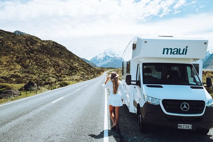
New Zealand offers a well-maintained road network, usually not too busy outside major cities. This is a huge plus if you're new to driving a campervan. The routes often feature spectacular viewpoints. You'll also find a vast network of campgrounds, and while freedom camping is regulated, there are still plenty of spots where you can sleep for free. Speed limits are reasonable, and the driving culture is pretty relaxed.
Adapted Infrastructure
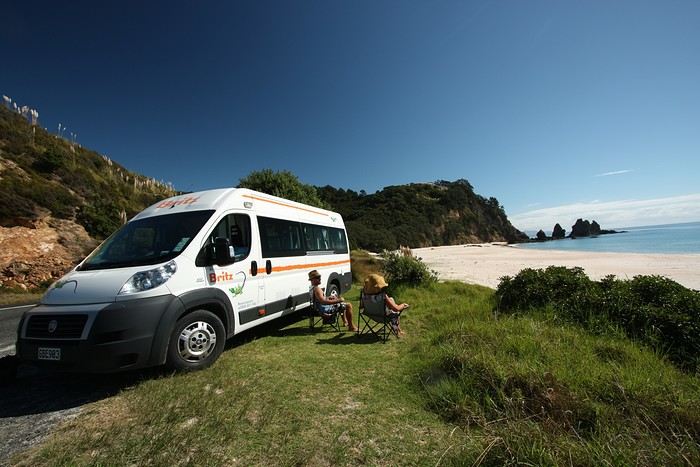
There are plenty of campervan rental companies offering different models, from converted vans to large family motorhomes. You'll find rental depots in major cities (Auckland, Christchurch, Queenstown), along with shuttle services between the airport and the depot. Campgrounds in New Zealand, whether private or managed by the Department of Conservation (DOC), are easy to find and well-marked. Plus, since New Zealand is a country of campers, you'll often get helpful tips from the locals.
Diverse and Accessible Landscapes
Beaches, volcanoes, deep fjords, or subtropical forests—you can experience a completely different setting in just a few hours of driving. No need to be a 4x4 expert: most roads leading to these stunning sites are campervan-friendly. This variety of landscapes, combined with easy access, makes New Zealand a top choice for a first road trip experience.
The Most Beautiful Places to Discover in a Campervan
To give you an idea, here’s a selection of must-see spots to inspire your next adventure.
1. The Coromandel Peninsula (North Island)
Just a few hours from Auckland, the Coromandel Peninsula is famous for its white sand beaches, hot springs, and lush vegetation. Hot Water Beach is a must-visit—dig your own "thermal bath" on the shore at low tide. You’ll easily find campgrounds by the ocean, perfect for your first taste of campervan life.
2. Rotorua and the Geothermal Wonders (North Island)
A little further south, Rotorua is the geothermal heart of New Zealand. Geysers, bubbling pools, and sulfur lakes with amazing colors—there’s no shortage of things to do. It’s also a major hub for Māori culture. Take the time to visit a traditional village or watch a haka performance. In the evening, relax at a campground with natural hot pools.
3. Tongariro National Park (North Island)
A UNESCO World Heritage site, this volcanic park is a paradise for hikers, especially with the famous Tongariro Alpine Crossing. Even if you're not an experienced hiker, you can enjoy stunning views from the roads or short marked trails. The campgrounds in the area will immerse you in a postcard-worthy setting.
4. Abel Tasman, Coastal Gem (South Island)
After taking the ferry from Wellington to Picton, head to Abel Tasman National Park. Its golden beaches, crystal-clear waters, and coastal trails are perfect for unwinding. One of the perks of a campervan is exploring at your own pace, choosing spots near the beaches or deeper in the forest.
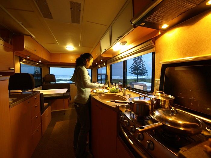
5. Punakaiki and the Pancake Rocks (South Island)
As you drive along the West Coast’s thick rainforests and wild beaches, stop at Punakaiki to see the Pancake Rocks—surprising rock formations that look like stacks of pancakes. A marked trail runs along the coast, letting you watch waves crash into the "blowholes" (marine geysers). Spending the night at a seaside campground, lulled by the sound of waves, is an experience not to be missed.
6. The Franz Josef and Fox Glaciers (South Island)
Further south, the glacier region is a must for lovers of breathtaking landscapes. You can admire the icy giants from a distance on an easy trail or take a helicopter to fly over them—or even walk on them. The campgrounds in Franz Josef or Fox Glacier let you wake up in an alpine atmosphere, contrasting with the lush vegetation around you.
7. Queenstown and Wanaka (South Island)
Queenstown, on the shore of a sparkling lake surrounded by majestic peaks, is known as the adventure capital: bungee jumping, paragliding, rafting—anything’s possible. If you prefer a quieter vibe, Wanaka is just as charming, with its beautiful lake and accessible walks. The road between these two towns is stunning, with plenty of perfect spots for a picnic stop.
8. Te Anau and Milford Sound (South Island)
New Zealand’s fjords are world-famous. Te Anau is the gateway to exploring Milford Sound or, for something wilder, Doubtful Sound. A cruise through these deep fjords, surrounded by towering cliffs, is one of the highlights of any trip to New Zealand. Staying overnight in a campervan in Te Anau saves you a long round trip in a day and lets you set off at dawn for more adventures.
9. Lake Tekapo and Mount Cook (South Island)
In the heart of the Southern Alps, Lake Tekapo charms with its unique turquoise color and its picturesque church by the water. The area is known for its starry skies (it’s an International Dark Sky Reserve). Mount Cook, the country’s highest peak, stands majestically in the background. Several campgrounds offer views of these mountains.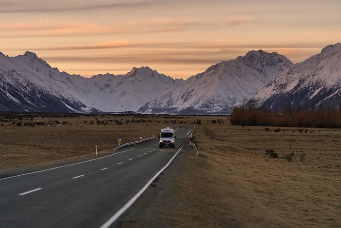
Practical Tips for a Successful Campervan Road Trip
Where to start? Between choosing the right vehicle, the best time to go, parking rules, and tips for where to sleep, here are our practical tips to plan your road trip stress-free.
Duration and Itinerary Choices
Less than 15 days: Focus on one island to avoid spending too much time on the road.
More than 15 days: Consider a North-South combo with a one-way trip (e.g., Auckland to Christchurch).
Book Early
In peak season (November to March), demand is high, especially for family-sized vehicles. Book your campervan ideally 6 to 8 months in advance.
Opt for full insurance to avoid high excess fees and hassles in case of issues. Standard bank insurance rarely covers campervans.
Choosing the Right Vehicle
Watch out for campervans over 3 years old—they can be "tired" in terms of both equipment and driving. If your budget allows, go for a newer model for better reliability and comfort.
Check the depot’s opening hours for pick-up. If you arrive late or after a long trip, it’s better to spend the first night in accommodation rather than driving straight away.
Where to Spend the Night
Freedom camping: Allowed in some remote areas but heavily regulated. Fines for breaking the rules can reach $200. Use comprehensive apps to identify legal spots and avoid penalties!
Basic campsites / DOC: Basic facilities but often in idyllic settings. These are campgrounds managed by the Department of Conservation, perfect for getting close to nature.
Private campgrounds: More expensive but offer hot showers, electricity, playgrounds for kids, pools, and laundry. Ideal for recharging—both your campervan’s batteries and your own.
Respect Nature
New Zealand is known for its pristine landscapes. Manage your waste, use designated dumping areas, and follow local signage. New Zealanders care deeply about keeping their environment clean and warmly welcome responsible tourists. For support, consider a local French-speaking agency like Frogs, which can help with administrative steps, planning your itinerary, and of course, renting a campervan.
Why is New Zealand the perfect country for your first campervan trip?
Safe and Scenic Roads
New Zealand offers a well-maintained road network, usually not too busy outside major cities. This is a huge plus if you're new to driving a campervan. The routes often feature spectacular viewpoints. You'll also find a vast network of campgrounds, and while freedom camping is regulated, there are still plenty of spots where you can sleep for free. Speed limits are reasonable, and the driving culture is pretty relaxed.
Adapted Infrastructure
There are plenty of campervan rental companies offering different models, from converted vans to large family motorhomes. You'll find rental depots in major cities (Auckland, Christchurch, Queenstown), along with shuttle services between the airport and the depot. Campgrounds in New Zealand, whether private or managed by the Department of Conservation (DOC), are easy to find and well-marked. Plus, since New Zealand is a country of campers, you'll often get helpful tips from the locals.
Diverse and Accessible Landscapes
Beaches, volcanoes, deep fjords, or subtropical forests—you can experience a completely different setting in just a few hours of driving. No need to be a 4x4 expert: most roads leading to these stunning sites are campervan-friendly. This variety of landscapes, combined with easy access, makes New Zealand a top choice for a first road trip experience.
The Most Beautiful Places to Discover in a Campervan
To give you an idea, here’s a selection of must-see spots to inspire your next adventure.
1. The Coromandel Peninsula (North Island)
Just a few hours from Auckland, the Coromandel Peninsula is famous for its white sand beaches, hot springs, and lush vegetation. Hot Water Beach is a must-visit—dig your own "thermal bath" on the shore at low tide. You’ll easily find campgrounds by the ocean, perfect for your first taste of campervan life.
2. Rotorua and the Geothermal Wonders (North Island)
A little further south, Rotorua is the geothermal heart of New Zealand. Geysers, bubbling pools, and sulfur lakes with amazing colors—there’s no shortage of things to do. It’s also a major hub for Māori culture. Take the time to visit a traditional village or watch a haka performance. In the evening, relax at a campground with natural hot pools.
3. Tongariro National Park (North Island)
A UNESCO World Heritage site, this volcanic park is a paradise for hikers, especially with the famous Tongariro Alpine Crossing. Even if you're not an experienced hiker, you can enjoy stunning views from the roads or short marked trails. The campgrounds in the area will immerse you in a postcard-worthy setting.
4. Abel Tasman, Coastal Gem (South Island)
After taking the ferry from Wellington to Picton, head to Abel Tasman National Park. Its golden beaches, crystal-clear waters, and coastal trails are perfect for unwinding. One of the perks of a campervan is exploring at your own pace, choosing spots near the beaches or deeper in the forest.
5. Punakaiki and the Pancake Rocks (South Island)
As you drive along the West Coast’s thick rainforests and wild beaches, stop at Punakaiki to see the Pancake Rocks—surprising rock formations that look like stacks of pancakes. A marked trail runs along the coast, letting you watch waves crash into the "blowholes" (marine geysers). Spending the night at a seaside campground, lulled by the sound of waves, is an experience not to be missed.
6. The Franz Josef and Fox Glaciers (South Island)
Further south, the glacier region is a must for lovers of breathtaking landscapes. You can admire the icy giants from a distance on an easy trail or take a helicopter to fly over them—or even walk on them. The campgrounds in Franz Josef or Fox Glacier let you wake up in an alpine atmosphere, contrasting with the lush vegetation around you.
7. Queenstown and Wanaka (South Island)
Queenstown, on the shore of a sparkling lake surrounded by majestic peaks, is known as the adventure capital: bungee jumping, paragliding, rafting—anything’s possible. If you prefer a quieter vibe, Wanaka is just as charming, with its beautiful lake and accessible walks. The road between these two towns is stunning, with plenty of perfect spots for a picnic stop.
8. Te Anau and Milford Sound (South Island)
New Zealand’s fjords are world-famous. Te Anau is the gateway to exploring Milford Sound or, for something wilder, Doubtful Sound. A cruise through these deep fjords, surrounded by towering cliffs, is one of the highlights of any trip to New Zealand. Staying overnight in a campervan in Te Anau saves you a long round trip in a day and lets you set off at dawn for more adventures.
9. Lake Tekapo and Mount Cook (South Island)
In the heart of the Southern Alps, Lake Tekapo charms with its unique turquoise color and its picturesque church by the water. The area is known for its starry skies (it’s an International Dark Sky Reserve). Mount Cook, the country’s highest peak, stands majestically in the background. Several campgrounds offer views of these mountains.
Practical Tips for a Successful Campervan Road Trip
Where to start? Between choosing the right vehicle, the best time to go, parking rules, and tips for where to sleep, here are our practical tips to plan your road trip stress-free.
Duration and Itinerary Choices
Less than 15 days: Focus on one island to avoid spending too much time on the road.
More than 15 days: Consider a North-South combo with a one-way trip (e.g., Auckland to Christchurch).
Book Early
In peak season (November to March), demand is high, especially for family-sized vehicles. Book your campervan ideally 6 to 8 months in advance.
Opt for full insurance to avoid high excess fees and hassles in case of issues. Standard bank insurance rarely covers campervans.
Choosing the Right Vehicle
Watch out for campervans over 3 years old—they can be "tired" in terms of both equipment and driving. If your budget allows, go for a newer model for better reliability and comfort.
Check the depot’s opening hours for pick-up. If you arrive late or after a long trip, it’s better to spend the first night in accommodation rather than driving straight away.
Where to Spend the Night
Freedom camping: Allowed in some remote areas but heavily regulated. Fines for breaking the rules can reach $200. Use comprehensive apps to identify legal spots and avoid penalties!
Basic campsites / DOC: Basic facilities but often in idyllic settings. These are campgrounds managed by the Department of Conservation, perfect for getting close to nature.
Private campgrounds: More expensive but offer hot showers, electricity, playgrounds for kids, pools, and laundry. Ideal for recharging—both your campervan’s batteries and your own.
Respect Nature
New Zealand is known for its pristine landscapes. Manage your waste, use designated dumping areas, and follow local signage. New Zealanders care deeply about keeping their environment clean and warmly welcome responsible tourists. For support, consider a local French-speaking agency like Frogs, which can help with administrative steps, planning your itinerary, and of course, renting a campervan.
Travel advice for the Azores
Hi there, we’re planning a 15-day trip to the Azores at the end of April/beginning of May. We’re torn between São Miguel and Terceira, or São Miguel and Flores—could you give us some advice based on the season? We saw a free flight offer within 24 hours of arriving in São Miguel—does this apply to French residents?
Thanks
The rule of the three unities
"In one place, in one day, a single deed accomplished,
May hold the theater filled until the end."
- Sunday morning, a chilly dawn - The kitchen - Smell of coffee and toast, a jar of honey on the table.
- Tits pecking at sunflower seeds in the transparent feeder stuck to the window.
- France Musique on the radio: Brahms, violin concerto by the lovely Hilary Hahn - Characters: - An old man in a plush dark blue dressing gown - An old woman in a worn-out duck-blue dressing gown. They dance cheek to cheek, the woman’s head resting on the old man’s broad chest. The old man breathes in the tangled hair of the lady. She smiles. Happy. Tomorrow, they’re off on a trip.
- Sunday morning, a chilly dawn - The kitchen - Smell of coffee and toast, a jar of honey on the table.
- Tits pecking at sunflower seeds in the transparent feeder stuck to the window.
- France Musique on the radio: Brahms, violin concerto by the lovely Hilary Hahn - Characters: - An old man in a plush dark blue dressing gown - An old woman in a worn-out duck-blue dressing gown. They dance cheek to cheek, the woman’s head resting on the old man’s broad chest. The old man breathes in the tangled hair of the lady. She smiles. Happy. Tomorrow, they’re off on a trip.
Visiting Bangkok and Chiang Mai during a short stay
Hello everyone,
My husband and I are planning a trip to Thailand from January 2 to 10. Departure from Brussels on January 1 – arriving in Bangkok at 6:00 AM on January 2. Departure from Bangkok on January 11 at 2:00 AM, arriving in Brussels at 1:25 PM the same day. For professional and personal reasons, we can’t extend the trip.
I don’t plan on just lounging on a beach in Phuket, so with 9 days on the ground, I know it’s short... But having done this before in Hong Kong and Shanghai, I know it’s doable, refreshing, and enjoyable. We did it with the kids and included a 2- or 3-day stay at Disneyland in each city. Basically, we spent 5-6 days in each city.
Anyway, I’m reaching out because I’ve heard and read so many conflicting opinions that my head is spinning.
Following the saying, "don’t bite off more than you can chew," I’m assuming I should keep it simple. So I’m torn between just Bangkok or Bangkok and Chiang Mai.
If I go with the second option, I’m debating whether to head straight to Chiang Mai on the day we arrive (but given the flight times, we’d lose pretty much the whole day) or spend two days in Bangkok first, then go to Chiang Mai for 3-4 days, and return to Bangkok.
Thanks for your advice!
My husband and I are planning a trip to Thailand from January 2 to 10. Departure from Brussels on January 1 – arriving in Bangkok at 6:00 AM on January 2. Departure from Bangkok on January 11 at 2:00 AM, arriving in Brussels at 1:25 PM the same day. For professional and personal reasons, we can’t extend the trip.
I don’t plan on just lounging on a beach in Phuket, so with 9 days on the ground, I know it’s short... But having done this before in Hong Kong and Shanghai, I know it’s doable, refreshing, and enjoyable. We did it with the kids and included a 2- or 3-day stay at Disneyland in each city. Basically, we spent 5-6 days in each city.
Anyway, I’m reaching out because I’ve heard and read so many conflicting opinions that my head is spinning.
Following the saying, "don’t bite off more than you can chew," I’m assuming I should keep it simple. So I’m torn between just Bangkok or Bangkok and Chiang Mai.
If I go with the second option, I’m debating whether to head straight to Chiang Mai on the day we arrive (but given the flight times, we’d lose pretty much the whole day) or spend two days in Bangkok first, then go to Chiang Mai for 3-4 days, and return to Bangkok.
Thanks for your advice!
Halong Bay
What we commonly call "Halong Bay" is actually made up of three bays. From south to north:
- The small Lan Ha Bay, south and east of Cat Ba Island, inaccessible to large cruise junks because the channels aren’t deep enough for big boats—so it’s more intimate and, above all, cleaner;
- Halong Bay itself, north of Cat Ba, also very beautiful but crowded with tourists since it can accommodate large boats (up to 35 cabins), making it very dirty due to many Asian tourists—except for the Japanese—who throw everything into the water: cigarette butts, bags, empty cans, etc.; - The large Bai Tu Long Bay, north of Halong Bay, characterized by larger islands with beautiful beaches and fewer tourists since it ideally takes 3 days to explore all three bays. PRIORITIZE LAN HA BAY FOR 2 DAYS AND BAI TU LONG BAY FOR THREE. Some travelers want to visit the bay in just one day. Strongly discouraged ! In fact, you need to allow 7 to 8 hours for the round trip between Hanoi and the bay; adding boarding time, you’ll only spend a few hours on a boat and barely scratch the surface of the bay. Plus, one of the most magical moments of the cruise is waking up in the morning surrounded by limestone karsts. Two days/1 night on a junk is the minimum to enjoy the enchanting landscapes. AVOID cheap junks! There’s no secret: cheap = limited comfort, laughable food, and service that’s barely acceptable. Never forget this is a unique site in the world, so it’s worth visiting under the best conditions. Don’t confuse Halong Bay with the "terrestrial Halong Bay" in Ninh Binh (Tam Coc). The first is 110 km north of Hanoi, the second 100 km south, right in the Red River Delta. Both are magnificent, and it’s now possible to take a direct bus from one to the other. To visit the bays, you have two options: - Travel to Cat Ba Island or Halong City on your own and book a junk on-site. We don’t recommend this, as there are many issues—especially overcharging for foreign tourists in ground transport and shortened cruises, not to mention you don’t speak Vietnamese. You’ll end up paying at least the same price as through a Hanoi agency, likely more, since you’re at high risk of being ripped off. - Book an organized tour in Hanoi with a good agency. Given the complexity of traveling from Hanoi to Halong and renting a junk on-site, this is by far the easiest option, with countless possibilities—from private junks (more expensive but with huge advantages) to luxury, superior, and standard group junks. Benefits: with a good agency, you’ll have a hassle-free cruise with no scams, and everything is included in the price: round-trip transfers from your hotel to the boat, guide, junk, all meals, site entries, kayaking, etc.
When it comes to choosing a junk, there are also two options: A private junk is by far the best for many reasons: - You’re the only passengers on board - Smaller than group junks, a private junk can navigate channels inaccessible to large boats and stop at small beaches also off-limits to big vessels - Private junks can anchor wherever the captain chooses, so in a quiet little bay, whereas all large junks are required to spend the night in the same big bay by local police order - Better service and food Of course, these advantages come at a cost—but after all, Halong is a once-in-a-lifetime trip! For luxury private junks, I recommend Bhaya Cruises and Indochina Junks. For superior, one of the best is Oriental Sun (2 cabins/2 bathrooms), owned by the excellent agency Oriental Bridge Travel. Also excellent are the two Dai Duong junks—the 02 with 2 cabins and the 03 with 3.
Group junks range from Deluxe to Superior. Choose a medium-sized junk (8-12 cabins). Among the Deluxe, Bhaya Cruises and Indochina Junks are flawless. For Budget, the superior Swan, Cozy Boutique, and Ocean 7 are great.
Warning: While group junks can be booked once in Hanoi (except during peak season), private junks must be reserved well in advance, especially in high season.
To make your choice and booking easier, the best is to contact Oriental Bridge Travel, which, unlike other agencies that offer every junk imaginable (from the best to the worst), has carefully selected 2 or 3 in each category. Check their website and, in the menu, click all the "Halong" links from "Luxury Private Junks" to "Superior Group Junks."
TRANSPORT TO HALONG BAY
Cruise prices include round-trip transfers between Hanoi and Cat Ba City or Hon Gai. If you want to go to Halong on your own, there are three departure ports for cruises: Cat Ba Island (especially for Lan Ha Bay), Halong City/Bai Chay port (Lan Ha, Halong, and Bai Tu Long), and Cai Rong, which serves only Bai Tu Long Bay. From Hanoi: To Cat Ba, take the Hanoi-Haiphong bus and the Haiphong-Cat Ba speedboat (3-hour journey). This is the fastest option since the boat arrives directly in Cat Ba City. Buy a combined ticket for Hanoi-Haiphong + Haiphong-Cat Ba speedboat. For Halong City, there are frequent direct buses. From other cities: Direct buses from Haiphong or Cat Ba City to Ninh Binh and Sapa. WHERE TO STAY IN CAT BA? If you spend a night in Cat Ba (not essential), there are more and more hotels. Here are the ones I liked among those I’ve visited: 2-star: Cat Ba Dream Impeccable, with a large terrace overlooking Cat Ba Bay, and unbeatable prices: $15-20 for a single/double/twin, $30 for a large triple. The owner is a great cook. 3-star: Hung Long Harbour Brand new and spotless, overlooking Cat Ba Bay. Ask for rooms with a balcony (the suites have very large terraces). Great value for the quality! Single/double: Standard 65 $, Deluxe 80 $, Suite 100 $, extra person: 30 $ There are also several bungalow hotels on the beach: on Monkey Island (3 km from Cat Ba City), the Cat Ba Monkey Island Resort; another on a different island 5 km south of Cat Ba City, the Cat Ba Ocean Beach Resort; and a third, the Cat Ba Beach Resort. In the mountains inside the island, you can stay at the Cat Ba Suoi Goi Resort and the Cat Ba Whisper Bungalows. RESTAURANTS In Cat Ba City, I’ve tried quite a few restaurants—more bad than good. Two excellent floating restaurants in Cat Beo, especially the one on the left. WHAT TO DO? Beyond cruises, there are some interesting sites to visit on the island: · Visit the Cannon Fort: No one goes there, and everyone’s wrong! It’s not far, just behind Cat Ba City on Nui Ngoc Road, the street leading to Cat Beo. You climb to 177 m altitude at the top of a hill with a superb panoramic view of Halong and Lan An Bays. In 1942, the French installed an artillery fort with three 137 mm cannons controlling the passages in the bay; two remain, along with the casemates. It later became an anti-aircraft post during the Vietnam War. Unfortunately, the last time I went, the road was blocked. Still worth a try—great views from the climb. Entry: 50,000 dong, and it’s worth it! · The national park: It covers three-quarters of the island. You can simply stroll or go trekking, especially the 15 km to Viet Hai village. No animals in sight. Just before the park entrance, visit the Viet Hospital, a series of caves remarkably set up as a hospital during the Vietnam War (there was even a natural pool and a cinema room). · The beaches (Cat Cô): The three beautiful beaches in coves at the southern end of Cat Ba City’s esplanade are taken—the first by a children’s water park and the other two by a huge hotel complex.
- The small Lan Ha Bay, south and east of Cat Ba Island, inaccessible to large cruise junks because the channels aren’t deep enough for big boats—so it’s more intimate and, above all, cleaner;
- Halong Bay itself, north of Cat Ba, also very beautiful but crowded with tourists since it can accommodate large boats (up to 35 cabins), making it very dirty due to many Asian tourists—except for the Japanese—who throw everything into the water: cigarette butts, bags, empty cans, etc.; - The large Bai Tu Long Bay, north of Halong Bay, characterized by larger islands with beautiful beaches and fewer tourists since it ideally takes 3 days to explore all three bays. PRIORITIZE LAN HA BAY FOR 2 DAYS AND BAI TU LONG BAY FOR THREE. Some travelers want to visit the bay in just one day. Strongly discouraged ! In fact, you need to allow 7 to 8 hours for the round trip between Hanoi and the bay; adding boarding time, you’ll only spend a few hours on a boat and barely scratch the surface of the bay. Plus, one of the most magical moments of the cruise is waking up in the morning surrounded by limestone karsts. Two days/1 night on a junk is the minimum to enjoy the enchanting landscapes. AVOID cheap junks! There’s no secret: cheap = limited comfort, laughable food, and service that’s barely acceptable. Never forget this is a unique site in the world, so it’s worth visiting under the best conditions. Don’t confuse Halong Bay with the "terrestrial Halong Bay" in Ninh Binh (Tam Coc). The first is 110 km north of Hanoi, the second 100 km south, right in the Red River Delta. Both are magnificent, and it’s now possible to take a direct bus from one to the other. To visit the bays, you have two options: - Travel to Cat Ba Island or Halong City on your own and book a junk on-site. We don’t recommend this, as there are many issues—especially overcharging for foreign tourists in ground transport and shortened cruises, not to mention you don’t speak Vietnamese. You’ll end up paying at least the same price as through a Hanoi agency, likely more, since you’re at high risk of being ripped off. - Book an organized tour in Hanoi with a good agency. Given the complexity of traveling from Hanoi to Halong and renting a junk on-site, this is by far the easiest option, with countless possibilities—from private junks (more expensive but with huge advantages) to luxury, superior, and standard group junks. Benefits: with a good agency, you’ll have a hassle-free cruise with no scams, and everything is included in the price: round-trip transfers from your hotel to the boat, guide, junk, all meals, site entries, kayaking, etc.
When it comes to choosing a junk, there are also two options: A private junk is by far the best for many reasons: - You’re the only passengers on board - Smaller than group junks, a private junk can navigate channels inaccessible to large boats and stop at small beaches also off-limits to big vessels - Private junks can anchor wherever the captain chooses, so in a quiet little bay, whereas all large junks are required to spend the night in the same big bay by local police order - Better service and food Of course, these advantages come at a cost—but after all, Halong is a once-in-a-lifetime trip! For luxury private junks, I recommend Bhaya Cruises and Indochina Junks. For superior, one of the best is Oriental Sun (2 cabins/2 bathrooms), owned by the excellent agency Oriental Bridge Travel. Also excellent are the two Dai Duong junks—the 02 with 2 cabins and the 03 with 3.
Group junks range from Deluxe to Superior. Choose a medium-sized junk (8-12 cabins). Among the Deluxe, Bhaya Cruises and Indochina Junks are flawless. For Budget, the superior Swan, Cozy Boutique, and Ocean 7 are great.
Warning: While group junks can be booked once in Hanoi (except during peak season), private junks must be reserved well in advance, especially in high season.
To make your choice and booking easier, the best is to contact Oriental Bridge Travel, which, unlike other agencies that offer every junk imaginable (from the best to the worst), has carefully selected 2 or 3 in each category. Check their website and, in the menu, click all the "Halong" links from "Luxury Private Junks" to "Superior Group Junks."
TRANSPORT TO HALONG BAY
Cruise prices include round-trip transfers between Hanoi and Cat Ba City or Hon Gai. If you want to go to Halong on your own, there are three departure ports for cruises: Cat Ba Island (especially for Lan Ha Bay), Halong City/Bai Chay port (Lan Ha, Halong, and Bai Tu Long), and Cai Rong, which serves only Bai Tu Long Bay. From Hanoi: To Cat Ba, take the Hanoi-Haiphong bus and the Haiphong-Cat Ba speedboat (3-hour journey). This is the fastest option since the boat arrives directly in Cat Ba City. Buy a combined ticket for Hanoi-Haiphong + Haiphong-Cat Ba speedboat. For Halong City, there are frequent direct buses. From other cities: Direct buses from Haiphong or Cat Ba City to Ninh Binh and Sapa. WHERE TO STAY IN CAT BA? If you spend a night in Cat Ba (not essential), there are more and more hotels. Here are the ones I liked among those I’ve visited: 2-star: Cat Ba Dream Impeccable, with a large terrace overlooking Cat Ba Bay, and unbeatable prices: $15-20 for a single/double/twin, $30 for a large triple. The owner is a great cook. 3-star: Hung Long Harbour Brand new and spotless, overlooking Cat Ba Bay. Ask for rooms with a balcony (the suites have very large terraces). Great value for the quality! Single/double: Standard 65 $, Deluxe 80 $, Suite 100 $, extra person: 30 $ There are also several bungalow hotels on the beach: on Monkey Island (3 km from Cat Ba City), the Cat Ba Monkey Island Resort; another on a different island 5 km south of Cat Ba City, the Cat Ba Ocean Beach Resort; and a third, the Cat Ba Beach Resort. In the mountains inside the island, you can stay at the Cat Ba Suoi Goi Resort and the Cat Ba Whisper Bungalows. RESTAURANTS In Cat Ba City, I’ve tried quite a few restaurants—more bad than good. Two excellent floating restaurants in Cat Beo, especially the one on the left. WHAT TO DO? Beyond cruises, there are some interesting sites to visit on the island: · Visit the Cannon Fort: No one goes there, and everyone’s wrong! It’s not far, just behind Cat Ba City on Nui Ngoc Road, the street leading to Cat Beo. You climb to 177 m altitude at the top of a hill with a superb panoramic view of Halong and Lan An Bays. In 1942, the French installed an artillery fort with three 137 mm cannons controlling the passages in the bay; two remain, along with the casemates. It later became an anti-aircraft post during the Vietnam War. Unfortunately, the last time I went, the road was blocked. Still worth a try—great views from the climb. Entry: 50,000 dong, and it’s worth it! · The national park: It covers three-quarters of the island. You can simply stroll or go trekking, especially the 15 km to Viet Hai village. No animals in sight. Just before the park entrance, visit the Viet Hospital, a series of caves remarkably set up as a hospital during the Vietnam War (there was even a natural pool and a cinema room). · The beaches (Cat Cô): The three beautiful beaches in coves at the southern end of Cat Ba City’s esplanade are taken—the first by a children’s water park and the other two by a huge hotel complex.
Retour aux Marquises: les îles méridionales Hiva Oa, Tahuata et Fatu Iva English translation pending
INTRO
En ces temps épidémiques troublés, la Polynésie Française - et en particulier l' archipel des Marquises - ont des atouts exceptionnels en matière de tourisme. A ce jour, l' épidémie de Coronavirus a juste effleuré le Territoire -presque uniquement Tahiti et Moorea - dont les îles éloignées ont été strictement confinées dès le départ, les offres sanitaires et hospitalières sur place étant très limitées. Pour l' instant, la situation est sous contrôle.
Le tourisme retrouve lentement ses marques depuis la mi-juillet. Il s'agit actuellement plus de tourisme local que de tourisme international, bien que la destination Polynésie / Marquises soit attirante : beauté et unicité des paysages, authenticité d'un archipel, certes situé à 4 heures d'avion ATR de Tahiti, mais que l' on peut facilement découvrir en solo et donc en dehors de la très onéreuse croisière sur l' Aranui, sécurité physique mais aussi sanitaire. Les Européens - dont une majorité de Français - arrivent... Ils avaient déjà leurs billets depuis des mois et l' entrée sur le territoire est facilitée.
Nous devions faire ce second voyage aux Marquises en mai dernier, mais il fut annulé jusqu'à la reprise progressive des vols en interne.
Nous avons simplement acheté un billet Air Tahiti en ligne, sans utiliser le Pass Marquises qui ne permet pas de visiter les deux îles les plus méridionales, à savoir Tahuata et Fatu Iva, dépourvues d'aéroport. On ne peut y aller qu' en bateau, en excursion à la journée ( ou plus bien sur ) pour Tahuata et en navette municipale au départ de Hiva Oa pour aller à Fatu Iva.
Les horaires changeant fréquemment, la première chose à faire est de se renseigner sur les jours de passage vers Fatu Iva. En ce moment, il y en a trois : le lundi ( départ à 2 heures du matin ), le mardi ( départ à 6 heures ) et le samedi ( départ à 6 heures également ). Mais tout cela aura peut-être changé dans 3 mois. Il faut donc une stratégie d'approche !
On peut rajouter la visite de ces deux îles à celles qui sont incluses dans le Pass, à savoir Nuku Hiva, Ua Pou, Ua Huka et Hiva Oa. Prévoir alors une extension de 8 jours environ, à partir de Hiva Oa.
Pourquoi vouloir absolument visiter ces deux îles peu accessibles ? Justement parce qu'il faut les mériter ! Elles demeurent très différentes.
L' une, Tahuata, a un lagon, des plages de sable blanc, des falaises abruptes, des baies échancrées ourlées d'une végétation luxuriante, des couleurs uniques dans les bleus et turquoise et culmine à plus de 1000 mètres.
L' autre, Fatu Iva , est une beauté sauvage et altière avec ses à-pics qui dévalent vers l' océan bleu outremer ( ou 'moana' en tahitien ), connue surtout pour sa fameuse baie des Vierges, considérée par beaucoup - en particulier les navigateurs - comme la plus belle île de Polynésie.
Dans mon premier carnet sur les Marquises, j' avais déjà mentionné notre séjour à Hiva Oa, un peu trop court. Cette fois, entre notre arrivée et notre retour, nous passerons 4 nuits à Hiva Oa et 4 nuits à Fatu Iva. Une journée et demie sera consacrée aussi à Hiva Oa.
Avant de partir à la découverte de ces îles polynésiennes lointaines et peu visitées, quelques chiffres édifiants qui montrent que les Marquises ont échappé de peu à l' oubli, à la perte de leur identité singulière et à la disparition de leur culture. L' archipel comptait 20000 habitants en 1842, seulement 2000 en 1920, environ 8000 actuellement en 2020. Au début des années 1920, c'est grâce à la politique nataliste du Dr Rollin, administrateur des Marquises de l' époque, que la situation commença lentement à s' améliorer. Ensuite et paradoxalement, ce fut un évêque, Mgr Lecleac'h, qui s'érigea en animateur engagé du réveil identitaire, via la sauvegarde du patrimoine, la reconnaissance de la langue marquisienne ( et non tahitienne ), les danses ( jugées trop lascives par les missionnaires ), les chants, le tatouage, enfin l' artisanat inspiré des motifs et des symboles de la culture ancienne. L' icône du renouveau marquisien est sans conteste le tiki, demi-dieu et créateur de l' homme. En lui réside la divinité et les ancêtres légendaires.

TAHUATA ou Île Lumière
DANS LA LEGENDE DES MARQUISES C' est la plus petite île habitée des Marquises dont le nom signifie l' aube en marquisien. J' aurai, plus tard, l' occasion de revenir sur la légende de la création des Marquises : dans cette légende, Tahuata représente le dernier acte de la construction avant l' aube. La symbolique de son nom est liée à l' arrivée de la lumière du jour, signifiant la fin de la construction de la 'Grande Maison', alias l' archipel des Marquises.
UN PEU DE GEOLOGIE Tahuata et Fatu Iva sont soeurs géologiquement parlant. Ce sont des îles plus jeunes que celles du nord de l' archipel ( de 5, 5 millions d'années au Nord-Ouest à seulement 1,2 million d'années au Sud-Est ) L' activité volcanique passée s' est matérialisée sous la forme de volcans dits boucliers, différents des volcans hawaiïens ou tahitiens, qui , suite à des secousses sismiques violentes et répétées, se sont peu à peu effondrés, disparaissant sous les flots de la moitié voire davantage des boucliers initiaux. Résultat : les calderas sont imbriquées l'une dans l' autre , la caldeira initiale étant dotée d'un volcan interne plus petit et plus récent. C 'est le cas à Fatu Iva par exemple.
UN PEU DE GEOGRAPHIE
Située à seulement 4 kms de Hiva Oa , on ne peut rejoindre Tahuata que par mer après 40 à 60 mn de navigation selon le temps ( il existe un catamaran communal, le Tahuata Nui mais qui est souvent en panne pour une durée indéterminée... ). On choisira entre l' excursion à la journée ou le passage simple en speedboat privé, assez cher. Ou si l' on doit résider à Tahuata, on s'arrangera au préalable avec la pension de famille choisie pour discuter des modalités et du prix de la course aller-retour entre Tahuata et Hiva Oa. Le canal dit du Bordelais qui est emprunté par les bateaux peut être extrêmement agité par des courants violents et rallonger un peu la course. (Petite digression sur ce fameux canal du Bordelais... Qui est donc ce Bordelais ? Un certain Joseph Capri ( ou Kabri ou Kabris ), originaire de Bordeaux même, initialement matelot de son état sur un bâtiment baleinier qui fait naufrage sur la côte de Nuku Hiva. Kabri , capturé par les guerriers du roi anthropophage de NH, s'apprête à mourir et à finir rôti à la broche, mais est sauvé in extremis par la fille du roi qui demande sa grâce. Celle-ci est accordée, il épouse la belle dans la foulée, le roi tatoue son gendre lui-même, lui offre des parures en tapa et mousse et le nomme grand juge du pays. Il tue, torture, garrotte, découpe en morceaux. Il pacifie à sa manière ! La vie est douce et belle, il a six enfants de sa princesse marquisienne ... Et puis un jour où il sommeille dans la nature, il est kidnappé par le navigateur russe Krunsenstern qui, à coups de knout, le ramène au navire puis à St Petersbourg pour y être interrogé et jugé. Kabri parvient à s' échapper vers Paris, demande à rencontrer Louis XVIII qu'il traite comme son cousin. Ce dernier - contre toute attente - le reçoit et lui donne un peu d'argent, mais la chance a définitivement tourné pour Kabri qui se retrouve à Valenciennes, gagnant son pain comme bête de foire. Il mourra à 42 ans, épuisé et sans avoir pu repartir vers son île marquisienne et vers sa famille nombreuse. Les autorités lui éviteront post mortem l' infamie d'une exhumation et d'un empaillage, son tatouage corporel et facial ayant conquis un amateur !!! JB Kabri le Tatoué, dessin publié dans le livre de Von Langsdorff
Retour à Tahuata... L' île n'est entourée que partiellement de récifs coralliens ( comme Mangareva aux îles Gambier ) , et est agrémentée de magnifiques plages de sable blanc, en particulier celle de Hanamoenoa. Avec ses versants escarpés se terminant en falaises, des vallées étroites et profondes ouvrant sur des baies échancrées à la végétation dense telles celles jumelles de Iva Iva Nui et de Iva Iva Iti, Tahuata surprend et attire. ' C'est une des rares fois où j' eus le désir de posséder de la terre ', écrivit en son temps le navigateur Alain Gerbault, conquis par une île qu'il qualifiait d'enchanteresse. Son relief est très accidenté et les communications terrestres - sur des pistes improbables - entre les vallées sont difficiles. L' île culmine au Mont Tumu-Mea-Ufa à 1050 m. Sa superficie est de 60 km2, avec une population de 650 à 700 habitants environ. L' île comporte 4 villages : Vaitahu, petit port historique, avec son église aux murs de galets et un magnifique vitrail, son musée d'art et d'histoire, et sa proximité avec des sites archéologiques; Hapatoni, autre village avec sa voie pavée ou ' allée de la reine ', construite sur ordre de la reine Vaekehu II au 19ème siècle, bordée d'arbres centenaires de tamanu plantés par les anciens , et ses ' me'ae ' ( ou ' marae ' en tahitien). Egalement Motopu et Hanatetena, deux plus petits villages. Il y a d'autres chemins pavés dans l' île, à Hapatoni en particulier, et des pétroglyphes à Hanatahua. On peut donc passer plus d'une journée à Tahuata, y séjourner dans l' une de ses pensions. Les chemins et pistes de l' île se prêtent parfaitement à la randonnée pédestre.
UN PEU D HISTOIRE
Plusieurs édifices du village de Vaitahu commémorent un passé souvent tragique. On peut y voir les trois stèles érigées en souvenir de l' arrivée des Espagnols en 1595, puis de celle de militaires français en 1838 et enfin de la prise de possession de l' archipel par l' amiral Abel Dupetit-Thouars en 1842. Alvaro de Mendaña y Neira jeta l' ancre à Vaitahu en 1595, un premier contact avec ceux que l' on appelait à l' époque dans les mers du Sud et ailleurs ' les naturels ' qui tourna rapidement au massacre par les soldats espagnols de 200 villageois, guerriers et civils mélangés. On peut comprendre, dans ce contexte, que l' arrivée d'Occidentaux au 18ème siècle et au début du 19ème siècle ait suscité beaucoup de méfiance, d'animosité et d'hostilité de la part des habitants de Tahuata, et des autres îles également. Les premières tentatives d' évangélisation protestante d'abord en 1797 puis catholique en 1839 se soldèrent par un échec retentissant ( le gouvernement français avait l' habitude d'envoyer les missionnaires en éclaireurs afin de tâter le terrain.. ). Le religieux ayant failli à sa mission, il restait donc le politique et le militaire : l' expédition Dupetit-Thouars arrive en vue de Tahuata mi - avril 1842. Les Français sont dans un premier temps plutôt bien reçus par le chef / roi Iotete qui a récemment subi la pression de la marine américaine et qui se dit que la France le protégera. On attribue donc un terrain en hauteur aux Français pour la construction d'un fortin et d'une garnison. Dupetit-Thouars veut aller vite et propose à Iotete de se mettre sous la protection du roi de France, Louis-Philippe. Iotete accepte et, le 1er mai, est organisée une cérémonie pour la prise de possession officielle des îles Sud de l' archipel des Marquises - et par extension de tout l' archipel - par la France en présence des missionnaires et du neveu de Iotete, Maheono, également chef de Hanatetena. Et puis rapidement, un malaise grandissant s'installe, l' ambiance se dégrade, Iotete devient peu accommodant et versatile, ne supportant pas de se voir privé de son autorité de chef incontesté. Il fugue dans la montagne, organise la résistance aux Français que l' on vient pourtant de fêter, et finit par assiéger le fortin à moitié achevé avec ses guerriers. Résultat : des morts et des blessés des deux côtés et un chaos inattendu. Après palabres et promesses, l' amiral, fidèle à sa stratégie initiale, convainc Iotete - contacté et ramené à la raison par son neveu - de revenir à la table des négociations, et les termes d' une paix durable sont établis définitivement. Iotete a tenté de lutter mais a perdu et la guerre et son pouvoir, son ' mana '. Il mourra l' année suivante, une fin triste et sans avenir pour un chef qui ne sera pas élevé au rang de dieu le jour de ses funérailles.
 Prise de possession officielle de Tahuata
De g. à d. : Maheono, Iotete ( en habit militaire d'apparat à galons d'or époque Louis XV ), le père Baudichon, Abel Dupetit-Thouars
Prise de possession officielle de Tahuata
De g. à d. : Maheono, Iotete ( en habit militaire d'apparat à galons d'or époque Louis XV ), le père Baudichon, Abel Dupetit-Thouars
 Iotete le 1er Mais 1842 ( portrait par Max Radiguet )
 Iotete le 1er mai 1842 ( portrait par Max Radiguet )
 Maheono, neveu de Iotete et son saisissant tatouage facial
 Guerriers marquisiens 19ème siècle
L' amiral repart bientôt sur son navire La Reine Blanche vers Tahiti où il va obtenir le 9 septembre 1842 de la reine Pomaré IV son acceptation formelle de placer son île sous protectorat français. C' est ainsi que Les Marquises alias La Terre des Hommes ( ou Te Fenua Enata en marquisien ) devient la première colonie française dans le Pacifique Sud un peu avant Tahiti.
FAUNE ET FLORE Depuis sa disparition de Hiva Oa, suite à l' introduction malheureuse d'un rapace nocturne, le grand-duc de Virginie ( ou Bubo Virginiasus en latin ), la seule population survivante de ' pahi ' ou martin-chasseur des Marquises, vit à Tahuata, en grand danger d'extinction, car en déclin lent mais constant. il ne resterait que 300 individus au mieux. La destruction du grand-duc est autorisée à cause de son impact fatal sur la faune aviaire locale. Des excursions à pied et à cheval, en excursion à la demi-journée ou à la journée entière, à la découverte du ' pahi ' sont possibles. Contacter le comité de tourisme de Tahuata.
ACTIVITES TRADITIONNELLES
Il y a à Tahuata plusieurs centres d'artisanat et ce dernier est le plus réputé des Marquises, en particulier pour la sculpture sur os. Dans l' île, on est souvent sculpteur de père en fils; les hommes travaillent le bois de rose, l' os de cheval, de chèvre et de mouton et le rostre d'espadon. Dans la vallée d'Hapatoni, ce sont surtout d' expertes sculptrices qui sont à l' oeuvre, souvent depuis des années. Au travail de l' os ou du rostre d'espadon, elles ajoutent la confection de bijoux originaux. La culture du coprah est bien présente à Tahuata et permet aux agriculteurs de gagner un revenu fixe. Les cultures vivrières et les récoltes d'agrumes tels les pamplemousses, très réputés permettent l' autosuffisance alimentaire des habitants de l' île et un peu d'exportation vers le marché et les supermarchés de Papeete ( via la diaspora marquisienne installée à Tahiti ). Pêche et chasse participent également, pleinement, de ce désir d'autosuffisance. La nature est généreuse et tout pousse à profusion et l' on vit simplement mais plutôt bien à Tahuata comme ailleurs aux Marquises, d'autant que désormais, les cargos mixtes apportent régulièrement de Tahiti ce qui manque aux îliens.
Fatu Iva L' île de tous les superlatifs / L'île érotique

Guerrier marquisien tatoué originaire de Fatu Iva 19ème siècle On notera sur sa poitrine les motifs reconstitués d'une tête de tiki, que l' on retrouve aussi sur la crosse du casse-tête ( ou ' u'u ' en marquisien ), arme réservée au guerrier. Cette tête est supposée augmenter le ' mana ' ( alias la puissance ), les yeux en amande évoquent cette puissance surnaturelle tandis que la bouche étirée où apparaissent parfois langue et dents, est censée défier l' adversaire.
SELON LA LEGENDE Dans la légende de la construction de l' archipel des Marquises, selon laquelle chaque île est partie intégrante de la Maison des Dieux, Fatu Iva représente la toiture faite de 9 ( Iva ) tresses ( Fatu ) de feuilles de palmier. Elle s'est aussi appelée Santa Magdalena, nom donné par Alvaro de Mendaña en l' honneur de la sainte du même nom.
UN PEU DE GEOGRAPHIE Fatu Iva est une île située à 75 kms de Hiva Oa, d'une superficie de 84 km2. Longue de 10 kilomètres et large de 4, elle a la forme d'un croissant ou d'un haricot. Elle culmine au Mont Touaouoho à 960 mètres et héberge une population d'environ 600 habitants. C' est l' île la plus australe de l' archipel, la plus isolée aussi car il est impossible d'y construire un aéroport en raison du relief accidenté ou même un aérodrome comme à Ua Pou par exemple. C' est aussi la plus pluvieuse, étant la plus proche du tropique du Capricorne. Les pluies étant abondantes, l' île est recouverte d'une végétation luxuriante en particulier en son centre où prospère une forêt primaire tropicale dense. C' est aussi l'île la plus sauvage et la plus spectaculaire de l' archipel. Géologiquement parlant, elle est constituée de deux caldeiras volcaniques enchâssées l' une dans l' autre. La première date de 2 millions d'années environ, la seconde, deux fois plus petite est née d'une énorme éruption, comme en témoignent les massives chandelles basaltiques qui montent au ciel tout autour de la baie de Hanavave, dite baie des Vierges. Initialement appelée baie des Verges par les Marquisiens, elle a été rebaptisée par de pudibonds missionnaires, effarouchés par l' imagerie locale et ses sous-entendus. Fatu Iva n' a que deux villages situées chacun sur le bord extérieur des deux caldeiras : Hanavave aux colonnes basaltiques et Omoa, chef-lieu de l' île , village surplombé par un piton rocheux qui surprend par son profil rappelant la tête d'un moai de l' île de Pâques.
UN PEU D'HISTOIRE Comme les autres îles de l' archipel, Fatu Iva fut initialement peuplée par des Polynésiens venus de l' ouest. Les rivalités entre tribus étaient au départ incessantes et donnèrent lieu à des batailles sanglantes. C' est en juillet 1595 que l'île - tout comme celle de Tahuata - fut abordée pour la première fois par un occidental, le navigateur espagnol Alvaro de Mendaña de Neira , le premier du genre à avoir établi des contacts avec des populations polynésiennes. Mais il n' y débarqua pas. Il crût tout d'abord avoir découvert les Iles Salomon, le but ultime de son voyage, mais se rendit rapidement compte qu' il avait découvert une nouvelle terre dans un archipel d' îles auxquelles il donna le nom de ' Marquesas de Mendoza ' pour remercier le Vice-Roi du Pérou - alias Garcia Hurtado de Mendoza y Maurique, IV marquis de Cañete - qui l' avait aidé à monter et financer son expédition, et pour honorer en même temps son épouse et ses filles. En 1935, l' anthropologue norvégien Thor Heyerdahl - et futur aventurier du Kon Tiki - aborda Fatu Iva avec l' idée bien ancrée d' en faire son éden. Il y vécut un an avec sa femme, d'abord à Omoa, puis à Ouia, une vallée inconfortablement située sur la côte au vent et désormais retournée à l' état naturel, ayant été abandonnée par ses quelques habitants. Heyerdahl avait à l' époque avancé l' hypothèse erronée que les Maori descendaient des Indiens d'Amérique du Sud alors qu'ils sont originellement arrivés en pirogue de l' Asie du Sud-Est, et plus particulièrement de Taïwan. ( Je vous renvoie à mon carnet sur Taïwan où j' aborde ce sujet )
De 1960 à 1966, une majorité d'hommes de Fatu Iva partirent travailler au CEP de Mururoa, participant ainsi de l' émigration économique ayant commencé à l' époque, et s'étant poursuivie jusqu'à nos jours, les perspectives en termes d' emploi étant plus que limitées si l' on ne veut pas rester ou devenir agriculteur ou coprahculteur comme ses parents ou grands-parents.
FAUNE ET FLORE L' île est une terre d'abondance pour les agrumes, les fruits en général et les fleurs... Tout pousse ou presque. Elle possède une espèce endémique très menacée aujourd'hui : le Monarque ( ou oma'o ke'eke'e en marquisien ', dont il ne restait il y a peu que 6 couples au monde ! Le rat noir et le chat haret ont littéralement décimé cette espèce, dévorant oeufs, oisillons et même femelles en couvaison. Un programme de sauvegarde de l' espèce a été mis en place, avec des résultats encourageants, le nombre de couples ayant augmenté ces dernières années.
ECONOMIE L' île est ravitaillée uniquement par bateau. Une unique route partiellement bétonnée des deux côtés, et partiellement à l' état de piste, et longue de 17 kilomètres relie les deux villages. On peut également aller d'un village à l' autre par la mer en un quart d'heure de navigation. Le secteur primaire prévaut à Fatu Iva, en particulier la culture du coprah, et puis la pêche au thon, à l' espadon et au thazard. On y a cultivé le noni à outrance à une certaine époque mais celle-ci est un peu révolue, les bienfaits miraculeux du noni n' ayant pas vraiment été prouvés scientifiquement. Comme à Rurutu, on a abandonné la culture du café qui était pourtant prometteuse il y a une quarantaine d'années. En revanche, on trouve davantage de vergers et des vanillières. La chasse aux cochons et aux chèvres permet l' auto-suffisance en viande quand le ravitaillement venu de Tahiti vient à manquer ou arrive irrégulièrement. L' artisanat s'est développé grâce au tourisme et aux expositions semestrielles organisées à Papeete. La spécialité - principalement féminine - de Fatu Iva est le tapa dont les dessins s'inspirent des anciens tatouages marquisiens. La sculpture sur bois ou os ou noix de coco est plutôt réservée aux hommes, nourrie des anciennes figures et des symboles centenaires : tikis sculptés en bois de rose ou en bois noir, casse-tête, plats de présentation.
Suivez-moi en page 2.....
TAHUATA ou Île Lumière
DANS LA LEGENDE DES MARQUISES C' est la plus petite île habitée des Marquises dont le nom signifie l' aube en marquisien. J' aurai, plus tard, l' occasion de revenir sur la légende de la création des Marquises : dans cette légende, Tahuata représente le dernier acte de la construction avant l' aube. La symbolique de son nom est liée à l' arrivée de la lumière du jour, signifiant la fin de la construction de la 'Grande Maison', alias l' archipel des Marquises.
UN PEU DE GEOLOGIE Tahuata et Fatu Iva sont soeurs géologiquement parlant. Ce sont des îles plus jeunes que celles du nord de l' archipel ( de 5, 5 millions d'années au Nord-Ouest à seulement 1,2 million d'années au Sud-Est ) L' activité volcanique passée s' est matérialisée sous la forme de volcans dits boucliers, différents des volcans hawaiïens ou tahitiens, qui , suite à des secousses sismiques violentes et répétées, se sont peu à peu effondrés, disparaissant sous les flots de la moitié voire davantage des boucliers initiaux. Résultat : les calderas sont imbriquées l'une dans l' autre , la caldeira initiale étant dotée d'un volcan interne plus petit et plus récent. C 'est le cas à Fatu Iva par exemple.
UN PEU DE GEOGRAPHIE
Située à seulement 4 kms de Hiva Oa , on ne peut rejoindre Tahuata que par mer après 40 à 60 mn de navigation selon le temps ( il existe un catamaran communal, le Tahuata Nui mais qui est souvent en panne pour une durée indéterminée... ). On choisira entre l' excursion à la journée ou le passage simple en speedboat privé, assez cher. Ou si l' on doit résider à Tahuata, on s'arrangera au préalable avec la pension de famille choisie pour discuter des modalités et du prix de la course aller-retour entre Tahuata et Hiva Oa. Le canal dit du Bordelais qui est emprunté par les bateaux peut être extrêmement agité par des courants violents et rallonger un peu la course. (Petite digression sur ce fameux canal du Bordelais... Qui est donc ce Bordelais ? Un certain Joseph Capri ( ou Kabri ou Kabris ), originaire de Bordeaux même, initialement matelot de son état sur un bâtiment baleinier qui fait naufrage sur la côte de Nuku Hiva. Kabri , capturé par les guerriers du roi anthropophage de NH, s'apprête à mourir et à finir rôti à la broche, mais est sauvé in extremis par la fille du roi qui demande sa grâce. Celle-ci est accordée, il épouse la belle dans la foulée, le roi tatoue son gendre lui-même, lui offre des parures en tapa et mousse et le nomme grand juge du pays. Il tue, torture, garrotte, découpe en morceaux. Il pacifie à sa manière ! La vie est douce et belle, il a six enfants de sa princesse marquisienne ... Et puis un jour où il sommeille dans la nature, il est kidnappé par le navigateur russe Krunsenstern qui, à coups de knout, le ramène au navire puis à St Petersbourg pour y être interrogé et jugé. Kabri parvient à s' échapper vers Paris, demande à rencontrer Louis XVIII qu'il traite comme son cousin. Ce dernier - contre toute attente - le reçoit et lui donne un peu d'argent, mais la chance a définitivement tourné pour Kabri qui se retrouve à Valenciennes, gagnant son pain comme bête de foire. Il mourra à 42 ans, épuisé et sans avoir pu repartir vers son île marquisienne et vers sa famille nombreuse. Les autorités lui éviteront post mortem l' infamie d'une exhumation et d'un empaillage, son tatouage corporel et facial ayant conquis un amateur !!!
JB Kabri le Tatoué, dessin publié dans le livre de Von LangsdorffRetour à Tahuata... L' île n'est entourée que partiellement de récifs coralliens ( comme Mangareva aux îles Gambier ) , et est agrémentée de magnifiques plages de sable blanc, en particulier celle de Hanamoenoa. Avec ses versants escarpés se terminant en falaises, des vallées étroites et profondes ouvrant sur des baies échancrées à la végétation dense telles celles jumelles de Iva Iva Nui et de Iva Iva Iti, Tahuata surprend et attire. ' C'est une des rares fois où j' eus le désir de posséder de la terre ', écrivit en son temps le navigateur Alain Gerbault, conquis par une île qu'il qualifiait d'enchanteresse. Son relief est très accidenté et les communications terrestres - sur des pistes improbables - entre les vallées sont difficiles. L' île culmine au Mont Tumu-Mea-Ufa à 1050 m. Sa superficie est de 60 km2, avec une population de 650 à 700 habitants environ. L' île comporte 4 villages : Vaitahu, petit port historique, avec son église aux murs de galets et un magnifique vitrail, son musée d'art et d'histoire, et sa proximité avec des sites archéologiques; Hapatoni, autre village avec sa voie pavée ou ' allée de la reine ', construite sur ordre de la reine Vaekehu II au 19ème siècle, bordée d'arbres centenaires de tamanu plantés par les anciens , et ses ' me'ae ' ( ou ' marae ' en tahitien). Egalement Motopu et Hanatetena, deux plus petits villages. Il y a d'autres chemins pavés dans l' île, à Hapatoni en particulier, et des pétroglyphes à Hanatahua. On peut donc passer plus d'une journée à Tahuata, y séjourner dans l' une de ses pensions. Les chemins et pistes de l' île se prêtent parfaitement à la randonnée pédestre.
UN PEU D HISTOIRE
Plusieurs édifices du village de Vaitahu commémorent un passé souvent tragique. On peut y voir les trois stèles érigées en souvenir de l' arrivée des Espagnols en 1595, puis de celle de militaires français en 1838 et enfin de la prise de possession de l' archipel par l' amiral Abel Dupetit-Thouars en 1842. Alvaro de Mendaña y Neira jeta l' ancre à Vaitahu en 1595, un premier contact avec ceux que l' on appelait à l' époque dans les mers du Sud et ailleurs ' les naturels ' qui tourna rapidement au massacre par les soldats espagnols de 200 villageois, guerriers et civils mélangés. On peut comprendre, dans ce contexte, que l' arrivée d'Occidentaux au 18ème siècle et au début du 19ème siècle ait suscité beaucoup de méfiance, d'animosité et d'hostilité de la part des habitants de Tahuata, et des autres îles également. Les premières tentatives d' évangélisation protestante d'abord en 1797 puis catholique en 1839 se soldèrent par un échec retentissant ( le gouvernement français avait l' habitude d'envoyer les missionnaires en éclaireurs afin de tâter le terrain.. ). Le religieux ayant failli à sa mission, il restait donc le politique et le militaire : l' expédition Dupetit-Thouars arrive en vue de Tahuata mi - avril 1842. Les Français sont dans un premier temps plutôt bien reçus par le chef / roi Iotete qui a récemment subi la pression de la marine américaine et qui se dit que la France le protégera. On attribue donc un terrain en hauteur aux Français pour la construction d'un fortin et d'une garnison. Dupetit-Thouars veut aller vite et propose à Iotete de se mettre sous la protection du roi de France, Louis-Philippe. Iotete accepte et, le 1er mai, est organisée une cérémonie pour la prise de possession officielle des îles Sud de l' archipel des Marquises - et par extension de tout l' archipel - par la France en présence des missionnaires et du neveu de Iotete, Maheono, également chef de Hanatetena. Et puis rapidement, un malaise grandissant s'installe, l' ambiance se dégrade, Iotete devient peu accommodant et versatile, ne supportant pas de se voir privé de son autorité de chef incontesté. Il fugue dans la montagne, organise la résistance aux Français que l' on vient pourtant de fêter, et finit par assiéger le fortin à moitié achevé avec ses guerriers. Résultat : des morts et des blessés des deux côtés et un chaos inattendu. Après palabres et promesses, l' amiral, fidèle à sa stratégie initiale, convainc Iotete - contacté et ramené à la raison par son neveu - de revenir à la table des négociations, et les termes d' une paix durable sont établis définitivement. Iotete a tenté de lutter mais a perdu et la guerre et son pouvoir, son ' mana '. Il mourra l' année suivante, une fin triste et sans avenir pour un chef qui ne sera pas élevé au rang de dieu le jour de ses funérailles.
Prise de possession officielle de Tahuata
De g. à d. : Maheono, Iotete ( en habit militaire d'apparat à galons d'or époque Louis XV ), le père Baudichon, Abel Dupetit-Thouars
Iotete le 1er Mais 1842 ( portrait par Max Radiguet )
Iotete le 1er mai 1842 ( portrait par Max Radiguet )
Maheono, neveu de Iotete et son saisissant tatouage facial
Guerriers marquisiens 19ème siècleL' amiral repart bientôt sur son navire La Reine Blanche vers Tahiti où il va obtenir le 9 septembre 1842 de la reine Pomaré IV son acceptation formelle de placer son île sous protectorat français. C' est ainsi que Les Marquises alias La Terre des Hommes ( ou Te Fenua Enata en marquisien ) devient la première colonie française dans le Pacifique Sud un peu avant Tahiti.
FAUNE ET FLORE Depuis sa disparition de Hiva Oa, suite à l' introduction malheureuse d'un rapace nocturne, le grand-duc de Virginie ( ou Bubo Virginiasus en latin ), la seule population survivante de ' pahi ' ou martin-chasseur des Marquises, vit à Tahuata, en grand danger d'extinction, car en déclin lent mais constant. il ne resterait que 300 individus au mieux. La destruction du grand-duc est autorisée à cause de son impact fatal sur la faune aviaire locale. Des excursions à pied et à cheval, en excursion à la demi-journée ou à la journée entière, à la découverte du ' pahi ' sont possibles. Contacter le comité de tourisme de Tahuata.
ACTIVITES TRADITIONNELLES
Il y a à Tahuata plusieurs centres d'artisanat et ce dernier est le plus réputé des Marquises, en particulier pour la sculpture sur os. Dans l' île, on est souvent sculpteur de père en fils; les hommes travaillent le bois de rose, l' os de cheval, de chèvre et de mouton et le rostre d'espadon. Dans la vallée d'Hapatoni, ce sont surtout d' expertes sculptrices qui sont à l' oeuvre, souvent depuis des années. Au travail de l' os ou du rostre d'espadon, elles ajoutent la confection de bijoux originaux. La culture du coprah est bien présente à Tahuata et permet aux agriculteurs de gagner un revenu fixe. Les cultures vivrières et les récoltes d'agrumes tels les pamplemousses, très réputés permettent l' autosuffisance alimentaire des habitants de l' île et un peu d'exportation vers le marché et les supermarchés de Papeete ( via la diaspora marquisienne installée à Tahiti ). Pêche et chasse participent également, pleinement, de ce désir d'autosuffisance. La nature est généreuse et tout pousse à profusion et l' on vit simplement mais plutôt bien à Tahuata comme ailleurs aux Marquises, d'autant que désormais, les cargos mixtes apportent régulièrement de Tahiti ce qui manque aux îliens.
Fatu Iva L' île de tous les superlatifs / L'île érotique
Guerrier marquisien tatoué originaire de Fatu Iva 19ème siècle On notera sur sa poitrine les motifs reconstitués d'une tête de tiki, que l' on retrouve aussi sur la crosse du casse-tête ( ou ' u'u ' en marquisien ), arme réservée au guerrier. Cette tête est supposée augmenter le ' mana ' ( alias la puissance ), les yeux en amande évoquent cette puissance surnaturelle tandis que la bouche étirée où apparaissent parfois langue et dents, est censée défier l' adversaire.
SELON LA LEGENDE Dans la légende de la construction de l' archipel des Marquises, selon laquelle chaque île est partie intégrante de la Maison des Dieux, Fatu Iva représente la toiture faite de 9 ( Iva ) tresses ( Fatu ) de feuilles de palmier. Elle s'est aussi appelée Santa Magdalena, nom donné par Alvaro de Mendaña en l' honneur de la sainte du même nom.
UN PEU DE GEOGRAPHIE Fatu Iva est une île située à 75 kms de Hiva Oa, d'une superficie de 84 km2. Longue de 10 kilomètres et large de 4, elle a la forme d'un croissant ou d'un haricot. Elle culmine au Mont Touaouoho à 960 mètres et héberge une population d'environ 600 habitants. C' est l' île la plus australe de l' archipel, la plus isolée aussi car il est impossible d'y construire un aéroport en raison du relief accidenté ou même un aérodrome comme à Ua Pou par exemple. C' est aussi la plus pluvieuse, étant la plus proche du tropique du Capricorne. Les pluies étant abondantes, l' île est recouverte d'une végétation luxuriante en particulier en son centre où prospère une forêt primaire tropicale dense. C' est aussi l'île la plus sauvage et la plus spectaculaire de l' archipel. Géologiquement parlant, elle est constituée de deux caldeiras volcaniques enchâssées l' une dans l' autre. La première date de 2 millions d'années environ, la seconde, deux fois plus petite est née d'une énorme éruption, comme en témoignent les massives chandelles basaltiques qui montent au ciel tout autour de la baie de Hanavave, dite baie des Vierges. Initialement appelée baie des Verges par les Marquisiens, elle a été rebaptisée par de pudibonds missionnaires, effarouchés par l' imagerie locale et ses sous-entendus. Fatu Iva n' a que deux villages situées chacun sur le bord extérieur des deux caldeiras : Hanavave aux colonnes basaltiques et Omoa, chef-lieu de l' île , village surplombé par un piton rocheux qui surprend par son profil rappelant la tête d'un moai de l' île de Pâques.
UN PEU D'HISTOIRE Comme les autres îles de l' archipel, Fatu Iva fut initialement peuplée par des Polynésiens venus de l' ouest. Les rivalités entre tribus étaient au départ incessantes et donnèrent lieu à des batailles sanglantes. C' est en juillet 1595 que l'île - tout comme celle de Tahuata - fut abordée pour la première fois par un occidental, le navigateur espagnol Alvaro de Mendaña de Neira , le premier du genre à avoir établi des contacts avec des populations polynésiennes. Mais il n' y débarqua pas. Il crût tout d'abord avoir découvert les Iles Salomon, le but ultime de son voyage, mais se rendit rapidement compte qu' il avait découvert une nouvelle terre dans un archipel d' îles auxquelles il donna le nom de ' Marquesas de Mendoza ' pour remercier le Vice-Roi du Pérou - alias Garcia Hurtado de Mendoza y Maurique, IV marquis de Cañete - qui l' avait aidé à monter et financer son expédition, et pour honorer en même temps son épouse et ses filles. En 1935, l' anthropologue norvégien Thor Heyerdahl - et futur aventurier du Kon Tiki - aborda Fatu Iva avec l' idée bien ancrée d' en faire son éden. Il y vécut un an avec sa femme, d'abord à Omoa, puis à Ouia, une vallée inconfortablement située sur la côte au vent et désormais retournée à l' état naturel, ayant été abandonnée par ses quelques habitants. Heyerdahl avait à l' époque avancé l' hypothèse erronée que les Maori descendaient des Indiens d'Amérique du Sud alors qu'ils sont originellement arrivés en pirogue de l' Asie du Sud-Est, et plus particulièrement de Taïwan. ( Je vous renvoie à mon carnet sur Taïwan où j' aborde ce sujet )
De 1960 à 1966, une majorité d'hommes de Fatu Iva partirent travailler au CEP de Mururoa, participant ainsi de l' émigration économique ayant commencé à l' époque, et s'étant poursuivie jusqu'à nos jours, les perspectives en termes d' emploi étant plus que limitées si l' on ne veut pas rester ou devenir agriculteur ou coprahculteur comme ses parents ou grands-parents.
FAUNE ET FLORE L' île est une terre d'abondance pour les agrumes, les fruits en général et les fleurs... Tout pousse ou presque. Elle possède une espèce endémique très menacée aujourd'hui : le Monarque ( ou oma'o ke'eke'e en marquisien ', dont il ne restait il y a peu que 6 couples au monde ! Le rat noir et le chat haret ont littéralement décimé cette espèce, dévorant oeufs, oisillons et même femelles en couvaison. Un programme de sauvegarde de l' espèce a été mis en place, avec des résultats encourageants, le nombre de couples ayant augmenté ces dernières années.
ECONOMIE L' île est ravitaillée uniquement par bateau. Une unique route partiellement bétonnée des deux côtés, et partiellement à l' état de piste, et longue de 17 kilomètres relie les deux villages. On peut également aller d'un village à l' autre par la mer en un quart d'heure de navigation. Le secteur primaire prévaut à Fatu Iva, en particulier la culture du coprah, et puis la pêche au thon, à l' espadon et au thazard. On y a cultivé le noni à outrance à une certaine époque mais celle-ci est un peu révolue, les bienfaits miraculeux du noni n' ayant pas vraiment été prouvés scientifiquement. Comme à Rurutu, on a abandonné la culture du café qui était pourtant prometteuse il y a une quarantaine d'années. En revanche, on trouve davantage de vergers et des vanillières. La chasse aux cochons et aux chèvres permet l' auto-suffisance en viande quand le ravitaillement venu de Tahiti vient à manquer ou arrive irrégulièrement. L' artisanat s'est développé grâce au tourisme et aux expositions semestrielles organisées à Papeete. La spécialité - principalement féminine - de Fatu Iva est le tapa dont les dessins s'inspirent des anciens tatouages marquisiens. La sculpture sur bois ou os ou noix de coco est plutôt réservée aux hommes, nourrie des anciennes figures et des symboles centenaires : tikis sculptés en bois de rose ou en bois noir, casse-tête, plats de présentation.
Suivez-moi en page 2.....
Cliquetement pédalier Shimano Deore 3 x 10 vitesses FC-M6000-3 English translation pending
Bonjour,
j'ai un velo de voyage neuf avec un pedalier Pédalier Shimano Deore 3 x 10 vitesses FC-M6000-3.
Depuis que je l'ai (Mai 2020) le pedalier fait un petit bruit de cliquetement lorsque la chaine est sur le plateau du milieu. Ce bruit n'apparait pas sur le petit ni sur le grand plateau. Il apparait uniquement sur le plateau du milieu pour tous les pignons.
Ca n'est pas un bruit de frottement, j'ai bien vérifié que le chaine ne frottait pas sur le derailleur mais bien des cliquettements.
Le vendeur m'a dit que cela pouvait venir des rivets situé au niveau du plateau du milieu qui toucheraient la chaine lorsque l'on roule. Apres 300km de rodage cela ne part pas.
Est ce que quelqu'un aurait une idée ?
Merci !