Results for "Porto+Torres+|+9+>+215"
87179 results found.
Meilleure saison et itinéraire pour Afrique du Sud? English translation pending
J'ai pour projet de partir dans ce pays contrasté et passionant. Mais je voudrais savoir plusieurs choses:
a quelle saison? est-ce important?
quel itinéraire? J epense que DURBAN ET LE CAP sont incontournable mais qu y atil à voir à l'intérieur des terres?
Rencontrer directement des ZOULOUs est-ce possible?
PEUT- on sortir des itinéraires des Tour opérators sans risque 😕 ? j'entend parler de zones très insécurisée...
MERCI D'AVANCE
MERCI D'AVANCE
Auberge de jeunesse à Barcelone? English translation pending
Coucou !
J'aurai voulu connaitre des bons plans concernant le logement a Barcelone pour cet été ! Je pars dans l'optique de sortir, m'amuser, je cherche donc un logement convivial type auberge de jeunesse mais pas trop cher si possible !!!
Merci !😉
J'aurai voulu connaitre des bons plans concernant le logement a Barcelone pour cet été ! Je pars dans l'optique de sortir, m'amuser, je cherche donc un logement convivial type auberge de jeunesse mais pas trop cher si possible !!!
Merci !😉
Barrière de corail en Australie English translation pending
Bonsoir,
Quel est le moyen le plus intéressant (rapport qualité-prix) pour voir la barrière de corail? (aller sur une île, prendre un bateau, plongée (casque uniquement) ... Et à partir de quelle ville: Cairns, Port Douglas, Towsville ...?
Merci
Quel est le moyen le plus intéressant (rapport qualité-prix) pour voir la barrière de corail? (aller sur une île, prendre un bateau, plongée (casque uniquement) ... Et à partir de quelle ville: Cairns, Port Douglas, Towsville ...?
Merci
bons plans logement dans les Asturies English translation pending
Bonjour,
J'envisage de louer un gite dans les Asturies une semaine au mois de juillet avec mes 2 ados (15 et 16 ans).
Qui aurait des adresses sympas dans des coins tranquilles, bien situés entre mer et montagne, loin de la foule .... style petit village etc ... merci
15 jours en Islande en fin juin début juillet 2006 English translation pending
Bonjour à toutes et à tous,
je prépare un tour du monde pour l'année prochaine et notre première étape est l'Islande pour une quinzaine de jours. Nous sommes trois et nous partons avec notre fille qui aura alors 2 ans. On envisage de louer une voiture et de partir dans les terres pour bivouaquer. On cherche des infos utiles pour louer une voiture, sur l'itinéraire à privilégier, sur ce qu'il faut absolument faire et ce qu'il faut éviter, sur la possibilité de camper en sauvage...Si vous avez des conseils, je suis preneuse!😄
Merci à tous et à bientôt
Louise
je prépare un tour du monde pour l'année prochaine et notre première étape est l'Islande pour une quinzaine de jours. Nous sommes trois et nous partons avec notre fille qui aura alors 2 ans. On envisage de louer une voiture et de partir dans les terres pour bivouaquer. On cherche des infos utiles pour louer une voiture, sur l'itinéraire à privilégier, sur ce qu'il faut absolument faire et ce qu'il faut éviter, sur la possibilité de camper en sauvage...Si vous avez des conseils, je suis preneuse!😄
Merci à tous et à bientôt
Louise
Grèce: quels sites antiques? English translation pending
Acropole, Delphes, Epidaure, Mycènes, Olympie, etc, etc... Les sites antiques ne manquent pas en Grèce. Si je ne devais en visiter que quelques-uns, ça serait lesquels ? En d'autres termes, lesquels avez vous préféré ?
Merci de votre aide...
Merci de votre aide...
Hôtel Rhodos Maris Rhodes Grèce English translation pending
Bonjour,
Je pense me rendre à cet hôtel en juin prochain.
Qui y est allé?
Merci pour vos infos sur cet hôtel.
Je pense me rendre à cet hôtel en juin prochain.
Qui y est allé?
Merci pour vos infos sur cet hôtel.
L'Australie à vélo: itinéraire, camping sauvage English translation pending
Je suis en train de préparer mon futur voyage qui contrairement aux autres serat lui à vélo. Je pars le 30 novembre pour voyager 6 mois en vélo.Grosso modo j'aimerai descendre la cote du queensland de Cairns à Bribane puis rentrer à l'interieur des terres pour aller jusqu'à Adelaide et ensuite attaquer THE desert en passant par Alice spring et ensuite improvisation en fonction du temps qu'il me reste pour entrer tranquilou jusqu'a Cairns. Au niveau équipement j'ai commandé une remorque BoB yak+ une poche a eau de 10L et j'ai deja une paire de sacoche AR ''sportline''(j'espere qu'elle vont tenir car c'est pas de la top qualité). Etant donné que j'ai un petit budget j'aimerai passer un max de nuit sous tente.
C'est là ou j'aimerai avoir les conseils des grands voyageurs à vélo ou de ceux qui on visiter l'australie car ce serat mon premier voyage seul et a vélo.
Le camping sauvage se pratique t-il et dans quelles conditions?
Le projet est-il faisable? (ravitaillement en eau dans le desert)
La mentalité des habitans?
Si vous avez d'autre conseils n'hésiter pas, en vous remerciant d'avance pour vos réponces,
Jérémy
C'est là ou j'aimerai avoir les conseils des grands voyageurs à vélo ou de ceux qui on visiter l'australie car ce serat mon premier voyage seul et a vélo.
Le camping sauvage se pratique t-il et dans quelles conditions?
Le projet est-il faisable? (ravitaillement en eau dans le desert)
La mentalité des habitans?
Si vous avez d'autre conseils n'hésiter pas, en vous remerciant d'avance pour vos réponces,
Jérémy
Visiter la Jamaïque English translation pending
Bonjour,
Après avoir écumé les différentes discussions je n'ai pas trouvé grand chose a propos de cette ile, mise à part les pb de sécurité..
Je pars 15j voir un ami qui y vit à kingston depuis très peu de temps et ne connait dc pas bien non plus.. Lui travaille, je serai dc seule la semaine pour me ballader..
J'ai vu des photos de plages mais aussi de rivères cascades et autre paysages ds les terres absolument superbes..
J'ai envie de bouger de découvrir cette ile et de revenir avec des paysages à couper le souffle plein la tete..Quels sont les coins circuits à ne pas manquer?
Merci d'avance de vos conseils..
Après avoir écumé les différentes discussions je n'ai pas trouvé grand chose a propos de cette ile, mise à part les pb de sécurité..
Je pars 15j voir un ami qui y vit à kingston depuis très peu de temps et ne connait dc pas bien non plus.. Lui travaille, je serai dc seule la semaine pour me ballader..
J'ai vu des photos de plages mais aussi de rivères cascades et autre paysages ds les terres absolument superbes..
J'ai envie de bouger de découvrir cette ile et de revenir avec des paysages à couper le souffle plein la tete..Quels sont les coins circuits à ne pas manquer?
Merci d'avance de vos conseils..
Visites sur la riviera italienne autour de Menton? (France) English translation pending
bonjour cela fait déjà plusieurs mois que je vous ai ecrit pour vous demander des idées a l'epoque nous voulions partir en Andalousie, mais voila nous avons changé pos projets et finalement nous restons en France, plus exactement nous allons à Menton la deuxième semaine du mois de mars, j'aimerai si quelqu'un connait l'endroit qu'il mes donne des idées d'excursion autour de la rivièrra italiènne des petits coins charmants a vister autour de 100 a 150km de menton Merci a vous si vous me répondez amicalement
Vaccins et traitements pour la République Dominicaine? English translation pending
Qui peut me dire quels sont les vaccin et traitements recommandés (paludisme) pour se rendre en république dominicaine en janvier ?
Francis
Francis
Tips for 20-day Sulawesi itinerary with friends
Hi everyone,
Thanks for all your contributions on the forum—they’ve really helped me plan my trip. There are four of us friends heading to Sulawesi for 20 days. Based on all your advice, I’ve put together the following itinerary:
July 30: Makassar – sightseeing July 31: Makassar – sightseeing + overnight bus to Rantepao August 1–7: Tana Toraja with a guide August 7: Tana Toraja to Tentena + visit Tentena August 8: Early departure with a private driver to Ampana, then ferry to the Togian Islands August 9–15: Togian Islands (2 different resorts) August 15: Depart Togian Islands for Luwuk August 16: Flight Luwuk to Makassar August 17: Rammang Rammang August 18: Stroll in Makassar, then return home
Overall, what do you think?
I also have a question about the connection between Tentena and the Togian Islands: Is it doable to leave early in the morning as planned and still be sure not to miss the ferry?
Thanks in advance for your feedback! :)
Thanks for all your contributions on the forum—they’ve really helped me plan my trip. There are four of us friends heading to Sulawesi for 20 days. Based on all your advice, I’ve put together the following itinerary:
July 30: Makassar – sightseeing July 31: Makassar – sightseeing + overnight bus to Rantepao August 1–7: Tana Toraja with a guide August 7: Tana Toraja to Tentena + visit Tentena August 8: Early departure with a private driver to Ampana, then ferry to the Togian Islands August 9–15: Togian Islands (2 different resorts) August 15: Depart Togian Islands for Luwuk August 16: Flight Luwuk to Makassar August 17: Rammang Rammang August 18: Stroll in Makassar, then return home
Overall, what do you think?
I also have a question about the connection between Tentena and the Togian Islands: Is it doable to leave early in the morning as planned and still be sure not to miss the ferry?
Thanks in advance for your feedback! :)
Rome: Feedback on my 7-day itinerary
Hello,
We’re heading to Rome from 21/09, arriving in the early afternoon, and returning on 28/09, leaving in the morning. We’ve already booked our flight tickets and our accommodation in the city center: Via Ezio.
I’d love to get your feedback on our itinerary and if there are any visits we should book right now:
Monday 21 afternoon:
Largo di Torre Argentina: a sacred spot for cats.
Tuesday 22:
The Vatican: Vatican Museums and Sistine Chapel in the morning. Afternoon: St. Peter’s Basilica, the dome, and if possible, the necropolis.
Wednesday 23:
Morning: Colosseum, Roman Forum, and Palatine Hill. Afternoon: Trastevere neighborhood and the Monumento a Garibaldi.
Thursday 24:
Piazza Navona, Church of St. Louis of the French, the Pantheon, Campo de’ Fiori, Piazza Venezia, Piazza Santa Maria Maggiore, Trevi Fountain.
Friday 25:
Villa Borghese, Piazza del Popolo, Spanish Steps, Quirinale, Piazza della Repubblica, and Santa Maria degli Angeli.
Saturday 26:
Aventine and Testaccio neighborhoods, the Capuchin Crypt.
Sunday 27:
Ostia.
Monday 28:
Departure.
Are any days too packed, or should we add more visits?
Thanks for your input and help!
Cheers!
Anne
Mamoudzou, Mayotte - December 2025
There exists a rare land where life expresses itself, a land where everything is destroyed, patched up, where everything is dirty and faded, yet paradoxically, each passing day is synonymous with light and joy. Seen from the sea, magnified by its translucent waters, the island is splendid; seen from inland, ochre and green dress a landscape one would wish to be pristine. As you approach the coast with the tides, countless boat wrecks never finish dying; returning from a hike, you know you’re nearing the city by the increasingly obvious proliferation of all kinds of trash. Overflowing the towns, makeshift homes made of corrugated iron stand here and there, wherever the eye lands; from a height, looking toward the horizon, you find the calm blue of the ocean and the beauty of infinity.
But where does all this corrugated iron come from? Blue, gray, red, or black, you find it pretty much everywhere—except, of course, on the island’s heights, where the heat is such that all life seems impossible. Yet, a few kilometers from the capital, more than an hour’s walk away, the corrugated iron is very much there, omnipresent, guaranteeing a land registry as hypothetical for us Europeans as it is very real for those who live there, far from civilization and comfort. I keep climbing. I’m precisely looking to meet these people who live on very little, if not nothing.
- Jéjé Mogné (Hello, sir in Shimahorais)! Where do you get water here, in this place? How do you drink, irrigate your plants?
- I wait for the rain. We have tanks that fill up well with each rainfall. But right now, it’s not raining much.
At the top of the next hill, lost in the bushes, it’s easier for me to guess the distant city, Mamoudzou, than the rest of the path, a remnant of a magnificent GR called the Island Tour, abandoned for the most part, sometimes maintained between two lost hamlets. The city, the pulse, water. Below, the ocean, running water, drinking water—despite regular interruptions; here, up high, an hour and a half’s walk away, tanks, arbitrariness. On other slopes, however, during another hike, I saw the water supply network, made of sturdy pipes tangled in the earth, right there by the path. It seems there are places where water climbs. Others not. Each to their own karma. In 2025. In a French department.
A path of misfortune, lost and regained, thanks to a sign, an inscription, or the compass’s directions. No one walks here anymore, except those who live here or come to harvest their crops. I remember that breathtaking hike in 2013, when I connected Bandrélé to Mamoudzou, passing by the peaks of Bénara (660m) and Bépilipili (643m), barely pausing at Tsararano and Vahibé: 34 km of intense effort on a rollercoaster path, along a trail that was still discernible. Today, it’s as if everything had disappeared. By also destroying the paths and vegetation, Chido* broke the last momentum of these cautious hikers: insecurity has made its way across the archipelago, and Sunday strolls are no longer the norm. Me, I keep going. I will have walked here and there during these three weeks to get an idea of the places, the people, the landscapes, and the superhuman effort required to move forward in over 40°C. To tell the truth, during my last hike, I cut my plans short and let myself be carried by a group of young people heading back to the city. The path is now just an inextricable network of small trails, the specter of Providence** comes to mind. True wisdom is knowing when to give up. I leave.
* A cyclone named "desire" (in Shona), which ravaged the island of Mayotte on December 14, 2024. ** June 2023, a very poorly prepared hike on Providence Island (Caribbean) from which I miraculously escaped.
On Petite-Terre, Marie takes me to visit some locals, white people who have lived there for a long time and make a living from their art; jewelry for her, all kinds of objects for him. We love this little shop, this oasis amid the chaos that embodies Dostoevsky’s phrase: "Beauty will save the world." It’s clean and tidy, beautiful, well-kept. Invariably, the question of insecurity resurfaces in the middle of the conversation. The woman says:
- I know someone who slipped in their bathtub. Still, I keep taking baths…
So, is this insecurity a myth or reality? I hear stories that are often true but sometimes seemingly exaggerated through the lens of misunderstanding and one-upmanship. Like that of this midwife assaulted one evening (it gets dark early) on her way home from work. Sometimes she was attacked on the path, dragged by the hair for several meters, sometimes she made it home, but it was her roommate who let the two men in. One version talks about a snatched phone and gratuitous violence, another about violence outright. In short, one thing is certain: walking around at night flaunting your phone isn’t a good idea, no more in Mamoudzou than in the rough neighborhoods of Nantes. Also, I played it safe: nothing flashy, nothing bling-bling, and always something to give if needed. I was never approached. It’s not easy to get a sense of the realities, between the hazy reports from journalists sensationalizing everything and the real lives of real people. But I know I can’t rely on these few ideas I’ve formed: I’m nobody, and above all, I don’t live here. What I do know, however, is that since my last visit to the island in 2017, over 80,000 babies have been born, and tens of thousands of immigrants have reached the archipelago’s shores. What’s also obvious is that poverty, hunger, and—let’s say it—indignity foster delinquency and insecurity. So, without taking journalists’ alarmist speeches at face value, we’ll try to keep in mind that a young person rendered orphaned by circumstances (parents expelled), poor and often hungry, involved more or less against their will in village wars and fueled by synthetic drugs*, will readily turn to violence when they truly have nothing to lose. We can trace the origin of this despair to the fact that in Mayotte, those without legal existence have virtually no hope of accessing anything.
* "Chimique" is a series of synthetic cannabinoids
Meanwhile, in the evening, it’s good to go home before the time of stone-throwing. From time to time, along the roads, gangs throw stones at vehicles and school buses, but mostly at police cars—almost all the white Dusters on the island! In front of the Mamoudzou police station, all parked vehicles—mostly Dusters—bear the scars of these attacks. Maybe it’s only at night that gangs unleash and all the burglaries happen? I saw nothing, heard nothing. I lived three weeks in a sort of bunker with no real access to outside light, protected by a fake wooden door doubled with a real metal door, both locked at all times. You don’t tempt fate. You endure it differently.
Today, extraordinarily, it’s raining. Yet, it’s the rainy season! But with my karma helping (what selfishness to want to walk dry when so many souls live off the rain) or is it climate change? The rain only falls once I’ve put on my horrible green pajamas. In front of the board outlining the program, I’m told that out of the six scheduled C-sections today (sic), they’ll probably only do two, maybe three. Because it’s raining. And when it rains, people don’t move around. Not for lack of will. Rather, for lack of means. And that ties into those sad days when the police patrol around the hospital: patients don’t come. They’ll come back tomorrow. To compensate, I’m happy at the thought of tackling the abscess program, but the sterilization unit is acting up and blocking the instrument trays. When it’s not the rain, it’s the unions. And when both finally quiet down, there’s always someone to find fault with the order of operations. You have to imagine an operating room where the question of urgency reigns supreme. Here, no surgery is scheduled more than 24 hours in advance—only emergencies, nothing but emergencies. So, following that reasonable adage that what’s done is no longer to be done, it’s sheer madness when the rain meets the interests of Force Ouvrière and the bad will of some combines with the laziness of others. To tell the truth, I’ve never seen so much energy expended to… do nothing. Hallucinating. But who am I, a small-time striver, an islander in my spare time, a temporary worker at the end of the world? I came, I saw, I was disappointed? Not really. Here again, I can’t judge a system in so little time. I can barely utter a few bitter words in front of obvious facts. But nothing will take away my joy of being here for three weeks. Here, they heal with somewhat outdated but still functional means. You do what you can with what you have, 8,000 km from the Métropole. Yes, the operating room doors hesitate, and the operating tables stutter, but in this blessed period, we lack neither medicines nor supplies. So we examine, anesthetize, and repair, far more undocumented people than French—if I may play with somewhat borderline statistics here; we deliver babies, dress wounds, and relieve pain in this hospital at the end of the world where neither white women nor Mahorais women would ever consider giving birth or getting treated.
What’s the solution? The obstetrician talks to the woman during a C-section under spinal anesthesia:
- Bouéni! (Madame, in Shimahorais) You need to think about tubal ligation. This is your fourth C-section. Your uterus is like tissue paper. Your next pregnancy will be very risky.
No answer. Culture. It’s all about culture. The funniest thing is that France also gets bogged down with the idea of other cultures’… cultures. The woman in question arrived illegally a few years ago to give birth to her first child. Since then, rejecting the very idea of contraception—her husband, for his part, will invoke God or Allah to refuse a vasectomy—she comes back every 12-14 months. And the obstetrician explains to me how his idea of making information about permanent contraception mandatory was deemed racist by associations. It’s always the same story. I suggest to the associations that they take charge of all these extra births, not only the medical costs but also the entire education, not just financial, of all these children doomed to live a life of misery on this forsaken archipelago. The probability that one of these offspring will emerge as a gifted, sensitive, and fiercely happy individual must truly be weighed against the degradation and abandonment that will invariably afflict the thousands of others living around him. In reality, simply mentioning a very real danger to the mother should be enough to impose sterilization. But we are a country whose greatness of soul is measured by the number of heads cut off to uphold the famous rights of man... Already a proponent at home of ending family allowances after the third child—you can’t subscribe to a certain idea of society and, at the same time, accept that tens of thousands of children are sacrificed on the altar of thoughtlessness and financial interest*—I will weakly advocate here for a controlled right to have children. Well, what will they say about me when I express the idea of imposing sterilization on women in irregular situations after the birth of their third child? National solidarity funds the noblest ideals? In Mayotte? Let’s be serious. It’s so much easier to hide behind the inalienable right of women to control their bodies than to acknowledge one’s own powerlessness to assume the consequences of such a policy. Because after 18 years of struggles as a second-class citizen, the young stateless person will have no choice but to live in hiding: faced with the impossibility of claiming birthright citizenship**, they will be deportable. In Mayotte, there aren’t enough schools, not enough housing, not enough projects for youth, not enough jobs, not enough money, not enough future… In Mayotte, an average of 5 children are born per woman. In reality, we never ask about the right of children to control their own lives.
* Single parent with 4 children: RSA at 1937 € + family allowances… ** Law of May 12, 2025 aiming to strengthen the conditions for accessing French nationality in Mayotte.
I live in the city in a clean apartment where air conditioning eases my aches and sweat, and where water flows abundantly, thanks to huge tanks that fill up between water cuts. On the hills of Koungou, I was struck by this image: there, women (a matriarchal society?) do the dishes in a miserable stream. Upstream of the same stream, the same image as downstream: disgusting water with bits of foam floating on it. A little further, however, there are taps with running water that children play with. Strange. In any case, water is a question. They tell me it’s drinkable; I doubt it. A system that’s regularly cut doesn’t seem reliable to me. In any case, I can’t help but think of the Canary Islands and their chronic water shortage, especially in Lanzarote. Without entering the debate on desalination plants—I’m quite ignorant about environmental repercussions—I’ll just say that in the Canary Islands, you can buy 8 L jugs of purified water for less than 2 €. Here, in Mayotte, the price of water—as is the price of gasoline—is the same everywhere: 0.65 € for a bottle of Cristaline (1 €/L)*. While I was walking up there with a couple of farmers shuttling between two remote spots, I know I hit the mark by offering them one of my two bottles I’d brought for the occasion.
* At home, we find Cristaline at 1.14 € for a 9 L pack, i.e., 0.13 € per liter.
Outside, everything is broken, abandoned, old, worn, torn, faded, heavy, dirty, forsaken. But life goes on. And that’s fascinating. At home, at 5:45 PM, people close their shutters and watch cable TV, sometimes late into the night, emptying the streets of any salutary clamor, unwittingly extinguishing the necessary pulse of life. At home, we die of boredom. In Mamoudzou, between two dying trash cans, metal frames laid on the ground are covered by the elements of a broken garden set. A bare concrete staircase, without railings, provides access to the upper floor of a dwelling. On the steps, you can read: Private space - Please take your trash with you. Metal rods protrude from the said dwelling. On the ground, it’s a festival of screws and nails… A cat passes by. It doesn’t look great. A madwoman crosses the street dancing. A slightly hurried driver brakes. A six- or seven-year-old boy comes out in his underwear from his low house made of corrugated iron. He smiles. He’s having fun doing acrobatic figures over an old mattress on the sidewalk. Forward roll, backward roll. You wonder if he eats enough. Different culture. Different customs.
I will remember for a long time this blinding morning light, a raw, vital, striking light. I almost forgot where I came from, the grayness and boredom of that continental European country where nothing really happens anymore. Here, I could join Camus, contemplating these people placed halfway between misery and the sun, resigned for the most part and, for the other part, not too unhappy with their lot. But the Mahorais discourse is unanimous: "France really screwed us over!" Today, more than half of the island’s inhabitants are undocumented; a tremendous amount of energy is spent expelling 20,000 to 25,000 of them each year; colossal sums are swallowed up to care for all these people, and the island is drifting. I talk with some gendarmes. One of them tells me:
- They intercept one kwassa* out of three… Can you explain to me why they can’t catch everyone? It’s 2025! Can’t they put the necessary boats in place?
Clearly, and this is also my opinion, this whole mess serves interests beyond us. For who can believe for a second that this glaring incompetence isn’t orchestrated? Shared interests between secret France and the Union of the Comoros? A desire to bring insecurity to its peak, either by the Comoros to eventually take back control of Mayotte, or by our own government, in a deliberate effort to see all the white people leave the archipelago and let the Mahorais fend for themselves? At one point, I’m even told about an extraordinary deposit beneath Mayotte’s soil, a promise of infinite wealth**. Not to infringe on human rights, to do some cleaning from time to time, to calm things down to avoid implosion, while waiting to go after this providential bounty? Decidedly, Mayotte hasn’t said its last word!
*What’s paradoxical is that in the early 2010s, to revive traditional fishing activity, the UN financed in Anjouan the construction of a factory to produce these light boats, 7-10m long and 1m wide, which largely served the interests of smugglers. This skiff owes its name to a Congolese dance known for being as rhythmic as it is jerky, much like the navigation experience offered during a crossing to Mayotte. ** A 2025 study revealed the existence of a gigantic magmatic reservoir located 23km beneath the archipelago. If the Icelandic experiment succeeds (Project KMT, see here), Mayotte will then possess almost unlimited energy.
Hell on earth. Paradise at sea. The world’s largest lagoon offering spectacular marine depths, Mayotte’s coral reef suffers less from the abundance of tourists* than from tropical storms**. So, let’s admit that Mayotte is best appreciated when approached from the lagoon. The heights are for old hands like me. The sea spray is rather for the snobs who shun the sun god Ra, risking too much exposure and ending up on sick leave for sunstroke! But I’m not exclusive: I twice don my snob attire and head out to tackle the waves, the seabeds, and the elusive. Because yes, underwater, we leave our landlubber reflexes behind, and flying over corals and other magnificent drop-offs, it’s as if we’re soaring, keeping in memory only what our eyes can store. Multicolored, even phosphorescent fish, sharks, rays, the immensity of the blue, and then, there, dolphins, just a few meters from me, underwater. Incredible.
* 70,000 tourists annually, mostly affinity tourism (links with family or an expatriate). ** Present almost at the water’s surface, the reefs were largely destroyed by Chido.
Paradise at sea? When you think that Mayotte comes from the Arabic Jazirat al Mawet—literally, Island of Death—because of its double coral barrier where many skiffs have run aground and continue to do so… Paradise. Eldorado. The Comoros now face an unprecedented influx of immigrants from the African Great Lakes. And Mayotte, for its part, continues to attract relentlessly, thanks to the evolution of the law*. In reality, whether hidden interests exist or not, France remains bound hand and foot by international, European, and French rules: it can’t do much. Barely has it boarded a kwassa when the one who flees by swimming cries attempted murder; barely has one been sent back to the Comoros when an association will look into their detention conditions and find a loophole; barely has one told a bouéni how her next pregnancy could be fatal when so-called human voices cry scandal.
* Regarding the Métropole, the rights of squatters and other bad payers against the notion of private property, legally violated in favor of the right to housing… ** You can read about France being condemned for its illegal practices of expelling Comorian minors. Inhumane treatment, arbitrary detention, collective expulsion.
Everyone forms their own idea of justice, and no one can claim a monopoly on good thinking. So, as long as I treat without prejudice, as long as my hands are sincerely guided by the love I bear for our humanity, I’ll allow myself to think what I think, understanding that I’m rather open to dialogue and that my opinions evolve with time and events. Today, Mayotte represents for me the failure of a model, a European one in this case, where opulence quickly meets its limits. For it’s not wrong to think that our society can’t share more than it produces, nor is it wrong to think that every human being has a right to their share of the pie; in Mayotte, you’ll find the proven result of our civilization: it doesn’t work. Exclusively financed by the right, the ideas of the left jam in Mayotte more than anywhere else: national solidarity coupled with a sense of guilt creates chaos. Political courage, or true social justice, would be to offer a future to those who have no choice—the one who’s already here, the child to be born—not to offer a present to those who can choose or to whom one can give keys to understanding—the woman of childbearing age, the candidate for exile. Ultimately, the Comoros’ coup d’état over France comes at the cost of many innocent victims, starting with the children*.
* Tens of thousands of deaths by drowning between Anjouan and Mayotte, tens of thousands of children left to fend for themselves and doomed to a non-existent future.
On the evening of the 31st, I go for my usual run and notice near a roundabout a fool in rags pedaling the wrong way. A police car passes by: the guy gets stopped. A rather quick identity check. The guy is taken away. Would he still be among us if he had ridden the right way? In the evening, the line is long in front of the club near the dock. Me, I’m just passing by, greeting my friends of the season, much more inclined to savor rest than to exhaust myself on an overheated dance floor. There, a man, thirty or forty years old, clearly in a world of his own, is searching the trash for something to eat. He’s barefoot. I console myself by thinking that at least he won’t die of cold. Out of ten children born in Mayotte, I can reasonably think that only one will be able to afford an existence that minimally meets any of our criteria.
It’s time to go home. After sweating and thinking so much about this gem of the Mozambique Channel, I spend peaceful hours by the pool at a hotel next to the airport. We checked out at 8 AM, and the flight is at 7 PM. The perfect opportunity to slack off and chat a bit more. I’m happy to get to know one of the co-pilots of tonight’s flight, staying at this hotel, while one of my flight attendant friends from this airline had already recommended me to the crew. But it’s not the captain’s day, who’s in a rather gloomy mood. I’ll travel in the back, up to the vertical of Cairo. Midnight has just struck; it’s January 2nd, my name day. Concerned about solving an unsolvable problem with a passenger, the crew asks me to give up my exit row seat and takes me to the front for the last four hours of the flight. In the end, the captain gave in? I laugh to myself: if there’s one thing I mustn’t forget, it’s that God never abandons me!
But where does all this corrugated iron come from? Blue, gray, red, or black, you find it pretty much everywhere—except, of course, on the island’s heights, where the heat is such that all life seems impossible. Yet, a few kilometers from the capital, more than an hour’s walk away, the corrugated iron is very much there, omnipresent, guaranteeing a land registry as hypothetical for us Europeans as it is very real for those who live there, far from civilization and comfort. I keep climbing. I’m precisely looking to meet these people who live on very little, if not nothing.
- Jéjé Mogné (Hello, sir in Shimahorais)! Where do you get water here, in this place? How do you drink, irrigate your plants?
- I wait for the rain. We have tanks that fill up well with each rainfall. But right now, it’s not raining much.
At the top of the next hill, lost in the bushes, it’s easier for me to guess the distant city, Mamoudzou, than the rest of the path, a remnant of a magnificent GR called the Island Tour, abandoned for the most part, sometimes maintained between two lost hamlets. The city, the pulse, water. Below, the ocean, running water, drinking water—despite regular interruptions; here, up high, an hour and a half’s walk away, tanks, arbitrariness. On other slopes, however, during another hike, I saw the water supply network, made of sturdy pipes tangled in the earth, right there by the path. It seems there are places where water climbs. Others not. Each to their own karma. In 2025. In a French department.
A path of misfortune, lost and regained, thanks to a sign, an inscription, or the compass’s directions. No one walks here anymore, except those who live here or come to harvest their crops. I remember that breathtaking hike in 2013, when I connected Bandrélé to Mamoudzou, passing by the peaks of Bénara (660m) and Bépilipili (643m), barely pausing at Tsararano and Vahibé: 34 km of intense effort on a rollercoaster path, along a trail that was still discernible. Today, it’s as if everything had disappeared. By also destroying the paths and vegetation, Chido* broke the last momentum of these cautious hikers: insecurity has made its way across the archipelago, and Sunday strolls are no longer the norm. Me, I keep going. I will have walked here and there during these three weeks to get an idea of the places, the people, the landscapes, and the superhuman effort required to move forward in over 40°C. To tell the truth, during my last hike, I cut my plans short and let myself be carried by a group of young people heading back to the city. The path is now just an inextricable network of small trails, the specter of Providence** comes to mind. True wisdom is knowing when to give up. I leave.
* A cyclone named "desire" (in Shona), which ravaged the island of Mayotte on December 14, 2024. ** June 2023, a very poorly prepared hike on Providence Island (Caribbean) from which I miraculously escaped.
On Petite-Terre, Marie takes me to visit some locals, white people who have lived there for a long time and make a living from their art; jewelry for her, all kinds of objects for him. We love this little shop, this oasis amid the chaos that embodies Dostoevsky’s phrase: "Beauty will save the world." It’s clean and tidy, beautiful, well-kept. Invariably, the question of insecurity resurfaces in the middle of the conversation. The woman says:
- I know someone who slipped in their bathtub. Still, I keep taking baths…
So, is this insecurity a myth or reality? I hear stories that are often true but sometimes seemingly exaggerated through the lens of misunderstanding and one-upmanship. Like that of this midwife assaulted one evening (it gets dark early) on her way home from work. Sometimes she was attacked on the path, dragged by the hair for several meters, sometimes she made it home, but it was her roommate who let the two men in. One version talks about a snatched phone and gratuitous violence, another about violence outright. In short, one thing is certain: walking around at night flaunting your phone isn’t a good idea, no more in Mamoudzou than in the rough neighborhoods of Nantes. Also, I played it safe: nothing flashy, nothing bling-bling, and always something to give if needed. I was never approached. It’s not easy to get a sense of the realities, between the hazy reports from journalists sensationalizing everything and the real lives of real people. But I know I can’t rely on these few ideas I’ve formed: I’m nobody, and above all, I don’t live here. What I do know, however, is that since my last visit to the island in 2017, over 80,000 babies have been born, and tens of thousands of immigrants have reached the archipelago’s shores. What’s also obvious is that poverty, hunger, and—let’s say it—indignity foster delinquency and insecurity. So, without taking journalists’ alarmist speeches at face value, we’ll try to keep in mind that a young person rendered orphaned by circumstances (parents expelled), poor and often hungry, involved more or less against their will in village wars and fueled by synthetic drugs*, will readily turn to violence when they truly have nothing to lose. We can trace the origin of this despair to the fact that in Mayotte, those without legal existence have virtually no hope of accessing anything.
* "Chimique" is a series of synthetic cannabinoids
Meanwhile, in the evening, it’s good to go home before the time of stone-throwing. From time to time, along the roads, gangs throw stones at vehicles and school buses, but mostly at police cars—almost all the white Dusters on the island! In front of the Mamoudzou police station, all parked vehicles—mostly Dusters—bear the scars of these attacks. Maybe it’s only at night that gangs unleash and all the burglaries happen? I saw nothing, heard nothing. I lived three weeks in a sort of bunker with no real access to outside light, protected by a fake wooden door doubled with a real metal door, both locked at all times. You don’t tempt fate. You endure it differently.
Today, extraordinarily, it’s raining. Yet, it’s the rainy season! But with my karma helping (what selfishness to want to walk dry when so many souls live off the rain) or is it climate change? The rain only falls once I’ve put on my horrible green pajamas. In front of the board outlining the program, I’m told that out of the six scheduled C-sections today (sic), they’ll probably only do two, maybe three. Because it’s raining. And when it rains, people don’t move around. Not for lack of will. Rather, for lack of means. And that ties into those sad days when the police patrol around the hospital: patients don’t come. They’ll come back tomorrow. To compensate, I’m happy at the thought of tackling the abscess program, but the sterilization unit is acting up and blocking the instrument trays. When it’s not the rain, it’s the unions. And when both finally quiet down, there’s always someone to find fault with the order of operations. You have to imagine an operating room where the question of urgency reigns supreme. Here, no surgery is scheduled more than 24 hours in advance—only emergencies, nothing but emergencies. So, following that reasonable adage that what’s done is no longer to be done, it’s sheer madness when the rain meets the interests of Force Ouvrière and the bad will of some combines with the laziness of others. To tell the truth, I’ve never seen so much energy expended to… do nothing. Hallucinating. But who am I, a small-time striver, an islander in my spare time, a temporary worker at the end of the world? I came, I saw, I was disappointed? Not really. Here again, I can’t judge a system in so little time. I can barely utter a few bitter words in front of obvious facts. But nothing will take away my joy of being here for three weeks. Here, they heal with somewhat outdated but still functional means. You do what you can with what you have, 8,000 km from the Métropole. Yes, the operating room doors hesitate, and the operating tables stutter, but in this blessed period, we lack neither medicines nor supplies. So we examine, anesthetize, and repair, far more undocumented people than French—if I may play with somewhat borderline statistics here; we deliver babies, dress wounds, and relieve pain in this hospital at the end of the world where neither white women nor Mahorais women would ever consider giving birth or getting treated.
What’s the solution? The obstetrician talks to the woman during a C-section under spinal anesthesia:
- Bouéni! (Madame, in Shimahorais) You need to think about tubal ligation. This is your fourth C-section. Your uterus is like tissue paper. Your next pregnancy will be very risky.
No answer. Culture. It’s all about culture. The funniest thing is that France also gets bogged down with the idea of other cultures’… cultures. The woman in question arrived illegally a few years ago to give birth to her first child. Since then, rejecting the very idea of contraception—her husband, for his part, will invoke God or Allah to refuse a vasectomy—she comes back every 12-14 months. And the obstetrician explains to me how his idea of making information about permanent contraception mandatory was deemed racist by associations. It’s always the same story. I suggest to the associations that they take charge of all these extra births, not only the medical costs but also the entire education, not just financial, of all these children doomed to live a life of misery on this forsaken archipelago. The probability that one of these offspring will emerge as a gifted, sensitive, and fiercely happy individual must truly be weighed against the degradation and abandonment that will invariably afflict the thousands of others living around him. In reality, simply mentioning a very real danger to the mother should be enough to impose sterilization. But we are a country whose greatness of soul is measured by the number of heads cut off to uphold the famous rights of man... Already a proponent at home of ending family allowances after the third child—you can’t subscribe to a certain idea of society and, at the same time, accept that tens of thousands of children are sacrificed on the altar of thoughtlessness and financial interest*—I will weakly advocate here for a controlled right to have children. Well, what will they say about me when I express the idea of imposing sterilization on women in irregular situations after the birth of their third child? National solidarity funds the noblest ideals? In Mayotte? Let’s be serious. It’s so much easier to hide behind the inalienable right of women to control their bodies than to acknowledge one’s own powerlessness to assume the consequences of such a policy. Because after 18 years of struggles as a second-class citizen, the young stateless person will have no choice but to live in hiding: faced with the impossibility of claiming birthright citizenship**, they will be deportable. In Mayotte, there aren’t enough schools, not enough housing, not enough projects for youth, not enough jobs, not enough money, not enough future… In Mayotte, an average of 5 children are born per woman. In reality, we never ask about the right of children to control their own lives.
* Single parent with 4 children: RSA at 1937 € + family allowances… ** Law of May 12, 2025 aiming to strengthen the conditions for accessing French nationality in Mayotte.
I live in the city in a clean apartment where air conditioning eases my aches and sweat, and where water flows abundantly, thanks to huge tanks that fill up between water cuts. On the hills of Koungou, I was struck by this image: there, women (a matriarchal society?) do the dishes in a miserable stream. Upstream of the same stream, the same image as downstream: disgusting water with bits of foam floating on it. A little further, however, there are taps with running water that children play with. Strange. In any case, water is a question. They tell me it’s drinkable; I doubt it. A system that’s regularly cut doesn’t seem reliable to me. In any case, I can’t help but think of the Canary Islands and their chronic water shortage, especially in Lanzarote. Without entering the debate on desalination plants—I’m quite ignorant about environmental repercussions—I’ll just say that in the Canary Islands, you can buy 8 L jugs of purified water for less than 2 €. Here, in Mayotte, the price of water—as is the price of gasoline—is the same everywhere: 0.65 € for a bottle of Cristaline (1 €/L)*. While I was walking up there with a couple of farmers shuttling between two remote spots, I know I hit the mark by offering them one of my two bottles I’d brought for the occasion.
* At home, we find Cristaline at 1.14 € for a 9 L pack, i.e., 0.13 € per liter.
Outside, everything is broken, abandoned, old, worn, torn, faded, heavy, dirty, forsaken. But life goes on. And that’s fascinating. At home, at 5:45 PM, people close their shutters and watch cable TV, sometimes late into the night, emptying the streets of any salutary clamor, unwittingly extinguishing the necessary pulse of life. At home, we die of boredom. In Mamoudzou, between two dying trash cans, metal frames laid on the ground are covered by the elements of a broken garden set. A bare concrete staircase, without railings, provides access to the upper floor of a dwelling. On the steps, you can read: Private space - Please take your trash with you. Metal rods protrude from the said dwelling. On the ground, it’s a festival of screws and nails… A cat passes by. It doesn’t look great. A madwoman crosses the street dancing. A slightly hurried driver brakes. A six- or seven-year-old boy comes out in his underwear from his low house made of corrugated iron. He smiles. He’s having fun doing acrobatic figures over an old mattress on the sidewalk. Forward roll, backward roll. You wonder if he eats enough. Different culture. Different customs.
I will remember for a long time this blinding morning light, a raw, vital, striking light. I almost forgot where I came from, the grayness and boredom of that continental European country where nothing really happens anymore. Here, I could join Camus, contemplating these people placed halfway between misery and the sun, resigned for the most part and, for the other part, not too unhappy with their lot. But the Mahorais discourse is unanimous: "France really screwed us over!" Today, more than half of the island’s inhabitants are undocumented; a tremendous amount of energy is spent expelling 20,000 to 25,000 of them each year; colossal sums are swallowed up to care for all these people, and the island is drifting. I talk with some gendarmes. One of them tells me:
- They intercept one kwassa* out of three… Can you explain to me why they can’t catch everyone? It’s 2025! Can’t they put the necessary boats in place?
Clearly, and this is also my opinion, this whole mess serves interests beyond us. For who can believe for a second that this glaring incompetence isn’t orchestrated? Shared interests between secret France and the Union of the Comoros? A desire to bring insecurity to its peak, either by the Comoros to eventually take back control of Mayotte, or by our own government, in a deliberate effort to see all the white people leave the archipelago and let the Mahorais fend for themselves? At one point, I’m even told about an extraordinary deposit beneath Mayotte’s soil, a promise of infinite wealth**. Not to infringe on human rights, to do some cleaning from time to time, to calm things down to avoid implosion, while waiting to go after this providential bounty? Decidedly, Mayotte hasn’t said its last word!
*What’s paradoxical is that in the early 2010s, to revive traditional fishing activity, the UN financed in Anjouan the construction of a factory to produce these light boats, 7-10m long and 1m wide, which largely served the interests of smugglers. This skiff owes its name to a Congolese dance known for being as rhythmic as it is jerky, much like the navigation experience offered during a crossing to Mayotte. ** A 2025 study revealed the existence of a gigantic magmatic reservoir located 23km beneath the archipelago. If the Icelandic experiment succeeds (Project KMT, see here), Mayotte will then possess almost unlimited energy.
Hell on earth. Paradise at sea. The world’s largest lagoon offering spectacular marine depths, Mayotte’s coral reef suffers less from the abundance of tourists* than from tropical storms**. So, let’s admit that Mayotte is best appreciated when approached from the lagoon. The heights are for old hands like me. The sea spray is rather for the snobs who shun the sun god Ra, risking too much exposure and ending up on sick leave for sunstroke! But I’m not exclusive: I twice don my snob attire and head out to tackle the waves, the seabeds, and the elusive. Because yes, underwater, we leave our landlubber reflexes behind, and flying over corals and other magnificent drop-offs, it’s as if we’re soaring, keeping in memory only what our eyes can store. Multicolored, even phosphorescent fish, sharks, rays, the immensity of the blue, and then, there, dolphins, just a few meters from me, underwater. Incredible.
* 70,000 tourists annually, mostly affinity tourism (links with family or an expatriate). ** Present almost at the water’s surface, the reefs were largely destroyed by Chido.
Paradise at sea? When you think that Mayotte comes from the Arabic Jazirat al Mawet—literally, Island of Death—because of its double coral barrier where many skiffs have run aground and continue to do so… Paradise. Eldorado. The Comoros now face an unprecedented influx of immigrants from the African Great Lakes. And Mayotte, for its part, continues to attract relentlessly, thanks to the evolution of the law*. In reality, whether hidden interests exist or not, France remains bound hand and foot by international, European, and French rules: it can’t do much. Barely has it boarded a kwassa when the one who flees by swimming cries attempted murder; barely has one been sent back to the Comoros when an association will look into their detention conditions and find a loophole; barely has one told a bouéni how her next pregnancy could be fatal when so-called human voices cry scandal.
* Regarding the Métropole, the rights of squatters and other bad payers against the notion of private property, legally violated in favor of the right to housing… ** You can read about France being condemned for its illegal practices of expelling Comorian minors. Inhumane treatment, arbitrary detention, collective expulsion.
Everyone forms their own idea of justice, and no one can claim a monopoly on good thinking. So, as long as I treat without prejudice, as long as my hands are sincerely guided by the love I bear for our humanity, I’ll allow myself to think what I think, understanding that I’m rather open to dialogue and that my opinions evolve with time and events. Today, Mayotte represents for me the failure of a model, a European one in this case, where opulence quickly meets its limits. For it’s not wrong to think that our society can’t share more than it produces, nor is it wrong to think that every human being has a right to their share of the pie; in Mayotte, you’ll find the proven result of our civilization: it doesn’t work. Exclusively financed by the right, the ideas of the left jam in Mayotte more than anywhere else: national solidarity coupled with a sense of guilt creates chaos. Political courage, or true social justice, would be to offer a future to those who have no choice—the one who’s already here, the child to be born—not to offer a present to those who can choose or to whom one can give keys to understanding—the woman of childbearing age, the candidate for exile. Ultimately, the Comoros’ coup d’état over France comes at the cost of many innocent victims, starting with the children*.
* Tens of thousands of deaths by drowning between Anjouan and Mayotte, tens of thousands of children left to fend for themselves and doomed to a non-existent future.
On the evening of the 31st, I go for my usual run and notice near a roundabout a fool in rags pedaling the wrong way. A police car passes by: the guy gets stopped. A rather quick identity check. The guy is taken away. Would he still be among us if he had ridden the right way? In the evening, the line is long in front of the club near the dock. Me, I’m just passing by, greeting my friends of the season, much more inclined to savor rest than to exhaust myself on an overheated dance floor. There, a man, thirty or forty years old, clearly in a world of his own, is searching the trash for something to eat. He’s barefoot. I console myself by thinking that at least he won’t die of cold. Out of ten children born in Mayotte, I can reasonably think that only one will be able to afford an existence that minimally meets any of our criteria.
It’s time to go home. After sweating and thinking so much about this gem of the Mozambique Channel, I spend peaceful hours by the pool at a hotel next to the airport. We checked out at 8 AM, and the flight is at 7 PM. The perfect opportunity to slack off and chat a bit more. I’m happy to get to know one of the co-pilots of tonight’s flight, staying at this hotel, while one of my flight attendant friends from this airline had already recommended me to the crew. But it’s not the captain’s day, who’s in a rather gloomy mood. I’ll travel in the back, up to the vertical of Cairo. Midnight has just struck; it’s January 2nd, my name day. Concerned about solving an unsolvable problem with a passenger, the crew asks me to give up my exit row seat and takes me to the front for the last four hours of the flight. In the end, the captain gave in? I laugh to myself: if there’s one thing I mustn’t forget, it’s that God never abandons me!
South Africa, Lesotho, and Eswatini Itinerary
Hi there,
In two months, I’m heading off for 4 weeks with three backpacker friends to South Africa, Lesotho, and Eswatini.
We’ve got our round-trip flight tickets from France to Johannesburg and plan to drive from Johannesburg to Cape Town and back to Johannesburg in an SUV or 4x4.
For other city trips, we’ll use local transport or Uber.
That’s the plan for our transportation.
For the car rental, I’d like to know which company to book with. Can anyone give me some tips on renting a vehicle and crossing into Lesotho and Eswatini?
Next, I’ve put together a rough itinerary that seems good to me, but could you share your experiences and maybe point out any mistakes I’ve made?
Day 1: Arrival in Johannesburg Day 2: Johannesburg (city tour) Day 3: Johannesburg to Cape Town (old town) Day 4: Cape Town (Table Mountain) Day 5: Cape Town (Robben Island + port) Day 6: Cape Town (peninsula: Boulders Beach, Cape of Good Hope) Day 7: Cape Town to Stellenbosch to Franschhoek Day 8: Franschhoek to Greyton to Genadendal to Montagu Day 9: Montagu to Swellendam Day 10: Swellendam to Overberg Day 11: Overberg Day 12: Overberg to George (Garden Route) to Gqeberha (Port Elizabeth) Day 13: Gqeberha to Queenstown to Aliwal North Day 14: Aliwal North to Lesotho (Maseru) Day 15: Lesotho Day 16: Lesotho to Drakensberg Day 17: Drakensberg Day 18: Drakensberg to Durban to St. Lucia Day 19: St. Lucia Day 20: St. Lucia to Eswatini Day 21: Eswatini Day 22: Eswatini to Kruger Day 23: Kruger Day 24: Kruger Day 25: Kruger to Blyde Canyon Day 26: Blyde Canyon to Johannesburg Day 27: Johannesburg Day 28: Johannesburg to France
That’s the plan. Of course, it’d be perfect, but some spots probably deserve more time, while others might be less interesting. I hope you can help me fine-tune this route.
Thanks in advance for your patience and great advice.
Cheers,
Didier
For the car rental, I’d like to know which company to book with. Can anyone give me some tips on renting a vehicle and crossing into Lesotho and Eswatini?
Next, I’ve put together a rough itinerary that seems good to me, but could you share your experiences and maybe point out any mistakes I’ve made?
Day 1: Arrival in Johannesburg Day 2: Johannesburg (city tour) Day 3: Johannesburg to Cape Town (old town) Day 4: Cape Town (Table Mountain) Day 5: Cape Town (Robben Island + port) Day 6: Cape Town (peninsula: Boulders Beach, Cape of Good Hope) Day 7: Cape Town to Stellenbosch to Franschhoek Day 8: Franschhoek to Greyton to Genadendal to Montagu Day 9: Montagu to Swellendam Day 10: Swellendam to Overberg Day 11: Overberg Day 12: Overberg to George (Garden Route) to Gqeberha (Port Elizabeth) Day 13: Gqeberha to Queenstown to Aliwal North Day 14: Aliwal North to Lesotho (Maseru) Day 15: Lesotho Day 16: Lesotho to Drakensberg Day 17: Drakensberg Day 18: Drakensberg to Durban to St. Lucia Day 19: St. Lucia Day 20: St. Lucia to Eswatini Day 21: Eswatini Day 22: Eswatini to Kruger Day 23: Kruger Day 24: Kruger Day 25: Kruger to Blyde Canyon Day 26: Blyde Canyon to Johannesburg Day 27: Johannesburg Day 28: Johannesburg to France
That’s the plan. Of course, it’d be perfect, but some spots probably deserve more time, while others might be less interesting. I hope you can help me fine-tune this route.
Thanks in advance for your patience and great advice.
Cheers,
Didier
Where to stay to explore the Spanish Basque Country and Navarre?
Hello,
After a road trip in Quebec in 2025, we’re looking for a destination this year (around September 20th to October 10th) where we can settle in 2 or 3 spots and explore the area without having to drive 200 km every day to see something. I’ve had my eye on northeastern Spain for a while, and I thought of the Basque Country and its hinterland (Rioja? Navarre?) to avoid too many kilometers from Belgium. Bilbao and San Sebastián seem like must-sees, and beyond that, we love the vibe of small ports, medieval old towns (like Onati), hiking in beautiful landscapes, and cycling on greenways. I also spotted the Bardenas Reales, but it might be too far from a home base—unless we make it an extra stop... Based on this, can you recommend where it’d be interesting to set up base? Have a great evening, Claire
After a road trip in Quebec in 2025, we’re looking for a destination this year (around September 20th to October 10th) where we can settle in 2 or 3 spots and explore the area without having to drive 200 km every day to see something. I’ve had my eye on northeastern Spain for a while, and I thought of the Basque Country and its hinterland (Rioja? Navarre?) to avoid too many kilometers from Belgium. Bilbao and San Sebastián seem like must-sees, and beyond that, we love the vibe of small ports, medieval old towns (like Onati), hiking in beautiful landscapes, and cycling on greenways. I also spotted the Bardenas Reales, but it might be too far from a home base—unless we make it an extra stop... Based on this, can you recommend where it’d be interesting to set up base? Have a great evening, Claire
Tips for cycling the EuroVelo 8 from Nice to Izmir
Hi there,
I’m planning to cycle the EuroVelo 8 route from Nice to Izmir in Turkey (about 2,500 km), but I’m not finding much info or tips for this itinerary.
I’d like to leave at the end of September and complete the route in a max of 2 months, as self-sufficiently as possible (I have a tent, sleeping bag, and camping cookware).
Is this a good idea (will it be too cold starting in October)?
Are there any precautions I should take? Any areas to avoid? Since multiple countries are involved.
And are there any places worth visiting that aren’t on the main route?
I’m used to cycle touring in France but not abroad, so I’d appreciate any tips!
Thanks in advance.
I’d like to leave at the end of September and complete the route in a max of 2 months, as self-sufficiently as possible (I have a tent, sleeping bag, and camping cookware).
Is this a good idea (will it be too cold starting in October)?
Are there any precautions I should take? Any areas to avoid? Since multiple countries are involved.
And are there any places worth visiting that aren’t on the main route?
I’m used to cycle touring in France but not abroad, so I’d appreciate any tips!
Thanks in advance.
Feedback on 3-week itinerary: Atlantic Coast - Spanish Basque Country - Northern Spain
Hello everyone,
So, summer 2025 is when I turn 40, and to mark the occasion, I had the idea of doing a road trip through Northern Spain. Since I’ll be traveling with my two kids (9 and 6½ years old), I’m tied to school holidays, but I’m hoping the northern regions of Spain are a little less crowded than the Costa Brava.
We’d leave from Lyon to reach the Atlantic coast, head down to the Basque Country, cross the Spanish border, and then visit: Cantabria - Asturias - Galicia. It’s not exactly around the corner—I’ve seen that it’s about 1,500 km (one way) from Lyon to Galicia. But for this adventure, I’ve got 3 to 3½ weeks. The twist would be doing it in an electric car, stopping for 2-3 days here and there before moving on (alternating between wild camping and hotels). Why electric? Because it’s my company car, and my employer covers the charging and toll costs. Over 3 weeks of vacation, that adds up to big savings.
Question: Do you think this plan is doable? Aside from the charging stops, does the route seem too ambitious for 3 weeks with two kids? And in July/August, are these regions not too packed?
Thanks for your feedback and experiences!
So, summer 2025 is when I turn 40, and to mark the occasion, I had the idea of doing a road trip through Northern Spain. Since I’ll be traveling with my two kids (9 and 6½ years old), I’m tied to school holidays, but I’m hoping the northern regions of Spain are a little less crowded than the Costa Brava.
We’d leave from Lyon to reach the Atlantic coast, head down to the Basque Country, cross the Spanish border, and then visit: Cantabria - Asturias - Galicia. It’s not exactly around the corner—I’ve seen that it’s about 1,500 km (one way) from Lyon to Galicia. But for this adventure, I’ve got 3 to 3½ weeks. The twist would be doing it in an electric car, stopping for 2-3 days here and there before moving on (alternating between wild camping and hotels). Why electric? Because it’s my company car, and my employer covers the charging and toll costs. Over 3 weeks of vacation, that adds up to big savings.
Question: Do you think this plan is doable? Aside from the charging stops, does the route seem too ambitious for 3 weeks with two kids? And in July/August, are these regions not too packed?
Thanks for your feedback and experiences!
In memory of Titi (77310)
Hello,
Some of you may not be aware, but a few days ago, Titi passed away suddenly. He was a very active member of this forum, keeping track of cruise departure schedules for members. Today, I wanted to open this post to inform you and let you share messages that will bring comfort to his partner, Agnés.
Harley Road Trip in the American West with West Forever
Hi there,
I’m planning a road trip in the American West in July 2025 with West Forever, which was highly recommended to me.
Has anyone done this route recently and could tell me a bit more about:
- the stages (easy or not/the stops)
- hotels
- restaurants to recommend
- things to prepare for
- must-see spots
This will be my first time in the U.S. and my first group road trip, so I have tons of questions, and your advice would be invaluable.
Thanks in advance!
Quel pays choisir entre la Malaisie et le Vietnam pour un circuit de 10 jours? English translation pending
Bonjour à toutes et tous,
Si - pour un circuit d'une dizaine de jours au mois de février - vous aviez à choisir entre le Vietnam et la Malaisie (la partie continentale) ... vers quelle destination pencheriez-vous ? Merci de vos conseils.
Quelques campings à me conseiller en Bretagne? English translation pending
Bonjour à tous
Cet été je pédale en France : en Bretagne et Loire-Atlantique. En gros : Redon - Carhaix par le Canal de Nantes à Brest direction Concarneau puis le littoral Sud, quelques îles, golfe du Morbihan Guérande - Pornic.
Les tarifs stratosphériques de certains campings m'affolent un peu. Il est vrai que je pars à la mauvaise période : fin juillet - mi août...
Quant aux tarifs cyclos, j'en ai trouvé quelques uns mais à partir de la presqu'île de Rhuys et jusqu'à Pornic je sèche un peu... il reste l'option bivouac mais dans les coins très touristiques, je préfère éviter et surtout pouvoir me "poser" afin de me donner le temps de visiter :)
Avez vous des campings à me conseiller - toute catégories confondues - pour leur accueil, leur confort et/ou leurs tarifs, de Port Navalo à Pornic (où j'ai déjà réservé un hébergement).
Merci !
Cet été je pédale en France : en Bretagne et Loire-Atlantique. En gros : Redon - Carhaix par le Canal de Nantes à Brest direction Concarneau puis le littoral Sud, quelques îles, golfe du Morbihan Guérande - Pornic.
Les tarifs stratosphériques de certains campings m'affolent un peu. Il est vrai que je pars à la mauvaise période : fin juillet - mi août...
Quant aux tarifs cyclos, j'en ai trouvé quelques uns mais à partir de la presqu'île de Rhuys et jusqu'à Pornic je sèche un peu... il reste l'option bivouac mais dans les coins très touristiques, je préfère éviter et surtout pouvoir me "poser" afin de me donner le temps de visiter :)
Avez vous des campings à me conseiller - toute catégories confondues - pour leur accueil, leur confort et/ou leurs tarifs, de Port Navalo à Pornic (où j'ai déjà réservé un hébergement).
Merci !
Où séjourner en ayant un point de chute central en Pays basque English translation pending
Bonjour,
Mon épouse et moi voulant passer une semaine en hôtel dans votre magnifique pays Basque mi -juillet, au départ nous avions pensé comme base St Jean de Luz.
Ce qui nous intéresse c'est le patrimoine , les beaux sites , bien sur la gastronomie et pas spécialement les plages pour se faire dorés. On se déplacera en voiture.
Mais peut être vaut il mieux trouver un hôtel dans un village (plus typique) qu'une ville.
Pouvez nous guider en nous donnons des idées et suggestions.
Merci d'avance
Mon voyage pour le Cameroun en voiture depuis la Suisse (en 4x4) English translation pending
Bonjour,
j'aimerais me rendre au Cameroun dans un mois en voiture si les frontière sont ouverte bien sur. est ce faisable niveau sécurité? Si oui quelle route faut-il emprunter? Il y a t'il des personnes intéresser pour faire la route avec moi? je partirai depuis la Suisse.
Merci d'avance pour vos réponses Happi
Merci d'avance pour vos réponses Happi
Hiva Oa aux Marquises English translation pending
Bonjour,
Je devais aller cet été au Groenland mais j'ai annulé. Du coup, je devais passer 21 jours aux marquises en 2021 mais comme je tiens absolument à me rendre au Groenland l'année prochaine, les Marquises ça sera pour 2022.
ça me permet de prendre mon temps pour trouver ce qui me correspond le mieux. J'ai déjà échangé avec plusieurs d'entre vous.
J'ai l'intention de rester 3 semaines dans la même île. Au début, j'avais choisi Maupiti puis mon choix s'est porté sur Hiva Oa. J'ai échangé avec une autochtone qui loue des bungalows. J'en ai trouvé un pour 100 euros/nuit. Elle me fait un prix car j'y resterai 3 semaines. 100 euros en demi pension par jour. ça me semble honnête. Peut être que ça aura augmenté dans deux ans ?
Qui s'est rendu à HIVA OA et peux m'en parler ? Je suis contemplative mais trois semaines au même endroit n'est ce pas trop long ?
Le cas échéant, n'est il pas préférable que je me rende sur une autre île ? Je pense à Maupiti mais la liaison aérienne Maupiti Hiva Oa est est possible et vous me conseilleriez de le faire dans quel ordre ? D'abord Hiva Oa ou d'abord Maupiti ? La liaison aérienne entre les deux îles est elle coûteuse ?
En effet, le vol Paris-Papetee-Hiva Oa est coûteux et je crains qu'il en soit de même pour Hiva Oa-Maupiti.
Enfin, Maupiti n'est il pas devenu trop touristique par rapport à Hiva Oa ? Je précise que je m'y rendrai au mois d'octobre.
Un grand merci pour votre aide.
Confinement vôtre.
Nat
Je devais aller cet été au Groenland mais j'ai annulé. Du coup, je devais passer 21 jours aux marquises en 2021 mais comme je tiens absolument à me rendre au Groenland l'année prochaine, les Marquises ça sera pour 2022.
ça me permet de prendre mon temps pour trouver ce qui me correspond le mieux. J'ai déjà échangé avec plusieurs d'entre vous.
J'ai l'intention de rester 3 semaines dans la même île. Au début, j'avais choisi Maupiti puis mon choix s'est porté sur Hiva Oa. J'ai échangé avec une autochtone qui loue des bungalows. J'en ai trouvé un pour 100 euros/nuit. Elle me fait un prix car j'y resterai 3 semaines. 100 euros en demi pension par jour. ça me semble honnête. Peut être que ça aura augmenté dans deux ans ?
Qui s'est rendu à HIVA OA et peux m'en parler ? Je suis contemplative mais trois semaines au même endroit n'est ce pas trop long ?
Le cas échéant, n'est il pas préférable que je me rende sur une autre île ? Je pense à Maupiti mais la liaison aérienne Maupiti Hiva Oa est est possible et vous me conseilleriez de le faire dans quel ordre ? D'abord Hiva Oa ou d'abord Maupiti ? La liaison aérienne entre les deux îles est elle coûteuse ?
En effet, le vol Paris-Papetee-Hiva Oa est coûteux et je crains qu'il en soit de même pour Hiva Oa-Maupiti.
Enfin, Maupiti n'est il pas devenu trop touristique par rapport à Hiva Oa ? Je précise que je m'y rendrai au mois d'octobre.
Un grand merci pour votre aide.
Confinement vôtre.
Nat
Avis et conseils sur mon road trip dans l'Ouest américain English translation pending
Bonjour,
Pouvez-vous me donner vos avis et conseils sur mon itinéraire pour notre 1er Road Trip dans l’Ouest Américain ? Nous partirons de mi-septembre à mi-octobre, j’attends de clôturer notre itinéraire afin de réserver les billets. Nous avons la chance d’être plutôt flexible sur la durée et les dates de notre voyage. J’ai volontairement restreint les jours sur L.A, car ce n’est pas une ville qui nous intéresse, juste le nécessaire de temps à l’arrivée et au départ en cas de problème.
- Jour 1 : Arrivée à L.A - Jour 2 : Los Angeles (Visite de L.A) - Jour 3 : Départ le matin pour Joshua Tree (faire un décroché à Pioneertown) et dormir à Palm Springs. - Jour 4 : Départ le matin pour faire la route 66 , Amboy - Needles - Oatman - Kingman – Seligman – Dormir à Williams - Jour 5 : Visite de la rive sud du Grand Canyon et ses alentours, Nuit à Grand Canyon Village. - Jour 6 : Le matin Tour en Hélicoptère du grand Canyon puis départ pour Monument Valley visite l’après-midi et couché du soleil, puis nuit proche de Monument Valley. - Jour 7 – 8 – 9 : Page et ses environs : * Lake Powell, Lower Antelope Canyon, Antelope Canyon, Horseshoe Bend, … - Jour 10 – 11 – 12 : Moab et ses environs : * Canyonlands National Park, Dead Horse Point State Park, Arches National Park - Jour 13 Goblin Valley et Capitol Reef (nuit à Caineville ou Torrey) A voir si je laisse cette étape ? - Jour 14 Bryce Canyon - Jour 15 Zion Park - Jour 16 Valley of Fire et nuit à Las Vegas - Jour 17 – 18 : Las Vegas - Jour 19 : Death Valley - Jour 20 : Sequoia OU Mammoth Lake (il faut faire un choix entre les deux) - Jour 21 - 22 : Yosemite, ⚠ Prévoir de faire Bodie (ville fantôme), soit au départ du parc soit en sortant. - Jour 23 – 24 – 25 – 26 - 27 : San Francisco - Jour 28 : Monterey - Jour 29 : Santa Barbara ou Santa Monica - Jour 30 - 31 : Loger à Venice Beach ou Santa Monica)
Mes interrogations : N’est-ce pas trop surchargé ? Sequoia ou Mammoth Lake ? Il y a t’il des étapes qui ne sont pas nécessaires ou au contraire, ai-je oublié certaines étapes indispensables ?
N’hésitez pas à commenter et conseiller. MERCI
Pouvez-vous me donner vos avis et conseils sur mon itinéraire pour notre 1er Road Trip dans l’Ouest Américain ? Nous partirons de mi-septembre à mi-octobre, j’attends de clôturer notre itinéraire afin de réserver les billets. Nous avons la chance d’être plutôt flexible sur la durée et les dates de notre voyage. J’ai volontairement restreint les jours sur L.A, car ce n’est pas une ville qui nous intéresse, juste le nécessaire de temps à l’arrivée et au départ en cas de problème.
- Jour 1 : Arrivée à L.A - Jour 2 : Los Angeles (Visite de L.A) - Jour 3 : Départ le matin pour Joshua Tree (faire un décroché à Pioneertown) et dormir à Palm Springs. - Jour 4 : Départ le matin pour faire la route 66 , Amboy - Needles - Oatman - Kingman – Seligman – Dormir à Williams - Jour 5 : Visite de la rive sud du Grand Canyon et ses alentours, Nuit à Grand Canyon Village. - Jour 6 : Le matin Tour en Hélicoptère du grand Canyon puis départ pour Monument Valley visite l’après-midi et couché du soleil, puis nuit proche de Monument Valley. - Jour 7 – 8 – 9 : Page et ses environs : * Lake Powell, Lower Antelope Canyon, Antelope Canyon, Horseshoe Bend, … - Jour 10 – 11 – 12 : Moab et ses environs : * Canyonlands National Park, Dead Horse Point State Park, Arches National Park - Jour 13 Goblin Valley et Capitol Reef (nuit à Caineville ou Torrey) A voir si je laisse cette étape ? - Jour 14 Bryce Canyon - Jour 15 Zion Park - Jour 16 Valley of Fire et nuit à Las Vegas - Jour 17 – 18 : Las Vegas - Jour 19 : Death Valley - Jour 20 : Sequoia OU Mammoth Lake (il faut faire un choix entre les deux) - Jour 21 - 22 : Yosemite, ⚠ Prévoir de faire Bodie (ville fantôme), soit au départ du parc soit en sortant. - Jour 23 – 24 – 25 – 26 - 27 : San Francisco - Jour 28 : Monterey - Jour 29 : Santa Barbara ou Santa Monica - Jour 30 - 31 : Loger à Venice Beach ou Santa Monica)
Mes interrogations : N’est-ce pas trop surchargé ? Sequoia ou Mammoth Lake ? Il y a t’il des étapes qui ne sont pas nécessaires ou au contraire, ai-je oublié certaines étapes indispensables ?
N’hésitez pas à commenter et conseiller. MERCI
Norway to hell English translation pending
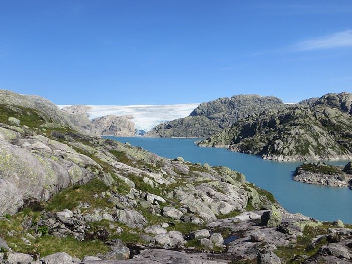
En ces temps coronatroublés, rien ne vaut de se remémorer le dernier voyage touristique que l’on a fait avant le plongeon dans le néant sanitaro-économique. La Norvège, plus précisément sa côte ouest et ses fjords, sera donc le sujet de ce carnet en 31 épisodes dotés chacun d’une bande-son, plutôt rock d’ailleurs. Attention, lecteur, vous vous exposez à un certain nombre de clichés pas du tout exagérés et de blagues pourries. I have nothing to offer but fjord, joy, tears (of the sky) and sweat.
Donc la Norvège, c’est l’apocalypse budgétaire dans votre portefeuille. D’où le titre (c’est tiré par les cheveux mais je ne refuse jamais un jeu de mots). Mais ce n’est pas que cela, c’est aussi fort joli, propre, policé et réellement rempli de charmantes têtes blondes. La Norvège, c’est également une monarchie pétrolière du golfe persique qui s’est égarée sur des terres glacées. Eh oui, c’est tout de suite plus facile d’être riche quand ils ont du pétrole (« mais ils n’ont que ça » aurait ajouté un jaloux), qu’ils sont peu nombreux et pas très partageurs. Allez, quelques détails pour commencer sur un plan aussi bien techeunique que tacqueutique
Le trajet En voiture Simone ! Depuis le Massif Central jusqu’à la Norvège avec une C3. J’avais décrété 2019, année sans avion. Donc c’était la voiture, certes petite mais costaude, où l’on a pu entasser notre matériel de camping. On en a profité pour prendre un covoitureur qui allait se perdre en Norvège pour l’été. Plus on est de fous entassés, plus on rit. Sur place, j'ai limité fortement notre aire d'action géographique. Je le connais le piège de faire une liste longue comme le bras et de courir tout le voyage tel un chien de ferme après un mollet cycliste. Il s'agissait de se cantonner au riz euh pardon à la façade sud-ouest du pays sans aller plus haut qu'Ålesund. Et comme il y avait un certain nombre de lieux qui me faisaient de l’œil, nous avons quand même eu un trajet digne d’une otarie bourrée essayant d’échapper à une orque affamée. On a finalement fait l’essuie-glace obliquement dans l’Ouest : à gauche, à droite, à gauche, à droite, à droite, A DROITE . Il faut dire que les fjords et les montagnes n’arrangent pas les affaires du voyageur adepte des routes rectilignes, et cela malgré la passion tunnelière locale.
Le lien vers la carte du trajet : http://u.osmfr.org/m/434267/
Les Norvégiens Les Norvégiens sont des êtres blonds aux yeux bleus, parfois d’un blond tellement blond qu’on dirait qu’ils ont appliqué de la javel sur leurs cheveux. Effet secondaire qui donne la chair de poule, cela fait disparaître les sourcils… Le Norvégien est réservé et poli. L’été, soit il se balade torse nu, soit il quitte le pays pour des horizons plus propices au rougeoiement de sa peau laiteuse où il pourra faire valoir son pouvoir d’achat dément. La Norvégienne quant à elle a une prédisposition naturelle à se promener en sous-tif ou brassière dès le premier rayon de soleil. Le dimanche, jour du Seigneur et de l’hypocrisie, le Norvégienne ne boit pas (vente d’alcool interdit !) les autres jours, iel se cache pour boire puis déambule cahin-caha entre les maisons de bois à la pelouse verdoyante. La Norvégien apprécie également les sorties familiales du dimanche après-midi où il peut effectuer 1000 mètres de dénivelé en 3,5km avec ses enfants de 7 et 9 ans. Le tout les doigts dans le nez.
Le logement Le logement, c’était principalement notre tente de 2 m² que nous avons montée/démontée dans des campings de qualité très variable pour un prix pas donné. Souvent les sites sont jolis mais plantés en bordure de route malgré l’espace qu’offre le pays. Ca manque quand même d’arbres ou arbustes et d’emplacements un tant soit peu délimités. Ce dernier point permet pendant les nuits les plus chaudes de l’été d’entasser les touristes de passage dans une promiscuité certaine et de rentabiliser un maximum l’espace. Malynx le Norvégynx ! Par contre, les sanitaires sont en général en bon état mais avec douche payante. Bref, le camping c’est le moyen de logement le plus abordable hors camping sauvage mais en général, la qualité est moyennasse au vu des prix. J’ai séché une petite larme en pensant à feus les campings des parcs nationaux et provinciaux canadiens. Requiescat in pace. Pour reprendre notre souffle, nous avons quand même varié les plaisirs avec des logements en b&b, du camping sauvage, des hytter (des petites cabanes souvent présentes dans les campings mais également ailleurs, très pratiques, pas trop chères pour la Norvège et aux prestations variables : électricité, eaux courantes en option par exemple) et une nuit en « refuge ». Les refuges, il y en a partout la plupart sont accessibles à pied, non gardés avec parfois une sorte de self-service payant.
La bouffe Courez en Norvège (ah mince vous êtes confinés) et vous me direz des nouvelles du Brunost . Sinon c’est cher mais pas mauvais globalement, peu porté sur le poisson hors saumon d’élevage et assez roboratif. Et bonne surprise pour moi, il y a quand même une tradition boulangère et même s’il y a peu de boulangeries, on peut trouver pleins de pains et de sorte de viennoiseries dans les supermarchés. Cela égaie les multiples piques-niques.
Avant de commencer le carnet proprement dit, entamons notre hymne norvégien : So many stop signs Speed limit Curves’ gonna slow me down Like a wheel Gonna spin it Tourists’ gonna mess me around Hey, Satan Payin' my tolls Bein’ among sheepin' bands Hey, mamma Look at me I'm on the way to the promised land
Jour 1,5 60 mph – New Order Clermont-Ferrand - Neumünster A nous les petites autoroutes allemandes tant prisées de ce côté du Rhin pour l’absence de limites de vitesse. Parcours Montbéliard – Fribourg – Karlsruhe – Francfort – Kassel – Hannovre – Hambourg – Neumünster. C’est long et pénible avec des travaux publics pas très deutsche Qualität tous les 20 kms, un trafic chargé et des zones limitées sans limite de vitesse qui rendent la conduite dangereuse : à droite ça roule à 90, à gauche à 200 pour les plus fous et comme c’est saturé, ça donne un résultat sportif et désagréable. Je me demande comment ils font pour avoir aussi peu de morts sur les routes en Allemagne. A part ça, le voyage est sans histoire, le colis covoitureur est livré à Fribourg et on arrive entiers et fatigués à Cathédraleneuve.
Jour 2 Seemann – Rammstein Neumünster - Kristiansand
Les autoroutes allemandes c’est rapidement fini, on revient à de la tranquillité avec le Danemark. Nous avons choisi de prendre le ferry Hirtshals-Kristiansand qui permet d'arriver plus rapidement sur la côte ouest Et comme on a beaucoup d’avance sur l’horaire du ferry Hirtshals-Kristiansand, on se permet un détour vers une dune danoise dominant la mer du Nord. Le temps est pas idéal et le coin est assez fréquenté. Bof. Le voyage en ferry est sans histoire, les Norvégiens en profitent pour faire des réserves d’alcool et de legos (les deux produits les plus présents dans les magasins du bateau). Nous voilà enfin en Norvège, 1900 kilomètres plus tard, sur la plage de Christian. Sacré Clavier qui a fait des fidèles un peu partout en Scandinavie.
Jour 3 Why does it always rain on me? - Travis 180 km Kristiansand – Hauge Notre premier jour en Norvège et ça ne s’annonce pas glorieux, plutôt gris tendance pluie. Nous commençons par un rapide passage par un bout de zone payante de Kristiansand juste pour le plaisir et accessoirement quitter cette ville. Je me suis inscrit, par honnêteté, sur le site internet des péages norvégiens (gérés d’ailleurs par une société anglaise) et par la grâce de caméras bien placées, nous allons devoir payer quelques euros pour à peu près 100 mètres dans ladite ville. Pfff. Quant au programme aujourd’hui, nous allons à la conquête de l’ouest, l’ouest de Kristiansand et nos plans capotent très largement. Ca tombe, ça tombe, ça dégouline, dégringole, s’abat, déverse, pleuvoche, tantôt torrentiel, tantôt bruineux. Pas question de faire une rando ou toute autre activité de plein air. Je m’aperçois en plus dans la journée que mon imper n’est plus imperméable et que j’ai oublié mon surpantalon. Prions, mes bien chers Frères, mes bien chères Sœurs pour que la météo soit clémente. Sinon ça va être long. Dans un premier temps, jusqu’à Flekkefjord, nous nous mouvons plus ou moins le long de la côte sans l’apercevoir, d’une parce que c’est complètement bouché, de deux parce qu’il est difficile de distinguer ce qui tient d’un lac ou d’un fjord, de trois parce que la route principale ne suit pas la côte. Nous nous rabattons donc sur la visite sans trop musarder des petites villes blanches du sud de la Norvège, leurs villages blancs andalous à eux mais en différent : avec du bois, de la pluie et de la mer. Premier arrêt à Mandal, un vrai coup dans le cœur. Deuxième arrêt : Flekkefjord, très mignon. Troisième arrêt version hameau, Stornes en entrée de fjord, très, très mignon. Quatrième arrêt : Sognalstranda, très, très, très mignon. C’est le règne de la mignonitude humide. Une maison en bois par ci, un entrepôt en bois par-là, et des garages à bateau à foison.
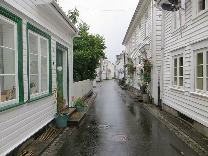 Pas un temps à mettre un chat norvégien dehors (Flekkefjord)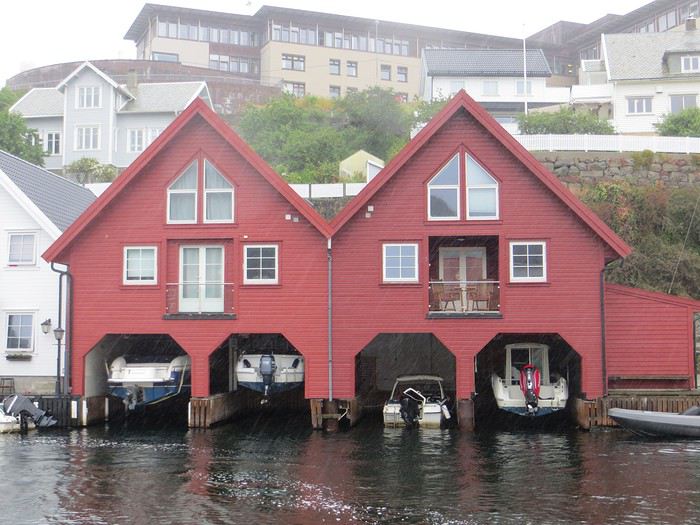
Pas un temps à mettre un bateau norvégien dehors
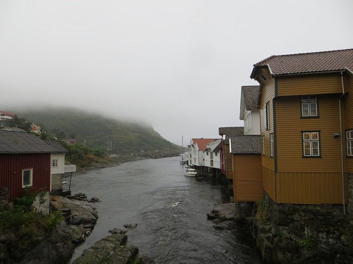 Mais pourquoi on est dehors nous alors ? (Sognalstranda)
Interlude de pipeau très intéressant : ces villes/villages, souvent fondés aux 17ème et 18ème siècle, sont les témoins de la politique mercantiliste du royaume du Danemark. L’État balbutiant entend organiser la production, la commercialisation et l’exportation des ressources comme le bois, les poissons et certains métaux de Norvège. Cette politique passe par la mise en place d’exploitations/manufactures à tendance monopolistique et la spécialisation des ports avec monopole des marchands d’abord hanséatiques (16ème siècle) puis néerlandais (17ème siècle) et enfin danois (17-18ème siècle). C’est d’ailleurs pour cela que le vieux centre de Flekkefjord est surnommé la ville hollandaise. Ce système mercantiliste fera par ailleurs les malheurs de l’Islande forcée de se soumettre pendant deux siècles à une compagnie royale danoise monopolistique à même d’imposer ses tarifs et ses conditions d’échange de marchandise. Les siècles sombres comme les appellent les Islandais ont en grande partie comme origine cette organisation économique très profitable pour la royauté danoise, beaucoup moins pour les habitants de l’île. La route 44 après Flekkefjord vaut par ailleurs son pesant de cacahuètes même si les conditions ne sont pas optimales pour en profiter. Tout le coin a été nommé magma geopark (patrimoine de l’UNESCO) dans une poussée de marketing touristique, des roches de la croûte terrestre d’une zone de subduction ayant fini par apparaître sous l’effet de l’érosion si j’ai bien compris. Point de volcan donc mais des effleurements d’anorthosites qui forment des paysage rocailleux arrondis et stériles comme autour d’Helleren et d’Åna Sira où devait se dérouler notre première randonnée norvégienne, projet qui tombe à l’eau (ahahah), noyé sous les larmes du ciel (ahahah). La partie la plus spectaculaire du trajet se trouve entre Åna Sira et Hauge où la route serpente tant bien mal entre les rochers. Nous goûtons le soir venu à la douceur des campings norvégiens : une espèce de carrière dans un espace réduit entre deux collines, un sol gravillonneux, pas de végétation et roule ma poule. Le seul avantage réside dans la vue en bout de carrière sur la côte. Pas vraiment de cuisine aménagée, des douches payantes : prometteur ! Le coupable aujourd’hui est le Vågan camping (garanti sans viande).
Jour 4 Sous le soleil exactement – Serge Gainsbourg 186km Hauge – Lysebotn Nuit et brouillard ce matin sur la Norvège et pourtant nous gardons espoir, le soleil vaincra. Nous continuons la route côtière pour faire une petite balade (4km aller-retour) jusqu’au Hådyr. C’est humide, boueux, bourbeux, fangeux, marécageux, tourbeux, machineux. C’est également l’occasion de compter la deuxième victime du voyage : le terrain a raison de mes chaussures de marche basses. Flap flap, bain de pieds et macération. Décidément, je suis équipé pour affronter l’humidité scandinave ! Arrivés au rocher censé donner un point de vue sympa sur la côte, c’est la douche froide (avec beaucoup de vapeur d’eau, la douche) : à gauche, du brouillard, à droite, du brouillard, droit devant, du brouillard, derrière, du brouillard et un bruit de ressac à nos pieds. Comme on est patient et qu’on croit en dame météo, nous nous asseyons pour attendre la percée du soleil. Une heure et quelques hésitations plus tard, ça se déchire (très) petit à petit, de quoi entrapercevoir une côte que je qualifierai de dantesque. J’adore ces rochers granitiques usés par les siècles, qui forment des forêts de sentinelles face à la mer.
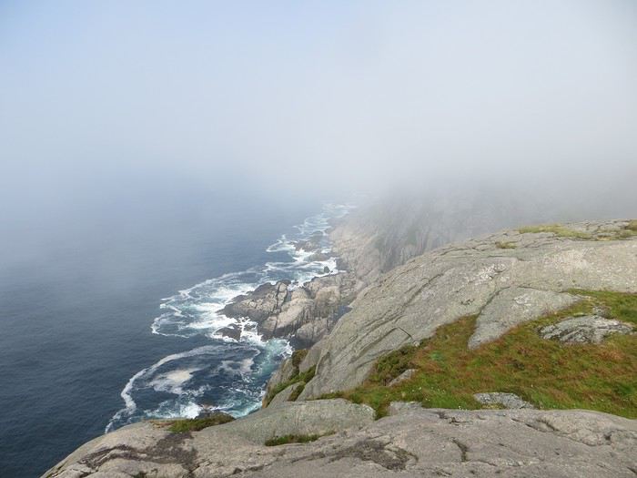 Les portes de l'Hådyr s'ouvrent et pas de cerbères à l'horizon
Et ça tombe bien que j’adore ce paysage puisque pour l’étape suivante (décidément le gentil organisateur a tout prévu !), nous traversons sans s’arrêter Egersund, autre petite ville en bois, pour Eigerøya, son phare et son paysage rocailleux sous le soleil exactement, un soleil de plomb je dirais même plus. La baladounette de l’après-midi de 4 km est sans difficulté sur une autoroute pédestre et permet d’accéder à un point de vue maousse costaud sur l’île d’Eiger et son phare.
Les portes de l'Hådyr s'ouvrent et pas de cerbères à l'horizon
Et ça tombe bien que j’adore ce paysage puisque pour l’étape suivante (décidément le gentil organisateur a tout prévu !), nous traversons sans s’arrêter Egersund, autre petite ville en bois, pour Eigerøya, son phare et son paysage rocailleux sous le soleil exactement, un soleil de plomb je dirais même plus. La baladounette de l’après-midi de 4 km est sans difficulté sur une autoroute pédestre et permet d’accéder à un point de vue maousse costaud sur l’île d’Eiger et son phare.
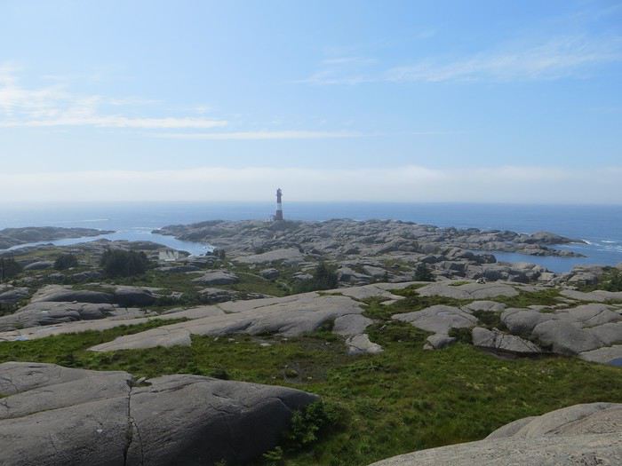 C'est un roc ! C'est un pic ! C'est un cap ! Que dis-je c'est une péninsule !
 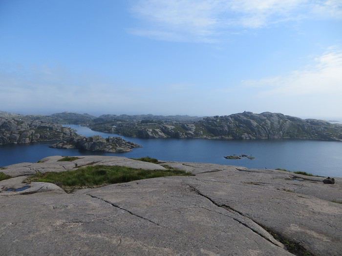 Eigerøya en beauté
Si j’ai bien compris le norvégien, øy est le suffixe pour île et a celui pour « la » en général, même si la langue se scinde en deux types distincts nynorsk et bokmål et en de nombreuses variantes dialectiques locales qui provoquent des orthographes changeantes des panneaux et des cartes. Par exemple, kirke (église en bokmål) s’écrit aussi kyrkje en nynorsk, voire a d’autres déclinaisons locales plus obscures. Le nynorsk, pour ceux qui ne connaissent pas, est issu d’une (re)création linguistique du 19ème siècle type occitan ou breton en France : pour donner à la Norvège une langue pure de toute saleté étrangère, danoise plus particulièrement, des linguistes ont construit une langue sur un mélange des dialectes considérés comme les moins viciés par l’outre-Skagerrak, c’est-à-dire ceux du Telemark et des fjords du sud-ouest. A contrario, le bokmål est un dérivé dédanoiïsé de la langue parlée (du danois grosso modo) dans les villes comme Oslo au début du 19ème siècle. De nos jours, il y a donc deux langues officielles et le nynorsk est très connoté nationaliste et perd du terrain : 13% des Norvégiens, principalement dans l’ouest, le parlent comme langue maternelle. Nous nous dirigeons ensuite vers l’intérieur des terres en direction de Lysebotn, le paysage change, pâturage, forêt et lacs avant de rentrer dans des zones à l’environnement plus âpre et tourmenté. Gloppedalsura (à vos souhaits) est l’occasion d’un arrêt bienvenu pour un point de vue sur un chaos de rochers impressionnant et son lac attenant.
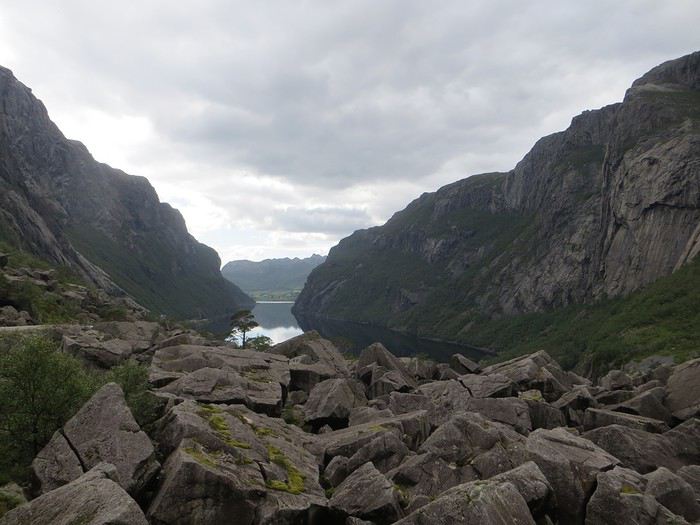 Gloppedalsura, lieu de franche rigolade entre Allemands et Norvégiens pendant la Seconde Guerre Mondiale
Nous remontons ensuite la Øvstabødalen, vallée glaciaire à citer dans toute conférence de géologie de bon niveau pour la perfection de sa forme en auge. Le parcours est varié, peu fréquenté et plaisant avant de plonger sur une zone moins sympa bien dotée en stations de ski et en habitat folklorico-traditionnel, ici des immeubles/chalets en bois sombre et toit végétalisé. L’avantage, au-delà du côté très artificiel des stations, c’est que les bâtiments se fondent dans la végétation.
Gloppedalsura, lieu de franche rigolade entre Allemands et Norvégiens pendant la Seconde Guerre Mondiale
Nous remontons ensuite la Øvstabødalen, vallée glaciaire à citer dans toute conférence de géologie de bon niveau pour la perfection de sa forme en auge. Le parcours est varié, peu fréquenté et plaisant avant de plonger sur une zone moins sympa bien dotée en stations de ski et en habitat folklorico-traditionnel, ici des immeubles/chalets en bois sombre et toit végétalisé. L’avantage, au-delà du côté très artificiel des stations, c’est que les bâtiments se fondent dans la végétation.La dernière partie du trajet, très belle mais pas très agréable à conduire tant la petite route est saturée par la circulation, traverse un plateau rocailleux avant de plonger vers le Lysefjord. Malheureusement, la route de descente, assez connue (elle est le lieu d’une compétition estivale de ski sur route très cotée) une fois passée le restaurant et bien que sûrement impressionnante vue d’un drone, n’offre quasiment aucune vue sur la vallée et le fjord. Ce qu’elle offre par contre, c’est un tunnel en épingle à cheveux, un classique que l’on retrouvera à plusieurs reprises dans les fantaisies souterraines norvégiennes. Le camping du soir, bonsoir, le Kjerag Lysebotn camping, jouit d’un site splendide et est bien équipé (cuisine, sanitaire). Malheureusement, comme on est en Norvège, il n’y a aucun arbre/arbuste et une promiscuité assez forte et accentuée par l’affluence d’un jour de juillet ensoleillé. Bref on se marche dessus comme des manchots en période de reproduction dans leur colonie.
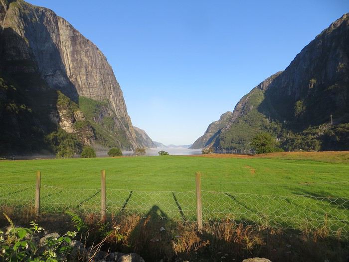 Quand je vous dis que le site est splendide...
Jour 5 Highway song – System of a Down 78km Lysebotn - Hjelmeland Aujourd’hui, c’est notre journée rando de masse dit trek pour ceux qui se sentent une âme d’aventurier, juste une âme, il ne faut pas trop abuser de l’aventure. Donc aujourd’hui, c’est le Kjeragbolten, concession faite à la liste des randonnées obligatoires. La Norvège fait partie de ces pays où la randonnée est l’une des activités touristiques obligatoires y compris pour des personnes qui ne marchent jamais par ailleurs. Pour la Norvège, l’activité s’effectue bien sûr en masse sur les mêmes chemins en cochant les fameuses cases de la to do list comprenant dans l’Ouest Preikestolen, Trolltunga, Kjeragbolten, Bessegen et Aurlandsdalen. Nous nous sommes contentés du rocher suspendu Kjerag, choisi car dans mon esprit, moins facilement accessible au commun du touriste (et moi je suis un touriste hors du commun, un tourista). C’est sûrement vrai mais cela n’empêche pas le monde… Je le savais, je le savais, j’étais prévenu, j’ai râlé avant, j’ai râlé pendant, je râle encore après et pourtant je n’ai pas d’oiseau dans la gorge et il n’y avait pas de genêts dans la balade (cf le r��le des genêts pour comprendre la blagounette). La randonnée commence par un parking gigantesque au tarif prohibitif. Nous payons sans moufter nos 30 euros (un repas dans un resto semi gastro en France pour ceux qui n’ont pas le sens des valeurs). J’espère que personne ne s’arrête juste pour voir la vue car de vue il n’y en a point : le point de vue est occupé par un restaurant qui met un point d’honneur à boucher accessoirement la vue. Et pour accéder à sa terrasse/point de vue, il faut payer. Bon, nous, on a du pain sur la planche et quelques montées raidasses en attente. Dont acte. Trafic fluide en ce début de matinée, quelques problèmes de surchauffe moteur pour la première montée puis la vitesse de croisière est atteinte pour une arrivée prévue à 10h30. Ce n’est pas encore un bouchon au niveau du rocher mais la circulation est déjà dense à l’approche. Au retour, le trafic est extrêmement chargé et les comportements touristico-idiots se multiplient (équipement inadéquat, coupage des routes à travers champs, ralentissements dus aux selfies intempestifs. Ne pas utiliser votre téléphone en conduisant, que la sécurité routière vous dit !).
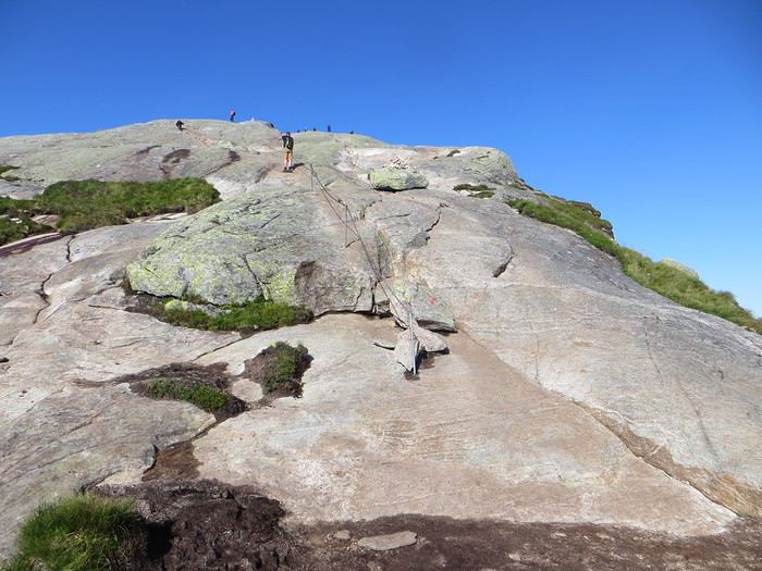
Pas un coin où amener sa traban
Sur le fond, la rando, 12 km et 700 mètres de dénivelée, est très chouette avec de belles vues sur le fjord et Lysebotn en particulier au début de la 3ème montée et tout au bout.
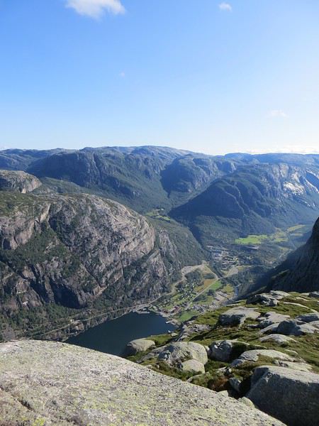
Le Lysefjord
Le caillou est flippant et spectaculaire tout comme la plateforme juste à côté. Une queue au bord d'un à pic de 1000 mètres se forme pour monter dessus (même pas en rêve, je fais un truc pareil).
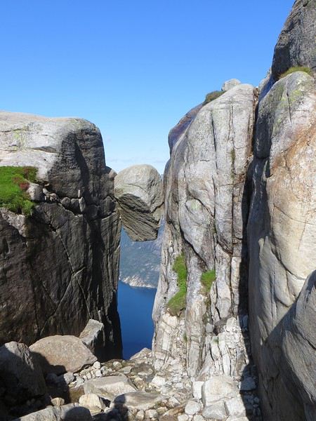 Le mythe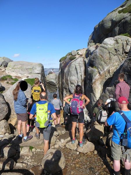
La réalité
Il est loisible d’explorer les environs du Kjeragbolten pour profiter d’un peu de la tranquillité des avancées rocheuses spectaculaires et des vues majestueuses sur le fjord. Bref ça claque grave.
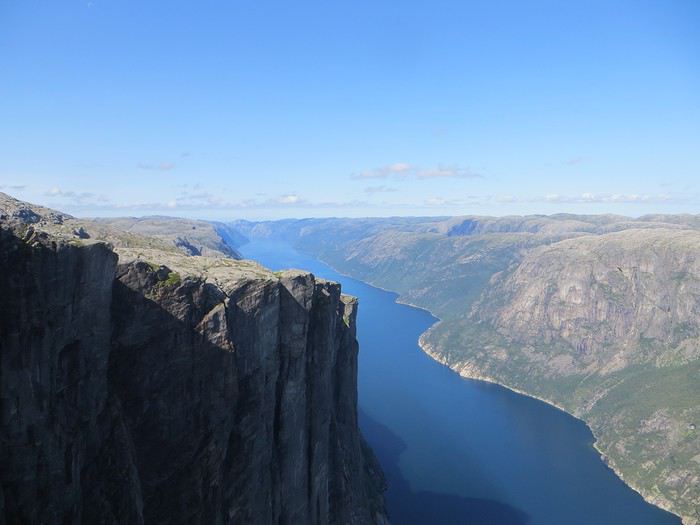 Le Lysefjord n'a pas bougé
On redescend à Lysebotn pour prendre un ferry réservé à l’avance. Et quand on voit le « ferry » arriver, on se dit que la réservation était une bonne idée. Rentrée en marche arrière et tassage de voitures dans un espace réduit pour notre mini-croisière sur le Lysefjord. Très bien la mini-croisière qui permet de s’apercevoir de la hauteur des falaises entourant le Kjeragbolten et d’apercevoir le Preikestolen où nous n’irons pas.
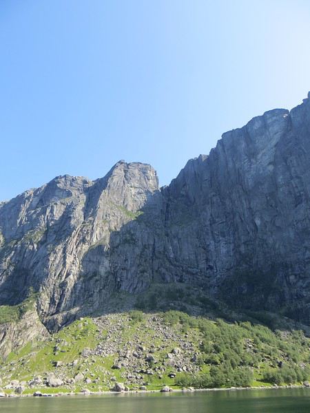
Le Kjeragbolten vu d'en bas. Les 1000 mètres de vide y sont bien
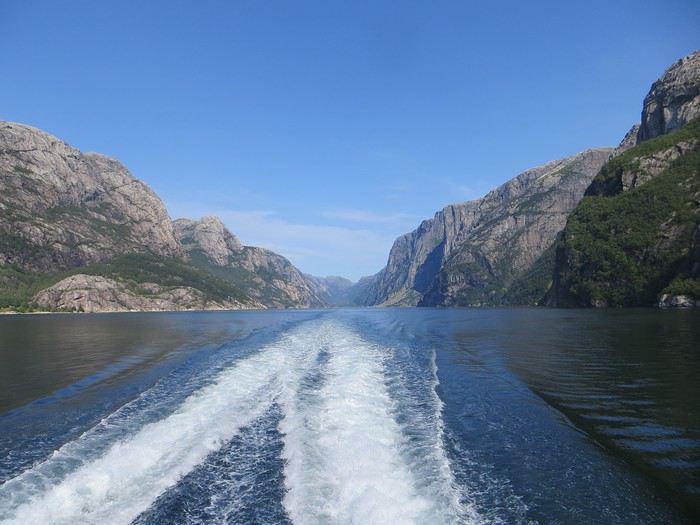 La croisière s'amuse
Le camping du soir se trouve à Hjelmeland et est ingénieusement intitulé Hjelmeland camping. Celui-ci fait dans l’original puisque nous avons planté notre tente dans le parc arboré d’une sorte de manoir qui sert de dortoir. Une chouette vue, une cuisine bien équipée et assez d’espace pour ne pas se marcher dessus (en principe, avec les Norvégiens, on ne sait jamais, ils pourraient parquer votre tente ou votre van à 50 cm du voisin), voilà pour les avantages. Pour les inconvénients, les sanitaires sont peu nombreux, peu pratiques et se salissent vite (forcément).
Idées circuit et étapes dans l'Ouest américain et ses parcs English translation pending
Bonjour,
Je prépare notre futur voyage (3 couples) pour septembre prochain (16 Sept - 15 Oct).
Il se déroulera en 2 temps, un couple rentrant en France le 3 Oct.
J'ai beaucoup lu posts et carnets de voyages (Merci à tous 🙂🙂) et je commence à y voir plus clair.
Une idée est un circuit "lent" avec des étapes courtes et du temps pour explorer les parcs (Las Vegas- Grand Canyon- Page- Monument Valley- Mesa Verde- Moab- Capitol Reef- Bryce Canyon- Zion- Death Valley- Las Vegas) J'ai un doc détaillé avec ce circuit établi à la lecture de vos expériences, mais cela serait trop long. Si c'est vers celui-ci que notre choix se porte, je reviendrai vers vous ;-)
L'autre idée est d'alléger ce circuit en supprimant certaines étapes et en passant moins de temps sur certains lieux afin d'intégrer Yellowstone (loin, mais si beau) pour compléter la découverte de l'Ouest pour nos amis qui partent le 3. Plus de route bien sûr. J'aimerai beaucoup avoir votre avis. Est-ce réalisable ? Des suggestions ?
Nous sommes prêts à faire quelques étapes longues mais pas tous les jours. Nous ferons des randonnées dans les parcs, mais pas trop et surtout des pas trop longues ni trop difficiles pour s'adapter à tout le monde. Merci beaucoup de votre aide
J1 arrivée Las Vegas J2 Las Vegas - Grand Canyon nuit Tusayane J3 Grand Canyon - Page J4 Antelope canyon, etc... Monument Valley nuit Mexican Hat J5Mexican Hat - Moab J6 Moab J7 Moab - direction Grand teton, arrêt à Evanston ou Rock Springs J8 Evanston ou Rock Springs - Jackson Hole le 23/09 J9 Grand Teton - Yellowstone nuit parc ou West Yellowstone J10 Yellowstone nuit West ou Gardiner J11 Yellowstone nuit West Yellowstone (mieux pour par vers SLC ?) J12 Yellowstone - Salt Lake City nuit SLC J13 SLC - Capitol Reef nuit Torrey J14 Torrey - Bryce Canyon nuit tropic J15 Journée Bryce Canyon nuit tropic J16 Tropic - Zion nuit Springdale ou Kanarraville J17 Zion - Las Vegas probablement via Valley of fire nuit Las Vegas J18 Vol Retour pour 1 couple
Une idée est un circuit "lent" avec des étapes courtes et du temps pour explorer les parcs (Las Vegas- Grand Canyon- Page- Monument Valley- Mesa Verde- Moab- Capitol Reef- Bryce Canyon- Zion- Death Valley- Las Vegas) J'ai un doc détaillé avec ce circuit établi à la lecture de vos expériences, mais cela serait trop long. Si c'est vers celui-ci que notre choix se porte, je reviendrai vers vous ;-)
L'autre idée est d'alléger ce circuit en supprimant certaines étapes et en passant moins de temps sur certains lieux afin d'intégrer Yellowstone (loin, mais si beau) pour compléter la découverte de l'Ouest pour nos amis qui partent le 3. Plus de route bien sûr. J'aimerai beaucoup avoir votre avis. Est-ce réalisable ? Des suggestions ?
Nous sommes prêts à faire quelques étapes longues mais pas tous les jours. Nous ferons des randonnées dans les parcs, mais pas trop et surtout des pas trop longues ni trop difficiles pour s'adapter à tout le monde. Merci beaucoup de votre aide
J1 arrivée Las Vegas J2 Las Vegas - Grand Canyon nuit Tusayane J3 Grand Canyon - Page J4 Antelope canyon, etc... Monument Valley nuit Mexican Hat J5Mexican Hat - Moab J6 Moab J7 Moab - direction Grand teton, arrêt à Evanston ou Rock Springs J8 Evanston ou Rock Springs - Jackson Hole le 23/09 J9 Grand Teton - Yellowstone nuit parc ou West Yellowstone J10 Yellowstone nuit West ou Gardiner J11 Yellowstone nuit West Yellowstone (mieux pour par vers SLC ?) J12 Yellowstone - Salt Lake City nuit SLC J13 SLC - Capitol Reef nuit Torrey J14 Torrey - Bryce Canyon nuit tropic J15 Journée Bryce Canyon nuit tropic J16 Tropic - Zion nuit Springdale ou Kanarraville J17 Zion - Las Vegas probablement via Valley of fire nuit Las Vegas J18 Vol Retour pour 1 couple
Comment faire pour louer une voiture à Sifnos et Naxos? English translation pending
Bonjour
Après quelques recherches je décide d'ouvrir un post sur location de voiture cyclades .
En Juin nous partons pour Sifnos et Naxos .
Pour ces deux iles sachant que nous resterons 6 jours dans chaque en Juin faut t'il réserver une voiture à l'avance ou peut on le faire à notre arrivée dans chacune des iles .
Pouvez vous m'indiquer une agence fiable dans chacune sachant que nous prendrons la voiture dan s les ports des Ferry.
Par avance merci
Philippe
Retour d'un voyage à vélo autour du Sri Lanka English translation pending
Je viens de rentrer d'un voyage à vélo de 26 jours au Sri Lanka, entre mi-janvier et mi-février 2020. Je résume ci-dessous quelques détails pratiques de cette randonnée.
1. Quand partir ? Arrivée - le climat - Avant de partir, il faut demander un visa électronique (ETA, Electronic Travel Authorization) sur le site https://www.eta.gov.lk/slvisa/visainfo/center.jsp (attention, il y a d'autres sites répertoriés de type phishing sur Google). Le visa était gratuit pour les Suisses, au moins jusqu'à fin février 2020 (point à vérifier, cette mesure étant provisoire pour encourager le tourisme au Sri Lanka après les attentats de 2019); il est délivré à l'aéroport pour un mois. - A l'arrivée à l'aéroport de Colombo, il n'y a aucun problème pour faire passer à la douane le vélo dans son carton. Il y a plusieurs guichets de change après la porte des arrivées; il y a aussi un seul distributeur de billets, et une queue d'une quarantaine de mètres de touristes pour retirer des roupies (il est beaucoup plus rapide de changer des francs suisses ou des euros à un des guichets, quitte à s'approvisionner plus tard à un des distributeurs en ville). Il y a aussi un guichet de la compagnie de téléphone Dialog (qui a une excellente couverture réseau du pays), où on peut acheter pour moins de 10 francs suisses une carte SIM locale valable un mois, prépayée avec 10 GB de données et un crédit (rechargeable) pour les conversations locales (crédit initial que je n'ai pas consommé entièrement pendant mon séjour).- J'ai pris un hôtel à Negombo, hôtelqui avait accepté par avance de me garder le carton du vélo pour le retour (hôtel Blue Bird). il est utile de noter que le quartier où se trouve les hôtels en bord de mer à Negombo est à 3 km du centre de la ville, qui est plus à l'intérieur des terres (prendre la route qui démarre au carrefour où il y a une statue de dauphin, éventuellement demander où se trouve le Burger King : les restaurants sont nettement plus authentiques dans le centre de la ville; par ailleurs on y trouve un assortiment de thés au supermarché Arpico à des prix sri lankais). - En janvier-février la mousson est localisée sur la côte Est (bien qu'en début 2020 celle-ci était plutôt faible), où c'est alors la basse saison touristique : j'ai donc fait l'impasse sur cette région. Sur mon trajet au centre de l'île et sur les côtes sud et ouest, je n'ai eu qu'une demi-journée d'averses en arrivant à Kandy. L'inverse serait vrai à partir d'avril, avec un climat plus favorable sur la côte Est. D'une façon générale le climat est plus contrasté dans les montagnes du centre vers les plantations de thé, avec des pluies plus fréquentes. Il a fait très chaud pendant presque tout le trajet, à l'exception de la partie autour des plantations de thé vers Nuwara Eliya et Ella. Sur le vélo, la température dépasse 35 degrés entre midi et 16h; les étapes ont donc été raccourcies avec une durée de pédalage d'environ 4-5h, pour arriver à l'étape autour de midi (après un départ avec le lever du soleil vers 7h).
2. Les conditions de circulation à vélo - l'hébergement Le revêtement des routes principales est en général en excellent état. Il n'y a aucun espace dédié aux vélos, et il faut partager, quand il existe, un petit espace réservé pour les piétons et marqué par une bande blanche. Le revêtement des routes secondaires est moins prévisible, mais plutôt mauvais. Celles-ci ont moins de trafic, mais sont plus étroites (le résultat final est que la densité de trafic ne change pas beaucoup, même s'il y a des exceptions). Mon trajet a suivi dans sa presque totalité les routes principales. Les conditions de circulation sont chaotiques, et on doit pédaler avec le principe de l'évitement continu. Il est remarquable que, malgré la densité du trafic et la façon de conduire des locaux, il y a peu de carrosseries cabossées. Le plus simple, pour comprendre la façon de circuler, c'est de prendre un tuk-tuk en ville, et d'observer la façon dont le chauffeur se faufile en klaxonnant dans le trafic : il occupe la place libre qu'il a devant lui s'il peut le faire sans abîmer son véhicule, et sans égard à ce qui se passe autour de lui. Les sorties des écoles peuvent être très embouteillées. Le danger principal vient des autobus, qu'ils soient gouvernementaux (couleur rouge), ou privés (couleur plutôt dans le bleu). Dans les deux cas, les chauffeurs récupèrent une partie variable des excédents de recettes une fois la cible quotidienne de ventes atteinte; ils mâchent souvent de la noix de bétel, pour résister à la fatigue (on voit ainsi des bus doubler d'autres bus à 80 km/h, en passant la ligne continue en plein centre d'un village). Ils s'arrêteront n'importe où à chaque fois qu'un piéton fait signe, sauf si celui-ci a des bagages (par exemple un vélo) qui feront perdre du temps au chauffeur pour le chargement en route. On peut négocier pour charger son vélo à la station de départ du bus en ville; le coût se fait à la tête du client (j'ai fait le retour de Jaffna à Kandy en bus, cela m'a coûté 3'000 roupies, soit 17 francs suisses; j'ai probablement payé 4 à 5 fois plus que les locaux). A part l'étape Anuradhampura- Thirumurikandy, la seule où le ravitaillement en boisson et en nourriture peut s'avérer délicat (la population étant clairsemée dans cette région), il n'y a aucun problème pour se ravitailler tout au long du pays. On trouve des lieux d'hébergement sans problèmes, sauf pour la section Anuradhampura- Thirumurikandy comme on vient de le voir. A noter que le mot Hotel, au bord des routes, veut principalement dire Restaurant, un peu du genre des haltes-restaurants pour routiers en Europe : il y a rarement des possibilités d'hébergement dans ces établissements. Je n'ai pas vu de camping sur le chemin; le pays étant densément peuplé, le camping sauvage me semble limité. J'ai pris un sac de couchage léger que je n'ai finalement jamais utilisé, et que je n'aurai pas pu utiliser si le besoin s'était avéré : il fait trop chaud (25 degrés la nuit, sauf dans les montagnes centrales). Un liner ("sac à viande") suffit largement. A noter qu'il y a des moustiques à-peu-près partout (moins à Nuwara Eliya et Ella), que les lois darwiniennes les ont sélectionné pour repérer la plus petite déchirure dans la moustiquaire.
3. Le trajet
Après une petite exploration de la côte au nord et au sud de Negombo, la décision a été d'éviter la route vers Puttalam et d'aller directement à l'Est sur Kandy. Puis direction nord pour voir Dambulla, le rocher de Sigiriya et les temples d'Anuradhampura. L'arrivée sur Kandy est une montée, au cours de laquelle on passe presque du niveau de la mer à environ 600 m d'altitude. L'étape Anuradhampura - Jaffna est à-peu-près plate, et a été effectuée en deux jours, avec le plus long trajet du voyage, soit 130 kms pour la première partie, jusqu'au village de Thirumurikandy (premier motel après Vavuniya). Il n'y a pas d'abri et peu d'arbres pour s'abriter de la chaleur dans cette étape, elle-même parfaitement monotone. Le retour sur Kandy a été fait en bus, avec un départ à 5h30 et une arrivée à 14h. A la lecture des informations sur Internet, il m'a semblé qu'il fallait suivre grosso modo la ligne de chemin de fer qui monte de Kandy vers Nuwara Eliya, en passant par Nawalapitiya et Hatton. Cette route s'est avérée vraiment magnifique, même si je n'ai pas d'élément de comparaison avec la route directe de Kandy à Nuwara Eliya. La montée se fait par paliers sur 74 kms, avec des passages à moins de 10% jusqu'au village de Talawakalle. Là les choses se corsent, avec des passages à 15% sur plusieurs centaines de mètres jusqu'à l'arrivée à Nuwara Eliya (l'hôtel était à 1'950 m d'altitude). C'est l'étape la plus physique de tout le circuit, avec un dénivelé positif de 2'562 m (mais elle valait largement le coup). Nuwara Eliya et l'étape suivante, Ella, sont des petites villes qui ont partiellement artificiellement grandi à cause du tourisme : il y a du monde, et les prix s'en ressentent. J'ai fait le trajet jusqu'à Haputale, puis Lipton's Seat, en train puis en tuktuk (le premier train du matin à 6h permet de voir la montagne sortir de la brume, et d'arriver avant les bus de touristes). Il pourrait se faire à vélo, mais avec avec un gros dénivelé entre Haputale et Lipton's Seat, sur une route défoncée. La descente sur Hambantota et la côte sud est assez monotone après Wellawaya. Puis depuis Hambantota jusqu'à Merissa, puis jusqu'à Colombo, la route est presque parfaitement plate (il y a bien un col à 40 m d'altitude sur le chemin). On ne voit la mer de façon intermittente qu'entre Merissa et Indurawa. La côte est entièrement construite entre Bentota et Colombo, puis Negombo. Il faut noter qu'il y a peu de plages "baignables" à l'époque où j'ai visité ces côtes sud et ouest : la mer y est souvent grosse, avec beaucoup de vent, en particulier l'après-midi. Merissa est une baie plus protégée (d'où son succès et la densité de touristes...et d'hôtels). Les plages sont souvent sales près des villes. Finalement la traversée de Colombo en vélo n'est pas triste.
3. En conclusion : La partie du trajet au nord de Dambulla a été pour moi de peu d'intérêt. Les temples dispersés autour de Anuradhampura, ainsi que les vagues ruines ici et là, n'ont que peu d'intérêt pour moi, et je les aurai évité si c'était à refaire. La même chose pour Jaffna et sa région, dont une partie de la côte est restée zone militaire interdite d'accès. Si c'était à refaire, je choisirai d'atterrir pour les premiers jours à Induruwa, qui est une belle plage tranquille à une dizaine de kilomètres au sud de Bentota, et certainement plus attirante que Negombo. Les hôtels locaux organisent les transferts depuis l'aéroport de Colombo pour 10'000 roupies (environ 60 francs suisses).
Le Sri Lanka est le pays du sourire : j'ai partout été gratifié de visages qui s'illuminait quand on les salue. En dehors évidemment des routes, je ne me suis jamais senti en insécurité. La partie hébergements-nourriture-accès aux sites touristiques m'est revenu à 30 francs suisses en moyenne par jour, pour 26 jours et 18 étapes pour un total de 1'196 km. Une visite de 15 jours - 3 semaines vaut la peine, à moduler en fonction du climat prévalent pendant la période de l'année où se fera la visite.
1. Quand partir ? Arrivée - le climat - Avant de partir, il faut demander un visa électronique (ETA, Electronic Travel Authorization) sur le site https://www.eta.gov.lk/slvisa/visainfo/center.jsp (attention, il y a d'autres sites répertoriés de type phishing sur Google). Le visa était gratuit pour les Suisses, au moins jusqu'à fin février 2020 (point à vérifier, cette mesure étant provisoire pour encourager le tourisme au Sri Lanka après les attentats de 2019); il est délivré à l'aéroport pour un mois. - A l'arrivée à l'aéroport de Colombo, il n'y a aucun problème pour faire passer à la douane le vélo dans son carton. Il y a plusieurs guichets de change après la porte des arrivées; il y a aussi un seul distributeur de billets, et une queue d'une quarantaine de mètres de touristes pour retirer des roupies (il est beaucoup plus rapide de changer des francs suisses ou des euros à un des guichets, quitte à s'approvisionner plus tard à un des distributeurs en ville). Il y a aussi un guichet de la compagnie de téléphone Dialog (qui a une excellente couverture réseau du pays), où on peut acheter pour moins de 10 francs suisses une carte SIM locale valable un mois, prépayée avec 10 GB de données et un crédit (rechargeable) pour les conversations locales (crédit initial que je n'ai pas consommé entièrement pendant mon séjour).- J'ai pris un hôtel à Negombo, hôtelqui avait accepté par avance de me garder le carton du vélo pour le retour (hôtel Blue Bird). il est utile de noter que le quartier où se trouve les hôtels en bord de mer à Negombo est à 3 km du centre de la ville, qui est plus à l'intérieur des terres (prendre la route qui démarre au carrefour où il y a une statue de dauphin, éventuellement demander où se trouve le Burger King : les restaurants sont nettement plus authentiques dans le centre de la ville; par ailleurs on y trouve un assortiment de thés au supermarché Arpico à des prix sri lankais). - En janvier-février la mousson est localisée sur la côte Est (bien qu'en début 2020 celle-ci était plutôt faible), où c'est alors la basse saison touristique : j'ai donc fait l'impasse sur cette région. Sur mon trajet au centre de l'île et sur les côtes sud et ouest, je n'ai eu qu'une demi-journée d'averses en arrivant à Kandy. L'inverse serait vrai à partir d'avril, avec un climat plus favorable sur la côte Est. D'une façon générale le climat est plus contrasté dans les montagnes du centre vers les plantations de thé, avec des pluies plus fréquentes. Il a fait très chaud pendant presque tout le trajet, à l'exception de la partie autour des plantations de thé vers Nuwara Eliya et Ella. Sur le vélo, la température dépasse 35 degrés entre midi et 16h; les étapes ont donc été raccourcies avec une durée de pédalage d'environ 4-5h, pour arriver à l'étape autour de midi (après un départ avec le lever du soleil vers 7h).
2. Les conditions de circulation à vélo - l'hébergement Le revêtement des routes principales est en général en excellent état. Il n'y a aucun espace dédié aux vélos, et il faut partager, quand il existe, un petit espace réservé pour les piétons et marqué par une bande blanche. Le revêtement des routes secondaires est moins prévisible, mais plutôt mauvais. Celles-ci ont moins de trafic, mais sont plus étroites (le résultat final est que la densité de trafic ne change pas beaucoup, même s'il y a des exceptions). Mon trajet a suivi dans sa presque totalité les routes principales. Les conditions de circulation sont chaotiques, et on doit pédaler avec le principe de l'évitement continu. Il est remarquable que, malgré la densité du trafic et la façon de conduire des locaux, il y a peu de carrosseries cabossées. Le plus simple, pour comprendre la façon de circuler, c'est de prendre un tuk-tuk en ville, et d'observer la façon dont le chauffeur se faufile en klaxonnant dans le trafic : il occupe la place libre qu'il a devant lui s'il peut le faire sans abîmer son véhicule, et sans égard à ce qui se passe autour de lui. Les sorties des écoles peuvent être très embouteillées. Le danger principal vient des autobus, qu'ils soient gouvernementaux (couleur rouge), ou privés (couleur plutôt dans le bleu). Dans les deux cas, les chauffeurs récupèrent une partie variable des excédents de recettes une fois la cible quotidienne de ventes atteinte; ils mâchent souvent de la noix de bétel, pour résister à la fatigue (on voit ainsi des bus doubler d'autres bus à 80 km/h, en passant la ligne continue en plein centre d'un village). Ils s'arrêteront n'importe où à chaque fois qu'un piéton fait signe, sauf si celui-ci a des bagages (par exemple un vélo) qui feront perdre du temps au chauffeur pour le chargement en route. On peut négocier pour charger son vélo à la station de départ du bus en ville; le coût se fait à la tête du client (j'ai fait le retour de Jaffna à Kandy en bus, cela m'a coûté 3'000 roupies, soit 17 francs suisses; j'ai probablement payé 4 à 5 fois plus que les locaux). A part l'étape Anuradhampura- Thirumurikandy, la seule où le ravitaillement en boisson et en nourriture peut s'avérer délicat (la population étant clairsemée dans cette région), il n'y a aucun problème pour se ravitailler tout au long du pays. On trouve des lieux d'hébergement sans problèmes, sauf pour la section Anuradhampura- Thirumurikandy comme on vient de le voir. A noter que le mot Hotel, au bord des routes, veut principalement dire Restaurant, un peu du genre des haltes-restaurants pour routiers en Europe : il y a rarement des possibilités d'hébergement dans ces établissements. Je n'ai pas vu de camping sur le chemin; le pays étant densément peuplé, le camping sauvage me semble limité. J'ai pris un sac de couchage léger que je n'ai finalement jamais utilisé, et que je n'aurai pas pu utiliser si le besoin s'était avéré : il fait trop chaud (25 degrés la nuit, sauf dans les montagnes centrales). Un liner ("sac à viande") suffit largement. A noter qu'il y a des moustiques à-peu-près partout (moins à Nuwara Eliya et Ella), que les lois darwiniennes les ont sélectionné pour repérer la plus petite déchirure dans la moustiquaire.
3. Le trajet
Après une petite exploration de la côte au nord et au sud de Negombo, la décision a été d'éviter la route vers Puttalam et d'aller directement à l'Est sur Kandy. Puis direction nord pour voir Dambulla, le rocher de Sigiriya et les temples d'Anuradhampura. L'arrivée sur Kandy est une montée, au cours de laquelle on passe presque du niveau de la mer à environ 600 m d'altitude. L'étape Anuradhampura - Jaffna est à-peu-près plate, et a été effectuée en deux jours, avec le plus long trajet du voyage, soit 130 kms pour la première partie, jusqu'au village de Thirumurikandy (premier motel après Vavuniya). Il n'y a pas d'abri et peu d'arbres pour s'abriter de la chaleur dans cette étape, elle-même parfaitement monotone. Le retour sur Kandy a été fait en bus, avec un départ à 5h30 et une arrivée à 14h. A la lecture des informations sur Internet, il m'a semblé qu'il fallait suivre grosso modo la ligne de chemin de fer qui monte de Kandy vers Nuwara Eliya, en passant par Nawalapitiya et Hatton. Cette route s'est avérée vraiment magnifique, même si je n'ai pas d'élément de comparaison avec la route directe de Kandy à Nuwara Eliya. La montée se fait par paliers sur 74 kms, avec des passages à moins de 10% jusqu'au village de Talawakalle. Là les choses se corsent, avec des passages à 15% sur plusieurs centaines de mètres jusqu'à l'arrivée à Nuwara Eliya (l'hôtel était à 1'950 m d'altitude). C'est l'étape la plus physique de tout le circuit, avec un dénivelé positif de 2'562 m (mais elle valait largement le coup). Nuwara Eliya et l'étape suivante, Ella, sont des petites villes qui ont partiellement artificiellement grandi à cause du tourisme : il y a du monde, et les prix s'en ressentent. J'ai fait le trajet jusqu'à Haputale, puis Lipton's Seat, en train puis en tuktuk (le premier train du matin à 6h permet de voir la montagne sortir de la brume, et d'arriver avant les bus de touristes). Il pourrait se faire à vélo, mais avec avec un gros dénivelé entre Haputale et Lipton's Seat, sur une route défoncée. La descente sur Hambantota et la côte sud est assez monotone après Wellawaya. Puis depuis Hambantota jusqu'à Merissa, puis jusqu'à Colombo, la route est presque parfaitement plate (il y a bien un col à 40 m d'altitude sur le chemin). On ne voit la mer de façon intermittente qu'entre Merissa et Indurawa. La côte est entièrement construite entre Bentota et Colombo, puis Negombo. Il faut noter qu'il y a peu de plages "baignables" à l'époque où j'ai visité ces côtes sud et ouest : la mer y est souvent grosse, avec beaucoup de vent, en particulier l'après-midi. Merissa est une baie plus protégée (d'où son succès et la densité de touristes...et d'hôtels). Les plages sont souvent sales près des villes. Finalement la traversée de Colombo en vélo n'est pas triste.
3. En conclusion : La partie du trajet au nord de Dambulla a été pour moi de peu d'intérêt. Les temples dispersés autour de Anuradhampura, ainsi que les vagues ruines ici et là, n'ont que peu d'intérêt pour moi, et je les aurai évité si c'était à refaire. La même chose pour Jaffna et sa région, dont une partie de la côte est restée zone militaire interdite d'accès. Si c'était à refaire, je choisirai d'atterrir pour les premiers jours à Induruwa, qui est une belle plage tranquille à une dizaine de kilomètres au sud de Bentota, et certainement plus attirante que Negombo. Les hôtels locaux organisent les transferts depuis l'aéroport de Colombo pour 10'000 roupies (environ 60 francs suisses).
Le Sri Lanka est le pays du sourire : j'ai partout été gratifié de visages qui s'illuminait quand on les salue. En dehors évidemment des routes, je ne me suis jamais senti en insécurité. La partie hébergements-nourriture-accès aux sites touristiques m'est revenu à 30 francs suisses en moyenne par jour, pour 26 jours et 18 étapes pour un total de 1'196 km. Une visite de 15 jours - 3 semaines vaut la peine, à moduler en fonction du climat prévalent pendant la période de l'année où se fera la visite.