Results for "Pont-Aven+|+127"
26376 results found.
Have you heard of the Yacht Club on the MSC Magnifica?
Hi there,
I’m considering a cruise on this ship in the recently introduced Yacht Club category.
Have any forum members tried it?
What are your thoughts? Positive or negative? Which cabins should we go for—or avoid?
We’re already familiar with the Yacht Clubs on the Splendida, Fantasia, Preziosa, and Divina series.
We weren’t as keen on the one on the Seashore—we found it too big.
Thanks in advance for your feedback!
Best,
Claudine
Daydreams in Corsica.
...
Hi everyone,
For those who can’t travel right now, I thought I’d offer a little escape—maybe!—through some images of Corsica (where I’ve lived for 48 years). This won’t be a structured travel journal or a step-by-step story, just a mishmash of landscapes and more... Through these photos, we’ll jump from one place to another, one season to the next, with no real order.
I debated adding details to each image but decided that for daydreaming, you don’t need much chatter—maybe just a place name.
....
Around Ajaccio:
-1-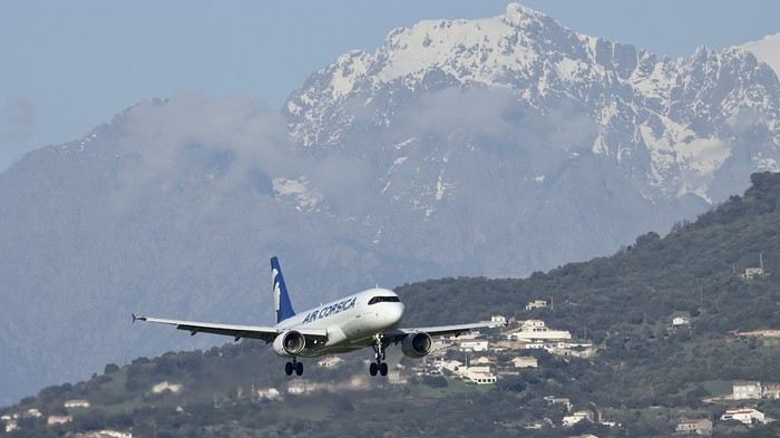 .
.
-2-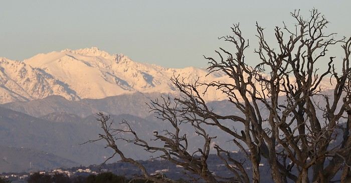 .
.
-3-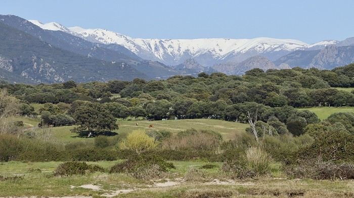 .
.
-4-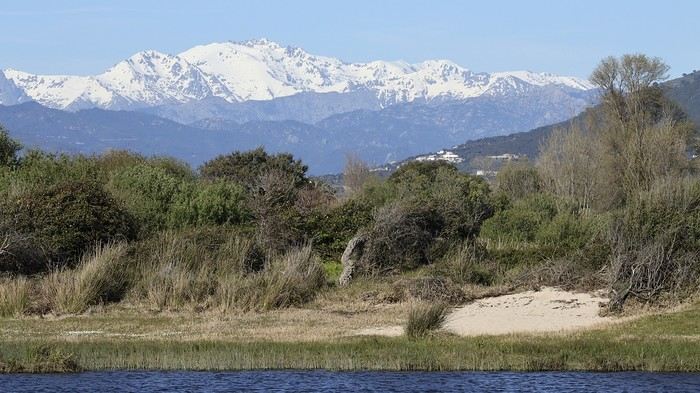 .
.
The last sunset of 2025 over the Gulf of Ajaccio. -5-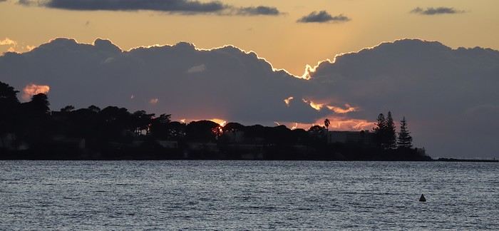 .
.
-6-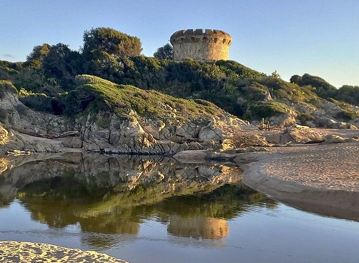 .
.
-7-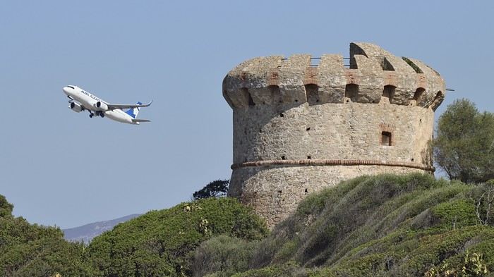 .
.
-8-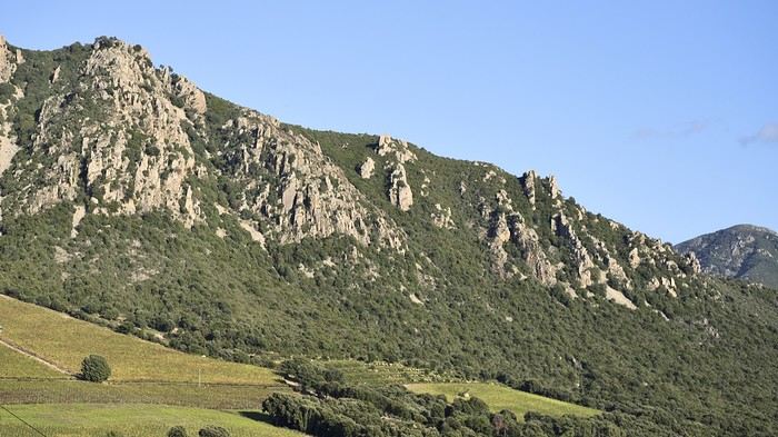 .
.
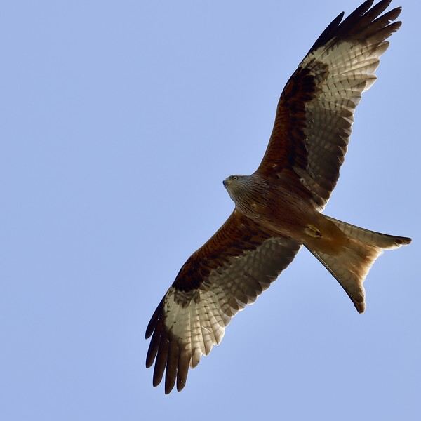
-9- Red kite (fairly common on the island)
 .
.
...
Hi everyone,
For those who can’t travel right now, I thought I’d offer a little escape—maybe!—through some images of Corsica (where I’ve lived for 48 years). This won’t be a structured travel journal or a step-by-step story, just a mishmash of landscapes and more... Through these photos, we’ll jump from one place to another, one season to the next, with no real order.
I debated adding details to each image but decided that for daydreaming, you don’t need much chatter—maybe just a place name.
....
Around Ajaccio:
-1-
.-2-
.-3-
.-4-
.The last sunset of 2025 over the Gulf of Ajaccio. -5-
.-6-
.-7-
.-8-
.-9- Red kite (fairly common on the island)
....
Late January or February 2027: Central Highlands of VIETNAM, circuit with guide and driver
I’m heading to Vietnam for the 3rd time for a 6-week stay.
Who’s planning a trip to the central region in 2027? And who’d like to share a few days with me? The idea is a circuit of several days with a guide and driver around BUON MA THUOT, PLEIKU, and KONTUM—or just a driver, or even a circuit with two easy riders, though they’re hard to find in this area.
And if we hit it off (check my profile), why not spend even more time together?
What I’m looking for: - Parks, nature reserves, or wildlife sanctuaries - BUON MA THUOT and surroundings: pagodas and traditional villages—Konklor village and the suspension bridge - PLEIKU: Bahnar villages and the ethnographic museum - KON TUM: cathedral, market, and traditional villages
Interested in: - Local markets, handicrafts (gongs, weaving, and basketry) - Ceremonies or performances with gongs - Pagodas - Museums - Street food
I’m not planning to travel long distances for waterfalls (unless they’re exceptional), or visits to farms . However, I’m open to any other suggestions for this trip to the Central Highlands, which are less touristy.
With prices rising, I’ve just bought my Paris/Danang and Ho Chi Minh/Paris flight ticket.
What I’m looking for: - Parks, nature reserves, or wildlife sanctuaries - BUON MA THUOT and surroundings: pagodas and traditional villages—Konklor village and the suspension bridge - PLEIKU: Bahnar villages and the ethnographic museum - KON TUM: cathedral, market, and traditional villages
Interested in: - Local markets, handicrafts (gongs, weaving, and basketry) - Ceremonies or performances with gongs - Pagodas - Museums - Street food
I’m not planning to travel long distances for waterfalls (unless they’re exceptional), or visits to farms . However, I’m open to any other suggestions for this trip to the Central Highlands, which are less touristy.
With prices rising, I’ve just bought my Paris/Danang and Ho Chi Minh/Paris flight ticket.
A day in Bratislava
Hi everyone,
I’m just passing through Bratislava quickly (one afternoon, one night, one morning) and I’d love to see the highlights of the city. I’ve put together a little itinerary—feel free to let me know what you think!
Start at the castle and its beautiful viewpoint Visit the Baroque gardens St. Martin’s Cathedral, quick visit National Theatre Discover the Cumil statues Primatial Palace via Hlavné Namestie Michael’s Gate Grassalkovich Palace via Obchodna Walk across Namesti Slobody to head back to the upside-down pyramid Head down to the Blue Church Cross the Danube to see Sad Janka Krala, then return via the UFO Bridge There you go—10 km and a packed day! What do you think?
Thanks, Stéphane.
I’m just passing through Bratislava quickly (one afternoon, one night, one morning) and I’d love to see the highlights of the city. I’ve put together a little itinerary—feel free to let me know what you think!
Start at the castle and its beautiful viewpoint Visit the Baroque gardens St. Martin’s Cathedral, quick visit National Theatre Discover the Cumil statues Primatial Palace via Hlavné Namestie Michael’s Gate Grassalkovich Palace via Obchodna Walk across Namesti Slobody to head back to the upside-down pyramid Head down to the Blue Church Cross the Danube to see Sad Janka Krala, then return via the UFO Bridge There you go—10 km and a packed day! What do you think?
Thanks, Stéphane.
One-day itinerary for Prague
Hi everyone,
I'm on my way to Slovakia, where I'll be spending about ten days on vacation in the High Tatras. I've decided to stop in Prague for 24 hours with my two teens (arriving around noon, leaving the next day). We don’t know the city at all. I know a single day is way too short to discover everything, so I’d like to plan a small circuit to see the must-see spots.
Here’s what I’ve planned:
Walk through Nový Svět street Visit the castle, St. Vitus Cathedral, and Golden Lane Quick stop at Vojanovy Sady gardens Malá Strana Square Maltese Square Kampa Island Then the iconic Charles Bridge and a short tour of the Jewish Quarter We’ll head back down to visit Old Town Square (Malé Náměstí, St. Nicholas Church, and the Church of Our Lady before Týn) Head to Wenceslas Square and the Church of Our Lady of the Snows Then to the Church of Saints Cyril and Methodius and the Dancing House And finally, back to the starting point.
Estimated distance: 10 km
I was thinking of a little evening stroll up Petřín Hill... what do you think? Are there things that aren’t really worth it, or other spots that are must-sees?
Thanks for your thoughts and feedback!
Stéphane.
I'm on my way to Slovakia, where I'll be spending about ten days on vacation in the High Tatras. I've decided to stop in Prague for 24 hours with my two teens (arriving around noon, leaving the next day). We don’t know the city at all. I know a single day is way too short to discover everything, so I’d like to plan a small circuit to see the must-see spots.
Here’s what I’ve planned:
Walk through Nový Svět street Visit the castle, St. Vitus Cathedral, and Golden Lane Quick stop at Vojanovy Sady gardens Malá Strana Square Maltese Square Kampa Island Then the iconic Charles Bridge and a short tour of the Jewish Quarter We’ll head back down to visit Old Town Square (Malé Náměstí, St. Nicholas Church, and the Church of Our Lady before Týn) Head to Wenceslas Square and the Church of Our Lady of the Snows Then to the Church of Saints Cyril and Methodius and the Dancing House And finally, back to the starting point.
Estimated distance: 10 km
I was thinking of a little evening stroll up Petřín Hill... what do you think? Are there things that aren’t really worth it, or other spots that are must-sees?
Thanks for your thoughts and feedback!
Stéphane.
Recent CFC Reviews
Hi
Has anyone taken the CFC recently?
Thoughts?
Thanks
Thoughts?
Thanks
2 weeks in northern Portugal: what to see with the Douro Valley and Porto?
Hi there,
We’re traveling in our camper van from Haute-Savoie.
We’ve got 2 weeks in April and want to explore northern Portugal.
We’re thinking of:
- Peneda-Gerês National Park - the Douro Valley - Porto
We love nature, hiking, and culture (and also good food and wine).😉
Do you have an itinerary to suggest?
Thanks in advance for your replies
We’re traveling in our camper van from Haute-Savoie.
We’ve got 2 weeks in April and want to explore northern Portugal.
We’re thinking of:
- Peneda-Gerês National Park - the Douro Valley - Porto
We love nature, hiking, and culture (and also good food and wine).😉
Do you have an itinerary to suggest?
Thanks in advance for your replies
Is two and a half days enough to visit Prague?
Hi there, I was wondering if it's possible to see the highlights of Prague in two and a half days? My flight arrives on a Sunday evening at 9 PM, so we’d have Monday, Tuesday, and Wednesday morning to explore. Return flight is on Wednesday at 4:30 PM. Best regards, Christophe
Shows and facilities on the MSC World Europa
Hi everyone,
I’m leaving at the end of March 2026 with 8 friends to celebrate an event on the MSC World Europa. I’ve been cruising for over 20 years with all kinds of companies and under many skies, but I’ve never traveled on a ship this size (6,800 people), and some specific info about this ship would be really helpful.
So, to those who’ve been on this boat before—thanks in advance!
SHOWS: Is it true that you have to book the evening show?... Just to secure a spot, or is it an internal rule?
THE SPA: Are the saunas and hammams mixed-gender? Are there several of them? Which pools are available?
SPORTS: Are there any “spaces” where ball sports like volleyball or basketball can be played?
Finally, is the management of passengers flexible and friendly, or quite strict?
Thanks!
Happy cruising.
Francis.
What to pack for a trip to New Zealand in March?
hi
After reading quite a few posts and buying a guidebook, I’m still struggling to finalize my suitcase.
Given that we’ll be visiting both islands during our road trip and suitcases aren’t exactly expandable,
I’ve noted that temperatures can be changeable—but should I pack more winter clothes than summer ones?
Thanks for your help
Biker companion for Nepal & Kailash trip
I'm seriously considering heading to Nepal to do some nice motorcycle loops... my goal is also to do the Kailash Yatra round trip from Kathmandu, in a small group with a guide, in May '26... but here's the thing—I'm solo! So if you're up for sharing a similar adventure, hit me up... Cheers, Frankoys
Nisyros: Greece’s most beautiful island?
Hi everyone,
I hesitated for a long time before publishing this travel journal since it’s been 8 months now since I left Nisyros. But in the end, I found it too beautiful to keep quiet about. So here we go—I finally got around to writing it. Nisyros is a stunning little Greek island, and luckily, it’s well hidden. Located a good twenty hours by boat from Athens, its distance from the Greek mainland deters most tourists from visiting. That’s what makes it an off-the-beaten-path destination. So much for the general info.
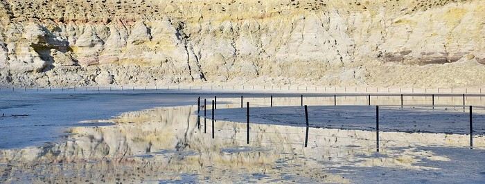
Before diving into the details, I should mention that I visited by bike (despite its severe and constant volcanic elevation) as part of a solo trip from France to Turkey. Why this detail? Because out of the ten countries I crossed and the dozens of sites I saw, Nisyros is one of my top three favorites (along with Pag Island, off-season, in Croatia, and Albania for its overall beauty—stunning natural landscapes and the incredible hospitality of its people). Anyway, welcome to this travel journal dedicated to the lovely little volcanic island of Nisyros…
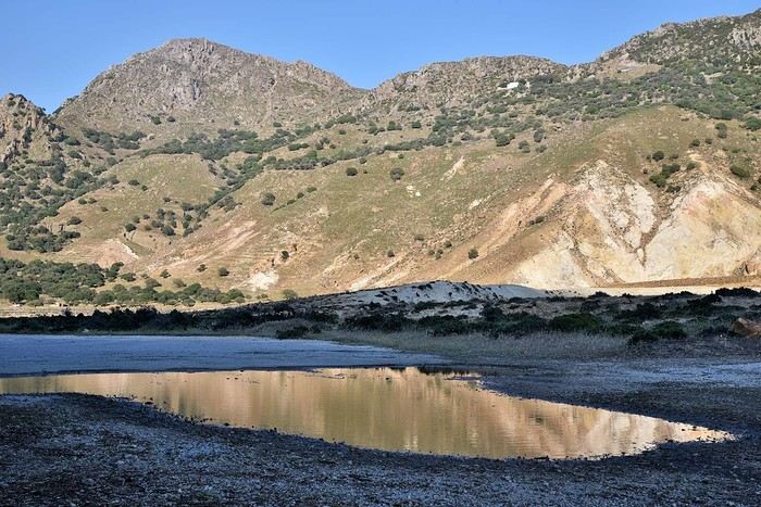
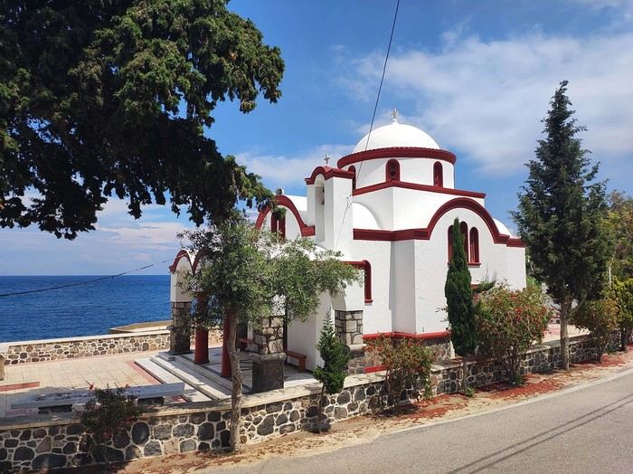
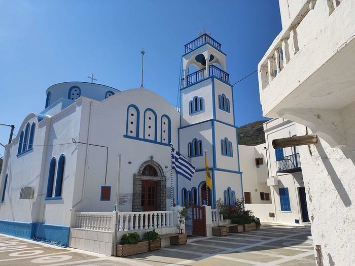
I arrived one beautiful morning in Mandraki, the island’s main port. The twenty-hour boat ride from Athens went by like a breeze. I slept on the deck for three or four hours, sprawled on a bench that was more or less sheltered from the wind. At this time of year (it’s May 2nd), tourists aren’t exactly flocking here, so the boat was far from full. My first glimpse of Nisyros is classic Greek island scenery: blazing sun, an azure sky, and an even deeper blue sea. The trip is off to a great start. I quickly found a small, out-of-the-way hotel (I’m one of those people who avoids crowds as much as possible when traveling, which is getting harder and harder to do). While everyone else from the boat turned right out of the port toward the center of Mandraki, I went left! My nice little hotel was just a hundred meters away, facing a pretty little Orthodox church whose red color contrasted beautifully with the deep blue sea.
I dropped off my panniers in my room so I could ride light for once, then headed toward the next village: Pali. It’s a small fishing village that apparently comes to life a bit in the summer with a few tourists.
As I pedaled along the dock, I passed right by a guy sitting in a chair in full sun. Unfazed despite the sweat pouring down his forehead, he untangled his fishing net with a precision that commanded respect. I gave him the obligatory kalimera (good morning), but he reacted like a deaf-mute—no response at all. On the other hand, his employee answered me kindly from the trawler docked right next to him. Standing on deck, he was also untangling a mess of nets and invited me aboard to chat. That’s Mohamed.
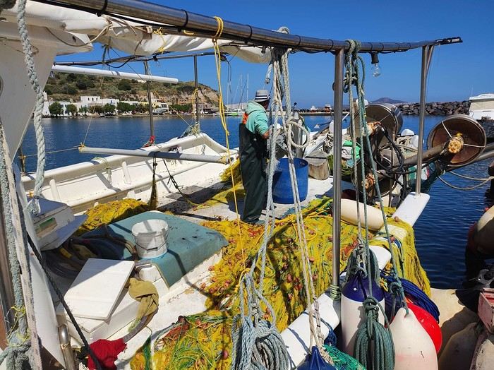
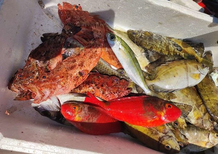
Communication wasn’t easy since he only spoke Greek and I didn’t, but he was cheerful, and his joy was contagious. He proudly showed off their catch of the day: two beautiful rays and a few brightly colored fish. We chatted like that for about fifteen minutes.
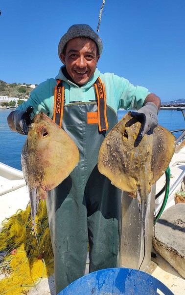
When it was time to hit the road again, I said goodbye to Mohamed, who smiled back. But this time, his boss—still dripping sweat in his chair under the scorching sun—greeted me too. Turns out he wasn’t deaf or mute after all.
I continued along the coast since that’s where most of Nisyros’ beaches are. They start lining up just outside Pali. These are black sand beaches, which can’t hide their volcanic origins.
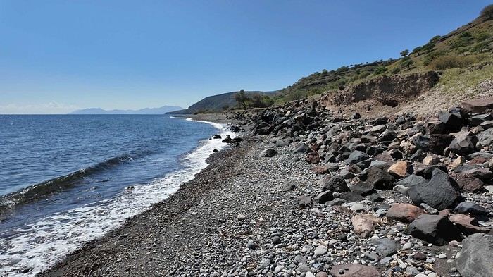
Yesterday afternoon in Athens, I met Peter and Michelle, a Dutch-French couple, while we were waiting for the ferry to depart. The Greek sailors were on strike, so we ended up waiting about twelve hours before setting off. Anyway, we had plenty of time to chat, and Peter, who’s lived on Tilos—a small island near Nisyros—for about twenty years, told me that many migrants pass through these two islands. Most come from Afghanistan and Syria, fleeing authoritarian regimes and the massacres that come with them. They’re looking for *anywhere* else where the future can’t possibly be worse. Peter explained that you often find their belongings on the local beaches. And sure enough, I didn’t have to look far to spot some—clothes, life jackets…
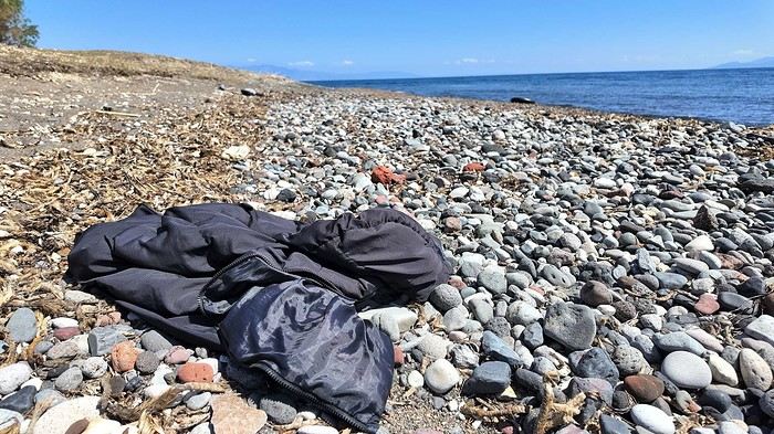
I glanced around, hoping to see one of them to maybe exchange a few words, but no—no one. I was completely alone.
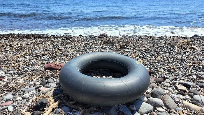
I got back on my bike and spent the rest of the day wandering aimlessly, just exploring this beautiful part of Nisyros. I also picked up some supplies because tomorrow, I’d be heading inland for two days, deep into its four-kilometer-wide caldera to explore the volcano. I’d be sleeping in a tent, so I needed to stock up on food. After a restful night in a real bed—something rare on this bike trip (and I won’t even mention the shower…)—I finally set off for the volcano (I’ll share details about that charming little hotel with the amazing breakfasts at the end of the journal). To reach Stefanos (the name of the main crater), I had to climb to the top of the caldera. It was hot, and some of the slopes were between 10 and 15%, which is steep, especially with a 54 kg bike. But who cares? I was admiring the scenery, and I have to say, I was surprised by how green it was. The higher I climbed, the more beautiful the vegetation became. It stood out against the blue of the sea, and the landscapes inside the island were truly stunning. So, I stopped every five minutes to take photos. Every now and then, I’d come across cows in the middle of the road—or goats in the trees! They climbed with the agility of monkeys to munch on the leaves. I couldn’t get a photo of them because they’d all scatter before I got close. It was actually the noise they made climbing down that tipped me off to their presence. Two villages sit at the top of the caldera: Emporios and Nikia. I passed the first one without climbing up to it, then continued to the second. And let me tell you, Nikia was love at first sight! I found myself pedaling through tiny streets, some barely wider than my bike with its panniers. The walls were white, and the doors were painted in all sorts of colors—green, blue, red… The streets were empty, and silence reigned. But it wasn’t a dead silence. It was more like the kind you find in small, secret, peaceful places. The village exuded tranquility, calm, and well-being. I leaned my bike—with all its gear—against a wall without locking it. It was the first time on this trip that I’d done that. Sure, its weight made it more like a tank than a bike, so you’d have to be *really* motivated to steal it, but here, for some reason, I felt completely at ease. Maybe it wasn’t the smartest move, but I go a lot by instinct, and here, it felt right. So I left my bike there and went to eat a little farther away, at a small restaurant on the village’s main square. It’s famous all over Greece for the beautiful mosaic that covers and decorates the floor. Once I’d eaten and drunk my fill, I hopped back on my bike, which had waited patiently without running off. And the best part? After riding uphill all morning to reach the top of the caldera, all I had to do now was coast downhill to the volcano. Pure bliss in such breathtaking scenery.
I hesitated for a long time before publishing this travel journal since it’s been 8 months now since I left Nisyros. But in the end, I found it too beautiful to keep quiet about. So here we go—I finally got around to writing it. Nisyros is a stunning little Greek island, and luckily, it’s well hidden. Located a good twenty hours by boat from Athens, its distance from the Greek mainland deters most tourists from visiting. That’s what makes it an off-the-beaten-path destination. So much for the general info.
Before diving into the details, I should mention that I visited by bike (despite its severe and constant volcanic elevation) as part of a solo trip from France to Turkey. Why this detail? Because out of the ten countries I crossed and the dozens of sites I saw, Nisyros is one of my top three favorites (along with Pag Island, off-season, in Croatia, and Albania for its overall beauty—stunning natural landscapes and the incredible hospitality of its people). Anyway, welcome to this travel journal dedicated to the lovely little volcanic island of Nisyros…
I arrived one beautiful morning in Mandraki, the island’s main port. The twenty-hour boat ride from Athens went by like a breeze. I slept on the deck for three or four hours, sprawled on a bench that was more or less sheltered from the wind. At this time of year (it’s May 2nd), tourists aren’t exactly flocking here, so the boat was far from full. My first glimpse of Nisyros is classic Greek island scenery: blazing sun, an azure sky, and an even deeper blue sea. The trip is off to a great start. I quickly found a small, out-of-the-way hotel (I’m one of those people who avoids crowds as much as possible when traveling, which is getting harder and harder to do). While everyone else from the boat turned right out of the port toward the center of Mandraki, I went left! My nice little hotel was just a hundred meters away, facing a pretty little Orthodox church whose red color contrasted beautifully with the deep blue sea.
I dropped off my panniers in my room so I could ride light for once, then headed toward the next village: Pali. It’s a small fishing village that apparently comes to life a bit in the summer with a few tourists.
As I pedaled along the dock, I passed right by a guy sitting in a chair in full sun. Unfazed despite the sweat pouring down his forehead, he untangled his fishing net with a precision that commanded respect. I gave him the obligatory kalimera (good morning), but he reacted like a deaf-mute—no response at all. On the other hand, his employee answered me kindly from the trawler docked right next to him. Standing on deck, he was also untangling a mess of nets and invited me aboard to chat. That’s Mohamed.
Communication wasn’t easy since he only spoke Greek and I didn’t, but he was cheerful, and his joy was contagious. He proudly showed off their catch of the day: two beautiful rays and a few brightly colored fish. We chatted like that for about fifteen minutes.
When it was time to hit the road again, I said goodbye to Mohamed, who smiled back. But this time, his boss—still dripping sweat in his chair under the scorching sun—greeted me too. Turns out he wasn’t deaf or mute after all.
I continued along the coast since that’s where most of Nisyros’ beaches are. They start lining up just outside Pali. These are black sand beaches, which can’t hide their volcanic origins.
Yesterday afternoon in Athens, I met Peter and Michelle, a Dutch-French couple, while we were waiting for the ferry to depart. The Greek sailors were on strike, so we ended up waiting about twelve hours before setting off. Anyway, we had plenty of time to chat, and Peter, who’s lived on Tilos—a small island near Nisyros—for about twenty years, told me that many migrants pass through these two islands. Most come from Afghanistan and Syria, fleeing authoritarian regimes and the massacres that come with them. They’re looking for *anywhere* else where the future can’t possibly be worse. Peter explained that you often find their belongings on the local beaches. And sure enough, I didn’t have to look far to spot some—clothes, life jackets…
I glanced around, hoping to see one of them to maybe exchange a few words, but no—no one. I was completely alone.
I got back on my bike and spent the rest of the day wandering aimlessly, just exploring this beautiful part of Nisyros. I also picked up some supplies because tomorrow, I’d be heading inland for two days, deep into its four-kilometer-wide caldera to explore the volcano. I’d be sleeping in a tent, so I needed to stock up on food. After a restful night in a real bed—something rare on this bike trip (and I won’t even mention the shower…)—I finally set off for the volcano (I’ll share details about that charming little hotel with the amazing breakfasts at the end of the journal). To reach Stefanos (the name of the main crater), I had to climb to the top of the caldera. It was hot, and some of the slopes were between 10 and 15%, which is steep, especially with a 54 kg bike. But who cares? I was admiring the scenery, and I have to say, I was surprised by how green it was. The higher I climbed, the more beautiful the vegetation became. It stood out against the blue of the sea, and the landscapes inside the island were truly stunning. So, I stopped every five minutes to take photos. Every now and then, I’d come across cows in the middle of the road—or goats in the trees! They climbed with the agility of monkeys to munch on the leaves. I couldn’t get a photo of them because they’d all scatter before I got close. It was actually the noise they made climbing down that tipped me off to their presence. Two villages sit at the top of the caldera: Emporios and Nikia. I passed the first one without climbing up to it, then continued to the second. And let me tell you, Nikia was love at first sight! I found myself pedaling through tiny streets, some barely wider than my bike with its panniers. The walls were white, and the doors were painted in all sorts of colors—green, blue, red… The streets were empty, and silence reigned. But it wasn’t a dead silence. It was more like the kind you find in small, secret, peaceful places. The village exuded tranquility, calm, and well-being. I leaned my bike—with all its gear—against a wall without locking it. It was the first time on this trip that I’d done that. Sure, its weight made it more like a tank than a bike, so you’d have to be *really* motivated to steal it, but here, for some reason, I felt completely at ease. Maybe it wasn’t the smartest move, but I go a lot by instinct, and here, it felt right. So I left my bike there and went to eat a little farther away, at a small restaurant on the village’s main square. It’s famous all over Greece for the beautiful mosaic that covers and decorates the floor. Once I’d eaten and drunk my fill, I hopped back on my bike, which had waited patiently without running off. And the best part? After riding uphill all morning to reach the top of the caldera, all I had to do now was coast downhill to the volcano. Pure bliss in such breathtaking scenery.
Booking Timing for the Marquesas Islands and Shuttle Schedules
Hello! We’re heading to the Marquesas in July-August and I’d love to know if it’s possible, for a fee, to do a leg of the journey on the Aranui—like from Hiva Oa to Fatu Hiva, or Nuku Hiva to Ua Pou, or even Ua Pou to Ua Huka? Sure, there are shuttles twice a week with Codim connecting these islands, but the schedules won’t be known until two months in advance, and I need to book flights and hotels much earlier than that. So, what’s the best way to handle this?
Looking forward to your replies—thanks in advance! Elisabeth Marcel babeth.marcel@yahoo.fr
Looking forward to your replies—thanks in advance! Elisabeth Marcel babeth.marcel@yahoo.fr
Spitsbergen – A Night with the Walruses on Lågøya
Spitsbergen, 80° North latitude. A lost archipelago on the edge of the world, northeast of Greenland, the last lands before the pole. I’m aboard the *Grigoriy Mikheev*, a Russian ship from the Murmansk Polar Research Institute. Russian flag, Russian crew. Chartered by OceanWide Expeditions.
Last night, we were stuck in drifting pack ice in the long Hinlopen Strait. This incident led to an unforgettable barbecue and party on the ship’s foredeck, but we had to abandon our plan to head south and circle Spitsbergen. This summer, there’s too much ice in the strait, and it’s too thick. At dawn, the tide turned, allowing us to break free and head north again. The ship is now moving slowly through sea ice density that satellite maps estimate at around five-tenths. Our progress is punctuated by dull thuds: the ship’s bow constantly shoves and fractures enormous ice floes.
At breakfast, Tarik, our expedition leader, informs us that our program will be significantly altered. Since we can’t cross the strait, we’ll turn back and head north. To kick off our Plan B, Tarik plans a landing tonight on the small island of Låg (Lågøya), at 80°10' North. Last summer, he saw a large walrus colony there and hopes we’ll find them again. The weather is perfect—glorious sunshine—and walruses are truly addicted to sunbathing on the beaches.
We’ve now exited the strait and are sailing far from the coast. In case the walrus colony is there, we don’t want the ship’s approach to scare them into the water before we even see them. So, we scan the shore methodically with binoculars. We pass several bays, round a cape, and examine several shorelines littered with driftwood, but no walruses in sight. Several times, clusters of large rounded rocks trigger false alarms… but no, they’re just rocks…
Suddenly, Tarik spots them through his binoculars! On an isolated peninsula, our expedition leader’s highly trained eye has picked out, among those brown masses, the shape and white color of the enormous tusks of what he calls "the heavyweights of the Arctic!" Now, fifteen or twenty pairs of binoculars are pointed in the indicated direction… Sure enough, I see them now! They’re there, huge, sprawled in the sun on the beach. Without Tarik’s sharp eye, we might have missed them. They’re so tightly packed together that they really look like a mass of brown rocks. Only the white, saber-shaped tusks and the occasional furtive movements hint that they’re animals.
It’s 11 PM, and on the deck of the *Grigoriy Mikheev*, as you can imagine, excitement has ramped up several notches. Several of us have already rushed to our cabins to gear up, pulling on boots and life jackets in anticipation of a landing that promises to be absolutely amazing. Tarik reins in our enthusiasm a bit: Okay, so we were lucky to find them, but now we need to think about how to approach them. Not that they’re dangerous—at least not on land… Their enormous bulk and their pseudo-feet (flippers) only allow for very limited mobility. But when they feel threatened, their first instinct is to head for the water, where their perfect ease keeps them safe. So, the challenge will be not to scare them off, to avoid them bolting into the water in the first few seconds! That’s exactly what would happen if we arrived by Zodiac right in front of them.
So, Tarik decides we’ll make a wide detour to land on the other side of the peninsula where they are. From there, we’ll leave the Zodiacs on the beach and cross the peninsula on foot, about a kilometer and a half. That way, we’ll approach the herd from behind. This approach will also keep us downwind of them. There you go—with a few precautions, they shouldn’t hear us coming or catch our scent.
Everyone is geared up now and practically bursting with impatience… While the Zodiacs are being lowered into the water, Tarik and Delphine recap the approach rules: absolute silence, communication only by signs, no dragging feet on the rocks, watch your step, and strict coordination with slow movements.
Here we go… we’re off now! Spray flying from the Zodiac’s bow, icy air whipping our faces, gloves gripping the side ropes, freezing splashes, pure emotion… Ahh, I love this! We describe a wide curve offshore to round the peninsula. Ahead of us, the magnificent landscape of this intensely blue sea unfolds, with the hills of Lågøya and, in the distance, the ice-covered mountains of Nordaustlandet under the sun. It’s midnight now. In July, at 80 degrees North, the sun is just like midday.
This navigation takes us far from the walruses, on the other side of the cape. Easy landing on a shoreline of large pebbles covered in giant seaweed brought in by the currents. They look like long strips of plastic—sometimes translucent, sometimes white, beige, or orange. In places, there are huge tangled layers of it. Our boots sink into this material, which gives off a strong iodine smell. Unfortunately, there’s also some plastic waste—fishing floats and net debris. Seeing this here is crazy… A little farther on, in a cove, tides and storms have piled up numerous tree trunks from Siberia.
We begin crossing the peninsula on foot, staying close together. We’re walking on a nearly deserted polar tundra. We’re only ten degrees of latitude from the North Pole here. The violent winds and extreme temperatures that dominate this island for nine months of the year allow only a few rare plants to grow, close to the ground, between the rocks. In places, rocks are covered with large patches of black lichen.
Gérard, rifle slung over his shoulder, constantly scans the terrain. Tarik and Delphine are also very vigilant. We know no one ever lands here, and although this environment isn’t ideal for bears, you never know—better to be cautious. The terrain is mostly flat, but whenever a small rise blocks our view, Gérard moves ahead and only signals us to proceed when he’s sure there’s no "big man in fur" (tradition dictates we don’t name the polar bear).
After a few hundred meters, we find an enormous whale vertebra. Judging by the state of the bone, it’s likely a relic from the whaling era that ravaged this area in the 17th century and all over northern Spitsbergen. A little farther on, the remains of a grave catch our attention. The only human trace on this remote island, this burial is surely very old, also likely dating from the whalers’ time. But this whaler’s final resting place didn’t shelter him for long—there’s not much left, just a piece of skull and a few broken bones. Due to the permafrost, the body could only be buried a few dozen centimeters deep, between some planks held in place by large stones. This makeshift grave was probably ravaged by a bear shortly after the burial. Several stone blocks are overturned, the planks are broken open. We only linger for a minute to pay our respects to this whaler, whose poor remains now merge with the mineral landscape.
A slight rise bulges in the center of the peninsula, and here we are at the highest point. If our orientation is correct, we’re heading straight for the walrus colony. A moment of emotion… my heart’s pounding. Yes, they’re there, about three hundred meters ahead of us! They haven’t moved since we spotted them from the *Grigoriy Mikheev*’s deck. They’re sprawled in a heap, packed tightly together in the sun, on the shingle beach. The light breeze blowing in our faces confirms we’re on the right track—not to be sniffed out from afar by the big beasts.
By signs, Tarik tells us we’ll approach slowly, in stages, moving about thirty meters at a time, making as little noise as possible with our boots, then freezing completely for a minute or two, crouching down to let them forget us. This strategy proves excellent. We’re now less than a hundred meters away, and it doesn’t seem like our presence is perceived as a threat by the "heavyweights of the Arctic." At this distance, let’s not kid ourselves: we’re certainly spotted, but our way of approaching must seem reassuring—or at least manageable—since they’re only a few meters from the water and know they could dash into it in seconds if they felt the need.
We now advance in shorter stages—twenty meters at a time, then just ten, crouching, then freezing like statues, our breathing nearly held from emotion and concentration. We’re now thirty meters from the mastodons. Our presence must be starting to stress them because they’re moving more. While still sprawled against each other, some suddenly rear up on their flipper-feet, grunting and snorting like monstrous pigs. Their head shakes make their two enormous ivory sabers sway. They jab them into the fat of their neighbors, who in turn stir and emit irritated snorts.
At Tarik’s signal, we move a few more meters, "on velvet paws"… We’re right there now. I hold my breath, throat tight… Intense emotion, a fantastic spectacle—these enormous Arctic animals sprawled in the sun, with the magnificent backdrop of snow-covered mountains across the sound. I think to myself: *I’m here… this can’t be real!* It’s nearly 2 AM now, the air is crystal clear, and the Arctic sun bathes this scene in what might be the most beautiful light I’ve ever seen. We’re about fifteen meters away now. Tarik signals that we won’t go any closer. The walruses are still lying down, but occasionally, our close presence and the clicking of cameras trigger bouts of agitation that ripple through the herd, causing some jostling. They’re so tightly packed and tangled that it’s a bit hard to count them. In the end, we tally sixteen, plus one "little one," half-crushed in the general mass.
Seen from here, they’re truly impressive! The "sumo wrestlers of the Arctic!" According to Tarik, they must weigh about a ton—slightly more for the males than the females—and the "little one" must already be around 200 kg. When the weather’s nice like today, they love sprawling on the beaches to soak up the sun.
Walruses are marvels of Arctic adaptation. They can modify their blood circulation depending on thermal conditions. They withstand extreme cold by directing most of their circulation to vital organs (heart, lungs) and minimizing peripheral blood flow (skin and limbs) to prevent heat loss. Conversely, when they sunbathe, they direct most of their blood flow to the skin, turning themselves into true solar collectors.
At this latitude, there’s practically no difference in sunlight between day and night. Noon or midnight, the sun’s angle barely changes. Walruses make the most of these fair-weather phases by sprawling in the sun 23 hours out of 24… Enough to make siesta lovers dream, right? Twenty-three hours of lounging… and the twenty-fourth for eating!
And when we say "eating," what a feast! The proverb *"Who sleeps dines"* is fully justified here: when a walrus decides to feed, it gulps down between 50 and 60 kg of shellfish in an hour! Its food consists of large bivalve mollusks, which it tears from the seabed with its tusks and sucks up nonstop! A 50 kg meal certainly justifies a 23-hour nap for digestion, right? And speaking of digestion—it’s what the "big guys" in front of us are doing right now! You might wonder how we know this… Well, I’ll tell you: if you were here, downwind (or should I say *down the winds!*) of these marine giants, you’d have no doubt! Pfft… what flatulence! I can confirm that today’s scent is called *"Morsanus, from the North"* (*"Because I’m worth it!"*). Mmm, yeah… Tarik, you had a great idea putting us upwind… at least *they* can’t smell us, but we sure can!
But… heepp! Delphine discreetly signals to get our attention—she’s just spotted something: in the smooth water of the bay, a small V-shaped ripple runs along the beach, then turns toward the shore… So the colony wasn’t complete on the beach… Here’s an 800 kg bather stepping ashore now, right before our astonished eyes! She lifts her head and stays like that for a long moment, her enormous tusks half out of the water. She looks exhausted, resting a bit before coming out. Or more likely, she’s hesitating to climb onto the beach because she’s seen us… The shapeless head stays still for a moment, then violently snorts like a clogged drain! A misshapen head where you can’t make out anything that usually makes a head! No eyes, no ears, no mouth… A sort of monstrous cabbage! But the temptation to join the warmth of the "sunbathers" is too strong! Here’s our pachyderm bather climbing the few meters of the shore and sprawling right in the middle of her companions, who greet her with jostling, grunts, and tusk jabs! Then everything settles back into order—800 kg of fat and flesh added to the fifteen or so tons of local biomass. Welcome to the club!
It seems the walruses have gotten a bit used to us now. They’re moving and grunting much less. I realize it wasn’t obvious to approach them like this without scaring them into the water… It’s thanks to Tarik and Delphine’s advice that we managed it. It’s also, let’s be honest, because we’re all passionate here, and there’s been total discipline and cohesion from the start of this approach.
It’s past 2 AM now—time to head back… We’ll leave them to their wild world, to their life at the beginning of the world. We’re happy to have disturbed them as little as possible and not to have disrupted their nap too much. We leave stealthily, first backing up a few meters, then turning around and crossing the peninsula again, walking slowly, avoiding making noise with our boots as long as we’re still close.
We find the Zodiacs on the shoreline with the giant kelp. The sea is like a lake—easy boarding. We make another wide loop to round the cape, passing offshore. The sharp cold stings my cheeks and ears again—I put my hat back on. The cold—I hadn’t thought about it at all during our encounter with the walruses. In the Zodiac, with the engine noise, no one speaks. The faces and smiles are those of men and women who’ve just crossed an inner frontier—the one that separates dream from reality. But tonight, that frontier was porous, and the dream entered reality.
We return to the *Grigoriy Mikheev*, waiting at anchor. It’s past 3 AM, but I don’t feel any fatigue. A few minutes later, I’m in my bunk, rocked by a gentle swell and the hum of the engines. In the soft warmth of the blanket, a strange sleep overtakes me… A sleep filled with luminous, icy landscapes, with large beasts bearing saber-like tusks. Large beasts that sleep, snore, snort, grunt, and jostle in their sleep… in *my* sleep. An unforgettable memory. It was July 2004, in Spitsbergen.
Chris51.
Last night, we were stuck in drifting pack ice in the long Hinlopen Strait. This incident led to an unforgettable barbecue and party on the ship’s foredeck, but we had to abandon our plan to head south and circle Spitsbergen. This summer, there’s too much ice in the strait, and it’s too thick. At dawn, the tide turned, allowing us to break free and head north again. The ship is now moving slowly through sea ice density that satellite maps estimate at around five-tenths. Our progress is punctuated by dull thuds: the ship’s bow constantly shoves and fractures enormous ice floes.
At breakfast, Tarik, our expedition leader, informs us that our program will be significantly altered. Since we can’t cross the strait, we’ll turn back and head north. To kick off our Plan B, Tarik plans a landing tonight on the small island of Låg (Lågøya), at 80°10' North. Last summer, he saw a large walrus colony there and hopes we’ll find them again. The weather is perfect—glorious sunshine—and walruses are truly addicted to sunbathing on the beaches.
We’ve now exited the strait and are sailing far from the coast. In case the walrus colony is there, we don’t want the ship’s approach to scare them into the water before we even see them. So, we scan the shore methodically with binoculars. We pass several bays, round a cape, and examine several shorelines littered with driftwood, but no walruses in sight. Several times, clusters of large rounded rocks trigger false alarms… but no, they’re just rocks…
Suddenly, Tarik spots them through his binoculars! On an isolated peninsula, our expedition leader’s highly trained eye has picked out, among those brown masses, the shape and white color of the enormous tusks of what he calls "the heavyweights of the Arctic!" Now, fifteen or twenty pairs of binoculars are pointed in the indicated direction… Sure enough, I see them now! They’re there, huge, sprawled in the sun on the beach. Without Tarik’s sharp eye, we might have missed them. They’re so tightly packed together that they really look like a mass of brown rocks. Only the white, saber-shaped tusks and the occasional furtive movements hint that they’re animals.
It’s 11 PM, and on the deck of the *Grigoriy Mikheev*, as you can imagine, excitement has ramped up several notches. Several of us have already rushed to our cabins to gear up, pulling on boots and life jackets in anticipation of a landing that promises to be absolutely amazing. Tarik reins in our enthusiasm a bit: Okay, so we were lucky to find them, but now we need to think about how to approach them. Not that they’re dangerous—at least not on land… Their enormous bulk and their pseudo-feet (flippers) only allow for very limited mobility. But when they feel threatened, their first instinct is to head for the water, where their perfect ease keeps them safe. So, the challenge will be not to scare them off, to avoid them bolting into the water in the first few seconds! That’s exactly what would happen if we arrived by Zodiac right in front of them.
So, Tarik decides we’ll make a wide detour to land on the other side of the peninsula where they are. From there, we’ll leave the Zodiacs on the beach and cross the peninsula on foot, about a kilometer and a half. That way, we’ll approach the herd from behind. This approach will also keep us downwind of them. There you go—with a few precautions, they shouldn’t hear us coming or catch our scent.
Everyone is geared up now and practically bursting with impatience… While the Zodiacs are being lowered into the water, Tarik and Delphine recap the approach rules: absolute silence, communication only by signs, no dragging feet on the rocks, watch your step, and strict coordination with slow movements.
Here we go… we’re off now! Spray flying from the Zodiac’s bow, icy air whipping our faces, gloves gripping the side ropes, freezing splashes, pure emotion… Ahh, I love this! We describe a wide curve offshore to round the peninsula. Ahead of us, the magnificent landscape of this intensely blue sea unfolds, with the hills of Lågøya and, in the distance, the ice-covered mountains of Nordaustlandet under the sun. It’s midnight now. In July, at 80 degrees North, the sun is just like midday.
This navigation takes us far from the walruses, on the other side of the cape. Easy landing on a shoreline of large pebbles covered in giant seaweed brought in by the currents. They look like long strips of plastic—sometimes translucent, sometimes white, beige, or orange. In places, there are huge tangled layers of it. Our boots sink into this material, which gives off a strong iodine smell. Unfortunately, there’s also some plastic waste—fishing floats and net debris. Seeing this here is crazy… A little farther on, in a cove, tides and storms have piled up numerous tree trunks from Siberia.
We begin crossing the peninsula on foot, staying close together. We’re walking on a nearly deserted polar tundra. We’re only ten degrees of latitude from the North Pole here. The violent winds and extreme temperatures that dominate this island for nine months of the year allow only a few rare plants to grow, close to the ground, between the rocks. In places, rocks are covered with large patches of black lichen.
Gérard, rifle slung over his shoulder, constantly scans the terrain. Tarik and Delphine are also very vigilant. We know no one ever lands here, and although this environment isn’t ideal for bears, you never know—better to be cautious. The terrain is mostly flat, but whenever a small rise blocks our view, Gérard moves ahead and only signals us to proceed when he’s sure there’s no "big man in fur" (tradition dictates we don’t name the polar bear).
After a few hundred meters, we find an enormous whale vertebra. Judging by the state of the bone, it’s likely a relic from the whaling era that ravaged this area in the 17th century and all over northern Spitsbergen. A little farther on, the remains of a grave catch our attention. The only human trace on this remote island, this burial is surely very old, also likely dating from the whalers’ time. But this whaler’s final resting place didn’t shelter him for long—there’s not much left, just a piece of skull and a few broken bones. Due to the permafrost, the body could only be buried a few dozen centimeters deep, between some planks held in place by large stones. This makeshift grave was probably ravaged by a bear shortly after the burial. Several stone blocks are overturned, the planks are broken open. We only linger for a minute to pay our respects to this whaler, whose poor remains now merge with the mineral landscape.
A slight rise bulges in the center of the peninsula, and here we are at the highest point. If our orientation is correct, we’re heading straight for the walrus colony. A moment of emotion… my heart’s pounding. Yes, they’re there, about three hundred meters ahead of us! They haven’t moved since we spotted them from the *Grigoriy Mikheev*’s deck. They’re sprawled in a heap, packed tightly together in the sun, on the shingle beach. The light breeze blowing in our faces confirms we’re on the right track—not to be sniffed out from afar by the big beasts.
By signs, Tarik tells us we’ll approach slowly, in stages, moving about thirty meters at a time, making as little noise as possible with our boots, then freezing completely for a minute or two, crouching down to let them forget us. This strategy proves excellent. We’re now less than a hundred meters away, and it doesn’t seem like our presence is perceived as a threat by the "heavyweights of the Arctic." At this distance, let’s not kid ourselves: we’re certainly spotted, but our way of approaching must seem reassuring—or at least manageable—since they’re only a few meters from the water and know they could dash into it in seconds if they felt the need.
We now advance in shorter stages—twenty meters at a time, then just ten, crouching, then freezing like statues, our breathing nearly held from emotion and concentration. We’re now thirty meters from the mastodons. Our presence must be starting to stress them because they’re moving more. While still sprawled against each other, some suddenly rear up on their flipper-feet, grunting and snorting like monstrous pigs. Their head shakes make their two enormous ivory sabers sway. They jab them into the fat of their neighbors, who in turn stir and emit irritated snorts.
At Tarik’s signal, we move a few more meters, "on velvet paws"… We’re right there now. I hold my breath, throat tight… Intense emotion, a fantastic spectacle—these enormous Arctic animals sprawled in the sun, with the magnificent backdrop of snow-covered mountains across the sound. I think to myself: *I’m here… this can’t be real!* It’s nearly 2 AM now, the air is crystal clear, and the Arctic sun bathes this scene in what might be the most beautiful light I’ve ever seen. We’re about fifteen meters away now. Tarik signals that we won’t go any closer. The walruses are still lying down, but occasionally, our close presence and the clicking of cameras trigger bouts of agitation that ripple through the herd, causing some jostling. They’re so tightly packed and tangled that it’s a bit hard to count them. In the end, we tally sixteen, plus one "little one," half-crushed in the general mass.
Seen from here, they’re truly impressive! The "sumo wrestlers of the Arctic!" According to Tarik, they must weigh about a ton—slightly more for the males than the females—and the "little one" must already be around 200 kg. When the weather’s nice like today, they love sprawling on the beaches to soak up the sun.
Walruses are marvels of Arctic adaptation. They can modify their blood circulation depending on thermal conditions. They withstand extreme cold by directing most of their circulation to vital organs (heart, lungs) and minimizing peripheral blood flow (skin and limbs) to prevent heat loss. Conversely, when they sunbathe, they direct most of their blood flow to the skin, turning themselves into true solar collectors.
At this latitude, there’s practically no difference in sunlight between day and night. Noon or midnight, the sun’s angle barely changes. Walruses make the most of these fair-weather phases by sprawling in the sun 23 hours out of 24… Enough to make siesta lovers dream, right? Twenty-three hours of lounging… and the twenty-fourth for eating!
And when we say "eating," what a feast! The proverb *"Who sleeps dines"* is fully justified here: when a walrus decides to feed, it gulps down between 50 and 60 kg of shellfish in an hour! Its food consists of large bivalve mollusks, which it tears from the seabed with its tusks and sucks up nonstop! A 50 kg meal certainly justifies a 23-hour nap for digestion, right? And speaking of digestion—it’s what the "big guys" in front of us are doing right now! You might wonder how we know this… Well, I’ll tell you: if you were here, downwind (or should I say *down the winds!*) of these marine giants, you’d have no doubt! Pfft… what flatulence! I can confirm that today’s scent is called *"Morsanus, from the North"* (*"Because I’m worth it!"*). Mmm, yeah… Tarik, you had a great idea putting us upwind… at least *they* can’t smell us, but we sure can!
But… heepp! Delphine discreetly signals to get our attention—she’s just spotted something: in the smooth water of the bay, a small V-shaped ripple runs along the beach, then turns toward the shore… So the colony wasn’t complete on the beach… Here’s an 800 kg bather stepping ashore now, right before our astonished eyes! She lifts her head and stays like that for a long moment, her enormous tusks half out of the water. She looks exhausted, resting a bit before coming out. Or more likely, she’s hesitating to climb onto the beach because she’s seen us… The shapeless head stays still for a moment, then violently snorts like a clogged drain! A misshapen head where you can’t make out anything that usually makes a head! No eyes, no ears, no mouth… A sort of monstrous cabbage! But the temptation to join the warmth of the "sunbathers" is too strong! Here’s our pachyderm bather climbing the few meters of the shore and sprawling right in the middle of her companions, who greet her with jostling, grunts, and tusk jabs! Then everything settles back into order—800 kg of fat and flesh added to the fifteen or so tons of local biomass. Welcome to the club!
It seems the walruses have gotten a bit used to us now. They’re moving and grunting much less. I realize it wasn’t obvious to approach them like this without scaring them into the water… It’s thanks to Tarik and Delphine’s advice that we managed it. It’s also, let’s be honest, because we’re all passionate here, and there’s been total discipline and cohesion from the start of this approach.
It’s past 2 AM now—time to head back… We’ll leave them to their wild world, to their life at the beginning of the world. We’re happy to have disturbed them as little as possible and not to have disrupted their nap too much. We leave stealthily, first backing up a few meters, then turning around and crossing the peninsula again, walking slowly, avoiding making noise with our boots as long as we’re still close.
We find the Zodiacs on the shoreline with the giant kelp. The sea is like a lake—easy boarding. We make another wide loop to round the cape, passing offshore. The sharp cold stings my cheeks and ears again—I put my hat back on. The cold—I hadn’t thought about it at all during our encounter with the walruses. In the Zodiac, with the engine noise, no one speaks. The faces and smiles are those of men and women who’ve just crossed an inner frontier—the one that separates dream from reality. But tonight, that frontier was porous, and the dream entered reality.
We return to the *Grigoriy Mikheev*, waiting at anchor. It’s past 3 AM, but I don’t feel any fatigue. A few minutes later, I’m in my bunk, rocked by a gentle swell and the hum of the engines. In the soft warmth of the blanket, a strange sleep overtakes me… A sleep filled with luminous, icy landscapes, with large beasts bearing saber-like tusks. Large beasts that sleep, snore, snort, grunt, and jostle in their sleep… in *my* sleep. An unforgettable memory. It was July 2004, in Spitsbergen.
Chris51.
Questions about the new airport and access to Preah Vihear temple
Hi everyone,
I’m heading back to Cambodia in a few weeks and had a couple of questions:
1/ the new airport Does anyone have info on the average tuk-tuk fare? From the old one, we’d usually pay between $7 and $10. Are we looking at the same range? It seems a bit farther, so maybe a little pricier. If you’ve got a rough idea of the time (always better to budget extra), I’m guessing around an hour?
2/ access to Preah Vihear temple I haven’t been back in a few years, but I was thinking of revisiting it this year. Given the border troubles, is access still allowed at the moment?
Looking forward to hearing from you,
Mathieu
I’m heading back to Cambodia in a few weeks and had a couple of questions:
1/ the new airport Does anyone have info on the average tuk-tuk fare? From the old one, we’d usually pay between $7 and $10. Are we looking at the same range? It seems a bit farther, so maybe a little pricier. If you’ve got a rough idea of the time (always better to budget extra), I’m guessing around an hour?
2/ access to Preah Vihear temple I haven’t been back in a few years, but I was thinking of revisiting it this year. Given the border troubles, is access still allowed at the moment?
Looking forward to hearing from you,
Mathieu
Flooding in the Hoi An and Hue regions
Good evening,
Exceptional floods occurred last week in central Vietnam, in the Hoi An and Hue regions. These areas get a lot of rain every year, but this time it's historically devastating.
The images are striking, horrifying, and surreal for those of us—like me—who walked these beautiful streets not long ago: the old town of Hoi An completely submerged, water up to the rooftops, the Japanese Bridge barely peeking out of the water... In Hue, the flag monument in front of the Imperial City entrance was nothing more than an island...
I’m not posting any links, but anyone can find them online if they wish.
Stay strong to our Vietnamese friends. And a strong warning to all tourists: avoid these regions. The water levels are receding, but more rain is on the way...
Exceptional floods occurred last week in central Vietnam, in the Hoi An and Hue regions. These areas get a lot of rain every year, but this time it's historically devastating.
The images are striking, horrifying, and surreal for those of us—like me—who walked these beautiful streets not long ago: the old town of Hoi An completely submerged, water up to the rooftops, the Japanese Bridge barely peeking out of the water... In Hue, the flag monument in front of the Imperial City entrance was nothing more than an island...
I’m not posting any links, but anyone can find them online if they wish.
Stay strong to our Vietnamese friends. And a strong warning to all tourists: avoid these regions. The water levels are receding, but more rain is on the way...
Road Trip USA 2023 - Part 2
HIGHWAY 1
Highway 1 runs along the Pacific coast of California from Leggett in the north to Dana Point in the south. It's the longest state route in California, stretching 1,050 km.
It's famous for its breathtaking ocean views. That’s actually why it’s become such a popular route for road trips, with tons of attractions and points of interest all along the way.
After crossing the U.S. interior on our way out (see Road Trip USA 2023 - Part 1), we’re starting our return trip along this route from Leggett.
Videos are embedded throughout the summary. Please click on the image to start the video. To jump to a specific post, here are the appropriate links:
CALIFORNIA:
Scenic Overlooks on Route 1 Between Leggett and Fort Bragg The Pudding Creek Trestle Bridge in Fort Bragg Glass Beach - Fort Bragg Jenner Lookout Point - Highway 1 Goat Rock Beach - Sonoma Coast State Park - Jenner Point Reyes National Seashore - White House Pool Trail Point Reyes National Seashore - Limantour Beach Point Reyes National Seashore - Point Reyes Shipwreck Point Reyes National Seashore - Kehoe Beach Trail Point Reyes National Seashore - McClures Beach Trail Point Reyes National Seashore - Cypress Tree Tunnel Point Reyes National Seashore - Point Reyes Beach North Point Reyes National Seashore - Elephant Seals on Drakes Beach Point Reyes National Seashore - Point Reyes Beach South Point Reyes National Seashore – Elephant Seals Overlooks Point Reyes National Seashore - Chimney Rock Trail Point Reyes National Seashore - Point Reyes Lighthouse Trail Point Reyes National Seashore – Tule Elk Observation Point Bonita Lighthouse Trail - Sausalito Hawk Hill - Sausalito Battery Spencer Trail - Sausalito Rodeo Beach - Sausalito Point Cavallo - Golden Gate View - Sausalito Exploring Downtown Sausalito Visiting Sausalito’s Houseboats Crossing the Golden Gate Bridge - San Francisco Golden Gate Bridge Viewpoints - San Francisco Cruise to Alcatraz Island - San Francisco Visiting Alcatraz Island - San Francisco Civic Center - Downtown San Francisco Market Street & Yerba Buena Gardens - Downtown San Francisco Union Square & Financial District - Downtown San Francisco Fisherman's Wharf, Pier 39 & Embarcadero - San Francisco Sea Lion Observation - Pier 39 - San Francisco Lombard Street & Cable Car - Russian Hill - San Francisco Macondray Lane Historic District - Russian Hill - San Francisco Grace Cathedral & Huntington Park - Nob Hill - San Francisco Telegraph Hill - San Francisco Chinatown - San Francisco Alamo Square & Painted Ladies - Western Addition - San Francisco Palace of Fine Arts - Marina District - San Francisco Presidio of San Francisco California Coastal Trail - Lincoln Park - San Francisco California Palace of the Legion of Honor - Lincoln Park - San Francisco Sutro Baths - Lincoln Park - San Francisco Queen Wilhelmina Garden - Golden Gate Park - San Francisco Bison Paddock - Golden Gate Park - San Francisco Portals of the Past - Golden Gate Park - San Francisco Strawberry Hill - Golden Gate Park – San Francisco Prayerbook Cross & Robin Williams Meadow - Golden Gate Park - San Francisco Hidden Garden Steps & 16th Avenue Tiled Steps - San Francisco Grandview Park - San Francisco Hike - Twin Peaks Three Summits - San Francisco Longboarding Down Twin Peaks Blvd in San Francisco Haight-Ashbury - San Francisco Corona Heights Park - San Francisco Mission Dolores - San Francisco Mural Frescoes (Part 1) - Mission District - San Francisco Mural Frescoes (Part 2) - Mission District - San Francisco Devil's Slide Bunker - Pacifica Mavericks Beach - Half Moon Bay Martins Beach - Half Moon Bay Pigeon Point Lighthouse State Historic Park - Pescadero What to See in Santa Cruz Visiting Capitola What to See in Monterey Carmel-by-the-Sea Lovers Point Park - Pacific Grove Castle Rock, Hurricane Point & Little Sur River Viewpoints Pfeiffer Falls Trail Julia Pfeiffer Burns State Park Vista Point & McWay Falls Highway 1 - Big Sur Viewpoints Salmon Creek Falls San Carpoforo Creek Trail Elephant Seal Vista Point - San Simeon San Simeon Pier Moonstone Beach Boardwalk Shipwreck - Estero Bluffs State Park Surfing Competition in Morro Bay Port San Luis Pier - San Luis Obispo Pismo Beach Monarch Butterfly Grove - Pismo State Beach Nojoqui Falls Park - Solvang Arroyo Hondo Vista Point Solvang, a Charming Danish Town in California Chumash Painted Cave - Santa Barbara Goleta San Marcos Rd & Cachuma Lake Vista Points - Santa Barbara Old Santa Barbara Mission Walking Tour of Santa Barbara’s Historic Downtown West Beach - Santa Barbara What to See in Ventura Paradise Falls - Wildwood Regional Park - Thousand Oaks Sandy Dune & El Matador State Beach - Malibu Point Dume Nature Reserve - Malibu Malibu Pier Road Trip in the Malibu Mountains Los Liones Trail - Santa Monica Santa Monica Pier Rodeo Drive - Beverly Hills Greystone Mansion - Beverly Hills Hollywood Walk of Fame - Los Angeles Griffith Observatory - Los Angeles Hollywood Forever Cemetery - Los Angeles What to See in Venice Beach Venice Beach Skatepark ShoreLine Aquatic Park - Long Beach Alamitos Beach - Long Beach Naples Island - Long Beach Crescent Bay Point Park & Helser Park Kiosk - Laguna Beach Shell Beach at Twin Points - Laguna Beach Prairie Dogs at Agra Vista Point Top Gun House & Oceanside Pier Annie's Canyon Trail - Solana Beach (Via North Rios Trailhead Loop) Old Town San Diego La Jolla Coastal Trail - San Diego Balboa Park - San Diego Pacific Beach - San Diego Mission Beach - San Diego Ocean Beach Tide Pools - San Diego Sunset Cliffs Natural Park - San Diego Tuna Harbor Park - San Diego Seaport Village & Embarcadero Marina Park - San Diego Gaslamp Quarter - Downtown San Diego Coronado Island - San Diego Dead Dolly Lane - Alpine Galleta Meadows Metal Sculptures - Borrego Springs What to See in Palm Springs Robolights - Palm Springs Andreas Canyon Trail - Indian Canyons - Palm Springs Palm Canyon Trail - Indian Canyons - Palm Springs West Fork Falls Trail - Indian Canyons - Palm Springs Tahquitz Canyon Loop Trail - Indian Canyons - Palm Springs Desert Christ Park - Yucca Valley Pioneertown Salvation Mountain - Niland Slab City - Niland
Highway 1 runs along the Pacific coast of California from Leggett in the north to Dana Point in the south. It's the longest state route in California, stretching 1,050 km.
It's famous for its breathtaking ocean views. That’s actually why it’s become such a popular route for road trips, with tons of attractions and points of interest all along the way.
After crossing the U.S. interior on our way out (see Road Trip USA 2023 - Part 1), we’re starting our return trip along this route from Leggett.
Videos are embedded throughout the summary. Please click on the image to start the video. To jump to a specific post, here are the appropriate links:
CALIFORNIA:
Scenic Overlooks on Route 1 Between Leggett and Fort Bragg The Pudding Creek Trestle Bridge in Fort Bragg Glass Beach - Fort Bragg Jenner Lookout Point - Highway 1 Goat Rock Beach - Sonoma Coast State Park - Jenner Point Reyes National Seashore - White House Pool Trail Point Reyes National Seashore - Limantour Beach Point Reyes National Seashore - Point Reyes Shipwreck Point Reyes National Seashore - Kehoe Beach Trail Point Reyes National Seashore - McClures Beach Trail Point Reyes National Seashore - Cypress Tree Tunnel Point Reyes National Seashore - Point Reyes Beach North Point Reyes National Seashore - Elephant Seals on Drakes Beach Point Reyes National Seashore - Point Reyes Beach South Point Reyes National Seashore – Elephant Seals Overlooks Point Reyes National Seashore - Chimney Rock Trail Point Reyes National Seashore - Point Reyes Lighthouse Trail Point Reyes National Seashore – Tule Elk Observation Point Bonita Lighthouse Trail - Sausalito Hawk Hill - Sausalito Battery Spencer Trail - Sausalito Rodeo Beach - Sausalito Point Cavallo - Golden Gate View - Sausalito Exploring Downtown Sausalito Visiting Sausalito’s Houseboats Crossing the Golden Gate Bridge - San Francisco Golden Gate Bridge Viewpoints - San Francisco Cruise to Alcatraz Island - San Francisco Visiting Alcatraz Island - San Francisco Civic Center - Downtown San Francisco Market Street & Yerba Buena Gardens - Downtown San Francisco Union Square & Financial District - Downtown San Francisco Fisherman's Wharf, Pier 39 & Embarcadero - San Francisco Sea Lion Observation - Pier 39 - San Francisco Lombard Street & Cable Car - Russian Hill - San Francisco Macondray Lane Historic District - Russian Hill - San Francisco Grace Cathedral & Huntington Park - Nob Hill - San Francisco Telegraph Hill - San Francisco Chinatown - San Francisco Alamo Square & Painted Ladies - Western Addition - San Francisco Palace of Fine Arts - Marina District - San Francisco Presidio of San Francisco California Coastal Trail - Lincoln Park - San Francisco California Palace of the Legion of Honor - Lincoln Park - San Francisco Sutro Baths - Lincoln Park - San Francisco Queen Wilhelmina Garden - Golden Gate Park - San Francisco Bison Paddock - Golden Gate Park - San Francisco Portals of the Past - Golden Gate Park - San Francisco Strawberry Hill - Golden Gate Park – San Francisco Prayerbook Cross & Robin Williams Meadow - Golden Gate Park - San Francisco Hidden Garden Steps & 16th Avenue Tiled Steps - San Francisco Grandview Park - San Francisco Hike - Twin Peaks Three Summits - San Francisco Longboarding Down Twin Peaks Blvd in San Francisco Haight-Ashbury - San Francisco Corona Heights Park - San Francisco Mission Dolores - San Francisco Mural Frescoes (Part 1) - Mission District - San Francisco Mural Frescoes (Part 2) - Mission District - San Francisco Devil's Slide Bunker - Pacifica Mavericks Beach - Half Moon Bay Martins Beach - Half Moon Bay Pigeon Point Lighthouse State Historic Park - Pescadero What to See in Santa Cruz Visiting Capitola What to See in Monterey Carmel-by-the-Sea Lovers Point Park - Pacific Grove Castle Rock, Hurricane Point & Little Sur River Viewpoints Pfeiffer Falls Trail Julia Pfeiffer Burns State Park Vista Point & McWay Falls Highway 1 - Big Sur Viewpoints Salmon Creek Falls San Carpoforo Creek Trail Elephant Seal Vista Point - San Simeon San Simeon Pier Moonstone Beach Boardwalk Shipwreck - Estero Bluffs State Park Surfing Competition in Morro Bay Port San Luis Pier - San Luis Obispo Pismo Beach Monarch Butterfly Grove - Pismo State Beach Nojoqui Falls Park - Solvang Arroyo Hondo Vista Point Solvang, a Charming Danish Town in California Chumash Painted Cave - Santa Barbara Goleta San Marcos Rd & Cachuma Lake Vista Points - Santa Barbara Old Santa Barbara Mission Walking Tour of Santa Barbara’s Historic Downtown West Beach - Santa Barbara What to See in Ventura Paradise Falls - Wildwood Regional Park - Thousand Oaks Sandy Dune & El Matador State Beach - Malibu Point Dume Nature Reserve - Malibu Malibu Pier Road Trip in the Malibu Mountains Los Liones Trail - Santa Monica Santa Monica Pier Rodeo Drive - Beverly Hills Greystone Mansion - Beverly Hills Hollywood Walk of Fame - Los Angeles Griffith Observatory - Los Angeles Hollywood Forever Cemetery - Los Angeles What to See in Venice Beach Venice Beach Skatepark ShoreLine Aquatic Park - Long Beach Alamitos Beach - Long Beach Naples Island - Long Beach Crescent Bay Point Park & Helser Park Kiosk - Laguna Beach Shell Beach at Twin Points - Laguna Beach Prairie Dogs at Agra Vista Point Top Gun House & Oceanside Pier Annie's Canyon Trail - Solana Beach (Via North Rios Trailhead Loop) Old Town San Diego La Jolla Coastal Trail - San Diego Balboa Park - San Diego Pacific Beach - San Diego Mission Beach - San Diego Ocean Beach Tide Pools - San Diego Sunset Cliffs Natural Park - San Diego Tuna Harbor Park - San Diego Seaport Village & Embarcadero Marina Park - San Diego Gaslamp Quarter - Downtown San Diego Coronado Island - San Diego Dead Dolly Lane - Alpine Galleta Meadows Metal Sculptures - Borrego Springs What to See in Palm Springs Robolights - Palm Springs Andreas Canyon Trail - Indian Canyons - Palm Springs Palm Canyon Trail - Indian Canyons - Palm Springs West Fork Falls Trail - Indian Canyons - Palm Springs Tahquitz Canyon Loop Trail - Indian Canyons - Palm Springs Desert Christ Park - Yucca Valley Pioneertown Salvation Mountain - Niland Slab City - Niland
Have you ever taken a cruise on the NCL Haven?
Hi, I have a quick question
I’d love to know if anyone in this group has sailed with NCL in The Haven?
And if so, can you compare it to YC, or is it different—better or not as good?
Thanks
Cruise Review: Regal Princess in the British Isles
Hi there!
Here’s a quick review of my cruise on the REGAL PRINCESS.
This was my 35th cruise and my second on the REGAL PRINCESS, which I first discovered in 2017 during a Caribbean cruise.
A few months ago, we received an email from PRINCESS changing the itinerary—DUBLIN and EDINBURGH were replaced by two Scottish islands. We were a little disappointed, but since we’d never sailed around the UK, we didn’t really know any of the ports anyway.
The itinerary was:
SOUTHAMPTON
AT SEA
KIRKWALL
INVERGORDON
AT SEA
STORNOWAY
GLASGOW
BELFAST
AT SEA
CORK
AT SEA
PORTLAND
LE HAVRE
SOUTHAMPTON
A 13-day/12-night cruise for 1350 € per person in a guaranteed deluxe balcony cabin. PRINCESS assigned us a balcony cabin on deck 8 with a large balcony. We ended up happy with our cabin, even though we’d initially preferred a higher deck. I’ll admit I hesitated to choose this cruise because of the weather—I love sunshine and good weather—but the desire to discover new ports won out, especially with the promise of heading to Corsica afterward to soak up some sun again 😉
On PRINCESS, as Catherine mentioned, there’s no card—everyone has a medallion! I loved this system, which unlocks your cabin door as you approach. It’s really well thought out!
We took the EUROSTAR from Lille to London, then a train from London to Southampton the day before. We stayed in a nice IHG hotel near the port.
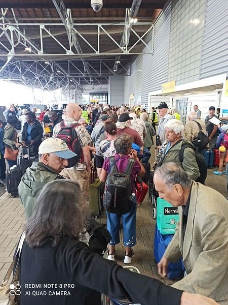
EMBARKATION It’s Friday, August 1st. After a good breakfast and a quick check-out, we realize our UBER app isn’t working in England ;(. We have to go back to reception to ask for a taxi because, even though the hotel is close to the port, the ship is still over 2 km away—hardly ideal with luggage! The problem is that many hotel guests also requested taxis... so we wait a good 30 minutes before ours arrives! We get to the REGAL PRINCESS pretty quickly but are shocked to see a huge line outside!!! We hadn’t seen that in over a decade! Not the best start! 🙁
TO BE CONTINUED!
A 13-day/12-night cruise for 1350 € per person in a guaranteed deluxe balcony cabin. PRINCESS assigned us a balcony cabin on deck 8 with a large balcony. We ended up happy with our cabin, even though we’d initially preferred a higher deck. I’ll admit I hesitated to choose this cruise because of the weather—I love sunshine and good weather—but the desire to discover new ports won out, especially with the promise of heading to Corsica afterward to soak up some sun again 😉
On PRINCESS, as Catherine mentioned, there’s no card—everyone has a medallion! I loved this system, which unlocks your cabin door as you approach. It’s really well thought out!
We took the EUROSTAR from Lille to London, then a train from London to Southampton the day before. We stayed in a nice IHG hotel near the port.
EMBARKATION It’s Friday, August 1st. After a good breakfast and a quick check-out, we realize our UBER app isn’t working in England ;(. We have to go back to reception to ask for a taxi because, even though the hotel is close to the port, the ship is still over 2 km away—hardly ideal with luggage! The problem is that many hotel guests also requested taxis... so we wait a good 30 minutes before ours arrives! We get to the REGAL PRINCESS pretty quickly but are shocked to see a huge line outside!!! We hadn’t seen that in over a decade! Not the best start! 🙁
TO BE CONTINUED!
6-Day Tokyo Visit Itinerary
Hi there! 😉
I’ve already created a post for our entire trip to Japan, but I’d love to focus specifically on our stay in Tokyo here. We (two couples of friends) will be spending 6 full days there in early November. Here’s what we’ve planned so far. We’d really appreciate your feedback to validate—or not—our schedule, and especially to hear your tips. Thanks in advance! 😉
DAY 0: Arrival in Tokyo in the evening, so rest and dinner near the hotel.
DAY 1:
09:00 – Shinjuku Gyoen Park
Must-see: ✔ Japanese garden (red bridge, pond) ✔ French garden (perspective and rose garden) ✔ English garden (lawns and maple trees) Photo spot: Red bridge + red maples (koyo).
11:00 – Harajuku & Takeshita Street
Walking route:
Start with Takeshita-dori (kawaii fashion, Japanese crepes). Walk up to Omotesandō (designer architecture: Dior, Prada).
Don’t miss: ✔ Kiddy Land (toys, souvenirs) ✔ Tokyu Plaza Omotesandō (entrance with escalators and mirrors → iconic photo)
12:30 – Lunch
Afuri Harajuku (yuzu ramen, light and fragrant). Alternative: Uogashi Nihon-Ichi (standing sushi, quick and fresh).
14:00 – Meiji-jingū (optional but recommended)
Access: From Omotesandō, enter through the large wooden torii. Must-see: ✔ Decorative sake barrels ✔ Forest path (zen atmosphere) ✔ Main pavilion (respect the purification ritual at the entrance). Duration: 45 min.
16:30 – Return to hotel / rest
JR Yamanote Line from Harajuku → Shinjuku (5 min).
18:30 – Evening in Yurakucho (Gado-shita)
DAY 2 09:00 – Visit to Asakusa
Walking route:
Kaminarimon Gate → photo under the large red lantern. Nakamise-dori → shopping street (souvenirs, snacks: melon pan, senbei). Sensō-ji Temple → main pavilion, five-story pagoda.
Don’t miss: ✔ Omikuji (fortune-telling draw) ✔ Photo with the pagoda and Tokyo Skytree in the background.
11:30 – Akihabara
Walking route: ✔ Yodobashi Camera (gadgets, electronics) ✔ Mandarake (figurines, manga) ✔ Super Potato (retro games)
13:00 – Lunch
Quick option: Ichiran Ramen (Akihabara). Local option: Tendon Tenya (affordable tempura).
14:30 – Free time / shopping
Explore the small alleys for anime shops, figurines, gashapon.
16:30 – Departure for Toyosu (teamLab Planets)
Transport:
JR Yamanote Line from Akihabara → Shimbashi (15 min) Yurikamome Line from Shimbashi → Shin-Toyosu (15 min)
Tip: Book a 6:30 PM slot to enjoy the evening atmosphere.
18:30 – teamLab Planets
Duration: 1.5 to 2 hours. Tip: Bring a towel (barefoot experience in water). Mandatory reservation: (official website).
20:30 – Dinner
Option on-site: DMM Café (Toyosu). Option back in Shinjuku: Izakaya (Torikizoku or Teyandei).
DAY 3:
Excursion to Mount Fuji (Kawaguchiko)
DAY 4:
09:00 – East Gardens of the Imperial Palace
Must-see: ✔ Ruins of Edo Castle ✔ Nijubashi Bridge (iconic photo) ✔ Museum of the Imperial Collections (free) Duration: 1h15. Tip: Open exceptionally this day (public holiday).
10:30 – Walk to Ginza
Walk: 15 min via Marunouchi Naka-dori (chic street with shops and cafés). Tip: Enjoy the autumn decorations and designer façades.
11:00 – Ginza
Must-see: ✔ Ginza Six (modern shopping center) ✔ Nissan Crossing (futuristic car exhibit) ✔ Wako Clock Tower (iconic photo)
14:30 – Shibuya
Walking route: ✔ Shibuya Crossing (photo from Starbucks Tsutaya) ✔ Hachikō Statue ✔ Shibuya Scramble Square → Shibuya Sky (panoramic view of Tokyo and Mount Fuji if the sky is clear). Shopping: Loft, Tokyu Hands, Shibuya 109 (fashion).
17:30 – Return to hotel / rest
JR Yamanote Line from Shibuya → Shinjuku (7 min).
19:30 – Dinner
Izakaya option: Izakaya Tofuro Shinjuku (traditional atmosphere). Modern option: Nabezo Shinjuku (all-you-can-eat shabu-shabu).
DAY 5:
10:00 – Ghibli Museum
Duration: 2 hours. Must-see: ✔ Permanent exhibits (Totoro, My Neighbor Totoro, Spirited Away) ✔ Exclusive short films (Saturn Theater) Tip: Photos are not allowed inside, but there are beautiful spots outside.
12:00 – Stroll in Inokashira Park
Must-see: ✔ Central pond (boat rental available) ✔ Benzaiten Shrine Duration: 30 min.
14:30 – Nakameguro & Daikanyama
Transport: JR Chuo Line from Mitaka → Shibuya, then Tokyu Toyoko Line → Nakameguro (40 min). Must-see: ✔ Walk along the Meguro River (trendy cafés, design shops) ✔ T-Site Daikanyama (magnificent architecture) Coffee break: Onibus Coffee Nakameguro (artisanal coffee).
17:30 – Return to Shinjuku
Transport: Tokyu Toyoko Line → Shibuya → JR Yamanote Line → Shinjuku.
DAY 6:
Free morning (shopping or relaxation)
Suggestions: ✔ Shopping at Lumine Shinjuku or Isetan ✔ Stop by Don Quijote for souvenirs ✔ Or Thermae-Yu Onsen (if you want a relaxing morning before departure).
14:45 – Arrival in Odaiba
Walking route: ✔ Aqua City (shopping, bay view) ✔ Statue of Liberty (photo with Rainbow Bridge) ✔ DiverCity Tokyo Plaza (giant Gundam statue) Immersive option: Immersive Fort Tokyo (if you want a fun indoor activity).
16:30 – Sunset over Rainbow Bridge
Best spot: Esplanade in front of Aqua City or Odaiba Beach. Photo tip: Wait for the bridge lights to turn on (around 5 PM).
18:30 – Dinner in Odaiba 20:00 – Departure for Tokyo Tower
Transport:
Yurikamome Line from Daiba → Shimbashi → Oedo Line → Akabanebashi (30 min).
Tokyo Tower: ✔ Incredible night view of illuminated Tokyo. ✔ Duration: 45 min to 1 hour.
21:30 – Return to Shinjuku
Transport: Oedo Line → Shinjuku (15 min).
And there you have it—I hope I didn’t go on too long! 😉 Thanks everyone for your advice....
I’ve already created a post for our entire trip to Japan, but I’d love to focus specifically on our stay in Tokyo here. We (two couples of friends) will be spending 6 full days there in early November. Here’s what we’ve planned so far. We’d really appreciate your feedback to validate—or not—our schedule, and especially to hear your tips. Thanks in advance! 😉
DAY 0: Arrival in Tokyo in the evening, so rest and dinner near the hotel.
DAY 1:
09:00 – Shinjuku Gyoen Park
Must-see: ✔ Japanese garden (red bridge, pond) ✔ French garden (perspective and rose garden) ✔ English garden (lawns and maple trees) Photo spot: Red bridge + red maples (koyo).
11:00 – Harajuku & Takeshita Street
Walking route:
Start with Takeshita-dori (kawaii fashion, Japanese crepes). Walk up to Omotesandō (designer architecture: Dior, Prada).
Don’t miss: ✔ Kiddy Land (toys, souvenirs) ✔ Tokyu Plaza Omotesandō (entrance with escalators and mirrors → iconic photo)
12:30 – Lunch
Afuri Harajuku (yuzu ramen, light and fragrant). Alternative: Uogashi Nihon-Ichi (standing sushi, quick and fresh).
14:00 – Meiji-jingū (optional but recommended)
Access: From Omotesandō, enter through the large wooden torii. Must-see: ✔ Decorative sake barrels ✔ Forest path (zen atmosphere) ✔ Main pavilion (respect the purification ritual at the entrance). Duration: 45 min.
16:30 – Return to hotel / rest
JR Yamanote Line from Harajuku → Shinjuku (5 min).
18:30 – Evening in Yurakucho (Gado-shita)
DAY 2 09:00 – Visit to Asakusa
Walking route:
Kaminarimon Gate → photo under the large red lantern. Nakamise-dori → shopping street (souvenirs, snacks: melon pan, senbei). Sensō-ji Temple → main pavilion, five-story pagoda.
Don’t miss: ✔ Omikuji (fortune-telling draw) ✔ Photo with the pagoda and Tokyo Skytree in the background.
11:30 – Akihabara
Walking route: ✔ Yodobashi Camera (gadgets, electronics) ✔ Mandarake (figurines, manga) ✔ Super Potato (retro games)
13:00 – Lunch
Quick option: Ichiran Ramen (Akihabara). Local option: Tendon Tenya (affordable tempura).
14:30 – Free time / shopping
Explore the small alleys for anime shops, figurines, gashapon.
16:30 – Departure for Toyosu (teamLab Planets)
Transport:
JR Yamanote Line from Akihabara → Shimbashi (15 min) Yurikamome Line from Shimbashi → Shin-Toyosu (15 min)
Tip: Book a 6:30 PM slot to enjoy the evening atmosphere.
18:30 – teamLab Planets
Duration: 1.5 to 2 hours. Tip: Bring a towel (barefoot experience in water). Mandatory reservation: (official website).
20:30 – Dinner
Option on-site: DMM Café (Toyosu). Option back in Shinjuku: Izakaya (Torikizoku or Teyandei).
DAY 3:
Excursion to Mount Fuji (Kawaguchiko)
DAY 4:
09:00 – East Gardens of the Imperial Palace
Must-see: ✔ Ruins of Edo Castle ✔ Nijubashi Bridge (iconic photo) ✔ Museum of the Imperial Collections (free) Duration: 1h15. Tip: Open exceptionally this day (public holiday).
10:30 – Walk to Ginza
Walk: 15 min via Marunouchi Naka-dori (chic street with shops and cafés). Tip: Enjoy the autumn decorations and designer façades.
11:00 – Ginza
Must-see: ✔ Ginza Six (modern shopping center) ✔ Nissan Crossing (futuristic car exhibit) ✔ Wako Clock Tower (iconic photo)
14:30 – Shibuya
Walking route: ✔ Shibuya Crossing (photo from Starbucks Tsutaya) ✔ Hachikō Statue ✔ Shibuya Scramble Square → Shibuya Sky (panoramic view of Tokyo and Mount Fuji if the sky is clear). Shopping: Loft, Tokyu Hands, Shibuya 109 (fashion).
17:30 – Return to hotel / rest
JR Yamanote Line from Shibuya → Shinjuku (7 min).
19:30 – Dinner
Izakaya option: Izakaya Tofuro Shinjuku (traditional atmosphere). Modern option: Nabezo Shinjuku (all-you-can-eat shabu-shabu).
DAY 5:
10:00 – Ghibli Museum
Duration: 2 hours. Must-see: ✔ Permanent exhibits (Totoro, My Neighbor Totoro, Spirited Away) ✔ Exclusive short films (Saturn Theater) Tip: Photos are not allowed inside, but there are beautiful spots outside.
12:00 – Stroll in Inokashira Park
Must-see: ✔ Central pond (boat rental available) ✔ Benzaiten Shrine Duration: 30 min.
14:30 – Nakameguro & Daikanyama
Transport: JR Chuo Line from Mitaka → Shibuya, then Tokyu Toyoko Line → Nakameguro (40 min). Must-see: ✔ Walk along the Meguro River (trendy cafés, design shops) ✔ T-Site Daikanyama (magnificent architecture) Coffee break: Onibus Coffee Nakameguro (artisanal coffee).
17:30 – Return to Shinjuku
Transport: Tokyu Toyoko Line → Shibuya → JR Yamanote Line → Shinjuku.
DAY 6:
Free morning (shopping or relaxation)
Suggestions: ✔ Shopping at Lumine Shinjuku or Isetan ✔ Stop by Don Quijote for souvenirs ✔ Or Thermae-Yu Onsen (if you want a relaxing morning before departure).
14:45 – Arrival in Odaiba
Walking route: ✔ Aqua City (shopping, bay view) ✔ Statue of Liberty (photo with Rainbow Bridge) ✔ DiverCity Tokyo Plaza (giant Gundam statue) Immersive option: Immersive Fort Tokyo (if you want a fun indoor activity).
16:30 – Sunset over Rainbow Bridge
Best spot: Esplanade in front of Aqua City or Odaiba Beach. Photo tip: Wait for the bridge lights to turn on (around 5 PM).
18:30 – Dinner in Odaiba 20:00 – Departure for Tokyo Tower
Transport:
Yurikamome Line from Daiba → Shimbashi → Oedo Line → Akabanebashi (30 min).
Tokyo Tower: ✔ Incredible night view of illuminated Tokyo. ✔ Duration: 45 min to 1 hour.
21:30 – Return to Shinjuku
Transport: Oedo Line → Shinjuku (15 min).
And there you have it—I hope I didn’t go on too long! 😉 Thanks everyone for your advice....
Renaissance from September 27 to October 4, 2025
Hi there, we’re taking this cruise from September 27 to October 4, 2025.
Could you share your experience on board—cabin, meals, etc.?
Are there any other members on this cruise between September 7 and October 4, 2025?
See you soon, Alexandre
Could you share your experience on board—cabin, meals, etc.?
Are there any other members on this cruise between September 7 and October 4, 2025?
See you soon, Alexandre
Accommodation on the River Kwai
Hi everyone,
I’m looking for addresses for guesthouses or, even better, houseboats or rafting houses on the River Kwai, between Kanchanaburi and Sangkhlaburi, to spend a few weeks contemplating this beautiful river.
Thanks for your suggestions!
Premaria
Vancouver to Toronto by train
Hi! I arrive in Vancouver on August 24, 2025, and I’m staying until Friday, August 29, 2025—the day I take *The Canadian* train to Toronto.
I’m exploring several things in Vancouver, including whale watching—if you’ve got any great tips, don’t hesitate! Thanks!
I’m exploring several things in Vancouver, including whale watching—if you’ve got any great tips, don’t hesitate! Thanks!
Venice Walking Itinerary
Hi everyone,
I’ve planned a little day trip with my kids (12 and 16 years old) to Venice. The goal is to go for a walk through the city’s streets rather than visiting museums, which would take way too much time. We’d like to pass by the main landmarks, so I’ve put together a small 15 km hike... (thanks to Komoot and visioRando). Could you take a quick look and let me know if I’ve missed anything or made any mistakes?
1. Start at Santa Lucia Train Station 2. Ponte Degli Scalzi 3. Ponte dei Pugni 4. squero de San Trovaso 5 Le rio della Salute 6. Accademia Bridge 7. St. Mark’s Square 8. St. Mark’s Basilica 9. Ponte de la Canonica 10. Ponte de la Pietà 11. Ponte de la Tana 12. The Arsenale 13. Bridge of Sighs 14. Doge’s Palace Then return to the Rialto Bridge via Marzaria dell’Orologio
Also, could you tell me if the Doge’s Palace courtyard is paid entry? Thanks for your help and feedback!
Stéphane.
I’ve planned a little day trip with my kids (12 and 16 years old) to Venice. The goal is to go for a walk through the city’s streets rather than visiting museums, which would take way too much time. We’d like to pass by the main landmarks, so I’ve put together a small 15 km hike... (thanks to Komoot and visioRando). Could you take a quick look and let me know if I’ve missed anything or made any mistakes?
1. Start at Santa Lucia Train Station 2. Ponte Degli Scalzi 3. Ponte dei Pugni 4. squero de San Trovaso 5 Le rio della Salute 6. Accademia Bridge 7. St. Mark’s Square 8. St. Mark’s Basilica 9. Ponte de la Canonica 10. Ponte de la Pietà 11. Ponte de la Tana 12. The Arsenale 13. Bridge of Sighs 14. Doge’s Palace Then return to the Rialto Bridge via Marzaria dell’Orologio
Also, could you tell me if the Doge’s Palace courtyard is paid entry? Thanks for your help and feedback!
Stéphane.
Questions about the Hautes-Alpes to Sweden route in a camper van
Hi everyone,
I’m planning a camper van trip from the Hautes-Alpes to Sweden in mid-July for three to four weeks.
My first question is about the route—specifically, which ferry to take? Bridges? Do I need to book in advance? Is it better to go via Denmark or take a ferry from Germany? And which cities should I leave from and arrive in?
Are there any toll passes or electronic toll systems I should get for road crossings?
My plan is to visit only southern Sweden…
Thanks in advance for your tips and experiences!
Best regards,
I’m planning a camper van trip from the Hautes-Alpes to Sweden in mid-July for three to four weeks.
My first question is about the route—specifically, which ferry to take? Bridges? Do I need to book in advance? Is it better to go via Denmark or take a ferry from Germany? And which cities should I leave from and arrive in?
Are there any toll passes or electronic toll systems I should get for road crossings?
My plan is to visit only southern Sweden…
Thanks in advance for your tips and experiences!
Best regards,
Going directly from Mahajanga to Morombe
Hi everyone,
Everything’s in the title: what are the options for getting from M. to M.?
By *boutre* (traditional sailboat), I know, if you’re not in a hurry.
Is there a coastal track between Mahajanga and the Tsingy? Meaning, can you reach Bekopaka by track without going back through Tana?
Thanks.
One-Day Visit on the Renaissance in May 2025 – CFC Cruise
Hi everyone,
We were offered a visit to the Renaissance by the new CFC cruise line through Croisiland. After reading all the reviews—some very harsh, others glowing—I wanted to form my own opinion without having to book a full cruise to test it out. This visit to the ship at the port of Le Havre for 49 € per person came at the perfect time, even if I’m a bit put off by having to pay for a ship tour. That’s not how it usually works with other cruise lines, as far as I know.
The Renaissance is a former Holland America Line ship, built in 1993 and renovated in 2023. We’re familiar with this style of ship since we took a long cruise in Polynesia in 2014 on one of its sister ships, the MS Statendam. We remember it as a charming small ship with a lovely pool terrace at the very back.
Off we went this morning for a relaxing day on a ship—always a nice change!
The Pont de Normandie is the last elegant structure you see before entering the vast and rather smelly port area of Le Havre.
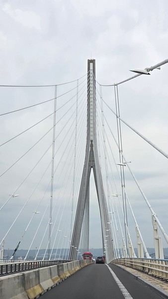
The area around the port where the Renaissance is docked is total chaos—cars everywhere and only a handful of taxis. We were supposed to have a reserved parking spot in front of the terminal (we’d even given them our car model and license plate), but we were denied entry. There’s no paved public parking, so we left the car on a vacant lot.
CFC was officially acquired by the British cruise line Ambassador Cruise Line in January 2025. Ambassador Cruise Line, launched in 2010, already owns two ships of the same type and age. They wasted no time repainting the funnel in their new colors.
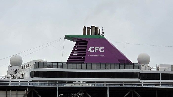
The line of passengers disembarking and waiting for taxis is endless... and taxis are trickling in. Is this the aftermath of yesterday’s strike, or is this the norm in this port? Either way, I feel bad for the poor travelers waiting—it’s going to be a long haul. Many are leaving on foot, dragging their suitcases. Compared to the port of Marseille, this is pretty dismal.
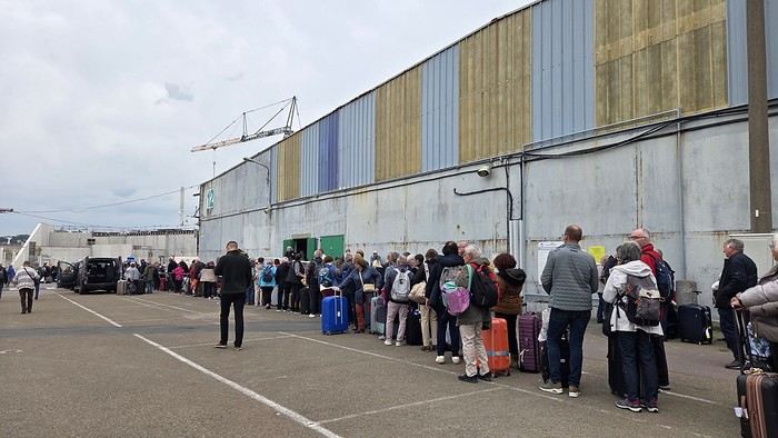
Forty spots were available for this visit organized by Croisiland, but we ran into a good hundred people at the meet-up. A group from the AVF (Accueil des Villes Françaises) of Le Havre will be joining us. Our Croisiland group consists of twelve people, if I counted right.
Security clearance is done alphabetically, and we quickly board the ship. Now we’re getting to the heart of the matter.
To be continued...
We were offered a visit to the Renaissance by the new CFC cruise line through Croisiland. After reading all the reviews—some very harsh, others glowing—I wanted to form my own opinion without having to book a full cruise to test it out. This visit to the ship at the port of Le Havre for 49 € per person came at the perfect time, even if I’m a bit put off by having to pay for a ship tour. That’s not how it usually works with other cruise lines, as far as I know.
The Renaissance is a former Holland America Line ship, built in 1993 and renovated in 2023. We’re familiar with this style of ship since we took a long cruise in Polynesia in 2014 on one of its sister ships, the MS Statendam. We remember it as a charming small ship with a lovely pool terrace at the very back.
Off we went this morning for a relaxing day on a ship—always a nice change!
The Pont de Normandie is the last elegant structure you see before entering the vast and rather smelly port area of Le Havre.
The area around the port where the Renaissance is docked is total chaos—cars everywhere and only a handful of taxis. We were supposed to have a reserved parking spot in front of the terminal (we’d even given them our car model and license plate), but we were denied entry. There’s no paved public parking, so we left the car on a vacant lot.
CFC was officially acquired by the British cruise line Ambassador Cruise Line in January 2025. Ambassador Cruise Line, launched in 2010, already owns two ships of the same type and age. They wasted no time repainting the funnel in their new colors.
The line of passengers disembarking and waiting for taxis is endless... and taxis are trickling in. Is this the aftermath of yesterday’s strike, or is this the norm in this port? Either way, I feel bad for the poor travelers waiting—it’s going to be a long haul. Many are leaving on foot, dragging their suitcases. Compared to the port of Marseille, this is pretty dismal.
Forty spots were available for this visit organized by Croisiland, but we ran into a good hundred people at the meet-up. A group from the AVF (Accueil des Villes Françaises) of Le Havre will be joining us. Our Croisiland group consists of twelve people, if I counted right.
Security clearance is done alphabetically, and we quickly board the ship. Now we’re getting to the heart of the matter.
To be continued...
Newfoundland - Hikes in the Western Part of the Island
INTRODUCTION
Trip taken in 2021, but still relevant for exploring the island of Newfoundland.
We went on multiple hikes in this Canadian province, which offers a unique and breathtaking landscape.
GPS coordinates: 46.20884, -60.24498 Marine Atlantic Ferry
To do this, we traveled to North Sydney, Nova Scotia, to board a Marine Atlantic ferry that took us to Port aux Basques in Newfoundland. The crossing takes about 7 hours.
The ferry *Highlanders* features spacious cabins for two or four people, a restaurant, a retail store, and a play area for kids.
The reclining seats are comfortable and include a headphone jack and a USB charging port.
We went out on the open-air panoramic observation deck several times to admire the Atlantic Ocean, hoping to spot some marine wildlife. Unfortunately, we didn’t see any.
This short video gives you an overview of the facilities. For more details, I invite you to check out Marine Atlantic’s website at the following address: https://www.marineatlantique.ca/.
https://youtu.be/oV9_7AcJnEQ
Trip taken in 2021, but still relevant for exploring the island of Newfoundland.
We went on multiple hikes in this Canadian province, which offers a unique and breathtaking landscape.
GPS coordinates: 46.20884, -60.24498 Marine Atlantic Ferry
To do this, we traveled to North Sydney, Nova Scotia, to board a Marine Atlantic ferry that took us to Port aux Basques in Newfoundland. The crossing takes about 7 hours.
The ferry *Highlanders* features spacious cabins for two or four people, a restaurant, a retail store, and a play area for kids.
The reclining seats are comfortable and include a headphone jack and a USB charging port.
We went out on the open-air panoramic observation deck several times to admire the Atlantic Ocean, hoping to spot some marine wildlife. Unfortunately, we didn’t see any.
This short video gives you an overview of the facilities. For more details, I invite you to check out Marine Atlantic’s website at the following address: https://www.marineatlantique.ca/.
https://youtu.be/oV9_7AcJnEQ
Dual pricing in Hoi An and big changes in 8 years
Hi there,
I’m currently in Hoi An—I hadn’t set foot here for 8 years. The city has already changed a lot, with lots of construction, and even in the old town, along one side of the riverbank, there are huge residential buildings going up that take away some of the charm of this place. But the worst part is the overtourism—it’s impossible to walk across the famous bridge in the middle of the canal in the evening because it’s so packed with people. There’s also a new trend: massage parlors have opened in the old town and around the city. I was shocked—people call out to you or even grab your arm on the sidewalk, and it’s everywhere. Bangkok and Phuket might start shaking—Hanoi’s the same way.
Anyway, let’s talk about the dual pricing specifically for non-Vietnamese tourists. We went to a restaurant near our hotel last night, and they gave us an English menu—okay, fine! But I noticed the table next to us, where Vietnamese tourists had a different menu. Weird! I asked to see the same menu as my neighbors, but the waitress refused, saying it was in Vietnamese and we wouldn’t understand. I insisted, and she finally agreed. Surprise!!! The prices on the two menus were different, with the English one up to 50% more expensive. I asked why, and she got flustered, telling me to just order from the Vietnamese menu, which I translated with my phone to see the local prices. I mentioned this to the hotel this morning, and the receptionist told me to go to restaurants where prices are displayed at the entrance to avoid getting ripped off. I just bought fresh bread this morning, and it was the same thing—the little loaf costs 4000 dong for Vietnamese people and 5000 dong for non-Vietnamese. It’s not a huge difference, but this way of doing things isn’t right. At supermarkets like VinMart+, prices are displayed, so there’s no surprise or dual pricing there.
I’m currently in Hoi An—I hadn’t set foot here for 8 years. The city has already changed a lot, with lots of construction, and even in the old town, along one side of the riverbank, there are huge residential buildings going up that take away some of the charm of this place. But the worst part is the overtourism—it’s impossible to walk across the famous bridge in the middle of the canal in the evening because it’s so packed with people. There’s also a new trend: massage parlors have opened in the old town and around the city. I was shocked—people call out to you or even grab your arm on the sidewalk, and it’s everywhere. Bangkok and Phuket might start shaking—Hanoi’s the same way.
Anyway, let’s talk about the dual pricing specifically for non-Vietnamese tourists. We went to a restaurant near our hotel last night, and they gave us an English menu—okay, fine! But I noticed the table next to us, where Vietnamese tourists had a different menu. Weird! I asked to see the same menu as my neighbors, but the waitress refused, saying it was in Vietnamese and we wouldn’t understand. I insisted, and she finally agreed. Surprise!!! The prices on the two menus were different, with the English one up to 50% more expensive. I asked why, and she got flustered, telling me to just order from the Vietnamese menu, which I translated with my phone to see the local prices. I mentioned this to the hotel this morning, and the receptionist told me to go to restaurants where prices are displayed at the entrance to avoid getting ripped off. I just bought fresh bread this morning, and it was the same thing—the little loaf costs 4000 dong for Vietnamese people and 5000 dong for non-Vietnamese. It’s not a huge difference, but this way of doing things isn’t right. At supermarkets like VinMart+, prices are displayed, so there’s no surprise or dual pricing there.
What transport options are there from Kuala Lumpur to Taman Negara? (Malaysia)
Hi there,
What are the transport options for getting from KL to Taman Negara National Park, please?
Where can I book the transport?
Thanks for your help! 😊
What are the transport options for getting from KL to Taman Negara National Park, please?
Where can I book the transport?
Thanks for your help! 😊