Road Trip USA 2023 - Part 2
FR

Translated into English.

Original post
PI
HIGHWAY 1

Highway 1 runs along the Pacific coast of California from Leggett in the north to Dana Point in the south. It's the longest state route in California, stretching 1,050 km.

It's famous for its breathtaking ocean views. That’s actually why it’s become such a popular route for road trips, with tons of attractions and points of interest all along the way.

After crossing the U.S. interior on our way out (see Road Trip USA 2023 - Part 1), we’re starting our return trip along this route from Leggett.

Videos are embedded throughout the summary. Please click on the image to start the video. To jump to a specific post, here are the appropriate links:

CALIFORNIA:

Scenic Overlooks on Route 1 Between Leggett and Fort Bragg The Pudding Creek Trestle Bridge in Fort Bragg Glass Beach - Fort Bragg Jenner Lookout Point - Highway 1 Goat Rock Beach - Sonoma Coast State Park - Jenner Point Reyes National Seashore - White House Pool Trail Point Reyes National Seashore - Limantour Beach Point Reyes National Seashore - Point Reyes Shipwreck Point Reyes National Seashore - Kehoe Beach Trail Point Reyes National Seashore - McClures Beach Trail Point Reyes National Seashore - Cypress Tree Tunnel Point Reyes National Seashore - Point Reyes Beach North Point Reyes National Seashore - Elephant Seals on Drakes Beach Point Reyes National Seashore - Point Reyes Beach South Point Reyes National Seashore – Elephant Seals Overlooks Point Reyes National Seashore - Chimney Rock Trail Point Reyes National Seashore - Point Reyes Lighthouse Trail Point Reyes National Seashore – Tule Elk Observation Point Bonita Lighthouse Trail - Sausalito Hawk Hill - Sausalito Battery Spencer Trail - Sausalito Rodeo Beach - Sausalito Point Cavallo - Golden Gate View - Sausalito Exploring Downtown Sausalito Visiting Sausalito’s Houseboats Crossing the Golden Gate Bridge - San Francisco Golden Gate Bridge Viewpoints - San Francisco Cruise to Alcatraz Island - San Francisco Visiting Alcatraz Island - San Francisco Civic Center - Downtown San Francisco Market Street & Yerba Buena Gardens - Downtown San Francisco Union Square & Financial District - Downtown San Francisco Fisherman's Wharf, Pier 39 & Embarcadero - San Francisco Sea Lion Observation - Pier 39 - San Francisco Lombard Street & Cable Car - Russian Hill - San Francisco Macondray Lane Historic District - Russian Hill - San Francisco Grace Cathedral & Huntington Park - Nob Hill - San Francisco Telegraph Hill - San Francisco Chinatown - San Francisco Alamo Square & Painted Ladies - Western Addition - San Francisco Palace of Fine Arts - Marina District - San Francisco Presidio of San Francisco California Coastal Trail - Lincoln Park - San Francisco California Palace of the Legion of Honor - Lincoln Park - San Francisco Sutro Baths - Lincoln Park - San Francisco Queen Wilhelmina Garden - Golden Gate Park - San Francisco Bison Paddock - Golden Gate Park - San Francisco Portals of the Past - Golden Gate Park - San Francisco Strawberry Hill - Golden Gate Park – San Francisco Prayerbook Cross & Robin Williams Meadow - Golden Gate Park - San Francisco Hidden Garden Steps & 16th Avenue Tiled Steps - San Francisco Grandview Park - San Francisco Hike - Twin Peaks Three Summits - San Francisco Longboarding Down Twin Peaks Blvd in San Francisco Haight-Ashbury - San Francisco Corona Heights Park - San Francisco Mission Dolores - San Francisco Mural Frescoes (Part 1) - Mission District - San Francisco Mural Frescoes (Part 2) - Mission District - San Francisco Devil's Slide Bunker - Pacifica Mavericks Beach - Half Moon Bay Martins Beach - Half Moon Bay Pigeon Point Lighthouse State Historic Park - Pescadero What to See in Santa Cruz Visiting Capitola What to See in Monterey Carmel-by-the-Sea Lovers Point Park - Pacific Grove Castle Rock, Hurricane Point & Little Sur River Viewpoints Pfeiffer Falls Trail Julia Pfeiffer Burns State Park Vista Point & McWay Falls Highway 1 - Big Sur Viewpoints Salmon Creek Falls San Carpoforo Creek Trail Elephant Seal Vista Point - San Simeon San Simeon Pier Moonstone Beach Boardwalk Shipwreck - Estero Bluffs State Park Surfing Competition in Morro Bay Port San Luis Pier - San Luis Obispo Pismo Beach Monarch Butterfly Grove - Pismo State Beach Nojoqui Falls Park - Solvang Arroyo Hondo Vista Point Solvang, a Charming Danish Town in California Chumash Painted Cave - Santa Barbara Goleta San Marcos Rd & Cachuma Lake Vista Points - Santa Barbara Old Santa Barbara Mission Walking Tour of Santa Barbara’s Historic Downtown West Beach - Santa Barbara What to See in Ventura Paradise Falls - Wildwood Regional Park - Thousand Oaks Sandy Dune & El Matador State Beach - Malibu Point Dume Nature Reserve - Malibu Malibu Pier Road Trip in the Malibu Mountains Los Liones Trail - Santa Monica Santa Monica Pier Rodeo Drive - Beverly Hills Greystone Mansion - Beverly Hills Hollywood Walk of Fame - Los Angeles Griffith Observatory - Los Angeles Hollywood Forever Cemetery - Los Angeles What to See in Venice Beach Venice Beach Skatepark ShoreLine Aquatic Park - Long Beach Alamitos Beach - Long Beach Naples Island - Long Beach Crescent Bay Point Park & Helser Park Kiosk - Laguna Beach Shell Beach at Twin Points - Laguna Beach Prairie Dogs at Agra Vista Point Top Gun House & Oceanside Pier Annie's Canyon Trail - Solana Beach (Via North Rios Trailhead Loop) Old Town San Diego La Jolla Coastal Trail - San Diego Balboa Park - San Diego Pacific Beach - San Diego Mission Beach - San Diego Ocean Beach Tide Pools - San Diego Sunset Cliffs Natural Park - San Diego Tuna Harbor Park - San Diego Seaport Village & Embarcadero Marina Park - San Diego Gaslamp Quarter - Downtown San Diego Coronado Island - San Diego Dead Dolly Lane - Alpine Galleta Meadows Metal Sculptures - Borrego Springs What to See in Palm Springs Robolights - Palm Springs Andreas Canyon Trail - Indian Canyons - Palm Springs Palm Canyon Trail - Indian Canyons - Palm Springs West Fork Falls Trail - Indian Canyons - Palm Springs Tahquitz Canyon Loop Trail - Indian Canyons - Palm Springs Desert Christ Park - Yucca Valley Pioneertown Salvation Mountain - Niland Slab City - Niland
PI Pinacoladada Globetrotter ·
SCENIC OVERLOOKS ON HIGHWAY 1 BETWEEN LEGGETT AND FORT BRAGG

39.70232, -123.80396 Devonte Lookout 39.68567, -123.79242 Westport Beach Vista Point 39.64309, -123.78455 Black Sand Beach Overlook 39.57107, -123.77219 Roadside Overlook

Several overlooks are set up along this road. The ones at Devonte, Westport Beach, Black Sand Beach, and Roadside offer stunning panoramic views of the coastline and its many rock formations, as well as two black sand beaches.

https://youtu.be/Fl1ez1EoqV8
PI Pinacoladada Globetrotter ·
THE PUDDING CREEK TRESTLE BRIDGE IN FORT BRAGG

39.45844, -123.80768 Trailhead 39.46144, -123.80983 End of trail 39.45860, -123.80914 Another viewpoint near the parking lot

The Pudding Creek Trestle Bridge is located on Highway 1 in Fort Bragg, California. Built in 1915, it was first used to transport timber to the Fort Bragg mill until 1949.

When this railway line was closed, the railroad bridge was reinforced and converted into a haul road to allow logging trucks—banned from public roads—to pass through.

Left unmaintained, it had weakened over the years. However, it was restored by California State Parks and is now part of the Ten Mile Trail, which runs through MacKerricher State Park and connects Glass Beach to Ten Mile Beach.

It has become a popular attraction for pedestrians and cyclists, offering scenic views of the area.

We took a short loop hike starting at this bridge, leading to the top of the cliff on the right side of the beach.

We spotted different bird species and enjoyed lovely viewpoints of the bridge and Pudding Creek Beach below.

We backtracked and noticed a small trail leading down to the beach.

So, we took that path to explore the beach and crossed the bridge again to return to our starting point.

Across from the parking lot, there’s a trail along the cliff edge that also offers stunning views of the bridge, the beach, and the steep cliffs lining the coastline.

Since the beach is flat, ocean waves roll in, creating a small stream that flows along the cliff.

https://youtu.be/77dCy46oOao
PI Pinacoladada Globetrotter ·
GLASS BEACH - FORT BRAGG

39.45189, -123.81059 Parking 39.45363, -123.81283 Glass Beach

Glass Beach is located at the northern end of MacKerricher State Park, just west of downtown Fort Bragg in California.

As the name suggests, the sand on this beach is made up of smooth, multicolored sea glass pebbles.

These come from household and industrial waste that was once dumped along the coastline by local residents.

Over the years and through the action of the waves, the sharp edges of these debris have worn down, forming the sea glass pebbles you can see today on this beach.

In addition to observing these iconic pebbles, the site is perfect for exploring tide pools where you can spot sea stars, hermit crabs, anemones, and more, or take a walk along the coastline to admire the sunset at the end of the day.

https://youtu.be/EdaVrJ3hPiY
PI Pinacoladada Globetrotter ·
JENNER LOOKOUT POINT - HIGHWAY 1

Location: 38.45264, -123.12835

Jenner Lookout Point is a scenic overlook on Highway 1 in Jenner, California. This spot is a great place to watch seals in their natural habitat.

You can see them lounging on a sandy strip that juts out into the ocean.

That said, you’ll get an even better view if you have binoculars or a camera with a strong zoom.

https://youtu.be/XYkLW7Mko74
PI Pinacoladada Globetrotter ·
GOAT ROCK BEACH - SONOMA COAST STATE PARK - JENNER

38.44078, -123.12648 Goat Rock Point Parking 38.44628, -123.12609 Goat Rock Beach Parking

Goat Rock Beach is located in Sonoma Coast State Park near the town of Jenner in California.

It’s a great spot to observe harbor seals while keeping a distance of at least 50 meters to ensure their safety.

You’ll understand that dogs are not allowed on this beach.

Swimming in the ocean near Goat Rock isn’t possible because the waves are too dangerous.

However, since this beach is a sandbar that extends into the ocean, you can swim in the river that runs along the other side of the beach.

You can even rent kayaks in Jenner and paddle up the river to reach this beach.

https://youtu.be/0YBXo_UhO4Y
PI Pinacoladada Globetrotter ·
POINT REYES NATIONAL SEASHORE - WHITE HOUSE POOL TRAIL

38.06223, -122.81682 Parking and trailhead

White House Pool Park is located in the Point Reyes National Seashore nature reserve in California. The scenery is really picturesque.

A 1.3-kilometer (0.8-mile) round-trip riverside trail runs along Lagunitas Creek and lets you spot a variety of wildlife, including river otters and different waterfowl.

During our visit, we didn’t see any otters or birds. However, we did spot some deer.

https://youtu.be/3kOWpSSMC2M
PI Pinacoladada Globetrotter ·
POINT REYES NATIONAL SEASHORE - LIMANTOUR BEACH

38.02980, -122.88280 Parking 38.02564, -122.88324 Beach

Limantour Beach is located in the Point Reyes National Seashore nature reserve in California. It’s one of the four beaches along the Point Reyes National Seashore coastline that are accessible by car.

A 385-meter trail from the parking lot leads to this nearly six-kilometer-long beach.

Pets are allowed on this beach but must be kept on a leash.

It’s perfect for walking and spotting shorebirds and marine mammals like harbor seals and gray whales.

https://youtu.be/VebT8Vo50yU
PI Pinacoladada Globetrotter ·
POINT REYES NATIONAL SEASHORE - POINT REYES SHIPWRECK

38.09686, -122.85110 Parking - Inverness Store 38.09849, -122.85067 Shipwreck

The wreck of the S.S. Point Reyes, located in Inverness, California, is a popular tourist destination.

This former World War II patrol boat sank during a storm. The wreck hasn’t been restored and remains stranded at the edge of the bay.

Over fifty ships have crashed on the rocks in this area during thick fogs.

The site is very photogenic.

https://youtu.be/nEwM0rjxDq0
PI Pinacoladada Globetrotter ·
POINT REYES NATIONAL SEASHORE - KEHOE BEACH TRAIL

38.15270, -122.93890 Parking and trailhead 38.15554, -122.94882 Beach (0.56 miles one way)

Kehoe Beach is located in the Point Reyes National Seashore nature reserve in California.

The trail leading to this beach is 1.1 miles round-trip and is mostly packed dirt. However, there are a few sandy sections just before reaching the beach.

Tall cliffs line the right side of this beautiful, long beach. The rocks there are actually millions of years old!

This beach isn’t ideal for swimming due to the often strong waves.

It’s a great spot for birdwatching. We even spotted an American kestrel perched near the trail.

https://youtu.be/Hw9if8Md8-0
PI Pinacoladada Globetrotter ·
POINT REYES NATIONAL SEASHORE - MCCLURES BEACH TRAIL

38.18845, -122.95820 Parking and trailhead 38.18777, -122.96375 Beach

McClures Beach is located in the Point Reyes National Seashore nature reserve in California.

A narrow dirt trail with a moderate incline, 1.7 kilometers round-trip, starts at the parking lot and descends a ravine down to the beach.

The section of the trail just above the beach may have a steep slope or be washed out due to high tides eroding the path.

It sits at the base of red sand dune cliffs that date back 120 million years.

This beach isn’t safe for swimming because the waves are often strong. Also, it’s best to avoid getting too close to the water’s edge since the undertow can be powerful.

https://youtu.be/btlXxEGl0ak
PI Pinacoladada Globetrotter ·
POINT REYES NATIONAL SEASHORE - CYPRESS TREE TUNNEL

Location: 38.09381, -122.94549

This majestic tree tunnel is located in the Point Reyes National Seashore nature reserve in California.

Stretching 120 meters long, it consists of a double row of Monterey cypress trees that form a natural archway.

It leads to an Art Deco-style building that houses a radio station, which is actually the last maritime Morse code station still operating on the Pacific coast of North America.

The tunnel was created in 1930 when the Radio Corporation of America (RCA) planted these trees to mark the entrance to their station.

Parking is available on the shoulder of Sir Francis Drake Boulevard.

https://youtu.be/O81DD5iEzmg
PI Pinacoladada Globetrotter ·
POINT REYES NATIONAL SEASHORE - POINT REYES BEACH NORTH

Location: 38.07747, -122.97532

North Beach is a section of a wild, roughly 11-mile-long beach located in the Point Reyes National Seashore nature reserve in California.

It's a great spot to watch the sunset and the powerful waves of the Pacific Ocean.

From the parking lot, it's just a few minutes' walk to the beach.

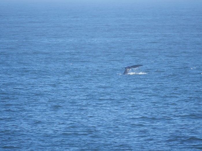
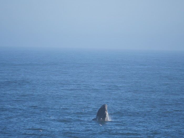
Gray whales can be spotted from the shore in December and January (winter migrations) and in March and April (spring migrations).

https://youtu.be/HN6dQWEGN9I
PI Pinacoladada Globetrotter ·
POINT REYES NATIONAL SEASHORE - ELEPHANT SEALS ON DRAKES BEACH

38.02804, -122.96163 Kenneth C. Patrick Visitor Center

Point Reyes National Seashore in California has several beaches where northern elephant seals gather in colonies.

The Kenneth C. Patrick Visitor Center, located near Drakes Beach, is one of the best spots in the area to observe elephant seals lounging on the beach. There’s plenty of parking available.

To protect them, the beach is seasonally closed to the public during the birthing and molting periods. However, you can still get really close to them.

Elephant seals are part of the seal family. Males develop a short trunk-like nose, which is how they got their name.

This trunk acts as a resonance chamber for their roars during the breeding season to scare off rivals who might try to mate with the same females.

A male can reach a size of 4 to 6 meters and weigh up to 2 tons, while a female can grow to 2.7 to 3 meters and weigh up to 800 kilograms.

It’s important to keep at least 7.5 meters (about 25 feet) between you and these elephant seals. Despite their appearance, they can move surprisingly fast.

https://youtu.be/Ua3Wa_KH_sg
PI Pinacoladada Globetrotter ·
POINT REYES NATIONAL SEASHORE - POINT REYES BEACH SOUTH

Location: 38.04780, -122.98883

South Beach is a section of a wild, roughly 11-mile-long beach located in the Point Reyes National Seashore nature reserve in California.

A sandy trail near the restrooms leads to this beach.

If you love watching powerful waves, this is the perfect spot. However, it's recommended to stay away from the water's edge due to the possible presence of rogue waves and rip currents.

https://youtu.be/16-JS1BbFU0
PI Pinacoladada Globetrotter ·
POINT REYES NATIONAL SEASHORE – ELEPHANT SEAL OVERLOOKS

37.99534, -122.97965 Parking 37.99703, -122.98230 Overlook 1 37.99424, -122.97417 Overlook 2

From the Chimney Rock Trail parking lot, just follow the road for about 50 meters, and you’ll see the start of the trail on your left.

Follow this 350-meter dirt trail, and you’ll arrive at an observation platform (Overlook 1) overlooking Drakes Bay.

This overlook is an excellent spot to observe a large number of elephant seals in their natural habitat. However, binoculars are necessary if you want to see them up close.

There’s also another spot (Overlook 2) nearby that offers a closer view of the elephant seals. From the parking lot or the start of the trail leading to the platform, follow the road for about 500 meters to the Point Reyes Lifeboat Station.

In this area, you’ll have a better view of the elephant seals lounging on the beach since you can see them from very close up.

The males are huge, and the females are about half the size of the males. We also spotted several pups—they’re absolutely adorable!

https://youtu.be/FekgFa2zP5E
PI Pinacoladada Globetrotter ·
POINT REYES NATIONAL SEASHORE - CHIMNEY ROCK TRAIL

37.99480, -122.97940 Trailhead 37.99299, -122.97349 Viewpoint over a beach 37.99248, -122.97210 Stunning viewpoint 37.99072, -122.97205 Turn left to continue and form a 3.2 km round-trip loop 37.99026, -122.96553 Facing Chimney Rock in the ocean Return to the parking lot

The Chimney Rock Trail is located in the Point Reyes National Seashore nature reserve in California.

At 3 kilometers round-trip, this trail offers spectacular views of Drakes Bay and the Pacific Ocean.

It starts near the parking lot on Chimney Rock Road and leads to a viewpoint at the southeastern tip of the Point Reyes headlands.

The trail gently climbs the hillside and passes by the building housing the Point Reyes Lifeboat Station below.

The trail continues to ascend gradually until you reach a lookout where you can observe elephant seals lounging on a beach below.

The trail then climbs a small hill before reaching the summit. From there, the remaining trail (about 800 meters) stays flat until the Chimney Rock viewpoint, where we were able to admire a cute little arch in the ocean.

At this spot, there’s a bench where you can rest while enjoying the view.

Simply retrace your steps to return to the parking lot.

https://youtu.be/ZG3n2CdGcm8
PI Pinacoladada Globetrotter ·
POINT REYES NATIONAL SEASHORE - POINT REYES LIGHTHOUSE TRAIL

37.99765, -123.01193 Parking 37.99710, -123.01175 Overlook Trail - Whale Watch Point 84 m round trip 37.99900, -123.01365 Sunset Beach Overlook 200 m round trip 37.99696, -123.01836 Learning Tree 37.99644, -123.02092 Point Reyes Whales Observation Point 37.99565, -123.02301 Lighthouse

The Point Reyes Lighthouse Trail, located in the Point Reyes National Seashore nature reserve in California, is a 1.2-mile round-trip trail that leads to the Point Reyes Lighthouse.

The trail starts on a paved road, and the coastal views are stunning. The beginning of the hike is slightly uphill but flattens out afterward.

Along the way, there’s a very photogenic tree.

At the top of the stairs leading to the lighthouse, you’ll find bones from the skull of a female gray whale.

The lighthouse is perched on a cliffside, and to reach it, you’ll need to descend 310 steps—then climb them back up on your return.

Luckily, there’s a viewpoint halfway down with a bench where you can catch your breath if needed.

The lighthouse is really pretty, and you can visit inside.

The lens room houses the original clocks and a first-order Fresnel lens, made in 1867 and installed in 1870.

The lower chamber of this historic lighthouse features exhibit panels on the lighthouse’s history and its keepers.

The equipment building next to the lighthouse displays the two foghorns from the 1947 super typhoon, air compressors, and a backup electricity generator that were used at Point Reyes.

Check the opening hours before you go: https://www.nps.gov/pore/planyourvisit/lighthouse.htm

https://youtu.be/8tgQ3uLejjs
PI Pinacoladada Globetrotter ·
POINT REYES NATIONAL SEASHORE – TULE ELK OBSERVATION

We were thrilled to spot several herds of Tule elk in the Point Reyes National Seashore nature reserve in California.

They had practically disappeared by 1860. Fortunately, they were protected by the state. In 1978, two males and eight females were brought to the reserve and confined in a temporary enclosure so they could adapt to their new environment. They were later released into the reserve.

The 2000 census counted a population of over 400 elk. The population fluctuates over the years but remains one of the largest in California.

You can spot them in several areas of the reserve, such as along Drakes Beach Road and in the Phillip Burton Wilderness, west of Limantour Road.

However, Tomales Point is where you’re most likely to see them. They’re often spotted near the road.

https://youtu.be/A9DOzFqBob4
PI Pinacoladada Globetrotter ·
POINT BONITA LIGHTHOUSE TRAIL - SAUSALITO

37.82136, -122.52964 Parking and trailhead (1 mile round trip) 37.81567, -122.52938 Lighthouse

The Point Bonita Lighthouse, built in 1855, is located at the southwestern tip of the Marin Headlands in the Golden Gate National Recreation Area in Sausalito, California. Even today, it remains an active aid to navigation in the Golden Gate Strait.

A 1-mile round-trip trail leads to the lighthouse, offering stunning views of the Pacific Ocean, rugged cliffs, and the Golden Gate Bridge.

You can also spot harbor seals resting on a rock below the viewpoint.

The lighthouse is accessible via a tunnel carved into the cliff. Entry is free, but be sure to check the opening hours before you go.

https://youtu.be/DC7b2731PtY

Similar discussions

You might also like