Results for "Lagoa+|+9+>+225"
6375 results found.
Parc naturel de Xel-Ha English translation pending
Bonjour!
J'aimerai avoir des infos de cette endroit. Est-il recommendé d'apporter son masque et tuba, est ce qui li a un vestière pour garder son linge sec, appareil photo, caméra en sécurité. demi journée ou bien journée complète.
Merci ! Caps🏴☠️
J'aimerai avoir des infos de cette endroit. Est-il recommendé d'apporter son masque et tuba, est ce qui li a un vestière pour garder son linge sec, appareil photo, caméra en sécurité. demi journée ou bien journée complète.
Merci ! Caps🏴☠️
17-day itinerary in Southern Chile
Hi everyone,
We're planning a trip to southern Chile in November. Here's our tentative itinerary:
Day 1: Arrival in Santiago, then a flight the next day to Balmaceda where we'll pick up a rental car to reach Coyhaique.
Day 3: Walk in the Coyhaique National Reserve, then continue to Puerto Chacabuco. Return to Coyhaique for the second night.
Day 4: Drive to Villa Cerro Castillo for a hike in the national park. Continue to Puerto Tranquilo and stay there for 3 nights.
Day 5: Boat tour on Laguna San Rafael.
Day 6: Day trip to Monte San Valentin Glacier.
Day 7: Excursion to the Marble Chapels, then drive to Puerto Guadal. We'll stay there for 3 nights.
Day 8: Walk along Lago Carrera and return to Puerto Guadal.
Day 9: Rio Baker Valley and, if possible, a glacier excursion.
Day 10: Drive to Cochrane and hike in Tamango National Reserve. We'll stay 2 nights in Cochrane.
Day 11: Walk in the Chacabuco Valley.
Day 12: Drive to Caleta Tortel. We'll stay there for 2 nights.
Day 13: Cruise in the Rio Baker delta.
Day 14: Return to Cochrane.
Day 15: Return to Balmaceda in two stages.
Day 16: Continue the return journey.
Day 17: Return the rental car and head back to Santiago.
After this, we're also planning to explore northern Santiago. I'll post about that part once I have a clearer idea of the route.
What do you think of this itinerary? Is it doable in 17 days? Thanks in advance for your tips and recommendations. martine
After this, we're also planning to explore northern Santiago. I'll post about that part once I have a clearer idea of the route.
What do you think of this itinerary? Is it doable in 17 days? Thanks in advance for your tips and recommendations. martine
Feedback on two-week Chile trip (Atacama + Lake District) for anniversary
Hi there,
I’m planning a trip with my partner (no kids this time—thanks, Grandma!) for two weeks to celebrate her 40th birthday. I’ve been thinking about Chile. We’re looking at leaving around September 18, 2027, starting in the south and returning in early April.
Here’s what I had in mind:
8 nights in a van in the Lake District and the start of the Carretera Austral (up to the Chaitén area). We’re set to arrive in Puerto Montt around 2:00 PM. We don’t want to go too far south since we’re planning to explore the heart of Patagonia (Chile and Argentina) with the kids when they’re older. The idea is to spend 3 nights discovering the lakes (up to Cochamó) and 3 nights in Pumalín Park. I’ve also added two transition nights. 7 nights in the Atacama to experience another side of Chile (San Pedro), taking a domestic flight from Puerto Montt to Calama in the early afternoon. We’ll depart for France in the early evening from Santiago.
What do you think? Thanks,
8 nights in a van in the Lake District and the start of the Carretera Austral (up to the Chaitén area). We’re set to arrive in Puerto Montt around 2:00 PM. We don’t want to go too far south since we’re planning to explore the heart of Patagonia (Chile and Argentina) with the kids when they’re older. The idea is to spend 3 nights discovering the lakes (up to Cochamó) and 3 nights in Pumalín Park. I’ve also added two transition nights. 7 nights in the Atacama to experience another side of Chile (San Pedro), taking a domestic flight from Puerto Montt to Calama in the early afternoon. We’ll depart for France in the early evening from Santiago.
What do you think? Thanks,
Seeking advice on car rental in Guatemala and Panajachel-Coban route
Hi there,
I’m heading to Guatemala for 18 days in August with my 11-year-old and I’m wondering if renting a car makes sense—not so much because of the road conditions, but because I’d like to spend about 3 days in Livingston. Since it’s only accessible by boat, I’d have to leave the car in Río Dulce. Maybe possible at a hotel, but that means paying for a rental for 3 days without using it... Same issue for Semuc Champey—it’s only reachable by 4x4, and I won’t be renting that type of vehicle.
Also, has anyone traveled from Panajachel (Lake Atitlán) to Cobán (to explore the caves and waterfalls in the area)? According to Google Maps, it’s a 6-hour, 44-minute drive... so whether by car or minibus, it’s *really* long (same for Cobán-Flores later). Are there any interesting stops along the way where I could spend a night? And if I’m not renting a car, is it possible to take two private shuttles for this route?
Thanks for your tips!
I’m heading to Guatemala for 18 days in August with my 11-year-old and I’m wondering if renting a car makes sense—not so much because of the road conditions, but because I’d like to spend about 3 days in Livingston. Since it’s only accessible by boat, I’d have to leave the car in Río Dulce. Maybe possible at a hotel, but that means paying for a rental for 3 days without using it... Same issue for Semuc Champey—it’s only reachable by 4x4, and I won’t be renting that type of vehicle.
Also, has anyone traveled from Panajachel (Lake Atitlán) to Cobán (to explore the caves and waterfalls in the area)? According to Google Maps, it’s a 6-hour, 44-minute drive... so whether by car or minibus, it’s *really* long (same for Cobán-Flores later). Are there any interesting stops along the way where I could spend a night? And if I’m not renting a car, is it possible to take two private shuttles for this route?
Thanks for your tips!
Combined trip to the two islands: Mauritius and Réunion
Hi everyone, we’re planning a trip to Réunion for 6 nights and Mauritius for 7 nights in March 2027. I’m starting to look into it now. We’re not hikers, so I’d love to hear your thoughts!
Should we book flights and small hotels separately, or go for a flight-and-stay package? We don’t want to blow our budget (around 2800 € per person). Thanks! Gigi
Should we book flights and small hotels separately, or go for a flight-and-stay package? We don’t want to blow our budget (around 2800 € per person). Thanks! Gigi
Currency on Île aux Nattes
Hi everyone, I’m heading to Île aux Nattes in a few weeks and I’d like to know if euros are accepted in the island’s restaurants.
At the hotel where I’ll be staying, they take card payments, but for activities, I can’t find any reliable info.
Could anyone tell me the approximate cost in euros and/or ariary for a week (food outside the hotel) on the island for two people?
Also, has anyone ever exchanged money at the Paris Magenta exchange bureau? Thanks!
Also, has anyone ever exchanged money at the Paris Magenta exchange bureau? Thanks!
Summer vacation at Lake Garda
Hello,
We're planning to visit Lake Garda from August 10th to 24th with our 4-year-old daughter. We’d stay for 15 days. We’ll be arriving at Verona Airport. We don’t know the area at all. We were thinking of staying near Malcesine. Do you think we should plan for two accommodations to explore the lake? We’d prefer to avoid crowded spots, even though I suspect it might be tricky in August. If you have any great tips or recommendations within a budget of up to 150 € per night, that would be amazing! Do you think a car is essential, or can the lake be easily explored by ferry and bus? For a 15-day stay, would you recommend staying around Lake Garda or visiting one or more other lakes as well? We’re looking for activities suitable for our 4-year-old daughter.
Thanks so much for your help. I
We're planning to visit Lake Garda from August 10th to 24th with our 4-year-old daughter. We’d stay for 15 days. We’ll be arriving at Verona Airport. We don’t know the area at all. We were thinking of staying near Malcesine. Do you think we should plan for two accommodations to explore the lake? We’d prefer to avoid crowded spots, even though I suspect it might be tricky in August. If you have any great tips or recommendations within a budget of up to 150 € per night, that would be amazing! Do you think a car is essential, or can the lake be easily explored by ferry and bus? For a 15-day stay, would you recommend staying around Lake Garda or visiting one or more other lakes as well? We’re looking for activities suitable for our 4-year-old daughter.
Thanks so much for your help. I
February contest theme: lakes and ponds around the world
Let’s stick with the water theme—it’s definitely the season (maybe a bit *too* much for some of those dealing with floods 😕).
After the flowing waters (with varying energy levels), let’s take it easy with still waters:
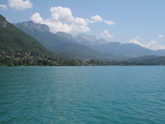 Lakes (Annecy)
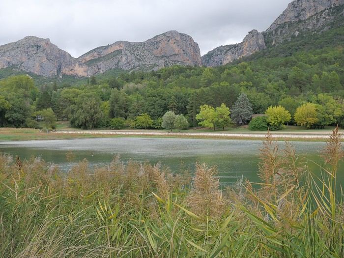 Ponds (near Moustiers Saint Marie)
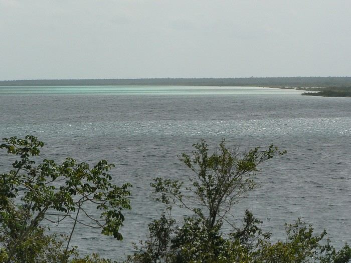 Lagoons (Bacalar)
If you’ve got nice photos of a pond—or even a puddle—why not? Natural bodies of water only: no pools or fountains (reservoir lakes are accepted… because they often look like natural lakes ).
The contest rules are the same as always 😉: Up to 3 photos per member, one photo per post (a little explanation is better), and past winning photos from other VF contests aren’t allowed. You have until Sunday, February 22nd at 11:59 PM (Paris time) to post your photos. Voting starts Monday the 23rd at midnight—rank your top 3 photos in order (3, 2, and 1 points). Voting ends Saturday, February 28th at 11:59 PM. Results will be announced on March 1st. The winning photo is the one with the most points (in case of a tie, the photo ranked first the most times wins). The lucky winner gets to organize March’s contest 😎.
Dig into your archives…
Lakes (Annecy)
Ponds (near Moustiers Saint Marie)
Lagoons (Bacalar)If you’ve got nice photos of a pond—or even a puddle—why not? Natural bodies of water only: no pools or fountains (reservoir lakes are accepted… because they often look like natural lakes ).
The contest rules are the same as always 😉: Up to 3 photos per member, one photo per post (a little explanation is better), and past winning photos from other VF contests aren’t allowed. You have until Sunday, February 22nd at 11:59 PM (Paris time) to post your photos. Voting starts Monday the 23rd at midnight—rank your top 3 photos in order (3, 2, and 1 points). Voting ends Saturday, February 28th at 11:59 PM. Results will be announced on March 1st. The winning photo is the one with the most points (in case of a tie, the photo ranked first the most times wins). The lucky winner gets to organize March’s contest 😎.
Dig into your archives…
Iceland: To do the Golden Circle or not?
Hi everyone! 🙂
For once, I'm heading north... I’ve decided to spend a short time in Iceland, alone, during the first week of July. I’ll only have 5 full days there. Sure, it’s not much, so I’ll focus on what attracts me the most: the Highlands. Obviously, renting a 4x4—or even a regular car—on my own isn’t an option. That’s why I’m breaking my (probably unfounded) principles and have contacted local agencies for "day tours" in small-group format. Well, small-group up to 15 people, anyway... Oh well, I’m going for it! I’m really hesitant about visiting the Golden Circle on the last day, since I’ve read it’s become super crowded. I’d love your thoughts on this. Plus, if I visit that area, I’d want to include Bruarfoss, and as far as I know, only the Troll agency offers that detour. There’s also the Snaefellsnes Peninsula excursion that appeals to me, but it seems time-consuming. Time-consuming like the Jokulsarlon tour I’ve already booked. (But that’s on the first day, so I’ll still be full of energy!) By the last day, I’ll probably be running on empty... Otherwise, I’ll be doing 3 4x4 excursions that I’m really excited about: 1 in Thorsmork Valley, 1 in Landmannalaugar, and 1 in Kerlingarfjöll.
So, Golden Circle or no Golden Circle—that’s the question... Or maybe a relaxed day visiting Reykjavik and a lagoon. Blue Lagoon? Sky Lagoon? Meh...
For once, I'm heading north... I’ve decided to spend a short time in Iceland, alone, during the first week of July. I’ll only have 5 full days there. Sure, it’s not much, so I’ll focus on what attracts me the most: the Highlands. Obviously, renting a 4x4—or even a regular car—on my own isn’t an option. That’s why I’m breaking my (probably unfounded) principles and have contacted local agencies for "day tours" in small-group format. Well, small-group up to 15 people, anyway... Oh well, I’m going for it! I’m really hesitant about visiting the Golden Circle on the last day, since I’ve read it’s become super crowded. I’d love your thoughts on this. Plus, if I visit that area, I’d want to include Bruarfoss, and as far as I know, only the Troll agency offers that detour. There’s also the Snaefellsnes Peninsula excursion that appeals to me, but it seems time-consuming. Time-consuming like the Jokulsarlon tour I’ve already booked. (But that’s on the first day, so I’ll still be full of energy!) By the last day, I’ll probably be running on empty... Otherwise, I’ll be doing 3 4x4 excursions that I’m really excited about: 1 in Thorsmork Valley, 1 in Landmannalaugar, and 1 in Kerlingarfjöll.
So, Golden Circle or no Golden Circle—that’s the question... Or maybe a relaxed day visiting Reykjavik and a lagoon. Blue Lagoon? Sky Lagoon? Meh...
Mauritius in July
Hey everyone,
Every year, we love escaping the autumn season—I really can’t stand it—by heading somewhere sunny during the All Saints' holiday.
This year, we were thinking of Mauritius... We’d found a place to stay, but after digging deeper, I realized it’s 40% cheaper in July. And the flights with Emirates aren’t more expensive in the summer, even though it’s peak season for them, compared to October.
Yet, after checking a bunch of sites, I don’t get the impression the weather is bad there in July—maybe just a *tiny* bit less hot than in October, but nothing major... So we’re tempted to go this summer after all.
This big price jump for All Saints' compared to summer is a mystery to me... Did I miss something?
If you’ve got any firsthand experience traveling to Mauritius in July or early August, I’d love to hear about it.
Thanks
Every year, we love escaping the autumn season—I really can’t stand it—by heading somewhere sunny during the All Saints' holiday.
This year, we were thinking of Mauritius... We’d found a place to stay, but after digging deeper, I realized it’s 40% cheaper in July. And the flights with Emirates aren’t more expensive in the summer, even though it’s peak season for them, compared to October.
Yet, after checking a bunch of sites, I don’t get the impression the weather is bad there in July—maybe just a *tiny* bit less hot than in October, but nothing major... So we’re tempted to go this summer after all.
This big price jump for All Saints' compared to summer is a mystery to me... Did I miss something?
If you’ve got any firsthand experience traveling to Mauritius in July or early August, I’d love to hear about it.
Thanks
What to see in the Algarve and homestay accommodations?
Hello,
I’d like to travel alone to the Algarve for about 10 days, as my husband sadly passed away.
I’m thinking of going at the end of April or beginning of May 2026. I’ll fly into Faro, then rent a car and head toward the westernmost tip of the coast.
Over 10 days, what are the best spots to see from Faro to the tip—hikes along the coastline or even exploring the countryside? For accommodations, can I also stay with locals? And which car rental company is the best?
Thanks in advance for your help!
Jo
Transport questions for a 9-day Northern/Central Vietnam itinerary
Hi everyone,
We’re heading to Vietnam in February as a family (2 adults and 2 kids) for 9 full days, and I was thinking of this itinerary:
Day 1: Hanoi Day 2: Halong Bay (Lan Ha) Day 3: Halong Bay (Lan Ha) Day 4: Hue Day 5: Danang Day 6: Danang Day 7: Hoi An Day 8: Hoi An/My Son Day 9: Hanoi
After reading almost all the discussions about Vietnam, I don’t see anything about transportation options for getting from Hue to Danang, then from Danang to Hoi An. Any ideas (train, bus)? From the map, it looks like Danang is close to Hoi An—easily accessible by taxi, right?
Also, after reading lots of comments and websites, I’ve noticed that Danang, aside from being a big developing city, seems to be more about hotels for relaxing on the beach—very laid-back, isn’t it? Not really a place to visit like Hanoi or Hoi An.
Generally speaking, if you have any recommendations for the itinerary or tips, I’d love to hear them.
I’ll post a trip report when we get back.
Merry Christmas to all!
Alex
We’re heading to Vietnam in February as a family (2 adults and 2 kids) for 9 full days, and I was thinking of this itinerary:
Day 1: Hanoi Day 2: Halong Bay (Lan Ha) Day 3: Halong Bay (Lan Ha) Day 4: Hue Day 5: Danang Day 6: Danang Day 7: Hoi An Day 8: Hoi An/My Son Day 9: Hanoi
After reading almost all the discussions about Vietnam, I don’t see anything about transportation options for getting from Hue to Danang, then from Danang to Hoi An. Any ideas (train, bus)? From the map, it looks like Danang is close to Hoi An—easily accessible by taxi, right?
Also, after reading lots of comments and websites, I’ve noticed that Danang, aside from being a big developing city, seems to be more about hotels for relaxing on the beach—very laid-back, isn’t it? Not really a place to visit like Hanoi or Hoi An.
Generally speaking, if you have any recommendations for the itinerary or tips, I’d love to hear them.
I’ll post a trip report when we get back.
Merry Christmas to all!
Alex
Which trek to choose in the Dolomites in August?
Hi there,
I’d like to spend a week in the Dolomites (4 days of trekking and a few day hikes). Unfortunately, it’ll be in August (no choice). My questions are:
- For a first time in the Dolomites, which 4-day trek should I pick? I’d love the most spectacular and varied landscapes possible. Around 1,000m elevation gain per day.
- Is it busier the first or last week of August?
- Will it still feel "quiet" while hiking? Not like a conga line in August...?
Thanks so much for your help! !
Thanks so much for your help! !
Impressions after two months in El Salvador
Hi there,
In 2024, I spent two months solo in El Salvador. While I’m still putting together my travel journal on Myatlas, here’s a quick recap. It’s a country where it’s really easy to travel without a guide or agency.
SAFETY:
For a long time, the country was considered one of the most dangerous in the world because of the "maras," ultra-violent gangs. But today, I think it’s the safest country in Latin America.
BUDGET:
For French tourists, the country is very affordable, especially in the less touristy regions.
TRANSPORT:
I got around everywhere by local bus.
Local buses go everywhere and run all the time. For me, it’s the best way to travel in El Salvador—you’re fully immersed, moving at the pace of the locals, and interacting with Salvadorans who are eager to connect with travelers.
I saw all sorts of things on those buses—I’ve got dozens of stories!
PEOPLE:
I’m used to traveling all over Latin America, and for me, Salvadorans are the warmest and most welcoming. Everywhere you go, people say, "Welcome to El Salvador!" The connections and long conversations with locals were my favorite part of the trip.
TOURIST CROWDS:
The country isn’t well-known among European tourists, but Americans and Quebecers visit. Overall, it’s still pretty low-key, especially compared to other Central American countries. That said, tourism has been growing since security improved significantly.
WHAT I LOVED ❤️
-Suchitoto, one of the most beautiful colonial towns in Central America.
-The volcanoes—there are so many! Santa Ana is the most touristy.
-The lakes—also plentiful. Coatepeque is the most famous, but there are lots of lagoons too.
-The mountainous regions, where the cooler weather is a nice break: La Palma, Perquín, Cerro El Pital, etc.
-The charming villages along the Ruta de las Flores, especially Nahuizalco with its nighttime atmosphere and food stalls. Juayúa and others are great too.
-The conversations with people who lived through the horrors of the civil war in Perquín and Cinquera. I met one of them by chance while waiting for a bus.
For surfers, El Salvador is a paradise, with world-famous beaches.
WHAT I LIKED LESS:
I loved almost everything, but I found the archaeological sites a bit underwhelming. Joyabaj de Cerén is billed as the "Pompeii of El Salvador," which is a stretch (though it *is* a UNESCO World Heritage Site for its historical value).
In 2024, I spent two months solo in El Salvador. While I’m still putting together my travel journal on Myatlas, here’s a quick recap. It’s a country where it’s really easy to travel without a guide or agency.
SAFETY:
For a long time, the country was considered one of the most dangerous in the world because of the "maras," ultra-violent gangs. But today, I think it’s the safest country in Latin America.
BUDGET:
For French tourists, the country is very affordable, especially in the less touristy regions.
TRANSPORT:
I got around everywhere by local bus.
Local buses go everywhere and run all the time. For me, it’s the best way to travel in El Salvador—you’re fully immersed, moving at the pace of the locals, and interacting with Salvadorans who are eager to connect with travelers.
I saw all sorts of things on those buses—I’ve got dozens of stories!
PEOPLE:
I’m used to traveling all over Latin America, and for me, Salvadorans are the warmest and most welcoming. Everywhere you go, people say, "Welcome to El Salvador!" The connections and long conversations with locals were my favorite part of the trip.
TOURIST CROWDS:
The country isn’t well-known among European tourists, but Americans and Quebecers visit. Overall, it’s still pretty low-key, especially compared to other Central American countries. That said, tourism has been growing since security improved significantly.
WHAT I LOVED ❤️
-Suchitoto, one of the most beautiful colonial towns in Central America.
-The volcanoes—there are so many! Santa Ana is the most touristy.
-The lakes—also plentiful. Coatepeque is the most famous, but there are lots of lagoons too.
-The mountainous regions, where the cooler weather is a nice break: La Palma, Perquín, Cerro El Pital, etc.
-The charming villages along the Ruta de las Flores, especially Nahuizalco with its nighttime atmosphere and food stalls. Juayúa and others are great too.
-The conversations with people who lived through the horrors of the civil war in Perquín and Cinquera. I met one of them by chance while waiting for a bus.
For surfers, El Salvador is a paradise, with world-famous beaches.
WHAT I LIKED LESS:
I loved almost everything, but I found the archaeological sites a bit underwhelming. Joyabaj de Cerén is billed as the "Pompeii of El Salvador," which is a stretch (though it *is* a UNESCO World Heritage Site for its historical value).
From Nicaragua to Honduras and El Salvador: Where to Cross the Borders?
Hi there, after my trip to Nicaragua in January, I’m planning to visit Honduras and El Salvador during the same journey. Can anyone tell me where to cross the border from Nicaragua to Honduras by bus? Is it doable? Safe? And most importantly, what’s a good route to take and what’s worth seeing in Honduras in a safe way?
Is it better to travel with a group (through an agency) or is solo travel no problem?
P.S.: And for El Salvador, same question—what’s a good route and what’s generally worth seeing? Is it better to start in the south (El Salvador) and then head north to Honduras before continuing to Guatemala, or...?
Thanks for the tips!
Is it better to travel with a group (through an agency) or is solo travel no problem?
P.S.: And for El Salvador, same question—what’s a good route and what’s generally worth seeing? Is it better to start in the south (El Salvador) and then head north to Honduras before continuing to Guatemala, or...?
Thanks for the tips!
Information for a cycling trip from Poland to Armenia via Romania and Georgia
Hi there! Every year, we go on a cycling trip abroad with panniers, lasting about two weeks. We stay in step lodgings, guesthouses, and the like. We mostly take small roads and really enjoyed northern Montenegro and Albania last year.
We’d love to hear from anyone who’s cycled in these countries before: tips on finding quiet roads, highlights of the regions we’ll pass through, how welcoming the locals are, and so on. Thanks in advance for any replies or exchanges!
We’d love to hear from anyone who’s cycled in these countries before: tips on finding quiet roads, highlights of the regions we’ll pass through, how welcoming the locals are, and so on. Thanks in advance for any replies or exchanges!
Hiking, camping, and snorkeling on Madagascar's east coast
Hello,
I’m continuing the Antalaha–Maroantsetra discussion but for some info in the other direction, specifically about hiking from Maroantsetra to Antalaha.
In mid-December, I plan to take it easy from Tamatave to Antalaha. I’m thinking of making a few stops, like Nosy Atafana—has anyone snorkeled there? Is it nice? Can you find bush taxis on the Soniera–Ivongo / Maroantsetra stretch?
After that, I’m considering walking from Maroantsetra to Antalaha and figuring things out as I go, since the path seems well-used, so I’m not planning on a guide. Good idea or totally foolish? Should I bring a tent and some camping gear, or, as I’ve read multiple times, are there several villages with lodging and food options along the way? Any spots worth stopping at or nothing special to see?
In Antalaha, I saw the recommendation for Villa Malaza in the previous discussion, so I’m keeping that in mind. If there’s space, I’ll plan to stay there. In Antalaha itself, are there any places to visit, things to see, or activities you’d recommend?
Thanks in advance to everyone for any tips—they’ll be really helpful!
In mid-December, I plan to take it easy from Tamatave to Antalaha. I’m thinking of making a few stops, like Nosy Atafana—has anyone snorkeled there? Is it nice? Can you find bush taxis on the Soniera–Ivongo / Maroantsetra stretch?
After that, I’m considering walking from Maroantsetra to Antalaha and figuring things out as I go, since the path seems well-used, so I’m not planning on a guide. Good idea or totally foolish? Should I bring a tent and some camping gear, or, as I’ve read multiple times, are there several villages with lodging and food options along the way? Any spots worth stopping at or nothing special to see?
In Antalaha, I saw the recommendation for Villa Malaza in the previous discussion, so I’m keeping that in mind. If there’s space, I’ll plan to stay there. In Antalaha itself, are there any places to visit, things to see, or activities you’d recommend?
Thanks in advance to everyone for any tips—they’ll be really helpful!
Road trip from Nice to Livorno by car, then Corsica
I'd love some destination suggestions for a road trip from Nice to Livorno by car, including the routes, tolls to cross, distance, and estimated travel time. We're planning a 5-day trip, with 2 nights near Nice, 1 night along the way, and finally 2 nights in Livorno. There are 4 of us in a rental car, and we'd like to stay in either an apartment, a mobile home near the sea, or a campsite. Our budget isn't too extravagant!!!! We want to visit the Promenade des Anglais, and I've heard Menton is really interesting. Once we reach Livorno, we'll take the ferry to Corsica for 12 days with the same rental car. We're planning to leave the last week of May and the first two weeks of June 2026, so around 17-18 days total.
Thanks
Visiting Fam and Rufas Islands from Gam and Mansuar
hi there
I’m planning a trip focused mainly on snorkeling and diving in Raja Ampat, covering two islands: Gam and Mansuar.
I’d also like to spend a few days on Fam and Rufas Islands. Is it cheaper to depart from Gam or Mansuar? Do you have any info on the budget I should expect?
If you’ve got any great tips, I’d love to hear them!
Thanks in advance
Exploring southern and western Iceland by 4x4
Hi there,
I’m looking to put together a group of 4 people to explore western and southern Iceland. The snow conditions in November (second half of the month) make access to the north and east tricky. Why November? The nighttime conditions (between 9 PM and 2 AM are ideal for spotting the northern lights), there’s still daylight (days run from about 9:30 AM to 5:30 PM—so we’ll need to start the day while it’s still dark), it’s not too cold (between 0 and 5 °C), and prices are more attractive than in late summer or during the December holidays.
I plan to use a provider to handle the logistics of the itinerary, which we’ll need to stick to (see details below). The provider charges 1345 € per person (price based on 2 people, but it’s better to have 4 to lower the cost per person since the vehicle rate is the same for 2, 3, or 4 people). We can tweak the itinerary a bit, but we all know that if we stray too far from the proposed offer, the price can quickly go up. Included:
7 nights in a guesthouse or hotel, twin or double room, shared facilities, and breakfast included. 7 days of rental for a 4-wheel-drive vehicle suited to the group size, unlimited mileage (fuel is on us), CDW insurance, and a second driver option. A road map and detailed itinerary A 24/7 French-speaking assistance service
Base itinerary proposed by the agency... It seems solid, given we’ll be there for 8 days (arrival and departure included). It’s possible to extend (by paying for extra accommodation) depending on your flight departure date. Day 1: Arrival in Iceland From the airport, the Blue Lagoon (optional) for a swim in its warm, turquoise, and milky waters. Then, the drive to Reykjavík, crossing the wild and lunar landscapes of the Reykjanes Peninsula. Explore the Icelandic capital, Reykjavík. Distance: 55 km. Meals: on your own. Accommodation: guesthouse in Reykjavík or the surrounding area.
Day 2: Exploring the west coast around Snæfellsjökull The west coast in the Snæfellsnes region. Cliffs, wild coastlines, and isolated farms in vast open spaces. Around the Snæfellsjökull volcano, the gateway to Jules Verne’s *Journey to the Center of the Earth*, you’ll discover the Djúpalónssandur reefs, the charming little port of Arnarstapi, nestled beneath the glacier, and the ports of the north coast, Grundarfjörður and Stykkishólmur. Distance: 260 km.
Day 3: Borgarfjörður, Reykholt & the Hraunfossar & Barnafoss waterfalls The lovely and unique Hraunfossar and Barnafoss waterfalls, before visiting Reykholt, the historic home of Snorri Sturluson, a famous 13th-century writer, poet, and historian. Distance: 160 km. Day 4: The famous Golden Circle The three most famous sites in the country, forming the Golden Circle. First, the Þingvellir tectonic rift, where you can hike or even dive between the two tectonic plates in a stunning, vast lake. Geysir, to see its hot springs and the Strokkur geyser. Finally, the impressive Gullfoss waterfall. You can also relax in one of the hot springs in the area. Distance: 160 km. Day 5: The south coast: Seljalandsfoss, Skógafoss, Dyrhólaey & Vík From the Golden Circle region, the route continues along the south coast. You can stop near two magnificent waterfalls: Seljalandsfoss, which you can walk behind, and Skógafoss. Head toward Vík, at the foot of Eyjafjallajökull, and the stunning cliffs of Dyrhólaey with its black sand beaches. Distance: 180 km. Day 6: Walk among the icebergs of Jökulsárlón & Vatnajökull Glacier Continuing on Route 1, Jökulsárlón will be your next stop, where you’ll see the glacial lagoon with icebergs breaking off from the Breiðamerkurjökull glacier. Skaftafell National Park, where you can take a walk, especially around the Svartifoss waterfall. As an option, you can visit a hidden ice cave beneath the glacier. Distance: 250 km. Day 7: Exploring the south coast & return to Reykjavík Return to Reykjavík. Stop in Vík or at the Skógar Folklore Museum, then pass through Hveragerði town center to see the fumaroles and solfataras before heading back to the capital in the late afternoon. Distance: 280 km.
Day 8: Departure from Reykjavík & return flight Take your flight from Keflavík International Airport. If you’d like to explore the capital further, an extra night in Reykjavík is totally doable. Distance: 55 km.
We’d need to lock in dates between November 20 and 30 (I can’t do earlier, and after that, the days get too short, temperatures drop, and prices go up). Ideally, 4 people from my area—I’m in Vendée, so people from neighboring departments in Pays de la Loire, southern Brittany, or northern Nouvelle-Aquitaine would work so we can meet up.
Contact me via PM if you’re *seriously* interested in joining. We’ll need to book soon to keep the option of tweaking the trip (within limits) and to reserve flights early to manage costs (Iceland isn’t cheap for flights or the trip itself) and stick to the travel dates.
Meeting beforehand is key—we’ll need to agree that we’ll be spending 7 days in the same vehicle and sharing a room with one other person, which requires some flexibility and respect for each other. It’s best if everyone’s a little active. You can do your own thing in terms of mobility, but it’s good to get out of the vehicle and walk a bit (more or less, depending on the person). I’m planning optional activities that might be possible, like: - Walking on a glacier - Visiting an ice cave - Winter diving in the Silfra fissure (if possible) - And of course, soaking in hot springs Everyone can decide based on their interests and budget, but we’ll need to be okay with others doing these activities while sharing the same vehicle—obviously, within the limits of the itinerary and timing tied to accommodations.
Pascal
I’m looking to put together a group of 4 people to explore western and southern Iceland. The snow conditions in November (second half of the month) make access to the north and east tricky. Why November? The nighttime conditions (between 9 PM and 2 AM are ideal for spotting the northern lights), there’s still daylight (days run from about 9:30 AM to 5:30 PM—so we’ll need to start the day while it’s still dark), it’s not too cold (between 0 and 5 °C), and prices are more attractive than in late summer or during the December holidays.
I plan to use a provider to handle the logistics of the itinerary, which we’ll need to stick to (see details below). The provider charges 1345 € per person (price based on 2 people, but it’s better to have 4 to lower the cost per person since the vehicle rate is the same for 2, 3, or 4 people). We can tweak the itinerary a bit, but we all know that if we stray too far from the proposed offer, the price can quickly go up. Included:
7 nights in a guesthouse or hotel, twin or double room, shared facilities, and breakfast included. 7 days of rental for a 4-wheel-drive vehicle suited to the group size, unlimited mileage (fuel is on us), CDW insurance, and a second driver option. A road map and detailed itinerary A 24/7 French-speaking assistance service
Base itinerary proposed by the agency... It seems solid, given we’ll be there for 8 days (arrival and departure included). It’s possible to extend (by paying for extra accommodation) depending on your flight departure date. Day 1: Arrival in Iceland From the airport, the Blue Lagoon (optional) for a swim in its warm, turquoise, and milky waters. Then, the drive to Reykjavík, crossing the wild and lunar landscapes of the Reykjanes Peninsula. Explore the Icelandic capital, Reykjavík. Distance: 55 km. Meals: on your own. Accommodation: guesthouse in Reykjavík or the surrounding area.
Day 2: Exploring the west coast around Snæfellsjökull The west coast in the Snæfellsnes region. Cliffs, wild coastlines, and isolated farms in vast open spaces. Around the Snæfellsjökull volcano, the gateway to Jules Verne’s *Journey to the Center of the Earth*, you’ll discover the Djúpalónssandur reefs, the charming little port of Arnarstapi, nestled beneath the glacier, and the ports of the north coast, Grundarfjörður and Stykkishólmur. Distance: 260 km.
Day 3: Borgarfjörður, Reykholt & the Hraunfossar & Barnafoss waterfalls The lovely and unique Hraunfossar and Barnafoss waterfalls, before visiting Reykholt, the historic home of Snorri Sturluson, a famous 13th-century writer, poet, and historian. Distance: 160 km. Day 4: The famous Golden Circle The three most famous sites in the country, forming the Golden Circle. First, the Þingvellir tectonic rift, where you can hike or even dive between the two tectonic plates in a stunning, vast lake. Geysir, to see its hot springs and the Strokkur geyser. Finally, the impressive Gullfoss waterfall. You can also relax in one of the hot springs in the area. Distance: 160 km. Day 5: The south coast: Seljalandsfoss, Skógafoss, Dyrhólaey & Vík From the Golden Circle region, the route continues along the south coast. You can stop near two magnificent waterfalls: Seljalandsfoss, which you can walk behind, and Skógafoss. Head toward Vík, at the foot of Eyjafjallajökull, and the stunning cliffs of Dyrhólaey with its black sand beaches. Distance: 180 km. Day 6: Walk among the icebergs of Jökulsárlón & Vatnajökull Glacier Continuing on Route 1, Jökulsárlón will be your next stop, where you’ll see the glacial lagoon with icebergs breaking off from the Breiðamerkurjökull glacier. Skaftafell National Park, where you can take a walk, especially around the Svartifoss waterfall. As an option, you can visit a hidden ice cave beneath the glacier. Distance: 250 km. Day 7: Exploring the south coast & return to Reykjavík Return to Reykjavík. Stop in Vík or at the Skógar Folklore Museum, then pass through Hveragerði town center to see the fumaroles and solfataras before heading back to the capital in the late afternoon. Distance: 280 km.
Day 8: Departure from Reykjavík & return flight Take your flight from Keflavík International Airport. If you’d like to explore the capital further, an extra night in Reykjavík is totally doable. Distance: 55 km.
We’d need to lock in dates between November 20 and 30 (I can’t do earlier, and after that, the days get too short, temperatures drop, and prices go up). Ideally, 4 people from my area—I’m in Vendée, so people from neighboring departments in Pays de la Loire, southern Brittany, or northern Nouvelle-Aquitaine would work so we can meet up.
Contact me via PM if you’re *seriously* interested in joining. We’ll need to book soon to keep the option of tweaking the trip (within limits) and to reserve flights early to manage costs (Iceland isn’t cheap for flights or the trip itself) and stick to the travel dates.
Meeting beforehand is key—we’ll need to agree that we’ll be spending 7 days in the same vehicle and sharing a room with one other person, which requires some flexibility and respect for each other. It’s best if everyone’s a little active. You can do your own thing in terms of mobility, but it’s good to get out of the vehicle and walk a bit (more or less, depending on the person). I’m planning optional activities that might be possible, like: - Walking on a glacier - Visiting an ice cave - Winter diving in the Silfra fissure (if possible) - And of course, soaking in hot springs Everyone can decide based on their interests and budget, but we’ll need to be okay with others doing these activities while sharing the same vehicle—obviously, within the limits of the itinerary and timing tied to accommodations.
Pascal
Trip to Madagascar in 2026: Nosy Be or Île Sainte-Marie?
Hi everyone,
I’m planning a third trip to Madagascar in 2026. This time, heading north and then part of the west coast before going back up.
The question I’m asking myself—same as during our first visits—is Nosy Be or not?
Of course, the photos show stunning beaches, and when you mention Madagascar, almost everyone says Nosy Be or at least has heard of it. That’s actually why we didn’t include it in our itineraries before, especially since we’d already seen paradise-like beaches in the south, and we had them all to ourselves because they were hard to reach.
On the other hand, I’ve always been drawn to Île Sainte-Marie, but from the north, you have to go back down to Tana, which I’m okay with in principle.
So, what’s your take? Nosy Be and its surroundings—what do you think? Just tourists looking to party?
Thanks
Trip to Oaxaca & Pacific Coast: Transportation Tips and Activity Ideas
Hello!
I’ve just got two tickets for my partner and me to spend 18 days starting from Oaxaca. We arrive on the morning of 10/27 and leave on the afternoon of 11/13.
I’ve already booked a lodge for 7 nights about 20 km from Oaxaca. The idea is to be nearby, especially for Día de los Muertos, which my partner has been dreaming about.
I’ve got a few questions:
- First, do you think renting a car is essential, or are the local bus networks (around Oaxaca) dense and reliable enough? - Roughly how much do taxi rides cost? - After our stay in Oaxaca (where the schedule is still flexible), I plan to head to the Pacific coast around Mazunte, with a goal of visiting a lagoon at night to swim in the bioluminescent algae and possibly witness turtle hatchings. But so far, I haven’t noted much else. Any suggestions for things to do/see around Mazunte, or along the route between Oaxaca and the Pacific coast?
Thanks in advance for your advice—I’ll definitely be back with more questions! :)
I’ve just got two tickets for my partner and me to spend 18 days starting from Oaxaca. We arrive on the morning of 10/27 and leave on the afternoon of 11/13.
I’ve already booked a lodge for 7 nights about 20 km from Oaxaca. The idea is to be nearby, especially for Día de los Muertos, which my partner has been dreaming about.
I’ve got a few questions:
- First, do you think renting a car is essential, or are the local bus networks (around Oaxaca) dense and reliable enough? - Roughly how much do taxi rides cost? - After our stay in Oaxaca (where the schedule is still flexible), I plan to head to the Pacific coast around Mazunte, with a goal of visiting a lagoon at night to swim in the bioluminescent algae and possibly witness turtle hatchings. But so far, I haven’t noted much else. Any suggestions for things to do/see around Mazunte, or along the route between Oaxaca and the Pacific coast?
Thanks in advance for your advice—I’ll definitely be back with more questions! :)
White as snow: February 2025 friendly photo contest
I could just as easily have written white as marble, white as salt, white as coconut milk...
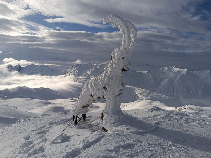
This month’s theme is white in every way imaginable.
Not just a little touch in the top right corner of the photo!
Nor a white square on a white background...
Also, black and white won’t be allowed.
For the rest, I’ll let the voters be the sole judges of whether the theme is respected!
I’m now borrowing Ragamuffin’s wording for the rules:
Every VF member can submit up to 3 photos, until Sunday, February 23 at 11:59 PM, Clermont-Ferrand time.
Each photo must be posted in a separate message, with its number (1, 2, or 3).
Don’t forget to add a little explanation (comment, location, etc.).
Voting:
Every VF member can vote for the 3 photos they think are the best, based on their own criteria and the theme.
Voting will take place from Monday, February 24 to Friday, February 28 at 2:00 PM, Clermont-Ferrand time.
The chosen photos should be listed in order of preference: - 1st photo: 3 points - 2nd: 2 points - 3rd: 1 point
The winner is the author of the photo with the most points.
Results will be published on February 28 in the late afternoon. In case of a tie, the number of first-place votes will decide. The winner will have the honor of organizing March’s contest.
Photos that have already been nominated (1st, 2nd, or 3rd) in another contest are not eligible to participate in this one.
The off-topic contest discussion is happening here
This month’s theme is white in every way imaginable.
Not just a little touch in the top right corner of the photo!
Nor a white square on a white background...
Also, black and white won’t be allowed.
For the rest, I’ll let the voters be the sole judges of whether the theme is respected!
I’m now borrowing Ragamuffin’s wording for the rules:
Every VF member can submit up to 3 photos, until Sunday, February 23 at 11:59 PM, Clermont-Ferrand time.
Each photo must be posted in a separate message, with its number (1, 2, or 3).
Don’t forget to add a little explanation (comment, location, etc.).
Voting:
Every VF member can vote for the 3 photos they think are the best, based on their own criteria and the theme.
Voting will take place from Monday, February 24 to Friday, February 28 at 2:00 PM, Clermont-Ferrand time.
The chosen photos should be listed in order of preference: - 1st photo: 3 points - 2nd: 2 points - 3rd: 1 point
The winner is the author of the photo with the most points.
Results will be published on February 28 in the late afternoon. In case of a tie, the number of first-place votes will decide. The winner will have the honor of organizing March’s contest.
Photos that have already been nominated (1st, 2nd, or 3rd) in another contest are not eligible to participate in this one.
The off-topic contest discussion is happening here
Around Cape Town in 15 days in May
Hi there,
I’ve got a bit of time to share my latest Cape Town – Cape Town trip... A fairly short itinerary, but it was just before heading to Kruger for an extension. In May... Honestly, I’d usually recommend a different time to visit CT—I’ve been there in August, September, and October before. But as they say, "Do as I say, not as I do" or "Only fools never change their minds." Why? Whale season peaks from August to October... and seeing whales right by the shore or breaching out of the water is absolutely spectacular. The end-of-year holiday period—take this year, for example—can get absolutely packed, with beaches closed due to overcrowding, etc. June and July are freezing (for me)... early August isn’t always great either. That said, 2024 saw a September-October with rain, cold, and fog like never before. The Postberg section of West Coast National Park (WCNP) is only open in August and September. Flower season is roughly from mid-August to mid-September.
So, May... The weather? Gorgeous (lucky me!). The route... Not super original (I’ve done it before, though it’s been a while). I didn’t go too far from CT because I prefer slow travel. Cape Town – Langebaan (for WCNP, again) – Cederberg (at Mountain Ceder, again) – Bontebok NP (new to me, and on the way) – De Hoop NR (at De Hoop) – Agulhas NP – Boulders (for Boulders Beach and the peninsula, again and again).
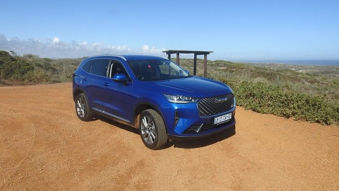
The trip started off badly due to storms in Frankfurt... My overnight flight was delayed until the next day, but via Amsterdam, so a daytime flight instead. A bit stressful, but Lufthansa and KLM handled it well. Now it was my turn to sort things out... "Well, I need you to keep the car for me... I’m arriving tonight!" (aroundaboutcars, a Chinese Haval, blue and 4x4—though I didn’t actually need the 4x4... which waited for me).
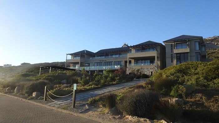
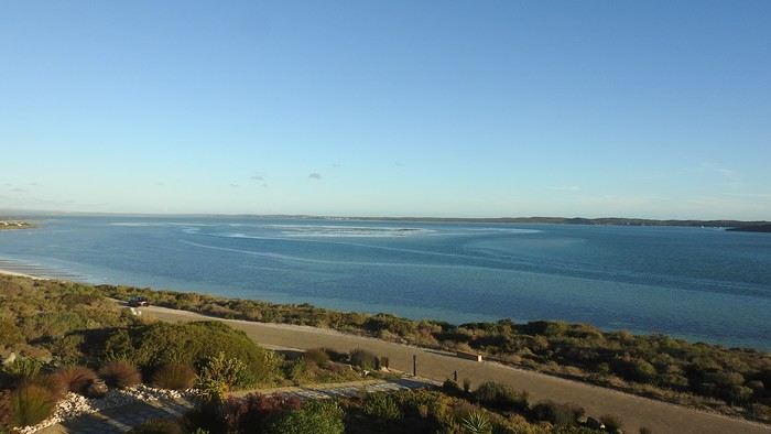
"Well, I need you to keep my room for me... I’m arriving *very* late tonight." A hotel perfectly located by the lagoon, right by the gates of WCNP, but still close to Langebaan and its restaurants. I spotted it myself and booked it during Black Friday...
Yep, what was normally a short 1.5-hour drive *in daylight* from the Mother City to Langebaan... was now *at night*. And here I am, usually the one telling people, "Don’t drive at night, folks!" Well, I know the route, and Google won’t let me get lost... until Langebaan, that is. The last few kilometers were rough—"Don’t they put up signs? Don’t they have streetlights?"
Alright, it’s late, the day’s been long—time for bed! !
I’ve got a bit of time to share my latest Cape Town – Cape Town trip... A fairly short itinerary, but it was just before heading to Kruger for an extension. In May... Honestly, I’d usually recommend a different time to visit CT—I’ve been there in August, September, and October before. But as they say, "Do as I say, not as I do" or "Only fools never change their minds." Why? Whale season peaks from August to October... and seeing whales right by the shore or breaching out of the water is absolutely spectacular. The end-of-year holiday period—take this year, for example—can get absolutely packed, with beaches closed due to overcrowding, etc. June and July are freezing (for me)... early August isn’t always great either. That said, 2024 saw a September-October with rain, cold, and fog like never before. The Postberg section of West Coast National Park (WCNP) is only open in August and September. Flower season is roughly from mid-August to mid-September.
So, May... The weather? Gorgeous (lucky me!). The route... Not super original (I’ve done it before, though it’s been a while). I didn’t go too far from CT because I prefer slow travel. Cape Town – Langebaan (for WCNP, again) – Cederberg (at Mountain Ceder, again) – Bontebok NP (new to me, and on the way) – De Hoop NR (at De Hoop) – Agulhas NP – Boulders (for Boulders Beach and the peninsula, again and again).
The trip started off badly due to storms in Frankfurt... My overnight flight was delayed until the next day, but via Amsterdam, so a daytime flight instead. A bit stressful, but Lufthansa and KLM handled it well. Now it was my turn to sort things out... "Well, I need you to keep the car for me... I’m arriving tonight!" (aroundaboutcars, a Chinese Haval, blue and 4x4—though I didn’t actually need the 4x4... which waited for me).
"Well, I need you to keep my room for me... I’m arriving *very* late tonight." A hotel perfectly located by the lagoon, right by the gates of WCNP, but still close to Langebaan and its restaurants. I spotted it myself and booked it during Black Friday...
Yep, what was normally a short 1.5-hour drive *in daylight* from the Mother City to Langebaan... was now *at night*. And here I am, usually the one telling people, "Don’t drive at night, folks!" Well, I know the route, and Google won’t let me get lost... until Langebaan, that is. The last few kilometers were rough—"Don’t they put up signs? Don’t they have streetlights?"
Alright, it’s late, the day’s been long—time for bed! !
Mora Mora in Boraha, One Week on a Little Malagasy Polynesian Vibe
Just back from a week on Nosy Boraha, better known as Île Sainte-Marie. Mostly on Île aux Nattes, actually, at the very south of the island—literally just a few hundred meters from Sainte-Marie’s airport. Far east of Madagascar, and if you keep going straight, you’ll hit Australia.
We flew in through that airport to avoid a long, rough road trip before and after Tamatave, plus a boat ride that could be short or long (boat time was inversely proportional to the bus ride to the port for the Sainte-Marie ferry). No issues with Tsaradia—departures and returns were on time, service was impeccable, and the ATR plane was smooth. Too bad the prices are so high. We managed a change due to a delayed Kenya Airways flight.
First, we stayed in the northern half, on the west coast of the island, at Natiora Green Lodge. The place is absolutely stunning—a little cove opening onto a small bay dotted with rocky outcrops under lush vegetation. The bungalows are practically on the beach, in a gorgeous, forested setting alive with birdsong. It’s the perfect spot for a pirate crew and just begs for daydreaming. No reef barrier, so it gets deep pretty quickly, but the rocks have healthy coral and plenty of small fish. Great snorkeling—we even saw a turtle. Really, really nice. The only downside is that it’s a bit far from the island’s center and kinda isolated, so eating anywhere but the hotel or going for a walk without a rental car or tuk-tuk is tricky. Not impossible, but harder than if you’re somewhere livelier.
Next, we moved to Île aux Nattes at Baboo Village, which overlooks the channel between Nosy Boraha and Nosy Nato. The bungalows are right on the water, nicely and simply decorated, with a restaurant and terrace right next door. You get to the hotel directly by pirogue from Sainte-Marie’s "embarcadère"—it takes 2-3 minutes, or a little longer if the motor’s acting up. The owner is super friendly and welcoming, with a relaxed, "family/friendly" vibe. There are often a few lemurs in the hotel’s park, adding life to the place, and the vegetation is beautiful once again. The path that circles the island starts right at the hotel entrance, making it easy to reach the island’s dock and the different beaches on the west, east, or even south. Several restaurants are within walking distance, and nothing’s far by pirogue anyway. You can also find the island’s "center" with a few small shops for basic supplies or a meal at a hotely. Since there’s no electricity on the island, the generator at the hotel runs from 6 PM to 10 PM, but you can charge your phone anytime by leaving it at reception. Kayaks are free to use and great for exploring—the whole island is doable, even if you’re not an expert. Just take your time. The upside of Île aux Nattes and Sainte-Marie’s east coast is the reef barrier and lagoon (unlike the west side), which means those gorgeous water colors, accessible coral, and shallow swimming spots. The only downside of Baboo for me, since I love snorkeling, is its location right on the channel. Personally, I prefer the south side of Île aux Nattes (near the Aurora) or the east side (like Kintana) for the lagoon views and easier snorkeling (though my wife didn’t agree). But as I said, those spots are still super easy to reach from Baboo. The west side’s okay, but I like it less—except for the view of Madagascar and the sunset. Again, totally subjective.
On Sainte-Marie, we didn’t try any restaurants other than Natiora’s. Not a ton of options, but it was fine. We weren’t fans of Chez Nono in Baie d’Ampanihy—overpriced for the tiny portions. Sure, the crab was good, but there was so little of it for the price. A bit of a rip-off, since crabs are everywhere and can’t cost much for Nono. On Île aux Nattes, there are plenty of little restaurants. We tried three—Chez Adelaide, La Buvette, and Coco Sud—and every time, we had fish or seafood, and it was always good and generous, with great achards. Prices were very reasonable.
Of course, we soaked up the time, the light, the beauty of the place, the sounds, the smells... just chilling in full *tranquillou billou* mode.
We also did some activities. Snorkeling—I’ll come back to it. In 2019, I thought it was a disaster, with no nice spots and really disappointing. This year, I jumped in everywhere I could and tested spots I’d spotted on Maps or during my last trip. And it was *really* good. Mostly on Île aux Nattes: the south side near the sacred islet, west in front of Kintana, west north of the channel (especially the sand islets), and on Sainte-Marie at Natiora’s rocks. Lots of healthy coral and plenty of fish typical of the area. If you’re into big fish, this isn’t the place, but if you love coral and little critters, it’s awesome. Snorkeling outside the reef was disappointing again, and diving was too. Unless you get lucky, it’s not worth it, in my opinion.
The tour of Île aux Nattes with a meal included was great—perfect for taking breaks whenever you find a pretty spot to snorkel or just relax on a nice beach.
A trip to the sand islets was also really fun. You can’t stay long because it gets super hot, and you’re at the mercy of the tides. There’s a good flock of terns that probably nest there. The coral reefs on the east side of the islet are gorgeous. Really, really nice. Plus, the islets themselves are just stunning.
We chose to go to Ampanihy via the lagoon, hugging the shore—it’s beautiful, with amazing colors, a wilder coastline than the west, and views of seaweed farms. It’s a long trip, though, and at Ampanihy, there’s a pretty beach (but there are tons elsewhere) and a nice mangrove. Maybe it’s better to go by road to the bay and take a boat to explore the lagoon and stop somewhere without going all the way to Ampanihy, saving yourself 2 hours of boat time round-trip. Once there, you can take a little pirogue tour to the beach and through the mangrove. The way we did it, the trip wasn’t essential. As I said, Chez Nono was disappointing—bring a picnic or try Chez Samson instead.
Of course, we visited the pirate cemetery, a place I love even though there’s not much left to see—just a few graves, unfortunately, and some vandalism. The site is still magical, though, and you can let your thoughts drift with La Buse and William Kidd, who passed through here.
We organized all our outings with Crépin, who runs two small boats with his brother. We met him totally by chance, but we don’t regret it. We could adjust the trips based on what we wanted—where to stop or which spot to visit next—and Crépin handled the meals. Prices were super affordable for a full day. I can share his number if you want. We didn’t try anyone else, but I’m sure there are other great operators—I just can’t compare or recommend.
Good prep for anyone looking for an alternative to Nosy Be. Way fewer activities, sure, but also way fewer people and a really nice vibe on Sainte-Marie in general, and Île aux Nattes in particular. The beaches are more beautiful than Nosy Be’s, and there’s a reef and lagoon (it *is* the pirate island, after all). And in whale season, well, the whales.
All in all, a great place to stay for a trip.
We flew in through that airport to avoid a long, rough road trip before and after Tamatave, plus a boat ride that could be short or long (boat time was inversely proportional to the bus ride to the port for the Sainte-Marie ferry). No issues with Tsaradia—departures and returns were on time, service was impeccable, and the ATR plane was smooth. Too bad the prices are so high. We managed a change due to a delayed Kenya Airways flight.
First, we stayed in the northern half, on the west coast of the island, at Natiora Green Lodge. The place is absolutely stunning—a little cove opening onto a small bay dotted with rocky outcrops under lush vegetation. The bungalows are practically on the beach, in a gorgeous, forested setting alive with birdsong. It’s the perfect spot for a pirate crew and just begs for daydreaming. No reef barrier, so it gets deep pretty quickly, but the rocks have healthy coral and plenty of small fish. Great snorkeling—we even saw a turtle. Really, really nice. The only downside is that it’s a bit far from the island’s center and kinda isolated, so eating anywhere but the hotel or going for a walk without a rental car or tuk-tuk is tricky. Not impossible, but harder than if you’re somewhere livelier.
Next, we moved to Île aux Nattes at Baboo Village, which overlooks the channel between Nosy Boraha and Nosy Nato. The bungalows are right on the water, nicely and simply decorated, with a restaurant and terrace right next door. You get to the hotel directly by pirogue from Sainte-Marie’s "embarcadère"—it takes 2-3 minutes, or a little longer if the motor’s acting up. The owner is super friendly and welcoming, with a relaxed, "family/friendly" vibe. There are often a few lemurs in the hotel’s park, adding life to the place, and the vegetation is beautiful once again. The path that circles the island starts right at the hotel entrance, making it easy to reach the island’s dock and the different beaches on the west, east, or even south. Several restaurants are within walking distance, and nothing’s far by pirogue anyway. You can also find the island’s "center" with a few small shops for basic supplies or a meal at a hotely. Since there’s no electricity on the island, the generator at the hotel runs from 6 PM to 10 PM, but you can charge your phone anytime by leaving it at reception. Kayaks are free to use and great for exploring—the whole island is doable, even if you’re not an expert. Just take your time. The upside of Île aux Nattes and Sainte-Marie’s east coast is the reef barrier and lagoon (unlike the west side), which means those gorgeous water colors, accessible coral, and shallow swimming spots. The only downside of Baboo for me, since I love snorkeling, is its location right on the channel. Personally, I prefer the south side of Île aux Nattes (near the Aurora) or the east side (like Kintana) for the lagoon views and easier snorkeling (though my wife didn’t agree). But as I said, those spots are still super easy to reach from Baboo. The west side’s okay, but I like it less—except for the view of Madagascar and the sunset. Again, totally subjective.
On Sainte-Marie, we didn’t try any restaurants other than Natiora’s. Not a ton of options, but it was fine. We weren’t fans of Chez Nono in Baie d’Ampanihy—overpriced for the tiny portions. Sure, the crab was good, but there was so little of it for the price. A bit of a rip-off, since crabs are everywhere and can’t cost much for Nono. On Île aux Nattes, there are plenty of little restaurants. We tried three—Chez Adelaide, La Buvette, and Coco Sud—and every time, we had fish or seafood, and it was always good and generous, with great achards. Prices were very reasonable.
Of course, we soaked up the time, the light, the beauty of the place, the sounds, the smells... just chilling in full *tranquillou billou* mode.
We also did some activities. Snorkeling—I’ll come back to it. In 2019, I thought it was a disaster, with no nice spots and really disappointing. This year, I jumped in everywhere I could and tested spots I’d spotted on Maps or during my last trip. And it was *really* good. Mostly on Île aux Nattes: the south side near the sacred islet, west in front of Kintana, west north of the channel (especially the sand islets), and on Sainte-Marie at Natiora’s rocks. Lots of healthy coral and plenty of fish typical of the area. If you’re into big fish, this isn’t the place, but if you love coral and little critters, it’s awesome. Snorkeling outside the reef was disappointing again, and diving was too. Unless you get lucky, it’s not worth it, in my opinion.
The tour of Île aux Nattes with a meal included was great—perfect for taking breaks whenever you find a pretty spot to snorkel or just relax on a nice beach.
A trip to the sand islets was also really fun. You can’t stay long because it gets super hot, and you’re at the mercy of the tides. There’s a good flock of terns that probably nest there. The coral reefs on the east side of the islet are gorgeous. Really, really nice. Plus, the islets themselves are just stunning.
We chose to go to Ampanihy via the lagoon, hugging the shore—it’s beautiful, with amazing colors, a wilder coastline than the west, and views of seaweed farms. It’s a long trip, though, and at Ampanihy, there’s a pretty beach (but there are tons elsewhere) and a nice mangrove. Maybe it’s better to go by road to the bay and take a boat to explore the lagoon and stop somewhere without going all the way to Ampanihy, saving yourself 2 hours of boat time round-trip. Once there, you can take a little pirogue tour to the beach and through the mangrove. The way we did it, the trip wasn’t essential. As I said, Chez Nono was disappointing—bring a picnic or try Chez Samson instead.
Of course, we visited the pirate cemetery, a place I love even though there’s not much left to see—just a few graves, unfortunately, and some vandalism. The site is still magical, though, and you can let your thoughts drift with La Buse and William Kidd, who passed through here.
We organized all our outings with Crépin, who runs two small boats with his brother. We met him totally by chance, but we don’t regret it. We could adjust the trips based on what we wanted—where to stop or which spot to visit next—and Crépin handled the meals. Prices were super affordable for a full day. I can share his number if you want. We didn’t try anyone else, but I’m sure there are other great operators—I just can’t compare or recommend.
Good prep for anyone looking for an alternative to Nosy Be. Way fewer activities, sure, but also way fewer people and a really nice vibe on Sainte-Marie in general, and Île aux Nattes in particular. The beaches are more beautiful than Nosy Be’s, and there’s a reef and lagoon (it *is* the pirate island, after all). And in whale season, well, the whales.
All in all, a great place to stay for a trip.
Dream Islands: Greece, French Polynesia, Mauritius...
Hello,
Who among us hasn’t dreamed of having a ticket to Tahiti, Bora Bora, or the Marquesas in their pocket—preferably a one-way ticket to “paradise”?
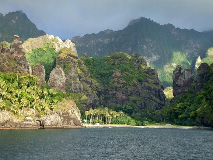 Idyllic landscape of a dream island, but difficult to access: the Bay of Virgins in Fatu Hiva, Marquesas Islands
Among the values conveyed by literature, tourism, and advertising is the quest for “elsewhere,” for a change of scenery, in the truest sense of the word—that is, the need to leave one’s country. This need for otherness, for difference, is projected onto dreamlike, idealized, even mythicized places. In our imaginary world, the island is often that place.
Yet we forget that islands have also been ideal prisons. The examples are numerous: Elba and Saint Helena, Alcatraz and Poulo Condor, If and Yeu, the Devil’s Islands and Leros. The latter, located in Greece in the Dodecanese, hosted a sinister forced labor camp during the colonels’ dictatorship as well as a psychiatric hospital. Despite the beauty of its bay, tourism has remained marginal there due to its bad reputation, unlike the neighboring island of Patmos.
I’d like to share a selection of about a dozen islands from across the world’s seas and oceans. For dreaming...
°°°°°°°°°°°°°°°
SANTORINI
July 27, 1967
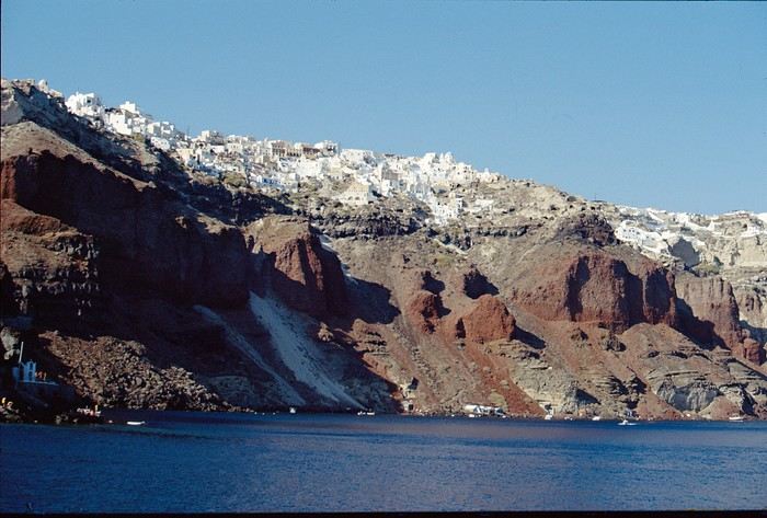
At dawn, the ferry from Agios Nikolaos (Crete) enters the immense caldera of Santorini. From the ship’s deck, Rainer, my travel companion, and I are left in awe by the sight of these towering, multicolored cliffs looming over us. We disembark and begin the steep climb on foot via the winding mule path up to the village of Fira, the capital perched above the cliff. Though it’s still very early, we head to the youth hostel. There wasn’t a soul in the alleys that morning—or rather, there were only cats! I have a fond memory of that encounter with Santorini: a sensory shock, a breathtaking volcanic site, a harmony of blue, ochre-red, and white. A welcoming island, as it was traditional to welcome the xénou, an island that hadn’t yet fully recovered from the terrible 1956 earthquake, a Cycladic architectural marvel where local life was still preserved.
It’s easy to see why, in antiquity, the island was named Kallisté (καλλίστη), “the most beautiful,” as it’s nearly impossible to resist gazing at this landscape shaped by tectonic forces. Indeed, a massive volcanic cataclysm—the Minoan eruption—shaped this scenery in the 17th century BCE, creating a caldera that was quickly filled by the sea. The enormous tsunamis that followed reached Crete, leading to the disappearance of the Minoan civilization.
A cliffside path along the caldera leads us to the peaceful village of Oia, at the northern tip of the island. Blue-domed churches and flower-filled villages with whitewashed houses line the way. This walk is a continuous marvel, offering splendid views of the caldera and the neighboring islands formed by the breakup of the ancient volcano (Thirissa, Nea Kameni). Oia is a large, picturesque village, like Fira perched on the cliff’s edge, which was severely damaged by the 1956 earthquake, and its scars are still visible. Its cave-like houses with vaulted roofs haven’t yet been turned into luxury hotels or shops. Absolute tranquility reigns here.
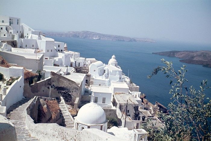 Oia in 1967—a peaceful village overlooking the caldera. But where are the pools and trendy bars?
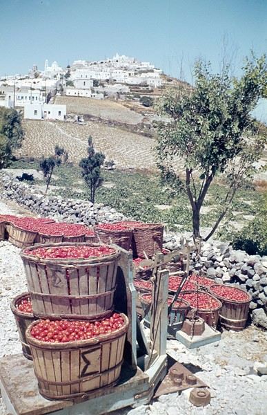
A lush countryside covered in olive trees and vineyards welcomes us for a pleasant hike, interrupted by the kindness of a friendly islander who gives us a lift in his truck for a few kilometers. He’s off to harvest his tomatoes, which he grows at the foot of Pyrgos Hill. The delicious little cherry tomato of Santorini earned an EU Protected Designation of Origin (PDO) in 2013. We climb up to the village of Pyrgos, perched on a hill and dominated by the elegant bell tower of its church. Finally, we reach the black sand beach of Kamari on the island’s eastern coast to enjoy a swim.
{...} To be continued

°°°°°°°°°°°°°°°°°
RAIVAVAE (French Polynesia)
November 15, 2007
Éléonore from Pension Tama welcomes us with traditional flower leis, as if she’d been waiting for old friends she hadn’t seen in ages. The small airport terminal is lively, the atmosphere warm—people hugging, rejoicing in reunions, all under kilos of flowers. Then, just as quickly, the place empties until the next flight... in a few days.
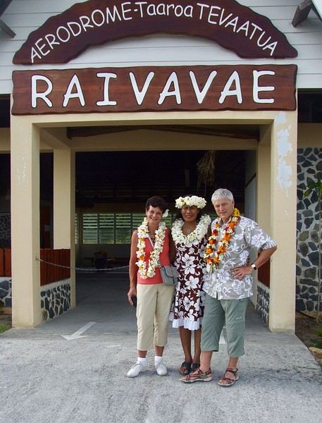
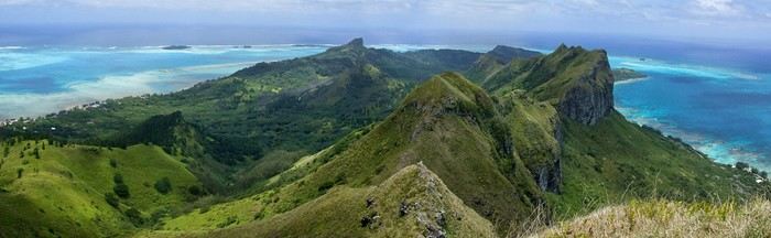
In the Austral Islands, a ninety-minute flight from Tahiti, Raivavae is a world away from the frenetic pace of Papeete or the tourist crowds of the Leeward Islands. The true paradise of the South Seas can still be savored here—it’s a bit like Bora Bora half a century ago. Our first feeling upon arriving on this island is wonder, with smiles that could melt even the gloomiest among us, landscapes so stunning they take your breath away, and above all, a sense of disorientation and fulfillment. Picture a mountainous island, about ten kilometers by three and a half, encircled by a coral reef and wild motu, cradling a lagoon with shades of blue that would make Bora Bora green with envy.
The roughly one thousand inhabitants of Raivavae are spread across four villages around the island. Children are everywhere, as is typical in Polynesia, and they greet you with open, genuine smiles. Here, ancestral values have survived progress. The predominantly Protestant population is very devout, as evidenced by the several temples built across the island. Religious fervor sets the rhythm of daily life. Sundays are reserved for worship and Sunday school (catechism). Work is forbidden on that day, and tourist activities are suspended. These rules are strict and respected.
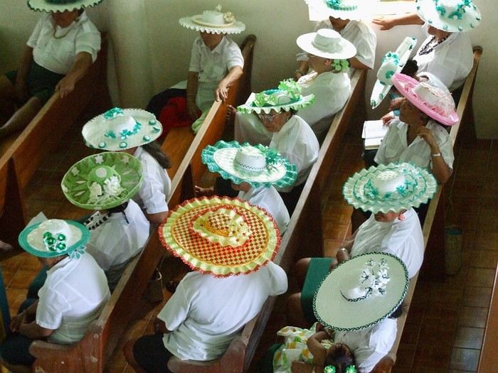 Hat contest for the worship celebration
Yet a sense of resignation is ever-present. The people of Raivavae know they are—and will remain—isolated. Despite the construction of an airstrip in 2004 and a few weekly flights to Tahiti and its nearest neighbor, Tubuai (200 km away), the island remains on the fringes of the world. One painful aspect is the separation of children from their parents when they leave for middle school in Tubuai starting in fifth grade. Television brings daily images of a world the islanders will likely never know, but one they often aspire to.
We are privileged. We have the pristine white-sand beaches of the motu and some of the most beautiful bays in Polynesia all to ourselves. The jewel in the crown, the island’s emblematic spot, is the “motu-pool,” about twenty minutes by boat. A natural, exquisite basin with crystal-clear water, gradients of blue, and white sand. And best of all, there’s almost no one there. In fact, lounging on the beach is frowned upon, especially for young women. Religion looks very unfavorably on sunbathing and lazing around. And yet, everything here leans toward that philosophy of life.
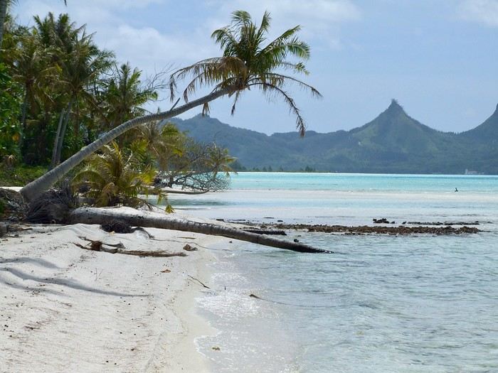
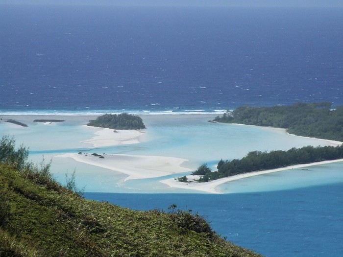 The "motu-pool"
{...} To be continued
Who among us hasn’t dreamed of having a ticket to Tahiti, Bora Bora, or the Marquesas in their pocket—preferably a one-way ticket to “paradise”?
Idyllic landscape of a dream island, but difficult to access: the Bay of Virgins in Fatu Hiva, Marquesas IslandsAmong the values conveyed by literature, tourism, and advertising is the quest for “elsewhere,” for a change of scenery, in the truest sense of the word—that is, the need to leave one’s country. This need for otherness, for difference, is projected onto dreamlike, idealized, even mythicized places. In our imaginary world, the island is often that place.
Yet we forget that islands have also been ideal prisons. The examples are numerous: Elba and Saint Helena, Alcatraz and Poulo Condor, If and Yeu, the Devil’s Islands and Leros. The latter, located in Greece in the Dodecanese, hosted a sinister forced labor camp during the colonels’ dictatorship as well as a psychiatric hospital. Despite the beauty of its bay, tourism has remained marginal there due to its bad reputation, unlike the neighboring island of Patmos.
I’d like to share a selection of about a dozen islands from across the world’s seas and oceans. For dreaming...
°°°°°°°°°°°°°°°
SANTORINI
July 27, 1967
At dawn, the ferry from Agios Nikolaos (Crete) enters the immense caldera of Santorini. From the ship’s deck, Rainer, my travel companion, and I are left in awe by the sight of these towering, multicolored cliffs looming over us. We disembark and begin the steep climb on foot via the winding mule path up to the village of Fira, the capital perched above the cliff. Though it’s still very early, we head to the youth hostel. There wasn’t a soul in the alleys that morning—or rather, there were only cats! I have a fond memory of that encounter with Santorini: a sensory shock, a breathtaking volcanic site, a harmony of blue, ochre-red, and white. A welcoming island, as it was traditional to welcome the xénou, an island that hadn’t yet fully recovered from the terrible 1956 earthquake, a Cycladic architectural marvel where local life was still preserved.
It’s easy to see why, in antiquity, the island was named Kallisté (καλλίστη), “the most beautiful,” as it’s nearly impossible to resist gazing at this landscape shaped by tectonic forces. Indeed, a massive volcanic cataclysm—the Minoan eruption—shaped this scenery in the 17th century BCE, creating a caldera that was quickly filled by the sea. The enormous tsunamis that followed reached Crete, leading to the disappearance of the Minoan civilization.
A cliffside path along the caldera leads us to the peaceful village of Oia, at the northern tip of the island. Blue-domed churches and flower-filled villages with whitewashed houses line the way. This walk is a continuous marvel, offering splendid views of the caldera and the neighboring islands formed by the breakup of the ancient volcano (Thirissa, Nea Kameni). Oia is a large, picturesque village, like Fira perched on the cliff’s edge, which was severely damaged by the 1956 earthquake, and its scars are still visible. Its cave-like houses with vaulted roofs haven’t yet been turned into luxury hotels or shops. Absolute tranquility reigns here.
Oia in 1967—a peaceful village overlooking the caldera. But where are the pools and trendy bars?A lush countryside covered in olive trees and vineyards welcomes us for a pleasant hike, interrupted by the kindness of a friendly islander who gives us a lift in his truck for a few kilometers. He’s off to harvest his tomatoes, which he grows at the foot of Pyrgos Hill. The delicious little cherry tomato of Santorini earned an EU Protected Designation of Origin (PDO) in 2013. We climb up to the village of Pyrgos, perched on a hill and dominated by the elegant bell tower of its church. Finally, we reach the black sand beach of Kamari on the island’s eastern coast to enjoy a swim.
{...} To be continued
°°°°°°°°°°°°°°°°°
RAIVAVAE (French Polynesia)
November 15, 2007
Éléonore from Pension Tama welcomes us with traditional flower leis, as if she’d been waiting for old friends she hadn’t seen in ages. The small airport terminal is lively, the atmosphere warm—people hugging, rejoicing in reunions, all under kilos of flowers. Then, just as quickly, the place empties until the next flight... in a few days.
In the Austral Islands, a ninety-minute flight from Tahiti, Raivavae is a world away from the frenetic pace of Papeete or the tourist crowds of the Leeward Islands. The true paradise of the South Seas can still be savored here—it’s a bit like Bora Bora half a century ago. Our first feeling upon arriving on this island is wonder, with smiles that could melt even the gloomiest among us, landscapes so stunning they take your breath away, and above all, a sense of disorientation and fulfillment. Picture a mountainous island, about ten kilometers by three and a half, encircled by a coral reef and wild motu, cradling a lagoon with shades of blue that would make Bora Bora green with envy.
The roughly one thousand inhabitants of Raivavae are spread across four villages around the island. Children are everywhere, as is typical in Polynesia, and they greet you with open, genuine smiles. Here, ancestral values have survived progress. The predominantly Protestant population is very devout, as evidenced by the several temples built across the island. Religious fervor sets the rhythm of daily life. Sundays are reserved for worship and Sunday school (catechism). Work is forbidden on that day, and tourist activities are suspended. These rules are strict and respected.
Hat contest for the worship celebrationYet a sense of resignation is ever-present. The people of Raivavae know they are—and will remain—isolated. Despite the construction of an airstrip in 2004 and a few weekly flights to Tahiti and its nearest neighbor, Tubuai (200 km away), the island remains on the fringes of the world. One painful aspect is the separation of children from their parents when they leave for middle school in Tubuai starting in fifth grade. Television brings daily images of a world the islanders will likely never know, but one they often aspire to.
We are privileged. We have the pristine white-sand beaches of the motu and some of the most beautiful bays in Polynesia all to ourselves. The jewel in the crown, the island’s emblematic spot, is the “motu-pool,” about twenty minutes by boat. A natural, exquisite basin with crystal-clear water, gradients of blue, and white sand. And best of all, there’s almost no one there. In fact, lounging on the beach is frowned upon, especially for young women. Religion looks very unfavorably on sunbathing and lazing around. And yet, everything here leans toward that philosophy of life.
The "motu-pool"{...} To be continued
Resuming discussions and returning to Madagascar
Oh, the good news—the site is back up after such a long closure. I think many of us were really missing it, though some have moved on to other forums like Routard.
Hopefully, activity will pick up little by little. Travel habits have probably changed post-Covid, and some regulars won’t be coming back for all sorts of reasons.
But for the rest of us, the forum is here for travel journals and pre-trip questions. Anyway…
Back to the main point: my last trip to Madagascar was a while ago now—about a year—on the High Plateaus during the austral winter. It was really chilly, and to be honest, my feelings were mixed between the joy of returning to Madagascar and the sadness of seeing the state of the country. The infrastructure is crumbling, and the population is sinking into poverty at unprecedented levels. The country’s closure likely had immeasurable consequences, compounded by destructive cyclones. Even secondary cities have seen large numbers of rural people arriving in search of work, while some rural areas barely allow survival. I’ve never felt such despair over the situation in 20 years.
From Tana to Fianar, it was nothing but heartbreaking observations. Probably made worse by the drizzle and cold typical of that season in the region.
In a few weeks, I’m planning to return to the High Plateaus and also Sainte Marie. On that note, a few questions: has anyone stayed at Samaria Cosy Lodge, and what did you think of it? On Île aux Nattes, which hotel would you recommend for a few peaceful days, ideally on the coast best suited for snorkeling?
Thanks in advance
Back to the main point: my last trip to Madagascar was a while ago now—about a year—on the High Plateaus during the austral winter. It was really chilly, and to be honest, my feelings were mixed between the joy of returning to Madagascar and the sadness of seeing the state of the country. The infrastructure is crumbling, and the population is sinking into poverty at unprecedented levels. The country’s closure likely had immeasurable consequences, compounded by destructive cyclones. Even secondary cities have seen large numbers of rural people arriving in search of work, while some rural areas barely allow survival. I’ve never felt such despair over the situation in 20 years.
From Tana to Fianar, it was nothing but heartbreaking observations. Probably made worse by the drizzle and cold typical of that season in the region.
In a few weeks, I’m planning to return to the High Plateaus and also Sainte Marie. On that note, a few questions: has anyone stayed at Samaria Cosy Lodge, and what did you think of it? On Île aux Nattes, which hotel would you recommend for a few peaceful days, ideally on the coast best suited for snorkeling?
Thanks in advance
Trois semaines en Italie entre les Dolomites et Vérone English translation pending
Bonjour à toutes et tous
Bon ben voilà, cela fait 1mois 1/2 que nous sommes rentrés de vacances et comme les photos sont triées, il est temps de vous faire un petit retour de nos 3 semaines de congés 🙂
Les Dolomites ... Voilà une destination qui me faisait envie depuis quelques temps. Entre les ouïes dire et les photos, j'avais envie de découvrir cette région italienne. Mon mari a suivi mes envies sans problème et mes enfants aussi alors, une fois rentrés de notre dernier séjour en août dernier, il a cherché des locations ( c'est le chef pour dénicher les bons plans 😛 ).
Notre but pour juillet 2020 : 15 jours dans les Dolomites et 1 semaine à Vérone pour faire la ville et le lac de Garde. Pour chaque semaine, nous voulions quelque chose de "central" pour pouvoir rayonner. Ce n'était pas l'idéal pour la route mais cela nous permettait de nous poser à chaque fois : les valises pouvaient être défaites , on pouvait faire des lessives et se préparer nos repas comme on voulait.
Tout se déroulait très bien, les réservations étaient terminées à Noël, il n'y avait plus qu'a peaufiner ce que nous voulions faire/voir et attendre l'heure du départ. Et puis est arrivé le Covid ... Ah, frontière fermée avec l'Italie 😕 et donc complication en vue avec ce satané virus 😠 Mais, tout s'est débloqué 10 jours avant notre départ et les italiens n'ont pas annulé nos réservations alors on pouvait croire en notre chance 😏 Nous sommes partis le 10 juillet de Nice avec un stock de masques et puis c'est tout.
Pour la 1ère semaine, nous avons logé dans un appart-hôtel à Carezza. Ce dernier se situait dans un immense hôtel. En fait, il y avait des chambres d'hôtel classiques et des appartements de particulier. Original mais bon ... Nous, nous étions donc chez un particulier. Et pour tout dire, il n'y avait pas grand monde dans cet établissement. C'était un peu, beaucoup, vide et tous les fauteuils de bienvenu étaient condamnés 🤪 L'appartement par lui-même était un peu trop petit pour 4 personnes mais il y avait tout le nécessaire. Nous sommes arrivés l'après-midi sous la pluie et avec 8°C 🏴☠️. Le temps de prendre possession du lieu, de ranger un peu les affaires, le ciel s'est dégagé et nous avons été nous balader à pied dans les alentours. Vue de notre chambre
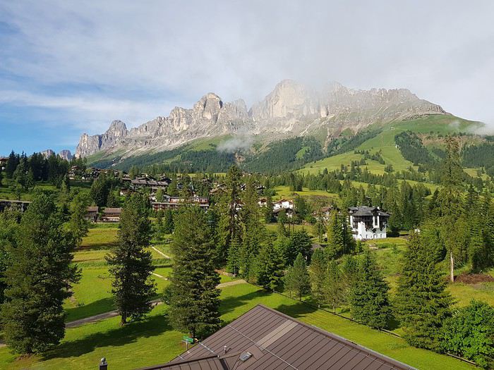
Notre hôtel
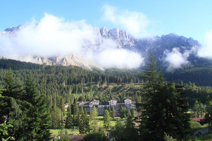

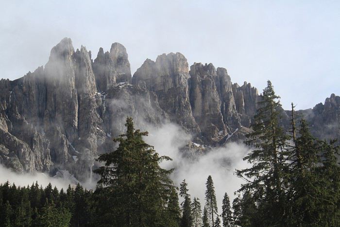
Le ciel se dégage bien
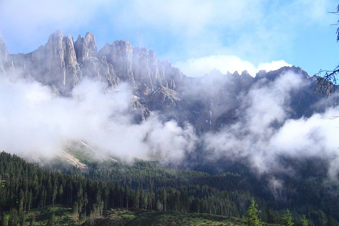
Bon ben voilà, cela fait 1mois 1/2 que nous sommes rentrés de vacances et comme les photos sont triées, il est temps de vous faire un petit retour de nos 3 semaines de congés 🙂
Les Dolomites ... Voilà une destination qui me faisait envie depuis quelques temps. Entre les ouïes dire et les photos, j'avais envie de découvrir cette région italienne. Mon mari a suivi mes envies sans problème et mes enfants aussi alors, une fois rentrés de notre dernier séjour en août dernier, il a cherché des locations ( c'est le chef pour dénicher les bons plans 😛 ).
Notre but pour juillet 2020 : 15 jours dans les Dolomites et 1 semaine à Vérone pour faire la ville et le lac de Garde. Pour chaque semaine, nous voulions quelque chose de "central" pour pouvoir rayonner. Ce n'était pas l'idéal pour la route mais cela nous permettait de nous poser à chaque fois : les valises pouvaient être défaites , on pouvait faire des lessives et se préparer nos repas comme on voulait.
Tout se déroulait très bien, les réservations étaient terminées à Noël, il n'y avait plus qu'a peaufiner ce que nous voulions faire/voir et attendre l'heure du départ. Et puis est arrivé le Covid ... Ah, frontière fermée avec l'Italie 😕 et donc complication en vue avec ce satané virus 😠 Mais, tout s'est débloqué 10 jours avant notre départ et les italiens n'ont pas annulé nos réservations alors on pouvait croire en notre chance 😏 Nous sommes partis le 10 juillet de Nice avec un stock de masques et puis c'est tout.
Pour la 1ère semaine, nous avons logé dans un appart-hôtel à Carezza. Ce dernier se situait dans un immense hôtel. En fait, il y avait des chambres d'hôtel classiques et des appartements de particulier. Original mais bon ... Nous, nous étions donc chez un particulier. Et pour tout dire, il n'y avait pas grand monde dans cet établissement. C'était un peu, beaucoup, vide et tous les fauteuils de bienvenu étaient condamnés 🤪 L'appartement par lui-même était un peu trop petit pour 4 personnes mais il y avait tout le nécessaire. Nous sommes arrivés l'après-midi sous la pluie et avec 8°C 🏴☠️. Le temps de prendre possession du lieu, de ranger un peu les affaires, le ciel s'est dégagé et nous avons été nous balader à pied dans les alentours. Vue de notre chambre
Notre hôtel
Le ciel se dégage bien
Cumuler randonnées à la Réunion et visites des îles alentours English translation pending
Bonjour,
L'été 2021 nous aimerions randonner à la Réunion (faire les 3 cirques au moins) pour cela j'ai trouvé pas mal de circuits, mais auriez vous un prestataire local à me conseiller ?
Après environ 10 jours de rando, que ne faut-il pas louper à visiter sur l'ile ?
Ensuite j'hésite entre Mayotte Madagascar et Maurice, sachant 2 ou 3 jours de balnéaires sont mon max. Que me conseillez vous pour le plus grand dépaysement
Pour finir je me demande s'il est judicieux de prendre un vol en boucle (paris, la réunion, mayotte, paris) ou s'il existe des AR genre : paris, la réunion, mayotte, paris ?
Merci pour toutes vos suggestions
Retour aux Marquises: les îles méridionales Hiva Oa, Tahuata et Fatu Iva English translation pending
INTRO
En ces temps épidémiques troublés, la Polynésie Française - et en particulier l' archipel des Marquises - ont des atouts exceptionnels en matière de tourisme. A ce jour, l' épidémie de Coronavirus a juste effleuré le Territoire -presque uniquement Tahiti et Moorea - dont les îles éloignées ont été strictement confinées dès le départ, les offres sanitaires et hospitalières sur place étant très limitées. Pour l' instant, la situation est sous contrôle.
Le tourisme retrouve lentement ses marques depuis la mi-juillet. Il s'agit actuellement plus de tourisme local que de tourisme international, bien que la destination Polynésie / Marquises soit attirante : beauté et unicité des paysages, authenticité d'un archipel, certes situé à 4 heures d'avion ATR de Tahiti, mais que l' on peut facilement découvrir en solo et donc en dehors de la très onéreuse croisière sur l' Aranui, sécurité physique mais aussi sanitaire. Les Européens - dont une majorité de Français - arrivent... Ils avaient déjà leurs billets depuis des mois et l' entrée sur le territoire est facilitée.
Nous devions faire ce second voyage aux Marquises en mai dernier, mais il fut annulé jusqu'à la reprise progressive des vols en interne.
Nous avons simplement acheté un billet Air Tahiti en ligne, sans utiliser le Pass Marquises qui ne permet pas de visiter les deux îles les plus méridionales, à savoir Tahuata et Fatu Iva, dépourvues d'aéroport. On ne peut y aller qu' en bateau, en excursion à la journée ( ou plus bien sur ) pour Tahuata et en navette municipale au départ de Hiva Oa pour aller à Fatu Iva.
Les horaires changeant fréquemment, la première chose à faire est de se renseigner sur les jours de passage vers Fatu Iva. En ce moment, il y en a trois : le lundi ( départ à 2 heures du matin ), le mardi ( départ à 6 heures ) et le samedi ( départ à 6 heures également ). Mais tout cela aura peut-être changé dans 3 mois. Il faut donc une stratégie d'approche !
On peut rajouter la visite de ces deux îles à celles qui sont incluses dans le Pass, à savoir Nuku Hiva, Ua Pou, Ua Huka et Hiva Oa. Prévoir alors une extension de 8 jours environ, à partir de Hiva Oa.
Pourquoi vouloir absolument visiter ces deux îles peu accessibles ? Justement parce qu'il faut les mériter ! Elles demeurent très différentes.
L' une, Tahuata, a un lagon, des plages de sable blanc, des falaises abruptes, des baies échancrées ourlées d'une végétation luxuriante, des couleurs uniques dans les bleus et turquoise et culmine à plus de 1000 mètres.
L' autre, Fatu Iva , est une beauté sauvage et altière avec ses à-pics qui dévalent vers l' océan bleu outremer ( ou 'moana' en tahitien ), connue surtout pour sa fameuse baie des Vierges, considérée par beaucoup - en particulier les navigateurs - comme la plus belle île de Polynésie.
Dans mon premier carnet sur les Marquises, j' avais déjà mentionné notre séjour à Hiva Oa, un peu trop court. Cette fois, entre notre arrivée et notre retour, nous passerons 4 nuits à Hiva Oa et 4 nuits à Fatu Iva. Une journée et demie sera consacrée aussi à Hiva Oa.
Avant de partir à la découverte de ces îles polynésiennes lointaines et peu visitées, quelques chiffres édifiants qui montrent que les Marquises ont échappé de peu à l' oubli, à la perte de leur identité singulière et à la disparition de leur culture. L' archipel comptait 20000 habitants en 1842, seulement 2000 en 1920, environ 8000 actuellement en 2020. Au début des années 1920, c'est grâce à la politique nataliste du Dr Rollin, administrateur des Marquises de l' époque, que la situation commença lentement à s' améliorer. Ensuite et paradoxalement, ce fut un évêque, Mgr Lecleac'h, qui s'érigea en animateur engagé du réveil identitaire, via la sauvegarde du patrimoine, la reconnaissance de la langue marquisienne ( et non tahitienne ), les danses ( jugées trop lascives par les missionnaires ), les chants, le tatouage, enfin l' artisanat inspiré des motifs et des symboles de la culture ancienne. L' icône du renouveau marquisien est sans conteste le tiki, demi-dieu et créateur de l' homme. En lui réside la divinité et les ancêtres légendaires.

TAHUATA ou Île Lumière
DANS LA LEGENDE DES MARQUISES C' est la plus petite île habitée des Marquises dont le nom signifie l' aube en marquisien. J' aurai, plus tard, l' occasion de revenir sur la légende de la création des Marquises : dans cette légende, Tahuata représente le dernier acte de la construction avant l' aube. La symbolique de son nom est liée à l' arrivée de la lumière du jour, signifiant la fin de la construction de la 'Grande Maison', alias l' archipel des Marquises.
UN PEU DE GEOLOGIE Tahuata et Fatu Iva sont soeurs géologiquement parlant. Ce sont des îles plus jeunes que celles du nord de l' archipel ( de 5, 5 millions d'années au Nord-Ouest à seulement 1,2 million d'années au Sud-Est ) L' activité volcanique passée s' est matérialisée sous la forme de volcans dits boucliers, différents des volcans hawaiïens ou tahitiens, qui , suite à des secousses sismiques violentes et répétées, se sont peu à peu effondrés, disparaissant sous les flots de la moitié voire davantage des boucliers initiaux. Résultat : les calderas sont imbriquées l'une dans l' autre , la caldeira initiale étant dotée d'un volcan interne plus petit et plus récent. C 'est le cas à Fatu Iva par exemple.
UN PEU DE GEOGRAPHIE
Située à seulement 4 kms de Hiva Oa , on ne peut rejoindre Tahuata que par mer après 40 à 60 mn de navigation selon le temps ( il existe un catamaran communal, le Tahuata Nui mais qui est souvent en panne pour une durée indéterminée... ). On choisira entre l' excursion à la journée ou le passage simple en speedboat privé, assez cher. Ou si l' on doit résider à Tahuata, on s'arrangera au préalable avec la pension de famille choisie pour discuter des modalités et du prix de la course aller-retour entre Tahuata et Hiva Oa. Le canal dit du Bordelais qui est emprunté par les bateaux peut être extrêmement agité par des courants violents et rallonger un peu la course. (Petite digression sur ce fameux canal du Bordelais... Qui est donc ce Bordelais ? Un certain Joseph Capri ( ou Kabri ou Kabris ), originaire de Bordeaux même, initialement matelot de son état sur un bâtiment baleinier qui fait naufrage sur la côte de Nuku Hiva. Kabri , capturé par les guerriers du roi anthropophage de NH, s'apprête à mourir et à finir rôti à la broche, mais est sauvé in extremis par la fille du roi qui demande sa grâce. Celle-ci est accordée, il épouse la belle dans la foulée, le roi tatoue son gendre lui-même, lui offre des parures en tapa et mousse et le nomme grand juge du pays. Il tue, torture, garrotte, découpe en morceaux. Il pacifie à sa manière ! La vie est douce et belle, il a six enfants de sa princesse marquisienne ... Et puis un jour où il sommeille dans la nature, il est kidnappé par le navigateur russe Krunsenstern qui, à coups de knout, le ramène au navire puis à St Petersbourg pour y être interrogé et jugé. Kabri parvient à s' échapper vers Paris, demande à rencontrer Louis XVIII qu'il traite comme son cousin. Ce dernier - contre toute attente - le reçoit et lui donne un peu d'argent, mais la chance a définitivement tourné pour Kabri qui se retrouve à Valenciennes, gagnant son pain comme bête de foire. Il mourra à 42 ans, épuisé et sans avoir pu repartir vers son île marquisienne et vers sa famille nombreuse. Les autorités lui éviteront post mortem l' infamie d'une exhumation et d'un empaillage, son tatouage corporel et facial ayant conquis un amateur !!!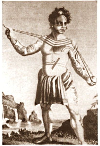 JB Kabri le Tatoué, dessin publié dans le livre de Von Langsdorff
Retour à Tahuata... L' île n'est entourée que partiellement de récifs coralliens ( comme Mangareva aux îles Gambier ) , et est agrémentée de magnifiques plages de sable blanc, en particulier celle de Hanamoenoa. Avec ses versants escarpés se terminant en falaises, des vallées étroites et profondes ouvrant sur des baies échancrées à la végétation dense telles celles jumelles de Iva Iva Nui et de Iva Iva Iti, Tahuata surprend et attire. ' C'est une des rares fois où j' eus le désir de posséder de la terre ', écrivit en son temps le navigateur Alain Gerbault, conquis par une île qu'il qualifiait d'enchanteresse. Son relief est très accidenté et les communications terrestres - sur des pistes improbables - entre les vallées sont difficiles. L' île culmine au Mont Tumu-Mea-Ufa à 1050 m. Sa superficie est de 60 km2, avec une population de 650 à 700 habitants environ. L' île comporte 4 villages : Vaitahu, petit port historique, avec son église aux murs de galets et un magnifique vitrail, son musée d'art et d'histoire, et sa proximité avec des sites archéologiques; Hapatoni, autre village avec sa voie pavée ou ' allée de la reine ', construite sur ordre de la reine Vaekehu II au 19ème siècle, bordée d'arbres centenaires de tamanu plantés par les anciens , et ses ' me'ae ' ( ou ' marae ' en tahitien). Egalement Motopu et Hanatetena, deux plus petits villages. Il y a d'autres chemins pavés dans l' île, à Hapatoni en particulier, et des pétroglyphes à Hanatahua. On peut donc passer plus d'une journée à Tahuata, y séjourner dans l' une de ses pensions. Les chemins et pistes de l' île se prêtent parfaitement à la randonnée pédestre.
UN PEU D HISTOIRE
Plusieurs édifices du village de Vaitahu commémorent un passé souvent tragique. On peut y voir les trois stèles érigées en souvenir de l' arrivée des Espagnols en 1595, puis de celle de militaires français en 1838 et enfin de la prise de possession de l' archipel par l' amiral Abel Dupetit-Thouars en 1842. Alvaro de Mendaña y Neira jeta l' ancre à Vaitahu en 1595, un premier contact avec ceux que l' on appelait à l' époque dans les mers du Sud et ailleurs ' les naturels ' qui tourna rapidement au massacre par les soldats espagnols de 200 villageois, guerriers et civils mélangés. On peut comprendre, dans ce contexte, que l' arrivée d'Occidentaux au 18ème siècle et au début du 19ème siècle ait suscité beaucoup de méfiance, d'animosité et d'hostilité de la part des habitants de Tahuata, et des autres îles également. Les premières tentatives d' évangélisation protestante d'abord en 1797 puis catholique en 1839 se soldèrent par un échec retentissant ( le gouvernement français avait l' habitude d'envoyer les missionnaires en éclaireurs afin de tâter le terrain.. ). Le religieux ayant failli à sa mission, il restait donc le politique et le militaire : l' expédition Dupetit-Thouars arrive en vue de Tahuata mi - avril 1842. Les Français sont dans un premier temps plutôt bien reçus par le chef / roi Iotete qui a récemment subi la pression de la marine américaine et qui se dit que la France le protégera. On attribue donc un terrain en hauteur aux Français pour la construction d'un fortin et d'une garnison. Dupetit-Thouars veut aller vite et propose à Iotete de se mettre sous la protection du roi de France, Louis-Philippe. Iotete accepte et, le 1er mai, est organisée une cérémonie pour la prise de possession officielle des îles Sud de l' archipel des Marquises - et par extension de tout l' archipel - par la France en présence des missionnaires et du neveu de Iotete, Maheono, également chef de Hanatetena. Et puis rapidement, un malaise grandissant s'installe, l' ambiance se dégrade, Iotete devient peu accommodant et versatile, ne supportant pas de se voir privé de son autorité de chef incontesté. Il fugue dans la montagne, organise la résistance aux Français que l' on vient pourtant de fêter, et finit par assiéger le fortin à moitié achevé avec ses guerriers. Résultat : des morts et des blessés des deux côtés et un chaos inattendu. Après palabres et promesses, l' amiral, fidèle à sa stratégie initiale, convainc Iotete - contacté et ramené à la raison par son neveu - de revenir à la table des négociations, et les termes d' une paix durable sont établis définitivement. Iotete a tenté de lutter mais a perdu et la guerre et son pouvoir, son ' mana '. Il mourra l' année suivante, une fin triste et sans avenir pour un chef qui ne sera pas élevé au rang de dieu le jour de ses funérailles.
 Prise de possession officielle de Tahuata
De g. à d. : Maheono, Iotete ( en habit militaire d'apparat à galons d'or époque Louis XV ), le père Baudichon, Abel Dupetit-Thouars
Prise de possession officielle de Tahuata
De g. à d. : Maheono, Iotete ( en habit militaire d'apparat à galons d'or époque Louis XV ), le père Baudichon, Abel Dupetit-Thouars
 Iotete le 1er Mais 1842 ( portrait par Max Radiguet )
 Iotete le 1er mai 1842 ( portrait par Max Radiguet )
 Maheono, neveu de Iotete et son saisissant tatouage facial
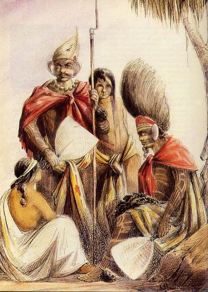 Guerriers marquisiens 19ème siècle
L' amiral repart bientôt sur son navire La Reine Blanche vers Tahiti où il va obtenir le 9 septembre 1842 de la reine Pomaré IV son acceptation formelle de placer son île sous protectorat français. C' est ainsi que Les Marquises alias La Terre des Hommes ( ou Te Fenua Enata en marquisien ) devient la première colonie française dans le Pacifique Sud un peu avant Tahiti.
FAUNE ET FLORE Depuis sa disparition de Hiva Oa, suite à l' introduction malheureuse d'un rapace nocturne, le grand-duc de Virginie ( ou Bubo Virginiasus en latin ), la seule population survivante de ' pahi ' ou martin-chasseur des Marquises, vit à Tahuata, en grand danger d'extinction, car en déclin lent mais constant. il ne resterait que 300 individus au mieux. La destruction du grand-duc est autorisée à cause de son impact fatal sur la faune aviaire locale. Des excursions à pied et à cheval, en excursion à la demi-journée ou à la journée entière, à la découverte du ' pahi ' sont possibles. Contacter le comité de tourisme de Tahuata.
ACTIVITES TRADITIONNELLES
Il y a à Tahuata plusieurs centres d'artisanat et ce dernier est le plus réputé des Marquises, en particulier pour la sculpture sur os. Dans l' île, on est souvent sculpteur de père en fils; les hommes travaillent le bois de rose, l' os de cheval, de chèvre et de mouton et le rostre d'espadon. Dans la vallée d'Hapatoni, ce sont surtout d' expertes sculptrices qui sont à l' oeuvre, souvent depuis des années. Au travail de l' os ou du rostre d'espadon, elles ajoutent la confection de bijoux originaux. La culture du coprah est bien présente à Tahuata et permet aux agriculteurs de gagner un revenu fixe. Les cultures vivrières et les récoltes d'agrumes tels les pamplemousses, très réputés permettent l' autosuffisance alimentaire des habitants de l' île et un peu d'exportation vers le marché et les supermarchés de Papeete ( via la diaspora marquisienne installée à Tahiti ). Pêche et chasse participent également, pleinement, de ce désir d'autosuffisance. La nature est généreuse et tout pousse à profusion et l' on vit simplement mais plutôt bien à Tahuata comme ailleurs aux Marquises, d'autant que désormais, les cargos mixtes apportent régulièrement de Tahiti ce qui manque aux îliens.
Fatu Iva L' île de tous les superlatifs / L'île érotique

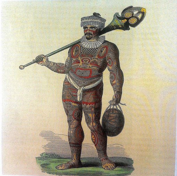
Guerrier marquisien tatoué originaire de Fatu Iva 19ème siècle On notera sur sa poitrine les motifs reconstitués d'une tête de tiki, que l' on retrouve aussi sur la crosse du casse-tête ( ou ' u'u ' en marquisien ), arme réservée au guerrier. Cette tête est supposée augmenter le ' mana ' ( alias la puissance ), les yeux en amande évoquent cette puissance surnaturelle tandis que la bouche étirée où apparaissent parfois langue et dents, est censée défier l' adversaire.
SELON LA LEGENDE Dans la légende de la construction de l' archipel des Marquises, selon laquelle chaque île est partie intégrante de la Maison des Dieux, Fatu Iva représente la toiture faite de 9 ( Iva ) tresses ( Fatu ) de feuilles de palmier. Elle s'est aussi appelée Santa Magdalena, nom donné par Alvaro de Mendaña en l' honneur de la sainte du même nom.
UN PEU DE GEOGRAPHIE Fatu Iva est une île située à 75 kms de Hiva Oa, d'une superficie de 84 km2. Longue de 10 kilomètres et large de 4, elle a la forme d'un croissant ou d'un haricot. Elle culmine au Mont Touaouoho à 960 mètres et héberge une population d'environ 600 habitants. C' est l' île la plus australe de l' archipel, la plus isolée aussi car il est impossible d'y construire un aéroport en raison du relief accidenté ou même un aérodrome comme à Ua Pou par exemple. C' est aussi la plus pluvieuse, étant la plus proche du tropique du Capricorne. Les pluies étant abondantes, l' île est recouverte d'une végétation luxuriante en particulier en son centre où prospère une forêt primaire tropicale dense. C' est aussi l'île la plus sauvage et la plus spectaculaire de l' archipel. Géologiquement parlant, elle est constituée de deux caldeiras volcaniques enchâssées l' une dans l' autre. La première date de 2 millions d'années environ, la seconde, deux fois plus petite est née d'une énorme éruption, comme en témoignent les massives chandelles basaltiques qui montent au ciel tout autour de la baie de Hanavave, dite baie des Vierges. Initialement appelée baie des Verges par les Marquisiens, elle a été rebaptisée par de pudibonds missionnaires, effarouchés par l' imagerie locale et ses sous-entendus. Fatu Iva n' a que deux villages situées chacun sur le bord extérieur des deux caldeiras : Hanavave aux colonnes basaltiques et Omoa, chef-lieu de l' île , village surplombé par un piton rocheux qui surprend par son profil rappelant la tête d'un moai de l' île de Pâques.
UN PEU D'HISTOIRE Comme les autres îles de l' archipel, Fatu Iva fut initialement peuplée par des Polynésiens venus de l' ouest. Les rivalités entre tribus étaient au départ incessantes et donnèrent lieu à des batailles sanglantes. C' est en juillet 1595 que l'île - tout comme celle de Tahuata - fut abordée pour la première fois par un occidental, le navigateur espagnol Alvaro de Mendaña de Neira , le premier du genre à avoir établi des contacts avec des populations polynésiennes. Mais il n' y débarqua pas. Il crût tout d'abord avoir découvert les Iles Salomon, le but ultime de son voyage, mais se rendit rapidement compte qu' il avait découvert une nouvelle terre dans un archipel d' îles auxquelles il donna le nom de ' Marquesas de Mendoza ' pour remercier le Vice-Roi du Pérou - alias Garcia Hurtado de Mendoza y Maurique, IV marquis de Cañete - qui l' avait aidé à monter et financer son expédition, et pour honorer en même temps son épouse et ses filles. En 1935, l' anthropologue norvégien Thor Heyerdahl - et futur aventurier du Kon Tiki - aborda Fatu Iva avec l' idée bien ancrée d' en faire son éden. Il y vécut un an avec sa femme, d'abord à Omoa, puis à Ouia, une vallée inconfortablement située sur la côte au vent et désormais retournée à l' état naturel, ayant été abandonnée par ses quelques habitants. Heyerdahl avait à l' époque avancé l' hypothèse erronée que les Maori descendaient des Indiens d'Amérique du Sud alors qu'ils sont originellement arrivés en pirogue de l' Asie du Sud-Est, et plus particulièrement de Taïwan. ( Je vous renvoie à mon carnet sur Taïwan où j' aborde ce sujet )
De 1960 à 1966, une majorité d'hommes de Fatu Iva partirent travailler au CEP de Mururoa, participant ainsi de l' émigration économique ayant commencé à l' époque, et s'étant poursuivie jusqu'à nos jours, les perspectives en termes d' emploi étant plus que limitées si l' on ne veut pas rester ou devenir agriculteur ou coprahculteur comme ses parents ou grands-parents.
FAUNE ET FLORE L' île est une terre d'abondance pour les agrumes, les fruits en général et les fleurs... Tout pousse ou presque. Elle possède une espèce endémique très menacée aujourd'hui : le Monarque ( ou oma'o ke'eke'e en marquisien ', dont il ne restait il y a peu que 6 couples au monde ! Le rat noir et le chat haret ont littéralement décimé cette espèce, dévorant oeufs, oisillons et même femelles en couvaison. Un programme de sauvegarde de l' espèce a été mis en place, avec des résultats encourageants, le nombre de couples ayant augmenté ces dernières années.
ECONOMIE L' île est ravitaillée uniquement par bateau. Une unique route partiellement bétonnée des deux côtés, et partiellement à l' état de piste, et longue de 17 kilomètres relie les deux villages. On peut également aller d'un village à l' autre par la mer en un quart d'heure de navigation. Le secteur primaire prévaut à Fatu Iva, en particulier la culture du coprah, et puis la pêche au thon, à l' espadon et au thazard. On y a cultivé le noni à outrance à une certaine époque mais celle-ci est un peu révolue, les bienfaits miraculeux du noni n' ayant pas vraiment été prouvés scientifiquement. Comme à Rurutu, on a abandonné la culture du café qui était pourtant prometteuse il y a une quarantaine d'années. En revanche, on trouve davantage de vergers et des vanillières. La chasse aux cochons et aux chèvres permet l' auto-suffisance en viande quand le ravitaillement venu de Tahiti vient à manquer ou arrive irrégulièrement. L' artisanat s'est développé grâce au tourisme et aux expositions semestrielles organisées à Papeete. La spécialité - principalement féminine - de Fatu Iva est le tapa dont les dessins s'inspirent des anciens tatouages marquisiens. La sculpture sur bois ou os ou noix de coco est plutôt réservée aux hommes, nourrie des anciennes figures et des symboles centenaires : tikis sculptés en bois de rose ou en bois noir, casse-tête, plats de présentation.
Suivez-moi en page 2.....
TAHUATA ou Île Lumière
DANS LA LEGENDE DES MARQUISES C' est la plus petite île habitée des Marquises dont le nom signifie l' aube en marquisien. J' aurai, plus tard, l' occasion de revenir sur la légende de la création des Marquises : dans cette légende, Tahuata représente le dernier acte de la construction avant l' aube. La symbolique de son nom est liée à l' arrivée de la lumière du jour, signifiant la fin de la construction de la 'Grande Maison', alias l' archipel des Marquises.
UN PEU DE GEOLOGIE Tahuata et Fatu Iva sont soeurs géologiquement parlant. Ce sont des îles plus jeunes que celles du nord de l' archipel ( de 5, 5 millions d'années au Nord-Ouest à seulement 1,2 million d'années au Sud-Est ) L' activité volcanique passée s' est matérialisée sous la forme de volcans dits boucliers, différents des volcans hawaiïens ou tahitiens, qui , suite à des secousses sismiques violentes et répétées, se sont peu à peu effondrés, disparaissant sous les flots de la moitié voire davantage des boucliers initiaux. Résultat : les calderas sont imbriquées l'une dans l' autre , la caldeira initiale étant dotée d'un volcan interne plus petit et plus récent. C 'est le cas à Fatu Iva par exemple.
UN PEU DE GEOGRAPHIE
Située à seulement 4 kms de Hiva Oa , on ne peut rejoindre Tahuata que par mer après 40 à 60 mn de navigation selon le temps ( il existe un catamaran communal, le Tahuata Nui mais qui est souvent en panne pour une durée indéterminée... ). On choisira entre l' excursion à la journée ou le passage simple en speedboat privé, assez cher. Ou si l' on doit résider à Tahuata, on s'arrangera au préalable avec la pension de famille choisie pour discuter des modalités et du prix de la course aller-retour entre Tahuata et Hiva Oa. Le canal dit du Bordelais qui est emprunté par les bateaux peut être extrêmement agité par des courants violents et rallonger un peu la course. (Petite digression sur ce fameux canal du Bordelais... Qui est donc ce Bordelais ? Un certain Joseph Capri ( ou Kabri ou Kabris ), originaire de Bordeaux même, initialement matelot de son état sur un bâtiment baleinier qui fait naufrage sur la côte de Nuku Hiva. Kabri , capturé par les guerriers du roi anthropophage de NH, s'apprête à mourir et à finir rôti à la broche, mais est sauvé in extremis par la fille du roi qui demande sa grâce. Celle-ci est accordée, il épouse la belle dans la foulée, le roi tatoue son gendre lui-même, lui offre des parures en tapa et mousse et le nomme grand juge du pays. Il tue, torture, garrotte, découpe en morceaux. Il pacifie à sa manière ! La vie est douce et belle, il a six enfants de sa princesse marquisienne ... Et puis un jour où il sommeille dans la nature, il est kidnappé par le navigateur russe Krunsenstern qui, à coups de knout, le ramène au navire puis à St Petersbourg pour y être interrogé et jugé. Kabri parvient à s' échapper vers Paris, demande à rencontrer Louis XVIII qu'il traite comme son cousin. Ce dernier - contre toute attente - le reçoit et lui donne un peu d'argent, mais la chance a définitivement tourné pour Kabri qui se retrouve à Valenciennes, gagnant son pain comme bête de foire. Il mourra à 42 ans, épuisé et sans avoir pu repartir vers son île marquisienne et vers sa famille nombreuse. Les autorités lui éviteront post mortem l' infamie d'une exhumation et d'un empaillage, son tatouage corporel et facial ayant conquis un amateur !!!
JB Kabri le Tatoué, dessin publié dans le livre de Von LangsdorffRetour à Tahuata... L' île n'est entourée que partiellement de récifs coralliens ( comme Mangareva aux îles Gambier ) , et est agrémentée de magnifiques plages de sable blanc, en particulier celle de Hanamoenoa. Avec ses versants escarpés se terminant en falaises, des vallées étroites et profondes ouvrant sur des baies échancrées à la végétation dense telles celles jumelles de Iva Iva Nui et de Iva Iva Iti, Tahuata surprend et attire. ' C'est une des rares fois où j' eus le désir de posséder de la terre ', écrivit en son temps le navigateur Alain Gerbault, conquis par une île qu'il qualifiait d'enchanteresse. Son relief est très accidenté et les communications terrestres - sur des pistes improbables - entre les vallées sont difficiles. L' île culmine au Mont Tumu-Mea-Ufa à 1050 m. Sa superficie est de 60 km2, avec une population de 650 à 700 habitants environ. L' île comporte 4 villages : Vaitahu, petit port historique, avec son église aux murs de galets et un magnifique vitrail, son musée d'art et d'histoire, et sa proximité avec des sites archéologiques; Hapatoni, autre village avec sa voie pavée ou ' allée de la reine ', construite sur ordre de la reine Vaekehu II au 19ème siècle, bordée d'arbres centenaires de tamanu plantés par les anciens , et ses ' me'ae ' ( ou ' marae ' en tahitien). Egalement Motopu et Hanatetena, deux plus petits villages. Il y a d'autres chemins pavés dans l' île, à Hapatoni en particulier, et des pétroglyphes à Hanatahua. On peut donc passer plus d'une journée à Tahuata, y séjourner dans l' une de ses pensions. Les chemins et pistes de l' île se prêtent parfaitement à la randonnée pédestre.
UN PEU D HISTOIRE
Plusieurs édifices du village de Vaitahu commémorent un passé souvent tragique. On peut y voir les trois stèles érigées en souvenir de l' arrivée des Espagnols en 1595, puis de celle de militaires français en 1838 et enfin de la prise de possession de l' archipel par l' amiral Abel Dupetit-Thouars en 1842. Alvaro de Mendaña y Neira jeta l' ancre à Vaitahu en 1595, un premier contact avec ceux que l' on appelait à l' époque dans les mers du Sud et ailleurs ' les naturels ' qui tourna rapidement au massacre par les soldats espagnols de 200 villageois, guerriers et civils mélangés. On peut comprendre, dans ce contexte, que l' arrivée d'Occidentaux au 18ème siècle et au début du 19ème siècle ait suscité beaucoup de méfiance, d'animosité et d'hostilité de la part des habitants de Tahuata, et des autres îles également. Les premières tentatives d' évangélisation protestante d'abord en 1797 puis catholique en 1839 se soldèrent par un échec retentissant ( le gouvernement français avait l' habitude d'envoyer les missionnaires en éclaireurs afin de tâter le terrain.. ). Le religieux ayant failli à sa mission, il restait donc le politique et le militaire : l' expédition Dupetit-Thouars arrive en vue de Tahuata mi - avril 1842. Les Français sont dans un premier temps plutôt bien reçus par le chef / roi Iotete qui a récemment subi la pression de la marine américaine et qui se dit que la France le protégera. On attribue donc un terrain en hauteur aux Français pour la construction d'un fortin et d'une garnison. Dupetit-Thouars veut aller vite et propose à Iotete de se mettre sous la protection du roi de France, Louis-Philippe. Iotete accepte et, le 1er mai, est organisée une cérémonie pour la prise de possession officielle des îles Sud de l' archipel des Marquises - et par extension de tout l' archipel - par la France en présence des missionnaires et du neveu de Iotete, Maheono, également chef de Hanatetena. Et puis rapidement, un malaise grandissant s'installe, l' ambiance se dégrade, Iotete devient peu accommodant et versatile, ne supportant pas de se voir privé de son autorité de chef incontesté. Il fugue dans la montagne, organise la résistance aux Français que l' on vient pourtant de fêter, et finit par assiéger le fortin à moitié achevé avec ses guerriers. Résultat : des morts et des blessés des deux côtés et un chaos inattendu. Après palabres et promesses, l' amiral, fidèle à sa stratégie initiale, convainc Iotete - contacté et ramené à la raison par son neveu - de revenir à la table des négociations, et les termes d' une paix durable sont établis définitivement. Iotete a tenté de lutter mais a perdu et la guerre et son pouvoir, son ' mana '. Il mourra l' année suivante, une fin triste et sans avenir pour un chef qui ne sera pas élevé au rang de dieu le jour de ses funérailles.
Prise de possession officielle de Tahuata
De g. à d. : Maheono, Iotete ( en habit militaire d'apparat à galons d'or époque Louis XV ), le père Baudichon, Abel Dupetit-Thouars
Iotete le 1er Mais 1842 ( portrait par Max Radiguet )
Iotete le 1er mai 1842 ( portrait par Max Radiguet )
Maheono, neveu de Iotete et son saisissant tatouage facial
Guerriers marquisiens 19ème siècleL' amiral repart bientôt sur son navire La Reine Blanche vers Tahiti où il va obtenir le 9 septembre 1842 de la reine Pomaré IV son acceptation formelle de placer son île sous protectorat français. C' est ainsi que Les Marquises alias La Terre des Hommes ( ou Te Fenua Enata en marquisien ) devient la première colonie française dans le Pacifique Sud un peu avant Tahiti.
FAUNE ET FLORE Depuis sa disparition de Hiva Oa, suite à l' introduction malheureuse d'un rapace nocturne, le grand-duc de Virginie ( ou Bubo Virginiasus en latin ), la seule population survivante de ' pahi ' ou martin-chasseur des Marquises, vit à Tahuata, en grand danger d'extinction, car en déclin lent mais constant. il ne resterait que 300 individus au mieux. La destruction du grand-duc est autorisée à cause de son impact fatal sur la faune aviaire locale. Des excursions à pied et à cheval, en excursion à la demi-journée ou à la journée entière, à la découverte du ' pahi ' sont possibles. Contacter le comité de tourisme de Tahuata.
ACTIVITES TRADITIONNELLES
Il y a à Tahuata plusieurs centres d'artisanat et ce dernier est le plus réputé des Marquises, en particulier pour la sculpture sur os. Dans l' île, on est souvent sculpteur de père en fils; les hommes travaillent le bois de rose, l' os de cheval, de chèvre et de mouton et le rostre d'espadon. Dans la vallée d'Hapatoni, ce sont surtout d' expertes sculptrices qui sont à l' oeuvre, souvent depuis des années. Au travail de l' os ou du rostre d'espadon, elles ajoutent la confection de bijoux originaux. La culture du coprah est bien présente à Tahuata et permet aux agriculteurs de gagner un revenu fixe. Les cultures vivrières et les récoltes d'agrumes tels les pamplemousses, très réputés permettent l' autosuffisance alimentaire des habitants de l' île et un peu d'exportation vers le marché et les supermarchés de Papeete ( via la diaspora marquisienne installée à Tahiti ). Pêche et chasse participent également, pleinement, de ce désir d'autosuffisance. La nature est généreuse et tout pousse à profusion et l' on vit simplement mais plutôt bien à Tahuata comme ailleurs aux Marquises, d'autant que désormais, les cargos mixtes apportent régulièrement de Tahiti ce qui manque aux îliens.
Fatu Iva L' île de tous les superlatifs / L'île érotique
Guerrier marquisien tatoué originaire de Fatu Iva 19ème siècle On notera sur sa poitrine les motifs reconstitués d'une tête de tiki, que l' on retrouve aussi sur la crosse du casse-tête ( ou ' u'u ' en marquisien ), arme réservée au guerrier. Cette tête est supposée augmenter le ' mana ' ( alias la puissance ), les yeux en amande évoquent cette puissance surnaturelle tandis que la bouche étirée où apparaissent parfois langue et dents, est censée défier l' adversaire.
SELON LA LEGENDE Dans la légende de la construction de l' archipel des Marquises, selon laquelle chaque île est partie intégrante de la Maison des Dieux, Fatu Iva représente la toiture faite de 9 ( Iva ) tresses ( Fatu ) de feuilles de palmier. Elle s'est aussi appelée Santa Magdalena, nom donné par Alvaro de Mendaña en l' honneur de la sainte du même nom.
UN PEU DE GEOGRAPHIE Fatu Iva est une île située à 75 kms de Hiva Oa, d'une superficie de 84 km2. Longue de 10 kilomètres et large de 4, elle a la forme d'un croissant ou d'un haricot. Elle culmine au Mont Touaouoho à 960 mètres et héberge une population d'environ 600 habitants. C' est l' île la plus australe de l' archipel, la plus isolée aussi car il est impossible d'y construire un aéroport en raison du relief accidenté ou même un aérodrome comme à Ua Pou par exemple. C' est aussi la plus pluvieuse, étant la plus proche du tropique du Capricorne. Les pluies étant abondantes, l' île est recouverte d'une végétation luxuriante en particulier en son centre où prospère une forêt primaire tropicale dense. C' est aussi l'île la plus sauvage et la plus spectaculaire de l' archipel. Géologiquement parlant, elle est constituée de deux caldeiras volcaniques enchâssées l' une dans l' autre. La première date de 2 millions d'années environ, la seconde, deux fois plus petite est née d'une énorme éruption, comme en témoignent les massives chandelles basaltiques qui montent au ciel tout autour de la baie de Hanavave, dite baie des Vierges. Initialement appelée baie des Verges par les Marquisiens, elle a été rebaptisée par de pudibonds missionnaires, effarouchés par l' imagerie locale et ses sous-entendus. Fatu Iva n' a que deux villages situées chacun sur le bord extérieur des deux caldeiras : Hanavave aux colonnes basaltiques et Omoa, chef-lieu de l' île , village surplombé par un piton rocheux qui surprend par son profil rappelant la tête d'un moai de l' île de Pâques.
UN PEU D'HISTOIRE Comme les autres îles de l' archipel, Fatu Iva fut initialement peuplée par des Polynésiens venus de l' ouest. Les rivalités entre tribus étaient au départ incessantes et donnèrent lieu à des batailles sanglantes. C' est en juillet 1595 que l'île - tout comme celle de Tahuata - fut abordée pour la première fois par un occidental, le navigateur espagnol Alvaro de Mendaña de Neira , le premier du genre à avoir établi des contacts avec des populations polynésiennes. Mais il n' y débarqua pas. Il crût tout d'abord avoir découvert les Iles Salomon, le but ultime de son voyage, mais se rendit rapidement compte qu' il avait découvert une nouvelle terre dans un archipel d' îles auxquelles il donna le nom de ' Marquesas de Mendoza ' pour remercier le Vice-Roi du Pérou - alias Garcia Hurtado de Mendoza y Maurique, IV marquis de Cañete - qui l' avait aidé à monter et financer son expédition, et pour honorer en même temps son épouse et ses filles. En 1935, l' anthropologue norvégien Thor Heyerdahl - et futur aventurier du Kon Tiki - aborda Fatu Iva avec l' idée bien ancrée d' en faire son éden. Il y vécut un an avec sa femme, d'abord à Omoa, puis à Ouia, une vallée inconfortablement située sur la côte au vent et désormais retournée à l' état naturel, ayant été abandonnée par ses quelques habitants. Heyerdahl avait à l' époque avancé l' hypothèse erronée que les Maori descendaient des Indiens d'Amérique du Sud alors qu'ils sont originellement arrivés en pirogue de l' Asie du Sud-Est, et plus particulièrement de Taïwan. ( Je vous renvoie à mon carnet sur Taïwan où j' aborde ce sujet )
De 1960 à 1966, une majorité d'hommes de Fatu Iva partirent travailler au CEP de Mururoa, participant ainsi de l' émigration économique ayant commencé à l' époque, et s'étant poursuivie jusqu'à nos jours, les perspectives en termes d' emploi étant plus que limitées si l' on ne veut pas rester ou devenir agriculteur ou coprahculteur comme ses parents ou grands-parents.
FAUNE ET FLORE L' île est une terre d'abondance pour les agrumes, les fruits en général et les fleurs... Tout pousse ou presque. Elle possède une espèce endémique très menacée aujourd'hui : le Monarque ( ou oma'o ke'eke'e en marquisien ', dont il ne restait il y a peu que 6 couples au monde ! Le rat noir et le chat haret ont littéralement décimé cette espèce, dévorant oeufs, oisillons et même femelles en couvaison. Un programme de sauvegarde de l' espèce a été mis en place, avec des résultats encourageants, le nombre de couples ayant augmenté ces dernières années.
ECONOMIE L' île est ravitaillée uniquement par bateau. Une unique route partiellement bétonnée des deux côtés, et partiellement à l' état de piste, et longue de 17 kilomètres relie les deux villages. On peut également aller d'un village à l' autre par la mer en un quart d'heure de navigation. Le secteur primaire prévaut à Fatu Iva, en particulier la culture du coprah, et puis la pêche au thon, à l' espadon et au thazard. On y a cultivé le noni à outrance à une certaine époque mais celle-ci est un peu révolue, les bienfaits miraculeux du noni n' ayant pas vraiment été prouvés scientifiquement. Comme à Rurutu, on a abandonné la culture du café qui était pourtant prometteuse il y a une quarantaine d'années. En revanche, on trouve davantage de vergers et des vanillières. La chasse aux cochons et aux chèvres permet l' auto-suffisance en viande quand le ravitaillement venu de Tahiti vient à manquer ou arrive irrégulièrement. L' artisanat s'est développé grâce au tourisme et aux expositions semestrielles organisées à Papeete. La spécialité - principalement féminine - de Fatu Iva est le tapa dont les dessins s'inspirent des anciens tatouages marquisiens. La sculpture sur bois ou os ou noix de coco est plutôt réservée aux hommes, nourrie des anciennes figures et des symboles centenaires : tikis sculptés en bois de rose ou en bois noir, casse-tête, plats de présentation.
Suivez-moi en page 2.....