Aides pour organiser un tour des Amériques à vélo
by Ceddeg
This discussion is in French, the community’s main language.
Original post
Bonjour,
Je suis à la recherche d’informations pour le projet suivants.
Ma compagne et moi-même partirons en juillet 2011 pour 12 mois traverser les Amériques à vélo, en partant de Calgary canada et pour arriver à Ushuaia Argentine. Soit selon mes estimations 18000 km. Les différents pays traversés seront les suivants : canada – USA – Mexique – Guatemala – El Salvador – Honduras – Nicaragua – Costa Rica – panama – Equateur – Pérou – Bolivie – argentine – chili.
Nous comptons vivre simplement, faire notre popote, loger sous notre tente ou chez une personne accueillante et occasionnellement un p’tit resto et un p’tit hôtel pour bien se décrasser
Alors si vous avez des remarques, commentaires suggestions, critiques… ou des expériences à partager…
J’ai pas mal bouquiné sur le sujet et également surfé , mais il reste des zones d’ombres :
- Comment estimer au mieux les distances a parcourir ? j’ai pour les usa fait un parcours sur google map et pour les autres pays j’ai tracer des traits sur une carte et multiplié cette distance par 1, 5.
- 18000 km en an est-ce raisonnable ou ambitieux ?
- Comment savoir le cout de la vie des pays traversés (nourritures et petit extras resto hotel…)
Bonjour,
Sacré projet chouette ! De mon côté, là où je m'interroge à fond, c'est le départ de Calgary. Enfin, c'est un des plus moches endroits de la Terre. Si vous partiez de Vancouver, vous vous taperiez les états de Washington, de l'Orégon et de la Californie, tout ça absolument magnifique et modéré au plan météo. Si vous partiez de Montréal, vous pourriez passer par les splendides états de la Nouvelle Angleterre, par Boston, New York, la Louisianne, etc. Mais partir par Calgary !… Vous devez y avoir de la famille, ou un truc du genre !? Sinon, vraiment, au-delà des gens, très sympas en général, et des champs de blé/pétrole… vous ne risquez pas de rencontrer grand chose. Au Sud, c'est champ de patates sur champ de patates. Même à vélo, ça pourrait être gonflant.
Ensuite, la distance, c'est à vous de savoir. 18 000 en un an, c'est jouable. 2000 par mois avec quelques longues pauses salutaires. En tout cas, vous allez revenir différents. Ça c'est indéniable.
Bon vents ! É.
Sacré projet chouette ! De mon côté, là où je m'interroge à fond, c'est le départ de Calgary. Enfin, c'est un des plus moches endroits de la Terre. Si vous partiez de Vancouver, vous vous taperiez les états de Washington, de l'Orégon et de la Californie, tout ça absolument magnifique et modéré au plan météo. Si vous partiez de Montréal, vous pourriez passer par les splendides états de la Nouvelle Angleterre, par Boston, New York, la Louisianne, etc. Mais partir par Calgary !… Vous devez y avoir de la famille, ou un truc du genre !? Sinon, vraiment, au-delà des gens, très sympas en général, et des champs de blé/pétrole… vous ne risquez pas de rencontrer grand chose. Au Sud, c'est champ de patates sur champ de patates. Même à vélo, ça pourrait être gonflant.
Ensuite, la distance, c'est à vous de savoir. 18 000 en un an, c'est jouable. 2000 par mois avec quelques longues pauses salutaires. En tout cas, vous allez revenir différents. Ça c'est indéniable.
Bon vents ! É.
Et il poursuivit sa route
Celle que voulait sa monture
Car en cela consistait
L'essence de l'aventure
— Cervantes
Je suis alle de Denver a Calgary a velo et la route etait superbe. On peut visiter plusieurs parcs nationaux magnifique comme Glacier, Yellowstone, et Grand Teton. Pas de probleme du tout a l'egard de Calgary. Banff est seulement 120 km a l'ouest, et on peut suivre les rocheuses jusqu'au Nouveau-Mexique. La cote Pacifique est tres jolie a velo aussi, et c'est plus facile que les rocheuses, bien sur.
Vous allez comment de Panama a l'Equateur? Bateau? Avion?
Merci à toi de partager tes connaissances.
Et non , nous n'avons pas de famille a calgari. L'idée était de traverser les parc nationaux suivants : parc de yellowstone, grand teton, les arches et mesa verde et big bend et éviter les zones archi peuplé et privilégiées le contact avec la nature. Les alternatives que tu proposes bien qu'un peu plus longues semblent intéressantes.
Car, il semble que les états que nous voulions traverser initialement risque peut-être d'être monotone (bcp de plaines).
Votre avis? Vancouver, montreal ou calgari?
Calgary est un départ original mais ça peut être bien intéressant. C'est un point d'entrée pour aller sur les rocheuses vers l'ouest. Vers l'est, vous pouvez aussi trouver des choses intéressantes comme les badlands ou plonger au sud-ouest vers yellowstone ou glacier park. En partant de Calgary vous serez rapidement dans les montagnes si vous aller vers l'Ouest ou le Sud Ouest, donc pas trop de monotonie
Je pense que si vous souhaitez faire les rocheuses canadiennes et le parc de Banff (et ça vaut le coup), vous pourriez aussi envisager un départ de Jasper. La route des glaciers sud-nord est la plus intéressante à faire en vélo. La route 1 Est-Ouest Calgary-Vancouver est, dans les rocheuses, plus encombrée et (je pense) moins amusante.
Un autre choix pourrait être de partir d'Edmonton, mais pour avoir fait le route entre Edmonton et le parc... c'est pas une partie de plaisir avec le vent... par moment j'étais presque arrêté net par des rafales.
De mon côté, j'avais ensuite passé la frontière en Idaho pour ensuite traverser le bassin de la Colombia River (j'en garde un très bon souvenir) jusque Seatle. Les infos que j'avais récoltées sur place ne m'avaient pas encouragé à rejoindre Glacier Park ou YellowStone. Il semble que le traffic y soit trop intense en été pour que ce soit amusant (et puis il fallait aussi que je me garde des raisons pour revenir 😉). Mais peut-être ai-je eu tord.
Concernant la côté Ouest, il faut savoir qu'il s'agit d'une véritable autouroute à cycliste (surtout Oregon et Californie, un peu moins Washington) durant l'été. Les infrastructures suivent (camping pas chers, informations, itinéraires cyclables, bas-cotés, ...). C'est super sympa avec beaucoup de rencontres de cyclistes, mais ce n'est pas vraiment l'aventure. Attention, il faut cependant oublier - pour un temps - les images des plages californiennes et des bimbos en maillot : jusqu'à San Francisco, c'est plutôt humide et frais (bon climat pour pédaler).
Si vous ne rejoignez pas la côte au Nord, il faut alors faire attention car il n'y pas vraiment beaucoup d'autres endroits pour le faire ensuite sans passer par des zones de désert difficiles en plein mois d'août. L'association américaine adventure cycling (http://www.adventurecycling.org/) propose plusieurs itinéraires détaillés. Je pense que certaines parties d'entre eux pourraient vous intéresser.
Concernant l'option de partir de Vancouver, si il s'agit de partir ensuite plein sud, je trouverai ça triste, puisque vous manqueriez alors les rocheuses. Si c'est pour partir vers l'Ouest, alors je pense que Vancouver et Calgary se valent, à ceci prêt qu'il faut garder à l'esprit qu'en Amérique du Nord le vent souffle majoritairement de l'Ouest vers l'Est dans les terres et du Nord-Ouest sur la côte Ouest.
Un départ de Montréal pour aller vers l'Ouest n'est pas aisé (rapport au vent) - la majorité des cyclistes trans-canadiens font Vancouver-->Montréal ou plus. La chose est différente si c'est pour partir au sud ou vers l'Est. Il faut savoir que les conditions de voirie ne sont pas bonnes au Québec. En raison du gel les routes sont souvent des tappe-culs et il y a de nombreux passages pas agréables avec de la circulation et pas de bas-côtés. Le gouvernement québecois est volontariste via le projet de la Route Verte", mais sur le terrai les itinéraires cyclables sont encore trop morcelés et ne conviennent pas pour des rando longues distances. Mais bien sûr... l'Est et le Nord-Est du Québec est magnifique. De l'autre côté de la frontière, pour ce que j'en ai fait la situation est la même du côté de la voirie mais avec plus de bas-côtés et/ou de routes secondaires.
Le sud américain et le mid-ouest (Lousiane, Mississipi, Alabama, Floride, Arkansas, Missouri, Illinois, Ohio, Pennsylvanie, Indiana sont les états que j'ai traversé) sont culturement super intéressants... mais un poil ennuyeux à pédaler. Je ne sais pas ce qu'il en est de la côte Est.
Si votre objectif est de voir les Amériques dans toutes leurs diversité et surtout si en terme de budget ça peut coller, voici une proposition d'itinéraire avec des portions de train pour USA et Canada (j'ai posé les mois de façon plus qu'approximative, mais on doit pas être loin du compte)
JUILLET - Partir d'Atlanta, rejoindre la côte Est, la suivre un bout, un bout de train pour passer la megalopole (ou couper par les terres jusqu'au lac Eirie puis Montréal), AOUT - rejoindre le Maine, remonter jusqu'à Gaspé, train jusqu'à Québec, route du Roi jusque Montréal, SEPTEMBRE - suivre la piste cyclable du petit train du Nord + parc de la Veyrandrie jusqu'en Abitibi, rejoindre la gare la plus proche (ça doit être à quelques centaines de km), train jusque Jasper (ou Edmonton si vous voulez voir un peu les prairies, mais il faudra allors accepter le vent), Rocheuses Nord Sud jusqu'au Montana/Idaho, OCTOBRE - rejoindre la côte Ouest aux alentours de Florence en Oregon, NOVEMBRE - descendre jusque San Francisco, DESCEMBRE - continuer à descendre jusqu'au Mexique ou aller vers l'Ouest pour rejoindre le Grand Canyon et piquer au sud pour rejoindre votre prochain pays.
Je pense qu'ensuite il faut rajoutter 3 mois pour l'Amérique centrale (je n'ai pas fait). La descente Quito-Ushaïa prend en général 6 bon mois. Ca fait 15 mois de voyage... plus que ce que vous avez prévu. En zappant l'Amérique centrale ou en démarrant de Japser/Vancouver/Calagary, je pense que vous seriez dans ce que vous avez planifié.
Une autre voie de réflexion pourrait être de ne pas aller jusqu'à Ushaïa. Personellement, maintenant que je roule en Amérique du Sud, j'essaye de diversifier mon parcours en passant par exemple en ce moment en Amazonie (après avoir roulé dans les andes)
Sur un an de voyage dans les Amériques, je pense qu'une répartition correcte pourrait être de faire 5 mois Amérique du Nord, 2 mois Amérique Centrale, 5 mois Amérique du Sud.
J'espère que mon message saura vous donner quelques éléments de réflexion.
Romain

Si votre objectif est de voir les Amériques dans toutes leurs diversité et surtout si en terme de budget ça peut coller, voici une proposition d'itinéraire avec des portions de train pour USA et Canada (j'ai posé les mois de façon plus qu'approximative, mais on doit pas être loin du compte)
JUILLET - Partir d'Atlanta, rejoindre la côte Est, la suivre un bout, un bout de train pour passer la megalopole (ou couper par les terres jusqu'au lac Eirie puis Montréal), AOUT - rejoindre le Maine, remonter jusqu'à Gaspé, train jusqu'à Québec, route du Roi jusque Montréal, SEPTEMBRE - suivre la piste cyclable du petit train du Nord + parc de la Veyrandrie jusqu'en Abitibi, rejoindre la gare la plus proche (ça doit être à quelques centaines de km), train jusque Jasper (ou Edmonton si vous voulez voir un peu les prairies, mais il faudra allors accepter le vent), Rocheuses Nord Sud jusqu'au Montana/Idaho, OCTOBRE - rejoindre la côte Ouest aux alentours de Florence en Oregon, NOVEMBRE - descendre jusque San Francisco, DESCEMBRE - continuer à descendre jusqu'au Mexique ou aller vers l'Ouest pour rejoindre le Grand Canyon et piquer au sud pour rejoindre votre prochain pays.
Je pense qu'ensuite il faut rajoutter 3 mois pour l'Amérique centrale (je n'ai pas fait). La descente Quito-Ushaïa prend en général 6 bon mois. Ca fait 15 mois de voyage... plus que ce que vous avez prévu. En zappant l'Amérique centrale ou en démarrant de Japser/Vancouver/Calagary, je pense que vous seriez dans ce que vous avez planifié.
Une autre voie de réflexion pourrait être de ne pas aller jusqu'à Ushaïa. Personellement, maintenant que je roule en Amérique du Sud, j'essaye de diversifier mon parcours en passant par exemple en ce moment en Amazonie (après avoir roulé dans les andes)
Sur un an de voyage dans les Amériques, je pense qu'une répartition correcte pourrait être de faire 5 mois Amérique du Nord, 2 mois Amérique Centrale, 5 mois Amérique du Sud.
J'espère que mon message saura vous donner quelques éléments de réflexion.
Romain
Peux-tu m'en dire plus sont ton parcours à vélo? Combien de jour, distance, ou dormais-tu, cout du voyage (nourriture et logement)?
Pour les deux voyages (Denver->Jasper->Calgary et Seattle->Ile Vancouver->Californie), j'ai fait le camping la plupart des nuits. Parfois des auberges de jeunesse, mais il n'y en a pas beaucoup. Tres rarement un nuit dans un motel. Beaucoup de state parks en Oregon et Californie ont des hiker/biker campings. Le prix maintenant est peut-etre $5/nuit (a verifier). Les distances entre les villes et motels sont parfois enormes dans l'ouest du continent. Donc, il faut souvent camper. J'ai fait un petit voyage dans le sud-ouest de Utah (Bryce Canyon, Zion, etc), et la-bas, nous avons trouve un motel chaque soir, mais ce tour etait seulement 12 jours pendant mai. On savait ou les motels existaient. Pendant mon tour aux Rocheuses, parfois des camping primitifs aux Forest Service campgrounds, parfois des campings aux parcs nationaux, quelques campings municipales (pas du tout comme un camping europeen).
La nourriture est moins chere aux USA qu'en europe grace a la faiblesse du dollar.
Au Mexique, je n'ai pas campe. Nous avons trouve des hotels pas chers. La meme chose dans Costa Rica. Au Chile et en Argentine, je dormais souvent aux hospedajes (Bed & Breakfast). Mais ce n'est pas possible dans la plupart du sud de Chile et Argentina. La-bas il faut camper en general, je crois. Cependant, mon tour etait dans la region de los lagos qui est dans le nord de Patagonia.
Pour les deux voyages (Denver->Jasper->Calgary et Seattle->Ile Vancouver->Californie), j'ai fait le camping la plupart des nuits. Parfois des auberges de jeunesse, mais il n'y en a pas beaucoup. Tres rarement un nuit dans un motel. Beaucoup de state parks en Oregon et Californie ont des hiker/biker campings. Le prix maintenant est peut-etre $5/nuit (a verifier). Les distances entre les villes et motels sont parfois enormes dans l'ouest du continent. Donc, il faut souvent camper. J'ai fait un petit voyage dans le sud-ouest de Utah (Bryce Canyon, Zion, etc), et la-bas, nous avons trouve un motel chaque soir, mais ce tour etait seulement 12 jours pendant mai. On savait ou les motels existaient. Pendant mon tour aux Rocheuses, parfois des camping primitifs aux Forest Service campgrounds, parfois des campings aux parcs nationaux, quelques campings municipales (pas du tout comme un camping europeen).
La nourriture est moins chere aux USA qu'en europe grace a la faiblesse du dollar.
Au Mexique, je n'ai pas campe. Nous avons trouve des hotels pas chers. La meme chose dans Costa Rica. Au Chile et en Argentine, je dormais souvent aux hospedajes (Bed & Breakfast). Mais ce n'est pas possible dans la plupart du sud de Chile et Argentina. La-bas il faut camper en general, je crois. Cependant, mon tour etait dans la region de los lagos qui est dans le nord de Patagonia.
Merci pour les réponses.
Mais je me permets de recentrer les discussions sur sujet de départ :
- Comment estimer au mieux les distances a parcourir ? j’ai pour les usa fait un parcours sur google map et pour les autres pays j’ai tracer des traits sur une carte et multiplié cette distance par 1, 5. - 18000 km en an est-ce raisonnable ou ambitieux ? - Quel budget prévoir sur place ? (En sachant que le camping et l'hospitalité seront les priorités, ainsi que la nourriture sera basique (pates, riz....) + quelques extras off course.
Hola,
Si cela peut t’aider, tu trouveras sur cette page le kilométrage exact de notre voyage entre Quito et Ushuaïa :
http://cyclocosmos.skynetblogs.be/...71853/1/Itin%E9raire
Il manque environ 2000 km au total car, comme tu le constateras, nous avons été forcé de prendre deux bus en Argentine sans quoi nous ne serions pas arrivé à temps pour notre vol à Ushuaïa, et un bus au Pérou suite à une morsure de chien.
Bref, Quito-Ushuaïa en six mois c'est trop court si on veux vraiment traverser le continent en passant dans la Cordillère des Andes.
BAT
Enzo.
Si cela peut t’aider, tu trouveras sur cette page le kilométrage exact de notre voyage entre Quito et Ushuaïa :
http://cyclocosmos.skynetblogs.be/...71853/1/Itin%E9raire
Il manque environ 2000 km au total car, comme tu le constateras, nous avons été forcé de prendre deux bus en Argentine sans quoi nous ne serions pas arrivé à temps pour notre vol à Ushuaïa, et un bus au Pérou suite à une morsure de chien.
Bref, Quito-Ushuaïa en six mois c'est trop court si on veux vraiment traverser le continent en passant dans la Cordillère des Andes.
BAT
Enzo.
J'oubliais :
Tu trouveras les cartes que nous avions emportées ici :
http://cyclocosmos.skynetblogs.be/archive-day/20080506
BAT
Enzo
Tu trouveras les cartes que nous avions emportées ici :
http://cyclocosmos.skynetblogs.be/archive-day/20080506
BAT
Enzo
Bonjour,
j'ai à peu près le même projet en trike mais en solo mais je compte partir en mai de Jasper pour arriver en mars à Ushuaia. Ça fait un moment que je me documente et j'ai lu le récit d'un couple français qui est parti d'Alaska en juillet pour arriver vers Ushuaia en juillet aussi et là, c'est la galère. En effet, en juillet, c'est l'hiver austral et ils ont trouvé la neige en Patagonie et les routes non dégagées bien sur, car c'est des zones peu peuplées. Ils ont du prendre un ferry en Patagonie chilienne pour y arriver .... Ils n'avaient pas trop le choix des dates, ils sont enseignants et ils avaient demandé une année de disponibilité. Si on a le choix, il vaut mieux arriver en février ou mars à Ushuaia.
Pour ma part, le projet se précise, je vais partir de Vancouver en train jusqu'à Jasper et je compte démarrer de Jasper. puis Banff, Yellowstone, Grand Teton, Lassen en Californie ( parc peu connu au nord de la Californie ) San Francisco, Los Angeles, San Diego, Tecate ( frontière USA Mexique ) Ensenada La Paz avec un petit crochet vers la sierra San Pedro Martir pour voir l'abservatoire. puis La Paz Mazatlan en ferry. Puis Mazatlan Guardalaraja Mexico peut être en bus si la circulation est trop intense. puis l'Oaxaca, le Chiapas, le Guatémala avec le lac Atitlan et Antigua puis Honduras Salvador Nicaragua Costa Rica et Panama.. Je compte alterner bus et vélo en Amériquye centrale, car, j'ai cru comprendre que certaines routes étaient un peu dangereuses à cause de la circulation ( c'est au Salavador que Matthieu Monceaux à eu son accident avec un camion )
A Panama, je n'ai pas encore décidé ce que je vais faire car avec un trike chargé, c'est difficile de prendre l'avion. ( depuis l'Europe, j'ai trouvé une solution par British Airways mais comme je vais acheter du matos à Vancouver : tente, sac de couchage, réchaud multicombustible qui ne passe pas dans l'avion, batterie de cuisine, quelques vêtements ... je serais beaucoup plus chargé qu'au départ de France ) J'ai trouvé des voiliers privés qui embarquent des passagers vers la Colombie, mais j'ai un peu peur de la traversée de la Colombie à vélo coté sécurité. Si il y a des voiliers ou des cargos vers Guayaquil ou les Galapagos, je préfèrerais mais je n'ai rien trouvé .... Sinon il y a peut être la possibilité de faire expédier le vélo et le matériel séparément et de prendre l'avion.
Après, je souhaites suivre un itinéraire proche d'Enzo et Corine sauf que je compte plutôt passer au Chili. J'ai un petit faible pour le Chili ...
Peut être que nos routes se croiseront ?
Hasta la Vista !
A vélo, ce n'est pas par hasard, si je ne m'arrête pas chez Total
http://www.grandpedaleurlibre.org
Merci à toi pour les infos.
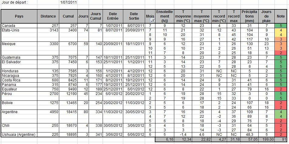
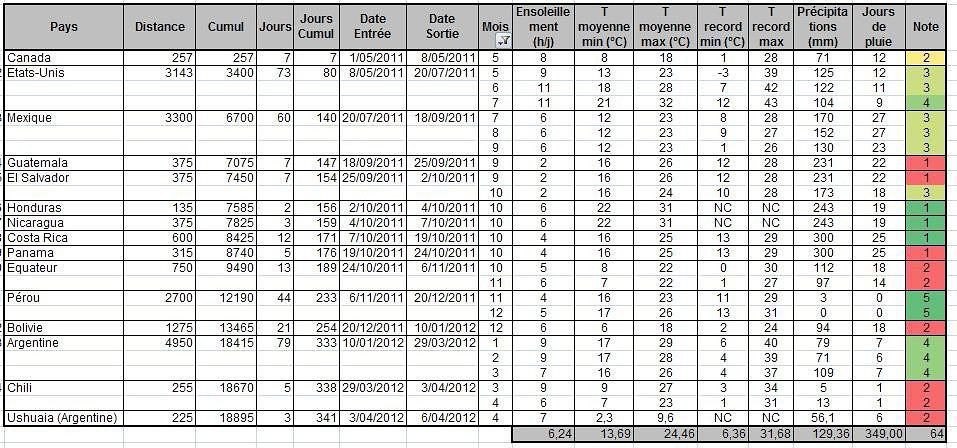
Concernant la météo, j'ai pas mal planché sur le sujet. J'ai mis au point une petite application pour étudier la période optimale pour la traverser de chaque pays et ce en tenant compte de notre vitesse de progression. Notre arrivée à Ushuaia.est prévue pour début juin (et pas juillet). Ce qui (sur le papier en tout cas) ne semble pas un mauvais choix puisque la terre de feu bénéficie d'un climat subpolaire océanique ou les saisons sont peu marquées avec des températures qui restent voisines de 0 °C quelle que soit la période de l'année...
Personne ne peux m'aider pour estimer les dépenses une fois sur place (nourritures, logements...) ?
Non, parce que chaque pays est different, et ce n'est que toi qui connait ta maniere de voyager (camping sauvage; campings; auberges de jeunesse; hospedajes; hotels pas chers. La meme chose pour la nourriture) Je te conseille de regarder un guide comme Lonely Planet pour chaque pays. Tu verras que les depenses peuvent varier beaucoup.
Personne ne peux m'aider pour estimer les dépenses une fois sur place (nourritures, logements...) ?
Cela dépend tellement de ta façon de voyager. Pour te donner un ordre d'idée, dis toi qu'il doit être très difficile aujourd'hui de descendre sous 5 euros par jour et par personne, même si tu es en camping sauvage la majorité des nuits et que tu manges pour pas cher. D'un autre côté, en voyageant quand même un peu baroudeur (camping, popote etc la moitié du temps), avec 20 euros par jour et par personne ça doit être plus que confortable. Donc a toi d'estimer tes exigences de confort. Dans le cas d'un voyage à 40% dans des pays coûteux (Canada, USA et Mexique) et à 60% dans des pays peu coûteux. Et concernant le budget quotidien (nourriture et logement principalement) : 5E/j/p = baroudeur de l'extrême 10E/j/p = baroudeur économe 15E/j/p = baroudeur tranquille 20E/j/p = baroudeur de luxe ! Après, on peut toujours partir avec plus, hein !! 😉
Je dis ça tenant compte d'un euro fort par rapport au dollar, comme c'est le cas dernièrement.
Voici le lien d'un couple de voyageur peu dépensier: http://mgdtasie.blogspot.com/2005/09/rcapitulatif-sous-forme-de-tableaux-de.html (attention c'est en $canadiens et ils comptent tout dedans...)
Cela dépend tellement de ta façon de voyager. Pour te donner un ordre d'idée, dis toi qu'il doit être très difficile aujourd'hui de descendre sous 5 euros par jour et par personne, même si tu es en camping sauvage la majorité des nuits et que tu manges pour pas cher. D'un autre côté, en voyageant quand même un peu baroudeur (camping, popote etc la moitié du temps), avec 20 euros par jour et par personne ça doit être plus que confortable. Donc a toi d'estimer tes exigences de confort. Dans le cas d'un voyage à 40% dans des pays coûteux (Canada, USA et Mexique) et à 60% dans des pays peu coûteux. Et concernant le budget quotidien (nourriture et logement principalement) : 5E/j/p = baroudeur de l'extrême 10E/j/p = baroudeur économe 15E/j/p = baroudeur tranquille 20E/j/p = baroudeur de luxe ! Après, on peut toujours partir avec plus, hein !! 😉
Je dis ça tenant compte d'un euro fort par rapport au dollar, comme c'est le cas dernièrement.
Voici le lien d'un couple de voyageur peu dépensier: http://mgdtasie.blogspot.com/2005/09/rcapitulatif-sous-forme-de-tableaux-de.html (attention c'est en $canadiens et ils comptent tout dedans...)
Log in first, then come back to this page.
You might also like
Densha Otaku - Lesser-Known Regions
Two weeks under the Puglia sun
Return to Swedish Lapland: Trek on the Kungsleden and Crossing the Sarek
Off on a winter adventure in the American West!
3 weeks in Laos, at a relaxed pace
Draw Me Your Japan...
South Africa in safari mode: February/March 2026
Back in Tunisia (live account)
More discussions
Bonjour,
Je prévois de faire la partie hollandaise de l'Eurovélo 19, de Maastricht à Rotterdam.
Comme c'est trop compliqué d'amener mon vélo en train, je cherche à louer un vélo sur place.
Je suis preneuse de conseils ou d'adresses de loueurs de vélos, j'ai du mal à en trouver même à Rotterdam.
L'idée serait de le louer à Rotterdam, de partir avec en train jusqu'à Maastricht, pour faire Maastricht/Rotterdam à vélo
Merci d'avance pour vos conseils ou suggestions.
Nath
I’ve gotten used to crossing Europe by bus to return by bike.
It was really convenient to take the bike without having to disassemble it.
But FlixBus no longer accepts bikes...
What alternatives do you know about?
Thanks.
Hi there,
I’m planning to cycle from Morlaix to Brest (via Roscoff and the V45 coastal route). We’ll start riding on August 16th for 13 days (with stops for island visits, surfing, etc.). Is there a lot of traffic at this time of year? I’ve got two kids, 11 and 13, and we don’t like riding in the middle of cars (we’ve already done the Vélomaritime—Caen to Cherbourg—the Loire route from Orléans to Saumur, the Vélodyssée from Nantes to Royans, and the canals like the Nivernais and Bourgogne, where there were plenty of bike-only lanes, which isn’t the case on this route).
Thanks for your help if you’ve already done this route in late August! Virginie
I’m planning to cycle from Morlaix to Brest (via Roscoff and the V45 coastal route). We’ll start riding on August 16th for 13 days (with stops for island visits, surfing, etc.). Is there a lot of traffic at this time of year? I’ve got two kids, 11 and 13, and we don’t like riding in the middle of cars (we’ve already done the Vélomaritime—Caen to Cherbourg—the Loire route from Orléans to Saumur, the Vélodyssée from Nantes to Royans, and the canals like the Nivernais and Bourgogne, where there were plenty of bike-only lanes, which isn’t the case on this route).
Thanks for your help if you’ve already done this route in late August! Virginie
Coming soon:
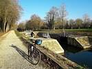
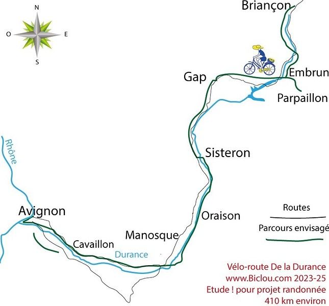
https://www.Biclou.com/parcours/durance/
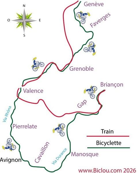
Starting from Faverges: 900 km over 9 days

Here’s the detailed Durance route starting from Briançon

Here’s the detailed Durance route starting from Briançon

Hi there,
I’ve got my flight ticket sorted—departing in mid-November and returning in mid-March. I’ll arrive in Santiago and leave from Buenos Aires. I’ve already been to southern Argentina, specifically Torres del Paine National Park, and I’d love to go back to do the full W trek (I only did the shorter version last time). I also want to do some hiking and maybe even tackle a summit. I climb and occasionally do some mountaineering, so I’ll definitely be going with a guide.
I plan to start around Temuco in Chile, with the idea of heading toward the lakes, then taking the Carretera Austral. I’m not sure if I’ll go all the way to Ushuaia—it’s supposed to not be *that* worth it, except for the bragging rights of saying you’ve been to the end of the world.
I saw there are lakes in Argentina too.
I don’t have a precise itinerary, but what I’d love is, once I reach the southernmost point of my trip, to take a mini-cruise to see some wildlife. Any tips for that?
What kind of sleeping bag did you take? Is a 0°C (32°F) one enough? And one last question: white gas stove or can I get by with my gas stove?
Nath
I’ve got my flight ticket sorted—departing in mid-November and returning in mid-March. I’ll arrive in Santiago and leave from Buenos Aires. I’ve already been to southern Argentina, specifically Torres del Paine National Park, and I’d love to go back to do the full W trek (I only did the shorter version last time). I also want to do some hiking and maybe even tackle a summit. I climb and occasionally do some mountaineering, so I’ll definitely be going with a guide.
I plan to start around Temuco in Chile, with the idea of heading toward the lakes, then taking the Carretera Austral. I’m not sure if I’ll go all the way to Ushuaia—it’s supposed to not be *that* worth it, except for the bragging rights of saying you’ve been to the end of the world.
I saw there are lakes in Argentina too.
I don’t have a precise itinerary, but what I’d love is, once I reach the southernmost point of my trip, to take a mini-cruise to see some wildlife. Any tips for that?
What kind of sleeping bag did you take? Is a 0°C (32°F) one enough? And one last question: white gas stove or can I get by with my gas stove?
Nath
Hi everyone,
This summer, we’re planning to cycle along the EV 19 that follows the Meuse River from Langres all the way to Rotterdam. My question is about getting back to Nantes. Do any of you know what the best return option might be? I’d love to hear about your experiences. I saw that FlixBus doesn’t take bikes. By train, I think it’s possible but would involve multiple local trains. We were also wondering if there’s a boat from Rotterdam to Saint-Nazaire that could take passengers with bikes.
Any tips or experiences you can share would be really helpful—thanks in advance! Have a great evening
This summer, we’re planning to cycle along the EV 19 that follows the Meuse River from Langres all the way to Rotterdam. My question is about getting back to Nantes. Do any of you know what the best return option might be? I’d love to hear about your experiences. I saw that FlixBus doesn’t take bikes. By train, I think it’s possible but would involve multiple local trains. We were also wondering if there’s a boat from Rotterdam to Saint-Nazaire that could take passengers with bikes.
Any tips or experiences you can share would be really helpful—thanks in advance! Have a great evening
Hi there,
I’ve been road cycling for several years, and I’m about to switch to gravel in the next few days—I’m waiting for my bike, which should arrive this week.
I’m planning a bikepacking trip in a few weeks along the Véloroute V81, also known as the Vélosud, from Biarritz to Le Barcarès.
Has anyone here already done this route? Any info is welcome, whether it’s about the route itself, gear, or accommodation. I’ll prioritize staying with locals as much as possible. On that note, I just signed up for the brand-new site *Guidon et Couette* ((www.guidon-et-couette.fr)), which offers free accommodation between cyclists across the country, but there’s almost no one listed along my route!
Thanks in advance.
Laurent.
Hi there,
I’m planning to build a new touring bike. I want to prioritize lightness. That said, I’m tempted by a suspension fork that could offer some comfort on rougher roads. The recent appearance of gravel suspension forks on the market might meet my needs—at least on paper. I’m particularly considering the RockShox Rudy Ultimate XPLR fork. Unlike MTB forks, its travel is short: either 30 mm or 40 mm. It weighs 1400 g, which is 400/500 g more than a steel fork.
Any thoughts or real-world feedback on this?
I’m also wondering about the durability of magnesium (lower leg) for long-distance bike touring. And what’s the impact of skipping the manufacturer-recommended maintenance every 50 and 200 hours? That’s bound to happen on a long trip unless you carry extra gear. More generally, how reliable are these kinds of forks?
Thanks in advance
I’m planning to build a new touring bike. I want to prioritize lightness. That said, I’m tempted by a suspension fork that could offer some comfort on rougher roads. The recent appearance of gravel suspension forks on the market might meet my needs—at least on paper. I’m particularly considering the RockShox Rudy Ultimate XPLR fork. Unlike MTB forks, its travel is short: either 30 mm or 40 mm. It weighs 1400 g, which is 400/500 g more than a steel fork.
Any thoughts or real-world feedback on this?
I’m also wondering about the durability of magnesium (lower leg) for long-distance bike touring. And what’s the impact of skipping the manufacturer-recommended maintenance every 50 and 200 hours? That’s bound to happen on a long trip unless you carry extra gear. More generally, how reliable are these kinds of forks?
Thanks in advance
Hi everyone,
I wanted to share with you the incredible feat my friend José, who’s 72 years old, is currently undertaking. He left Auterive near Toulouse on Monday, May 18, 2026, on his non-electric bike, heading for the North Cape in Norway!
You can follow his route on the link below—he’s currently in Sweden:
https://thierry-thomas.travelmap.net/jose-de-toulouse-a-nord-cap-2026
You can zoom in on the map and click on each stopover town to see the photos
Hi there!
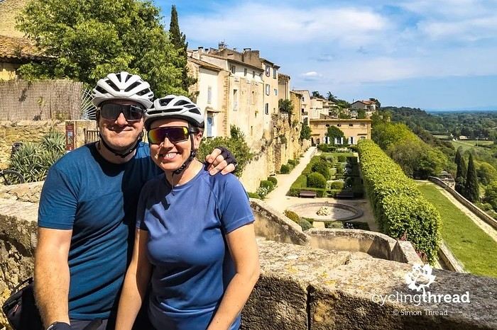
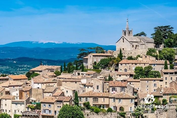
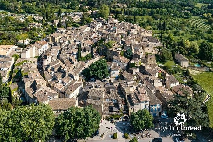
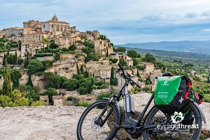
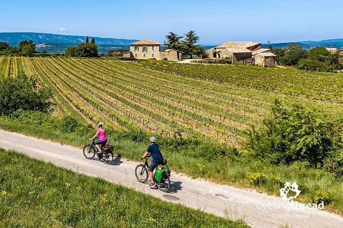
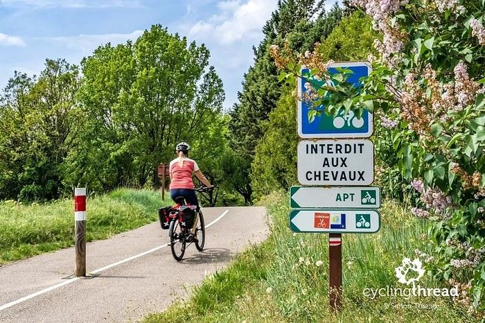
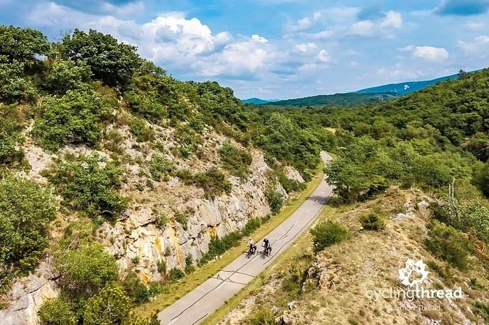
I’m making an exception and creating a separate post this time, since it’s all about France. In May, we spent a week in Provence, specifically in the Luberon, exploring the cycling routes *Autour du Luberon à Vélo*, the *Véloroute du Calavon* (part of EuroVelo 8), and the shorter *Les Ocres à Vélo* route. Together, they gave us an amazing journey through rolling hills, vineyards, lavender fields still green in spring, and some of the most stunning landscapes in southern France.

It was, of course, the perched villages that impressed us the most. We visited Gordes, Roussillon, Bonnieux, Lacoste, Lourmarin, Ménerbes, Oppède-le-Vieux, Cucuron, and Lauris. Many of them are among the most beautiful villages in Provence, and it’s hard not to agree with that reputation.


One interesting point is the route of EuroVelo 8 in this part of the region. The official path mainly follows the old railway line of the *Véloroute du Calavon*, which is very comfortable and safe. But in our opinion, cyclists traveling EuroVelo 8 around the Mediterranean would discover even more treasures if the route passed through villages like Bonnieux, Lacoste, or Oppède-le-Vieux.


We were also pleasantly surprised by how safe cycling felt. Most of the route takes small local roads, but traffic is light, drivers are respectful, and road design really takes cyclists into account. It’s one of those places where you can ride peacefully even without separated bike lanes.


Our full story:
Around Luberon by bicycle - the most beautiful villages of Provence
You can also find all our cycling travel stories on the forum:
Cycling Thread - Europe’s most beautiful bike routes
S.
I’m making an exception and creating a separate post this time, since it’s all about France. In May, we spent a week in Provence, specifically in the Luberon, exploring the cycling routes *Autour du Luberon à Vélo*, the *Véloroute du Calavon* (part of EuroVelo 8), and the shorter *Les Ocres à Vélo* route. Together, they gave us an amazing journey through rolling hills, vineyards, lavender fields still green in spring, and some of the most stunning landscapes in southern France.

It was, of course, the perched villages that impressed us the most. We visited Gordes, Roussillon, Bonnieux, Lacoste, Lourmarin, Ménerbes, Oppède-le-Vieux, Cucuron, and Lauris. Many of them are among the most beautiful villages in Provence, and it’s hard not to agree with that reputation.


One interesting point is the route of EuroVelo 8 in this part of the region. The official path mainly follows the old railway line of the *Véloroute du Calavon*, which is very comfortable and safe. But in our opinion, cyclists traveling EuroVelo 8 around the Mediterranean would discover even more treasures if the route passed through villages like Bonnieux, Lacoste, or Oppède-le-Vieux.


We were also pleasantly surprised by how safe cycling felt. Most of the route takes small local roads, but traffic is light, drivers are respectful, and road design really takes cyclists into account. It’s one of those places where you can ride peacefully even without separated bike lanes.


Our full story:
Around Luberon by bicycle - the most beautiful villages of Provence
You can also find all our cycling travel stories on the forum:
Cycling Thread - Europe’s most beautiful bike routes
S.
Hi there, we’re a group of 4 cyclists looking to get from Treviso in Italy to Munich with our 4 non-folding bikes. It seems complicated! Are there any solutions? Thanks so much.
hello fellow cycling enthusiasts
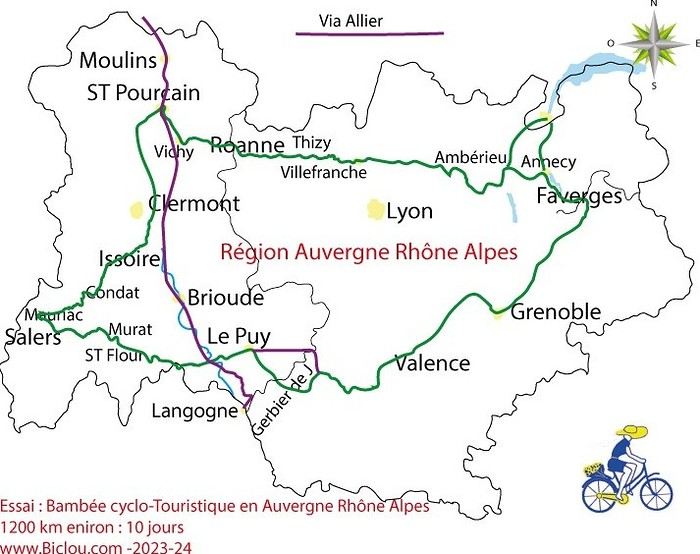
here’s a travel journal of the cycling tour through the Rhône-Alpes Auvergne region by Claudio
zouli
it was the plan
http://cbandiera.free.fr/parcours/auvergne-Ralpes/
the trip was completed story being posted online soon 1100 km in 11 days beautiful and varied regions
claudio

the trip was completed story being posted online soon 1100 km in 11 days beautiful and varied regions
claudio

Hi, I'm looking for a Pino tandem bike for sale in Quebec and I can't find any. Does anyone have any info, please? Thanks a bunch!
Hi there, we’re planning a Munich to Venice bike trip at the end of June 2026. Getting back from Venice to Toulouse by train with 4 bikes isn’t straightforward. What return options have others who’ve done this trip chosen? Any tips or great deals would be much appreciated. Thanks a bunch! !
Hi everyone,
Happy owner of a Pegasus Estremo bike with a Rohloff hub, which is giving me trouble with the SF11-NCX-FT-E-LITE 700C TS 300/0 fork (serial number TD01329060). It’s starting to show its age, and I’d like to repair it to extend the life of my beloved bike.
The suspension is gone, and there’s an oil leak from the seals.
Does anyone know how to repair it? Where can I find parts that are about fifteen years old? Or where to find an identical replacement fork? Just to clarify, the Magura HS11 brakes are mounted using Firm Tech, meaning they’re on pivots behind the fork, facing the frame.
Thanks for your help! Have a great day, Alexandre
The suspension is gone, and there’s an oil leak from the seals.
Does anyone know how to repair it? Where can I find parts that are about fifteen years old? Or where to find an identical replacement fork? Just to clarify, the Magura HS11 brakes are mounted using Firm Tech, meaning they’re on pivots behind the fork, facing the frame.
Thanks for your help! Have a great day, Alexandre
Hi, I'd like to know if anyone has done this route recently or has reliable info.
Does the track exist, and most importantly, is there sand (for biking)?
Any info is welcome.
Cheers,
diego ambilobe: mangaoka, manondro, ramena vohemar sambava: masondrono, tanambao
Hi there,
New to bike touring,
I’d love to start with a section of the Via Rhona to explore and share (route to be decided).
Looking forward to exchanging tips!
hey everyone,
I’m landing in Madagascar with a buddy before the end of April 2026. We’re planning to bike around for about twenty days or so. We don’t have a specific goal other than exploring the country and meeting the locals.
Ideally, we’d prefer a loop route starting from Antananarivo with a good chunk of it along the coast. On the bike side, we’re used to riding 6 to 8 hours a day, depending on the needs, encounters, and mood 😉 Any feedback or tips from trips around this length?
Thanks in advance, Jérôme
I’m landing in Madagascar with a buddy before the end of April 2026. We’re planning to bike around for about twenty days or so. We don’t have a specific goal other than exploring the country and meeting the locals.
Ideally, we’d prefer a loop route starting from Antananarivo with a good chunk of it along the coast. On the bike side, we’re used to riding 6 to 8 hours a day, depending on the needs, encounters, and mood 😉 Any feedback or tips from trips around this length?
Thanks in advance, Jérôme
A big thank you to Lazarou for all the info you share in this forum!
I'm passionate about Morocco, which I cycled through back in 2009.
Last year, my wife and I explored the High Atlas by tandem. Completely smitten, we're heading back in April (Anti Atlas) and May (High and Middle Atlas), still on our tandem.
Do you have any info on the track between Amezri and Ali Ait Nito? Are the river crossings in the Tessaout still there? It's not easy to navigate with a loaded tandem... especially if the river level is high due to this year's heavy snowmelt!
Thanks in advance for any tips you might have, and best wishes for health in this new year!
A shout-out to a cycling colleague from Savoie
Claudio specializes in the route of the Savoie lakes Here are his travels Between Bornes, Chartreuse, the Savoie foothills, and Dauphiné Five lakes: Léman, Annecy, Paladru, Aiguebelette, Bourget, not to mention a few ponds along the way Plenty of accommodation options: camping, hotels, and more...
A lovely route not far from his place Rural and quite peaceful A road cycling route created by Serge B...
N+1 reconnaissance trips on a loop of about 400 km This way, he avoids the SNCF and its troubles http://cbandiera.free.fr/vv/lacs-savoie/recos.php

The latest reconnaissance trip from April to May 2026 http://cbandiera.free.fr/recits/2026-grenoble-H/index.php

Claudio specializes in the route of the Savoie lakes Here are his travels Between Bornes, Chartreuse, the Savoie foothills, and Dauphiné Five lakes: Léman, Annecy, Paladru, Aiguebelette, Bourget, not to mention a few ponds along the way Plenty of accommodation options: camping, hotels, and more...
A lovely route not far from his place Rural and quite peaceful A road cycling route created by Serge B...
N+1 reconnaissance trips on a loop of about 400 km This way, he avoids the SNCF and its troubles http://cbandiera.free.fr/vv/lacs-savoie/recos.php


The latest reconnaissance trip from April to May 2026 http://cbandiera.free.fr/recits/2026-grenoble-H/index.php

First of all... happy New Year! Wishing you great roads in 2017!
I’ve been traveling for a few years now with a high-quality mountain bike, but it’s equipped with hydraulic disc brakes. I live (pedal) with the constant worry of a breakdown (leak, air bubble, heat causing the fluid to...). My bike mechanic tells me it’s impossible to switch them out for V-brakes.
What do you all think? Am I taking a big risk continuing (alone) with these brakes? Thanks in advance for your great tips!
Hi everyone,
First post here to share a quick recap of our west-to-east bike trip along Algeria’s coast in January 2025. It was just the two of us—my partner and I—with French passports and not a word of Arabic. No friends or welcoming hosts in the country.
Under those conditions, we’d strongly advise against going.
Our original plan was to follow the coast from Algiers to Tunis. We ended up cycling from Algiers to Béjaia, then took the train from Béjaia to Annaba (with a stop in Constantine), and finally biked to the border. We were tailed by police the whole way—whether on our bikes, on the train, or even on foot while exploring towns. On top of that, we couldn’t wild camp and were limited to the few state-approved hotels that accept foreigners. Under those circumstances, connecting with locals was especially tough.
With such an omnipresent and intrusive police presence, we’d definitely recommend against this destination for bike touring. A really sad situation that completely cuts you off from the local population...
We’d been warned, we went to check it out, and we weren’t disappointed!
You’ve been warned.
First post here to share a quick recap of our west-to-east bike trip along Algeria’s coast in January 2025. It was just the two of us—my partner and I—with French passports and not a word of Arabic. No friends or welcoming hosts in the country.
Under those conditions, we’d strongly advise against going.
Our original plan was to follow the coast from Algiers to Tunis. We ended up cycling from Algiers to Béjaia, then took the train from Béjaia to Annaba (with a stop in Constantine), and finally biked to the border. We were tailed by police the whole way—whether on our bikes, on the train, or even on foot while exploring towns. On top of that, we couldn’t wild camp and were limited to the few state-approved hotels that accept foreigners. Under those circumstances, connecting with locals was especially tough.
With such an omnipresent and intrusive police presence, we’d definitely recommend against this destination for bike touring. A really sad situation that completely cuts you off from the local population...
We’d been warned, we went to check it out, and we weren’t disappointed!
You’ve been warned.
Hi there,
I’m planning the route to cycle from Lille to Nordkapp with my partner.
Duration: 3 months, from May 1st to July 31st, 2026.
In the attached details below, I need to add some "non-riding" days (rest days, basically).
So I’m looking to "shorten" the trip by taking ferries or trains for some stretches. Which areas could I skip?
Thanks in advance for your great tips.
Have a good evening.
https://www.komoot.com/fr-fr/collection/4023980/-lille-cap-nord-1er-mai-au-31-juillet-2026?ref=collection
Hi there,
I’m planning to bike back from Poland this summer. Does anyone know a way to ship it there without having to take it apart? Otherwise, it’s a real hassle to fine-tune all the settings before departure! Thanks in advance.
Hi, has anyone recently bought Primus or Butagaz gas, possibly puncture-style, in Dubrovnik or the surrounding area? Same question for Albania... thanks. aichatou
Hi there,
Coming from Laos (*), I’m planning to enter Thailand by bike via the Fourth Thai–Lao Friendship Bridge.
Before this bridge was built, I’d already cycled the road from Louang Namtha to Houei Sai and crossed the river by boat to reach Thailand.
At the time, the condition of that road was impeccable, and most importantly, traffic was light.
So I’m wondering if anyone who’s taken it recently can tell me whether traffic has increased since the bridge opened.
Thanks in advance!
(*) I’m currently cycling in China (Yunnan)
Coming from Laos (*), I’m planning to enter Thailand by bike via the Fourth Thai–Lao Friendship Bridge.
Before this bridge was built, I’d already cycled the road from Louang Namtha to Houei Sai and crossed the river by boat to reach Thailand.
At the time, the condition of that road was impeccable, and most importantly, traffic was light.
So I’m wondering if anyone who’s taken it recently can tell me whether traffic has increased since the bridge opened.
Thanks in advance!
(*) I’m currently cycling in China (Yunnan)
Hi there,
Just a few words about the loop I did by bike in Yunnan.
Entry and exit
I entered China through the Sino-Vietnamese border crossing at Lào Cai / Hekou under the 30-day visa exemption currently available to French nationals and others.
The process was simple and quick. A Chinese police officer even helped me complete my electronic pre-registration at a computer kiosk. I wasn’t aware this formality was required—it’s similar to Thailand’s TM6.
No issues with the bike.
I left the country via the Sino-Laotian border crossing at Mohan / Boten.
The atmosphere was a bit chaotic there, but again, no problems with the bike.
The timing
I visited Yunnan in February 2026.
Weather-wise, at higher altitudes (between 1,500 and 2,000 meters), it was around ten degrees at night and in the mornings, and around twenty degrees at the hottest part of the day.
I had two days of rain, so I took the bus to keep moving. Otherwise, clear blue skies.
Culturally, Chinese New Year fell on February 17th (and the 15 days following), right in the middle of my trip. Because of this, my take on the traffic might be off.
Accommodation and food I always found a hotel to stay in for prices ranging from 8 to 15 €. Except in Kunming (the capital), where many hotels were fully booked (Chinese New Year). I ended up at a 100 € hotel with great value for money.
A bowl of noodles costs about 1.5 € on average.
Onboard electronics Since my smartphone doesn’t support eSIMs, I subscribed to a China plan with my carrier. Otherwise, for much cheaper, Alipay offers eSIMs for foreigners that allow access to services usually blocked for Chinese users (WhatsApp, Facebook, etc.).
An internet connection is essential for paying with Alipay or WeChat, as this payment method is widespread.
I only managed to use Alipay.
Either way, always carry cash because sometimes there’s no signal, or the merchant only accepts WeChat.
Also, it’s best to bring a power adapter when you arrive rather than struggling to find one.
Traffic and roads The Chinese aren’t reckless drivers. They follow traffic rules and watch out for cyclists. This is slightly less true in Xishuangbanna (the region bordering Myanmar and Laos).
In urban areas, there are almost always wide bike lanes, separated from other roads, where bikes, electric mini-scooters, and scooters share the space pretty harmoniously.
The roads are in great condition, and traffic is generally manageable—even light—except for one stretch (Eshan -> Yangwu).
Most traffic is absorbed by expressways, China’s equivalent of highways: toll roads that are off-limits to slow vehicles.
You’re never far from these expressways; sometimes you even ride alongside them, which can be noisy at times.
The climbs are usually reasonable, around 5% to 6%. From what I remember, the steepest section was between Menglun and Mengla, with gradients of 8% to 10%, sometimes more.
Riding at these altitudes—though modest—took a bit of getting used to.
The route I didn’t plan anything in advance. My only goal was to reach Kunming. I don’t know why, but just hearing the name of that city, like Yunnan, always felt dreamy to me.
Here’s the breakdown: Hekou -> Man Hao (94 km); Man Hao -> Yuanyang (64 km); Yuanyang -> Jianshui (bus); Jianshui -> Tong Hai (78 km); Tong Hai -> Chenjiang (85 km); Chenjiang -> Kunming (60 km); Kunming -> Kunyang (60 km); Kunyang -> Eshan (67 km); Eshan -> Yangwu (58 km); Yangwu -> Yuanjiang (59 km); Yuanjiang -> Pu'er (bus); Pu'er -> Dadugang (75 km); Dadugang -> Jinghong (80 km); Jinghong -> Menglun (67 km); Menglun -> Mengyuancun (51 km); Mengyuancun -> Mengla (43 km); Mengla -> Boten (67 km).
Otherwise, I’m currently in Thailand and just hoping my return flight with Qatar won’t get canceled.
Oh well... 😉
Just a few words about the loop I did by bike in Yunnan.
Entry and exit
I entered China through the Sino-Vietnamese border crossing at Lào Cai / Hekou under the 30-day visa exemption currently available to French nationals and others.
The process was simple and quick. A Chinese police officer even helped me complete my electronic pre-registration at a computer kiosk. I wasn’t aware this formality was required—it’s similar to Thailand’s TM6.
No issues with the bike.
I left the country via the Sino-Laotian border crossing at Mohan / Boten.
The atmosphere was a bit chaotic there, but again, no problems with the bike.
The timing
I visited Yunnan in February 2026.
Weather-wise, at higher altitudes (between 1,500 and 2,000 meters), it was around ten degrees at night and in the mornings, and around twenty degrees at the hottest part of the day.
I had two days of rain, so I took the bus to keep moving. Otherwise, clear blue skies.
Culturally, Chinese New Year fell on February 17th (and the 15 days following), right in the middle of my trip. Because of this, my take on the traffic might be off.
Accommodation and food I always found a hotel to stay in for prices ranging from 8 to 15 €. Except in Kunming (the capital), where many hotels were fully booked (Chinese New Year). I ended up at a 100 € hotel with great value for money.
A bowl of noodles costs about 1.5 € on average.
Onboard electronics Since my smartphone doesn’t support eSIMs, I subscribed to a China plan with my carrier. Otherwise, for much cheaper, Alipay offers eSIMs for foreigners that allow access to services usually blocked for Chinese users (WhatsApp, Facebook, etc.).
An internet connection is essential for paying with Alipay or WeChat, as this payment method is widespread.
I only managed to use Alipay.
Either way, always carry cash because sometimes there’s no signal, or the merchant only accepts WeChat.
Also, it’s best to bring a power adapter when you arrive rather than struggling to find one.
Traffic and roads The Chinese aren’t reckless drivers. They follow traffic rules and watch out for cyclists. This is slightly less true in Xishuangbanna (the region bordering Myanmar and Laos).
In urban areas, there are almost always wide bike lanes, separated from other roads, where bikes, electric mini-scooters, and scooters share the space pretty harmoniously.
The roads are in great condition, and traffic is generally manageable—even light—except for one stretch (Eshan -> Yangwu).
Most traffic is absorbed by expressways, China’s equivalent of highways: toll roads that are off-limits to slow vehicles.
You’re never far from these expressways; sometimes you even ride alongside them, which can be noisy at times.
The climbs are usually reasonable, around 5% to 6%. From what I remember, the steepest section was between Menglun and Mengla, with gradients of 8% to 10%, sometimes more.
Riding at these altitudes—though modest—took a bit of getting used to.
The route I didn’t plan anything in advance. My only goal was to reach Kunming. I don’t know why, but just hearing the name of that city, like Yunnan, always felt dreamy to me.
Here’s the breakdown: Hekou -> Man Hao (94 km); Man Hao -> Yuanyang (64 km); Yuanyang -> Jianshui (bus); Jianshui -> Tong Hai (78 km); Tong Hai -> Chenjiang (85 km); Chenjiang -> Kunming (60 km); Kunming -> Kunyang (60 km); Kunyang -> Eshan (67 km); Eshan -> Yangwu (58 km); Yangwu -> Yuanjiang (59 km); Yuanjiang -> Pu'er (bus); Pu'er -> Dadugang (75 km); Dadugang -> Jinghong (80 km); Jinghong -> Menglun (67 km); Menglun -> Mengyuancun (51 km); Mengyuancun -> Mengla (43 km); Mengla -> Boten (67 km).
Otherwise, I’m currently in Thailand and just hoping my return flight with Qatar won’t get canceled.
Oh well... 😉
Hi! I’m planning to visit the Stockholm Archipelago by bike in early April.
Do you know if the boats will be running between the different islands at that time of year? For those who’ve already been, all your tips and recommendations are welcome—accommodation, etc. Also, do you know where I can rent a bike in Stockholm? Thanks so much in advance for your help!
Hello there, pedal-powered Young Boys!
Claudio (still from Faverges)
dreaming about a cycling getaway in Italy from Faverges (train all the way to Turin)
from Turin down to Venice along the Po River and back via the Padana (Alta Italia da attraversare – Northern Italy to cross)
The tricky part is getting from Chioggia to Venice.
I read it’s possible by hopping on a boat from island to island,
but it sounds a bit stressful.
Has anyone already tackled this route?
Thanks, and cheers to all! http://cbandiera.free.fr/parcours/Padania/
Claudio
Thanks, and cheers to all! http://cbandiera.free.fr/parcours/Padania/
Claudio

Hi there,
I’m currently looking for a bike to do my first bike trip across France, with the ultimate goal of cycling through Latin America. I’ve got a lot of questions and I’d love to hear if you have any answers or advice to share. First off, I’ve been through this before with hiking. I want to get top-quality gear right away. When I started hiking, I ended up buying everything three times—first beginner gear, then intermediate, then expert, etc. For biking, I’d prefer to skip that process and invest right now in a bike that could ideally handle Latin America. I’ve set a total max budget of around 5000 € (roughly 4000–4500 € for the bike and the rest for accessories: panniers, helmet, cycling shorts, etc.).
So, I’ve got quite a few questions:
* I’ve read in several places that some people recommend buying the bike directly in Latin America. Since I need a first bike to train in Europe, would it be better to buy an entry-level bike in France (and sell it before the big departure)? Or is it preferable to start right away with my final bike to get used to it? Is buying it there just to save a bit of money?
* For a long-term trip (around six months) in Latin America, is it better to go for a gravel bike or a mountain bike?
* Should I buy a new bike or a refurbished one? Even more so given that I’m planning a long trip—could a refurbished bike end up causing more breakdowns?
If you have any advice on models, technical features to prioritize, or recommended sellers or resellers, I’d love to hear it. I’m a total beginner—I’ve only just started watching videos and reading up on the subject, and all the technical specs are new to me!
Thanks in advance for your help!
I’m currently looking for a bike to do my first bike trip across France, with the ultimate goal of cycling through Latin America. I’ve got a lot of questions and I’d love to hear if you have any answers or advice to share. First off, I’ve been through this before with hiking. I want to get top-quality gear right away. When I started hiking, I ended up buying everything three times—first beginner gear, then intermediate, then expert, etc. For biking, I’d prefer to skip that process and invest right now in a bike that could ideally handle Latin America. I’ve set a total max budget of around 5000 € (roughly 4000–4500 € for the bike and the rest for accessories: panniers, helmet, cycling shorts, etc.).
So, I’ve got quite a few questions:
* I’ve read in several places that some people recommend buying the bike directly in Latin America. Since I need a first bike to train in Europe, would it be better to buy an entry-level bike in France (and sell it before the big departure)? Or is it preferable to start right away with my final bike to get used to it? Is buying it there just to save a bit of money?
* For a long-term trip (around six months) in Latin America, is it better to go for a gravel bike or a mountain bike?
* Should I buy a new bike or a refurbished one? Even more so given that I’m planning a long trip—could a refurbished bike end up causing more breakdowns?
If you have any advice on models, technical features to prioritize, or recommended sellers or resellers, I’d love to hear it. I’m a total beginner—I’ve only just started watching videos and reading up on the subject, and all the technical specs are new to me!
Thanks in advance for your help!