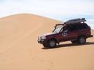
Etant entrain d'organiser mon voyage en ALGERIE, quelqu'un aurait-il les points GPS des stations de carburants .
Pour calculer l'autonomie selon mon projet .( malgré le fait que nous aurons une agence avec nous )
SALUT MEMBO
QUEL EST VOTRE CIRCUIT EN ALGERIE?POUR QUE JE DONNE LES POINT GPS DES STATIONS DE CARBURANTS.
LES CIRCUITS DE :
FRONTIERE TUNISIE EL.OUED.OUaRGLA.HASSI MESSAOUD.ILLIZI.DJANET.OU BIEN:
FRONTIERE TUNISIE.OUARGLA.GHARDAIA.EL.GOLEA.INSALEH.TAMANRASSET.
ABIENTOT
SALUT MEMBO
POUR QUE JE TE DONNE LES POINTS DE GPS IL FAUT ME DIT A MOI QUEL ES VOTRE CIRCUITS .L'ALGERIE UN GRAND PAYS.
DE LA FRONTIERE TALEB L'ARBI JUS'QUA TAMANRASSET IL YA DES CARBURANTS.
AUSSI LA FRONTIERE TALEB L'ARBI JUSQUA DJANET IL YA DES CARBURANTS. SAUF LE DESERET DE DJANET A TAMANRASSET 700KM PAS DE CARBURANTS.
ABIENTOT
Renseignez vous avant de partir !! je crois bien que Cibie et GPS sont interdit en Algérie pour les touristes ..
Sur le site de Google Earth, il y a les points GPS des villes et villages si vous y cliquez dessus ..
Bonjour,
effectivement il y a une interdiction pour GPS, Ci-Bi, radio VHF, MAIS.....
J'ai un GPS dans ma montre et également dans le tél Thuraya .
Idem, pour la Tunisie et le Maroc, mais toujours possible faire une déclaration et une demande d'autorisation.
Par contre pour faire le sud Tunisien il demande d'avoir GPS, tél satellite et radio .
Par contre en Libye je cache tout à la frontiére, comme partout .
L'AFRIQUE quoi... il suffit dêtre discret et de ne pas avoir d'antenne bien voyante .
Maintenant je suis toujours à la recherche de points précis de station en ALGERIE mais d'ici octobre je pense que je trouverais ...!!!
inhallah.
SALUT MEMBO
TU AS MELANGE TOUS LES CIRCUITS.
ESQUE TU AS VENU DIJA EN ALGERIE OU BIEN NON?TALEB L'ARBI HASSI KHALIFA SI EL-OUED.
BORDJ MESSAOUDA IN AMENAS (INTERDIT) POUR TOUS LES AGENCE.
DE EL-OUED.TOUGGOURT.HASSI MESSAOUD-AIN-AMENAS.ILLIZI.BOURDJ EL HAOUSE.DJANET.TU PEUT LE FAIRE AUCUN PROBLEME.POUR TOUS LES AGENCE.DJANET.... TADRART TU PEUT LE FAIRE TOUS LE BOUCLE JUSQUE TIN-MERZOUGA.
DJANET -- ERG ADMER...TOUS LES CIRCUIT POSSIBLE JUSQUA TAMANRASSET...ASSEKREM..(possible)TAMANRASSET.IN-SALEH.EL.GOLEA.GHARDAIA.OUARGLA.EL-OUED.LA FRONTIERE ..TOUS POSSIBLE. OK MON AMI.
ABIENTOT
Bonjour,
Non je ne mélange pas les circuits, mais je cherche les points des ravitaillements station où au bidons en gaz oil des villes ou villages et aprés viendra le circuit..!!!
En fait, il y a beaucoup de goudron pour aller à TAM dommage que les pistes des forts dans l'erg Oriental depuis Hassi Khalifa, Bordj Rebah, Bordj Djedid, Bordj Berenoff, Bordj Ghoraffa, Bordj Larache puis vers Deb Beb, Fort Thirit soit INTERDITE, puis 700 km de piste voir plus selon pour rejoindre Djanet .
Au fait est il possible d'aller au 4 chemins.
Est il possible d'aller à IN AMENAS .
Je note qu'il n'y a pas d'amélioration au niveau des pistes autorisées et que nous sommes toujours obligés de prendre le goudron .
Je fais une proposition.
Il faudrait que les agences fassent préssion auprés du Ministre du Tourisme, puisque nous sommes obligés de prendre une agence il nous cas mettre dans le 4x4 de l'agence un militaire, comme en Libye .Et la je pense que vous auriez plus de clients.
Inchallah
slt, je trouve que tu mélange vraiment tout, tu cite bien les endroits et les régions, mais tu connait rien de cette terre sèche raclé jusq'un l'os, alors vas droit au but si t'as envie d'avoir des répenses précis.
tu as trois(03) points éssentielle de la traversé du sud algerien.
bon courage@+
majid
Mon cher ami,
Je ne mélange rien je cite des noms de villages ou villes, mais je pense que tu ne connais pas les points GPS des stations puisque tu ne les as pas .
Comme moi je ne connais pas les points GPS des stations en France .
Mais si je visite une région de France que je ne connais pas et bien je fait des recherches, si j'ai besoins .
Il me parrait plus simple que tu dises je n'ai pas les points GPS des stations pour du gazoil .
Si j'arrive d'ALGER connais tu le point gps station, Je passe par Bou Saada y a t'il une station.
Puis à LAGHOUAT .
En fait, il y a beaucoup de goudron pour aller à TAM dommage que les pistes des forts dans l'erg Oriental depuis Hassi Khalifa, Bordj Rebah, Bordj Djedid, Bordj Berenoff, Bordj Ghoraffa, Bordj Larache puis vers Deb Beb, Fort Thirit soit INTERDITE, puis 700 km de piste voir plus selon pour rejoindre Djanet .
Au fait est il possible d'aller au 4 chemins.
Est il possible d'aller à IN AMENAS .
slt
les pistes de forts est interdites aux touristes car trop souvent lieux de banditisme, vers Deb-Deb notamment
pour raison professionnelle, j'y traînais assez souvent, et cela se passait assez mal avec l'armée si ils m'accrochaient
dans toute cette zone sur un millier de km ... pas de carburant, et les camps de Sonatrach, même contre monnaie sonnante et trébuchante, sont inflexibles, pas de carburant sans "coupons" Sonatrach (situation vécue 😛)
si on veut passer outre (ce que je déconseille vivement) minimum 240 litres par véhicule
il était (est ?) possible d'aller à In Amenas sans trop de contrainte en passant par Izili
croire qu'en Algérie on peut faire pression sur les militaires 😇
c'est le meilleurs moyen de se prendre une trempe 😛 (situation vécue par mon assistant algérien .. en ma présence)
et que ce soit les agences de voyage qui pourraient 😮😛😮
enfin, on peu rêver
Bonjour Dominique,
Merci pour l'aimable réponse, il va de soit que je ne veux surtout pas me balader sans agence, j'ai pour habitude de me plier "malheureusement aux lois ou obligations des pays visiter, bon grés mal grés ...
Je regrette qu'il ne soit pas possible de faire la piste des forts, pour l'histoire "dommage".
Ou se trouve le siége de la SONATRACH pour essayer et faire une demande de "coupons de carburants".
Y a t'il du gasoil à AMENAS et à IZILI.
Merci .
Bien que pas spécialiste du hors-piste, il faut savoir que la région que tu cites + 4 Chemins, est une région militaire...sous surveillance militaire ! Le Ministère n'interviendra pas dans les affaires militaires... C'est ainsi !
J'habite au Sahara, pour info...
LILI
Il n'y a personne qui soit née sous une mauvaise étoile, il n'y a que des gens qui ne savent pas lire le ciel. (Dalaï Lama)
mais rien ni personne ne vient à bout de ceux qui défendent une cause juste... (Mano Dayak)
Juste une question, avant le GPS comment on faisait ? C'est tellement simple d'avoir la liste des villages/villes où se trouvent des stations NAFTAL... dans le sud il y en a de partout, et c'est facile de prendre une réseve en cas de besoin !
Aussi, il faut faire attention puisque le GPS étant interdit, la fouille pourra exister si doute...!!
A vrai dire, quand je me déplace dans le sahara (goudron évidemment) je n'ai jamais ressenti le besoin d'avoir un GPS pour trouver du gasoil ou essence !!! Et ce n'est pas les kilomètres qui m'ont manquées !!!
Il n'y a personne qui soit née sous une mauvaise étoile, il n'y a que des gens qui ne savent pas lire le ciel. (Dalaï Lama)
mais rien ni personne ne vient à bout de ceux qui défendent une cause juste... (Mano Dayak)
re
oublie pour la Sonatrach (siège social Alger), faisait partie de mes clients, et ....
je n'ai jamais eu accès à ces fichus coupons 😛
et le refus de dépannage par un de leurs camps, m'est arrivé perso 😇
à priori, pas de problème de carburant (sauf lorsque les stations sont à sec ... 🤪)
à Izili, ou In Aménas (Izili est une Wilaya quand même ... mais Aménas juste une Daïra)
sous ces latitudes, TOUT EST POSSIBLE, Y COMPRIS ET PLUS SPÉCIALEMENT ... L'IMPOSSIBLE 😛😛😉
Le siège de SONATRACH se trouve à Alger - Val d'Hydra ! Mais tu n'auras pas satisfaction puisque réservé aux intervenants des sociétés pétrolières au Sahara (en mission) !
Bonne chance !
Il n'y a personne qui soit née sous une mauvaise étoile, il n'y a que des gens qui ne savent pas lire le ciel. (Dalaï Lama)
mais rien ni personne ne vient à bout de ceux qui défendent une cause juste... (Mano Dayak)
Bonjour,
A des fins utiles vous trouverez ici quelques WPT de carburant ( NEFTA)
TALEB LARBI. N33°43.662.E 7°32.693
ILLZI ( ex FORT POLIGNAC ). N 26°30.079 E 8°28.351
DJANET. N 24°30.765 E 9°29.553 et N 24°30.841 E 9°29.464
DI IN EKER. TAM N 24°1.250 E 5°04.933
LES 4 CHEMINS Proche du contrôle H. Bel Guebbour N 28°41.448 E 6°30.236
Bonjour,
oui les GPS sont interdit, mais j'ai un GPS dans ma montre je ne pense pas que les montres soit interdites et il y a un GPS avec le tél THURAYA .
Et il ya les gars de l'agence (OBLIGATOIRE ) qui t'améne où il le désire et toi tu veux peut-être voir autres choses d'ou l'importance d'avoir des points gps de stations mais aussi de sites que tu juges a visiter .
Concernant avant, il y 30 ans j'ai débuté avec une boussole et un compas que j'ai toujours sur le 4x4 ( pas les mêmes ), merci de me rappeler que le temps passe .
Mais, le GPS est vraiment pratique, d'ailleurs maintenant ils sont même de série dans certains véhicules, alors impossible d'arracher les appareils d'origine .
Concernant ton conseil de prendre une réserve en cas de besoin merci de l'attention, mais tous les pratiquants de 4x4 parcourant les grands espaces, + de 1000 km de piste avec 700 km de sable et dunes sans aucun ravitaillement posséde un réservoir supplémentaire, j'ai la possibilité de mettre 400 litres de gasoil dans le mien et 2 réservoirs soit une réserve de 138 litres d'eau plus les bouteilles d'eau plus les les cubis de rosé, pastis, etc..Pour le réconfort et l'amitié .
Par contre, pour le guide qui selon toi t'amène où lui veut... ce n'est pas tout à fait ca, sauf pour des sites "touristiques" sinon c'est à toi de discuter avec lui avant pour faire le programme... mais si dans certains cas, il ne t'amène pas dans certains endroits que toi tu veux à tout prix visiter, c'est qu'il a de vraies raisons fondées pour ne pas le faire ! Un vrai guide (souvent nomade/chamelier) procède ainsi !
Et les raisons sont variées : interdiction de zones (l'armée survole en hélicoptère et n'hésites pas de tirer à vue !!) - zones dangereuses à cause de plaques de sable mouvant (il y a eu des disparus, autant en véhicule que des caravanes) ou des dunes qui se sont déplacées (j'ai eu un groupe expérimenté en 2008 qui s'est aventuré dns un endroit qu'ils connaissaient avant, et puis ils se sont retrouvés enfermés par des dunes infranchissables, le retour était impossible à cause d'un vent de sable qui s'est levé... bref, ils ont failli faire appel à l'armée pour une évacuation par les airs ...) etc......
Juste un petit avis...
LILI
Il n'y a personne qui soit née sous une mauvaise étoile, il n'y a que des gens qui ne savent pas lire le ciel. (Dalaï Lama)
mais rien ni personne ne vient à bout de ceux qui défendent une cause juste... (Mano Dayak)
bonjour;
permettez moi de participer dans votre conversation pace que j'ai un avis à vous proposé en étant une personne qui pocède une agnece de location de voiture et qui a fait du cercuit (Djanet, tamanrasset, hassi messaoud, ina menas, oued souf, ouargla).
je vous confirme que le GPS est interdit a cause des différentes raisons (terrorisme, bonditisme espionnage) sauf autorisation de l'ARPT, c'est une agence qui s'occupe d'attribution des autorisations d'exploitation des reseaux HF, GPS ... leur siége se trouve à alger (hussen day).
pour les régions ou se trouve les champs pétroliers comme hassi messaoud, hassi r'mel, in-amenas) ce sont des régions interdites aux touristes survelliées par l'armé, donc il faut avoir une carte d'accée.
concernant votre cercuit je vous recommande vivement de solicité des pisteurs ou guidees, parce que ce sont des gents qui connessent parfaitement des endroits paradisiaques, les zones dangerouses, les points de carburant, conduire dans des pistes sableuse et reglés les problemes.
personnellement je suit reste à djanet 17 jours dont 5 jours à Ali dema et tinelcom qui se trouvent a 172 km de djanet en allon vers la libie (frontière), 02 jours tassili, ticoubaouine, issendillen, croyez moi c'est un paradis sur terre, si vous voulez je vous envoi quelque photos pour voir de quoi je suis entrain de parler.
en bref, pour aprécier votre voyage, il faut savoir choisir son guide et
éviter de prendre le risque de conquérire le désert en cavalier solitaire. bonne voyage
Merci foud, de tes remarques, tu dis le GPS est interdit, OK mais il faut savoir que maintenant les GPS ils sont dans la voiture quand tu l'achétes et là impossible de l'arracher sinon tu casses tout ton tableau de bord .
Tu as aussi le GPS dans la montre .
Tu as aussi le GPS dans le téléphone THURAYA .
Alors, interdire les GPS alors que tu vas sur GOOGLE et tu regardes les rues de ta ville .
Mais les gouvernements sont parfois loin des réalités du terrain et du progrés .
Maintenant je n'ai pas besoin de GPS une boussole suffit .
Tu as raison il faut fuir les champs pétrolier, mais les gens qui y travaillent sont souvent trés sympathique et content de rencontrer des touristes ce qui change de la monotonie et de la vie en groupe .
Inch Allah .
bonjour membo, les gents qui travaillent dans les champs pétroliers ce sont intégrés avec les étrangés qui travaillent dans d'autres base de vie, même la montalité a changé avec la nouvelle génération de jeune, maintenant en envoi un peux de tout sauf qu'en dehor des bases de vie il ya un manque d'infrastructure et les moyens de loisire dans les villes.
pour le GPS officiellement est interdit, officieusement opérationnel discretement mais comme vous le saver il n'y a pas de cartographyie actualisé pour le public, donc il faut faire recour a google earth.
Je remonte aussi ce sujet pour savoir :
- Y a t'il une ou plusieurs enseignes de stations services en Algérie
- Sont elles rares ou raisonnablement implantées sur routes ordinaires
- Quel est le prix actuel du G.O.
Merci pour vos réponses
"Il vaut mieux faire des enfants quand on est vieux, on les em...de moins longtemps (Desproges)
Nous préparons un raid en 4x4 pour fin 2012 (date à déterminer) mais probablement Novembre, d'une durée de 3 à 4 semaines. Trajet envisagé: Ghardaia, El-Goela,…
On prepare un circuit 4x4 aux alentours de djanet avec un peu de marche la fin du mois d avril pour une duree d une semaine cherchons voyageurs pour constituer…
Je desire faire un voyage en 4*4 dans le sud Algerien 15 novembre, 15 decembre. Est ce quelqu un pourait me donner qq renseignement, notament le prix du GO, A…
Je veut acht un 4x4 picup, appret une grande visit au grand sud algerien avec des touregs, j ai voulut le refaire mais avec mon propre materiel, alor il ya sur…
Hi there,
I’m planning a trip to Russia and Mongolia, starting from France.
Crossing the border at Poland/Belarus or Georgia/Russia—other borders seem either closed or complicated.
Tourist visas for 3 months with multiple entries.
Do you have any info on Russian companies that cover a 4x4 vehicle for 3 months, and what prices in rubles or euros you’ve paid?
Which bank did you use for expenses? (EuroMastercard and Visa cards no longer work.)
Regarding Russian SIM cards, a new system called "Gosuslugi" has been introduced. How long did it take you to get one, and what steps did you follow?
Hi,
we’re planning to visit a park again.
Could you point us toward the camps in Gonarezhou Park?
>We’re traveling completely self-sufficiently.
We love wildlife.
Thanks for any tips you can share!
JP
Hi there, we’ll be in Mozambique in early December 2026 and we’d like to travel from Vilanculos to Beira by car or bus to reach Beira airport. After that, we’re planning to visit Gorongosa National Park before flying back to France from Beira. From what we’ve heard, the road to Beira is tricky, especially at this time of year (start of the rainy season). Could anyone share their thoughts or suggest a solution? Thanks so much for your help!
Anne
Hi there,
I’m heading to Lesotho in a few days and I’m struggling to find info on the best route between Katse Dam and Sehlathebe National Park. There’s a fairly "direct" route from Thaba Tseka, but the roads seem rough, and we’re not exactly 4x4 pros. Anyone have any tips to share? Thanks!
Hi everyone,
We’re heading to Mozambique in October and are looking for either a 4x4 or 4x2 rental in Maputo, or a driver transfer option to reach:
- Ponta Do Ouro
- Tofo
- Vilankulos
The idea is to be self-sufficient for sightseeing and stops while still being able to access certain lodges or beaches that require a 4x2.
Do you have any contacts, addresses, or ideas to share?
Thanks in advance,
Hello,
We're hitting the road again in 2027 to discover new countries and cultures.
Could anyone give me some tips on driving from Ulaanbaatar to Lake Baikal and the route to take?
Thanks, and safe travels to those who are setting off!
We’re planning a 4x4 trip from Belgium to Central Asia, passing through Georgia, Russia, Uzbekistan, Kazakhstan, and Kyrgyzstan.
For these countries, our national insurance obviously doesn’t cover the vehicle, so we’ll need to get local insurance.
Will it be a problem if the vehicle is registered under person A and the national insurance is under person B? Both A and B will be in the vehicle, and both will be listed as drivers on the insurance.
When we get the local insurance, if we again list A and B as drivers, does the order matter? Could we get stuck at the border for this reason?
Hi,
For those who’ve driven on Iceland’s gravel roads in their own or a rented Duster, could you tell me what tires were fitted on the vehicle?
Were they All Terrain tires or more "standard" ones like all-season tires, for example?
Follow-up question: if they were "standard" tires, did that cause any issues on the gravel roads and rough terrain?
Thanks so much for any info you can share.
Best,
Marc
Hi there,
I'm planning a 4x4 road trip from Darwin to Broome with a rooftop tent in July 2026.
I'd like to know if I need to book overnight stops in advance or if I can just wing it and stop wherever I feel like it?
Some evenings, we'd like to stop and make use of campsite facilities (restaurant, shop, showers, toilets).
What do you recommend?
Do I need a permit?
My rough itinerary looks like this:
Darwin - Kakadu
Kakadu - Nitmiluk
Nitmiluk - Kununurra
Kununurra - Purnululu
Purnululu - El Questro
El Questro - Mt Elizabeth - Bell Gorge - Broome
I’m planning a trip to Iceland for next July-August, with a car and tent, and I’m wondering about booking campsites.
From your experience, is it necessary or even essential to book campsites in advance, or do you always manage to find a spot to pitch your tent?
We’ll also have the option to sleep in the car without pitching the tent.
Does that give us the flexibility to stay outside a campsite for a night here and there?
Hi,
I’m planning a road trip in the Middle Atlas, starting and ending in Fez and heading down to the south of Midelt, the Assoul Massif.... We’ll be traveling with two small 4x4s.
I’m looking for detailed maps of this region that include small roads and tracks.
Last year, we had a fantastic road trip in the Anti-Atlas and High Atlas using Erfahren maps, but unfortunately, they don’t cover the area we’re interested in this year.
Thanks for your suggestions!
Dominique
We’re planning a 13-day family road trip in Morocco this July, with six people in a Toyota Prado 4x4 (renting in Marrakech).
We’ll alternate between bivouacking and small hotels/riads depending on the stops.
Here’s the planned route (in this order):
Marrakech
→ Ouarzazate
→ Draa Valley
→ Zagora
→ Erg Chegaga
→ Lake Iriki
→ Foum Zguid
→ Tata
→ Tafraoute
→ Aït Mansour
→ Tiznit
→ Mirleft
→ Taroudant
→ Back to Marrakech
Our goal:
Atlas Mountains + desert + dunes + plateaus + valleys + a bit of coastline.
We’ll cover about 1,700 km in total.
We’re planning:
Bivouacking in the Chegaga/Iriki area
Flexible for the rest (booking the day before or same day)
Sand gear: traction plates, compressor, tow strap, roof rack
Questions:
Is the Zagora → Chegaga → Iriki → Foum Zguid crossing in July doable on our own (single vehicle, no guide)?
Are there any truly technical or risky sections between Chegaga and Iriki?
Does the overall itinerary seem manageable in 13 days without rushing?
Any suggestions for great bivouac spots or particularly interesting stops along this route?
The points on the route are provisional overnight stops. Some spots will include two nights in the same area.
We’re used to off-road driving, but not yet in the Moroccan desert.
Thanks in advance for your feedback and tips! 😊
Good evening
I could use some advice 🙂
Our trip to Namibia is planned for June/July 2026.
We’re struggling a bit with timing and choosing activities for the part of the trip between Sesriem and Brandberg.
Day 1: Sesriem to Mirabib
Day 2: Mirabib to Swakopmund – visit Swakopmund, overnight in Swakopmund
Day 3: Sandwich Harbour – overnight in Swakopmund
Day 4: Kayaking with the seals + the living dunes – overnight in Swakopmund
Day 5: Moon Landscape, Henties Bay + Cape Cross – overnight at White Lady Lodge in Brandberg
Does this itinerary seem realistic to you? Is Cape Cross really worth the trip? If I had to choose between Cape Cross and kayaking with the seals, which would you recommend?
Thanks in advance for your help!
Hélix
My son and I are heading to Georgia this summer to explore the High Caucasus (Svaneti, Kazbek, and Tusheti regions). For this, we’re planning to rent a 4x4.
However, the rental agencies we’ve found prohibit driving on the tracks to Omalo (Tusheti) and/or Ushguli (Svaneti).
Do you know of any agencies in Tbilisi (local and reliable) that allow rented 4x4s to drive on these tracks? If so, which ones?
Hi everyone,
I’m starting to plan an itinerary for September 2027 focused on Zimbabwe and Zambia. I’d love to visit Gonarezhou National Park—I see there are two sectors: the Mwenezi Region in the south and the area around the Runde River in the north. Should I cover both sectors or just focus on the northern region?
For the parks along the Zambezi River, is it better to visit Mana Pools on the Zimbabwe side or Lower Zambezi on the Zambia side?
Thanks in advance for any tips on the parks in these two countries.
Have a great day, everyone.
We’re spending 18 days in New Zealand from 05/04 to 05/21, arriving in QUEENSTOWN and leaving from AUCKLAND.
Any ideas for a road trip that covers the highlights of both islands but only changes hotels every 3–4 nights?
Thanks.
For our trip to Georgia in July, I’d like to rent a 4x4 starting from Tbilisi.
Do you have any rental companies to recommend?
The traditional rentals like Hertz, Avis, etc. seem way overpriced compared to local companies—what do you think? Are they properly insured?
Has anyone here tried Geo Rent Car, Auto 4 Rental, or Sur Price?
Also, I’m looking for info on the condition of the Ushguli–Lentekhi track—is it passable?
Hi everyone,
A well-prepped 4x4, a travel plan across Africa in stages since I’ve got kids to see regularly and work to earn a living.
I’m leaving in November for about a month with the goal of reaching Senegal via Mauritania. I’d love to share this trip with someone who wants to discover Mauritania and a bit of Senegal... and also experience life on board a 4x4 in the desert or bush, sometimes sleeping in the vehicle or in hostels/small hotels for comfort. I want to share this rediscovery because two’s better than one!
Just traveling, exploring, and living! !
I’m planning to explore Argentine and Chilean Patagonia for a month in December 2019.
I’m looking for a rental company (or several) that offers single-cab 4x4 pick-ups with a fitted camper cell for two people. I’m specifically after a vehicle with an indoor shower for extra comfort ;)
So, no vans—at least not from the rental companies I’ve seen so far.
While browsing the forum, I came across the Chilean rental company Holiday Rent. But do you have any recommendations for Argentine rentals?
Because, if I can’t return the vehicle in the same city as pickup, I’d prefer—and it’d likely be cheaper—to at least return it in the same country.
I’m traveling through Argentina and Chile (as well as Paraguay and Uruguay) with a 2019 Toyota Hilux Euro 6. Could anyone tell me if the local diesel is suitable for its engine, or if I need to take any special precautions (like adding an additive, for example) for these countries?
I’d also like to know if driving at high altitudes is possible, and up to what elevation—or if I should worry about the vehicle going into limp mode?
If that happens, what should I do?
Hi there,
Can you tell me if the road between Zagora and M'Gouna is easy or difficult for a 4x4? How much time and how many kilometers should I plan for? I’m traveling in May.
Thanks!
Hi there,
My trip to South Africa is starting to take shape.
However, I'm struggling to figure out the route through Kruger Park. I can't seem to find the information I need about getting around.
Coming from the south, I plan to arrive on Day 1 in the early afternoon at Malelane or Crocodile Bridge.
Do some shopping in Malelane (or Crocodile Bridge main area) and stay overnight outside the park.
Leave on Day 2 at 5 AM for the park. Explore the southern part of the park.
Stay overnight around Skukuza or Lower Sabie. (We don’t want to stay in one of the park’s big camps. We’re looking for a lodge around 200 €.
Head out on Day 3 for a self-drive safari, maybe as far as Orpen.
We’d like to stay in a private reserve on nights 4 and 5.
We’re not sure which one or how to get into a private reserve. Do we need to exit Kruger Park?
On Day 5, we’d like to leave to visit Blyde Canyon (on Day 6).
I’m planning to leave Morocco for the summer but want to leave my 4x4 there to avoid exceeding the famous 6-month limit. I’d like to park it in one of the two Spanish enclaves (Ceuta or Melilla).
Does anyone know of people or companies that handle long-term parking (preferably secure) in either place?
Once the car is parked, what’s the best way to get back to France using public transport?
Is the nearest airport Tanger from Ceuta?...
How do I get there easily, etc. etc.
hello! I’d like to go to Kazakhstan and rent a fitted 4x4 locally so I can drive off-road trails and sleep inside the vehicle... could anyone share some local rental company addresses, please? Thanks! !
I'm about to rent a self-drive 4x4 in Mongolia. Has anyone heard of GOBI.RENT?
Otherwise, do you have any tips for checking this company since there's no info on their website (e.g., registration number on the RCS)?
I’m finalizing my trip starting from Namibia.
When I arrive in Divundu, I’d like to head straight to the Khwai area early in the morning to one of the campsites in the Khwai Development Trust. Is the drive doable with a good 4x4 in a day?
We’ll spend 2 nights in Khwai, then 2 or maybe 3 nights in the Moremi area (Third Bridge/Xakanaxa/Mboma) before heading back to Maun to wrap up our journey.
Is that too much time to spend in each place?
We’d also like to do one or two boat excursions in the delta. Any suggestions for the best options and operators?
Thanks in advance for your tips and advice!
Best,
Patrick
Hi everyone,
I’m planning to explore the western part of Madagascar from May 1st to 5th, specifically to visit the Tsingy. I’ve heard different versions about the road conditions and access to the Tsingy during this time, so I’d love to hear from people who’ve actually made this trip during this time of year.
Have you traveled from Morondava → Tsingy between May 1st and 5th?
Was the journey doable and safe?
Did you have access to the Grands Tsingy, or just the Petits Tsingy?
Thanks so much for your feedback—it’ll really help me get a clearer picture! 😊
Also, if you have any recommendations for reliable and experienced driver-guides, I’d love to hear them.
Thanks again!