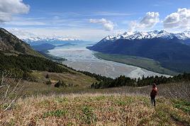
Je pars pour un short trip de 3 semaines en vélo à la fin de ce mois en Alaska.. pas d'idée définitive sur le parcours, je pense en gros partir d'Anchorage direction Fairbanks bifurquer sur le NP du Denali, camper 2-3 jours et reprendre la route.. Pour le reste du parcous je me tâte encore j'aimerais bcp monter sur Fairbanks visiter la ville .. mais d'un autre côté je souhaites aussi prendre la denali hway en direction de Paxson et redescendre sur le NP Wrangell qui a l'air vraiement fabuleux!! 😎.les kms ne me font pas peur mais quand même il faut que je réfléchisse au niveau timing 😠
la denali hway semble assez sauvage à première vue (merci google street).. Aurais-je la chance de croiser un semblant de camping ou du moins un terrain avec un point d'eau et une toilette si je l'emprunte? et si quelqu un à des retours d'info sur les coins sympa pour y poser la tente entre Cantwell, Paxson Glennallen je suis preneur🙂
Merci milles fois pour votre aide
j'ai découvert ce forum il y a peu, c'est vraiement super!
Steve
C’est l’histoire d’un homme qui tombe d’un immeuble de cinquante étages.
Le mec au fur et à mesure de sa chute, il se répète sans cesse pour se rassurer : “jusqu’ici tout va bien, jusqu’ici tout va bien, jusqu’ici tout va bien”.
Mais l’important c’est pas la chute, c’est l’atterrissage..
Tu sais que le Denali highway n'est pas goudronnee? J'ai trouve le suivant dans le site suivant: ("MP" = mile post)
"There are developed campgrounds at Tangle Lakes (MP 22) and Brushkana Creek (MP 104), but there are dozens of pullouts where you can camp on public lands.
Services are scant along this road. Year-round operations include Denali Highway Cabins & Tours (MP 0.2), Maclaren River Lodge (MP 42), Alpine Creek Lodge (MP68) and Backwoods Lodge (MP134); summer-only operations include Tangle River Inn (MP 20) and Gracious House (MP 82) - limited service there summer 2010. Winter travel on the Denali Highway is exclusively by snowmobile and dogsled. Automobile travelers are severely discouraged from attempting to traverse the road in winter; as recently as 1996 three persons died from exposure when snows blocked their progress. The road is cleared by DOT late in April and generally is passable by non-4WD from then until the first snows close it, usually late September on the eastern, tundra end and late October-early November on the lower, boreal forest western end."
je m'attendais un peu à cela, route non goudronnée peu de services au bord de cet route, (vs paysages grandioses 😇..) je vais quand même bien y réfléchir surtout qu'il s'agit de mon premier voyage en Alaska.
C’est l’histoire d’un homme qui tombe d’un immeuble de cinquante étages.
Le mec au fur et à mesure de sa chute, il se répète sans cesse pour se rassurer : “jusqu’ici tout va bien, jusqu’ici tout va bien, jusqu’ici tout va bien”.
Mais l’important c’est pas la chute, c’est l’atterrissage..
Bonjour,
J'ai parcouru une bonne douzaine de fois la Denali Highway....(en véhicule à moteur) ne la manquez sous aucun prétexte !
Mais attention : non goudronnée signifie qu'en cas de précipitations abondantes (pas rares à partir de la mi aôut) celà peut devenir très galère en vélo.
Les distances sans aucun abri sont importantes, et la nature vierge est un milieu hostile, par mauvais temps. Soyez donc bien équipé !
A partir de la mi aout, les coins de camping sont souvent occupés par les chasseurs.
Des endroits où vous trouverez toujours de la place pour votre tente, de l'eau et des toilettes :
Brushkana camp ground, Gracious and Susitna lodge (quelques possibilités d'hébergement et provisions), Clearwater creek recreation site, et enfin Tangle lakes bien entendu. Là vous retrouverez le goudron. A Paxson, le restaurant-hotel-station-service était fermé en 2008 et 2009.... Ensuite en redescendant vers Glenallen vous trouverez notamment le Sourdough camping and recreation site.
Wrangell National Park and Preserve : la seule route qui y pénètre est celle de Mac Carthy, depuis Chitina : une autre merveille...encore plus sauvage...
Cheechako
Merci pour toutes ces informations cheechako! j'ai à boire et à manger 🙂 dans tout ça
tu me parle de chasseur, c'est donc la période de la chasse qui commence ..humm la belle affaire..j'espère ne pas me retrouver avec des prunneaux dans les fesses! 😄
je profites de tes lumières pour te demander..certaines années à cause de la migration des saumons trop tardive les ours deviennent plus "nerveux" avec les humains🏴☠️.. qu'en penses-tu pour cette année?
Il y a deux ans je m'étais retrouvé nez à nez avec un black bear en colombie britannique 😮..un ours brun me fera pas les mêmes faveurs que j'ai pu avoir si ma tronche ne lui reviens pas
Amicalement,
Steve
C’est l’histoire d’un homme qui tombe d’un immeuble de cinquante étages.
Le mec au fur et à mesure de sa chute, il se répète sans cesse pour se rassurer : “jusqu’ici tout va bien, jusqu’ici tout va bien, jusqu’ici tout va bien”.
Mais l’important c’est pas la chute, c’est l’atterrissage..
Bonjour,
Les chasseurs de la Denali Highway fin Aout sont au caribou et à l'élan : ils n'utilisent pas du plomb de 4 ...mais de gros calibres !!!!
Pas de danger pour toi, le cycliste sur la piste n'est pas un gibier intéressant pour eux. Leurs cibles sont à des miles de là dans la toundra.
Les ours que tu pourrais rencontrer le long de ton parcours sont des ours de l'intérieur :la migration des saumons ne les concerne pas, sauf en remontant la Parks Highway sur les affluents de la Susitna (montana creek par exemple). Mais sur ces rivières c'est simple : pas de saumons, pas d'ours, inutile de se demander s'ils sont...nerveux !
Ce qui est arrivé l'an dernier à Anchorage : lors d'une manifestation VTT, une mère ours agacée par les passages fréquents de vttistes sur le sentier à agressé une jeune fille. Il est arrivé aussi que des joggueurs se fassent attaquer: c'est le réflexe de prédation en présence d'une "proie" qui fuit.
Et détrompe toi : l'ours noir peut être aussi, voire plus dangereux que le grizzly.
Cheechako
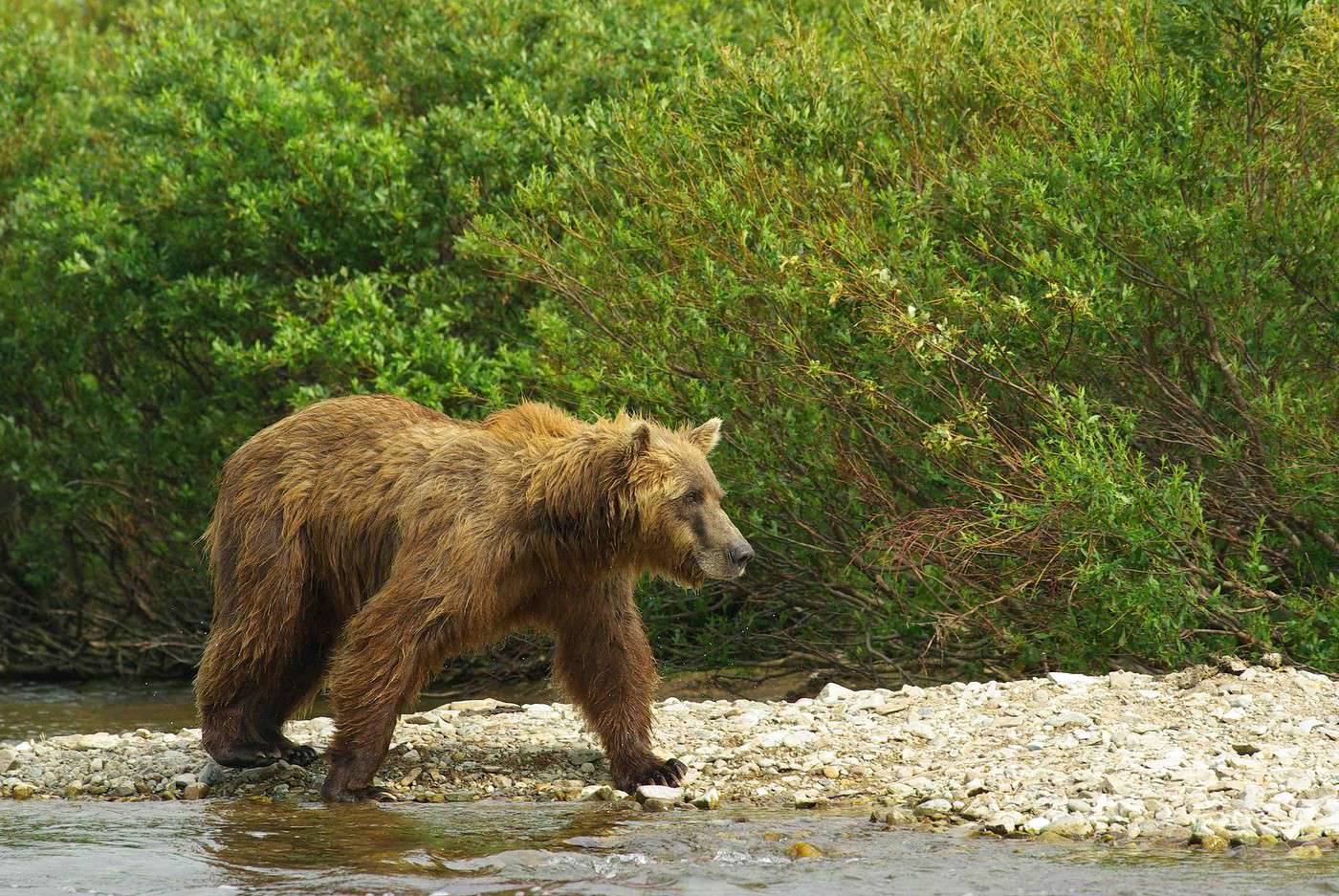
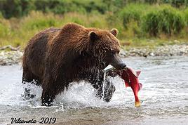
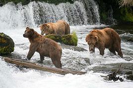
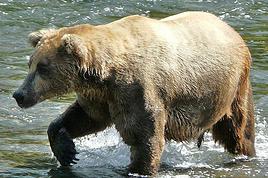
Ci-dessous un ours affamé !!!!!
En effet il a l'air affamé le pauvre... j'arriverai le 28 à anchorage je me réjoui déjà de tout cela!!
Steve
C’est l’histoire d’un homme qui tombe d’un immeuble de cinquante étages.
Le mec au fur et à mesure de sa chute, il se répète sans cesse pour se rassurer : “jusqu’ici tout va bien, jusqu’ici tout va bien, jusqu’ici tout va bien”.
Mais l’important c’est pas la chute, c’est l’atterrissage..
Bonjour Steve,
On a parcouru la Denali Highway il y a une dizaine de jours : magnifique en effet, vraiment!
Le camping de Tangle Lake est fermé (jusqu'à quand?), la route d'accès a l'air en travaux.
Brushkana est ouvert.
Tu croiseras des cours d'eau de temps en temps (eau à traiter avant de la boire)
Tu auras des couleurs d'automne magnifiques.
On a croisé qq vélos.
Chekakoo pourra sans doute de donner plus de détails mais la partie sud de la George Parks Highway nous a paru vraiment soporifique : le route est coincée entre des forêts d'épinettes et tu ne vois que ces 2 murs végétaux de part de d'autre pendant un bon moment. Wassilia pas terrible, bidonvilles le long de la route...
A ta place je me renseignerais sur la Glen Highway dont j'ai lu le plus grand bien.
Je la prendrai jusqu'à Glenallen, puis tournerai au nord sur la Richardson Highway jusqu'à Paxson (le resto/bar/station était ouvert en août, quid en septembre?) et prendrai alors la denali Highway vers l'ouest et le Denali NP.
Anticipe bien tes ravitaillements en bouffe : Glenallen et Paxson qui figurent sur la carte avec des caractères aussi gros que ceux d'Anchorage sont microscopiques (83 hab à Paxson) et tu n'y trouveras pas grand chose et sans doute à prix d'or!
Il y a un supermarché bien achalandé à l'embranchement pour Talkeetna.
Il a neigé un peu au Denali au-dessus de 1000 m en août donc pense à cette éventualité.
Il y a plein d'endroits pour camper sur la Denali Highway, souvent avec une vue à tomber! Les chasseurs vont à perpète de la piste avec des quads, tu devrais t'en sortir!
Bon voyage!
Marie
Ne venant quasiment plus du tout sur ce Forum AmNord, je n'ai pas suivi ton voyage en Alaska. J'espère que vous en avez bien profité tous les cinq.
Je vais de ce pas voir ton site.
Bonne soirée.
Salut Gérard!
Un peu de patience! Nous ne sommes rentrés que depuis qq jours et justement c'est aussi la rentrée donc il n'y a pour le moment même pas un début de commencement du carnet!
Je te ferai signe quand il sera en ligne.
Il faut aussi que je te renvoie ta doc, encore merci!
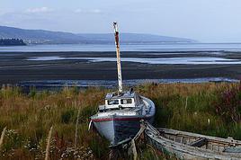
Nous sommes bien allés à Cordova où le temps était si pourri qu'on a bien failli ne jamais voir le Child's Glacier!
A+
Marie
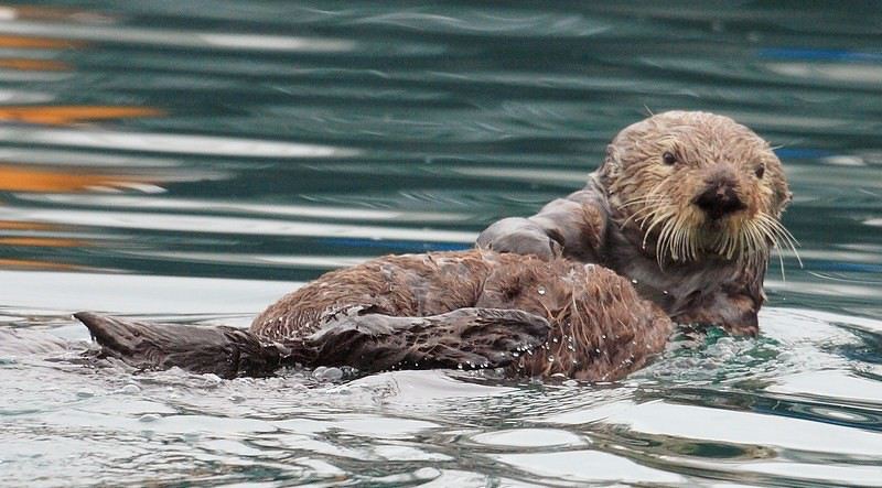
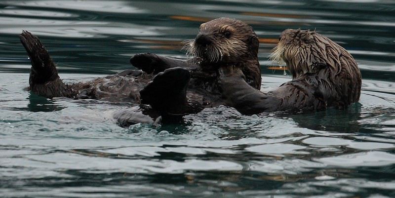
Pour le Child's, je compatis ayant eu la même couleur du ciel, mais as tu pu voir les adorables loutres du port de Cordova? Autrement cette région est tout de même superbe et je compte bien y retourner lors de mon périple là haut avec mon 4x4. Il y a de belles balades à faire et notamment continuer la piste après le pont pour faire encore de belles découvertes. Parait que c'est interdit?
Pour la doc ce n'est pas pressé, tu as jusque vers le 20 octobre car après nous serons sur le bateau direction l'AmSud, vite vite c'est long!
Nan pas à Cordova mais on a vu une adorable loutre à Valdez, vraiment craquante!
Non ça n'a pas l'air interdit puisqu'on a continué cette piste sur qq km avant de faire demi-tour vu qu'on ne voyait rien à part des nuages et qu'avec le camping car la végétation devenait de + en + gênante en empiétant sur la route: bonne idée en tout cas d'aller voir jusqu'où ça va.
Il faut dire qu'il n'y avait pas un chat : 1 tente à part nous dans le campground (dire que j'avais réservé depuis 6 mois!) A mon sens on peut dormir ailleurs sans problème.
Il y a juste après le pont à droite un endroit avec vue sur la Cooper River et Miles Glacier qui a l'air parfait pour le bivouac.
Oui tu peux dormir assez facilement dans le secteur mais attention aux ours noirs qui sont en nombre ici, nous en avons vu dans le camping et le gardien nous avait demandé de klaxonner en cas de problème la nuit. Nous en avons vu aussi de l'autre côté du pont. La piste qui est en réalité la route qui devait relier McCarthy est en partie tracée et s'enfonce assez loin, il est possible de faire ce chemin en rando mais cela doit être "bavant".
Bonjour,
Tout ceci nous éloigne un peu des soucis de Lovenatura...qui doit être sur son vélo à l'heure qu'il est !
Non non les ours noirs ne craignent pas la pluie, au contraire...
Au delà de Million Dollar Bridge, il ne s'agit pas en réalité d'une piste mais de l'ancienne voie ferrée qui servait à acheminer le minerai de la mine de Kennicott vers Cordova via Chitina.
Il y a depuis le pont environ 15km plus ou moins praticables en 4x4 selon les années, la saison et les conditions météo. De l'autre côté, c'est à dire Chitina, les 5 premiers km sont tout à fait praticables, ensuite c'est du même acabit sur environ 20km (O Brien creek road). Toutefois les choses ont pu changer un peu, je n'y suis pas allé depuis plusieurs années. C'est un excellent endroit pour observer les pêches traditionnelles (roues à saumon et dipnets) et très fréquenté également par les ours noirs.
La réouverture de cette voie est toujours en question, comme la reconstruction du pont...
Cheechako
PS : Des bidonvilles à Wasilla ?!! Même les quartiers les plus pourris d'Anchorage ne sont pas des bidonvilles. Vous avez peut-être confondu avec les baraques qui servent lors du départ de l'Iditarod....
des news en route.. je suis arrive a fairbanks il y a 2 jours.. j ai parcouru depuis Anchorage sur la Parks highway qui monte droit au nord sur Fairbanks passant par le Denali.. j en ai ch..des haricots comme on dit si bien par chez moi.. la route up and down fait mal ..mais quelle beaute de paysage:)
Pour l instant j ai vu un Moose en trottant direction Teklenika campground pour y passer la nuit.. ils sont super ces bob le ranger US tres sympa.
les couleurs sont jaune rouge vert brun c est incroyable..
pas eut de souci sur la route, seule une bonne portion de route etait en travaux sur quelques miles avant d entrer dans "l etat du denali". j ai camper dans pas mal de coin air de repos sinon camping je trouve cher et souvent la tente on est bien a part des coins sypa.
Demain j attaque Delta junction (100 miles au programme grosse journee) je dors la bas sous tente je pense et redescendrai direction paxson-glennallen (maybe) , puis remontee pour prendre la denali highway et rejoindre Denali park .
je prendrai le train pour redecsendre sur anchorage je pense, la route n est pas des plus interessante en descendant sur Anchorage
C’est l’histoire d’un homme qui tombe d’un immeuble de cinquante étages.
Le mec au fur et à mesure de sa chute, il se répète sans cesse pour se rassurer : “jusqu’ici tout va bien, jusqu’ici tout va bien, jusqu’ici tout va bien”.
Mais l’important c’est pas la chute, c’est l’atterrissage..
Salut Lovenatura !
Sympa de donner de tes nouvelles...
En effet, en direction de Fairbanks, après Nenana, il y a de sacrées côtes !
En espérant que tu pourras lire ces lignes avant de partir :
De Fairbanks à Delta celà va être aussi un peu monotone : camp militaire (base de missiles, ne pas emprunter les pistes interdites !), North Pole (le village du Père Noël, version américaine de celui de Rovaniemi....)
Après Delta c'est super beau, nombreux élans vers Donnelly Dome...vues magnifiques vers Isabel Pass (Rainbow mountain sur la gauche).
Avec un peu- beaucoup de chance, les troupeaux de bisons du côté de Delta Junction (les sauvages... car des élevages il y en a aussi...). Ils seront en migration.
Avant Paxson un camping avec une belle vue : Fielding lake SRS.
Bonne route !
Cheechako
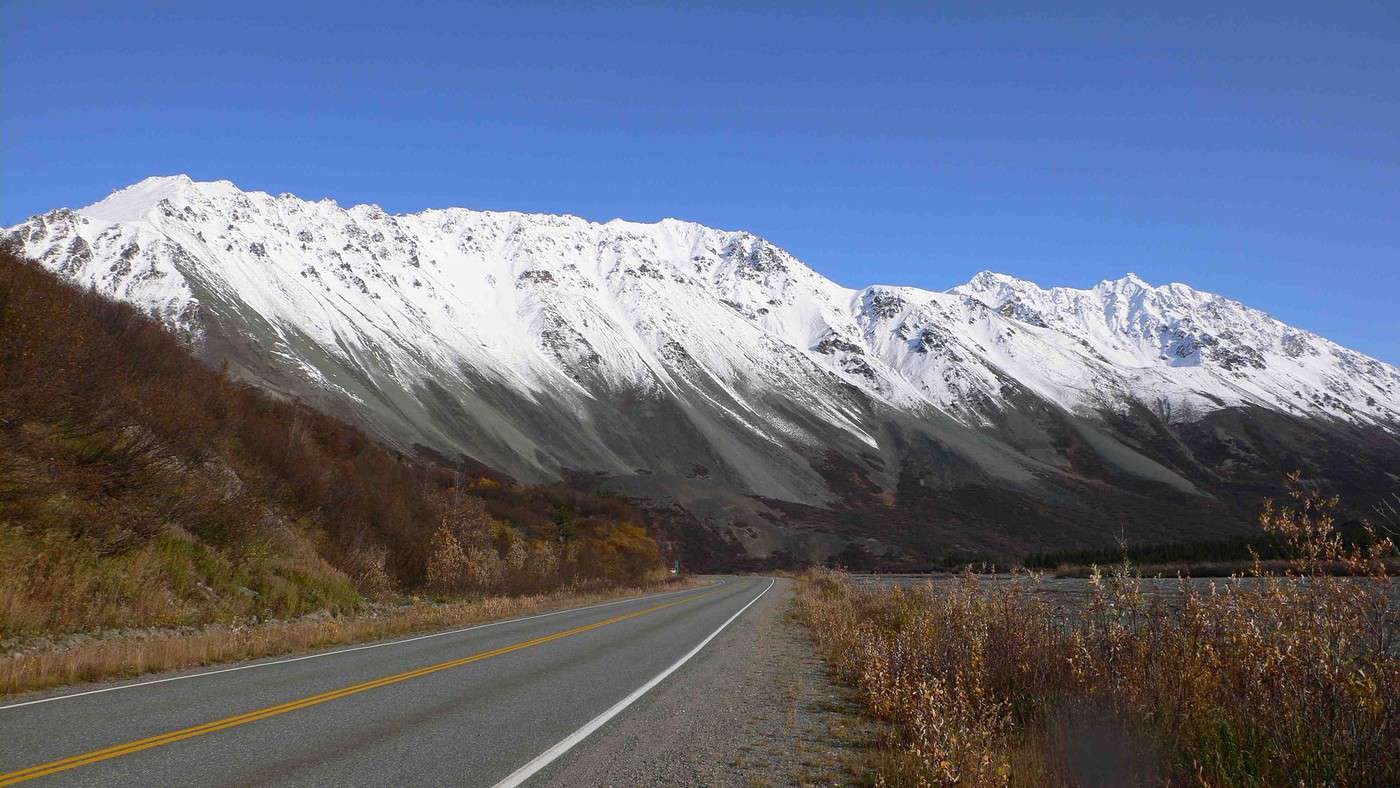
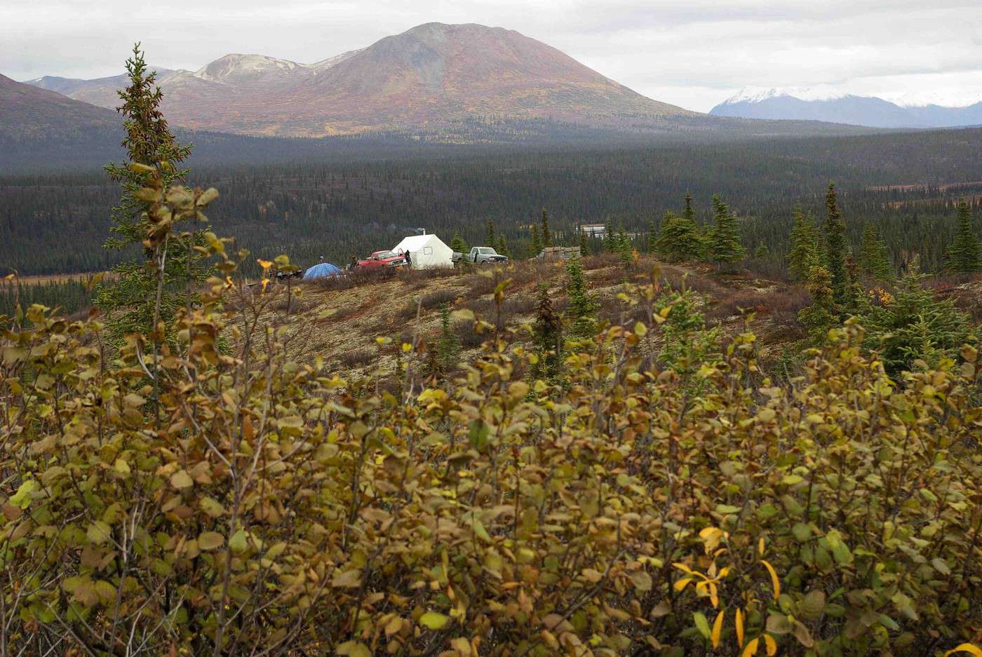
Ci-dessous camp de chasseurs sur la Denali h - rainbow mountain (oct 2008)
S'il te reste un peu de temps, je conseille la tres belle route entre Anchorage et Seward, et tu peux prendre le train pour le retour. La route est magnifique avec fjords, lacs, montagnes, et foret. Bonne continuation.
Hello! The itinerary is pretty much set for August 2026. Yeah, I know it’s gonna be *super* hot. But it’s the only time we can get away.
So, here’s the plan: Montpellier-CDG-Dallas.
Stay from July 31 to August 26, 2026:
Car rental – check,
Hotels – check,
Itinerary – almost check,
Photo gear – check,
Budget – check, 🤪
Meal planning – meh, we’ll see...
Walmart, of course, for the cooler when we arrive.
And now, without too much detail...
Fort Worth:
The Longhorns and the Stockyards;
JR’s ranch (for the missus);
Medal of Honor Museum – Arlington.
Houston and NASA Space Center:
See the Gulf of Mexico/America.
San Antonio and the missions.
Fort Stockton for an overnight stop.
El Paso via Guadalupe Mountains:
El Paso and White Sands.
Tucson and the Pima Air & Space Museum:
Tombstone, Bisbee.
Phoenix:
Still working on the program.
Sedona:
Round trip around the area via Flagstaff and Williams, or the Grand Canyon (already done) – we’ll decide on the spot.
Albuquerque:
Santa Fe,
Turquoise Trail,
Los Alamos.
Amarillo via Route 66:
Old Route 66 in the city;
Big Texas Ranch Steak 😏.
Dallas:
JFK Museum;
Perot Museum;
West End district.
And through it all – the road, the road, and more road!!!
We’ll adapt day by day based on our mental and physical state (we’re not exactly spring chickens).
Hello everyone! Really damaged due to flooding caused by runoff after forest fires (a total mess!), does anyone in this friendly forum have any updates on the Apache Trail between Apache Junction and Roosevelt Dam? Is there still a section of the road that’s tough to navigate?
We're leaving at the end of June and will be driving the route between Buffalo and Cody. We’ve already booked our accommodations and a rodeo in Cody, but during the day, we’ll be driving between the two and I’m unsure about the itinerary.
Which route do you think is the most pleasant, interesting, or scenic between:
- The northern route via Highway 14 with Sheridan, Lowell, etc.
- The southern route with Highways 16/20/14, passing by Loaf Mountain Overlook, Powder River Pass, Ten Sleep Canyon...
We’ll be in a car, so we should be able to drive on any road.
Thanks for your input!
I’m almost done planning our September road trip. After our 3-night visit to Sequoia, we’ll have a stopover night in Coalinga (to break up the drive). We’ll be staying two nights in Monterey and would like to stop along the way to visit one side of Pinnacles National Park. We’re torn between the West entrance and the East entrance, and we’d like to do a short hike of no more than 2 hours since we don’t want to arrive too late in Monterey.
This park is split into two distinct zones with no connection between them, and the mileage from Coalinga to Monterey is pretty much the same for both. Which area do you recommend visiting—east or west? And which route is the most scenic?
I’ve spotted two short hikes:
- East: Moses Spring to Rim Trail Loop
- West: Balconies Cliffs Cave Loop
Has anyone been there, or do you have another hike to suggest?
Thanks in advance, and have a great afternoon!
Marcalamar 🙂
After our first trip as a young couple to the West in 2007 (yes, that doesn’t make us any younger!), we’re planning to go back in 2028, but this time as a family of four! (We have two boys who’ll be 5½ and 13 years old in the summer of 2028.)
Our plan is to combine a few big cities (SF and LA, maybe San Diego) with national parks and state parks, mostly!
Ideally, we’d like to leave at the end of June and head back to France around July 19–20, so we can enjoy the first week of the Olympic Games in Los Angeles.
Since we already did the "loop" in 2007, there are must-see places we absolutely want to revisit—and especially share with our kids: Bryce Canyon, Yosemite, and above all, the Grand Canyon, which is still the most incredible thing I’ve ever seen on Earth!
On the other hand, some places didn’t leave a big impression on us for various reasons, so we’re not making them a priority: Antelope Canyon, Monument Valley, for example.
We’re planning ahead, but might as well be smart about it😏
Do you have any tips for a fun and doable itinerary over about 20–25 days with kids, without rushing?
Hi everyone! 🙂
Just a quick question about King Canyon and Sequoia National Park.
Before our night in Miramonte, we plan to visit King Canyon. The next stop will be two nights in Three Rivers to explore Sequoia National Park. I wanted to go all the way to Roaring River Falls on the King Canyon Scenic Byway and then turn back to head to Miramonte. Since we’re coming from Oakhurst, Google Maps says it’s 300 km and 5 hours of driving. Since we also want to hike to see the sequoias (Big Stump Area and Grand Grove) before tackling the King Canyon Scenic Byway, the timing’s going to be tight. How far do you recommend going before turning back to miss as few points of interest as possible on the King Canyon Scenic Byway? Thanks for your advice, and have a great evening!
Marcalamar 🙂
Hi everyone!
After years of hoping, waiting, planning, then changing, saving, and searching for the best possible route... we're FINALLY off this summer for a 5-week road trip in the West.
I had planned a trip to Colorado in 2021 but canceled due to COVID, so with time passing and my eldest’s high school graduation approaching fast, I figured it was now or never!
Anyway, the itinerary has been modified and extended to please everyone (I’m no longer the only one making decisions!!)
Here’s our final route:
Day 1 - 7/12/2026 - Brussels / Los Angeles
Day 2 - 7/13/2026 - Los Angeles
Day 3 - 7/14/2026 - Los Angeles
Day 4 - 7/15/2026 - Los Angeles
Day 5 - 7/16/2026 - Los Angeles
Day 6 - 7/17/2026 - Los Angeles / Kingman
Day 7 - 7/18/2026 - Kingman / Grand Canyon
Day 8 - 7/19/2026 - Grand Canyon / Page
Day 9 - 7/20/2026 - Page
Day 10 - 7/21/2026 - Page / Monument Valley
Day 11 - 7/22/2026 - Monument Valley / Durango
Day 12 - 7/23/2026 - Durango
Day 13 - 7/24/2026 - Durango
Day 14 - 7/25/2026 - Durango
Day 15 - 7/26/2026 - Durango / Glenwood Springs
Day 16 - 7/27/2026 - Glenwood Springs
Day 17 - 7/28/2026 - Glenwood Springs / Moab
Day 18 - 7/29/2026 - Moab
Day 19 - 7/30/2026 - Moab
Day 20 - 7/31/2026 - Moab
Day 21 - 8/1/2026 - Moab
Day 22 - 8/2/2026 - Moab / Vernal
Day 23 - 8/3/2026 - Vernal / Grand Teton
Day 24 - 8/4/2026 - Grand Teton
Day 25 - 8/5/2026 - Grand Teton / Cody
Day 26 - 8/6/2026 - Cody / Yellowstone
Day 27 - 8/7/2026 - Yellowstone
Day 28 - 8/8/2026 - Yellowstone
Day 29 - 8/9/2026 - Yellowstone
Day 30 - 8/10/2026 - Yellowstone / Salt Lake City
Day 31 - 8/11/2026 - Salt Lake City / Bryce Canyon
Day 32 - 8/12/2026 - Bryce Canyon / Zion
Day 33 - 8/13/2026 - Zion
Day 34 - 8/14/2026 - Zion
Day 35 - 8/15/2026 - Zion / Las Vegas
Day 36 - 8/16/2026 - Las Vegas
Day 37 - 8/17/2026 - Las Vegas / Los Angeles
Day 38 - 8/18/2026 - Los Angeles
Day 39 - 8/19/2026 - Los Angeles / Brussels
Day 40 - 8/20/2026 - Brussels / Home
We’ll be alternating between house swaps, motels, and campgrounds. I’ve booked all the accommodations (except the campground at Bryce since sunset bookings open only 14 days in advance) and the first activities, as well as the most touristy ones.
I’m currently putting together my day-by-day roadbook and having some trouble planning certain days, like in LA or Las Vegas. Choosing hikes isn’t easy either—it’s tough to decide!
We’re really excited but could definitely use your help with choices and optimizations!!
Hello.
I’d like to travel along I-15N from San Diego to Las Vegas with my mom, who’s 67. We’ve explored Northern California and the California Coast over the past two years and now want to continue through the desert.
There are several attractions along the way:
- Mormon Rocks
- Desert Discovery Center and visit the Old Woman meteorite
- Joshua Tree National Park
- Mojave Desert
- Mojave National Preserve
- Anza-Borrego Desert State Park
- Silverwood Lake
My mom has back issues that prevent her from hiking or walking on trails with elevation changes. Is it possible to visit these places by car, or are the routes flat enough?
I’d love for her to experience the desert with an itinerary adapted to her condition. I’m also open to other points of interest that aren’t mentioned. We have 3-4 days for the trip, so we’re not in a rush—just want to explore.
I’d love to take a road trip and visit Nova Scotia. I’d appreciate some info on the best cities to see and the most interesting spots. The trip should last about 10 to 15 days, staying in hotels or motels. Thanks in advance!
We’re being relocated to Saint Pierre and Miquelon.
We’ll be taking the flight from Nantes to Montreal and then from Montreal to Saint Pierre.
Could you recommend a hotel near the departure terminal that allows dogs?
Hi,
My 16-year-old son is flying to Grand Rapids with other kids his age. There’s a layover in Detroit. There’s no unaccompanied minor service available. Is it pretty easy to navigate Detroit Airport to catch the connecting flight to Grand Rapids (domestic flight)? There are several of them who speak English well.
Thanks for your replies,
Good evening, everyone! 🙂
Just a few last questions to wrap up our Lake Tahoe visit plans.
**Parking:**
We’d like to walk to Eagle Falls and then Eagle Lake. I’ve spotted two parking lots that seem close to each other and give access to the trailhead. Where and how do we pay for entry to Emerald Bay State Park and Inspiration Point?
**Viewpoints on the East Side:**
Are most of the viewpoints (Balancing Rock, Granite Cave, Bonsai Rock, etc.) right by the road, or do you have to hike to reach them?
**Donner Memorial State Park:**
Is it worth making a detour to Truckee to visit this park and the Truckee historic downtown?
Hi there. I'm shocked by the price of the Upper Antelope Canyon tour—$175 for less than an hour… You might say, "if you can’t afford it…" But the real question is whether it’s really worth it, because $350 for two makes me feel like I’m getting ripped off. For those who’ve done both Lower and Upper, can you tell me if the price difference is really justified? Thanks
Hi everyone! 🙂
As you can see, we're heading back from September 6th to the 27th.
Everything’s booked for September—flights, accommodations, and the car. As I plan, I’ll be asking the experts for help. This is our second trip to California, but most of the stops are new to us.
We’ll start directly from San Francisco to our first overnight stop, Davis, before heading to Lassen Volcanic Park for 4 nights. Our flight lands at 12:50 PM.
Here’s our itinerary:
Day 1: Davis – overnight stop
Day 2: Red Bluff – exploring Lassen Volcanic Park (scenic drive to Lake Helen)
Day 3: Susanville – scenic drive through the park via the South Entrance, points of interest, and hikes
Day 4: Susanville – Cinder Cone and Painted Dunes hike
Day 5: Susanville – Warner Valley (hikes)
Day 6: South Lake Tahoe
Day 7: South Lake Tahoe
Day 8: Mammoth Lake
Day 9: Mammoth Lake
Day 10: El Portal via Tioga Road
Day 11: El Portal
Day 12: El Portal
Day 13: Oakhurst
Day 14: Miramonte
Day 15: Three Rivers
Day 16: Three Rivers
Day 17: Coalinga
Day 18: Monterey
Day 19: Monterey
Day 20: San Francisco
Day 21: San Francisco
Day 22: Departure
For hikes in Lassen Volcanic Park, I’ve planned:
Bumpass Hell, Cold Boiling Lake (Day 2)
Paradise Meadow (maybe not going all the way), Devastated Area, and the loop around Reflection and Manzanita Lakes (Day 3)
Cinder Cone and Painted Dunes (Day 4)
Devil’s Kitchen and Boiling Spring Lake (Day 5)
I’ve read there are trails to access the trailheads for Cinder Cone (11 km) and Warner Valley. Are these easy trails for an SUV?
Are there any other must-see spots or things we shouldn’t miss?
That’s where I’m at for now. Thanks for your replies, and have a great evening!
Marcalamar 🙂
I’m a total USA addict. I’ve already done several road trips, including the East Coast and West Coast.
I’m here today because I’m planning to go back for another road trip on the West Coast. Possibly with one of my sisters and a couple of friends. It’s still just a plan for now, but I’m working on an itinerary in the meantime. Ideally, I’d leave in 2026, but I don’t have the exact dates yet—maybe April-May or September-October.
My last trip to the West Coast was in September 2014. We went for 2 weeks, but this time it’d be 3 weeks. What made me want to go back was simply a colleague who just left today. As I’m writing this, he’s on the plane. I’m so happy for him, but now all I can think about is going back.
Since I recently went to NY, I noticed that prices have really gone up. I assume the same is true for the West Coast? For 2 people over 3 weeks, what budget should I expect? We’re the type to watch our spending and find great tips.
I think we’ll arrive in San Francisco like the first time and leave from either Los Angeles or Las Vegas.
Merci de me conseiller pour la réservation pour la plus belle vue faut il réserver une chambre dans l'hôtel ou choisir une cabane ?
Prendre le petit déjeuner ou pas ?
Que pensez vous du restaurant ?
Hello, if the off-the-beaten-path enthusiasts are still around 😉, I’d love some info on tackling these trails. I’m not super familiar with the rules, risks, or what to expect—I’m looking for firsthand experience from folks who’ve done it on their own once or multiple times.
Hi everyone!
I’m planning a week-long family trip to NYC in October 2026. The focus is on museums and soaking up the New York vibe. I’ve been checking Airbnb, but the prices in Manhattan are through the roof. Since I don’t know NYC well, is it "wise" to look outside Manhattan? Any neighborhoods you’d recommend?
After our first trip to the West, we’d love to go back to see other must-see spots!
The stay would be from May 11 to 20, 2026—it’s short, but hey...
M11: Lyon to Las Vegas (overnight in Vegas)
T12: Route 66 – overnight in Grand Canyon (GC)
W13: Visit GC – overnight in Page
Th14: Visit Antelope Canyon / Horseshoe Bend – overnight in Monument Valley (MV)
F15: Visit MV – overnight in Moab
Sa16: Visit Arches / Dead Horse Point – overnight in Bryce
Su17: Visit Bryce – overnight in Zion
M18: Visit Zion / Valley of Fire – overnight in Vegas
Tu19: Return flight
What do you think? Could we add one more night somewhere? We’re not big hikers, so we’ll mostly explore the parks using shuttles.
Also, we’re all set—passports are good. Do you think one classic Visa card and one premium Visa card will be enough for coverage?
Thanks so much for your feedback, and happy holidays!
Hi North America forum crew,
Just a little post that might interest some of you:
Travelers to the United States | Photo Now Mandatory Upon Entry and Exit | La Presse
I assume many of you already know, but the America the Beautiful annual pass, which was $80, will increase to $250 starting January 1, 2026.
So if you're planning to travel before the end of December 2026, it's in your best interest to buy your pass in December 2025, since it will still cost $80 and be valid until the end of December 2026 if you purchase it in December 2025.
This price increase only applies to non-U.S. residents.
Additionally, for those who planned to visit just one park, a $100 surcharge per person will apply to access a list of 11 national parks...
For example, if there are 4 of you in a car, you’ll have to pay $35 + $400,
which comes to $435 to visit one of the 11 parks on the list (I don’t have all of them... Bryce, Zion, Grand Canyon, Yellowstone, Grand Teton, etc.).
Total madness.
The goal is to push people who only visit one park into buying the annual pass.
Last point: free entry days are over for non-residents!
Hi everyone, I’m traveling to Los Angeles and would like to rent a vehicle at the airport. However, I have a Boursobank Ultim deferred debit card, so I’d love to know if it’s possible for those who’ve experienced this recently. Thanks for the info!
I’m planning a week in S.F. in April 2026 and I can’t figure out how to tell the cable cars—of which I understand there are three lines—apart from the trams, which I think number seven. I can’t find their individual numbers or routes anywhere.
Could someone shed some light on this for me? Thanks in advance.
Wishing you all a Merry Christmas and a wonderful 2026 full of amazing travels.
Cheers,
Régine
Hi,
I’m planning a road trip through the American national parks starting from Denver in June 2026.
The price of the pass is jumping from 80 € to 250 € on January 1st, 2026!!!
Is it possible to buy the pass online before the end of the year to lock in the 80 € rate? If so, where and how do I go about it?
Thanks for your tips.
Arnale
I’m planning a road trip for July 2026 in northern Florida. Could you let me know if my itinerary makes sense?
Day 1: Orlando
Day 2: Amelia Island
Day 3: Amelia Island
Day 4: Tallahassee
Day 5: Panama City Beach
Day 6: Panama City Beach (visit to Destin)
Day 7: Crystal River (stop in Cedar Key on the way)
Day 8: Crystal River
Day 9: Anna Maria (stop in Clearwater)
Day 10: Anna Maria (St. Pete)
Day 11: Anna Maria
Day 12: Orlando
Day 13: Orlando
Day 14: Orlando
Day 15: Departure
We just finished 9 days in the American West and wanted to share our experience because we had an amazing time.
I know some of you might ask, why use an agency? Honestly, we didn’t really feel like doing all the driving and planning, especially since we didn’t know the area at all. And since our English isn’t great, having French-speaking guides was a big comfort.
We found Emmanuelle and Isabelle, and wow, they were fantastic. It was just the two of us with them, so it was a truly VIP, ultra-personalized experience. They treated us like royalty from start to finish. These two live in Las Vegas and know the region like the back of their hand. They told us they’ve spent over 15 years exploring every corner of the American West, and it really shows. Their knowledge of geology, park history, and local anecdotes is just impressive. It’s nothing like someone reciting a memorized script. They answer all your questions and really adapt to what you want to see or do.
What we really loved: the vehicle was super comfortable, and the little details made a difference—like snacks and even a homemade cake! Though, to be fair, we devoured the cake right away, so that counts.
Since they know the sites inside out, they took us at the right times to avoid crowds. So we could enjoy peaceful picnics at Grand Canyon viewpoints without being packed in with 200 people. Plus, on top of the must-see spots, they showed us some hidden gems that were absolutely stunning—places we never would’ve found on our own. They’re true locals who know all the best tips.
The service was really personalized. They adapted to our pace and preferences, and we could stop whenever we wanted to take photos. It’s the luxury of being in a small private group—you’re not just a number on a big bus.
In short, we really felt like we were traveling with friends rather than professional guides. Everything’s included in the price (hotel pickup, meals, park entries, etc.), so the value for money is fair.
We loved it so much that we’re already planning to come back next year to explore other areas with them. I think we’ve caught the American West bug—it’s all we can think about, and we can’t wait to return.
If you’re looking for a French-speaking tour with real personalized service and guides who know the region like no one else, we highly recommend them. We had unforgettable moments. They also design road trips for those who don’t want a guide. And they handled our hotel reservations in Las Vegas too. If you want genuine advice from friendly locals, we’re giving them a 200% recommendation!
I’m currently looking for well-located hotels near points of interest in the cities below. I’ve found a few, but the prices are really high.
Could any of you share some great addresses in the following cities?
- Los Angeles
- Las Vegas
- San Francisco
Also, do you have a preferred airline for domestic flights? If so, which one?