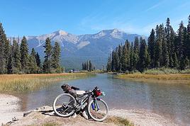
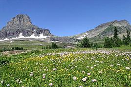
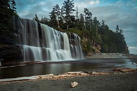
Je pars avec ma fille pendant 4 semaines dans l'Ouest de Canada pour des vacances itinérants (Sacs à dos). Nous arrivons à Vancouver et repartons de Vancouver. Nous souhaitons opter pour des déplacements en transports en commun et voulons faire des randos/bivouac dans les parcs provinciaux et nationaux des Rocheuses (Jasper, Banff, autres..).
Avez vous des conseils, informations et retours d'expérience à nous communiquer par rapport à ce projet ?
Merci !
En cherchant sur ce topic "amérique du nord" vous trouverez des tas d'infos que j'ai mises sur tous les parcs de la région.
Vous allez faire un superbe voyage.
Si besoin de plus de détails, ne pas hésiter 🙂
Merci beaucoup pour votre réponse.
Nous avons commencé à lire toutes les précieuses informations, très documentées, que vous avez laissées sur le site.
Votre enthousiasme et les photos de yoho sur votre site nous rendent impatients de partir là bas!
Faut-il prévoir de se protéger contre les moustiques à la période de juillet?
Nous prévoyons de ne rien réserver à l'avance (camping, lodges, etc): qu'en pensez vous?
Encore merci
Gil
javascript: addTag(':)')javascript: addTag(':)')
Les campings sont facilement réservables à l'avance sur le site de Park Canada. Mais vous trouverez toujours de la place, suffit de tomber au bon moment car le premier arrivé est le premier servi.Pour les campings en arrière pays, vous devez les réserver avant de partir faire votre rando (Bureaux des parks rangers).
Pour les lodges alors là c'est dangereux car il y a beaucoup de monde dans l'ouest et les lodges sont réservés longtemps à l'avance. Les hotels c'est plus simple, il suffit d'arriver un peu avant midi et il y aura toujours du "vacancy" d'affiché devant chaque hotel. Je n'ai jamais eu de probléme pour en trouver un.
Les moustiques sont présent en juillet, prendre un répulsif "insecte écran" que l'on trouve facilement au Vieux Campeur, ou sur leur site internet. Dans l'arrière pays il y a des grosses mouches noires qui sont particulièrement désagréables, je mets un filet de tête pour être tranquille, surtout en soirée juste avant la tombée de la nuit.Passé un certain moment elles disparaissent et on peut enfin respirer.
A votre disposition pour d'autres renseignements.
Merci pour votre réponse. Nous ne réserverons donc pas à l'avance.
Comme nous n'aurons pas de véhicule, le service des transports en commun dans les parcs (pour atteindre les camping ou les départs de randos) est-il bien fait?
J'essaie de me persuader que, sans véhicule personnel, la visite de ces vastes espaces est bien réaliste.
Y a t-il des endroits pour s'approvisionner en nourriture à l'intérieur des parcs (dans certains camping?)ou bien faut-il se réapprovisionner dans les villes comme Banff ou Jasper?
Bien cordialement
Gil
J'essaie de me persuader que, sans véhicule personnel, la visite de ces vastes espaces est bien réaliste.
Gil
Et bien justement non....Le camping, le parc ne sera jamais à coté du centre d'achat ni même de l, épicerie .De plus en été vous pourriez avoir de fortes chaleurs...et comment garder la nourriture, les boissons au frais!!
Moi qui ne voyage qu'en camping-car je dois dire que je n, ai jamais vu de service de bus jusqu'à l, entrée des parcs...!!!!
Avez-vous une idée de la superficie des parcs et de leur siutuation géographique par rapport aux villes...?
Et sans matériel adéquat...cela veut dire l, épicerie au moins aux deux jours. Généralement les bureaux d'acceuil vendent, via distributrices, des boissons gazeuses, mais ce sera limite...
En fait, depuis pres de 25 ans maintenant, je n, ai jamais vu arriver un pieton-campeur dans un parc...!!!
Je ne dis pas que c'est impossible, mais ce serait toute une épreuve a imposer à la fille. Espérons que la marche ne vous fait pas peur....!!!!
On ne le répètera jamais assez: le Canada ce n'est pas un pays, c'est un continent....
Bonne chance
jai fais tout le canada sur le pouce l'été passé en packsac, et je suis bel et bien un campeur-pieton. banff est tres beau (c'est en alberta en passant, un bon bout en autobus - je vous conseil GreyHound c le moins cher et il y a un terminus a vancouver), la ville est tres petite et touristique, (des autobus d'asiatiques qui débarquent pour prendre des photos). il y a des centres dachats dans la petite ville, tout se fait tres bien a pied. pour remonter au camping, il y a un service d'autobus (2, 50$ environ) transport en commun si vous avex des sacs. sinon, ca se fait tres bien en 30min de marche (ca monte dans la montagne). C'est sur que quand on fait un voyage a pied, on doit sattendre a marcher un peu, mais banff est vraiment fait pour les campeurs pietons. ils mettent a disposition des hangars avec des casiers en metal pour la nourriture, pate a dent, etc (il y a beaucoup de grizzli). Vous devez apporter votre cadenas. il y a aussi la location de velos de montagne dans la ville, ce qui permet daller se ballader dans les nombreux circuits dans les rocheuses.
arriver a vancouver sans reserver nulle part va vous mener a aller dormir dans une ruelle avec des vagabonds agressifs. Tout est toujours réservé, que ce soit auberge de jeunesse, motel... un mois en avance. moi jai dormi dans le stanley park(parc public, 2500$ damende pour y dormir), avec 3 gars. Il y a regulierement des meutres dans ce parc. on a entendu des cris toute la nuit. il n'y a PAS de camping a vancouver, vous allez vous retrouver en pleine ville (tres belle ville dailleurs). je vous conseil daller a la plage derriere le UBC (university of british columbia). tres belle plage qui donne sur le pacifique a 10 min dautobus de ville du centreville (plage de nudistes par exemple, mais biensur, personne nest obligé de se deshabiller) donc RESERVEZ a vancouver si vous prevoyez dormir la-bas. si vous prevoyez aller sur lile de vancouver, vous pouvez prendre un traversier 11$, et ensuite a partir de nanaimo, prendre un autobus special qui se rend a Toffino. (moi jai tout fais sur le pouce, mais il y a beaucoup dalerte aux cougars, et on peut facilement attendre des heures et des heures au milieux de nulle part dans un territoire indien.) donc autobus qui vous rends a toffino, au PArc NAtional de Rim, c'est magnifique, mais encore une fois, vous devez reserver en avance car tout est toujours pris. dans le parc, il y a la plus grande plage au canada, Long Beach, paradis des surfeurs. leau est parcontre glaciale, c'est le pacifique. je vous conseil d'arriver au mois de juin pour voir le soleil parceque vers le mois d'aout, puisque ca s'appelle la Rain Forest (c la foret la plus humide avec des grosss arbres), vous allez etre dans le brouillard sinon. c magnifique.
jasper je ne suis pas allée, mais il parait que c tresssss beau. alors ne vous fiez pas a vos idées de grand espace, parce OUIII les espaces sont tres grands dans le rocheuses, mais les parcs nationaux sont tres en demande et il y a des places limitées. puisque c, est sauvage, vous ne pouvez pas partir planter votre tente nimporte ou dans les rocheuses. les cougars et les grizzlis ne feront qu'une bouchée de vous. surtout si vous vous retrouvez malencontreusement dans leur territoire.
si vous avez des questions... vous pouvez toujours me demander. :)
Comme le dit l'ami Memphre, sans voiture cela va être très difficile car pour se rendre aux points de départs des sentiers, les bus ne le font pas. Je pense aussi à une chose encore plus importante, vos sacs à dos!! Vous allez devoir porter toutes vos affaires pendant vos randos et là ce n'est pas jouable. Connaissant parfaitement un très grand nombre de sentiers, vous ne pourrez passer avec des sacs trop lourds. Ne faite pas l'économie d'une petite voiture de loc, elle vous rendra de nombreux services. Sachez que le Canada, sur les parkings cela n'est pas l'Europe (pour ne pas dire la France), vos affaires ne craignent rien. J'ai laissé mon véhicule de nombreuses fois pour plusieurs jours sur des parkings isolés et il n'y a jamais eu de problème.
De plus vous irez plus vite que par les lignes de bus et serez plus libre de vos mouvements.Une petite compacte ne coûte pas bien chère en location, pensez y 🙂.
Merci à vous pour vos réponses.
Tu as raison, Memphre, nous autres Français avons tendance à sous-estimer les distances: je te remercie pour ce "recadrage" et je vois que Vilcanota et toi êtes d'accord sur le fait qu'avoir une voiture est préférable: je pense que je vais choisir cette option.
Merci Julie pour tes infos: j'ai prévu de réserver la première nuit à Vancouver et nous prévoyons de visiter la ville et ses alentours à vélo avantde partir pour les parcs de Banff et Jasper.
Y a t-il autant d'Ours que tu le dis? Je pense qu'en restant sur les²chemins balisés, on doit minimiser les rencontres indésirables?
Gil
Ne t'en fais pas pour les nounours, ils sont en montagne et assez loin des routes. Nous n'en croisons pas autant que cela.Dans les parcs ils sont surveillés par les rangers dans toutes les zones phoniques. La surveillance se fait à l'aide d'antennes qui donne la position sur une sorte de GPS, en fait un récepteur. Les ours sont équipés d'éméteur et leur position est connue. Donc si l'un d'eux se rapproche trop des routes, il est reconduit plus haut aprés s'être fait endormir.
Maintenant ils ont tendance à descendre la nuit d'où quelques précautions à prendre en camping pour la nouriture, mais il ne faut pas se rendre malade à l'avance. Moi je ne souhaite qu'une chose c'est de les rencontrer quand je suis la bas 😎, vivement la péninsule de Katmaï en aout 😊
salut
j'ai passé 3 semaines à randonner dans les rocheuses l'année dernière et si je peux te donner un conseil : loue une voiture. Tu seras plus mobile, plus indépendant, plus libre d'aller ou tu veux. Tu passeras aussi moins de temps en vallée à faire tes courses, tu laisseras tes affaires dans ton coffre lors des randos (gain de poids!), tu pourras changer de plan si tu vois qu'il va pleuvoir, passer rapidemment les campings et hôtels à la recherche de "vacancy" et puis bien sûr, tu pourras t'arrêter où bon te semble pour admirer le paysage, notamment sur la superbe icefield parkway.
tu pourras louer à Vancouver, mais tu peux aussi louer à Banff, ce qui évite de faire la route entre Vancouver et les rocheuses. Pour celà, tu pourras prendre le bus greyhound (13 h de bus) et avec ta fille vous aurez un tarif réduit dit "companion fare" qu'on obtient en voyageant à 2. Ca vaut peut-être le coup pour éviter la fatigue de la route, et financièrement tu peux faire le voyage de nuit ce qui économise une nuit d'hotellerie (reste à voir si tu peux dormir dans un bus !!!).
Pour les réservations, pas la peine pour les campings (en plus c'est payant) à condition d'arriver avant midi et même avant 10 h pour les plus réputés comme Lake Louise, mais ca peut valoir le coup pour les hotels (sans frais mais l'annulation doit être faite qqchose comme 24 h à l'avance). Ceci dit, ce sera peut-être le prix qui vous décidera : 15-20 $ l'emplacement de camping contre 80-100 $ la nuit d'hôtel. quant aux lodges on n'en parle pas... mais ca vaut le coup c'est sûr.
J'avoue qu'en 3 semaines en aout dans les rocheuses je n'ai jamais rien réservé et tout s'est bien passé.
Quant aux courses de nourriture et l'essence, c'est essentiellement sur Banff et Jasper.
Pour tes achats de matériel, je t'invite à acheter sur Vancouver. C'est un petit peu moins cher qu'en France et il y a bcp de magasins outdoor avec de très bons conseils. Par contre, n'achète rien sur Banff et Jasper c'est 10 à 20 % plus cher qu'à Vancouver.
n'hésite pas si tu as besoin d'autre chose, c'est encore tout frais. 😉
Hi everyone,
I’m leaving on Monday, August 3rd for my very first long-distance trek: the GR223 from Coutances to Mont Saint-Michel, over 6-7 days (~11-14 miles/day), solo.
I’m looking for tips from people who know this section well (Coutances → Regnéville-sur-Mer → Hauteville-sur-Mer → Bréhal → Granville → Genêts → bay crossing):
Budget-friendly accommodations: I’m struggling to find affordable stopover lodgings (a lot of what I find online are expensive vacation rentals, not really suited for a solo hiker). If you have any great spots (hostels, hiker-friendly B&Bs, nice campgrounds), I’d love to hear them!
Bay crossing: Any feedback on guides/providers leaving from Genêts for the final crossing?
General tips for a first long-distance trek: What you wish you’d known before your first time, pitfalls to avoid, etc.
Hi,
We’re planning to do the 4-day trek from Mestia to Ushguli without an agency. The descriptions mention that there are accommodations at each stop, but we can’t find any details about them. Has anyone got info or feedback on this route?
I'm developing a free and open-source web app for planning walking and cycling trips (and even car trips). You can create a route by clicking directly on the map to add waypoints, and it can consist of multiple stages. The app provides tools to edit the stages and the overall route, and to display useful information (distances, altitudes, and elevation changes). A relief profile can be shown as a graph for a specific stage or the entire route.
Once the route is ready, it can be exported as a GPX file, which can then be used with a GPS or a mobile navigation app.
The app is built in JavaScript and runs entirely in the web browser. It uses the Leaflet library and several OpenStreetMap-based services. Initially developed for my personal needs (I enjoy hiking and cycle touring), I’d be happy to share it with anyone who might find it useful. It’s free to use, doesn’t require an account, and the source code is available.
New to this forum, I’m planning a pretty big project for 2028.
I’m heading to Nepal to do a trek from Kathmandu all the way to Everest Base Camp (a cool 5,300 m 😄).
This trek is a bit special because even though I’ll be part of a group, I’m going solo (so far, no problem—I’m used to it). But it’s my first real trek, and it’s also a humanitarian one: once I reach base camp, I’ll stay an extra week to help clean up the waste left by tens of thousands of climbers! Since I’m originally from South America, from two countries that share the Andes, I have a deep respect for mountains—they fascinate me. So Everest… it’s kind of the trip of a lifetime!
So, a little question for those who’ve done treks to Everest before… any tips for good mental preparation (I’m already working on the physical side)?
We're planning to trek in Peru and Bolivia and would love to find some local agencies.
If you know any, could you share details on prices and, of course, the names of the agencies?
Which trek would you recommend?
Elocine
I'm heading out on a fully self-sufficient trek in Morocco (10 days) from Imilchil to Aghbalou.
Can I find screw-on gas canisters (Coleman, Primus) in Marrakech (any addresses?) or in villages between Imilchil and Aghbalou?
If not, are Butagaz canisters for camping gas (small 230g size) available?
Thanks in advance for your tips!
Hello, I’d like to embark on a little trip in my home country, Switzerland. I’ll start walking from La Cure, heading toward Le Noirmont first, then I’ll improvise my route—but it’ll probably follow the French border... at least as far as Lac de Joux.
I’ll decide day by day how much farther to go after that. My goal is to stay in nature as much as possible, wander around for as long as I can, and restock food in villages or towns along the way.
I’m thinking of mostly camping, but we’ll see if I end up in a hotel or another campsite depending on my route.
I’d love to reach La Chaux-de-Fonds on foot... maybe even Delémont.
The whole thing should take about a week, give or take.
I’ll be bringing my dog, and I’m preparing for this as soon as I’m ready.
Any tips to make sure everything goes smoothly for us? Things I should know—or avoid? What about shepherds with their flocks of sheep? And isn’t hunting season open right now?
I’m not sure if what I’m planning is even doable, which is why I’m asking around.
This’ll be my first time doing something like this—wandering in nature *and* with a dog. I’m really excited for this adventure... and I need it. Thanks!
We’re really keen on ecosystems and want to hike in "natural" ancient forests—not planted woods or areas heavily degraded by human activity. Travel guides (like Lonely Planet) don’t provide much info on this. Could you point us to the most interesting spots?
Thanks in advance for your tips.
We wish you happy holidays and a fantastic 2026, full of discoveries!
Claire and Albert
Hi, this might not be the right section, but I’d like to know if it’s possible to start mountaineering with another person without necessarily hiring a guide. We’ve done quite a bit of hiking but not mountaineering—we’ll just do a half-day glacier course. After that, we were thinking of starting with La Grande Motte and the Pointe de la Traversière, which were recommended to us. Honestly, for things like roping up and knots, I’ll learn at home with lots of videos and a book.
I’d love to know if anyone has done treks in the Rwenzori Mountains and how much it costs on average, what the infrastructure is like, the landscapes, and safety in the area. Thanks so much! I’m really looking forward to your replies.
We’re leaving in 9 days for a two-week trip to Madeira, mainly to hike.
From my research, I’ve found that since last year, access to most trails—and systematically for the most popular ones—is now paid. You have to pay an access fee of 4.50 € per person per classified hike in 2026, and even 10.50 € for the most iconic hike: Pico Arieiro to Pico Ruivo. When paying, you also have to choose a day and a 30-minute time slot for your start time. Of course, this reservation is neither changeable nor refundable, even if the weather that day is terrible.
Personally, given the massive influx of tourists to the island in recent years, I don’t mind paying a fee to help maintain the trails. Similarly, setting a limit on the number of people who can hike them per day is certainly preferable to preserve this priceless heritage.
However, what’s much less fair is that in reality, most of the available spots are reserved: 1/ for Madeira residents (which is normal); 2/ for "economic operators" (meaning local tour operators). For example, if you’re a non-resident (independent tourist), no booking is possible for the Pico Arieiro hike for an early morning start before September! So, unfortunately, we’ll have to skip this hike.
It’s the same issue for Ponta de São Lourenço, the 25 Fontes, Pico Ruivo... in short, all the most popular hikes. Oh well, we’ll skip those too!
So my question is: which hikes do you recommend where we won’t face the huge crowds that the others get? And where we can book the day before for the next day, taking the weather into account?
Finally, a quick accommodation question: we’ve booked the first week in Funchal, but I haven’t decided yet for the second week. Do you have any advice on where to stay in the south or north, preferably avoiding overly concrete-heavy and touristy spots?
I’m reposting about the logistics for Samaria Gorge.
I’d love to get recent info, especially about whether it’s possible to park my car in Omalos, do the hike, and then catch a bus back to my vehicle.
In theory, it’s doable, but when you check the KTEL website, there aren’t any feasible schedules listed. If anyone has recently organized this with reliable, verified details, I’d really appreciate it. Thanks in advance!
Hi there,
We’re flying from Montreal to Lyon this August to go hiking in the French Alps. We’ve rented a car and will be staying at campgrounds. We’re planning to do day hikes and want to stay a few days in one spot, do a few hikes, then move on to our next camping spot. Could you share your favorite spots or any recommendations for places to spend a few days with great hikes?
A few details:
We arrive in early August and leave in early September.
We’re looking for day hikes (or shorter), moderate difficulty, with a cumulative elevation gain of no more than 1000m, and of course, beautiful scenery!
We’d prefer not to drive too much—maybe it’s best not to head too far south and deal with unnecessary heat?
Along the same lines, if you know of any great campgrounds where we can start our hike directly without needing the car, we’d love to hear your suggestions!
Hi there,
I’m planning to go hiking on this island and would like to know the best time to do it. I visited for a few days in November 2018—not for hiking but just to explore—and the weather wasn’t great, especially in the mountains. So, is a star-shaped itinerary doable if I rent a car and maybe use two different accommodations?
I’m not planning to join an organized group—just traveling with one other person and organizing things ourselves—unless you’d recommend a local agency or guide. Finally, even though I’ll be getting maps, a topo guide, and a GPS, I’d really appreciate your top hiking recommendations.
Thanks so much for your tips!
I’m planning to do the Mercantour crossing following the Randoxygène route in mid-July.
I’m used to hiking in the mountains, but I sometimes get vertigo, for example on ridges with drops on both sides. I wanted to check if there are any T4 or T3-T4 sections and find out if there are any very exposed passages—and if so, where—so I can plan an alternative route.
Can anyone give me some info on this?
Thanks!
I’m planning a trip around Cap Corse and the AGRIATES in 2026, from May 8th to 15th (there are still 2 spots left, by the way! Just DM me if you're interested).
I’d love to know which hikes are worth prioritizing in the AGRIATES. We’ll be staying in SALECCIA for two days as our base—what should we focus on from there?
A round trip to IGNHU beach? Any other suggestions?
For Ostricano, I think it’s too far for a round trip...
Thanks for your tips!
Have a great day,
Anie, Toulouse
I’d like to get some info about the GR10 Pyrenees traverse. I need help planning the daily stages and accommodations—my wife isn’t an experienced hiker but walks a lot, so I’d like to schedule shorter walking days and thus a longer overall trip in terms of number of days.
Could anyone give me some help and advice?
Best regards,
Hi there, I’m planning the Annapurna Circuit for March 2027 and I’m looking for a local agency with a local guide—preferably French-speaking—to arrange this trek for us. Any suggestions? Thanks
Hello!
We’re spending a few days in Toraja country at the end of May. We’d love to do a day trek—taking our time—on a route that’s stunning in terms of scenery, but not a level 5 in difficulty!
Any suggestions you can share, please?
Thanks in advance
I’d like to do the Mare a Mare Sud in May over 4 days. I’ve found quite a few places to stay along the route, but I’m stuck on the start and finish.
I’ll be arriving by plane on Sunday evening and would like to start pretty early on Monday morning. Ideally, accommodation right at the trailhead (Alzu di Gallina) would be amazing, but I can’t find anything. Any tips?
Also, for the transfer from Figari Airport to Porto Vecchio or Alzu di Gallina?
At the end, I’d like to pick up a rental car—any advice on that too?
I’m traveling solo by plane to Catania in May and plan to hike the northern side of Etna, starting from Linguaglossa where I’ll arrive by bus. After that, I’d love some info on how to get up to Piano Provenzana (shuttles or hitchhiking), since it seems there’s no public transport except in the summer. Can you sleep there in a free or cheap refuge, or camp? And how far up can you go without having to hire a guide? Thanks in advance. Bernard.
Hi everyone,
I’m heading to Morocco in August and we’ll start with a stop in Chefchaouen (we’re driving).
My question: can anyone suggest a 5-to-7-day loop hiking route from Chefchaouen in Talassemtane Park, ideally passing by the God’s Bridge? Or a paper guidebook that covers a few options?
We prefer wild camping and guesthouses.
Thanks in advance
Hi there, for those who’ve been recently—is it possible to find other solo travelers in March on the island to share transport or room costs? It doesn’t seem easy to travel on a budget.
If you have any recommendations for simple lodgings or places with dorms, I’d love to hear them.
For those who’ve done multi-day treks while moving around: do you need to bring your own sleeping bag? I’d love to hear about itineraries you’ve done without a guide, just with a map and GPS.
Thanks, and have a great day!
Hi everyone!
We’re planning a 15-day road trip to Scotland this summer, specifically to explore and hike on Lewis and Harris—places we’ve never been before. We’ve visited other islands on previous road trips in Scotland (we usually go in April for a week). This would be our first time in Scotland in the summer and for 15 days. We’re looking at late August to early September.
I’m currently drafting the itinerary. We’d be crossing from Ullapool and were thinking of spending 3 nights on Harris and 4 nights on Lewis.
Does that sound balanced to you? Is it better to keep the same accommodation on Harris and the same on Lewis to explore the area? I’d love to hear about any past experiences you’ve had on these islands.
Thanks!
Hi there, I’m trying to leave for 15 days very soon to São Vicente. I’m either looking to join an agency or figure things out on my own to go hiking on one of these islands or both. From what I’ve seen, it’s not easy to organize with local transport, so it gets expensive. Can I use the services of a small local agency? I’m looking for the simplest way to hike for several days. Also, how do you get from São Vicente to São Nicolau? Thanks in advance and have a great day!
Aichatou
I’ve been wanting to do this for several years, and this year’s the one. Next September, I’ll be trekking in Tusheti (Georgia), from Omalo to Shatili.
Of course, I won’t be renting a vehicle that’d just sit unused. No problem getting to Pshaveli, but from there to Omalo, it’s a dirt road (still the case?)
There must be some form of public transport since there are so many guesthouses, and not all travelers come in a 4x4.
If any of you have been to Omalo, could you confirm that these shared transports exist and how often they run?
we’re planning a trip to Yellowstone and hoping to do a three-day backcountry hike if we get a permit.
if any of you have done this before, could you let me know if it’s possible to find water along the way? And if we can transport it, are we allowed to use a stove?